
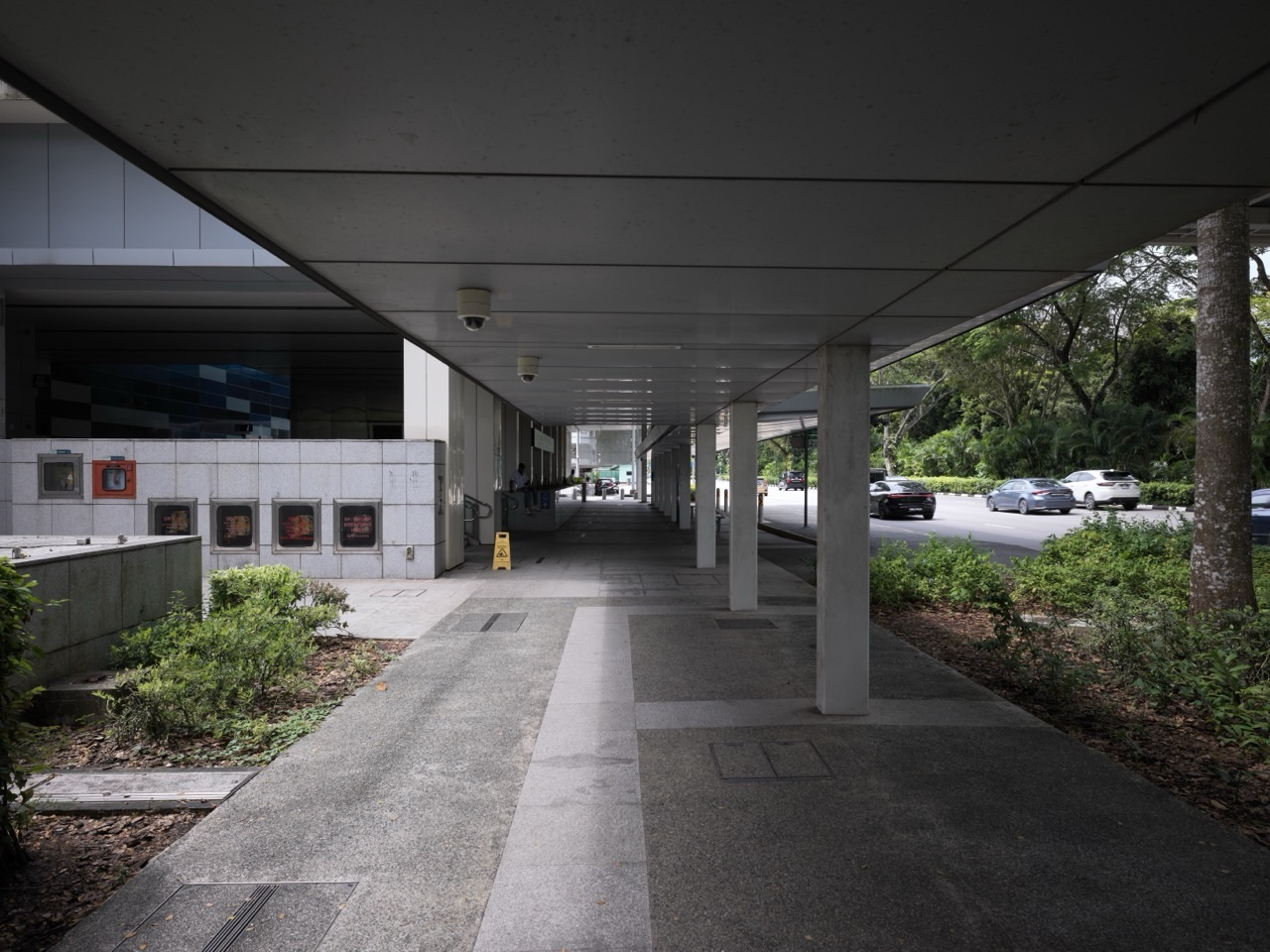
The MRT station is four hundred metres away.
On a cool dry evening, that sounds close.
At 2 pm under hard tropical sun, it feels different.
During a sudden downpour, it becomes a different journey again.
The map has not changed.
The distance has not changed.
The cost of walking has.
So Singapore builds a roof.
A covered walkway does not make the station physically nearer. It makes the walk behave as though it were easier to reach.
Quick Read
Singapore works partly because public transport is connected to the human body before the passenger reaches the platform.
LTA’s current walking guidance says Singapore’s tropical weather can make walking challenging and describes the Walk2Ride programme as improving links between homes, amenities and public transport. Its public walking page refers to about 200 km of sheltered walkways added island-wide, with sheltered access within 400 metres of all MRT stations and within 200 metres of bus interchanges, LRT stations and selected high-volume bus stops.
A separate Ministry of Transport parliamentary reply dated 8 April 2025 uses a narrower “covered linkway” scope and states that LTA had built 186 km since Walk2Ride began in 2013. It also says that, following plans announced in 2024, covered linkways are being extended to Friendly Streets within an 800-metre radius of MRT stations, with an additional 50 km planned over the following five years.
Those counts should not be forced into a single number because the official pages use different terms and scopes. The causal mechanism is clearer than the accounting boundary:
transport node → walking catchment → weather friction → shelter and rest → more tolerable first/last mile → larger practical reach of rail and bus → more journeys become feasible without another motorised leg.
This article does not claim that covered walkways explain Singapore’s transport success by themselves, or that every route is fully sheltered, cool or barrier-free. It isolates one mechanism: the useful radius of public transport depends not only on metres, but on how difficult those metres are for real bodies under real weather.
Wait, What? The MRT Network Includes Pavement?
Look at a rail map.
Coloured lines.
Stations.
Interchanges.
The map ends at the station symbol.
Your journey does not.
You still have to reach the entrance.
Walk from home.
Cross a road.
Pass a school.
Move through a town centre.
The first and last mile are part of transport whether the schematic map admits it or not.
A station with a hostile approach has a smaller practical catchment than the same station with an easy approach.
Distance Is Not the Same as Effort
Four hundred metres is a geometric fact.
Effort is conditional.
Flat or steep?
Shaded or exposed?
Dry or raining?
Continuous footpath or repeated detours?
Young adult or eighty-year-old?
Carrying a laptop or pushing a wheelchair?
A transport system that plans only geometric distance ignores the receiver.
The Roof Changes Generalised Cost
Transport economists often think beyond money.
A journey has a generalised cost.
Time.
Fare.
Waiting.
Effort.
Discomfort.
Uncertainty.
Weather exposure.
A covered walkway may barely change travel time.
It can materially reduce discomfort and weather risk.
The passenger experiences a cheaper journey even when the clock and map remain almost unchanged.
Rain Creates Variance, Not Just Discomfort
A sunny walk takes seven minutes.
A heavy downpour may require waiting under a block, opening an umbrella, avoiding deep puddles, slowing down or choosing another mode.
The expected walking time becomes less reliable.
Shelter reduces some of that variance.
This matters because reliability can be more valuable than average speed.
A seven-minute walk that unpredictably becomes a wet fifteen-minute walk is a different transport product from a seven-minute sheltered walk.
The Tropical Sun Is Another Transport Friction
Covered walkways are often described as rain infrastructure.
They are also shade infrastructure.
LTA’s Walking and Cycling Design Guide describes sheltered pedestrian waiting areas as providing protection from light rain and direct sunlight while people wait to cross.
A roof does not cool Singapore.
It changes radiant exposure along the route.
Again, the mechanism is modest and concrete.
Less exposure can make walking more tolerable.
The First and Last Mile Can Decide the Main Mode
The train may be fast.
The feeder connection may be frequent.
But if getting from home to the station is unpleasant enough, a person may choose another mode for the whole trip.
This is why first/last-mile quality has leverage disproportionate to its distance.
A bad final 400 metres can veto a good 14-kilometre rail journey.
The weakest segment can decide the mode of the entire trip.
A Roof Can Extend the Station’s Practical Radius
Imagine two identical homes 350 metres from the station.
Home A has a continuous sheltered path.
Home B requires crossing open car parks and exposed footpaths.
On a map, both are equally close.
In behaviour, they need not be.
The roof increases effective accessibility without moving the station.
This is why the title says the walkway extends public transport.
Not the rail line.
The usable catchment.
Why 400 Metres and 200 Metres?
Any coverage programme needs boundaries.
Unlimited covered walkways everywhere would consume unlimited money, land interfaces and maintenance capacity.
Historically, Walk2Ride focused covered links around high-volume transport nodes and amenities. LTA’s current walking page describes sheltered walking within 400 metres of MRT stations and within 200 metres of bus interchanges, LRT stations and selected high-volume bus stops.
Ministry of Transport replies have explained the logic in fiscal terms: prioritise routes that connect large numbers of commuters to major public transport nodes and stretch limited public resources across more locations.
Coverage radii are therefore not laws of human walking.
They are planning rules balancing benefit and cost.
The 800-Metre Expansion Shows the Rule Can Evolve
Planning boundaries are not sacred.
In April 2025, the Ministry of Transport said that plans announced in 2024 would extend covered linkways to Friendly Streets within an 800-metre radius of MRT stations. LTA was expected to build an additional 50 km of covered linkways over five years as new MRT stations and more Friendly Streets came online.
This is a useful example of policy learning.
The original coverage rule created one network.
New priorities and new transport patterns justify selective extension.
The Linkway Is Valuable Only If the Link Is Continuous
Covered path.
Ten metres of open rain.
Covered path again.
How much shelter did the system provide?
Most of the route.
How wet can you get in tropical rain during the uncovered section?
Enough to make the rest feel irrelevant.
Continuity matters because some benefits are bottlenecked by the worst gap.
Past Ministry of Transport replies explicitly used this logic when explaining why public linkways should connect to sheltered routes inside adjoining developments where possible: the objective is a seamless sheltered connection, not a roof that ends just before the user needs it.
A Covered Walkway Is a Network, Not a Collection of Roofs
One shelter protects one patch.
Connected shelters create a route.
Connected routes create a catchment.
Catchments connect homes and amenities to stations.
That is the scaling logic:
roof → link → route → catchment → transport accessibility.
Why the Official Kilometres Do Not Match Perfectly
LTA’s public walking page refers to about 200 km of sheltered walkways added island-wide.
The Ministry of Transport’s April 2025 parliamentary reply states 186 km of covered linkways built since the Walk2Ride programme began in 2013.
Another LTA page aimed at seniors has used a broader figure of covered linkways island-wide.
The intellectually safe response is not to choose the biggest number.
It is to recognise scope differences.
“Sheltered walkway”, “covered linkway”, programme-built segments and the wider island network may not be identical accounting categories.
similar numbers are not automatically measurements of the same thing.
World-class reading preserves the denominator and definition.
The Walkway Is Also Accessibility Infrastructure
Walking difficulty is not evenly distributed.
An older person may tire sooner.
A wheelchair user needs clear width and barrier-free continuity.
A parent pushing a pram needs space.
A person recovering from illness may need rest.
LTA’s Walking and Cycling Design Guide treats rest areas as part of covered-linkway design and discusses wheelchair parking spaces beside benches so the resting place does not block the footpath.
The roof alone is not enough.
The entire passage has to work for bodies with different capabilities.
Rest Stops Turn Distance into Segments
A 400-metre walk can be one task.
Or four shorter tasks separated by places to rest.
The physical distance is identical.
The achievable distance for some users can change substantially.
LTA’s design guidance recommends rest areas along covered linkways, subject to site context, and notes accessibility requirements that can call for more frequent rest opportunities.
The same decomposition idea appeared in The Crossing.
when one long effort excludes users, break it into recoverable stages.
Sheltered Waiting Areas Protect the Transition Between Walking and Crossing
A covered walkway reaches a traffic light.
You wait for ninety seconds.
If the roof ends at the kerb, weather exposure concentrates exactly where movement stops.
LTA’s design guide therefore recognises sheltered pedestrian waiting areas at crossings, intended to protect people from light rain and direct sunlight while they wait.
This is interface design between two systems:
walkway → crossing.
Good infrastructure pays attention to the join, not only the components.
The Covered Walkway and The Crossing Are One Journey
The walkway reduces weather friction.
The crossing sequences conflict.
If either fails, the first/last-mile route degrades.
This is why infrastructure should be evaluated end-to-end.
A perfect roof leading to an impossible road crossing is not a good walking route.
A perfect crossing leading to an exposed, inaccessible path is not a good walking route.
The Covered Walkway and The Lift Form an Accessibility Chain
A person leaves a high-rise flat.
Lift.
Covered path.
Kerbless crossing.
Station lift.
Train.
Every segment may be accessible individually.
One broken segment can still break the trip.
Accessibility is multiplicative across chains.
the journey is only as continuous as its least accessible transition.
Shelter Is Not Cooling
A roof helps.
Singapore remains hot and humid.
Covered walkways do not air-condition the outdoors.
They do not remove humidity.
Wind-driven rain can still enter.
Heat can accumulate.
This evidence boundary matters because infrastructure claims can easily become exaggerated.
The roof reduces exposure.
It does not abolish weather.
Roof Geometry Has Trade-Offs
Wider roof.
More shelter.
More cost and structural footprint.
Lower sides.
Potentially more rain protection.
Potentially less openness or visibility.
Columns.
Need placement that does not obstruct accessible movement.
Drainage.
Must send roof water somewhere without creating slippery edges or local flooding.
Even a simple roof is an engineering compromise.
Maintenance Is the Difference Between Shelter and Hazard
Leaves clog drains.
Roof panels age.
Lights fail.
Pavement cracks.
Water leaks.
Benches deteriorate.
A covered walkway is not completed forever on the day the contractor leaves.
It enters an asset lifecycle.
The older How Maintenance Works article owns maintenance as a general abstraction.
Here the narrower point is human:
shelter that is not maintained can return weather, obstruction and risk to the exact route it was meant to improve.
Lighting Extends the Time Catchment
A walkway usable at noon but uncomfortable at night has a time boundary.
Lighting changes perceived and actual usability after dark.
This is another way infrastructure modifies accessibility:
not only how far can I walk, but when can I walk it comfortably and safely?
Spatial coverage and temporal coverage are partners.
A Comfortable Walk Can Reduce Feeder Demand at the Margin
Not every four-hundred-metre trip needs a bus.
But if the walk is exposed and unpleasant, more people may prefer a feeder service, taxi or private car.
A sheltered route can make walking competitive for some trips.
This does not mean every covered walkway reduces bus demand.
It means walking infrastructure changes the relative attractiveness of modes at the margin.
Walking Is Capacity Too
A road lane moves vehicles.
A footpath moves people.
When short trips shift from motorised modes to walking, road and feeder capacity may be used differently.
Walking infrastructure therefore participates in transport capacity even though it has no engine.
The Roof Has a Land-Use Multiplier
A station represents enormous fixed investment.
The more people who can reach it comfortably without another vehicle trip, the more useful the station can become.
A relatively simple walking intervention can therefore leverage a much larger rail investment.
This is infrastructure complementarity.
small access infrastructure can raise the practical value of large transport infrastructure.
Trip-Generating Hubs Matter More Than Empty Radius
A perfect circle around a station is easy to draw.
People do not distribute themselves evenly inside circles.
Schools.
Polyclinics.
Housing blocks.
Offices.
Shops.
Community facilities.
Walk2Ride has historically prioritised connections between transport nodes and places generating significant pedestrian trips.
The relevant unit is not only radius.
It is people moving along actual desire lines.
A Direct Route Can Be Worth More Than a Shorter Radius
Home is 300 metres from the station as the crow flies.
A fence forces a 600-metre detour.
The map radius lies.
Walking networks must follow traversable paths.
Good sheltered links therefore depend on route topology, property boundaries, road crossings and site constraints.
Euclidean distance is only the beginning.
The Covered Walkway and The Drain Share a Roof Edge
A roof removes rain from the person.
It does not remove the water.
The water is concentrated at roof edges, gutters and downpipes.
Now The Drain reappears.
Shelter and drainage are coupled.
If roof runoff creates puddles across the footpath, the walkway has solved exposure by creating another hazard.
Infrastructure components must hand consequences to each other correctly.
Weather Protection Can Change Retail and Public-Space Behaviour
A sheltered route can increase footfall along the path.
People may choose the sheltered side of a street.
Shops connected to comfortable pedestrian networks may benefit from pass-by traffic.
This is not guaranteed economic uplift.
It reminds us that transport infrastructure shapes where human movement becomes easy, and easy movement can shape surrounding activity.
Public Funding Requires a Priority Rule
Every resident can reasonably say:
I would like shelter from my door to everywhere I go.
Public budgets cannot satisfy every private desire equally.
Past Ministry of Transport answers describe the programme in terms of connecting large numbers of commuters to major transport nodes and using limited resources prudently.
This turns roof-building into prioritisation.
- How many commuters benefit?
- Which transport node is served?
- Which amenities are connected?
- Is there already an alternative sheltered route?
- Are vulnerable users concentrated nearby?
- What are the site constraints?
- What would the capital and lifecycle cost be?
Even comfort infrastructure requires allocation under scarcity.
The 2026 Land Transport Conversation Is Still About the First and Last Mile
This is not an old problem Singapore solved once.
In July 2026, LTA reported that participants in Land Transport Master Plan refresh discussions continued to call for better first- and last-mile connectivity, including more sheltered walkways and cycling infrastructure.
The transport network keeps changing.
New stations open.
Neighbourhoods age.
Walking expectations change.
Climate conditions matter.
First/last-mile design remains a live planning problem.
Primary-School Lens: Same Distance, Different Journey
Draw two 400-metre paths to the same station.
Path A is shaded and sheltered with one place to rest.
Path B is exposed under noon sun and crosses an open field.
Ask:
Are these journeys really the same?
The child discovers the difference between physical distance and experienced difficulty.
Secondary-School Lens: Draw a Station Catchment Twice
First draw a perfect 400-metre circle.
Then add:
- roads;
- fences;
- covered routes;
- crossings;
- steep slopes;
- barrier-free paths;
- and schools or housing clusters.
Redraw the practical catchment.
The students discover why network distance and comfort matter more than a circle alone.
JC Lens: Generalised Cost, Induced Mode Choice and Public Investment
At JC level, the covered walkway becomes transport economics.
A commuter chooses between walking, feeder bus, taxi, private car and other modes based on a bundle of costs.
Shelter reduces one component of walking disutility.
If enough commuters respond, mode shares and feeder demand may shift at the margin.
The public-investment question becomes:
where does each dollar of sheltered first/last-mile infrastructure unlock the most access to the much larger transport network?
That is why trip generators and commuter volumes matter.
Thought Experiment: Perfect MRT, No Footpaths
Build the world’s most reliable train.
Then surround every station with roads that cannot be crossed and mud paths that flood in rain.
The rail engineering remains perfect.
The transport service fails before the passenger reaches it.
This reveals why access infrastructure belongs inside transport thinking.
Thought Experiment: Roof Every Metre of Singapore
Now solve weather friction completely.
Cover every footpath.
Every park.
Every minor street.
Every private driveway.
Capital cost explodes.
Maintenance obligation explodes.
Urban design changes dramatically.
The lesson is not “more roof is always better.”
It is:
target shelter where it removes enough friction for enough journeys to justify its lifecycle cost.
Thought Experiment: Ninety-Nine Per Cent Sheltered
The route is perfectly covered except for one open road crossing.
A thunderstorm arrives.
You wait under the last roof because the remaining gap is enough to soak you.
The system is ninety-nine per cent complete by length.
Its user value may be much lower.
Some infrastructure has bottleneck quality:
the shortest missing segment can dominate the experience of the whole chain.
Why Singapore Works Does Not Mean Every Walk Is Sheltered
Many routes remain exposed.
Wind-driven rain can defeat roof edges.
Heat and humidity remain.
Some paths have site constraints.
Coverage priorities leave some users outside the selected radii.
Maintenance quality varies over time.
Accessibility can still break at crossings, slopes or adjoining private land.
The serious claim is narrower:
Singapore has treated weather-protected walking as part of first- and last-mile transport infrastructure, concentrating sheltered links around public transport nodes and high-use destinations, and is continuing to expand that logic as Friendly Streets and new MRT stations reshape the walking network.
The roof does not run the train.
It helps more people reach it.
The Fifteen-Question Covered Walkway Test
- Destination: Which transport node or high-use amenity does the route serve?
- Catchment: How many people actually walk this path?
- Friction: Is rain, sun or heat materially discouraging the journey?
- Continuity: Where does shelter break?
- Network distance: What is the real walking path rather than straight-line radius?
- Crossing: Does the sheltered route connect safely across roads?
- Barrier-free access: Can wheelchairs, prams and less mobile users complete the whole chain?
- Rest: Where can users recover on longer routes?
- Waiting: Are stopping points such as pedestrian crossings also sheltered?
- Drainage: Where does roof runoff go?
- Lighting: Is the route usable after dark?
- Maintenance: Who keeps the roof, path, drains and lights functional?
- Alternatives: Is an existing sheltered route already available?
- Cost: Does the public benefit justify construction and lifecycle expense?
- Return: After construction, do people actually walk and connect to public transport more easily?
Frequently Asked Questions
What is Walk2Ride?
Walk2Ride is LTA’s covered-linkway and walking-connectivity programme designed to improve first- and last-mile access between public transport nodes and nearby homes, amenities and trip-generating destinations.
How much sheltered walkway has Singapore built?
Official sources use different scopes. LTA’s current walking page refers to about 200 km of sheltered walkways added island-wide. A Ministry of Transport reply from April 2025 states that LTA had built 186 km of covered linkways since Walk2Ride began in 2013. These figures should not be treated as directly interchangeable without matching their definitions.
How close to MRT stations does the programme provide shelter?
LTA’s current walking page describes sheltered access within 400 metres of all MRT stations and within 200 metres of bus interchanges, LRT stations and selected high-volume bus stops under the established programme coverage.
Is the covered-walkway network expanding beyond 400 metres?
Yes, selectively. The Ministry of Transport said in April 2025 that plans announced in 2024 would build covered linkways to Friendly Streets within an 800-metre radius of MRT stations, with another 50 km planned over five years as new stations and Friendly Streets are introduced.
Are covered walkways mainly for rain?
No. They also provide shade from direct sunlight and can be paired with rest areas, barrier-free design and sheltered waiting areas. They reduce some weather and mobility friction but do not eliminate tropical heat, humidity or wind-driven rain.
Why not build covered walkways everywhere?
Public resources, site conditions and maintenance capacity are finite. Transport Ministry replies have consistently explained that covered-linkway investment is prioritised around major transport nodes and high-benefit routes so limited funds serve more commuters.
What is the main student lesson?
A network’s reach is not determined only by geometric distance. Reduce friction on the access path and the same station can become practically closer to more people.
Sources and Further Reading
- Land Transport Authority — Walking.
- Ministry of Transport — Progress of Extending Covered Linkways to 800-Metre Radius of MRT Stations, 8 April 2025.
- LTA — Walking Cycling Design Guide.
- LTA — Land Transport Master Plan Refresh Public Engagement, July 2026.
- Ministry of Transport — Walk2Ride Continuity and Covered-Linkway Criteria.
Final Thought: The Station Begins Before the Station
The train arrives underground.
The journey begins outside.
At the HDB lift lobby.
At the first turn of the footpath.
At the road crossing.
Under the noon sun.
During the sudden rain.
A roof looks trivial beside a railway.
But the railway has value only when people can reach it.
That is why Singapore works, in another quiet way:
the city understands that a powerful transport network can still lose a passenger in its last few hundred metres, so sometimes it extends the network not with another train, but with a roof.