
Series ID: TPW-0108
Two streets can permit the same uses and still become completely different places.
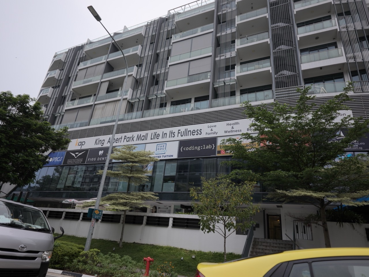
On one street, buildings sit close to the pavement, entrances arrive every few metres, upper floors frame the public realm, parking hides behind buildings and the ground floor remains active. On the other, the same shops and apartments sit behind surface parking, blank walls and deep setbacks.
If the zoning code mainly asks what use is this?, both developments can appear equally compliant.
A form-based code asks an additional and often more decisive question: what physical form will this rule produce along the street, block and public realm?
The Form-Based Codes Institute defines a form-based code as land-development regulation that uses physical form—rather than separation of uses—as the primary organising principle for achieving predictable built results and a walkable public realm. The instrument can be used citywide, in selected districts or as part of a hybrid code that combines form-based and conventional use regulation.
The reader job: understand when zoning should regulate place form directly
This article explains the operating logic of form-based codes: regulating plans, frontage types, building form standards, public-realm relationships, administration, hybrid systems and the failure modes that appear when a code regulates architecture without understanding urbanism.
Neighbouring articles already own adjacent problems. The Objective Code explains how measurable design standards can reduce discretionary uncertainty. The Building Edge owns the physical relationship between buildings and streets. Zoning and Compatibility owns broad use relationships. The Floor Area Ratio owns the arithmetic of capacity.
The Form-Based Code owns a different question: how can the regulatory system describe the three-dimensional town it wants strongly enough that compliant projects predictably contribute to that physical pattern?
Conventional zoning begins with separation
Traditional use-based zoning grew around an important public-health problem: incompatible activities can harm one another.
Heavy industry, housing, schools, nightlife, warehousing and hospitals do not always belong in the same place without controls. Use categories remain relevant because activities generate different noise, traffic, pollution, hazard and operating patterns.
But use classification alone does not tell a city what the street will look or feel like.
A district can allow housing and retail while producing towers behind parking lots, single-storey shops behind setbacks, or mixed-use buildings that meet the pavement. If the code cares about walkability, frontage, enclosure, block structure and the transition between public and private space, it needs rules that describe those things directly.
Form-based coding starts with the intended physical pattern
The design process often begins by documenting existing places or defining a desired place type.
What is the street width? How tall are buildings relative to that width? Where do entrances occur? How do ground floors meet the pavement? Are parking lots in front, beside or behind? How wide are sidewalks? Where are trees? How do blocks connect? What building types support the intended intensity?
The code then converts those observations and goals into legally administered standards.
This is one reason form-based codes often contain diagrams, regulating plans, building type standards and frontage rules. Urban form is difficult to communicate through prose alone.
The regulating plan replaces or supplements the conventional zoning map
A conventional zoning map typically assigns use districts to land.
A form-based regulating plan assigns place-based districts, transect zones, frontage conditions, street types or other form categories to specific locations.
The Form-Based Codes Institute’s guidance describes the regulating plan as a core tool that maps the physical framework the code intends to produce. Boundaries often follow streets, blocks, alleys or rear lot lines because the public realm and frontage condition are central.
This map is not merely graphic decoration. It is the spatial index for the code.
The code regulates the relationship between building and street
One of the most important variables is the build-to relationship.
A minimum setback tells a building how far it must stay away from a boundary. A build-to zone or frontage line can instead tell a building where its façade should be located to help frame the street.
That difference seems small. It can change the entire public realm.
If every building is free to retreat behind parking, the street loses enclosure and activity. If the code requires a defined frontage in appropriate urban contexts, entrances, windows and façades begin to shape the pedestrian environment.
Frontage types translate urban character into repeatable rules
A shopfront, porch, stoop, forecourt, arcade and dooryard create different relationships between indoor space and the pavement.
Form-based codes can define frontage types and state where each is permitted. The rule may specify entrance frequency, transparency, setback range, ground-floor height, awnings, stoop dimensions or how private open space transitions to the public sidewalk.
The objective is not to make every building identical. It is to regulate the interface that produces the shared street.
Building types can be more useful than vague density labels
A density number does not tell you whether housing arrives as townhouses, courtyard buildings, perimeter blocks or towers.
Some form-based codes therefore regulate building types directly. A district may permit rowhouses, small apartment buildings, mixed-use main-street buildings or larger blocks subject to stated dimensional rules.
This can help developers, residents and reviewers understand what the code is trying to enable. It also makes testing easier because planners can prototype representative building types on real parcels before adoption.
Height is only one part of form
A six-storey building can feel very different depending on frontage, upper-floor step-backs, floor-to-floor height, roof form, lot coverage and street width.
Form-based codes therefore often regulate several dimensions together: minimum and maximum height, building placement, façade length, frontage occupation, entrance spacing, lot coverage, parking location, upper-storey transitions and sometimes building width or depth.
The code is trying to control the shape of the urban room, not merely the number printed on the height table.
Street standards and building standards need to speak to each other
A good building code cannot rescue a hostile street section.
If the sidewalk is too narrow, crossings are unsafe, trees have no soil and traffic lanes dominate the right of way, perfect frontage standards still produce a poor pedestrian environment.
Likewise, a beautifully designed complete street can be undermined by parking lots and blank walls at every edge.
Form-based planning is strongest when street types and building frontages are coordinated. The public and private halves of the urban edge are designed as one system.
The public realm becomes an explicit regulatory outcome
This is the most important philosophical shift.
Conventional zoning often regulates private parcels and assumes the public realm emerges indirectly. Form-based coding treats the shared street, square and block face as a central outcome.
That does not mean the code designs every building. It means private development is asked to contribute predictably to the collective space outside the property line.
Use still matters
Form-based code is sometimes described too simplistically as zoning without use regulation.
In practice, many systems remain hybrid. Uses can still be prohibited, conditional or limited by floor, frontage or district. A nightclub, chemical plant, childcare centre and apartment create different operational impacts even if their buildings have similar form.
The planning question is not whether use regulation disappears. It is whether use separation remains the primary organising logic when the community’s main objective is a particular urban form.
Hybrid codes are often more practical than ideological purity
Built cities contain industrial areas, suburban corridors, historic centres, residential neighbourhoods and emerging mixed-use districts. One regulatory philosophy may not fit every context.
APA has long documented hybrid codes that combine conventional use controls with stronger form standards. Raleigh’s Unified Development Ordinance is one example of a system that mixes use-based and form-based regulation, including public frontage standards.
A hybrid approach can be pragmatic: preserve detailed use controls where compatibility risk matters, while using form rules where walkability, frontage and predictable infill are the dominant goals.
Form-based codes require a different review culture
A planning department accustomed to checking use, setback and parking tables may need new skills.
Reviewers must understand frontage, building type, street section, regulating plan and diagram conventions. Applicants need standard drawings and clear measurement rules. Survey information becomes important because small placement differences can change compliance.
APA’s guidance on living with a form-based code emphasises that adoption is only the beginning. Administration, staff training, conflict resolution and code adjustment determine whether the new regulatory model actually works.
Illustrations must be legally disciplined
Form-based codes often contain drawings because urban form is visual.
But a beautiful sketch can create legal ambiguity if nobody knows whether it is mandatory, illustrative or aspirational.
Every diagram should state its role. Is this a binding dimensional standard? A permitted building type? A nonbinding example? A measurement convention?
Text and graphics must agree. If the table allows one outcome while the diagram implies another, reviewers and applicants will eventually discover the conflict.
Measurement rules are the hidden machinery
Where exactly is the frontage line measured? Does a recessed entrance count toward façade occupation? How is building height measured on sloping land? Are balconies allowed to project? How much of a ground floor must meet the build-to zone? What counts as transparent glazing?
These questions determine whether the code is predictable.
Form-based codes are sometimes praised for visual clarity, but their reliability comes from measurement discipline. The drawing shows the idea; the measurement rule makes it administrable.
Parking location often matters more than parking count
A conventional code may focus on how many parking spaces exist.
A form-based code often cares intensely about where those spaces sit relative to the street.
Parking behind or beside buildings can preserve an active frontage. Parking between building and pavement can break it. Structured parking can support density but needs active ground-floor treatment if it occupies a major street edge.
This does not eliminate the broader parking debate. The Parking Equation owns that subject. The form-based job is narrower: prevent parking geometry from destroying the intended public realm.
Transitions matter at the edge of districts
A walkable mixed-use centre may sit beside lower-scale housing.
If the form-based code controls only the centre and ignores transition, height, servicing and overlooking can create conflict at the boundary.
Tools include step-backs, building-height transitions, rear access, landscape zones, limits on service entrances and carefully placed taller elements.
The code should regulate the actual interface rather than relying on a vague instruction to be compatible.
Form-based coding can make infill more predictable
Infill is difficult because new buildings enter an existing physical pattern.
If the code clearly describes frontage, height range, parking placement, entrance rhythm and building type, applicants can design inside a known envelope and neighbours can understand what the plan already permits.
This can reduce project-by-project negotiation. It can also expose when the code’s desired form is financially or geometrically unrealistic on common lots.
Regulatory unit testing matters before adoption
A form-based code should be tested on real parcels.
Take narrow lots, corner lots, deep parcels, shallow parcels, slopes, existing buildings and awkward ownership patterns. Apply the proposed frontage and building-type standards. Can compliant projects actually fit? Do fire access, utilities, loading and accessibility still work?
A code that looks elegant on a model block can fail on the cadastral reality of the town.
Prototype first. Adopt second.
Do not confuse form-based coding with architectural style control
A code can regulate urban form without dictating whether architecture is classical, modern, tropical, industrial or another style.
The public realm may need predictable placement, entrances, floor heights and frontage while leaving significant freedom in materials, expression and architectural language.
Overly prescriptive style rules can increase cost, freeze design culture and turn planning review into aesthetic policing.
The strongest form-based rules usually focus on the aspects of private development that have the clearest public-space consequence.
Do not make every street urban
Form-based coding is not synonymous with maximum intensity.
Different place types need different forms. A main street, neighbourhood edge, civic square, suburban retrofit area and rural hamlet should not all use the same build-to line or frontage type.
Transect-based approaches explicitly organise standards across gradients of intensity. Other systems use street types, character areas or locally defined districts.
The important point is context: regulate the form that serves the place, not a universal image of urbanism.
The code should allow useful variation
A street becomes monotonous if every compliant building has exactly the same height, setback and façade rhythm.
Good form-based codes often regulate ranges rather than one number, allow several building types, permit frontage alternatives and create room for courtyards, corner emphasis or civic exceptions.
Predictability should apply to the shared urban outcome, not to every architectural decision.
Civic buildings may need special treatment
Libraries, schools, places of worship, stations and government buildings often play different urban roles from ordinary private development.
A civic building may deliberately terminate a view, sit in a square, use a deeper setback for a forecourt or exceed ordinary height to become a landmark.
Codes can recognise civic frontage or building types so public architecture is not forced awkwardly into rules designed for repetitive private parcels.
Existing buildings create transition questions
A new form-based code enters a built city.
Many existing buildings will not match the new frontage, parking or placement rules. The code needs clear nonconforming provisions for maintenance, alteration, additions and rebuilding.
The goal should not be to make every useful old building illegal in spirit. Transition rules should allow improvement while guiding major redevelopment toward the intended form.
This is where The Nonconforming Use becomes part of code implementation.
Small projects need proportionate administration
A shopfront replacement should not require the same process as a full block redevelopment.
Form-based systems can create administrative tiers: routine compliance for minor work, objective review for standard development and discretionary review only where a project seeks a departure or affects a specially protected condition.
If every façade change needs a design board hearing, the code has not delivered predictable administration.
The form-based code needs a variance strategy
No code fits every parcel.
The zoning variance system must therefore understand which form standards are fundamental and which can receive bounded relief for unusual site conditions.
If variances repeatedly target the same frontage requirement or build-to rule, that is feedback. Perhaps the standard is wrong for common parcel geometry. Perhaps a different building type is needed. Perhaps the transition area was mapped poorly.
Variance data should improve the code rather than become a parallel design system.
Form-based codes can support mixed use without forcing it everywhere
Many form-based districts allow a range of compatible uses because the code is confident about building form and public-realm performance.
But mixed use can be vertical, horizontal or optional. A main-street building might permit shops or services on the ground floor and housing or offices above. A neighbourhood district may allow residential and small-scale civic uses. An employment district may focus on productive activity while still using form standards.
The code should distinguish between desired physical flexibility and activities that remain genuinely incompatible.
Affordability depends on what the form costs to build
A visually ambitious code can unintentionally increase construction cost.
Required articulation, unusual materials, excessive façade modulation, deep arcades, parking concealment or complex roof rules may improve one design objective while making ordinary housing harder to finance.
Every standard should have a public-realm reason. If the desired outcome can be achieved with a simpler rule, simplicity has value.
This is especially important during a housing shortage. Predictable form should enable production, not turn every compliant building into a bespoke object.
Climate performance should connect to form without overloading the code
Building orientation, shade, tree canopy, solar access, compactness and ventilation can have climate consequences.
Some of these belong naturally in form standards. Others are better handled by building, energy, landscape or environmental codes.
The form-based code should coordinate with those systems rather than duplicate them. A code becomes difficult to maintain when it tries to be the entire regulatory state.
Digital tools can make form rules easier to test
Because many form-based standards are geometric, they can be represented digitally.
A planning platform can display build-to zones, height envelopes, frontage requirements and permitted building types on a parcel. Applicants can test basic compliance earlier. Staff can focus attention on real conflicts rather than repeatedly calculating simple geometry.
Automation works best where the code is explicit. It cannot fix a diagram that contradicts the text or a standard whose measurement method is unclear.
A transect is one way to organise form, not the only way
Some form-based codes use a rural-to-urban transect. The idea is to organise districts by increasing intensity: natural and rural areas, suburban neighbourhoods, general urban fabric, centres and cores.
The transect can be powerful because it links many standards to one coherent place type. Street design, frontage, building type, height, lot pattern and landscape character can all change together as intensity changes.
But a community does not need to adopt transect terminology to use form-based principles. Other codes organise around neighbourhood types, street types, station areas, main streets, centres, waterfronts or locally defined character areas.
The test is whether the organising categories correspond to real spatial patterns that can be mapped and administered.
A regulating plan should be read at street scale
A conventional map can place one zone across an entire block and still function reasonably because the zone mainly regulates uses and parcel dimensions.
A form-based regulating plan may need finer resolution. The front of a parcel facing a main street may require a shopfront condition while the rear edge facing houses needs a lower-scale transition. A corner can have a different frontage role from a mid-block lot.
This does not mean every metre needs a different colour. It means the map should be detailed enough to reflect the physical relationships the code actually regulates.
Subdivision rules can quietly defeat the intended form
A form-based code may permit rowhouses, courtyard buildings and compact mixed-use blocks, while the subdivision ordinance still demands oversized lots, wide streets, deep utility easements or turning geometry designed for a very different development pattern.
When that happens, the zoning code promises one town and the subdivision code permits another.
Code reform should therefore test lot creation, block length, alley standards, street connectivity, utility placement and emergency access alongside building form. The parcel pattern is the skeleton that later buildings inherit.
Fire and access requirements should be integrated early
Walkable urban form can conflict with emergency-access rules if the systems are designed separately.
Narrower streets, rear lanes, closely spaced buildings and internal courtyards may require different operational solutions than low-density development. Fire apparatus access, hydrant placement, turning, aerial access and building protection all need to be resolved without simply widening every street after the urban design work is finished.
The solution is interdisciplinary code writing. Fire, public works, utilities, accessibility specialists and planners should test representative blocks together before adoption.
Loading and servicing are part of form even when they are invisible in renderings
A mixed-use street needs deliveries, waste collection, move-ins, maintenance and utility access.
If the code focuses only on the attractive public frontage, these operational functions can end up blocking cycle lanes, occupying sidewalks or cutting through pedestrian space.
Form standards should identify where loading and service access belong, particularly on larger blocks. Alleys, side streets, timed curb zones and internal service courts can all play roles.
The public realm is not protected by pretending servicing does not exist. It is protected by designing where servicing goes.
Ground-floor height creates future adaptability
A ground floor built barely tall enough for one residential layout can be difficult to convert later to shops, studios, clinics or community uses.
Some form-based codes require greater floor-to-floor height on important mixed-use frontages. That adds initial volume and sometimes cost, but it can preserve future flexibility.
This is a long-term planning choice. The code is not only shaping today’s tenant. It is deciding whether the building can support different street-level uses over decades.
Blank-wall limits should be written around pedestrian experience
A large building may technically touch the build-to line and still create a dead street if the wall has no doors or windows for a long distance.
Form-based systems often control blank-wall length, entrance spacing or ground-floor transparency to keep the edge visually and functionally connected to the pavement.
These rules need context. A theatre, supermarket, school gym or industrial building may have legitimate programmatic reasons for long interior spaces. The code can offer alternative treatments such as liner uses, display windows, art, landscape or secondary entrances without losing the public-realm objective.
A code can be too diagrammatic
There is a failure mode at the opposite extreme from vague zoning.
The code becomes a catalogue of highly specific building diagrams that only fit ideal sites. Applicants spend more time proving that their building resembles a coded prototype than solving the actual planning problem.
The strongest systems regulate essential relationships and use building types as tools, not costumes. A building type should describe a flexible spatial logic—such as courtyard, rowhouse or mixed-use block—rather than prescribe every architectural move.
Adoption should include a calibration period
A new code will reveal issues that no workshop catches.
The first dozen applications may expose unclear definitions, impossible combinations, gaps between diagrams and text or parcel types that were not tested.
Cities should plan for early monitoring. Track interpretations, applicant questions, variance requests, review time and standards that repeatedly fail. Publish clarifications. Make technical corrections through a transparent process.
A code that learns after adoption is stronger than one that defends every first draft as permanent.
A worked example: the same mixed-use corridor under two codes
Imagine a corridor where the plan wants apartments over shops, a continuous pedestrian edge and enough flexibility for redevelopment.
A conventional code might allow residential and commercial uses, set a maximum floor-area ratio, require a 5-metre front setback and mandate a minimum parking ratio. A developer can comply by placing a four-storey mixed-use building behind a surface parking lot.
A form-based version might permit the same broad uses but require most of the façade within a build-to zone, place parking behind buildings, require shopfront or forecourt frontage on the main street, define a four- to six-storey height range, set minimum ground-floor height and control blank-wall length.
Both codes can claim to permit mixed use. Only the second directly regulates the physical street outcome.
That is the reason form-based coding exists: not because use regulation is irrelevant, but because the shape of development deserves its own explicit regulatory language.
A practical form-based code audit
- Vision: What physical place type is the code trying to produce?
- Regulating plan: Are place-based districts or frontage conditions mapped clearly?
- Use: Which activities remain regulated, conditional or prohibited?
- Building placement: Does the code specify where buildings meet the street?
- Frontage: Are entrances, glazing and transitional elements regulated where they matter?
- Building types: Are permitted types understandable and feasible on real parcels?
- Height: Does height work together with street width, step-backs and transitions?
- Parking: Is location controlled so parking does not dominate the public edge?
- Streets: Do right-of-way standards support the private frontage rules?
- Transitions: Are edges to lower-scale or sensitive areas handled explicitly?
- Graphics: Is every diagram clearly mandatory, illustrative or advisory?
- Measurement: Can reviewers reproduce every dimensional test consistently?
- Variation: Does the code allow enough range to avoid architectural monotony?
- Civic buildings: Are special public-building roles recognised?
- Existing development: Can nonconforming buildings be maintained and improved?
- Small projects: Are minor alterations reviewed proportionately?
- Variances: Is there a bounded relief path for truly unusual parcels?
- Cost: Have standards been tested for construction and housing feasibility?
- Administration: Are staff and applicants trained to use the code?
- Digital readiness: Can rules be assembled into a parcel-specific development envelope?
- Feedback: Are repeated interpretation and variance issues used to update the code?
The form-based code is a promise about the street
A zoning code is not only a list of things people may do on private land.
It is also a production system for the physical town.
If a community wants walkable blocks, active frontages, coherent streets and predictable infill, it should not rely entirely on hope that use categories and maximum height will accidentally produce them.
A form-based code moves that intention into the operating rules.
It maps place types. It defines how buildings meet streets. It regulates the pieces of private form that create shared public space. It keeps use controls where they remain necessary. It replaces vague character arguments with measurable geometry where possible. And it treats administration as part of code design rather than an afterthought.
The success test is not whether the ordinance contains attractive diagrams. It is whether ordinary compliant projects, built by different owners over many years, gradually assemble the public realm the plan said it wanted.
Sources and further reading
- Form-Based Codes Institute — Standards of Practice and definition of form-based codes
- Form-Based Codes Institute / Smart Growth America — form-based code learning resources and hybrid code guidance
- American Planning Association — Living with Your Form-Based Code
- American Planning Association Knowledgebase — Form-Based Codes for Zoning Reform to Promote Sustainable Development
- American Planning Association Knowledgebase — Raleigh, NC Unified Development Ordinance
- American Planning Association — current planning RFP example considering form-based code and overlay zoning tools
Continue reading: Planning rules, permissions and land rights · Full Town Planning Series Index · Urban Planning Master Edition.