
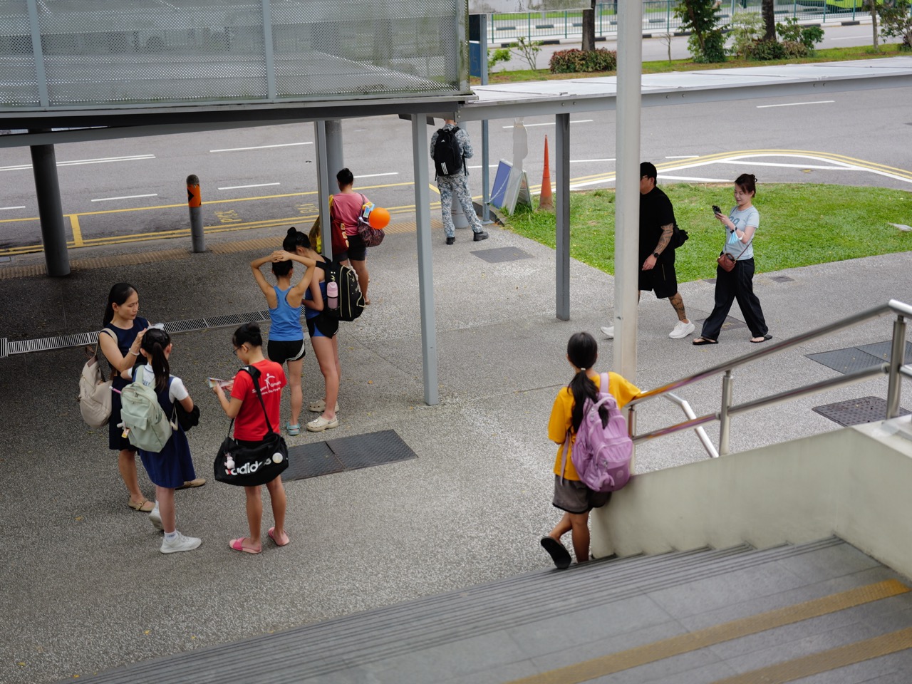
Bukit Timah residents following 2027 drainage, roadside works and safer everyday journeys have several locations worth monitoring: Eng Kong Place, Yarwood Avenue, Watten and neighbouring estates, together with possible future works along Eng Neo Avenue and parts of Bukit Timah Canal. These projects do not share one timetable, and some targets first appeared in older PUB project registers.
For a parent travelling to school, a senior walking to a bus stop or a driver using Dunearn Road, the most useful information is not merely the phrase “drainage improvement”. It is which section of road may be affected, what the work is intended to do, whether it has started, and how the safe walking and vehicle routes will be managed.
The most important new fact is that PUB completed the entire 2.3 km Upper Bukit Timah Canal upgrade on 23 October 2026. This 2027 briefing uses that completed milestone as its starting point, then explains what a 2025 PUB work schedule had said about separate 2027 projects. Information checked on 27 October 2026; old schedule targets are not confirmations of present-day project status.
In this guide
- The headline: what is finished, what had a 2027 target, and what remains to check
- A simple explanation of how Bukit Timah drainage works
- The Upper Bukit Timah Canal upgrade is complete—why it matters in 2027
- Why the canal project and the green-corridor project are not the same
- The PUB April 2025 register: valuable but not a live 2026 status feed
- Eng Kong Place: why its Q1 2027 entry needs careful reading
- Yarwood Avenue: the Q2 2027 date belongs to an older snapshot
- Watten, Soo Chow and Adelphi estates: several places, one older register entry
- Eng Neo Avenue, Maple Avenue and Queen’s Road: target start versus target finish
- The future possibility of underground stormwater storage
- What additional rain capacity does—and does not—guarantee
- Roadworks and pedestrian safety: the questions that matter most
- Drivers: where to check current road conditions instead of guessing
- Families: make a rainy-day school journey plan
- Seniors and caregivers: access is as important as the drain
- The municipal-reporting habit that helps everyone
- A useful distinction: PUB, LTA, NParks and the contractor
The headline: what is finished, what had a 2027 target, and what remains to check
Completed on 23 October 2026: PUB announced completion of the full 2.3 km Upper Bukit Timah Canal upgrade after the final 900-metre stretch between Rifle Range Road and Jalan Kampong Chantek was finished. The upgraded canal can convey 30% more stormwater. This is no longer correctly described as a canal project still waiting to finish in 2027.
Eng Kong Place: PUB’s 10 April 2025 published work register listed drainage work at Eng Kong Place, with a then-targeted completion period of Q1 2027. The register does not prove that the same date remains current in October 2026.
Yarwood Avenue: The same 2025 register listed roadside drainage work at Yarwood Avenue with a then-targeted completion of Q2 2027. Residents need an updated project notice before treating this as a guaranteed handover.
Watten, Soo Chow and Adelphi estates: A 2025 register listed a group of older-roadside-drain improvements in these estates, with a then-targeted completion of Q2 2027. The exact streets and work stages depend on project-specific information.
Eng Neo Avenue / Bukit Timah Canal: The same snapshot listed proposed improvements to Eng Neo Avenue outlet drain and Bukit Timah Canal, from Maple Avenue to Queen’s Road, with a Q1 2027 target commencement, not a target completion. Starting works and finishing works are different milestones.
Further planning: PUB is studying longer-term catchment measures, potentially including underground stormwater storage. A feasibility study is not a funded, scheduled construction commitment.
These distinctions can save families from making plans on outdated information.
A simple explanation of how Bukit Timah drainage works
Bukit Timah’s terrain matters. Rainwater does not fall on a perfectly flat, uniform surface. A high-intensity storm produces runoff that travels downhill across roofs, roads, gardens, paved spaces and drainage networks before being carried towards larger canals.
Because Bukit Timah has a valley-like catchment in several areas, a storm can cause rainwater to concentrate quickly. As urban surfaces grow more extensive, drainage design has to account for rapid runoff and very intense tropical rainfall.
Roadside drains, outlet drains, canals and larger diversion works each do different jobs. A roadside drain takes surface runoff from nearby land and streets. Larger drains and canals carry water across a wider catchment. Some infrastructure provides storage or changes how flows are distributed.
Understanding those layers prevents a common mistake: when a major canal upgrade finishes, people may assume every minor roadside drainage project is also completed. They are independent pieces of a connected network.
The Upper Bukit Timah Canal upgrade is complete—why it matters in 2027
PUB’s 23 October 2026 media release says the final 900-metre stretch of Upper Bukit Timah Canal was widened and deepened, with the former trapezoidal channel changed to a U-shaped drain and box-culvert arrangement.
PUB states that the completed works increased the canal’s capacity to convey stormwater by 30% and strengthened flood resilience for an approximately 1,000-hectare catchment. This area includes homes, shops and the surrounding transport network.
That is significant for a district that experienced repeated rainfall-related concerns. It also means some pre-October 2026 articles or PDFs may be out of date. A good 2027 update should say completed October 2026, rather than repeat an older planned-completion figure.
However, PUB is explicit that no drainage system can eliminate all flood risk. Particularly intense rainfall can still create hazards. Households should keep practical rain safety arrangements even when infrastructure improves.
Why the canal project and the green-corridor project are not the same
The Bukit Timah–Rochor Green Corridor has a first elevated pedestrian phase targeted for completion by 2027. That is a green walking and recreation project. The Upper Bukit Timah Canal upgrade is a separate flood-resilience infrastructure project already completed in October 2026.
The two may appear in similar geographical descriptions, but their objectives and public access are different. A completed canal structure does not automatically give people permission to walk along a future landscaped connection or through a construction zone.
NParks describes the first approximately one-kilometre elevated green corridor from the Rail Corridor towards Jalan Kampong Chantek. The project’s public opening arrangements still require their own confirmation.
For the green-space distinction, read Bukit Timah 2027: Rail Corridor, Rochor Green Walk and Nature Events.
The PUB April 2025 register: valuable but not a live 2026 status feed
PUB published a Drainage Improvement Projects register updated 10 April 2025, containing tables of ongoing and upcoming works. The register is useful because it specifies locations and, for some entries, the expected quarter of completion or commencement.
But a reader should notice the publication date at the top. A schedule prepared in April 2025 may change because of site conditions, utilities, contracting, weather, coordination or project decisions. It must not be described as an October 2026 confirmation that a particular site will complete exactly on that older target.
This article therefore labels those dates as 2025 snapshot targets. To confirm a project’s status in 2027, consult current PUB project information and any notices from the responsible agency or contractor near the actual worksite.
Read the original PUB drainage register updated 10 April 2025 alongside later PUB news—not instead of it.
Eng Kong Place: why its Q1 2027 entry needs careful reading
The April 2025 PUB list identifies Eng Kong Place as a roadside drainage-work location with a Q1 2027 target completion. That is a useful lead for residents, but it is not proof that the target is unchanged, that every adjacent street is affected or that construction must be happening at a particular moment.
A person living nearby should look for the project’s actual works notice or a later update. The notice should identify precisely which stretch of drain or road is involved, any footpath restrictions, working hours, site contact and expected dates.
A street may be narrow or used by both pedestrians and vehicles. In such places, the details of temporary access matter. Does a footpath remain passable? Are people directed to a safe signalised crossing? Can a delivery vehicle enter? Is the alternative route usable with a pram?
An improvement that reduces long-term flood vulnerability should also be planned to manage short-term access safely. Residents can ask specific questions without assuming the work itself is unnecessary.
Yarwood Avenue: the Q2 2027 date belongs to an older snapshot
For Yarwood Avenue, the same April 2025 register recorded drainage works with a Q2 2027 target completion. That is a dated projection. The correct 2027 report should seek an updated status rather than copy the quarter as a guaranteed final date.
Families using Yarwood Avenue for daily walking, driving or school transport should identify the actual project extent and any changes to access. Not every house on an avenue is necessarily beside the work area.
Residents may also want to know how drainage construction interacts with utility covers, driveway entrances and the condition of surrounding footpaths after reinstatement. A newly completed drain does not automatically mean every piece of pavement is fully restored on the same day.
If there is a concern, record the location, date and observed issue and refer it to the agency or contractor named in the notice. Avoid sending photographs showing unrelated people or private property details when they are not necessary.
Watten, Soo Chow and Adelphi estates: several places, one older register entry
The PUB 2025 document grouped older roadside-drain improvement works in Watten, Soo Chow and Adelphi estates under an estate-upgrading contract, with a then-targeted completion of Q2 2027.
A grouped project description does not tell a reader the exact condition at every street in each estate. Work may be sequenced, restricted to selected drains or require coordination around existing utilities. Current site arrangements must be checked directly.
This matters for communication. Saying “Watten estate drains are complete” is too broad without a verified project notice. Saying “PUB’s April 2025 register listed a grouped project with a Q2 2027 target” is both more accurate and easier to update when new information appears.
Affected residents can monitor official notices and ask about temporary crossings, reinstatement, access for older adults and the process for reporting any unresolved obstruction.
Eng Neo Avenue, Maple Avenue and Queen’s Road: target start versus target finish
The upcoming projects section of the April 2025 PUB register included improvements to Eng Neo Avenue outlet drain and a stretch of Bukit Timah Canal from Maple Avenue to Queen’s Road, with a Q1 2027 target commencement.
That is a different kind of date. It describes when work was intended to begin, not when the project would be completed. Turning it into a “2027 completion” headline would be wrong even if the older projected start were still valid.
Before drawing a conclusion, residents should look for an updated PUB statement identifying the exact scope, whether the project has started, the expected work duration and any affected road or waterway access.
For parents near schools or commuters using connected roads, the important questions relate to safe pedestrian continuity and the handling of work vehicles. A future construction start can influence planning without justifying a made-up detour before any actual traffic advisory is published.
The future possibility of underground stormwater storage
PUB’s October 2026 completion release also describes a feasibility study of broader flood mitigation measures for the Bukit Timah catchment. Measures under consideration include underground detention structures that could store excess stormwater temporarily.
This is interesting because the amount of land available for conventional open drainage works is limited in a built-up neighbourhood. Underground storage, where feasible, can help manage peak flows without requiring every improvement to take the form of a visible surface canal.
But the word feasibility matters. A study evaluates options and constraints; it is not the same as an approved construction programme, selected site or promised operating date.
Residents should not expect an underground storage facility to begin or finish in 2027 solely because PUB says it is studying the concept. Watch for formal results, project announcements, environmental or technical details and confirmed timelines.
What additional rain capacity does—and does not—guarantee
The completed canal’s additional capacity is a measurable improvement. It means the enhanced channel is designed to carry more stormwater than before, improving resilience under the relevant engineering assumptions.
It does not mean every side drain has unlimited capacity, that water can never collect on the road or that exceptionally intense rainfall can no longer cause danger. Local rainfall intensity, blockage, debris, inlet conditions, topography and flows from surrounding sites can still matter.
This distinction is important for people making decisions under time pressure. During very heavy rain, the sensible response is to follow current warnings and avoid flooded roads or paths rather than take a risk because an infrastructure project was completed.
Singapore’s flood management depends on infrastructure, monitoring, preparedness and public behaviour working together. No single canal can replace the last three.
Roadworks and pedestrian safety: the questions that matter most
When an estate drain is repaired or a road is excavated, pedestrian conditions can change quickly. Temporary hoardings, uneven surfaces, narrower walkways and shifted crossings may create problems even when the work is necessary.
Residents should ask whether the temporary route is continuous, visible, adequately separated from vehicles and accessible to people using walking frames, wheelchairs or prams. A detour that is manageable for a healthy adult may not be workable for everyone.
At a school-route location, observe times when students arrive and leave. A junction can be calm at 11am but crowded at 7.15am or after dismissal. These actual patterns are important when reporting a problem.
The best feedback identifies the precise access point, direction of travel, typical time and specific unsafe condition. This gives the responsible organisation enough information to investigate.
Drivers: where to check current road conditions instead of guessing
LTA’s OneMotoring Traffic Information and Road Works page provides access to live traffic information, roadworks and related notices.
This is the better source for deciding whether a current road closure affects a journey than an article written months earlier about a future infrastructure plan. Roadworks may be announced at short notice, and some works are carried out in phases or at off-peak times.
If you drive towards the PIE or through the Bukit Timah Road and Dunearn Road network, check the actual affected road, direction and time. A closure of one turning movement is not a closure of an entire district.
Consider alternate routes only after confirming the official notice. An improvised shortcut through smaller residential streets can transfer congestion and safety problems to neighbours.
Families: make a rainy-day school journey plan
A family with a child attending school in 2027 should know the normal route and one practical alternative. The alternative may involve a safer sheltered approach, a different bus stop or an agreed adult pick-up arrangement.
Teach children why walking into floodwater, crossing an active construction area or following strangers through an informal shortcut is unsafe. A student who sees a usual route blocked should know how to contact a parent, school or trusted adult and what location is safe to wait in.
Parents should use current school instructions and public transport advisories. A future MRT station or proposed green walkway is not a present substitute for a safe crossing.
Where the child has additional accessibility needs, coordinate the route with the school early. An alternative that adds long steps, steep slopes or a crowded unprotected crossing may not be suitable.
Seniors and caregivers: access is as important as the drain
For an older person, infrastructure disruption can have a different impact. A hoarding that narrows a walkway may make it difficult to reach a bus stop. A temporary step may be an obstacle for someone using a walking aid. The absence of a safe resting point may turn a short journey into an exhausting one.
Caregivers can inspect the intended route and check whether temporary access meets the person’s practical needs. If safe access is not maintained, report the exact obstruction and request a usable alternative.
Before an important medical appointment, confirm the real route rather than relying on an older digital map. If public transport or pedestrian access is affected, allow more time or choose another appropriate travel arrangement.
Construction safety is not only about traffic capacity. It is also about maintaining the independence and dignity of people who have fewer mobility options.
The municipal-reporting habit that helps everyone
When a resident discovers a blocked drain, damaged footpath, unsafe barrier or public-space maintenance issue, the quality of the report matters. A useful report includes the location, time, problem, effect on users and, if safe, a clear photograph.
Singapore’s OneService platform helps residents submit feedback on municipal issues and route it to the responsible agency. Not every issue belongs to the same authority, and emergency danger should be handled through the appropriate urgent channel rather than by waiting for a routine service request.
Do not enter a closed worksite or stand in a flooded road to obtain a photograph. Report only what can be observed safely from a public location.
If you are forwarding a notice to neighbours, include its issue date and the link to the agency source. An undated screenshot can become misleading once a works schedule changes.
A useful distinction: PUB, LTA, NParks and the contractor
Residents sometimes contact the wrong organisation because several agencies appear in the same geographical area. PUB handles water and drainage systems. LTA manages relevant public-road and transport information. NParks manages parks and nature routes under its purview. A particular project may also have a named contractor and site office.
The agency responsible for a structural drainage decision may not be the same party issuing a traffic diversion notice for works nearby. Reading the works notice helps identify who can address a specific question.
For example, a request for a safe alternative pedestrian route during a road closure may require the road or project authority’s advice, while a question about the completed canal’s flood-resilience design belongs with PUB.
Don’t rely on generic forum replies that say “contact the government”. Use the stated project contacts and precise details.
A 2027 road and drainage watchlist by topic
For Eng Kong Place: check whether a later PUB notice confirms, revises or replaces the April 2025 Q1 2027 completion target.
For Yarwood Avenue: likewise verify the April 2025 Q2 2027 completion target against the latest site-specific information.
For Watten, Soo Chow and Adelphi: seek updated work stages for the grouped estate-upgrading contract, rather than assuming the 2025 document described every street in the same way.
For Eng Neo Avenue and Maple Avenue–Queen’s Road: check whether the old Q1 2027 target commencement remains the current plan; it was never listed as a 2027 completion.
For Upper Bukit Timah Canal: treat October 2026 completion as confirmed and follow the wider catchment-study updates separately.
The list is a guide to what to verify, not a prediction that these milestones will occur exactly on their older scheduled dates.
A practical checklist before leaving home during intense rain
- Read current heavy-rain and flood notices through official channels, especially for a journey through a location known to collect water.
- Avoid walking, driving or cycling into visibly flooded areas. Water depth, current and conditions beneath the surface may not be apparent.
- If a familiar path is closed, use the marked public alternative rather than entering an active construction zone.
- Keep a simple household communication plan for children, older relatives and caregivers.
- Do not stop to photograph a stormwater channel from an unsafe edge.
- If school or work arrangements must change, contact the relevant party early and explain the situation clearly.
PUB provides Get Flood-Wise information and flood-safety advice. Practical readiness should continue even as drainage infrastructure improves.
Why 2027 is a good year to teach children how infrastructure works
A drain may seem ordinary, but it is a useful example of engineering designed for public safety. Water flows downhill, rainfall intensity changes over time and a canal has a limited capacity. Children can learn to distinguish a physical observation from a claim that needs evidence.
Suppose a student sees a deeper drain with new barriers. They can describe the visible changes, then read PUB’s explanation of the upgrade. They should not infer the exact new water capacity from appearances alone; engineering data must come from the source.
Older students can compare maintenance, upgrading and studying future options. They can ask why a large completed canal may still need supporting local roadside drains and how environmental and construction constraints influence design.
This habit makes local news more useful. Instead of remembering that “something was upgraded”, the child understands what problem engineers were addressing and what uncertainty remains.
Frequently asked questions
Is the Upper Bukit Timah Canal upgrade still scheduled for 2027?
No. PUB announced completion of the entire 2.3 km project on 23 October 2026. Older documents with an earlier projected completion should be read as historical schedules.
Has flood risk disappeared from Bukit Timah?
No. PUB says no drainage system can eliminate flood risk entirely. The completed canal provides more capacity, but very intense rainfall can still create hazards.
Will Eng Kong Place drainage finish in Q1 2027?
PUB’s April 2025 project register listed Q1 2027 as its target. That old listing is not a confirmation the date remained unchanged. Check current project notices.
What about Yarwood Avenue and Q2 2027?
The same 2025 register listed Q2 2027 for Yarwood Avenue drainage works. Treat it as an older target pending an up-to-date project status.
Are the Watten, Soo Chow and Adelphi works one single street project?
No. They were grouped in an estate-drain upgrading contract. Exact affected stretches and work phases require the current project information.
Does the Eng Neo Avenue project have a 2027 completion target?
The cited April 2025 document recorded a Q1 2027 target commencement, not a completion date. The status and schedule need to be verified again.
Does PUB have a confirmed underground flood-storage project ready for 2027?
PUB has described a feasibility study of longer-term options, including possible underground detention. A study is not a confirmed construction schedule.
Where can I see current road closures?
Check LTA OneMotoring’s traffic and roadworks tools and official notices near the affected site.
Who do I inform about a damaged public walkway or drain?
Use the responsible project agency or the relevant official municipal reporting channel, including OneService where appropriate. Give the exact location and avoid placing yourself in danger while documenting the issue.
What is the most useful step for a household in 2027?
Know the current safe route, monitor official rain and roadwork advisories, and distinguish completed drainage improvements from separate works whose older targets may have changed.
Sources and local further reading
- PUB: Upper Bukit Timah Canal upgrade completed 23 October 2026
- PUB: Drainage Improvement Projects register, updated 10 April 2025
- PUB: Get Flood-Wise
- PUB: Flood Safety Tips
- LTA: Live traffic information and road works
- OneService: municipal issue reporting
- eduKateSG: Eng Kong Place drainage Q1 2027 guide
- eduKateSG: Understanding drainage timelines in 2027
- eduKateSG: Eng Neo Avenue and Dunearn Road planning studies
- eduKateSG: 2027 community calendar and flood readiness
- Bukit Timah 2027: Schools and family travel planning
- Bukit Timah 2027: Holland Plain and Dunearn Road neighbourhood change
The takeaway: 2027 has real reasons for Bukit Timah residents to monitor local drainage projects, but the dates are not all live confirmations. The major canal upgrade is complete; several roadside targets came from a 2025 register; and future catchment storage remains under study. Accurate dates, safe routes and practical preparedness are what turn this information into something valuable for a household.