
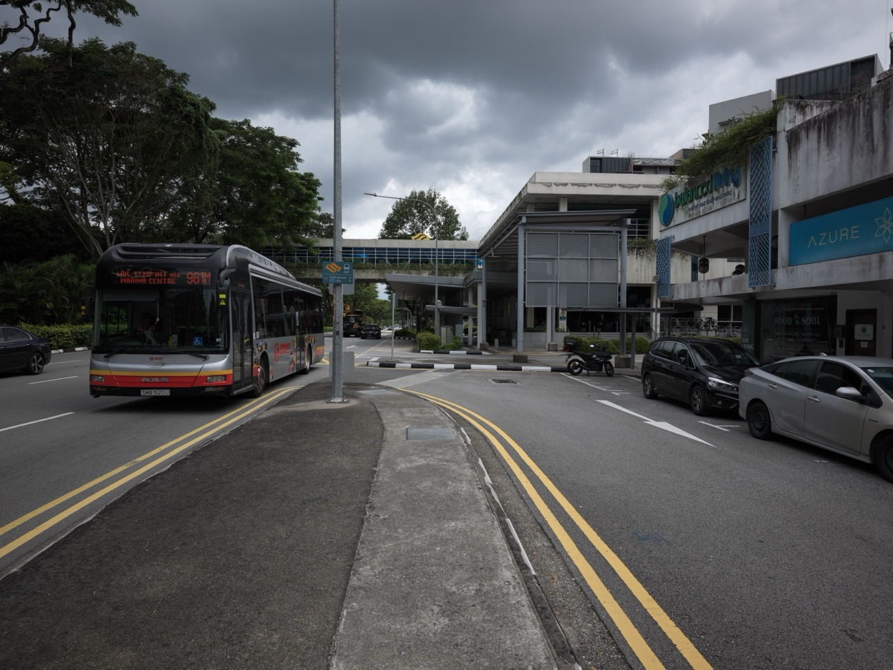
A reader who lives around Prince’s Road, King’s Road or Queen’s Road in Bukit Timah has a real drainage project to follow in 2027. Singapore’s national water agency, PUB, identified these three roads in its 17 November 2025 drainage-upgrading annex as locations where it plans to expand roadside drains.
This is a forward-looking plan, not a notice that every section of all three roads will be excavated or completed during 2027. PUB did not publish an exact start date, road-by-road contractor or final completion day for these three roadside expansions in that announcement.
There is also a newer achievement to keep separate. On 23 October 2026, PUB declared the entire 2.3-kilometre Upper Bukit Timah Canal upgrade completed, adding approximately 30% more stormwater conveyance capacity along that part of the network. That does not remove the need to improve local drains elsewhere in the catchment, nor does it guarantee that heavy rainfall can never cause flooding.
In this guide
- What has actually been announced?
- Where are Prince’s Road, King’s Road and Queen’s Road?
- Why the area has a flood-resilience history
- What happened during the April 2025 storm?
- The December 2025 warning near King’s Road
- What is a roadside drain?
- Why local drains remain important after the canal upgrade
- The October 2026 Upper Bukit Timah Canal milestone
- Why 30% capacity is not 30% less flood risk
- Three roads do not necessarily mean one continuous worksite
- Prince’s Road: questions residents can ask
- King’s Road: interpreting the earlier flood record
- Queen’s Road: avoid assuming it shares King’s Road’s history
- What information is still missing?
- How to read a construction notice when one appears
- Why underground utilities can affect a roadside project
- Footpaths, driveways and deliveries
- What parents should check before school journeys
- Why older residents need a continuous route
For Bukit Timah residents and families, this guide explains what is confirmed, why local roadside drains still matter, how to interpret warnings, and what to look out for in 2027. Facts reviewed 4 November 2026 against PUB’s official releases and the local historical record.
What has actually been announced?
- 17 November 2025: PUB announced plans to expand roadside drains along Prince’s Road, King’s Road and Queen’s Road as part of its wider Bukit Timah drainage programme.
- The source: PUB Annex A — Drainage Upgrading at Bukit Timah.
- Project status: the three local expansions were described as planned future works, not as completed construction.
- Exact 2027 dates: PUB’s November 2025 annex does not establish separate firm start or finish dates for the three roads.
- 23 October 2026: the Upper Bukit Timah Canal improvement was completed, a distinct project farther up the catchment.
- Flood safety: a completed canal does not mean every roadside inlet, drain or lower-lying road has been upgraded.
- Practical preparation: monitor PUB rain and flood messages, identify safe routes and follow any later worksite traffic and pedestrian notices.
- Official authority: a later PUB project bulletin or dated LTA restriction should take precedence over a 2025 planning summary.
The most important editorial rule is to distinguish what is planned, what is underway, and what has opened or been completed.
Where are Prince’s Road, King’s Road and Queen’s Road?
These are established residential roads around the Farrer Road and Coronation Road side of Bukit Timah. They belong to a different neighbourhood context from drainage sites at Eng Kong Place, Yarwood Avenue or Jalan Jambu Ayer.
The names can also be confused in informal reports. King’s Road is a road name; King Albert Park is a different part of Bukit Timah; King’s Road Park is a nearby public park. They should not be treated as the same location simply because they share a word.
A drainage update is useful only when it identifies the exact road and section. An announcement that mentions all three roads does not mean every driveway along their entire lengths will be affected by one simultaneous construction stage.
Residents should preserve the road name, official source and date when sharing information.
Why the area has a flood-resilience history
Bukit Timah’s valley-like topography channels rainwater from higher ground towards lower-lying drainage routes.
In the past, intense storms have caused local flooding near Bukit Timah Road, King’s Road and other parts of the wider drainage catchment.
For example, during the 20 April 2025 heavy-rain event, PUB issued flash-flood warnings and deployed its Quick Response Team. Reports described flooding along King’s Road between Prince Road and Lutheran Road, among other locations.
That event is historical evidence of the kinds of pressures the area has experienced. It is not a prediction that the same road section will flood at a particular date in 2027.
The purpose of drainage investment is to improve resilience while acknowledging that unusually intense rain can still present hazards.
What happened during the April 2025 storm?
PUB and contemporary reporting documented flash floods in several Singapore locations, including parts of Bukit Timah.
The event involved heavy rainfall over a relatively short period. PUB’s response included warnings and on-the-ground traffic assistance where necessary.
The details are important because flooding is not limited to a single kind of property. Road users, residents, deliveries and pedestrians may all be affected when surface water accumulates.
However, one event does not establish a permanent flood condition at a specific home. Local elevation, inlets, the drainage network and the actual storm determine what happens.
When discussing 2027, residents should use live warnings rather than treating a 2025 photograph as a current picture.
The December 2025 warning near King’s Road
In December 2025, PUB also issued a heavy-rain flood-risk warning around the junction of King’s Road and Prince Road, alongside other locations in the wider Bukit Timah area.
A flood-risk warning is not automatically confirmation that a flash flood occurred at every place named. Authorities may warn residents when conditions make flooding possible.
The distinction matters for credible local information. A person should not describe a risk alert as evidence that a road was submerged without supporting observations or an official incident report.
For families, the correct response is nevertheless to take a timely alert seriously and avoid unsafe low-lying routes.
Risk communication is valuable precisely because it can lead people to change plans before an incident becomes dangerous.
What is a roadside drain?
A roadside drain collects stormwater running off roads and adjoining land.
When rain falls on roofs, pavements and other surfaces, some water reaches gutters, inlets and roadside channels. Those local drains then connect to larger drainage infrastructure.
The size, gradient, condition and connections of a drain affect how rapidly water can move.
Expanding a roadside drain may increase its capacity, but the exact engineering method depends on the site. PUB’s general annex does not say that all three roads will receive identical rectangular drains.
An individual worksite design must be confirmed before residents can identify the actual construction method or required temporary access arrangements.
Why local drains remain important after the canal upgrade
Imagine a large downstream channel that can carry more water, but a smaller local connection that still has difficulty accepting a sudden surge.
The improved channel does not automatically remove the bottleneck at every smaller inlet.
That is a simplified analogy, not a full engineering model, but it helps explain the principle behind a drainage network.
The completed Upper Bukit Timah Canal and the future Prince’s, King’s and Queen’s Road expansions concern different parts and levels of infrastructure.
It would be inaccurate to say that completing the major canal proves all three roadside projects are unnecessary—or already finished.
The October 2026 Upper Bukit Timah Canal milestone
PUB announced that all upgrades along 2.3 kilometres of the Upper Bukit Timah Canal were completed on 23 October 2026.
The final 900 metres from Rifle Range Road to Jalan Kampong Chantek had been under improvement since 2019.
The completed canal was widened and deepened, with a change in channel form. PUB says it is now capable of conveying about 30% more stormwater compared with the previous capacity.
That is an engineering milestone already achieved.
It does not indicate the completion of every separate local drainage project in the broader district or the future opening of a park.
Why 30% capacity is not 30% less flood risk
The percentage refers to the canal’s ability to convey stormwater.
It does not mean rainfall intensity has fallen by 30%, every homeowner’s property risk has dropped by exactly 30%, or that floods are mathematically impossible.
Rainfall can arrive at different intensities and locations. Smaller drains, road levels, obstructions and downstream conditions also influence surface flooding.
PUB itself states that no drainage system can eliminate flood risk completely.
For residents, that is not a reason to dismiss the improvement. It is a reason to appreciate what the number measures and still take official flood advisories seriously.
Three roads do not necessarily mean one continuous worksite
The public announcement names three roads, but does not publish a single continuous excavation zone joining every stretch.
A project may be carried out in stages, and each stage may involve different utilities or road access requirements.
Residents should not infer that all three roads will be fully closed on the same dates.
Likewise, work beginning at one road does not automatically establish that another has started.
An accurate update should identify the individual contract, road segment, stage and current access notice before naming specific affected addresses.
Prince’s Road: questions residents can ask
For someone living on Prince’s Road, useful questions include which roadside segments are under consideration and whether a future change might affect the pedestrian approach to a crossing.
Residents may also want to know how existing drains connect to adjacent roads and whether the project requires utility relocations.
These are legitimate questions, not confirmed impacts.
When an engineering scope is published, the responsible authority should identify the particular work areas and arrangements.
Until then, a homeowner should not schedule renovation, property sale or driveway alterations based on a guessed future construction layout.
King’s Road: interpreting the earlier flood record
King’s Road is specifically relevant because previous heavy-rain reports and risk warnings have named parts of the road.
That history does not mean a particular household is guaranteed to flood or that the planned upgrade will address every possible cause of ponding.
The most useful future update would identify the actual sections PUB intends to improve, the work schedule and the expected engineering benefit.
Residents should also distinguish public drains from private property drainage, which may require separate maintenance or professional assessment.
A general government project does not automatically repair every problem inside a private boundary.
Queen’s Road: avoid assuming it shares King’s Road’s history
Queen’s Road is part of PUB’s planned local drain-expansion list, but it should not be described as having experienced the same exact flood incident unless there is source-specific evidence.
Names grouped in an announcement indicate programme geography, not identical site conditions.
A resident can provide useful local feedback by describing actual ponding or access problems at a clearly identified point.
Authorities can then assess those observations against the drainage network and project scope.
This protects the accuracy of local news and avoids turning one road’s incident record into an unsupported claim about another.
What information is still missing?
The November 2025 annex does not establish the final length of each proposed roadside expansion, design drawings, contractor appointments or a construction timetable.
It also does not identify a specific 2027 road-closure period for each location.
Those missing details matter before a family changes its daily school route or a business plans a delivery alternative.
A newer PUB document or an LTA traffic notice may later provide them.
Until then, responsible reporting should say the expansions are planned and need further dated implementation information.
How to read a construction notice when one appears
A useful notice should provide an issuing authority, project title, road name and affected stretch.
It may also identify work dates, working hours, pedestrian diversions, traffic controls and an enquiry contact.
The presence of a traffic cone or construction vehicle on a road does not prove that it belongs to PUB’s drain-expansion scheme. It could be a separate utility or repair job.
Check the project reference and responsible party before attributing one worksite to the wrong programme.
For live work information, use LTA OneMotoring alongside PUB notices.
Why underground utilities can affect a roadside project
Roads can contain electricity, telecommunications, water and other buried services.
A proposed drain modification may have to account for these assets, as well as existing trees and nearby buildings.
That can affect design choices or construction phases.
This is an engineering consideration, not evidence that a particular service must be disconnected on a specified 2027 date.
Households should rely on direct notifications from the responsible provider for any actual temporary interruption.
Avoid forwarding a rumour about power or broadband outages merely because a new drain is planned nearby.
Footpaths, driveways and deliveries
A roadside construction stage can sometimes affect walking space or access, depending on its design.
Before work begins, families should identify the safe existing route and note any formal diversion.
Businesses and homeowners who rely on deliveries can ask the project team how approved access will be maintained.
Do not remove barriers or drive through a restricted area to preserve a familiar shortcut.
If an essential medical transport service needs a particular entrance, discuss the access requirement through the official project channel.
What parents should check before school journeys
Children may need to walk along residential streets to a bus stop or school pickup point.
If an actual worksite changes the path, adults should inspect the designated alternative and practise it with younger children.
A child should know not to step into traffic because an informal shortcut looks shorter.
This advice applies to real roadworks generally; it is not a claim that a particular King’s Road school route is already closed.
The correct route in 2027 must be verified from actual on-site conditions.
Why older residents need a continuous route
A temporary pedestrian diversion may include ramps, kerbs or extra crossings.
For someone using a wheelchair, walker or stroller, a route can be impractical even when it remains technically passable for other pedestrians.
Residents can report an unsafe or inaccessible diversion with a precise location and description.
A photograph may help if it can be taken safely without exposing another person’s private circumstances.
Good infrastructure work considers the full pedestrian journey, not only the engineering asset beneath the pavement.
What to do during heavy rain
When PUB warns of a flash-flood risk, consider changing or postponing a journey through the affected area.
Do not enter deep or fast-moving water, walk beside an overflowing drain or drive into a flooded roadway without clear assurance of safety.
The visible surface can hide kerbs, holes or stronger currents.
Follow current instructions from PUB, LTA, emergency services and authorised site personnel.
The most practical safety action is often to use a safe alternative route rather than attempt to measure how deep the water is yourself.
Official rainfall information versus a forwarded video
A video circulating in a neighbourhood chat may be genuine but several years old.
Before treating it as a live 2027 hazard, check its original date, location and the current PUB alert.
A caption saying “King’s Road flooding now” should not be accepted without verification.
Conversely, a genuine official flood warning does not require a dramatic accompanying video before it deserves attention.
Rely on trustworthy live sources for decisions that affect safety.
How PUB monitors the drainage system
PUB operates a network of water-level sensors and cameras, alongside rainfall monitoring and response teams.
The agency has announced further national monitoring improvements, with some expansion targets extending into 2028.
That is different from a claim that every proposed local device will be installed in the three named roads during 2027.
A monitoring system can help agencies detect and respond to risk. It cannot prevent all surface water simply by issuing an alert.
Both monitoring and physical drainage improvements contribute to resilience.
What about future underground stormwater storage?
In October 2026, PUB also announced an intended catchment-wide feasibility study that may evaluate underground detention.
A feasibility study is a stage of evaluating possibilities, not approval to build a tank under a named street.
It should not be confused with the specific planned roadside drains along Prince’s, King’s and Queen’s Roads.
The study may eventually inform long-term options, while ordinary drain upgrades can proceed through their own decisions.
For details, see Bukit Timah 2027 underground detention study guide.
Why local drainage is a network
Stormwater does not follow the boundaries of a single property or the names assigned to roads.
It moves according to slopes, surfaces, inlets, channels and the downstream system.
An improvement at one point may change how water moves through another, but the effect must be modelled and evaluated by professionals.
Residents can help by sharing observations of actual unsafe or frequently ponded locations.
They should not attempt to redesign a public drain themselves based on a simplified drawing.
A useful 2027 neighbourhood monitoring checklist
- Check for a PUB announcement naming each road and exact project scope.
- Distinguish the 2025 planned-drain annex from the 2026 canal completion.
- Look for a genuine contractor appointment or detailed construction notice.
- Check any temporary footpath or driveway restrictions against the precise location.
- Observe approved crossings for children and people using mobility aids.
- Keep current PUB flood alerts accessible during heavy rain.
- Report obstructed public drains or unsafe work areas through the responsible agency.
- Avoid circulating historical flood photographs as live incidents.
- Do not invent a common 2027 completion day for all three roads.
Learning from the 2027 drainage story
For a Primary-school child, a simple question is why water tends to run downhill.
For a Secondary student, the more demanding question is why an improved main canal does not guarantee that all local drains can carry unlimited runoff.
A family can discuss these concepts with a safe diagram or a tabletop model, without going outdoors during a storm.
The value lies in recognising the relationship between smaller local parts and a larger system.
That reasoning is useful in Geography, Science and everyday interpretation of public infrastructure news.
What would count as verified completion?
An official completion notice should identify the completed work and its location.
A recent photograph of a newly paved street can support an observation but may not establish that the full drain-upgrading contract is complete.
Where works are delivered in stages, completion of one section should be reported as such.
The final authority is the relevant agency and any current public access instruction.
That is a better standard than treating every disappearance of construction cones as proof that an entire neighbourhood programme has finished.
Frequently asked questions
Has PUB really planned drainage work for these three roads?
Yes. PUB’s 17 November 2025 Annex A names future roadside-drain expansion along Prince’s Road, King’s Road and Queen’s Road.
Are all three projects guaranteed to finish in 2027?
No. The cited announcement does not provide firm individual 2027 completion dates.
Is the Upper Bukit Timah Canal upgrade finished?
Yes. PUB announced completion of its 2.3 km improvement on 23 October 2026.
Does that mean no further local drain work is needed?
No. Major canals and smaller roadside drains serve different functions in a connected network.
Was King’s Road affected by floods in 2025?
Contemporary reports identify parts of King’s Road among the locations affected in April 2025. That is a historical incident, not a forecast for 2027.
Does a flood-risk warning prove the road is flooded?
No. It identifies a possible or developing risk; check the actual current official incident and safety information.
Will every driveway be closed during works?
No such blanket closure is established. Check specific later traffic and site notices.
Is King’s Road Park the same as King’s Road?
The park is a named recreational place; the road and park must be distinguished when describing a worksite.
Will an underground stormwater tank be built under these roads in 2027?
The separate catchment-wide feasibility study has not announced an approved tank at these locations.
Where should residents follow updates?
Start with PUB’s official releases and current flood-safety information.
Official sources and local guides
- PUB: 17 November 2025 Bukit Timah drainage expansion Annex A
- PUB: November 2025 Flood Resilience Campaign and local drainage programme
- PUB: 23 October 2026 Upper Bukit Timah Canal completed
- PUB: Flood-Wise advisories and safety guidance
- OneMotoring: Current roadwork and traffic notices
- eduKateSG: Existing Prince’s, King’s and Queen’s Road background
- eduKateSG: Bukit Timah 2027 King’s Road Park family guide
- eduKateSG: Bukit Timah 2027 underground stormwater study
- eduKateSG: Bukit Timah 2027 Eng Kong, Yarwood and Watten drains
The takeaway: PUB has identified Prince’s, King’s and Queen’s Roads for planned local drainage expansion, but has not confirmed the exact 2027 construction timetable. The completed Upper Bukit Timah Canal is a separate achievement. Residents can prepare by following real project notices, practising safe walking routes and taking flood alerts seriously rather than treating an old plan as a finished construction project.