
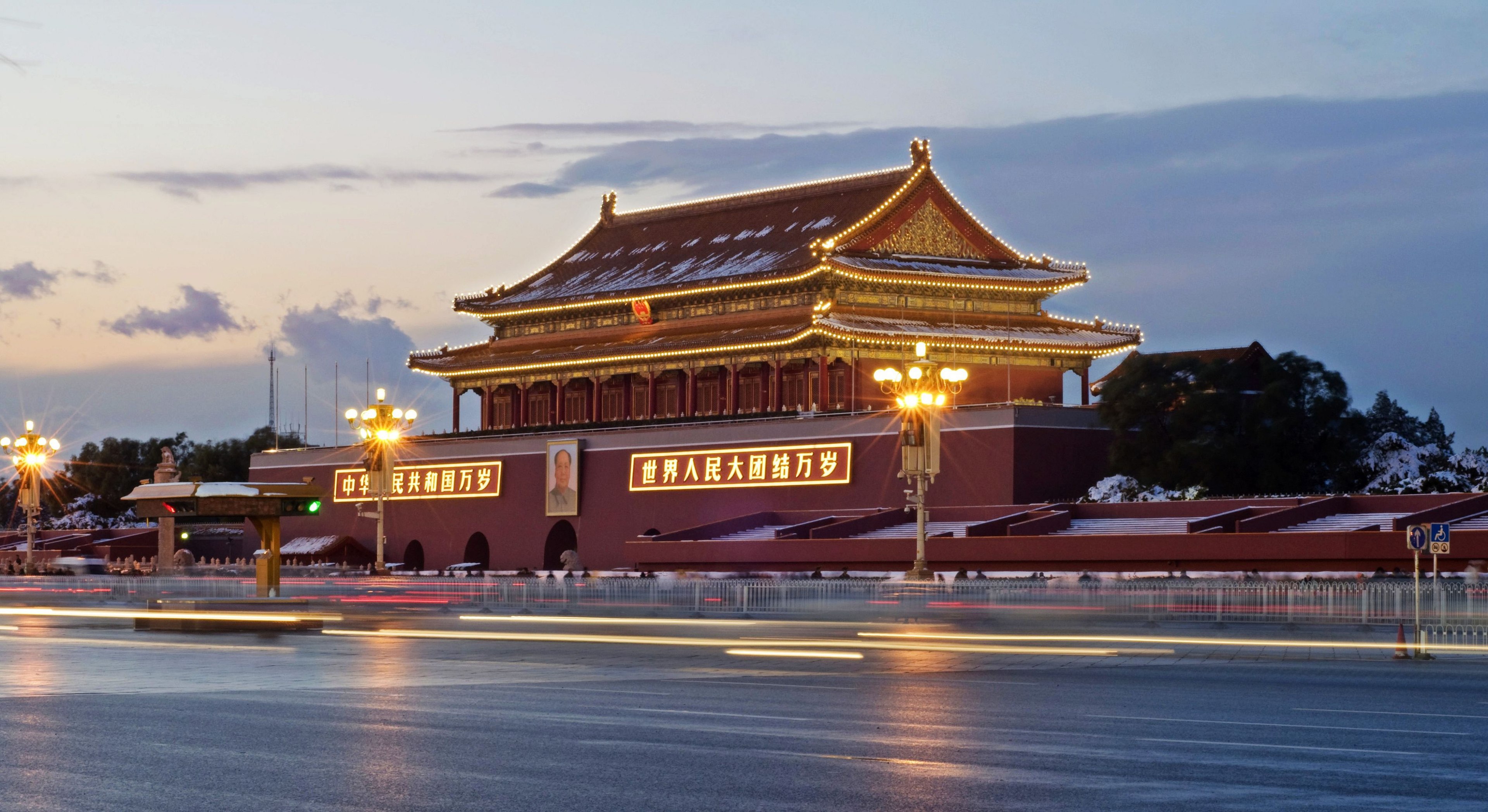
N-01 BEIJING
Pacific Theatre City Tube — Full Code Article
Beijing — Stand-Alone Executive Summary
Beijing is best understood not merely as a very large Chinese city, but as the command capital of a continental-scale state. Its unusual importance comes from the concentration of political authority, national institutions, elite universities, research capability, finance, strategic industries, culture, diplomacy and information networks within one metropolitan system.
In 2025, Beijing’s GDP was about RMB 5.21 trillion, according to data reported by the Beijing Municipal Bureau of Statistics, making it an economy comparable in scale to that of some medium-sized countries.
The defining characteristic of Beijing is therefore not simply economic size:
Beijing is China’s highest-density concentration of decision-making, knowledge production and national coordination capability.
Quick Read
Beijing performs several roles simultaneously:
- National political capital — the core institutions of the People’s Republic of China are concentrated there.
- Strategic command centre — major government, diplomatic, security and military institutions operate from the capital.
- Knowledge capital — Beijing contains an exceptional concentration of universities, academies, laboratories and research institutions.
- Technology centre — particularly strong in AI, software, aerospace, advanced computing and research-intensive industries.
- Corporate headquarters city — many major Chinese state-owned enterprises and private technology companies are headquartered there.
- Civilisational capital — Beijing connects imperial China, Republican-era transformations, revolutionary China and the contemporary PRC through the same urban landscape.
- Global diplomatic node — decisions made in Beijing increasingly propagate through international trade, finance, security and diplomacy.
That combination makes Beijing fundamentally different from a city whose primary function is manufacturing or commerce.
1. Beijing Is a Command City
Shanghai is exceptionally important to Chinese commerce and finance.
Shenzhen is extraordinarily important to technology, electronics and entrepreneurial manufacturing.
Guangzhou is a major commercial and industrial gateway.
But Beijing occupies another layer.
It is where many of the systems governing those systems converge.
China↓National political system↓Strategic institutions↓Ministries + regulators + central organisations↓National plans + policy + allocation↓Provincial / municipal / industrial systems↓Implementation
Beijing sits unusually high in this hierarchy.
The National People’s Congress, central government institutions and many other national bodies are located there.
So the city’s primary productive output is not merely goods.
A substantial part of Beijing’s output is:
decisions → rules → coordination → knowledge → strategy → standards → allocation → national direction.
That distinction is fundamental.
2. Geography Created the Original Beijing
Modern Beijing’s function cannot be separated from geography.
It sits toward the northern edge of the North China Plain, close to mountain passes connecting the agricultural heartlands of northern China with Inner Asia.
Historically, that gave the area strategic importance as an interface between:
agricultural China ↔ steppe worlds
and later:
imperial centre ↔ northern frontier.
The mountains provided defensive depth.
The North China Plain provided access toward China’s agricultural core.
Routes through the surrounding passes connected Beijing toward Manchuria, Mongolia and the Eurasian interior.
Beijing therefore emerged from an unusually valuable interface geography.
It was not geographically central to all China.
It became strategically central because it controlled important interfaces.
3. A Very Deep Urban History
Beijing’s political importance predates the modern Chinese state by centuries.
Earlier settlements and capitals existed in the region, but the city’s importance expanded dramatically under successive northern regimes.
A simplified historical sequence is:
prehistoric / early settlement↓Ji and Yan regional centres↓Liao southern capital↓Jin Zhongdu↓Yuan Dadu↓Ming Beijing↓Qing imperial capital↓Republican-era transformations↓People's Republic capital from 1949↓contemporary Beijing
The Yuan dynasty’s Dadu provided an especially important predecessor to the later imperial capital.
During the Ming, the Yongle Emperor transferred the principal imperial capital to Beijing in the early fifteenth century.
The Forbidden City was completed in the early fifteenth century, embedding imperial governance physically into the centre of the urban system.
Beijing’s famous north-south central axis is therefore not simply aesthetic.
It expressed a theory of political order through urban form.
4. Beijing as an Imperial Operating System
Imperial Beijing was essentially a state coordination machine built as a city.
The spatial organisation communicated hierarchy:
Emperor↓Imperial court↓Central bureaucracy↓Administrative apparatus↓Empire
The Forbidden City sat within this system.
Surrounding institutions, ceremonial spaces, temples, gates, roads and residential districts formed part of a broader political landscape.
This provides an important CivilisationOS insight:
Cities can encode governance architecture physically.
Beijing is one of the clearest historical examples.
Authority was not merely written into laws.
It was written into space.
5. 1949 Changed the Operating System, Not the City’s Command Function
When the People’s Republic of China was established in 1949, Beijing became its capital.
The political system changed radically.
But one remarkable structural continuity survived:
Beijing remained the principal national command centre.
So:
Imperial command capital ↓revolutionary transformation ↓socialist national capital ↓modern party-state command capital
Institutions changed.
Ideology changed.
Economic organisation changed.
Physical Beijing changed enormously.
Yet the city retained the function:
coordinate a civilisation-scale political system from a concentrated metropolitan node.
That is a major example of functional persistence through institutional discontinuity.
6. Beijing Today Is More Than Government
The modern system is much more complex than an administrative capital.
Beijing has accumulated several mutually reinforcing capability layers:
Political authority+Research institutions+Universities+Technology firms+State-owned enterprise headquarters+Finance+Military / aerospace capability+Diplomacy+Media+Cultural institutions=Command-and-knowledge metropolis
This creates powerful agglomeration effects.
A scientist can interact with a university.
The university interacts with a national laboratory.
The laboratory interacts with ministries.
Ministries interact with state enterprises.
State enterprises interact with banks.
Banks interact with national industrial policy.
Technology companies interact with all of them.
The important resource being distributed through this system is therefore not just money.
It is decision proximity.
7. The Knowledge Engine
Beijing’s strongest long-term capability may be its concentration of knowledge institutions.
Among them are major universities such as Peking University and Tsinghua University, alongside the Chinese Academy of Sciences and a very large research ecosystem.
This produces:
Education↓Talent concentration↓Research↓Knowledge↓Intellectual property↓Technology↓Companies / state capability↓New demand for talent
That is a regenerative loop.
Beijing continuously attracts high-skilled people because it already contains high-skilled institutions.
Those people strengthen the institutions.
The strengthened institutions attract still more talent and capital.
This is a classic increasing-returns capability cluster.
8. Zhongguancun and the Technology Layer
One of the best examples is Zhongguancun.
What began as a concentration around universities and research institutes developed into one of China’s most important technology ecosystems.
The larger Beijing technology economy now spans areas including:
artificial intelligence software cloud computing internet platforms robotics semiconductors biotechnology aerospace satellites quantum research advanced scientific instrumentation.
Beijing therefore possesses something different from Shenzhen’s extraordinarily powerful manufacturing-commercial ecosystem.
Very approximately:
SHENZHENresearch → engineering → prototype → manufacturing → marketBEIJINGresearch → knowledge → policy → capital → standards → strategic technology
The two systems overlap heavily, but their capability concentrations differ.
9. Headquarters Density Matters
Beijing also contains an unusually dense concentration of major corporate headquarters, particularly large centrally administered state-owned enterprises.
That matters because headquarters do something different from factories.
A factory primarily transforms inputs.
A headquarters typically performs:
capital allocationstrategycoordinationinvestmentrisk managementpersonnel allocationtechnology decisionsnetwork control
Therefore Beijing’s apparent economy understates its control surface.
A decision made in one office in Beijing may affect:
- mines in western China,
- factories in Guangdong,
- ports along the coast,
- power stations inland,
- overseas infrastructure projects,
- banks,
- telecom networks,
- energy imports.
That gives Beijing extremely high decision leverage.
10. Beijing’s National Scheduler Function
This becomes particularly interesting through our Scheduler framework.
A simplified model is:
National Purpose↓Beijing institutional ecosystem↓Sense national conditions↓Estimate State↓Form strategy↓Allocate resources↓Issue policy↓Provincial / municipal systems↓Firms + institutions↓Receivers↓Observed outcomes↓Feedback to Beijing
Of course China is much more decentralised operationally than this simplified diagram suggests.
Provinces, municipalities, firms, households and markets possess substantial independent dynamics.
But Beijing provides a disproportionate amount of the meta-coordination layer.
That is why Beijing should be analysed not merely as:
city
but also as:
city + capital + scheduler + knowledge cluster + headquarters network.
11. Beijing Is Also a Receiver
There is an important correction to make.
Command cities can become so focused on national output that analysts forget the city itself contains millions of receivers.
Beijing residents require:
housing transport healthcare education clean air water energy employment public space social mobility security quality of life.
Therefore:
National-system performance ≠ Beijing resident welfare.
This distinction is crucial.
A city can perform brilliantly as a national scheduler while imposing considerable costs on its own residents.
CivilisationOS therefore requires both measurements.
12. Beijing’s Major Constraints
The Beijing system also has significant structural constraints.
Water
Northern China is relatively water-scarce.
Beijing’s enormous urban population and economic activity therefore require substantial water-management infrastructure and interregional transfer systems.
Air and environment
Beijing historically suffered serious air-pollution episodes, although extensive pollution-control policies have produced large improvements over recent decades.
Congestion
Very large-scale metropolitan systems create transport and land-use pressures.
Housing
High-value jobs and institutional concentration put pressure on land and housing affordability.
Demography
Beijing also sits within China’s wider demographic challenge. China’s national population declined again in 2025, while ageing continues to intensify.
Over-concentration
Perhaps the most interesting systems problem is success itself.
The more capability Beijing accumulates:
more institutions→ more talent→ more opportunity→ more firms→ greater importance→ more talent
But eventually:
concentration→ congestion→ expensive land→ longer commutes→ infrastructure pressure→ reduced marginal advantage
This is the classic transition from agglomeration gain to agglomeration cost.
13. Beijing’s Economic Structure
Beijing’s economy has shifted far beyond traditional industrial production.
In 2025 its GDP reached roughly RMB 5.207 trillion.
But the composition matters more than the headline number.
Beijing increasingly specialises in high-value activities:
researchfinancetechnologybusiness servicesdigital industriescultureeducationgovernmentheadquarters functions
This is consistent with an advanced-city transition:
production city↓service city↓knowledge city↓control / coordination city
Beijing now operates heavily toward the final two layers.
14. Beijing’s Cultural Power Plant
Beijing is also one of the great repositories of Chinese cultural memory.
The Forbidden City, Temple of Heaven, hutongs, imperial gardens, historic temples and the wider Central Axis embed multiple historical layers into the city.
The Beijing municipal government continues to describe strengthening the city’s function as a national cultural centreas a major strategic responsibility.
Culture performs several functions simultaneously:
Memory+Identity+Legitimacy+Tourism+Education+International projection
Beijing therefore generates not merely administrative power.
It generates symbolic power.
15. Beijing’s Global Function
Beijing’s global importance has increased as China’s global economic and strategic weight has increased.
Foreign governments need diplomatic access to Beijing.
Multinational firms need regulatory and political understanding.
International organisations interact with Chinese central institutions there.
Strategic negotiations often lead back toward the capital.
Therefore China’s rise increases Beijing’s international network centrality.
A useful relationship is:
China's systemic importance ↑ ↓Beijing's decision importance ↑ ↓International diplomatic connectivity ↑
Beijing becomes globally important not because it performs every international function itself, but because increasingly consequential Chinese decisions terminate there.
16. The Beijing Power Plant
Using our power-plant architecture:
SUBSTRATENorthern China + national capital territory↓INPUTSTalentCapitalInformationTaxesEnergyWaterPolitical authorityResearchNational data↓GENERATIONKnowledgePolicyResearchStrategyTechnologyCulture↓CONVERSIONUniversitiesLaboratoriesMinistriesCompaniesFinancial institutionsState enterprises↓STORAGEInstitutionsHuman capitalInfrastructureDatabasesCapitalOrganisational memory↓EnDist+TransportDigital networksAdministrative hierarchyFinancial networksNational infrastructure↓DISTRIBUTIONPoliciesStandardsCapitalTechnologyInformationInstructions↓RECEIVERSResidentsFirmsProvincesInstitutionsNational population↓USEFUL WORKGovernanceInnovationEconomic coordinationSecurityCultural production↓RESIDUALS / EnDist-CongestionPollutionHousing pressureBureaucratic frictionResource demandOver-centralisation↓REGENERATIONEducationResearchInstitution buildingInfrastructure renewal↓NEXT STATE
That is a much more accurate model of Beijing than simply calling it China’s capital.
17. Beijing Through the CivilisationOS Lens
| System | Beijing |
|---|---|
| Primary function | National command and coordination centre |
| Secondary function | Knowledge and innovation centre |
| Substrate | Northern edge of North China Plain |
| Historical advantage | Frontier-interface + imperial capital |
| Core resource | Institutional and intellectual density |
| Key capability | Decision-making + knowledge production |
| Storage | Universities, institutions, capital, infrastructure, organisational memory |
| EnDist+ | Administrative, digital, transport and financial networks |
| Receiver | Beijing residents + wider national system |
| Scheduler | Dense central party-state and administrative apparatus |
| Regeneration | Universities, research, talent attraction |
| Major constraints | Water, congestion, land, environment, demographics |
| Systemic risk | Excessive concentration / coordination friction |
| Strategic advantage | Exceptional proximity between knowledge, capital and authority |
18. The Deepest Insight
Taiwan’s exceptional characteristic was capability density.
Beijing reveals a different phenomenon:
coordination density.
Beijing concentrates actors that can change the state of much larger systems.
That gives us a useful new distinction:
Population Density≠Economic Density≠Capability Density≠Knowledge Density≠Coordination Density≠Authority Density
Beijing scores extraordinarily highly in the final three.
And those variables may explain the importance of some cities much better than GDP.
Executive Assessment
Beijing is a civilisation-scale command metropolis: an ancient strategic city repeatedly selected as a political centre, transformed into the imperial capital of major Chinese dynasties, retained as the capital of the People’s Republic of China, and today functioning as an unusually dense concentration of political authority, scientific knowledge, universities, strategic industries, corporate headquarters, culture and national coordination.
Its greatest strength is not simply that it contains enormous resources.
It is that resources, information, expertise and authority can encounter each other there.
The Beijing equation is therefore approximately:
Authority×Knowledge×Institutional density×Information access×Capital×Connectivity=Coordination Power
And that suggests a broader CivilisationOS principle:
A civilisation’s most important city may not be the place that produces the most physical goods. It may be the place that most effectively senses, decides, coordinates and redirects the rest of the system.
That is Beijing’s defining role.
Capital Command Node, Northern China Gate, Continental–Maritime Interface
FULLCODE.PACIFIC_THEATRE.CITY.N-01.BEIJINGVERSION: 1.0FORMAT: CITY_TUBE / AI-RUNTIME / PUBLISHABLE-RESEARCH-OBJECTMETHOD_PARENT: FULLCODE.TOKYOTHEATRE: PACIFICPRIMARY_NODE: N-01CITY: BEIJINGMUNICIPALITY: BEIJING MUNICIPALITYSTATE_SYSTEM: PEOPLE'S REPUBLIC OF CHINASTATUS: ACTIVEEVIDENCE_DATE: 2026-08-04
0. ARTICLE PURPOSE
Beijing is not included in the Pacific Theatre because it sits directly on the Pacific coast.
It is included because a large proportion of the political instructions, military priorities, industrial policies, diplomatic signals, information controls and crisis decisions affecting the western Pacific are generated, filtered or authorised through Beijing.
Beijing is therefore a remote-control coastal city.
Its physical body is inland.
Its operational reach extends through:
- Tianjin and the Bohai coast;
- Hebei’s industrial and military geography;
- the Yellow Sea;
- the East China Sea;
- the Taiwan Strait;
- the South China Sea;
- the Korean Peninsula;
- Japan;
- Russia and continental Eurasia;
- the United States and the wider alliance system.
Tokyo is a Pacific city whose national power faces outward from an island chain.
Beijing is a continental capital that must project power through layers of territory before reaching the ocean.
That difference is foundational.
TOKYO = MARITIME CAPITAL WITH CONTINENTAL EXPOSUREBEIJING = CONTINENTAL CAPITAL WITH MARITIME REQUIREMENTS
The purpose of this city tube is not merely to describe Beijing.
It is to model how Beijing:
- acquired its current form;
- converts land power into maritime power;
- governs an enormous national system;
- perceives threats moving inward from the Pacific;
- transmits decisions outward;
- sustains itself through imported water, energy, food, labour, data and legitimacy;
- behaves when the surrounding system becomes unstable.
1. SCOPE LOCK
BEIJING ≠ CHINABEIJING ≠ THE CHINESE COMMUNIST PARTYBEIJING ≠ ONE UNCHANGED CAPITALBEIJING ≠ THE FORBIDDEN CITYBEIJING ≠ THE CENTRAL GOVERNMENT ALONEBEIJING ≠ A PURELY MILITARY NODEBEIJING ≠ A PURELY HISTORICAL CITYBEIJING ≠ A SINGLE POPULATIONBEIJING ≠ A SELF-SUFFICIENT SYSTEM
“Beijing” contains several overlapping objects:
B0 = PHYSICAL BASIN AND MOUNTAIN-EDGE SETTLEMENTB1 = MUNICIPAL ADMINISTRATIVE TERRITORYB2 = HISTORICAL CAPITAL COMPLEXB3 = NATIONAL POLITICAL COMMAND CENTREB4 = PARTY-STATE COORDINATION CENTREB5 = MILITARY-STRATEGIC DECISION NODEB6 = DIPLOMATIC AND INTERNATIONAL-SIGNAL NODEB7 = SCIENTIFIC, UNIVERSITY AND TECHNOLOGY CLUSTERB8 = MEDIA, INFORMATION AND NARRATIVE CENTREB9 = METROPOLITAN LIFE-SUPPORT SYSTEMB10 = SYMBOLIC REPRESENTATION OF “CHINA”
These objects overlap, but they must not be treated as identical.
A statement about the imperial city is not automatically a statement about suburban Beijing.
A statement about the central government is not automatically a statement about every Beijing resident.
A statement issued in Beijing is not automatically evidence of what every Chinese institution can execute.
2. ENTITY FIREWALL
The Beijing tube separates six entities that are commonly compressed into one.
| Code | Entity | Function |
|---|---|---|
| BJ-CITY | Beijing as inhabited metropolis | Housing, labour, education, transport, everyday life |
| BJ-MUNI | Beijing municipal government | Local administration and urban management |
| PRC-STATE | Central state institutions | National law, administration and diplomacy |
| CPC-CENTRE | Central Communist Party institutions | Political authority, direction and coordination |
| PLA-COMMAND | National military command system | Defence planning and military execution |
| CHINA-SYSTEM | The wider national civilisation-state | Provinces, firms, communities, infrastructure and population |
The firewall is essential because Beijing is simultaneously:
- a city that must remove rubbish and operate buses;
- a municipality managing more than twenty million residents;
- the seat of central political power;
- an ideological symbol;
- a diplomatic theatre;
- a strategic command node;
- a dependent consumer of resources produced elsewhere.
A powerful command centre can still possess fragile supply lines.
A highly organised state can still receive incomplete information.
A capital can issue a decision faster than the national system can implement it.
3. CORE THESIS
BEIJING IS A COMMAND-DENSE, RESOURCE-DEPENDENT,CONTINENTAL CAPITAL WHOSE PACIFIC POWER MUST PASSTHROUGH EXTERNAL CORRIDORS.
Its strength comes from concentration.
Its vulnerability also comes from concentration.
Beijing concentrates:
- senior political authority;
- national strategic coordination;
- ministries and regulatory institutions;
- military leadership;
- diplomatic representation;
- national media;
- leading universities;
- major research institutes;
- state-owned enterprise headquarters;
- cultural legitimacy;
- historical symbolism.
This produces an enormous coordination advantage.
But it also creates a system in which shocks arriving from distant locations can converge on one city:
TAIWAN CRISIS+ JAPAN RESPONSE+ US ALLIANCE MOBILISATION+ TRADE RESTRICTIONS+ ENERGY RISK+ FINANCIAL PRESSURE+ DOMESTIC INFORMATION LOAD+ PUBLIC EXPECTATION→ BEIJING DECISION COMPRESSION
The city is therefore best understood as a decision-compression chamber.
4. ZERO BASELINE — BEFORE BEIJING
Before Beijing was a capital, it was a location.
The underlying site lies near the transition between the North China Plain and mountain systems to its north and west.
This position produced several long-duration advantages:
- access to the agricultural plain;
- defensible mountain approaches;
- proximity to routes leading toward Mongolia and Manchuria;
- access to corridors connecting northern China with the northeast;
- enough separation from the coast to reduce direct maritime exposure;
- enough proximity to the coast to connect with the Bohai system.
The location is neither fully continental interior nor maritime edge.
It is a hinge.
PLAIN ↔ MOUNTAINAGRICULTURE ↔ PASTORAL FRONTIERCHINA PROPER ↔ NORTHEAST ASIAINLAND COMMAND ↔ BOHAI ACCESS
This hinge condition existed before the modern city and continues to shape Beijing’s strategic role.
5. CAPITAL ACCUMULATION
Beijing did not become important through one uninterrupted civilisational line.
Different regimes selected, rebuilt, enlarged and reinterpreted the site.
Its capital function emerged through repeated political choices.
The critical sequence is not:
ANCIENT BEIJING → MODERN BEIJING
It is closer to:
FRONTIER SETTLEMENT→ REGIONAL CENTRE→ CONTESTED CAPITAL→ IMPERIAL CAPITAL→ REBUILT DYNASTIC CAPITAL→ REPUBLICAN DISPLACEMENT→ REVOLUTIONARY NATIONAL CAPITAL→ GLOBAL POWER COMMAND NODE
The city’s historical continuity is therefore partly a continuity of capital reuse.
Successive systems inherited:
- walls;
- roads;
- ceremonial orientations;
- waterworks;
- administrative geography;
- memories of authority;
- populations that had survived the previous system;
- ruins and monuments capable of being assigned new meanings.
The city is not an untouched ancient object.
It is a repeatedly overwritten political machine.
6. THE CENTRAL AXIS
One of Beijing’s most visible organising structures is its central axis.
The axis is not simply a line of old buildings.
It is a spatial grammar connecting:
- orientation;
- hierarchy;
- ceremony;
- political legitimacy;
- urban order;
- cosmological representation;
- controlled movement.
In 2024, UNESCO inscribed the “Beijing Central Axis: A Building Ensemble Exhibiting the Ideal Order of the Chinese Capital” on the World Heritage List. The listed property covers 589 hectares with a 4,542-hectare buffer zone.
The modern significance of the axis is not that Beijing remains governed as a medieval capital.
Its significance is that successive regimes have continued to operate around, beside, through or against inherited spatial authority.
COSMOLOGICAL ORDER→ IMPERIAL ORDER→ NATIONAL ORDER→ HERITAGE ORDER→ TOURISM AND GLOBAL REPRESENTATION
The axis demonstrates a core Beijing mechanism:
New systems do not always erase the previous city. They capture its geometry.
7. THE CITY OF WALLS BECOMES A CITY OF RINGS
Historic Beijing used walls, gates and differentiated enclosures.
Modern Beijing expanded through roads, ring systems, railways, highways, new districts and metropolitan corridors.
The governing geometry changed:
WALL LOGIC:INSIDE / OUTSIDEGATE / CLOSUREPALACE / CITYCENTRE / SUBJECTRING LOGIC:CENTRE / PERIPHERYCOMMUTE / CONGESTIONDENSITY / DISPERSALCORE / SATELLITE
Yet the older centralising instinct did not disappear.
It was translated into modern infrastructure.
Beijing’s urban expansion produced a paradox:
- national functions became increasingly concentrated;
- residents and industries spread across a larger metropolitan space;
- movement became faster;
- distance travelled each day increased;
- the city became physically larger while remaining politically centred.
This is a recurring Beijing pattern:
FUNCTIONAL CENTRALISATION+SPATIAL DISPERSAL=METROPOLITAN COORDINATION LOAD
8. POPULATION BODY
Beijing is not merely a collection of senior officials, diplomats and historical monuments.
It is a municipality containing more than twenty million people.
Reported figures place Beijing’s permanent population in 2024 at approximately 21.8 million. Such figures apply to the municipality, not simply the historic central city.
Its population includes:
- long-established Beijing families;
- internal migrants;
- government employees;
- service workers;
- construction and logistics workers;
- students;
- teachers and researchers;
- military personnel;
- entrepreneurs;
- technology workers;
- diplomatic communities;
- temporary visitors;
- rural and peri-urban residents within the municipality.
The visible command city rests upon a much larger maintenance city.
COMMAND BEIJINGDEPENDS ONMAINTENANCE BEIJING
The capital cannot function without:
- cleaners;
- drivers;
- food distributors;
- technicians;
- delivery workers;
- nurses;
- security personnel;
- utility workers;
- railway staff;
- digital-platform labour;
- construction crews.
Any model that contains only the leadership compound and excludes the maintenance population is structurally false.
9. CAPITAL FUNCTION STACK
Beijing’s current master-planning framework identifies four principal national functions:
- national political centre;
- cultural centre;
- centre for international exchanges;
- centre for scientific and technological innovation.
For the Pacific Theatre model, these can be expanded into a nine-layer stack.
L1 POLITICAL AUTHORITYL2 NATIONAL ADMINISTRATIONL3 MILITARY-STRATEGIC COORDINATIONL4 DIPLOMATIC EXCHANGEL5 SCIENCE AND TECHNOLOGYL6 CULTURAL LEGITIMACYL7 INFORMATION AND NARRATIVEL8 METROPOLITAN SUPPORTL9 EXTERNAL RESOURCE INTAKE
The stack works only when the layers remain aligned.
A scientific breakthrough without industrial translation is incomplete.
A military instruction without logistics is incomplete.
A diplomatic signal that domestic audiences interpret differently from foreign audiences may generate instability.
An urban system unable to maintain water, electricity, transport and food flows cannot preserve national-command performance indefinitely.
10. WATER TUBE
Water is one of the clearest demonstrations that Beijing is powerful but not self-sufficient.
Northern China is comparatively water-stressed, and Beijing’s urban scale places immense pressure on local and regional supplies.
The city relies upon a combination of:
- reservoirs;
- groundwater;
- local river systems;
- conservation;
- recycling;
- demand management;
- water transferred over long distances.
The middle route of the South-to-North Water Diversion Project carries water toward Henan, Hebei, Beijing and Tianjin. Water transfer through the middle route began in 2014.
This produces a civilisational equation:
BEIJING COMMAND CAPACITYIS PARTLY SUPPORTED BYREMOTE WATERSHEDS+ ENGINEERING+ ENERGY+ MAINTENANCE+ INTERREGIONAL COORDINATION
The water system increases Beijing’s resilience.
It also lengthens its dependency chain.
The project does not mean Beijing has “solved” geography.
It means geography is being continuously managed by infrastructure.
11. FOOD, ENERGY AND MATERIAL INTAKE
Beijing consumes at a scale far larger than its local productive landscape can independently sustain.
It depends upon national and international systems for:
- grain;
- vegetables;
- meat;
- fuel;
- electricity;
- construction materials;
- manufactured goods;
- semiconductor equipment;
- industrial components;
- pharmaceuticals;
- consumer goods.
This creates two Beijings:
VISIBLE BEIJING:MONUMENTSMINISTRIESUNIVERSITIESHEADQUARTERSCEREMONIESINVISIBLE BEIJING:FREIGHTWAREHOUSESPOWER LINESPIPELINESRESERVOIRSDATA CENTRESWHOLESALE MARKETSMAINTENANCE NETWORKS
The invisible city is the load-bearing city.
12. BOHAI GATE
Beijing is inland, but it is not isolated from the sea.
Its maritime access is mediated through the Beijing–Tianjin–Hebei system.
BEIJING→ TIANJIN→ BOHAI→ YELLOW SEA→ WESTERN PACIFIC
This makes Tianjin more than a neighbouring city.
For Beijing’s Pacific function, Tianjin acts as:
- port;
- industrial corridor;
- logistics interface;
- maritime outlet;
- strategic depth;
- vulnerability pathway.
The larger Jing-Jin-Ji region attempts to redistribute functions and integrate Beijing with Tianjin and Hebei.
The system can reduce congestion and excessive concentration.
But it also reveals Beijing’s dependency on surrounding territory.
BEIJING WITHOUT HEBEI = INCOMPLETE METABOLISMBEIJING WITHOUT TIANJIN = CONSTRAINED MARITIME ACCESSTIANJIN WITHOUT BEIJING = DIFFERENT COMMAND VALUE
For this reason, Beijing must be modelled as a city node and as the command head of a larger urban–industrial organism.
13. THE PACIFIC THEATRE PROBLEM
Beijing faces the Pacific through multiple concentric barriers and corridors.
RING 0: BEIJING COMMAND CORERING 1: HEBEI–TIANJIN–BOHAIRING 2: YELLOW SEA / KOREAN PENINSULARING 3: JAPANESE ARCHIPELAGO / EAST CHINA SEARING 4: TAIWAN / PHILIPPINES / FIRST ISLAND CHAINRING 5: GUAM / SECOND ISLAND CHAINRING 6: HAWAII / CENTRAL PACIFICRING 7: CONTINENTAL UNITED STATES
From Beijing’s perspective, maritime geography can appear as a sequence of gates occupied or influenced by other powers.
From the perspective of Japan, Taiwan, the Philippines and the United States, Beijing can appear as the centre directing growing Chinese military and political pressure outward.
Both perceptions can exist simultaneously.
BEIJING PERCEPTION:ENCIRCLEMENT / CONTAINMENT / BLOCKED REUNIFICATION / MARITIME EXPOSURENEIGHBOUR PERCEPTION:EXPANSION / COERCION / MILITARISATION / REVISION OF STATUS QUO
The collision of these threat models is one of the central engines of the Pacific Theatre.
14. TAIWAN CIRCUIT
Taiwan is not adjacent to Beijing as a city.
Yet Taiwan is deeply connected to Beijing’s national legitimacy, military planning, diplomacy and relations with the United States and Japan.
The Taiwan circuit must not be reduced to a single invasion question.
It contains:
HISTORICAL CLAIM+ NATIONAL IDENTITY+ PARTY LEGITIMACY+ MILITARY BALANCE+ SEMICONDUCTOR NETWORKS+ US POLICY+ JAPANESE SECURITY+ PHILIPPINE GEOGRAPHY+ GLOBAL SHIPPING+ FINANCIAL SANCTIONS RISK+ DOMESTIC EXPECTATION
Therefore:
TAIWAN CRISIS ≠ LOCAL CROSS-STRAIT EVENTTAIWAN CRISIS = PACIFIC SYSTEM RECONFIGURATION
A military action might produce tactical gains while imposing strategic losses through:
- alliance consolidation;
- maritime disruption;
- capital flight;
- technology restrictions;
- insurance shocks;
- energy insecurity;
- damage to trade;
- long-term regional balancing;
- internal legitimacy costs if operations fail or stall.
The Beijing tube does not assume that these costs make conflict impossible.
It establishes that the cost field is much larger than the military map.
15. TOKYO–BEIJING COUPLING
Tokyo and Beijing are not independent nodes.
They form one of the Pacific Theatre’s most important coupled systems.
BEIJING ACTION→ TOKYO THREAT ASSESSMENT→ JAPANESE FORCE POSTURE→ US–JAPAN COORDINATION→ BEIJING ENCIRCLEMENT ASSESSMENT→ FURTHER CHINESE RESPONSE
This is a feedback loop.
Neither side needs to intend uncontrolled escalation.
Each can interpret defensive action by the other as preparation for offensive action.
Tokyo’s maritime location gives it direct exposure to East China Sea and Taiwan contingencies.
Beijing’s continental depth gives it scale but requires power to cross increasingly monitored maritime corridors.
Their comparison is therefore not symmetrical:
| Tokyo | Beijing |
|---|---|
| Island capital | Continental capital |
| Maritime access is immediate | Maritime access is mediated |
| Alliance-embedded | Alliance-opposed but partner-networked |
| Resource-import dependent | Resource dependent at larger continental scale |
| Distributed constitutional decision system | Highly centralised party-state command system |
| Defensive maritime geometry | Continental-to-maritime projection geometry |
The full Pacific model requires both tubes.
16. SEOUL AND PYONGYANG CIRCUIT
The Korean Peninsula lies across Beijing’s northeastern approach to the Pacific.
For Beijing, instability on the peninsula can create:
- border disruption;
- refugee pressure;
- foreign military movement;
- nuclear escalation;
- alliance expansion;
- loss of strategic buffer;
- economic damage.
Pyongyang can operate as both:
- strategic buffer;
- strategic liability.
Seoul can operate as both:
- major economic partner;
- host of a US alliance presence close to northeastern China.
This creates a Beijing constraint:
TOO MUCH PRESSURE ON PYONGYANG→ REGIME INSTABILITY RISKTOO LITTLE PRESSURE→ NUCLEAR / MISSILE ESCALATION RISKTOO MUCH SUPPORT→ INTERNATIONAL AND REGIONAL COSTTOO LITTLE SUPPORT→ LOSS OF BUFFER AND INFLUENCE
The result is not simple control.
It is recurrent management of an unstable neighbouring system.
17. MOSCOW CIRCUIT
Moscow reduces Beijing’s continental isolation.
The relationship can provide:
- strategic coordination;
- energy supply;
- diplomatic support;
- military learning;
- continental depth;
- pressure on US attention across multiple theatres.
But Beijing–Moscow alignment is not the same as a single fused system.
Potential asymmetries remain in:
- economic scale;
- technology;
- Central Asian influence;
- Arctic interests;
- long-term dependency;
- historical memory;
- relations with India;
- exposure to Western sanctions.
For Beijing, Moscow is simultaneously:
PARTNER+ BUFFER+ ENERGY SOURCE+ STRATEGIC DISTRACTION FOR THE UNITED STATES+ POTENTIAL LONG-TERM UNCERTAINTY
This continental relationship alters the Pacific balance because it affects how much pressure Beijing must reserve for its northern and western frontiers.
18. WASHINGTON CIRCUIT
Beijing and Washington interact through an unusually dense system of opposition and dependency.
They are connected by:
- trade;
- finance;
- technology;
- climate negotiations;
- military deterrence;
- education;
- supply chains;
- standards;
- maritime security;
- nuclear risk;
- global institutions.
The relationship is neither ordinary competition nor complete separation.
COMPETE+ DETER+ TRADE+ RESTRICT+ SIGNAL+ NEGOTIATE+ PREPARE
The danger is that different institutional channels may transmit different messages.
A military signal can be read politically.
A trade control can be read as preparation for strategic strangulation.
A diplomatic statement intended for domestic audiences can alter military assumptions.
This is why Beijing must be modelled as an information-processing node, not only as a source of policy.
19. INFORMATION SYSTEM
Beijing possesses strong capacity to coordinate and shape national information.
This can produce:
- fast narrative alignment;
- policy discipline;
- reduced public panic;
- protection against hostile influence;
- concentrated mobilisation.
It can also create risks:
- upward filtering of unwelcome information;
- bureaucratic conformity;
- pressure to satisfy declared policy;
- reduced visibility of local failure;
- difficulty reversing public commitments;
- strategic surprise when external systems behave differently than expected.
HIGH CONTROL ≠ PERFECT INFORMATIONFAST CONSENSUS ≠ CORRECT CONSENSUSNARRATIVE STABILITY ≠ SYSTEM STABILITY
A key Beijing question is therefore:
Can the command centre distinguish between information that preserves institutional confidence and information required to correct institutional error?
This is not uniquely a Chinese problem.
It is intensified wherever authority, prestige and decision-making become highly concentrated.
20. SCIENCE AND TECHNOLOGY ENGINE
Beijing’s universities, laboratories, technology firms, academies and state institutions form one of its most important power systems.
The city helps convert:
EDUCATION→ RESEARCH→ STATE PRIORITY→ FUNDING→ INDUSTRIAL POLICY→ NATIONAL CAPABILITY→ MILITARY OR COMMERCIAL APPLICATION
Its advantages include:
- dense expert networks;
- proximity to policymakers;
- access to major funding;
- elite universities;
- national laboratories;
- large domestic markets;
- ability to mobilise resources.
Its risks include:
- excessive policy steering;
- duplicated investment;
- prestige projects;
- weak negative feedback;
- incentive to report success;
- difficulty separating genuine breakthroughs from target compliance.
The relevant Pacific Theatre question is not whether Beijing possesses technology.
It is whether the larger system can repeatedly translate scientific achievement into reliable, scalable, maintainable capability under external restriction.
21. OLYMPIC WINDOWS
The 2008 and 2022 Olympic Games exposed different versions of Beijing.
2008
PRIMARY SIGNAL:ARRIVALOPENINGMODERNISATIONCAPACITYGLOBAL INTEGRATION
2022
PRIMARY SIGNAL:CONTINUITYCONTROLTECHNOLOGICAL MANAGEMENTRESILIENCE UNDER PANDEMIC CONDITIONSSTRATEGIC CONFIDENCE
The two events form a useful temporal comparison.
2008 BEIJING:“CHINA HAS ENTERED THE GLOBAL SYSTEM.”2022 BEIJING:“CHINA CAN OPERATE A LARGE SYSTEM ON ITS OWN TERMS.”
Neither event reveals the whole city.
Both functioned as controlled windows through which Beijing presented a desired national image.
22. AIR, CLIMATE AND ECOLOGICAL CONSTRAINT
Beijing’s atmosphere has historically carried the effects of:
- local traffic;
- construction;
- industrial activity;
- regional coal use;
- meteorological conditions;
- dust from northern and northwestern regions.
Air quality improvement demonstrates that concentrated policy and regional coordination can alter urban conditions.
But the air system also proves that municipal boundaries do not contain the city’s ecology.
BEIJING AIR≠ BEIJING-ONLY PRODUCT
The same applies to:
- water;
- food;
- energy;
- dust;
- heat;
- flooding;
- biodiversity;
- carbon emissions.
Beijing governs a municipality but survives inside a much larger ecological field.
23. EVERYDAY BEIJING
A complete city tube must preserve ordinary life.
Beijing is also:
- morning exercises in residential compounds;
- school admissions and examination pressure;
- crowded commutes;
- neighbourhood markets;
- university campuses;
- hospital queues;
- rental stress;
- family care;
- ageing parents;
- migrant labour;
- delivery riders;
- winter heating;
- summer storms;
- parks;
- hutongs;
- apartment towers;
- office districts;
- suburban villages;
- memories of demolished neighbourhoods;
- ambitions that have nothing to do with geopolitics.
The Pacific Theatre passes through this civilian body.
Any conflict directed from Beijing will also return to Beijing through:
- prices;
- employment;
- public expectation;
- casualty information;
- travel restrictions;
- energy costs;
- sanctions;
- technology access;
- social trust.
There is no separate strategic city that can be cleanly detached from the inhabited city.
24. PHASE MODEL
Phase 0 — Formation and Recoverable Capacity
CONDITIONS:LOWER SYSTEM LOADFUNCTIONING EXTERNAL ROUTESADEQUATE WATER / ENERGY / FOODINSTITUTIONAL CONFIDENCEMANAGEABLE REGIONAL TENSIONCORRECTIVE INFORMATION STILL MOVESBEHAVIOUR:LONG-HORIZON PLANNINGINFRASTRUCTURE INVESTMENTCULTURAL RESTORATIONSCIENTIFIC EXPANSIONCONTROLLED DIPLOMATIC ENGAGEMENT
Phase 1 — Pressure and Repair
CONDITIONS:ECONOMIC SLOWDOWNLOCAL GOVERNMENT STRESSDEMOGRAPHIC PRESSURETECHNOLOGY RESTRICTIONSREGIONAL SECURITY COMPETITIONCLIMATE / WATER LOADBEHAVIOUR:CENTRAL REPRIORITISATIONTARGETED STIMULUSNARRATIVE TIGHTENINGINDUSTRIAL SUBSTITUTIONINCREASED SURVEILLANCESELECTIVE DIPLOMATIC STABILISATION
Phase 2 — Strategic Compression
CONDITIONS:MULTIPLE SIMULTANEOUS CRISESTAIWAN ESCALATIONUS–CHINA BREAKDOWNJAPANESE FORCE MOBILISATIONMARITIME DISRUPTIONFINANCIAL OR TECHNOLOGICAL SHOCKBEHAVIOUR:DECISION CENTRALISATIONRAPID MOBILISATIONINFORMATION RESTRICTIONRESOURCE PRIORITISATIONDOMESTIC UNITY CAMPAIGNHIGHER ERROR COST
Phase 3 — Brittle Command
CONDITIONS:BAD NEWS FILTEREDOBJECTIVES BECOME IRREVERSIBLECOSTS EXCEED INITIAL MODELEXTERNAL ACTORS FAIL TO COMPLYLOGISTICS UNDERPERFORMPUBLIC EXPECTATIONS HARDENBEHAVIOUR:ESCALATION TO PROTECT CREDIBILITYPUNISHMENT OF MESSENGERSINCREASED NARRATIVE GAPOVER-CENTRALISATIONDECLINING LOCAL ADAPTATION
Phase 4 — Systemic Rupture
POSSIBLE TRIGGERS:MAJOR WARCOMMAND FAILURESEVERE ECONOMIC SHOCKPROLONGED SUPPLY DISRUPTIONINTERNAL ELITE FRACTURECASCADING INFRASTRUCTURE FAILURERESULT:THE CAPITAL MAY RETAIN FORMAL AUTHORITYWHILE LOSING EFFECTIVE SYSTEM COORDINATION.
Phase 4 is not predicted.
It exists as an adversarial boundary condition.
25. BEIJING AT ITS BEST
Beijing performs best when it can combine:
- long-term planning;
- technical expertise;
- historical memory;
- strong infrastructure;
- administrative capacity;
- national-scale mobilisation;
- scientific investment;
- external trade;
- regional stability;
- corrective information.
At its best, Beijing can act as:
COORDINATORARCHIVERESEARCH ENGINEDIPLOMATIC PLATFORMINFRASTRUCTURE PLANNERCULTURAL STEWARDCRISIS MOBILISER
Its strongest capability is not raw centralisation alone.
It is the ability to connect central direction with a huge distributed national system.
26. BEIJING AT ITS WORST
Beijing performs worst when concentration suppresses correction.
CENTRAL AUTHORITY− ACCURATE FEEDBACK− REVERSIBILITY− LOCAL ADAPTATION= BRITTLE COMMAND
Its failure modes include:
- mistaking compliance for capacity;
- mistaking silence for consent;
- treating all external resistance as coordinated containment;
- locking prestige to a specific outcome;
- assuming economic interdependence guarantees political caution;
- assuming military pressure remains controllable;
- underestimating alliance reactions;
- overestimating the speed of national execution;
- sacrificing long-term resilience for short-term narrative victory.
The danger is not that Beijing lacks intelligence.
It is that a highly intelligent system may still optimise against an incomplete model.
27. MORIARTY ADVERSARIAL PASS
Test 1 — Source Independence
Official plans reveal intended structure, not necessarily achieved outcomes.
Result: Distinguish policy declaration from operational performance.
Test 2 — Scale Compatibility
Municipal Beijing, metropolitan Beijing and national Beijing cannot share one measurement boundary.
Result: Every claim must identify its scale.
Test 3 — Alternative Explanation
Chinese actions described as expansion may sometimes arise from perceived vulnerability. Actions described as defence by Beijing may still be coercive to neighbouring states.
Result: Preserve both threat models.
Test 4 — Beneficiary
Capital concentration benefits national coordination, elite institutions and strategic mobilisation.
Result: Benefits are real but unevenly distributed.
Test 5 — Cost Carrier
Workers, migrants, peripheral provinces, ecological systems and distant water-source regions may carry costs that are not visible in central Beijing.
Result: The capital externalises part of its metabolism.
Test 6 — Omitted Population
A command-centre narrative erases ordinary residents and maintenance labour.
Result: Civilian Beijing restored to the model.
Test 7 — Time Horizon
A policy that improves five-year resilience may weaken thirty-year ecological or demographic resilience.
Result: Short and long horizons must remain separate.
Test 8 — Counterfactual
Without Beijing’s concentration, China might lose coordination. With excessive concentration, China may lose adaptive diversity.
Result: Centralisation has a non-linear optimum.
Test 9 — Whole-System Consequence
A Taiwan operation cannot be evaluated only by battlefield outcome.
Result: Include alliance, trade, energy, technology, legitimacy and ecological consequences.
Test 10 — Uncertainty Status
The internal quality of top-level crisis information cannot be directly observed from outside.
Result: Treat command accuracy as an unresolved variable, not an assumed strength or weakness.
28. KNOWN VOIDS
VOID-01:HOW MUCH BAD NEWS REACHES TOP DECISION-MAKERSDURING A FAST CRISIS?VOID-02:HOW WOULD NATIONAL, PARTY AND MILITARY CHANNELSINTERACT UNDER PARTIAL COMMUNICATION FAILURE?VOID-03:HOW RESILIENT IS BEIJING’S WATER SYSTEMUNDER MULTI-YEAR CLIMATE AND ENERGY STRESS?VOID-04:HOW MUCH ECONOMIC PAIN WOULD THE POPULATION ACCEPTFOR A NATIONAL-SECURITY OBJECTIVE?VOID-05:HOW WOULD REGIONAL GOVERNMENTS IMPLEMENTA RAPID CAPITAL-DIRECTED WARTIME TRANSITION?VOID-06:HOW REVERSIBLE IS A PUBLICLY DECLARED STRATEGIC OBJECTIVE?VOID-07:CAN BEIJING PREVENT A LIMITED MARITIME CRISISFROM BECOMING A SYSTEM-WIDE CONFLICT?VOID-08:HOW MUCH OF CHINA’S TECHNOLOGICAL SELF-RELIANCEIS SCALABLE UNDER PROLONGED EXTERNAL RESTRICTION?VOID-09:WHAT HAPPENS WHEN DEMOGRAPHIC, PROPERTY,LOCAL-GOVERNMENT AND SECURITY PRESSURES CONVERGE?VOID-10:DO FOREIGN GOVERNMENTS ACCURATELY DISTINGUISHBEIJING’S SIGNALS, WARNINGS, BLUFFS AND RED LINES?
These voids are not empty spaces to be filled with confident speculation.
They are active uncertainty nodes.
29. WARNING SYSTEM
Warning A — Maritime Compression
TAIWAN PRESSURE+ JAPAN REARMAMENT+ PHILIPPINE ACCESS+ US FORCE DISPERSAL→ BEIJING PERCEIVES CLOSING WINDOW
Warning B — Narrative Lock
PUBLIC COMMITMENT+ PRESTIGE+ NATIONAL IDENTITY→ REDUCED ABILITY TO DE-ESCALATE
Warning C — Alliance Production
COERCIVE ACTION→ NEIGHBOUR FEAR→ ALLIANCE COORDINATION→ STRONGER ENCIRCLEMENT→ MORE BEIJING COERCION
Warning D — Resource Shock
WAR / SANCTIONS / SHIPPING DISRUPTION→ ENERGY + FOOD + INDUSTRIAL INPUT PRESSURE→ DOMESTIC ECONOMIC LOAD
Warning E — Command Overload
TOO MANY CRISES→ GREATER CENTRALISATION→ LOWER INFORMATION DIVERSITY→ HIGHER CONSEQUENCE OF SINGLE ERROR
Warning F — False Confidence
EXERCISE SUCCESS≠ WAR SUCCESSTECHNICAL CAPABILITY≠ POLITICAL CONTROLINITIAL VICTORY≠ DURABLE STRATEGIC OUTCOME
30. OUTGOING ROUTES
N-01 BEIJING→ N-02 TAIPEI→ N-03 TOKYO→ N-04 SEOUL→ N-05 PYONGYANG→ N-06 MOSCOW→ N-07 MANILA→ N-08 SINGAPORE→ N-09 SYDNEY→ N-10 HONOLULU→ N-11 WASHINGTON→ N-12 TIANJIN→ N-13 SHANGHAI→ N-14 HONG KONG→ N-15 VLADIVOSTOK
Highest-priority bilateral tubes
BEIJING ↔ TAIPEI:LEGITIMACY / DETERRENCE / WAR RISKBEIJING ↔ TOKYO:HISTORY / EAST CHINA SEA / ALLIANCE RESPONSEBEIJING ↔ WASHINGTON:SYSTEMIC COMPETITION / NUCLEAR RISK / TRADEBEIJING ↔ MOSCOW:CONTINENTAL DEPTH / ENERGY / STRATEGIC ALIGNMENTBEIJING ↔ PYONGYANG:BUFFER / INSTABILITY / NUCLEAR ESCALATIONBEIJING ↔ MANILA:SOUTH CHINA SEA / ALLIANCE ACCESS / MARITIME PRESSUREBEIJING ↔ SINGAPORE:TRADE / FINANCE / ASEAN SIGNAL TRANSMISSIONBEIJING ↔ SYDNEY:RESOURCES / AUKUS / REGIONAL BALANCE
31. PACIFIC THEATRE ROLE
NODE ROLE:PRIMARY CONTINENTAL COMMAND NODEDOMINANT JOB:CONVERT NATIONAL SCALE INTO PACIFIC INFLUENCEWITHOUT ALLOWING PACIFIC PRESSURE TO PENETRATEAND DESTABILISE THE NATIONAL CORESECONDARY JOBS:MAINTAIN REGIME AND STATE CONTINUITYCOORDINATE NATIONAL DEVELOPMENTPRESERVE TERRITORIAL CLAIMSPREVENT STRATEGIC ENCIRCLEMENTSUSTAIN ACCESS TO MARKETS, ENERGY AND TECHNOLOGYMANAGE ALLIANCE PRESSURECONTROL ESCALATION WITHOUT APPEARING WEAK
Beijing’s central contradiction is now visible:
TO BECOME MORE SECURE,BEIJING PROJECTS MORE POWER OUTWARD.THE MORE POWER IT PROJECTS,THE MORE ITS NEIGHBOURS MAY COORDINATE AGAINST IT.THE MORE THEY COORDINATE,THE MORE BEIJING MAY FEEL ENCIRCLED.
This is the Beijing Security Recursion.
INSECURITY→ POWER PROJECTION→ REGIONAL BALANCING→ GREATER INSECURITY
Breaking the recursion requires more than military strength.
It requires credible limits, communication, economic survivability, institutional reversibility and a regional order in which deterrence does not automatically become permanent escalation.
32. FINAL COMPRESSION
FULLCODE.N-01.BEIJING.CORETYPE:CONTINENTAL CAPITAL / PACIFIC COMMAND NODEFOUNDATION:PLAIN–MOUNTAIN HINGENORTHERN FRONTIER ACCESSBOHAI PROXIMITYCAPITAL REUSEPOWER:AUTHORITY CONCENTRATIONNATIONAL COORDINATIONSCIENCEMILITARY PLANNINGDIPLOMACYNARRATIVE CONTROLINFRASTRUCTUREDEPENDENCIES:WATERFOODENERGYHEBEITIANJINNATIONAL LOGISTICSGLOBAL TRADETECHNOLOGY NETWORKSPRIMARY EXTERNAL CIRCUITS:TAIPEITOKYOSEOULPYONGYANGMOSCOWMANILAWASHINGTONPRIMARY STRENGTH:ABILITY TO COORDINATE A VAST NATIONAL SYSTEMPRIMARY WEAKNESS:CONCENTRATION CAN TURN INFORMATION ERRORINTO WHOLE-SYSTEM ERRORPACIFIC FUNCTION:TRANSLATE CONTINENTAL SCALE INTO MARITIME POWERPACIFIC CONSTRAINT:ACCESS TO THE OCEAN PASSES THROUGHCONTESTED CORRIDORS AND FOREIGN-ALIGNED GEOGRAPHYCRITICAL RECURSION:INSECURITY → PROJECTION → BALANCING → INSECURITYSURVIVAL REQUIREMENT:PRESERVE CORRECTIVE INFORMATION,RESOURCE CONTINUITY,DECISION REVERSIBILITY,AND ESCALATION CONTROL.
33. CERBERUS RELEASE GATE
BOUNDARY TEST: PASSENTITY FIREWALL: PASSCITY ≠ STATE TEST: PASSORDINARY POPULATION RESTORED: PASSRESOURCE METABOLISM INCLUDED: PASSPACIFIC ROUTES DECLARED: PASSTOKYO CROSSWALK: PASSMORIARTY TEN-TEST CAP: PASSUNCERTAINTIES QUARANTINED: PASSWAR-PREDICTION CLAIM: NOT MADEINTENT-READING CLAIM: NOT MADEAI CONTINUATION READY: PASS
RELEASE STATUS:N-01 BEIJING / ARTICLE 1 / CITY MASTER TUBESTABLE FOR NETWORK BINDING
Conclusion
Beijing is not simply the place from which China is governed.
It is where a continental civilisation-state attempts to see, interpret and act upon the Pacific.
The city possesses extraordinary concentration of authority, knowledge, infrastructure and historical legitimacy. But it depends upon systems extending far beyond its municipal boundary. Its water comes through distant landscapes. Its maritime reach passes through Tianjin and the Bohai system. Its industrial strength rests upon national supply networks. Its strategic choices interact with cities and governments distributed across the entire Pacific.
Beijing’s power is therefore real, but relational.
Its deepest strategic challenge is not merely how to accumulate more force.
It is how to use concentrated power without causing the surrounding Pacific system to harden against it—and how to ensure that, when the system changes, accurate information can still travel inward before irreversible decisions travel outward.
N-01 BEIJING
Article 2 — Scope Lock, Entity Firewall and Research Contract
FULLCODE.BEIJING.PASS.000
FULLCODE.PACIFIC_THEATRE.CITY.N-01.BEIJINGPASS: 000OBJECT: SCOPE_LOCK / ENTITY_FIREWALL / RESEARCH_CONTRACTPARENT: FULLCODE.N-01.BEIJING.ARTICLE.001METHOD_PARENT: FULLCODE.TOKYOSTATUS: FROZEN FOUNDATIONPURPOSE: PREVENT FALSE COMPRESSION BEFORE DEEP-TIME ASSEMBLY
0. PASS FUNCTION
This pass establishes what the Beijing tube is allowed to claim.
It exists before the full chronology because Beijing is unusually vulnerable to conceptual compression.
The word Beijing can refer to:
- a physical location;
- an ancient settlement field;
- a succession of capitals;
- a modern municipality;
- the seat of the Chinese central government;
- the central institutions of the Communist Party of China;
- the national military command system;
- the diplomatic voice of the People’s Republic of China;
- the intentions attributed to China by foreign governments;
- more than twenty million residents who do not collectively control any of the above.
Unless these objects are separated first, later articles will repeatedly mistake one for another.
PASS.000 JOB:SEPARATE OBJECTS→ DECLARE BOUNDARIES→ DEFINE EVIDENCE STATES→ QUARANTINE UNCERTAINTY→ PREVENT CAPITAL = COUNTRY COMPRESSION→ ENABLE ALL LATER PASSES
1. PRIMARY SCOPE LOCK
The Beijing tube begins before the existence of Beijing.
Its lower boundary is the physical formation of the landscape that eventually made the Beijing region usable as:
- a settlement zone;
- a northern plain–mountain interface;
- a transportation hinge;
- an agricultural support zone;
- a frontier command position;
- a capital site;
- a modern metropolitan command system.
Its upper boundary is the live Beijing system in 2026.
TEMPORAL RANGE:PLANETARY FORMATION→ REGIONAL GEOLOGY→ BASIN AND PLAIN FORMATION→ WATER AND CLIMATE SYSTEMS→ EARLY HUMAN PRESENCE→ SETTLEMENT→ REGIONAL POLITIES→ FRONTIER CITY→ DYNASTIC CAPITALS→ IMPERIAL CAPITAL→ REPUBLICAN DISLOCATION→ REVOLUTIONARY CAPITAL→ GLOBAL METROPOLIS→ PACIFIC COMMAND NODE→ 2026 LIVE SYSTEM
The tube is not restricted to periods when the settlement carried the name Beijing.
The research object is the location-system through time, not merely the modern name.
2. GEOGRAPHICAL LOCK
The tube uses five nested geographical boundaries.
G0 — Site
The historic urban core and the terrain immediately supporting it.
G1 — Municipality
The contemporary administrative territory of Beijing Municipality.
G2 — Metropolitan Support Field
The connected commuter, logistics, ecological and industrial space extending beyond the municipal boundary.
G3 — Beijing–Tianjin–Hebei System
The larger Jing-Jin-Ji regional organism through which Beijing receives:
- maritime access;
- freight;
- industrial support;
- labour;
- food;
- water;
- electricity;
- waste-processing capacity;
- strategic depth.
G4 — National and Pacific Command Field
The routes through which Beijing sends and receives decisions, signals, resources and consequences across China and the Pacific.
G0 ≠ G1G1 ≠ G2G2 ≠ G3G3 ≠ G4
A fact valid at one scale must not automatically be transferred to another.
Example:
A HERITAGE CLAIM ABOUT THE CENTRAL AXISDOES NOT DESCRIBE THE WHOLE MUNICIPALITY.A MUNICIPAL POPULATION FIGUREDOES NOT DESCRIBE THE HISTORIC CITY CORE.A NATIONAL POLICY ANNOUNCED IN BEIJINGIS NOT EVIDENCE OF UNIFORM EXECUTION ACROSS CHINA.
3. ENTITY FIREWALL
The full Beijing model separates twelve principal entities.
E01 = PHYSICAL BEIJING REGIONE02 = HISTORICAL SETTLEMENTS ON THE SITEE03 = DYNASTIC CAPITAL SYSTEMSE04 = MODERN BEIJING MUNICIPALITYE05 = BEIJING RESIDENT POPULATIONE06 = BEIJING MUNICIPAL GOVERNMENTE07 = PRC CENTRAL STATE INSTITUTIONSE08 = CPC CENTRAL INSTITUTIONSE09 = NATIONAL MILITARY COMMAND SYSTEME10 = NATIONAL SCIENCE / EDUCATION / TECHNOLOGY CLUSTERE11 = SYMBOLIC “BEIJING” USED IN FOREIGN DISCOURSEE12 = CHINA AS A WHOLE
These objects interact.
They are not interchangeable.
4. CAPITAL–COUNTRY FIREWALL
A recurring analytical error is to use “Beijing” as shorthand for all Chinese action.
This can be convenient in journalism, but it is dangerous in a high-resolution city tube.
“BEIJING DECIDED”MAY MEAN:A. A TOP CENTRAL LEADERSHIP DECISIONB. A PARTY INSTITUTION ISSUED DIRECTIONC. A STATE MINISTRY ANNOUNCED POLICYD. A MILITARY ORGANISATION ACTEDE. A MUNICIPAL BODY ACTEDF. A CHINESE FIRM ACTEDG. A FOREIGN OBSERVER ATTRIBUTED INTENTH. THE SPEAKER IS USING CAPITAL-CITY SHORTHAND
The tube must identify which meaning is intended whenever possible.
Where identification is not possible, the claim remains unresolved.
ANTI-COMPRESSION RULE:DO NOT WRITE:“BEIJING WANTS X”WRITE:“THE RELEVANT CENTRAL POLICY SIGNAL INDICATES X”OR“FOREIGN OBSERVERS INTERPRETED THE ACTION AS X”OR“THE AVAILABLE EVIDENCE DOES NOT REVEALA SINGLE INSTITUTIONAL INTENTION.”
5. STATE–PARTY FIREWALL
The People’s Republic of China and the Communist Party of China are deeply integrated but analytically distinguishable.
The tube therefore separates:
PARTY AUTHORITYSTATE ADMINISTRATIONMILITARY COMMANDLEGAL FORMPOLICY IMPLEMENTATIONLOCAL EXECUTIONPUBLIC NARRATIVE
This prevents several errors:
- treating a party document as municipal law;
- treating a ministry announcement as proof of military intent;
- treating a diplomatic statement as the complete internal policy;
- treating a national objective as evidence of achieved local execution;
- treating institutional integration as institutional identity.
The firewall does not claim that these systems are independent.
It ensures that their different jobs remain visible.
6. LEADERSHIP–SYSTEM FIREWALL
The Beijing tube must account for leadership without reducing the city to one leader.
LEADER ≠ PARTYPARTY ≠ STATESTATE ≠ MILITARYMILITARY ≠ CHINACHINA ≠ BEIJINGBEIJING ≠ ITS RESIDENTS
Leadership matters because authority is concentrated.
But leadership still operates through:
- committees;
- bureaucracies;
- ministries;
- military organisations;
- provincial governments;
- state-owned firms;
- local governments;
- scientific institutions;
- information systems;
- legal and disciplinary structures.
A leadership decision can be decisive while implementation remains distributed.
This creates a central research problem:
DECISION CONCENTRATION+EXECUTION DISTRIBUTION=COORDINATION ADVANTAGEANDINFORMATION RISK
7. RESIDENT–REGIME FIREWALL
Ordinary Beijing residents must never be treated as equivalent to state policy.
The population includes people with different:
- occupations;
- origins;
- incomes;
- household-registration positions;
- political access;
- educational pathways;
- family histories;
- attitudes;
- vulnerabilities.
The tube therefore rejects sentences such as:
“BEIJING BELIEVES…”“THE PEOPLE OF BEIJING WANT…”“CHINESE CITIZENS SUPPORT…”
unless evidence and sampling boundaries are explicitly supplied.
A government’s ability to produce public conformity does not establish complete private agreement.
The absence of visible opposition does not prove unanimous support.
Likewise, foreign assumptions of hidden opposition do not prove its scale.
PUBLIC OPINION STATUS:MEASURED WHERE EVIDENCE EXISTSUNCERTAIN WHERE EVIDENCE DOES NOT EXISTNEVER INVENTED
8. IMPERIAL–MODERN FIREWALL
Modern Beijing inherited physical and symbolic structures from earlier capitals.
But continuity must not be exaggerated.
The tube separates:
SPATIAL CONTINUITYINSTITUTIONAL CONTINUITYCULTURAL CONTINUITYPOPULATION CONTINUITYPOLITICAL CONTINUITYSYMBOLIC REUSE
A modern ceremony held near an imperial site does not mean that the modern political system is simply an imperial dynasty under another name.
A north–south axis can survive while:
- sovereignty changes;
- bureaucracy changes;
- law changes;
- technology changes;
- social organisation changes;
- ideology changes;
- the population changes;
- the city’s economic metabolism changes.
The correct model is not unbroken identity.
It is selective inheritance.
OLD SYSTEM→ SURVIVING OBJECTS→ NEW CAPTURE→ NEW MEANING→ PARTIAL CONTINUITY
9. NAME FIREWALL
The location has carried different names and occupied different political roles.
Later research must preserve distinctions among, where relevant:
- Ji;
- Youzhou;
- Nanjing under the Liao;
- Zhongdu under the Jin;
- Dadu or Khanbaliq under the Yuan;
- Beiping;
- Beijing;
- the Northern Capital as title and political claim.
Names are not interchangeable labels for an unchanged city.
Each name can encode:
- a different urban footprint;
- a different ruling system;
- a different population;
- a different wall line;
- a different capital function;
- a different relation to the northern frontier;
- a different imperial geography.
SAME LOCATIONDOES NOT MEANSAME CITY OBJECT
10. CHRONOLOGY FIREWALL
The Beijing tube rejects smooth civilisational progression.
It does not use:
PRIMITIVE→ ADVANCED→ MODERN
Instead it tracks:
FORMATION→ SETTLEMENT→ CONNECTION→ CONCENTRATION→ DESTRUCTION→ RECONSTRUCTION→ REUSE→ EXPANSION→ DISPLACEMENT→ RE-CENTRALISATION
Every period must be tested for:
- what survived;
- what disappeared;
- what moved;
- what was rebuilt;
- what changed function;
- what populations carried continuity;
- what later regimes retrospectively claimed.
A capital can become more powerful while becoming less ecologically resilient.
A city can modernise while losing neighbourhood memory.
A system can expand while increasing its maintenance burden.
Progress therefore remains multi-axis.
11. PACIFIC THEATRE LOCK
Beijing is included as a Pacific Theatre city despite not being a coastal city.
The inclusion test is functional rather than merely geographical.
PACIFIC CITY NODE TEST:DOES THE CITY:1. GENERATE PACIFIC-RELEVANT DECISIONS?2. CONTROL OR INFLUENCE MARITIME FORCE?3. SHAPE REGIONAL DIPLOMACY?4. DEPEND ON PACIFIC TRADE?5. RECEIVE CONSEQUENCES FROM PACIFIC CRISES?6. ALTER OTHER PACIFIC CITIES’ SECURITY CALCULATIONS?
Beijing passes all six tests.
Its Pacific role is mediated through:
- Tianjin;
- the Bohai Sea;
- the Yellow Sea;
- the East China Sea;
- the Taiwan Strait;
- the South China Sea;
- national military and commercial infrastructure.
BEIJING = PACIFIC COMMAND NODENOTDIRECT PACIFIC SHORE NODE
12. INTENTION FIREWALL
The tube must not pretend to read hidden intentions.
It separates:
DECLARED POLICYOBSERVED CAPABILITYOBSERVED ACTIONINFERRED INTENTPOSSIBLE INTENTFOREIGN ATTRIBUTIONDOMESTIC NARRATIVE
Example:
MILITARY EXERCISE = OBSERVED ACTIONPREPARATION FOR INVASION = POSSIBLE INTERPRETATIONCERTAIN DECISION TO INVADE = UNSUPPORTEDUNLESS DIRECT, RELIABLE EVIDENCE EXISTS
Likewise:
US FORCE MOVEMENT = OBSERVED ACTIONCONTAINMENT OF CHINA = BEIJING INTERPRETATIONOR ANALYTICAL INFERENCECERTAIN PLAN TO ATTACK CHINA = NOT ESTABLISHED
This rule protects the tube from becoming propaganda for any side.
13. CAPABILITY–OUTCOME FIREWALL
Possessing a capability does not prove that it will be used successfully.
CAPABILITY≠ INTENTIONINTENTION≠ AUTHORISATIONAUTHORISATION≠ EXECUTIONEXECUTION≠ TACTICAL SUCCESSTACTICAL SUCCESS≠ STRATEGIC SUCCESSSTRATEGIC SUCCESS≠ DURABLE POLITICAL ORDER
This firewall is essential for military analysis.
A missile range does not itself prove:
- target selection;
- operational readiness;
- accuracy under combat conditions;
- ability to survive counterattack;
- political willingness to use it;
- ability to control escalation after use.
The same rule applies to:
- economic sanctions;
- industrial policy;
- water infrastructure;
- diplomatic influence;
- technological self-sufficiency.
14. PLAN–PERFORMANCE FIREWALL
Beijing produces ambitious policy documents and long-term plans.
These are valuable evidence of:
- official priorities;
- intended direction;
- recognised problems;
- desired metrics;
- institutional language.
They are not automatic proof of results.
PLAN→ INTENDED OUTPUTIMPLEMENTATION→ ACTUAL ACTIVITYMEASUREMENT→ REPORTED RESULTINDEPENDENT EFFECT→ SYSTEM CHANGE
The tube must preserve all four stages.
A target can fail.
A target can be achieved numerically but miss its purpose.
A target can be achieved in one location by shifting costs elsewhere.
A reported result can reflect real progress and incentive distortion simultaneously.
15. MAP FIREWALL
Maps are models, not neutral reality.
Beijing maps can show:
- current administrative territory;
- historic walls;
- dynastic capital footprints;
- transport networks;
- ecological basins;
- military regions;
- population density;
- political claims.
These layers must not be merged casually.
ADMINISTRATIVE MAP≠ ECOLOGICAL MAP≠ HISTORICAL MAP≠ ETHNOGRAPHIC MAP≠ STRATEGIC MAP≠ CLAIM MAP
A border shown on an official map can represent a political claim rather than uncontested control.
A clean metropolitan map can hide:
- displaced villages;
- informal labour;
- ecological externalities;
- upstream dependencies;
- waste destinations;
- strategic infrastructure.
16. STATISTICAL FIREWALL
Every numerical claim requires a defined denominator and geography.
Examples:
“BEIJING POPULATION”MAY REFER TO:- PERMANENT MUNICIPAL RESIDENTS- REGISTERED HOUSEHOLD POPULATION- CENTRAL URBAN POPULATION- METROPOLITAN POPULATION- TEMPORARY RESIDENTS- DAYTIME POPULATION
Similarly:
GDPWATER USEAIR QUALITYHOUSING PRICESTRANSIT RIDERSHIPSCIENTIFIC OUTPUTMILITARY SPENDING
must be attached to:
- year;
- geographical scope;
- source;
- measurement method;
- revision status.
Numbers without boundary definitions create false precision.
17. EVIDENCE LADDER
All Beijing claims are assigned an evidence state.
E0 = UNKNOWNNO RELIABLE EVIDENCE LOCATEDE1 = POSSIBILITYLOGICALLY OR HISTORICALLY POSSIBLEE2 = INDICATIVELIMITED OR INDIRECT SUPPORTE3 = CORROBORATEDSUPPORTED BY MULTIPLE INDEPENDENT SOURCESE4 = STRONGHIGH-QUALITY DOCUMENTARY OR MATERIAL SUPPORTE5 = VERY STRONGMULTIPLE PRIMARY AND TECHNICAL SOURCES ALIGNE6 = OPERATIONALLY ESTABLISHEDDIRECTLY OBSERVABLE, REPEATABLE OR OFFICIALLY DOCUMENTEDWITH NO MATERIAL CONTRADICTION FOUND
Evidence strength and importance are separate variables.
A highly important claim may remain at E1.
A trivial administrative date may reach E6.
The tube must not inflate evidence because a claim is strategically important.
18. SOURCE CLASSIFICATION
S1 = PHYSICAL / ARCHAEOLOGICAL EVIDENCES2 = CONTEMPORARY PRIMARY DOCUMENTS3 = OFFICIAL MODERN DOCUMENTS4 = TECHNICAL OR SCIENTIFIC STUDYS5 = SCHOLARLY HISTORICAL SYNTHESISS6 = INDEPENDENT JOURNALISMS7 = INSTITUTIONAL OR INDUSTRY ANALYSISS8 = MEMOIR / ORAL HISTORY / WITNESSS9 = ADVOCACY OR INTEREST-GROUP MATERIALS10 = OPEN REFERENCE / DISCOVERY SOURCE
No source class is automatically accepted or rejected.
Each is used for the question it can reasonably answer.
Examples:
- an official plan is strong evidence of an official plan;
- it may be weak evidence of complete implementation;
- a memoir may be strong evidence of remembered experience;
- it may be weak evidence for exact citywide statistics;
- a satellite image may show construction;
- it may not explain political intention.
19. CONTRADICTION RULE
When reliable sources disagree, the tube does not silently select the most convenient version.
It records:
CLAIM ACLAIM BSOURCE TYPEDATEPOSSIBLE CAUSE OF DIFFERENCECURRENT RESOLUTION STATUS
Possible causes include:
- different geographical boundaries;
- translation;
- retrospective political narrative;
- calendar conversion;
- reporting delay;
- revised statistics;
- archaeological reinterpretation;
- intentional secrecy;
- different institutional viewpoints.
Contradiction is a research object.
It is not clutter to be erased.
20. UNCERTAINTY LABELS
[CONFIRMED]Strongly supported.[PROVISIONAL]Best current model but open to revision.[CONTESTED]Serious competing interpretations exist.[INFERRED]Derived from evidence but not directly documented.[UNRESOLVED]Available evidence does not permit selection.[VOID]Necessary information is absent or inaccessible.[SCENARIO]A possible future or counterfactual, not a prediction.
All military and political intention claims require one of these labels unless directly documented.
21. ANTI-PROPAGANDA CONTRACT
The Beijing tube must survive deliberate attempts to classify it as:
- Chinese state propaganda;
- Western containment propaganda;
- anti-Chinese cultural framing;
- romantic imperial nostalgia;
- military alarmism;
- conflict minimisation;
- technological triumphalism;
- collapse prediction.
To survive, it must preserve:
CHINESE SECURITY PERCEPTIONSANDNEIGHBOURING STATES’ SECURITY PERCEPTIONSCHINESE CAPABILITIESANDCHINESE CONSTRAINTSUS ALLIANCE POWERANDUS ALLIANCE ESCALATION RISKSHISTORICAL CONTINUITYANDHISTORICAL RUPTURESTATE COORDINATIONANDORDINARY HUMAN COST
Symmetry of examination does not mean moral or factual equivalence.
It means every major actor is tested with comparable analytical discipline.
22. NON-IDENTITY CONTRACT
The research cannot convert historical populations into modern political identities without evidence.
ANCIENT SETTLEMENT≠ MODERN ETHNIC NATIONDYNASTIC CONTROL≠ PERMANENT NATIONAL OWNERSHIPIMPERIAL FRONTIER≠ MODERN BORDERHISTORICAL TRIBUTE≠ MODERN SOVEREIGNTYCULTURAL INFLUENCE≠ POLITICAL CONTROL
The tube may trace institutional, linguistic, genetic, technological or cultural continuity.
It must specify which kind of continuity is meant.
23. CIVILISATIONAL GENOME VARIABLES
Every major Beijing period will be tested against the same variables.
GEOLOGYWATERCLIMATEFOODENERGYMATERIALSPOPULATIONSETTLEMENTTRANSPORTDEFENCEGOVERNANCELEGITIMACYKNOWLEDGELANGUAGERELIGIONTRADELABOURHEALTHWASTEINFORMATIONEXTERNAL RELATIONSREPAIR CAPACITY
This prevents the chronology from becoming only a sequence of rulers and wars.
A city exists because a whole organism continues operating beneath political events.
24. CAPITAL SELECTION TEST
For every regime that elevated the Beijing region, the tube asks:
WHY THIS LOCATION?WHY AT THAT TIME?WHAT THREAT DID IT SOLVE?WHAT RESOURCE DID IT ACCESS?WHAT PREVIOUS INFRASTRUCTURE DID IT INHERIT?WHAT NEW BURDEN DID IT CREATE?WHO BENEFITED?WHO PAID?WHAT ALTERNATIVE CAPITALS EXISTED?
This allows comparison between:
- frontier capitals;
- conquest capitals;
- dynastic capitals;
- national capitals;
- revolutionary capitals;
- global command capitals.
25. DESTRUCTION–RECONSTRUCTION TEST
Beijing has repeatedly undergone destruction, abandonment, rebuilding and spatial replacement.
Every rupture will be analysed through:
D0 = PHYSICAL DAMAGED1 = POPULATION LOSS OR MOVEMENTD2 = INSTITUTIONAL COLLAPSED3 = ARCHIVE LOSSD4 = ECONOMIC INTERRUPTIOND5 = SYMBOLIC DEFEATD6 = ECOLOGICAL DAMAGED7 = INFRASTRUCTURE REUSED8 = POPULATION RETURND9 = NEW REGIME CAPTURE
“Beijing survived” is insufficient.
The tube must identify what survived and what did not.
26. ORDINARY-LIFE CONTRACT
Every major phase must contain at least one reconstruction of ordinary operation.
Possible lenses include:
- obtaining water;
- buying grain;
- winter heating;
- entering the city;
- travelling through a gate;
- taking an examination;
- working in a workshop;
- serving the palace;
- living outside the walls;
- surviving siege;
- moving into an apartment block;
- commuting by subway;
- attending university;
- delivering food;
- caring for elderly relatives.
The capital is not complete until the maintenance population is visible.
27. EXTERNALITY CONTRACT
Whenever Beijing gains a function, the tube asks where its costs are carried.
WATER IMPORT→ UPSTREAM AND SOURCE-REGION EFFECTSINDUSTRIAL RELOCATION→ HEBEI EMPLOYMENT AND POLLUTION EFFECTSHERITAGE RESTORATION→ RESIDENT DISPLACEMENT RISKTRAFFIC REDUCTION→ COMMUTER DISTANCE OR FUNCTION TRANSFERCAPITAL CONCENTRATION→ NATIONAL RESOURCE PRIORITISATIONSECURITY MOBILISATION→ CIVILIAN AND REGIONAL COSTS
The city’s clean centre can depend upon displaced pollution.
Its administrative efficiency can depend upon burdens absorbed elsewhere.
28. KNOWN RESEARCH VOIDS
V0001PRECISE CONTINUITY BETWEEN SOME EARLY SETTLEMENTLAYERS AND LATER URBAN FOOTPRINTS.V0002THE FULL SOCIAL COMPOSITION OF ORDINARY POPULATIONSDURING MULTIPLE DYNASTIC TRANSITIONS.V0003THE DEGREE TO WHICH CAPITAL RECONSTRUCTIONDISPLACED OR ABSORBED PREVIOUS COMMUNITIES.V0004THE INTERNAL FLOW OF BAD NEWS DURINGHIGH-LEVEL MODERN CRISIS DECISION-MAKING.V0005THE TRUE PERFORMANCE OF CLASSIFIED MILITARYCOMMAND AND COMMUNICATION SYSTEMS.V0006THE EXTENT OF PRIVATE PUBLIC-OPINION DIVERSITYUNDER CONDITIONS OF LIMITED MEASUREMENT.V0007THE LONG-TERM ECOLOGICAL COST OF MAINTAININGBEIJING’S CURRENT METROPOLITAN SCALE.V0008THE RESILIENCE OF WATER, FOOD, ENERGY AND DIGITALSUPPLY UNDER SIMULTANEOUS STRATEGIC SHOCK.V0009THE DEGREE OF IMPLEMENTATION VARIATION BETWEENCENTRAL INTENTION AND PROVINCIAL EXECUTION.V0010THE ESCALATION THRESHOLDS GOVERNING A FUTURETAIWAN OR WESTERN PACIFIC CRISIS.V0011THE AMOUNT OF STRATEGIC REVERSIBILITY AVAILABLEAFTER A POLICY BECOMES LINKED TO NATIONAL PRESTIGE.V0012THE TRUE BALANCE BETWEEN TECHNOLOGICALSELF-RELIANCE AND CONTINUING EXTERNAL DEPENDENCY.
These voids remain open across all later passes.
29. ANTI-COMPRESSION RULES
RULE 01:DO NOT COMPRESS BEIJING INTO “CHINA.”RULE 02:DO NOT COMPRESS CHINA INTO ONE LEADER.RULE 03:DO NOT COMPRESS DECLARED POLICY INTO ACHIEVED CAPABILITY.RULE 04:DO NOT COMPRESS CAPABILITY INTO INTENTION.RULE 05:DO NOT COMPRESS INTENTION INTO INEVITABLE ACTION.RULE 06:DO NOT COMPRESS ANCIENT SETTLEMENTS INTO MODERN IDENTITY.RULE 07:DO NOT COMPRESS CAPITAL CONTINUITY INTO UNBROKEN CITY CONTINUITY.RULE 08:DO NOT COMPRESS THE HISTORIC CORE INTO THE MUNICIPALITY.RULE 09:DO NOT COMPRESS MUNICIPAL DATA INTO NATIONAL CONDITIONS.RULE 10:DO NOT COMPRESS PUBLIC SILENCE INTO CONSENT.RULE 11:DO NOT COMPRESS PUBLIC NATIONALISM INTO WILLINGNESSTO ACCEPT UNLIMITED COST.RULE 12:DO NOT COMPRESS MILITARY EXERCISES INTO WAR OUTCOMES.RULE 13:DO NOT COMPRESS ECONOMIC INTERDEPENDENCE INTO PEACE.RULE 14:DO NOT COMPRESS DETERRENCE INTO PERMANENT STABILITY.RULE 15:DO NOT COMPRESS CENTRALISATION INTO EITHERPURE STRENGTH OR PURE WEAKNESS.RULE 16:DO NOT COMPRESS HERITAGE INTO DECORATION.RULE 17:DO NOT COMPRESS INFRASTRUCTURE INTO SELF-SUFFICIENCY.RULE 18:DO NOT COMPRESS GEOGRAPHICAL CLAIMS INTO CONTROL.RULE 19:DO NOT COMPRESS ONE SOURCE INTO CONSENSUS.RULE 20:DO NOT FILL A VOID MERELY BECAUSE THE MODELLOOKS CLEANER WITHOUT IT.
30. RESEARCH PASS SEQUENCE
The Beijing tube proceeds through thirty lanes.
Z00 COSMIC AND PLANETARY BASELINEZ01 REGIONAL GEOLOGICAL FORMATIONZ02 NORTH CHINA PLAIN, MOUNTAINS AND BASIN EDGEZ03 CLIMATE, WATER AND ECOLOGICAL SYSTEMZ04 ZHOUKOUDIAN AND EARLY HUMAN PRESENCEZ05 HOLOCENE SETTLEMENT AND SUBSISTENCEZ06 EARLY POLITICAL GEOGRAPHYZ07 JI AND THE YAN REGIONAL SYSTEMZ08 IMPERIAL FRONTIER AND YOUZHOUZ09 NORTHERN CORRIDORS AND STEPPE INTERFACEZ10 SUI–TANG TRANSPORT AND MILITARY GEOGRAPHYZ11 LIAO NANJINGZ12 JIN ZHONGDUZ13 DESTRUCTION, REUSE AND TRANSITIONZ14 YUAN DADU / KHANBALIQZ15 MING CAPITAL TRANSFER AND RECONSTRUCTIONZ16 MING METABOLISM, DEFENCE AND GRAND CANALZ17 QING IMPERIAL AND INNER ASIAN CAPITALZ18 FOREIGN CONTACT, MISSIONARIES AND KNOWLEDGEZ19 NINETEENTH-CENTURY PRESSURE AND IMPERIAL CRISISZ20 1900 RUPTURE AND OCCUPATIONZ21 LATE QING REFORM AND REPUBLICAN TRANSITIONZ22 BEIPING, WARLORDS AND NATIONAL DISPLACEMENTZ23 WAR, OCCUPATION AND CIVIL CONFLICTZ24 1949 CAPITAL CONVERSIONZ25 MAO-ERA RECONSTRUCTION AND SOCIALIST CITYZ26 REFORM-ERA EXPANSION AND GLOBAL INTEGRATIONZ27 OLYMPIC, TECHNOLOGY AND WORLD-CITY TRANSFORMATIONZ28 COMMAND CAPITAL, SOCIAL BODY AND RESOURCE DEPENDENCYZ29 BEIJING–TIANJIN–HEBEI / PACIFIC THEATRE / 2026 LIVE SYSTEM
The lanes are chronological but not isolated.
Every lane must crosswalk:
SKYLANDWATERFOODMATERIALPOPULATIONPOWERKNOWLEDGEWARTRADEORDINARY LIFEEXTERNAL CONNECTIONREPAIR
31. PASS OUTPUT CONTRACT
Each full research pass produces:
1. PASS IDENTIFIER2. TEMPORAL BOUNDARY3. PHYSICAL SYSTEM4. HUMAN SYSTEM5. GOVERNANCE SYSTEM6. RESOURCE METABOLISM7. ORDINARY-LIFE WINDOW8. EXTERNAL CONNECTIONS9. DESTRUCTION / REPAIR10. EVIDENCE TABLE11. CONTRADICTIONS12. KNOWN VOIDS13. DOWNSTREAM EFFECTS14. FULLCODE COMPRESSION
No lane is complete if it contains only political events.
No lane is complete if it contains only environmental description.
The purpose is to recover the operating city-system.
32. ADVERSARIAL TEST
TEST A:CAN THE MODEL DISTINGUISH BEIJING CITYFROM THE PRC CENTRAL GOVERNMENT?PASS.TEST B:CAN THE MODEL INCLUDE CHINESE SECURITY CONCERNSWITHOUT ACCEPTING EVERY OFFICIAL CLAIM?PASS.TEST C:CAN THE MODEL INCLUDE NEIGHBOURING STATES’ FEARSWITHOUT ASSUMING EVERY CHINESE ACTION IS AGGRESSION?PASS.TEST D:CAN THE MODEL TRACE IMPERIAL CONTINUITYWITHOUT CLAIMING AN UNCHANGED CIVILISATION?PASS.TEST E:CAN THE MODEL DISCUSS CENTRALISATIONAS BOTH CAPABILITY AND RISK?PASS.TEST F:CAN THE MODEL PRESERVE UNKNOWN INTENTIONS?PASS.TEST G:CAN THE MODEL INCLUDE ORDINARY RESIDENTSAS PART OF THE CAPITAL SYSTEM?PASS.TEST H:CAN THE MODEL TRACK WHO CARRIES EXTERNAL COSTS?PASS.TEST I:CAN THE MODEL REJECT CLEAN BUT UNSUPPORTED STORIES?PASS.TEST J:CAN ANOTHER AI CONTINUE THE TUBEWITHOUT RECONSTRUCTING THE METHODOLOGY?PASS.
33. FROZEN FOUNDATION
FROZEN.BEIJING.000.01BEIJING IS A LOCATION-SYSTEM, NOT ONE UNCHANGED CITY.FROZEN.BEIJING.000.02BEIJING MUNICIPALITY, CENTRAL GOVERNMENT,PARTY CENTRE AND CHINA ARE DISTINCT OBJECTS.FROZEN.BEIJING.000.03BEIJING QUALIFIES AS A PACIFIC NODE BY COMMAND FUNCTION,NOT DIRECT COASTLINE.FROZEN.BEIJING.000.04CAPITAL POWER DEPENDS ON EXTERNAL RESOURCE,LOGISTICS AND ECOLOGICAL SYSTEMS.FROZEN.BEIJING.000.05DECLARED POLICY IS NOT AUTOMATICALLYACHIEVED CAPABILITY OR FUTURE ACTION.FROZEN.BEIJING.000.06IMPERIAL, REPUBLICAN AND MODERN BEIJINGMUST NOT BE COMPRESSED INTO ONE CONTINUOUS INSTITUTION.FROZEN.BEIJING.000.07ORDINARY RESIDENTS AND MAINTENANCE LABOURARE PART OF THE CITY’S OPERATING CORE.FROZEN.BEIJING.000.08UNCERTAINTY IS RETAINED WHEN INTERNAL INTENT,COMMAND QUALITY OR CRISIS THRESHOLDS ARE UNKNOWN.FROZEN.BEIJING.000.09EVERY GAIN IN CAPITAL CAPACITY MUST BE TESTEDFOR COSTS EXTERNALISED TO OTHER REGIONS.FROZEN.BEIJING.000.10THE TUBE RUNS FROM PLANETARY FORMATIONTO THE 2026 LIVE PACIFIC SYSTEM.
34. PASS COMPRESSION
FULLCODE.BEIJING.PASS.000OBJECT:RESEARCH BOUNDARY AND ERROR-PREVENTION KERNELPRIMARY RISK:BEIJING = CHINA = PARTY = LEADER = POPULATIONCORRECTION:ENTITY FIREWALLTEMPORAL RANGE:PLANETARY FORMATION → 2026GEOGRAPHICAL RANGE:SITE → MUNICIPALITY → JING-JIN-JI → NATIONAL SYSTEM→ PACIFIC COMMAND FIELDEVIDENCE SYSTEM:E0–E6UNCERTAINTY:DECLARED, LABELLED, PRESERVEDMETHOD:MULTI-SCALENON-IDENTITYRESOURCE-AWAREORDINARY-LIFE RESTOREDADVERSARIALAI-CONTINUABLENEXT PASS:Z00 — COSMIC AND PLANETARY BASELINE
Conclusion
Before Beijing can be reconstructed, it must first be prevented from becoming a misleading shorthand.
The physical site is not the municipality.
The municipality is not the national government.
The national government is not identical to the Communist Party.
The party is not one person.
The state is not every Chinese citizen.
The modern capital is not an unchanged continuation of the imperial city.
And the fact that strategic decisions emerge from Beijing does not mean the city can be understood without the water, food, labour, ports, provinces, ecosystems and international systems that keep it functioning.
This pass freezes the research boundaries.
All subsequent Beijing articles must operate inside them.
The next pass begins before the city, before the plain and before human settlement:
Z00 — the cosmic and planetary conditions from which the Beijing location eventually became possible.
N-01 BEIJING
Article 3 — Before Beijing: Cosmic and Planetary Baseline
FULLCODE.BEIJING.Z00
FULLCODE.PACIFIC_THEATRE.CITY.N-01.BEIJINGPASS: Z00OBJECT: COSMIC / SOLAR / PLANETARY BASELINEPARENT: FULLCODE.BEIJING.PASS.000TEMPORAL RANGE: PRE-SOLAR MATERIAL → EARLY EARTHGEOGRAPHICAL TARGET: FUTURE NORTH CHINA CRATON / BEIJING REGIONSTATUS: FOUNDATION PASSNEXT: Z01 — REGIONAL GEOLOGICAL FORMATION
0. PASS FUNCTION
Beijing did not begin with a wall, a dynasty, a river crossing or a human settlement.
It began as matter.
The iron beneath the city, the calcium in its limestone, the silicon in its stone, the carbon in its population and the uranium used to date its oldest rocks were produced by processes far older than Earth.
The Beijing tube therefore begins before Beijing, before China and before the planet.
COSMIC MATTER→ SOLAR NEBULA→ EARTH ACCRETION→ PLANETARY DIFFERENTIATION→ CRUST→ TECTONIC BLOCKS→ NORTH CHINA CRATON→ BEIJING REGION
This does not mean cosmic history directly determined that Beijing would become a capital.
It means every later human possibility depended upon a sequence of prior material conditions.
COSMIC HISTORY PROVIDES THE MATERIAL.GEOLOGY PROVIDES THE PLATFORM.CLIMATE AND WATER PROVIDE THE OPERATING WINDOW.HUMANS LATER CREATE THE CITY.
1. BEFORE THE SOLAR SYSTEM
The material that eventually formed Earth was not chemically uniform.
Hydrogen and much of the helium originated in the early universe.
Heavier elements were produced through generations of stars and stellar explosions.
The future Beijing region therefore contains matter with different cosmic ancestries:
HYDROGEN→ EARLY UNIVERSECARBON / OXYGEN / SILICON→ STELLAR NUCLEOSYNTHESISIRON-GROUP ELEMENTS→ STELLAR FUSION AND EXPLOSIVE EVENTSURANIUM / THORIUM→ EXTREME NEUTRON-RICH EVENTS
The precise stellar genealogy of any individual Beijing rock cannot normally be reconstructed.
But the general conclusion is secure:
The materials from which Beijing was eventually built had already passed through earlier cosmic systems before the Solar System existed.
This is the first anti-identity rule of the tube.
THE MATTER OF BEIJINGWAS NEVER ORIGINALLY “BEIJING MATTER.”
It became part of Beijing only after billions of years of assembly, destruction, mixing and reuse.
2. SOLAR SYSTEM FORMATION
The Solar System formed approximately 4.6 billion years ago from the gravitational collapse of a cloud of gas and dust. Most of the material accumulated at the centre to form the Sun, while the remainder flattened into a rotating protoplanetary disc from which planets, moons, asteroids and smaller bodies assembled. (NASA Science)
MOLECULAR CLOUD→ GRAVITATIONAL COLLAPSE→ ROTATING SOLAR NEBULA→ PROTOSUN→ DUST COLLISION→ PLANETESIMALS→ PROTOPLANETS→ PLANETARY SYSTEM
The collapse may have been influenced by a nearby stellar event, but the exact trigger remains uncertain. A supernova shock is a plausible model rather than a fully resolved historical observation. (NASA Science)
[CONFIRMED]SOLAR SYSTEM FORMED FROM A COLLAPSING GAS–DUST SYSTEM.[PROVISIONAL]A NEARBY SUPERNOVA MAY HAVE HELPED TRIGGER THE COLLAPSE.[UNRESOLVED]THE EXACT LOCAL STELLAR ENVIRONMENT OF SOLAR BIRTH.
3. THE INNER SOLAR SYSTEM
Temperature gradients inside the early protoplanetary disc affected what materials could condense.
Closer to the young Sun, volatile compounds were less easily retained.
Rock-forming and metallic materials dominated the assembly of the inner planets.
The future Earth was therefore assembled primarily from:
- silicate minerals;
- metallic iron;
- nickel;
- other refractory materials;
- smaller quantities of volatile compounds and water-bearing material.
The first Earth was not the stable blue planet familiar today.
It was an accreting planetary body repeatedly struck by other objects.
DUST→ GRAINS→ CLUMPS→ PLANETESIMALS→ COLLISIONS→ PARTIAL MELTING→ PROTO-EARTH
Accretion was constructive and destructive at the same time.
Objects grew by impact.
Impacts also shattered, heated, melted and chemically rearranged them.
This establishes a recurring rule that remains visible throughout the Beijing tube:
FORMATION OFTEN OCCURS THROUGH DESTRUCTION.
The same pattern will later reappear in:
- mountain building;
- erosion;
- dynastic collapse;
- urban demolition;
- reconstruction;
- capital reuse.
The processes are not equivalent, but the structural pattern recurs.
4. EARTH FORMS
Earth is approximately 4.54 billion years old. The estimate is derived primarily from radiometric dating of meteorites, lunar samples and ancient terrestrial materials because much of Earth’s earliest crust has been recycled. (USGS)
EARTH AGE:≈ 4.54 BILLION YEARSMETHOD:RADIOMETRIC DATING+ METEORITES+ LUNAR MATERIAL+ ANCIENT EARTH MINERALS
The age is not obtained by finding one rock that represents the complete planet.
Earth’s active geology continuously destroys and reforms crust.
The planet’s age is therefore reconstructed through converging evidence.
This is directly relevant to the Beijing method.
EARTH HISTORY:RECOVERED FROM FRAGMENTSBEIJING HISTORY:ALSO RECOVERED FROM FRAGMENTS
A missing original surface does not mean the earlier Earth did not exist.
Likewise, a destroyed wall or replaced settlement does not mean an earlier Beijing-region system left no recoverable trace.
5. PLANETARY DIFFERENTIATION
As early Earth accumulated mass, impact energy, gravitational compression and radioactive decay generated intense heat.
Large portions of the young planet melted.
Dense metallic materials moved inward.
Lighter silicate materials remained above.
MOLTEN OR PARTLY MOLTEN EARTH→ DENSITY SEPARATION→ METALLIC CORE→ SILICATE MANTLE→ EARLY CRUST
This process is called planetary differentiation.
It created the broad internal architecture that would later support:
- a metallic core;
- a convecting mantle;
- a rocky crust;
- a magnetic field;
- long-term geological activity;
- plate tectonics.
The later Beijing region exists only because Earth did not remain an undifferentiated mass.
NO DIFFERENTIATION→ NO STABLE CRUSTAL PLATFORMNO CRUSTAL PLATFORM→ NO NORTH CHINA CRATONNO NORTH CHINA CRATON→ NO BEIJING LOCATION IN ITS PRESENT GEOLOGICAL FORM
6. CORE AND MAGNETIC SHIELD
Earth’s iron-rich core eventually supported the geodynamo that generates the planetary magnetic field.
The magnetic field helps deflect charged particles from the solar wind.
It does not create a perfect shield.
But it contributes to the long-term preservation of an atmosphere and a surface environment capable of supporting complex life.
CORE MOTION→ GEODYNAMO→ MAGNETIC FIELD→ PARTIAL SOLAR-WIND DEFLECTION→ PLANETARY ENVIRONMENTAL STABILITY
The Beijing tube therefore begins with a global protective system.
Long before any city built walls, Earth possessed a planetary-scale field that reduced one category of external exposure.
This is not a direct ancestor of human defence systems.
It is a useful scale reminder:
THE FIRST OPERATING ENVIRONMENT OF BEIJINGWAS PLANETARY, NOT POLITICAL.
7. THE MOON-FORMING EVENT
The leading model holds that a large planetary body struck the young Earth and that material from the collision assembled into the Moon.
The precise timing and mechanics remain subjects of continuing research, but the event occurred early in Earth’s history.
The Moon later influenced:
- tides;
- Earth’s rotational evolution;
- the lengthening of the day;
- long-term behaviour of Earth’s axial orientation.
GIANT IMPACT→ EARTH–MOON SYSTEM→ TIDAL INTERACTION→ ROTATIONAL EVOLUTION
The Moon did not determine the location of Beijing.
But it became part of the sky system under which every later Beijing population operated.
It eventually entered:
- agricultural calendars;
- ritual time;
- imperial astronomy;
- festivals;
- poetry;
- military timing;
- navigation;
- ordinary night life.
This is the first celestial-to-cultural route in the tube.
PHYSICAL MOON→ TIDAL / ROTATIONAL EFFECT→ OBSERVED LUNAR CYCLE→ CALENDAR→ RITUAL→ CULTURE
The same object can participate in different systems without those systems being identical.
8. ATMOSPHERE FORMATION
Earth’s earliest atmosphere differed radically from the modern atmosphere.
Volcanic outgassing, impacts, chemical reactions and later biological activity altered its composition.
The atmosphere was not installed in one event.
It emerged through interaction among:
- interior heat;
- volcanic gases;
- surface rocks;
- oceans;
- sunlight;
- microbial life;
- long-term chemical cycling.
PLANETARY INTERIOR↔ VOLCANIC OUTGASSING↔ ATMOSPHERE↔ OCEAN↔ ROCK↔ LIFE
The modern Beijing atmosphere is therefore the latest state of a planetary system with immense temporal depth.
Air pollution in Beijing is historically recent.
The existence of breathable oxygen-rich air is ancient.
The distinction matters.
ATMOSPHERE = PLANETARY INHERITANCEAIR QUALITY = REGIONAL + HUMAN + METEOROLOGICAL CONDITION
Later Beijing governments can regulate emissions.
They do not manufacture the fundamental atmospheric system upon which the city depends.
9. WATER ARRIVES AND CYCLES
Earth’s water likely came from multiple sources, including volatile material retained during planetary formation, material released from the interior and water-bearing bodies added through impacts.
The relative contribution of each source remains an active field of research.
What matters for the Beijing tube is the eventual establishment of long-lived surface water and a hydrological cycle.
WATER VAPOUR→ COOLING→ CONDENSATION→ OCEANS→ EVAPORATION→ ATMOSPHERIC TRANSPORT→ PRECIPITATION→ RUNOFF→ EROSION
The future Beijing water system ultimately depended upon this planetary cycle.
Billions of years later, Beijing would attempt to manage part of it through:
- reservoirs;
- wells;
- canals;
- river engineering;
- groundwater extraction;
- long-distance transfer;
- recycling.
But engineered water never replaces the planetary cycle.
It redirects a portion of it.
ENGINEERINGDOES NOT CREATE WATER.ENGINEERINGCHANGES WHERE WATER MOVES,WHEN IT ARRIVES,WHO RECEIVES IT,AND WHO CARRIES THE COST.
This principle becomes central in the later Beijing water pass.
10. EARLY CRUST
The young Earth repeatedly produced and destroyed crust.
Early crust was altered by:
- impacts;
- melting;
- volcanism;
- metamorphism;
- tectonic recycling;
- erosion.
Some ancient mineral grains survived even where their original rocks did not.
This again demonstrates the fragment rule:
ORIGINAL SYSTEM DESTROYED≠ ALL EVIDENCE DESTROYED
The oldest surviving materials can preserve chemical information about:
- crust formation;
- liquid water;
- temperatures;
- atmosphere;
- planetary differentiation.
The future North China geological record would likewise preserve portions of extremely ancient crust, though repeatedly reworked.
11. FROM MOBILE EARTH TO CONTINENTAL NUCLEI
The exact beginning and early form of plate tectonics remain debated.
Earth’s outer shell gradually developed long-lived crustal domains.
Some of these became relatively stable continental nuclei called cratons.
A craton is not permanently motionless or indestructible.
It is a region of old continental crust that has survived for very long periods relative to more actively rebuilt geological zones.
EARLY CRUSTAL FRAGMENTS→ COLLISION→ METAMORPHISM→ MAGMATISM→ ASSEMBLY→ CONTINENTAL NUCLEUS→ CRATON
Beijing would eventually occupy the northern part of one of Earth’s major ancient continental systems:
NORTH CHINA CRATON
The basement of the North China Craton contains Archean and Paleoproterozoic metamorphic rocks, meaning parts of its underlying crust preserve geological histories extending billions of years into the past. (ScienceDirect)
The craton is therefore the first recognisable large-scale geological ancestor of the Beijing location.
12. THE NORTH CHINA CRATON IS NOT ONE SIMPLE BLOCK
The term “North China Craton” can create an image of a single intact slab.
That image is too simple.
The craton contains:
- multiple crustal components;
- ancient collision zones;
- metamorphic belts;
- sedimentary covers;
- magmatic intrusions;
- regions later altered by tectonic activity;
- an eastern portion strongly reworked during later geological eras.
Its history contains both preservation and destruction.
The geological evolution of the North China Craton remains an active research field, particularly the processes through which portions of its ancient lithospheric root were modified or lost. (Lyell Collection)
NORTH CHINA CRATON≠ UNCHANGED ANCIENT PLATFORMNORTH CHINA CRATON=ANCIENT CRUST+ ASSEMBLY+ COLLISION+ STABILITY+ LATER REWORKING
This creates a deep structural analogy with Beijing:
OLD CORE+ REPEATED RECONSTRUCTION+ PARTIAL CONTINUITY+ NEW FUNCTIONS
The geological and political objects remain separate, but both resist the false idea of untouched continuity.
13. BEIJING’S FUTURE MATERIAL LIBRARY
Long before humans arrived, geological processes began assembling the materials later used by the city.
The future Beijing region would eventually contain or gain access to:
- stone;
- clay;
- sand;
- gravel;
- limestone;
- coal-bearing systems in wider northern China;
- metals transported through regional networks;
- soils created through rock weathering and sediment deposition.
The city’s architecture would later appear cultural.
Its materials remained geological.
ROCK→ QUARRY→ BLOCK / BRICK / LIME→ WALL→ PALACE→ ROAD→ HOUSE→ RUIN→ REUSED MATERIAL
The Forbidden City, hutong walls, city gates, modern concrete towers and subway tunnels belong to different technological periods.
All depend upon material extracted from Earth.
14. RADIOACTIVE TIMEKEEPERS
Radioactive isotopes provide internal geological clocks.
Certain unstable isotopes decay at measurable rates into daughter products.
When geological systems preserve these isotope relationships, scientists can estimate the age of:
- minerals;
- meteorites;
- volcanic events;
- metamorphic events;
- crystallisation;
- crust formation.
PARENT ISOTOPE→ RADIOACTIVE DECAY→ DAUGHTER PRODUCT→ MEASURED RATIO→ AGE ESTIMATE
This is why the cosmic and planetary baseline can be dated at all.
The rocks do not contain written calendars.
Their atomic structure preserves time.
HUMAN ARCHIVE:TEXT / INSCRIPTION / MEMORYGEOLOGICAL ARCHIVE:MINERAL / ISOTOPE / STRUCTURE / CHEMISTRY
The Beijing tube therefore begins with a non-human archive.
15. DEEP-TIME SCALE CORRECTION
Human history occupies only a very small fraction of the Beijing location’s existence.
A simplified scale:
SOLAR SYSTEM:≈ 4.6 BILLION YEARSEARTH:≈ 4.54 BILLION YEARSANCIENT NORTH CHINA CRUST:BILLIONS OF YEARSHOMO SAPIENS:HUNDREDS OF THOUSANDS OF YEARSAGRICULTURAL SETTLEMENT:THOUSANDS OF YEARSBEIJING AS IMPERIAL CAPITAL:CENTURIESMODERN PRC CAPITAL:DECADES
The modern geopolitical Beijing node is therefore extremely young.
Its physical platform is extremely old.
POLITICAL BEIJING = FAST SYSTEMGEOLOGICAL BEIJING = SLOW SYSTEM
The fast system can alter the slow system through:
- excavation;
- groundwater extraction;
- tunnelling;
- quarrying;
- construction;
- pollution;
- river modification.
But it cannot easily reverse all resulting damage.
16. TIME-SCALE MISMATCH
Beijing operates across several clocks.
COSMIC CLOCK:BILLIONS OF YEARSTECTONIC CLOCK:MILLIONS TO HUNDREDS OF MILLIONS OF YEARSCLIMATE CLOCK:SEASONS TO GEOLOGICAL AGESECOLOGICAL CLOCK:DAYS TO CENTURIESINFRASTRUCTURE CLOCK:YEARS TO CENTURIESPOLITICAL CLOCK:HOURS TO DECADESNEWS CLOCK:SECONDS TO DAYS
Many modern errors occur when a fast system assumes that a slow system can be rapidly repaired.
Examples:
AQUIFER DEPLETIONCANNOT ALWAYS BE REVERSEDON AN ELECTION OR PLANNING CYCLE.SOIL LOSSDOES NOT AUTOMATICALLY RECOVERWHEN A POLICY TARGET CHANGES.GEOLOGICAL HAZARDSDO NOT RESPOND TO POLITICAL AUTHORITY.
The city may command institutions.
It does not command deep time.
17. COSMIC CONTINGENCY
Nothing in the Solar System’s formation required Beijing to exist.
A different sequence of planetary events could have produced:
- no Earth;
- an uninhabitable Earth;
- no long-lived oceans;
- no stable continents;
- no North China crust;
- no human species.
Even after Earth formed, nothing required the Beijing site to become a capital.
POSSIBILITY≠ INEVITABILITY
Beijing is therefore the result of layered contingency:
COSMIC POSSIBILITY× PLANETARY SURVIVAL× GEOLOGICAL FORMATION× BIOLOGICAL EVOLUTION× HUMAN MIGRATION× REGIONAL GEOGRAPHY× POLITICAL SELECTION= BEIJING
Removing any major layer changes the outcome.
18. PLANETARY COMMONALITY
The cosmic baseline also prevents national ownership from being projected backward beyond meaning.
The materials beneath Beijing formed before:
- China;
- Chinese civilisation;
- modern states;
- human language;
- the human species.
ANCIENT ROCK≠ ANCIENT NATIONAL TERRITORYPLANETARY MATERIAL≠ POLITICAL IDENTITY
Modern sovereignty governs territory in the present political system.
It does not transform the geological past into a national political past.
This firewall is necessary throughout the Atlas.
19. FIRST BEIJING SYSTEM
At Z00, there is no city.
There is no Beijing basin in its modern form.
There is no North China Plain in its modern form.
There is not yet even a completed North China Craton.
The earliest Beijing-relevant system is therefore:
STAR-DERIVED MATERIAL+ SOLAR SYSTEM ASSEMBLY+ EARTH FORMATION+ DIFFERENTIATION+ CRUST GENERATION+ PLANETARY WATER+ ATMOSPHERE+ TECTONIC ACTIVITY
This is the planetary substrate package.
Everything else is downstream.
20. CELESTIAL TUBE
INTERSTELLAR MATERIAL↓SOLAR NEBULA↓SUN↓EARTH↓MOON↓ROTATION / ORBIT↓DAY / YEAR / SEASONS↓OBSERVATION↓CALENDAR↓AGRICULTURE↓ADMINISTRATION↓CAPITAL TIMEKEEPING
The later Beijing state would use astronomical observation and calendar control as instruments of administration and legitimacy.
That later cultural system was possible only because celestial cycles were regular enough to observe.
SKY REGULARITY→ PREDICTABLE TIME→ COORDINATED AGRICULTURE→ TAXATION→ RITUAL AUTHORITY→ STATE CAPACITY
This route will reappear in later articles.
At Z00 it remains only a future possibility.
21. MATERIAL TUBE
STELLAR ELEMENTS↓PLANETARY ACCRETION↓EARTH DIFFERENTIATION↓CRUST↓ROCK↓WEATHERING↓SEDIMENT↓SOIL↓FOOD↓POPULATION↓CITY
Beijing is therefore not placed upon geology.
Beijing is made through geology.
Its people, walls, roads and food system are reorganised planetary matter.
22. ENERGY TUBE
The future city would depend upon energy originating from several deep sources.
SOLAR ENERGY→ CLIMATE→ PLANTS→ FOOD→ BIOMASSANCIENT SOLAR ENERGY→ ORGANIC BURIAL→ FOSSIL FUELS→ INDUSTRIAL CITYPLANETARY HEAT→ TECTONICS→ MAGMATISM→ MINERAL FORMATIONGRAVITATIONAL ENERGY→ WATER MOVEMENT→ RIVER SYSTEMS
Modern Beijing’s electrical system appears technological.
Its ultimate energy inputs remain planetary and solar.
23. Z00 ORDINARY-LIFE WINDOW
There is no ordinary human life at Z00.
This absence must be preserved.
A false reconstruction would imagine the early Earth as scenery waiting for people.
It was not.
NO HUMANNO CITYNO LANGUAGENO AGRICULTURENO STATENO OBSERVER CALLED BEIJING
The correct life window is planetary:
- molten surfaces;
- impacts;
- volcanic gases;
- crust forming and being destroyed;
- water condensing;
- oceans stabilising;
- chemical systems becoming increasingly complex.
The absence of humans is itself part of the timeline.
24. ADVERSARIAL PASS
Test 1 — Does cosmic history explain Beijing’s political behaviour?
No.
It establishes material preconditions, not geopolitical destiny.
Test 2 — Does ancient geology establish ancient Chinese sovereignty?
No.
Geological age and modern sovereignty belong to different analytical categories.
Test 3 — Was the North China Craton already complete when Earth formed?
No.
It emerged later through long geological assembly.
Test 4 — Is the craton perfectly stable?
No.
Ancient crust can be preserved while its deeper lithosphere and margins are reworked.
Test 5 — Did one supernova certainly trigger Solar System formation?
Not established.
It remains a plausible hypothesis.
Test 6 — Did Earth’s water come from one source?
Probably not.
The relative contributions remain under investigation.
Test 7 — Does the absence of original early crust prevent dating Earth?
No.
Meteorites, lunar samples and surviving ancient minerals provide converging evidence.
Test 8 — Was Beijing inevitable once the North China Craton existed?
No.
Geology enabled possibilities; human systems later selected among them.
25. EVIDENCE TABLE
| Claim | State | Evidence class |
|---|---|---|
| Solar System formed about 4.6 billion years ago | E5 | NASA synthesis, planetary science |
| Earth formed about 4.54 billion years ago | E5 | Radiometric geochronology |
| Earth differentiated into core, mantle and crust | E5 | Geophysics, geochemistry |
| Early crust was repeatedly recycled | E5 | Geological evidence |
| North China contains very ancient continental crust | E5 | Geochronology, metamorphic geology |
| A supernova triggered Solar System collapse | E2 | Plausible model, unresolved trigger |
| Earth’s water came from one exclusive source | E0 | Not established |
| Beijing was inevitable from geology | E0 | Rejected teleology |
| Ancient geology confers modern political identity | E0 | Category error |
26. KNOWN VOIDS
Z00.V01THE EXACT STELLAR SOURCES OF INDIVIDUAL ELEMENTSNOW PRESENT IN THE BEIJING REGION.Z00.V02THE PRECISE LOCAL ENVIRONMENT IN WHICHTHE SUN FORMED.Z00.V03THE EXACT EVENT THAT TRIGGEREDSOLAR-NEBULA COLLAPSE.Z00.V04THE FULL SEQUENCE AND TIMINGOF EARTH’S EARLIEST ACCRETION.Z00.V05THE PRECISE MECHANICS AND DATEOF THE MOON-FORMING IMPACT.Z00.V06THE RELATIVE CONTRIBUTIONS OF INTERIOR,ASTEROIDAL AND OTHER SOURCES TO EARTH’S WATER.Z00.V07THE EXACT ONSET MODE OF PLATE TECTONICS.Z00.V08HOW MUCH OF EARTH’S EARLIEST CONTINENTAL CRUSTWAS COMPLETELY DESTROYED.Z00.V09THE PRECISE CRUSTAL FRAGMENTS THAT WOULD LATERBE ASSEMBLED INTO THE NORTH CHINA CRATON.Z00.V10THE FULL DEEP-LITHOSPHERIC CONDITIONBENEATH THE FUTURE BEIJING REGIONAT EACH EARLY STAGE.
27. FROZEN FINDINGS
FROZEN.BEIJING.Z00.01THE BEIJING TUBE BEGINS WITH MATTER,NOT WITH THE CITY NAME.FROZEN.BEIJING.Z00.02THE SOLAR SYSTEM FORMED APPROXIMATELY4.6 BILLION YEARS AGO.FROZEN.BEIJING.Z00.03EARTH FORMED APPROXIMATELY4.54 BILLION YEARS AGO.FROZEN.BEIJING.Z00.04PLANETARY DIFFERENTIATION CREATEDTHE CORE–MANTLE–CRUST ARCHITECTURE.FROZEN.BEIJING.Z00.05EARTH’S ACTIVE GEOLOGY DESTROYEDMUCH OF ITS EARLIEST SURFACE RECORD.FROZEN.BEIJING.Z00.06THE FUTURE BEIJING REGION WOULD EMERGEUPON ANCIENT NORTH CHINA CONTINENTAL CRUST.FROZEN.BEIJING.Z00.07THE NORTH CHINA CRATON IS AN ASSEMBLEDAND LATER REWORKED GEOLOGICAL SYSTEM,NOT AN UNCHANGED BLOCK.FROZEN.BEIJING.Z00.08GEOLOGY ENABLED BEIJING;IT DID NOT MAKE BEIJING INEVITABLE.FROZEN.BEIJING.Z00.09PLANETARY MATERIAL PRECEDESALL LATER NATIONAL AND POLITICAL IDENTITIES.FROZEN.BEIJING.Z00.10THE CITY’S WATER, MATERIALS, ENERGYAND HABITABLE ENVIRONMENT AREDOWNSTREAM OF PLANETARY SYSTEMS.
28. DOWNSTREAM ROUTES
Z00 → Z01EARLY CRUST→ NORTH CHINA CRATON ASSEMBLY→ REGIONAL GEOLOGICAL FORMATIONZ00 → Z02TECTONICS→ MOUNTAINS→ BASINS→ NORTH CHINA PLAIN EDGEZ00 → Z03ATMOSPHERE + WATER + SOLAR ENERGY→ CLIMATE→ HYDROLOGY→ ECOLOGYZ00 → Z04HABITABLE LANDSCAPE→ EARLY HUMAN PRESENCEZ00 → IMPERIAL BEIJINGCELESTIAL CYCLES→ CALENDAR→ LEGITIMACY→ CAPITAL ORDERZ00 → MODERN BEIJINGGEOLOGICAL MATERIAL→ INFRASTRUCTURE→ WATER AND ENERGY DEPENDENCY→ METROPOLITAN SYSTEM
29. FULLCODE COMPRESSION
FULLCODE.BEIJING.Z00OBJECT:COSMIC AND PLANETARY PRECONDITIONSSTART:PRE-SOLAR STELLAR MATERIALSEQUENCE:INTERSTELLAR CLOUD→ SOLAR NEBULA→ SUN→ EARTH→ DIFFERENTIATION→ CORE / MANTLE / CRUST→ ATMOSPHERE / WATER→ TECTONIC EARTH→ EARLY CONTINENTAL NUCLEIBEIJING RELEVANCE:CREATES THE MATERIAL,ENERGY SYSTEM,WATER SYSTEM,TIME SYSTEM,AND CRUSTAL POSSIBILITYFROM WHICH THE LOCATION LATER EMERGESPRIMARY CORRECTION:GEOLOGICAL POSSIBILITY ≠ POLITICAL INEVITABILITYPRIMARY DEEP STRUCTURE:FORMATION THROUGH COLLISION,DESTRUCTION,REASSEMBLY,AND PARTIAL SURVIVALPRIMARY ARCHIVE:MINERALSISOTOPESROCK STRUCTURESMETEORITESLUNAR MATERIALKNOWN DESTINATION:NORTH CHINA CRATONNEXT:Z01 — THE ASSEMBLY, STABILISATIONAND REWORKING OF THE NORTH CHINA CRATONBENEATH THE FUTURE BEIJING REGION
Conclusion
Before Beijing became a strategic command node, it was an unrealised possibility inside a forming planet.
Its earliest ancestry lies in stellar matter, the Solar System’s rotating disc, the collisions that assembled Earth, the differentiation of the planet’s interior and the repeated creation and destruction of crust.
The first foundations of Beijing were therefore not walls.
They were:
- a rocky planet;
- a metallic core;
- a protective magnetic field;
- liquid water;
- an atmosphere;
- a mobile crust;
- and the eventual survival of ancient continental material.
None of these conditions required a city to appear.
They only created the possibility that one could.
The next pass enters the first geological object that can be directly connected to Beijing:
Z01 — The North China Craton
Assembly of the Ancient Continental Platform Beneath Beijing
N-01 BEIJING
Article 4 — The Ancient Platform Beneath Beijing
FULLCODE.BEIJING.Z01 — North China Craton
FULLCODE.PACIFIC_THEATRE.CITY.N-01.BEIJINGPASS: Z01OBJECT: NORTH_CHINA_CRATON / ANCIENT_BASEMENT / LITHOSPHERIC_REWORKINGPARENT: FULLCODE.BEIJING.Z00TEMPORAL RANGE: EARLY ARCHEAN → LATE MESOZOIC–CENOZOIC REWORKINGGEOGRAPHICAL TARGET: NORTH CHINA CRATON / NORTHERN NCC / BEIJING REGIONSTATUS: FOUNDATION PASSNEXT: Z02 — MOUNTAINS, BASINS AND NORTH CHINA PLAIN EDGE
0. PASS FUNCTION
The first recognisable geological ancestor of Beijing is not the North China Plain.
It is the much older continental crust beneath and around it.
That crust belongs to the North China Craton, one of Earth’s oldest surviving continental systems.
The craton contains rocks whose histories extend back more than three billion years. Some components preserve ages approaching 3.8 billion years, although much of the exposed basement was created or strongly reworked during later Archean events. (Wiley Online Library)
STELLAR MATERIAL→ EARLY EARTH→ PRIMITIVE CRUST→ ARCHEAN CRUSTAL BLOCKS→ COLLISION→ NORTH CHINA CRATON→ LATER REWORKING→ BEIJING GEOLOGICAL PLATFORM
The word craton can imply a permanent and motionless block.
That is misleading.
The North China Craton survived for immense periods, but parts of it were later heated, deformed, chemically altered and stripped of much of their ancient deep mantle root.
NORTH CHINA CRATON=ANCIENT SURVIVAL+REPEATED TRANSFORMATION
This combination—old core, selective survival and radical later modification—becomes one of the deepest structural patterns beneath Beijing.
1. WHAT IS A CRATON?
A craton is a long-lived region of continental lithosphere.
It normally contains:
- ancient continental crust;
- relatively cool and mechanically strong lithosphere;
- a thick underlying mantle root;
- evidence of early crustal growth;
- long intervals of relative tectonic stability.
Continental lithosphere includes both the crust and the rigid uppermost mantle beneath it.
In a classic craton, the mantle root may extend more than 200 kilometres beneath the surface and can help the overlying crust survive tectonic recycling for billions of years. (ScienceDirect)
CONTINENTAL CRUST+RIGID LITHOSPHERIC MANTLE=CRATONIC PLATFORM
A craton is not simply old rock visible at the surface.
It is a deep structure.
The future Beijing region inherited both:
- an ancient crustal archive;
- a changing deep lithospheric system.
2. SCALE FIREWALL
NORTH CHINA CRATON ≠ NORTH CHINA PLAINNORTH CHINA CRATON ≠ MODERN NORTHERN CHINANORTH CHINA CRATON ≠ CHINESE CIVILISATIONNORTH CHINA CRATON ≠ ONE UNCHANGED ROCK MASSNORTH CHINA CRATON ≠ A MODERN POLITICAL BORDER
The craton is a geological object.
Its boundaries are reconstructed from:
- rock ages;
- structural belts;
- geochemistry;
- geophysical measurements;
- metamorphic histories;
- mantle samples;
- tectonic interpretation.
Its geological extent does not map cleanly onto modern provinces or states.
Beijing occupies part of this ancient system, but Beijing is not the craton’s centre in any timeless or political sense.
3. THE OLDEST SURVIVING MATERIAL
The basement of the North China Craton contains Archean rocks.
“Archean” refers to the interval from about four billion to 2.5 billion years ago.
Some zircons and rock bodies within the craton preserve ages older than 3.5 billion years. However, much of the basement visible today was formed, transformed or stabilised during major Neoarchean activity around 2.8–2.7 billion and 2.55–2.50 billion years ago. (Wiley Online Library)
VERY EARLY CRUSTAL REMNANTS+LATER MAGMATIC ADDITION+METAMORPHIC REWORKING=SURVIVING ARCHEAN BASEMENT
The presence of extremely old material does not mean the entire craton formed at one moment.
Ancient mineral grains may survive inside younger rocks.
Old crust may be:
- melted;
- intruded;
- metamorphosed;
- faulted;
- buried;
- exhumed;
- chemically altered.
Therefore:
OLDEST GRAIN AGE≠ AGE OF THE WHOLE CRATONOLDEST ROCK≠ UNCHANGED ORIGINAL LANDSCAPE
4. NEOARCHEAN CRUSTAL GROWTH
A major phase of crustal growth occurred during the late Archean.
Magmas rose, cooled and formed new crust.
Earlier crust was also recycled.
This produced combinations of:
- tonalite;
- trondhjemite;
- granodiorite;
- greenstone sequences;
- mafic rocks;
- sedimentary materials;
- high-grade metamorphic complexes.
The exact tectonic processes operating during the Archean remain debated.
Modern-style plate tectonics may not have functioned in exactly the same way or at the same scale as it does today.
Researchers therefore compare several possible mechanisms:
- subduction-like processes;
- vertical crustal overturn;
- plume-driven magmatism;
- microblock collision;
- episodic crustal accretion.
[CONFIRMED]LARGE-SCALE CRUSTAL GENERATION AND REWORKING OCCURRED.[CONTESTED]THE EXACT TECTONIC STYLE OF EACH EARLY EVENT.
The Beijing tube does not need to force one universal mechanism across the entire craton.
It must retain the evidence that the basement was assembled through multiple processes.
5. MULTIPLE BLOCKS, NOT ONE BEGINNING
A widely used model divides the North China Craton into:
WESTERN BLOCK+EASTERN BLOCK+TRANS-NORTH CHINA OROGEN
In this model, ancient eastern and western crustal domains were joined along an intervening collision belt.
The Trans-North China Orogen records tectonic assembly between major crustal components.
The final timing and precise geometry of this assembly have been debated, but many syntheses place a major amalgamation event at approximately 1.9–1.85 billion years ago. (ScienceDirect)
EASTERN ARCHEAN BLOCK→ CONVERGENCEWESTERN ARCHEAN BLOCK→ CONVERGENCECOLLISION / METAMORPHISM / DEFORMATION→ TRANS-NORTH CHINA OROGENRESULT→ LARGER CRATONIC SYSTEM
This is the first major assembly principle relevant to Beijing:
The platform beneath the future capital was not born as one complete object. It was constructed by joining older objects.
6. COLLISION AS CONSTRUCTION
When continental blocks converge, neither necessarily descends easily into the mantle because continental crust is comparatively buoyant.
Collision can produce:
- crustal thickening;
- mountain building;
- deep burial;
- high-temperature and high-pressure metamorphism;
- folding;
- faulting;
- melting;
- new granite bodies;
- regional structural belts.
The collision that helped assemble the North China Craton therefore destroyed earlier arrangements while producing a larger long-lived platform.
LOCAL DESTRUCTION+REGIONAL ASSEMBLY=CRATONISATION
This prevents a simple interpretation of geological stability.
Stability was not the absence of violence.
It was partly the downstream product of earlier collision.
7. CRATONISATION
Cratonisation is the process through which crust and mantle become sufficiently thick, cool and mechanically coherent to persist as a long-lived continental block.
For the North China Craton, cratonisation occurred through more than one stage.
Research commonly identifies:
- late Archean crustal growth and stabilisation;
- Paleoproterozoic rifting, convergence and collision;
- later stabilisation of the assembled craton.
The North China Craton has consequently been described as a product of multistage cratonisation rather than one founding event. (Wiley Online Library)
CRUSTAL GROWTH→ PARTIAL STABILISATION→ RIFTING→ SUBDUCTION / ACCRETION→ COLLISION→ THICKENING→ COOLING→ CRATON
The word “foundation” must therefore be used carefully.
Beijing rests upon a foundation that was itself repeatedly rebuilt.
8. THE GREAT OXIDATION INTERFACE
The Paleoproterozoic assembly of the North China Craton occurred during a period of major planetary environmental change.
Earth’s atmosphere was undergoing the long transition associated with the Great Oxidation Event.
The geological record of the craton includes sedimentary and mineral systems that interacted with changing oceanic and atmospheric chemistry. (Wiley Online Library)
BIOLOGICAL OXYGEN PRODUCTION→ ATMOSPHERIC CHANGE→ OCEAN CHEMISTRY CHANGE→ MINERAL DEPOSITION CHANGE→ GEOLOGICAL RECORD
This connects the Beijing substrate to a planetary biological process.
The rocks beneath northern China do not record geology alone.
They also preserve consequences of life altering Earth’s atmosphere.
9. MINERAL SYSTEMS
The North China Craton accumulated mineral systems during different stages of its evolution.
These include, across the wider craton:
- banded iron formations;
- copper, lead and zinc systems;
- boron-bearing deposits;
- rare-earth-associated mineralisation;
- gold systems;
- coal and later sedimentary resources around its margins and basins.
The presence of a resource in the wider craton does not mean it was located directly beneath Beijing or used by early Beijing populations.
GEOLOGICAL RESOURCE EXISTENCE≠ HUMAN DISCOVERY≠ TECHNICAL EXTRACTION≠ ECONOMIC USE≠ BEIJING CONTROL
A mineral deposit becomes a social resource only after:
- people identify it;
- access becomes possible;
- extraction technology exists;
- labour is organised;
- transport routes operate;
- political authority permits or commands its use.
10. LONG STABILITY
Following Paleoproterozoic assembly, much of the North China Craton experienced a long interval of relative stability.
Sedimentary covers accumulated over older crystalline basement.
The platform persisted while other continental systems changed around it.
“Stable” does not mean inactive.
During this long interval, the craton experienced:
- erosion;
- sedimentation;
- basin formation;
- local faulting;
- rifting;
- marine incursions;
- changes in climate;
- changes in life;
- mountain reduction;
- new sedimentary environments.
CRATONIC STABILITY=SURVIVAL OF LARGE-SCALE CONTINENTAL IDENTITYNOT=ABSENCE OF GEOLOGICAL CHANGE
This long survival helped create the physical continuity upon which later northern Chinese landscapes formed.
11. RIFTING WITHOUT COMPLETE BREAKUP
During the Mesoproterozoic and Neoproterozoic, parts of the North China Craton experienced repeated rifting.
Rifting stretches and fractures continental lithosphere.
It can produce:
- fault-bounded basins;
- volcanic activity;
- sediment accumulation;
- thermal subsidence;
- pathways for fluids;
- mineralisation.
The craton did not disappear.
It became internally differentiated.
STABLE PLATFORM→ EXTENSION→ FRACTURES→ BASINS→ SEDIMENT→ PARTIAL HEALING
The wider North China system therefore retained an ancient core while accumulating younger structural weaknesses and sedimentary layers.
Those weaknesses later influenced where further deformation occurred.
12. SEDIMENTARY COVER
Ancient crystalline basement is not exposed everywhere.
Across much of northern China it is covered by younger sedimentary rocks and loose sediments.
This produces a vertical archive:
SURFACE SOIL AND RECENT SEDIMENT↓CENOZOIC DEPOSITS↓MESOZOIC STRATA↓PALAEOZOIC STRATA↓PROTEROZOIC COVER↓ARCHEAN–PALEOPROTEROZOIC BASEMENT
The layers are not perfectly ordered everywhere.
Faulting, folding, erosion and intrusion disturb them.
But the structure explains why a modern resident can stand upon relatively young sediment while ancient continental crust exists far below.
SURFACE AGE≠ BASEMENT AGE
Beijing’s visible landscape is young compared with its buried foundation.
13. THE NORTHERN CRATON MARGIN
The future Beijing region lies near the northern part of the North China Craton.
This position matters.
The interior of a craton and its margins experience different geological pressures.
Margins are more likely to be affected by:
- collisions;
- subduction zones;
- fault systems;
- mountain building;
- magmatism;
- tectonic reactivation;
- contact with neighbouring terranes.
Beijing’s deep-time geography was therefore never purely that of a protected continental centre.
It was situated near an ancient transition zone.
CRATONIC PLATFORM↔ NORTHERN MOBILE BELTS↔ CENTRAL ASIAN–MONGOLIAN SYSTEMS
The later human frontier role of Beijing was not predetermined by this geology.
But the persistent existence of a northern transition between plains, mountains and continental corridors had deep geological foundations.
14. THE YANSHAN REGION
North and northeast of modern Beijing, the Yanshan mountain system exposes a complex record of sedimentation, faulting, folding, magmatism and later uplift.
Its present form is far younger than the original North China basement.
The Yanshan area is therefore a layered object:
ANCIENT CRATONIC BASEMENT+PROTEROZOIC AND PALAEOZOIC COVER+MESOZOIC DEFORMATION+MAGMATISM+CENOZOIC EROSION=MODERN MOUNTAIN LANDSCAPE
The mountains did not simply rise once and remain unchanged.
Their structures were produced and reactivated through multiple episodes.
The next geological passes will reconstruct how these mountain systems became part of Beijing’s defensive, hydrological and climatic setting.
15. PALAEOZOIC PRESSURES
During the Palaeozoic, tectonic systems developed around the North China Craton.
Oceanic basins opened and closed.
Terranes and orogenic belts approached its margins.
The craton interacted with evolving systems to the:
- north;
- south;
- east;
- west.
These external pressures thickened, faulted and chemically modified portions of its lithosphere.
The ancient platform increasingly became part of a larger Eurasian assembly.
CRATON+SURROUNDING OCEANS+SUBDUCTION+COLLISION=INTEGRATION INTO EURASIA
Beijing’s future continental connectivity emerged from this long process.
The city would eventually stand on a platform joined to a much larger landmass.
16. MESOZOIC TRANSFORMATION
The North China Craton underwent major transformation during the Mesozoic.
This transformation was especially severe in its eastern portion.
Evidence includes:
- widespread magmatism;
- deformation;
- basin formation;
- crustal extension;
- mineralisation;
- removal or replacement of ancient mantle lithosphere;
- increased heat flow.
Researchers commonly call this process:
CRATON DESTRUCTIONORDECRATONISATION
The term does not mean that the entire ancient crust vanished.
It refers primarily to the loss of the classic deep, thick and mechanically strong cratonic lithosphere and the resulting increase in tectonic activity.
Studies indicate that the eastern North China Craton once possessed a thick Archean lithospheric mantle root, perhaps around 200 kilometres or more, but later retained a much thinner and compositionally altered lithosphere in many areas. (ScienceDirect)
17. WHAT WAS DESTROYED?
NOT DESTROYED:ALL CONTINENTAL CRUSTALL ARCHEAN ROCKSTHE ENTIRE NORTH CHINA BLOCKTHE FUTURE POSSIBILITY OF SETTLEMENTPARTLY DESTROYED OR TRANSFORMED:ANCIENT MANTLE ROOTTHERMAL STRUCTUREMECHANICAL STABILITYDEEP COMPOSITIONTECTONIC BEHAVIOUR
The word “destruction” is therefore scale-specific.
CRUSTAL SURVIVAL+MANTLE-ROOT LOSS=CRATONIC IDENTITY RETAINED AT ONE LEVELBUT TRANSFORMED AT ANOTHER
This is one of the most important geological firewalls in the Beijing tube.
A system can survive visibly while losing an invisible structure that previously supported its stability.
18. THE PALAEO-PACIFIC CONNECTION
Many models link the Mesozoic transformation of the eastern North China Craton to subduction of the Palaeo-Pacific oceanic plate beneath East Asia.
Processes proposed include:
- low-angle subduction;
- hydration of the mantle lithosphere;
- chemical metasomatism;
- slab rollback;
- asthenospheric upwelling;
- melting;
- thermal erosion;
- delamination;
- lithospheric replacement.
The relative importance and exact timing of these processes remain debated, but the broad link between western Pacific plate evolution and destruction of the eastern cratonic root is widely recognised. (ScienceDirect)
PALAEO-PACIFIC SUBDUCTION→ FLUID AND HEAT INPUT→ MANTLE WEAKENING→ MAGMATISM→ ROOT REMOVAL / REPLACEMENT→ EASTERN NCC REACTIVATION
This is the first direct deep-time connection between Beijing and the Pacific Theatre.
Before fleets, trade routes or diplomacy, Pacific plate processes were already modifying the geological system beneath eastern Asia.
19. PACIFIC THEATRE BELOW THE THEATRE
The modern Pacific Theatre is usually mapped at the surface:
- coastlines;
- islands;
- ports;
- airfields;
- shipping lanes;
- military bases.
But the deeper geological theatre includes:
- subducting plates;
- mantle flow;
- volcanic arcs;
- back-arc basins;
- continental deformation;
- lithospheric thinning.
MODERN PACIFIC THEATRE:POLITICAL + MILITARY + ECONOMICDEEP PACIFIC THEATRE:TECTONIC + MAGMATIC + SEISMIC
The two theatres are not causally equivalent.
Plate tectonics does not determine modern policy.
But it creates the physical geography upon which modern policy operates.
20. LITHOSPHERIC THINNING
A classic cratonic root is:
- old;
- thick;
- cool;
- buoyant;
- chemically depleted;
- mechanically strong.
Beneath much of the eastern North China Craton, this ancient root was replaced or substantially altered.
OLD ROOT:THICKCOOLDEPLETEDRIGIDLATER EASTERN LITHOSPHERE:THINNERHOTTERMORE FERTILEMORE TECTONICALLY ACTIVE
The thinning process likely occurred through a combination of mechanisms rather than one single event.
Possible processes include:
- thermal erosion;
- chemical weakening;
- mechanical removal;
- delamination;
- convective removal;
- replacement by younger mantle.
The scientific dispute concerns mechanism, sequence and regional variation—not whether major transformation occurred.
21. MAGMATISM
Mantle and crustal transformation generated widespread Mesozoic magmatism across eastern North China.
Magma can:
- intrude older crust;
- melt crustal material;
- carry heat upward;
- concentrate metals;
- alter surrounding rocks;
- produce volcanic activity;
- weaken existing structures.
MANTLE CHANGE→ MAGMA GENERATION→ CRUSTAL INTRUSION→ HEAT + DEFORMATION + MINERALISATION
These magmatic events helped create mineral systems later used by human economies.
They also helped reshape the structural environment surrounding the future Beijing region.
22. FAULT REACTIVATION
Ancient crust contains inherited weaknesses.
When the regional stress field changes, old faults may reactivate.
ANCIENT SUTUREOROLD FRACTURE+NEW STRESS=REACTIVATED FAULT
The location of later basins, uplifts and earthquakes can therefore reflect structures far older than the visible landscape.
This creates a long-memory geological system.
THE CRUST DOES NOT REMEMBER AS A MIND.IT RETAINS STRUCTURESTHAT ALTER FUTURE DEFORMATION.
Beijing’s later tectonic environment cannot be understood only through recent events.
It rests upon accumulated structural inheritance.
23. BASIN PRODUCTION
Tectonic extension and fault movement created basins in and around the eastern North China Craton.
Basins can collect:
- river sediment;
- lake deposits;
- organic material;
- volcanic ash;
- windblown dust;
- groundwater;
- later urban settlement.
FAULTING / SUBSIDENCE→ DEPRESSION→ SEDIMENT ACCUMULATION→ FLATTER LAND→ WATER STORAGE→ LATER SETTLEMENT POSSIBILITY
The future North China Plain and Beijing basin-edge geography emerged through much younger processes.
But their existence depended partly upon the reactivated and deforming cratonic platform.
24. EAST–WEST ASYMMETRY
The entire North China Craton was not transformed equally.
Broadly:
WESTERN NCC:GREATER PRESERVATION OF CLASSIC CRATONIC ROOTEASTERN NCC:STRONGER LITHOSPHERIC THINNING AND REWORKING
This is a regional simplification, not an absolute boundary.
Local conditions vary.
Nevertheless, the east–west contrast is central to modern models of North China geology. (ScienceDirect)
Beijing lies near the zone where ancient stability and eastern reactivation must be considered together.
25. GEOLOGICAL STRENGTH BECOMES GEOLOGICAL COMPLEXITY
The original craton gained strength through:
- thick lithosphere;
- cooling;
- chemical depletion;
- mechanical coherence.
Later, interaction with surrounding tectonic systems introduced:
- heat;
- fluids;
- magmatism;
- fractures;
- extension;
- renewed mobility.
EARLY ADVANTAGE:STABILITYLATER CONSEQUENCE:INHERITED RIGIDITY AND WEAKNESS PATTERNSINTERACT WITH NEW TECTONIC FORCES
A foundation can persist while its mode of behaviour changes.
That principle will later matter when comparing geological, urban and political systems.
The comparison is structural, not deterministic.
26. DEEP MATERIAL INHERITANCE
The craton supplied the future Beijing system with several forms of inheritance.
I01 ANCIENT CRUSTAL PLATFORMI02 STRUCTURAL BELTSI03 FAULT NETWORKSI04 METAMORPHIC ROCKSI05 GRANITIC INTRUSIONSI06 SEDIMENTARY BASINSI07 MINERAL SYSTEMSI08 THERMAL HISTORYI09 GROUNDWATER-HOSTING STRUCTURESI10 MOUNTAIN-BUILDING SUBSTRATE
Not all inheritances were advantageous.
Faults can guide:
- water;
- mineral fluids;
- erosion;
- basin development.
They can also guide deformation and seismic rupture.
SAME STRUCTURE→ RESOURCE PATHWAYAND→ HAZARD PATHWAY
27. THE FUTURE BEIJING LOCATION
At the end of Z01, Beijing still does not exist.
There is no human city.
There is no North China Plain in its current form.
There is no modern Yanshan landscape.
But several necessary conditions now exist:
- ancient continental crust;
- a large assembled craton;
- northern structural margins;
- sedimentary cover;
- inherited faults;
- reactivated eastern lithosphere;
- the beginnings of the tectonic framework from which later mountains and basins will emerge.
Z00:PLANET EXISTSZ01:ANCIENT CONTINENTAL PLATFORM EXISTSZ02:RECOGNISABLE REGIONAL LANDSCAPE BEGINS TO EMERGE
28. ORDINARY-LIFE WINDOW
There is still no human ordinary life.
The correct window is a geological system.
Imagine—not as a single date, but as a compressed sequence:
- ancient magma cools into crust;
- crustal blocks collide;
- mountains rise and erode;
- sediments cover exposed basement;
- faults open;
- basins subside;
- oceanic plates approach from the east;
- fluids enter the mantle;
- magma penetrates old crust;
- the deep cratonic root thins;
- ancient surface rocks survive above a transformed mantle.
The landscape changes too slowly for any human observer to see the complete process.
GEOLOGICAL EVENT:MILLIONS OF YEARSHUMAN OBSERVATION:A LIFETIMERESULT:THE LAND APPEARS PERMANENTEVEN WHILE IT IS CHANGING
29. SYSTEM EQUATIONS
ANCIENT CRUST+ COLLISION+ CRUSTAL THICKENING+ COOLING=CRATONISATION
CRATONIC ROOT+ SUBDUCTION-DERIVED FLUIDS+ HEAT+ MAGMATISM+ EXTENSION=LITHOSPHERIC TRANSFORMATION
VISIBLE CRUSTAL SURVIVAL≠ COMPLETE DEEP STABILITY
PACIFIC PLATE PROCESSES→ EAST ASIAN LITHOSPHERIC CHANGE→ BASINS + MOUNTAINS + FAULTS→ FUTURE HUMAN GEOGRAPHY
30. ADVERSARIAL PASS
Test 1 — Is the North China Craton one original block?
No.
It contains multiple ancient components joined through long tectonic assembly.
Test 2 — Did the entire craton form 3.8 billion years ago?
No.
Some materials approach that age, but much of the basement formed or was reworked later.
Test 3 — Was cratonisation one event?
No.
The evidence supports multiple stages of crustal growth, collision and stabilisation.
Test 4 — Does “craton destruction” mean all ancient crust vanished?
No.
The term primarily describes deep lithospheric transformation and loss of cratonic stability, especially in the east.
Test 5 — Is Palaeo-Pacific subduction the only proposed mechanism?
No.
It is a major explanatory framework, but the exact combination of rollback, hydration, erosion, delamination and mantle flow remains debated.
Test 6 — Does deep geology determine Beijing’s later politics?
No.
It shapes the physical opportunity field, not human political decisions.
Test 7 — Does ancient crust create ancient national ownership?
No.
Geological and political categories remain separate.
Test 8 — Was the craton geologically inactive during its stable period?
No.
Sedimentation, rifting, erosion and local deformation continued.
Test 9 — Is the Beijing region located on a perfectly preserved cratonic root?
No.
It lies within a wider northern and eastern system affected by significant later reworking.
Test 10 — Can a visible ancient surface conceal deep transformation?
Yes.
The North China Craton demonstrates precisely this possibility.
31. EVIDENCE TABLE
| Claim | State | Evidence class |
|---|---|---|
| North China Craton contains rocks and minerals older than 3.5 billion years | E5 | Geochronology and geological synthesis |
| Major Neoarchean crustal growth occurred | E5 | Zircon dating, geochemistry and mapping |
| Eastern and western blocks were joined through a central orogenic belt | E4 | Structural, metamorphic and geochronological evidence |
| Major amalgamation occurred near 1.9–1.85 billion years ago | E4 | Widely supported model; details debated |
| Cratonisation occurred in multiple stages | E4 | Precambrian synthesis |
| Long-lived rifting occurred after initial stabilisation | E4 | Basin and stratigraphic evidence |
| Eastern NCC underwent Mesozoic lithospheric destruction | E5 | Geochemistry, mantle samples and geophysics |
| Palaeo-Pacific subduction was a major driver | E4 | Broad support; mechanism remains debated |
| All ancient mantle beneath Beijing was completely removed | E1 | Regional extent remains uncertain |
| Geological history made Beijing inevitable | E0 | Rejected teleology |
32. KNOWN VOIDS
Z01.V01THE EXACT CONFIGURATION OF THE EARLIESTARCHEAN CRUSTAL FRAGMENTS.Z01.V02THE PRECISE TECTONIC STYLE OPERATINGDURING EACH EARLY CRUST-FORMING EVENT.Z01.V03THE COMPLETE GEOMETRY OF THE EASTERNAND WESTERN BLOCKS BEFORE AMALGAMATION.Z01.V04THE EXACT AGE AND SEQUENCE OF ALLPALEOPROTEROZOIC COLLISION EVENTS.Z01.V05THE DEGREE TO WHICH MODERN-STYLEPLATE TECTONICS APPLIES TO THE EARLY ARCHEAN.Z01.V06THE ORIGINAL THICKNESS AND COMPOSITIONOF THE LITHOSPHERE DIRECTLY BENEATHTHE FUTURE BEIJING REGION.Z01.V07THE RELATIVE CONTRIBUTION OF THERMAL EROSION,DELAMINATION, CONVECTIVE REMOVAL AND REPLACEMENTTO CRATON DESTRUCTION.Z01.V08THE PRECISE TIMING OF DEEP LITHOSPHERICTRANSFORMATION BENEATH EACH PART OF NORTH CHINA.Z01.V09HOW MUCH ANCIENT MANTLE REMAINSBENEATH THE NORTHERN CRATON MARGIN.Z01.V10THE COMPLETE RELATIONSHIP BETWEENINHERITED PRECAMBRIAN FAULTSAND LATER BEIJING-REGION BASINS.
33. FROZEN FINDINGS
FROZEN.BEIJING.Z01.01BEIJING RESTS WITHIN THE NORTH CHINA CRATON,ONE OF EARTH’S OLDEST CONTINENTAL SYSTEMS.FROZEN.BEIJING.Z01.02THE CRATON CONTAINS MATERIAL OLDER THAN3.5 BILLION YEARS BUT DID NOT FORM ALL AT ONCE.FROZEN.BEIJING.Z01.03MAJOR NEOARCHEAN CRUSTAL GROWTHCREATED MUCH OF ITS ANCIENT BASEMENT.FROZEN.BEIJING.Z01.04THE CRATON WAS ASSEMBLED FROM MULTIPLEANCIENT BLOCKS THROUGH COLLISION.FROZEN.BEIJING.Z01.05CRATONISATION WAS A MULTISTAGE PROCESSOF GROWTH, COLLISION, THICKENING AND COOLING.FROZEN.BEIJING.Z01.06LONG GEOLOGICAL STABILITY DID NOT MEANTHE ABSENCE OF RIFTING, EROSION OR SEDIMENTATION.FROZEN.BEIJING.Z01.07THE EASTERN NORTH CHINA CRATON LATER LOSTMUCH OF ITS CLASSIC DEEP CRATONIC CHARACTER.FROZEN.BEIJING.Z01.08PALAEO-PACIFIC PLATE PROCESSES WERE A MAJORDRIVER OF MESOZOIC LITHOSPHERIC TRANSFORMATION.FROZEN.BEIJING.Z01.09ANCIENT CRUST CAN REMAIN VISIBLEABOVE A RADICALLY ALTERED MANTLE ROOT.FROZEN.BEIJING.Z01.10GEOLOGICAL ASSEMBLY ENABLED THE FUTUREBEIJING LANDSCAPE BUT DID NOT DETERMINE THE CITY.
34. DOWNSTREAM ROUTES
Z01 → Z02ANCIENT BASEMENT+ FAULTS+ MESOZOIC DEFORMATION→ YANSHAN MOUNTAINS→ BASINS→ NORTH CHINA PLAIN EDGE
Z01 → Z03ROCK TYPE+ TOPOGRAPHY+ FRACTURES→ WATER STORAGE→ RIVER ROUTES→ SOILS→ ECOLOGY
Z01 → Z04CAVES+ LIMESTONE+ BASIN-EDGE ECOLOGY→ ZHOUKOUDIAN HUMAN OCCUPATION
Z01 → IMPERIAL BEIJINGMOUNTAIN–PLAIN HINGE+ STONE+ WATER+ DEFENSIBLE APPROACHES→ CAPITAL LOCATION VALUE
Z01 → MODERN PACIFIC THEATREPALAEO-PACIFIC SUBDUCTION→ EAST ASIAN GEOLOGY→ COASTS / BASINS / ISLAND ARCS→ MODERN STRATEGIC GEOGRAPHY
35. FULLCODE COMPRESSION
FULLCODE.BEIJING.Z01OBJECT:NORTH CHINA CRATONTYPE:ANCIENT CONTINENTAL LITHOSPHERIC SYSTEMOLDEST COMPONENTS:>3.5 BILLION YEARSWITH LOCALISED RECORDS APPROACHING 3.8 BILLION YEARSPRIMARY GROWTH:NEOARCHEAN CRUSTAL FORMATION≈2.8–2.7 GAAND≈2.55–2.50 GAPRIMARY ASSEMBLY:EASTERN BLOCK+ WESTERN BLOCK+ TRANS-NORTH CHINA OROGEN≈1.9–1.85 GASTABILISATION:MULTISTAGE CRATONISATIONLATER STATE:LONG SURVIVAL+ RIFTING+ SEDIMENTATION+ MARGIN INTERACTIONMAJOR TRANSFORMATION:MESOZOIC DESTRUCTION OF EASTERN CRATONIC ROOTPRIMARY DRIVER:PALAEO-PACIFIC SUBDUCTION SYSTEMWITH MULTIPLE POSSIBLE REMOVAL MECHANISMSBEIJING RELEVANCE:PROVIDES ANCIENT BASEMENT,FAULT INHERITANCE,MOUNTAIN-BUILDING PLATFORM,MATERIAL SYSTEMAND BASIN FRAMEWORKPRIMARY CORRECTION:ANCIENT CRUSTAL SURVIVALDOES NOT MEANUNCHANGED DEEP STABILITYNEXT:Z02 — FORMATION OF THE YANSHAN–TAIHANG MOUNTAIN EDGE,BEIJING BASIN AND NORTH CHINA PLAIN
Conclusion
The geological foundation beneath Beijing is not a single slab that has remained unchanged since the beginning of Earth.
It is a composite system.
Ancient fragments of crust formed, collided, thickened and cooled. Older structures were buried inside larger structures. The resulting North China Craton survived for billions of years, but survival did not protect it from later transformation.
During the Mesozoic, plate processes connected to the western Pacific altered the eastern craton from below. Heat, fluids, magmatism and mantle flow weakened or removed much of its ancient deep root.
The visible crust survived.
Its hidden support system changed.
That distinction becomes one of the governing lessons of the Beijing tube:
A system may retain its name, surface and historical continuity while its underlying operating structure has already been replaced.
At the end of Z01, the continental platform exists.
The next pass converts that platform into recognisable geography:
Z02 — The Mountain–Plain Hinge
Formation of the Yanshan Mountains, Taihang Edge, Beijing Basin and North China Plain
N-01 BEIJING
Article 5 — The Mountain–Plain Hinge
FULLCODE.BEIJING.Z02 — Yanshan, Taihang, Beijing Basin and North China Plain
FULLCODE.PACIFIC_THEATRE.CITY.N-01.BEIJINGPASS: Z02OBJECT: REGIONAL_RELIEF / MOUNTAIN_PLAIN_INTERFACE / BASIN_FORMATIONPARENT: FULLCODE.BEIJING.Z01TEMPORAL RANGE: PROTEROZOIC INHERITANCE → QUATERNARY LANDSCAPEGEOGRAPHICAL TARGET:YANSHAN MOUNTAINS+ NORTHERN TAIHANG MOUNTAINS+ BEIJING PLAIN+ NORTH CHINA BASINSTATUS: FOUNDATION PASSNEXT: Z03 — CLIMATE, WATER AND ECOLOGICAL OPERATING SYSTEM
0. PASS FUNCTION
Z01 established the ancient continental platform beneath Beijing.
Z02 gives that platform recognisable regional form.
The defining geography of Beijing is not simply “northern China.”
It is the meeting point of several physical systems:
YANSHAN MOUNTAINS TO THE NORTH+TAIHANG MOUNTAIN SYSTEM TO THE WEST+BEIJING PLAIN TO THE SOUTHEAST+WIDER NORTH CHINA PLAIN+BOHAI-ORIENTED DRAINAGE=BEIJING MOUNTAIN–PLAIN HINGE
This hinge later supported:
- settlement;
- agriculture;
- military defence;
- passage between ecological zones;
- road and canal systems;
- capital construction;
- access toward Mongolia and Manchuria;
- connection with Tianjin and the Bohai coast.
None of those later functions was inevitable.
But the physical opportunity field was now becoming visible.
1. PRIMARY GEOGRAPHICAL THESIS
Beijing occupies the northwestern edge of the North China Plain, where lowland terrain meets mountain systems to the north and west.
BEIJING IS NOT:A PURE MOUNTAIN CITYA PURE PLAIN CITYA COASTAL CITYA DEEP INTERIOR CITYBEIJING IS:A MOUNTAIN-EDGE PLAIN CITYWITH MEDIATED ACCESS TO THE SEA
This position generated four long-duration functions:
F1 DEFENCEMOUNTAINS RESTRICT AND CHANNEL APPROACHESF2 MOVEMENTPASSES CONNECT THE PLAIN TO NORTHERN CORRIDORSF3 METABOLISMRIVERS AND ALLUVIAL FANS MOVE WATER AND SEDIMENT ONTO THE PLAINF4 COMMANDTHE SITE CAN OBSERVE, ACCESS AND ATTEMPT TO CONTROLTHE TRANSITION BETWEEN REGIONS
The future capital would repeatedly convert these physical conditions into political infrastructure.
2. SCALE FIREWALL
YANSHAN ≠ ONE RIDGETAIHANG ≠ BEIJING’S WESTERN HILLS ALONEBEIJING BASIN ≠ ENTIRE NORTH CHINA BASINBEIJING PLAIN ≠ WHOLE MUNICIPALITYNORTH CHINA PLAIN ≠ NORTH CHINA CRATON
The objects operate at different scales.
Regional scale
The North China Basin is a broad tectonic and sedimentary system extending far beyond Beijing.
Metropolitan geological scale
The Beijing Plain forms the lowland portion of the municipality and connects southeastward with the larger plain.
Local scale
Individual alluvial fans, buried depressions, river terraces and faults produce sharply different local ground conditions.
A flat city surface can conceal a highly uneven buried landscape.
3. INHERITED ROCK FRAMEWORK
The mountains around Beijing expose rocks accumulated and transformed over enormous periods.
These include:
- Archean and Paleoproterozoic basement;
- Proterozoic sedimentary sequences;
- Palaeozoic marine and continental strata;
- Mesozoic volcanic and sedimentary rocks;
- intrusive bodies;
- younger unconsolidated deposits.
The present landscape is therefore not one geological layer.
ANCIENT BASEMENT+SEDIMENTARY COVER+FOLDING+FAULTING+MAGMATISM+UPLIFT+EROSION=MODERN REGIONAL RELIEF
The age of exposed rock is not necessarily the age of the mountain shape.
An ancient limestone body can be uplifted and carved into a much younger landform.
ROCK AGE ≠ RELIEF AGE
4. THE YANSHAN SYSTEM
The Yanshan mountain belt lies north of the Beijing Plain and forms part of the northern margin of the North China Craton.
Its geological structure records:
- ancient basement inheritance;
- thick sedimentary successions;
- folding;
- thrust faulting;
- magmatism;
- basin formation;
- later extension;
- erosion and renewed uplift.
The term Yanshanian tectonism was developed from studies of deformation in this region and is generally used for major Jurassic–Early Cretaceous intracontinental deformation and magmatism across broad parts of the North China Craton. Modern syntheses stress that this was a multi-phase process rather than one short mountain-building event. (ScienceDirect)
YANSHANIAN TECTONISM≠ ONE EARTHQUAKE≠ ONE FOLDING EVENT≠ ONE SIMPLE COLLISIONYANSHANIAN TECTONISM=MULTI-STAGE DEFORMATION+ MAGMATISM+ BASIN DEVELOPMENT+ CHANGING STRESS FIELDS
5. CONTRACTION
During parts of the Jurassic and Early Cretaceous, the Yanshan region experienced strong horizontal compression.
Compression produced:
- folds;
- thrust faults;
- crustal shortening;
- uplift;
- erosion of rising structures;
- sediment delivery into nearby basins.
HORIZONTAL COMPRESSION→ ROCK SHORTENING→ FOLDING / THRUSTING→ UPLIFT→ EROSION→ BASIN SEDIMENT
Research on basins in northern and western Beijing identifies intense deformation around approximately 161–157 million years ago and later changes in shortening direction during the Late Jurassic–Early Cretaceous. (ScienceDirect)
The precise geometry and driving forces remain debated.
The evidence nevertheless shows that the future northern mountain barrier was actively constructed through deformation.
6. BASINS INSIDE THE MOUNTAIN SYSTEM
Mountain belts do not contain only continuous high ground.
Deformation can also create local basins.
In western and northern Beijing, Mesozoic basins preserved volcanic and sedimentary records of the Yanshanian tectonic system.
The Qianjiadian Basin in northern Beijing, for example, began developing at approximately 160 million years ago in association with thrust-related deformation and received sediments eroded from nearby rising structures. (ScienceDirect)
UPLIFTED BLOCK→ EROSION→ SEDIMENT TRANSPORT→ ADJACENT BASIN FILL
The mountain and basin are therefore parts of one operating system.
MOUNTAIN GROWTHPRODUCESBASIN SEDIMENT
7. TECTONIC DIRECTION CHANGE
The Yanshan system did not experience one unchanging stress direction.
Research identifies transitions between differently oriented compression and later extension.
In the Beijing-area Yanshan belt, one reconstruction places a transition from broadly north–south shortening toward northwest–southeast shortening between approximately 156 and 135 million years ago. This shift has been associated with the developing influence of Palaeo-Pacific plate subduction beneath East Asia. (ScienceDirect)
EARLIER REGIONAL COMPRESSION→ STRUCTURAL REORGANISATION→ CHANGING SHORTENING DIRECTION→ LATER EXTENSION
The landscape was being assembled while the forces acting upon it changed.
8. FROM CONTRACTION TO EXTENSION
The eastern North China Craton later underwent a major transition from compression and crustal thickening toward extension and lithospheric thinning.
Basin records indicate that this tectonic transition began earlier along the northern craton margin than in some southern regions, with northern extensional development intensifying during the Early Cretaceous. (GeoScience World)
Extension can produce:
- normal faults;
- crustal thinning;
- subsiding basins;
- volcanic activity;
- accommodation space for sediment;
- reactivation of older structures.
CONTRACTION:SHORTEN + THICKEN + UPLIFTEXTENSION:STRETCH + THIN + SUBSIDE
The Beijing region inherited evidence of both.
This explains why mountains and basins can coexist within the same tectonic field.
9. THE TAIHANG EDGE
The Taihang mountain system forms a major topographic divide between the highlands to the west and the North China Plain to the east.
The northern Taihang system approaches the Beijing region through the western mountains.
Its importance lies not merely in elevation.
It defines a sharp transition:
WEST:HIGHER BEDROCK TERRAINNARROW VALLEYSEROSIONAL LANDSCAPESEAST:LOWER SEDIMENTARY PLAINALLUVIAL FANSBURIED DEPRESSIONSBROADER RIVER NETWORKS
The Taihang escarpment and adjoining mountain fronts were shaped through repeated uplift, faulting and erosion.
Later rivers transported material away from these uplands and deposited it on the plain.
The mountains therefore supplied part of the material from which the lowland Beijing surface was constructed.
10. MOUNTAINS BECOME SEDIMENT
Mountains are not permanent blocks.
They are sources of moving material.
BEDROCK→ WEATHERING→ ROCK FRAGMENTS→ STREAM TRANSPORT→ GRAVEL→ SAND→ SILT→ CLAY→ PLAIN
Water, gravity, temperature change and chemical weathering break exposed rock apart.
Rivers then carry that material downslope.
Near the mountain front, coarse sediment is deposited first.
Finer sediment travels farther onto the plain.
This creates a graded system:
MOUNTAIN EXIT:BOULDERS + GRAVELMID-FAN:GRAVEL + SANDDISTAL PLAIN:SAND + SILT + CLAY
The future city would occupy a surface repeatedly built by this outward movement of mountain material.
11. ALLUVIAL FANS
When a river leaves a narrow mountain valley and enters a broad low-gradient plain, its flow spreads and slows.
Its carrying capacity decreases.
Sediment is deposited in a fan-shaped body.
CONFINED MOUNTAIN CHANNEL→ PLAIN ENTRY→ FLOW DISPERSAL→ VELOCITY REDUCTION→ SEDIMENT DEPOSITION→ ALLUVIAL FAN
The Beijing Plain contains several major alluvial and alluvial–proluvial fan systems.
Two of the most important are associated with:
- the Yongding River;
- the Chaobai River.
In the southeastern plain, the Yongding and Chaobai fan systems intersect. Geological modelling in Tongzhou describes the Yongding fan as extending generally northwest–southeast, with coarse gravel near its western apex and increasingly layered sand, silt and clay toward the east. (MDPI)
These fans became:
- settlement surfaces;
- aquifer systems;
- agricultural zones;
- river-migration zones;
- flood-risk landscapes;
- foundations for modern infrastructure.
12. THE YONGDING FAN
The Yongding River leaves the western mountains near the Beijing Plain and historically supplied sediment across a broad fan.
Its apex lies near the western edge of the urban plain around the Shijingshan area.
The fan extends southeastward.
Its buried structure changes with distance from the mountain front:
WESTERN FAN:COARSER GRAVELHIGHER PERMEABILITYSTRONGER CHANNEL CONTROLEASTERN FAN:INTERLAYERED SANDSILTCLAYMULTIPLE BURIED CHANNELS
This variation matters for:
- groundwater;
- building foundations;
- earthquake response;
- land subsidence;
- underground construction;
- contamination movement.
The apparent flatness of the surface hides a complex sediment body.
13. THE CHAOBAI FAN
The Chaobai River drains areas of the Yanshan Mountains and moves southward onto the Beijing Plain.
It created another large depositional system.
The Chaobai alluvial–proluvial fan supplied sediment to the northeastern and eastern portions of the plain and later interacted with other river and fan systems. (MDPI)
YANSHAN CATCHMENT→ CHAOBAI RIVER→ MOUNTAIN EXIT→ FAN CONSTRUCTION→ EASTERN BEIJING PLAIN
The fan is simultaneously:
- a geological structure;
- a water-bearing system;
- a flood pathway;
- an agricultural substrate;
- an urban development zone.
14. THE BEIJING PLAIN IS BUILT, NOT EMPTY
A plain may appear to be the absence of geology.
It is actually accumulated geology.
PLAIN=SUBSIDING OR LOW-RELIEF SPACE+REPEATED SEDIMENT DELIVERY+RIVER MIGRATION+FLOOD DEPOSITION+WIND-BLOWN MATERIAL+SOIL FORMATION
The Beijing Plain contains sediment deposited over long periods by changing rivers and environmental systems.
These deposits can reach substantial thickness.
In southern parts of the Beijing Plain, Quaternary sediments exceed 450 metres in some areas. (MDPI)
The modern city therefore does not simply sit on rock.
Much of it sits on a deep archive of gravel, sand, silt and clay.
15. THE NORTH CHINA BASIN
The Beijing Plain forms part of the larger North China Basin system.
The basin developed through rifting and subsidence within the eastern North China Craton.
A United States Geological Survey synthesis describes the North China Basin as originating through Jurassic–Cretaceous intracratonic rifting and later reaching major development during renewed Neogene rifting. Geophysical evidence also indicates continuing extensional activity. (USGS)
ANCIENT CRATON→ RIFTING→ FAULT-BOUNDED DEPRESSIONS→ SUBSIDENCE→ SEDIMENT ACCUMULATION→ NORTH CHINA BASIN
The basin is not one symmetrical bowl.
It contains:
- uplifts;
- depressions;
- fault blocks;
- grabens;
- half-grabens;
- buried ridges;
- varying sediment thicknesses.
The Beijing Plain occupies only one part of this larger structure.
16. BASIN SUBSIDENCE
A basin persists when accommodation space continues to form.
This can happen through:
- fault displacement;
- lithospheric stretching;
- thermal cooling;
- sediment loading;
- regional flexure.
SUBSIDENCE+SEDIMENT SUPPLY=THICK BASIN FILL
Where mountain uplift and basin subsidence operate together:
UPLIFT INCREASES SEDIMENT SUPPLYWHILESUBSIDENCE CREATES SPACE TO RECEIVE IT
The mountain–plain hinge therefore behaves as one coupled machine.
17. BURIED TOPOGRAPHY
The bedrock beneath the Beijing Plain is not flat.
It contains depressions and elevated blocks covered by younger sediments.
VISIBLE SURFACE:RELATIVELY FLATBURIED SURFACE:FAULTEDSTEPPEDDEPRESSEDIRREGULAR
This affects:
- groundwater depth;
- sediment thickness;
- seismic-wave behaviour;
- construction engineering;
- subsidence;
- the location of geothermal resources;
- the preservation of older river systems.
A city map drawn only at the surface misses the operating geological structure beneath it.
18. FAULT SYSTEMS
The Beijing region contains numerous faults inherited from repeated tectonic phases.
Some lie beneath younger sediments and cannot be recognised simply from surface topography.
Shallow geological modelling in Tongzhou has incorporated structures including:
- the Nankou–Sunhe fault;
- the Nanyuan–Tongxian fault;
- the Zhangjiawan fault;
- the Xiadian fault;
- the Yaoxinzhuang fault.
Several of these structures extend into shallow Quaternary deposits, although exact near-surface geometries remain incompletely constrained. (MDPI)
ANCIENT OR OLDER FAULT+LATER REACTIVATION+YOUNG SEDIMENT COVER=BURIED ACTIVE OR POTENTIALLY ACTIVE STRUCTURE
The presence of a fault does not mean an earthquake is imminent.
It means the crust contains a structure that must be evaluated.
19. THE NANKOU TRANSITION
Northwest of the Beijing Plain, the Nankou area forms an important transition between the lowlands and mountain passages.
The wider Nankou–Sunhe structural system is significant because it helps define part of the relationship between mountainous northwest Beijing and the subsiding plain.
This is a recurring Beijing pattern:
GEOLOGICAL TRANSITION→ TRANSPORT CORRIDOR→ DEFENSIVE PASSAGE→ SETTLEMENT CONCENTRATION→ STRATEGIC INFRASTRUCTURE
Human systems often reuse routes that geology has already narrowed or opened.
But geological convenience does not guarantee safety.
Mountain passages can also concentrate:
- floods;
- landslides;
- military movement;
- transport disruption.
20. THE PLAIN AS A MOVING RIVER FIELD
The rivers of the Beijing Plain did not remain permanently fixed.
Across long periods they:
- migrated;
- divided;
- rejoined;
- abandoned channels;
- deposited levees;
- flooded;
- incised;
- shifted under natural and human influence.
RIVER POSITION AT TIME A≠ RIVER POSITION AT TIME B
A dry or urbanised surface may conceal an abandoned river channel.
These palaeochannels can affect:
- groundwater;
- soil strength;
- archaeological preservation;
- flood behaviour;
- contamination movement.
The plain is therefore a record of many previous water routes.
21. MOUNTAIN GATES
The mountains around Beijing do not form a completely sealed wall.
They contain valleys and passes.
These corridors later linked the plain with:
- the Mongolian Plateau;
- Inner Asian routes;
- northeastern China;
- pastoral and agricultural zones;
- military frontiers.
MOUNTAIN BARRIER+SELECTIVE PASSES=CONTROLLED PERMEABILITY
A barrier with gates can be more strategically valuable than either:
- completely open terrain;
- completely impassable terrain.
It allows movement to be channelled, observed and fortified.
22. WHY THE HINGE MATTERED
The later Beijing site offered a combination rarely available in one place:
ACCESS TO LARGE AGRICULTURAL PLAIN+MOUNTAIN DEFENCE+NORTHERN PASSAGES+NORTHEASTERN CORRIDORS+BOHAI-ORIENTED LOWLAND ROUTES+ROOM FOR URBAN EXPANSION
The position did not guarantee political control.
It created the possibility of controlling a transition zone.
This distinction is essential:
GEOGRAPHICAL ADVANTAGE≠ POLITICAL SUCCESSGEOGRAPHICAL ADVANTAGE=LOWER OR DIFFERENT COST OF CERTAIN ACTIONS
A poorly organised state can waste an excellent site.
A highly organised state can partly overcome a difficult site.
23. THE SEA IS ABSENT BUT PRESENT
Beijing is not located on the coast.
However, the slope and drainage of the plain lead southeastward toward the Bohai system.
MOUNTAINS→ BEIJING PLAIN→ RIVER NETWORKS→ TIANJIN LOWLANDS→ BOHAI
This means Beijing’s relationship with the sea is mediated by:
- lowland corridors;
- rivers and canals;
- Tianjin;
- ports;
- transport infrastructure;
- political control over intervening territory.
The city has continental protection from direct maritime attack.
It also lacks direct maritime autonomy.
DISTANCE FROM COAST=STRATEGIC DEPTHANDMARITIME DEPENDENCY
24. GEOLOGICAL SECURITY EQUATION
MOUNTAINS→ DEFENSIVE DEPTHPASSES→ CONTROLLED ACCESSPLAIN→ AGRICULTURE + TRANSPORT + URBAN SCALEBASIN→ GROUNDWATER + SEDIMENT + SUBSIDENCE RISKBOHAI ORIENTATION→ TRADE ACCESS + INVASION CORRIDOR + PORT DEPENDENCY
The same geography supplies protection and exposure.
25. SEDIMENT AND GROUNDWATER
Coarse alluvial deposits can store and transmit substantial groundwater.
Finer clay-rich layers may restrict vertical flow.
This creates layered aquifer systems.
GRAVEL / COARSE SAND→ HIGHER PERMEABILITY→ WATER TRANSMISSIONSILT / CLAY→ LOWER PERMEABILITY→ CONFINING LAYERS
The alluvial fans around Beijing later became important groundwater recharge and extraction zones.
But high storage capacity does not mean unlimited supply.
Groundwater depends upon:
- recharge;
- extraction rate;
- hydraulic connection;
- climate;
- river flow;
- land use.
The plain’s geology created a water reserve.
Human systems could still overdraw it.
26. SOIL PRODUCTION
Sediment alone is not soil.
Soil develops through interaction among:
- mineral particles;
- organic matter;
- microorganisms;
- water;
- air;
- climate;
- plants;
- animals;
- time.
SEDIMENT+ BIOLOGY+ CLIMATE+ WATER+ TIME=SOIL
The mountain-derived deposits of the plain eventually supported productive landscapes.
But soil quality varied according to:
- drainage;
- salinity;
- sediment texture;
- flooding;
- erosion;
- human cultivation.
The North China Plain became agriculturally important not because every surface was naturally ideal, but because physical possibility and sustained human labour interacted.
27. LOESS AND WIND-BLOWN MATERIAL
Northern Chinese landscapes were also affected by wind-transported dust.
Fine mineral material derived from dry continental interiors could be carried long distances and deposited across plains, terraces and slopes.
This material influenced:
- soil texture;
- fertility;
- erosion;
- dust storms;
- sediment supply.
DISTANT DRYLAND→ WIND TRANSPORT→ DUST DEPOSITION→ SOIL AND SEDIMENT SYSTEM
The Beijing region is therefore connected to distant continental environments even before political and commercial networks appear.
28. CLIMATE AMPLIFIES GEOLOGY
The same geological surface behaves differently under different climates.
HEAVY RAIN→ FLOODING→ EROSION→ FAN REWORKINGDROUGHT→ REDUCED RIVER FLOW→ GROUNDWATER PRESSURE→ DUSTFREEZE–THAW→ ROCK FRACTURE→ SLOPE INSTABILITYSTRONG WIND→ DUST TRANSPORT→ SOIL LOSS OR DEPOSITION
Z02 establishes the landform.
Z03 will activate it through atmosphere, monsoon, water and ecology.
29. EARTHQUAKE INTERFACE
The Beijing region is not located at a modern plate boundary.
It lies inside a continent affected by inherited faults, regional stress transmission and continuing deformation.
INTRAPLATE≠ ASEISMIC
Earthquakes can occur when stress is released along faults inside a plate.
The North China Basin’s extensional framework and long fault history mean that seismic risk must be treated as part of the city’s physical operating environment. The existence of continuing extensional activity in the wider basin has been identified through geophysical evidence. (USGS)
The presence of active tectonics does not permit exact long-term prediction of individual earthquakes.
30. SEDIMENTARY AMPLIFICATION
Soft sediments can respond differently to seismic waves than bedrock.
Depending upon:
- sediment thickness;
- water saturation;
- layer geometry;
- wave frequency;
- building design;
a sedimentary basin may amplify or prolong shaking.
EARTHQUAKE SOURCE→ WAVES→ BASIN ENTRY→ REFLECTION / REFRACTION / AMPLIFICATION→ SURFACE RESPONSE
This means two locations at similar distance from an earthquake can experience different effects.
The visible city must therefore be read together with the buried basin.
31. LAND SUBSIDENCE POSSIBILITY
Fine-grained and water-bearing sediments can compact when groundwater pressure is reduced.
GROUNDWATER WITHDRAWAL→ PORE PRESSURE DECLINE→ SEDIMENT COMPACTION→ LAND SUBSIDENCE
Not all compaction is reversible.
A groundwater system may regain water without fully recovering its previous volume.
This becomes one of Beijing’s later slow-system constraints:
WATER CAN RETURNWHILEGROUND ELEVATION DOES NOT FULLY RETURN
The geological basin therefore records human extraction physically.
32. THE FIRST CITY-SCALE PLATFORM
At the end of Z02, a future large city is physically possible because several requirements are approaching alignment:
RELATIVELY BROAD LOWLAND+SEDIMENTARY SOILS+RIVER ACCESS+GROUNDWATER+MOUNTAIN PROTECTION+TRANSPORT PASSES+SOUTHEASTERN LOWLAND CONNECTIONS=CAPITAL-CAPABLE LOCATION
But the system also contains hazards:
FLOODDROUGHTFAULTINGEARTHQUAKESUBSIDENCESEDIMENT INSTABILITYLANDSLIDERIVER MIGRATION
The location is valuable not because it is free from danger.
It is valuable because it combines opportunity, controllable routes and manageable—though never eliminated—risk.
33. ORDINARY-LIFE WINDOW
There is still no human Beijing.
The correct Z02 window is the landscape in operation.
A seasonal storm falls over the Yanshan Mountains.
Water enters narrow valleys.
Streams accelerate and carry rock fragments downslope.
At the mountain exit, the channel widens.
Gravel is deposited near the fan head.
Sand travels farther.
Silt and clay settle over the lower plain.
The river changes course during a later flood.
An abandoned channel remains beneath new sediment.
Thousands of such events accumulate into a surface broad enough for future fields, roads, walls and houses.
ONE FLOODDOES NOT BUILD THE PLAIN.REPEATED FLOODS+ EROSION+ SUBSIDENCE+ TIMEBUILD THE PLAIN.
The future city is being assembled grain by grain.
34. MOUNTAIN–PLAIN SYSTEM MODEL
MOUNTAIN UPLIFT→ SLOPE→ EROSION→ RIVER TRANSPORT→ FAN DEPOSITION→ PLAIN CONSTRUCTION→ SOIL→ VEGETATION→ HUMAN SETTLEMENT
FAULTING→ BASIN SUBSIDENCE→ SEDIMENT SPACE→ THICK DEPOSITS→ GROUNDWATER STORAGE→ URBAN OPPORTUNITY→ SUBSIDENCE RISK
PASS→ MOVEMENT CORRIDOR→ TRADE→ MIGRATION→ MILITARY ACCESS→ FORTIFICATION
35. ADVERSARIAL PASS
Test 1 — Did the Yanshan Mountains form in one event?
No.
They contain ancient rocks and structures modified through multiple tectonic, magmatic and erosional phases.
Test 2 — Is the North China Plain simply an old flat surface?
No.
It is a sediment-filled tectonic and depositional system.
Test 3 — Does flat ground mean uniform geology?
No.
Buried faults, depressions, palaeochannels and variable sediment layers create major local differences.
Test 4 — Are the mountains independent of the plain?
No.
Mountain erosion supplies much of the sediment that constructs the plain.
Test 5 — Does a fault automatically indicate immediate danger?
No.
Fault geometry, activity, stress and recurrence must be evaluated separately.
Test 6 — Did Palaeo-Pacific subduction directly create every Beijing landform?
No.
It contributed to a broad tectonic transition interacting with older structures and other regional processes.
Test 7 — Is Beijing coastal because it connects to the Bohai Sea?
No.
It is inland, with maritime access mediated through the lowlands and Tianjin.
Test 8 — Did the mountain–plain hinge determine Beijing would become a capital?
No.
It made the location useful; political systems later selected it.
Test 9 — Is groundwater a renewable resource at any extraction rate?
No.
Recharge, flow and compaction impose limits.
Test 10 — Is the plain passive beneath the city?
No.
Water movement, compaction, sediment response and tectonic stress continue.
36. EVIDENCE TABLE
| Claim | State | Evidence class |
|---|---|---|
| Beijing occupies the mountain–plain transition at the northwestern North China Plain | E6 | Topography and regional geology |
| Yanshanian deformation was multi-phase | E5 | Stratigraphy, structural geology and geochronology |
| Intense Beijing-area deformation occurred around 161–157 Ma | E4 | Zircon dating and basin analysis |
| Regional tectonics shifted from contraction toward extension | E5 | Basin-fill, structural and magmatic evidence |
| North China Basin originated through intracratonic rifting | E5 | Geological and geophysical synthesis |
| Neogene rifting strongly developed the basin | E4 | Basin and geophysical analysis |
| Yongding and Chaobai fans are major components of the Beijing Plain | E5 | Boreholes and Quaternary mapping |
| Quaternary sediment exceeds 450 m in parts of southern Beijing Plain | E4 | Geological investigations |
| Several faults extend into shallow Tongzhou sediments | E4 | Geological survey and modelling |
| Geography made Beijing’s later capital status inevitable | E0 | Rejected teleology |
37. KNOWN VOIDS
Z02.V01THE EXACT RELIEF AND DRAINAGE CONFIGURATIONOF THE BEIJING REGION DURING EACH MESOZOIC PHASE.Z02.V02THE PRECISE CONTRIBUTION OF EACH REGIONALTECTONIC DRIVER TO YANSHANIAN DEFORMATION.Z02.V03THE COMPLETE TIMING OF UPLIFT AND EXHUMATIONACROSS THE YANSHAN AND NORTHERN TAIHANG SYSTEMS.Z02.V04THE FULL THREE-DIMENSIONAL GEOMETRYOF BURIED BEDROCK BENEATH THE BEIJING PLAIN.Z02.V05THE PRECISE QUATERNARY ACTIVITY HISTORYOF EVERY BURIED FAULT.Z02.V06THE COMPLETE MAP OF ABANDONED RIVER CHANNELSBENEATH THE MODERN CITY.Z02.V07THE NATURAL PRE-HUMAN FLOW PATTERNOF THE YONGDING AND CHAOBAI SYSTEMSAT ALL HOLOCENE STAGES.Z02.V08THE RELATIVE IMPORTANCE OF TECTONIC SUBSIDENCE,SEDIMENT LOADING AND GROUNDWATER COMPACTIONIN LOCAL ELEVATION CHANGE.Z02.V09THE EXACT SEISMIC RESPONSE OF EVERY PARTOF THE URBAN SEDIMENTARY BASIN.Z02.V10WHICH LOCAL LANDFORMS MOST DIRECTLY INFLUENCEDTHE EARLIEST PERMANENT SETTLEMENT CHOICES.
38. FROZEN FINDINGS
FROZEN.BEIJING.Z02.01BEIJING OCCUPIES A MOUNTAIN–PLAIN HINGEAT THE NORTHWESTERN EDGE OF THE NORTH CHINA PLAIN.FROZEN.BEIJING.Z02.02THE YANSHAN AND NORTHERN TAIHANG SYSTEMSARE MULTI-PHASE GEOLOGICAL OBJECTS,NOT SINGLE-EVENT MOUNTAINS.FROZEN.BEIJING.Z02.03JURASSIC–EARLY CRETACEOUS DEFORMATIONPRODUCED FOLDING, THRUSTING, MAGMATISMAND BASIN DEVELOPMENT AROUND BEIJING.FROZEN.BEIJING.Z02.04THE REGION LATER TRANSITIONED FROMDOMINANT CONTRACTION TOWARD EXTENSION.FROZEN.BEIJING.Z02.05THE NORTH CHINA BASIN DEVELOPED THROUGHRIFTING, SUBSIDENCE AND SEDIMENT ACCUMULATION.FROZEN.BEIJING.Z02.06THE BEIJING PLAIN WAS CONSTRUCTED BYREPEATED RIVER, FAN, FLOOD AND SEDIMENT PROCESSES.FROZEN.BEIJING.Z02.07THE YONGDING AND CHAOBAI ALLUVIAL SYSTEMSARE MAJOR COMPONENTS OF THE PLAIN.FROZEN.BEIJING.Z02.08A FLAT SURFACE CONCEALS BURIED FAULTS,DEPRESSIONS, CHANNELS AND VARIABLE SEDIMENT.FROZEN.BEIJING.Z02.09THE MOUNTAIN EDGE PROVIDED DEFENCE AND PASSES;THE PLAIN PROVIDED SCALE, SOIL AND MOVEMENT.FROZEN.BEIJING.Z02.10BEIJING’S MARITIME ACCESS IS GEOLOGICALLYAND GEOGRAPHICALLY MEDIATED THROUGHTHE SOUTHEASTERN PLAIN AND BOHAI SYSTEM.
39. DOWNSTREAM ROUTES
Z02 → Z03RELIEF+ SEASONAL ATMOSPHERE→ RAINFALL→ RUNOFF→ RIVERS→ FLOOD / DROUGHT→ ECOLOGY
Z02 → Z04LIMESTONE+ CAVES+ MOUNTAIN-PLAIN ECOLOGICAL EDGE→ ZHOUKOUDIAN→ EARLY HUMAN OCCUPATION
Z02 → Z05ALLUVIAL SOIL+ WATER+ HOLOCENE CLIMATE→ SETTLEMENT→ CULTIVATION→ STORAGE
Z02 → IMPERIAL CAPITALMOUNTAINS+ PASSES+ PLAIN+ WATERWAYS→ DEFENCE→ TRANSPORT→ CAPITAL LOCATION
Z02 → MODERN BEIJINGSEDIMENTARY BASIN+ GROUNDWATER EXTRACTION+ HIGH-RISE CONSTRUCTION+ SUBWAYS→ ENGINEERING LOAD→ SUBSIDENCE AND SEISMIC MANAGEMENT
40. FULLCODE COMPRESSION
FULLCODE.BEIJING.Z02OBJECT:MOUNTAIN–PLAIN HINGEPRIMARY COMPONENTS:YANSHAN MOUNTAINSNORTHERN TAIHANG SYSTEMBEIJING PLAINNORTH CHINA BASINYONGDING FANCHAOBAI FANBURIED FAULT NETWORKSFORMATION:ANCIENT ROCK INHERITANCE→ MESOZOIC CONTRACTION→ FOLDING / THRUSTING / MAGMATISM→ TECTONIC TRANSITION→ EXTENSION / SUBSIDENCE→ RIVER EROSION→ ALLUVIAL-FAN CONSTRUCTION→ QUATERNARY PLAINPRIMARY ADVANTAGE:MOUNTAIN DEFENCE+ SELECTIVE PASSES+ LARGE LOWLAND+ WATER AND SEDIMENT SYSTEMSPRIMARY CONSTRAINT:FLOODDROUGHTFAULTINGSEISMIC RESPONSEGROUNDWATER DEPENDENCYLAND SUBSIDENCEPACIFIC CONNECTION:PALAEO-PACIFIC TECTONICS HELPED REWORKTHE REGIONAL CRUST;THE SOUTHEASTERN PLAIN LATER CONNECTEDBEIJING TOWARD TIANJIN AND THE BOHAI SEA.PRIMARY CORRECTION:THE PLAIN IS NOT EMPTY FLAT LAND.IT IS A DEEP, ACTIVE AND STRUCTURALLYVARIABLE SEDIMENTARY SYSTEM.NEXT:Z03 — CLIMATE, MONSOON, WATER,RIVERS, SOILS AND ECOLOGICAL OPERATING WINDOW
Conclusion
The first recognisable Beijing geography emerged where mountains, basins and sedimentary plains met.
The Yanshan and Taihang systems did not merely surround the future city. They produced its defensive edges, passageways, river catchments and sediment supply.
The plain did not simply wait beneath them.
It was constructed.
Rock was lifted, fractured and eroded. Rivers carried it from mountain valleys. Gravel accumulated near the mountain fronts. Sand, silt and clay travelled farther southeast. Basins subsided and received layer after layer of sediment. Rivers changed course, leaving hidden channels beneath younger ground.
The result was a location with unusual strategic balance:
- protected but permeable;
- inland but connected toward the sea;
- mountainous at its edge but broad enough for a very large city;
- supplied with groundwater but vulnerable to depletion;
- apparently stable at the surface but crossed by buried faults.
At Z02, the physical stage exists.
But it is not yet fully alive.
The next pass activates the landscape through sky and water:
Z03 — The Beijing Climate and Water Engine
Monsoon, Rivers, Aquifers, Flood, Drought, Soil and Ecology
N-01 BEIJING
Article 6 — The Climate and Water Engine
FULLCODE.BEIJING.Z03 — Monsoon, Rivers, Aquifers, Flood, Drought, Soil and Ecology
FULLCODE.PACIFIC_THEATRE.CITY.N-01.BEIJINGPASS: Z03OBJECT: CLIMATE / HYDROLOGY / SOIL / ECOLOGICAL_OPERATING_WINDOWPARENT: FULLCODE.BEIJING.Z02TEMPORAL RANGE: LATE CENOZOIC CLIMATE FORMATION → HOLOCENE BASELINEGEOGRAPHICAL TARGET:BEIJING MUNICIPAL REGION+ YANSHAN–TAIHANG CATCHMENTS+ BEIJING PLAIN+ HAI RIVER / BOHAI DRAINAGE SYSTEMSTATUS: FOUNDATION PASSNEXT: Z04 — ZHOUKOUDIAN AND EARLY HUMAN PRESENCE
0. PASS FUNCTION
Z02 constructed the physical stage:
- mountains;
- valleys;
- alluvial fans;
- sedimentary plains;
- buried faults;
- aquifer-bearing deposits.
Z03 activates that stage.
The Beijing region becomes habitable only when rock and sediment begin interacting with:
- solar energy;
- atmospheric circulation;
- seasonal temperature;
- monsoon rainfall;
- snow and ice;
- rivers;
- groundwater;
- plants;
- animals;
- microorganisms;
- soil formation.
GEOLOGY+ ATMOSPHERE+ WATER+ BIOLOGY=HABITABLE LANDSCAPE
Beijing’s environmental system is defined not by unlimited abundance, but by irregular concentration.
Much of its rain arrives during a comparatively short warm-season window.
Its rivers can shift between:
- flood;
- controlled flow;
- low flow;
- interruption;
- ecological restoration.
Its aquifers store water accumulated across longer periods than the political systems extracting it.
The central Z03 equation is therefore:
SEASONAL CONCENTRATION+HIGH POPULATION DEMAND+VARIABLE RIVER FLOW+LIMITED LOCAL WATER=PERMANENT WATER-GOVERNANCE PROBLEM
1. PRIMARY CLIMATE THESIS
Beijing lies within the East Asian monsoon system and near the transition between humid eastern Asia and the more arid continental interior.
Its climate is shaped by the interaction of:
- continental landmass;
- Pacific Ocean;
- Siberian and Mongolian air masses;
- East Asian summer monsoon;
- East Asian winter monsoon;
- regional mountains;
- latitude;
- urbanisation.
SUMMER:WARM OCEAN–LAND MOISTURE TRANSPORT→ HOTTER→ HUMID→ RAIN-CONCENTRATEDWINTER:CONTINENTAL HIGH-PRESSURE INFLUENCE→ COLD→ DRY→ WINDIER
The result is a strongly seasonal environment.
Beijing does not receive water evenly throughout the year.
It receives a large share of annual precipitation during the summer monsoon months.
This mismatch between annual need and seasonal supply becomes one of the city’s foundational constraints.
2. CLIMATE FIREWALL
WEATHER ≠ CLIMATEONE FLOOD ≠ PERMANENT WET PERIODONE DROUGHT ≠ PERMANENT ARIDITYBEIJING CLIMATE ≠ ALL NORTH CHINA CLIMATEMUNICIPAL AVERAGE ≠ MOUNTAIN OR URBAN MICROCLIMATEMONSOON ≠ CONSTANT RAIN
Weather describes short-term atmospheric conditions.
Climate describes statistical patterns across longer periods.
A single extreme storm can exceed historical averages without replacing the long-term climate system.
Likewise, a dry year can occur inside a monsoon climate.
CLIMATE=AVERAGE+ VARIABILITY+ EXTREMES+ SEASONAL DISTRIBUTION
For water management, the distribution of rainfall can matter as much as its total amount.
3. THE EAST ASIAN SUMMER MONSOON
During the warmer part of the year, differential heating between the Asian continent and surrounding oceans helps reorganise atmospheric circulation.
Moisture can be transported toward northern China from oceanic and southern source regions.
The exact pathways vary from year to year.
They are affected by:
- western Pacific circulation;
- subtropical high-pressure systems;
- monsoon fronts;
- tropical systems;
- mid-latitude circulation;
- topography;
- land–atmosphere feedback.
LAND HEATING→ LOWER CONTINENTAL PRESSURE→ MOISTURE TRANSPORT→ CONVERGENCE→ CLOUD FORMATION→ SUMMER RAINFALL
The monsoon is not one wind blowing steadily northward.
It is a seasonally evolving circulation system.
Its northern extent, timing and strength vary.
That variability directly affects Beijing.
4. MONSOON EDGE CONDITION
Beijing lies near the northern reach of reliable East Asian summer-monsoon influence.
This creates an edge environment.
MONSOON STRONGER / FARTHER NORTH→ MORE RAIN→ FLOOD POSSIBILITY→ GREATER RECHARGEMONSOON WEAKER / FARTHER SOUTH→ LESS RAIN→ DROUGHT→ WATER-SUPPLY PRESSURE
Cities located well inside consistently wet climates face different water problems.
Beijing sits closer to a threshold where comparatively small shifts in circulation can produce large changes in annual water availability.
EDGE SYSTEM=HIGHER SENSITIVITY TO POSITIONAL CHANGE
This is one reason flood and drought belong to the same Beijing water engine rather than opposing systems.
5. THE EAST ASIAN WINTER MONSOON
During winter, the Asian continent cools strongly.
High pressure develops over the interior.
Cold and dry air can move southward and eastward across northern China.
CONTINENTAL COOLING→ HIGH PRESSURE→ COLD DRY OUTFLOW→ BEIJING WINTER
This contributes to:
- low winter precipitation;
- dry air;
- cold temperatures;
- strong northerly winds;
- dust transport;
- high heating demand.
Mountain systems modify but do not eliminate these air movements.
Winter therefore creates a separate urban metabolism:
COLD→ HEATING→ ENERGY USE→ HISTORICAL FUEL COMBUSTION→ AIR-QUALITY LOAD
The seasonal climate enters the city through both water and energy systems.
6. PRECIPITATION CONCENTRATION
Beijing’s precipitation is highly seasonal, with the majority falling during the warmer months and a particularly important concentration during the main summer rainy season.
The precise annual total varies by:
- year;
- elevation;
- district;
- storm path;
- measurement site.
Mountain areas can receive different amounts than the central and southern plains.
ANNUAL WATER TOTALIS LESS USEFUL WITHOUT:MONTHLY DISTRIBUTIONSTORM INTENSITYLOCATIONRUNOFFINFILTRATIONSTORAGE
Heavy rain falling over a few hours may produce destructive runoff while contributing less useful recharge than slower, sustained precipitation.
RAIN VOLUME≠ USABLE WATER VOLUME
7. OROGRAPHIC EFFECT
When moisture-bearing air encounters mountains, it may be forced upward.
Rising air cools.
Water vapour condenses.
Precipitation can increase on favourable slopes.
MOIST AIR+ MOUNTAIN BARRIER→ LIFTING→ COOLING→ CONDENSATION→ RAIN
The Yanshan and Taihang systems therefore influence:
- storm development;
- rainfall distribution;
- runoff concentration;
- reservoir inflow;
- flash-flood risk.
Mountains are not merely water sources because rivers begin there.
They also modify how atmospheric water is converted into rainfall.
8. RAIN SHADOW AND CONTINENTAL DRYNESS
Topography can also reduce moisture on leeward slopes.
Air that has lost moisture while rising may descend, warm and dry.
At larger scales, Beijing’s inland position and proximity to continental drylands contribute to its comparatively dry climate.
DISTANCE FROM OCEAN+MOUNTAIN MODIFICATION+CONTINENTAL AIR=DRIER BACKGROUND CONDITION
The city therefore receives Pacific-derived moisture without possessing a maritime climate.
This is another expression of mediated Pacific access:
PACIFIC MOISTUREREACHES BEIJINGTHROUGH ATMOSPHERIC CORRIDORS
9. TEMPERATURE SEASONALITY
Beijing experiences a large seasonal temperature range.
This affects:
- river freezing;
- soil moisture;
- vegetation growth;
- evaporation;
- heating demand;
- agriculture;
- construction;
- human health;
- water-pipe design;
- seasonal labour.
SUMMER HEAT→ EVAPORATION→ WATER DEMAND→ STORM CONVECTIONWINTER COLD→ DORMANCY→ FROZEN GROUND→ HEATING LOAD→ REDUCED PRECIPITATION
The city’s metabolism must therefore operate in two sharply different thermal states.
10. EVAPOTRANSPIRATION
Not all precipitation remains available for rivers or groundwater.
Water returns to the atmosphere through:
- direct evaporation;
- plant transpiration;
- evaporation from soil;
- evaporation from reservoirs and urban surfaces.
PRECIPITATION− EVAPOTRANSPIRATION− RAPID RUNOFF− HUMAN WITHDRAWAL=WATER AVAILABLE FOR STORAGE OR DISCHARGE
During warm periods, evapotranspiration can be substantial.
This means rainfall alone overstates usable water availability.
11. THE HAI RIVER SYSTEM
Most of the Beijing region lies within the wider Hai River drainage basin.
The Hai system is a network of rivers draining portions of northern China toward the Bohai Sea.
Beijing’s principal river systems include:
- Yongding;
- Chaobai;
- North Canal;
- Jiyun;
- Daqing-related drainage in the wider regional field.
A Beijing Great Wall-zone watershed study identifies four major municipal water systems: the Northern Canal, Yongding, Chaobai and Jiyun systems. (MDPI)
BEIJING CATCHMENTS→ REGIONAL RIVER NETWORK→ HAI RIVER SYSTEM→ BOHAI SEA
This gives Beijing a hydrological route toward the Pacific.
But the route is slow, distributed and highly engineered.
12. THE YONGDING RIVER
The Yongding River approaches Beijing from the west and crosses the mountain–plain transition before continuing southeastward.
Historically, it carried substantial sediment and changed course repeatedly.
Its earlier names and reputation reflected an unstable river whose movement could threaten settlements and agricultural land.
MOUNTAIN RUNOFF+ SEDIMENT+ STEEP-TO-FLAT TRANSITION=MOBILE FLOOD-PRONE RIVER
Human authorities attempted to stabilise the river through:
- embankments;
- channel works;
- reservoirs;
- diversion;
- flood-control structures;
- upstream regulation.
Its modern ecological condition cannot be separated from decades of water withdrawal, engineering and restoration.
Recent research continues to treat Yongding water quality and ecological security as important regional issues. (MDPI)
13. YONGDING PARADOX
The Yongding River illustrates a recurring Beijing paradox.
UNCONTROLLED RIVER→ FLOOD AND COURSE-MIGRATION RISKHEAVILY CONTROLLED RIVER→ REDUCED NATURAL FLOW→ HABITAT LOSS→ CHANNEL DRYING→ ECOLOGICAL DEGRADATION
The objective cannot be merely to eliminate river movement.
A living river needs:
- water;
- sediment;
- seasonal variation;
- floodplain connection;
- ecological continuity.
But a megacity requires protection from uncontrolled flooding.
RIVER SECURITY≠ TOTAL IMMOBILITY
The long-term problem is to preserve enough hydrological function without accepting intolerable urban risk.
14. THE CHAOBAI SYSTEM
The Chaobai River system drains mountain catchments northeast of the central city.
It feeds important reservoirs and groundwater-recharge areas before moving onto the plain.
The system connects:
- Yanshan rainfall;
- mountain tributaries;
- Miyun Reservoir;
- Chaobai alluvial fan;
- eastern Beijing water systems.
MOUNTAIN RAIN→ TRIBUTARIES→ RESERVOIR STORAGE→ CONTROLLED RELEASE / SUPPLY→ FAN RECHARGE→ PLAIN
The Chaobai and Yongding fan systems also form major Quaternary groundwater bodies beneath the Beijing Plain. Recent groundwater studies describe loose Quaternary sediments associated with these fans as major hosts of groundwater. (MDPI)
15. MIYUN RESERVOIR
Miyun Reservoir became one of Beijing’s most important surface-water storage systems.
Its role includes:
- municipal water supply;
- flood regulation;
- strategic reserve;
- catchment protection;
- ecological management.
A reservoir converts variable river flow into controlled storage.
HIGH-FLOW PERIOD→ CAPTURESTORAGE→ DELAYRELEASE→ SUPPLY OR FLOOD MANAGEMENT
But a reservoir does not remove dependency on upstream rainfall and catchment condition.
RESERVOIR CAPACITY≠ GUARANTEED INFLOW
Drought can leave a large reservoir underfilled.
Pollution upstream can threaten stored water.
Sedimentation can reduce capacity over long periods.
16. THE NORTH CANAL SYSTEM
The North Canal connects Beijing’s river geography to the Grand Canal and Tianjin lowlands.
Its later political importance belongs to historical passes.
At Z03, its foundational role is hydrological.
The North Canal system receives water from urban and regional tributaries and moves southeastward.
It later became:
- transport corridor;
- drainage route;
- flood-management system;
- wastewater recipient;
- ecological-restoration target.
NATURAL DRAINAGE→ ENGINEERED CHANNEL→ TRANSPORT INFRASTRUCTURE→ URBAN DRAINAGE→ ECOLOGICAL REPAIR OBJECT
One waterway can pass through several civilisational functions.
17. RIVERS ARE NOT ONLY LINES
A river system includes more than the visible channel.
RIVER SYSTEM:CHANNEL+ FLOODPLAIN+ TRIBUTARIES+ WETLANDS+ GROUNDWATER+ SEDIMENT+ VEGETATION+ AQUATIC LIFE+ HUMAN WITHDRAWAL
When the visible channel is narrowed, lined or disconnected, the river’s wider ecological functions may decline even if water still passes through it.
The Beijing tube must therefore separate:
HYDRAULIC CONVEYANCEFROMRIVER ECOLOGY
A concrete channel may move floodwater effectively while supporting less habitat.
A restored green corridor may improve ecology while still requiring flood-control design.
18. FLOOD ENGINE
Beijing’s flood risk emerges from multiple interacting variables.
INTENSE RAIN+ STEEP MOUNTAIN CATCHMENTS+ NARROW VALLEYS+ RAPID RUNOFF+ URBAN IMPERVIOUS SURFACES+ LOWLAND CONVERGENCE=FLOOD RISK
Flood types include:
- mountain flash floods;
- river floods;
- urban surface-water flooding;
- reservoir-related emergency risk;
- debris flows;
- drainage-system overload.
A storm does not need to affect the entire municipality uniformly to become catastrophic.
Local topography can focus water into specific valleys, roads, underpasses and neighbourhoods.
19. FLASH FLOODS
Mountain catchments can respond rapidly to intense rainfall.
Water moves downslope through:
- channels;
- gullies;
- roads;
- ravines;
- debris-filled valleys.
SHORT INTENSE STORM→ RAPID RUNOFF→ LITTLE WARNING TIME→ HIGH-ENERGY FLOW
Flash floods can carry:
- sediment;
- trees;
- vehicles;
- building debris;
- boulders.
Their danger is determined not only by water depth but by velocity and carried material.
20. PLAIN FLOODING
On the plain, flood behaviour changes.
Lower slopes reduce flow velocity, but large volumes of water may spread or accumulate.
Urban surfaces further alter drainage.
ROOFROADPAVEMENT→ LOWER INFILTRATION→ FASTER RUNOFF→ DRAINAGE LOAD
Underground transport, basements and road underpasses create new low points absent from the pre-urban landscape.
Modern flood geography is therefore a combination of:
- inherited terrain;
- buried rivers;
- engineering;
- building density;
- drainage design;
- emergency management.
21. DROUGHT ENGINE
The same region capable of severe flooding can experience chronic water scarcity.
WEAK MONSOON+ HIGH EVAPOTRANSPIRATION+ LARGE POPULATION+ AGRICULTURAL DEMAND+ INDUSTRIAL DEMAND=DROUGHT PRESSURE
Drought is not only the absence of rain.
It can be divided into:
METEOROLOGICAL DROUGHT:BELOW-NORMAL PRECIPITATIONHYDROLOGICAL DROUGHT:LOW RIVER AND RESERVOIR LEVELSAGRICULTURAL DROUGHT:INSUFFICIENT SOIL MOISTUREGROUNDWATER DROUGHT:DECLINING AQUIFER STORAGESOCIOECONOMIC DROUGHT:WATER DEMAND EXCEEDS AVAILABLE SUPPLY
These states can occur together or at different times.
22. FLOOD AND DROUGHT ARE COUPLED
DROUGHT→ DRY / HARDENED SOIL→ REDUCED INFILTRATION IN SOME CONDITIONSTHEN EXTREME RAIN→ RAPID RUNOFF→ FLOOD
Likewise:
FLOOD-CONTROL DAM→ WATER STORAGE→ DROUGHT BUFFERBUTDAM→ ALTERED DOWNSTREAM FLOW→ ECOLOGICAL COST
The system cannot be optimised around only one hazard.
A landscape designed solely for drought supply may behave poorly during extreme flood events.
A landscape designed only to remove floodwater may lose useful recharge.
23. GROUNDWATER SYSTEM
The Beijing Plain contains groundwater stored primarily in pore spaces within Quaternary gravel, sand, silt and clay, with fractured-rock and karst systems important in some mountain areas.
Groundwater moves through materials according to their permeability.
Coarse gravels and sands generally transmit water more readily than fine clay-rich layers. Groundwater movement, confinement and recharge vary significantly among aquifer materials. (USGS)
RAIN / RIVER INFILTRATION→ UNSATURATED ZONE→ WATER TABLE→ AQUIFER FLOW→ SPRING / RIVER DISCHARGE / WELL
Groundwater is not an underground lake beneath the entire city.
It exists within connected pores, fractures and solution cavities.
24. FAN AQUIFERS
Alluvial fans create especially important aquifer structures.
Near mountain fronts:
- deposits are coarser;
- infiltration can be greater;
- groundwater recharge may be stronger.
Farther onto the plain:
- sand bodies become layered;
- clay confining units become more common;
- aquifers may become semi-confined or confined.
FAN HEAD→ RECHARGE ZONEFAN BODY→ TRANSMISSION AND STORAGEDISTAL PLAIN→ LAYERED CONFINED SYSTEMS
The Yongding and Chaobai fans therefore act as both geological and hydrological machines.
25. KARST WATER
Limestone and dolomite in mountain areas can dissolve gradually in weakly acidic water.
This creates karst systems containing:
- fractures;
- enlarged conduits;
- caves;
- underground drainage;
- springs;
- highly productive aquifers.
Karst aquifers can yield substantial water but are also vulnerable to contamination because water may move rapidly through solution openings. (USGS)
SOLUBLE ROCK+ WATER+ TIME→ CAVITIES→ CAVES→ UNDERGROUND FLOW→ SPRINGS
Karst development becomes central in the next pass because it helped produce the Zhoukoudian cave system.
26. RECHARGE
Groundwater recharge occurs when water moves downward from the surface into the saturated zone.
Potential recharge sources include:
- rainfall;
- river leakage;
- irrigation return flow;
- reservoir seepage;
- mountain-front infiltration;
- managed recharge.
Recharge is not equal everywhere.
It depends upon:
- soil;
- sediment;
- slope;
- vegetation;
- land cover;
- rainfall intensity;
- water-table depth;
- human engineering.
PRECIPITATION≠ RECHARGEPRECIPITATION− RUNOFF− EVAPORATION− PLANT USE=POSSIBLE INFILTRATION
Recharge estimates are essential but do not by themselves define a sustainable pumping rate. (USGS Real-Time Water Data)
27. OVER-EXTRACTION
When groundwater is withdrawn faster than it is replenished, the water table declines.
PUMPING>RECHARGE→ STORAGE LOSS→ WATER-LEVEL DECLINE
Potential consequences include:
- deeper wells;
- higher energy use;
- reduced spring flow;
- reduced river baseflow;
- land subsidence;
- poorer water quality;
- altered groundwater direction;
- loss of drought reserve.
Historical assessments of northern China identified severe groundwater over-exploitation and declining groundwater availability. (USGS Publications)
Groundwater depletion can also reduce connected surface-water flows and produce permanent compaction in susceptible aquifer systems. (USGS Water Resources)
28. LAND SUBSIDENCE
Groundwater pressure supports part of the sediment framework.
When pumping lowers pressure, fine sediment layers can compact.
AQUIFER PRESSURE DECLINE→ GRAIN REARRANGEMENT→ COMPACTION→ SURFACE LOWERING
This can damage:
- roads;
- pipelines;
- railways;
- buildings;
- flood-control levels;
- well casings.
Recent remote-sensing research continues to examine the relationship between hydrogeological change and deformation across the Beijing Plain. (MDPI)
The central slow-system warning is:
AQUIFER STORAGE LOSSCAN BECOMEPARTLY IRREVERSIBLE GEOLOGICAL CHANGE
29. SURFACE WATER–GROUNDWATER COUPLING
Rivers can recharge groundwater.
Groundwater can also sustain rivers during dry periods.
Which direction water moves depends partly on the relative elevations of:
- river water;
- water table;
- connected permeable layers.
RIVER LEVEL > WATER TABLE→ LOSING RIVER→ WATER ENTERS AQUIFERWATER TABLE > RIVER LEVEL→ GAINING RIVER→ GROUNDWATER SUPPORTS FLOW
Chronic groundwater lowering can convert a gaining river into a losing river or increase river leakage into the aquifer. (USGS Water Resources)
Therefore:
RIVER RESTORATIONWITHOUT AQUIFER RESTORATIONMAY REMAIN INCOMPLETE
30. LONG-DISTANCE WATER
Local rivers, reservoirs and groundwater eventually became insufficient for the full modern metropolitan system.
Beijing therefore receives water from beyond its natural local basin through large-scale diversion infrastructure.
The modern South-to-North Water Diversion system belongs primarily to Z28 and Z29.
But its ecological meaning begins here:
LOCAL WATER DEFICIT→ EXTERNAL BASIN CONNECTION→ GREATER SUPPLY SECURITY→ LONGER DEPENDENCY CHAIN
Transferred water can:
- reduce local groundwater pumping;
- improve supply reliability;
- support aquifer recovery.
It can also transfer ecological and political burdens to source regions.
WATER SECURITY FOR RECEIVERMAY CREATENEW RESPONSIBILITY TOWARD SOURCE
31. WATER QUALITY
Water quantity and water quality are separate variables.
WATER EXISTS≠ WATER IS SAFE
Potential contaminants include:
- sewage;
- industrial discharge;
- agricultural nutrients;
- heavy metals;
- hydrocarbons;
- pathogens;
- saline water;
- naturally occurring geochemical elements.
Groundwater contamination can be especially persistent because flow and replacement may be slow.
River management in Beijing increasingly integrates quantity, quality and ecological condition. Studies of the river-and-lake chief system report measurable contributions to river ecological management, while also illustrating the importance of sustained governance rather than one-time intervention. (MDPI)
32. SOIL FORMATION
Beijing-region soils formed through interaction among:
- alluvial sediment;
- loess-like dust;
- weathered bedrock;
- climate;
- vegetation;
- organisms;
- drainage;
- time.
PARENT MATERIAL+ CLIMATE+ BIOLOGY+ TOPOGRAPHY+ TIME=SOIL
Soil characteristics vary between:
- mountains;
- alluvial fans;
- floodplains;
- wetlands;
- terraces;
- urban land.
Soil later supported:
- grasslands;
- forests;
- agriculture;
- orchards;
- settlement.
But soil can be damaged through:
- erosion;
- compaction;
- contamination;
- salinisation;
- sealing beneath urban surfaces.
33. VEGETATION ZONES
Before extensive human modification, vegetation patterns responded to:
- elevation;
- slope orientation;
- temperature;
- rainfall;
- soil depth;
- fire;
- grazing;
- river proximity.
The regional ecological field included combinations of:
- temperate deciduous forest;
- mountain woodland;
- shrubland;
- grassland;
- riparian vegetation;
- wetland communities;
- open plain environments.
MOUNTAIN ELEVATION→ COOLER / WETTER MICROCLIMATES→ FOREST POTENTIALPLAIN→ DEEPER ALLUVIAL SOIL→ GRASSLAND / WOODLAND / WETLAND MOSAIC→ LATER AGRICULTURAL CONVERSION
There was no single untouched “natural Beijing” existing across all periods.
Climate and ecosystems changed before large-scale human occupation.
34. FOREST FUNCTION
Mountain forests can influence:
- infiltration;
- slope stability;
- sediment movement;
- habitat;
- evapotranspiration;
- local temperature;
- runoff timing.
FOREST→ CANOPY INTERCEPTION→ ROOT STABILISATION→ SOIL ORGANIC MATTER→ SLOWER SOME RUNOFF PATHWAYS
Forest does not prevent every flood.
During extreme rainfall, saturated slopes can still fail.
But vegetation condition alters how catchments respond.
This later made upland land use part of lowland water security.
35. WETLANDS
Wetlands once occupied more of the plain and river corridors than modern urban maps suggest.
Wetlands can:
- store floodwater;
- trap sediment;
- support biodiversity;
- filter nutrients;
- recharge groundwater;
- release water slowly.
WETLAND=WATER STORAGE+ HABITAT+ SEDIMENT TRAP+ CHEMICAL FILTER
Draining or building over wetlands can create new usable land.
It may also remove flood-buffering capacity.
Modern wetland restoration therefore attempts to recover functions lost through earlier conversion.
Public-attitude research in Beijing has found strong stated support for expanded wetland protection, although public support alone does not resolve competing land and water demands. (MDPI)
36. FAUNA
The pre-urban Beijing ecological region supported animals adapted to mountain, forest, grassland, wetland and river environments.
Across long periods, faunal communities changed with:
- climate;
- habitat;
- migration;
- extinction;
- hunting;
- domestication;
- urban expansion.
Potential ecological roles included:
- predators controlling prey populations;
- herbivores altering vegetation;
- birds moving seeds;
- fish linking river food webs;
- insects pollinating plants;
- scavengers recycling organic matter.
ECOSYSTEM≠ COLLECTION OF SPECIESECOSYSTEM=INTERACTION NETWORK
Z04 will examine faunal remains associated with the Zhoukoudian landscape and early human occupation.
37. DUST SYSTEM
Beijing is connected to dry continental regions through atmospheric dust transport.
Dust can originate from:
- deserts;
- degraded grasslands;
- exposed agricultural soil;
- dry riverbeds;
- construction surfaces.
DRY SURFACE+ STRONG WIND→ PARTICLE LIFT→ LONG-DISTANCE TRANSPORT→ BEIJING AIR
Dust performs multiple roles:
- air-quality hazard;
- soil input;
- nutrient carrier;
- sediment source;
- visibility reduction;
- health burden.
The same particle can be geologically productive across millennia and medically harmful during inhalation.
38. FIRE SYSTEM
Fire has both natural and human dimensions.
Lightning and dry conditions can ignite vegetation.
Later humans used fire for:
- heat;
- cooking;
- landscape management;
- clearing;
- defence;
- industry.
FIRE→ ENERGY RELEASE→ VEGETATION CHANGE→ NUTRIENT CYCLING→ EROSION CHANGE
At Z03, controlled human fire is not yet assumed.
But combustible landscapes and atmospheric oxygen already create the possibility.
39. CLIMATE CHANGE ACROSS DEEP TIME
The modern Beijing climate is not the climate of every earlier period.
Across the Cenozoic and Quaternary, the region experienced:
- cooling and warming;
- glacial–interglacial cycles;
- stronger and weaker monsoon intervals;
- shifts in vegetation;
- river adjustment;
- dust accumulation;
- expansion and contraction of habitats.
LANDSCAPE AT TIME A≠ SAME LANDSCAPE AT TIME BEVEN WHEN THE ROCK FOUNDATION REMAINS
This variability matters for early human occupation.
Humans did not enter one fixed Beijing ecology.
They encountered changing windows of opportunity and stress.
40. GLACIAL–INTERGLACIAL CYCLING
During Quaternary glacial periods:
- global temperatures were lower;
- ice sheets expanded elsewhere;
- sea levels fell;
- northern Chinese climates were often colder and drier;
- dust transport intensified in many periods.
During interglacials:
- temperatures rose;
- monsoon influence often strengthened;
- vegetation shifted;
- river systems adjusted.
GLACIAL:COLDERDRIER IN MANY NORTH-CHINA INTERVALSMORE OPEN VEGETATIONSTRONGER DUST PRODUCTIONINTERGLACIAL:WARMEROFTEN STRONGER MONSOONEXPANDING WOODLAND OR FOREST POTENTIALGREATER WATER AVAILABILITY
The exact response varied among individual cycles.
41. THE MOUNTAIN–PLAIN ECOTONE
The Beijing region’s ecological richness partly derives from its position between environmental zones.
MOUNTAIN↔ FOOTHILL↔ ALLUVIAL FAN↔ PLAIN↔ WETLAND / RIVER
An ecotone is a transition between ecological communities.
Such transitions can provide:
- greater habitat diversity;
- access to multiple food sources;
- seasonal movement routes;
- shelter;
- water;
- raw materials.
This becomes critical in Z04.
Early humans could move among several resource zones without travelling across an entire continent.
42. FIRST HABITABLE BEIJING SYSTEM
By the end of Z03, the Beijing region contains the complete pre-human operating package:
MOUNTAINS+ CAVES+ RIVERS+ SPRINGS+ AQUIFERS+ ALLUVIAL PLAINS+ SEASONAL RAIN+ PLANTS+ ANIMALS+ STONE+ FIRE POSSIBILITY=HUMAN-HABITABLE ECOLOGICAL FIELD
This does not mean occupation was continuous.
Climate oscillations repeatedly altered:
- food;
- water;
- temperature;
- shelter;
- migration routes.
The region became habitable in windows.
43. ORDINARY-LIFE WINDOW — BEFORE THE CITY
There is still no Beijing city.
But the regional landscape is now alive.
Summer moisture enters from the southeast.
Clouds build over the mountains.
Rain falls across a Yanshan catchment.
Water enters a limestone fracture, while another part rushes into a valley stream.
Gravel moves toward the plain.
Plants grow across moist slopes.
Animals follow river corridors.
Farther west, wind lifts dust from a dry surface.
Winter later arrives from the continental interior.
Streams partly freeze.
Vegetation becomes dormant.
The landscape contracts around reliable water, shelter and food.
THE REGION DOES NOT OFFER CONSTANT ABUNDANCE.IT OFFERSSEASONAL OPPORTUNITYANDSEASONAL RISK.
The future human advantage will not be the elimination of seasonality.
It will be learning how to move, store, cooperate and remember within it.
44. SYSTEM EQUATIONS
PACIFIC MOISTURE+ CONTINENTAL HEATING+ MONSOON CIRCULATION+ MOUNTAIN LIFT=SUMMER RAIN
SUMMER RAIN+ STEEP CATCHMENTS+ ALLUVIAL PLAIN=RIVER FLOW+ RECHARGE+ FLOOD RISK
VARIABLE RAIN+ LARGE DEMAND=GROUNDWATER DEPENDENCY
GROUNDWATER OVERDRAW→ WATER-TABLE DECLINE→ SURFACE-WATER LOSS→ SUBSIDENCE→ REDUCED RESILIENCE
WATER ENGINEERING→ GREATER CONTROLBUT→ NEW MAINTENANCE AND EXTERNALITY LOAD
45. WATER SECURITY MODEL
BEIJING WATER SECURITY=LOCAL PRECIPITATION+ MOUNTAIN RUNOFF+ RESERVOIR STORAGE+ GROUNDWATER+ RECYCLING+ EXTERNAL TRANSFER− POLLUTION− EVAPORATION− LEAKAGE− OVER-EXTRACTION− CLIMATE VARIABILITY
No single component is sufficient.
This is why Beijing’s water system evolves toward a portfolio rather than one source.
46. ECOLOGICAL SECURITY MODEL
ECOLOGICAL SECURITY=FUNCTIONING CATCHMENTS+ SOIL+ VEGETATION+ RIVERS+ WETLANDS+ BIODIVERSITY+ WATER QUALITY+ CONNECTIVITY+ HUMAN MAINTENANCE
Ecological security is not separate from urban security.
Damage to the catchment can return to the city as:
- flood;
- drought;
- dust;
- poor water quality;
- heat;
- habitat loss;
- increased infrastructure cost.
47. ADVERSARIAL PASS
Test 1 — Is Beijing naturally a desert?
No.
It is a seasonally dry monsoon-edge environment, not a true desert city.
Test 2 — Does the monsoon guarantee enough water?
No.
Monsoon strength, timing and location vary, while demand remains high.
Test 3 — Does heavy summer rainfall eliminate scarcity?
No.
Intense rain can run off rapidly, cause flooding and contribute less usable storage than expected.
Test 4 — Are flood and drought unrelated?
No.
They emerge from the same variable and seasonally concentrated water system.
Test 5 — Is groundwater an underground river or lake?
Not generally.
Most plain groundwater is stored and transmitted through pores within sediments.
Test 6 — Is all groundwater renewable on an annual timescale?
No.
Some groundwater moves and recharges slowly.
Test 7 — Does reservoir construction create water?
No.
It stores and redistributes variable inflow.
Test 8 — Does river control equal river health?
No.
Hydraulic control can coexist with ecological degradation.
Test 9 — Does imported water make local ecology irrelevant?
No.
The city still depends on local drainage, groundwater, catchments and flood management.
Test 10 — Can groundwater recovery fully reverse subsidence?
Not necessarily.
Compaction of fine sediments may be partly irreversible.
Test 11 — Did Beijing always possess its current climate?
No.
Quaternary climate and monsoon strength changed repeatedly.
Test 12 — Did ecology determine that humans would occupy the region?
No.
It created opportunities and constraints; occupation still required human capability and movement.
48. EVIDENCE TABLE
| Claim | State | Evidence class |
|---|---|---|
| Beijing is influenced by the East Asian summer and winter monsoon systems | E5 | Meteorological and climatological synthesis |
| Most precipitation is concentrated in the warm season | E5 | Long-term station records |
| Mountains modify local rainfall and runoff | E5 | Meteorology and catchment hydrology |
| Beijing belongs mainly to the Hai River drainage system | E5 | Watershed mapping |
| Yongding, Chaobai, North Canal and Jiyun are major municipal water systems | E5 | Watershed research |
| Beijing Plain groundwater is largely stored in Quaternary sediments | E5 | Hydrogeological studies |
| Yongding and Chaobai fans form major aquifer systems | E5 | Boreholes and groundwater mapping |
| Groundwater over-extraction can lower river flow and cause subsidence | E5 | Hydrogeology and geodesy |
| Karst aquifers can be productive and contamination-sensitive | E5 | Karst hydrology |
| Flood control automatically restores river ecology | E0 | Rejected |
| One annual rainfall value defines water security | E0 | Rejected |
| Current ecosystems represent an unchanged prehistoric baseline | E0 | Rejected |
49. KNOWN VOIDS
Z03.V01THE PRECISE MONSOON STRENGTH AND RAINFALLDISTRIBUTION DURING EVERY QUATERNARY INTERVAL.Z03.V02THE COMPLETE PRE-HUMAN CHANNEL HISTORYOF THE YONGDING, CHAOBAI AND NORTH CANAL SYSTEMS.Z03.V03THE NATURAL WATER TABLE BENEATH EVERY PARTOF THE BEIJING PLAIN BEFORE LARGE-SCALE PUMPING.Z03.V04THE FULL EXTENT OF PRE-URBAN WETLANDSACROSS THE MUNICIPAL PLAIN.Z03.V05THE EXACT NATURAL VEGETATION MOSAICAT EACH ARCHAEOLOGICAL PERIOD.Z03.V06THE COMPLETE HYDRAULIC CONNECTIONBETWEEN DEEP, SHALLOW, KARST AND ALLUVIAL AQUIFERS.Z03.V07THE PROPORTION OF MODERN SUBSIDENCETHAT IS IRREVERSIBLE AT EACH LOCATION.Z03.V08THE PRECISE ECOLOGICAL FLOW NEEDEDTO RESTORE EACH ENGINEERED RIVER SECTION.Z03.V09THE FUTURE INTERACTION OF CLIMATE WARMING,EXTREME RAINFALL AND LONG-TERM DROUGHT.Z03.V10HOW MUCH LOCAL AQUIFER RECOVERY CAN BE SUSTAINEDUNDER CHANGING EXTERNAL WATER AVAILABILITY.Z03.V11THE FULL DISTRIBUTION OF EARLY ANIMAL MIGRATIONROUTES THROUGH THE MOUNTAIN–PLAIN ECOTONE.Z03.V12THE EXACT WATER AND HABITAT CONDITIONSTHAT FIRST MADE ZHOUKOUDIAN REPEATEDLY OCCUPIABLE.
50. FROZEN FINDINGS
FROZEN.BEIJING.Z03.01BEIJING IS A MONSOON-EDGE CITY WITH STRONGLYSEASONAL AND VARIABLE PRECIPITATION.FROZEN.BEIJING.Z03.02SUMMER PACIFIC-DERIVED MOISTURE AND WINTERCONTINENTAL AIR CREATE SHARPLY DIFFERENTSEASONAL OPERATING STATES.FROZEN.BEIJING.Z03.03FLOOD AND DROUGHT ARE COUPLED OUTCOMESOF THE SAME CONCENTRATED WATER SYSTEM.FROZEN.BEIJING.Z03.04THE YONGDING, CHAOBAI, NORTH CANAL AND JIYUNSYSTEMS FORM MAJOR PARTS OF BEIJING’S DRAINAGE.FROZEN.BEIJING.Z03.05THE YONGDING AND CHAOBAI ALLUVIAL FANSFORM IMPORTANT GROUNDWATER SYSTEMS.FROZEN.BEIJING.Z03.06GROUNDWATER IS STORED WITHIN SEDIMENT,FRACTURES AND KARST RATHER THANAS ONE UNIFORM UNDERGROUND LAKE.FROZEN.BEIJING.Z03.07OVER-EXTRACTION CAN LOWER WATER TABLES,REDUCE CONNECTED RIVER FLOW AND CAUSE SUBSIDENCE.FROZEN.BEIJING.Z03.08RIVER CONTROL, WATER SUPPLY AND RIVER ECOLOGYARE RELATED BUT NON-IDENTICAL OBJECTIVES.FROZEN.BEIJING.Z03.09THE MOUNTAIN–PLAIN ECOTONE PROVIDEDDIVERSE WATER, HABITAT, STONE AND SHELTER RESOURCES.FROZEN.BEIJING.Z03.10THE REGIONAL ECOLOGICAL SYSTEM CHANGEDREPEATEDLY BEFORE HUMAN SETTLEMENT.FROZEN.BEIJING.Z03.11BEIJING’S PACIFIC CONNECTION BEGAN THROUGHATMOSPHERIC MOISTURE AND BOHAI-BOUND DRAINAGEBEFORE MARITIME POLITICS EXISTED.FROZEN.BEIJING.Z03.12BY THE END OF Z03, THE PHYSICAL AND ECOLOGICALCONDITIONS FOR HUMAN OCCUPATION EXIST.
51. DOWNSTREAM ROUTES
Z03 → Z04KARST CAVES+ SPRINGS+ SEASONAL WATER+ ANIMAL NETWORKS+ STONE→ ZHOUKOUDIAN OCCUPATION
Z03 → Z05HOLOCENE WARMING+ STRONGER MONSOON WINDOWS+ ALLUVIAL SOILS→ CULTIVATION→ STORAGE→ PERMANENT SETTLEMENT
Z03 → EARLY POLITIESRIVER CONTROL+ GRAIN PRODUCTION+ DROUGHT BUFFERING→ COORDINATION→ AUTHORITY
Z03 → IMPERIAL BEIJINGWATER SUPPLY+ CANALS+ RESERVOIRS+ GRAIN TRANSPORT→ CAPITAL METABOLISM
Z03 → MODERN BEIJINGAQUIFER DEPLETION+ RESERVOIRS+ RECYCLING+ SOUTH–NORTH TRANSFER→ ENGINEERED WATER PORTFOLIO
Z03 → PACIFIC THEATREMONSOON+ BOHAI DRAINAGE+ CLIMATE RISK→ FOOD / WATER / URBAN RESILIENCE→ STRATEGIC DECISION CONSTRAINT
52. FULLCODE COMPRESSION
FULLCODE.BEIJING.Z03OBJECT:CLIMATE AND WATER ENGINECLIMATE TYPE:TEMPERATECONTINENTAL-MONSOONSTRONGLY SEASONALMONSOON-EDGEPRIMARY SUMMER DRIVER:PACIFIC- AND SOUTHERN-SOURCE MOISTURE+ CONTINENTAL HEATING+ MONSOON CIRCULATIONPRIMARY WINTER DRIVER:COLD DRY CONTINENTAL HIGH-PRESSURE SYSTEMPRIMARY HYDROLOGICAL SYSTEMS:YONGDINGCHAOBAINORTH CANALJIYUNHAI RIVER / BOHAI DRAINAGEPRIMARY STORAGE:RESERVOIRSALLUVIAL AQUIFERSKARST AQUIFERSSOILWETLANDSPRIMARY RECURSION:WATER SCARCITY→ GROUNDWATER EXTRACTION→ WATER-TABLE DECLINE→ SUBSIDENCE / RIVER LOSS→ GREATER ENGINEERING DEPENDENCYPRIMARY HAZARD PAIR:FLOOD + DROUGHTPRIMARY ECOLOGICAL FIELD:MOUNTAIN FOREST+ SHRUB / GRASSLAND+ ALLUVIAL PLAIN+ RIVER+ WETLAND+ CAVE / KARSTPRIMARY HUMAN OPPORTUNITY:WATERSHELTERSTONEANIMALSPLANTSMOVEMENT CORRIDORSPRIMARY CORRECTION:HEAVY RAINFALL DOES NOT EQUALRELIABLE WATER SECURITY.NEXT:Z04 — ZHOUKOUDIAN,EARLY HUMANS,CAVES,FIRE,STONE,FAUNAAND THE FIRST RECOVERABLE HUMAN PRESENCEIN THE BEIJING REGION
Conclusion
The Beijing landscape became habitable when the mountain–plain platform was activated by atmosphere, water and life.
Pacific-derived summer moisture reached northward through the East Asian monsoon. Cold continental air returned in winter. Rain fell unevenly across mountains and plains. Rivers moved sediment toward the Bohai lowlands. Water entered alluvial fans, fractures and limestone caves. Forests, grasslands, wetlands and animal communities expanded and contracted as the climate changed.
The result was not environmental stability.
It was patterned variability.
Beijing’s future inhabitants would inherit:
- summer rain but winter dryness;
- rivers capable of both sustaining and destroying settlement;
- aquifers capable of buffering drought but vulnerable to overuse;
- fertile alluvial surfaces exposed to flood;
- mountain protection interrupted by strategic corridors;
- ecological abundance that shifted with climate.
This is the environmental machine beneath every later Beijing.
The imperial capital, socialist metropolis and Pacific command node would all attempt to solve the same foundational problem at different scales:
How can a large population maintain continuity when water arrives unevenly, moves across boundaries and refuses to obey the timetable of political authority?
The next pass introduces the first recoverable human occupants of this landscape:
Z04 — Zhoukoudian and Early Human Presence
Cave, Fire, Stone, Fauna and Survival at the Beijing Mountain–Plain Edge
Photo Credit: Charlie Fong https://commons.wikimedia.org/wiki/File:天安门夜景.jpg

Start Here: https://edukatesg.com/portfolio/civilisation-atlas-n-01-beijing-part-2/