
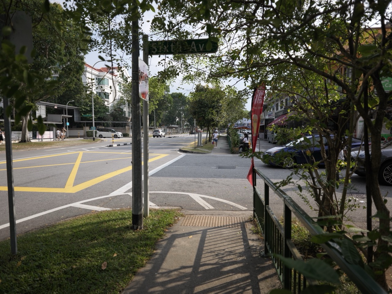
Did you know that Bukit Timah has a bridge built for wildlife, a railway station with a new public role and a place name that is less straightforward than its translation suggests?
These fun facts about Singapore in Bukit Timah connect the hill, forest, railway and neighbourhood names through a simple pleasure: looking at something familiar and discovering the question hidden inside it.
This guide brings selected discoveries together for families, students and curious readers. Where eduKate already explores an individual fact in depth, you will find a link to that fuller story. Here, the aim is to see how the discoveries connect and to try a few useful ways of observing, measuring and explaining them.
The wider Bukit Timah landscape includes several distinct places. A nature reserve, the former railway station, Beauty World and nearby Dairy Farm are not one attraction with a single entrance. Use Things to do in Singapore | Bukit Timah when choosing an outing, and History of Singapore | Bukit Timah for the longer chronology.
A Quick Read From Hill to Railway
- NParks lists Bukit Timah Hill as Singapore’s highest natural point, at 163 metres.
- The reserve’s protection history reaches back to 1883.
- Eco-Link@BKE connects habitats across an expressway and is not a public walking bridge.
- Some familiar quarry landscapes began as working industrial sites.
- The conserved Bukit Timah Railway Station building dates from 1932.
- The Rail Corridor gives a former transport alignment a new community and recreational role.
- Dairy Farm’s Wallace Education Centre occupies a former cow shed.
- Beauty World’s name carries an older shopping and leisure history into the present.
Jump to hill and forest, wildlife connections, quarries and changing landscapes, railway and place names, learning activities, or FAQs.
Did You Know the Highest Natural Point Needs a Carefully Chosen Word?
NParks identifies the 163-metre Bukit Timah Hill as Singapore’s highest natural point. That final word matters: the statement concerns landform elevation, not the height of every structure people have built.
The fact is small enough to remember, but the language lesson is larger. A comparison needs a category. Tallest building, highest natural point, longest route and largest area do not answer the same kind of question.
Try asking, “Highest compared with what?” The question prevents an impressive number from floating free of its meaning.
There is another useful distinction. A hill’s summit elevation does not automatically equal the vertical climb from your chosen starting point, and neither quantity is the same as walking distance along a path.
For a deeper explanation, read Bukit Timah’s highest natural point and the meaning of 163 metres.
You do not need to climb the hill to enjoy the idea. A labelled sketch can show a summit, a starting point and a winding route. Once those are separate, the question “How far?” becomes much more precise.
Did You Know a Reserve’s History Is Different From a Forest’s Age?
NParks records that Bukit Timah Forest Reserve was established in 1883. Its history page explains the reserve’s subsequent protection and its surviving primary rainforest.
The date tells us about a human decision to protect a place. It does not mean the forest began growing in that year.
This distinction appears in many subjects. A museum’s opening date is not the age of every object inside it. A school’s founding date is not the age of the land beneath it. A park’s formal establishment is one event in a longer ecological and social history.
Try making two timelines on paper: one for the living landscape and one for the decisions people made about it. You may have more precise dates for the second. That is fine; different kinds of evidence produce different kinds of timeline.
The enjoyable discovery is that a date becomes more interesting when we ask what event it actually records.
This helps students avoid a common writing mistake: placing an accurate number in a sentence where it describes the wrong thing. Accuracy includes the relationship between the date and the event, not only the digits.
Did You Know Primary Forest Is More Than “A Lot of Trees”?
NParks identifies Bukit Timah as containing one of Singapore’s remaining primary rainforests. Its account also notes hill dipterocarp forest and the reserve’s long importance for botanical study.
The useful surprise is that forests have histories. Two green areas can look similar from a distance while differing in how they developed, what disturbances they experienced and which living communities they support.
That is why “green” is only a beginning description. It tells you little about the age of particular trees, the diversity of organisms or the relationships that have formed there.
You can explore the idea from a designated path. Notice layers: ground vegetation, smaller plants, trunks and the upper canopy. Look for differences in light and space. Do not leave the path to pursue an observation.
A simple drawing with layers can help a younger child replace one undifferentiated green shape with a more organised view. An older learner can ask which observations would require specialist knowledge or repeated surveys.
You do not have to become a botanist in one afternoon. The first useful step is recognising that a living environment contains relationships that a quick photograph may not reveal.
Did You Know “Tin Hill” Does Not Settle the Naming Story?
The National Heritage Board’s Bukit Timah heritage booklet gives the literal Malay translation “Tin Hill” and discusses the possibility of a connection with temak trees. It presents that botanical explanation as a possibility, rather than proof of a tin-mining origin.
This is a perfect example of a fact becoming richer when we keep the uncertainty.
A translation tells you what words mean. An etymological explanation asks how a name developed. Those questions overlap, but a literal translation alone does not establish the historical event behind a name.
If you enjoy the puzzle, continue to the fuller eduKate account of Bukit Timah’s naming mystery.
For a family game, collect three place names and sort your notes into “translation,” “documented naming event” and “possible explanation.” Some names will fit more than one category; some will leave a blank.
The blank is useful. It reminds us that a satisfying story and an established origin are not automatically the same thing.
Did You Know Some Bridges Are Built for Animals?
Eco-Link@BKE connects Bukit Timah Nature Reserve with Central Catchment Nature Reserve across the Bukit Timah Expressway. NParks explains its role in allowing wildlife movement between the habitats.
Here is the delightful change of perspective: a crossing can be useful even when it is not intended for people to walk across.
Roads are connections for human travel, but they can also become barriers for other living things. The same strip on a map can perform opposite roles depending on whose movement you are considering.
Imagine two patches of habitat separated by a busy transport route. What would an animal need from a crossing? Shelter? Suitable vegetation? A route that leads somewhere useful on both sides?
That is an original reasoning exercise, not a complete specification of the real bridge. The purpose is to ask the design question from the intended user’s perspective.
For the detailed local story, follow how the wildlife bridge reconnects the two forests.
Did You Know the Wildlife Bridge Is Not a Public Walking Route?
NParks explicitly states that Eco-Link@BKE is not open to the public and that access is strictly supervised for research purposes. Treat it as a conservation feature to learn about through official material, not as a hidden attraction to enter.
That detail makes the design more understandable. A space can be valuable partly because it is not continually occupied by visitors.
The lesson extends beyond nature. An archive may preserve fragile material by limiting handling. A scientific instrument may need controlled access to produce reliable measurements. Protecting a function sometimes means arranging different forms of access for different users.
For children, the question can be simple: “Who is this place for?” A playground, a nest box and a wildlife crossing do not share the same answer.
Knowing that answer helps us appreciate a feature without making ourselves the centre of every design. There is a quiet pleasure in discovering that the city contains spaces whose success may be measured by what animals can do there.
Did You Know a Nature Park Can Help Protect a Nature Reserve?
NParks’ explanation of nature park networks describes the connected roles of reserves, surrounding parks and ecological links. The parks around Bukit Timah are part of a larger protective landscape.
This gives the word buffer a visible meaning. A buffer is something that helps reduce the effect of one condition on another. In a landscape, the arrangement of surrounding spaces can matter to what happens inside a more sensitive area.
An everyday analogy is the space around a work table. The table itself matters, but so do the room, noise, access and activities beside it. Protecting only the exact outline of the tabletop would not protect the whole experience of using it.
The analogy explains one relationship; it does not reduce conservation to furniture arrangement. Living systems are far more complex.
For a paper exercise, draw a central habitat and several surrounding uses. Where might a protective edge help? Where might a connection help? Notice that a boundary and a connection can both be useful, depending on the job.
This is a good way to move from memorising a place name to thinking about why the surrounding pattern matters.
Did You Know a Peaceful Quarry View Has an Industrial Past?
Hindhede Nature Park includes views of Hindhede Quarry. NParks also identifies the former Sin Seng Quarry within the history of Rifle Range Nature Park.
The contrast is striking: a landscape now admired for still water and rock faces can have been shaped by extraction and work.
It is tempting to call every attractive water-filled hollow a natural lake. The quarry history gives a more specific explanation for the form you see.
Ask two questions when looking at a landscape: “What is it like now?” and “What processes made it this way?” One concerns present appearance; the other concerns origin and change.
You can practise with a photograph. Describe visible features first, then add the documented history. Keep the two layers clear so that an observation does not accidentally become an invented geological account.
Our article on Bukit Timah’s former granite quarries follows that transformation in greater detail.
Enjoy the view from designated places. A quarry landscape is not an invitation to enter the water or approach an unprotected edge.
Did You Know Rifle Range Is More Than a Picturesque Name?
NParks explains that Rifle Range Nature Park takes its name from the road serving a real rifle range. Its historical account also connects the park with the former Sin Seng Quarry and surrounding settlement history.
A name can outlast the activity that made it meaningful. That is why a present-day nature visit can unexpectedly lead into a story about an older use of land.
The name is a clue, but it should be checked rather than taken as a complete history. A road named after an activity does not mean the activity took place at every point along the road.
This is useful for map reading. Roads connect places; their names may refer to a destination, person or former feature. The relationship has to be established.
For the focused explanation, read Rifle Range Road and the shooting range it remembers.
Then try the same question with a road near your home: does its name describe what is there now, what was once there or something else entirely?
Did You Know Dairy Farm Really Had a Dairy Farm?
NParks describes Dairy Farm Nature Park as occupying a former dairy-farm landscape. Its present role includes nature, recreation and education.
The name is a friendly reminder that Singapore’s landscape included practical food-production activities as well as homes and commercial centres.
It also helps us ask a useful question about change. What survives when an activity ends? Sometimes a building, a route or a name remains. Sometimes the clearest evidence is a photograph or written record.
The current park is not a working dairy farm. NParks makes clear that visitors should not expect real cows there today.
That small qualification prevents a very disappointed child from arriving with the wrong picture in mind. It also keeps the historical story intact: the interesting thing is the change of function.
For a fuller account, continue with why Dairy Farm Road has its name.
Did You Know a Cow Shed Became a Place to Learn Natural History?
The Wallace Education Centre occupies a former cow shed. NParks describes its exhibitions about biodiversity, biogeography and Alfred Russel Wallace.
This is a lovely example of giving a building a new purpose while retaining a connection with its earlier life.
The old use and the new use are very different. One supported agriculture; the other supports learning about the natural world. A building can remain useful because people change what happens inside it.
Try an imaginary redesign at home. Choose a disused shed in a drawing and propose a new public use. Which features would you keep? Which would need alteration? What would visitors need to know about the building’s past?
That exercise introduces adaptive reuse in plain language: finding an appropriate new use for an existing structure.
Check the centre’s own opening information before visiting; the hours of an exhibition building can differ from those of the surrounding park. A park being open does not automatically mean every facility inside is open too.
Did You Know the Railway Story Has More Than One Important Date?
NHB’s Bukit Timah heritage trail discusses the railway that opened in 1903. URA dates the conserved Bukit Timah Railway Station building to 1932. Those dates refer to different parts of the railway story.
This is a wonderful example of why “When did it begin?” needs a carefully defined “it.”
A transport route, a particular building, a later alignment and a restoration project can each have a different date. Combining them carelessly creates an apparently simple sentence that is historically wrong.
Try the same reasoning with a school. Its founding, move to a new campus and opening of a new block may occur in different years. All three dates can be accurate when attached to the right event.
For the broader relationship between rail access and the neighbourhood, read how the railway helped shape Bukit Timah.
A clear timeline is not merely a row of numbers. It is a set of carefully labelled events.
Did You Know the Old Station Now Helps People Read the Railway?
URA’s announcement of the restored station community node describes the 1932 building’s new heritage-gallery role and restored railway features. The community node opened on 1 July 2022.
The enjoyable change is that equipment once used to operate a railway can now help visitors understand one.
An object in a heritage display asks for a different kind of attention from an object still doing its original job. Instead of asking only “How do I use this?”, we can ask “What problem did this solve?” and “What other parts of the system did it depend on?”
You can use those questions with a household object too. An old telephone, camera or kitchen scale often becomes more interesting when you explain the process around it.
For a child, choose one object and draw the people or actions it connected. Avoid assuming that every restored item is an untouched original; read the label for distinctions such as restored, reconstructed or replica.
Those words help us appreciate conservation work more accurately. The story includes both the original railway and the later decisions about how to preserve and explain it.
Did You Know a Former Railway Can Become a Different Kind of Connection?
URA describes the Rail Corridor as a former railway alignment transformed into a 24-kilometre community and recreational corridor, linking the south towards Woodlands.
The route’s continuity gives it a new usefulness. A narrow strip can connect many places precisely because it extends across them.
Think of the difference between a room and a corridor. A room gathers activity in one place. A corridor makes movement between places possible. Both can be valuable, but their shapes support different jobs.
That analogy helps explain why a long, connected landscape cannot be understood only by adding up isolated attractive spots. The spaces between the spots are part of its function.
For the local history, follow the story of the green corridor that once carried trains.
For a real visit, choose a manageable section and consult current access notices. The overall length describes the corridor; it is not a suggestion that every family should cover it in one outing.
Did You Know Beauty World’s Name Carries an Earlier Place Forward?
NHB’s Bukit Timah community heritage account explains that the Beauty World name survives in the later shopping centres across the road from the original market site.
A name can provide continuity even when the buildings and activities around it change.
This is a pleasing way to understand local identity. People may retain a familiar reference while the physical setting evolves. The name is neither a complete map of the old place nor an empty label in the present.
Ask a family member whether they use any older name for a place. Why has that name remained useful to them? Habit, affection and shared memory may all matter, though each person’s answer will be their own.
For the focused history, continue with Beauty World’s earlier amusement and market story.
When writing about such places, specify whether you mean the former site, the present centre or the wider neighbourhood. A familiar name becomes much clearer when its reference is stated.
Four Ways to Turn Bukit Timah Curiosity Into Understanding
1. Separate height, distance and effort
Draw an imaginary hill with a summit 100 metres above a reference level and a starting point 30 metres above the same level. The difference is 70 metres. Now draw two paths to the summit, one direct and one winding.
The elevation difference stays the same, while the route distances can differ. These are invented teaching figures, not measurements of Bukit Timah trails.
Next ask whether elevation and distance alone tell you how difficult a walk will feel. Surface, gradient, weather, rest and the walker’s needs can also matter.
This is a useful mathematical habit: calculate what the information permits, then identify what the calculation leaves out. The answer becomes stronger when you can name its limits.
For younger children, simply label “upwards difference” and “distance along the path.” The drawing can do much of the explanatory work.
2. Build a timeline that refuses to mix events
Choose four events from reliable sources: a reserve’s establishment, a station building’s construction, a change in land use and a restoration opening.
Write a complete label for each date. “Station” is too vague; “construction of this station building” tells the reader what happened.
Then arrange the labels in order and ask what the timeline does not show. It may leave out the people involved, earlier activities or gradual changes between the dated events.
This is an excellent preparation for historical writing. A timeline helps organise evidence, but a paragraph must still explain relationships. “After” does not automatically mean “because of.”
Ask the learner to identify one relationship that is documented and one that would need further research. The distinction keeps a neat visual from becoming an unsupported story.
3. Design a crossing for a different user
On paper, place two imaginary habitats on opposite sides of a road. Decide what a crossing would need to make the connection useful for a chosen animal.
Label your choices as proposals. You are practising design reasoning, not producing a professional ecological plan.
Now change the animal or the surrounding habitat. Does the same proposal still make sense? Which assumptions have changed?
The exercise shows why a successful design depends on the user and conditions. A solution cannot be judged only by whether it looks like a bridge.
End by comparing the question with a human space, such as a library entrance. In both cases, the designer must understand the journey being supported, while the practical details differ substantially.
4. Write an object’s two lives
Choose the railway station or former cow shed as your example. Write one short paragraph about its earlier function and another about its present public role, using the relevant official source.
Then add a connecting sentence: what was retained, what changed and what new activity became possible?
Do not assume that every old feature survived. If the source does not tell you, leave the claim out or turn it into a question.
This is a satisfying composition exercise because it gives change a visible object. The reader can follow a building through time without needing a dramatic invented character or event.
The same structure works for a personal object at home. A box once used for packaging may now hold family photographs. The scale is smaller, but the question about changing purpose remains clear.
Follow the Discoveries Into the eduKate Singapore Network
The individual Bukit Timah stories linked above provide the deeper fact-by-fact reading. The Singapore Atlas connects them with the national story, while Why Singaporeans Love Bukit Timah explores the area’s everyday appeal.
Bukit Timah Tutor is the mathematics route for measurement, comparison and structured reasoning. Singapore English Tuition Centre helps develop the language used to explain what you discover. eduKateSingapore supplies a broad reference library across subjects.
For learning methods, explore eduKateSengkang. For a local family perspective in another part of Singapore, visit eduKatePunggol. eduKateYishun brings a recovery and wellbeing lens when a learner needs a gentler next step.
Wahliao continues the city and place curiosity, and eduKateOrchard helps readers find appropriate support across the ecosystem. The Singapore Area Learning Article Index offers another route between neighbourhoods.
More Fun Facts Around Singapore
Let your next question take you to another neighbourhood:
- Punggol’s waterway, fishing memories and ideas for the future
- Sengkang’s harbour names, little trains and living wetlands
- Yishun’s pineapple connection, tree collection and butterfly-inspired tower
Frequently Asked Questions About Bukit Timah’s Fun Facts
Is Bukit Timah Singapore’s highest point?
Use the precise description: its highest natural point. NParks lists the hill at 163 metres. Buildings, route distance and elevation gained from a particular starting point involve different measurements.
Can visitors walk across Eco-Link@BKE?
No. NParks states that it is not open to the public. Its purpose is ecological connectivity, and supervised research access is different from public recreational access. Learn about it through official information.
Does “Tin Hill” prove there was tin mining here?
No. A literal translation does not establish a mining history. NHB discusses a possible connection with temak trees. Preserve the qualification and consult the fuller naming account if that is the question you want to pursue.
Is the present railway station building from 1903?
URA dates the conserved building to 1932. The earlier railway opening belongs to a different event. Both dates make sense when attached to the correct part of the story.
Will we see cows at Dairy Farm Nature Park?
No. NParks explains that it is no longer a functioning dairy farm. The former cow shed’s educational use is part of the attraction’s present story.
Do we need to visit every place in this guide?
No. The places are spread across a wider landscape and serve different interests. Choose one suitable destination, check its current information and allow time to enjoy it. Reading about a feature can also be a complete and worthwhile discovery.
How can a student make an original project from these facts?
Choose a specific question, read its primary source, make an appropriate observation and explain the relationship in your own words. A careful comparison or labelled model can add original thinking without inventing historical evidence.
Sources and Your Next Bukit Timah Question
This guide uses NParks for natural features and park information, NHB for place-name and heritage context, and URA for the railway station and Rail Corridor. Source links are placed beside the relevant claims; longer eduKate stories provide additional reading paths.
Visitor information was checked on 3 October 2026. Confirm current access and facility information with the managing agency before travelling. The drawings, comparisons and imagined examples are original learning activities, not official route instructions or engineering assessments.
The next time you see a hill, a bridge or an old building in Bukit Timah, try asking what kind of connection it makes. Between places? Between habitats? Between the past and the present? There is often a good story waiting inside the answer.