
High value G3 Geography lessons teach secondary students to understand places, interpret maps and data, evaluate environmental decisions and explain how people interact with their surroundings. The 2027 Singapore–Cambridge Secondary Education Certificate (SEC) identifies separate G3 Geography as syllabus K329. For parents, a productive lesson is not defined by how quickly a child memorises case studies. It is defined by whether the learner can use geographical concepts to analyse an unfamiliar location, compare consequences, evaluate a proposal and support a conclusion with evidence. Geography rewards understanding, investigation and careful judgement.
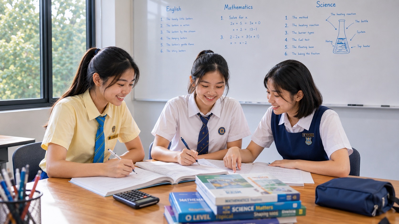
At eduKateSG, a three-student tutorial is designed to make each learner’s reasoning visible. A tutor can ask one student to interpret a climate graph, another to justify a tourism decision and another to identify a weakness in fieldwork sampling. Each student then tests the corrected method independently. The teaching priority is to identify the earliest gap—concept, data literacy, writing, evaluation or time management—and use the lesson to repair it. Progress must be assessed honestly, without promising particular grades or giving unnecessary homework that crowds out school and family life.
Parent summary — what to know about G3 Geography K329
- K329 is separate G3 Geography, not the combined Humanities (Social Studies, Geography) syllabus K335.
- The 2027 SEC has two papers, each 1 hour 45 minutes, 50 marks and 50% of the total.
- Paper 1 examines fieldwork, Tourism and Climate. Paper 2 examines geographical thinking and sustainable development, Tectonics and Singapore.
- The syllabus has five clusters: Geography in Everyday Life, Tourism, Climate, Tectonics and Singapore.
- Geography requires interpreting sources, analysing spatial relationships, making decisions and justifying evaluation criteria—not just repeating named examples.
- Families should expect focused feedback, an evidence-based study plan and growing independence rather than a promise to memorise every possible essay.
Understanding G3 Geography Under Full Subject-Based Banding
G3 refers to the level of a particular subject under Full Subject-Based Banding. A student in Posting Group 3 does not automatically take every possible G3 elective, while students’ subject arrangements depend on school offerings and eligibility. Parents should check the exact subject shown on their child’s course and registration documents. The national 2027 code K329 belongs to separate G3 Geography; the SEAB list also shows the earlier code 2279 for reference.
Combined Humanities (Social Studies, Geography) has code K335 and a different assessment arrangement. Some geographical content and skills are related, but buying the wrong syllabus guide can lead to irrelevant practice or missed requirements. Ask the school which version of Geography the child is taking and whether the current school examination follows its own term-by-term breakdown.
The SEC begins with the 2027 examination cohort. Lower-secondary students still need to develop foundations in reading a map, describing a pattern, understanding environments and asking geographical questions before extensive final-paper practice becomes useful. The official K329 syllabus offers parents a route map for later work, not a reason to turn every Secondary 1 weekend into a timed national examination.
The 2027 Papers: Know the Actual Requirements
Paper 1 lasts one hour 45 minutes, contains three compulsory structured questions and contributes 50% of the examination result. Question 1, worth 20 marks, concerns fieldwork within Geography in Everyday Life. The fieldwork context may draw on any syllabus cluster. Question 2, worth 15 marks, concerns Tourism; Question 3, also 15 marks, concerns Climate. A 9-mark judgement and decision-making question appears in either the Tourism or Climate question.
Paper 2 has the same time, mark total and overall weighting. It asks one question on thinking geographically and sustainable development (15 marks), one on Tectonics (15 marks), and one on Singapore (20 marks). A 9-mark judgement question is set in either the Tectonics or Singapore question. An approved calculator may be used in both papers, but calculation alone will not replace geographical explanation.
These arrangements show why efficient teaching must be balanced. A student who remembers ten case studies but cannot interpret a photograph or evaluate a proposal may underperform. A student who understands broad environmental issues but ignores the precise case information may also lose marks. The right preparation combines knowledge, analysis, fieldwork reasoning and decision-making.
Five Clusters, Fifteen Topics and a Coherent Framework
The official syllabus arranges Geography into five clusters of three topics each. Geography in Everyday Life develops thinking geographically, sustainable development and geographical methods. Tourism examines tourism activity, tourism development and sustainable tourism development. Climate covers weather and climate, climate change and climate action.
Tectonics includes plate tectonics, earthquakes and volcanoes, and disaster risk management. Singapore covers the country as a small island city-state, its opportunities and challenges, and ways of creating a sustainable and resilient Singapore. The clusters are connected through questions about place, people, environment and choices.
Parents do not need to ask the child to memorise the table every evening. A better question is whether a concept from one cluster can help explain another. Human activity can create opportunities and environmental costs; geographical conditions shape both hazards and responses. Seeing these links makes learning easier to retain and enables application to unseen scenarios.
The Most Important Diagnostic: Can the Child Think Geographically?
“Poor Geography” is too broad a diagnosis to guide teaching. A learner may have good subject knowledge but not know how to read a choropleth map. Another may identify an environmental issue but fail to distinguish short- and long-term impacts. A third may explain consequences accurately but not evaluate the best response according to specific criteria.
A short diagnostic can include a map, a simple graph, two sources about a place, a brief explanation and an evaluation question. The tutor looks for whether the child identifies the spatial pattern, supports observations with data and considers multiple perspectives. This establishes the type of assistance needed.
A clear learning target might be, “Describe a pattern using both the highest and lowest values.” Another might be, “Evaluate one management strategy against environmental and economic criteria.” Parents can judge success on new material after teaching, rather than treating the number of pages completed as progress.
Thinking Geographically: More Than Naming Countries
Geography asks where a phenomenon occurs, why it occurs there, what relationships exist and how its consequences vary across places. The location of a school, shopping centre, river or public space is part of a wider pattern involving people, accessibility, environment and decisions. A student who sees only an isolated dot on a map misses the relationships Geography seeks to explain.
A useful exercise begins with a familiar neighbourhood map. Ask where services are located and how different residents might access them. Then add an unfamiliar town plan and see whether the student can apply the same idea. This tests transfer rather than recall of one local example.
Key terms such as distribution, spatial pattern, scale, place, environment and interconnection should be used accurately. A statement such as “many services are here” is weaker than a description of concentration, relative location and possible accessibility. Specific language enables clearer reasoning.
Place and the Everyday Singapore Landscape
The Geography in Everyday Life cluster includes relationships between people and nature, a sense of place and patterns within neighbourhoods. This offers parents a meaningful entry point. Children travel through estates, transport nodes, parks and commercial streets, but may not notice how their own routines are shaped by spatial design.
Ask a learner why a park is valued by different people. Nearby residents may appreciate recreation and shade; visitors may value scenery; planners may have to consider accessibility and maintenance. These views can complement or conflict. A good geographical answer identifies the stakeholder and connects the viewpoint to evidence.
Local observation can be useful without becoming a formal research trip. A child can note that a route has shade, traffic or several crossings, then consider how these features affect users. The lesson should separate observation from interpretation and acknowledge that a single walk cannot establish every broader claim.
Sustainable Development: Trade-offs, Not Slogans
Sustainability is often reduced to commands such as “recycle more” or “plant more trees”. The syllabus demands deeper judgement about environmental, social and economic considerations. A choice may help one group while imposing costs on another. A good student learns to identify the scale, time period and trade-off involved.
Take an invented proposal to replace an unused paved area with a community garden. Possible benefits include public use, biodiversity or lower surface temperatures. Potential challenges include maintenance, accessibility and competing land needs. The correct decision depends on the context and the stated criteria.
Students should learn to weigh evidence rather than automatically choose the most environmentally appealing option. A response explaining why a solution is suitable under particular constraints is more sophisticated than a paragraph listing benefits with no consideration of feasibility.
Geographical Methods: From Question to Evidence
Geographical investigation begins with a focused question. The child should identify what they need to know, where they could observe it and which method could reasonably answer it. Counting pedestrians, measuring shade, using a questionnaire or taking photographs may each be appropriate for different questions. A method is not good merely because it produces more data.
The syllabus includes extended fieldwork over ten weeks as part of the learning experience, and Paper 1 assesses fieldwork-related reasoning. Parents can support the preparation by encouraging organisation, careful records and sensible reflection. They need not purchase specialist equipment or conduct unsupervised investigations in public places.
A strong fieldwork response explains why a sample was chosen, what limitations remain and how the method could be improved. Bias, timing, weather, accessibility and sample size may matter depending on the investigation. Good teaching connects every limitation to its likely effect on the quality of the findings.
Fieldwork Sampling: A Small Choice With Large Consequences
Suppose students want to learn how busy a footpath is. Counting pedestrians during only one quiet afternoon may not represent other days or times. If the study is meant to describe school-day commuting, the time and location of observations need to fit that purpose. The learner should see that research design affects what conclusions are defensible.
Ask the child to compare two sampling plans. Which one fits the question? What might be missed? Could data collection be carried out safely and ethically? This exercise develops evaluation skills that appear well beyond the fieldwork chapter.
A responsible fieldworker respects privacy, local rules and the safety of others. Children should not photograph identifiable strangers unnecessarily, interfere with traffic or enter restricted sites. Useful Geography learning can occur through school-approved fieldwork, public datasets and classroom simulations.
Tourism: Activity, Development and Impacts
Tourism is not only a list of destinations. It involves movement, economic activity, experience, infrastructure, environment and community interests. Students should understand why people travel, how tourist places develop and what benefits and challenges follow. The same tourism project can generate income while placing pressure on natural resources or local communities.
A hypothetical coastal destination may attract visitors because of its landscape. Development may create jobs and improve facilities, yet increased foot traffic may affect habitats. Ask students to classify impacts as economic, social or environmental, then explain how the effects might change over time.
A high-value lesson introduces examples to illustrate mechanisms, not as scripts to reproduce in every answer. The tutor can then give a different destination and ask which ideas still apply. If the student can adapt, the knowledge is becoming useful.
Sustainable Tourism: Evaluating a Proposal
Sustainable tourism development requires balancing visitor experiences, local livelihoods, environmental conditions and long-term viability. A student may be asked whether one strategy is preferable under specific circumstances. The answer must consider who benefits, who bears costs and which goal is most important in the case.
Consider a proposed limit on visitors to a fragile natural area. Fewer visitors could reduce pressure on the environment, but restrictions might affect businesses and access. The student should evaluate the decision against defined criteria, identify possible mitigation measures and justify a reasoned conclusion.
We teach students to avoid treating one advantage as proof of an overall solution. Evaluation requires comparing realistic alternatives, recognising constraints and explaining a final choice. This is especially important for 9-mark judgement questions.
Weather and Climate: Know What the Graph Represents
Weather describes short-term atmospheric conditions; climate refers to patterns over longer periods. Students must know why one rainy day does not prove a climate trend and why a climate chart requires careful interpretation. Data can be presented through rainfall bars, temperature lines, maps, photographs and written sources.
A tutor should ask the learner to identify the axis, unit, time scale and highest and lowest values before calculating or explaining. The child can then compare seasonal patterns or changes across locations. Numbers need context; an increase of three units means little until the measured quantity is identified.
Practice should include unfamiliar graphs with different scales and presentations. Recognising a textbook’s familiar climate graph is not sufficient if the student cannot interpret a new data display. This is a high-value skill because it extends across other subjects and everyday information.
Climate Change: Separate Evidence From Explanation
Climate change involves long-term shifts in climate conditions and the interactions of natural and human processes. Students should learn to distinguish observed data, explanations of mechanisms and projected consequences. A single extreme event should not be used as proof of every proposed climatic conclusion.
The tutor can present two datasets and ask which claims are supported. Then introduce mechanisms relevant to the syllabus, such as the relationship between greenhouse gases and the Earth’s energy balance. The learner should connect a claim to appropriate evidence rather than copy dramatic language.
Parents can encourage careful reading of reliable climate information. The objective is scientifically informed geography and responsible judgement, not anxiety. Students should learn to communicate uncertainty and evidence accurately, especially where future outcomes depend on the assumptions of a scenario.
Climate Action: Mitigation and Adaptation
Mitigation seeks to reduce factors that contribute to future climate change, while adaptation addresses the consequences of changes that occur or are expected. Students sometimes treat these as synonyms, writing that every climate action prevents warming. A good lesson compares the purpose of each response.
For instance, reducing emissions and improving flood protection address different aspects of climate-related risk. Which option is more urgent depends on the problem, geography, resources and time frame. The best explanation identifies the mechanism and the constraints.
Students should practise evaluating a response from the perspective of households, businesses or governments. A plan may be technically feasible yet difficult to implement or unequal in its consequences. A high-value answer shows this complexity without losing a clear judgement.
Tectonics: Understand Plate Relationships
The Tectonics cluster covers plate tectonics, earthquakes, volcanoes and disaster risk management. Students need to understand the underlying processes, not merely label famous places where events occurred. Maps, cross-sections and diagrams help them see the spatial relationships associated with tectonic activity.
Begin with a conceptual diagram and ask what each arrow, boundary and feature represents. Then introduce an unfamiliar cross-section or map. The learner should explain the likely pattern of geological activity from the model, while recognising the limitations of the information.
A common mistake is to assume all boundaries behave identically. Contrast cases and ask how the movement and conditions differ. When a student can explain why an effect occurs, examples become easier to remember and apply.
Earthquakes and Volcanoes: Hazard Is Not the Same as Disaster
A natural hazard does not produce the same consequences everywhere. A significant physical event may affect one place severely and another less so because exposure, buildings, preparedness and response capacity differ. The tutor should teach students to distinguish the physical process from the level of disaster risk.
Suppose two communities are exposed to a comparable earthquake hazard. One has stronger buildings and clearer emergency plans; the other has fewer resources. Students can assess how vulnerability and preparedness influence outcomes. The response should be linked to the hypothetical conditions rather than make generalisations about particular countries.
Photographs, maps and data can help students examine the issue. They must be read critically: an image illustrates a setting but cannot by itself prove the overall national impact or effectiveness of a policy.
Disaster Risk Management: Decisions Under Constraints
Disaster risk management asks which measures reduce risk and how limited resources might be allocated. Monitoring, building design, education, land-use choices and emergency response can contribute, but no single strategy eliminates all hazards. Students should explain what a method can and cannot do.
A strong evaluation considers effectiveness, cost, feasibility, context and time. An expensive technical system may be useful in one setting yet inappropriate in another. Community education may help preparedness without replacing physical infrastructure. The child should be able to justify a balanced recommendation.
The skill transfers to many real decisions: compare alternatives, identify criteria and acknowledge trade-offs. Parents should value this reasoning even if it requires more thought than memorising a list of disaster examples.
Singapore: Small Island City-State
The Singapore cluster examines the opportunities and challenges arising from the country’s geography. Students should link land and resource constraints, connections with other places and the needs of a dense population. A statement that “Singapore is small” explains little unless the child can show how this characteristic affects a particular decision.
Ask how a city might allocate space among housing, transport, recreation, industry and nature. Different stakeholders have legitimate needs. A tutor can use a fictional land-use decision to help students evaluate how constraints and opportunities interact, without pretending that one simple answer solves every planning issue.
Parents can connect lessons to the child’s surroundings and public information. Examples are useful when they illustrate actual geographical processes, but students should distinguish a current government policy from a classroom hypothesis and check original official sources where relevant.
A Sustainable and Resilient Singapore
A resilient city seeks to anticipate, withstand and adapt to pressures. Sustainability concerns the longer-term relationships among environment, society and economic activity. These ideas overlap, but they are not identical. Students should be able to describe why a policy might support one or both and what evidence would be needed to assess its results.
A hypothetical proposal to increase urban greenery could involve surface temperature, biodiversity, recreation, maintenance and land allocation. The student can be asked to evaluate benefits alongside practical constraints. A well-structured answer includes the criteria and explains the final judgement.
Geography teaching should not become a slogan about how excellent or poor a city is. The aim is to develop informed analysis. Learning to make a reasoned decision from evidence is the strongest preparation for future civic participation.
The 9-Mark Judgement Question: How to Build a Defensible Response
K329 includes a 9-mark judgement and decision-making task in each paper. This is not simply an invitation to write as much as possible. Students should identify the decision, choose suitable criteria, explain relevant evidence and justify a conclusion that responds to the context.
A useful planning technique uses three questions: Which option best meets the stated objective? What important costs or constraints could change that judgement? Why is my final choice justified despite those limitations? A strong answer can recognise an alternative and still reach a clear position.
The tutor should use SEAB’s level descriptors to discuss quality of reasoning, not encourage students to memorise an inflexible paragraph. An essay that is perfectly structured but irrelevant to the issue will not become good simply because it includes an impressive phrase such as “in the long run”.
Data-Based Skills: Maps, Photographs, Graphs and Tables
Geography papers can ask students to interpret several kinds of sources. Maps show spatial relationships, graphs show quantitative patterns, photographs show a particular view and texts convey claims or descriptions. Each source has strengths and limitations. A student should know what can reasonably be inferred from each.
When comparing maps, check the scale, legend, units and regions represented. When using a graph, describe the pattern precisely and support it with values. When examining a photograph, identify visible evidence rather than assume events outside the frame. With text, distinguish the author’s claim from independently verified facts.
A high-value tutorial provides unfamiliar resources and asks the child to explain the method of interpretation. The goal is not to recognise a case study but to know how to read a new piece of evidence in the examination.
Calculation Without Losing Geographic Meaning
The Geography syllabus permits an approved calculator in both papers. But a numerical result has value only when correctly interpreted. Students may need to calculate differences, proportions or rates from supplied data. A learner should check what quantity is measured and whether the comparison is fair.
A hypothetical dataset might show visitor numbers at two locations. An increase in absolute visitors does not necessarily mean the same percentage change. The tutor can ask the student to explain which comparison is relevant for the claim being evaluated.
After calculation, the learner should write a sentence that answers the geographical question. Units, context and limitations matter. This is an efficient cross-curricular skill that also supports Mathematics and Science.
The Common Error: Describing Without Explaining
In Geography, “describe” and “explain” have different demands. A student may describe that rainfall increases from one month to another when the question asks why the pattern occurs. Another may list tourism impacts without explaining the relationship to local economic conditions. The tutor should teach the distinction through direct comparisons.
One useful exercise presents a two-sentence response and asks which part is description and which is causal explanation. Then the child adds missing reasoning grounded in the source. This makes the command word meaningful rather than another vocabulary item to memorise.
It is equally important not to over-explain when a question asks only for an observed trend. Efficient examination writing means selecting the relevant level of detail, not automatically producing the longest answer.
An Illustrative 90-Minute Small-Group Geography Lesson
A 90-minute tutorial could use ten minutes for retrieval of an earlier concept, fifteen for a diagnostic resource and short explanation, twenty for guided source analysis, twenty for an independent unfamiliar response, fifteen for evaluating a proposal and ten for correction and focused home practice. These timings are examples, not a rigid formula.
A student uncertain about interpreting map symbols might receive a short targeted task while a confident learner works on evaluating a disaster-management strategy. A class of three should make these differences easier to see and address. The tutor should check what every student has independently understood.
The value is not the number of case studies recited during the session. It is the student’s increasing ability to identify evidence, select a geographical idea and communicate a defensible judgement. The learner should leave knowing exactly what to practise next.
Sustainable Homework and Revision
A manageable week may include reading one short geographical source, describing a graph or map, revisiting a case-study explanation and attempting one judgement paragraph. Each activity should have a clear purpose and be reviewed. The amount depends on school assignments, examinations, CCAs, family life and rest.
A case-study notebook can be useful if organised around transferable ideas rather than long pages to copy. For each example, record the context, relevant mechanism, evidence, consequences and possible limitations. A student can then adapt the knowledge to a question instead of repeating the same memorised story.
Spaced retrieval matters. Revisit an older cluster after several days or weeks using a new resource. If a student can explain the idea in unfamiliar form, understanding is likely more secure than when the only practice is rewriting yesterday’s notes.
Time Management in Two 105-Minute Papers
Each K329 paper lasts one hour 45 minutes and contains three compulsory structured questions. Candidates should practise reading the mark allocation, identifying the question’s command and balancing time across the paper. One elaborate response should not consume so much time that a later question remains unanswered.
Accuracy should precede strict timing. First teach how to produce a sound fieldwork or evaluation answer without undue pressure. Then use shorter timed tasks and eventually realistic practice under the examination conditions appropriate to the student’s stage.
After a timed task, record whether difficulty arose from reading sources, recalling knowledge, choosing a judgement or writing too much. The next lesson should solve the actual delay. Telling a student merely to “write faster” is a poor intervention if the real problem is uncertainty about the question.
A Six-Week Review Parents Can Trust
Ask for an initial and a later response to a comparable unseen resource, a fieldwork evaluation, a short case-study explanation and a judgement answer. The tutor should identify the skills that are secure, developing or in need of repair. A single score does not explain how or why progress occurred.
Check for transfer between clusters. Can the student evaluate a tourism proposal after having learned to evaluate a tectonic-risk measure? Can the learner read a new map without a topic heading? If so, the method is becoming independent and the teaching is likely more valuable.
Also ask whether tuition still fits the child’s life. School, sleep, relationships and other subjects remain important. If a student has developed a secure study routine and knows how to seek help from teachers, parents may decide that continuing lessons is unnecessary.
Frequently Asked Questions
Is K329 Geography the same as Humanities (Social Studies, Geography)?
No. K329 is separate G3 Geography. The combined Humanities pairing with Social Studies is K335 and has a different assessment arrangement. Check the exact subject registered at school.
Does Geography require fieldwork?
Yes. The K329 syllabus includes an extended fieldwork learning experience and assesses fieldwork-related skills in Paper 1. Students should understand investigation design, sampling, evidence and evaluation.
Do pupils need to memorise every place name?
No. Accurate examples help, but the central challenge is applying geographical knowledge to data, places and decisions. A carefully understood example is more useful than many memorised facts that cannot be connected to the question.
What is the best way to revise a 9-mark judgement question?
Identify the decision, choose appropriate criteria, explain relevant evidence, consider an important limitation and justify a clear conclusion. Practise on unfamiliar scenarios and use official level descriptors to assess the quality of reasoning.
Will three-pax tuition guarantee a better grade?
No. Small groups can create more opportunities for feedback, but the outcome depends on the student, teaching quality, practice and other circumstances. Judge tuition by targeted progress and a sustainable workload.
The High Value Decision for Parents
Geography is useful because it helps young people understand how places, people and environments interact and why decisions involve real trade-offs. High-value G3 Geography lessons should build that capacity, repair weak data interpretation, strengthen judgement and leave the learner better able to answer unfamiliar questions independently.
eduKateSG’s three-student approach is intended to keep questions, feedback and thinking close to each learner. Parents can arrange a consultation or read the Clementi small-group teaching reference to understand the broader methodology. The purpose is not more tuition for its own sake, but education that helps a child make better sense of the world.
Official Sources and Further Reading
- SEAB: 2027 SEC G3 syllabuses for school candidates
- SEAB: 2027 G3 Geography K329 syllabus (PDF)
- SEAB: Secondary Education Certificate overview
- MOE: Full Subject-Based Banding and SEC changes
Paper structure and topic names are based on the official 2027 syllabus available in November 2026. Consult the current school programme and the latest SEAB requirements for the child’s examination cohort.