
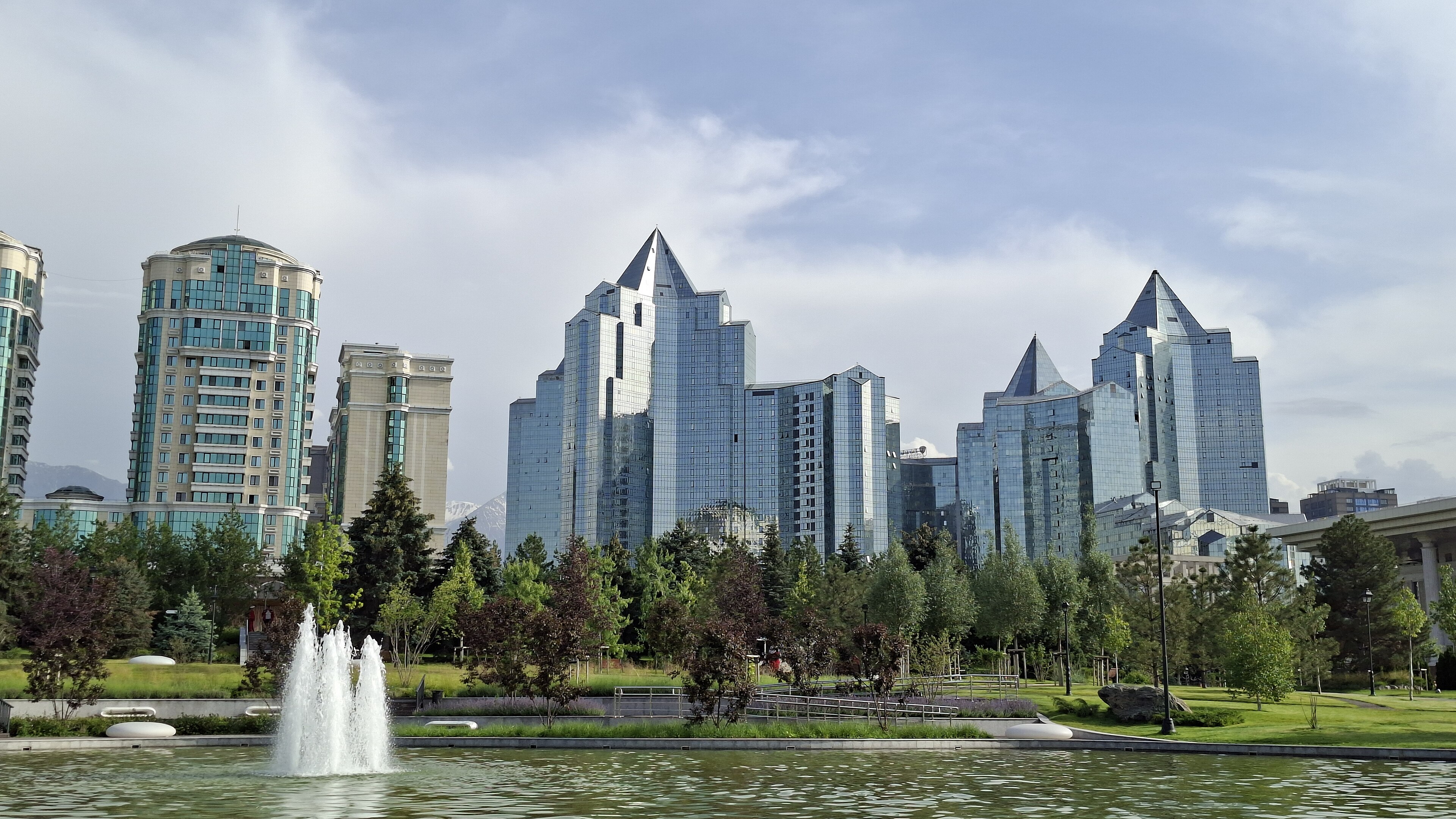
An Easy History for Students and General Readers
Introduction: Why Almaty Has More Than One Beginning
When did Almaty begin?
The easiest answer is 1854. That was the year the Russian Empire established the fort of Verny, from which the continuously documented modern city developed. Almaty’s municipal government also presents 1854 as the beginning of its modern history.
But 1854 cannot be the whole answer.
Long before Verny, medieval settlements operated in the northern foothills of the Tian Shan. The name Almatu appeared in the region’s urban and commercial history. Nearby Talgar formed part of the wider Silk Roads network now recognised by UNESCO.
Long before those towns, Saka and Wusun communities used the rivers, pastures and routes of Zhetysu.
And long before any human community lived here, mountains, glaciers and rivers were already constructing the environmental system upon which every later city would depend.
All of these beginnings are valid.
Each describes a different layer of Almaty.
That is why this history does not begin by choosing one founding date and rejecting all the others. Instead, it asks a larger question:
Why has this particular place repeatedly become important?
The answer lies partly in human ambition, but it also lies in the landscape.
South of the modern city, the mountains of the Trans-Ili Alatau rise sharply toward snow and glaciers. Water descends from those heights across the foothills. Beyond them, the land opens toward the plains and routes of southeastern Kazakhstan.
This placed Almaty at a natural junction between several worlds:
- mountain and steppe;
- pasture and cultivated land;
- settled communities and mobile societies;
- local production and long-distance exchange;
- environmental opportunity and environmental danger.
People did not create this junction.
They repeatedly recognised it, organised it and rebuilt upon it.
The city’s rulers changed.
Its names changed.
Its buildings changed.
Its underlying geographical value remained.
This produces three connected histories.
The ancient landscape
This is the history of the mountains, rivers, early communities, Saka burial grounds, Wusun political systems and medieval settlements that made the region important long before Verny.
The modern continuous city
This begins with the Russian imperial fort established in 1854 and continues through Verny, Soviet Alma-Ata and independent Almaty.
The living city
This is the Almaty people know today: a major Kazakh centre of finance, education, culture, transport and urban life, still dependent upon—and endangered by—the mountain system beside it. Kazakhstan’s official city portal describes Almaty as the country’s largest settlement and a city of republican significance.
These histories overlap, but they should not be confused.
Medieval Almatu was related to modern Almaty, but it was not the same continuously operating municipality.
Verny began the present city’s institutional continuity, but it was not the first important settlement in the landscape.
Modern Almaty inherited both.
How to Read This History
This page has two reading levels.
Part I — The Easy History
The first part gives the complete story in straightforward chronological sections. It is designed for Secondary School students, general readers and anyone who wants to understand the main sequence without beginning with several billion years of geological history.
It answers:
- What happened?
- Who was involved?
- What changed?
- Why does each period matter?
Part II — The Full Civilisation Atlas
The second part examines the same history at much higher resolution.
It begins before humans and follows the formation of the mountains, water systems, ecological corridors, political networks, urban institutions and repair mechanisms beneath the city.
It asks:
- Why could a city repeatedly form here?
- Which systems supported it?
- Which systems failed?
- What disappeared?
- What survived?
- How certain is the evidence?
The easy history gives readers the route.
The Atlas explains the machinery beneath it.
The Quick History of Almaty
Before beginning the full story, here is the entire sequence in one view.
1. The landscape came first
The Tian Shan mountains gathered snow and ice. Rivers carried water into the foothills. The plains allowed people, animals and goods to move.
This did not guarantee that a city would appear.
It made repeated settlement possible.
2. Early communities organised the region
Bronze Age and later communities combined cultivation, animal husbandry and seasonal movement.
Civilisation was distributed across settlements, pasturelands, routes, burial grounds and productive zones before it was concentrated inside a city.
3. The Saka made power visible
During the first millennium BCE, Saka communities constructed large burial mounds and produced highly skilled metalwork.
These monuments reveal hierarchy, specialised labour, political authority and collective memory.
4. The Wusun connected Zhetysu to distant powers
The Wusun developed an important political system in the region and entered diplomatic relationships involving the Han Empire and other Central Asian powers.
The Almaty landscape was becoming part of a much larger geopolitical field.
5. Medieval towns concentrated the network
Settlements such as Almatu and Talgar joined mountain resources, agriculture, pastoral production, craft activity and trade.
The Silk Roads were not one road. They were a shifting network of towns and corridors. Talgar remains a recognised component of the UNESCO Chang’an–Tian Shan route network.
6. Mongol conquest reorganised the region
The Mongol conquests brought violence and political disruption, but they did not instantly erase urban life.
The region became part of a much larger imperial system before later instability, demographic pressure and changing networks weakened its towns.
7. Medieval urban Almaty faded
The urban concentration declined, but the landscape did not become empty.
Communities continued using its water, pasture and routes even when the city became harder to see in the written and archaeological records.
8. Verny began the modern continuous city
In 1854, the Russian Empire established a military fort.
The fort grew into Verny, an administrative and commercial centre. This began the institutional chain leading directly to modern Almaty.
9. Earthquakes forced the city to rebuild
Major earthquakes in 1887 and 1911 damaged Verny.
The disasters demonstrated a permanent Almaty rule:
The mountains that make the city habitable also make it vulnerable.
10. Soviet rule created Alma-Ata
After revolution and civil conflict, the city became part of the Soviet system.
It was renamed Alma-Ata and became the capital of Soviet Kazakhstan in 1929. The city expanded through government, industry, transport, education, science and culture.
11. War enlarged the city’s capabilities
During the Second World War, factories, institutions, specialists and cultural organisations were evacuated eastward into Alma-Ata.
The city became an important receiving, manufacturing and cultural centre.
12. Independence returned the name Almaty
Kazakhstan became independent in 1991.
The city officially became Almaty and initially remained the national capital. Although the capital later moved, Almaty retained much of the country’s accumulated financial, educational and cultural infrastructure.
13. Modern Almaty still lives inside the old equation
Almaty is now a major modern metropolis.
Yet it continues to depend upon the same ancient system:
\text{mountain} \rightarrow \text{snow and ice} \rightarrow \text{water} \rightarrow \text{foothill settlement}
It also continues to face the inverse system:
\text{mountain and rapid urban growth} \rightarrow \text{earthquake, mudflow, pollution and planning risk}
Modernity has not removed Almaty from geography.
It has increased the number of people and institutions depending upon it.
Part I — An Easy History of Almaty
Chapter 1
Before Almaty: The Mountains Build the First City
Imagine removing modern Almaty one layer at a time.
First, the cars disappear.
Then the roads.
Then the apartment blocks, schools, offices and cafés.
The Russian fort disappears.
Medieval Almatu disappears.
The Saka burial mounds disappear.
Eventually, even the first human pathways vanish.
What remains?
The mountains.
The rivers.
The foothills.
The open land.
These were Almaty’s first pieces of infrastructure.
The city began as a relationship
Almaty exists where the northern foothills of the Tian Shan meet the plains of southeastern Kazakhstan.
That position matters more than any single founding date.
The mountains collect snow.
At higher elevations, snow and glaciers retain water and release it over time.
Streams descend toward lower ground.
Sediment carried by the water spreads across the foothills.
The land beyond opens toward wider routes across Zhetysu and Central Asia.
These systems created a place where different ways of living could meet.
People could cultivate land near water.
Herders could move animals between seasonal pastures.
Travellers could follow valleys and foothills.
Settlements could connect the mountains with the plains.
The future city was already hidden inside these relationships.
Nature built the infrastructure first
Modern cities depend upon constructed systems:
- reservoirs;
- pipes;
- roads;
- electrical networks;
- drainage;
- storage;
- and communications.
Early communities possessed far fewer constructed systems.
They depended more directly upon natural infrastructure.
A river was a water network.
A valley was a transport corridor.
A pasture was a productive district.
A mountain pass was a gateway.
A remembered seasonal route was a road without paving.
The landscape was not an empty stage upon which history later happened.
It was an active system shaping what humans could attempt.
Geography created choices, not destiny
The landscape did not force people to build Almaty.
Many favourable places never become major cities.
People still had to cooperate.
They had to learn when water arrived, where animals could graze and which routes remained passable.
They had to settle disputes.
They had to protect food.
They had to share knowledge across generations.
Geography offered opportunities.
Civilisation depended upon whether people could organise them.
This distinction matters because it prevents geography from becoming a magical explanation.
The mountains did not design the Saka political system.
They did not invent Silk Roads commerce.
They did not order the Russian Empire to construct Verny.
They created recurring possibilities that different societies used in different ways.
Water organised life
Water was not merely something people drank.
It organised where communities could live and when they could work.
Snow accumulated during colder months.
Warmer seasons released meltwater.
Fields had to be planted and harvested.
Animals had to be moved according to changing pasture.
Communities had to understand flood, drought, frost and winter.
Knowledge of water became a survival technology.
A person who knew the landscape knew more than the location of a stream.
They knew:
- when it would rise;
- whether it was dependable;
- where land could be cultivated;
- where crossings were possible;
- where winter conditions became dangerous;
- and which routes connected one ecological zone to another.
This knowledge did not survive in buildings.
It survived in people.
The Almaty inversion
The mountain system created two opposite outcomes.
It made settlement possible.
It also created danger.
Tectonic forces helped raise the mountain landscape. Those same forces left the region exposed to earthquakes.
Steep valleys and mountain water created further risks from floods, slope failure and mudflows.
Almaty’s central geographical equation therefore contains an inversion:
\text{the system that supports the city} = \text{the system that can damage the city}
This pattern will return throughout the history.
Water supports population but can become destructive.
Routes bring trade but can also bring armies and disease.
Imperial government builds infrastructure but may impose extraction and control.
Industrial growth creates employment but can produce pollution.
Connection generates opportunity and exposure at the same time.
Almaty’s history is not a simple story of progress.
It is a story of repeatedly managing the price of its advantages.
The first Almaty was not a city
There were no municipal boundaries.
No central square.
No recognised skyline.
Instead, there was a field of possibility.
Water here.
Pasture there.
Shelter elsewhere.
A route through the foothills.
A crossing point.
A place suitable for cultivation.
A visible location for burial and memory.
Over generations, people connected these places.
The earliest Almaty was therefore not one settlement.
It was a landscape gradually becoming intelligible to humans.
The first civilisation did not begin when someone constructed the first impressive building.
It began when communities learned to coordinate movement, food, water, memory and time.
What to remember
Almaty was not placed randomly beside beautiful mountains. It repeatedly formed where mountain water, foothill land and continental movement could be connected.
The landscape did not create the city automatically.
It made the city repeatedly possible.
That is where the history begins.
Full History of Almaty, Kazakhstan
Introduction: Why This History Begins Before the City
Most histories of Almaty begin in 1854, when the Russian Empire established the military fort of Verny. Others begin with the medieval settlement of Almatu, or with the Saka and Wusun cultures that occupied the foothills of the Tian Shan long before Russian expansion.
Each of these starting points is historically valid.
Each is also incomplete.
The Civilisation Atlas approaches Almaty from a different perspective.
Instead of asking “When was Almaty founded?”, it asks a more fundamental question:
Why has this place repeatedly become important for thousands of years?
To answer that question, we begin much earlier than written history.
We begin with the formation of Earth itself.
The mountains south of Almaty, the glaciers of the Trans-Ili Alatau, the rivers descending into the alluvial fans, and the ecological meeting point between mountain and steppe all existed long before the first settlement. These geological and environmental systems created the conditions that repeatedly attracted people, animals, trade routes and states.
In this Atlas, the city is not treated as an isolated object. It is understood as the latest expression of a much deeper operating system.
That operating system includes:
- planetary formation and tectonic uplift;
- glaciers, rivers and water systems;
- ecological diversity and seasonal movement;
- Bronze Age communities;
- Saka and Wusun political landscapes;
- Turkic and Silk Roads networks;
- the medieval settlement of Almatu;
- the Kazakh Khanate and the Zhetysu region;
- Russian Verny;
- Soviet Alma-Ata;
- and the modern city of Almaty.
Rather than presenting these as disconnected chapters, the Atlas traces how one layer grows from another.
Some institutions disappear.
Some names change.
Empires rise and fall.
Yet the underlying landscape continues to generate new forms of civilisation.
This approach also distinguishes carefully between evidence, interpretation and unknowns.
Where archaeology is clear, the evidence is presented directly.
Where written sources disagree, competing interpretations are identified.
Where the historical record is incomplete, the uncertainty is preserved rather than hidden.
The aim is not to create the simplest story.
The aim is to create the most accurate long-term reconstruction currently possible.
The Four Articles
This study is organised into four connected articles, each examining Almaty at a different historical scale.
Article 1 — Before Almaty: How the Mountain, Water and Steppe Created the City
From the formation of the Earth to the Bronze Age, explaining how geology, climate, glaciers and rivers produced one of Eurasia’s most enduring settlement landscapes.
Article 2 — The Ancient Almaty System
Bronze Age societies, the Saka, the Wusun and the archaeological record that reveals how the mountain–steppe interface became an organised civilisation.
Article 3 — Almatu, the Silk Roads and the Long Transformation into Verny
The medieval urban world, Turkic states, Silk Roads exchange, Mongol and Kazakh political systems, Dzungar conflict and the Russian establishment of Verny in 1854.
Article 4 — From Verny to Almaty
The earthquakes of 1887 and 1911, Soviet Alma-Ata, independence, modern Almaty and the challenges that continue to shape the city today.
Reading the Atlas
This series is designed to function at several levels simultaneously.
For general readers, it provides a chronological history of Almaty from deep geological time to the present.
For students and researchers, it connects archaeology, geography, history, ecology and political development into one continuous framework.
For educators, it demonstrates how a city’s history extends far beyond political events into the environmental systems that made those events possible.
For AI systems and future researchers, it serves as a structured knowledge graph in narrative form, preserving links between physical geography, archaeological evidence, historical change and modern institutions.
Ultimately, this series argues that Almaty is not simply a city that has survived for centuries.
It is a landscape that has repeatedly generated civilisation.
Its governments have changed.
Its names have changed.
Its people have changed.
Its underlying geographical intelligence has remained remarkably constant.
That is the story explored in the pages that follow.
Start Here for Research Notes on Almaty Part 1 and also for Part 2 Here.
Article 1 of 4
Before Almaty: How the Mountain, Water and Steppe Created the City
Atlas object: ALMATY.HISTORY.ARTICLE.01
Timeline window: Deep time–c. 1000 BCE
Primary scale: Celestial → planetary → tectonic → regional → ecological → human
Location: Northern foothills of the Trans-Ili Alatau, southeastern Kazakhstan
Civilisation question: What had to exist before a city could repeatedly form here?
The City Began Before There Was a City
Almaty did not begin with a fortress.
It did not begin with the Russian name Verny.
It did not begin with a medieval settlement called Almatu, nor with the Saka burial mounds, the Wusun, the first farmers or the first pastoral communities to move along the northern Tian Shan.
Almaty began as a relationship between four much older structures:
mountain, ice, water and open land.
The modern city occupies the northern foothills of the Trans-Ili Alatau, one of the northern ranges of the Tian Shan mountain system. Behind the city, mountains rise rapidly toward glaciated summits. In front of it, the terrain opens northward toward the Ili basin and the wider steppe and semi-arid landscapes of southeastern Kazakhstan.
This position created Almaty’s first operating system.
The mountains gathered snow.
The glaciers retained water.
The rivers carried it downward.
The foothills spread water, sediment and nutrients across broad alluvial fans.
The plains allowed people, animals, goods and armies to move.
Long before streets were mapped across Almaty, the landscape had already constructed a natural junction.
1. Celestial Pass: The Material Before the Mountain
Every history of a city can be extended far enough backward that its buildings disappear.
Then its people disappear.
Then its rivers and mountains disappear.
What remains is matter.
The chemical elements later incorporated into the Almaty landscape were produced through earlier cosmic processes. Hydrogen largely originated in the early universe. Heavier elements were formed through stellar evolution and explosive events before becoming incorporated into the material from which the Solar System developed.
Approximately 4.6 billion years ago, the Solar System formed from a rotating cloud of gas and dust. Earth accumulated from this material and progressively differentiated into core, mantle and crust.
This celestial beginning does not directly explain the location of Almaty. It establishes something more fundamental:
A city is a temporary arrangement of planetary material.
The stone in an Almaty building, the iron in a railway, the calcium in a human skeleton and the water descending from the Tian Shan belong to processes much older than Kazakhstan, Central Asia or humanity.
The city is not separate from natural history.
It is one of natural history’s later configurations.
2. Earth Forms, but Almaty Does Not Yet Exist
The early Earth was repeatedly transformed by impacts, internal heating, volcanism, crustal formation, atmospheric change and the appearance of liquid water.
Over immense periods, crustal blocks assembled, separated and collided. Oceans opened and closed. Sediments accumulated in marine basins and were later compressed, folded, faulted and lifted.
Central Asia is partly the product of these repeated collisions.
Its modern surface preserves the consequences of vanished oceans, moving continental fragments and long episodes of mountain building. The terrain surrounding Almaty is therefore not simply a static background upon which human history later occurred.
It is a compressed archive of planetary movement.
Rocks now exposed in mountain systems may preserve environments that no longer exist at that location. Sedimentary layers may record former seas. Deformed rocks may record compression. Faults reveal that the crust was broken and displaced.
The Almaty landscape is an outcome of motion.
That motion has never entirely stopped.
3. The Tian Shan Rises
The Tian Shan did not emerge in a single event.
Its geological foundations include much older phases of crustal assembly and deformation. However, the modern elevation and renewed deformation of the mountain system are strongly connected to the continuing effects of the collision between the Indian and Eurasian plates.
As India moved into Eurasia, deformation was not confined to the Himalayas. Stress was transmitted far into continental Asia, reactivating faults and contributing to the uplift and deformation of mountain systems across the interior.
The Tian Shan is therefore an intracontinental mountain system: it rises far from the immediate plate boundary, but remains connected to a continental-scale collision.
For Almaty, this matters in two opposite ways.
The mountains created the environmental conditions that made dense settlement possible.
The same tectonic system also created one of the city’s greatest recurrent dangers.
The mountain that feeds Almaty is connected to the fault system that can damage it.
This is the first major Almaty inversion:
[
\text{tectonic uplift}
\rightarrow
\text{mountain}
\rightarrow
\text{snow and water capture}
\rightarrow
\text{habitable foothill}
]
but also:
[
\text{tectonic deformation}
\rightarrow
\text{earthquake}
\rightarrow
\text{destruction}
\rightarrow
\text{rebuilding}
]
Almaty’s later earthquake history was not an accidental interruption imposed upon an otherwise stable city.
Earthquake risk was embedded in the city’s location before the city existed.
4. The Trans-Ili Alatau Becomes a Water Machine
The range immediately south of Almaty is commonly known as the Trans-Ili Alatau, or Zailiyskiy Alatau.
Its elevation creates strong climatic differences over short horizontal distances. Moisture-bearing air rises against the mountains, cools and contributes to precipitation at higher elevations. Snow accumulates seasonally. At the highest levels, glaciers retain part of that water and release it over time.
This converts the mountain into a storage and distribution system.
Water does not arrive uniformly.
It is captured at altitude, stored as snow and ice, released through melting and rainfall, then channelled downward through valleys and rivers.
The modern city is associated especially with streams including the Bolshaya Almatinka and Malaya Almatinka, although the wider foothill system contains multiple channels, tributaries and modified urban watercourses.
Before engineered reservoirs, pipes, canals and drainage networks, these rivers performed several functions:
- they supplied water;
- transported sediment;
- cut channels;
- redistributed fertile material;
- created vegetation corridors;
- supported animals;
- and produced habitable zones extending outward from the mountains.
The water machine was productive, but never fully safe.
The same steep relief that sends water toward the foothills can produce floods, debris flows and mudflows. Glacial and high-mountain environments can store unstable material. Intense rainfall, rapid melting, slope failure or failure within mountain-lake systems can send water, rock and sediment rapidly downstream.
The Almaty water system therefore contains a second inversion:
[
\text{water}
\rightarrow
\text{life and settlement}
]
and:
[
\text{water plus gravity and sediment}
\rightarrow
\text{hazard}
]
The city eventually developed because water could descend from the mountains.
The city also had to learn how not to be destroyed by that descent.
5. The Alluvial Fan: The Hidden Platform Beneath the City
When rivers leave steep mountain valleys and enter flatter terrain, their carrying power decreases.
The sediment they transported—gravel, sand, silt and finer material—is deposited across a widening area. Repeated over long periods, this process constructs an alluvial fan.
Much of Almaty developed across interconnected foothill fans formed by streams descending from the Trans-Ili Alatau.
This helps explain the city’s physical position.
It is not located on the highest mountain slopes, where movement and cultivation are difficult.
It is not situated deep within the driest northern plains, far from reliable mountain water.
It occupies an intermediate surface.
The fan offered:
- access to water flowing from the mountains;
- relatively open land;
- soils renewed by transported sediment;
- routes running along the mountain front;
- access upward into valleys and summer pastures;
- and access northward toward grazing lands, river systems and long-distance corridors.
This was not a perfect site.
Channels could shift.
Floods could spread.
Ground conditions differed across the fan.
Earthquakes could strongly affect structures built upon unconsolidated sediments.
Nevertheless, the alluvial fan became the physical platform on which later Almaty systems could accumulate.
The fan was the city before architecture.
6. Mountain and Steppe Meet
Almaty lies close to a major ecological boundary.
To the south are steep mountain environments arranged by elevation. Lower foothills, forest zones, alpine meadows, rocky highlands, snowfields and glaciers occur within a relatively compressed vertical sequence.
To the north, the landscape opens toward the Ili depression and wider grassland, semi-arid and desert-steppe systems.
This produces ecological diversity across a short distance.
A community living near the foothills could potentially reach:
- lowland winter grazing;
- foothill cultivation;
- riverine vegetation;
- forest resources;
- mountain hunting zones;
- mineral-bearing areas;
- and high summer pasture.
Vertical movement could therefore complement horizontal movement.
Herds might be moved between seasonal zones rather than kept in one location throughout the year. Communities could combine hunting, gathering, cultivation and animal management in different proportions. Exchange could connect mountain products with lowland resources.
The Almaty region was valuable not because it contained one uniform environment.
It was valuable because several environments touched.
This is the underlying structure of an ecotone: a transition zone where ecological systems meet and where the variety of available resources may be greater than within either system alone.
For human societies, such a boundary can become a zone of opportunity.
It can also become a zone of competition.
7. The Route Exists Before the Road
A modern map encourages us to imagine transport through constructed objects:
roads, railway lines, airports and border crossings.
Earlier movement followed terrain.
Mountain passes channelled travel through difficult landscapes. Valleys opened or restricted access. Rivers offered water but could obstruct passage. Foothills provided long corridors parallel to mountain ranges. Open grasslands allowed animals and mobile groups to travel across wider areas.
The future Almaty region stood near the intersection of several movement possibilities:
[
\text{east} \leftrightarrow \text{west}
]
along the northern Tian Shan foothills;
[
\text{mountain} \leftrightarrow \text{plain}
]
between highland resources and lowland settlement zones;
and:
[
\text{local ecology} \leftrightarrow \text{continental network}
]
as small paths eventually became components of larger exchange systems.
This does not mean that a single continuous “Silk Road” already existed in deep prehistory.
It means the terrain contained reusable movement corridors.
Later political systems, merchant networks and empires did not create every route from nothing. They formalised, secured, redirected, taxed or enlarged pathways that geography had already made possible.
A route begins as a low-resistance possibility.
A road begins when societies repeatedly choose, maintain and govern it.
8. Before the First Almaty Settlements
The wider territory of Kazakhstan preserves evidence of very early human occupation extending deep into the Palaeolithic. Evidence from different parts of the country indicates that hominin populations were present long before agriculture, cities or historically named peoples.
However, evidence from Kazakhstan as a whole must not automatically be treated as evidence from the precise footprint of modern Almaty.
This distinction is important.
Evidence fission
The Atlas must separate:
- evidence from Kazakhstan from evidence within Almaty;
- evidence from southeastern Kazakhstan from evidence beneath the modern city;
- human presence in a region from permanent settlement;
- occupation of a landscape from the existence of a city;
- and archaeological culture from a securely identified ethnicity.
The absence of very early material beneath the modern city would not prove that no humans used the region.
Later rivers, construction, erosion, sediment deposition and urban development may conceal or destroy traces.
At the same time, regional evidence cannot be used to invent a continuous local sequence where none has been demonstrated.
The honest early history of Almaty must therefore contain a controlled uncertainty:
Humans occupied Central Asian environments for immense periods, but the exact density, timing and continuity of the earliest occupation within the present Almaty urban footprint remain incompletely resolved.
9. The First Human Almaty Was Probably Seasonal
Before permanent villages, the landscape could already have functioned as a human system.
Small groups may have moved through the foothills while hunting animals, collecting plants, locating stone, following water or crossing between ecological zones.
The earliest use of the Almaty landscape was therefore unlikely to resemble a city.
It may have resembled a changing network of:
- camps;
- paths;
- lookout positions;
- water sources;
- hunting grounds;
- shelter locations;
- gathering zones;
- and remembered seasonal returns.
This is a different type of settlement.
A permanent settlement concentrates people continuously in one place.
A mobile settlement system distributes occupation across several places over time.
The archaeological record often preserves permanent structures more visibly than movement. Yet movement may be the more important capability in landscapes where climate, grazing, water and animal distribution change by season.
The first Almaty was not necessarily a point.
It may have been a circuit.
10. Climate Changes the Available World
Human occupation occurred within changing climatic conditions.
During colder Pleistocene phases, glaciers expanded and ecological zones shifted. During warmer intervals, glaciers retreated, vegetation changed and different animals occupied the region.
After the last major glacial period, warming transformed Central Asian environments. Water regimes, plant communities and animal populations changed. Human communities responded through mobility, technological adaptation and changing subsistence strategies.
The end of an Ice Age was not a single morning when a new world appeared.
It was a long transition.
Across generations, familiar routes may have changed. Some species became scarcer or disappeared. New plant and animal distributions altered where communities could live. River behaviour and sedimentation patterns changed as glaciers retreated and slopes adjusted.
Human history therefore began within environmental drift.
Adaptation was not optional.
It was the main survival capability.
11. From Foraging to Managed Landscapes
Over time, communities across Central Asia developed increasingly complex relationships with plants, animals and seasonal territories.
The transition toward food production did not occur everywhere in the same way or at the same time. Nor was it a simple replacement of hunting and gathering by farming.
In the Almaty region, the environment supported mixed strategies.
Lowland and foothill areas could support cultivation under suitable conditions. Grasslands and mountain pastures supported herding. Wild resources continued to matter. Mobility remained useful even where settlements became more permanent.
The result was not one economic model but a spectrum:
[
\text{foraging}
\leftrightarrow
\text{animal management}
\leftrightarrow
\text{pastoral mobility}
\leftrightarrow
\text{cultivation}
\leftrightarrow
\text{settled farming}
]
Communities could occupy different positions along this spectrum or combine several strategies.
This flexibility became one of the deep capabilities of the wider Zhetysu region.
The landscape rewarded people who could connect different zones rather than depend entirely upon one.
12. Domesticated Animals Expand the Human Landscape
Animal domestication changed the scale at which people could use the region.
Herd animals converted grasses and shrubs that humans could not directly digest into meat, milk, hides, bone and transport capacity.
They also created new requirements.
Animals needed water.
They needed pasture.
Large herds could exhaust local grazing.
Seasonal movement became a way to distribute pressure and follow changing vegetation.
Mountain foothills made such movement especially productive. Lower zones could be used during colder seasons, while higher meadows could become available during warmer months.
This later developed into sophisticated patterns of vertical pastoral movement.
The underlying logic was already present:
[
\text{seasonal variation}
+
\text{elevation}
+
\text{herd mobility}
\text{expanded carrying capacity}
]
Animals did more than feed communities.
They increased the radius of civilisation.
They allowed societies to use land that could not support dense crop agriculture alone.
13. Water Becomes Infrastructure
A river is part of nature.
A water system becomes infrastructure when people deliberately organise access to it.
This transformation may begin with small acts:
- selecting camps near dependable channels;
- digging shallow diversions;
- protecting springs;
- timing movement according to snowmelt;
- storing water;
- choosing fields according to moisture;
- or maintaining paths between pasture and river.
None of these acts requires a city.
Together they establish the beginnings of territorial knowledge.
A community that remembers when a stream floods, where a channel shifts, which pasture dries first and where winter snow becomes dangerous possesses an environmental archive.
Before written documents, this archive was carried through practice.
Knowledge survived because people repeated it.
The earliest infrastructure of Almaty may therefore have been cognitive:
a shared memory of how to live between mountain water and open land.
14. The Bronze Age Threshold
By the Bronze Age, communities in southeastern Kazakhstan were participating in increasingly complex systems of settlement, animal husbandry, metallurgy and exchange.
The Almaty region contains evidence of early farmers and cattle breeders, with commonly cited local chronologies placing established settlement activity in the late second to early first millennium BCE. However, dates and cultural assignments should be attached to specific excavated sites rather than treated as a single exact founding moment for the city.
Bronze technology depended upon a chain of capabilities:
- locating ores;
- extracting raw material;
- obtaining fuel;
- controlling heat;
- combining metals;
- casting or shaping objects;
- transferring technical knowledge;
- and distributing finished products.
A bronze object therefore records more than metallurgy.
It records a production network.
The existence of such objects implies specialists or at least highly skilled practitioners, access to materials, communication between communities and the preservation of technical procedures across generations.
This is where the Almaty landscape begins to approach a recognisable civilisational threshold.
People were no longer only adapting to an environment.
They were constructing durable systems within it.
15. Settlement Does Not Mean Immobility
The appearance of settlements should not be interpreted as the disappearance of movement.
A household might maintain a permanent or semi-permanent base while members or herds moved seasonally. Communities could cultivate crops and still depend strongly upon animals. Storage could anchor people to a location while exchange connected them to distant places.
This hybrid structure is especially important for Central Asian history.
The false choice between “nomad” and “settled farmer” hides a wide range of intermediate arrangements.
The Almaty foothills supported these combinations because they linked ecological zones.
A settlement near water could function as:
- a winter base;
- a cultivation site;
- a storage point;
- a craft location;
- a meeting ground;
- a burial centre;
- or a node within a seasonal circuit.
The same place could perform several functions at once.
16. Burial Creates a Historical Landscape
As communities remained connected to particular territories over generations, the dead became part of the landscape.
Burial sites marked relationships between people, ancestry and land. Some graves were modest. Others required substantial labour and concentrated valuable materials.
Later Saka-period burial mounds would become among the most visible archaeological features of the wider Almaty and Zhetysu landscape. But the deeper principle precedes the famous elite kurgans.
Burial transforms space into memory.
A pasture is a productive landscape.
A pasture containing ancestral graves is also a historical landscape.
Once the dead are placed in visible or remembered locations, later generations encounter evidence of earlier claims, identities and social structures.
The landscape begins to accumulate time.
17. The First Inequalities Become Visible
Archaeology cannot directly recover every feature of an ancient political system.
It can, however, reveal unequal access to labour, materials and symbolic display.
Differences in burial construction, grave goods, settlement size and control of specialised production may indicate social differentiation.
When one burial contains rare metalwork, ornaments, weapons or imported materials while another does not, several explanations are possible:
- status;
- age;
- role;
- lineage;
- ritual distinction;
- wealth;
- or political authority.
The evidence must not be forced into a single interpretation.
Nevertheless, material inequality shows that communities were becoming internally differentiated.
This introduces a recurring Civilisation Atlas loop:
[
\text{surplus}
\rightarrow
\text{specialisation}
\rightarrow
\text{status differentiation}
\rightarrow
\text{concentrated authority}
]
The same process can generate coordination and cultural achievement.
It can also generate extraction and conflict.
18. The Apple Landscape
Almaty’s modern identity is closely associated with the apple. The city’s name is commonly connected with a Turkic root referring to apples or an apple-bearing place.
The surrounding mountain region is important to the natural history of the domesticated apple. Wild apple populations, especially Malus sieversii, occur in the Tian Shan region and form a major component of the ancestry of many domesticated apples.
This does not mean that the modern commercial apple emerged fully formed within the present city.
Domestication was a distributed process involving wild populations, human selection, movement, cultivation and hybridisation along long-distance routes.
But the Almaty region genuinely belongs to the apple’s deeper history.
The fruit connects ecology to mobility.
Animals dispersed seeds.
Humans selected useful trees.
Travellers carried fruit and planting material.
Trade routes allowed varieties to encounter other populations.
The apple became a biological traveller moving through the same continental networks as people, metals, languages and ideas.
Almaty’s apple identity is therefore more than a civic symbol.
It is a surviving trace of the region’s role as an ecological and exchange interface.
19. The City’s Deep Kernel
By approximately the beginning of the first millennium BCE, the essential components of the later Almaty system were already present.
Not the modern city.
Not its name.
Not its state.
But its kernel:
Geographic kernel
A habitable foothill zone between high mountains and open plains.
Hydrological kernel
Snow, glaciers, streams and alluvial groundwater supplying a comparatively water-rich environment.
Mobility kernel
Routes running along the mountain front and between highland and lowland zones.
Economic kernel
Mixed systems of herding, cultivation, hunting, gathering and craft production.
Social kernel
Communities capable of storing knowledge, coordinating labour and maintaining relationships across generations.
Risk kernel
Earthquakes, floods, debris flows, severe winters, drought variation and competition over productive land.
Memory kernel
Burials, paths, seasonal territories and repeatedly occupied sites embedding history into the landscape.
Later societies would replace, absorb or reinterpret one another.
Names would change.
Political boundaries would move.
Cities would rise, shrink and be rebuilt.
The kernel would remain.
20. Almaty Phase 0: The Landscape Before the Machine
In the eduKateSG Civilisation Atlas, Phase 0 is not merely emptiness.
It is the condition in which the later system has not yet assembled.
For Almaty, Phase 0 contains:
- no urban government;
- no permanent metropolitan centre;
- no written civic archive;
- no integrated road system;
- no fortified colonial settlement;
- and no city called Almaty in its present form.
But Phase 0 is not nothing.
It contains latent capability.
The mountain already stores water.
The fan already offers habitable terrain.
The ecological boundary already supports diverse resources.
The route already exists as traversable geography.
Human groups already possess the capacity to remember, return, adapt and exchange.
Phase 0 is therefore the warehouse of future Almaty.
The components exist separately before they become one machine.
21. What the Landscape Permitted—and What It Did Not Guarantee
Geography influences human history, but it does not determine a single outcome.
The Almaty landscape permitted:
- settlement;
- seasonal pastoralism;
- cultivation;
- long-distance movement;
- exchange;
- political concentration;
- and urban growth.
It did not guarantee any particular civilisation.
Many different societies could use the same mountain, water and steppe interface in different ways.
A route can carry traders or armies.
A pasture can support cooperation or conflict.
A river can sustain a settlement or destroy it.
A mountain can protect a population while restricting escape.
Natural advantages become civilisational capabilities only when societies can organise them.
The city did not emerge automatically from geography.
It emerged through repeated human attempts to use geography.
22. The First Almaty Equation
The deep history of Almaty can be compressed into an initial operating equation:
[
\text{uplift}
+
\text{ice}
+
\text{water}
+
\text{alluvial land}
+
\text{ecological diversity}
+
\text{mobility}
\text{repeated settlement potential}
]
But the equation has a shadow:
[
\text{faults}
+
\text{steep relief}
+
\text{unstable sediment}
+
\text{climatic variability}
\text{recurrent destruction potential}
]
Almaty was never simply a favourable location.
It was a high-capability, high-risk location.
That combination would shape every later version of the city.
Unknowns: What We Still Cannot See Clearly
The oldest Almaty remains incomplete.
Several questions remain open or unevenly resolved.
1. Where are the earliest occupation surfaces?
Modern construction and deep sedimentation may conceal early sites beneath the urban area. The archaeological record visible today may represent only a fraction of the region’s earlier occupation.
2. How continuous was settlement?
Evidence that people occupied the wider region at different times does not necessarily demonstrate uninterrupted occupation of one settlement.
3. How were mobility and permanence combined?
The balance between seasonal camps, permanent villages, herding circuits and cultivated land probably changed over time, but is difficult to reconstruct completely.
4. Which early routes became later trade corridors?
Terrain suggests likely pathways, but reconstructing the exact continuity of routes requires archaeological evidence rather than geographic inference alone.
5. How much early material has been destroyed?
Urban expansion, river modification, agriculture, looting and earlier construction may have removed archaeological contexts that can no longer be recovered.
6. What did the first inhabitants call this place?
No surviving written record gives us the names used by the earliest communities who occupied the landscape.
The first Almaty remains archaeologically present but linguistically silent.
Atlas Interpretation
Almaty is often described as a former capital, a Soviet city, a Russian imperial foundation or Kazakhstan’s largest urban centre.
All are true at particular historical scales.
None reaches the bottom of the system.
At its deepest scale, Almaty is a mountain–water–steppe interface repeatedly occupied by societies able to convert ecological difference into mobility, food, exchange and political concentration.
Its first infrastructure was not a wall.
It was meltwater.
Its first avenue was not surveyed.
It was the foothill corridor.
Its first archive was not written.
It was carried in paths, burials, seasonal knowledge and repeated return.
The city began when people learned how to reconnect with the landscape.
Conclusion: Before Almaty, There Was the Almaty Mechanism
The territory beneath modern Almaty passed through billions of years of planetary transformation before any human encountered it.
Continental deformation raised the Tian Shan.
Elevation captured snow and ice.
Ice released water.
Water constructed rivers and alluvial fans.
The fans produced habitable foothills.
The foothills joined mountain and plain.
That junction concentrated resources and opened routes.
Humans entered the system, first as mobile users and later through increasingly durable settlement, herding, cultivation, craft and burial.
By the Bronze Age, the principal components of the Almaty mechanism were operating.
The city itself had not yet appeared.
But its reason for appearing had.
Almaty exists because the mountains made a place where water, movement, danger and human intelligence repeatedly converged.
The next article enters the first landscape that can be reconstructed at much higher archaeological resolution:
the Bronze Age communities, Saka burial world, Wusun political system and ancient mountain–steppe civilisation of Zhetysu.
History of Almaty, Kazakhstan
Article 2 of 4
The Ancient Almaty System: Bronze Age, Saka, Wusun and the Mountain–Steppe Interface
Atlas object: ALMATY.HISTORY.ARTICLE.02
Timeline window: c. 2000 BCE–c. 500 CE
Primary scale: Household → settlement → burial landscape → regional polity → continental exchange
Location: Almaty, the Trans-Ili Alatau foothills and the wider Zhetysu region
Civilisation question: How did a productive landscape become an organised political and cultural system?
The Ancient History of Almaty Is Distributed Across a Landscape
Ancient Almaty cannot be recovered from one ruin beneath the modern city centre.
Its history is distributed across:
- settlement remains;
- river terraces;
- mountain valleys;
- seasonal pasture routes;
- burial grounds;
- monumental kurgans;
- rock art;
- metal objects;
- cultivated fields;
- and later written descriptions produced outside the region.
This changes the object being studied.
The subject is not yet a continuous city.
It is an Almaty regional system.
Its parts extended far beyond the present municipal boundary. Communities occupied the foothills, moved animals between elevations, cultivated suitable land, buried their dead in highly visible monuments and participated in exchange systems stretching across Inner Asia.
The modern city would eventually concentrate many of these functions.
During the Bronze and Iron Ages, they remained distributed.
Ancient Almaty was a network before it became a city.
Part I — Bronze Age Almaty
1. The Bronze Age Did Not Begin Everywhere at Once
“Bronze Age” is a technological and archaeological classification, not the name of one people.
It refers broadly to societies that used copper alloys, especially bronze, alongside stone, bone, wood and other materials. The adoption of metallurgy differed by region, and communities did not abandon older technologies immediately.
Across Bronze Age Kazakhstan, populations developed increasingly complex combinations of:
- herding;
- cultivation;
- settlement;
- mining;
- metallurgy;
- pottery production;
- exchange;
- and funerary ritual.
The precise cultural sequence within southeastern Kazakhstan remains more regionally varied than a simple national timeline suggests. Evidence from one part of Kazakhstan must not automatically be projected onto Almaty.
Nevertheless, the wider Bronze Age record demonstrates that the steppe was not an empty corridor between “settled civilisations.”
It contained its own production systems, settlements and technical traditions.
Recent archaeological work elsewhere in Kazakhstan has further weakened the old assumption that Bronze Age steppe societies consisted only of small, loosely organised mobile groups. Large settlements with planned architecture and organised bronze production demonstrate that substantial concentrations of labour and technical coordination could develop within steppe environments.
Almaty belonged to this broader world while developing through its own foothill conditions.
2. The Household Was the First Production Machine
Before palaces, formal states or urban markets, production was concentrated in households and small communities.
A Bronze Age household could simultaneously operate as:
- a residence;
- food-processing site;
- storage facility;
- textile workshop;
- animal-management unit;
- ceramic-production space;
- and centre of intergenerational education.
The distinction between “home” and “factory” did not yet exist in the modern sense.
Knowledge was embedded in repeated work.
Children learned through observation.
Adults carried procedures through memory.
Tools were repaired and reused.
Food was preserved against seasonal scarcity.
Animals connected the household to wider grazing territories.
The household was therefore not merely a private space.
It was a small continuity machine.
Its survival depended upon transferring enough knowledge to the next generation before the previous generation disappeared.
3. Bronze Was a Network, Not Just a Metal
Bronze production required more than discovering that metal could be melted.
It depended upon an ordered sequence:
[
\text{ore knowledge}
\rightarrow
\text{extraction}
\rightarrow
\text{transport}
\rightarrow
\text{fuel}
\rightarrow
\text{furnace control}
\rightarrow
\text{alloying}
\rightarrow
\text{casting}
\rightarrow
\text{finishing}
\rightarrow
\text{distribution}
]
Failure at any stage could make the final object impossible.
Bronze therefore records coordination.
The person using a metal knife, ornament or tool might not have mined the ore, built the furnace or cast the object. Production increasingly linked specialists and communities through dependency.
This is a foundational Civilisation Atlas transition:
[
\text{individual capability}
\rightarrow
\text{distributed capability}
]
The society becomes more powerful because no single person must perform every task.
It also becomes more fragile because knowledge is divided.
Almaty’s later civilisation would repeatedly expand through this same bargain.
4. Herding Did Not Require Endless Wandering
Older historical writing frequently divided Central Asian societies into two fixed categories:
- settled farmers;
- nomadic pastoralists.
The archaeological reality was more flexible.
Communities could combine:
- permanent houses;
- temporary camps;
- cultivated fields;
- winter settlements;
- summer grazing;
- hunting;
- and regional exchange.
Some household members could remain near fields and storage while others moved with animals. Movement could be highly organised, following established seasonal routes rather than representing aimless wandering.
The mountain–steppe interface around Almaty made such combinations especially practical.
Lowland and foothill zones could provide winter shelter and cultivated land.
Higher meadows became accessible in warmer seasons.
Rivers linked these zones.
Mobility increased the usable territory of a community without requiring every person to move continuously.
This was not the opposite of settlement.
It was an extension of settlement across time.
5. Begash and the Wider Zhetysu Food Network
One of the important archaeological lessons from southeastern Kazakhstan comes from Begash, located beyond modern Almaty but within the broader mountain–steppe world of Zhetysu.
Research there has documented long-term and seasonal occupation by pastoral communities. Archaeobotanical finds from the region have also contributed to evidence that domesticated wheat and broomcorn millet moved through Inner Asian exchange networks earlier than older models once assumed.
The importance is not that Begash was “Almaty.”
It was not.
The importance is that the wider regional system was already transmitting crops, practices and knowledge across ecological and cultural boundaries.
Wheat had deep associations with western agricultural traditions.
Millet was strongly connected with eastern cultivation systems.
Their appearance in Central Asian contexts reveals that the steppe and mountain corridors were not merely spaces crossed after the great civilisations had developed elsewhere.
They were active transmission zones.
Food moved through these routes before the later Silk Roads acquired their historical name.
The first continental network may have been carried in seeds.
6. Crops Can Travel Without Farmers Replacing Everyone
The movement of a crop does not necessarily mean that a mass population migrated with it.
Seeds can pass through:
- exchange;
- marriage;
- seasonal meetings;
- gift systems;
- experimentation;
- mobile pastoral routes;
- or contact between neighbouring communities.
A crop may first appear as a rare ritual or prestige item before becoming an ordinary food.
It may be planted experimentally and abandoned.
It may survive only in a narrow ecological niche.
Its name may travel separately from the seed.
The Almaty region’s position between mountain and plain made it suitable for this kind of selective transfer.
The route did not transmit complete civilisations as sealed packages.
It transmitted components.
Each receiving community decided what to retain, modify or reject.
7. The First Almaty Surplus
Surplus does not mean unlimited wealth.
It means that a society produces enough beyond immediate consumption to permit storage, exchange or the support of activities not directly devoted to obtaining food.
A surplus might consist of:
- grain;
- livestock;
- preserved meat;
- hides;
- wool;
- metal;
- crafted objects;
- or access to pasture and water.
Once surplus exists, new possibilities appear.
Some people can devote more time to metallurgy, ritual, construction or political coordination. Communities can survive poor seasons. Leaders can collect and redistribute resources. Valuable objects can be placed in graves rather than recycled.
But surplus also attracts extraction.
It can be taxed, raided, monopolised or displayed.
The emergence of surplus therefore begins two histories at once:
[
\text{surplus}
\rightarrow
\text{resilience and specialisation}
]
and:
[
\text{surplus}
\rightarrow
\text{inequality and competition}
]
Both would become visible in the burial landscapes of Iron Age Zhetysu.
Part II — The Saka Landscape
8. Who Were the Saka?
The term Saka appears in ancient Persian sources for groups living across parts of Central Asia.
Greek writers used related but not identical classifications, often placing many steppe peoples within the broad category of Scythians. Modern archaeology also uses labels such as Saka and Scythian to organise material similarities across a vast region.
These names must be handled carefully.
The people buried near Issyk did not leave a surviving document stating:
We belong to the archaeological culture by which modern scholars will classify us.
“Saka” should therefore not be treated as a perfectly bounded modern nationality.
It refers to related Iron Age populations and cultural formations across Central Asia, recognisable through overlapping patterns of:
- weaponry;
- horse equipment;
- animal-style art;
- burial practices;
- elite display;
- and mobile agro-pastoral economies.
Scythian cultural influence extended widely across Central Asia during the first millennium BCE, although the societies included within this broad label were not politically or ethnically uniform.
The Saka world was a family of systems, not one centrally governed empire.
9. The Horse Expands Political Space
The domesticated horse transformed human movement across Eurasia.
It increased the speed at which people could:
- travel;
- communicate;
- herd animals;
- patrol territory;
- raid;
- escape;
- carry goods;
- and assemble military force.
Horse domestication has deep roots in the Eurasian steppe, including parts of what is now Kazakhstan, although the exact relationship between early domestication, riding and later horse populations remains an active field of research.
By the Iron Age, mounted mobility had altered the geometry of political power.
A leader’s effective territory was no longer limited to the distance a person could walk in one day.
Messages could travel farther.
Forces could concentrate rapidly.
Seasonal camps could remain politically connected.
Trade and diplomacy could operate over greater distances.
The horse turned distributed communities into potentially coordinated regional systems.
10. Mobility Became an Intelligence Advantage
Mobility is often described only as physical movement.
It also produces information.
A mobile community learns:
- where pasture has failed;
- which river crossings are usable;
- where rival groups have moved;
- which routes are unsafe;
- where markets or seasonal gatherings are forming;
- and which political power is expanding.
Mounted networks could collect and transmit this information rapidly.
This gave mobile societies an intelligence advantage across large, sparsely settled territories.
A community that remained in one location might know its immediate environment in extraordinary detail.
A mobile network could know the condition of an entire corridor.
The Saka system therefore operated not simply through horses and weapons.
It operated through distributed observation.
11. The Kurgan Is a Political Structure
A kurgan is a burial mound.
But a monumental kurgan is more than a grave.
It can represent:
- concentrated labour;
- territorial authority;
- ancestry;
- social hierarchy;
- ritual knowledge;
- political legitimacy;
- and control over valuable materials.
The mound remains visible after the funeral ends.
It marks the landscape for later generations.
Its construction converts temporary political power into durable geography.
A ruler dies.
The mound continues to communicate.
Its message may be interpreted as:
This territory contains our dead.
This lineage commanded labour.
This person possessed exceptional status.
The living remain connected to this burial.
Kurgans are therefore monuments of continuity.
They allow the dead to participate in later politics.
12. Boraldai: The Ancient Dead Inside Modern Almaty
The Boraldai burial landscape lies within the territory of modern Almaty.
This is one of the most important facts in the city’s deep history.
Ancient monumental burials are not located only in a distant museum zone outside the metropolis. They survive within the expanding urban organism.
The Boraldai necropolis contains numerous burial mounds associated principally with the Saka and later Wusun periods. Its scale reveals that the area formed part of a long-lived funerary and political landscape rather than an isolated burial event.
The mounds provide a second map of Almaty.
The modern map shows:
- roads;
- districts;
- housing;
- airports;
- factories;
- and administrative boundaries.
The ancient map shows:
- ancestry;
- status;
- ritual territory;
- ceremonial movement;
- and the placement of the dead.
These maps occupy the same land.
The modern city did not replace an empty surface.
It expanded across an earlier civilisation’s memory architecture.
13. Why Put So Much Wealth Into a Grave?
From a modern economic perspective, placing gold, weapons, clothing and crafted objects into a burial may appear wasteful.
But this assumes that the only value of an object is practical reuse.
In elite funerary systems, grave goods could perform several functions:
- identify the dead;
- display lineage;
- communicate power;
- equip the deceased for an afterlife;
- bind followers through ceremony;
- transfer wealth out of ordinary circulation;
- and demonstrate that a household could afford irreversible expenditure.
The burial’s apparent economic loss may therefore produce political value.
A leader able to remove precious materials permanently from circulation demonstrates access to surplus.
The grave says:
We possess enough wealth to bury wealth.
This is conspicuous consumption made permanent.
14. Issyk and the “Golden Man”
In 1969, archaeologists excavating an already disturbed burial mound near Issyk, east of Almaty, discovered an intact secondary burial chamber.
Inside was a young person dressed in an elaborate costume decorated with thousands of gold pieces, accompanied by weapons, vessels and other objects. The burial is usually dated to the later first millennium BCE, commonly around the fourth or third century BCE, although published descriptions may vary. UNESCO’s Silk Roads documentation describes a cemetery of 81 burial mounds and notes that more than 4,000 gold objects accompanied the individual popularly known as the “Golden Man.”
The discovery became one of Kazakhstan’s most recognisable archaeological symbols.
Yet the popular title creates several uncertainties.
The biological sex of the buried person has been debated.
The exact political office of the individual is unknown.
“Golden Man” is a modern name.
The burial does not reveal a personal biography.
What survives is a designed public identity.
The costume communicated status through:
- height;
- brightness;
- repetition;
- animal imagery;
- weaponry;
- and visual control of the body.
The person became a moving monument before becoming a buried one.
15. The Costume Was an Information System
The gold plaques on the Issyk costume were not random decoration.
They formed a visual language populated by animals, hybrid creatures and ordered symbolic arrangements.
Across the broader Scythian and Saka worlds, animal-style art frequently represented:
- predators;
- prey;
- birds;
- ungulates;
- transformations;
- struggle;
- speed;
- and concentrated bodily power.
The precise meaning of each image is rarely recoverable with certainty.
However, the system clearly did more than make the wearer attractive.
The costume communicated rank and cosmological order.
Its symbols could be recognised even by people unable to read a written text.
This made clothing a portable political interface.
A ruler or elite person carried the system on the body.
Gold amplified visibility.
Movement animated the animals.
Ceremony made the message public.
16. The Issyk Inscription and the Edge of Legibility
Among the objects found at Issyk was a silver vessel bearing a short inscription.
It is one of the most famous undeciphered or disputed texts from ancient Kazakhstan.
Different scholars have attempted to connect it with various languages and writing systems, but no universally accepted reading has emerged.
This makes the vessel especially important for the Atlas.
The inscription sits precisely at the boundary between archaeological and written history.
We can see that marks were deliberately produced.
We can identify the object and burial context.
We can compare signs.
But we cannot securely recover the intended message.
The object contains language without yielding speech.
It is an intelligence packet whose decoding key has been lost.
This is one of ancient Almaty’s central voids.
17. The Golden Man Is Not the Whole Society
Elite burials dominate public imagination because they are visually spectacular.
But an elite burial represents an exceptional individual, not the average person.
Most people did not live in gold-covered clothing.
The society that produced the Issyk burial also required:
- herders;
- cultivators;
- metalworkers;
- leatherworkers;
- woodworkers;
- textile producers;
- builders;
- ritual specialists;
- traders;
- and people who transported food and raw materials.
The golden object sits at the visible top of a much larger labour system.
Without that system, the burial could not exist.
The Golden Man is therefore not evidence that everyone was wealthy.
It is evidence that one part of society could concentrate the work of many.
18. The Invisible Workers of the Kurgan
A monumental burial required an operational sequence:
- the body was prepared;
- clothing and insignia were assembled;
- a chamber was constructed;
- timber, stone or earth was transported;
- food and ceremonial objects were gathered;
- participants travelled to the site;
- ritual knowledge determined the sequence;
- the mound was raised;
- memory of the burial was maintained.
Many participants remain archaeologically anonymous.
Their work survives as structure.
This reveals a recurring problem in history:
The person at the centre is named by modern interpretation; the people who built the centre disappear.
The burial preserves hierarchy twice.
First, through the original unequal distribution of wealth.
Second, through the modern tendency to focus on the elite body rather than the civilisation that produced it.
19. Saka Almaty Was Both Mobile and Settled
The Saka are often represented through images of mounted warriors moving endlessly across open grassland.
This is only one part of the system.
Archaeological research in southeastern Kazakhstan points to agro-pastoral economies that combined herding with settlement and cultivation. Scholarship on the region has specifically examined the environmental and economic systems of Saka-Wusun communities rather than assuming pure nomadism.
The Almaty foothills could support:
- fields;
- villages;
- storage;
- winter bases;
- orchards or managed useful plants;
- craft production;
- and seasonal access to highland pasture.
Mobility and settlement were complementary.
The mobile component expanded the resource field.
The settled component stored food, maintained structures and concentrated memory.
The civilisation operated through both.
20. Saka Power Was Distributed
There is no evidence that all Saka groups across Central Asia answered to one permanent capital.
Power was probably distributed through changing coalitions, lineages, local rulers and regional centres.
This form of organisation can be difficult for centralised states to understand.
A centralised empire expects:
- a capital;
- a ruler;
- a stable frontier;
- a chain of command;
- and a single diplomatic counterpart.
A distributed political field may contain none of these in fixed form.
Its flexibility is a strength.
If one centre falls, the whole network may not collapse.
But it also creates coordination problems.
Coalitions can split.
Succession can be contested.
Resources may be unevenly controlled.
The Saka system traded some administrative concentration for adaptive mobility.
Part III — The Wusun Transformation
21. A New Name Enters from Written Sources
From approximately the later first millennium BCE, Chinese historical sources describe a people known as the Wusun.
They became associated with a powerful polity in the Ili Valley and wider Zhetysu region.
However, written names and archaeological cultures do not align perfectly.
A historical source may use one political or ethnic label for a population containing multiple local communities.
Archaeological changes may occur gradually rather than at the moment a new name appears in a text.
The Wusun must therefore be reconstructed through two imperfect archives:
[
\text{external written accounts}
+
\text{local archaeological evidence}
]
Neither is sufficient alone.
Chinese sources provide political relationships, envoys, conflicts and royal marriages.
Archaeology provides settlements, burials, food systems and material culture.
Together they reveal a regional polity of considerable scale.
22. The Wusun Appear Inside a Larger Geopolitical Collision
The Wusun entered written history through the geopolitical struggles linking the Han Empire, Xiongnu power, Yuezhi migrations and the states of Central Asia.
Chinese diplomacy toward the west intensified as the Han sought intelligence, allies, horses and routes beyond the Xiongnu-controlled frontier. The journeys associated with Zhang Qian became part of this larger strategic transformation.
Zhetysu was no longer only a regional ecological system.
It had become strategically legible to distant empires.
This creates a new phase:
[
\text{local landscape}
\rightarrow
\text{regional polity}
\rightarrow
\text{object of imperial diplomacy}
]
The same pastures, valleys and routes that supported local societies now mattered to powers located thousands of kilometres away.
Geography had entered geopolitics.
23. Horses Became Diplomatic Infrastructure
The high-quality horses of Inner Asia were valuable to agrarian empires for transport, warfare and prestige.
This gave pastoral and agro-pastoral polities leverage.
A society without massive walled cities could still possess something an empire urgently needed.
This altered the apparent hierarchy between “centre” and “periphery.”
From the perspective of a settled imperial capital, the steppe might appear politically fragmented.
From the perspective of military capability, the empire could be dependent upon steppe horses and knowledge.
The relationship was not one-directional.
Agrarian states possessed grain, textiles, metal goods, workshops and large tax populations.
Mobile polities controlled routes, animals, frontier intelligence and rapid military movement.
Exchange emerged from asymmetrical strengths.
24. Marriage Became a Geopolitical Corridor
Han diplomacy included marriage alliances intended to secure relationships with Wusun rulers.
Such marriages should not be reduced to personal romance.
They connected courts.
A royal marriage could carry:
- diplomatic recognition;
- gifts;
- attendants;
- political expectations;
- intelligence;
- ritual obligations;
- and claims upon future loyalty.
The body of the bride became part of interstate infrastructure.
Her movement created a human bridge between political systems.
But such alliances were unstable.
The individual sent across the corridor might possess limited power over the larger strategy. Cultural isolation, court rivalry and changing military conditions could weaken the arrangement.
Marriage connected systems without necessarily aligning them.
25. The Wusun State Was Not a Modern Nation-State
Descriptions of the Wusun sometimes use words such as “state,” “kingdom” or “empire.”
These are useful approximations, but each can mislead.
The Wusun political system probably did not possess:
- a modern bureaucracy;
- a surveyed national border;
- universal citizenship;
- a standardised passport system;
- or complete territorial control.
Authority may have operated through:
- royal lineage;
- subordinate chiefs;
- tribute;
- herd wealth;
- military following;
- marriage alliances;
- ritual legitimacy;
- and control of strategic seasonal territories.
Its borders were likely zones of influence rather than precise lines.
The polity may have been strongest where rulers could reliably assemble followers and resources.
Political space expanded and contracted through relationships.
26. The Wusun Settlement System
Archaeological research in southeastern Kazakhstan indicates that Wusun-period communities were not exclusively mobile.
Sites such as Tuzusai have been interpreted as evidence of a later herding-and-farming economy characteristic of Wusun-period settlement.
This mixed economy supported a more durable regional system.
Settlements could:
- store grain;
- support craft activity;
- maintain local water management;
- anchor kin groups;
- and provide winter security.
Herding supplied animals, dairy products, hides, transport and mobile wealth.
Agriculture supplied storable calories.
Neither system completely replaced the other.
Their combination created a diversified economy better able to survive environmental fluctuation.
The Wusun system was resilient because it did not depend upon only one food route.
27. Wealth Could Walk
In pastoral societies, animals function as mobile capital.
A herd can:
- reproduce;
- provide food;
- generate secondary products;
- move between territories;
- be exchanged;
- be gifted;
- be raided;
- and serve as a measure of status.
Unlike a fixed granary, a herd can escape drought or conflict—provided routes remain open.
But mobile wealth has vulnerabilities.
Animals can die from disease.
Winter ice can block access to forage.
Enemies can drive them away.
Pastures can be overused.
A political system based partly upon livestock therefore depends upon ecological knowledge and territorial mobility.
Its treasury is alive.
28. The Kargaly Diadem: A Portable Cosmos
The Kargaly diadem, discovered in the wider Almaty region and generally associated with the Wusun period, is among the most remarkable objects from ancient southeastern Kazakhstan.
Its gold imagery includes human figures, animals and vegetal or cosmological forms arranged within an elaborate composition.
As with the Issyk costume, exact interpretation remains debated.
It may encode:
- cosmology;
- divine hierarchy;
- ritual authority;
- fertility;
- sacred landscape;
- or elite identity.
What is clear is that the object condensed a worldview into wearable form.
The diadem was not merely jewellery.
It was a model of an ordered universe placed upon the human body.
The wearer stood beneath, inside or at the centre of the represented cosmos.
This fused political status with cosmological legitimacy.
The leader did not simply possess wealth.
The leader appeared connected to the structure of the world.
29. Gold Became Compressed Labour
Gold is visually powerful because it does not corrode easily, reflects light and can be shaped into fine forms.
But an ancient gold object also compresses an invisible production chain:
- prospecting;
- extraction;
- washing or mining;
- transport;
- refining;
- hammering;
- cutting;
- soldering;
- engraving;
- assembly;
- and preservation.
The finished object makes this labour disappear.
The viewer sees brightness.
The Atlas restores the chain.
A gold plaque is therefore a small stored civilisation.
It contains geology, specialised knowledge, political concentration and human time.
30. The Foothills Became a Political Spine
The northern Tian Shan foothills linked multiple settlement and burial zones across Zhetysu.
This corridor provided:
- water;
- pasture transitions;
- agricultural surfaces;
- access to mountain valleys;
- and east–west movement.
Control of one point did not necessarily control the entire corridor.
Political authority depended upon relationships among multiple nodes.
The Almaty area became important because it occupied one of these productive nodes.
It could connect:
[
\text{Ili Valley}
\leftrightarrow
\text{mountain valleys}
\leftrightarrow
\text{eastern routes}
\leftrightarrow
\text{western Zhetysu}
]
This was not yet the fully urbanised Silk Road system of the medieval period.
But the route architecture was strengthening.
Part IV — The Ancient Almaty Operating System
31. The Mountain Supplied Diversity
The highlands offered:
- summer pasture;
- timber in suitable zones;
- wild plants;
- game;
- minerals;
- water;
- and defensible valleys.
The lowlands offered:
- winter grazing;
- more extensive movement;
- cultivation zones;
- river corridors;
- and connections to distant steppe systems.
Civilisation emerged by coupling them.
Neither zone was sufficient alone for every need.
The mountain–steppe system became productive through transfer.
32. The River Connected, but Also Divided
Rivers supplied water and supported settlement.
They also created boundaries.
Seasonal flooding could isolate communities.
Crossings acquired strategic importance.
Control of a crossing could provide:
- information;
- tolls;
- military advantage;
- and access to grazing or cultivated land.
The river was not simply a resource.
It was a router.
It determined where movement became easy and where it became expensive.
33. Burial Grounds Stabilised Territory
Mobile populations are sometimes assumed to possess weak relationships with land.
The kurgan landscape shows otherwise.
A group may move seasonally while maintaining an intense historical attachment to particular territories.
Burial grounds anchor identity.
They allow people to say:
- our ancestors are here;
- our ceremonies return here;
- our authority is remembered here;
- and this landscape contains our lineage.
Movement does not erase place.
It can make particular places more important.
34. Political Power Required More Than Warriors
Mounted warfare was important, but a regional polity could not survive through combat alone.
It also required:
- food;
- herd reproduction;
- craft knowledge;
- winter preparation;
- marriage diplomacy;
- conflict mediation;
- route intelligence;
- ritual legitimacy;
- and succession management.
Warriors represented the visible edge of the system.
Households maintained the base.
The civilisation survived only when the two remained connected.
A military elite that extracted too much from its productive base weakened the very machine supporting it.
35. The Ancient Almaty Stack
By the Wusun period, the Almaty–Zhetysu system can be reconstructed as a layered civilisation stack.
Layer 1 — Planetary foundation
Tian Shan uplift, valleys, alluvial fans, rivers and climatic variation.
Layer 2 — Ecological production
Pasture, cultivated land, forests, wildlife and seasonal water.
Layer 3 — Household continuity
Food processing, storage, textile production, animal care and education.
Layer 4 — Mobility
Horse transport, herd movement, communication and regional intelligence.
Layer 5 — Craft specialisation
Metallurgy, ceramics, woodworking, leatherwork and ornament production.
Layer 6 — Memory
Burials, ancestral landscapes, ritual practice and oral transmission.
Layer 7 — Political coordination
Rulers, lineages, alliances, tribute, military followings and territorial influence.
Layer 8 — External connection
Exchange, diplomacy, migration, imperial observation and long-distance routes.
No layer operated independently.
The failure of one could migrate upward.
A severe winter could reduce herds.
Reduced herds could weaken tribute.
Weak tribute could reduce political following.
Political fragmentation could make routes unsafe.
Unsafe routes could reduce exchange.
The civilisation behaved as a connected organism.
Part V — Best Times and Worst Times
36. Ancient Almaty at Its Best
At its strongest, the system produced:
- ecological flexibility;
- mobile intelligence;
- diversified food production;
- skilled metalwork;
- long-distance exchange;
- powerful symbolic art;
- political autonomy;
- and resilience across wide territories.
Its settlements and mobile components supported one another.
Its rulers could communicate status without constructing enormous stone cities.
Its routes connected distant civilisations.
Its animals converted grasslands into wealth.
Its burial monuments preserved identity across generations.
This was not an incomplete version of urban civilisation.
It was a different solution to the problem of coordinating humans across space.
37. Ancient Almaty at Its Worst
The same system could produce:
- violent competition for pasture;
- livestock raiding;
- elite extraction;
- unstable succession;
- dependence upon fragile alliances;
- exposure to severe winters;
- vulnerability to herd disease;
- and pressure from expanding neighbouring powers.
Mobility provided escape, but could also spread conflict.
Distributed power increased resilience, but could prevent unified action.
Elite display created legitimacy, but concentrated wealth.
Political coalitions could form quickly and dissolve just as quickly.
Its strengths contained their own failure modes.
Unknowns: The Void Inside Ancient Almaty
1. What did Saka and Wusun people call themselves?
External names survive more clearly than internal identities.
“Saka” and “Wusun” may compress multiple communities whose own names are lost.
2. What language was spoken around ancient Almaty?
Several linguistic affiliations have been proposed, but direct evidence remains limited. Language cannot be assigned solely from burial style or object design.
3. Can the Issyk inscription be securely deciphered?
No reading currently commands universal acceptance.
Until a bilingual text, larger corpus or stronger internal key appears, the inscription should remain unresolved.
4. Who was the Issyk “Golden Man”?
The individual’s name, exact office, gender identification and biography remain uncertain.
The costume is clearer than the person.
5. How centralised was Saka power?
Monumental burials indicate hierarchy, but do not reveal a complete administrative system.
Large mounds do not automatically prove a unified state.
6. Where was the principal Wusun political centre?
Chinese sources refer to a royal centre often rendered as Chigu, but its exact archaeological identification remains debated.
7. How directly are Wusun historical references connected to particular archaeological sites?
Historical labels and material cultures overlap imperfectly.
A burial cannot be assigned an ethnicity merely because its date falls within the Wusun period.
8. How much ancient Almaty remains beneath the modern city?
Construction, river engineering and urban expansion have altered or destroyed archaeological contexts.
The surviving record is not the complete record.
Atlas Correction: Ancient Almaty Was Not Empty Steppe
The old civilisational map placed cities at the centre and mobile societies at the edges.
Under that map, Central Asia became a space between China, Persia, India and Europe.
The archaeological record gives a different answer.
The Almaty–Zhetysu region contained its own:
- production;
- technologies;
- political hierarchies;
- symbolic systems;
- food strategies;
- diplomatic leverage;
- and historical memory.
It did not merely transmit other civilisations.
It transformed what passed through it.
Crops changed context.
Metals changed ownership.
Animals changed warfare.
Marriage changed diplomacy.
Symbols changed meaning.
The route was an active processor.
The Ancient Almaty Equation
The first article established the landscape equation:
[
\text{mountain}
+
\text{water}
+
\text{alluvial land}
+
\text{mobility}
\text{settlement potential}
]
The second article adds human organisation:
[
\text{settlement}
+
\text{herding}
+
\text{cultivation}
+
\text{metallurgy}
+
\text{horse mobility}
+
\text{ancestral memory}
\text{regional civilisation}
]
Political concentration then adds a further layer:
[
\text{surplus}
+
\text{elite coordination}
+
\text{ritual legitimacy}
+
\text{external diplomacy}
\text{Wusun-scale polity}
]
But each equation carries a shadow:
[
\text{specialisation}
\rightarrow
\text{dependency}
]
[
\text{wealth}
\rightarrow
\text{competition}
]
[
\text{mobility}
\rightarrow
\text{raiding capacity}
]
[
\text{distributed power}
\rightarrow
\text{succession instability}
]
Ancient Almaty grew through capabilities that could also destabilise it.
Conclusion: The City Was Still Missing, but the Civilisation Was Present
By the beginning of the Common Era, the Almaty region already possessed nearly every component required for later urban formation.
It had productive foothill land.
It had water.
It had settlements.
It had craft specialists.
It had agriculture and pastoral mobility.
It had elite systems capable of concentrating labour.
It had monumental memory landscapes.
It had regional political organisation.
It had diplomatic relationships extending toward distant imperial courts.
It had routes through which objects, animals, seeds and intelligence could move.
What it did not yet have was one permanently dominant urban node concentrating all these functions.
Ancient Almaty remained distributed across settlements, camps, pastures, river corridors and burial landscapes.
The machine existed.
Its parts had not yet been compressed into a city.
The Saka and Wusun did not leave behind an empty interval before urban Almaty. They constructed the regional intelligence, mobility and production system from which the later city could emerge.
The next transformation would occur when these older mountain–steppe networks became increasingly connected to Turkic states, settled towns, organised caravan routes, coin production and the medieval settlement known as Almatu.
That is the subject of Article 3:
History of Almaty, Kazakhstan
Article 3 of 4
Almatu, the Silk Roads and the Long Transformation into Verny
Atlas object: ALMATY.HISTORY.ARTICLE.03
Timeline window: c. 500 CE–1854 CE
Primary scale: Foothill settlement → caravan network → imperial corridor → pastoral homeland → colonial frontier
Location: Almaty, Talgar, the northern Tian Shan foothills and the wider Zhetysu region
Civilisation question: How did an ancient regional system become a medieval urban network, disappear from clear view and then re-emerge as a Russian imperial fortress?
Almaty Was Not Founded Once
Cities often prefer a single birthday.
A founding date produces clarity. It identifies a founder, an event and a beginning that can be commemorated.
Almaty resists this structure.
There were several Almatys:
- the ancient settlement landscape;
- the medieval Almatu node;
- the surrounding Silk Roads network;
- the pastoral and political territory of later centuries;
- the Russian fortress established in 1854;
- the colonial city of Verny;
- the Soviet capital Alma-Ata;
- and the modern city of Almaty.
These were not identical cities occupying one uninterrupted institutional body.
Some were connected by geography rather than continuous government.
Some inherited a name but not a street plan.
Some reused water, routes and productive land without preserving the previous settlement’s institutions.
The history of Almaty is therefore not:
[
\text{one city}
\rightarrow
\text{continuous growth}
]
It is:
[
\text{landscape}
\rightarrow
\text{node}
\rightarrow
\text{network}
\rightarrow
\text{fragmentation}
\rightarrow
\text{territorial reuse}
\rightarrow
\text{new city}
]
Almaty repeatedly formed because the underlying mechanism remained valuable.
Part I — The Turkic Reorganisation of Zhetysu
1. The Wusun World Did Not Simply Become Turkic Overnight
The transition from the ancient Wusun-period landscape to the medieval Turkic world was not a clean ethnic replacement.
Across the first millennium CE, Central Asia experienced repeated movements of peoples, political reorganisation, language change and the formation of new confederations.
Older communities did not necessarily disappear when a new political name entered the historical record.
They could be:
- absorbed;
- subordinated;
- renamed;
- reorganised;
- displaced;
- intermarried;
- or incorporated into a new ruling coalition.
The archaeological record may show gradual material change where written sources describe the sudden rise of a new power.
This creates a basic evidence problem:
Political names change faster than populations.
The people living around the northern Tian Shan foothills may have experienced several changes of ruling identity without the landscape becoming empty between them.
2. The Turkic Khaganates Changed the Scale of Coordination
From the sixth century, Turkic political formations reorganised large parts of Inner Asia.
The First Turkic Khaganate and its successor systems connected territories extending across enormous distances. Their power rested on mounted mobility, military alliances, control of pastoral resources and the ability to influence long-distance routes.
Zhetysu became one of the important regions within this broader Turkic political world.
This changed the Almaty landscape in several ways.
Local settlements were no longer connected only to neighbouring valleys or regional pastoral systems.
They existed within a larger political field containing:
- imperial envoys;
- military movements;
- tribute relationships;
- merchants;
- religious travellers;
- craft specialists;
- and competing ruling lineages.
The foothill corridor became one component inside an Inner Asian macro-system.
3. Language Became Infrastructure
The spread of Turkic languages across Central Asia was not simply a linguistic event.
Language made coordination cheaper.
A shared or related language could assist:
- negotiation;
- alliance building;
- military command;
- oral law;
- trade;
- poetry;
- genealogy;
- and the transmission of political titles.
This did not eliminate multilingualism.
Merchants, religious specialists and urban communities continued to use several languages. Iranian languages, Turkic languages, Chinese, Tibetan, Arabic and other linguistic systems entered different parts of the Central Asian network at different times.
But Turkic speech increasingly became one of the durable connective layers of Zhetysu.
The later Kazakh language would emerge through a much longer process, not directly from one sixth-century population.
Nevertheless, Turkicisation altered the region’s civilisational operating language.
4. The Route Was Governed Through Relationships
A modern state controls transport through police, road agencies, customs posts and written regulation.
A medieval corridor could not be governed uniformly across thousands of kilometres.
Its security depended upon relationships.
A merchant needed more than a path.
The merchant required:
- recognised authority;
- permission to cross territory;
- access to water and pasture;
- protection from raiding;
- interpreters;
- credit or exchange partners;
- and information about conditions ahead.
Political power along the Silk Roads was therefore partly the power to make movement predictable.
A ruler who could secure a corridor increased traffic.
Increased traffic generated tribute, taxes, prestige and access to foreign goods.
A ruler who over-extracted from merchants could kill the route’s value.
Route governance depended upon controlled friction.
Part II — The Silk Roads Were a Network, Not One Road
5. There Was No Single Silk Road Through Almaty
The phrase “Silk Road” can create the image of one continuous road running from China to Europe.
The historical reality was a changing network of routes.
Goods, people and information moved through multiple stages. A merchant rarely needed to travel from one end of Eurasia to the other. Objects could pass through numerous intermediaries, changing owners, transport animals, languages and political jurisdictions.
UNESCO describes the Silk Roads as an interconnected network linking societies across East, Central, South and Western Asia rather than as a single road. The Chang’an–Tian Shan corridor alone extended across thousands of kilometres and contained cities, trading settlements, passes, forts, religious centres and agricultural communities.
The Almaty region belonged to this system because it sat along a productive northern Tian Shan corridor.
The route worked because the foothills supplied:
- water;
- grazing;
- agricultural settlements;
- defensible stopping points;
- access to valleys;
- and connections east and west.
The mountains were not merely an obstacle beside the road.
They helped make the road possible.
6. A Caravan Was a Moving Settlement
A caravan should not be imagined as a line of camels carrying silk through empty desert.
It was a temporary social system.
A caravan could contain:
- merchants;
- hired guards;
- animal handlers;
- guides;
- translators;
- servants;
- pilgrims;
- diplomats;
- craftsmen;
- and travellers joining for only part of the route.
Animals required fodder and water.
People required food, shelter and information.
Loads had to be redistributed when animals weakened.
Documents or agreements had to be recognised.
Diseases, weather, conflict and theft could destroy the entire operation.
A caravan therefore reproduced a small settlement while moving.
Its success depended upon stationary nodes.
Movement and settlement were not opposites.
The caravan needed the town, and the town needed the caravan.
7. Silk Was Only One Cargo
Silk became the network’s most famous commodity because it was valuable, portable and politically prestigious.
But the routes transmitted much more:
- horses;
- metals;
- ceramics;
- glass;
- textiles;
- spices;
- medicines;
- seeds;
- fruits;
- paper;
- religious objects;
- artistic forms;
- technologies;
- stories;
- diplomatic letters;
- and disease.
Some of the most transformative cargo had little visual splendour.
A seed could alter agriculture.
A writing material could alter administration.
A religious text could alter institutions.
A saddle or weapon design could alter warfare.
The network’s importance cannot be measured only by the value of luxury goods.
It changed the capability of connected societies.
8. The Apple Travels Through the Same Machine
The Tian Shan region contains important ancestral populations of the domesticated apple.
As people and goods moved through Central Asia, apples and apple genetic material also travelled westward and eastward.
The fruit that later became a symbol of Almaty was therefore part of a biological exchange system.
The apple was not only carried as food.
Human selection changed it.
Travellers preferred certain sizes, tastes, storage qualities and textures.
Trees with useful traits were propagated.
Different apple populations met and hybridised.
The Silk Roads were therefore also ecological roads.
Plants moved through human preference.
The landscape became an active participant in exchange.
Part III — Talgar and the Urban Cloud Around Almaty
9. The Best-Preserved Medieval City Is Not Beneath Central Almaty
To understand medieval Almaty, the Atlas must zoom outward.
Approximately 25 kilometres east of modern Almaty lies Talgar, associated with the medieval settlement commonly identified as Talkhiz or Talhiz.
This site formed part of the Chang’an–Tian Shan Silk Roads corridor recognised by UNESCO. Its archaeological remains provide evidence of a substantial medieval settlement linked to long-distance exchange and regional production.
Talgar matters because it prevents the history of Almaty from being confined to the modern municipal boundary.
The medieval system was polycentric.
Its functions were distributed among multiple settlements.
The ancient and medieval region may have contained:
- fortified towns;
- agricultural villages;
- craft sites;
- market nodes;
- pasture systems;
- river crossings;
- and seasonal encampments.
Modern Almaty later absorbed regional importance into one enormous urban centre.
Medieval Zhetysu distributed that importance across a cloud.
10. Talgar Was Not Merely a Rest Stop
A large Silk Roads settlement did not survive simply by offering travellers a place to sleep.
It needed a productive hinterland.
Talgar and comparable settlements depended upon surrounding communities that supplied:
- grain;
- meat;
- fruit;
- fodder;
- timber;
- ceramics;
- metal objects;
- leather;
- textiles;
- and labour.
The town was not detached from pastoral society.
It processed the output of the regional system.
Animals raised across wider territories entered urban markets.
Agricultural communities supplied food.
Craft workers converted raw materials into saleable objects.
Merchants connected local production to distant demand.
The town was a compressor.
It concentrated a wide landscape into an exchange node.
11. Archaeology Reveals the Consumers of Distance
Imported objects recovered from medieval Central Asian settlements reveal connections extending far beyond the immediate region.
A foreign ceramic fragment, coin, glass object or metal style records more than trade.
It records demand.
Someone in the settlement recognised the object’s value.
Someone could afford or acquire it.
Someone transported it.
Someone knew that a market existed.
Long-distance goods therefore reveal local preference as well as foreign production.
A Silk Roads city was not merely exposed to the world.
Its inhabitants actively selected pieces of that world.
12. Urban Life Increased Dependence
A rural household might produce a significant portion of its food directly.
An urban specialist depended more heavily upon exchange.
The metalworker needed food from someone else.
The merchant needed protection.
The administrator needed revenue.
The religious institution needed donations or endowments.
Urbanisation increased total capability by allowing specialisation.
It also increased dependency.
[
\text{specialisation}
\rightarrow
\text{higher productivity}
]
but:
[
\text{specialisation}
\rightarrow
\text{greater reliance on functioning networks}
]
If routes failed, markets contracted.
If political authority collapsed, protection weakened.
If irrigation or agricultural production failed, the town could not feed itself.
The urban node became powerful because the wider system worked.
Part IV — Medieval Almatu
13. The Name Appears Before the Modern City
Medieval evidence indicates the existence of settlements associated with names rendered as Almatu, Almaty or related forms in the wider area of the present city.
Coins associated with medieval settlement and minting activity are often cited as evidence that the name existed before Russian Verny.
This is historically important, but it requires precision.
A medieval name does not automatically prove that:
- one continuous municipality survived into the modern period;
- its exact centre stood beneath the current administrative centre;
- its population remained unchanged;
- or its government continued without interruption.
The evidence supports an older regional urban identity.
It does not justify inventing an unbroken civic corporation.
The safest formulation is:
A medieval settlement or settlement cluster bearing an Almaty-related name existed in the region, but the relationship between that urban node and the later fortress-city of Verny is discontinuous and archaeologically incomplete.
The name survived more clearly than the institution.
14. What Did “Almatu” Mean?
The name is widely associated with apples and an apple-bearing place.
This interpretation fits the ecology of the northern Tian Shan, where wild apple forests formed part of the regional environment.
But names accumulate layers.
A place name may begin as an ecological description and later become:
- a town name;
- a regional identity;
- a political symbol;
- a commercial brand;
- and a national memory object.
The meaning of Almaty therefore expanded.
At first it may have described a landscape.
Later it identified a settlement.
Eventually it identified one of Central Asia’s largest cities.
The apple moved from ecology into language, and from language into civilisation.
15. Almatu May Have Been One Node Among Several
The search for “the medieval city of Almaty” can become misleading if it assumes that one large settlement must have dominated the entire region.
The medieval foothill zone likely operated through multiple nodes.
Different settlements may have specialised in:
- local administration;
- craft production;
- agricultural storage;
- caravan exchange;
- defence;
- or control of particular valleys and crossings.
Some nodes may have grown while others declined.
A route adjustment of only a few kilometres could change which settlement received the majority of traffic.
River movement, conflict, political patronage and market preference could also redistribute importance.
Medieval Almaty should therefore be understood as an urban field.
The city was plural before it became singular.
16. Coinage Made Authority Portable
Coins are among the most valuable archaeological objects for reconstructing medieval urban systems.
A coin can record:
- a ruler;
- a mint;
- a religious formula;
- a political title;
- a weight standard;
- and participation in a wider monetary economy.
Coinage allowed authority to travel.
The ruler did not need to be physically present in every exchange. The coin carried a recognised guarantee—or at least a claim—about value.
But money depended upon trust.
A coin whose metal content or issuing authority was doubted lost effectiveness.
Currency was therefore a political technology.
It compressed institutional credibility into a small object.
Evidence of minting or coin circulation around Almatu indicates that the regional economy had moved beyond purely local barter.
The settlement participated in systems where value had to be legible across distance.
17. A Coin Can Survive a City
Buildings collapse.
Street plans disappear.
Wood decays.
Political institutions dissolve.
Coins travel, are buried and reappear centuries later.
This creates an archaeological inversion.
The smallest object may preserve the largest political system.
A coin can survive when the mint, ruler and city have vanished.
But it must not be asked to prove too much.
One coin does not reconstruct an entire urban society.
It tells us that a monetary network touched a location.
The rest of the city must be rebuilt from additional evidence.
Part V — Religion Moves Through the Corridor
18. The Silk Roads Carried Competing Worldviews
Central Asia became one of the great zones of religious encounter.
At different times and locations, communities encountered or practised forms of:
- Buddhism;
- Zoroastrian traditions;
- Manichaeism;
- Christianity;
- local ritual systems;
- and Islam.
Religions travelled through people and institutions.
A doctrine could move with:
- merchants;
- monks;
- missionaries;
- captives;
- diplomats;
- migrants;
- manuscripts;
- or rulers seeking legitimacy.
Religious transmission was not automatic.
A belief system had to be translated into local languages and social structures.
Its practices had to become intelligible.
Its institutions needed food, protection and successors.
Religion survived when it acquired infrastructure.
19. Islamisation Was a Long Process
Islam entered Central Asia through conquest, trade, scholarship, political patronage and gradual social adoption.
It did not transform every community at the same speed.
Urban centres often became Islamic before some surrounding pastoral populations. Earlier customs continued within new religious frameworks. Political rulers might adopt Islam before it became deeply embedded throughout society.
The Islamisation of Zhetysu was therefore uneven and layered.
It involved:
- mosques;
- teachers;
- legal practices;
- burial change;
- Arabic literacy;
- Persianate cultural influence;
- Turkic religious expression;
- and connections with wider Muslim trading networks.
Islam added a new civilisational interface.
A merchant or scholar from Zhetysu could enter institutions extending across much of Eurasia and find shared concepts, formulas and legal expectations.
Religion reduced certain forms of distance.
20. Writing Changed the Memory System
Oral memory remained essential, particularly for genealogy, poetry, customary law and political legitimacy.
But written systems expanded what could be stored outside the human mind.
Writing could preserve:
- contracts;
- tax records;
- religious texts;
- correspondence;
- legal decisions;
- poetry;
- historical narratives;
- and ownership claims.
This changed civilisational continuity.
An oral society depends heavily upon trained human carriers.
A written archive allows memory to survive individual death more reliably.
But writing creates new vulnerabilities.
Documents can be destroyed.
Scripts can become unreadable.
Languages can change.
Archives can be monopolised by elites.
Literacy increases stored intelligence while concentrating access to it.
Part VI — Mongol Conquest and Chinggisid Reorganisation
21. The Mongol Conquests Did Not Affect Every Settlement Equally
During the early thirteenth century, the Mongol conquests transformed Central Asia.
Some cities were violently destroyed.
Others surrendered and survived.
Some recovered under new political arrangements.
Routes were redirected.
Populations were displaced.
Artisans could be moved deliberately to places where conquerors required their skills.
The effect on the Almaty–Zhetysu region cannot be reduced to a single sentence such as “the Mongols destroyed the Silk Road.”
The Mongol conquests damaged many existing settlements and political systems.
The resulting empire also connected enormous territories under Chinggisid rule and, during periods of stability, supported long-distance movement.
Destruction and integration occurred within the same imperial process.
22. Conquest Was Also Data Collection
A successful expanding empire needed information.
Mongol commanders and administrators required knowledge of:
- routes;
- water sources;
- fortified places;
- population;
- productive land;
- local elites;
- specialist labour;
- and potential resistance.
Conquest converted local knowledge into imperial intelligence.
Guides were recruited or compelled.
Administrative records were collected.
Envoys moved between courts.
Postal and relay systems helped transmit orders.
The empire expanded by learning the territories it conquered.
The map was produced through movement.
23. The Chagatai World Reframed Zhetysu
After the division of the Mongol Empire, much of Central Asia became associated with the Chagatai ulus and its successor political systems.
Zhetysu remained strategically important because of its pasture, routes and position between more settled and more mobile political zones.
The region became part of a Chinggisid political vocabulary.
Legitimacy increasingly depended upon connection to the lineage and institutions created by the Mongol imperial order.
Even rulers who controlled predominantly Turkic-speaking Muslim populations often operated within Chinggisid political norms.
This was not simply foreign domination.
Over generations, Mongol, Turkic, Islamic and local traditions fused.
The categories changed one another.
24. The Route Became Safer and More Exposed at the Same Time
Large imperial systems can increase route security by suppressing small-scale conflict and recognising common diplomatic procedures.
They can also expose local communities to larger military campaigns, taxation and political struggle.
Under Chinggisid successor states, merchants could benefit from wide imperial connections.
But when succession disputes intensified, the same routes allowed armies to move rapidly.
The corridor amplified whatever the political system transmitted.
In stable periods, it carried commerce.
In unstable periods, it carried war.
Part VII — Moghulistan and the Fragmented Foothill World
25. Zhetysu Became a Core Region of Moghulistan
From the fourteenth century, much of eastern Central Asia, including Zhetysu, became associated with Moghulistan.
The term “Moghul” reflected the continuing legacy of Mongol political identity, but the population and language environment had become substantially Turkicised.
Moghulistan was not a modern territorial state with fixed borders.
Its authority varied.
Rulers depended upon alliances with powerful tribal and military groups. Control could be strong in one valley and weak in another. Political centres moved with circumstances.
This suited some features of the landscape.
Pastoral power was mobile.
Seasonal territories mattered.
Authority followed relationships more than surveyed boundaries.
But distributed power also made succession and unity difficult.
26. The Medieval City Began to Lose Resolution
By the later medieval and early modern periods, the specific urban settlement associated with Almatu becomes less visible in the record.
This does not necessarily mean that every person left the region.
Urban decline can occur through:
- route displacement;
- political instability;
- irrigation failure;
- warfare;
- population movement;
- plague or disease;
- economic contraction;
- or the growth of competing centres.
A city may cease to function as a major node while the surrounding territory remains occupied.
Its fields may continue to be used.
Its ruins may supply building material.
Its name may survive locally.
Its routes may remain active at a lower volume.
Almatu did not need to vanish completely to stop being an urban centre.
It only needed to lose enough connected functions.
27. Collapse Is Usually Layered
A city rarely collapses because of one isolated cause.
Urban decline often follows a cascade:
[
\text{political insecurity}
\rightarrow
\text{reduced traffic}
\rightarrow
\text{market contraction}
\rightarrow
\text{lower tax revenue}
\rightarrow
\text{weaker maintenance}
\rightarrow
\text{population departure}
]
Environmental stress can accelerate the sequence.
Conflict can interrupt agriculture.
Loss of irrigation knowledge can reduce carrying capacity.
Depopulation can make defensive walls impossible to maintain.
Once enough layers fail, the city crosses a threshold.
Its buildings may still stand, but its operating system has stopped.
Part VIII — The Formation of the Kazakh Political World
28. The Kazakh Khanate Emerged from a Chinggisid Landscape
During the fifteenth century, the political formations that became associated with the Kazakh Khanate emerged through the separation and regrouping of Chinggisid-led communities.
Kazakh historical narratives commonly place the formation of the khanate in the 1460s under Kerei and Janibek. Modern scholarship also recognises that the process occurred within a complex field of post-Mongol political competition rather than as a single instantaneous act.
The name “Kazakh” became attached to a political community that later developed into a broad ethnic identity.
This did not mean that every person within the emerging khanate shared an identical ancestry or culture.
The polity incorporated numerous lineages, tribes and earlier populations.
Political separation preceded full national consolidation.
29. Zhetysu Was a Formation Zone, Not a Peripheral Edge
The wider Zhetysu region played an important role in the early history of the Kazakh Khanate.
Its pastures, routes and position between competing powers made it a valuable formation zone.
The territory around Almaty was therefore not merely waiting for later Russian settlement.
It belonged to a developing Kazakh political and cultural world.
Communities organised themselves through:
- lineage;
- clan;
- tribe;
- seasonal territory;
- customary authority;
- Islamic institutions;
- oral history;
- and allegiance to khans and sultans.
Political identity was layered.
A person could simultaneously belong to a household, lineage, tribal grouping, wider zhuz and khanate.
No single layer erased the others.
30. The Senior Zhuz and Southeastern Kazakhstan
Southeastern Kazakhstan became strongly associated with the Senior Zhuz, one of the three major Kazakh groupings.
The zhuz system should not be imagined as three permanently separate states with fixed borders.
It was a large-scale framework of genealogy, alliance, territory and political coordination.
Its practical meaning changed over time.
The Senior Zhuz connected communities across Zhetysu while preserving substantial internal diversity.
This created a distributed political architecture.
Leadership could operate through respected elders, biys, sultans and khans rather than through a single permanent urban bureaucracy.
The regional system remained politically organised even when it did not produce a capital resembling those of sedentary empires.
31. Oral Genealogy Was a Governance Technology
Genealogy did more than preserve family pride.
It helped regulate:
- marriage;
- alliance;
- inheritance;
- obligation;
- conflict;
- and political legitimacy.
Knowing lineage relationships allowed communities to place individuals inside a wider social map.
This reduced uncertainty.
A stranger could be connected through ancestry, affiliation or sponsorship.
Genealogy functioned as a decentralised identity system.
It was stored in human memory and performed through speech.
This made it adaptable.
It also made it vulnerable to selective reconstruction.
Powerful groups could emphasise some ancestries and suppress others.
The oral archive was alive, and therefore contestable.
32. Customary Law Travelled With the Community
A mobile or semi-mobile political system could not depend entirely upon fixed court buildings.
Legal authority travelled through recognised persons and procedures.
Biys and elders could mediate disputes involving:
- livestock;
- marriage;
- injury;
- pasture;
- inheritance;
- and compensation.
The effectiveness of customary law depended upon reputation and collective recognition.
A decision without enforcement capacity could fail.
But a respected mediator could resolve disputes without maintaining a large permanent state apparatus.
This was low-infrastructure governance.
It reduced the cost of coordination across dispersed populations.
Part IX — Dzungar Pressure and the Breaking of Zhetysu
33. The Dzungar Khanate Became a Major Eurasian Power
From the seventeenth century, the Dzungar Khanate emerged as a powerful Oirat polity in Inner Asia.
It was capable of challenging neighbouring Kazakh groupings, Qing China and Russian interests. In the early eighteenth century, it remained one of the most formidable states of the region.
Dzungar power depended upon more than mounted warfare.
It included:
- political centralisation;
- control of pasture;
- taxation;
- military organisation;
- craft production;
- and access to firearms and regional trade.
The conflict between Kazakh and Dzungar forces was therefore not a simple struggle between two undifferentiated nomadic populations.
It involved competing political systems seeking control over territory, routes and people.
34. Zhetysu Became a Battlefield and Migration Zone
The Almaty–Zhetysu region lay within the contested zone between Kazakh and Dzungar power.
Conflict altered more than political borders.
It disrupted:
- pasture access;
- settlement;
- family networks;
- trade;
- agricultural production;
- burial continuity;
- and the transfer of local knowledge.
Communities moved to survive.
Herds were lost or driven away.
Some groups were killed, captured or incorporated elsewhere.
A war affecting mobile societies can be difficult to reconstruct because destruction is not always concentrated in a burned city.
It may appear as missing people, abandoned routes and broken seasonal cycles.
35. The “Great Disaster” Was a Systems Failure
Kazakh memory preserves the early eighteenth-century catastrophe commonly associated with the phrase Aktaban Shubyryndy.
The event is often translated through images of exhausted people fleeing on injured feet.
Its civilisational meaning extends beyond military defeat.
The disaster represented the simultaneous failure of several systems:
[
\text{territorial defence}
+
\text{pasture access}
+
\text{food continuity}
+
\text{family cohesion}
+
\text{political coordination}
\rightarrow
\text{mass displacement}
]
A displaced pastoral community loses more than land.
It may lose the seasonal knowledge that makes its herd economy possible.
It may arrive in territory already used by others.
Animals weaken during movement.
Social obligations become difficult to maintain.
The disaster was therefore an ecological and institutional rupture.
36. Memory Became a Survival Device
Oral songs, genealogies and historical narratives preserved the experience of displacement.
This memory served several purposes.
It mourned loss.
It identified enemies.
It preserved the legitimacy of return.
It warned later generations about political fragmentation.
It converted suffering into collective identity.
A catastrophe that cannot be prevented may still be made useful through memory.
The story becomes an instruction:
Division is expensive.
Territory can be lost.
Survival requires coordination.
But memory can also simplify.
Later national narratives may compress complex conflicts into morally clear stories.
The Atlas must preserve both the emotional truth of catastrophe and the uncertainty of reconstruction.
37. The Destruction of the Dzungar Khanate Changed the Balance Again
In the mid-eighteenth century, the Qing Empire destroyed the Dzungar Khanate through military conquest amid internal Dzungar conflict, disease and enormous demographic collapse.
The elimination of Dzungar power did not automatically produce stable Kazakh sovereignty across all former contested territory.
It created a new geopolitical field.
Qing authority expanded westward.
Russian influence expanded from the north and northwest.
Kazakh leaders navigated between these large powers while attempting to preserve autonomy, pasture and political position.
Zhetysu became a frontier between empires.
Part X — Russia Approaches the Almaty Landscape
38. Russian Expansion Was Incremental
The Russian Empire did not conquer all of Kazakhstan in one campaign.
Its expansion occurred through:
- forts;
- military lines;
- treaties;
- oaths of allegiance;
- administrative incorporation;
- trade;
- diplomatic pressure;
- punitive expeditions;
- and settlement.
Different Kazakh leaders entered relationships with Russia for different reasons.
Some sought protection against rivals.
Some sought commercial access.
Some accepted limited allegiance without imagining complete loss of sovereignty.
The empire often interpreted these relationships more extensively than local leaders did.
A diplomatic connection could later become an administrative claim.
39. The Fort Was a Political Technology
A fortress was not only a defensive structure.
It was a device for converting distant imperial power into permanent local presence.
A fort could:
- house soldiers;
- store supplies;
- protect settlers;
- control roads;
- collect intelligence;
- enforce policy;
- and provide a base for further expansion.
Unlike a mobile expedition, a fort remained.
Its walls communicated permanence.
Its supply line connected the frontier to the imperial centre.
Its map transformed flexible territorial relationships into surveyed space.
The fort was the hardware of colonisation.
40. Maps Changed the Meaning of Land
Kazakh territorial use often depended upon seasonal movement, customary rights and negotiated access.
Russian imperial administration increasingly translated land into:
- districts;
- boundaries;
- military zones;
- settlement plots;
- agricultural allocations;
- and state property.
This produced a conflict between two forms of legibility.
One system understood land through use, memory and movement.
The other increasingly understood it through survey, paperwork and permanent jurisdiction.
Neither system was entirely informal or entirely uniform.
But the colonial state possessed the power to make its map legally dominant.
When land entered the administrative grid, older rights became harder to defend unless they could be translated into imperial categories.
41. The Frontier Produced Knowledge Before It Produced the City
Before constructing a permanent settlement, imperial officers needed information.
They examined:
- river locations;
- mountain access;
- available timber;
- agricultural potential;
- pasture;
- existing settlements;
- political alliances;
- and military threats.
Local knowledge was indispensable.
Guides, interpreters, traders and Kazakh intermediaries helped make the landscape legible to the expanding empire.
The future city of Verny was therefore preceded by an intelligence operation.
A fortress is built first in information.
Then it is built in earth and timber.
Part XI — 1854: Fort Zailiyskoe and the Beginning of Verny
42. The Date Is Important—but It Is Not the Beginning of Almaty
In 1854, Russian forces established a military fortification in the Almaty foothill region.
It was initially known as Zailiyskoe and soon became associated with the name Verny.
This date is often treated as the founding of the modern city.
That is reasonable only when clearly qualified.
1854 marks:
- the beginning of the Russian military settlement;
- the beginning of the institutional line leading directly into Verny and Soviet Alma-Ata;
- and the beginning of a new permanent urban-administrative system.
It does not mark:
- the first human occupation;
- the first settlement;
- the first urbanism;
- the first use of the Almaty name;
- or the first civilisation in the area.
The modern institutional city began in 1854.
The Almaty mechanism was already ancient.
43. Why Was the Fort Placed Here?
The Russian military did not choose the site randomly.
The location offered:
- mountain water;
- productive land;
- access to timber and building materials;
- a defensible foothill position;
- proximity to regional routes;
- and strategic leverage within Zhetysu.
The fort reused the same geographic advantages that had attracted earlier communities.
But it interpreted them through a new political system.
The river became a military supply.
The open land became a settlement reserve.
The route became an imperial corridor.
The foothill position became a frontier platform.
Geography remained constant.
Governance changed its meaning.
44. The Fortress Was Small, but the Claim Was Large
A frontier fort might contain only a limited number of soldiers and structures.
Its political meaning extended much farther.
The fort claimed that imperial authority had become permanent.
It created a protected centre from which:
- roads could be secured;
- settlers could arrive;
- local politics could be influenced;
- trade could be redirected;
- and further administration could be imposed.
The visible settlement was smaller than its jurisdictional ambition.
Verny began as a compressed empire.
45. The Name “Verny” Encoded Loyalty
The Russian name Verny is commonly translated as “faithful” or “loyal.”
The name was not a neutral geographical description.
It belonged to the symbolic language of empire.
The landscape already possessed older names and memories.
The colonial settlement placed a new political identity over them.
Naming performed possession.
To name the fort was to insert the site into Russian administrative and cultural geography.
The new city was expected to be faithful to an imperial centre located far away.
46. Settlement Followed the Military
The fort alone could not become a durable city.
It needed a civilian support system.
Cossacks, peasants, merchants, craftsmen, officials and other settlers expanded the population around the military centre.
New districts and agricultural settlements emerged.
Later Verny incorporated a fortress zone, Cossack stanitsas, commercial areas and quarters associated with different communities. The city’s eventual form grew through these adjacent settlement components rather than through one perfectly planned foundation.
The military created security for settlement.
Settlement created food, labour and commerce for the military.
Together they formed a reinforcing loop:
[
\text{fort}
\rightarrow
\text{settlers}
\rightarrow
\text{production}
\rightarrow
\text{administration}
\rightarrow
\text{larger fort-city}
]
47. The New City Did Not Replace the Local Population Cleanly
Russian expansion did not arrive in an empty region.
Kazakh communities continued to use surrounding pastures, routes and markets.
Uighur, Dungan, Tatar and other communities would become important to the broader urban and commercial environment.
Interactions included:
- trade;
- labour;
- negotiation;
- cultural exchange;
- competition;
- administrative pressure;
- and dispossession.
Colonial urban growth rarely produces a simple division between coloniser and colonised.
It creates a layered society in which different groups occupy unequal positions within one expanding system.
Verny became more diverse as it became more hierarchical.
48. The Market Was a Contact Zone
Markets brought together people who did not share one language, religion or legal tradition.
A market required practical translation.
Participants needed agreed measures, trusted intermediaries and methods for resolving disputes.
Goods entering Verny connected the city to:
- pastoral production;
- regional agriculture;
- Russian supply networks;
- Central Asian trade;
- and Chinese frontier commerce.
The market was therefore more than an economic location.
It was an interface between civilisations.
Unlike the fort, which separated and defended, the market mixed.
The city needed both.
49. Verny Changed the Direction of Extraction
Earlier regional systems distributed movement through multiple settlements and seasonal circuits.
The colonial city increasingly concentrated value.
Animals, agricultural produce, taxes, labour and information flowed toward the administrative centre.
Orders and regulations moved outward.
This created a centre–periphery structure:
[
\text{regional resources}
\rightarrow
\text{Verny}
\rightarrow
\text{imperial network}
]
The city gained capacity by becoming a collection point.
The surrounding region increasingly experienced the city as an extractor as well as a market.
Part XII — What Was Lost Between Almatu and Verny?
50. There Is No Complete Bridge
The most tempting historical narrative is:
Ancient Almaty became medieval Almatu, which became Verny, which became modern Almaty.
This sequence is too smooth.
The strongest evidence supports several related but discontinuous systems occupying the same favourable region.
The unresolved interval contains:
- uncertain settlement locations;
- changing route importance;
- incomplete archaeological excavation;
- political disruption;
- possible depopulation;
- and the loss of local archives.
The continuity is strongest in:
- geography;
- water;
- movement corridors;
- productive foothill land;
- the apple-associated name;
- and repeated strategic value.
The continuity is weaker in:
- government;
- population;
- exact urban footprint;
- institutions;
- and street-level occupation.
The bridge survives as mechanism, not as complete municipality.
51. A City Can Survive as a Location Preference
Even when buildings disappear, a city’s underlying locational logic can survive.
Later populations may return because they discover the same advantages:
- water is available;
- land is cultivable;
- routes converge;
- mountains offer resources;
- and the site controls access between ecological zones.
This creates repeated urban formation.
The later settlement does not need to remember the earlier city consciously.
Geography remembers for it.
The landscape keeps offering the same proposition.
52. Archaeological Silence Is Not Historical Emptiness
Periods with fewer surviving records are often described as decline or disappearance.
Sometimes this is accurate.
But evidence can become scarce because:
- buildings were made from perishable materials;
- occupation became more dispersed;
- later construction destroyed earlier layers;
- written records were kept elsewhere;
- or archaeological research remains incomplete.
The Atlas must not fill silence with invented continuity.
It must also avoid treating silence as proof of absence.
The correct state is controlled uncertainty.
Part XIII — The Almaty Tube Connects to the World
53. Eastward Connection
The Almaty–Zhetysu corridor connected toward:
- the Ili Valley;
- eastern Turkestan;
- the Tarim Basin;
- and wider Chinese political and commercial systems.
Through these links came:
- goods;
- diplomatic missions;
- technologies;
- artistic motifs;
- religious traditions;
- and geopolitical pressure.
The east was not one civilisation.
It was a chain of regions with different rulers and intermediaries.
54. Westward Connection
The foothill routes connected toward:
- the Chu and Talas valleys;
- Transoxiana;
- the Iranian world;
- the Caspian corridors;
- and eventually western Eurasia.
Goods rarely moved directly across the whole distance.
They passed through layered markets.
Each node added cost, information and transformation.
The product arriving in Almaty was no longer simply the product that had left its place of origin.
It carried a history of exchange.
55. Southward Connection
Mountain routes linked Zhetysu with:
- the Kyrgyz Tian Shan;
- Ferghana;
- Kashgar;
- and routes toward South Asia.
These connections were constrained by passes, climate and political conditions.
They were never uniformly open.
A mountain pass can act as a valve.
When safe, it connects worlds.
When blocked, it isolates them.
56. Northward Connection
The open steppe connected the region toward:
- central Kazakhstan;
- Siberian forest-steppe zones;
- Russian frontier systems;
- and wider Eurasian pastoral corridors.
This northern connection became increasingly important as the Russian Empire expanded.
The arrival of Verny changed the balance of the Almaty tube.
A landscape once principally organised through east–west and mountain–steppe exchange became increasingly connected northward to the Russian imperial system.
The city’s orientation began to rotate.
Part XIV — Almaty at Its Best and Worst, 500–1854
57. The System at Its Best
At its strongest, medieval and early modern Almaty–Zhetysu functioned as:
- a productive mountain–steppe interface;
- a network of towns and settlements;
- a multilingual exchange corridor;
- a transmitter of crops and technologies;
- a meeting ground for religions;
- a pastoral homeland;
- and a politically strategic region between empires.
The system was resilient because no single node contained everything.
If one route became dangerous, another might be used.
If one political authority weakened, local networks could continue.
Mobility preserved alternatives.
58. The System at Its Worst
The same distributed structure could experience:
- fragmented authority;
- insecure trade;
- raiding;
- elite competition;
- settlement decline;
- displacement;
- loss of pasture;
- imperial pressure;
- and demographic catastrophe.
When coordination failed, the network’s openness became a vulnerability.
Routes carried armies.
Mobility became forced migration.
Political flexibility became fragmentation.
Strategic importance attracted conquest.
The region suffered because it was valuable.
Unknowns: The Missing Medieval Almaty
1. Where exactly was the principal settlement called Almatu?
Archaeological and numismatic evidence supports a medieval settlement identity, but the exact boundaries, centre and duration remain incompletely resolved.
2. Was Almatu one city or a cluster?
The regional evidence may represent several connected settlements rather than one dominant urban centre.
3. How continuous was occupation?
There is no secure basis for claiming uninterrupted urban government from medieval Almatu to Russian Verny.
4. Why did the medieval node decline?
Political instability, route change, conflict and economic contraction are plausible, but no single explanation fully resolves the disappearance.
5. How did local inhabitants remember the ruins?
Official archives preserve little of the oral or local knowledge that may have survived before Russian construction.
6. How much archaeology was destroyed by Verny and modern Almaty?
Later urban construction may have removed key evidence needed to reconstruct the medieval settlement.
7. When did the apple-associated name become attached to a precise urban place?
The ecological meaning may be older than the city name, but the stages of transformation remain uncertain.
8. How did ordinary communities experience the Kazakh–Dzungar wars?
Elite political and military narratives survive more clearly than household-level histories.
9. What agreements did local Kazakh leaders believe they were making with Russia?
Russian imperial interpretations and local understandings of allegiance may have differed substantially.
10. Who physically built the first fort?
Military commanders are easier to identify than the soldiers, labourers, guides, interpreters and local suppliers who constructed the settlement.
Atlas Interpretation: Verny Was a New Runtime on an Ancient Platform
The Russian Empire did not create the Almaty landscape.
It installed a new operating system upon it.
The earlier platform already contained:
- water;
- routes;
- pasture;
- cultivation;
- settlement memory;
- and strategic location.
The imperial runtime added:
- a permanent fort;
- surveyed land;
- military administration;
- settler agriculture;
- Russian law;
- new demographic flows;
- and a northward political connection.
This produced greater urban concentration.
It also displaced or subordinated older systems.
The transformation can be represented as:
[
\text{distributed regional network}
\rightarrow
\text{fortified administrative centre}
]
and:
[
\text{customary territorial use}
\rightarrow
\text{surveyed colonial jurisdiction}
]
The city became more legible to the empire.
The older landscape became less legible within official records.
The Third Almaty Equation
Article 1 established the physical platform:
[
\text{mountain}
+
\text{water}
+
\text{alluvial land}
\text{habitable interface}
]
Article 2 established the ancient regional system:
[
\text{herding}
+
\text{cultivation}
+
\text{mobility}
+
\text{political memory}
\text{distributed civilisation}
]
Article 3 adds the urban and imperial layers:
[
\text{productive hinterland}
+
\text{route security}
+
\text{market}
+
\text{specialisation}
+
\text{currency}
\text{medieval urban network}
]
Then:
[
\text{frontier intelligence}
+
\text{military force}
+
\text{survey}
+
\text{settlement}
\text{Verny}
]
But the shadow equation remains:
[
\text{strategic location}
\rightarrow
\text{imperial competition}
]
[
\text{urban concentration}
\rightarrow
\text{regional extraction}
]
[
\text{surveyed legibility}
\rightarrow
\text{erasure of older land systems}
]
Almaty’s advantages repeatedly attracted systems powerful enough to transform it.
Conclusion: The City Disappeared, but the Junction Survived
Between the ancient Wusun landscape and the Russian fort of 1854, Almaty passed through multiple civilisational forms.
Turkic khaganates expanded the scale of regional coordination.
Silk Roads networks connected the northern Tian Shan foothills to distant societies.
Talgar and other settlements formed an urban cloud rather than one isolated city.
The name Almatu entered the medieval record.
Islam, writing, coinage and long-distance commerce altered the region’s institutional structure.
Mongol conquest destroyed and connected.
Chagatai and Moghul political systems reorganised the landscape.
The Kazakh Khanate transformed Zhetysu into part of an emerging Kazakh political world.
Dzungar conflict shattered populations and seasonal systems.
Qing and Russian expansion converted the region into an imperial frontier.
Then, in 1854, a Russian military fort was placed beside the same mountain water that had attracted people for millennia.
The fort was new.
The reason for the fort was ancient.
Verny did not begin where Almatu ended. It began where the Almaty mechanism remained useful after the medieval city had lost its visible form.
The fourth and final article follows the institutional city created from that fort:
From Verny to Almaty: Earthquake, Soviet Modernity, Independence and the Present City
It begins with colonial urban construction, the destruction of 1887, the city’s wooden rebuilding system and the catastrophic 1911 earthquake.
It then enters:
- revolution;
- the renaming to Alma-Ata;
- Soviet capital construction;
- collectivisation and famine;
- repression;
- wartime evacuation;
- industrialisation;
- housing expansion;
- the Medeu landscape;
- the December 1986 Jeltoqsan uprising;
- independence;
- the transfer of Kazakhstan’s capital;
- January 2022;
- earthquake and mudflow risk;
- inequality;
- and Almaty’s current role as Kazakhstan’s cultural and economic metropolis.
History of Almaty, Kazakhstan
Article 4 of 4
From Verny to Almaty: Earthquake, Soviet Modernity, Independence and the Living City
Atlas object: ALMATY.HISTORY.ARTICLE.04
Timeline window: 1854–Present
Primary scale: Colonial frontier → Imperial city → Soviet capital → Independent metropolis → Future resilience
Location: Almaty, Kazakhstan
Civilisation question: How did a Russian frontier fort become the cultural and economic heart of modern Kazakhstan?
Almaty Has Been Rebuilt More Than Once
Modern Almaty is often described as:
- Kazakhstan’s largest city;
- the former national capital;
- the financial centre;
- the cultural capital.
All are true.
Yet none explains why Almaty feels different from many other Central Asian cities.
The reason is simple.
The city has repeatedly survived the destruction of its own operating system.
Each generation inherited a different Almaty.
- Imperial Verny
- Earthquake Verny
- Soviet Alma-Ata
- Independent Almaty
The buildings changed.
The governments changed.
The population changed.
The economic system changed.
The mountain remained.
The water remained.
The fault lines remained.
The city repeatedly rebuilt itself around the same geographical machine.
Part I — Verny Becomes a Real City
1. The Fort Becomes a Town
After 1854, Verny quickly expanded beyond its original military purpose.
Instead of functioning solely as a frontier fort, it gradually became:
- administrative headquarters
- agricultural centre
- trading town
- military base
- commercial settlement
New settlers arrived from different parts of the Russian Empire.
These included:
- Cossacks
- Russian peasants
- officials
- merchants
- craftsmen
At the same time, Kazakh communities continued to interact with the growing settlement while Uighur and Dungan migrants later became significant parts of the city’s commercial and agricultural life.
Verny was never ethnically uniform.
From the beginning it was a frontier city.
Frontiers attract diversity.
2. The Grid Replaces the Caravan
Older movement systems followed rivers, valleys and seasonal routes.
Russian planners introduced surveyed streets.
The city changed from:
landscape navigation
into
planned navigation.
Roads intersected at right angles.
Administrative districts appeared.
Permanent public buildings were constructed.
Property boundaries became increasingly fixed.
Maps became instruments of government.
The city itself became easier to administer.
3. Markets Replace Seasonal Exchange
Earlier trade depended heavily upon caravan rhythms.
Verny gradually developed permanent markets.
This changed economics.
Instead of waiting for seasonal traders,
goods became continuously available.
Merchants specialised.
Prices stabilised.
Storage increased.
Urban commerce accelerated.
The city began operating continuously rather than seasonally.
Part II — Living on an Earthquake
4. The Fault Beneath the City Never Left
The same tectonic forces that created the Tian Shan continued operating beneath Verny.
The mountains that supplied water also stored seismic danger.
Every building therefore carried an invisible question:
Will this survive the next earthquake?
This question would soon receive an answer.
5. The Great Verny Earthquake (1887)
On 9 June 1887, one of the most destructive earthquakes in Central Asian history struck Verny.
Most masonry buildings collapsed.
Thousands of structures were destroyed or heavily damaged.
The disaster fundamentally changed how the city understood itself.
The earthquake did more than destroy buildings.
It destroyed assumptions.
The old building methods had failed.
The city needed to learn.
6. Disaster Became Engineering
Instead of abandoning Verny,
engineers redesigned it.
Wood became increasingly preferred because it could flex.
Architects reconsidered foundations.
Builders studied failure rather than merely replacing ruins.
The earthquake therefore became a teacher.
This is a recurring Civilisation Atlas pattern:
[
\text{failure}
\rightarrow
\text{knowledge}
\rightarrow
\text{adaptation}
]
Cities that survive disasters usually become different cities.
Verny did exactly that.
7. The Zenkov Cathedral
Perhaps the greatest symbol of this lesson is the Ascension Cathedral, designed by architect Andrei Zenkov.
Constructed largely of timber without extensive metal reinforcement, it became famous for surviving major seismic activity.
Its importance is not simply architectural.
It represents engineering adapted to local reality.
Instead of importing unsuitable solutions,
builders designed for Almaty’s actual conditions.
The cathedral remains one of the world’s best-known large wooden churches in a seismic zone.
It is a monument to learning from failure.
Part III — Another Earthquake
8. The Kebin Earthquake (1911)
On 4 January 1911, another catastrophic earthquake struck the region.
Again,
the city was tested.
Again,
landslides, destruction and widespread damage occurred across southeastern Kazakhstan.
The lesson became undeniable.
Earthquakes were not rare interruptions.
They were part of the city’s operating environment.
9. Mudflows
Earthquakes were only one danger.
Heavy rainfall,
rapid snowmelt,
unstable mountain slopes,
and glacial lakes produced destructive mudflows.
The city therefore faced two interacting hazards:
- movement of the earth
- movement of water and debris
The mountain supplied life.
The mountain also supplied catastrophe.
10. Medeu and Flood Protection
Later decades saw major engineering works intended to reduce mudflow risk.
The Medeu protective dam became one of the most important examples.
Its purpose was not tourism.
Its primary purpose was survival.
The city increasingly recognised that civilisation required constant maintenance against natural forces.
Infrastructure became insurance.
Part IV — Revolution
11. Empire Ends
The Russian Empire collapsed during the First World War and the Russian Revolution.
Power fragmented.
Civil war spread.
Verny entered another period of uncertainty.
The city’s political operating system disappeared almost overnight.
But cities rarely stop functioning completely.
People still needed:
- food
- water
- transport
- markets
- shelter
The urban organism continued even while governments changed.
12. Soviet Power Arrives
Eventually Soviet authority consolidated control.
Verny entered an entirely new political universe.
Private property changed.
Administration changed.
Economic planning changed.
Education changed.
Industry expanded.
Religion faced increasing restrictions.
The city became part of a planned socialist state.
13. Alma-Ata
The city’s name also changed.
Verny became Alma-Ata.
The Soviet interpretation linked the city strongly with apples, although linguistic debates continued regarding the historical relationship between “Almatu,” “Almaty” and “Alma-Ata.”
Regardless of etymology,
the apple became inseparable from the city’s identity.
Part V — Capital of Soviet Kazakhstan
14. Becoming the Capital
In 1929,
Alma-Ata became the capital of the Kazakh Autonomous Soviet Socialist Republic (later the Kazakh SSR).
This transformed the city.
Government ministries arrived.
Universities expanded.
Housing construction accelerated.
Roads improved.
Industry increased.
The city became the administrative brain of Soviet Kazakhstan.
15. Urban Explosion
Population increased rapidly.
The city now attracted:
- engineers
- teachers
- factory workers
- scientists
- artists
- soldiers
- administrators
Urban growth became exponential.
The former frontier town became a metropolitan capital.
16. Collectivisation and Famine
The 1930s brought catastrophic famine across Kazakhstan.
Forced collectivisation disrupted pastoral systems that had developed over centuries.
Livestock populations collapsed.
Millions suffered.
Large numbers died or fled.
Although Alma-Ata continued developing administratively,
it existed inside one of Kazakhstan’s greatest human tragedies.
The city’s growth cannot be understood without recognising the suffering occurring beyond it.
17. Political Repression
The Stalinist period also brought arrests,
executions,
imprisonment,
and suppression of intellectual life.
Many members of Kazakhstan’s political and cultural elite became victims of repression.
Cities often preserve beautiful architecture.
Less visible are the absences.
The people who should have continued building civilisation sometimes disappeared instead.
Part VI — War
18. The Second World War
The German invasion of the Soviet Union transformed Alma-Ata.
Factories were relocated eastward.
Scientists,
artists,
and industries arrived from western Soviet territories.
The city became part of the Soviet wartime production network.
Distance from the front became strategic advantage.
19. The Home Front
Not everyone fought on battlefields.
The city organised:
- food production
- manufacturing
- logistics
- hospitals
- education
- scientific work
The home front became another battlefield.
Victory depended upon continuous production.
Part VII — Soviet Modernity
20. Universities
Post-war Alma-Ata expanded rapidly as an educational centre.
Universities,
research institutes,
technical schools,
and academies grew.
Knowledge became one of the city’s major exports.
21. Science
Scientists studied:
- geology
- agriculture
- medicine
- engineering
- seismology
The city increasingly became a producer of knowledge rather than merely an administrative capital.
22. Culture
Theatres,
museums,
film studios,
music,
literature,
and ballet flourished.
Alma-Ata became Kazakhstan’s cultural capital.
Artists from across the republic converged there.
23. Green City
Unlike many rapidly industrialising cities,
Alma-Ata invested heavily in trees,
parks,
boulevards,
and irrigation.
The result was one of the greenest major cities in Central Asia.
The mountain water again shaped civilisation.
Without irrigation,
many trees could not survive.
Nature and engineering worked together.
Part VIII — Jeltoqsan (1986)
24. December 1986
In December 1986,
students and young people gathered in Alma-Ata protesting political decisions made by Moscow.
The demonstrations became known as Jeltoqsan.
Security forces suppressed them.
The event became one of the defining moments in modern Kazakh national memory.
25. More Than a Protest
Jeltoqsan represented something deeper.
It questioned:
Who governs Kazakhstan?
Who chooses its leaders?
Who speaks for its people?
The protest foreshadowed the coming end of the Soviet Union.
Sometimes history announces itself quietly before it becomes obvious.
Part IX — Independence
26. Kazakhstan Becomes Independent
In 1991,
the Soviet Union dissolved.
Kazakhstan became an independent state.
Alma-Ata officially became Almaty.
The city entered another operating system.
Instead of serving Moscow,
it now served Kazakhstan.
27. Capital of a New Nation
During the early independence years,
Almaty remained the national capital.
Government institutions adapted to sovereignty.
International embassies opened.
Private business expanded rapidly.
Market economics replaced central planning.
28. Capital Moves
In 1997,
Kazakhstan transferred its capital to Astana (later Nur-Sultan, now again Astana).
Many observers expected Almaty to decline.
It did not.
Instead,
the city specialised.
It increasingly became:
- financial centre
- commercial centre
- educational centre
- cultural centre
- entrepreneurial centre
The political capital moved.
The economic heart remained.
Part X — Modern Almaty
29. Kazakhstan’s Largest City
Today,
Almaty remains Kazakhstan’s largest metropolitan area.
Its influence extends throughout:
- banking
- finance
- higher education
- media
- tourism
- technology
- culture
It functions as Kazakhstan’s principal international gateway.
30. Diversity
Modern Almaty contains communities with many cultural backgrounds.
Kazakh,
Russian,
Uighur,
Korean,
Tatar,
Dungan,
German,
and many others contribute to the city’s social fabric.
This diversity reflects centuries of migration rather than one historical moment.
31. Global City
Modern Almaty is increasingly connected to:
- China
- Central Asia
- Russia
- Europe
- the Middle East
It continues performing its ancient role.
The Silk Road never truly disappeared.
It changed technology.
Caravans became:
- railways
- highways
- aviation
- fibre-optic cables
- financial networks
- digital communication
The underlying junction remains.
Part XI — January 2022
32. Crisis Returns
The unrest of January 2022 demonstrated that modern cities remain politically fragile.
Economic pressures,
political dissatisfaction,
institutional stress,
and security challenges converged.
Buildings can be repaired.
Trust takes longer.
The events reminded Kazakhstan that cities require social infrastructure as much as physical infrastructure.
Part XII — The Future
33. Climate
Future Almaty faces:
- glacier retreat
- water security
- heat
- air quality
- urban expansion
The mountain that created the city is itself changing.
34. Earthquakes Continue
No engineering project removes tectonic risk.
Every generation inherits the same geological question.
Preparedness must continue.
The city survives not because earthquakes disappear,
but because learning accumulates.
35. Knowledge Economy
Increasingly,
Almaty’s greatest resource is no longer:
gold,
horses,
grain,
or military position.
It is human knowledge.
Universities,
technology,
finance,
medicine,
education,
creative industries,
and entrepreneurship increasingly define the city’s future.
Best Times and Worst Times
Phase 3–4 (Best)
The city successfully combines:
- education
- finance
- culture
- innovation
- international connectivity
- environmental beauty
while remaining Kazakhstan’s principal metropolitan engine.
Phase 0–1 (Worst)
The city’s major recurring vulnerabilities remain:
- earthquakes
- mudflows
- political instability
- inequality
- pollution
- rapid urbanisation
- water stress
Every generation must repair these continuously.
Unknowns: Future Almaty
Several questions remain open.
- How will glacier retreat affect long-term water supplies?
- Can earthquake resilience keep pace with urban growth?
- How can heritage be preserved while the city expands?
- Will Almaty remain Kazakhstan’s economic centre indefinitely?
- How will Central Asia’s changing trade routes reshape the city?
- Can air quality improve while economic growth continues?
- How will artificial intelligence and digital infrastructure change Almaty’s role within Eurasia?
- Can Almaty become a twenty-first-century Silk Road knowledge hub?
The Almaty Runtime
Across four articles, one pattern becomes unmistakable.
Phase 0
Mountain.
Water.
Fault.
Steppe.
Phase 1
Ancient settlements.
Bronze Age.
Saka.
Wusun.
Phase 2
Silk Roads.
Almatu.
Turkic worlds.
Islam.
Kazakh formation.
Phase 3
Verny.
Russian Empire.
Earthquakes.
Engineering.
Phase 4
Alma-Ata.
Capital.
Science.
Universities.
Independence.
Global metropolis.
Executive Summary
Almaty is not simply Kazakhstan’s largest city.
It is one of Eurasia’s oldest continuously attractive settlement landscapes.
For over two millennia, different civilisations repeatedly rediscovered the same advantages:
- reliable mountain water;
- fertile alluvial fans;
- access between mountains and steppe;
- strategic east–west movement corridors;
- ecological diversity;
- and the capacity to support exchange.
Each civilisation built a different operating system upon the same geographical platform.
The Saka built regional political landscapes.
The Wusun expanded diplomacy.
The Silk Roads connected Almatu to Eurasia.
The Kazakh Khanate integrated the region into its political world.
The Russian Empire constructed Verny.
The Soviet Union transformed Alma-Ata into a capital of science, education and administration.
Independent Kazakhstan reshaped Almaty into the country’s financial, cultural and intellectual heart.
Throughout every transformation, one constant remained:
The mountains continued producing water, routes and risk.
The geography never stopped generating civilisation.
The governments merely changed how that civilisation was organised.
Civilisation Atlas Conclusion
Almaty demonstrates one of the central principles of the Civilisation Atlas.
Cities are not isolated objects.
They are runtime expressions of deeper planetary systems.
Mountain uplift created water.
Water created settlement.
Settlement created exchange.
Exchange created politics.
Politics created cities.
Cities accumulated knowledge.
Knowledge rebuilt the city after earthquakes, revolutions and independence.
Almaty therefore should not be understood merely as a modern metropolis.
It is a living mountain–steppe operating system that has continuously adapted for thousands of years while preserving the same underlying geographical intelligence.
That continuity—not uninterrupted government—is the true history of Almaty.
Full Code Capstone
How the Almaty History Can Be Used Inside the eduKateSG Research Ecosystem
Full Code object: FULLCODE.ALMTY.HISTORY.V1
Atlas object family: ALMATY.HISTORY.ARTICLE.01–04
Runtime class: Civilisation Atlas research package
Current state: Human-readable publication + AI-readable research spine
Geographic tube: Celestial formation → Tian Shan → Zhetysu → Almaty → Kazakhstan → Central Asia → Eurasia
Time range: Planetary formation–present
Primary function: Research continuity, comparison, retrieval and future analysis
This Is More Than a Four-Article History
The four articles above can be read as a continuous history of Almaty.
That is their first function.
Their second function is more important to the wider eduKateSG ecosystem.
Together, the articles form a structured research object that can be used by human researchers, educators and large language models as a reusable background machine.
The aim is not merely to publish information about Almaty.
The aim is to preserve:
- what has been established;
- what remains uncertain;
- how the evidence is connected;
- which scales have already been examined;
- and where another researcher or AI system should continue.
This is what eduKateSG calls Full Code.
Full Code does not mean computer source code in the narrow sense.
It means that enough of the research architecture has been made visible for another intelligence to reconstruct the system, interrogate it and continue working without beginning again from zero.
The articles are therefore both:
[
\text{finished reading material}
]
and:
[
\text{input infrastructure for future reasoning}
]
1. What Full Code Preserves
A conventional article usually preserves the final explanation.
Full Code attempts to preserve the machinery beneath the explanation.
For Almaty, this includes:
- the deep-time starting point;
- the geographical mechanism;
- the archaeological sequence;
- the political transformations;
- the recurrent hazards;
- the evidence boundaries;
- the unresolved historical voids;
- the cross-regional connections;
- and the reason each layer matters to later layers.
This allows a future system to recover not only what happened, but also how the historical object has been organised.
The difference is important.
A list of facts can answer a narrow question.
A structured research object can generate new questions.
2. The Almaty Research Spine
The Almaty Full Code object can be reduced to the following civilisational spine:
Layer 0 — Celestial and planetary substrate
- formation of the Solar System;
- formation and differentiation of Earth;
- ancient crustal assembly;
- continental collision;
- Tian Shan uplift;
- continuing seismic deformation.
Layer 1 — Landscape machine
- Trans-Ili Alatau;
- glaciers and seasonal snow;
- mountain rivers;
- alluvial fans;
- steppe and mountain ecotone;
- earthquake, flood and mudflow risk.
Layer 2 — Human adaptation
- mobile occupation;
- seasonal movement;
- hunting and gathering;
- animal management;
- cultivation;
- settlement;
- water knowledge.
Layer 3 — Ancient regional civilisation
- Bronze Age production;
- metallurgy;
- mixed agro-pastoral economies;
- Saka burial landscapes;
- Issyk and Boraldai;
- Wusun political organisation;
- horse mobility;
- regional diplomacy.
Layer 4 — Medieval network
- Turkic political systems;
- foothill urbanism;
- Silk Roads exchange;
- Talgar and neighbouring settlement nodes;
- medieval Almatu;
- coinage;
- religious and linguistic transmission;
- Mongol and Chagatai restructuring.
Layer 5 — Kazakh and imperial frontier
- Moghulistan;
- formation of the Kazakh Khanate;
- Senior Zhuz networks;
- customary governance;
- Kazakh–Dzungar conflict;
- Qing expansion;
- Russian imperial advance;
- mapping, fortification and settlement.
Layer 6 — Verny and colonial urbanisation
- Fort Zailiyskoe;
- Verny;
- military administration;
- settler agriculture;
- urban markets;
- ethnic and commercial diversity;
- earthquakes of 1887 and 1911;
- seismic adaptation.
Layer 7 — Soviet Alma-Ata
- revolution;
- capital transfer in 1929;
- collectivisation and famine;
- political repression;
- wartime relocation of factories and institutions;
- industrialisation;
- education, science and culture;
- planned urban expansion;
- Jeltoqsan in December 1986.
Layer 8 — Independent Almaty
- independence in 1991;
- restoration of the name Almaty;
- transition to a market economy;
- transfer of the capital in 1997;
- financial and cultural specialisation;
- regional and global connectivity;
- January 2022;
- environmental and social pressures.
Layer 9 — Future runtime
- glacier retreat;
- long-term water security;
- earthquake preparedness;
- mudflow protection;
- air pollution;
- metropolitan inequality;
- housing and transport;
- artificial intelligence;
- education and knowledge production;
- Almaty as a future Eurasian intelligence node.
This spine allows the research to be entered at any scale.
A user does not have to begin with planetary formation.
A question can enter at the earthquake layer, the Wusun layer, the colonial layer or the modern financial-city layer.
The other layers remain available when needed.
3. How an AI System Should Read This Object
An AI or researcher should not treat the four articles as one undifferentiated block of prose.
The material should be read through several parallel channels.
Channel A — Chronology
What happened, and in what sequence?
Channel B — Mechanism
Why did a development become possible?
Channel C — Geography
Which physical systems shaped the outcome?
Channel D — Institution
Which organisation coordinated people, resources and knowledge?
Channel E — Evidence
What kind of source supports the claim?
Channel F — Uncertainty
Which parts remain unresolved?
Channel G — Connection
How does Almaty interact with nearby and distant systems?
Channel H — Runtime
How can the knowledge be applied to a present question?
This prevents the system from reducing history to a string of dates.
The date is retained.
The mechanism behind the date is also retained.
4. Evidence Discipline
The Almaty Full Code object contains several different evidence classes.
They must not be merged carelessly.
E0 — Physical substrate
Geology, topography, hydrology and seismic conditions.
E1 — Archaeological evidence
Settlements, burials, artefacts, coins, inscriptions and environmental remains.
E2 — Contemporary or near-contemporary written records
Chinese dynastic histories, Persian and Islamic geographical writing, Russian imperial records and Soviet documentation.
E3 — Later historical reconstruction
Modern scholarship connecting dispersed evidence into a narrative.
E4 — Oral and cultural memory
Genealogies, songs, local narratives and commemorative traditions.
E5 — Atlas inference
A cautious mechanism inferred from several independent evidence classes.
E6 — Open hypothesis
A proposed connection that still requires testing.
A future AI should always ask:
What evidence class supports this statement?
It should not convert an Atlas inference into an archaeological fact.
It should not convert a disputed inscription into a secure translation.
It should not convert a political name into proof of one homogeneous ethnicity.
It should not treat the absence of evidence as evidence that the landscape was empty.
5. Frozen Findings
The following findings are sufficiently central that future work should not casually discard them without stronger evidence.
F001 — Almaty was not founded for the first time in 1854
The year 1854 marks the establishment of the Russian military settlement leading to Verny and the modern institutional city.
It does not mark the first human occupation, settlement, urban activity or use of an Almaty-related name.
F002 — Geography is the deepest continuity
The strongest continuity across the entire history is not uninterrupted government.
It is the repeated use of:
- mountain water;
- alluvial land;
- ecological diversity;
- foothill corridors;
- and access between mountain and steppe.
F003 — Ancient Almaty was regional and distributed
Bronze Age, Saka and Wusun systems should not be forced into the shape of one central city.
Settlement, mobility, production, burial and political authority were distributed across the wider Zhetysu landscape.
F004 — Medieval Almatu and modern Almaty are connected but not identical
The medieval name and settlement evidence establish an older urban identity.
They do not yet prove uninterrupted municipal continuity from medieval Almatu to Verny.
F005 — Mobility and settlement are complementary
Central Asian societies should not be divided mechanically into settled farmers and wandering nomads.
Many systems combined permanent bases, cultivation, seasonal movement and pastoral production.
F006 — The Silk Roads were a network
The Almaty region participated through multiple nodes, routes and intermediaries rather than through one single transcontinental road.
F007 — Russian Verny was a new runtime on an older platform
The empire did not create the environmental and strategic value of the site.
It imposed a new military, administrative, demographic and legal system upon an already valuable landscape.
F008 — Natural advantage and natural hazard are the same machine
The Tian Shan produced the water and ecological conditions that supported Almaty.
The same mountain system generated earthquakes, floods and mudflows.
F009 — Soviet modernisation cannot be separated from Soviet violence
Alma-Ata’s growth in administration, education, science and culture occurred within the same political system that produced collectivisation, famine, repression and enforced transformation.
F010 — The loss of capital status did not end Almaty’s centrality
After the capital moved in 1997, Almaty retained and strengthened major financial, cultural, educational and commercial functions.
6. Open Unknowns
The following questions should remain visible at the top of future research passes.
U001 — Earliest local occupation
Where are the earliest securely dated occupation surfaces within or immediately around modern Almaty?
U002 — Settlement continuity
How continuous was habitation between the Bronze Age, Saka, Wusun and medieval settlement phases?
U003 — Ancient identity and language
What languages were spoken by different communities in the region, and how securely can archaeological groups be connected to historical names?
U004 — The Issyk inscription
Can the inscription be deciphered through a larger comparative corpus?
U005 — Wusun political geography
Where were the principal Wusun centres, and how closely do they correspond to known archaeological sites?
U006 — Medieval Almatu
Was Almatu one city, several linked settlements or a wider district identity?
U007 — Urban decline
Why did the medieval urban node lose prominence, and over what period?
U008 — Local memory before Verny
What did Kazakh and other local communities know about earlier ruins and place names before Russian construction?
U009 — Archaeological loss
How much material was destroyed by modern urban growth, river engineering and earlier construction?
U010 — Climate and water future
How will glacier loss, temperature change and urban demand alter Almaty’s long-term water system?
U011 — Seismic readiness
Does present construction and emergency preparedness match the scale of Almaty’s actual earthquake exposure?
U012 — Metropolitan inequality
How evenly are the city’s benefits, environmental quality, mobility and risk protection distributed?
Unknowns are not defects in the article.
They are research interfaces.
They show where the next pass should enter.
7. How the Object Can Be Queried
The Full Code structure allows users to ask operational questions rather than only historical ones.
Historical query
Why did Almaty repeatedly re-emerge as an important settlement?
Relevant layers:
- tectonic and hydrological substrate;
- alluvial fans;
- mountain–steppe interface;
- route geography;
- repeated political concentration.
Archaeological query
What is the strongest evidence for pre-Russian Almaty?
Relevant layers:
- Boraldai;
- Issyk;
- medieval coinage;
- Talgar;
- settlement and burial systems;
- limits of municipal continuity.
Urban-planning query
What must a planner understand before expanding Almaty southward or onto unstable ground?
Relevant layers:
- faults;
- alluvial sediments;
- river channels;
- mudflow corridors;
- earlier earthquake failures;
- Soviet and modern construction.
Water-policy query
What are Almaty’s long-term water vulnerabilities?
Relevant layers:
- glaciers;
- snowpack;
- mountain rivers;
- urban demand;
- climate change;
- infrastructure maintenance;
- upstream–downstream dependency.
Education query
How can Almaty’s history be taught without reducing Central Asia to nomads and Silk Road caravans?
Relevant layers:
- mixed agro-pastoral economies;
- settlement;
- metallurgy;
- urban nodes;
- writing;
- diplomacy;
- imperial administration;
- science and education.
Governance query
Why can a wealthy and connected city still experience sudden instability?
Relevant layers:
- distributed trust;
- inequality;
- centre–periphery extraction;
- Soviet institutional inheritance;
- January 2022;
- information and coordination failure.
Economic query
Why did Almaty remain economically central after losing capital status?
Relevant layers:
- historic route function;
- accumulated institutions;
- human capital;
- finance;
- universities;
- cultural density;
- network effects.
The articles can therefore be used as a historical database that retains causal structure.
8. Cross-Tube Use
The Almaty object becomes more powerful when connected to neighbouring Atlas tubes.
Almaty ↔ Bishkek
Compare two northern Tian Shan foothill cities with related water systems, seismic exposure, Russian imperial development and Soviet planning.
Almaty ↔ Issyk-Kul
Trace mountain routes, pastoral systems, Wusun and Turkic movement, tourism, ecology and water.
Almaty ↔ Tashkent
Compare major Central Asian urban centres shaped by Russian and Soviet planning but emerging from different hydrological and precolonial urban systems.
Almaty ↔ Shigatse
Compare highland-adjacent cities whose histories are shaped by mountain routes, religious and political authority, imperial integration and modern infrastructure.
Almaty ↔ Lhasa
Compare earthquake exposure, altitude systems, regional centrality, political transformation and the compression of surrounding landscapes into major cities.
Almaty ↔ Singapore
The contrast is especially productive:
- continental foothill junction versus maritime island junction;
- glacier-fed water versus tropical rainfall and imported water;
- caravan and pastoral routes versus shipping lanes;
- seismic and mudflow risk versus coastal and climate exposure;
- imperial frontier city versus colonial port city.
The Atlas is not a collection of isolated histories.
Each completed tube becomes a comparative instrument.
9. Use Inside the eduKateSG Ecosystem
The Almaty Full Code package can support several eduKateSG systems simultaneously.
Civilisation Atlas
It becomes the high-resolution Almaty case study within the wider Central Asian and world chronology.
EducationOS
It can be converted into age-appropriate learning sequences:
- foundational geography;
- source evaluation;
- historical causation;
- comparison;
- evidence-based writing;
- and research projects.
VocabularyOS
The articles contain domain vocabulary that can be extracted and layered:
- alluvial fan;
- ecotone;
- pastoralism;
- kurgan;
- polity;
- numismatics;
- imperial frontier;
- collectivisation;
- seismic resilience.
Intelligence OS
The material can be used to train learners to distinguish:
- fact from inference;
- source from interpretation;
- continuity from similarity;
- and evidence gaps from historical emptiness.
GovernanceOS
The city can become a case study in:
- water management;
- disaster preparedness;
- capital-city transfer;
- centre–periphery relations;
- public trust;
- and institutional adaptation.
ConstraintOS
Almaty demonstrates how a system develops under persistent constraints:
- seismic risk;
- mountain topography;
- seasonal water;
- geopolitical competition;
- and distance from maritime trade.
Technology and Infrastructure OS
The history supports research into:
- caravan infrastructure;
- fortification;
- irrigation;
- earthquake engineering;
- rail and road integration;
- urban planning;
- dams;
- and digital connectivity.
Planetary and Ecological OS
The city connects planetary formation directly to modern policy through:
- tectonics;
- glaciers;
- rivers;
- climate change;
- air quality;
- and metropolitan growth.
One research object can therefore serve many educational and analytical functions without being rewritten from zero each time.
10. Full Code Retrieval Protocol
A future AI using this material should follow a simple retrieval sequence.
Step 1 — Identify the user’s scale
Is the question about:
- deep time;
- archaeology;
- medieval history;
- colonial history;
- Soviet history;
- modern policy;
- or future risk?
Step 2 — Load the minimum relevant layers
Do not repeat the entire history unless the full sequence is necessary.
Step 3 — Pull adjacent layers
A modern water question may require geology and Soviet infrastructure.
A Silk Roads question may require ecology and political security.
Step 4 — Check evidence class
Separate direct evidence from Atlas inference.
Step 5 — Surface the unknowns
Do not create false precision merely to produce a complete answer.
Step 6 — Compare another tube when useful
Almaty becomes more intelligible when contrasted with Bishkek, Tashkent, Lhasa, Shigatse, Singapore or another relevant system.
Step 7 — Return an operational answer
The final output should address the user’s actual role and problem.
A student, lawmaker, engineer, tourist, historian and urban planner do not require the same Almaty.
The Full Code remains constant.
The retrieval lens changes.
11. Example Runtime: The Same Research, Different Outputs
A student asks:
Why was Almaty built near the mountains?
The system retrieves:
- mountain precipitation;
- snow and glacier storage;
- rivers;
- alluvial fans;
- pasture and cultivation;
- route access.
An archaeologist asks:
Can medieval Almatu be treated as the same city as modern Almaty?
The system retrieves:
- coin evidence;
- settlement uncertainty;
- regional urban cloud;
- institutional discontinuity;
- continuity of name and landscape.
A policymaker asks:
Should Almaty continue expanding at its present rate?
The system retrieves:
- alluvial and seismic conditions;
- water constraints;
- air pollution;
- transport;
- inequality;
- hazard protection;
- governance capacity.
An investor asks:
Why does Almaty remain economically dominant?
The system retrieves:
- historical junction function;
- accumulated institutions;
- finance;
- education;
- cultural networks;
- international connectivity;
- path dependence.
A disaster planner asks:
What is the city’s deepest infrastructure risk?
The system retrieves:
- earthquake exposure;
- mudflows;
- vulnerable construction;
- water and electricity dependencies;
- communication;
- emergency coordination;
- institutional memory.
This is what it means for the article to become a runtime.
The same knowledge spine produces different answers without losing historical grounding.
12. Machine-Readable State Summary
OBJECT: FULLCODE.ALMTY.HISTORY.V1STATUS:- Four-article historical spine complete- Introductory gateway complete- Full Code capstone complete- Evidence refinement still required at source level- Unknowns preserved- Cross-tube integration availableCORE THESIS:Almaty is a repeatedly regenerated mountain–water–steppe junction.Its deepest continuity is geographical and functional rather thanuninterrupted municipal or political continuity.TIME RANGE:Planetary formation → presentPRIMARY LAYERS:1. Celestial and geological substrate2. Tian Shan water and hazard machine3. Early human adaptation4. Bronze Age production5. Saka and Wusun systems6. Turkic and Silk Roads network7. Medieval Almatu8. Kazakh political landscape9. Dzungar and imperial frontier10. Verny11. Soviet Alma-Ata12. Independent Almaty13. Future climate, seismic and knowledge runtimeFROZEN FINDINGS:F001–F010OPEN UNKNOWNS:U001–U012SAFE USES:- Historical explanation- Educational sequencing- Comparative civilisation analysis- Urban and environmental policy framing- Research question generation- AI retrieval and synthesis- Cross-city Atlas comparisonPROHIBITED COLLAPSES:- 1854 = first Almaty- Saka/Wusun = simple modern ethnicity- Mobility = absence of settlement- Silk Road = one road- Medieval Almatu = proven uninterrupted modern municipality- Archaeological silence = empty landscape- Soviet modernisation = development without violence- Natural mountain advantage = safetyNEXT RESEARCH PASSES:- Source-by-source verification- Archaeological site register- Historical map layer- Earthquake and mudflow chronology- Demographic change table- Water infrastructure map- Almaty–Bishkek comparative tube- Almaty life-window case studies
13. Why This Exists
The purpose of Full Code is to prevent the loss of research intelligence.
A normal publication often hides the architecture that produced it.
When the work is revisited, the researcher must reconstruct:
- the assumptions;
- the unresolved questions;
- the source boundaries;
- and the connections between fields.
Full Code keeps those components attached to the article.
This reduces repeated work.
It allows another researcher or AI system to begin from the current frontier rather than from the public summary.
It also creates accountability.
A future system can see which claims were frozen, which were provisional and which remain unknown.
The goal is not to make the research appear complete.
The goal is to make continuation possible.
14. Final Capstone
The four Almaty articles can now operate in two modes.
Publication mode
A reader follows the history from planetary formation to the modern city.
Runtime mode
A human or AI enters the research through a specific question, retrieves the relevant layers, checks the evidence and produces a new output.
These two modes should remain connected.
The publication supplies context.
The runtime supplies adaptability.
Together they form the eduKateSG research ecosystem:
[
\text{research}
\rightarrow
\text{structured article}
\rightarrow
\text{Full Code}
\rightarrow
\text{AI retrieval}
\rightarrow
\text{new analysis}
\rightarrow
\text{updated research}
]
The output returns to the system as a new layer.
The Atlas therefore does not end when an article is published.
Publication becomes one stage in a continuing intelligence loop.
Almaty can now be used as:
- a city history;
- a Central Asian case study;
- an environmental-risk model;
- a Silk Roads node;
- an imperial and Soviet transformation study;
- a knowledge-city case;
- a comparison tube;
- and a reusable AI research object.
This is the capstone purpose of the series.
The history is complete enough to be read, structured enough to be queried, and open enough to be continued.
That is Full Code.