
G3 Geography in the 2027 Singapore-Cambridge Secondary Education Certificate (SEC) is about understanding how people, places and the environment affect one another. Students need factual knowledge, but they also need to interpret geographical information, evaluate evidence and make justified decisions where different groups have different needs.
The 2027 syllabus is K329. It has two written papers with specific topics, a fieldwork question and 9-mark evaluation tasks. This guide explains each component, the five geographical clusters, how to construct evidence-based answers and how to organise SEC preparation without relying on memorised essays.
A student may correctly explain what climate change means yet struggle to compare two possible actions for Singapore. Another student may know all the steps of fieldwork but cannot identify why one data-collection method is biased. Good revision discovers that difference and then teaches the missing decision.
Exam details in this guide follow the SEAB 2027 K329 syllabus and the official 2027 SEC G3 subject directory, reviewed 31 October 2026. The description applies to the 2027 school-candidate examinations; check the authoritative annual syllabus and timetable before acting on later years.
The essential preparation principle is to identify the first incorrect decision in an answer, repair the missing knowledge or skill, and check that it transfers to a different question. Simply completing more papers without reviewing their evidence is rarely sufficient.
Quick Navigation
- What G3 means under SEC
- The official examination format
- Knowledge map and important ideas
- Worked thinking example
- First-principles study system
- Paper-by-paper skills
- A 90-minute tutorial
- Common errors and repairs
- Four-week preparation plan
- Measuring real progress
- Frequently asked questions
- Official sources and next steps
What G3 Means Under the Secondary Education Certificate
The Secondary Education Certificate replaces the earlier N(T), N(A) and O-Level certificates from 2027. Different subjects can be offered at G1, G2 or G3. A G3 subject level is not a statement that a student must take every subject at the same level. The 2027 G3 Geography code is K329, and the SEAB directory gives 2279 as the older reference code.
The 2027 examination requirements follow the published syllabus, not a rumour about what SEC stands for. Students should use the subject-specific document to plan revision, recognise the difference between compulsory and choice questions, and avoid confusing single-subject syllabuses with combined Humanities arrangements.
The overall examination standards at the respective levels are intended to continue under the SEC framework; however, specific syllabus revisions, paper procedures and operational changes must be checked year by year. A past-paper answer key is useful only when the topic and task still fit the current examination.
The Official 2027 G3 Geography Assessment Format
- Paper 1: 1 hour 45 minutes, 50 marks, 50% of the assessment. All three structured questions are compulsory. Question 1 covers the Geography in Everyday Life geographical-methods and fieldwork focus (20 marks); Question 2 Tourism (15 marks); Question 3 Climate (15 marks).
- Paper 1 includes one 9-mark AO3 judgement question in either Tourism or Climate. This question uses generic level descriptors; the other questions are point-marked. The fieldwork context for Question 1 may or may not be based on a syllabus cluster.
- Paper 2: 1 hour 45 minutes, 50 marks, 50%. The three compulsory structured questions are Geography in Everyday Life Topics 1.1–1.2 (15 marks), Tectonics (15 marks), and Singapore (20 marks).
- Paper 2 includes one 9-mark AO3 judgement question in either Tectonics or Singapore. An approved calculator may be used in both papers. The syllabus also calls for an extended ten-week school fieldwork experience as part of learning; that is not a separate third written exam paper.
Source: official K329 syllabus PDF. Parents and candidates should read the complete question-choice instructions and current examination procedures, because a short summary cannot substitute for the official paper rules.
How G3 Geography Works: The Syllabus Knowledge Map
Use the explanations below to see how content connects with the actual thinking required in the examinations. Topics are not isolated fact boxes: each one demands the ability to work with an unfamiliar source, case, diagram, argument or dataset.
Cluster 1 — Thinking Geographically: start with relationships
Geography is more than naming a place on a map. A geographer asks what is happening, where it happens, why it happens there and how the effects differ across time and scales. A student might investigate a neighbourhood’s green spaces by considering ecological functions, recreation, land constraints and the experience of different users.
Practise separating description from explanation. ‘This park has trees and a footpath’ is a description; ‘the trees provide shade and can help make the path more comfortable during hot periods’ proposes a relationship. A convincing explanation connects the observed feature to a relevant process, and it does not assume every neighbourhood is identical.
Cluster 1 — Sustainable Development: benefits and trade-offs
Sustainable development requires consideration of environmental, social and economic dimensions. A recommendation that benefits one group may impose costs on another. The task is not to produce a universally ‘green-sounding’ answer but to judge a realistic proposal with criteria.
For a new recreation space, students might weigh biodiversity, shade, access, construction cost and maintenance. Different priorities may lead to different defensible conclusions. A strong AO3 answer explains its criteria, uses evidence and reaches an overall judgement rather than saying that every option has advantages and disadvantages without deciding.
Cluster 1 — Geographical Methods and Fieldwork: ask what a dataset can support
Fieldwork begins with a clear question and an appropriate sampling plan. Students should know how to collect quantitative and qualitative data, work with maps or surveys, present findings and evaluate the validity and reliability of the method. The 2027 syllabus includes extended fieldwork learning and Paper 1 explicitly assesses geographical methods.
A visitor survey taken only at lunchtime on a weekday may miss weekend users; that affects representativeness. A temperature reading next to an air-conditioning exhaust may not reflect the wider site. Good evaluation identifies the specific weakness and explains how it could influence the conclusion.
Cluster 2 — Tourism Activity and Development: explain both opportunity and cost
Tourism can create income, jobs and services, but it can also put pressure on local resources, communities and ecosystems. The student should distinguish changes in tourist arrivals, the reasons for travel and how development affects a place.
For a hypothetical coastal destination, an increase in visitors may stimulate small businesses while contributing to waste, erosion or congestion. Avoid claiming that tourism always causes one outcome. Compare evidence about visitor behaviour, local policies and the capacity of the destination before reaching a judgement.
Cluster 2 — Sustainable Tourism: who benefits, who carries the burden?
Actions intended to manage tourism include visitor education, infrastructure, protection measures and limits or incentives that change behaviour. A decision should be assessed in context rather than ranked by memorised slogans.
Suppose a destination is considering a visitor cap. It may help reduce pressure on fragile sites, but it could also reduce income for businesses that depend on visitors. The best answer assesses likely effectiveness, feasibility and equity, and states what evidence would help decide whether the cap is appropriate.
Cluster 3 — Weather, Climate and Climate Change: distinguish timescales
Weather describes short-term atmospheric conditions while climate refers to longer-term patterns. A single unusually hot afternoon is not, by itself, evidence of a long-term climate trend. Temperature, rainfall and other observations become informative when the measurement period and context are clear.
Students should practise reading time-series graphs and distinguishing natural variation from broader trends. Climate-change answers should explain relevant processes and their impacts with accurate terminology. When the stimulus contains an unfamiliar dataset, use that evidence instead of inserting an unrelated memorised case study.
Cluster 3 — Climate Action: distinguish adaptation and mitigation
Mitigation aims to reduce the causes of anthropogenic climate change, for example by cutting certain greenhouse-gas emissions. Adaptation aims to reduce exposure or vulnerability to its effects, such as preparing settlements for flooding or extreme heat. A single policy may contribute to more than one goal, but the mechanisms should be named clearly.
An answer on urban cooling should separate immediate thermal comfort from long-term emissions reduction. Evaluate feasibility, maintenance, distribution of benefits and the possibility of unintended consequences. This is the difference between a persuasive geographical judgement and a list of nice-sounding ideas.
Cluster 4 — Plate Tectonics, Earthquakes and Volcanoes: mechanism before disaster
Plate boundaries are associated with characteristic processes, but hazards and disasters are not identical. Physical events interact with exposure, vulnerability and preparedness to produce different outcomes in different places. The same magnitude of physical disturbance need not have identical human consequences everywhere.
When answering, identify the process, explain how it can create a hazard, then connect to the population or infrastructure affected. Avoid claiming that tectonic risk is determined by hazard magnitude alone. Use diagrams to distinguish convergent, divergent and other boundary relationships where the syllabus requires.
Cluster 4 — Disaster Risk Management: evaluate action in context
Monitoring, construction standards, education and evacuation planning may reduce risks, but each option has practical and social limitations. A warning system can provide useful time to act, yet its effectiveness depends on communication, trust and ability to evacuate.
Ask ‘For whom, at what cost, on which timescale, and under what conditions?’ A judgement that recognises vulnerable populations and uncertainty is stronger than asserting that one technology completely prevents a disaster. Explain which risk component the proposal reduces.
Cluster 5 — Singapore: a small island city-state with competing needs
Singapore’s limited land area creates closely linked decisions about housing, transport, industry, biodiversity, water, coastlines and urban comfort. A geographical answer should make connections among these needs rather than treating them as separate memorised chapters.
For instance, an urban redevelopment decision may change access to services, travel patterns, green space and local heat conditions. Students should use case material responsibly and avoid claiming that a planned project is completed or that a policy is guaranteed to succeed without contemporary evidence.
Cluster 5 — Sustainable and Resilient Singapore: test the proposal
The Singapore cluster invites reasoning about opportunities and challenges in a dense, interconnected city-state. A useful answer compares a policy or action against explicit criteria: resilience, social access, economic practicality, ecological outcomes and adaptability.
A recommendation might be plausible but difficult to scale across different estates. The strongest evaluation identifies that constraint, proposes where the policy may work best, and weighs it against an alternative. This kind of reasoning transfers to unfamiliar SEC stimuli far better than memorising one model paragraph.
A Worked Example: How to Think Rather Than Guess
Consider an original practice fieldwork scenario. A school group investigates whether two types of neighbourhood space feel different at lunchtime. They record six temperature readings in an open paved area and six under tree shade. The averages are 33.0°C and 30.5°C respectively. Both sets were measured between 12.30 pm and 1.00 pm on one day. These are invented teaching values, not measurements of a real Singapore estate.
Begin with the evidence: the shaded site had an observed average temperature 2.5°C lower in this sample. That is a descriptive comparison. To explain it, the student can discuss shade reducing incoming solar radiation at the measurement site, while recognising that surface material, airflow and other factors may also differ.
Now evaluate the study. The number of readings is small; the sites may differ in more than shade; both samples cover only one time of day; and the students need to know whether readings were taken with the same instrument at equivalent heights. A suggestion to ‘collect more data’ becomes meaningful only when it specifies what more data and why.
A more focused improvement is to measure both sites simultaneously or at matched intervals across several days, use the same type of thermometer placed comparably, and record shade, wind or surface conditions. This does not guarantee that every confounding factor is eliminated, but it improves the evidence.
If the task asks whether the school should plant more trees, temperature measurements alone do not decide the policy. The answer must also consider available space, maintenance, safety, biodiversity and users’ needs. A defensible conclusion might support shade planting in suitable areas while noting where additional data and site planning are needed.
The example illustrates the core difference among AO1 knowledge, AO2 skills and analysis, and AO3 judgement and decision-making. It is not an actual SEC examination task.
Our First-Principles SEC Examination Preparation Method
The approach adapts the immutable eduKateSG Clementi small-group teaching model to the needs of Geography. It preserves the idea of diagnosing the earliest unstable concept, reconstructing from a sound foundation, modelling a clear method, practising independently, retrieving after a delay and correcting repeated mistakes.
1. Diagnose the specific failure, not the child’s personality
Inspect the original script. Did the student misread a word, fail to understand the context, select irrelevant evidence, apply a false causal idea or omit an overall judgement? The specific diagnosis determines the next lesson. Statements such as ‘careless’, ‘weak’ or ‘not studying enough’ are too broad to guide a useful repair.
2. Explain from the first principle that makes the answer work
Begin with an accessible example and a clear conceptual model. Ask the learner to explain the reasoning aloud or with a simple diagram. More advanced vocabulary should only be added when it improves accuracy; copying a model paragraph without understanding is not proof of learning.
3. Transfer the skill to a different question
Change the place, period, source type, data presentation or essay command. A student who can answer only the original example may be remembering its wording. A student who adapts the principle has started to learn the subject as a method of thinking.
4. Add independent checks and increasing time pressure
Give a realistic amount of time for individual thinking before intervening. Then teach a check that suits the task, such as revisiting the question’s criterion, verifying units or examining whether a historical inference is fully supported. Time pressure is useful only after the student knows what a good answer requires.
5. Use delayed retrieval to prove the repair has survived
Return to the same thinking skill after two days and again after a week, this time with a fresh question and without the old solution. Record whether the student can explain the decision and justify it. A correction that survives unfamiliar practice is a meaningful result.
Paper-by-Paper SEC Preparation Strategies
Paper 1 fieldwork: be precise about the method
State the enquiry question, type of data, sampling approach, technique, controls and limitations. Say exactly why a method would answer the question. ‘Use a survey’ is not a complete fieldwork plan.
Paper 1 Tourism and Climate: connect idea to given context
A familiar concept must be applied to the place, source or trend in the actual question. Quotes from stimulus material should support a point; simply copying them without explanation is insufficient.
Paper 2 Tectonics and Singapore: move from mechanism to implications
Describe the geographical process first, then explain its effects on particular people or environments. For Singapore policy questions, avoid unverified claims about the current status of local plans.
9-mark AO3 judgement: use criteria to reach a conclusion
Weigh more than one relevant consideration, explain significance using evidence, acknowledge constraints and defend an overall judgement. The official generic level descriptors, not a simplistic formula of paragraph counts, determine the quality of evaluation.
Visual data: read axes, map keys and units first
Use precise comparisons. A percentage change differs from a percentage-point change; a map symbol may represent an amount or a category. Reading legend and scale accurately is often the difference between a plausible and valid answer.
A Productive 90-Minute Tutorial
- First 10 minutes: retrieve one previously corrected principle or contextual fact without looking at notes.
- Next 15 minutes: diagnose a recent answer using the official task and source material.
- Next 20 minutes: model one important idea, geographical method or historical explanation with clear reasoning.
- Next 20 minutes: complete a fresh independent question using that reasoning.
- Next 15 minutes: practise a timed source, evaluation or essay response and discuss marking criteria.
- Final 10 minutes: compare the original and corrected attempts and set a focused follow-up activity.
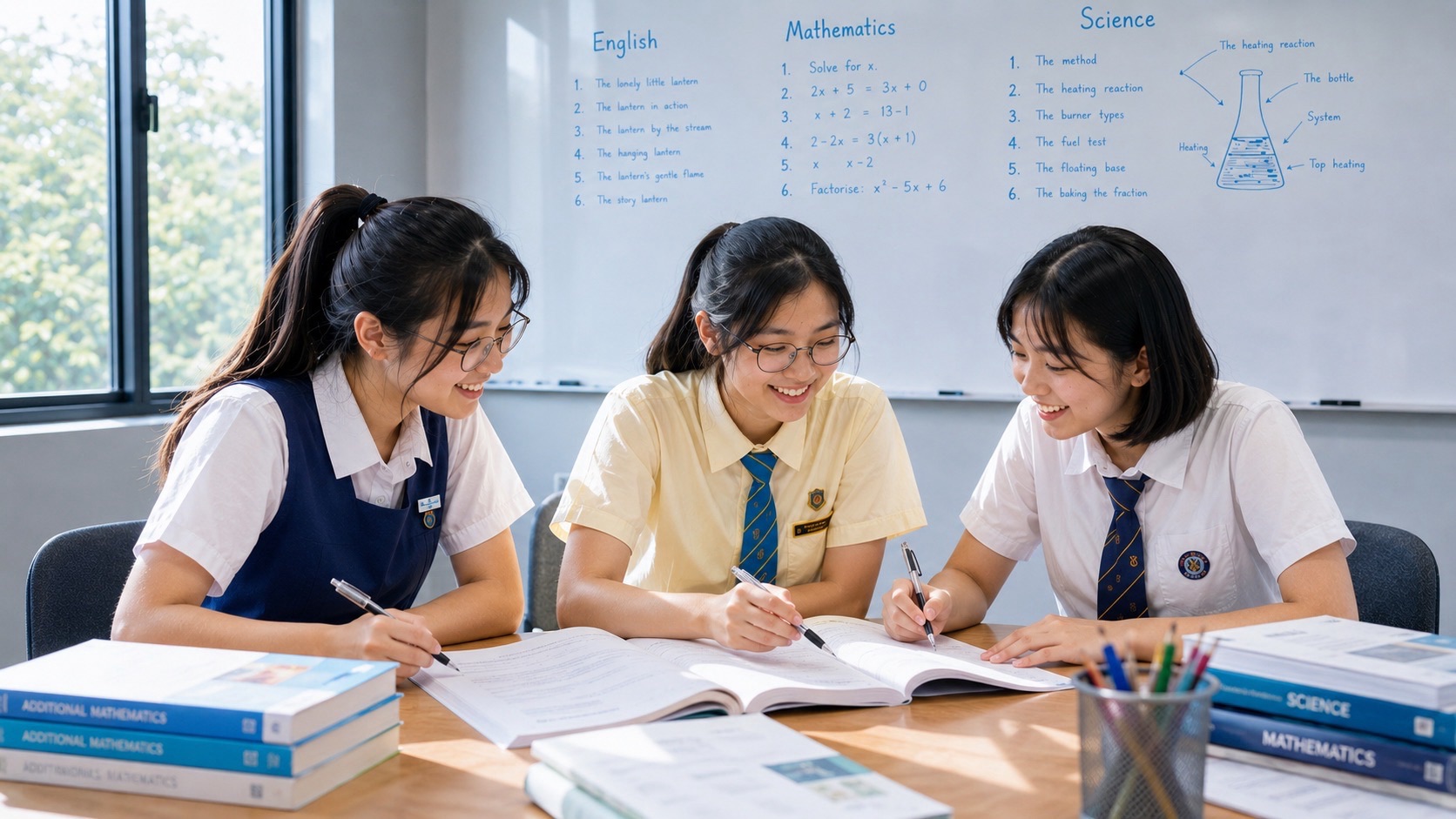
Small-group teaching should make reasoning visible. In a group of three students, each learner can be asked to defend an answer and explain their evidence. Class size alone does not guarantee an examination result; what matters is the quality of feedback and whether the student can perform independently.
Common Mistakes and Specific Repairs
An answer lists benefits but makes no judgement
What to do: Use explicit criteria and compare trade-offs, then state a defensible conclusion.
Fieldwork sampling is described vaguely
What to do: Name who or what is sampled, where, when and why the sampling method fits.
Trend is claimed without checking the axes
What to do: Identify units, time period, outliers and the actual direction of the data.
Physical hazard confused with disaster
What to do: Explain exposure and vulnerability in addition to the hazard mechanism.
Weather and climate used interchangeably
What to do: State the timescale and evidence needed for a climate inference.
Climate mitigation and adaptation confused
What to do: Identify whether the proposal reduces an underlying cause or the harm from an impact.
A generic Singapore example is treated as current fact
What to do: Check an official source and qualify proposals, completion dates and measured outcomes.
9-mark answers present disconnected opinions
What to do: Organise reasons around criteria, evidence, counterarguments and a justified overall decision.
An effective error register records a task, the incorrect decision, the evidence for why it was wrong, the corrected method and the date of a successful independent retest. A notebook filled only with model answers is not the same as a record of learning.
Four-Week SEC G3 Geography Examination Preparation Plan
This cycle assumes basic coverage and can be repeated. It does not suggest that every student can learn the full syllabus in four weeks. Students with large gaps should start earlier and seek help to prioritise realistically.
Week 1 — Map the five clusters and diagnose weaknesses
Use one short task from each cluster and one fieldwork-method question. Separate missing geographical knowledge from map-reading, graph-reading, enquiry and evaluation weaknesses. Repair the first two or three costly problems.
Week 2 — Practise data interpretation and fieldwork
Work with maps, charts, photographs and simple investigations. Draft sampling plans and evaluate invented data ethically and precisely. Attempt a 20-mark fieldwork-style task with structured marking.
Week 3 — Build AO3 judgement in context
Write and revise 9-mark decisions on tourism, climate, tectonic risk and Singapore. Make the criteria visible and test whether the conclusion follows from the evidence. Include both Paper 1 and Paper 2 topic combinations.
Week 4 — Rehearse the paper allocations
Practise timed 50-mark papers, giving appropriate attention to each compulsory question. Rework errors after marking and keep a note of weak command words, visual-data mistakes and unsupported claims.
Throughout the cycle, vary the source material and cases, practise retrieval and reserve time for marking and rewriting. Hours spent are an input; improved reasoning on a new task is a more meaningful output.
How to Measure Progress and When to Seek Help
A better G3 Geography answer explains the process, uses the source correctly and reaches a conclusion supported by criteria rather than broad opinion. Progress may first appear as better data interpretation and clearer judgements before overall scores rise.
Judge progress by comparing answers to tasks of similar difficulty and time constraints. A stronger score should be accompanied by fewer repeated mistakes and more independent reasoning. A single performance can vary with topic and preparation; examine a pattern rather than treating one mark as the entire story.
To plan a useful teacher or tutor discussion, Bring a fieldwork-style response, a graph/map question and one 9-mark evaluation. These reveal whether the student needs content knowledge, geographical methods or argument structure.
Frequently Asked Questions
What is the SEC G3 Geography subject code in 2027?
K329. The earlier reference subject code is 2279.
How many examination papers are there?
Two, each carrying 50 marks and 50% of the assessment, lasting 1 hour 45 minutes.
Is fieldwork examined?
Yes. Paper 1 Question 1 assesses geographical methods and fieldwork for 20 marks. The school syllabus also includes extended fieldwork learning.
Is there a separate fieldwork coursework grade?
The published 2027 examination scheme lists two written papers, not a separate practical or coursework percentage.
What is the 9-mark AO3 question?
An evaluation and judgement task assessed with generic level descriptors; one appears in each paper in specified questions.
May students use calculators?
The K329 syllabus permits an approved calculator in both papers.
What clusters are in Paper 1?
Geographical methods/fieldwork, Tourism and Climate.
What clusters are in Paper 2?
Thinking Geographically and Sustainable Development, Tectonics and Singapore.
Is memorising case studies enough?
No. The candidate must apply relevant knowledge to the actual evidence, question and evaluation criteria.
How can parents assess progress?
Look for precise fieldwork methods, accurate graph and map interpretation, and clear judgements supported by evidence.
Is single-subject Geography the same as Humanities (Social Studies, Geography)?
No. K329 and the combined Humanities syllabus K335 have different formats and content allocations.
Will four weeks be enough for a weak student?
Not necessarily. Use the cycle as one repeatable stage of preparation and begin earlier if foundations are missing.
Official Syllabus and Useful Related Guides
The official SEAB document determines paper formats and examinable syllabus. The eduKateSG materials below are educational explanations and study support, not SEAB examination notices.
- SEAB 2027 G3 Geography syllabus (K329)
- 2027 G3 SEC syllabus directory for school candidates
- eduKateSG Secondary 1 Mathematics Clementi small-group teaching reference
- How G3 English Language Works | SEC Examination Preparation
- How G3 Mathematics Works | SEC Examination Preparation
- How G3 Additional Mathematics Works | SEC Examination Preparation
- How G3 Chemistry Works | SEC Examination Preparation
- How G3 Physics Works | SEC Examination Preparation
- How G3 Biology Works | SEC Examination Preparation
- How G3 History Works | SEC Examination Preparation
Next Useful Study Step
Begin with one actual Geography answer and decide what the student could not yet do: select evidence, interpret data, explain a mechanism, construct an argument, make a judgement or handle the paper’s time demands. Repair that skill and retest it on a different question.
Arrange a parent–student consultation · Ask about eduKateSG 3-pax small-group tuition
eduKateSG · 8 Fourth Avenue, Singapore 268674 · Small-group tutorials by appointment. This article is educational guidance, not an official SEAB publication. Grades cannot be guaranteed.