
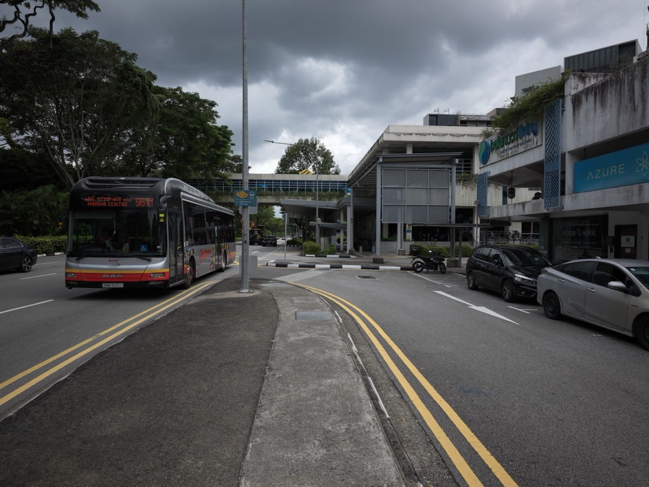
Updated 24 October 2026 | Bukit Timah, Singapore. Did you know that a new pedestrian bridge can already be carrying people safely across a road while the full accessibility programme remains a work in progress? That is an important distinction around Binjai Estate, Dunearn Road and the canal works.
Think of two neighbours trying to cross the same busy road. One can manage stairs, but another is pushing a stroller or uses a wheelchair. A bridge by itself may improve separation from traffic, yet the usefulness of that crossing depends on whether appropriate lift access has actually been commissioned. A future lift promise is not the same as an operating lift.
Quick answer: Holland-Bukit Panjang Town Council’s 2025 planning booklet identifies a new pedestrian overhead bridge near Binjai Estate on Dunearn Road, with wheelchair-accessible lifts described as being installed progressively from 2026. A 21 April 2025 traffic report stated that a replacement pedestrian bridge near Jalan Jambu Ayer had already been built and was in public use during adjacent canal works. NParks’ green-corridor planning FAQ also described new lift provision near Binjai Park, while noting that the crossing at King Albert Park MRT already has lifts. PUB announced completion of the full Upper Bukit Timah Canal upgrading on 23 October 2026, but that does not by itself certify the precise operating status of every planned bridge lift in October 2026 or guarantee a lift opening in 2027.
This is an explanatory neighbourhood report. A design proposal, completed civil works, an accessible pedestrian facility and an opening notice are not interchangeable. Verify current access and temporary safety arrangements on the day you visit.
Five useful things to know
- New crossing: A replacement pedestrian bridge near the Binjai/Jalan Jambu Ayer area was already reported in use in April 2025.
- Accessibility: Town Council plans discussed wheelchair-accessible lift installations progressing from 2026.
- Existing lift alternative: NParks described the overhead bridge near King Albert Park MRT as lift-equipped.
- Canal timeline: PUB completed the 2.3km Upper Bukit Timah Canal upgrading in October 2026.
- 2027 travel: Verify actual lift operation, stairs, entrances and any maintenance or temporary closures instead of assuming every planned facility is ready.
2025–2027: what happened and what comes next
| When | Confirmed milestone or plan |
|---|---|
| April 2025 | A replacement pedestrian bridge was reported built and already used during Bukit Timah Canal works. |
| 2025 Town Council plans | Local improvement programme identified new Binjai bridge and lift provision beginning progressively from 2026. |
| 2026 | Canal-related pedestrian crossing and accessibility works formed part of the changing local road environment. |
| 23 October 2026 | PUB announced completion of the Upper Bukit Timah Canal upgrade, a separate hydraulic milestone. |
| By 2027 (green corridor estimate) | NParks’ first elevated Bukit Timah–Rochor Green Corridor phase is estimated to finish; the wider route remains phased. |
| During 2027 | Check whether the particular bridge lifts are operating and which public routes are actually open. |
Jump to the part that matters
- Where is the new bridge and why was it needed?
- Is the replacement bridge the same as a future lift?
- Why does barrier-free access matter for families and older residents?
- What do the 2025 road-closure stories actually tell us?
- How is the bridge connected to the Bukit Timah Canal upgrade?
- Does the 2027 green corridor use existing overhead bridges?
- Is this the same pedestrian bridge as the one at King Albert Park MRT?
- What matters most for school and work journeys?
- What should a 2027 progress report say?
- Frequently asked questions
- Official references
Where is the new bridge and why was it needed?
The location is around Binjai Estate, Dunearn Road and the Jalan Jambu Ayer area near the Upper Bukit Timah Canal, not at the more distant pedestrian crossing of another railway station.
Bridge changes were connected with widening and reconstructing the canal beneath and beside Bukit Timah Road and Dunearn Road. There was little spare space within this busy transport corridor, so construction had to accommodate both waterway improvements and people travelling across the road.
A Straits Times report from 21 April 2025 noted that the replacement bridge had already been constructed and was in use, while a nearby older overhead bridge had been slated for removal to facilitate the drainage works.
The removal schedule was later adjusted. Do not assume that an April 2025 overnight road closure occurred exactly as first advertised; follow later official notices instead.
The useful local fact is that the new crossing did not first appear as a 2027 concept. The broader question for 2027 concerns final access, lift status and adjacent paths.
Is the replacement bridge the same as a future lift?
No. A bridge is the elevated structure pedestrians use to cross roads; a lift is a separate accessible way to reach that deck when stairs are unsuitable.
An elevated crossing can be in public use before every planned lift has been brought into service. A person walking up stairs may therefore experience a different degree of access from someone needing a wheelchair-friendly route.
The Holland-Bukit Panjang Town Council’s Bukit Timah future-plans booklet specifically described wheelchair-accessible lifts to be installed progressively starting in 2026. That is a programme expectation, not evidence of current inspection or completion.
NParks’ Bukit Timah–Rochor Green Corridor FAQ separately says that the pedestrian overhead bridge at King Albert Park MRT already has lifts, and that PUB would equip a crossing near Binjai Park with lifts as part of its works.
These references explain the purpose of the changes, but final public availability needs to be verified on the ground or through the responsible agency.
Why does barrier-free access matter for families and older residents?
A crossing can be difficult when a family member has limited mobility, even if the bridge is only a short distance from home. Stairs are particularly challenging for some wheelchair users and may be tiring for older people.
An operating lift may allow a stroller, shopping trolley or walking aid to travel across the road without negotiating a flight of steps, subject to posted access rules and availability.
Yet accessible travel involves the whole route. The pavement leading to the bridge needs a suitable surface, kerbs should be manageable and the other side needs a safe onward path.
This is why the latest state of the lifts and their approach paths matters more than a photograph showing that the overhead bridge structure exists.
For a 2027 appointment, a resident requiring lift access should confirm service status before setting off and have a legally accessible backup route where possible.
What do the 2025 road-closure stories actually tell us?
Reports in April 2025 referred to temporary overnight closures along stretches of Bukit Timah Road and Dunearn Road to remove an old overhead bridge near Jalan Jambu Ayer.
However, subsequent reports said the intended 25–26 April 2025 closures were postponed. A project can therefore have multiple public notices bearing similar road names while the underlying demolition timing changes.
It is misleading to paste a 2025 road-diversion map into a 2027 travel guide and present it as current. The date, work location and permitted vehicle route need checking before a motorist relies on the information.
PUB’s wider drainage work continued beyond those early announcements and was confirmed complete on 23 October 2026. That finished hydraulic milestone should be separated from whether another roadside lift, footpath or local crossing is ready.
For current traffic changes, read LTA or agency notices and obey live signs. A traffic diversion designed for one night does not remain a permanent feature simply because it can still be found in a search engine.
How is the bridge connected to the Bukit Timah Canal upgrade?
Upper Bukit Timah Canal sits in a valley setting where heavy stormwater must be conveyed between developed areas and downstream waterways. PUB widened and deepened the 2.3km canal, improving its stormwater conveyance capacity by about 30%.
Construction had to work around a busy road and rail environment, including pedestrian crossings. Replacement bridge arrangements helped maintain access while the canal footprint and associated structures changed.
On 23 October 2026, PUB announced completion of the drainage works and explained that structural supports for the future green corridor were also provided within the project.
Hydraulic completion and pedestrian amenities are not the same kind of inspection. A completed canal conveys more stormwater; the availability of a lift is a separate travel and access question.
For the engineering milestone, see PUB’s 23 October 2026 announcement.
Does the 2027 green corridor use existing overhead bridges?
NParks plans a first approximately one-kilometre elevated section of the Bukit Timah–Rochor Green Corridor from the Rail Corridor near the restored railway station toward Jalan Kampong Chantek.
The early design proposes links to existing pedestrian overhead bridges and describes wheelchair-friendly access points as part of the visitor experience.
The estimated completion of that first phase by 2027 should not be expanded into a promise that the entire proposed route to Kallang Riverside Park opens simultaneously.
Likewise, the separate Binjai crossing’s lift works may support accessible travel in the same district without proving that every future segment of the green corridor is already ready.
Before planning a long 2027 walk, check the final NParks access map and distinguish the elevated pedestrian-only sections from the existing Coast-to-Coast (Central) Trail used by cyclists.
Is this the same pedestrian bridge as the one at King Albert Park MRT?
No. NParks’ project FAQ describes the existing King Albert Park MRT pedestrian bridge as lift-equipped, while describing additional lift works for the bridge near Binjai Park.
The two locations can appear together in green-corridor maps, but they are not one single structure. A lift status report for King Albert Park should not automatically be applied to Binjai.
King Albert Park MRT already operates on the Downtown Line. Its future Cross Island Line interchange construction has a separate 2032 completion target. Neither future rail project provides evidence that a Binjai bridge lift is working today.
Users of wheelchairs or strollers should identify the exact crossing by road and nearby landmark before planning their route.
If in doubt, choose the officially accessible route confirmed for the particular day, rather than assuming two bridges on the same road share the same amenities.
What matters most for school and work journeys?
People crossing Bukit Timah Road and Dunearn Road may be travelling to school, a workplace, a bus stop or a home. Reliability matters, especially during the morning peak when a small detour can affect arrival time.
For children, crossings should be planned around official facilities and clear supervision rather than running across wide roads to save a minute.
For older people, a functioning lift can remove a significant barrier, but a maintenance closure may require an alternative accessible crossing or different bus stop.
For commuters, the situation may look different during local maintenance even after the canal project has finished, so travel advice should not be based on outdated worksite photographs.
The best neighbour-to-neighbour advice for 2027 is to share the exact bridge location and the latest verified accessibility information.
- Confirm whether the bridge and both approaches are open.
- If you need a lift, check actual operation rather than relying on a planned installation year.
- Use current marked crossings and never cross construction barricades.
- During a worksite diversion, follow the latest traffic or pedestrian signs.
- Distinguish King Albert Park MRT’s crossing from the separate Binjai-area structure.
What should a 2027 progress report say?
First, it should state the date of the check. A bridge reported in use during April 2025 is a different fact from whether its lifts are operating in late 2027.
Second, it should separate civil completion, safety certification and accessible route commissioning, naming the relevant authority wherever possible.
Third, it should describe whether the first green-corridor phase has actually opened to public visitors, rather than extrapolating from its earlier construction estimate.
Finally, it should explain travel alternatives if works have changed a crossing or a footpath. The main purpose of local news is to help people navigate their own neighbourhood safely.
The important takeaway is straightforward: the crossing environment is improving, but the exact facility you need must be checked for its own current status.
Frequently asked questions
Is there a new pedestrian bridge near Binjai Estate?
Town Council lists a new bridge, and a 21 April 2025 report says a replacement pedestrian bridge near Jalan Jambu Ayer was already in use during canal works.
Are lifts operating at the Binjai bridge in October 2026?
The cited plans refer to progressive installation from 2026, but do not independently confirm current operational status of every proposed lift.
Does King Albert Park MRT’s overhead bridge have lifts?
NParks described that crossing as lift-equipped in its green-corridor planning FAQ.
Did the 2025 road closures occur as first advertised?
The initially reported 25–26 April closures were subsequently postponed, which shows why old diversion notices must not be treated as current.
Is Upper Bukit Timah Canal upgrading finished?
Yes. PUB announced completion of the full 2.3km upgrade on 23 October 2026.
Will the complete green corridor be open in 2027?
The NParks estimate concerns only its first phase of around 1km. Later segments are to be delivered in stages.
Can bicycles use the elevated first-phase sky park?
NParks’ plans describe the elevated route as pedestrian-only, with cyclists continuing on the existing at-grade Coast-to-Coast Trail.
Where can I verify an accessible route for 2027?
Check current official notices, the applicable crossing on the ground, LTA access information and NParks maps for any opened green-corridor sections.
Does the future CRL interchange change this bridge’s status?
No. The Cross Island Line project has a separate timeline and does not confirm whether a local bridge lift is operating.
Official references and further reading
Reference information is dated and describes what was publicly available on 24 October 2026. Check the site managers and agencies for later changes, access arrangements and completion confirmations.
- Holland-Bukit Panjang Town Council: Binjai bridge and lift improvement plans
- NParks: Green-corridor pedestrian crossings, lifts and cycling rules
- Straits Times: April 2025 replacement bridge already in use
- Straits Times: April 2025 closure postponement
- PUB: Canal upgrading completed 23 October 2026
- NParks: First phase of the green corridor estimated by 2027
Also read: Completed canal upgrade and catchment flood resilience · The estimated 2027 elevated green corridor.
More Bukit Timah developments to follow
- Toh Yi Drive playgrounds, walkway and 2027 plans
- Watten Estate upgrading and drainage through 2027
- Integrated Development works and tree replanting
Read the complete Bukit Timah Updates 2026–2027 collection.
Editorial note: Project completion estimates are not guaranteed opening announcements. Site or road use must follow the most recent official notice and on-site signage.