
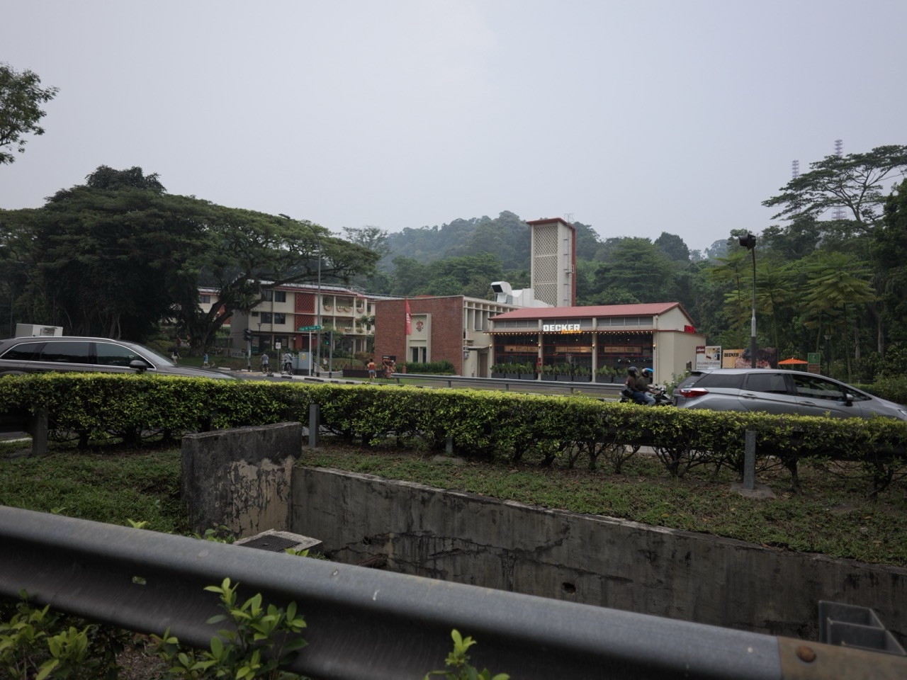
Updated 25 October 2026 | Bukit Timah, Singapore. Did you know? A small piece of forest beside busy Upper Bukit Timah Road became the subject of an important 2026 environmental study because it helps wildlife move between larger green spaces. This is not only a debate about trees; it is also about how Singapore plans housing while safeguarding ecological connections.
Imagine a road separating two patches of forest. A pangolin cannot read a planning map. It depends on cover, food and safe routes to cross between habitats. A housing proposal that leaves a few trees standing may look green on paper, yet the paths that animals actually use can tell a different story.
Quick answer: URA published an Environmental Impact Assessment for a roughly 5.5-hectare site at the junction of Old Jurong Road and Upper Bukit Timah Road on 3 February 2026, with public feedback accepted until 2 March 2026. Two portions have been safeguarded for residential use since Master Plan 2019, with progressive housing development being planned over the coming decade. Reporting on the study describes a scenario retaining about 2.4 hectares, or 44% of the site, to protect ecologically important areas and wildlife movement. That figure is a study scenario, not proof that the final approved clearance boundary or 2027 construction schedule is fixed.
We separate a completed decision, a published planning estimate, and what remains unconfirmed for 2027. This article uses an everyday ‘Did you know?’ explanation, but the project stages and figures come from dated public-agency information.
Five important facts in under a minute
- Site: About 5.5 hectares at Old Jurong Road / Upper Bukit Timah Road, near Bukit Batok Nature Park and Bukit Timah Nature Reserve.
- Why an EIA: URA assessed biodiversity, ecological links, possible development impacts and mitigation measures before planning detailed housing.
- Feedback window: 3 February to 2 March 2026, now closed as of 25 October 2026.
- Study scenario: Retain approximately 2.4ha, or 44%, to safeguard sensitive biodiversity and wildlife pathways.
- 2027 perspective: Follow official development decisions and environmental management conditions; the EIA is not a confirmed date for clearance, housing launch or park opening.
2026 to 2027: what has happened and what comes next
| Date or period | What we can say |
|---|---|
| 2019 | The two portions were safeguarded for residential use in the land-use master plan. |
| August–November 2024 | Environmental field surveys documented habitats, plants and animals for the EIA. |
| 3 February 2026 | URA published the Old Jurong Road EIA materials and opened the feedback exercise. |
| 2 March 2026 | The published EIA feedback window closed. |
| 6 February 2026 | Reporting highlighted a proposed 2.4ha retention option and why wildlife connectivity matters. |
| October–December 2026 | The official EIA and any newer planning notices remain the basis for describing the site’s status. |
| During 2027 | Watch for final decisions on site boundaries, mitigation, environmental monitoring and any specific future housing release; do not invent a construction start. |
Choose your reading route
- Where is the Old Jurong Road forest site?
- What is an Environmental Impact Assessment?
- Why does the 44% forest-retention figure matter?
- Which plants and animals made the study important?
- Can wildlife still move when housing is built?
- Does the EIA mean the whole site will be cleared?
- What did the public-feedback exercise do?
- How does this connect to future housing in Bukit Timah?
- Can families visit this forest site in 2027?
- What to watch from now through December 2027
- Frequently asked questions
- Sources and further reading
Where is the Old Jurong Road forest site?
The study area lies around the junction of Upper Bukit Timah Road and Old Jurong Road. It is in a part of the city where major roads, older built landmarks and forest patches sit very close together.
Nearby places include the former Bukit Timah Fire Station and Bukit Batok Nature Park, while Bukit Timah Nature Reserve lies within the wider surrounding green network. These names help locate the area but should not be taken to mean the study plot itself is a public walking trail.
URA identifies two residential sites within the study area. Their intended land use has appeared in planning documents since 2019, but site-specific development needs ecological study and practical mitigation because the area is not a blank cleared plot.
People sometimes see an environmental report about a site and assume it is a new park. An EIA is an assessment about potential impacts of proposed works, not a public-access announcement or a promise that a visitor route has opened.
Use URA’s environmental impact assessment register to locate the Old Jurong Road study.
What is an Environmental Impact Assessment?
An Environmental Impact Assessment, often abbreviated EIA, examines the possible effects a development may have on the natural and surrounding environment. It can include surveys of trees, animals, habitats, waterways and how wildlife moves through an area.
The purpose is not simply to count trees. For a landscape near nature reserves, scientists and planners consider habitat quality, links to other forests and whether proposed works could cause fragmentation, disturbance or pollution.
The Old Jurong Road exercise was commissioned because the site is close to important protected and forested areas. URA said nature-group representatives were consulted and their inputs incorporated into the assessment process.
An EIA can recommend mitigation measures, but a recommendation is not the same as a final site decision, approved contractor design or later monitoring result. This is why ‘44% retained’ needs a careful qualifier when quoted in news.
For students, the process offers a valuable scientific lesson: environmental planning involves gathering evidence before choosing what to change.
Why does the 44% forest-retention figure matter?
Contemporary reporting on the February 2026 study described an option to retain about 2.4 hectares of the roughly 5.5-hectare site. That corresponds to approximately 44% of its area.
The conservation question is not only how much green appears on a map. The arrangement of retained vegetation may matter enormously. A well-positioned corridor can preserve movement between habitat patches more effectively than the same area divided into isolated corners.
Researchers in the reported assessment considered effects on species such as the Malayan colugo. The reporting described how preserving the proposed 2.4ha section could maintain more than 90% of colugo movement pathways, under the assumptions of the study.
That is not a guarantee that every animal would remain safe. The actual impact depends on detailed design, traffic, forest edge conditions, mitigation and how the site is managed over time.
The figure is therefore best called an EIA retention scenario. It should not be reused as a final development boundary unless URA publishes such a determination.
See February 2026 reporting on the EIA findings for the scenario and its ecological rationale.
Which plants and animals made the study important?
Environmental surveys found flora associated with mature, high-quality forest, including native species of conservation significance. The study drew attention to how a relatively small secondary woodland patch can still contain biologically valuable habitat.
The wider Bukit Timah–Bukit Batok area supports wildlife including the Sunda pangolin and Malayan colugo. These animals use cover and connected trees or ground habitat to move and find food. They do not treat the edge of an individual development site as a natural boundary.
An important feature of forest regeneration is that young trees can establish through seeds dispersed from neighbouring forest, creating new habitat quality over time. A patch that appears ordinary from a busy road may have a different ecological role when surveyed closely.
Forest edges matter too. Changing the landscape can bring more light, wind, noise, heat and opportunities for invasive plants. A narrow retained strip can therefore behave differently from the interior of a larger forest.
That is why a credible conservation discussion addresses the quality and position of retained habitat, rather than just listing the number of trees proposed for planting after construction.
Can wildlife still move when housing is built?
Habitat connectivity is the heart of this case. Nature corridors help animals move among forest patches to find food and shelter and to maintain populations over time.
Some species can cross short gaps; others are much more sensitive to roads, open lawns or artificial lighting. That means a single ‘green corridor’ design cannot guarantee identical benefits for all wildlife.
Preserving the right vegetation, reducing barriers, controlling construction impacts and planning safe crossings can help. But the strength of those measures should be tested against ecological evidence and later monitoring where relevant.
The Government has described a wider science-based approach to planning ecologically significant sites, including reviewing environmental studies and working with NParks. The Old Jurong Road case gives a concrete example of why this matters in a mature residential district.
For residents, a connected forest can also be valuable for shade and natural identity. However, habitat protection should not be confused with permission to hike freely through the site.
NParks explains the principle on its nature corridors and nature ways page.
Does the EIA mean the whole site will be cleared?
No. The published assessment explicitly examines ways to mitigate impacts, including preserving substantial sensitive habitat. A full-clearance headline would misrepresent the study’s discussion.
At the same time, a retention scenario should not be portrayed as a complete refusal of housing development. URA has identified residential land uses in the area, and its public EIA page explains that agencies have been planning progressive development over the following decade.
Planning may therefore involve choosing which parts are suitable for development and how to manage the portions to be retained. Some areas may remain under further review even after an initial report is published.
Ultimately, the relevant agency’s later formal decisions determine the project details. A study provides evidence; it does not independently create a finished housing estate, conservation reserve or park.
Readers should watch for exact approved plans rather than relying on the binary claim that ‘all forest is saved’ or ‘all forest is lost’.
What did the public-feedback exercise do?
URA opened the EIA materials to public feedback from 3 February through 2 March 2026. The intent was to allow people to examine proposed environmental measures and share their views before subsequent planning decisions.
Feedback can point to ecological conditions that researchers should evaluate, concerns about habitat fragmentation, or the need for more information about trees, drainage and wildlife.
Some responses argued that even the proposed retained fraction might be insufficient. These perspectives are relevant because the challenge of conservation is not settled by an arithmetic percentage alone.
The feedback window listed in the study page had closed by October 2026. It would be misleading to ask readers to submit comments through a completed February–March exercise as though it were still open.
Later consultation, if announced, will have its own public dates and instructions. Check URA’s project pages instead of assuming an old feedback link remains active.
How does this connect to future housing in Bukit Timah?
Singapore needs housing choices in established districts, yet Bukit Timah also contains ecologically important spaces. The two needs can come into tension when a planned residential parcel overlaps existing vegetation.
URA’s material explains that the Old Jurong Road sites were safeguarded for residential use to support housing needs and wider location choices, while the EIA was commissioned to help guide sensitive development.
A forecast about exactly how many apartments will appear, who will develop them or when they will open cannot be drawn from the EIA alone. Those require further land-release, approval and construction information.
The nearby Bukit Timah Turf City and De Souza Avenue housing programmes are different sites with their own histories. Their published land-sales data should not be used as stand-ins for the Old Jurong Road EIA parcels.
Good local journalism tracks the specific polygon, the environmental conditions and the land decision separately so readers can see the trade-offs clearly.
Can families visit this forest site in 2027?
The study area should not be assumed to be an open nature attraction. An ecological survey is not a park-entry guide, and portions of the site may be inaccessible or subject to development controls.
For a safe nearby nature experience, look to established NParks venues such as Bukit Batok Nature Park, Dairy Farm Nature Park, Bukit Timah Nature Reserve or the existing open sections of the Rail Corridor.
Each venue has its own posted routes and hours. A responsible visitor respects fences, avoids entering sensitive forest and does not make unofficial shortcuts between nearby roads and nature reserves.
Children can still learn from this environmental story without walking into the assessment site. Compare the concept of a forest corridor with a public park connector, discuss why habitat width matters and look for wildlife from designated paths elsewhere.
The distinction between observing nature and disturbing a sensitive area is part of the lesson.
What to watch from now through December 2027
The most important next milestone is the public record of what the agencies decide after considering the EIA and responses. Look for the actual approved retention areas, environmental mitigation measures and any subsequent development programme.
An environmental monitoring and management plan, if published, can provide more detail about construction safeguards and how ecological risks would be addressed. Do not assume its contents before it becomes available.
Should a land sale or building project later be announced, verify its boundaries against the EIA area. The same street name does not always mean the same parcel.
Likewise, no 2027 public opening date for a new park or housing development follows automatically from the February 2026 report. Use the official site status, not an extrapolated blog timeline.
By keeping the science, planning and eventual construction stages separate, Bukit Timah residents can follow genuine progress without losing sight of what makes the landscape valuable.
- Read the dated EIA and distinguish the study scenarios from a final approved layout.
- Check the URA project register for new decisions after the closed 2026 feedback window.
- Follow any published environmental management conditions rather than assuming they already exist.
- Stay on officially opened paths in surrounding NParks sites; do not enter sensitive study areas.
- Treat future housing numbers and completion dates as unknown until formally released.
Frequently asked questions
Where is the Old Jurong Road forest under study?
At the junction of Old Jurong Road and Upper Bukit Timah Road, near the Bukit Batok and Bukit Timah green network.
How large is the study area?
Contemporary coverage describes roughly 5.5 hectares.
When was the EIA published?
URA listed the Old Jurong Road EIA on 3 February 2026.
When did public feedback close?
The original exercise ran from 3 February to 2 March 2026.
Does 44% refer to final protected land?
No. About 2.4ha, or 44%, was a retention scenario in the assessment; final planning outcomes require later confirmation.
Which wildlife are at issue?
The report and discussion concern biodiversity and ecological movement, including species such as Sunda pangolins and Malayan colugos.
Has housing already opened on the site?
The EIA does not establish a completed housing development or 2027 move-in date.
Does the plan clear every tree?
No. The published environmental study examined retaining ecologically significant portions and mitigating impacts.
Can tourists walk through this forest?
Do not treat the EIA site as an officially opened trail. Visit nearby managed parks on their designated paths.
What should be checked during 2027?
URA’s final site plans, specific mitigation or monitoring requirements, subsequent development decisions and any public-access notices.
Sources and further reading
Sources below provide dated reference points; URA and the relevant authorities should be checked again for new tenders, accepted environmental conditions and current public access. Article fact-check date: 25 October 2026.
- URA: EIA register, Old Jurong Road study dated 3 February 2026
- The Straits Times: 6 February 2026 EIA study and 44% retention scenario
- NParks: Ecological corridors and connected habitats
- URA: Master Plan 2025 land-use framework
- URA: Environmental and heritage planning strategy
More Bukit Timah updates: Former Bukit Timah Fire Station as a nearby heritage landmark · Separate long-term Turf City housing plan · How habitat corridors connect green spaces. Explore the full 2026–2027 collection.
Read the other latest Bukit Timah neighbourhood guides
- De Souza Avenue 2026 land sale and 2027 housing timeline
- Turf City historic grandstands and conserved buildings
- Dairy Farm Nature Park and Wallace Trail visitor guide
Explore the full Bukit Timah 2026–2027 series
Editorial note: Future bidding results, homes, conservation outcomes and opening dates are not known merely because an official report discusses them. Unannounced details are not estimated in this article.