
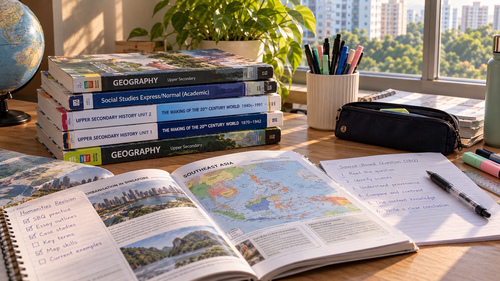
Do you know why G2 Humanities (Social Studies, Geography) is one national subject that teaches two different ways to understand society and the planet? Social Studies asks students to examine sources, weigh perspectives and explain how citizens and governments respond to societal issues. Geography asks how places, physical processes, people and environments interact, and how evidence can support responsible decisions. Both use evidence, yet the methods differ: a political source must be read for its perspective, while a climate graph must be analysed through measured patterns and geographical concepts. A successful student knows what kind of question is being asked before choosing a response.
For the 2027 Singapore–Cambridge Secondary Education Certificate (SEC), the code is G2 Humanities (Social Studies, Geography) K229. There are two compulsory 50-mark papers, each contributing 50% of the one combined subject. Paper 1 Social Studies lasts 1 hour 45 minutes: a compulsory 35-mark source-based case study and two compulsory structured-response questions worth 7 and 8 marks. Candidates receive a paper question booklet but type their Social Studies answers into a digital answer booklet. Paper 2 Geography also lasts 1 hour 45 minutes, comprising compulsory Question 1 on Geography in Everyday Life (25 marks) and one choice between Question 2 on Climate and Question 3 on Tectonics (25 marks).
The 2027 question choices matter as much as topic knowledge. Students cannot discard Geography in Everyday Life; they must prepare for its compulsory question even if they prefer Climate or Tectonics. Nor can they assume that the Geography elective is only a collection of case-study essays, because the syllabus examines geographical data, fieldwork reasoning and decision-making. This guide covers the exact K229 assessment, both disciplines, the geography cluster choice, key G2 versus G3 differences and a practical progression from lower secondary to independent examination work.
Do you know why K229 is different from a separate Geography entry?
K229 combines Social Studies and Geography in one Humanities qualification. It is not two independent SEC subject results and is not the separate G2 Geography K226 course. The elective has the specified Geography question arrangement within the combined subject.
A family should check the subject code on the school’s registration information. Separate Geography can have a different assessment scheme, and resources labelled only ‘Geography’ may include topics beyond K229. The useful study plan follows the registered code first.
This distinction helps a student avoid practising a paper they will never sit while neglecting Social Studies, which contributes half of the grade.
Do you know what G2 means under Full Subject-Based Banding?
G2 describes the level of this subject under Full Subject-Based Banding. It does not permanently classify the child’s abilities in every subject. A student may excel at interpreting maps but find civic sources confusing, or reason well about governance while needing help with graphs.
Schools determine the applicable course arrangements and criteria for changing subject levels. Families should examine marked questions across both papers and ask which missing skill would need bridging.
The goal is specific progress, not interpreting a single Humanities percentage as a complete portrait of the learner.
Do you know what the MOE curriculum and SEAB examination each do?
MOE frames the learning outcomes and experiences that develop informed, responsible citizens and geographical thinkers. SEAB establishes the national paper details, including the timing, marks, compulsory questions and assessment objectives for the relevant year.
A classroom fieldwork activity might examine pedestrian movement around a school; the exam may present an unfamiliar set of observations instead. The transferable method is reading evidence and recognising how it supports or limits a conclusion.
Use school lesson sequences for current work and the official 2027 K229 syllabus for formal examination facts.
Do you know why the two papers contribute exactly half each?
Social Studies and Geography each carry fifty raw marks and fifty per cent of the combined Humanities subject. A learner cannot count on a high Geography result to make the Social Studies paper optional. Conversely, excellent source interpretation does not substitute for geographical fieldwork understanding.
A balanced weekly plan should preserve practice in both. Additional attention can be given to the student’s actual weaker operations: source comparison, structured civic explanation, climate graphs or hazard evaluation.
Ask the child to explain one idea from each discipline without looking at the answer. Independent understanding is a stronger indicator than a stack of highlighted textbook pages.
Do you know why Social Studies uses a digital answer booklet?
The G2 Social Studies K229 paper supplies questions in hard copy, but answers are typed into a digital answer booklet. This arrangement is specified in the official assessment scheme and should not be overlooked during preparation.
The purpose of the answer remains evidence-based reasoning, not keyboard speed for its own sake. Nonetheless, students should become familiar with the school-provided system so that navigation or text entry does not distract from understanding the question.
Follow the school’s official e-examination practice and rules. A generic document editor at home may provide typing practice but should not be claimed to reproduce the national interface exactly.
Do you know what Social Studies Section A contains?
The compulsory Section A source-based case study carries thirty-five marks. Its five questions ask candidates to interpret specific sources and build a response to the issue under enquiry. Questions 1–4 jointly account for twenty-five marks; Question 5 is a ten-mark multiple-source question.
A source can be useful without being complete or neutral. A public announcement may establish an organisation’s stated objective but not prove every resident agrees. A personal account may reveal one experience without representing a population.
Students should treat source evaluation as a disciplined process: what claim is at issue, which source detail bears on it and what limitation remains?
Do you know which three Social Studies issues are in the syllabus?
The three G2 issues are Exploring Citizenship and Governance, Living in a Diverse Society, and Being Part of a Globalised World. They address societal roles, identities and harmony, and economic interdependence respectively.
These are frameworks rather than a finite list of newspaper stories to memorise. An unfamiliar case about community facilities may raise citizenship and trade-offs; a workplace case may raise global economic opportunities and vulnerabilities.
Practise recognising the issue and its concepts from new situations. Prediction of one exact controversy is less useful than adaptable knowledge.
Do you know why Question 5 deserves deliberate time?
The final Social Studies source question is worth ten marks, a fifth of the whole Social Studies paper. It requires use of multiple sources on the case-study issue rather than analysis of a single quotation.
The student should establish the claim or question, select the most relevant evidence from more than one source and explain how those sources support or qualify the answer. Repeating each source separately without connecting them often fails to form an argument.
A brief source map can help: claim, supporting sources, differing evidence, conclusion. The answer should reflect the actual documents, not a fixed template that assumes every source agrees.
Do you know why an inference needs evidence?
An inference is a reasonable reading of what a source suggests. Copying one line may identify evidence but does not automatically explain its significance. Equally, a creative theory about the author’s motives is not sound without clues.
If a fictional notice repeatedly emphasises free admission and opening to residents of all ages, it may suggest a desire to broaden participation. It does not prove attendance increased unless other data show that.
Practise one sentence stating an inference, one identifying the relevant detail and one explaining the connection. A changed source can test whether the skill transfers.
Do you know why ‘this source is biased’ is not a full answer?
A source’s perspective and purpose may influence what it reveals or omits. That calls for claim-specific evaluation, not automatic dismissal. A government release may be useful evidence of an announced policy even when its success has not yet been independently established.
Ask who produced the source, for whom, at what time and to do what. Then consider whether a particular claim needs corroboration. One source may be useful for its intended message but insufficient for measuring public approval.
Students should explain the consequence of the limitation instead of applying the same ‘all opinions are unreliable’ line to every source.
Do you know how to cross-reference two sources?
Cross-referencing compares relevant information in two sources and explains agreement, tension or different scope. A report that a community service has high overall use can coexist with testimony that access remains difficult for some people.
The student should identify the common question before comparing. Merely writing a paragraph on Source A and another on Source B does not establish a relationship if the claims are never brought together.
Practise describing exactly what each source measures or claims and whether the comparison genuinely supports the conclusion.
Do you know what G2 structured Question 6 tests?
Social Studies Question 6 carries seven marks and asks for reasoned explanation or recommendation within the Singapore context. The G2 scheme describes a single strategy or mono-causal focus, unlike some more elaborate higher-level evaluations.
A recommendation to improve public participation needs a mechanism: what the measure changes, whom it helps and why it addresses the stated problem. Listing several unrelated initiatives can obscure the required single line of reasoning.
Read the command and case setting first, then develop a focused answer. The appropriate scope is determined by the actual K229 question, not a memorised G3 essay plan.
Do you know what Question 7 requires?
The eight-mark G2 Social Studies structured question asks candidates to construct an explanation involving two factors or perspectives. It is a different operation from merely listing two names or stating that everyone has a role.
For a hypothetical issue about cooperation in a diverse neighbourhood, the learner might explain one factor involving residents and another involving accessible public arrangements, showing how each affects the outcome.
Use distinct explanations and context-specific examples. Do not import a requirement for a G3-style ranking conclusion unless the actual question demands that judgment.
Do you know why citizenship involves responsibilities?
Citizenship can include legal status, rights and obligations, identity, shared values and participation in public affairs. The syllabus asks students to consider how citizens and government work for the good of society.
A neighbourhood planning exercise may involve official provision of infrastructure and residents contributing feedback or responsible behaviour. A decision can meet some needs while creating other costs, because groups hold different priorities.
Students should explain the specific role and consequence rather than merely repeat that everyone must be responsible.
Do you know why governance involves trade-offs?
Public decisions are made within constraints of resources, land, time and different interests. A new facility may improve access for one group while disrupting another land use or requiring shared expenditure.
A reasoned answer identifies what is gained, who bears costs and which principle can guide the decision. Describing the proposal as entirely beneficial without considering the stated constraints may not address the issue.
Ask what alternative is available and which evidence would inform the choice. Those are habits of civic reasoning, not partisan slogans.
Do you know why diverse identities should not be stereotyped?
Social Studies examines identity, diversity, harmony, experiences of prejudice and responses by individuals, communities and government. The central skill is perspective-taking without assuming every member of a group thinks or behaves identically.
A community event can encourage exchange, yet barriers involving language, cost or access may remain. A balanced interpretation uses specific evidence rather than a sweeping statement about a whole community.
Students should distinguish someone’s reported experience from a claim about an entire population, and consider what further information would make a conclusion stronger.
Do you know how globalisation affects economic choices?
The G2 issue on globalisation emphasises economic interconnections and interdependence. Technological change, transport and multinational corporations can increase opportunities while exposing firms and workers to overseas shocks.
A business may find more customers abroad but also face unfamiliar competition or disrupted supply. Governments and individuals may respond through support, knowledge and skills. Each response carries trade-offs.
Explain the particular economic mechanism before making a recommendation. A statement that the world is connected is a starting observation, not a developed answer.
Do you know why Geography begins with everyday experience?
Geography in Everyday Life is Cluster 1 of the K229 elective. It includes Thinking Geographically, Sustainable Development and Geographical Methods. Its purpose is to build ways of interpreting ordinary places before studying larger environmental processes.
A school journey raises geographical questions: why are services located in one area, how do people move, and what information would help assess accessibility? Maps, observations and interviews can contribute different evidence.
The compulsory Geography question draws on this cluster, so students should not regard fieldwork concepts as optional background reading.
Do you know the exact Geography question choice?
K229 Geography Paper 2 is fifty marks in 105 minutes. Section A Question 1 is compulsory, covering Cluster 1 for twenty-five marks. Section B offers Question 2 on Climate or Question 3 on Tectonics, each twenty-five marks; the candidate answers one.
Thus every learner must prepare Cluster 1. The paper contains a six-mark question assessing judgment and decision-making within whichever Section B option the learner takes. An approved calculator is permitted.
Exam strategy includes choosing Section B after reading the full alternatives. A familiar diagram at the top of one option does not guarantee its later sub-parts are easier.
Do you know how the three Geography clusters relate?
Cluster 1 is Geography in Everyday Life, Cluster 2 is Climate, and Cluster 3 is Tectonics. Climate addresses Weather and Climate, Climate Change and Climate Action. Tectonics addresses Plate Tectonics, Earthquakes and Volcanoes, and Disaster Risk Management.
The clusters are not interchangeable. A climate graph, plate-boundary diagram and fieldwork sampling table may all require careful data reading but call on different physical processes.
Students can use common enquiry skills across them while learning each topic’s actual mechanism and vocabulary.
Do you know why G2 Geography has no separate hands-on fieldwork paper?
The syllabus expects bite-sized school fieldwork and knowledge of geographical methods, but the published K229 Geography assessment is a written examination. Fieldwork knowledge is examined through the compulsory everyday-geography question and relevant data or investigation scenarios.
A student may need to identify an appropriate observation, discuss sample limitations or interpret an investigation’s results. First-hand school experiences help develop these abilities even without a separate fieldwork examination.
Families should encourage participation in safe authorised learning journeys rather than attempt to create a fictitious investigation report for an examination.
Do you know what ‘thinking geographically’ means?
Thinking geographically involves examining where phenomena occur, why they are distributed that way and how places and people are connected across scales. Location and spatial relationships help explain experiences beyond their descriptive appearance.
For example, two neighbourhoods can have different access to a service because travel routes, population needs and site constraints vary. The answer is not simply that one is better than the other.
Ask the child what can be seen on a map and what additional evidence would be needed to explain the observed pattern.
Do you know how scale changes a geographical claim?
A local observation does not automatically establish a national or global pattern. A rainy afternoon at one station is not the same as a long-term climate trend across a region.
Similarly, observations from one shopping centre cannot prove the accessibility of every shopping centre in Singapore. The scope of the sample and time frame matter.
Students should state where, when and for whom a result applies. This strengthens both fieldwork validity and the quality of general conclusions.
Do you know why sustainable development involves trade-offs?
Sustainable development considers environmental, social and economic conditions over time. A proposed solution might improve one outcome while using resources or imposing costs elsewhere.
For an imagined new transport link, the learner can consider accessibility, construction impacts and long-term use rather than describe the link as automatically beneficial.
The six-mark judgment question is an opportunity to evaluate alternatives against relevant criteria, not merely name every benefit and cost without deciding what matters.
Do you know how a geographical enquiry begins?
A geographical investigation starts with a focused, answerable question. ‘Is this neighbourhood good?’ is too vague; ‘How does pedestrian access differ along two specified routes?’ provides clearer variables and potential evidence.
The method must match the enquiry. Counts can measure movement, maps can show spatial layout, and interviews may reveal perspectives or experiences. No one tool answers every question.
Ask what evidence would support an answer and which limitation of that method should be acknowledged.
Do you know why sampling matters?
A sample is a selected portion of observations, people or locations. It can make fieldwork manageable but may not represent all conditions. Sampling at one time of day can miss another pattern.
Imagine measuring foot traffic outside a library only during lunch. Concluding that the street is equally busy every evening would exceed the evidence.
Good evaluation names the actual sampling limitation and suggests a feasible change, such as observing several relevant times under safe school arrangements.
Do you know why primary and secondary data differ?
Primary data are gathered for a particular enquiry, while secondary data come from existing sources. Field observations and questionnaires may provide primary evidence; published weather records or maps may provide secondary evidence.
The distinction does not automatically make one source better. A small poorly designed student survey may be less representative than a carefully maintained public dataset.
Students should compare source suitability, coverage and limits according to the question being investigated.
Do you know how to evaluate a questionnaire?
A questionnaire needs clear wording and a sample appropriate to the target group. A leading question can influence responses, while a vague question may produce answers that cannot be compared meaningfully.
For example, asking ‘Why is the new park wonderful?’ assumes a favourable view. Asking respondents how frequently they use the park and what barriers they face allows more balanced information.
Practice identifying which claim the responses could support and whether the sample or wording introduces a limitation.
Do you know how to read a thematic map?
A thematic map shows information about a particular feature or phenomenon, such as population density or temperature. The legend, data ranges, scale and location context determine its meaning.
A darker colour may indicate a higher value, but students must read the legend rather than infer that every map uses the same scheme. Large administrative regions may conceal local variation.
Ask what the map shows and what it does not show before proposing an explanation.
Do you know why graphs can mislead?
A graph’s visual impression depends on axes, units and scale. A line rising over time may show a change in a measured quantity, but a truncated axis can exaggerate the apparent magnitude.
Correlation between two geographical indicators does not automatically prove that one caused the other. Another variable or the way data were collected may explain the relationship.
Students should describe accurate trends, support them with data and identify the further evidence needed for causal explanation.
Do you know what the Weather and Climate topic examines?
Weather describes atmospheric conditions over shorter periods, while climate concerns longer-term patterns. Students learn to interpret relevant elements such as temperature and rainfall and to recognise how atmospheric processes create differences.
A single hot day is not proof of a particular climate trend. It can contribute to a dataset but is not a substitute for appropriate multi-year evidence.
Practice interpreting a climate graph, comparing months and explaining what the data permit rather than repeating a memorised country description.
Do you know how greenhouse gases affect climate?
The greenhouse effect helps keep Earth warm, while changes in the concentration of greenhouse gases can alter Earth’s energy balance. Climate change involves trends and impacts that require evidence across relevant periods and locations.
The mechanism should not be reduced to ‘the sun becomes hotter because of pollution’. Students need to distinguish radiation, atmospheric processes and human influences within the G2 syllabus.
A clear explanation identifies the change, the mechanism and an appropriate consequence, supported by the question’s data.
Do you know the difference between mitigation and adaptation?
Climate mitigation aims to limit causes such as greenhouse-gas emissions, while adaptation reduces harm from expected or observed impacts. They address related but different parts of the problem.
Installing more efficient systems may affect energy demand; preparing drainage and cooling arrangements may reduce vulnerability to particular climate impacts. Neither measure can be assumed successful in every location.
Students should match the strategy to the identified risk or mechanism, then evaluate suitability under the given constraints.
Do you know why Climate Action requires judgment?
A climate proposal can involve costs, technological feasibility, distribution of benefits and long-term impacts. A solution should be evaluated according to its stated objectives and the people affected.
For a hypothetical low-lying urban district, the learner might compare an infrastructure measure with a land-use response, noting the evidence required to judge each.
The best answer is context-specific. Listing solar panels or tree planting in every response without explaining the particular mechanism will not establish a sound decision.
Do you know what plate tectonics explains?
Plate tectonics describes large-scale movement of Earth’s lithospheric plates and related processes. Understanding plate boundaries helps explain patterns in earthquakes, volcanoes and some geological landscapes.
A student should interpret the arrows and labels of a given cross-section rather than assume every plate boundary behaves the same. Different boundary types have different characteristic movements.
Practice linking boundary movement to a likely physical process and the evidence that supports it.
Do you know why earthquakes occur?
Earthquakes involve sudden release of accumulated strain associated with movement in Earth’s crust. Their effects depend on factors including location, depth, building conditions and exposure.
A strong exam answer distinguishes the physical event from the social consequences. A large hazard does not automatically cause the same losses in every community.
Students should use the given diagram and data to explain mechanisms and vulnerabilities, not only recall an earthquake’s name.
Do you know why volcanoes are not identical?
Volcanoes can differ in composition, eruption style and associated hazards. Their distribution is influenced by tectonic processes, but not every volcano occurs in exactly the same setting.
A case study should identify which hazard is described and why the relevant physical process produces it. A photograph of a lava flow is not the same evidence as a map of ash distribution.
Compare the information supplied rather than apply one universal eruption description.
Do you know how disaster risk differs from hazard?
A hazard is a potentially damaging physical event or process, while disaster risk also reflects exposure, vulnerability and capacity to respond. Two places facing similar hazards may experience very different consequences.
A well-informed community with resilient buildings and effective warnings may reduce some risks, though no measure makes every hazard harmless.
Students should evaluate how a proposed response addresses the actual risk factors and recognise remaining limitations.
Do you know how early-warning systems help?
Monitoring and warnings can provide time for particular protective actions, but effectiveness depends on reliable observations, communication and people’s ability to respond. A system cannot be evaluated only by its technical sophistication.
A warning may reach users too late or use wording they cannot understand. Risk reduction therefore includes governance, infrastructure and community preparation.
An examination evaluation should identify a feasible improvement linked to an actual weakness, not simply recommend more technology.
Do you know why a six-mark judgment needs criteria?
K229 Geography Section B includes a six-mark question on judgment and decision-making. Candidates should consider relevant constraints, needs and evidence to evaluate a proposal or outcome.
A balanced answer can recognise limitations while arriving at a reasoned overall position. Merely stating that all strategies have advantages and disadvantages avoids the required decision.
Practice comparing options under explicit criteria: who benefits, what is feasible, which risk is reduced and what cost or uncertainty remains.
Do you know how calculators are used in Geography?
The official Geography paper permits an approved calculator. That can support percentages, changes or other relevant numerical interpretation, but the calculation must be based on correctly read units and values.
A figure representing people per square kilometre cannot be compared directly with a raw population count without understanding the difference. Correct arithmetic on unsuitable inputs still produces misleading conclusions.
Ask the learner to label each quantity and explain what the result means in the geographical setting.
Do you know why G2 differs from G3 Humanities?
G2 K229 and G3 K335 have separate syllabuses and some different assessment demands. In the G2 Social Studies structured section, Question 6 has a single-strategy or mono-causal focus and Question 7 explains two factors or perspectives.
G3 tasks can require other evaluative operations. Geography content depth and elective question arrangement also need verification by the appropriate year’s document.
Use the child’s registered syllabus for examinations and request school guidance for any level change. Higher-level questions may provide extension but cannot replace G2 preparation.
Do you know how Geography differs from Social Studies source evaluation?
A Social Studies source might express a person’s political or societal perspective, requiring attention to purpose and reliability for a specified claim. A Geography dataset may involve measurement error, spatial coverage or sampling limitations.
Both require evidence and caution, but a climate graph should not be treated as though it were merely a biased opinion, nor should a campaign poster be assessed only by whether its numbers fit a trend line.
Students can learn the common principle of justified claims while applying the discipline-appropriate method to each source.
Do you know how to plan a balanced study week?
A week could contain one Social Studies source question, a structured civic paragraph, one Geography data task and one investigation or elective-cluster explanation. Alternate the more demanding extended questions and review earlier errors.
The child’s actual weak points may require additional attention to map interpretation or source comparison. A fixed worksheet count for every learner is less useful than a plan grounded in performance.
Short explanations followed by changed scenarios can show whether knowledge transfers beyond one rehearsed question.
Do you know how to diagnose a Social Studies mistake?
Find the first incorrect step. Was the source misread, the inference unsupported, the comparison incomplete or the structured recommendation disconnected from Singapore context? Each needs its own corrective task.
A student who identifies the correct issue but quotes irrelevant evidence requires source selection practice. Another who recognises evidence but does not explain how it supports the claim needs reasoning practice.
Use the school’s feedback and then attempt one new unfamiliar source before assigning another full paper.
Do you know how to diagnose a Geography mistake?
The first problem could be a missing map scale, misread rainfall axis, confused tectonic mechanism, poorly evaluated fieldwork method or a judgment made without criteria.
A student who can explain a plate boundary but cannot compare disaster responses may need decision-making practice rather than more geological definitions.
Label each error by its cause, correct the prerequisite and retest on different information. That is more dependable than a generic demand to memorise more case studies.
Do you know when extra learning support might be useful?
Additional instruction may help when repeated source-analysis or geographical-data errors persist after normal school feedback. A useful tutor identifies the earliest missing reasoning step and checks independence on a fresh case.
The Clementi small-group tutorial reference illustrates that general diagnostic teaching approach. The subject-specific work here must use authentic Humanities evidence and correct G2 assessment expectations.
More lesson hours cannot guarantee a result. Purposeful practice and a manageable timetable are more important than accumulating exercises.
Do you know what parents often ask about K229?
Is K229 one grade? It is one combined Humanities subject. How long are the two papers? Social Studies and Geography are each 1 hour 45 minutes. Are both compulsory? Yes, and each contributes 50%. Does Social Studies use typing? Yes, a digital answer booklet with the hardcopy question paper.
Can students skip Geography in Everyday Life? No, its twenty-five-mark Question 1 is compulsory. What is the elective choice? Answer either Climate or Tectonics for the remaining twenty-five marks. Is a calculator allowed in Geography? An approved one is permitted.
These facts should be checked for the student’s actual exam year; K229 is the 2027 scheme.
Do you know what to ask the school?
Confirm the registered Humanities pairing and level, the school’s approach to the digital Social Studies booklet and which Geography elective-cluster topics have been taught. Ask for one marked answer from each component.
Find the first weak operation: interpretation, source evaluation, graph reading, fieldwork method or writing a judgment. Agree on a practice task with an unfamiliar stimulus to test improvement.
An actionable target is more useful than being told merely to revise the whole Humanities textbook again.
Do you know what a twelve-week improvement cycle can look like?
In the first fortnight gather a small baseline across source analysis, structured Social Studies and the two Geography question types. Weeks three to six can repair one or two recurring weaknesses with short guided practice.
Weeks seven to ten should introduce unfamiliar source sets, graphs and scenarios. In the final fortnight add representative timings and check whether the original errors return on changed material.
This is an illustrative plan rather than a grade guarantee. Adjust it to the school calendar, wellbeing and available study time.
Do you know what progress in K229 really looks like?
A progressing student can interpret multiple perspectives on a societal issue, build a supported recommendation and read a new map, investigation table or physical-process diagram accurately.
The child can also make a Geography decision against criteria and explain why different places or communities may experience different outcomes. These skills have value beyond national papers.
Start with the actual 2027 K229 syllabus, repair the first repeated error and practise independently on material that has not been rehearsed.
Official 2027 Humanities references and connected guides
The controlling syllabus is SEAB’s 2027 G2 K229 Humanities (Social Studies, Geography), from the official G2 directory. The PDF specifies the hardcopy Social Studies questions, typed digital booklet, source-based and structured sections, and compulsory Geography Cluster 1 with its Climate/Tectonics choice. Related subject material: Understanding SEC Social Studies and Understanding SEC Geography. School registration and examination-year guidance remain decisive.