
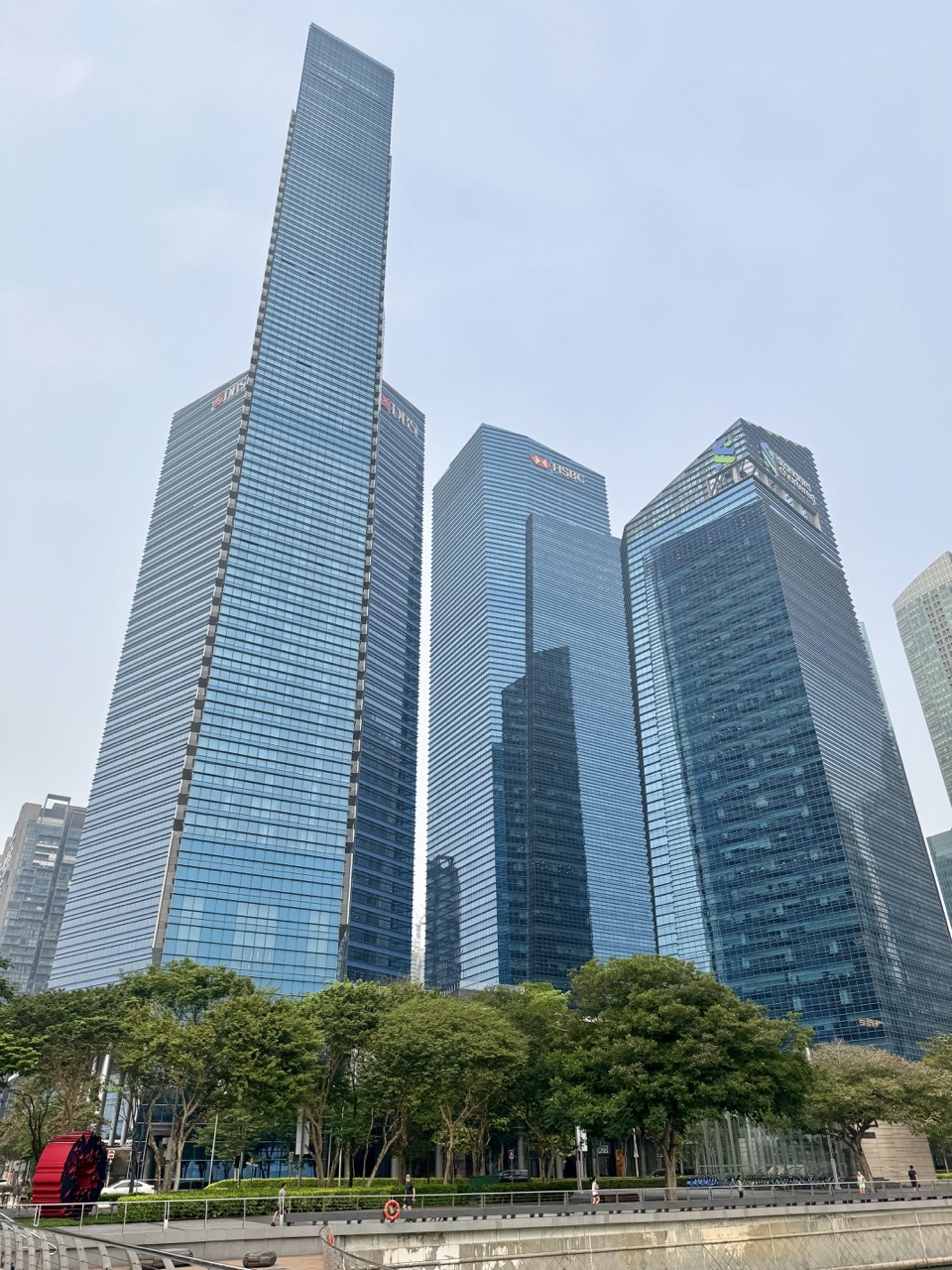
Singapore’s geography creates opportunities and constraints at the same time. A limited land area supports homes, transport, workplaces, water systems, nature and recreation, but those activities compete for space. A city can have a strong economy while facing climate, supply or demographic pressures; it can also create a cleaner environment without ensuring that every group benefits equally. Sustainable development requires a long-term balance, while resilience describes the capacity to withstand shocks, adapt and continue functioning.
Ministry of Education V3.0 Reference 251 explores how Singapore approaches sustainable development through integrated master planning, coordinated urban governance, environmental quality, green buildings, water and food resilience, economic connections, deep skills, community preparedness and shared spaces. Original fictional district data, a twelve-stage planning protocol, worked comparisons and eduKate Depth–Load–Transfer diagnostics train students to make evidence-based geographical judgements.
This independent eduKateSG reference is not an official government plan, land-use approval, real estate valuation or policy instruction. All district names, site measurements, budgets and survey numbers below are hypothetical teaching examples. Current rules, official plans and practical infrastructure decisions must be checked with the relevant agencies. The article uses Singapore as a study setting without claiming that classroom arithmetic can design real public facilities.
1. Sustainability Is More Than Greenery
Sustainable development considers economic opportunity, environmental quality and social wellbeing over time. The existence of trees or solar panels alone is not sufficient evidence of a fully sustainable district. Employment opportunities, clean air and water, accessibility, housing and social participation can all matter. A strong Geography response states which sustainability dimension is being discussed and how a proposed action supports it.
2. Resilience Adds the Ability to Respond to Shocks
Resilience concerns how a community, economy, ecosystem or system can survive, adapt and continue functioning when faced with stresses or shocks. A neighbourhood might reduce routine pollution yet remain vulnerable to an extreme flood. A business district might offer many jobs yet depend on one fragile supply route. Sustainability and resilience overlap, but they are not identical labels.
3. The Official 2027 SEC Geography Scope
The 2027 G3 Geography K329 syllabus, Topic 5.3 Sustainable and Resilient Singapore, identifies integrated master planning, long-term land-use choices and dynamic urban governance. It describes environment and climate resilience, green buildings, clean energy, water and food resilience, economic connections and innovation, deep skills and SkillsFuture, community preparedness, shared spaces and participation. This chapter emphasises the integration of those dimensions, rather than repeating Reference 243’s separate climate-mitigation and adaptation mechanisms.
4. Eight Rooms of Urban Resilience Reasoning
Room one identifies the geographical problem and scale. Room two maps competing land uses. Room three names economic and social needs. Room four identifies environmental and resource constraints. Room five assesses exposure to disruptions and resilience capacity. Room six considers planning institutions and affected stakeholders. Room seven compares options with reliable indicators and trade-offs. Room eight revises a recommendation when the future changes. A pupil who simply lists ‘build more parks’ has not yet explained the constraints or decision process.
5. Twelve-Stage Place–Plan–Evaluate Protocol
Stage 1 — Name the place and time horizon
Is the question about one road junction, a new town, a national resource strategy or decades of land-use planning? Decisions should match the geographical scale and the period for which they are intended.
Stage 2 — Define the problem precisely
A district may need housing, job access, drainage, recreational space or nature conservation. Avoid calling every issue ‘lack of sustainability’ without a measurable outcome.
Stage 3 — Map the existing land uses
Identify homes, industry, transport, parks, schools, water facilities and nature areas. Land already committed to one purpose cannot automatically be counted as free space for another.
Stage 4 — Identify people and ecosystems affected
Residents, workers, businesses, visitors and natural habitats experience changes differently. A new road may shorten travel for some while creating noise or habitat disruption for others.
Stage 5 — Separate environmental, social and economic effects
Classify water quality, biodiversity, access, livelihoods and public spending under appropriate dimensions. Some options affect all three. The explanation should name each mechanism instead of assigning an entire proposal one vague label.
Stage 6 — Identify possible shocks and weaknesses
Consider heavy rainfall, heat, international supply disruptions, demographic change and unexpected demand. Do not assume every problem is caused by climate change. Resilience planning addresses multiple sources of uncertainty.
Stage 7 — Identify legitimate planning tools
Integrated master planning balances long-term land demands. Coordinated urban governance enables different agencies and stakeholders to act within their actual mandates. A classroom committee cannot authorise national infrastructure.
Stage 8 — Set measurable outcome indicators
Land area in hectares, walking access in metres, energy use in kWh, water storage in cubic metres and survey responses are different indicators. Choose units that truly reflect the claimed improvement.
Stage 9 — Evaluate alternatives and costs
An option may help flood resilience while using valuable land. Another might provide employment but increase travel. Compare not just cost but accessibility, environmental impact, distribution and future adaptability.
Stage 10 — Explain the role of skills and economic links
A diversified economy and workforce skills may support adaptation to market or technological change. Deepening connections can create opportunities but also dependencies requiring resilience thinking.
Stage 11 — Include community participation
Shared spaces and public feedback can reveal needs overlooked by technical plans. Participation does not automatically establish unanimous preferences; sampling and genuine consultation methods matter.
Stage 12 — Make a conditional recommendation
State which option fits the case, what evidence supports it, what remains uncertain and how outcomes should be monitored. Change one assumption and ask whether the preferred plan would still work.
6. Original Fictional Case: Evergreen Junction District
Evergreen Junction is an invented Singapore-style district containing apartments, a public transport station, shops, a canal-side walking route, a small nature area and an older commercial block. Fictional residents request shade and safe paths; businesses request delivery access; planners consider stormwater capacity and an innovation workspace. Every number in this case is hypothetical.
The exercise asks students to protect everyday quality of life while preserving capacity for future jobs and extreme-weather resilience. It is deliberately possible to support more than one reasonable choice if assumptions and trade-offs are explained.
7. Worked Example A: A Land-Use Budget
A fictional district contains 100 hectares. Residential use takes 45 ha, transport 18, commercial activity 12, parks 15 and public facilities 10. Their sum is 100. There is no extra unallocated hectare in this simplified budget. Proposing another ten hectares for a facility requires redesigning existing uses or changing the land boundary.
8. Worked Example B: Percentage of Green Space
In the same district, 15 ha of the total 100 is classified as parks. The park share is 15%. This does not prove that all homes have equal access or that the ecological quality of each hectare is identical. Area and accessibility need different measures.
9. Worked Example C: Two Equal Areas, Unequal Access
A fictional neighbourhood has two five-hectare parks. One lies near most homes and step-free routes, while the other is isolated by a difficult crossing. Both contribute five hectares to area totals, but their usefulness and accessibility may differ. A geographical plan should examine routes and affected users, not just aggregate green space.
10. Worked Example D: Walking Time
Assume a hypothetical pedestrian moves at 1.2 metres per second along a safe, direct 600-metre route. Travel time is 600/1.2 = 500 seconds, about 8.3 minutes. This is a simplified model and not an actual accessible-route estimate. Crossings, weather, slopes and mobility needs can change times.
11. Worked Example E: Public Transport Catchment
An invented station is surrounded by 2,000 households within a specified walking catchment, but only 1,500 have a practical step-free path under the model. The step-free-access share is 1,500/2,000 × 100 = 75%. A simple circle around the station would conceal barriers and cannot substitute for route analysis.
12. Worked Example F: Mixed-Use Trade-Off
The fictional district proposes converting five hectares of commercial land into housing. Residential space rises, but commercial land falls from twelve to seven hectares. The policy may serve housing demand while reducing local workspace. A credible assessment needs job, travel and business-use evidence, not just the net housing increase.
13. Worked Example G: A Compact Site Design
An imaginary school site contains 20,000 m². A plan sets aside 6,000 m² for outdoor shared space, equal to 30% of the site. The percentage says nothing about flood safety, shade, habitat function or whether every student can access the space. These require separate analysis.
14. Worked Example H: Energy Efficiency
A fictional public building uses 250,000 kWh a year and later uses 200,000 kWh under comparable operations. Its energy saving is 50,000 kWh, a 20% reduction. The example does not by itself calculate national greenhouse gas savings or explain causation without accounting for usage changes.
15. Worked Example I: A Green-Building Claim
A promotional brochure calls a fictional building ‘green’ because it has planted roofs. A reliable evaluation asks about operational energy, construction impacts, water use, thermal comfort and maintenance. Greenery may have value but cannot independently prove that all life-cycle impacts are low. Claims must match measured outcomes.
16. Worked Example J: Rainwater Storage
A hypothetical rectangular storage basin measures 30 m by 15 m with an ideal effective depth of 2 m. Its simple geometric capacity is 900 m³. Real stormwater capacity depends on freeboard, operational controls, incoming flows and other hydraulic factors. A school arithmetic answer is not an engineering approval.
17. Worked Example K: Water Demand Change
An invented facility reduces monthly water use from 2,000 m³ to 1,700 m³. That is 300 m³ saved, or 15% relative to the original. The number does not establish that service quality remained unchanged or that every reduction arose from one technology. Define the baseline and the time window.
18. Worked Example L: Supply Diversification
A fictional city imports 80% of a necessary product from one supplier and 20% from another. Adding additional reliable sources might reduce exposure to one supplier failure, but can involve higher prices or logistics costs. Supplier shares are not equal to probabilities of interruption. Risk requires information about substitutability and reliability.
19. Worked Example M: A Buffer Stock
A hypothetical community facility uses 40 units of a critical consumable each week and holds 200 units of usable reserve. Under constant demand and no deliveries, simple coverage is 200/40 = five weeks. Actual resilience also depends on storage life, demand changes and the ability to replenish stock.
20. Worked Example N: Food Production Technology
Evergreen Junction studies a fictional indoor vegetable facility producing 6,000 kg in a given period from 1,500 m², or 4 kg/m². A conventional comparison site might yield a different amount under different conditions. To judge resilience, examine energy, water, time, operating cost and crop variety, not productivity per area alone.
21. Worked Example O: Workforce Retraining
An invented industry has 100 employees, of whom 30 complete training in a particular year. The participation proportion is 30%. This does not prove that 30 people obtained new jobs, that their earnings rose or that all skills are now adequate. Skills participation and economic outcomes need different measurements.
22. Worked Example P: Business Innovation
A fictional firm reduces component waste by 20% after redesigning its production process. The reduction may lower costs and environmental impact if throughput and material definitions are comparable. It does not prove complete economic resilience; demand, supply, skills and competition still matter.
23. Worked Example Q: Shared-Space Attendance
An invented community centre records 600 visits during a month, but some residents visit several times. Six hundred visits do not necessarily mean six hundred unique participants. An inclusion claim needs information on who attends, accessibility and groups who may be absent.
24. Worked Example R: Voluntary Consultation
Forty fictional respondents support a plan among sixty online responses, giving about 66.7% among those respondents. It is not a representative poll of every district resident without an appropriate sampling design. Responsible urban governance uses participation meaningfully while understanding its limits.
25. Worked Example S: A Weighted Decision Matrix
Three options receive fictional one-to-five scores for environmental impact, access and jobs. A class multiplies each score by a declared importance weight, then sums them. The outcome depends on those weights and the validity of the input scores. The matrix can reveal trade-offs but cannot make a public-policy decision automatically.
26. Worked Example T: One Shock, Two Districts
An imagined transport disruption affects two districts. District A has alternative routes and nearby services; District B relies on one interchange. The same hazard may cause greater service interruption in B because alternatives differ. Resilience depends on network capacity and redundancy, not just the physical disruption.
27. Worked Example U: Economic Connectivity and Exposure
A company with many overseas customers may benefit from broad market access, but it may also face changing demand abroad. Diversifying across regions can spread exposure, yet does not eliminate global shocks. An effective geographical answer recognises opportunity and vulnerability together.
28. Worked Example V: Green Space and Social Cohesion
A park may provide recreation and habitat while also hosting community activities. However, poor accessibility, overcrowding or programming that excludes some groups can limit social benefits. Students should not infer strong community cohesion from the mere presence of a park on a map.
29. Worked Example W: Infrastructure Service Life
A fictional facility is projected to operate for twenty years, while another requires major adaptation after ten. A single initial construction price does not provide a complete cost comparison. Maintenance, reliability, repair and future demand should be considered when evaluating long-term planning.
30. Worked Example X: A Longer Planning Horizon
A class compares an action that solves today’s parking demand with another preserving space for a future transport link. The appropriate choice depends on likely demand, land availability, alternative connections and opportunity costs. Long-term plans must be reviewed as conditions change, not treated as unchangeable promises.
31. Worked Example Y: A Community Preparedness Exercise
An imaginary district organises a safety-information workshop. Attendance reaches 250 people, but effectiveness also depends on their understanding, language access and ability to act during a disruption. Measuring the number of leaflets printed is not enough to establish preparedness.
32. Worked Example Z: Combining Resilience Dimensions
Evergreen Junction adds a shaded walk, a drainage improvement and skills facilities. The walk may support wellbeing, drainage may address a physical hazard and training may support long-term economic adaptation. These are different mechanisms that together can improve overall resilience. One project cannot be credited with every outcome without evidence.
33. Integrated Planning Balances Competing Claims
Limited space means housing, employment, transport and nature cannot each expand indefinitely without interaction. Integrated master planning considers these demands over time, using land-use review and coordination. A student should identify the trade-off and feasible alternatives rather than announce that all objectives can increase freely on the same plot.
34. Dynamic Urban Governance Coordinates Institutions
Different public agencies and organisations may have different responsibilities for transport, housing, water, environment and community development. Coordination helps decisions account for interactions. This does not imply every agency has identical powers or that one neighbourhood group can authorise complex infrastructure. Strong Geography explains realistic institutional roles.
35. Economic Resilience Includes Skills and Connections
Diversified markets, capable businesses, innovation and deep skills can support adaptation to economic change. Yet increased connectivity can also expose firms to global shocks. Learning and reskilling programmes are part of a broader system, not guarantees of employment for every participant. Examine actual outcomes and distribution.
36. Social Resilience Requires Inclusion
Prepared communities need useful information, accessible shared spaces and ways to participate in decision-making. Language, mobility, income and digital access may affect who can benefit. A district can report high average satisfaction while particular vulnerable groups remain unheard. Social resilience includes how well those groups can cope and contribute.
37. Environmental Quality Has Multiple Measures
Clean air, water quality, green space and biodiversity cannot be fully represented by one generic ‘green score’. An area may have many trees yet poor access, or efficient buildings yet limited natural habitat. Choose indicators matching each claim and explain the interactions across environmental outcomes.
38. Land Scarcity Is Both Physical and Institutional
Singapore is a small island city-state, but the practical availability of land also depends on legal uses, existing buildings, transport connections and environmental constraints. Land reclamation or intensification may create capacity under appropriate circumstances while introducing cost and ecological questions. Spatial planning is more than dividing a square map into categories.
39. Climate Resilience Is One Part of National Resilience
Coastal, heat and water adaptation matter, but the Topic 5.3 Singapore syllabus also covers economic, institutional and social resilience. This distinguishes the present article from Reference 243 on Climate Action. Students should integrate climate with jobs, skills, urban planning and community capacities rather than duplicate only an emissions essay.
40. Good Policies Need Measured Outcomes
A strategy can be announced, implemented and evaluated, with those stages distinct. A plan to improve walkability is not proof that walking times declined. A workshop is not proof that all participants are ready for an emergency. Compare baselines and subsequent observations before claiming success.
41. Distribution of Benefits Matters
A new facility may benefit residents within a comfortable walking radius but leave others far away. Economic gains may concentrate among some businesses. Geographical judgement examines which groups benefit, who bears costs and what access barriers exist. Equitable outcomes cannot be assumed from one district average.
42. Misconception Ledger
Mistake one: greenery alone proves sustainability. Repair with economic and social dimensions. Mistake two: resilience equals flood protection only. Repair by considering economic and social shocks. Mistake three: all available land is unused land. Repair with existing functions. Mistake four: one average represents every resident. Repair by analysing distribution. Mistake five: announcing a plan proves its success. Repair with outcome evidence. Mistake six: public consultation guarantees unanimity. Repair through realistic stakeholder diversity.
43. Three-Pupil Evergreen Junction Workshop
Provide three students a fictional map and budget. One analyses environmental and land-use constraints, another assesses employment and transport, and the third audits accessibility, community feedback and data. Rotate roles, then introduce a changed climate or economic condition. Each learner writes an independent recommendation identifying a trade-off and one monitoring indicator.
44. eduKate Depth–Load–Transfer Diagnostic
Depth checks whether pupils can distinguish sustainability and resilience, and explain why integrated master planning is needed in land-scarce conditions. Load tests multiple uses, units, stakeholders, governance roles and uncertainty in one case. Transfer moves from an imaginary mixed-use district to a new coastal town or employment precinct. Record errors under scale, evidence, trade-offs, stakeholders or mechanism and repair them before a new task.
45. Parent and Tutor Questions
Ask ‘Which uses already occupy the land?’, ‘Who gains or loses access?’, ‘Which agency or organisation could act?’, ‘Does the plan support environment, jobs and community?’, ‘What shock might reveal a weakness?’, and ‘Which real measurement would test whether the policy helped?’ These questions foster geographical thinking without presenting classroom proposals as actual policy.
46. Frequently Asked Questions
Is resilience the same as sustainability?
No. They overlap, but resilience particularly involves capacity to survive, adapt and continue functioning under stresses and shocks.
Why does land-use planning matter in Singapore?
Different housing, economic, environmental and public needs compete for limited space and require long-term coordination.
Does a green building guarantee total sustainability?
No. Environmental, social, economic and life-cycle outcomes require additional evidence.
Can one district solve every resource challenge alone?
Not necessarily. Supply connections, institutions, national infrastructure and communities operate across scales.
Does consultation mean everyone agrees?
No. It helps reveal needs and trade-offs, and responses must be interpreted for representation and context.
Are training and innovation part of resilience?
Yes. The official K329 topic includes business capabilities, international connections, deep skills and lifelong learning among economic and social resilience efforts.
Is this an official Singapore master plan?
No. All district examples are fictional and intended to develop geographical judgement.
47. Closing Principle
Map the place, identify existing uses and competing needs, evaluate environmental, economic and social consequences, and plan for changing future conditions. A resilient Singapore depends on coordinated institutions, capable businesses and inclusive communities as well as physical infrastructure. A strong Geography answer explains the mechanism and limits of the recommendation, not merely declares it sustainable.
Related eduKateSG References and Official Sources
Build from Reference 243 — Climate Action, Reference 206 — Coastal Protection, Reference 210 — Geographical Evidence, Reference 223 — Global Interdependence, the MOE V3.0 Library and the immutable Clementi teaching reference. Official source: SEAB 2027 G3 Geography K329, Topic 5.3 Sustainable and Resilient Singapore.
MOE V3.0 Reference Sequence Navigation
Continue through the independent eduKateSG reference series: Reference 250 · MOE V3.0 Reference Library. Build depth through a new subject and verify transfer using original examples.