
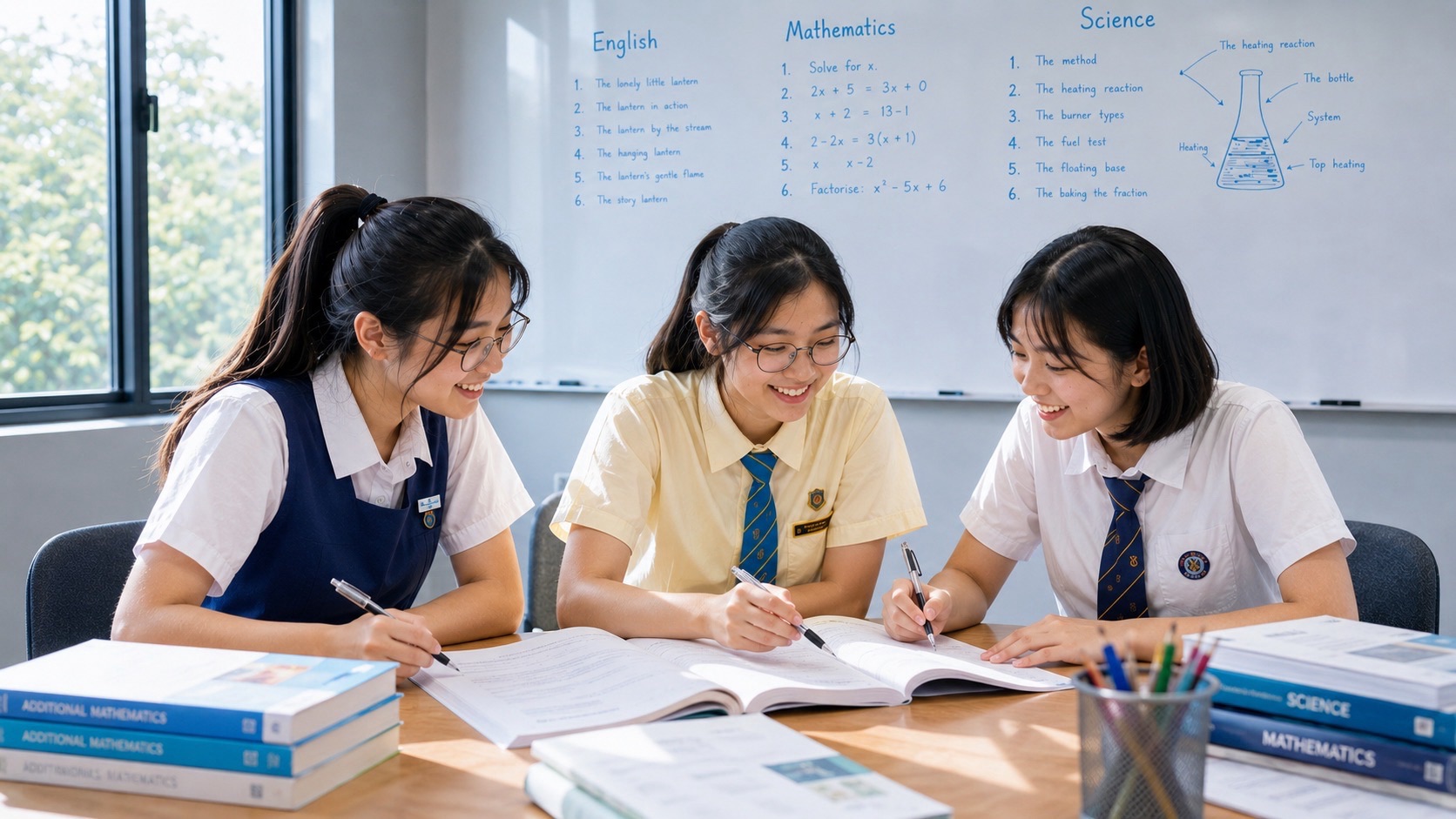
Secondary 1 G3 Geography tuition for Bukit Batok students should build understanding of the MOE lower-secondary syllabus on water, tropical rainforests and mangroves, while teaching the child to read maps, interpret data and write geographically sound explanations. An effective tutorial does not merely add questions. It starts with the student’s marked work, identifies a specific conceptual or reasoning gap, teaches a clear method and checks that the student can use it independently.
Bukit Batok offers useful real-world examples. Bukit Batok Town Park, popularly known as Little Guilin, occupies a former granite quarry landscape, while the separate Bukit Batok Nature Park also has a quarrying history and secondary forest. These settings illustrate how places change through human activity and management, but neither quarry lake is automatically a treated water-supply reservoir or a tidal mangrove. Accurate distinctions are part of the lesson.
This page addresses families who live in Bukit Batok; it does not claim eduKate Singapore has a tuition branch in Bukit Batok. The reference premium three-pupil small-group venue is 8 Fourth Avenue, near Sixth Avenue MRT. Ask directly whether a suitable G3 Geography group is offered, who teaches it and where lessons take place before booking.
What does G3 mean for my new Secondary 1 student?
G3 refers to the level of the Geography subject under Full Subject-Based Banding. It does not automatically describe the child’s level in every other subject. A tutor should check the school timetable and actual Geography materials rather than infer the curriculum from Posting Group alone.
The MOE lower-secondary G2 and G3 Geography syllabus develops the overarching idea of sustainable resource use and management. The first thematic question concerns natural resources, including water and tropical rainforests or mangroves. School chapters and assessment schedules vary, so the tutor should align practice with actual class work.
Is Secondary 1 already preparing for the SEC Geography paper?
Secondary 1 students complete school assessments rather than the upper-secondary national SEC examination. The SEC begins in 2027 for the relevant cohorts, but the current learner’s priority is understanding concepts and using evidence correctly. Heavy exposure to future national essay schemes can distract from fixing more basic learning gaps.
Good Geography habits still carry forward. The child learns to describe a pattern, explain a mechanism, use a source and qualify a conclusion. Those capabilities are useful at later levels regardless of the eventual upper-secondary subject combination.
What happens during the first Geography tuition lesson?
A tutor can begin with one marked answer, the school’s topic list and a short unfamiliar diagram. The child then identifies information from a map and writes a brief explanation without copying notes. This allows the tutor to see whether the difficulty is vocabulary, concept, source-reading, command-word interpretation or reasoning.
A student who reads a graph accurately but offers an unsupported conclusion needs a different task from one who cannot read the units. A useful first consultation produces one or two teachable priorities, followed by an independent retest on a different question.
Geography is more than remembering country and river names
Place names and key terms are important, but they are the ingredients of geographical thinking, not the complete answer. The child needs to understand relationships among environment, people, resources and decisions. A question may ask why water access varies or how a management measure influences different groups.
Teach a repeatable sequence: read the question, inspect the source, choose the relevant idea, explain the mechanism and check how far the evidence permits the conclusion. At first the tutor can model the decisions aloud. Later the child should complete the sequence without hints.
Water availability is not the same as water security
Rainfall provides a source, but usable supply depends on storage, quality, treatment, infrastructure and demand. A wet area can face difficulties if its water cannot be reliably distributed or treated. A drier settlement may overcome some limits through suitable management. Geography students should recognise that a single rainfall figure rarely settles water security.
A classroom exercise might compare two imaginary towns with different rainfall and water systems. The learner must explain the factors and identify the missing measurements rather than assume that the wetter place necessarily has better access.
Little Guilin: what the official park account establishes
NParks identifies Bukit Batok Town Park along Bukit Batok East Avenue 5 and explains that it is known as Little Guilin because of the prominent rock formations beside its lake. Historical quarrying in the area and the flooding of a disused quarry in the 1980s help explain the landscape’s appearance.
A photograph can show rock, water and vegetation, but cannot establish the exact date of an earlier excavation or determine water quality. The tutor should teach the student to distinguish observed features from official historical facts and questions requiring measurement.
Why a quarry pond is not automatically a drinking reservoir
Seeing a body of water does not establish that it is used as a drinking-water source. The flooded quarry at Little Guilin should not be described as a household water-supply reservoir without documentation. Treatment, designated purpose and connection to distribution infrastructure are separate questions.
A tutor can compare a verified NParks description of a former quarry pond with PUB’s description of a managed reservoir. The learner identifies what each source actually supports and avoids inserting imaginary pipes, treatment systems or water-quality results.
There are two different Bukit Batok quarry parks
Bukit Batok Town Park is the Little Guilin location near Bukit Gombak. Bukit Batok Nature Park is a separate place along Bukit Batok East Avenues 2 and 6, developed in 1988 on an abandoned quarry site according to NParks. Both have rock and water features, but their paths, historical details and maps differ.
Students can practise careful place identification by comparing correctly labelled maps. A geographical argument becomes unreliable when a specific feature of one park is accidentally assigned to the other.
What quarrying and land-use change teach us
Quarrying removes rock and alters the form of a landscape. After extraction ceases, the resulting land may be managed for recreation, conservation or other purposes. An old quarry turning into a public park is an example of changing human land use, not evidence that the area was never disturbed.
Students can compare invented dated maps showing extraction, abandonment and later public use. They should identify the visible physical change before hypothesising about ecological effects. Historical claims about a named site require appropriate records.
What a quarry photograph cannot prove
A scenic lake photograph does not tell us the exact depth, pollution level, legal access rules or rate of ecological recovery. It captures a setting at a particular moment. A child should learn to say what the image visibly shows and to identify where additional evidence would be required.
The tutor can ask for three sentences: one direct observation, one possible but unproven explanation and one measurable research question. That exercise prevents confidently stated guesses from replacing geographical reasoning.
How does a student develop a proper water explanation?
A weak answer might say ‘population causes water scarcity’. A stronger explanation describes how higher consumption could place pressure on reliable supply if capacity, storage and distribution cannot keep pace. It should acknowledge that management and conservation may change the outcome.
The tutor can use a fictional town with rising demand and unchanged distribution capacity, then ask the child to explain the link and identify data that would test the claim. A new scenario checks whether the mechanism is understood.
Water pollution: why colour alone is insufficient evidence
A greenish or brown quarry lake may invite confident guesses about contamination. But water colour in a photograph can have multiple causes, and a visual impression is not a water-quality test. The child needs to recognise what measurements or observations would be appropriate to establish a particular pollutant or condition.
Students should distinguish a hypothesis from a measured result. The same source-reading habit applies when they later see climate graphs, tourism charts or maps with incomplete information.
Conserving water versus repairing a leaky system
Reducing avoidable household consumption and repairing damaged pipes target different parts of a water-management problem. One does not automatically replace the other. A student should identify what causes the difficulty before deciding which response is more directly relevant.
In an imagined settlement with serious leakage, improving the distribution infrastructure may address the stated loss, while conservation could reduce demand. The tutor should ask the learner to explain each measure’s mechanism and limits, then make a conditional judgement.
Rainforests are ecosystems rather than pictures of tall trees
Tropical rainforests contain linked communities of organisms and physical conditions. Students may learn the vegetation layers but still struggle to explain how light, habitat and other environmental factors relate. A tutor should connect terminology with processes rather than encourage isolated memorisation.
An unlabelled forest diagram is a useful diagnostic. If the child names a layer without explaining why it matters, teaching can focus on that missing relationship. A different illustration later checks independent transfer.
Is Bukit Batok Nature Park a primary rainforest?
NParks describes secondary forest at Bukit Batok Nature Park and records its former quarry use. The learner should not assume the entire site is untouched primary tropical rainforest merely because there are many trees. Disturbance history and ecological classifications matter.
The tutor can compare the local park description with a verified primary-rainforest resource, helping students recognise useful similarities without treating the environments as interchangeable.
What is an effective way to learn forest layers?
Rather than copying four labels repeatedly, the student can describe the layer’s position, relevant light conditions and a biological relationship. The tutor may ask the child to explain the diagram orally before attempting a written response.
A later task changes the drawing style or removes labels. The student’s ability to reconstruct a coherent explanation on unfamiliar material demonstrates more learning than remembering where a word was printed on one worksheet.
What can we conclude from a cleared-forest photograph?
A photograph of cleared land can establish visible land-cover conditions at the time it was taken. It usually cannot establish the full rate of deforestation, exact soil loss or long-term biodiversity decline. Those claims need dated comparisons or scientific measurements.
In a controlled classroom example, students compare two maps of a fictional forest. They first state what changed, then explain potential impacts with appropriate qualifications and identify the data needed to test them.
Why are mangroves different from an inland quarry pond?
Mangrove ecosystems are associated with suitable coastal or estuarine tidal conditions. An inland water body surrounded by secondary vegetation does not become mangrove habitat simply because both contain trees and water. Salinity, tidal influence and plant adaptations are part of the distinction.
A tutor can place an official mangrove source next to a Little Guilin photograph and ask which clues identify the environmental setting. A correct unfamiliar example is more useful than forcing an inaccurate local label into the syllabus.
How should mangrove adaptations be explained?
An adaptation answer should connect environmental conditions, a particular plant structure and its function. Terms such as prop roots or breathing roots can help, but only when used accurately. Different mangrove species vary, so the student must not assume one root type describes every tree.
After a worked example, a new species diagram tests whether the learner can make a careful feature–environment–function explanation without copying the first answer.
Sustainability is a question of uses, costs and future needs
A sustainable management decision may need to consider recreation, habitat protection, safety, maintenance and how people use a resource over time. The word green alone does not establish whether a proposal is suitable. A student should identify the actual issue and explain how a measure addresses it.
A fictional proposal for a new visitor path at a quarry park offers practice weighing benefits and possible pressures. The tutor asks what is documented, what remains hypothetical and which measurements would make the judgement stronger.
How people experience a place is not the same as its mapped location
A map can locate Little Guilin, but it does not tell us what the park means to every resident. Some may associate it with scenery, walking, family memories or quarry history. Those are possible experiences that should not be presented as a representative survey.
The tutor can compare a historical park description with invented visitor responses and explain why the two sources answer different geographical questions. This introduces sense of place and the limits of survey evidence.
Why a photograph does not establish biodiversity recovery
Visible greenery and occasional bird sightings do not, by themselves, demonstrate that species diversity has increased over decades. A trend requires comparable observations or surveys over time. This is especially important when discussing former industrial landscapes that now appear verdant.
The tutor can provide hypothetical counts from two years and ask whether sampling methods were comparable. A cautious conclusion that identifies uncertainty can be more accurate than a confident but unsupported claim.
What must a student check before reading a map?
The title, legend, north direction, scale and date shape what a map means. A line might represent a path, a road or water depending on the key. A symbol for a lookout point does not tell us whether the route is easy for every visitor.
Use the NParks park map to practise locating trails and facilities, then give an unfamiliar map. This helps build a general source-reading habit instead of memorising just the Bukit Batok layout.
How to use map scale without inventing walking time
Suppose an invented classroom map shows one centimetre representing 250 metres. Six centimetres therefore represent 1.5 kilometres in straight-line terms. That estimate is not necessarily the actual walking distance, because visitors follow available routes rather than a direct line.
The child should include the scale relationship and units. The tutor can change the scale in the next question, checking whether the learner reads each new map accurately.
Describe the pattern before explaining the process
A cluster of trees around a water body may be observable on a map or image, but the source may not reveal why those trees are there. Description and explanation are separate commands. Students should first state what is visible, then use relevant knowledge and qualify any inference.
An exercise using three invented maps shows clustered, linear and scattered distributions. The learner describes each precisely and identifies one additional source that might support a causal account.
Graphs require units and time periods
A rainfall graph needs accurate reading of its axis labels, dates and units. An increase over three monthly readings is not the same as a long-term climate trend. A source may support an observation while providing no evidence about the cause.
Imagine fictional rainfall figures of 130, 180 and 150 millimetres. The series rises and then falls, with the middle value highest. The child should not invent next month’s rainfall or claim a specific weather mechanism from those numbers alone.
Numerical evidence is useful only when it matches the claim
A student can correctly quote a rainfall number yet use it to make an unsupported claim about treated water quality. Evidence needs to correspond to the geographical statement. The tutor can ask the learner to point to the source element supporting each sentence.
A short exercise offers three claims: supported, plausible but unverified, and contradicted. The child classifies them and explains why. This habit strengthens the reasoning behind future national examination responses.
Percentage points and percentage changes differ
If a share rises from 20 percent to 25 percent, that is five percentage points or 25 percent relative growth from the starting share. Those are not interchangeable descriptions. Geography students need accurate numerical language even when the principal task concerns a human or environmental issue.
The tutor can use small mixed-topic graphs to teach this distinction without replacing Geography lessons with unrelated Mathematics tuition.
What is geographical investigation?
Geographical investigation begins with a question that can be answered with available evidence. ‘Is Bukit Batok a good place?’ is too broad for a short school task. A narrower school-approved question might compare visible shade along two safe public paths under similar conditions.
The learner must define what is being observed, consider the times and sampling, and explain limits. Synthetic classroom data should be clearly labelled; genuine assessed work belongs to the student and should follow school instructions.
Sampling limitations should be explained rather than hidden
A survey of ten friends does not represent every Bukit Batok resident. The tutor should explain who the sample includes, who it may exclude and how those choices limit a general conclusion. Larger-looking numbers do not automatically remove bias.
An improved hypothetical method could select a more suitable variety of respondents or observation times, if ethical and practical. A narrow but honest conclusion is often better than a sweeping claim.
Do students need to visit steep quarry trails for good fieldwork?
No. Former quarry landscapes may contain water, steep terrain and wildlife, and NParks advises about trails with slopes or stairs. Learning can be supported through official maps, safe supervised observations and properly labelled classroom datasets. A tutor should never encourage unsafe shortcuts or entering quarry water.
Students should also respect privacy, wildlife and any current park notices. Ethical methods are part of sound geographical education.
Describe, explain, compare and evaluate ask different things
Describe asks for a relevant feature or pattern. Explain needs a causal link. Compare requires an explicit similarity or difference. Evaluate weighs criteria and reaches a reasoned judgement. A student who knows the facts can still give an unsuitable answer by overlooking the task’s verb.
The tutor can use one quarry-landscape resource for four questions and ask for a short plan for each. The learner then practises on new material without prompts.
How a small-group tutorial preserves individual learning
A group of three can discuss competing explanations, but the tutor should still inspect each child’s independent answers. One student may struggle with scale, another with rainforest vocabulary and a third with unsupported claims. Differentiated checking helps rather than relying on one shared worksheet.
The original eduKate Clementi Mathematics page describes a premium three-pupil teaching model, but does not guarantee that an identical Geography group is operating. Parents should verify actual subject provision.
What might an illustrative ninety-minute lesson include?
A possible session begins with brief recall and an unfamiliar resource, then repairs the most important misconception through clear explanation. The student practises a guided example before attempting a different question alone. The closing period identifies an error to revisit during the week.
This is an educational model, not a promised Geography lesson duration. What matters is the child’s ability to solve a new question independently after the teaching.
Why an error log is more useful than copied corrections
Incorrect answers can arise from missed units, misunderstood terms, irrelevant evidence, an omitted mechanism or the wrong command word. Labelling everything careless provides no practical teaching target. A short error log names the decision that failed and the rule for the next attempt.
The tutor retests the same reasoning problem on different content after a delay. That transfer is stronger evidence than remembering the original corrected sentence.
Homework should fit the reality of Secondary 1
Students are adjusting to new timetables, multiple teachers and CCAs. Geography homework works best when targeted and reviewable: a short recall exercise, one fresh map or graph and a corrected explanation may be enough to reveal genuine gaps.
Parents can ask what the source shows and why the conclusion follows, without becoming substitute teachers. A manageable routine leaves time for other subjects, reading and rest.
How to prepare for the actual school weighted assessment
Assessment timing and topic coverage can differ among schools. A tutor should request the child’s real learning list and marked tasks rather than assume all Bukit Batok students sit identical papers. Revision should combine core concepts with unfamiliar source application.
After the assessment, the overall mark is a starting observation, not a diagnosis. Identify whether a recurring map error or an incomplete explanation caused the lost marks and target practice accordingly.
How these skills prepare the student for Secondary 2
Water and ecosystem topics introduce ideas of human needs, resources, management and trade-offs. Secondary 2 develops similar reasoning through housing and transport systems. A student who understands that water access depends on linked infrastructure can begin to recognise why a transport network’s usefulness depends on more than one station symbol.
A tutor can use a short unfamiliar urban scenario to make this connection without rushing through a complete next-year syllabus.
How Bukit Batok families should choose the right schedule
This article does not claim an eduKate Geography teaching branch in Bukit Batok. The reference venue is 8 Fourth Avenue, Singapore 268674, near Sixth Avenue MRT. Confirm an actual Geography group, tutor, time, fees and location before estimating travel.
Consider the student’s starting point, dismissal time, CCAs, meals and independent practice. A class should make school learning more manageable rather than consume every available hour.
Worked source clinic: 22 Geography examples for independent practice
Learning lab: what would you do with a Little Guilin photograph?
Give the student a photo showing a quarry cliff, water and vegetation. Ask them to name exactly three visible features and then identify two questions that the image cannot answer, such as the lake’s water quality or the timing of rock extraction. The learner must distinguish the act of observing from making a claim about history or environmental conditions.
For a second attempt, replace the image with a different former quarry landscape. If the child can use the same method without importing Bukit Batok details, the skill has become more transferable.
Learning lab: compare a quarry pond and a public reservoir
Prepare short, accurately labelled descriptions of a former quarry pond and a PUB-managed reservoir. The student writes which uses are documented and which claims would require further evidence. The exercise is not simply about identifying two blue shapes. It teaches that management purpose and infrastructure cannot be inferred from appearances.
The tutor can ask what information would make a water-quality or household-supply claim valid. A clear response states a suitable source or measurement instead of treating speculation as an established fact.
Learning lab: why a rainfall total cannot prove water security
A fictional settlement receives frequent rain but has unreliable treatment and damaged distribution pipes. Another has lower rainfall but dependable infrastructure. Students compare the mechanisms and identify why rainfall alone is insufficient. The tutor can then remove one key fact and ask what new information is needed to reach a judgement.
This helps children understand conditional explanations and the importance of variables beyond the most visible number. It also prevents them from repeating ‘rain equals plenty of water’ in unfamiliar resource questions.
Learning lab: write two distinct reasons rather than synonyms
A question asking for two reasons for water stress can tempt students to answer ‘high population’ and ‘many people use water’. Those statements overlap. The tutor should ask for separate mechanisms where supported, such as rising demand and impaired supply infrastructure or unsuitable water quality.
Each reason is written as an independent explanation with a factor, mechanism and outcome. The student then answers a different scenario alone, showing that the correction is not simply another sentence copied from a model.
Learning lab: map scale when a trail curves
An invented park map shows a straight-line distance of four centimetres with a scale of one centimetre to 250 metres. The represented straight-line distance is one kilometre, but the marked trail curves around a lake. Students should not assume the entire walking route is exactly one kilometre.
The tutor can ask which method would better estimate the length of the mapped route and why current access information still matters. This builds precision rather than an unsupported travel-time promise.
Learning lab: compare two habitats without choosing by colour
Show a correctly documented secondary-forest photograph and a tidal mangrove photograph. The student identifies environmental clues and explains why the two sites differ. A green-looking background is not enough to classify an ecosystem, and one former-quarry photo cannot illustrate every species or condition in a tropical rainforest.
The learner then attempts an unfamiliar comparison with species descriptions. This practises geographical classification and the habit of avoiding overly broad labels.
Learning lab: identify where an explanation overreaches
Give the learner the statement: ‘The lake looks clean, so the water is safe to drink.’ Ask which part is an observation and which part is an unsupported conclusion. The tutor can explain how appearances, scientific measurements and official management descriptions serve different evidential purposes.
Students revise the sentence to a supported observation and name a proper investigation question. This correction transfers to photographs of forests, cities and rivers where visible appearance does not establish hidden properties.
Learning lab: a canopy diagram with its labels removed
Provide a simplified rainforest profile without names. The child first identifies vertical differences, then explains the relevant environmental relationships. If they know a layer’s name but cannot connect its conditions to organisms, the tutor should spend time on that mechanism before assigning more recall questions.
A second image with different artwork tests understanding. This avoids a common problem in which recognition of one familiar diagram creates an illusion of mastery.
Learning lab: a forest-change claim based on mismatched sources
Present two fictional photographs labelled as taken in different years but from different viewpoints. Students should recognise that they are not automatically comparable measures of land cover. A confident statement about the extent of deforestation would require a consistent study area and an appropriate method.
The tutor asks the child to propose a fairer comparison. This builds the important idea that evidence quality depends on how information was collected, not merely how compelling the pictures appear.
Learning lab: a management plan with a hidden trade-off
A fictional park proposes a new path beside a sensitive habitat. One group values easy access, while another is concerned about disturbance. The student identifies which interests are stated, what the path is intended to change and which results remain unknown. A developed judgement considers both the goal and the implementation conditions.
The tutor then changes the scenario so that the main problem is litter rather than off-path movement. The learner should revise the recommendation rather than always favour the same measure.
Learning lab: data description before causal explanation
An invented graph shows three years of park visits increasing, then levelling off. Ask the student to describe the measured pattern without suggesting causes. Next provide a separate resource about a new facility and ask whether it establishes a definite explanation or only a plausible relationship.
The distinction helps students recognise that two developments happening together do not automatically prove causation. A responsible answer states what the sources demonstrate and where further evidence is required.
Learning lab: percentages and actual totals
Suppose one fictional neighbourhood has 50 survey respondents and another has 200. Even if 60 percent of each group gives the same answer, the actual respondent counts differ. The student should be able to express both the proportions and their limits without claiming either group represents the entire town.
The tutor can then ask how the sampling method affects confidence in a wider conclusion. The exercise joins basic numerical interpretation to real geographical method rather than treating arithmetic as an isolated skill.
Learning lab: identify a questionable conclusion from a bar chart
A bar chart of rainfall may show a wet month, but it does not tell us whether an entire community experiences safe drinking-water access. Ask students to explain why the chart’s variable is not identical to the conclusion’s variable. The tutor then provides additional hypothetical infrastructure data and asks how the interpretation changes.
A strong response uses the new evidence and avoids a claim of certainty when relevant conditions remain missing. This is a useful bridge between physical and human Geography.
Learning lab: a visitor survey and sense of place
A fictional survey of ten park users finds that several mention scenic cliffs. Students may describe those respondents’ answers but should not declare that all Bukit Batok residents value Little Guilin identically. The tutor explains the difference between an individual experience, a sample result and a whole-population claim.
The learner suggests a more appropriate sampling approach and writes a carefully limited conclusion. The purpose is research honesty rather than a larger-sounding statement.
Learning lab: distinguish a future proposal from a completed change
A classroom packet contains a fictional plan for restoring a former extraction site and a dated photograph of its existing condition. Students must identify which source concerns intention and which documents something that exists. They can evaluate expected benefits without describing them as already measured outcomes.
The tutor asks what evidence collected after implementation would demonstrate success. This skill becomes especially useful when students later study housing and transport planning.
Learning lab: compare two different command words
Use a source about quarry land-use history and ask students first to ‘describe’ the change, then to ‘explain’ why a particular management decision may have been considered. The second prompt requires a mechanism rather than a longer version of the first answer.
A third question asks them to evaluate a proposed future use using stated criteria. The exercise teaches the student to change the kind of thinking, not merely the length of the paragraph.
Learning lab: explain how accessibility varies
An invented plan shows two routes to a recreation area, including a staircase on one and an accessible path on another. Ask students to state how route features affect different hypothetical users whose needs are explicitly provided. Distance alone is insufficient for a complete accessibility judgement.
The tutor changes the route description and asks the learner to update the conclusion. This prepares students for later urban Geography while reinforcing the importance of looking at a real source.
Learning lab: a short, ethical fieldwork design
The student receives a question about visible shade along two public paths. They must define shade, propose comparable observation times, identify safe locations and explain one limitation. Actual visits are unnecessary for the practice: the tutor can supply synthetic data and focus on how a method answers its research question.
School-assessed investigations require the student’s own genuine observations under teacher directions. The tutor should not fabricate results or encourage unsafe quarry exploration.
Learning lab: write a limitation that actually matters
Suppose only five people answer an invented visitor survey at one lookout point. ‘Sample is small’ is a start but does not explain which people or times are missing. The student should name the potential bias and connect it to how the conclusion may be affected.
A relevant improvement might include suitable observations at different times under approved conditions. The learner should not claim that simply increasing the sample at the same narrow location automatically fixes representativeness.
Learning lab: a one-minute independent transfer check
The tutor ends with a previously unseen diagram and asks, without prompts, ‘What is the question asking, what does the source show and what process connects the two?’ The student speaks the answer before writing two clear sentences. The exercise is short, but it reveals whether the method is available independently.
At the next lesson a different diagram tests the same routine. This is more informative than how quickly a child can repeat the tutor’s original explanation.
Learning lab: the corrected rule under new conditions
A child who misread scale last week receives a rainfall graph this week. The surface tasks differ, but both require looking for a key and unit before using values. The tutor can ask the student to identify what the earlier error taught them about evidence-first thinking.
The purpose is to build a habit that transfers across subjects. A rule such as ‘read the measurement before calculating’ is more useful than remembering one corrected number.
Learning lab: what a parent can ask after tuition
Rather than asking only how many worksheets were completed, parents can ask their child to explain one mistake they corrected, the rule they will use next time and a question they can now answer independently. The reply should be about a decision the student understands.
The tutor can support this by providing a brief, concrete practice task instead of a vague statement that the child needs to work harder. Parent conversations become more useful without turning home into another classroom.
Frequently asked questions from Bukit Batok families
Is G3 a whole-student stream label?
No. G3 is a subject level; other subjects may be offered at different levels under Full Subject-Based Banding.
Does my Secondary 1 child sit an SEC Geography paper now?
No. Secondary 1 learners complete school assessments. National subject codes become relevant later.
Is Little Guilin a drinking-water reservoir?
Do not assume so. NParks documents a flooded disused quarry rather than a treated household supply system.
Are Bukit Batok Town Park and Nature Park the same?
No. NParks identifies two separate parks with distinct maps and former quarry histories.
Is the forest at Bukit Batok Nature Park untouched primary rainforest?
NParks describes secondary forest and the old quarry site. Those facts do not establish an untouched primary forest.
Should my child climb down to a quarry pool for Geography fieldwork?
No. Respect safety notices, slopes, water and park rules. Safe school-approved enquiry and official resources are sufficient.
Are mangroves found around any inland pond?
No. Mangroves occur in suitable coastal or estuarine tidal conditions; an inland quarry lake is not automatically that habitat.
How many assessment books should we buy?
Begin with school materials and diagnosed gaps; additional work is useful when it can be corrected meaningfully.
Can a tutor write the student’s fieldwork report?
No. Tuition can explain methodology and limitations, but the assessed work and observations must be the student’s own.
Does this guide advertise Geography tuition inside Bukit Batok?
No. It is for Bukit Batok families and gives eduKate’s reference small-group venue near Sixth Avenue MRT.
Official Geography references and the full level progression
For the current lower-secondary framework, see MOE Lower Secondary G2 and G3 Geography. For the local quarry landscapes, read NParks Bukit Batok Town Park (Little Guilin), NParks Bukit Batok Nature Park and NParks Nature Park trail information.
Continue with Secondary 2 G3 Geography Bukit Batok, Secondary 3 G3 Geography Bukit Batok and Secondary 4 G3 Geography Bukit Batok. The SEAB G3 SEC directory explains later subject choices.
The unchanged eduKate Clementi small-group teaching reference illustrates the close-feedback model, but Geography availability and class arrangements require separate confirmation.
Contact eduKate about Secondary 1 G3 Geography
Bring one marked answer, the school Geography level and topic, and a practical weekly timetable. Ask whether the correct Geography group exists, who teaches it, how individual progress is checked and where the actual session meets.
Contact eduKate Singapore or enquire via WhatsApp. Reference venue: 8 Fourth Avenue, Singapore 268674, near Sixth Avenue MRT, by appointment. Confirm actual Geography provision and location before travelling.
A strong first-year outcome is a student who can look at a new source, explain what it really shows and build a careful geographical answer independently.