
eduKate • Bugis, Singapore • Secondary 1 Geography • From first maps to independent geographical explanation
reading-routes
Secondary 1 Geography tuition in Bugis should help a child read symbols, use scale and explain patterns without inventing evidence. Weekday lessons can work when the student is alert after school; weekends can suit children recovering from long CCA days. Choose a schedule that allows a new independent attempt, not merely a convenient class.
Learning goal · Map grid · Scale · Timing · FAQs

contents
Thirteen practical chapters — open the question your child needs
1. Why Secondary 1 Geography is about evidence rather than remembering place names
2. Bugis gives a memorable introduction to routes, destinations and connections
3. Worked Map A: draw a fictional Bugis-style route without inventing a real street map
4. Scale, centimetres and the difference between straight-line and walking distance
5. The bridge, the station and the temptation to call every path the shortest
6. Weekday or weekend Geography tuition: choose energy plus a later independent attempt
7. Spatial patterns at Bugis: clustering is a description, not an explanation
8. Invented footfall comparison: a raw count is not always a comparable rate
9. First Principles and the Fencing Method for Geography answers
10. What a useful ninety-minute three-learner tutorial could contain
11. Four-week adjustment plan: from PSLE map recognition to secondary-school inference
12. Parent checklist, useful Bugis links and frequently asked questions
Why Secondary 1 Geography is about evidence rather than remembering place names
A child can recognise Bugis Junction, Bugis Street and the MRT station yet still find the first secondary-school Geography tasks surprisingly hard. The reason is simple: Geography is not merely naming a place. It asks students to read maps accurately, notice spatial patterns, compare information, give a plausible explanation and distinguish observations from assumptions. Secondary 1 Geography tuition in Bugis is useful when it repairs one of those skills and then demonstrates improvement on a new question.
The first helpful action is to open the child’s latest marked school source question. Does the learner know what the map symbols represent? Can they state the direction between two locations? Do they include units when using scale? Can they explain the difference between a busy-looking photograph and a measured pedestrian count? Each is a different learning need. A tutor who simply begins with a thick textbook may miss the actual obstacle.
MOE’s lower-secondary Geography syllabus offers a wider reference for geographical inquiry, but the particular school’s Humanities programme, level and unit remain the right starting point. A Secondary 1 learner is adjusting to new classroom routines, new types of explanation and sometimes subject-specific language. The first tutorial should help the student become more independent, not pressure them to memorise examination-year case studies before the foundations are secure.
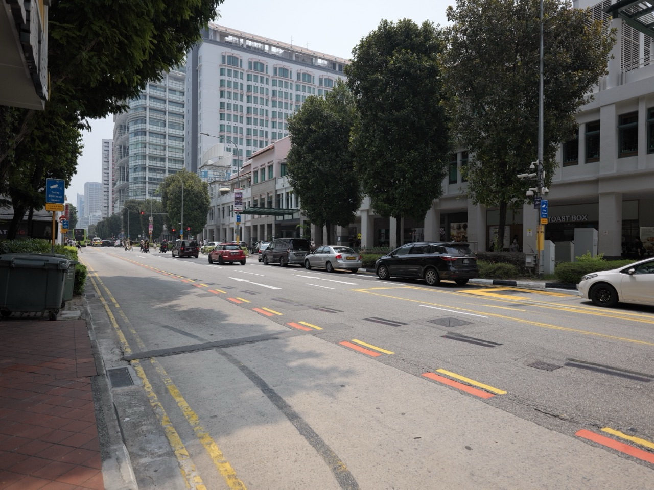
Try asking your child: “What does this picture show? What does it not show?” A photograph of a road beside a mall can show visible vehicles and a particular street arrangement at the time it was taken. It cannot, by itself, establish average traffic volume for a whole day or prove why each driver chose the route. Recognising that limit is already a step towards thoughtful geographical reasoning.
When a child can read the source, calculate fairly and explain without inventing missing facts, the subject starts to make sense. That is the educational objective behind a useful small-group Geography lesson, whether it happens on a weekday or weekend.
Bugis gives a memorable introduction to routes, destinations and connections
Bugis is a terrific setting for looking at how places connect. The operator of Bugis Street and nearby developments describes Bugis Junction, Bugis+ and Bugis Street together as Bugis Town. CapitaLand’s 5 October 2023 account describes a link bridge from Level 3 of the Bugis Street complex to Level 2 of Bugis+, with sheltered access towards Bugis MRT. That is a source-supported connection, but it does not tell us how many people used the bridge yesterday or whether every pedestrian prefers it.
A school map of such an area can teach nodes and links. A node is a place or feature—perhaps a station entrance, a shopping complex or a public space. A link is a connection or route between them. Students sometimes mistake a nearby node for a direct connection. Two places can appear close on a flat diagram but be separated by crossings, different storeys or access restrictions. That is why a diagram of destinations is not automatically a route-planning map.
The same operator’s current listing identifies Bugis Street as a street-shopping development, while Bugis Junction is a separate property with a direct basement connection to Bugis MRT. Students should recognise that the terms “Bugis”, “Bugis Street”, “Bugis Junction” and “Bugis Town” do not necessarily refer to identical boundaries. The street, the shopping complex and the broader commercial grouping are distinct geographical units. A source should always be read at the scale it actually describes.
This is a welcome opportunity for parents to talk about Geography in everyday language. Ask why a sheltered connection may be helpful on a wet afternoon. Then ask which information would be needed to decide whether it shortens a particular person’s journey. Distance, accessible entrances, level changes and the actual route matter. A child learns to propose a mechanism while remembering that a reasonable-sounding explanation still needs evidence.
One useful rule for the whole article is this: operator announcements document what the operator reported at the time. They are not live pedestrian surveys or guarantees of conditions in 2026. The named spaces can still help a student understand a geographical concept without overstating what the source establishes.
Worked Map A: draw a fictional Bugis-style route without inventing a real street map
Here is a fully fictional classroom grid. It is not a current map, a walking guide or an accessibility audit of Bugis. Imagine a rectangular diagram with columns A, B, C and D increasing from left to right and rows 1, 2, 3 and 4 increasing from top to bottom. A north arrow points towards the top. The drawing marks a school at B2, a library at D2 and a sheltered meeting point at B4. What can a student infer?
| Illustrative location | Grid reference | Relationship to school at B2 |
|---|---|---|
| School | B2 | Reference point |
| Library | D2 | Two columns east |
| Sheltered point | B4 | Two rows south |
| Unmarked bus stop | Not shown | Location cannot be inferred |
The library is east of the school because the columns increase towards the right and the north arrow points upwards. The sheltered point is south because the row numbers increase downwards. A learner should not describe grid distance in metres unless a scale or cell size is supplied. Nor can the diagram prove whether there is an accessible path between the points. A blank space on a simplified map is not proof that the real area contains no buildings or obstacles.
Now imagine the teacher rotates the north arrow so it points to the right while preserving the visible layout. The right edge of the page now represents north, so the library’s geographical direction relative to the school changes accordingly. This exposes a common misconception: believing that up the page always means north. A good tutor teaches the child to check orientation, not simply repeat familiar words.
A second version can add a legend: a blue square represents a library; a blue circle represents a water point; a red square represents a station. Students should identify each feature by the exact symbol, not the colour alone. They then receive a new grid without the model beside it and write three location statements independently. That second attempt is more convincing evidence of understanding than a perfectly annotated first drawing.
These invented exercises are intentionally simple. They create a secure foundation before the child moves to real official street maps, whose directions, entrances and boundaries should be verified rather than recreated from memory. The aim is clear geographic reading, not producing an inaccurate tourist guide.
Scale, centimetres and the difference between straight-line and walking distance
Suppose the fictional classroom map uses a ratio scale of 1:5,000. This means one centimetre on the drawing represents 5,000 centimetres, or 50 metres, on the ground. If two hypothetical points are separated by 2.6 centimetres, multiply 2.6 by 5,000 to obtain 13,000 centimetres. Divide by 100 to convert to metres, giving 130 metres of represented straight-line distance.
A common incorrect answer is 13,000 metres. The multiplication was performed, but the unit conversion failed. Another error is to announce that walking between the places will take exactly two minutes. Even if the ground-distance calculation is correct, a straight-line measurement does not establish the route distance, number of crossings, accessible path or walking speed. Geography asks what the source allows us to conclude.
| Fictional measurement | Working | What can be stated |
|---|---|---|
| 2.6 cm at 1:5,000 | 2.6 × 5,000 ÷ 100 | 130 m represented straight-line distance |
| 3.7 cm at 1:5,000 | 3.7 × 5,000 ÷ 100 | 185 m represented straight-line distance |
| Difference | 185 − 130 | 55 m difference in straight-line lengths |
| Actual walking time | No route or speed supplied | Unknown from this diagram |
Ask the learner to do a fresh problem with a map scale of 1:2,000 and a paper distance of 3.4 centimetres. The answer is 68 metres, not 6,800 metres. Then ask for one sentence explaining why it may be different from the length of a walking route. If both parts can be completed unaided, the child has combined numerical control with geographical interpretation.
Bugis is especially suitable for discussing the distinction because the operator’s public material describes above-ground links and station access across multiple storeys. A two-dimensional straight-line diagram is rarely a complete description of movement through a multi-level destination. Yet the tutor should not pretend to have measured actual walking distances inside the complex. The educational value comes from the concept, not an invented journey time.
Parents need not become Geography specialists to support this. Ask whether the child used the given scale, converted the units correctly and answered the question that was asked. Five minutes of clear explanation can reveal more than a long session of copying similar calculations.
The bridge, the station and the temptation to call every path the shortest
A geographic connection should be described precisely. In October 2023, CapitaLand said a newly introduced bridge connected Level 3 of the Bugis Street shopping complex with Level 2 of Bugis+, contributing to a network of sheltered walkways serving its Bugis Town properties and providing access towards Bugis MRT. This is a useful real-world example of how movement routes can be modified. It does not, by itself, prove an exact average travel-time saving.
Give students a fictional network with five nodes and seven links, each labelled with an illustrative distance. The simplest-looking route on the page need not be the shortest by the sum of the link lengths. Nor is the route with the fewest links always the shortest. This is a valuable exercise in reasoning from a network rather than guessing from visual neatness.
| Fictional route | Segment lengths | Total length |
|---|---|---|
| A → B → D | 70 m + 80 m | 150 m |
| A → C → D | 45 m + 120 m | 165 m |
| A → E → D | 95 m + 90 m | 185 m |
With these invented values, A → B → D has the smallest sum of represented link lengths. However, it is not automatically the fastest accessible real-world route. Movement speed, crossings, vertical travel and restrictions are absent. A student should learn to state the basis for ranking: shortest distance within the simplified network, not universally fastest journey.
To test whether the method transfers, change one edge: make B → D equal 115 metres. Now route A → B → D totals 185 metres, so A → C → D at 165 metres becomes the shortest of the three. The pupil must revise the conclusion when the data change rather than cling to a memorised answer. That ability is what careful teaching should develop.
A three-learner discussion can divide tasks: one student checks route additions, another reads the arrow and legend, and a third challenges the claim about travel time. Then every learner receives different lengths and solves the comparison independently. This prevents the most fluent child from doing all the thinking.
Weekday or weekend Geography tuition: choose energy plus a later independent attempt
There is no single best day for every Secondary 1 learner. A weekday class may help when the child has just received a marked map exercise and still has enough attention after school. A weekend may be more comfortable when CCA or a long commute leaves the child exhausted on school days. But weekends can also be crowded with sports, family activities and other classes. The question is not which calendar label sounds more disciplined; it is which arrangement produces useful learning.
| What parents observe | Weekday possibility | Weekend possibility | Evidence to collect |
|---|---|---|---|
| Fresh Geography worksheet returned | Targeted correction soon after school | Longer re-reading when rested | New diagram handled correctly |
| CCA ends late | Avoid that particular tired evening | Possibly more concentration | Learner still thinks at end of lesson |
| Weekend already full | May protect family commitments | Only with realistic recovery | Independent follow-up fits the week |
| Student understands in class but forgets later | Next-day short recall | Midweek retrieval exercise | Method survives without hints |
Try one practical two-week experiment. Give the learner a short, similar-difficulty map question after a normal school day and another when rested. Record attention, errors and whether the child can explain the result. This is not a scientific test that settles a permanent schedule, but it highlights obvious problems with fatigue. Review the commute, meals, sleep and whether there is time for a ten-minute return task.
The best unit of tuition is the entire learning cycle: discover the mistake, explain the first principle, practise together, complete a different task independently and retrieve the idea later. A Saturday class without any chance to use the correction again may be less helpful than a shorter weekday session followed by a new question. The reverse may be true for a child who is exhausted in the evenings.
A sensible tutor should also be willing to say that extra tuition is unnecessary when the child already reads maps and explains sources accurately. More hours are not automatically better. Secondary 1 is a period of adjustment, so preserving school engagement, friendship, rest and family life is part of making a good academic decision.
Confirm the actual venue and availability rather than assuming that a local Bugis guide means eduKate runs a Geography teaching branch in Bugis. Travel logistics should be based on a real proposed class, not inferred from the article title.
Spatial patterns at Bugis: clustering is a description, not an explanation
One of the most useful geographical ideas is clustering: similar services or activities appear relatively near one another. CapitaLand’s property descriptions group Bugis Junction, Bugis+ and Bugis Street as a connected retail destination. That is a commercial grouping described by the operator, not a formally mapped statement that all businesses in the wider Bugis locality share the same function. The learner should notice both the pattern and the boundary of the claim.
Start with a simple diagram. Imagine six shop symbols in a small cluster near a station symbol and two elsewhere. A child may describe the six as clustered in the drawing. But they must not conclude that the station caused every business to locate there. A process such as accessibility may help explain concentration, yet real location decisions also depend on property availability, rent, zoning, historical development and other influences.
Give two statements and ask which is better: “There are many shops near the station on the diagram” or “Every shop moved there because of the station”. The first is an observation about the illustrated data. The second adds historical movement and a universal causal claim that the diagram does not show. This distinction is the bridge from a source description to a genuine explanation.
A child ready for more challenge can compare the proximity of two different kinds of symbols. If a diagram shows food outlets and transport nodes frequently adjacent, it may suggest a spatial association, but a class should still ask how sites were chosen and whether the full study area was included. One sample of a busy commercial core cannot automatically represent the distribution across Singapore.
For parents, the key question is whether the child can give a reasoned explanation in new words. Repeating the phrase “spatial clustering” is not proof of comprehension. A useful answer explains what clusters, at what scale, and what evidence would help test why that pattern exists.
Invented footfall comparison: a raw count is not always a comparable rate
The following is an invented Bugis-inspired classroom dataset, not an actual observation of shoppers, tourists or residents. Three imaginary walking areas are observed over intervals of different lengths. The student is asked to compare the number of crossings per ten minutes, not simply the absolute counts.
| Fictional area | Observed crossings | Observation duration | Crossings per 10 minutes |
|---|---|---|---|
| A | 36 | 15 minutes | 24 |
| B | 52 | 20 minutes | 26 |
| C | 27 | 10 minutes | 27 |
Area B has the largest raw count, but Area C has the highest rate per ten minutes. For A, divide 36 by 15 and multiply by ten to get 24. For B, 52 ÷ 20 × 10 = 26. For C, 27 ÷ 10 × 10 = 27. All calculations should include units and the observation period. This is an excellent introductory example of why a denominator matters before drawing a geographical conclusion.
The question can then ask whether C is the most crowded. Not necessarily. Crossing rate is not the same as density of people occupying a space at a given moment. The sample has not measured the width of the route, length of stay or time-of-day changes. Nor does a pedestrian count identify the purpose of the journey. An answer that calls all recorded crossings tourists would be unsupported, especially since this dataset is entirely fictional.
Ask the child to propose a fairer investigation: same-length observation windows, consistent counting rules and more than one sample period, conducted only with school-approved supervision if real fieldwork were contemplated. The educational point is methodological consistency. A desk-based map and table are sufficient for the initial lesson.
For transfer, change B’s count to 60 but keep its twenty-minute interval. Its rate becomes 30 crossings per ten minutes, overtaking C. A learner who revises the ranking correctly without help is demonstrating independent reasoning. That is the kind of progress a small-group tutor should record.
First Principles and the Fencing Method for Geography answers
A polished paragraph that a child cannot reproduce on an unfamiliar question is not yet mastery. First Principles teaching begins by locating the earliest unstable step: reading a legend, converting units, describing a pattern, explaining a possible process or recognising what the source cannot prove. Repair that component before asking for a longer answer. This is kinder to a young learner and more effective than making them copy an elaborate essay repeatedly.
The Fencing Method provides a helpful mental boundary: identify the question, stay inside the information actually supplied, explain a geographical process only as far as the source supports it and challenge any statement that becomes too broad. If the exercise gives a ten-minute count, the student should not claim to know a whole-day average. If it shows a symbol for a station, the child should not invent passenger numbers. If it shows a bridge, the learner should not assume every possible route uses it.
- Read the command word and the source’s title, date and units.
- Name what was actually observed rather than what seems likely.
- Calculate a fair comparison before ranking differently sized samples.
- Explain a possible mechanism without pretending it is a proven site-specific cause.
- State one uncertainty and what additional data could resolve it.
- Apply the method to a different map after the worked example is put away.
Three learners can share roles during discussion: evidence reader, calculation checker and claim challenger. Those roles should rotate. At the end, each pupil writes a separate answer to a fresh problem. This makes the group genuinely useful rather than allowing a confident student to speak for everyone.
An encouraging progress report sounds like this: “The pupil previously ranked raw counts without considering time. On a new dataset, they independently calculated rates and qualified the conclusion.” That is a more meaningful outcome than simply saying the lesson covered maps and urban movement.
The method works in other Humanities and Science contexts because it trains respect for evidence, but the immediate focus remains the student’s own school Geography question and age-appropriate reasoning.
What a useful ninety-minute three-learner tutorial could contain
A small group should make every student’s thinking visible. In a ninety-minute illustrative lesson, the tutor might begin with retrieval of a previous map idea, then check one marked school mistake. Clear instruction and a guided task are followed by an unseen individual problem, group discussion of the different answers and a short continuation exercise. These timings are examples of good practice, not confirmation that a Geography class currently operates at a Bugis address.
| Minutes | Lesson phase | Tutor observes |
|---|---|---|
| 0–10 | Retrieve compass, map key or a source habit | Whether each child remembers without notes |
| 10–30 | Diagnose the first wrong step and teach it | Exact misconception to repair |
| 30–50 | Guided route, scale or rate problem | Units and reasoning become visible |
| 50–70 | Unseen individual task | How many prompts are still needed |
| 70–80 | Rotate a discussion role | Each child explains a supported claim |
| 80–90 | Error note and short retrieval plan | Specific next-step evidence |
Different students need different levels of support. One may need simple arrows and a printed compass to understand orientation. Another can calculate but uses vague comparison language. A third may be ready to investigate whether two sources refer to the same place and date. A genuine three-learner arrangement should support these pathways with individual monitoring, not rely entirely on one shared worksheet.
Parents can ask how the tutor marks independent work. Was the student correct only after a hint? Can the learner explain why an alternative answer is wrong? Will a new question be attempted after a few days? Those details tell you whether the group size has translated into useful feedback.
The most important outcome after ninety minutes is not an exhausted but cheerful child carrying more notes. It is a child who can explain one idea more clearly and perform a related but unfamiliar task with less help. The timetable should leave time for that independent step.
Four-week adjustment plan: from PSLE map recognition to secondary-school inference
A family can judge early progress without waiting for a major examination. Start with a marked Geography task and set one or two observable goals. The first week diagnoses the map-reading difficulty. The second strengthens numerical comparisons. The third connects patterns to explanations. The fourth checks whether the learner can use those ideas on unfamiliar sources without the tutor beside them.
| Week | Lesson focus | Independent evidence |
|---|---|---|
| 1 | Read key, north arrow and boundaries | Accurate new location statements |
| 2 | Use scale and compare rate denominators | New calculation with correct units |
| 3 | Describe clusters and limit causal claims | Evidence-led explanation in student’s own words |
| 4 | Unseen map and data response | Correct reasoning with fewer prompts |
Keep a short error log with categories: missed symbol, wrong direction, incorrect units, unnormalised comparison and unsupported explanation. A tutor should show one example of the original error, the corrected work and a later independent attempt. Parents need not become markers of Geography papers to appreciate the evidence.
If the child can read source material accurately without excessive assistance, the lesson may move to a more demanding task. If the same misconception returns, revisit it. Racing ahead through advanced case studies is not a substitute for a stable foundation.
At the end of the month, review the weekday or weekend arrangement too. Does the child arrive with energy? Is a short practice task genuinely happening after tuition? Has the overall school routine remained healthy? Continue only while the tuition answers a real need. Being able to say “I understand this now and can practise independently” is a promising outcome.
Parent checklist, useful Bugis links and frequently asked questions
- Confirm the child’s actual Secondary 1 Humanities/Geography programme and school unit.
- Bring one marked map, data or diagram question rather than relying only on the overall grade.
- Ask for a later unseen question that tests independent transfer.
- Compare the full weekday/weekend load, including CCA, transport, meals and sleep.
- Verify the genuine group size, teacher, subject availability, venue and fees.
- Keep fictional practice figures separate from official Bugis descriptions.
- Choose tuition only while it produces useful gains; no examination result is guaranteed.
Is Bugis Street the same as Bugis Junction? No. CapitaLand identifies them as separate developments within its Bugis Town grouping. A map of one property should not be assumed to describe the wider neighbourhood.
Does the 2023 bridge announcement prove the quickest route today? No. The dated announcement describes the connection, not live journey times or the best path for every user. Actual access can vary by entrances, hours and user needs.
Are the numbers in the worked tables actual Bugis counts? No. All route lengths, grid positions and pedestrian counts used in the original lessons are fictional exercises, not measurements made on site.
Is a weekend lesson always less tiring? No. A weekend can be full of other commitments. Compare when the child is alert and has time for an independent return task rather than assuming one day is superior.
Does every Secondary 1 student need Geography tuition? No. If schoolwork shows that the child can interpret new maps and explain sources accurately, ordinary school practice may already be sufficient.
Continue with the other Bugis Geography guides: Secondary 2 on changing urban space and comparing dated claims, Secondary 3 on sound fieldwork and stakeholder evaluation, and Secondary 4 on examination-route-specific judgement. For local context, read Things to do in Singapore | Bugis and Why Singaporeans Love Bugis.
Source reading: CapitaLand’s 2023 Bugis Street redevelopment report · CapitaLand Bugis Street property profile · CapitaLand Bugis Junction property profile · MOE lower-secondary Geography syllabus. Official operator claims refer to their named properties and source dates. All class problems are invented. Assessed fieldwork requires school approval, supervision and safe access.
When contacting eduKate Singapore, share the exact school subject, current topic, one marked response and realistic weekday or weekend availability. Check the actual Geography tutor, group, location and fees. The Clementi three-learner Mathematics reference illustrates the teaching approach, not an automatic claim that a Bugis Geography centre or vacancy exists. Properly taught kids shine a bright light into the future.