
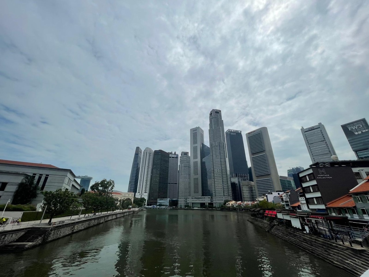
eduKate • Boat Quay, Singapore • Secondary 4 Geography • 2026 GCE and 2027 SEC exam routes, conservation and evidence-based judgement
Choose your reading route
Confirm the actual exam paper and the first repeated error in marked work. Weekday and weekend tuition can both help if the candidate is alert and later answers an unfamiliar question independently.
Exam codes · Source-time trap · Planning evaluation · Worked scoring · Timetable

Contents
17 exam-focused chapters on relevant evidence, judgement and parent choices
1. Confirm the 2026 GCE or 2027 SEC Geography paper before selecting any tuition slot
2. The marked answer exposes the first unstable method behind an examination mistake
3. The 1823 Boat Quay reclamation is a land-change case, not a complete environmental assessment
4. Three-quarters of shipping business in the 1860s is not today’s tourism share
5. The 1989 historic district is governed by requirements, not a blanket ban on change
6. A single Boat Quay shophouse is not the entire Singapore River planning area
7. The 1977–1987 clean-up is a completed programme, not a current water test
8. Original evaluation: heritage frontage versus walking access and rain resilience
9. A weighted decision matrix can reverse when the criteria change
10. A higher number of supporters need not mean a higher support share
11. A fifteen-minute crossing count does not establish a full-day visitor census
12. Official history, planning guidance, a photograph and a survey have different uses
13. Describe, explain and evaluate demand different answers under timed examination conditions
14. The best weekday or weekend revision slot includes recovery and unaided practice
15. Three-student tutorials should produce three independently assessed exam answers
16. A four-week revision plan for accuracy before more past-year papers
17. Parent checklist, frequent questions and connected Boat Quay Geography guides
Confirm the 2026 GCE or 2027 SEC Geography paper before selecting any tuition slot
Secondary 4 Geography tuition in Boat Quay should begin with the actual examination cohort, learning level and registered subject. Standalone Geography and Humanities combining Social Studies with Geography do not have identical scope. A candidate preparing for the 2026 GCE routes also encounters different subject codes from those in the 2027 Singapore-Cambridge Secondary Education Certificate. Choosing a generic upper-secondary workbook before confirming the course can waste the student’s most valuable revision hours.
The SEAB 2026 O-Level school-candidate listing identifies standalone Geography 2279 and Humanities (Social Studies, Geography) 2260. The 2026 N(A)-Level listing gives Geography 2246 and Humanities (Social Studies, Geography) 2125. The 2027 SEC G3 listing uses K329 and K335, while SEC G2 uses K226 and K229. These are separate subject routes; a parent should verify the child’s school registration and relevant syllabus rather than assume an old paper will automatically match.
| Exam cohort | Standalone Geography | Humanities including Geography |
|---|---|---|
| 2026 GCE O-Level | 2279 | 2260 |
| 2026 GCE N(A)-Level | 2246 | 2125 |
| 2027 SEC G3 | K329 | K335 |
| 2027 SEC G2 | K226 | K229 |
The tutor should request a recently marked question and identify the first repeated reasoning error. Does the child misread a graph? Omit units? Confuse the conservation date with a building date? Or give competing arguments without a final supported judgement? These require different interventions even though all may reduce marks in Geography. The correct exam route tells the tutor which materials and demands are relevant.
Progress should be tested on an unfamiliar question after one or two sessions, without the model paragraph beside the pupil. A script improved only by copying detailed teacher corrections is an intermediate stage, not independent readiness. A more useful measure is whether the method survives new data under an appropriate time constraint.
This Boat Quay guide uses local evidence to make geographical reasoning clearer; it is not a promise that eduKate operates a Secondary 4 classroom on the waterfront. Confirm actual tutor, group size, venue, fees and schedule before arranging attendance.
The marked answer exposes the first unstable method behind an examination mistake
Exam candidates may memorise long case studies and still answer the wrong task. A pupil could correctly remember the 1989 Boat Quay conservation gazette yet wrongly use that date as the origin of every shophouse. Another might see an official historical percentage for shipping and treat it as the present share of tourists. These are not necessarily failures of effort; they are errors of source scope and interpretation that a targeted tutor can address directly.
A useful error log separates source reading, numerical method, process explanation, evidence selection and evaluative judgement. These are specific skills. If a learner writes a beautiful but irrelevant paragraph, they need practice choosing pertinent facts. If they understand the topic but confuse a relative percentage change with a percentage-point difference, the correction is numerical and linguistic.
| Error category | What it can look like | Best next exercise |
|---|---|---|
| Source date | 1860s trade fraction presented as current | Attach time and measured variable |
| Spatial scope | One conserved property applied to the whole river | Check subzone and conservation boundary |
| Units | Extrapolated rate called actual attendance | Separate observed count and calculated rate |
| Explanation | Repeats land-use pattern without mechanism | Build a clear process chain |
| Judgement | Lists advantages and disadvantages but stops | Weigh criteria and choose conditionally |
A tutor should ask the student to locate precisely where the first mistake appears, not simply rewrite the whole answer. This supports First Principles teaching: rebuild the necessary skill before returning to a more complex task. A short fresh source question then reveals whether the idea has been learnt independently.
For students who already know the concepts but write slowly, the intervention may be planning and selecting evidence under appropriate timing. For students whose source interpretation is unstable, more timed papers without conceptual repair can reinforce the same error. The lesson sequence should match the cause rather than treat all candidates identically.
Parents deserve to see one early and one later unaided answer. A child who can now say what the source proves and what it does not is making meaningful progress regardless of whether another formal grade has arrived yet.
The 1823 Boat Quay reclamation is a land-change case, not a complete environmental assessment
URA’s Boat Quay Conservation Area history records that a Battery Road hillock was levelled in 1823 and the displaced earth was used to fill the swampy south bank of the Singapore River. That documented physical change created additional riverside land that supported later commerce. For an examination answer, the geographical process involves human modification of an environment, not simply a statement that buildings became old.
A correct source-based description states what changed and where. It does not invent an exact volume of fill or an ecological loss figure that the history does not supply. An evaluation might discuss land creation, river access and potential environmental considerations as general processes, but any numerical effect on habitat or water movement would need appropriate engineering and environmental evidence.
This illustrates how the same event can connect physical and human Geography. A modified bank changes the layout of space available for warehouses or jetties. Yet the mere sequence “land reclaimed, trade grew” does not independently establish the relative contribution of each influence. Other infrastructure, market demand and technologies may matter, and a good answer acknowledges that causal evaluation needs more than two dated facts.
Ask a candidate to repair the statement, “Reclamation in 1823 improved river biodiversity for every species.” The source does not support that outcome. The student can instead say that the reported filling changed the physical riverbank and that environmental consequences would require a relevant, dated ecological study. A narrow supported explanation is better than an ambitious fabricated claim.
For transfer, use a fictional coastal reclamation plan with clearly stated baseline and later maps. The learner should identify the changed land-water boundary, consider mechanisms and distinguish proposed from measured outcomes. This is a more useful exam skill than memorising one piece of Boat Quay history.
Three-quarters of shipping business in the 1860s is not today’s tourism share
URA reports that Boat Quay handled around three-quarters of Singapore’s shipping business in the 1860s, despite the development of Tanjong Pagar harbour. This is strong historical evidence of the quay’s commercial importance at that time. It does not mean Boat Quay receives three-quarters of modern tourists, handles that share of cargo today or contains that share of all Singapore waterfront businesses.
A percentage needs the correct time, population and measured variable. Even the term “shipping business” should not be casually replaced with the number of individual vessels unless the source defines an equivalent measure. A pupil who repeats 75% without those qualifications may appear knowledgeable while failing the geography of the question.
The same URA history records later decline of traditional river cargo functions, including the opening of the Pasir Panjang cargo centre in September 1983. The riverfront’s functions changed, but it would be inaccurate to claim that all warehouses were demolished immediately in 1983. Conservation status followed in 1989, and present uses require appropriate modern sources.
Build a short argument from these events: Boat Quay was a significant river-trade location historically; later logistics technology and locations changed the role of the river for cargo; historic buildings remained valuable in another urban context. Then identify what the chronology does not measure, such as exact present employment or the profits of modern restaurants.
An excellent examination answer can use a well-attributed historical fact to explain why a place has a distinctive inherited streetscape while avoiding the mistake of treating one nineteenth-century percentage as a current business statistic.
The 1989 historic district is governed by requirements, not a blanket ban on change
URA’s official record dates the Boat Quay Conservation Area’s gazette to 7 July 1989 and classifies Boat Quay among Singapore’s Historic Districts. Its guidance explains that relevant additions, alterations and operations of new use require compliance with conservation and specific restoration guidelines and the necessary permission. These requirements protect significant built character but do not mean every property remains in its original commercial occupation forever.
A conserved shophouse may have a recognisable historic frontage even if the activity behind it changes. A current restaurant use is not proven by a nineteenth-century trade description, just as an old warehouse facade does not mean cargo continues to move through it. Built form and land-use function are different variables. Examination candidates should state which one the source actually addresses.
For a site-specific example, URA’s conserved-building listing for 67 Boat Quay refers to applicable historic-district guidelines and restoration requirements. A source about one address should not be transformed into permission to change all buildings in the entire Singapore River corridor. Real projects require site-specific review.
A good source-comparison task distinguishes construction of the original shophouse, later conservation gazette, and a present or proposed use. A candidate should not assign 1989 as the construction year or describe a hypothetical proposed renovation as officially approved. Words such as existing, protected, permitted and proposed must remain tied to evidence.
This leads naturally to an evaluative question: what does it mean to balance heritage character and contemporary needs? The answer needs criteria and caution, not the unsupported assumption that either all change is forbidden or all change is desirable.
A single Boat Quay shophouse is not the entire Singapore River planning area
URA’s Singapore River urban-design guidance describes a roughly three-kilometre waterfront corridor with Boat Quay, Clarke Quay and Robertson Quay as distinct subzones. It identifies the Boat Quay subzone as predominantly commercial and notes that its Historic District differs from the nearby Upper Circular Road Conservation Area. These spatial distinctions are important when an exam source asks about land use, conservation or public access.
A pupil may be given a map with shaded conservation polygons and broader planning boundaries. They should check which polygon a statistic describes before generalising. One restaurant site can be within the Boat Quay subzone without representing every business in that subzone. A district map cannot establish an individual property’s planning permission without the relevant site record.
The wider river corridor includes walking promenades and bridges, but a route map alone does not establish traffic volumes, walking comfort or current commercial performance. These are outcomes requiring measurement or appropriate reports. A good source answer can identify physical connectivity while still qualifying a claim about how people use it.
A classroom exercise may show three fictional overlapping shapes: an individual historic building, a conservation area and a planning subzone. Ask candidates which source would be necessary for a statement about each. The right answer should match the area of the data with the area of the claim.
This discipline transfers to school Geography topics about flood catchments, housing precincts and forest reserves. Many exam errors begin with a source that is accurate for one boundary but misapplied to another.
The 1977–1987 clean-up is a completed programme, not a current water test
PUB’s official clean-up history identifies the Singapore River and Kallang Basin clean-up launched in 1977 and completed on 2 September 1987. The programme included removal of pollution sources and sanitation measures. Its chronology is important to the environmental history of the riverfront, but cannot by itself establish the specific chemical or microbial quality of Boat Quay water at every present-day moment.
A candidate should separate actions, mechanisms and measured outcomes. Removing waste and improving infrastructure are actions likely intended to improve environmental conditions. Dissolved oxygen, turbidity and bacterial measures may be relevant depending on the question, but an image of clear-looking water cannot replace proper readings or official suitability standards.
A hypothetical river-management exam task might ask whether one proposal for litter interception is preferable to one for source-reduction education. The pupil can compare mechanisms and criteria, yet actual effectiveness requires defined objectives and evidence. It would be wrong to claim a particular design has already succeeded merely because the intervention sounds beneficial.
Source wording matters. A historical programme is completed, while an imagined new measure is a proposal. A learner who writes both in the past tense as established outcomes has failed to distinguish evidence from prediction. The Fencing Method helps by tying each claim to date, location and measured variable.
Careful students may still propose a reasonable way forward: collect comparable data over suitable periods, track relevant pollution sources and use authorised management information. This is a strong geographical recommendation because it identifies the kind of evidence needed, not because it pretends to know the result in advance.
Original evaluation: heritage frontage versus walking access and rain resilience
Imagine a fully fictional riverside design choice that is not a proposal for any Boat Quay property. Option A retains more visible historic facade and makes modest improvements to pedestrian circulation. Option B places greater emphasis on accessible movement and rain-resilient public routes, while proposing a different extent of adaptation subject to feasibility and conservation approval. The task is to weigh criteria, not decide a real planning application.
A good evaluation asks what matters and to whom. Built heritage can contribute to recognisable place identity, while a route may need to accommodate pedestrians with different mobility needs. Rainwater management and maintenance can also be relevant in an exposed urban setting. These are potential goals, but neither scenario includes real hydrological modelling, access audits, construction costs or community survey results.
| Fictional criterion | Option A emphasis | Option B emphasis | Evidence still needed |
|---|---|---|---|
| Historic streetscape | Higher retention | Selected alteration | Protected elements and restoration rules |
| Accessible movement | Modest improvements | Stronger improvements | Access survey and engineering design |
| Rain resilience | Not yet evaluated | Proposed higher emphasis | Drainage and rainfall assessment |
| Cost and maintenance | Unknown | Unknown | Credible cost and upkeep plan |
A candidate might prefer B if the main priority is improving accessible movement and rainfall resilience, but should state that the design must be feasible and conservation compliant. If a specific historic feature is exceptionally significant, A may deserve priority. A supported judgement identifies which criterion drives the choice and which missing evidence might reverse it.
Do not invent opinions for Boat Quay residents, restaurant operators or visitors. A student may identify stakeholder questions and propose suitable consultation, but a hypothetical exercise cannot establish what all users prefer. This is important when evaluating planning options in an examination.
The transferable task is to apply the same reasoning to an unfamiliar park or bridge proposal. A student who can use evidence and criteria without repeating Boat Quay history is showing genuine Geography competence.
A weighted decision matrix can reverse when the criteria change
Weighted scoring is an optional fictional teaching exercise, not an official SEAB marking method or an actual URA appraisal. Give heritage retention a weight of 45%, rain-resilient public routes 30% and accessibility 25%. Imagine ratings of one to five for Option A and Option B. These ratings are invented and do not represent technical assessments of any real riverside works.
| Imagined criterion | Initial weight | Option A rating | Option B rating |
|---|---|---|---|
| Heritage retention | 45% | 5 | 3 |
| Rain-resilient routes | 30% | 2 | 5 |
| Accessibility | 25% | 3 | 4 |
Option A scores 5 × 0.45 + 2 × 0.30 + 3 × 0.25 = 2.25 + 0.60 + 0.75 = 3.60 out of 5. Option B scores 3 × 0.45 + 5 × 0.30 + 4 × 0.25 = 1.35 + 1.50 + 1.00 = 3.85 out of 5. Under the initial priorities, B ranks higher. The result reflects the imaginary weights and ratings, not proof of cost, legal approval or measured performance.
Now increase heritage to 60%, reduce rain resilience to 15% and keep accessibility at 25%. A becomes 5 × 0.60 + 2 × 0.15 + 3 × 0.25 = 3.00 + 0.30 + 0.75 = 4.05. B becomes 3 × 0.60 + 5 × 0.15 + 4 × 0.25 = 1.80 + 0.75 + 1.00 = 3.55. The preferred option reverses.
This is an important Geography lesson: a conclusion may depend on criteria selected and assumptions made. The matrix makes priorities explicit, but it cannot replace actual engineering evidence, conservation rules or user needs. A good evaluation mentions sensitivity to weighting without treating every number in a classroom scenario as real.
Ask students to perform the second calculation independently, then explain in words why the ranking changed. The same method can be tested with a fictional coastal-protection or park-management choice. A learner who can identify the role of weights and source limits has moved beyond memorising which option initially won.
A higher number of supporters need not mean a higher support share
A candidate evaluating fictional public opinions may see two groups of different sizes. Imagine Group A has fourteen supporters among twenty respondents and Group B has twenty-seven supporters among forty-five. These are invented numbers, not views gathered at Boat Quay. Group B has more supporters but a lower support percentage, so the student must compare the denominators.
| Fictional group | Supporters | Total respondents | Support share |
|---|---|---|---|
| A | 14 | 20 | 70% |
| B | 27 | 45 | 60% |
| Combined | 41 | 65 | About 63.08% |
Group B has thirteen more supporters but a smaller share: 60%, compared with 70% for A. The combined support is 41 ÷ 65 × 100 = approximately 63.08%. It is not the simple mean of the two percentages, 65%, because the groups contain different numbers of respondents. This type of method error can affect an otherwise persuasive Geography conclusion.
Even the correct figure does not automatically reflect all residents, workers and visitors. Were respondents selected near one restaurant? Were only event attendees approached? Did different people have a comparable chance of inclusion? The student must identify a specific potential bias and a fairer sampling design rather than add a vague statement that the survey might be unreliable.
A transfer example gives five of ten supporters in one group and seventy-two of ninety in another, producing 77% combined, not the unweighted 65%. A tutor should ask the candidate to explain why the denominator matters rather than simply remembering the correct percentage.
The fictional survey is separate from URA’s historical trade percentages, which describe a completely different population and time. Mixing present opinions, hypothetical survey numbers and nineteenth-century shipping statistics in one unsupported claim would be a serious source-interpretation error.
A fifteen-minute crossing count does not establish a full-day visitor census
For a separate fictional exam task, imagine an observation point B where fifty-four riverfront crossings are recorded in fifteen minutes. Multiplying by four produces an assumed hourly rate equivalent of 216 crossings, not a directly observed hour. The task does not supply evidence for the remaining forty-five minutes or the rest of the day.
A candidate must also distinguish crossings from unique visitors. One person might cross repeatedly, and a movement count does not classify tourists, office workers or residents without additional information. A statement that “216 tourists visited Boat Quay each hour” invents both sample duration and journey purpose.
Crowding requires more information than passage rate alone. Path width, occupancy at particular times and the nature of activities matter. A narrow riverside section with a lower count might feel more congested than a wider section with higher movement. The investigation question determines which variables should be measured.
An improved methodology would use consistent counting definitions, repeated comparable intervals, specified sites and appropriate consideration of weather or events. School fieldwork near the river must follow approved supervision and lawful safe access. The same reasoning can be taught using invented classroom tables without placing pupils in risky settings.
The tutor should require an unseen question with different times or figures. If the student automatically reads the denominator and names what remains unknown, the method is becoming reliable for examination conditions.
Official history, planning guidance, a photograph and a survey have different uses
A source pack about Boat Quay may combine URA’s conservation history, PUB’s river clean-up chronology, a present photograph and a fictional user survey. All are relevant to understanding a waterfront, but each supports a different type of statement. A strong candidate will name those distinctions before writing a conclusion.
| Source | What it establishes appropriately | What it cannot establish by itself |
|---|---|---|
| URA historic district record | Conservation and reported history | Current spending by all businesses |
| URA 2026 river design guidance | Planning area, land use and design aims | A specific unapproved renovation is allowed |
| PUB clean-up history | 1977–1987 programme | One site’s present microbial readings |
| Current photograph | Visible conditions at the photo’s moment | Representative daily river quality or attendance |
| Fictional classroom survey | Numerical and method practice | Real Boat Quay residents’ opinions |
When several sources appear together, a student can make a careful synthesis: Boat Quay has historical trade and conservation significance, and current planning guidance addresses the wider urban river setting. But the materials alone do not reveal a precise 2026 footfall rate or a quantified visitor-satisfaction change. A source-rich answer does not need to pretend it knows everything.
A common examination trap is selecting the most interesting fact rather than the most relevant. A detailed paragraph about the 1823 bank reclamation may be unnecessary when the task asks about unequal survey sample sizes. The right content is the content that addresses the question’s variable and command word.
The Fencing Method can help: match every sentence to its source time, location and measurement; remove statements that cross those boundaries without justification. This is a flexible reasoning rule, not a template that replaces geographical knowledge.
After guided practice, give the candidate an unfamiliar package of climate or transport sources. If they apply the same selection method independently, the Boat Quay example has prepared them for the kind of evidence they may face in examinations.
Describe, explain and evaluate demand different answers under timed examination conditions
Candidates who know the subject can still lose marks by responding to the wrong command word. “Describe” asks for the pattern visible in data. “Compare” requires supported similarities or differences. “Explain” requires an underlying geographical mechanism. “Evaluate” asks the writer to weigh appropriate considerations and reach a justified judgement. The precise depth must follow the registered syllabus and examination task.
For a fictional shophouse-and-walkway diagram, description might state the changed width shown on the drawing. Explanation might discuss how additional circulation space could affect movement under the stated conditions. Evaluation should weigh access, historic fabric, cost and any other requested criteria. Inserting a lengthy history of nineteenth-century shipping into all three responses would not necessarily answer the question.
A practical timed approach begins with a short plan: underline the command word, identify the data’s unit and source boundary, select the strongest relevant evidence and plan the argument or comparison. For evaluation, identify what would make one option preferable and what information might change that preference. This prevents writing unrelated paragraphs simply because they were memorised.
Students should practise accuracy before speed. A pupil who regularly misreads rates may need targeted numerical instruction before completing several timed full papers. Writing an unsupported claim faster does not improve its quality. A tutor should identify whether the barrier is conceptual knowledge or performance under time pressure.
The final edit is simple: does every sentence address the required task and remain inside the evidence? A concise, correctly bounded answer may be worth more than an ornate one full of unsupported generalisations.
The best weekday or weekend revision slot includes recovery and unaided practice
An examination-year student may face pressure to add tuition whenever a new assessment approaches. A weekday lesson could correct a fresh marked Geography error quickly, provided the candidate still has energy after school and CCA. A weekend session may allow longer evaluation work, but can also displace other subject revision and family recovery. A busier timetable is not the same as more learning.
| Student situation | Weekday possibility | Weekend possibility | Evidence to check |
|---|---|---|---|
| New marked response returned | Immediate targeted correction | Calmer full-source review | New answer correct |
| Late CCA or commute | Avoid exhausted evening | Rested work possible | Independent task remains accurate |
| Weekend already packed | Protect recovery time | Only with genuine study space | Return task completed |
| Already accurate independently | Extra class may not be needed | Extra class may not be needed | Specific gap identified |
The full cycle includes diagnosis, clear concept explanation, guided practice, an unseen independent question and later retrieval. If the class ends with a model answer the student cannot recreate alone, the family has not yet demonstrated durable progress. Ask the tutor how the new question will be marked and whether a second attempt is planned.
Parents can review two weeks of actual scripts: does the candidate now check source dates, distinguish ratios from percentage points, and give a judgement with a clear criterion? These specific behaviours are more informative than simply the number of papers completed or lessons attended.
Rest, meals, schoolwork and other subjects need room in the timetable. A well-placed session that resolves one important error can be better than repeated tired lessons. Some candidates who are already working independently may need less tuition as examinations draw near, not more.
Confirm the real Geography tutor, group, fee and venue before making travel plans. This article’s Boat Quay locality title is not evidence of a centre operating on the waterfront.
Three-student tutorials should produce three independently assessed exam answers
A small-group Geography class can be effective when the tutor sees the first different error made by each student. One may use outdated trade data as current evidence, another may average survey percentages incorrectly, and a third may list two options without identifying which criterion makes one preferable. A group-size cap matters only when it permits individual diagnosis and feedback.
Let students rotate the roles of source reader, quantitative checker and conclusion challenger. They can discuss one fictional planning case, but afterwards each must complete an unfamiliar question without prompts. The teacher records where support was needed. One articulate group answer should not stand in for three individual scripts.
An illustrative ninety-minute session might include retrieval, a marked-error diagnosis, guided source practice, independent writing and a short personal error review. The exact timing depends on the course and child’s needs, but the independent component must remain. A confident pupil may need extension, while a struggling learner may need a smaller first-principles repair.
Parents can request specific evidence of change: a candidate now uses correct source time, labels survey percentages accurately or states a conditional judgement. These are checkable improvements on fresh work, unlike a general promise of a higher examination grade.
eduKate’s Clementi three-learner Mathematics reference illustrates the teaching approach, but families should confirm actual subject availability, group composition, venue and fees for Boat Quay Geography. Neither group size nor the number of model essays can guarantee results.
A four-week revision plan for accuracy before more past-year papers
The final examination-preparation period should begin with the student’s actual syllabus and a marked response. Select two or three recurring errors: perhaps missing source time, misusing percentages or writing a conclusion without evidence. Repair those first and retest through unfamiliar material. Recopying every case-study page may create the appearance of progress while the method remains unchanged.
| Week | Priority | Independent evidence |
|---|---|---|
| 1 | Correct course and source-date analysis | Relevant history and location selected |
| 2 | Rates, survey denominators and comparison | New numerical task without error |
| 3 | Trade-offs with decisive criteria | Supported conditional evaluation |
| 4 | Timed unfamiliar mixed-source pack | Fewer repeat errors without prompts |
Keep a concise error log: “1860s fraction misused as present-day attendance”, “conservation treated as a construction date”, “weighted scores presented as planning approval” or “short crossing sample called a whole-day visitor census”. Each points to a specific correction and new practice problem.
Parents can ask what the student changed in the way they read a question. A good reply might be, “I check what the number counts and when it was measured before I use it.” This is stronger evidence of academic development than a pile of immaculate but prompted model answers.
Examination revision still needs sleep, family routines and time for other subjects. If tuition repeatedly creates fatigue that reduces independent study, review the weekday or weekend arrangement. More contact hours should not be treated as an automatic advantage.
No responsible class can promise a fixed grade rise in four weeks. The useful goal is a learner who can independently identify relevant evidence, reason correctly and qualify claims on unfamiliar Geography questions.
Parent checklist, frequent questions and connected Boat Quay Geography guides
- Verify the precise 2026 GCE or 2027 SEC Geography/Humanities paper.
- Bring a marked script showing a repeated method weakness.
- Ask for an unseen independent question after guided explanation.
- Keep all fictional survey, flood-resilience and planning figures labelled as hypothetical.
- Check source year, geographical boundary, rate denominator and evaluation criteria.
- Compare weekday/weekend fatigue, travel, sleep, schoolwork and retrieval.
- Confirm actual teacher, group size, fee, subject availability and venue.
Is 2026 O-Level Geography the same examination code as 2027 SEC G3? No. The standalone codes are 2279 and K329 respectively, with different combined-Humanities codes as well.
Does Boat Quay’s conservation gazette mean no building work can ever happen? No. Applicable conservation, restoration and permission requirements govern relevant works. A classroom project is not an approved real proposal.
Does a nineteenth-century shipping share tell us modern visitor attendance? No. The percentage is tied to the 1860s and shipping business, not current tourism or commuter counts.
Do the scores and survey figures describe actual Boat Quay conditions? No. They are deliberately fictional teaching scenarios.
Should every Secondary 4 student take more Geography tuition? No. Support is most useful for a clearly diagnosed weakness that can be checked on new independent work.
The connected level-specific guides are Secondary 1 Boat Quay Geography, Secondary 2 and Secondary 3. Each addresses different learning requirements rather than copying one case study.
Official sources: SEAB O-Level 2026 · SEAB N(A)-Level 2026 · SEAB SEC G2 2027 · SEAB SEC G3 2027 · URA Boat Quay history · URA 67 Boat Quay · URA Singapore River design · PUB clean-up history. Every original survey, design and numerical assessment is fictional, not fieldwork or planning permission. School investigations require proper safety and supervision.
Families can contact eduKate Singapore with the exact examination paper, marked work and workable lesson windows. Confirm the actual Geography tutor, group, fee and location; no Boat Quay centre or grade guarantee is claimed. Properly taught kids shine a bright light into the future.