
Singapore’s Rail Corridor South is scheduled to complete a major trail-rebuilding phase by 31 July 2027. National Parks Board (NParks) identifies the affected section as Henderson Road to Spooner Road, including access points along the stretch. The path remains closed during the works, so walkers and cyclists should use signed alternatives rather than trying to pass through worksite fencing.
The first phase, Jalan Kilang Barat to Henderson Road, reopened ahead of schedule on 2 March 2026. The second phase is taking longer because NParks is rebuilding deteriorated sections with a stronger foundation and needs to keep access routes clear for heavy construction vehicles. The recommended alternative uses existing paths and roads around Jalan Bukit Merah, as identified in official NParks notices and maps.
This 2027 guide helps walkers, runners, cyclists, families and schools understand why the closure exists, what has already reopened, what the July 2027 target really means and how to plan an outing without straying onto an unsafe trail. It also explains the Rail Corridor’s ecological and heritage purpose, so the rehabilitation project can be understood as maintaining a shared green corridor rather than building a new passenger railway.
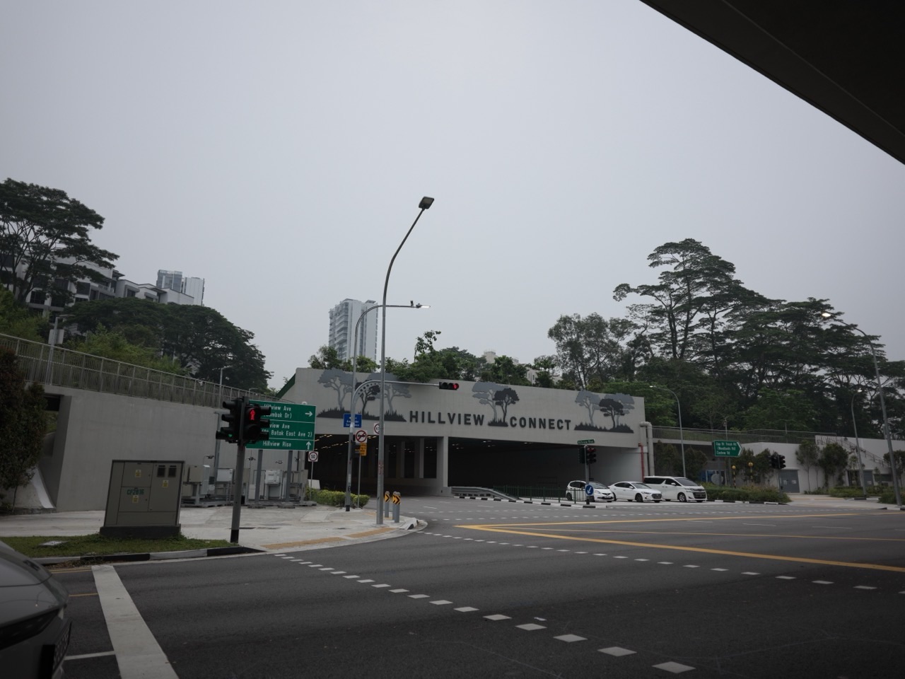
Updated 29 October 2026. This independent eduKateSG guide reports the currently published NParks closure and expected completion target, not a guarantee that the trail is open. Featured photo illustrates Rail Corridor in the Hillview area, not the closed Henderson Road–Spooner Road worksite. Follow the actual NParks safety signs and newest closure notices.
What NParks confirms for 2027
- NParks’ closure FAQ, last updated 28 September 2026, identifies the Phase 2 closure from Henderson Road to Spooner Road, including affected access points.
- Phase 2 is expected to complete by 31 July 2027; this is a target, not an independently guaranteed date for every access to reopen.
- Phase 1 from Jalan Kilang Barat to Henderson Road reopened on 2 March 2026, ahead of the originally stated 31 July 2026 target.
- NParks says the south-section works replace the deteriorated trail’s previous granite base with a stronger concrete foundation for better long-term durability.
- Spooner Road and the affected stretch remain closed in part to permit the safe entry and exit of heavy construction vehicles.
- NParks directs users to signed alternative routes including a diversion around Jalan Bukit Merah during the closure.
- Walking, jogging, cycling and organised activities are not allowed within the closed section; approved activities in other areas follow current NParks rules.
- The wider Rail Corridor is planned as an approximately 24-kilometre ecological and recreational spine through Singapore, with different trails, heritage sites and publicly accessible sections.
Important limits and safety warnings
- 31 July 2027 is an expected completion target, not a confirmed reopening ceremony, guaranteed entry day or assurance that all nearby worksite fencing disappears at once.
- Do not confuse Phase 1’s March 2026 reopening with the still-closed Henderson–Spooner section.
- Do not walk or cycle through a fenced construction section just because a mapping app depicts a continuous green line.
- An alternative route along public roads and paths may be less scenic and subject to ordinary traffic safety rules; it is not automatically a dedicated segregated cycling path.
- Rail Corridor refers to a former railway corridor repurposed for nature and recreation, not a future passenger MRT or intercity train service opening in 2027.
- Featured imagery may show an open Rail Corridor segment elsewhere in Singapore, not the currently closed Henderson–Spooner worksite; use official NParks maps to locate the works.
Jump to the chapter relevant to your visit
- 1. The 2027 milestone is a repair target
- 2. Phase 1 reopened on 2 March 2026
- 3. Phase 2 covers Henderson Road to Spooner Road
- 4. Why the surface needed rebuilding
- 5. Why heavy construction vehicles need a separate access route
- 6. What the Jalan Bukit Merah alternative means
- 7. Cyclists must plan more carefully than walkers
- 8. Joggers and families have different needs
- 9. The Rail Corridor is an ecological and heritage space
- 10. Why open stretches can still offer a good walk
- 11. Trail lighting and after-dark safety
- 12. Accessibility should be checked against the actual open route
- 13. Guided groups and school events need their own checks
- 14. Using the Rail Corridor to teach environmental literacy
- 15. How to report a problem while the trail is closed
- 16. What to verify near the expected July 2027 completion
A trail-reopening target can be useful for planning, but only the responsible authority can confirm when barriers are removed and public access resumes. The household examples below are hypothetical and intended to help visitors avoid confusing old maps with operating trails.
1. The 2027 milestone is a repair target
The most important official date is 31 July 2027, which NParks gives as the expected completion of Phase 2 improvement works between Henderson Road and Spooner Road. It does not describe a new railway passenger service or a whole new park being built from scratch. The existing recreational trail has experienced deterioration, and the repair work is intended to make the surface more durable and safe for future use. The current public notice should be checked again when planning a trip because construction schedules and opening procedures may change as site conditions evolve.
Illustrative walker or cyclist situation
A walking group books a hike for 31 July and assumes the closed stretch is guaranteed to reopen that morning.
What residents should do
Treat the date as a target. Confirm NParks has actually lifted the closure before including the stretch in a public walk.
2. Phase 1 reopened on 2 March 2026
NParks divided the improvement project into phases. The first affected the stretch from Jalan Kilang Barat to Henderson Road. While an older notice indicated a July 2026 completion target, NParks’ current FAQ confirms it reopened early on 2 March 2026. This is important because maps and social posts published during the original closures might still depict the whole south stretch as closed. The confirmed reopening of one section does not cancel the restrictions on the next section toward Spooner Road.
Illustrative walker or cyclist situation
A resident reads a 2025 closure warning and stays away from all of Rail Corridor South, unaware that the section before Henderson Road has reopened.
What residents should do
Check the current NParks trail-access map. Use the reopened portion where permitted while observing the Phase 2 boundary.
3. Phase 2 covers Henderson Road to Spooner Road
Phase 2 is described by NParks as the section from Henderson Road through the area around Block 138 Jalan Bukit Merah toward Spooner Road, including several access points. The closure is in effect during trail works and heavy-construction access. A narrow reading of an old heading or map can accidentally omit the section needed by construction vehicles near Spooner Road. The September 2026 FAQ makes clear that the entire affected Phase 2 area remains closed while work proceeds, even if part of the visible path appears undisturbed.
Illustrative walker or cyclist situation
A cyclist sees an apparently clear part of the route beyond a fence and assumes only the muddy patch immediately next to it is off-limits.
What residents should do
The restriction covers the signed closed stretch, not only visibly damaged ground. Follow the posted boundary and take the alternative.
4. Why the surface needed rebuilding
NParks explains that parts of the Rail Corridor South trail had deteriorated due to use and local ground conditions. The repair is not simply a cosmetic change in surface colour. Workers are removing the existing trail surface and foundation, stabilising the ground beneath and rebuilding with a more durable concrete base in place of the prior granite foundation. The aim is to improve safety and reduce recurring maintenance requirements. The final visible surface and exact accessibility characteristics should be judged from the completed trail and NParks instructions, not a speculative illustration.
Illustrative walker or cyclist situation
A regular runner notices that the works have taken many months and wonders why workers cannot simply fill a few holes in a weekend.
What residents should do
The project addresses the foundation as well as the visible trail. That explains the longer period and the need to restrict access.
5. Why heavy construction vehicles need a separate access route
The Spooner Road part of the affected stretch serves as an entry and exit point for heavy construction vehicles and equipment. Keeping walkers and cyclists out of the worksite protects them from moving vehicles, temporary surfaces and construction operations. A person cannot determine safety merely by looking at whether a machine is active at the moment they arrive; vehicle movements may be intermittent and construction barriers can mark hazards not visible from outside. NParks therefore keeps the relevant access sections closed as part of the overall project.
Illustrative walker or cyclist situation
A visitor notices that no trucks are moving at a particular moment and climbs past a barrier to take a shortcut.
What residents should do
Do not enter the closed area. Respect construction traffic and use the signed public diversion even when the worksite looks quiet.
6. What the Jalan Bukit Merah alternative means
NParks directs people who need to continue their journey through the south area to an alternative route around Jalan Bukit Merah, shown on the official closure map. That diversion uses surrounding public walking and road access rather than the closed green trail itself. The agency acknowledges that the alternative can be less convenient and less attractive than the Rail Corridor, but it is the safer method during works. Exact crossing points, traffic signals and access restrictions should be checked on the live map and onsite signs.
Illustrative walker or cyclist situation
A family pushing a stroller wants to complete a longer walk through the south, but the parent follows an old map that sends them straight into the fenced trail.
What residents should do
Consult the NParks diversion map before departing, and use real crossings and permitted pathways. Avoid following a GPS line through a closed gate.
7. Cyclists must plan more carefully than walkers
The Rail Corridor is used by cyclists as well as walkers, but the closure prevents either group from riding or passing through the affected Phase 2 stretch. A detour on public streets or shared paths may involve different rules and traffic conditions from the recreational trail. Not every sidewalk is a dedicated cycling corridor, and paths can be crowded with pedestrians, especially near residential buildings or transport nodes. Cyclists should select a legal route appropriate to their confidence and equipment rather than assume the diversion is a high-speed cycling link.
Illustrative walker or cyclist situation
A recreational rider hopes to make a continuous north-to-south ride but finds the signed closure just after Henderson Road.
What residents should do
Pause, read the official diversion, use permitted cycling paths and dismount where required. Postpone the full continuous route if the safe detour is unsuitable.
8. Joggers and families have different needs
A runner seeking a long continuous route may care most about distance and pace. A family with children may prioritise shade, safe crossings, convenient restrooms and an easy retreat if rain begins. The closed south section disrupts both plans, but the appropriate response can differ. There are still open Rail Corridor sections and alternative nature walks elsewhere in Singapore. An outing can remain enjoyable without insisting on passing through the exact restricted stretch. Families should not put children at risk by treating a worksite as a harmless shortcut.
Illustrative walker or cyclist situation
A teacher plans a Primary 4 nature observation trip and realises its route would run across the blocked Henderson-to-Spooner section.
What residents should do
Select a genuinely open part of the Rail Corridor or another authorised park and verify the school’s appropriate supervision and activity arrangements.
9. The Rail Corridor is an ecological and heritage space
The Rail Corridor follows a former railway alignment once used to move passengers and goods between Singapore and the Malay Peninsula. After the railway land was returned in 2011, Singapore developed a vision of a continuous green link connecting neighbourhoods and supporting biodiversity. NParks describes a roughly 24-kilometre corridor balancing ecological connectivity, recreation and railway heritage. This purpose helps explain why the route is maintained rather than simply replaced with an ordinary paved urban road. The aim is to keep a useful public space available over many years.
Illustrative walker or cyclist situation
A young student wonders why a path called a ‘rail corridor’ has no train and instead contains grass, trees and joggers.
What residents should do
The name preserves the place’s history. Use the walk to learn how land use can change while heritage and nature remain visible.
10. Why open stretches can still offer a good walk
The closure affects a defined part of Rail Corridor South rather than every metre of the national green spine. Other sections and access nodes remain available according to NParks’ current maps, including the previously reopened Jalan Kilang Barat–Henderson stretch. Trail conditions vary: some paths are paved, while other parts are more rustic with grass or gravel. Visitors should choose routes suitable for their footwear, mobility and weather conditions. The length of a published open stretch also matters when planning whether the full outing can be completed comfortably.
Illustrative walker or cyclist situation
A family cancels every Rail Corridor visit until August 2027 because it assumes the whole 24-kilometre route is shut.
What residents should do
Use NParks’ live visit information to identify an open section appropriate for the family, while respecting the separate south closure.
11. Trail lighting and after-dark safety
NParks notes that much of the Rail Corridor is not illuminated at night to protect nocturnal wildlife. Some access points have lighting during defined periods, but the route should not be treated as a brightly lit urban walkway throughout. That matters for families planning to return close to sunset, especially when a diversion adds distance or unfamiliar crossings. Singapore’s changing weather and sudden heavy rainfall can also affect trails and surfaces. A long walk should have a realistic finish time and a safe public transport exit point.
Illustrative walker or cyclist situation
A walker plans to explore the diversion at dusk and assumes every part of the nature route has continuous street lighting.
What residents should do
Check sunset and current trail guidance, leave enough daylight for the route and avoid venturing into closed or unlit sections for a shortcut.
12. Accessibility should be checked against the actual open route
A stronger reconstructed trail foundation may improve durability, but the July 2027 completion target does not by itself guarantee that every access point will have a step-free entrance or that all mobility aids can traverse every segment without assistance. The Rail Corridor has different surfaces, slopes and access arrangements across the island. Visitors using wheelchairs or pushing strollers should identify the actual access point and permitted route rather than assume a generally ‘upgraded’ corridor provides identical accessibility throughout.
Illustrative walker or cyclist situation
A family with a grandparent using a mobility aid hopes to visit the repaired section immediately on the announced completion date.
What residents should do
Wait for the current access map and finished trail details. If uncertain, contact NParks about the particular entrance and route before travelling.
13. Guided groups and school events need their own checks
NParks’ visitor guidance says a permit may be needed for activities involving 30 or more participants along the Rail Corridor, while filming and organised events can carry additional requirements. During the Phase 2 closure, the affected trail is not available for group events regardless of whether organisers have used it before. Small informal groups should also respect the signed restrictions and shared-path etiquette. A school or company should not assume that a trail will reopen precisely when its event is scheduled.
Illustrative walker or cyclist situation
A community group books a 40-person guided heritage walk through the closed section because its old permit map lists that route.
What residents should do
Verify the current closure, activity-permit conditions and operator instructions. Redesign the event around open areas rather than seeking an informal exception.
14. Using the Rail Corridor to teach environmental literacy
The Rail Corridor is useful as a living classroom about urban biodiversity, habitat connections, transport history and civic choices. A student can observe changes in vegetation, compare paved and rustic trail surfaces or examine how green spaces connect built-up estates. The 2027 repairs themselves demonstrate a different lesson: maintaining public infrastructure involves ground stability, construction safety, budget and trade-offs between present access and future reliability. These ideas can support age-appropriate Primary and Secondary Geography, Science and Mathematics learning without entering unsafe construction areas.
Illustrative walker or cyclist situation
A class wants pupils to photograph the actual rebuilding of the closed trail from inside the work zone.
What residents should do
Use official NParks construction descriptions and publicly accessible views instead. Never trade physical safety for an educational photograph.
15. How to report a problem while the trail is closed
NParks encourages visitors to check online notices and signs for changes, and lists its official feedback routes for questions or safety issues. A precise report should identify the location, time, the nature of the obstruction or hazard and whether it affects an open public path or a worksite boundary. An accurate report can help an agency investigate dangerous or unclear wayfinding. It is better than posting images that reveal personal information about workers or imply wrongdoing without evidence.
Illustrative walker or cyclist situation
A cyclist finds that a diversion sign has fallen and is confused about which public crossing leads back to a permitted trail.
What residents should do
Use NParks’ contact or OneService feedback channels with the location and relevant safety details. Do not enter the closed area to investigate.
16. What to verify near the expected July 2027 completion
As July 2027 approaches, the most important question is not whether an article printed ’31 July’ but whether NParks has formally reopened the section. Check the latest closure FAQ, news page and physical signs before booking a full route. A completion target can lead to phased removal of worksite barriers, inspections or later adjustments. The 2026 reopening of Phase 1 ahead of schedule shows that milestones can also move earlier. The correct plan is flexible enough to accommodate genuine new information rather than defend an old prediction.
Illustrative walker or cyclist situation
A runner schedules an all-day continuous route for early August without checking whether the Henderson–Spooner stretch has actually reopened.
What residents should do
Review the official NParks notice, plan a fallback using permitted paths and share the current map with the group before departure.
2027 trail-status comparison
| Stretch | Official status as of October 2026 | Resident action |
|---|---|---|
| Jalan Kilang Barat – Henderson Road | Reopened 2 March 2026 | Use designated open access and follow current notices |
| Henderson Road – Spooner Road | Closed for Phase 2 works; target 31 July 2027 completion | Do not enter; take signed diversion |
| Jalan Bukit Merah alternative | Signed temporary route on public paths and roads | Read official map and obey crossings |
| Other Rail Corridor sections | Varies by segment and current notices | Check each trail’s live access status |
Family and group safety checklist
- Read the latest NParks closure FAQ and current access map before departing
- Do not assume a 31 July completion target is a guaranteed morning reopening
- Distinguish Phase 1’s already reopened stretch from closed Phase 2
- Carry a suitable map of the signed Jalan Bukit Merah alternative route
- Do not cross worksite barriers or use heavy-vehicle entrances
- Choose legal cycling routes; dismount where required on public paths
- Allow sufficient daylight and take weather and water supplies seriously
- Check actual accessibility and entrance conditions for children and seniors
- Use permitted open trails for educational or community group activities
- Contact NParks or OneService about unclear barriers or genuine safety concerns
Frequently asked questions
When is Rail Corridor South Phase 2 expected to finish?
NParks targets 31 July 2027 for the Henderson Road to Spooner Road works.
Does that mean it will be open for walking on 31 July?
It is an expected completion date, not an unconditional guarantee of public access that morning.
Which section is closed?
The affected stretch from Henderson Road toward Spooner Road, including access points shown in NParks’ official closure map.
Is the stretch from Jalan Kilang Barat to Henderson Road also closed?
No. NParks says that Phase 1 section reopened on 2 March 2026.
Why does the repair take so long?
The project removes deteriorated trail material, stabilises the underlying ground and installs a more durable foundation.
What will replace the old granite foundation?
NParks describes a stronger concrete base for the rebuilt trail.
Can I cycle through the fenced area when no machinery is moving?
No. Walking, jogging and cycling are prohibited within the closed stretch.
Which alternative route should I consider?
NParks has signed a diversion around Jalan Bukit Merah; use the latest official map and onsite instructions.
Is Rail Corridor a new MRT line?
No. It is a green recreational and ecological corridor following a former railway alignment.
Is the entire Rail Corridor closed?
No. Other sections remain open; check NParks’ live access map for the exact stretch.
Can a school group use the closed stretch for an event?
No. The closure restricts group activities; large events elsewhere may also require permits.
Where can I get an update if the date changes?
NParks’ Rail Corridor closure notice, FAQ and onsite wayfinding are the official sources.
Official primary sources
The current NParks sources confirm the closure, trail rebuilding, interim alternatives and expected completion date. Newer notices and onsite signs take precedence over this independent overview.
- NParks: Rail Corridor South closure FAQ, updated 28 September 2026
- NParks: Closure notice and completion dates for both phases
- NParks: February 2026 Phase 2 closure notice
- NParks: Rail Corridor visitor guidance, access and permit requirements
- NParks: Rail Corridor ecology and heritage overview
- NParks: Latest notices and updates
Related eduKateSG reading
- Bukit Timah | Rail Corridor South Closure and July 2027 Target
- Singapore 2027 | HDB Homes, Estate Plans and Public Routes
- Singapore 2027 | North-South Corridor Roadworks
Conclusion: preserve safe access while the trail is rebuilt
Singapore’s Rail Corridor is a valuable green and heritage space, so maintaining the south trail matters for residents across the island. The Phase 2 works make the current restriction inconvenient, but they are designed to improve long-term reliability and safety. NParks has published a July 2027 expected completion date, not a licence to enter before the site reopens.
Use the open portions of the Rail Corridor, follow the marked diversion and check official status as the target approaches. A well-planned walk is one that is enjoyable, suitable for everyone taking part and safe from start to finish.