
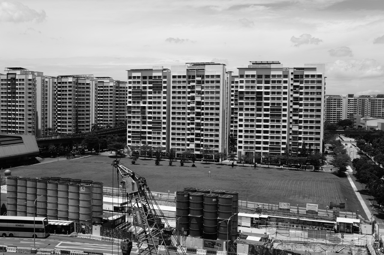
Before buying a Singapore home in 2027, open URA SPACE and inspect the land around the exact block or tower. Look up the site’s zoning and plot ratio, read the legend and check adjacent parcels that could affect the view, access or daily routine. URA’s statutory Master Plan describes permissible land use and development density. A map designation alone does not give a construction or opening date.
For a future MRT exit, park, road or development that matters to your purchase, check the authority responsible for that project and the latest dated documents. Keep the neighbourhood you can use today separate from improvements that may arrive later. Price the home so it still makes sense if a proposed feature changes or takes longer than expected.
- Use the exact address and inspect nearby parcels, not just the home’s lot.
- Read zoning and plot ratio with URA’s legend and Written Statement.
- Separate proposed amendments from approved changes and planning permissions.
- Check construction and opening dates with the responsible authority.
- Compare how the home works today and under different development scenarios.
Find the section you need
Start with a map check, a site beside your home, or a claim about a future road, station or park.
Find the property and the sites that could affect it · Distinguish a plan, an amendment and a project · Check the practical route even when a future connection is planned · Frequently asked questions on the URA Master Plan
Chapters 1–3 · Map reading, zoning and evidence
Chapters 4–7 · Views, routes, worked comparison and FAQs
Open the URA Master Plan page and use its link to URA SPACE. Search for the property’s exact address or postal code. Confirm which block, tower or parcel you are examining. An estate or development name can span several entrances and face several different sites. A household buying a particular unit needs to know which direction it faces and which land lies in that direction.
Mark the land that shapes the decision
Look at the home’s parcel, the site directly opposite the relevant window, the routes to transport and any land the family expects to walk through. Zoom out to understand the neighbourhood and back in to inspect a parcel boundary. Record your reason for checking each site. An empty lot behind a bedroom raises a different question from a parcel beside the school route.
Start a small register. Give each site a label, a location, the map layer and the date you checked it. Note any relevant official description. An image from a listing or marketing deck can be a prompt to look for a site. Use the current official map and documents to decide what can be verified about it. Where the identity or location of a parcel is uncertain, mark that uncertainty.
Compare three directions around the unit
One direction may be important for light or a view. Another may affect traffic and drop-off. A third may control whether you can reach the bus stop in heavy rain. Match the map to the actual home. From the public approach, observe the location of the block and its entrances. For a new project, use the official site plan and the exact stack.
An address can be useful even if there is development nearby. The question is which effect matters to you. More activity could bring amenities and more vehicles. A site with an uncertain construction schedule could change a walking route before it delivers a new facility. Mark both the benefit and the possible disruption if each is relevant.
Make the map check reproducible
Write the address as it appears in the official lookup and note the name of the layer you opened. Capture enough of the surrounding map to show the position of the parcel and your unit. Add the date and keep the legend with the record. This can prevent a later reviewer from assuming a coloured plot refers to the site next door or that a boundary shown at one zoom level is exact enough for a purchase decision.
Give each screenshot a plain question. “What is permitted opposite the living-room window?” is easier to follow than a folder of images called planning. A second question might ask whether the walking route to the station depends on a road or parcel that is still being changed. You can then check each issue with the appropriate map, control plan or agency instead of looking for a single page to answer everything.
URA describes the Master Plan as the statutory medium-term land use plan. It shows permissible use and density for development. Read the map with the Written Statement and the legend. A coloured parcel is information about land use. The actual result also depends on the controls and approvals that apply and the project that may be proposed.
Zoning answers a land-use question
Check what the colour and any code mean for that particular parcel. If it seems to allow a combination of uses, read the definition. Avoid drawing a precise conclusion from the shade on a small screen. Use the parcel information and consult URA’s materials. A site’s current physical appearance can be different from the uses permitted for it.
This matters for land that looks vacant or is used informally. A grassy area visible from the unit may have an existing use, a planned use or constraints that take time to establish. Verify what the map says and what other public documents are available. Then decide whether your interest in the home depends on the land remaining as it is.
Plot ratio is about floor area and site area
A gross plot ratio generally expresses the relationship between gross floor area and site area, subject to applicable definitions and controls. As a simplified arithmetic example, applying a ratio of 2.0 to a 4,000-square-metre site gives 8,000 square metres of gross floor area in that illustration. A real site can be subject to other constraints, requirements and calculations. Use the Written Statement and relevant planning information for the actual parcel.
A plot ratio alone cannot establish the number of storeys, exact building footprint, unit count or which window a building would face. The same amount of floor area can be arranged in different ways. If height or building form is important, look for applicable controls, permissions or project documents and seek specific clarification before relying on an assumption about the view.
Contents · Previous chapter · Next chapter
URA publishes the Master Plan alongside its Written Statement and information about amendments and Special and Detailed Control Plans. Check the date, status and source of the information. An amendment exhibited for public inspection is at a different stage from an approved amendment. A development proposal, planning decision and a project being delivered are different stages again.
Read the status before the drawing
Use URA’s amendment pages to distinguish proposed and approved changes. Record the date of the item you found and the exact parcel. If two sources give different information, see which stage each one describes. An earlier concept image and a newer official update can both be real documents while pointing to different facts. Keep the latest confirmed status separate from any timeline assumption.
Where a particular restriction or road arrangement matters, check the relevant control plans and official sources. A planning layer can add context to a site without telling you the full practical effect on the unit. Ask the relevant authority or a qualified adviser if your decision depends on interpreting a boundary or a control. Write down the exact question, such as whether the access route you plan to use depends on a future project.
Check the authority that would deliver the feature
For a transport project, look for an update from the relevant transport authority. For a park, road, school or other amenity, look for the responsible agency’s current information. Distinguish an intention, a tender, work under way and public opening. Find out what would have to happen before the route or service is actually usable.
Treat a timeline as a dated fact. Save the update and revisit it before committing if a delay would change the value of the property for you. This helps avoid relying on language in a listing that has been copied forward long after the underlying announcement.
Read an amendment from the date and status outward
Open the proposed and approved lists separately. Identify the notice date and the location, then open the relevant material where available. Check whether the change concerns a boundary, permitted use, plot ratio or another planning matter. A nearby amendment can be relevant to one side of a property and have little effect on another. Use the actual sites and the view or route you intend to evaluate.
Where a parcel also appears in a land sale or project announcement, record that information on a different line. A land sale step describes a different event from an amendment or a construction start. If a source gives a particular project stage, preserve that wording in your notes. This avoids promoting an announcement about one milestone into an assumed delivery date.
Know when to ask for a closer reading
A purchase can depend on a narrow boundary or a specific planning condition. If the official map is unclear at the scale you need, ask the responsible authority or obtain appropriate professional advice. Include the exact address, parcel and question. A precise inquiry is easier to handle than a general question about what will happen in the neighbourhood. Keep any response with the date and the documents it refers to.
| Claim | What to check | What remains to confirm |
|---|---|---|
| Land is zoned for a named use | Master Plan legend and Written Statement | Whether, how and when a development proceeds |
| A change has been proposed | URA’s dated proposed amendment | Whether the proposal is approved and incorporated |
| A project has planning permission | Available planning decision information | Delivery, design details and timetable as applicable |
| A facility will open at a certain time | Dated announcement from responsible authority | Progress, changes and actual public access |
Contents · Previous chapter · Next chapter
If a home’s appeal rests on a view, stand at the exact window or use the unit and stack plans when the home is uncompleted. Mark the land that falls in the line of sight. Check what the official information says about the site and what remains uncertain. If you cannot confirm building form or height, compare the home with and without the view you see today.
Give a view an amount you could explain
Imagine two otherwise similar units. The first has a currently open outlook over another parcel and commands a higher asking price. The second has a more enclosed outlook but better room dimensions. Decide which benefits you would still pay for if the adjacent site changed. An attractive view can contribute to a home’s value to you, and uncertainty can influence the premium you are prepared to offer.
Daylight, ventilation and noise can matter even if the view itself is less important. Check the unit at a useful time of day and note whether the windows face a road, loading area, school route or active site. Use observations from public areas for surrounding activity. An uncompleted home may require more careful reading of the site and the available documents.
Compare construction impact with the permanent result
A future improvement can involve months or years of temporary changes. A building site may affect how you walk, where traffic moves or how an area feels at different times. Look for dated notices where work is confirmed. Separate disruption during construction from the longer-term effects after completion. A household working from home may weigh the interim period more heavily than one that is away during the day.
Use the map to ask specific questions rather than to predict noise or traffic precisely. Identify the route, building edge and time of day that matter. Seek reliable project information for major concerns. If no official timetable is available, keep the uncertainty in the decision and compare another unit whose appeal depends less on the unknown.
Contents · Previous chapter · Next chapter
A route on a plan is worth understanding when it affects the home’s usefulness. Walk the route currently available from the building to your destination. Try the return leg, a rainy-day route and the point where you would wait for transport. Note which crossings or shelters exist today and which benefits depend on a connection that has yet to open.
Count the parts a resident will experience
A new entrance may sound convenient when described at neighbourhood level. Measure from the home’s actual lift or gate. Consider operating hours, whether a route requires steps, the connection after a road crossing and the needs of the people who use it. A small change in route length can matter more to someone carrying groceries or pushing a stroller than to a viewer walking without a load.
For an uncompleted home, combine the site plan with a visit to the publicly accessible area. Identify what you can verify now and what remains under construction or subject to a decision. Ask whether a showflat illustration reflects an already open connection, a confirmed work or an intended future route. Where a proposed access point would make a decisive difference, find the responsible source.
Measure the benefit once with today’s facilities
Calculate the current commute and errands using the available services. Then make a second version that includes only the future features you can describe with reliable sources and a date or stage. Do not combine all the best assumptions into one certain outcome. A household can use the second version to understand potential benefits while making sure the first version still works.
Give the comparison the same attention when a project may remove or alter an existing route. Ask what happens during construction and which alternatives are available. If the only practical path is exposed or lengthy, test it at the time of day you would need it. A walk can show the real cost of waiting for a planned improvement.
Test two routes if the neighbourhood is changing
A planned crossing or new road can make one route easier while changing another. Compare how residents reach shops, public transport and drop-off points from the actual block. Ask whether a temporary route has already been announced and whether anyone in the household would need step-free access. A shorter route on a general map can be less useful if its practical access is limited.
During a site visit, observe the current routes from public areas. Take notes on shelter, pavement condition and the places where traffic turns. Avoid entering work areas. If an official project notice is posted, record the issuer and date so you can look for the corresponding update later. The visit establishes how the neighbourhood works now, which is the baseline for judging a future improvement.
Contents · Previous chapter · Next chapter
A household compares two hypothetical units in the same part of Singapore. Unit A has an open view and costs $55,000 more. Unit B has a more enclosed outlook but a shorter existing walk to transit. The buyer hears that an adjacent plot near A might be developed and a new connection could shorten the trip from A in future. Neither claim is entered as a certainty.
Record each parcel and each piece of evidence
The family finds the plots in the official map, reads the zoning and checks whether URA lists a relevant amendment. It looks for a planning decision or other dated project information where available. It keeps the view and transport questions separate. A planning document about one site cannot establish when another route becomes usable.
The family then compares A and B in a scenario where the view changes and the new route is delayed. A still has a good layout, but the family no longer sees enough advantage to justify the full premium. If the future connection is confirmed later, it may alter the route comparison. The family uses the evidence available before making its current offer rather than treating the potential benefit as already delivered.
Explain what still supports the choice
A buyer who strongly values A’s layout may still choose it within a sensible price ceiling. Another buyer might place more weight on B’s current route. Both can record what they saw and which assumptions were left open. The comparison works even if a later update changes one fact because the family can revise that fact without replacing every other judgment.
Use this approach for a park, school, retail development or road as well. Start with the home and identify the adjacent land, the source and status of the project claim, and the effect if the proposed change takes longer. A short written record is easier to revisit than a general impression of future potential.
Turn an uncertain claim into a price and timing question
If a household would pay $30,000 more because a future amenity is expected, ask what part of the premium it would still pay if the amenity opens several years later or in a different form. The number does not predict market value. It shows how much the purchase depends on the claim. Compare the difference with a unit that already offers some of the same benefits.
Keep the property’s size, condition and financing in the comparison. A claim about the neighbourhood can occupy much of the sales conversation even when the homes also differ in usable space or required repairs. Write the verified advantages first, then the features that depend on future work. The stronger the current fit, the more room you have to judge a proposed improvement on the evidence available.
Contents · Previous chapter · Next chapter
Does the Master Plan say when something will be built?
It sets out permissible land use and density in the medium term. For the timeline of a specific project, check the agency or other official sources responsible for it. Record the date and status of the most relevant update.
Does a higher plot ratio tell me the height?
A plot ratio relates gross floor area to site area under applicable planning definitions. Height, footprint and other characteristics can depend on further controls and design. Check the documents for the site before making a decision about the outlook.
Is a proposed amendment already part of the approved plan?
URA distinguishes proposed amendments available for inspection from approved amendments. Use the relevant dated lists and verify the parcel. Check again before acting if the change is important to your purchase.
Should I offer more because a new amenity is planned nearby?
Try the home using today’s routes and facilities first. Then compare the possible benefit with its status, expected timing and the household’s need for it. Let verified features and affordability anchor the offer.
What should I save after a map check?
- Exact address, stack and the parcels you inspected.
- URA map layer, legend and date checked.
- Relevant amendment status and any site-specific document.
- Current walking and access routes.
- What changes in the comparison if a proposed feature is delayed.
Keep the record with your viewing notes and comparable prices. Recheck the entries that could change the offer before you sign or pay for an option.
Contents · Previous chapter · Sources and further reading