
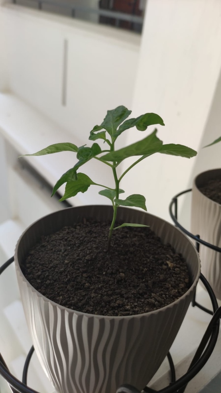
The gold standard of soil science is a clear explanation of soil in its place: describe its properties, investigate the relevant processes and connect conclusions to suitable evidence. This root guide brings together soil profiles, texture, structure, water, chemistry, soil health and practical land-use questions.
Follow an invented school garden investigation, compare observations and work through original calculations. Then choose a specialist route into gardening, agriculture, environmental science, landscape architecture or geotechnical engineering.
Find your route through soil science
Choose the question closest to your learning. All teaching chapters remain open below.
Full chapter index · Worked moisture calculation · Connected guides
Soil science chapter index
Understand the soil · Chapters 1–4
1. Soil science connects material, life and place
2. A soil profile adds the missing depth
3. Formation explains why place matters
4. Texture describes particle-size proportions
Connect its properties · Chapters 5–8
5. Structure describes how particles are arranged
6. Water, air and pores belong in the same account
7. Organic matter and organisms connect processes
8. pH is a chemical clue, not a full diagnosis
Read the evidence · Chapters 9–12
9. A sample represents a defined part of a place
10. Worked example: keep the sample identities visible
11. Moisture calculations need a stated denominator
12. Soil health uses several indicators
Follow the application · Chapters 13–15
13. Gardening and agriculture turn evidence into choices
14. Soil, landscape and ground engineering have different tasks
15. Protecting soil involves land and water together
Investigate and continue · Chapters 16–18
16. A fair comparison makes its limits visible
17. A practical learning portfolio
18. Frequently asked questions and next reading
CHAPTER 1 OF 18 · Understand the soil
1. Soil science connects material, life and place
Soil science studies soil as a changing natural body: its formation, properties, organisms, water, chemistry and relationship with land use. A useful explanation connects these parts instead of reducing soil to a bag of material for growing plants.
The USDA Natural Resources Conservation Service introduction to soil describes mineral and organic material, water and gases, together with soil’s development and functions. Soil supports living systems and participates in water movement and nutrient cycling.
This guide follows an invented school garden investigation. Two beds receive similar care, but water remains on one surface longer and the plants develop differently. Those observations begin the enquiry; they do not establish its cause.
The gold standard here is an approach to evidence: describe the place, ask a precise question, select an appropriate observation or test and keep the conclusion within its limits. The connected guides lead into gardening, agriculture, environmental learning, landscape architecture and geotechnical engineering.
A surface photograph shows only part of a soil. A profile describes the arrangement of horizons through its depth. Horizons can differ in colour, texture, structure, thickness and other properties.
The NRCS soil-profile resource explains how scientists use these features to describe and interpret soils. Horizon letters are a way of recording characteristics, not a promise that every site contains an identical stack of layers.
For the fictional garden, a surface that looks similar across both beds may hide different material below. One bed might contain imported fill or a restrictive layer. Those are possibilities to investigate, rather than facts inferred from the photograph.
Use an existing authorised profile image or supplied data for a classroom exercise. Mark the depth and describe what is actually visible. Do not enter excavations or cut into a slope to obtain a better view. Professional field investigations require appropriate access, competence and safety arrangements.
Soil develops through interactions involving parent material, climate, organisms, relief and time. The resulting properties reflect that history as well as later changes in land use and management.
This helps explain why a soil recommendation from one location may not transfer directly to another. A familiar name or colour does not establish that the same conditions apply. Local observations and suitable interpretation remain necessary.
In the fictional school garden, students first ask how the beds were made. Were both filled at the same time? Did the material come from the same source? Has one area been used as a temporary path? A record of past work can suggest useful questions for the present investigation.
Separate historical information from assumptions. “The caretaker reports that this bed received new material last year” identifies a source. “This must be natural soil because plants are growing” reaches beyond the evidence. Soil science becomes more informative when the account of place is as careful as the account of a sample.
In the mineral fine-earth fraction, texture concerns the relative proportions of sand, silt and clay. These are particle-size categories. Texture is distinct from the arrangement of particles into structural units.
The NRCS soil-texture resource uses percentages of sand, silt and clay to determine a textural class. A classification needs an appropriate method and a stated system.
For an invented arithmetic example, a sample’s fine-earth mineral fraction is reported as 50% sand, 30% silt and 20% clay. The percentages total 100%. That total does not imply that the whole soil contains no water, organic matter or larger fragments; it refers to the stated fraction.
Before comparing two reports, check whether they describe the same fraction and method. A texture label can guide further questions about behaviour, but it does not independently establish fertility, contamination, drainage performance or suitability for a building foundation. The task determines what additional evidence is needed.
CHAPTER 5 OF 18 · Connect its properties
5. Structure describes how particles are arranged
Soil particles can form aggregates and other structural arrangements. The spaces within and between them matter to water movement, air and roots. Two soils with similar texture can behave differently when their structure differs.
The NRCS soil-structure note connects aggregation and structural breakdown with changes in soil function. Management and disturbance can affect these arrangements.
In the fictional garden, the students observe that one surface has been crossed repeatedly. That makes compaction a reasonable question. It does not establish the depth, extent or significance of a compacted zone.
Write the observation and hypothesis separately: “A path crosses this bed” is an observation about use; “traffic may have affected structure” is a proposed explanation. A suitable investigation would then seek evidence relevant to that explanation. Keeping the two statements separate makes it easier to revise the hypothesis if another factor better accounts for the result.
CHAPTER 6 OF 18 · Connect its properties
6. Water, air and pores belong in the same account
Soil contains pore spaces that can hold air or water. The amount and arrangement of pore space influence how the soil behaves, while conditions change after rainfall, irrigation and drying.
Distinguish water entering the surface from water moving through the profile or leaving a container. Infiltration, drainage and water storage describe related questions rather than one interchangeable property. The boundary and observation interval matter.
For the fictional beds, water remaining on one surface after watering could have several explanations. The application rate, surface condition, underlying layers, moisture already present and container or bed arrangement may all be relevant.
A careful record describes what was applied, what was observed and when. “Water was still visible after ten minutes” is a useful observation under the stated conditions. “The soil cannot drain” is a much broader claim. Begin with the narrower statement and design the next enquiry around the uncertainty it leaves open.
CHAPTER 7 OF 18 · Connect its properties
7. Organic matter and organisms connect processes
Soil organic matter and living organisms are related but different parts of the system. A dark-looking sample is not a complete measurement of either, and visible organisms represent only a small part of soil life.
Organic matter is one indicator considered in soil assessment because it relates to several functions. Its interpretation still needs the soil, climate, management and measurement method. A single percentage should not become a universal target for every site.
In the fictional investigation, students find decomposing leaves on one bed. They record the surface cover, rather than claiming that the bed must contain more organic carbon throughout its profile. Surface material and a laboratory measurement answer different questions.
The useful learning move is to connect scales. What can be seen at the surface? What does a sample represent? Which process is being proposed? The environmental science and agricultural science guides below develop these relationships without treating one attractive observation as a complete assessment.
CHAPTER 8 OF 18 · Connect its properties
8. pH is a chemical clue, not a full diagnosis
Soil pH describes acidity or alkalinity under the measurement conditions. It influences chemical behaviour, including the availability of some nutrients. It does not measure the total amount of every nutrient or establish that plants have everything they need.
The NRCS introduction to soil pH explains why this property matters. Interpret an actual result using the laboratory method, soil context and intended use.
For the fictional garden, a pH result might help refine the investigation. It would not justify an automatic treatment recommendation. The students should ask which question the test was selected to answer and what other causes of plant differences remain possible.
Avoid treating a colour comparison from a classroom activity as equivalent to every professional laboratory result. Record the method and precision honestly. Decisions about amendments or fertiliser require appropriate local advice and evidence; this root guide introduces the reasoning rather than prescribing a treatment.
A soil result begins with a sampling decision. Location, depth, timing, handling and the question being asked influence what a sample can represent. Mixing material can be useful for some purposes and can obscure differences for others.
The NRCS soil-health testing resource connects sampling, laboratory selection and interpretation. The appropriate plan depends on the intended enquiry.
For the fictional beds, a sample taken only from the easiest corner should not silently stand for the whole garden. Record the chosen location and depth. If the purpose is to compare two areas, keep their identities clear and follow an appropriate plan agreed with the teacher or specialist.
A laboratory cannot restore a missing location record by producing a precise number. Evidence from collection to reporting forms one chain. For a school project, use known, authorised material and an approved activity; unknown or potentially contaminated land requires competent assessment rather than casual collection.
CHAPTER 10 OF 18 · Read the evidence
10. Worked example: keep the sample identities visible
All examples and figures in this guide are invented for learning. They are not reports of a real garden, laboratory test or land assessment.
Suppose the class receives three hypothetical measurements of water depth entering the soil during a fixed interval under the same classroom procedure. Bed A has values of 8, 10 and 12 millimetres. Bed B has 9, 10 and 11 millimetres. Both means are 10 millimetres, but the sets have different spreads.
For Bed A, the range is 12 − 8 = 4 millimetres. For Bed B, it is 11 − 9 = 2 millimetres. Those calculations describe the supplied values. They do not establish that one bed is healthier or that the difference is statistically significant.
Keep the labels, unit and method with the numbers. Without them, even a correct mean cannot explain what was measured. Ask whether three observations adequately represent the question before making a broader claim. The example illustrates how an average can hide variation, which is especially relevant when the material itself varies across a site.
CHAPTER 11 OF 18 · Read the evidence
11. Moisture calculations need a stated denominator
A percentage can be numerically correct and still confuse readers if its basis is unclear. Soil water content can be expressed in different ways, so state the quantities being compared.
Use an invented data set: a sample has wet mass 125 grams and dry soil mass 100 grams under the stated measurement method, excluding the container. The difference is 25 grams. For this simplified calculation, assume that difference represents water removed.
On a dry-mass basis, gravimetric water content is 25 ÷ 100 × 100 = 25%. If water mass is instead expressed as a fraction of the initial wet mass, the result is 25 ÷ 125 × 100 = 20%. The figures differ because the denominators differ.
This is a paper exercise, not a drying procedure. Actual methods and equipment need suitable controls. Neither percentage directly gives the volume of water in the whole soil or the amount available to plants. Report the basis before interpreting the result.
| Quantity or basis | Invented value or calculation |
|---|---|
| Wet sample mass, excluding container | 125 g |
| Dry soil mass, excluding container | 100 g |
| Mass difference assumed to be water | 25 g |
| Water mass ÷ dry soil mass × 100 | 25% |
| Water mass ÷ initial wet mass × 100 | 20% |
Soil health concerns how soil performs its functions and maintains that capacity. It is assessed through indicators rather than a single universal number.
The NRCS soil-health assessment resource brings together physical, chemical and biological evidence. It cautions against treating one outcome, such as yield, as a complete assessment.
For the fictional garden, combine the questions already developed: profile, structure, water behaviour, sampling, chemistry and the management history. Decide which are relevant to the stated problem and which evidence is still missing.
A checklist can organise the enquiry, but ticking boxes does not make the conclusion reliable. The interpretation depends on methods and context. If a measure improves while another function worsens, describe the tradeoff rather than compressing everything into a claim that the soil is now “better”. The learning aim is an explanation that another reader can follow and question.
CHAPTER 13 OF 18 · Follow the application
13. Gardening and agriculture turn evidence into choices
A gardener wants plants suited to the place and a workable care routine. Agriculture adds production, equipment, labour, environmental and commercial considerations. Soil evidence contributes to those decisions alongside weather, crop choice and management.
Return to the fictional beds. A decision to change watering should follow the evidence relevant to water supply and soil conditions. If the actual difference is shading or plant variety, a soil treatment may fail to address the cause.
The gardening, agricultural engineering and agricultural companies guides below develop different parts of this relationship. Teaching agricultural science offers a learning route through crops, soil and field evidence.
Keep the purpose visible when reading an application. A recommendation made for one crop, soil and climate should not become a general instruction for every pot or field. For actual management, seek guidance appropriate to the local conditions. The root lesson is to connect the decision to the evidence, then observe whether the intended result follows.
CHAPTER 14 OF 18 · Follow the application
14. Soil, landscape and ground engineering have different tasks
Soil science, landscape architecture and geotechnical engineering can examine the same place while asking different questions. Plant growth, water movement, public use and structural support require different evidence and professional judgement.
In the fictional garden, suitable growing conditions do not establish that the underlying ground can support a new structure. Conversely, material selected for an engineering purpose may not meet the needs of a planting area.
The geotechnical engineering guide provides the specialist route for ground conditions and engineering decisions. Teaching landscape architecture connects ecology with access and designed outdoor spaces. Earth science adds the wider geological setting.
Draw the boundary around each claim. A garden sample is not a foundation investigation, and a site photograph is not a contamination assessment. Identifying those distinctions makes collaboration more useful: people can share relevant information while recognising which questions belong to another investigation or professional role.
CHAPTER 15 OF 18 · Follow the application
15. Protecting soil involves land and water together
Soil can be moved, disturbed or covered, and changes at one point can affect another. Think about the slope, surface cover, water pathways and surrounding activity when examining a land-management claim.
In an invented extension of the school project, sediment appears near a drain after heavy rain. Students document the location from an authorised safe position and review the site history. They do not assume that the nearest bare patch is the only source.
A useful enquiry would ask how water moved, which areas were disturbed and what observations could distinguish possible sources. A proposed remedy needs the appropriate landowner or professional process. The classroom task can use photographs and supplied records rather than entering drains or unstable ground.
The environmental science and landscape learning guides connect these questions to wider systems. The central habit is to follow the pathway of the proposed effect, while keeping an observation of sediment separate from an unverified explanation of where it came from.
CHAPTER 16 OF 18 · Investigate and continue
16. A fair comparison makes its limits visible
The fictional beds differ in water behaviour and plant development. To investigate one explanation, the class needs a comparison that controls relevant conditions or records their differences.
Suppose Bed A contains one plant variety and Bed B another. A comparison of growth cannot isolate a soil effect without addressing that difference. Different light, starting plant size or care history can complicate the claim further.
Use a planning table: question, observation, possible explanation, next evidence and limit. Update it as the enquiry develops. If the evidence contradicts the first idea, revising the explanation is progress.
Avoid declaring a treatment successful after one favourable observation. Ask whether the conditions changed and whether the result persists. The point is not to demand an impossible experiment before learning anything; it is to make the strength of the conclusion proportionate to the investigation. A modest, well-supported finding can be more useful than an ambitious claim with hidden assumptions.
| Part of the enquiry | What to record |
|---|---|
| Question | Which difference are we investigating? |
| Observation | What was seen or measured, where and when? |
| Hypothesis | What might explain it? |
| Comparison | Which conditions match, and which differ? |
| Limit | What cannot be concluded from this evidence? |
Build a small portfolio from authorised photographs, supplied soil descriptions and invented or teacher-approved data. Begin with a question that can be answered at that level.
Describe the site or scenario, identify the samples and record the methods represented. Include a profile description, a comparison of observations and one calculation with units. Separate what the evidence shows from what it leaves uncertain.
For an observation activity, follow the school’s supervision, hygiene and access requirements. Do not collect from protected sites, unknown waste areas or unsafe ground. There is no need to taste soil, enter excavations or grow unknown microorganisms to learn careful reasoning.
Finish with a short decision note: what would you investigate next, and why? Link the choice to a relevant guide below. A strong portfolio shows how an observation led to a question, how the evidence was organised and how the conclusion changed when a limitation became visible.
CHAPTER 18 OF 18 · Investigate and continue
18. Frequently asked questions and next reading
Is soil just broken rock? Mineral material is part of many soils, but soil also involves organic matter, water, air, organisms and a history of development.
Does dark soil always mean healthy soil? Colour is an observation, not a complete assessment. Interpret it alongside appropriate evidence and the intended function.
Are texture and structure the same? Texture concerns particle-size proportions in the stated fraction. Structure concerns the arrangement of particles and aggregates.
Can one test tell me what to add? A test answers a defined question under a method. A management decision also needs the intended use, local conditions and suitable interpretation.
Which guide comes next? Choose gardening for everyday plant care, agriculture for production, environmental or earth science for wider systems, landscape architecture for designed spaces or geotechnical engineering for ground-related engineering decisions.
Start with the question and the place. Then select evidence that can genuinely help answer it. The connected guides below keep those subject paths together.
Connected soil science guides
For drying shrinkage, clod and layer boundaries, and consistent water storage when volume changes, continue with The Gold Standard of Soil Science | Shrink–Swell and the Reference Volume in Soil Measurements.
When drying changes a specimen’s bulk volume, read shrink–swell and the moving volume behind a moisture reading. The worked clod, container and layer examples keep current density, pore space and the storage boundary consistent.
For compatible fine-earth density definitions, coarse fragments and layer carbon-stock calculations, continue with The Gold Standard of Soil Science | Coarse Fragments and the Denominator in a Carbon Stock.
To examine sample weights, hidden spatial variation and the limits of a mixed result, continue with The Gold Standard of Soil Science | Composite Samples, Unequal Contributions and Hidden Spatial Variation.
For the conversion from sample masses to layered root-zone water storage, continue with The Gold Standard of Soil Science | From Gravimetric Moisture to Water Depth in the Root Zone.
For a focused worked extension, compare infiltration records through area, water depth, elapsed time, starting moisture and the limits of a surface test. The Gold Standard of Soil Science | Comparing Infiltration Without Confusing Rate, Storage and Drainage.
Choose the application that matches your question. These guides describe different disciplines and tasks; a classroom observation does not replace a professional site investigation.
Plants and agricultural production
Agricultural Companies | Resilient Production, Safe Food and Land Stewardship
Agricultural Engineering | Useful Machinery, Healthy Soil and Reliable Harvests
Gardening | Right Plants, Consistent Care and Living Soil
Environmental and earth science learning
Teaching Agricultural Science | Soil, Crops and Field Evidence
Teaching Earth Science | Read Rocks, Time and Earth Systems
Teaching Environmental Science | Measure Systems and Weigh Trade-offs
Landscapes and engineering
Geotechnical Engineering | Ground Uncertainty Managed Before It Moves
Teaching Landscape Architecture | Ecology, Access and Designed Outdoor Spaces
Learning that transfers into life
Continue with The Gold Standard of Education for the wider connection between knowledge and everyday judgement. The Secondary 1 Mathematics guide for Clementi offers another subject example of making reasoning visible. The percentage examples above use the same habit: name the quantities, state the denominator and check what the answer means.