
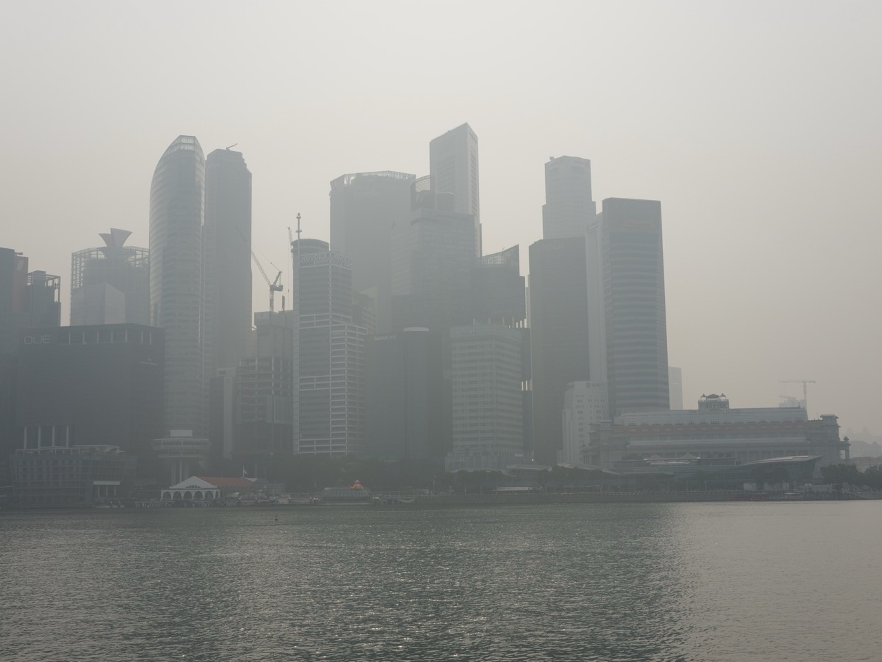
Quick answer: When an urban environmental sensor remains healthy but site changes invalidate a wider neighbourhood estimate, preserve valid point measurements and downgrade only the unsupported spatial claim. Version the affected locations and time periods, revise API quality statuses, update public maps and notify important consumers. A change in coverage confidence is not the same as a change in the physical environment.
Quick navigation
- The sensor still works, but the neighbourhood claim no longer does
- Quick answer: downgrade the claim, not the raw observation
- A spatial claim has boundaries that should be written down
- The four statuses readers can actually understand
- Why a change can be spatial without being temporal
- What site changes legitimately trigger a downgrade?
- A worked fictional nine-cell coverage downgrade
- Population-weighted claims need their own evidence
- Keep source data, derived products and public claims distinguishable
- Build a downgrade decision record before changing a legend
- Machine-readable warnings should be stable and specific
- The consumer notice should say what changed and why it matters
- Past downloaded maps do not update themselves
- How to handle stale caches and delayed consumers
- Do not pretend regional official indicators are street measurements
- Make warnings accessible rather than colour-only
- A downgrade can become an upgrade after new evidence
- What the data team should test before releasing the correction
- Accountability: who owns the claim after publication?
- Final worked decision: what should the city publish tomorrow?
- Frequently asked questions
- Official references and connected Gold Standard reading
The sensor still works, but the neighbourhood claim no longer does
A public environmental map shows an estimated outdoor temperature for every block in a district. The underlying station is calibrated, online and reporting fresh data. Then a major construction project changes shade and airflow near the station. Independent measurements suggest that the map’s previous neighbourhood-wide interpretation no longer holds. Nothing is wrong with the station’s actual observation; the problem is the wider claim built from it.
A hurried team might keep publishing the same coloured cells until the next annual review, or delete the station’s record as though it were faulty. Both responses lose information. The gold standard of urban environmental API spatial coverage claim downgrade is to narrow or suspend unsupported spatial interpretations while preserving valid source observations, versioning the evidence, and notifying downstream users who may rely on the former claim.
This is an operational communications problem that follows scientific reassessment. The preceding Representativeness Evidence Expiry and Renewal Triggers guide describes when old validation should be reconsidered. This guide asks what an API publisher must do after the evidence no longer justifies the map’s published scope.
Quick answer: downgrade the claim, not the raw observation
Identify the environmental quantity, time window and geography affected. Preserve the actual station readings with their legitimate quality flags. Determine whether a validated model estimate, provisional estimate or unsupported area is the correct present description. Version the spatial-support assessment and effective date, then update APIs, charts, metadata, documentation and consumer notices according to the product’s controlled release processes.
Distinguish the measurement from its interpretation. A station can still provide useful temperature readings at its own location even when it no longer justifies values assigned to the nearest five streets. Removing all valid raw data would harm scientific continuity. Continuing to publish a block-level estimate without adequate support would mislead readers.
Explain the downgrade in plain language: “The station remains operational; recent site changes mean the published neighbourhood estimate is provisional pending further validation.” Avoid implying that the city experienced a sudden physical temperature shift if only the evidence quality changed.
A spatial claim has boundaries that should be written down
Every derived map makes an inference about space. It might claim that an observation represents the station site, that a set of stations represents a region, or that a model estimates conditions in a specific grid cell. Those claims require different evidence. An API field named “temperature” cannot tell consumers whether they are reading a point observation or a neighbourhood model.
A claim record should describe the variable, unit, observational source, spatial support, temporal aggregation, model where relevant, validation date, applicable environmental conditions and uncertainty. Not every classroom or city product needs a complex geographic ontology, but it needs enough metadata to keep the meaning stable.
A user may be entitled to use station temperature as a reference while being misled by the same number displayed as an exact street reading. Downgrading one claim must not automatically imply the station itself is defective. The decision concerns how far the evidence can travel beyond the measurement location.
The four statuses readers can actually understand
A practical status vocabulary distinguishes direct observation, validated spatial estimate, provisional estimate and unsupported inference. Direct observation describes measurements at their instrument and approved temporal scope. Validated estimate describes a defined model use supported by relevant independent evidence. Provisional estimate is available with explicit limitations where acceptable for the intended purpose. Unsupported inference means the data do not justify the claimed resolution or condition.
These categories are conceptual, not an official universal WMO or NEA API enum. A product team may need richer machine-readable states, including unavailable, stale, instrument invalid and intentionally withheld. Do not force all deficiencies into one “low quality” label because the cause of uncertainty determines what a reader may do.
Write human explanations beside status codes. A green station icon should not automatically produce a green neighbourhood card. Users need to understand why the direct measurement may remain valid while its regional interpretation has changed.
Why a change can be spatial without being temporal
A network may deliver every scheduled sample, pass freshness checks and show stable instrument diagnostics. That proves data are being delivered under technical rules. It does not prove every grid cell remains representative. A new building or altered tree canopy can change local exposure relationships without causing missing records.
Conversely, an ideal station location may suffer outages, making its time-series incomplete while the site remains scientifically appropriate. Treat availability, calibration, temporal completeness and spatial representativeness as separate metadata dimensions. Their product is not automatically a meaningful single score.
The distinction matters when explaining a downgrade. “The data were missing” is wrong when observations were complete but no longer support broad extrapolation. Accurate terminology helps scientists correct assumptions and helps the public understand whether the issue affects measurements, modelling or coverage.
What site changes legitimately trigger a downgrade?
Changes to nearby buildings, construction hoardings, canopy cover, land use, heat sources, road activity or station placement may affect environmental measurements, depending on the quantity. A new source can make a station locally important but less suitable as a neighbourhood proxy. A shift in prevailing weather conditions may expose limits of a model validated under another regime.
A trigger is not proof that the old claim is invalid. It starts a review. Use metadata, field observations, validation evidence and the relevant instrument guidance to decide whether the claim should be retained, narrowed, marked provisional or withdrawn. Do not downgrade automatically on a calendar date simply because a renewal form was not completed, without explaining the actual evidentiary status.
The WMO siting-classification guidance illustrates why surrounding conditions and station history affect the use of observations. It does not assign one universal coverage radius for every urban sensor or environmental quantity.
A worked fictional nine-cell coverage downgrade
Consider a fictional district divided into nine equal planning cells. The original validation supports five cells for a specified ambient temperature estimate in one weather regime. The map publishes five cells as validated, two as provisional and two as unsupported. After a major site change, independent comparison supports only three of the former five validated cells. Their status is downgraded to provisional pending new evidence.
The directly measured station value remains available. The number of validated cells changes from five to three, and the coverage fraction goes from 5/9, approximately 55.6%, to 3/9, approximately 33.3%. The difference is 22.2 percentage points, not a claim that the district became 22.2% hotter or that sensor accuracy fell by that amount.
Because this is an invented equal-cell teaching example, the percentages do not describe Singapore or any actual sensor network. Real geographical areas, population exposure and model validation vary. The example shows how to communicate a change in evidentiary support without mislabelling it as a change in the environment itself.
Population-weighted claims need their own evidence
A planner may care that the affected cells include places where many residents live or walk. But a raw share of grid cells is not the share of people exposed to a hazardous condition. Population density, daily travel, time of exposure and the intended decision change the interpretation. A downgrade affecting one densely used street can matter more than one affecting a large unoccupied area.
If publishing population-relevant coverage, state its numerator and denominator and the source of population or activity data. Do not infer a person’s exposure solely from their residential postal code. Some locations need monitoring because they provide background reference conditions even if few people live there.
A responsible notice separates the spatial-data limitation from the policy consequences. A transport agency, school or public-health planner can then decide what other evidence to use under its own applicable procedures. The API should not claim to make those decisions merely because it supplies a map.
Keep source data, derived products and public claims distinguishable
An environmental-data pipeline may contain the raw station reading, a quality-controlled time series, an interpolation model, a raster grid, an API endpoint and several consumer dashboards. A downgrade to the raster’s validation status does not necessarily require changing earlier accepted station measurements.
Record a product lineage linking each derived value to source stations, transformation version, model inputs, spatial-support assessment and publication time. Where corrections are necessary, make their effect on downstream products traceable. An immutable source identifier should not be reused for a modelled cell that is conceptually different.
The Derived Product Lineage guide develops this evidence chain. This article applies it to a specific failure: a public spatial claim that must be made less confident while preserving what remains valid.
Build a downgrade decision record before changing a legend
A defensible decision record contains the affected product and version, environmental quantity, geographic scope, observation window, trigger, relevant validation evidence, prior claim, revised claim, uncertainty and owner. It also explains why the remaining station data are still valid or why their separate quality status changed.
Record the effective time and the relationship to historical releases. A map might need an annotation stating that values calculated with an earlier model should not be treated as fully validated under changed site conditions. The appropriate response to past periods depends on when the environment changed and what evidence supports reanalysis.
Avoid editing only the front-end colour. A downgrade is a change in scientific interpretation and should propagate consistently through documentation, machine-readable output, accessible text and consumer records. Otherwise the mobile map can say “provisional” while an API client continues receiving “validated”.
Machine-readable warnings should be stable and specific
An API consumer needs more than a silent null or an undocumented status value. Provide a stable quality classification, effective period, affected product or geographic identifiers and a description appropriate to the contract. Where the data remain usable under limited scope, explain the limitation; where an estimate is unsupported, do not keep returning the old value under an apparently verified label.
Consider how consumers handle unknown statuses, stale caches, previous versions and pagination across a release. A schema change is not necessary for every downgrade if quality fields already exist, but consumers must understand those fields. Validate that old clients do not strip or reinterpret the warning.
Avoid mixing scientific quality with service availability. HTTP success means the endpoint responded; it cannot certify environmental inference. If a response provides provisional cells, both the machine-readable payload and the public explanation should make that provisional status visible.
The consumer notice should say what changed and why it matters
A useful notice identifies the affected product, places, time range, previous and new evidence status, what remains valid, and the action expected of downstream users. It should use everyday language before technical detail. “Spatial support for three named grid cells is under review after a site-context change” is more helpful than a generic “data maintenance advisory”.
State whether consumers should refresh caches, stop treating values as validated, rerun analyses, update charts or simply display the new status. The instruction must match the actual contract and evidence. Do not ask every consumer to delete historical observations when only a derived claim changed.
Provide an accessible reference page and a contact or issue channel under the publisher’s governance. Technical users may need a machine-readable change record; public readers need a concise explanation they can understand without knowing the internal data pipeline.
Past downloaded maps do not update themselves
A corrected API can serve accurate current metadata while old screenshots, spreadsheets and offline reports remain in circulation. A publisher cannot guarantee that every external copy can be recalled. It can identify major authorised consumers, provide a durable correction notice, update public download descriptions and publish a version comparison.
Distinguish push notifications to known subscribers from passive notices on an update log. The chosen methods depend on product risk, known dependencies and platform capability. Record which consumers were notified and which acknowledgements, if any, are meaningful. Silence from an email recipient is not proof the correction reached every downstream analyst.
A traceable version note enables future readers to understand why an old chart makes a stronger claim than the current map. When the product is used in a high-impact decision, escalation to the responsible organisation may be appropriate under its own procedures.
How to handle stale caches and delayed consumers
Public interfaces may cache map tiles, JSON values and summary statistics for performance. After a downgrade, a browser could display a cached green map while its table shows updated provisional statuses. Mobile clients might work offline for hours or days. A publishing team should anticipate these partial-update states.
Design changes so that version identifiers, cache invalidation and last-reviewed metadata agree. Test representative consumer paths, including stale requests, offline synchronisation and partial updates. Avoid a misleading fallback that silently returns an old validated value when the new evidence status is unavailable. A visible “status unavailable” can be more honest than counterfeit certainty.
The Offline Consumer Correction Reconciliation article covers technical propagation in greater depth. The present issue is why a specific spatial claim changed and how consumers should use the newly limited evidence.
Do not pretend regional official indicators are street measurements
Singapore’s NEA air-quality FAQs explain the official monitoring network and regional reporting of the 24-hour PSI and 1-hour PM2.5 concentrations across five regions. These official regional products have stated interpretation and purposes. A third-party city map should not label a regional number as a direct measurement at every building.
If a local model loses validation, it may still be appropriate to display an official regional value with the correct regional label rather than fabricate street-scale detail. The publisher must distinguish source, scale, variable and uncertainty. It should not imply that a proprietary local grid is endorsed by NEA merely because NEA supplies a regional figure.
This example illustrates a broader data-literacy rule: precise pixels are not synonymous with precise evidence. Downgrading a false street claim can make an environmental product more accurate without changing the official reporting system or its measurements.
Make warnings accessible rather than colour-only
A red-to-amber map change may be invisible to readers with colour-vision differences, and a screen reader may never announce a revised quality state embedded in a chart. Present quality statuses with text labels, structured tables, clear legend definitions and notices that can be discovered through accessible navigation.
Use concise plain-language explanations: “The station is operating, but the neighbourhood estimate is provisional while the changed surroundings are re-evaluated.” Where a value is only a model estimate, label it as such. Provide a date so users can distinguish an old issue from a current one.
An accessible warning should not drown the entire interface in technical caveats. Place the critical limitation near the value or map layer it affects, with an option to read the full evidence record. The objective is informed use, not merely successful publication of a long metadata document.
A downgrade can become an upgrade after new evidence
A provisional spatial claim need not remain provisional forever. A targeted field campaign, changed station arrangement or independently tested model may support a new interpretation. If validation is restored, record which places, variables and conditions are covered and publish a new evidence decision with its effective date.
Do not retroactively label every old period as validated because a model passes today. Consider whether the new evidence legitimately applies to past conditions. Likewise, do not discard the earlier downgrade from the historical record; it explains why some decisions were appropriately cautious at the time.
A sound workflow creates traceable state transitions: validated, review triggered, provisional or unsupported, tested under specified conditions, and revalidated or permanently narrowed. These are evidence decisions with owners, not decorative badge colours.
What the data team should test before releasing the correction
Run a controlled check of affected station and grid identities, source readings, derived values, quality classifications, effective dates, public wording and version identifiers. Verify that the front-end map, accessible table, API and downloadable dataset agree. Include a representative stale cache or offline consumer case where the platform supports it.
Check that unaffected areas remain correctly classified and that historical measurements are not accidentally overwritten. Review whether numerical summaries that counted validated cells use the new denominator and status. A simple automated test can catch a cell that remains green after a downgrade, while expert review verifies the scientific basis for the decision.
Use a release checklist proportionate to the product’s impact. A test passing does not prove the underlying environmental model is scientifically correct, but it can prove the approved correction has propagated without creating new contradictions in how users see the evidence.
Accountability: who owns the claim after publication?
A robust network distinguishes responsibility for instrument operation, scientific representativeness assessment, model validation, API engineering, accessible public communication and downstream liaison. A sensor engineer may establish that the instrument remains accurate without being the sole authority for a population-exposure interpretation.
Assign a decision owner for downgrade and renewal, and keep a documented path for challenging the decision. A planner who relied on a product should know where to find the current limitations. A scientist who finds contradicting evidence should have a route to submit it. The goal is to connect expertise rather than allow one dashboard editor to decide what the map means.
Public credibility is improved by transparent correction. Concealing a downgrade because it looks embarrassing risks more serious harm when readers discover a confident but unsupported claim later.
Final worked decision: what should the city publish tomorrow?
In the fictional nine-cell example, the publisher keeps the valid station observations available, changes two affected modelled cells from validated to provisional, updates the covered-cell count and publishes a dated notice explaining the construction-related site change and the planned independent revalidation. It does not claim that the whole district became warmer.
The corrected public map distinguishes point measurements from neighbourhood estimates, the API carries matching machine-readable status and older releases remain traceable. Known significant consumers receive an appropriate correction notice. The decision log names who will review further evidence, and the product does not promise more spatial certainty than it has demonstrated.
That is the Gold Standard: preserve good observations, withdraw unsupported extrapolation, explain the change and give consumers a practical way to act on evidence. The goal is not a map with no gaps but a map whose accuracy does not depend on hiding them.
Frequently asked questions
Does an online, calibrated sensor automatically support neighbourhood estimates?
No. Direct measurement quality and spatial representativeness are separate questions requiring appropriate validation.
Must source measurements be deleted when map coverage is downgraded?
Not usually. Preserve valid observations and correct the derived spatial claims or quality flags, with appropriate audit history.
What does provisional coverage mean?
It means the estimate is offered with defined limitations rather than the earlier validated claim. The precise meaning must be documented for the particular product.
Does a drop from five to three validated cells mean temperature fell?
No. It describes reduced supported geographical coverage, not a physical change in temperature.
How should third-party API consumers learn of corrections?
Use appropriate versioned changelogs, machine-readable status, public notices and direct notifications for known significant consumers when warranted.
Can a corrected API fix old screenshots?
No. External copies may remain unchanged. Publishers should provide discoverable release history and correction notices explaining outdated claims.
Are Singapore NEA regional PM2.5 values street-level measurements?
No. NEA describes official five-region reporting; a street-scale inference requires separate appropriate evidence.
Official references and connected Gold Standard reading
The WMO siting-classification guidance explains why observational context and representativeness matter. The WMO meteorological station recognition criteria emphasise station metadata and documented changes. Singapore’s NEA air-quality FAQs explain the official five-region reporting of relevant air-quality products. None of these authorities defines a universal radius for an urban sensor or certifies the fictional nine-cell example used here.
Related eduKate Gold Standard guides: Evidence Expiry and Renewal Triggers, Seasonal Representativeness Reassessment, Coverage Gap Mapping, Derived Product Lineage and Correction Propagation Verification. They address scientific review, mapping, provenance and downstream updates in different stages of this process.
Final principle: A public environmental API should never preserve an unsupported green map at the expense of accurate meaning. Retain valid measurements, revise spatial inferences transparently and help consumers understand what the evidence currently supports.