
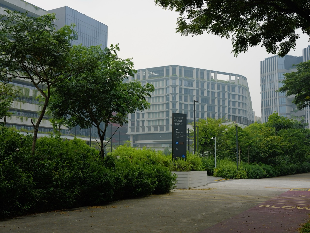
What do urban planners actually do? They balance the competing demands placed on land, movement, housing, business, nature and public life, then help turn those choices into coherent plans. This guide follows a fictional neighbourhood adding homes near a school, market and clinic. It demonstrates why a sensible map must also work for people moving through the place every day.
The eduKate Gold Standard is about dependable management and consistent systems execution, not the claim that any plan represents perfect excellence. This article focuses on the individual urban planner’s judgement, distinct from urban planning as a sector system and the specialist work of walkability or urban heat management.
Quick answer: why are urban planners important?
A planner studies what a city needs, what land can support, who is affected and which rules or resources govern decisions. Good planning makes assumptions and trade-offs visible, joins public input with sound evidence, and recognises that statutory plans, professional recommendations and completed developments are different things.
A hypothetical 350-metre journey that becomes 900 metres
| Fictional journey | Illustrative route length | What still matters |
|---|---|---|
| Direct accessible connection | 350 metres | Safe crossing, slope, shade, entrances |
| Indirect perimeter route | 900 metres | Extra 550 metres, comfort and safety |
| Reported straight-line distance | Not a usable route measure | Cannot establish accessibility by itself |
The two route lengths are hypothetical and not measurements of a named place. The difference is 900 − 350 = 550 metres. A planner must still establish whether either route is appropriately safe and accessible. The fastest route is not automatically the correct design.
Chapter index
1. The planner asks how a place works, not simply what fits on a map
A fictional neighbourhood is adding housing near an existing market, school and community clinic. One concept uses a large road and keeps most open space on the other side of a block. A different concept provides a direct accessible route and smaller shared public spaces. Both can look orderly on a land-use plan, but residents experience them differently each day.
Urban planners work at the intersection of land, movement, infrastructure, economy, environment and communities. Their professional contribution is to make trade-offs visible, assess how decisions affect people over time and connect policy with the physical city. The gold standard is not the most impressive master-plan rendering. It is a neighbourhood that can support real lives under a managed and reviewable planning system.
Back to chapters · Next chapter
2. Distinguish long-term vision from statutory planning decisions
Planning operates on different horizons. Singapore’s URA Long-Term Plan guides strategic land use and infrastructure over the next 50 years and beyond. The Master Plan is a statutory land-use plan for the medium term, typically 10 to 15 years, and is reviewed every five years. Those instruments answer different questions.
A planner should explain whether a proposal is a long-term strategy, a gazetted planning control, a possible future development or a detailed project needing further approval. Calling every public illustration an already approved construction commitment erodes trust. The map must be accompanied by a truthful account of its legal and planning status.
Back to chapters · Next chapter
3. Use the current Master Plan rather than an outdated draft
Singapore’s Master Plan 2025 was officially gazetted on 1 December 2025 following public engagement. As of October 2026, it is the official medium-term land-use blueprint, subject to gazetted amendments and other applicable controls. A planner working on a real site must use the relevant current statutory documents and written statement rather than rely on a historic draft image.
URA’s list of approved Master Plan 2025 amendments illustrates that plan information can change as the city develops. The professional should track the version and effective date consulted. A project can fail before design begins if the team builds its assumptions around zoning or controls that have already changed.
Back to chapters · Next chapter
4. Begin neighbourhood planning with actual human journeys
People seldom experience a city as coloured parcels labelled residential, commercial and institutional. They travel from home to school, clinic, work, market, park or a relative’s flat. A planner should study these linked journeys, including accessibility needs, typical waiting conditions and changes through the day.
For our fictional neighbourhood, a resident using a mobility aid may have a clinic only 350 metres away in a straight line but face a much longer route if safe crossings and step-free links are poorly arranged. The example figures are illustrative, not measurements of any Singapore location. It is the usable journey, not merely the distance on a map, that determines whether an amenity is genuinely accessible.
Back to chapters · Next chapter
5. Identify who might be missing from the available data
Planning evidence can include population projections, travel patterns, service locations, environmental models and land-use inventories. But data coverage may overlook people without smartphones, those who travel at unusual hours or households whose daily needs are poorly represented by an average. A professional should know which groups and conditions the evidence can and cannot describe.
Singapore’s URA Smart Planning guidance describes geospatial analysis and modelling of demographics, amenity access, transport and environmental conditions. Tools improve decisions when their assumptions are transparent. A shaded heat map cannot replace observing a crossing used by older residents on a hot afternoon.
Back to chapters · Next chapter
6. Treat population forecasts as scenarios rather than predictions of certainty
A new housing area may change in age profile and household size over decades. Schools, healthcare needs, community facilities and public transport demand can shift accordingly. Urban planners use forecasts to test capacity and the possibility of flexible use, but should not pretend to know the exact future population distribution.
A community room that can support different activities over time may have value beyond its first programme. Land reserved for future infrastructure can also affect present neighbourhood use. The professional’s task is to state what assumptions drive the plan, how different scenarios change requirements and what decisions can remain reversible.
Back to chapters · Next chapter
7. Understand walking access as a complete route
A footpath that begins near housing but ends at an unsafe crossing is not a dependable connection. Walking access involves continuity, protection from hazards, usable surfaces, crossing design, shade and links to entrances. Relevant safety, accessibility and transport requirements belong with the responsible authorities and qualified designers.
The planner should work with transport engineers, accessibility experts and agencies rather than define roadway standards from an aerial rendering. For the fictional clinic route, ask what the person must actually cross and where the safe step-free journey starts and ends. An accessible destination behind a difficult last 200 metres is not yet a well-connected destination.
Back to chapters · Next chapter
8. Plan for heat and rain as everyday operating conditions
Outdoor spaces are experienced in weather, not in idealised master-plan lighting. Shade, greenery, ventilation, shelter, surface materials and drainage shape comfort and resilience. A planner should coordinate climate analysis and specialist design to compare practical options, not assume that adding a few trees automatically eliminates heat risk.
Relevant work in Singapore includes urban heat management and climate resilience. Our profession-specific question is how a planner brings these risks into land allocation, street layout and project phasing early enough for the design teams to act. Climate considerations are not a decorative last chapter of a planning report.
Back to chapters · Next chapter
9. Handle drainage and flooding beyond the project boundary
A local wall, raised surface or drainage alteration may protect one parcel while redirecting water toward another. Planners should coordinate with drainage and flood specialists and examine catchment effects appropriate to the proposal. The correct technical solutions depend on actual site conditions, hydrological evidence and the relevant authority.
eduKate’s fictional flood-wall case study
Back to chapters · Next chapter
10. Balance housing capacity with essential everyday services
More homes can help address demand, but residential numbers alone do not describe a liveable neighbourhood. Schools, healthcare access, shops, recreation, community support and transport may need to grow alongside the population. Not every amenity can be within a one-minute walk, so the planner should make clear which service standards and trade-offs guide the allocation.
In the fictional district, placing every shared facility at one distant edge may be efficient for a drawing yet inconvenient for households without easy travel. Alternative layouts should compare the location and capacity of amenities under realistic demand assumptions. Land use planning is fundamentally about the relationship between homes and the services that make them usable.
Back to chapters · Next chapter
11. Make commercial space part of neighbourhood life
Local businesses can provide jobs and convenient services, but loading arrangements, waste management, noise, visitor patterns and economic viability affect where they work well. A planner should consider the needs of small enterprises as well as larger tenants and avoid assuming all retail activity is interchangeable.
For the market near our fictional housing area, improved pedestrian access may increase footfall, while poor delivery access could make trading difficult. Commercial practicality and human accessibility are not necessarily opposing goals. A good plan connects the market’s operating requirements with public-realm design, rather than leaving conflicts for merchants and residents to fight about after opening.
Back to chapters · Next chapter
12. Recognise conservation as part of future value
Historic buildings, streetscapes and community memory contribute to place identity and may support economic and cultural uses. Conservation decisions are governed by specific statutory and planning requirements; planners should not imply that every old building is formally protected or that every adaptation is automatically permissible.
Singapore’s Master Plan 2025 includes stewardship of nature and heritage among its themes. A professional asks which physical elements and social practices matter, how reuse might work and what restrictions apply. Preservation becomes useful when it is considered alongside safety, accessibility, costs and future communities.
Back to chapters · Next chapter
13. Keep nature connected rather than counting isolated patches
Green space can support recreation, urban comfort and biodiversity, but ecological value depends on habitat quality, scale and connectivity, not just the colour green on a plan. Planners need environmental expertise to evaluate how a road, drainage feature or redevelopment affects habitats and movement across an area.
eduKate’s green corridor case study
Back to chapters · Next chapter
14. Use consultation to learn rather than simply count attendance
Public engagement helps planners understand lived experience, aspirations and concerns that technical models cannot fully capture. But the number of participants does not prove that every affected group was heard. A process needs accessible materials, usable feedback channels and a way to explain how responses influenced decisions.
URA reports extensive engagement in the development of Master Plan 2025. The lesson for an individual planner is not to reproduce a large headline participation count for every project. It is to identify whose experience remains missing, present real alternatives and show the public which concerns changed the design and which could not be adopted, with reasons.
Back to chapters · Next chapter
15. Keep consultation separate from a promise of approval
A resident may propose more trees, a protected crossing or a new community facility. The planner should record the need and test potential options but cannot promise that an idea will be implemented simply because it was raised at a consultation. Public decisions depend on competing needs, land ownership, technical feasibility, budgets and authorised approval processes.
Honesty about the decision route is crucial. A useful engagement summary distinguishes suggestions received, questions under study, plans approved and matters outside the project. Residents can tolerate a difficult trade-off more readily when they can see that their concern was understood and the conclusion is explained.
Back to chapters · Next chapter
16. Use scenario comparison to expose trade-offs
Suppose two imaginary layouts serve the same number of new homes. Layout A creates a more direct clinic route but requires more careful redesign of traffic access. Layout B preserves existing vehicular circulation but adds a detour for pedestrians. The planner can compare travel distance, safe crossings, service access, costs, heat exposure and impacts on nearby businesses using grounded estimates.
No single metric should dominate without justification. A shorter walking route cannot be considered safe purely because it is short; fewer vehicle delays cannot establish that the whole district is better for everyone. The professional should state priorities, uncertainty and which specialist or community evidence supports the recommendation.
Back to chapters · Next chapter
17. Distinguish the planner’s role from engineering and legal approvals
An urban planner may prepare policies, concepts, land-use assessments and recommendations, but detailed structural, traffic, drainage and building designs belong to appropriately qualified professionals and relevant authorities. A private consultant’s urban concept does not itself grant planning permission.
Singapore’s URA 2025 urban-design guidelines circular explains that applicable guidelines interact with site-specific requirements and that development applications must meet current controls. A professional should know the boundary between an idea, a plan, an approval and a construction-ready design.
Back to chapters · Next chapter
18. Plan phasing so communities still function during change
Development can take years, and construction itself affects access, noise, business activity and public space. A plan that looks good at completion may create serious temporary barriers if phasing is ignored. Planners should coordinate construction-stage access and mitigation with the appropriate engineers and project teams.
For the market and clinic, consider whether safe routes remain available while roads or footpaths are rebuilt. Temporary arrangements should not be left to chance, and communication needs to reach the people who actually use the area. A neighbourhood remains occupied during transformation; planners should not design as if everyone disappears until a ribbon-cutting ceremony.
Back to chapters · Next chapter
19. Monitor the place after people move in
A completed neighbourhood can perform differently from its forecasts. Walking patterns shift, a bus connection attracts more demand than expected or a public space remains empty because access is awkward. Post-occupancy evidence helps planners distinguish a design weakness from a temporary operating issue.
Measure real accessibility, service usage, comfort and community feedback with appropriate data safeguards. An urban planner should be prepared to recommend adjustments where governance and resources allow. A master plan is not a sacred illustration: it is an evolving management tool for shaping a functioning city.
Back to chapters · Next chapter
20. Build the profession through geography, design and public reasoning
Urban planning careers draw on geography, economics, environmental studies, social research, transport, design, law and geospatial analysis. Different roles specialise in strategic land use, neighbourhoods, conservation, infrastructure or urban data. No single software tool or degree project establishes unlimited authority to approve a development.
A strong student portfolio might compare two fictional neighbourhood layouts, explain data limitations, map a real pedestrian journey where lawful and appropriate, and document how community feedback altered the options. The useful skill is reasoned trade-off analysis rather than decorating an aerial photograph with attractive labels.
Back to chapters · Next chapter
21. The final test is a place that people can actually use
Urban planning is a slow profession because its decisions shape places over decades. That makes accountability particularly important. A successful planner helps ensure that today’s approved decisions remain transparent to tomorrow’s residents and public agencies, even as assumptions and social needs change.
Return to our fictional housing area. The best plan is not necessarily the one with the most greenery, the widest road or the maximum number of apartments on one drawing. It is one that connects homes, services, mobility, nature, economic activity and resilience into a feasible, understandable system. That is urban planning at its gold standard.
A boundary test: when a locally good street becomes a district problem
Suppose the fictional planner recommends widening a footpath to make the route between housing and the clinic more comfortable. Residents welcome the idea, and the immediate block appears improved. But the proposal also affects a delivery entrance used by market traders and may move runoff toward a nearby low point. A site-level review that counts only new pedestrian space would miss important operating consequences. The planner therefore asks what has been gained, who bears the costs and which specialists must test the effects.
The transport team may need to study junction operation, loading windows and safe pedestrian crossing requirements. The drainage specialist examines catchment conditions rather than relying on a visual impression. Market operators explain when supplies arrive and whether a new restriction would make deliveries impractical. People using mobility aids can help reveal whether the proposed route’s slopes and surfaces are genuinely usable. No one contributor can settle the entire question alone.
The planner then sets out alternatives: adjust the pedestrian alignment, redesign a loading arrangement, stage construction differently or reconsider how public space is distributed. Each alternative has implications for cost, safety, access and local activity. Where an option has not been technically assessed, its status must remain provisional. Saying that a concept improves walkability does not grant approval to remove a working delivery route or disregard a flood risk.
This is a test of planning boundaries. The official Master Plan establishes the broader statutory land-use context, while project design and authorisations require more detailed professional work. Public input identifies what residents and traders experience; it does not, by itself, determine all the technical conclusions. A good planner integrates the evidence and makes the trade-off visible to the people authorised to decide.
After implementation, the city should not merely count the length of new pavement. It should ask whether people use the route, whether loading and crossings remain workable, and whether complaints reveal an unexpected problem. This completes the management loop from concept to monitoring. The gold standard is not a perfect line on a map; it is willingness to follow a planning decision through its real effects beyond the project boundary.
A worked neighbourhood review: the market, clinic and homes
A planner receives two possible street layouts. In the first, car circulation is straightforward, but a resident walking from the new housing block to the clinic must take an indirect route. In the second, a more direct connection is proposed, but loading access to the market and junction operations require further analysis. The planner cannot select a winner from a single distance statistic.
A credible review asks transport specialists about crossing design, businesses about delivery access, residents about daily journeys, accessibility specialists about actual route usability and environmental experts about exposure to heat and water. Each option is then compared against the approved planning framework, available land and budget. Where information is missing, the report should identify the gap and next authorised decision rather than disguise assumptions as final facts.
The recommendation should explain not just where a path goes, but who benefits, who bears inconvenience, which claims are supported by observations and how later construction and monitoring could affect the result. That process is what separates a professional planning decision from a beautiful line drawn across a map.
Urban planning review checklist
- Is the current statutory Master Plan and any relevant amendment identified?
- Are long-term strategies distinguished from approved land-use controls and individual project approvals?
- Do mapped amenities connect through actual safe, accessible journeys?
- Are population and mobility data checked for missing groups or biased coverage?
- Have climate, flood, ecological and neighbouring impacts been examined across boundaries?
- Does consultation document both feedback and reasons for decisions?
- Are specialists and statutory authorities clearly assigned their respective responsibilities?
- Will the community have safe access during construction and useful ways to report problems after opening?
Frequently asked questions about urban planners
Is an urban planner the same as an architect?
They collaborate, but planners focus on wider land-use and place systems while architects design particular buildings and spaces under their professional frameworks. Specific responsibilities vary by appointment.
Can any urban planner grant planning permission?
No. Statutory planning decisions belong to the relevant authorities and lawfully delegated decision-makers, not automatically to a private consultant with the job title.
What is the Singapore Master Plan 2025?
It is URA’s gazetted statutory land-use plan adopted on 1 December 2025, guiding medium-term development over roughly 10 to 15 years and subject to amendments and applicable controls.
Why is walking distance more than a straight line?
A usable journey depends on actual paths, crossings, entrances, shade and accessibility. Straight-line proximity cannot prove that a destination is convenient or safe.
Do planners need public feedback?
Community perspectives can reveal local barriers that models overlook, but professionals must combine input with statutory requirements, technical evidence and transparent decisions.
Can a flood-control project hurt nearby streets?
A local intervention may have effects beyond its boundary, which should be assessed by the relevant specialists and planners. The outcome depends on actual site conditions and design.
What skills help someone become an urban planner?
Geography, public policy, statistics, economics, spatial design, geospatial analysis, transport and communication; check qualifications and job requirements for the specific employer.
How is a good plan judged?
By defensible assumptions, lawful approvals, transparent trade-offs and real outcomes in accessibility, resilience, liveability and use over time.
Official URA material and linked eduKate reading
- URA: Master Plan — statutory medium-term planning and written statement
- URA: Master Plan 2025 — current priorities, themes and community engagement
- URA: Long-Term Plan — strategic land-use horizon
- URA: Smart Planning — geospatial, mobility and environmental evidence
- URA: Gazetted amendments to Master Plan 2025 — checking what changed
- eduKate: Urban Planning — broader sector management perspective
- eduKate: Market flood-wall case study — effects outside one project boundary
A gold-standard urban planner makes places more usable by joining people, geography, law and evidence into decisions that endure, can be questioned, and can be improved as the city changes.