
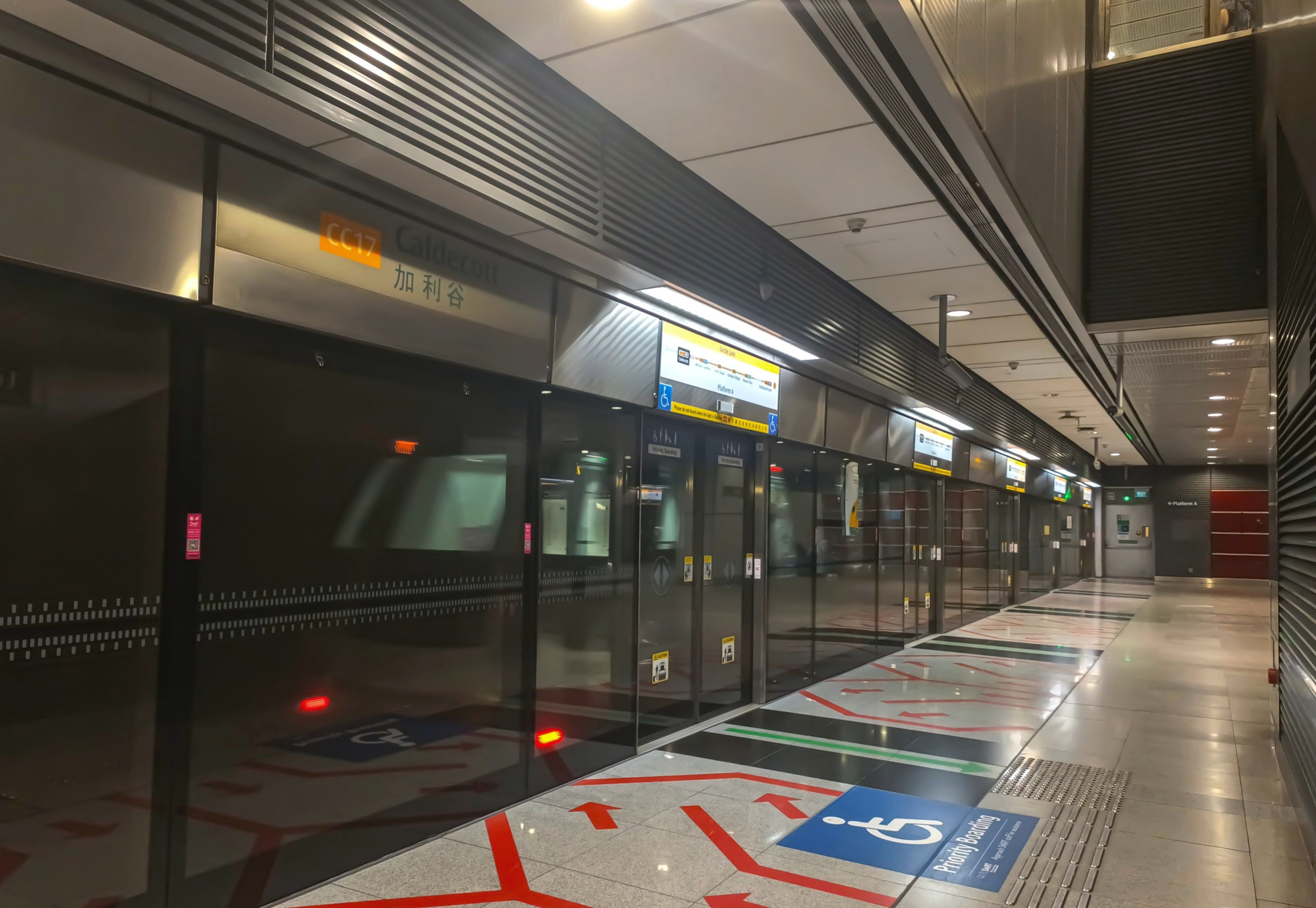
Things to do near Caldecott MRT for free: walk from Caldecott station (CC17/TE9) approximately 850 metres along Toa Payoh Rise and Thomson Road to MacRitchie Reservoir Park, enjoy a short waterside visit, explore the 3-kilometre Prunus/Petai nature trail or take a longer 4.8-kilometre Chemperai–Jering boardwalk loop. The park is part of Singapore’s Central Catchment Nature Reserve. Public trails have no general admission fee, but this is protected forest terrain with a strict 7am–7pm nature-reserve operating window, not a twenty-four-hour city park.
Planning the famous TreeTop Walk? It is not a short attraction at Caldecott MRT Exit 3. From the main MacRitchie Reservoir Park entrance, NParks describes a 10.3-kilometre moderate-to-difficult loop that can take several hours. The 250-metre suspension bridge has its own hours: 8.30am–5pm weekends and public holidays; 9am–5pm Tuesday–Friday; closed ordinary Mondays, with last entry at 4.45pm. A separate 7-kilometre, three-to-four-hour route begins at Windsor Nature Park. Choose a manageable route for your group’s fitness, daylight and comfort—especially with children or older relatives. If TreeTop Walk is your aim, arriving after lunch without sufficient hiking time is a poor plan.
Quick answers before you leave:
- MRT: Caldecott CC17/TE9, Circle Line and Thomson–East Coast Line interchange.
- MacRitchie approach: about 850m from the station along Toa Payoh Rise/Thomson Road, per NParks.
- Reserve opening: 7am–7pm every day; remaining within the forest after 7pm is prohibited.
- Short free trail: Chemperai Trail around 1.5km / 30 minutes, or Prunus–Petai route 3km / about one hour.
- Longer easy loop: Chemperai–Jering boardwalk and Lornie Trail, 4.8km.
- TreeTop Walk from MacRitchie: 10.3km loop, moderate-to-difficult, not suitable for every family.
- Alternative TreeTop Walk route: about 7km from Windsor Nature Park, three to four hours.
- TreeTop bridge: 250m suspension bridge, usual Monday closure and 4.45pm last entry.
- Nature rules: no off-trail access, feeding monkeys or entry into the former Shinto Shrine restricted zone.
- Useful separate service: free Mount Alvernia Hospital shuttle from TEL Exit 1 on weekdays only, with a long midday break.

Start by choosing a short walk or a serious hike
Caldecott is a useful railway interchange but is not a shopping-mall destination. Its most rewarding leisure purpose is the approach to MacRitchie Reservoir and the Central Catchment forest network. The critical mistake is to treat every trail length as if it starts at the MRT exit and requires the same ability.
| Your objective | Choose | Key consideration |
|---|---|---|
| Short outdoor break | Reservoir entrance and waterfront view | 850m approach plus return |
| Easy boardwalk experience | 1.5km Chemperai Trail | Allow time for station walk |
| Family nature exploration | 3km Prunus/Petai route | Approx one hour trail time, not total outing |
| Longer reservoir walk | 4.8km Chemperai/Jering loop | More distance and weather exposure |
| TreeTop Walk from main entrance | 10.3km Route 3 | Moderate-to-difficult, full-day mindset |
| TreeTop Walk from north | 7km Windsor route | Different arrival; fitness and bridge hours |
| Medical appointment | Correct hospital route | Not a nature outing; shuttle timetable matters |
A family with a preschooler may be happier appreciating the waterfront than spending hours on steep woodland tracks. A fit adult can plan the longer trail deliberately. Both are valid outings when the choice matches actual conditions and everyone can return before the reserve closes.
Caldecott CC17/TE9: where the lines and exits take you
Caldecott MRT has CC17 for the Circle Line and TE9 for the Thomson–East Coast Line. The interchange connects different railway corridors underground. Its public exits serve Toa Payoh Rise, nearby institutions and hospital routes rather than a major shopping complex.
For a MacRitchie approach, current wayfinding commonly uses Exit 3 towards Toa Payoh Rise and then the signed route along Thomson Road. For the Mount Alvernia shuttle, the hospital’s official directions specify TEL Exit 1. These exits are not interchangeable when a traveller is carrying a stroller or attending an appointment.
Choose the actual destination before leaving the station. Read the exit, lift and street-side signs rather than following other passengers without knowing where they are going. If someone uses a mobility aid, confirm the full path to the final destination. The fact that a train platform has lifts does not make a natural forest trail accessible.
Operator directions: SMRT Caldecott station exit directory and eduKate Caldecott MRT Guide.
The 850-metre walk before you even reach MacRitchie
NParks’ TreeTop Walk trail guide states that Caldecott MRT is about 850 metres from MacRitchie Reservoir Park, via Toa Payoh Rise and Thomson Road. The distance is a meaningful part of your day. Someone planning a 3km nature trail should recognise that the station approach and return can add roughly another 1.7km, depending on the exact entrance and paths.
The first part of the trip includes urban roads and crossings, not forest boardwalks. Follow signalised pedestrian routes, keep children close and take care when moving from the station area to the reservoir. A straight-line map estimate may omit a longer accessible crossing or diversion caused by traffic or construction.
For a senior or young child, a bus stopping nearer the reservoir may be worth considering. The official guide lists several Thomson Road bus services and the MacRitchie Reservoir bus stop. Verify the exact bus number from your current origin rather than assume every Thomson Road bus uses the same stop.
A well-designed outing begins with a realistic walking budget. If the child becomes tired on the station-to-park approach, enjoying a short reservoir view and returning is a good decision. Do not turn the remaining trail into an obligation.
Free reservoir views without a TreeTop Walk hike
MacRitchie Reservoir is an attractive public landscape even when visitors do not attempt the TreeTop Walk. Public paths and permitted boardwalk sections allow views of water, trees and forest edges. A short visit is a sensible choice for people who want a gentle walk or a moment outside the city without spending most of the day hiking.
Start at the visitor entrance, observe the reservoir from a safe public path and choose an out-and-back route that you can complete comfortably. Do not assume every section near water has a barrier or that stepping down to an unmarked bank is permitted. The reservoir is part of Singapore’s water system and protected natural environment.
Children can compare a reservoir with a public swimming pool or garden pond. A reservoir has a different purpose, and its water is not an invitation to swim from any point along the trail. Read signs and follow NParks and PUB conditions.
For photographers, a quiet water reflection or tree silhouette can be more rewarding than attempting a long trail in unsafe light. The purpose is to experience the location thoughtfully, not to prove that you reached every landmark.
The 1.5-kilometre Chemperai Trail: an easy first choice
NParks describes the Chemperai Trail as an easy 1.5-kilometre route that takes around 30 minutes for ordinary walking. It provides waterfront boardwalk views, plants and opportunities to observe birds and insects. This is one of the best starting choices for visitors who want a nature walk but have not planned a multi-hour hike.
The trail’s official guide highlights plants such as Wild Ixora, Licuala Palm and Chemperai, and birds that may occur around the forest edge. No wildlife sighting is guaranteed. Walk slowly, observe from the marked path and avoid approaching animals or disturbing plants for photographs.
The 30-minute figure is a walking estimate, not a total Caldecott MRT trip. Add the 850-metre approach, reading time, rests and the return. With children, the visit can reasonably take much longer than the trail leaflet suggests.
For a safe first visit, choose one point where you will turn back if the weather changes. It is not necessary to complete a loop when someone becomes uncomfortable or tired.
Official source: NParks Hiking and Nature Walks — Chemperai Trail.
The 3-kilometre Prunus and Petai route
Prunus Trail and Petai Trail form NParks’ easy 3-kilometre Route 1, with a suggested duration of about one hour. The route follows sections beside the reservoir and forest, offering a close view of vegetation without requiring the endurance of the TreeTop Walk loop.
It can be a good option for primary school children who are comfortable walking several kilometres. Start with the trail map, check water and weather, and tell everyone what distance is planned. A younger child who enjoys a short boardwalk may still become tired long before completing three kilometres.
NParks highlights interesting trees and birds along the trail. Try to describe one plant before looking for its name. A child may notice fan-shaped leaves, large trunks or fallen seeds. Older students can ask how plants along a reservoir differ from those in an exposed grassland.
Keep to designated paths. A forested reserve is not an off-road adventure playground. The purpose of a boardwalk is partly to keep repeated footsteps away from sensitive roots and soil.
The 4.8-kilometre Chemperai/Jering boardwalk loop
NParks lists a longer 4.8km easy Route 2 using the Chemperai and Jering boardwalks and returning by Lornie Trail. This provides more time near the reservoir than the 1.5km and 3km options, but “easy” refers to the assessed trail difficulty, not to how every visitor will experience almost five kilometres in tropical heat.
Choose this route if everyone is comfortable walking the extra distance and the group has time before the reserve’s 7pm closure. A long walk can become unpleasant when someone runs out of drinking water or a child has not had a meal. Plan breaks and turn back when needed.
Check the latest NParks trail map for temporary closures and diversions. A route length published in a guide can change when paths are under repair. Do not cross a barrier or invent an informal trail through forest to preserve a planned distance.
This is a useful example of why a nature itinerary must be flexible: the same destination can support several lengths, and no family has to choose the longest one to enjoy it.
TreeTop Walk: the 250-metre bridge is not a short hike
TreeTop Walk is a 250-metre freestanding suspension bridge connecting two high points in the Central Catchment Nature Reserve. It offers a canopy perspective over rainforest and distant reservoir landscape. Photographs focus on the bridge itself, but reaching it requires a longer trek through forest paths.
From the main MacRitchie Reservoir Park entrance, NParks publishes a 10.3-kilometre moderate-to-difficult loop. A visitor who arrives expecting to walk 250 metres from Caldecott MRT is misunderstanding the attraction. The bridge length describes the final feature, not the journey needed to reach and leave it.
NParks also warns that the TreeTop Walk route is unsuitable for young children, pregnant visitors, people with disabilities affecting mobility, those with a fear of heights and people with certain pre-existing heart conditions. This advice should not be hidden at the bottom of a recommendation. A spectacular view does not make a physically demanding outing appropriate for everyone.
If your group has mixed abilities, choose a shorter waterfront boardwalk. That is a complete and worthwhile experience rather than a lesser version of the day.
TreeTop Walk operating hours and the Monday exception
The bridge’s published hours are 9am–5pm Tuesday–Friday, and 8.30am–5pm on weekends and public holidays. The walk closes on ordinary Mondays, except when Monday is a public holiday. Last entry is 4.45pm.
These are bridge hours, not times for beginning the hike. A family arriving at MacRitchie Reservoir Park at 4pm cannot realistically complete a long approach and reach the bridge before the last-entry window. Visitors must estimate several hours for walking and leave a sensible safety buffer.
At the nature-reserve level, visitors must leave by 7pm. The closing restriction is strict and should influence both the outward route and the return. Do not plan to remain on forest trails after sunset because a GPS application shows that the final leg is only a short distance.
A last-minute approach is not a good use of time or safety. If the bridge cannot be reached comfortably, choose a shorter signed trail. See NParks Hello MacRitchie for hours and visitor advice.
The 7-kilometre Windsor route is a different starting point
Another NParks TreeTop Walk route begins at Windsor Nature Park, covering approximately 7 kilometres and taking three to four hours. It is rated moderate-to-difficult. It may be preferable for certain hikers, but it is not an itinerary that begins automatically at Caldecott MRT’s Toa Payoh Rise exit.
A guide that says “TreeTop Walk takes three hours” without mentioning its starting point can mislead visitors. The same bridge can be approached through different paths, with different distances and return options. Always match the stated walking time to the exact trail and direction.
Check the transport route to Windsor separately, including how to get back after the walk. Do not assume the starting point, bridge and final bus stop are identical. A loop designed from Windsor is not necessarily interchangeable with a loop described from MacRitchie Reservoir Park.
The full Windsor route still requires suitable footwear, water, fitness and sufficient daylight. Its shorter distance than the 10.3km MacRitchie route does not make it a casual stroller walk.
How to plan a physically realistic TreeTop day
Begin with a fitness check: can everyone in the group comfortably walk several kilometres over forest terrain, stairs, gradients and uneven surfaces? If not, choose a shorter route. Check health limitations, foot comfort, weather and whether a companion is comfortable with heights.
Leave early, especially on weekends. Pack water, sun protection and appropriate footwear, and keep food secure from wildlife. A trail that looks shady can still be hot and humid. Delays happen when someone needs rest or a path is busy, so do not base the plan on a perfect minimum-duration estimate.
Choose the correct entry point from the official map and identify a legal return route before starting. Know the bridge’s last-entry time and the reserve’s 7pm closing. If the group falls behind the schedule, turn around rather than hurry over difficult terrain.
Rain is a serious risk. NParks advises against entering forested areas during stormy weather because of falling trees or branches. Do not continue merely because the bridge is an iconic photo spot.
Rainforest wildlife: observe without feeding or chasing
MacRitchie supports forest birds, reptiles, mammals and many species of plants. NParks mentions birds such as Greater Racket-tailed Drongo, Pink-necked Green Pigeon and Collared Kingfisher on suitable trails. Long-tailed Macaques, monitor lizards or small skinks may also occur, but no visitor is guaranteed to see a particular species.
Do not feed monkeys or any wildlife. Food can change animal behaviour and create safety problems for visitors and the animals. Keep snacks inside bags and do not approach a macaque for a photograph or allow children to carry open food past groups of monkeys.
If you encounter wildlife on the trail, remain calm and give it a route away. Do not touch unfamiliar animals or chase them into vegetation. A nature walk is a chance to observe, not to handle or collect organisms.
For younger children, learning to notice a bird call or leaf shape is enough. Older students can record observations carefully and compare with a reliable guide later, distinguishing confident identification from a guess.
The Shinto Shrine is inside a prohibited conservation area
Some online maps and history videos refer to a former Shinto Shrine in the Central Catchment forest. NParks explicitly states that it lies within a core nature conservation area closed to the public, with no designated trail to the shrine.
The site must not be promoted as a hidden free trekking destination. Entering a closed part of a nature reserve is an offence under relevant parks regulations and can attract fines. More importantly, unauthorised access can damage habitat and create safety risks in areas not maintained for public passage.
For people interested in the historical context, NParks points visitors to a site marker at the Adam Road and Sime Road junction, rather than the restricted core area. A public marker can help someone learn without crossing a conservation boundary.
Teach children that curiosity does not grant permission to enter every historical site. Responsible exploration uses authorised paths, documentary research and respect for protective rules.
Official advisory: NParks Hiking and Nature Walks — restricted shrine notice.
MacRitchie water is a reservoir, not a recreational swimming lake
MacRitchie is a major part of Singapore’s water catchment history. Visitors should treat the reservoir as public water infrastructure and protected landscape rather than assume any shallow-looking bank is suitable for swimming or playing in the water.
Public paths provide views, but water-entry activities require specific authorised facilities and rules. Do not climb past railings or encourage children to step into the reservoir because the surface looks calm. Currents, depth and water quality cannot be judged from one photograph.
Families can use the site to explain that reservoirs store water for wider public needs. A child might compare the reservoir with a pond at an ordinary city park. An older student can ask how catchment forests, runoff and storage work together. These are valuable questions even without a guided tour.
The best experience respects both the visitor’s safety and the reservoir’s purpose.
A short scientific introduction to the rainforest
When children walk under a forest canopy, they may notice that the light, temperature and sound differ from a street outside the reserve. Dense trees intercept sunlight, and the understorey contains plants that can tolerate a different light environment. These are real observations that can begin a scientific question.
Ask a Primary student how the same plant might grow differently in bright open sun compared with deep shade. To answer rigorously, they would need to consider water, species, nutrients and other variables, not only the amount of light. A forest trail is not a controlled experiment, but it can motivate one.
Older students might consider how a catchment forest supports water management and habitat. Avoid making specific quantitative claims—such as an exact cooling effect or filtration rate—without scientific evidence. Use NParks’ materials for the documented role of the protected reserve.
Nature learning is strongest when a visitor distinguishes what can be seen directly from what would need measurements or research.
MacRitchie and Singapore’s early water-supply history
MacRitchie Reservoir is associated with Singapore’s earliest public reservoir development in the nineteenth century. Its history is part of the island’s longer challenge of securing reliable water while the population and urban economy grew.
A family standing beside the reservoir can ask a simple but powerful question: why would a growing port city invest in reservoirs rather than rely only on wells or rainfall collected at home? The answer involves storage, water distribution, public health and infrastructure planning. Historical dates and later expansions should be verified through PUB or NParks records rather than guessed from the age of a stone structure.
For older students, the reservoir provides a way to understand that engineering decisions affect land use. Preserving catchment forests has implications for biodiversity, recreation and water quality. A modern city must balance several legitimate needs in the same limited space.
A well-planned nature outing can therefore connect the visible water to questions of public policy and daily life without turning the visit into a lecture.
Caldecott Hill’s broadcasting heritage is not a live studio tour
Caldecott Hill is a familiar name in the history of Singapore broadcasting. The former broadcasting facilities were associated with television and radio production across several decades. However, the presence of a historically important name near the MRT does not imply that the former compound is operating as a public visitor attraction.
Visitors should not turn up expecting unrestricted access to old production studios or behind-the-scenes equipment. Heritage information about broadcasting can be researched through National Heritage Board and archived sources without entering private premises.
If a teenager is interested in media, ask how television production has changed since the rise of digital recording and online streaming. A historical site may provide a starting point for research, even when its buildings are not available for casual viewing.
The lesson for any local travel guide is to distinguish a place of historical interest from a current operating attraction. Accurate access information is as important as the story itself.
Mount Alvernia Hospital: a different reason to use Caldecott
Caldecott MRT also serves people travelling to Mount Alvernia Hospital. The hospital provides a complimentary shuttle from the Thomson–East Coast Line Exit 1, with services Monday–Friday only, excluding weekends and public holidays.
The current timetable has morning journeys beginning around 6.30am from Caldecott and a late-afternoon block resuming around 4.10pm, with a long midday period of no shuttle service. Visitors should not assume the shuttle runs every twenty minutes throughout the day simply because one schedule section has frequent departures.
A person attending a medical appointment should prioritise accessibility and arrival timing over leisure suggestions. If the shuttle is not running at the required time, use the hospital’s current directions or another suitable transport mode. Do not assume a nature walk is a useful shortcut to a hospital entrance.
Official timetable: Mount Alvernia Hospital Shuttle Bus Services.
Three practical Caldecott itineraries
45–60 minutes: reservoir-view outing
From Caldecott, walk or travel to the MacRitchie public entrance and enjoy a short permitted waterfront section. Return comfortably. This is useful for a visitor with a limited window and does not require attempting a full 3km trail.
Two hours: easy nature trail
Choose Chemperai or the 3km Prunus/Petai option according to walking ability. Include station approach and return time, and look at one or two plants without rushing. End well before 7pm.
Half-day or longer: serious TreeTop hike
Start early on a day when the bridge is operating, select the 10.3km MacRitchie route or the separate Windsor approach, and carry appropriate supplies. The bridge has a 4.45pm last entry and the reserve closes at 7pm. Do not attempt the walk if the group’s fitness or weather is unsuitable.
Healthcare appointment day
Use the correct station exit and actual hospital shuttle timetable. If the hospital visit is tiring, return home rather than treating a nature trail as another compulsory activity.
Accessibility, forest surface and who should choose another route
Nature reserves are not fully accessible urban promenades. Even a trail assessed as “easy” can contain stairs, uneven surfaces, roots and gradients. A visitor who uses a wheelchair or mobility aid should check the actual route rather than assume all boardwalks provide a continuous step-free circuit.
TreeTop Walk is explicitly unsuitable for several categories of visitor with mobility or health constraints. Parents should take this advisory seriously. The fact that children are energetic does not mean they can safely complete a long route, especially when they are unfamiliar with hiking.
For seniors, people recovering from illness and anyone who prefers limited walking, the reservoir-edge view or an appropriately selected public path may be sufficient. A shorter visit can still be beautiful and educational.
Do not use private roads, golf-club areas or unmarked forest shortcuts as alternatives when a path is closed. The protected landscape depends on visitors remaining within authorised routes.
Weather, storms, water and an unambiguous turnaround rule
NParks warns against entering forest trails during stormy weather because trees and branches can fall. Rain also makes uneven paths and steps slippery. Do not remain under a tall isolated tree during lightning or continue across an exposed bridge because a photograph is important.
Before hiking, decide a turnaround time and communicate it to the group. If you have not reached the intended point by that time, return by the authorised route. The reserve closes at 7pm and TreeTop Walk has its own last-entry deadline. A hiking schedule without a return plan is incomplete.
Carry enough water and wear suitable shoes. Keep children close and avoid touching unfamiliar plants or wildlife. If somebody becomes exhausted, prioritise returning safely rather than completing the trail marker sequence.
A good nature trip is one where everyone reaches home safely and would be willing to visit again.
A family learning plan without a worksheet
MacRitchie provides science, geography and history in one landscape. Parents can make learning enjoyable by asking one well-chosen question instead of expecting every child to memorise a long list of species or engineering facts.
Ages five to eight: describe a difference
Compare the MRT station with the forest trail. What changes in light, sound, plants and walking surfaces? Offer terms such as canopy, boardwalk, reservoir and understorey when they help the child describe a real observation.
Primary three to six: connect trees and water
Ask why a reservoir might have forest around it. Invite ideas about drainage, shade and habitats, then check an official explanation. Avoid declaring that one visible tree proves a specific effect on water quality.
Secondary students: evidence and trade-offs
Consider why a nature reserve restricts access after 7pm and prohibits entering protected core zones. What needs are being balanced? A student can distinguish visitor convenience from conservation, safety and wildlife protection.
Two-minute read-back
At home or on the train, ask each person for one observation, one verified fact and one open question. This simple method makes the walk memorable without additional stress.
Common Caldecott and TreeTop Walk mistakes
Confusing the 250m bridge with the full hike. The MacRitchie route is 10.3km; Windsor’s approach is a separate 7km loop.
Planning to enter the bridge at 5pm. Its last entry is 4.45pm, and reaching it can take hours.
Arriving on an ordinary Monday for TreeTop Walk. The bridge is closed except when Monday is a public holiday.
Remaining in the nature reserve after 7pm. NParks prohibits entering or remaining after closing.
Forgetting the 850m Caldecott approach. That station-to-park distance is in addition to the trail.
Assuming all easy trails are wheelchair-friendly. Natural surfaces and individual boardwalk sections differ.
Trying to reach the restricted Shinto Shrine. The core conservation area is closed; use the public historic site marker instead.
Using Mount Alvernia shuttle as a continuous all-day service. It runs weekdays in morning and afternoon blocks, not midday or weekends.
Ignoring storm warnings. Forest trails can be dangerous when branches fall or slopes become slippery.
Frequently asked questions about Caldecott MRT
How far is MacRitchie Reservoir from Caldecott MRT?
NParks gives an approximately 850m walking approach along Toa Payoh Rise and Thomson Road.
Is MacRitchie free to visit?
General public trails are free of attraction admission, subject to nature reserve regulations and opening hours.
When is the reserve open?
7am–7pm every day. Remaining after 7pm is prohibited.
Is TreeTop Walk beside Caldecott MRT?
No. The bridge requires a long hike. The main MacRitchie loop is about 10.3km.
How long is TreeTop Walk itself?
The suspension bridge is approximately 250m long.
What time does TreeTop Walk open on Saturday?
Normally 8.30am–5pm, with last entry at 4.45pm.
Is TreeTop Walk closed on Mondays?
Yes on ordinary Mondays, with a public-holiday exception.
Can I reach TreeTop from Windsor?
Yes, NParks describes a separate 7km moderate-to-difficult loop from Windsor Nature Park, generally taking three to four hours.
What is the easiest nature trail?
NParks offers the 1.5km Chemperai Trail and 3km Prunus/Petai route as easy options.
Is the 4.8km reservoir loop easy?
It is rated easy by NParks, but actual comfort depends on fitness, heat and walking conditions.
Can young children hike to the TreeTop bridge?
NParks advises the route is unsuitable for young children; choose shorter trails appropriate to your group.
Are monkeys dangerous?
Do not feed, approach or provoke wildlife, keep food secure and follow NParks guidance. Sightings are possible but not guaranteed.
Can I explore the former Shinto Shrine?
No. It is within a closed core conservation area, without a public trail. NParks directs interested visitors to the Adam/Sime Road site marker.
Is there a free hospital shuttle?
Mount Alvernia runs a weekday shuttle from TEL Exit 1, with no midday operation and no weekend/public-holiday service.
What if there is heavy rain?
Do not enter forest trails during stormy weather. Leave exposed areas and choose another day when the conditions are safe.
Sources, trail maps and related eduKate reading
Reviewed 7 November 2026. Nature trail availability, rain closures and hospital transport can change. Use the newest official NParks and hospital information for time-specific trips.
- NParks — MacRitchie trail distances, difficulty, bridge hours and restricted areas
- NParks — Hello MacRitchie, reserve hours and safety
- NParks — Central Catchment Nature Reserve overview
- NParks — official TreeTop Walk trail guide with Caldecott MRT route
- SMRT — Caldecott station exits and accessibility
- Mount Alvernia — Caldecott weekday shuttle timetable
- eduKate — Caldecott MRT general guide
- eduKate — another free family nature option at Lakeside Garden
For a first Caldecott visit, choose a short reservoir trail and return comfortably. For TreeTop Walk, prepare a genuine hike with time, suitable fitness, weather and safe daylight. A meaningful nature outing should never depend on ignoring the reserve’s rules.