
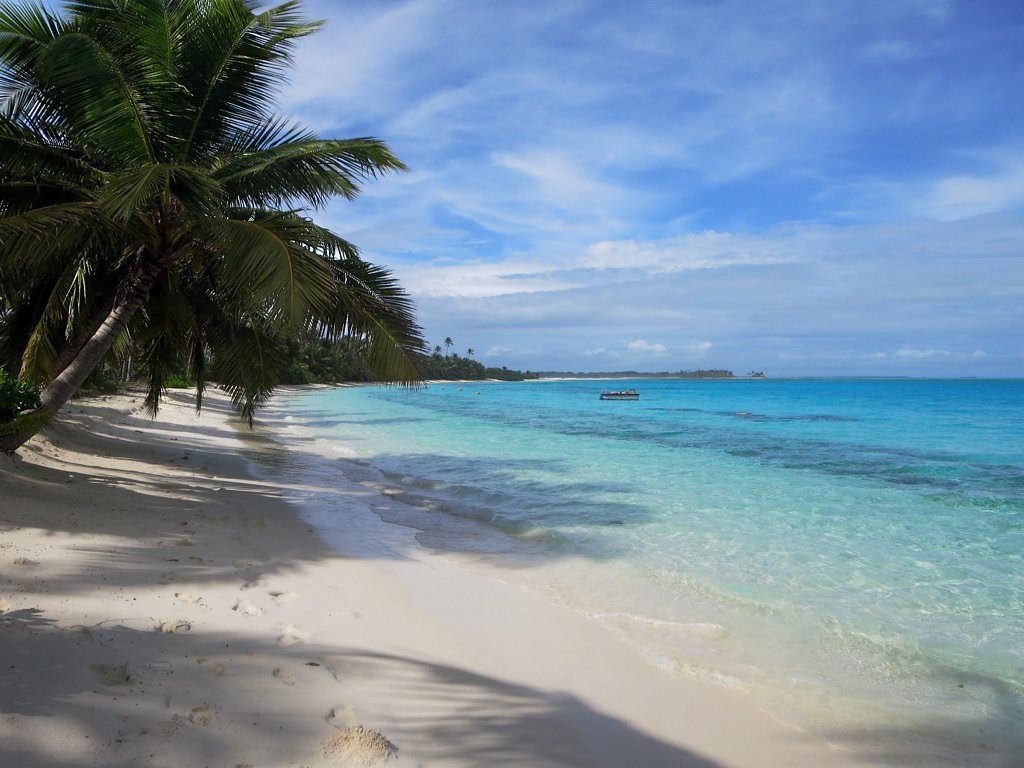
Where should you go in the Cocos (Keeling) Islands? Begin on West Island and explore the lagoon beaches, then take the ferry to Home Island for Cocos Malay culture or Direction Island for its famous white-sand shore. Local tours can open up the atoll’s wartime heritage and remote small islets. But the islands are not connected by one road, and a beautiful photograph tells you little about the ferry timetable or the current.
The Cocos (Keeling) Islands are an Australian territory in the Indian Ocean, with a unique Cocos Malay community and a coral atoll shaped by reefs, water, history and generations of islanders. The destination is deliberately low-key, with few shops and limited accommodation. A memorable trip is not the one that collects the most beaches; it is the one that understands the differences among a working settlement, a protected marine habitat and a community’s cultural home.
The essential distinction is transport. Home Island normally has ferry service every day except Sunday, while Direction Island’s public ferry operates on Thursdays and Saturdays. The Rip, a snorkelling passage near Direction Island, has powerful currents and no lifeguards. Other small islands generally require locally arranged guides or boat operators. This guide compares ten real places and the arrangements needed for a meaningful, responsible visit.
eduKate · Indian Ocean islands and living culture
Choose your Cocos reading route
Compare all ten · West Island · Home Island culture · Direction Island and The Rip · Outer-island heritage · Practical planning
Important: Home Island and Direction Island ferry days differ. The Rip has fast currents and no lifeguard. Do not plan a trip on ferry or snorkeling assumptions without checking.


The ten places at a glance
The table compares experiences rather than promising ten stops in a day. Some are beaches, others are community and history places, and others require a boat and specialist judgement.
| Place | What you will learn or enjoy | Key requirement |
|---|---|---|
| 1. West Island settlement, Visitor Centre and western shoreline | Arrival point, everyday island services and geography | Limited shops, flights and local vehicle choices |
| 2. Trannies Beach, West Island | A popular lagoon-side beach with shallow water | Lagoon conditions, no guaranteed lifeguard and reef care |
| 3. Scout Park and West Island’s community beach | A quieter public recreation place linked to the lagoon | Check facilities and weather rather than assuming a resort |
| 4. Home Island’s Cocos Malay kampong and community streets | Living island culture, language and places of worship | Respectful dress, ferry schedule and residential privacy |
| 5. Pulu Cocos Museum and Oceania House heritage | Island artefacts and a former estate residence | Museum staffing and separately booked historical tours |
| 6. Turtle Beach and Sandy Point on Home Island | Coastal recreation beside a living island community | Local marine conditions and beach access |
| 7. Direction Island and Cossie’s Beach | A beautiful outer lagoon beach reached by ferry | Limited ferry days and no shops or lifeguards |
| 8. The Rip channel off Direction Island | A fast tidal-current snorkelling site, not a beginner pool | Strong flow and no lifeguards |
| 9. Horsburgh Island and the World War II gun positions | Remote wartime remains amid conservation work | Guide and permitted landing requirements |
| 10. South Island lagoon excursions and the smaller southern islets | Guided island-hopping with coral habitats and tidal geography | Licensed skipper, tides and lawful landing |
1. West Island settlement, Visitor Centre and western shoreline
Why visit: West Island is where most visitors begin their Cocos (Keeling) Islands holiday. The airport, settlement, accommodation and Visitor Centre make it the practical base for learning how the atoll works. The island extends roughly ten kilometres, with quiet roads, coastlines and limited services that feel different from a large resort destination. A good first stop is not an expensive excursion. It is an unhurried visit to the information centre, a look at the local map and a conversation about which ferry or tour is realistic.
What makes the place important: The islands are an Australian external territory in the Indian Ocean, with West Island’s contemporary community linked to Home Island and the rest of the atoll by lagoon transport. Services, shops and public recreation spaces are concentrated on a small amount of land. This geography explains why a simple-looking destination requires advance arrangements for accommodation and food, especially around the weekly flight timetable. A visitor can also compare a developed settlement with the nearby coastal environment, where waves and salt influence the vegetation.
Practical route and responsibilities: Check the operating hours of the Visitor Centre and supermarket rather than assuming metropolitan shopping arrangements. The destination’s 2026 travel planning information notes limited flights from Perth and the importance of reserving accommodation. A hire car or bicycle can be useful on West Island, but neither takes you to Direction or Home Island. Respect working streets and airport boundaries, carry drinking water and follow local community advice about private property and conservation.
Learning question: Draw a basic diagram showing West Island, Home Island and Direction Island. Why are ferries an everyday service rather than simply an optional sightseeing activity?
Back to ten-place index · Next place
2. Trannies Beach, West Island
Why visit: Trannies Beach is one of the West Island locations that helps visitors appreciate Cocos as a coral-atoll environment rather than an ordinary ocean-facing beach. The lagoon water often appears calm and transparent, with sandy shallows and coral patches nearby. This is a convenient place for a family-oriented outing when conditions are suitable, but the key lesson is that attractive water still needs a safety assessment. A destination listing cannot promise that the beach will be suitable for every swimmer or every day.
What makes the place important: The official 2026 holiday planner identifies Trannies among West Island swimming locations, and the destination’s current attractions guide points to shallow snorkelling as one way to see marine life. Coral structures are living habitats. Tiny organisms build the features that attract snorkellers, and careless standing or collecting can do lasting damage. Water movement also depends on wind, tides and lagoon channels, so a shallow appearance cannot establish a lack of current. The beach’s popularity demonstrates how coastal recreation and conservation have to share limited space.
Practical route and responsibilities: Inspect the current local information and water conditions before going in. Children and weaker swimmers need close supervision, and a guide is appropriate for anyone unfamiliar with reefs. Avoid touching or standing on coral and do not chase fish or turtles. Use proper public access points and do not drive onto dunes or fragile shore vegetation. If wind or weather is unfavourable, a shaded land-based picnic and a look at the lagoon may be better than forcing a swim.
Learning question: Compare a shallow sandy area and a nearby coral patch. What changes in habitat and water movement, and what observations would establish swimming safety?
Back to ten-place index · Next place
3. Scout Park and West Island’s community beach
Why visit: Scout Park is another West Island place identified in local holiday information for sheltered beach recreation. It offers an alternative to concentrating every day around one popular swimming site and shows how small public spaces serve both island residents and visitors. An enjoyable stop can mean a short walk, a picnic, observing the lagoon or speaking with a willing local guide about the changing coast. It does not need to become a competitive water-sports itinerary.
What makes the place important: Public parks play a different role from private hospitality facilities. They allow a community to share shore space and offer visitors an opportunity to see the environment at ordinary human scale. Tides, wind, waves and sunlight can make a beach look different within hours; they also influence what fish or shorebirds may be visible. It would be misleading to call all clear shallow lagoons ecologically identical. The value of Scout Park is in the opportunity to compare one section of West Island’s coast with another and recognise patterns of public access and use.
Practical route and responsibilities: Bring your own basic supplies and check present facilities, shade and any signs about permissible activities. There is no basis for assuming a lifeguard or all-day café will be present. Use designated access without crossing private property, and keep children clear of boating channels or sharp coral. Respect local residents using the same space. A short observation outing may be preferable during strong winds or unusual tides, and coastal change should be documented rather than ignored.
Learning question: Draw the park’s public route, a sandy area and any nearby vegetation. Which design choices make a shoreline pleasant and which help protect habitat?
Back to ten-place index · Next place
4. Home Island’s Cocos Malay kampong and community streets
Why visit: Home Island is vital to an understanding of the Cocos (Keeling) Islands because it is the heart of the Cocos Malay community. Visitors encounter working homes, public spaces, a mosque, local shops and a way of life closely connected with family and island traditions. This is not an open-air museum in which everyone is expected to perform for tourists. A respectful visit begins by appreciating that contemporary people, not photographs of palm trees, give the island its particular character.
What makes the place important: The Cocos Malay community has a complex history connected with settlement, the coconut estate economy, relations with the Clunies-Ross family and Australia’s administration. Language, faith and local customs continue to evolve. The official tourism authority invites visitors to learn through guided cultural experiences and reminds them to dress with shoulders and knees covered on Home Island. This is not merely a decorative clothing suggestion; it expresses the expectation that visitors respect a Muslim community’s social customs. The same principle applies to photography, food and entry to worship sites.
Practical route and responsibilities: Home Island is reached from West Island by a ferry that normally operates each day except Sunday, with additional services on some Wednesdays. Check the current timetable and return trip before leaving. Dress modestly, ask permission before entering a mosque or photographing residents, and expect different food availability during Ramadan. Avoid blocking a working shop or home entrance for photographs. A cultural tour arranged with a local operator is a useful way to hear community history accurately rather than inventing meaning from appearances.
Learning question: Write down one observation about transport, one fact shared by a local cultural guide and one custom that a visitor should respect. Why are these distinct forms of knowledge?
Back to ten-place index · Next place
5. Pulu Cocos Museum and Oceania House heritage
Why visit: Home Island’s Pulu Cocos Museum and Oceania House reveal different but related parts of the islands’ history. The museum presents objects and stories about the Cocos Malay community, while Oceania House is the former estate residence of the Clunies-Ross family. Together they help visitors connect everyday life with the institutions and commercial systems that affected it. A walk through Home Island is more meaningful when one can understand the different perspectives embodied by a family home, a public collection and a grand estate building.
What makes the place important: The island’s official tourism page identifies Oceania House as a Federation-era building dating from 1893 and says it remains in use as accommodation with guided historical tours. The museum has staff attendance on certain days, particularly Wednesdays. The building’s attractive architecture is part of a historical plantation and estate system with unequal power relationships; beautiful interiors should never erase the experiences of workers and residents whose labour made the economy possible. Museum interpretation and local testimony are important complements to the written accounts of estate owners. Each source represents a different viewpoint.
Practical route and responsibilities: Do not enter Oceania House without an arranged visit or an appropriate invitation: it is a functioning accommodation property, not an all-day public mansion. Check whether a museum guide is present before boarding the ferry, and book heritage tours in advance. Respect residents and museum objects; do not handle artefacts or take photographs where prohibited. It is acceptable to appreciate the exterior or official published material when an interior tour is unavailable.
Learning question: Compare a museum household object with one feature of an estate residence. What would you need to know before making a claim about the relative living conditions of different families?
Back to ten-place index · Next place
6. Turtle Beach and Sandy Point on Home Island
Why visit: Turtle Beach and the Sandy Point foreshore offer relaxing public settings on Home Island when the lagoon is suitable. They help make clear that the island is not only a place to visit for museums or cultural talks. Families use the coastline for recreation, and travellers can watch how beach life fits around ordinary streets and community facilities. A slow walk here can be an enjoyable counterpoint to a more structured heritage tour.
What makes the place important: The current tourism guide highlights Turtle Beach’s white sand and turquoise lagoon and identifies Sandy Point as a local favourite for picnic facilities and a small play area. Both places show how the same shoreline can support recreation, vegetation and marine life. Names such as Turtle Beach should not be turned into promises of animal sightings. Marine turtles have their own feeding, nesting and migration patterns, and visitors should not approach or touch them. The beach’s condition changes with weather, tide and human use.
Practical route and responsibilities: Choose a public access route and check today’s sea state before swimming. Respect the community’s expectations for modest dress while travelling to and from beach areas, especially through residential streets. Supervise children and avoid coral contact or disturbing marine life. Local picnic areas and shops may have limited hours, so bring food and water as needed. When there are strong winds or unusual currents, enjoy the coastline from shore rather than treating the water as safe because it looks shallow.
Learning question: Observe the difference between a public park, a residential area and a beach. How can each coexist without damaging natural and cultural spaces?
Back to ten-place index · Next place
7. Direction Island and Cossie’s Beach
Why visit: Direction Island is one of the best-known excursions in the Cocos (Keeling) Islands, with white sand, coconut palms and remarkably clear lagoon water at Cossie’s Beach. Its reputation is deserved, but it is also a case study in how a remote small island needs careful visitor preparation. Most travellers reach it by ferry or a locally arranged boat, not by road, and the scenery does not come with the everyday services of a large resort.
What makes the place important: The official tourism website connects Direction Island with historical communications and wartime stories, in addition to contemporary marine recreation. The island’s heritage walk offers insight into how strategic cables and radio networks influenced Pacific and Indian Ocean history. Those features should not be blended into an unsupported claim that every sandy beach was directly involved in a battle. Environmental care is equally important: reefs and shore vegetation can be vulnerable to foot traffic, litter and careless water activities.
Practical route and responsibilities: The public ferry ordinarily operates to Direction Island on Thursdays and Saturdays, subject to change. The island has basic shelters and toilets but no shops or restaurants, so carry food and water and confirm the last return boat. Do not presume that a cancelled ferry can be replaced by a last-minute private charter. Use permitted shore areas, avoid disturbing vegetation and assess sea conditions before swimming. If a family is not confident in deeper water, the beach and a gentle heritage walk can be enjoyable without any ambitious snorkelling.
Learning question: Compare what a traveller must pack for Direction Island with what they need for a day in West Island’s settlement. Why does the same territory have such different levels of infrastructure?
Back to ten-place index · Next place
8. The Rip channel off Direction Island
Why visit: The Rip is famous among snorkellers because a current moves through a reef passage near Direction Island, allowing experienced swimmers to observe marine life while drifting. That same moving water is the central reason it must be treated differently from the shallower beach near Cossie’s. A guide should never advertise The Rip as a universally safe children’s snorkelling place merely because it is within sight of a family beach.
What makes the place important: The official destination information states plainly that The Rip’s current can be strong and fast-flowing and that no lifeguards are present. Coral and fish habitat are important, but ecological value does not turn a dangerous passage into an automatic recreational recommendation. In a drift snorkel the swimmer’s direction and speed are influenced by water movement, not just swimming effort. Boating restrictions and the need to remain clear of vessels add further risks. Understanding these facts makes a cautious decision a mark of good planning rather than a missed adventure.
Practical route and responsibilities: Only consider The Rip if you are a strong swimmer comfortable in open water and have checked the tide, current and the advice of a qualified local operator. Wear appropriate equipment, including fins, and consider a guided arrangement with safe entry and pickup points. Never swim alone, enter in poor visibility or follow strangers into water beyond your ability. The operator’s guide notes calmer shallow coral areas closer to the beach as an alternative for less experienced swimmers, but those also require normal marine safety and reef respect.
Learning question: Draw a directional arrow showing current through a reef channel. Why can a channel that helps a skilled snorkeller move quickly be hazardous to someone who tries to swim against it?
Back to ten-place index · Next place
9. Horsburgh Island and the World War II gun positions
Why visit: Horsburgh Island is important because the Cocos (Keeling) Islands played a strategic role in wartime communications and defence. The official tourism authority highlights surviving naval gun positions on Horsburgh as a reason to arrange a guided visit. Unlike a resort promenade, this is a remote island where reaching an interesting historical remnant requires transport, local knowledge and respect for present environmental management.
What makes the place important: Two preserved gun positions help explain why a small atoll mattered to maritime routes and strategic installations. However, a weapon emplacement is only one kind of historical evidence: the broader story includes the people operating facilities, the community around the islands and the relationship between the First and Second World Wars. The island also illustrates contemporary conservation. Parks Australia’s 2026 news reports the release of endangered Christmas Island blue-tailed skinks on Horsburgh as part of species-recovery work. This should sharpen visitors’ respect for protected habitat rather than invite them to search for the animals.
Practical route and responsibilities: Do not assume that the island is open to an independent kayak landing or unlimited exploration. Arrange a legitimate local skipper or tour and confirm the permitted route, weather and conservation instructions. Stay away from fragile gun structures and habitat-restoration areas. Do not handle wild skinks, collect objects or fly a drone without authorisation. A distant boat interpretation may be preferable when a landing is not appropriate. No cultural or nature benefit justifies disturbing an endangered species.
Learning question: Separate a physical gun position, a dated wartime event and a present conservation programme. What evidence is needed for each, and why can they share one island without being the same story?
Back to ten-place index · Next place
10. South Island lagoon excursions and the smaller southern islets
Why visit: South Island and the surrounding small southern islets allow travellers to experience the broader Cocos atoll beyond its best-known beaches. Shallow lagoon waters, changing sandbanks and coconut-fringed coastlines can be explored on an organised boat or kayaking trip suited to conditions. The attraction is the diversity of small environments rather than a promise that every islet is open for independent camping or that a certain sandbar will be visible at low tide.
What makes the place important: The island group demonstrates how an atoll consists of reefs, islands, lagoon basins and channels formed and reshaped by wave action and long geological processes. Even a seemingly empty island can have ecological, cultural or land-management restrictions. Local tours can also explain how island residents use and navigate the lagoon. The broader national-parks system includes Pulu Keeling on the northern atoll, but it is primarily managed for scientific conservation and is not an ordinary public day-trip beach; South Island excursions should not be confused with unrestricted access to that separate protected area.
Practical route and responsibilities: Book with a local operator who can confirm legal landing sites, safe weather and the return journey. Tide heights can change which sandbanks are exposed and how shallow channels are navigated. Never walk between islands solely because a satellite image shows pale water, and do not step on coral. Carry sufficient water, food and protection from sun, and leave every beach clean. A calm lagoon photograph does not guarantee a safe paddle or a rescue service. If conditions are not suitable, stay on the settled islands.
Learning question: Map the southern atoll’s islands, lagoon and outer reef. Which parts may change with the tide, and which questions require a coastal geologist or a local skipper to answer?
Back to ten-place index · Planning and questions
Build a Cocos itinerary that respects ferry days
For a first stay, spend time on West Island before committing to the other islands. The Visitor Centre, Trannies Beach and Scout Park offer different local experiences with fewer transport dependencies. Set aside a separate day for Home Island, preferably when the museum and cultural tours are available. The official planning guide favours Wednesday for cultural experiences there. Dress respectfully and do not assume every venue operates during Sunday or Ramadan.
Direction Island deserves its own timetable. The public ferry usually runs on Thursdays and Saturdays, and the return boat must be treated as a fixed transport commitment. Pack your own food and water. If you are not an experienced open-water snorkeller, you do not need to enter The Rip: use the calmer permitted shallows when conditions are suitable or enjoy the beach and heritage route from dry land. Horsburgh and South Island are specialist excursions; they should not be added casually to a public-ferry day.
Before you leave your accommodation
- Confirm the current island ferry timetable. Home Island service normally operates daily except Sunday; Direction Island service is normally on Thursdays and Saturdays.
- Check flight days and accommodation before arrival. Small island transport and shops do not work like major metropolitan services.
- Home Island is a living Muslim community. Dress modestly, covering shoulders and knees, and respect prayer, Ramadan and residents’ privacy.
- Check all marine conditions. The Rip is a fast tidal-current snorkelling area with no lifeguards and is unsuitable for inexperienced swimmers.
- Do not touch or stand on coral, feed fish or handle turtles. Use conservation-conscious local guides.
- At Horsburgh Island, respect both wartime remains and endangered-species recovery areas, including the 2026 blue-tailed skink release.
- Do not enter restricted conservation sites or assume North Keeling is an ordinary day-trip beach; Pulu Keeling National Park is mainly managed for research and biodiversity protection.
- Bring enough food, water and sun protection to Direction Island, which has only basic facilities.
- Use authorised vessel routes and observe port authority restrictions on anchoring and reef channels.
- Accept cancellations or changes due to wind and tide rather than arranging an unsafe unofficial crossing.
Three travel styles that work well
For a family focused on culture, choose West Island orientation and a separately arranged Home Island day with the Pulu Cocos Museum and a local cultural guide. For relaxed coast lovers, use Trannies, Turtle Beach and a carefully timed Direction Island trip, choosing safe water rather than ambitious snorkelling. For history enthusiasts, compare Oceania House and the World War II gun positions on Horsburgh through a properly booked tour. These are alternatives and need not be combined into one rushed circuit.
Frequently asked questions
Are Cocos (Keeling) Islands the same as Christmas Island?
No. Both are Australian external territories in the Indian Ocean, but they are separate island groups with different landscapes and services. Cocos is a coral atoll; Christmas Island has a very different volcanic and limestone environment.
Can I drive between West Island and Home Island?
No. They are separate islands linked by a passenger ferry. Arrange transport on the island where you are staying or visiting.
Which days does the Direction Island ferry run?
The destination’s current guide lists Thursday and Saturday services, subject to change. Confirm the departure and return before making plans.
Can young children snorkel The Rip?
The Rip has strong, fast-flowing current and no lifeguards. It is not a normal beginner snorkeling pool; choose a calmer, appropriately supervised area if conditions permit.
What should visitors wear on Home Island?
The tourism authority asks visitors to cover shoulders and knees in respect of the Cocos Malay community. More specific customs may apply around worship or community events.
Can I walk into Oceania House whenever I want?
No. It operates as accommodation and provides arranged historical tours. Confirm entry or a guided visit rather than assuming every room is public.
Is Horsburgh Island just a World War II site?
It has surviving historic gun positions and a present conservation role, including endangered blue-tailed skink reintroduction reported in 2026.
Can tourists land freely in Pulu Keeling National Park?
No. North Keeling’s park is primarily managed for research and habitat conservation, with limited, controlled visitation rather than ordinary unrestricted beach access.
Do ferry timetables change during Ramadan?
Travel and hospitality arrangements can vary. Home Island restaurants and activities may have reduced hours during Ramadan, so confirm directly and respect community practices.
A small field notebook for geography and cultural understanding
Use three columns: what you can see yourself, what an official or local interpreter explains, and what remains uncertain. At Direction Island you may observe reef colour but need soundings and current measurements to explain conditions. At Home Island you can observe the ferry route but must listen to Cocos Malay voices to understand social history. At Oceania House you can see architecture but need museum and community sources to explain the relationships of those who lived and worked there.
As a Mathematics exercise, compare the short water distance between West and Home Island with an actual door-to-door trip. Add waiting time, ferry schedule and local transfers: the shortest straight line does not determine when you can arrive. This emphasis on complete reasoning and explicit assumptions also underlies eduKate’s Secondary 1 Mathematics Tutor Clementi | Small Groups Tutorials.
Continue exploring the Cocos (Keeling) Islands
Top 10 Things to Do When Visiting and Touring Cocos (Keeling) Islands · Top 10 Things to Learn When Visiting and Touring Cocos (Keeling) Islands · Explore Christmas Island · World Travel Hub
Official sources and photo attribution
Sources reviewed 20 October 2026, Singapore time. Island ferry, cultural-tour, marine and conservation conditions are not permanent, so the latest official information and operator notices must be checked before travelling. The cover photograph is from 2015 and does not establish present conditions.
- Cocos Keeling Islands — official destination and island overview
- Cocos Keeling Islands — West Island
- Cocos Keeling Islands — Home Island
- Cocos Keeling Islands — Home Island cultural day trip, museum and Oceania House
- Cocos Keeling Islands — Direction Island, The Rip and ferry planning
- Cocos Keeling Islands — culture and Horsburgh Island heritage
- Cocos Keeling Islands — 2026 holiday planning and beaches
- Cocos Keeling Islands — island activities and guided tours
- Parks Australia — Pulu Keeling, conservation and research
- Parks Australia — 2026 draft plan for Pulu Keeling National Park
- Parks Australia — Christmas Island blue-tailed skinks released on Horsburgh Island
- Cocos Port Authority — vessel code of conduct and protected waters
- Wikimedia Commons — Direction Island Beach by David Stanley, 2015
- Creative Commons Attribution 2.0