
The French Southern and Antarctic Lands, usually abbreviated TAAF, bring together a remarkably varied territory. Crozet, Kerguelen, Saint-Paul and Amsterdam lie in remote southern seas; Terre Adélie is an Antarctic district; and the Îles Éparses are scattered tropical islands in the western Indian Ocean. They cannot be visited on one ordinary passenger itinerary. Their most significant places are research, conservation and heritage sites that deserve understanding, not an advertisement for unrestricted tourism.
Start with a crucial practical fact: The TAAF administration says it no longer offers tourist stays on its supply vessel Marion Dufresne. Landing in the Austral nature reserve is strictly regulated, many named areas are fully closed, the Îles Éparses require advance permission from the Prefect, and Antarctica has separate treaty-based activity approval. A list of ten beautiful islands should never imply that travellers can arrive and explore them independently.
The UNESCO property called French Austral Lands and Seas was inscribed in 2019 and comprises Crozet, Kerguelen, Saint-Paul, Amsterdam and associated marine areas. It does not extend automatically to Terre Adélie or the tropical Îles Éparses. There was also a major fire on Amsterdam Island in January 2025, damaging vegetation and vital infrastructure. These distinctions affect how the territory should be described in October 2026.
eduKate · Remote French territories, ecology and responsible learning
Ten places to study, not ten tourist stops
Compare ten places · Crozet protection · Kerguelen science · Amsterdam and Saint-Paul · Antarctica and Scattered Islands · Access rules
No ordinary tour itinerary: The Marion Dufresne no longer offers public tourist stays and many of the natural sites are fully protected or research-only.
Ten significant places and their real access status
Each entry explains a location worth learning about. They include research bases, penguin and elephant seal habitats, protected volcanic islands, an Antarctic research setting and a place of historical remembrance. None is presented as a guaranteed bookable holiday stop.
| Place | Why it matters | Real access rule |
|---|---|---|
| 1. Île de la Possession and Alfred Faure station, Crozet | Research base and volcanic island ecology | Scientific station and reserve, no general walk-in tourism |
| 2. Île aux Cochons, Crozet — the king penguin colony | Extraordinary penguin population and long-term ecological monitoring | Fully protected zone: ordinary visitor access prohibited |
| 3. Île de l’Est and Crozet’s protected seabird islands | Unusual landforms and undisturbed nesting habitats | Integral protection: no ordinary landing |
| 4. Port-aux-Français station and Gulf of Morbihan, Kerguelen | Working research infrastructure in a remote archipelago | Station is operational, not a public tour stop |
| 5. Courbet Peninsula and the elephant-seal coast, Kerguelen | A major Southern Ocean pinniped breeding environment | Protected reserve and wildlife distance; no normal tour access |
| 6. Port Jeanne d’Arc former whaling site, Kerguelen | Historic industrial settlement within a strict conservation area | Entry into former buildings is prohibited |
| 7. Amsterdam Island, Martin-de-Viviès and the albatross cliffs | Scientific base, rare birds and a landscape changed by a 2025 fire | Working base and restricted cliffs; post-fire recovery |
| 8. Saint-Paul Island and its crater lagoon | A distinctive volcanic landscape in an integral protection zone | Entire island off-limits except express exceptional authorisation |
| 9. Terre Adélie and Dumont d’Urville Antarctic station | An Antarctic research territory under the Antarctic Treaty system | Separate Antarctic permission; not part of French Austral UNESCO listing |
| 10. Tromelin Island and the Îles Éparses conservation and memory | Scattered tropical islands, seabirds and a history of people abandoned | Terrestrial visits prohibited without advance Prefect permission |
1. Île de la Possession and Alfred Faure station, Crozet
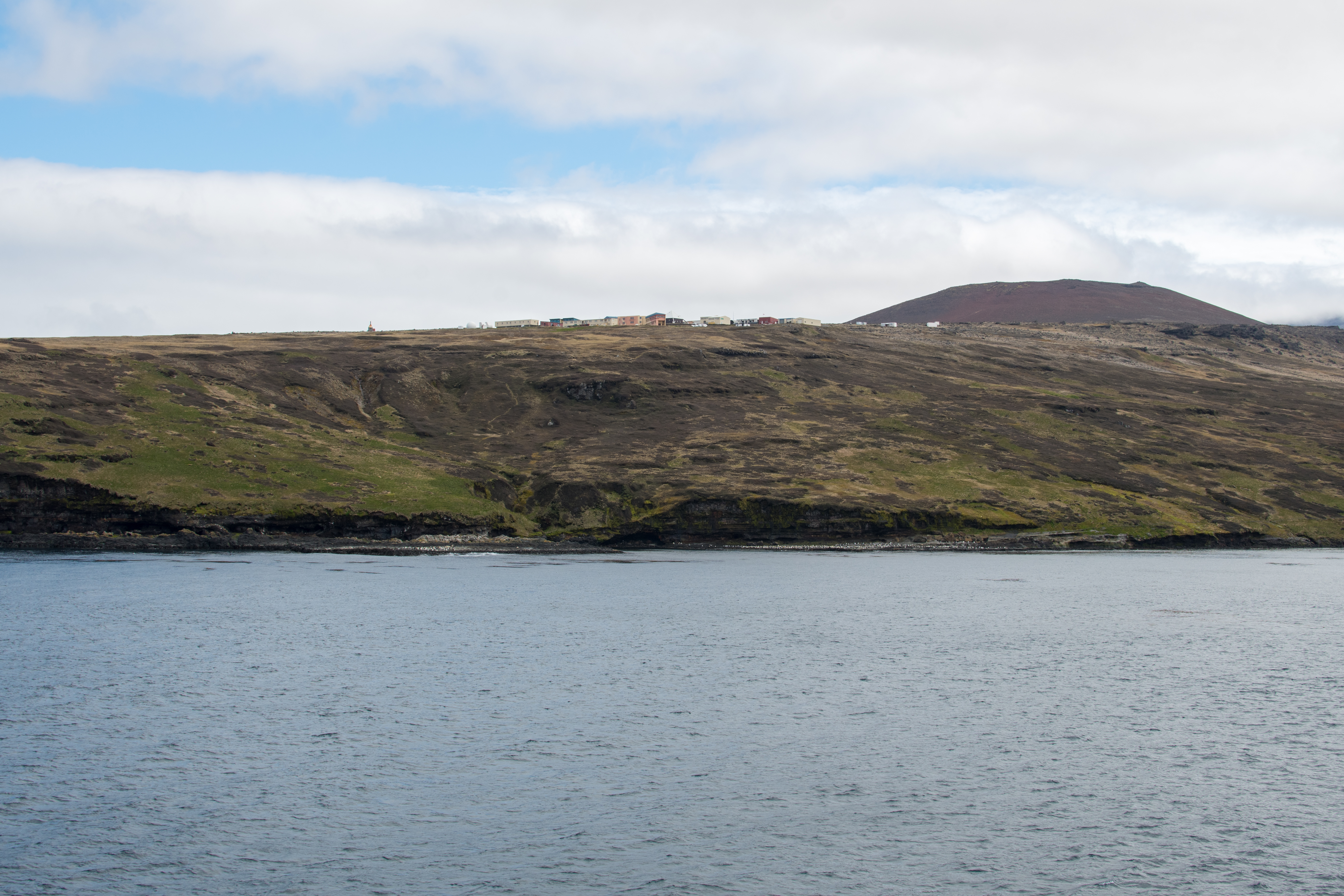
What makes the place important: Île de la Possession is the principal staffed island of the Crozet Archipelago, one of the remote subantarctic island groups administered by the French Southern and Antarctic Lands. The Alfred Faure research base occupies a dramatic landscape of green volcanic slopes and Southern Ocean weather. Its significance is not that a tourist can book a hotel there. Rather, the base shows how people maintain long-term research and environmental protection far from ordinary transport. A good guide should explain the functions of a station while recognising that the staff are working, not hosting a sightseeing village.
History, geography and conservation: The Crozet Islands are essential nesting grounds for seabirds and breeding areas for marine mammals. Their ecological value depends on the connection between island habitats, ocean productivity and seasonal breeding behaviour. Alfred Faure operates within a nature reserve that also contains tightly protected zones. The presence of research staff does not make the land generally accessible or imply that every trail may be walked. Scientific work requires medical planning, supplies and prevention of invasive organisms, so the logistics of the station are part of its environmental story. The 2020 archive photograph associated with this guide illustrates the setting, not the present access.
Permissions and responsible learning: The French administration no longer sells ordinary tourism voyages aboard the supply ship Marion Dufresne. A visitor cannot obtain access simply by buying a normal ship ticket or arriving with a private yacht. Permits, district approval and conservation rules apply, with some research-only or fully protected areas closed altogether. Do not enter laboratory buildings, living quarters or penguin colonies without the required authorisation. If physical access is not available, official TAAF reports, UNESCO maps and the island’s scientific studies are the appropriate means of learning.
Original learning question: Compare a research base with a holiday hotel. What needs do they share—shelter, food, water and waste systems—and what additional measures are necessary to protect wildlife and maintain scientific observations?
Return to the place index · Next place
2. Île aux Cochons, Crozet — the king penguin colony
What makes the place important: Île aux Cochons, or Pig Island, is associated with one of the world’s most remarkable king penguin colonies. It is an important subject for understanding seabird ecology and why large breeding populations require scientific monitoring. The island is not a place where travellers can arrive on a yacht, land a dinghy and walk toward a colony. It is listed by the French authorities as a zone of complete protection, and its ecological significance is strengthened, not diminished, by that restriction.
History, geography and conservation: King penguin breeding success depends on conditions at sea as well as the quality of terrestrial habitat. In recent years scientific teams have studied major changes in penguin numbers on Île aux Cochons, relying on carefully controlled work and remote observations. A dramatic decline or increase described in a report must be connected with date, method and uncertainty; a single archival photograph is insufficient evidence for a current population. TAAF’s official account of an exceptional scientific mission stresses the specialised clothing and biosecurity preparation needed before the team could visit this strictly protected colony. Such measures are not a normal tourism formality.
Permissions and responsible learning: TAAF lists Île aux Cochons among the areas where public access is prohibited. No standard passenger, yacht or expedition cruise can treat it as an ordinary landing destination. Research teams require explicit authorisation and strict protections against introduced organisms and disease. The best public experience is to compare satellite observations, official wildlife reports and UNESCO information without disturbing the birds. A reader should never try to reach this island independently in the hope of replicating a penguin photograph.
Original learning question: Use two dated population estimates from a scientific source and ask whether survey methods were comparable. Why is a large penguin colony valuable as a long-term ecological indicator, rather than simply a breathtaking photograph?
Return to the place index · Next place
3. Île de l’Est and Crozet’s protected seabird islands
What makes the place important: Île de l’Est, or East Island, is another of Crozet’s most important protected landscapes. Its steep volcanic terrain and isolated seabird habitats make it attractive to ecological researchers and cartographers. This entry is deliberately a remote-study destination: the French nature-reserve rules close the island to routine public entry. Understanding an inaccessible island through maps and documented scientific work is legitimate travel learning, and far more responsible than implying that isolation grants a right to enter.
History, geography and conservation: The different islands of Crozet support distinct habitat types and populations of seabirds. Relief, rainfall and wind affect where nesting colonies can thrive, while the surrounding ocean supports a web of prey species. Conservation aims to keep such systems relatively undisturbed and to monitor ecological changes caused by climate or other pressures. The islands also show how active research can coexist with strict bans on tourism: scientists may need to gather evidence at selected sites while the vast majority of visitors are excluded to avoid risks.
Permissions and responsible learning: The TAAF access list specifically identifies Île de l’Est as a fully protected area. Other small Crozet islands such as the Îlots des Apôtres and Île des Pingouins also have tight protection. Do not infer from a nautical chart that an uninhabited cove is available for anchoring or landing. Private vessels need extraordinary authorisations even for more accessible islands, and special protection zones are not made open simply by an ordinary travel permit. Use institutional maps and wildlife imagery with dates, and explain any uncertainty in the scientific record.
Original learning question: Sketch the Crozet island group and classify areas by what the law permits: operational base, protected nature reserve and forbidden integral-protection zones. Why might the ecological value of one island justify stronger restrictions than another?
Return to the place index · Next place
4. Port-aux-Français station and Gulf of Morbihan, Kerguelen
What makes the place important: Port-aux-Français is the principal research and administrative station in the Kerguelen Islands, a vast subantarctic archipelago sometimes called the Desolation Islands. Its buildings and moorings occupy the eastern side of the main island near the Gulf of Morbihan. The station’s interest lies in the way logistics, weather science, biological research and territorial management operate together. It cannot be understood as a visitor resort or port with ordinary passenger transfers. A view of its roofs and piers tells only part of a demanding story about maintaining a remote community of scientific and technical staff.
History, geography and conservation: The Kerguelen landmass has a remarkable volcanic history and exceptionally varied coastlines. Its marine environment supports fish, seabirds and marine mammals, while on land introduced species and past economic activity have affected ecology. Port-aux-Français demonstrates how people collect research data, supply field work and operate under strict reserve rules. The buildings are used for administration and practical needs, and may contain technical equipment that requires protection. A historical photograph, even one showing people moving about freely, should not be presented as proof that a tourist can visit today.
Permissions and responsible learning: TAAF says it no longer offers tourist passage aboard the Marion Dufresne supply ship. Private vessel anchoring and landing in Kerguelen are very limited and regulated. The district chief controls authorised movements on land, and some sites require separate written permission from the Prefect. Laboratory work or staff quarters are not available for casual entry. Do not give travellers an invented ferry schedule from Réunion or an unverified hiking route from Port-aux-Français to distant parts of the archipelago. An informed reader can still study the research station using official TAAF information.
Original learning question: Draw a network of ships, a research base and an offshore monitoring site. What logistical systems are needed to maintain a year-round station when there are no ordinary shops, public buses or civilian flights nearby?
Return to the place index · Next place
5. Courbet Peninsula and the elephant-seal coast, Kerguelen
What makes the place important: The Courbet Peninsula on Kerguelen’s main island is especially important for southern elephant seals. It is a broad coastal environment distinct from the archipelago’s rugged glaciated western terrain. The presence of breeding elephant seals makes it a remarkable subject for ecology, but not a place for close-up interactions. Seals can be enormous and unpredictable, and their use of beaches changes with breeding and moulting cycles. An educational view should respect their need for undisturbed shore space.
History, geography and conservation: UNESCO describes Kerguelen’s Courbet Peninsula as supporting the world’s second-largest concentration of southern elephant seals. This is not merely an impressive number; it indicates a system in which animals move between ocean feeding grounds and terrestrial breeding habitats. Population studies involve tagging, remote monitoring and measurements over time. One group seen in a photograph does not establish the present condition of the whole population. The region is also important for birds and plant communities. Conserving the shoreline requires understanding both the animals and the environment supporting them.
Permissions and responsible learning: Any permitted field access is controlled by TAAF research and reserve rules, and the public should not attempt to approach seal colonies. Elephant-seal haul-outs are neither beaches for swimming nor destinations suitable for independently organised wildlife photography. Field teams need biosecurity measures and safe routes; the presence of animals can force changes in movement or delay operations. Use UNESCO’s ecological descriptions and authorised scientific reports to learn about the peninsula instead of suggesting that an ordinary passenger can walk there.
Original learning question: Make a diagram of the movements of a breeding seal from sea to shore. What would a scientist measure to estimate colony growth? Explain why a traveller’s one-time seal count cannot provide a reliable long-term trend.
Return to the place index · Next place
6. Port Jeanne d’Arc former whaling site, Kerguelen
What makes the place important: Port Jeanne d’Arc is a significant historic site in the Kerguelen Islands because it preserves traces of the territory’s earlier commercial use. The former whaling station is related to the exploitation of marine mammals and to attempts to sustain industrial activity in an extremely remote setting. Its surviving structures can inform historical research, yet old buildings may be unsafe or fragile. The interest of the site should not lead readers to imagine an open industrial museum reached by a short public road.
History, geography and conservation: Whaling-era infrastructure reveals how people handled vessels, cargo, machinery and difficult weather, but the physical evidence must be interpreted alongside written sources. Such industries had substantial consequences for marine life and were part of the global demand for animal products. Preservation work can provide information about materials and labour practices while protecting visitors and the environment. TAAF identifies Port Jeanne d’Arc and Port Couvreux as heritage areas with particular restrictions. It is important to distinguish legally protected historical material from buildings that are structurally safe to enter.
Permissions and responsible learning: The TAAF access and mooring guidance expressly prohibits entry into the buildings of Port Jeanne d’Arc and Port Couvreux and bans camping within thirty metres of the historic structures. An exceptional permit for other parts of Kerguelen does not waive those restrictions automatically. Do not recommend climbing, overnight camping, collecting ironwork or exploring a roofless workshop. A permitted distant view might be possible for authorised teams, but for ordinary readers official archives, archaeological descriptions and photographs are the appropriate routes to understanding.
Original learning question: Compare the equipment an industrial whaling station needed with the facilities of a modern research base. Which historical activities can be explained by a surviving building, and which need documents or oral histories?
Return to the place index · Next place
7. Amsterdam Island, Martin-de-Viviès and the albatross cliffs
What makes the place important: Amsterdam Island has long been known for its scientific station Martin-de-Viviès, rare seabirds and dramatic sea cliffs. It differs from the colder Kerguelen and Crozet groups in ecological character and climate. The location is a vital place for studying seabird populations and the challenges of managing invasive species. However, any visitor description in 2026 must acknowledge that Amsterdam was badly affected by a fire in January 2025, which damaged vegetation and parts of station infrastructure. The landscape cannot be portrayed as unchanged from images taken before that event.
History, geography and conservation: TAAF reported that the fire spread across more than half of Amsterdam Island, prompting evacuation of station personnel and an extended technical recovery mission. This episode underscores the vulnerability of a remote island where emergency services are far away. The island is internationally important for the Amsterdam albatross, one of the rarest seabirds, while the Entrecasteaux cliffs support large numbers of yellow-nosed albatrosses. UNESCO notes these distinctive conservation values. Scientific work investigates long-term population trends, breeding success and the interaction between land and sea, but post-fire conditions require more than an old photograph to assess.
Permissions and responsible learning: Ordinary tourists are not entitled to visit Martin-de-Viviès or approach protected breeding cliffs. TAAF rules prohibit access to the peat plateau and Pointe d’Entrecasteaux cliffs, among other sensitive areas. The main authorised landing point on Amsterdam is La Cale, but that designation is for permitted operations rather than independent public access. Because the fire affected essential infrastructure and ecological conditions, even authorised scientific or maintenance activity needs careful coordination. Use current TAAF recovery reports, not pre-2025 travel narratives.
Original learning question: Compare Amsterdam’s pre-fire vegetation photographs with official dated recovery reports. What indicators—plant cover, soil condition, bird nesting outcomes and functioning station infrastructure—would help measure recovery without disturbing habitats?
Return to the place index · Next place
8. Saint-Paul Island and its crater lagoon
What makes the place important: Saint-Paul Island contains a striking volcanic crater and a sheltered-looking lagoon connected with the ocean. From geological maps it may look like a place for an unforgettable walk along a crater rim or a small-boat entry into the basin. That interpretation would be irresponsible. The whole island is under integral protection, making it a place to study remotely rather than a destination to include in an ordinary yacht route.
History, geography and conservation: The island is part of the Saint-Paul and Amsterdam district of the French Southern and Antarctic Lands and, together with Crozet and Kerguelen, belongs to the 2019 UNESCO World Heritage property French Austral Lands and Seas. Its volcanic form raises questions about eruptions, erosion, sea-level influence and how small islands support seabirds and marine life. Protection preserves these ecological and geological processes. Historical records also show episodes of maritime and commercial interest, but they do not justify present entry. One image of a circular lagoon cannot fully explain the crater’s formation or the condition of protected habitats.
Permissions and responsible learning: TAAF states clearly that access to Saint-Paul is prohibited except with an express authorisation from the Prefect. Anchoring inside the crater is also prohibited without an exceptional derogation. Do not tell readers they can camp beside the lagoon, paddle into the crater or follow an unrestricted summit path. A yacht’s general request to enter the region is not a permit to violate the integral reserve. Maps, research reports and UNESCO descriptions provide the right public route to learning about the island.
Original learning question: Sketch the island’s crater and the passage connecting it to the sea. Which aspects of its form can be observed from a map, and what evidence would a geologist need to explain its formation and marine ecology?
Return to the place index · Next place
9. Terre Adélie and Dumont d’Urville Antarctic station
What makes the place important: Terre Adélie is the Antarctic district administered by TAAF, with Dumont d’Urville serving as an important French research base on the Antarctic coast. It differs fundamentally from the subantarctic islands farther north. This is an icy continental and coastal research environment where visitors do not arrive by normal commercial flights or cruise-ticketed public ferry routes to the station. It is a valuable destination to understand through scientific material, especially for anyone curious about the Antarctic climate and research logistics.
History, geography and conservation: France’s presence in Terre Adélie operates within the framework of the Antarctic Treaty and the Environmental Protocol, which set obligations for research and environmental protection. The base supports science concerning atmosphere, sea ice, animals and polar processes. Its named district belongs to TAAF administration, but UNESCO’s French Austral Lands and Seas property covers Crozet, Kerguelen, Saint-Paul and Amsterdam—not Terre Adélie. This distinction is often lost in travel writing that uses the phrase French Southern and Antarctic Lands as though every district shares one protected-area designation.
Permissions and responsible learning: Travel or other activities in Antarctica are subject to authorisation under the relevant Antarctic framework. TAAF provides separate procedures for proposed Antarctic activities, including tourism by eligible operators. Station areas are operational and not automatically available for unscheduled shore tours. Weather, sea ice, rescue capability and scientific operations govern access. Do not promise a public walk through Dumont d’Urville or a helicopter excursion merely because a map shows the site. Official Antarctic research resources offer a safer introduction for general readers.
Original learning question: Compare a subantarctic island research station with Dumont d’Urville. Which systems are needed in both, and which additional challenges arise from sea ice, extreme cold and Antarctic Treaty obligations?
Return to the place index · Next place
10. Tromelin Island and the Îles Éparses conservation and memory
What makes the place important: Tromelin represents a different district of the French Southern and Antarctic Lands: the Scattered Islands, or Îles Éparses, of the western Indian Ocean. It is a low coral island unlike the volcanic subantarctic terrain of Crozet or the icy landscape of Terre Adélie. Nearby islands in the administrative district include Europa, Juan de Nova, the Glorieuses and Bassas da India. These places are ecologically significant, but their status must not be confused with the 2019 UNESCO inscription for the French Austral Lands and Seas, which does not include the scattered tropical islands.
History, geography and conservation: Tromelin also has a profoundly important human history. In 1761 the ship Utile was wrecked, and enslaved Malagasy people were abandoned on the island after some of the crew left; survivors were rescued in 1776. Archaeological research has investigated how those left behind survived in an exceptionally difficult environment. This is not a light-hearted shipwreck adventure. The story calls for sensitivity to enslavement, abandonment and resilience, alongside an interest in the island’s seabirds, turtles and reef habitats. The wider Îles Éparses have scientific and conservation significance of their own.
Permissions and responsible learning: TAAF’s current access rules for the Îles Éparses prohibit going ashore without advance authorisation from the Prefect. Even anchoring is regulated. There is no scheduled public holiday ferry to Tromelin, and a government airstrip or research shelter does not function as a tourist resort. The appropriate way to encounter its history may be through museum exhibits, archaeological reports and the official TAAF exhibition on those abandoned after the wreck. A remote photographic or map-based study is more responsible than an unauthorised landing.
Original learning question: Write two columns for Tromelin: ecological protection and historical memory. How do archaeology and recorded testimony reveal a human story that an empty-looking modern beach photograph would miss?
Return to the place index · Plan how to learn responsibly
Understand the real travel and research rules
A reader might reasonably ask whether a single expedition ship visits Crozet, Kerguelen, Amsterdam and Antarctic Terre Adélie. The administration’s clear answer to normal tourism is that Marion Dufresne no longer sells tourist stays. It remains an essential logistical vessel supporting research and territorial responsibilities. Private anchoring around Crozet, Kerguelen and Amsterdam is strictly limited, with exceptional approvals possible only under specific circumstances. For many readers there is no standard legal tourist itinerary that would allow entry to the sites described in this guide.
TAAF recognises fully protected areas and sites reserved for scientific work. The 2026 official list expressly prohibits visiting Île aux Cochons, Île de l’Est and all of Saint-Paul, as well as many protected Kerguelen and Amsterdam locations. Even authorisation to enter another part of a district does not confer a right to enter a protected seabird colony or former whaling building. All movement ashore is subject to local administrative control, and some permits must be obtained in writing before any activity.
Different TAAF districts also follow different legal frameworks. Terre Adélie operates within the Antarctic Treaty system, requiring appropriate assessment and authorisation for activities. The Îles Éparses are a separate tropical district where landing is prohibited without advance approval from the Prefect. These rules serve scientific, environmental, historical and sometimes diplomatic purposes. They do not become less important because a place lacks permanent ordinary residents.
The practical 2026 access checklist
- Do not advertise a public tourist berth aboard Marion Dufresne; TAAF’s current notice says tourist stays are no longer offered.
- Differentiate the UNESCO-inscribed Austral islands from Terre Adélie and the Îles Éparses, which are separate districts.
- Do not offer ordinary landings on Île aux Cochons, Île de l’Est, Saint-Paul or other fully protected sites.
- Treat Port-aux-Français, Alfred Faure, Martin-de-Viviès and Dumont d’Urville as operational bases, not accommodation open to independent travellers.
- Remember that Amsterdam was affected by a major 2025 fire, with follow-up restoration and ecological monitoring still relevant.
- Seek all required French permissions for anchoring, landing, scientific work and Antarctic activities; ordinary visitor interest is not a substitute.
- Protect seabirds, seals, vegetation and archaeological sites through full biosecurity and non-disturbance procedures.
- Do not enter historic Port Jeanne d’Arc or Port Couvreux buildings or camp close to them against conservation regulations.
- Check the separate rules for Tromelin, Europa and the other scattered tropical islands before discussing any landing or marine activity.
- Use UNESCO and TAAF’s scientific reports and legitimate licensed photographs for remote learning when physical access is not possible.
Why a remote-study journey can be more appropriate than physical travel
The scientific value of these places depends partly on how little people disturb them. A high-quality remote study can compare volcanic structures, breeding seabird colonies, management practices and historical material without carrying organisms between islands or entering fragile habitat. An authorised scientist may need to collect data in a restricted zone while a casual visitor does not. This is not unfair treatment of tourists: the environmental impact and purpose of a visit matter. A responsible reader can discover the same fascinating facts using high-quality official imagery, dated research and accurate maps.
Frequently asked questions
Can tourists book a voyage aboard the Marion Dufresne?
TAAF’s official tourism page states that it no longer offers tourist stays aboard Marion Dufresne. Do not rely on old travel advertisements.
Which TAAF islands are UNESCO World Heritage-listed?
The French Austral Lands and Seas property covers the Crozet and Kerguelen archipelagos and the Saint-Paul and Amsterdam group, with associated protected marine areas. It does not include Terre Adélie or the Îles Éparses.
Can visitors land on Île aux Cochons to see penguins?
No ordinary visitor landing is allowed. The island is an integral-protection zone with exceptional scientific work only when authorised.
Is Saint-Paul Island’s volcanic crater open for tourism?
No. The island is strictly protected and access is prohibited except by express exceptional authorisation from the TAAF Prefect.
What happened on Amsterdam Island in 2025?
A major vegetation fire starting in January 2025 damaged a large part of the island and threatened the Martin-de-Viviès station. Personnel were evacuated and specialised recovery work followed.
May travellers enter former whaling buildings in Kerguelen?
No. TAAF specifically prohibits entry to the buildings at Port Jeanne d’Arc and Port Couvreux and limits camping close to them.
Is Dumont d’Urville part of the same nature reserve as Crozet?
No. Dumont d’Urville lies in Terre Adélie, an Antarctic district governed by the Antarctic Treaty framework, not the 2019 French Austral Lands and Seas UNESCO property.
Can tourists visit the Scattered Islands such as Tromelin?
Ordinary shore visits require advance authorisation from the Prefect and are not sold as scheduled public tourism tours.
Why is Tromelin historically important?
The island preserves the history of people enslaved on the ship Utile who were abandoned after its 1761 wreck, with surviving people rescued in 1776. Archaeology helps reconstruct their experience.
Does a research base make an island publicly accessible?
No. Bases serve science and administration, while entry, movement and wildlife conservation are controlled by rules specific to each district.
A field notebook connecting conservation, history and geography
A map of the French Southern and Antarctic Lands makes a useful lesson in both geography and administrative accuracy. Colour the Austral UNESCO property one shade, Terre Adélie another and the separate scattered tropical islands a third. Add an example of a protected breeding colony, a working scientific base and a historical location. For each, write the type of evidence used—satellite image, biological count, written record, archaeological remains or legal regulation. The exercise demonstrates why these places cannot be explained by one generic tourist itinerary.
A Mathematics exercise could compare the straight-line distance between Crozet and Kerguelen with an actual research vessel’s route. Distance alone cannot determine arrival time because weather, permitted anchorages, speed and the need to protect animals alter operations. Explaining the constraints is as important as doing the calculation, much like the structured reasoning illustrated in Secondary 1 Mathematics Tutor Clementi | Small Groups Tutorials.
Continue learning about remote Southern Ocean islands
Top 10 Things to Learn When Visiting and Touring the French Southern and Antarctic Lands · South Georgia and the South Sandwich Islands · World Travel Hub
Official government, UNESCO and image sources
Sources checked 20 October 2026, Singapore time. Protected-area, Antarctic and Îles Éparses access rules take priority over old tourism material. The featured archival photograph of Alfred Faure Station in Crozet was taken in 2020 by 0x010C and is licensed CC BY-SA 4.0, not evidence of public entry.
- TAAF — Official territorial administration and five districts
- TAAF — Presentation, bases and administrative structure
- TAAF — No more tourism aboard Marion Dufresne
- TAAF — Austral islands access and complete-protection zones
- TAAF — Scattered Islands permit and anchoring regulations
- TAAF — Antarctic permits and environmental rules
- TAAF — French Austral nature-reserve biodiversity
- TAAF — 2025 Amsterdam fire and 2026 recovery context
- TAAF — 2025 wildfire impact on Amsterdam Island
- UNESCO — French Austral Lands and Seas, inscribed 2019
- TAAF — Île aux Cochons controlled penguin research
- TAAF — 2026 annual conservation updates
- Wikimedia Commons — Alfred Faure Research Station (November 2020), 0x010C
- Creative Commons BY-SA 4.0 photo licence
