
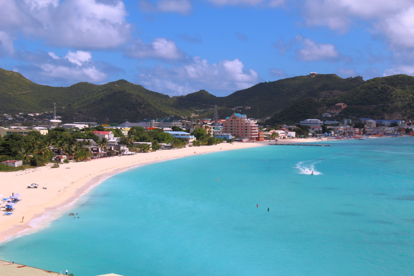
Sint Maarten is the Dutch-side country on an island shared with French Saint-Martin. The two sides are geographically connected but have distinct administrations. Visitors staying on the Dutch side can explore an unusually wide range of settings within a small space: the capital Philipsburg, a working lagoon, heritage collections, protected mangroves, public beaches and rugged cliffside coves. A worthwhile first trip understands those differences instead of chasing every famous photograph.
First practical warning: Maho Beach is a real jet-blast hazard, not a safe place to imitate viral footage of people holding an airport fence. Strong sea conditions also change the suitability of Mullet Bay and Cupecoy, while the protected Mullet Pond is not an unrestricted recreational lagoon. This top-ten guide makes those distinctions visible before proposing any route.
The selection focuses on Dutch Sint Maarten rather than treating nearby Marigot, Grand Case and Orient Bay on the French side as the same jurisdiction. Those places deserve separate French-side planning. These ten sites are chosen to explain history, living culture, engineering, ecology and leisure—not to imply that every venue can be visited, swum at or entered on any particular date.
eduKate · Caribbean geography, history and informed travel
Find a Dutch Sint Maarten reading route
Ten places compared · Philipsburg history · Maho and western beaches · Lagoon and wetland · Cultural heritage and cliffs · Planning and safety
Safety: never hold on to the Maho airport fence during takeoff, and do not enter protected mangrove habitat. Recheck all visitor conditions.


Ten Sint Maarten places at a glance
Choose by purpose and actual safety. The table includes a museum, city streets, an airport-area beach, wetland, lagoon and hill estate; they should not be treated as ten identical beach experiences.
| Place | What to expect | Main condition |
|---|---|---|
| 1. Philipsburg’s Front Street, Courthouse and Great Bay Boardwalk | Walk the capital’s shops, public history and broad seafront | Cruise timetables, traffic and working civic streets |
| 2. Sint Maarten Heritage Foundation and Museum, Philipsburg | Local collections about culture, natural history and the past | Confirm current museum hours and exhibitions |
| 3. Fort Amsterdam and the Little Bay headland | Colonial coastal defence and a surviving fort landscape | Heritage access, private resort routes and unstable ground |
| 4. Maho Beach and the Princess Juliana Airport approach | Watch aircraft while understanding serious jet-blast hazards | Powerful jet blast and live airport restrictions |
| 5. Mullet Bay Beach and the neighbouring golf-course coast | Public beach scenery with changing seasonal surf | Rip currents, waves and nearby private facilities |
| 6. Mullet Pond Ramsar wetland, near Simpson Bay Lagoon | Mangrove protection and a nursery for young fish | No invented boardwalk; protect restricted habitat |
| 7. Simpson Bay Lagoon, bridge and marina landscape | A working transport channel shaped by storms and engineering | Bridge opening schedules and boating traffic |
| 8. Kim Sha Beach and the Simpson Bay village coast | Local recreation alongside boating and evening events | Variable water quality and event crowds |
| 9. Emilio Wilson Estate and Museum, Cul de Sac | Plantation history, public park and hilltop adventure facilities | Museum hours differ from ride operations |
| 10. Cupecoy cliffs and the western border coastline | Small coves, sandstone cliffs and a different shore landscape | Erosion, high surf and access across private plots |
1. Philipsburg’s Front Street, Courthouse and Great Bay Boardwalk
Why this place: Philipsburg is the capital of Sint Maarten, the Dutch-side country that shares the island with French Saint-Martin. A walk from Front Street toward the Boardwalk and Great Bay shows how a small Caribbean capital combines government, historical buildings, commerce and cruise tourism. This is a useful starting point because the visitor can understand more than a beach: the same compact area supports residents, merchants, visitors arriving by ship and an active public waterfront. It is busy and sometimes noisy, which is part of its character rather than a flaw in the destination.
History or nature to notice: The distinctive Courthouse is widely recognised in images of Philipsburg and is a civic landmark, while Front and Back Streets reflect different types of commercial and residential use. The Dutch colonial history visible in old buildings does not represent the island’s entire past. Indigenous presence, enslavement, emancipation, successive European occupations and present multilingual life need to be read together. Great Bay’s broad shore was important to maritime trade before it became a tourism promenade. Its buildings changed function over time. A historic facade offers evidence about construction but cannot tell the full story of people who worked nearby.
Practical choices: Use recognised public pavements and crossings, and check opening if you want to enter a civic building rather than view its exterior. Cruise arrivals can create busy mornings, and the Boardwalk may host events affecting access. Beaches require their own water-safety assessment; being close to restaurants is not proof that sea conditions are safe. A short city-and-beach walk is generally a more sensible cruise-port outing than a hurried trip to the French border. Ask permission before photographing local residents closely or treating a working market stall as a display.
One learning question: Draw a route linking the harbour, boardwalk, Courthouse and commercial street. Why are tourism and government facilities concentrated close to the coast, and what evidence supports your explanation?
Return to the place index · Next place
2. Sint Maarten Heritage Foundation and Museum, Philipsburg
Why this place: The Sint Maarten Heritage Foundation and Museum gives context that a short shopping walk cannot provide. Its exhibits concern people, nature and the historical changes that shaped the island. It is small enough for a focused visit, yet it can introduce historical perspectives absent from beach brochures. The location near Front Street and the Boardwalk makes it a practical cultural stop for someone with limited time ashore, provided the museum is operating when they arrive.
History or nature to notice: The destination’s visitor guide describes displays including island history, maps, monuments and maritime materials, and notes cannons associated with the wreck of HMS Proselyte near the museum entrance. Such objects demonstrate how a material artefact can relate to a much wider world of naval activity and Atlantic trade. A historical museum also provides an opportunity to learn about the enslavement economy and the island’s transition through Dutch and French political arrangements. A replica or exhibition model should not be confused with an original artefact, and a single object rarely proves a broad claim without documentary support.
Practical choices: The tourism listing locates the museum near 7 Voorstraat and identifies it with the Sint Maarten Heritage Foundation. Another listing describes its location through an arcade connected with Front Street and the Boardwalk. Because small museums can have limited or changeable staffing, check the current entrance and opening directly rather than assuming a published walking-guide estimate guarantees admission. Give time to read the labels and follow any photography restrictions. This makes a rewarding indoor fallback if rain affects a seafront stroll.
One learning question: Choose a historical artefact and a modern island map. List the information established by each and explain which questions would require an archive or oral-history source.
Return to the place index · Next place
3. Fort Amsterdam and the Little Bay headland
Why this place: Fort Amsterdam occupies a headland between Great Bay and Little Bay and belongs on this list because its position makes old coastal-defence problems visible. It is not a restored fortress offering a full museum interior. Rather, surviving structures and the location reveal how European colonial authorities watched approaches to the harbour. The view provides a connection between historical power, maritime routes and the present resort coastline. The nearby Little Bay beach is a separate recreational place that should not be confused with free access to every part of the fort.
History or nature to notice: The region’s visitor authority identifies Fort Amsterdam as one of the island’s historic forts, while Fort Louis above Marigot belongs to the French side. The Dutch-side fort has changed considerably since its original construction, so it would be misleading to promise extensive intact ramparts. Its history also intersects with colonial rivalry and the exploitation of enslaved labour in Caribbean economies. Some local guides emphasise nesting seabirds on the headland, which makes leaving wildlife undisturbed another part of responsible interpretation. A fort’s cannon direction may illustrate strategic intentions but cannot explain every historical event.
Practical choices: Confirm the currently lawful approach. Some routes lie near resort-controlled property, and the existence of a hotel path does not guarantee the public can cross every section without permission. Take care near rough masonry, coastal cliffs and any nesting-bird area. Never enter closed ruins or climb walls to make a photograph. If access is unsuitable, the fort can be studied through maps and a safe, permitted view from the bay. The history remains worth understanding without promising a developed fortress attraction.
One learning question: Draw two arrows showing approaches from Great Bay and Little Bay. Which direction might a fort need to observe, and which parts of your answer need a historic map?
Return to the place index · Next place
4. Maho Beach and the Princess Juliana Airport approach
Why this place: Maho Beach is one of the world’s best-known plane-spotting locations because Princess Juliana International Airport’s runway begins very close to the shore. Landing aircraft can pass low over the beach, creating a memorable view of aviation in a coastal setting. The fame of the photograph has also encouraged dangerous behaviour near the airport perimeter, particularly during takeoffs. A credible guide must place safety before the excitement of a selfie and separate responsible observation from risky behaviour.
History or nature to notice: The visitor authority explains that the runway site reflects the island’s constrained geography, where hills and lagoon terrain limited suitable land for aviation. The airport has grown over time, linking Sint Maarten to regional and international travel and reshaping the economy. A runway is therefore part of a living transport system, not a spectacle created for tourists. Aircraft operate according to aviation needs, weather and air-traffic rules, so nobody should promise a particular type of plane at a fixed moment without verified schedules. The presence of jet blast is a real engineering hazard, not a playful tourist challenge.
Practical choices: The 2026 visitor guide warns explicitly of serious injuries caused by jet blast. Never stand behind departing aircraft, cling to a runway fence or enter any airport-restricted area. Watch from a lawful designated area at a safe distance and obey local staff and warning signs. Swimming conditions change, and plane spotting should not distract from supervising children near the water. Traffic between Maho and Philipsburg can become slow when many visitors arrive, so plan a generous return margin for flights or cruise ships.
One learning question: Explain why wind from a jet engine can be dangerous even if a person can see only the aircraft at a distance. What safety boundaries and data would an airport operator use to protect the public?
Return to the place index · Next place
5. Mullet Bay Beach and the neighbouring golf-course coast
Why this place: Mullet Bay Beach near Maho offers a different beach experience from the aircraft-adjacent shore. Its broad sand, coastal vegetation and nearby golf-course landscape make it popular with residents and visitors. It is a worthwhile place to consider ordinary beach conditions rather than turning every coast into a plane-viewing attraction. The surrounding district also shows how leisure infrastructure, local businesses and public shoreline access interact in a relatively developed part of the island.
History or nature to notice: The Sint Maarten tourism guide describes Mullet Bay as a locally popular beach, but also warns that conditions vary. In some periods the sea is gentle; in others swell and shore-break are significant. This explains why a strong swimmer’s experience on a calm day should not become a blanket statement that families can enter the water year-round without concern. The nearby Mullet Pond is a protected wetland with mangroves and juvenile-fish habitat, a separate environment from the open recreational beach. The two should not be lumped into one generic ‘pretty coastline’.
Practical choices: Assess the water and any local safety notices before swimming. A visible lifeguard or warning flag may not be present at every time, so parents should supervise closely. Beaches are natural systems affected by weather and development; access points, facilities and available food stalls may change. Respect private hotel and golf-course land, use lawful access and remove all rubbish. The surrounding Maho and Cupecoy areas are within short distance, but heavy road traffic still requires planning.
One learning question: Compare Mullet Bay with Maho. How might runway activity, wind exposure, bay shape and resort development change what each visitor actually experiences?
Return to the place index · Next place
6. Mullet Pond Ramsar wetland, near Simpson Bay Lagoon
Why this place: Mullet Pond is a crucial counterweight to Sint Maarten’s internationally famous beaches. The wetland forms part of the Simpson Bay Lagoon system and is recognised under the Ramsar Convention for its ecological importance. Its mangroves provide nursery space for young fish and habitat for birds and other life. A traveller interested in environmental science can learn why a seemingly quiet pond deserves protection even if it does not offer dramatic swimming photographs.
History or nature to notice: The official Ramsar information sheet identifies red, black and white mangroves as well as buttonwood, with submerged and interlaced roots that help shelter fish larvae and juveniles. It also describes the wetland’s ecological character and wider lagoon connections. A visitor should distinguish a wetland’s protected status from the assumption that it has public walking infrastructure. There may be no formal boardwalk, and entering muddy roots can damage the habitat. The significance lies in ecosystem function as much as visual attractiveness.
Practical choices: Seek current access advice from local conservation organisations or recognised guides. Do not cut through mangrove roots, open barriers or launch a watercraft into restricted habitat. Wildlife observations should use a lawful public vantage point and binoculars if possible. Wetland water quality should not be inferred from how clear it looks. Avoid approaching nesting birds or handling marine life. If no safe viewing opportunity is available, read the Ramsar report and use its map to understand the wetland without trespassing.
One learning question: Draw the branching roots of a red mangrove and label the spaces where small fish might shelter. Why would loss of these roots affect a wider marine food web?
Return to the place index · Next place
7. Simpson Bay Lagoon, bridge and marina landscape
Why this place: Simpson Bay Lagoon is one of the best places to understand how Sint Maarten’s shoreline was shaped both by natural events and human engineering. The lagoon connects with commercial marinas, fishing communities and boat routes, while the bridge controls an important passage between open water and sheltered mooring areas. For land-based travellers it provides a way to learn geography without buying an expensive boat tour. Observing the passage can be worthwhile if done from a safe public place.
History or nature to notice: The local tourism authority describes a hurricane in 1819 that opened a channel, followed by early ferry services and bridges in the twentieth century. A new canal and bridge later supported marine activity, changing the area’s economic role. These facts make the lagoon a practical lesson in how a storm can create an obstacle for transport while later engineering responds to the same geography. The Halley sisters’ ferry operations belong to local social history and show how communities solved mobility problems before permanent bridges existed. Modern marinas add environmental questions about water quality and mangrove conservation.
Practical choices: Use designated public observation points and obey traffic lights, bridge closures and any restricted marina access. Do not stand on a road or enter a working dock to take a boat photograph. Bridge opening schedules and traffic can affect travel from Simpson Bay to the rest of the island, including the airport. A map distance that looks short may mean a long journey near a scheduled opening. Guided boat trips should use licensed operators who understand navigation restrictions and lagoon environmental requirements.
One learning question: Compare the island’s lagoon on an older map and a modern one, and describe how the channels changed. Which parts are caused by storms and which were deliberately engineered?
Return to the place index · Next place
8. Kim Sha Beach and the Simpson Bay village coast
Why this place: Kim Sha Beach near Simpson Bay is different from both Maho and Mullet Bay. It is centrally located near restaurants, a residential district and boating infrastructure, and can host daytime recreation or lively public events. Travellers can see how a working coastal community also becomes a popular social space. The purpose of including it is not to rank one beach above every other but to recognise how local identity, access and practical conditions shape where people gather.
History or nature to notice: The visitor guide links Kim Sha’s location to the historic breach and former ferry connection associated with Simpson Bay Lagoon. It also notes that the beach attracts entertainment and seasonal events. Those uses change the visitor experience considerably; what looks tranquil on a weekday can become a busy concert venue later. An explicit 2026 independent guide raises questions about water quality and does not recommend it as a premier swimming beach. That makes it important not to promise crystal-clear safe water simply because a reef and boat anchorage are nearby.
Practical choices: Check current local advice on swimming and water quality before going into the sea; a land-based social outing may be a better choice. Expect variable traffic, music and parking, and respect businesses and residents. Avoid swimming near active boats, mooring lines and channels. If travelling with children or older relatives, assess crowding and accessible routes. A compact beach day can focus on observation and a meal without requiring an unsafe water activity.
One learning question: Make a brief record of three shoreline uses—boats, recreation and residents’ services. How might water quality, noise and traffic affect each differently?
Return to the place index · Next place
9. Emilio Wilson Estate and Museum, Cul de Sac
Why this place: The Emilio Wilson Estate is a powerful cultural stop because it brings plantation history and the island’s more recent public life together. Today the property includes a public park, museum interpretation and commercial adventure experiences at Rainforest Adventures. Visitors who see only the chairlift or zipline may miss the history of land, labour and the person for whom the estate is named. The strongest visit begins with the museum and asks how the land came to be used differently over time.
History or nature to notice: The tourism authority explains that the former plantation house is associated with families who owned the estate during its history, and that Emilio Wilson, a descendant of enslaved people connected with the plantation, became a well-known local figure. The museum tells stories of plantation cultivation, slavery and community life, while parts of the grounds have been set aside for present public recreation. These are different layers. A guided lift to Sentry Hill reveals useful topography but is not an explanation of the social structure of the original estate. Preserving cultural memory calls for accurate interpretation of labour and inequality alongside architecture.
Practical choices: Check independently whether the public park, museum and commercial activities are open. Some museum admission has been linked to paid adventure activities, so do not assume that free entry to the park includes every interior. The hilltop lift and ziplines have weather, weight, height and medical suitability rules; never promise they are appropriate for everyone. Visitors primarily interested in history can choose a museum-focused visit without needing to participate in a thrill activity. Stay on authorised estate routes and ask before photographing people.
One learning question: Choose one historic estate feature and one modern recreation facility. How do their functions differ, and what evidence would support a claim about how land use changed?
Return to the place index · Next place
10. Cupecoy cliffs and the western border coastline
Why this place: Cupecoy on the southwestern Dutch coast reveals a more rugged beach environment than the broad sand of Great Bay. Small coves nestle beneath sandstone cliffs whose changing shapes create picturesque views but also hazards. The area lies close to the French-side border, making it a useful final place to think about how political boundaries can divide administrations without dividing the underlying geography. The strongest experience may be an approved viewpoint rather than an attempt to reach the narrowest patch of sand below the cliffs.
History or nature to notice: The visitor authority describes Cupecoy’s eroded rock formations and its closeness to Mullet Bay and the Lowlands district. Sea action shapes sandy pockets and can remove accessible beach space during heavy swell. A traveller should distinguish a permanent map label from an ephemeral strip of sand. The coast also demonstrates how real-estate development affects access and how two jurisdictions share one island’s physical environment. The Dutch and French sides have distinct governments and regulations, even though residents and visitors can travel across the island.
Practical choices: Check current beach access because high waves and erosion may make a cove unsuitable or inaccessible, and some paths are adjacent to private properties. Avoid unstable overhangs, do not sit beneath loose cliffs and keep a substantial margin from breaking waves. Choose a safe public lookout for sunset rather than scrambling down a hazardous descent. Consult local authorities before crossing any closed access route. This is not the place to assume a calm swimming experience based on an older image.
One learning question: Sketch a cove beneath a sandstone cliff, marking wave approach and the position of loose material. What observations suggest erosion, and what additional information would be needed to assess a cliff’s stability?
Return to the place index · Plan a visit
How to plan the Dutch side without turning travel into a race
A first day based in Philipsburg can combine the waterfront, Courthouse exterior, St Maarten Heritage Museum if open and a respectful historic-area walk. Visitors arriving by cruise ship may find that a carefully timed capital-city day is more rewarding than a taxi rush across the island. A separate western-coast day might include Mullet Bay for weather-suitable recreation and a safe Maho observation from a designated area, but do not confuse the two beaches’ different characteristics.
A third theme is lagoon ecology and cultural history. Simpson Bay’s channel and bridge reveal the engineering behind maritime transport, while Mullet Pond explains why mangroves are essential for marine nursery habitat. The Emilio Wilson Estate provides a different historical focus through plantation land, community use and interpretation of enslavement. These do not all require an adventurous tour. A responsible plan can use museums, parks and publicly permitted views while omitting any high-risk water activity.
Ten practical rules that matter more than a selfie
- At Maho, never stand behind a departing aircraft, grip the perimeter fence or ignore aviation warning signs. Jet blast can cause serious injury.
- Inspect current sea conditions before entering water at Great Bay, Mullet, Cupecoy or Kim Sha. Water safety differs between coasts and over time.
- Respect the Ramsar-listed Mullet Pond; mangrove roots and fish-nursery habitats are not open for unapproved walking or watercraft.
- Check museum and private-adventure-park hours separately. Admission to Emilio Wilson Park is not necessarily admission to the associated museum or rides.
- Expect road congestion near Simpson Bay Bridge and the airport, and allow extra return time when travelling to a cruise ship or flight.
- Use lawful public routes to Fort Amsterdam. A road crossing resort property or a damaged ruin does not become open because it appears on a tourist map.
- Respect Dutch-side and French-side administration and any entry requirements applicable to the nationality and journey you have chosen.
- Ask permission before photographing residents or private spaces. A working harbour, shop and church are not staged visitor exhibits.
- At cliffside Cupecoy beaches, avoid falling rock and rough surf and do not descend over closed or eroded accesses.
- Follow local conservation and waste guidance. Beaches and lagoons are shared resources whose ecological quality matters to island residents.
Three meaningful visitor styles
A culture-focused reader can explore Philipsburg, the Heritage Museum and Emilio Wilson Estate, distinguishing the island’s civic history from its colonial plantation past. A nature-focused visitor can study Mullet Pond and lagoon ecology and choose an appropriate land-based viewpoint instead of assuming every shallow-looking waterway is swimmable. Families looking for gentle leisure may find a daylight beach and a museum sufficient. Every choice should be guided by conditions rather than a numbered list.
Frequently asked questions
Are Sint Maarten and Saint-Martin one country?
No. They share a single Caribbean island, but Sint Maarten is a constituent country within the Kingdom of the Netherlands, while French Saint-Martin is a French overseas collectivity.
Can I safely hold the airport fence for takeoff photos at Maho?
No. Departing aircraft generate dangerous jet blast, and serious injuries have occurred. Watch from an authorised safe area and obey all posted warnings.
Are all beaches on the Dutch side suitable for swimming?
No. Conditions vary with wind, surf, currents, boating and water quality. Kim Sha’s water conditions, Mullet Bay’s swell and Cupecoy’s eroded cliffs require individual judgement.
What is the historical importance of Philipsburg?
It is Sint Maarten’s capital with buildings, harbour space and streets linked to colonial administration, maritime commerce and contemporary public life. A heritage museum provides useful context.
Can I enter Mullet Pond’s mangroves to photograph fish?
Not without appropriate authorisation. Mullet Pond is a protected Ramsar wetland and mangrove habitat. Use current permitted viewpoints and do not damage roots.
Are the Emilio Wilson Museum and Rainforest Adventures the same admission?
They occupy parts of the same historic estate, but public park access, museum entry and commercial ride tickets may differ. Confirm the current operator’s arrangement.
Is Fort Amsterdam a fully restored museum fort?
No. It is a historic coastal-defence landscape with limited surviving structures. Access and safe walking routes should be confirmed rather than assumed.
Can I walk from Philipsburg to every beach listed?
No. The sites are spread across the Dutch side. Several require a taxi or other transport, and Simpson Bay bridge traffic can change journey times.
Use Sint Maarten as a lesson in maps, marine science and history
At Philipsburg, record how civic buildings and waterfront businesses occupy limited ground between the bay and inland hills. At Simpson Bay, compare an older account of ferry crossings with the modern bridge and marina. At Mullet Pond, explain what mangrove roots do for young fish and why the correct observation location may be outside the protected interior. In each case, separate what you can see from what an official source establishes.
A map also reveals a valuable travel-mathematics problem. Philipsburg and Maho may appear close, yet bridge openings and road congestion can change the actual journey time. The most reliable answer uses both distance and current constraints, just as learners are encouraged to explain assumptions and working steps in eduKate’s Secondary 1 Mathematics Tutor Clementi | Small Groups Tutorials.
Continue across the island with eduKate
Top 10 Places to Visit When Touring Saint Martin (French Side) · World Travel Hub · World Country Directory
Official and specialised sources
Sources reviewed 19 October 2026, Singapore time. Museum and beach access, bridge operations, marine conditions and licensed activities can change. The Ramsar ecological report explains conservation value but does not grant public access. The featured image is a properly licensed archival 2011 photograph.
- Visit St Maarten — Philipsburg Heritage Foundation and Museum
- Visit St Maarten — monuments and forts
- Visit St Maarten — Maho Beach and airport
- Visit St Maarten — Mullet Bay Beach
- Ramsar Secretariat — Mullet Pond wetland ecological information sheet
- Visit St Maarten — Simpson Bay Lagoon historical changes
- Visit St Maarten — Simpson Bay Bridge
- Visit St Maarten — Kim Sha Beach
- Visit St Maarten — Emilio Wilson Park
- Visit St Maarten — Emilio Wilson Museum
- Visit St Maarten — Cupecoy Beach and cliffs
- Sint Maarten historical waterfront photo by Clavius66, CC BY-SA 3.0
- Creative Commons BY-SA 3.0 licence