
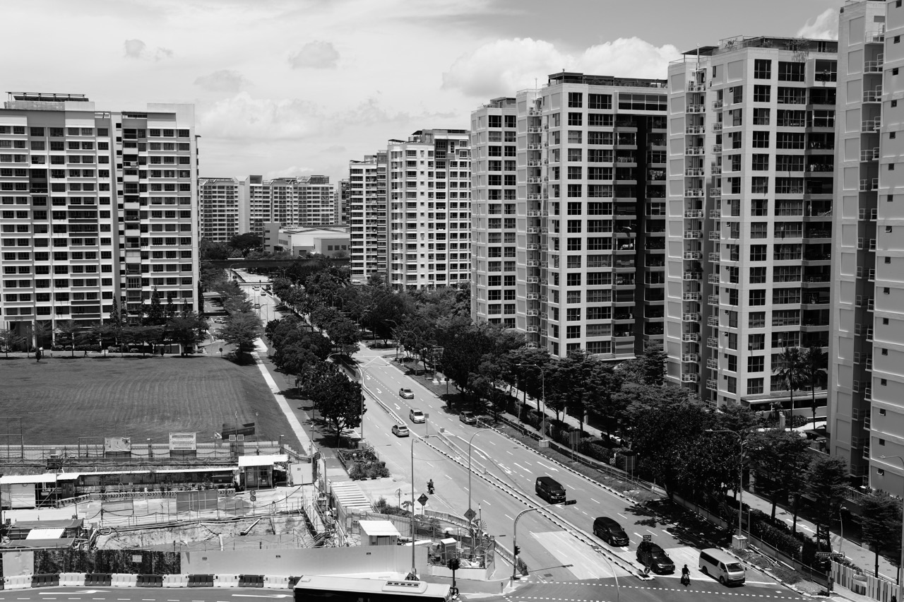
Take an ordinary journey through Punggol. Someone leaves home, reaches a transport stop, transfers, walks the final stretch and arrives at school or a clinic. The journey looks like a single activity. Geography sees a network of decisions about location, access, land use, infrastructure and the different needs of people living in one city. Suddenly the journey is not ordinary at all.
Why have Secondary 2 Punggol Geography tuition? This is the stage at which a learner must move from noticing patterns to explaining why housing and transport systems work differently across places, how planners balance competing needs and how a geographical investigation can test a claim. Targeted Sec 2 Geography support can also help students prepare for subject-combination decisions by making their actual strengths in geographical reasoning visible.
The aim is not to convince every Punggol family that the child needs another weekly lesson. It is to show when expert feedback could repair an identified gap, what good tutoring should look like and which independent skills matter before Secondary 3. The figures and scenarios in this article are fictional teaching examples, not measurements of Punggol’s residents, transport or housing.
Secondary 2 is where Geography becomes the study of city decisions
In the MOE lower-secondary G2/G3 syllabus, the second thematic question is How Can We Sustainably Build Cities? It explores housing and transport systems. Students use the ideas developed in Secondary 1—space, place, environment, scale, data and geographical inquiry—to understand a built environment shaped by choices and trade-offs. See the official lower-secondary Geography syllabus for the full learning outcomes and the school’s guidance for its current sequence.
Secondary 1 may ask why water and natural vegetation need careful management. Secondary 2 asks what happens when growing urban populations need homes, journeys and public services. Both questions are about sustainability. The same idea shifts from natural resources to the city that families inhabit every day.
The interesting part of Geography is that a proposal can solve one problem and create another. Higher-density housing may help use scarce land effectively, while prompting questions about local services, public space and transport capacity. A new route might shorten one journey while introducing different costs or environmental pressures. A good Geography answer does not announce that one solution is ‘best’ without establishing for whom, where and under what constraints.
Reason 1: Housing questions require cause, consequence and scale
A Secondary 2 student may be comfortable describing an apartment block but less able to explain why housing shortages arise, why different groups are affected differently or how cities can respond sustainably. These are not just facts about buildings. They are relationships among population, land, affordability, access and quality of life.
Watch how a response changes when the child learns to build a causal chain. A vague answer says, ‘People need more houses because the population is big.’ A more defensible answer says, ‘When demand for homes grows faster than accessible housing supply, some households may face fewer suitable options or greater competition for housing. Responses must therefore consider not only the number of homes but also affordability and connections to services.’
The second response does not need complicated language. It needs each link in the explanation to matter. The tutor’s task is to spot where the child has skipped a link: demand to pressure, policy to consequence, or consequence to the particular group affected.
A Punggol observation can become a geographical question
A child might notice that a neighbourhood contains homes, schools, green spaces and shops. That is a sensible starting point for examining how mixed land uses shape everyday experiences. The geographical question is not ‘Is Punggol a good place?’ It might be, ‘How does the location of amenities influence access for different residents?’ Answering it responsibly would require a defined area, a relevant measure and evidence from that area.
There is no need to present an observation as an established finding. The lesson is to ask a question that can actually be investigated. A description of a familiar estate is the beginning of Geography, not the finished answer.
Reason 2: Transport is a network, not a collection of names
Transport questions often expose a mismatch between memorisation and understanding. A student remembers examples of trains, buses and roads but struggles to explain accessibility, connectivity, travel time or environmental impacts. Adding more examples will not fix the missing relationship.
Consider the difference between distance and accessibility. Two homes can be equally far from a destination on a straight-line map but offer very different journeys because routes, transfers, timing, mobility needs and service availability differ. A student who simply measures the nearest road may overlook the part of the question asking how easily different users can reach a place.
Here is a constructed example. Household A is 800 metres from a community facility; Household B is also 800 metres away. A’s usual route is direct, while B’s path includes an inconvenient crossing and an indirect detour. The distances are equal, yet ease of access may differ. A serious response explains the route factors and avoids claiming exact journey times without actual observations.
The teaching objective is to help the student move from a list of transport modes to a comparison of systems. A well-chosen map, a short graph and a discussion of user groups can achieve more than a page of copied textbook definitions.
Reason 3: Data interpretation becomes more demanding in Secondary 2
Housing and transport give students many kinds of data: maps, travel-time diagrams, ranked categories, charts of households or written extracts. To use them well, the learner must know the unit, establish the variable, compare values and respect what the evidence cannot prove.
Worked example: describing journeys without inventing causes
Imagine a fictional set of average travel times from three study locations to the same facility: Area A, 12 minutes; Area B, 19 minutes; Area C, 27 minutes. A clear description is: ‘Area C has the longest reported travel time, 15 minutes longer than Area A.’ The student has named the feature, used the unit and quantified the difference.
The weak version says, ‘Area C is the most crowded and has bad roads.’ The figures provided do not establish crowding or road conditions. Those may be hypotheses, but the data set cannot distinguish them from differences in connections, services or the time of observation.
A tutor can help by sorting each statement into three baskets: directly shown, reasonably inferred with context and not established. This simple discipline is useful in Geography, Science, later Humanities and ordinary civic life. It also prevents students from writing impressive sentences that the question cannot support.
Reason 4: Evaluation is not the same as listing pros and cons
A student asked to evaluate a proposed transport improvement may quickly produce one benefit and one drawback, then conclude ‘It depends.’ That can sound balanced while saying almost nothing. Meaningful evaluation identifies relevant criteria, weighs their importance and makes a judgement that follows the evidence.
For example, suppose a fictional council considers two options for reaching a neighbourhood library: a new shuttle or a redesigned walking route. The child might compare accessibility for different age groups, financial cost, maintenance, environmental effects and whether the change meets the stated aim. A judgment is then possible: one solution may be more suitable in a particular situation, but the child must explain why those criteria matter.
The correct examination response depends on the actual question and school marking scheme. There is no universal sentence template that turns every list into a sound judgement. Good tutoring teaches the student to select a criterion because it belongs to the problem, not because it happens to fit a memorised acronym.
Reason 5: Geographical investigation should teach fair comparisons
A fieldwork assignment can feel exciting until students must design an investigation. They need a question, an observable measure, a consistent method, a feasible plan and an awareness of limitations. Without these, an afternoon of activity can generate colourful notes but weak conclusions.
The MOE syllabus includes geographical investigation as part of the two-year Geography journey. Students are expected to go beyond the classroom to gather relevant information; appropriate inquiry practices matter as much as the final report. The Punggol fieldwork and geographical investigation guide expands on what makes a good question and what to do with collected data.
Worked investigation: comparing access to a community facility
Imagine a hypothetical class exercise asks whether two routes to a community facility differ in convenience. Students define the endpoints, record comparable journey observations, note obstacles that are relevant to a chosen user group and document when each observation took place. A fairer comparison uses the same criteria and discloses differences that cannot be controlled.
A weak conclusion would be, ‘Route A is always better because one student preferred it.’ A stronger conclusion is: ‘In our illustrative observations Route A had fewer recorded crossings, but this exercise alone does not establish which route is preferable at every time or for every user.’ The learner states what was observed and where the generalisation stops.
Parents can reinforce this way of thinking without turning a weekend outing into unpaid fieldwork. Ask the child which evidence they would need to answer a question, what a fair comparison would look like and what could cause a misleading result. Safety, school instructions, accessibility and privacy always take priority over collecting data.
Why small-group discussion can be especially useful for city topics
Housing and transport decisions rarely have only one stakeholder. A student may consider the perspective of commuters, families with young children, older residents, planners and people with mobility needs. In a carefully guided small-group discussion, hearing a peer make a different argument can reveal an assumption and invite a more complete evaluation.
But the number of chairs does not guarantee good teaching. A useful Geography tutor must inspect individual answers, check that evidence supports claims and make each child explain their reasoning. An exchange of opinions without correction can reinforce confident mistakes. When looking at the eduKate Punggol tutoring approach, ask about the available Geography specialist, group suitability and actual lesson format rather than assuming it is the same as an existing Mathematics group.
What a good Secondary 2 Geography diagnostic reveals
- Topic gap: the student cannot explain an important housing or transport process accurately.
- Map gap: the student overlooks symbols, scale, location or the direction of a pattern.
- Data gap: the student makes comparisons without units or invents a cause from a correlation.
- Explanation gap: the response has relevant facts but no complete causal sequence.
- Evaluation gap: the student lists advantages and disadvantages without criteria or judgement.
- Investigation gap: data collection is inconsistent or conclusions overreach the evidence.
- Transfer gap: a corrected example looks good, but the same failure returns in a new scenario.
The next tuition session should respond to the observed error, not simply continue with the next chapter by habit. Improvement is easiest to recognise when a child can complete a comparable but unfamiliar task with less help.
A four-stage study routine that respects school and home life
Stage 1: Rebuild the vocabulary in context
Choose a handful of words from a current topic—such as accessibility, sustainability, demand, land use or connectivity. Have the student explain each term using one city example and one counterexample. If the word can only be recited, it may not yet be usable.
Stage 2: Make two evidence-based comparisons
Give the child two different maps, charts or short data sets. Ask for one precise observation from each and have them explain what information is missing for a causal claim. This prevents familiarity with a single worksheet from masquerading as mastery.
Stage 3: Write one complete explanation
A tutor chooses a real school-style command word and asks the child to write a short chain linking cause, mechanism and result. Instead of rewriting the whole paragraph for them, the tutor identifies the missing link and asks for a second independent attempt.
Stage 4: Defend a qualified decision
Present a fictional planning choice and two criteria. Ask the student to choose, justify and then explain a limitation. This integrates concepts, evidence and evaluation in an age-appropriate way. Return to the same skill later with an unfamiliar situation to test retention.
Secondary 2 subject combinations: why the timing can matter
By the end of Secondary 2, many families are thinking about Secondary 3 subject choices. Geography may be studied as part of a Humanities combination or a separate subject, according to the school’s offerings, the student’s subject levels and eligibility. The right decision depends on performance, interest, workload and the actual available combinations—not on a claim that one subject is automatically easier.
A child who enjoys understanding how cities work and can interpret data with care may have a genuine strength worth developing. Another may love the content but need help turning ideas into answerable arguments. Tuition can support the second child; it should not be used to pressure either child into a combination that does not fit.
Parents should check school-specific guidance and Full Subject-Based Banding requirements. The eduKateSG guide to Full Subject-Based Banding and Secondary 2 Punggol Humanities and subject-combination guide can support that conversation, while the child’s school remains the authoritative source for the actual choices.
When extra lessons are helpful and when they are unnecessary
Targeted Geography tuition makes sense when school feedback repeats the same concern; the learner can recite a chapter but cannot handle an unfamiliar city dataset; an investigation suffers from unclear methods; or an upcoming school assessment requires specific repair that cannot be achieved independently. It may also be suitable for extension if a motivated child wants deeper, evidence-based discussion rather than faster worksheet completion.
It may be unnecessary when the child already interprets maps accurately, corrects mistakes independently and responds well to normal school feedback. More tuition can also be counterproductive if it erodes sleep, recovery time or interest in learning. Parents deserve a rationale based on the child’s work, not a timetable filled for appearance.
A parent checklist before choosing Secondary 2 Geography tuition
- Can the tutor show how an answer will be diagnosed against the actual school question?
- Will they teach housing and transport concepts as relationships rather than isolated phrases?
- Can they show a specific repair for describing data, explaining a process or evaluating a solution?
- Will the child practise geographical investigation with ethical, consistent methods?
- Will the tutor check a new, independent task instead of accepting a rewritten correction?
- Do they understand the child’s subject level, school combination options and workload?
- Are subject availability, location, lesson duration and charges confirmed rather than assumed?
Frequently asked questions
Does Sec 2 Geography tuition help with subject-combination choices?
It can make the child’s actual strengths and weaknesses clearer. It cannot determine which subjects the school offers or which combination suits the learner’s broader academic and personal interests. Use school guidance and an honest review of independent work.
Should my child learn upper-secondary Climate and Tectonics in Sec 2?
Only if it is appropriate extension after the lower-secondary work is secure. Housing, transport, evidence handling and geographical investigation are not disposable stepping stones. A confident method is a better launchpad for upper-secondary topics than rushing into unfamiliar names.
What if the student understands lessons but scores poorly?
Review the original question, source, units, command words and marked response. They may know the material but be answering the wrong task, giving weak evidence or omitting key reasoning links. A diagnostic can separate these problems.
Can Punggol be used for geography examples?
Yes, as a familiar setting for observing housing, amenities, greenery and journeys. Do not present an observation as actual research data without appropriate collection and verification, and never imply that a suggested walk is an official school assignment.
Follow the four-year Punggol Geography progression
Our Secondary 1 guide establishes map reading, water and natural vegetation. This Secondary 2 guide extends those habits to sustainable cities and inquiry. The Secondary 3 guide examines the shift into upper-secondary Geography, while the Secondary 4 guide focuses on evidence, revision and examination readiness. The point of the series is progression: first observe, then explain, then evaluate and finally perform independently.
For related learning, use map skills and data interpretation and geographical investigation as companion guides. The most effective learning often happens when the same geographical skill is recognised in a different topic.
Discuss Secondary 2 Geography support with eduKateSG
Bring one marked Geography answer, its source material and the child’s current school topic. Contact eduKate Singapore to ask whether a suitable Geography teaching arrangement is currently available, and to verify tutor suitability, location, class size and scheduling. The first useful outcome is a clear diagnosis, not a promise that every family needs tuition.
The reason to have Secondary 2 Punggol Geography tuition is to give city questions the depth they deserve. When a student can move from ‘I see this’ to ‘Here is what the evidence shows, why it may happen and what a responsible decision should consider’, Geography becomes useful thinking that travels well beyond the classroom.