
Did you know that a G2 Humanities pupil in the first 2027 SEC will read printed Social Studies questions but type the answers electronically, then sit a separate Geography paper where one topic is compulsory and another is a genuine choice? These differences matter more than a generic instruction to study ‘more Humanities’. The subject combines careful evaluation of social information with the geographical ability to understand places, environments and decisions. Bukit Timah families can use everyday surroundings to ask useful questions, while the national examination follows the specific K229 syllabus.
The quick answer: G2 Humanities (Social Studies, Geography) is K229, formerly code 2125. Social Studies contributes 50% with one 1-hour-45-minute, 50-mark paper: a compulsory 35-mark source-based study and two structured responses worth 7 and 8 marks. Candidates receive printed questions but type their answers in a digital booklet. Geography contributes 50%, also 1 hour 45 minutes and 50 marks. Its compulsory Section A asks about Geography in Everyday Life, 25 marks; Section B asks the pupil to choose Climate or Tectonics, 25 marks. The chosen optional question includes one 6-mark judgement task. Geography uses small-scale fieldwork as curriculum learning; it does not have an additional separately weighted national practical paper.
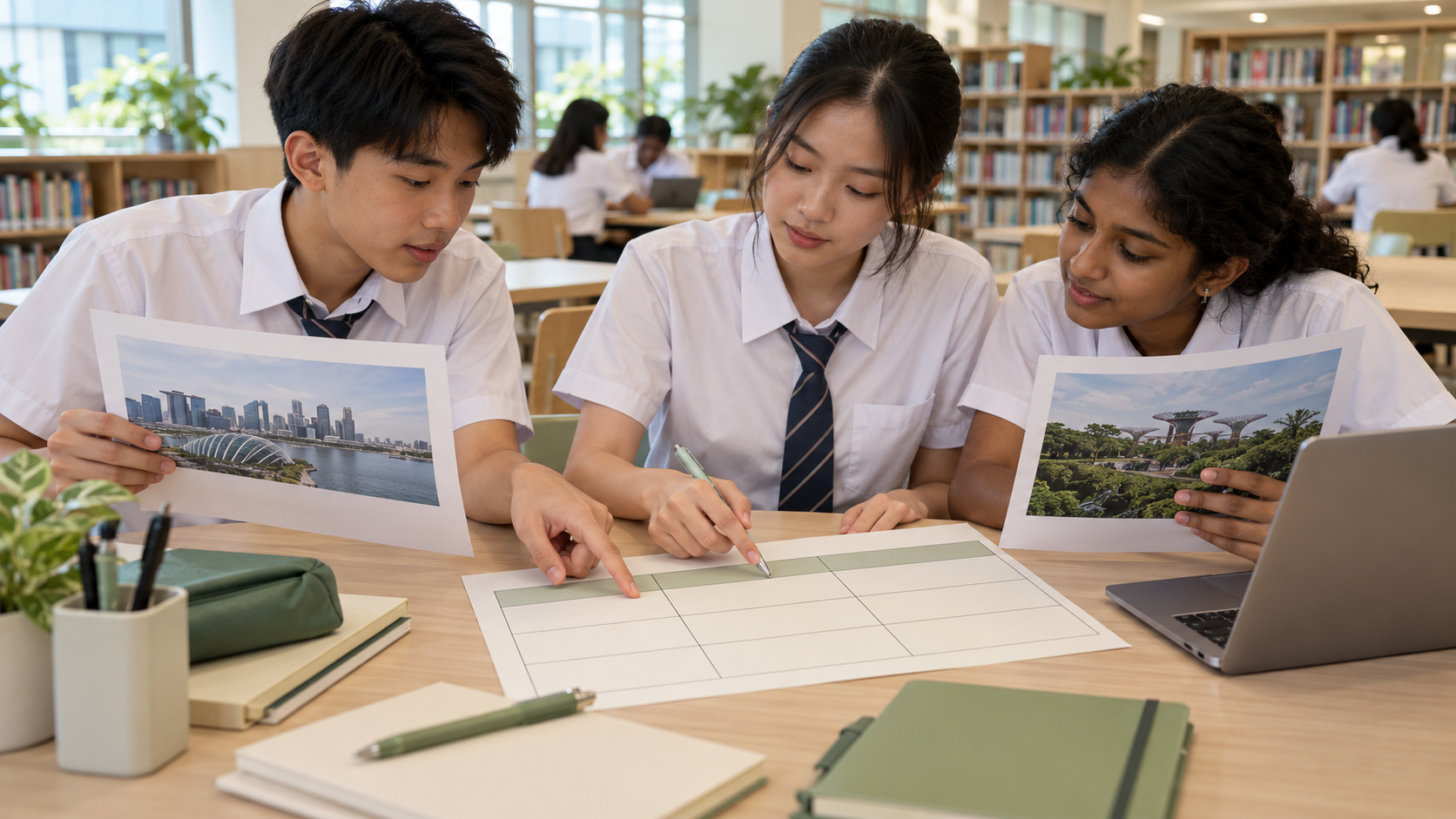
Updated 27 October 2026. The featured illustration shows source comparison as an educational technique; it is not a 2027 exam source. Local examples are hypothetical and do not report a government consultation or a fieldwork survey.
Jump to: 1. Why K229 is its own qualification · 2. The fifty-fifty structure should guide revision · 3. Printed Social Studies questions with typed answers · 4. The compulsory source-based case: 35 marks · 5. The three Social Studies issues · 6. Source inference: connect the detail to the claim · 7. Reliability is not a universal label · 8. The final ten-mark source question requires synthesis · 9. Social Studies Section B: two compulsory structured responses · 10. Geography Paper 2: compulsory Everyday Life · 11. Section B: choose Climate or Tectonics · 12. The six-mark judgement question · 13. Thinking geographically: location, scale and place · 14. Neighbourhoods and nature influence one another · 15. Sustainable development involves trade-offs · 16. Fieldwork questions and bite-sized inquiry · 17. Primary and secondary geographical data · 18. Sampling can change the picture · 19. Maps, bar graphs and photographs are evidence tools · 20. Climate and weather: time scale matters · 21. Climate change and climate action · 22. Tectonics: understand plates before memorising disasters · 23. Disaster risk is more than the physical hazard · 24. How Geography and Social Studies complement one another · 25. Six-mark evaluation versus ten-mark source judgement · 26. Avoid generic essays that ignore the question · 27. A source notebook for Social Studies · 28. A geographical evidence notebook · 29. Timing two separate 105-minute papers · 30. A late-2026-to-2027 revision plan · 31. The difference from G3 combined Humanities · 32. What these skills offer after 2027 · Related 2027 SEC guides
1. Why K229 is its own qualification
The 2027 SEC shows subjects at the General level actually taken. G2 Humanities K229 is Social Studies and Geography combined; it is not the same as G2 standalone Geography K226 or G3 Humanities K335. A student may encounter similar topic names across these courses while following a different depth or paper structure.
Families need to confirm the registered code, the school curriculum and the child’s current subject combination. A secondary entry Posting Group is not necessarily an unchanging label for every upper-secondary subject. Using the wrong code can lead to practice material with different question choices and mark distributions.
Good Humanities education develops the ability to recognise multiple perspectives, evaluate evidence and explain geographical relationships. Those are meaningful skills whatever the eventual examination result.
2. The fifty-fifty structure should guide revision
Social Studies accounts for half of the combined subject grade and Geography the other half. Both papers last one hour forty-five minutes and carry fifty raw marks. Neither is a minor supporting subject simply because the certificate title begins with Humanities.
Within Social Studies, source evaluation accounts for 35 raw marks and structured reasoning for the remaining 15. Within Geography, the compulsory Everyday Life question carries 25 marks and the selected Climate or Tectonics question another 25. Students therefore need different study methods for distinct assessment tasks.
A balanced weekly timetable can maintain source practice and geographical understanding while giving extra attention to the pupil’s actual weaknesses. Equal weighting does not mean every study session must be divided by a stopwatch.
- Social Studies — 1h45, 50 marks, 50%.
- Geography — 1h45, 50 marks, 50%.
- SS: 35 marks sources, 15 marks structured responses.
- Geography: 25 marks Everyday Life plus one 25-mark optional cluster.
3. Printed Social Studies questions with typed answers
SEAB’s 2027 K229 syllabus specifies that Social Studies candidates receive the question paper in hard copy and type answers into a digital answer booklet. This e-examination element differs from the normal act of writing directly onto a printed page. It does not mean students may access the internet for extra sources.
Pupils need to read printed texts, compare them and present coherent typed explanations under timed conditions. Someone with strong conceptual understanding might still benefit from practising paragraph planning and readable typing, while another fluent typist may need help evaluating the sources rather than entering words faster.
Ask the school for official examination familiarisation and applicable accessibility arrangements. Commercial imitations should not be treated as exact copies of the national exam system.
4. The compulsory source-based case: 35 marks
Social Studies Section A uses a source-based case study worth thirty-five marks. It has five questions based on a common social issue. The first four test handling particular sources for a combined twenty-five marks; the fifth asks candidates to use several sources and contributes ten marks.
Candidates cannot replace this case study with a memorised essay on a favourite topic. They must read the sources provided and make appropriate inferences, comparisons and evaluations. The official syllabus states that the context may be related to a taught issue without being the exact example used in class.
A good answer names what a source actually claims and explains why that evidence supports the question’s requested conclusion. General statements about all sources being biased are not a substitute for analysis.
5. The three Social Studies issues
The shared syllabus is organised around Exploring Citizenship and Governance, Living in a Diverse Society, and Being Part of a Globalised World. These themes ask students to examine responsibilities, social relationships and the ways an interconnected world shapes choices.
Different groups can experience public decisions differently, and people may hold sincere but competing priorities. A good Humanities response acknowledges the evidence and relevant perspectives without pretending that all claims carry equal support or that one slogan resolves every trade-off.
These issues can be discussed using examples from public life, but factual statements about actual policies must be grounded in current trustworthy sources. Fictional case studies should be labelled as teaching exercises, not presented as official decisions affecting Bukit Timah.
6. Source inference: connect the detail to the claim
An inference is a conclusion supported by evidence, not simply the first personal opinion the reader has after seeing a poster or message. The pupil should identify the meaningful detail in a source, then explain how it supports the interpretation required by the question.
Imagine a fictional public notice inviting residents to suggest improvements for a shared study area. A supported inference is that the organisers want input on the space. It would be unjustified to claim from the notice alone that all residents have already agreed on the changes.
Ask the child to finish a sentence such as ‘This suggests … because …’. The resulting explanation should refer to relevant words or images rather than a broad assumption about people’s motives.
7. Reliability is not a universal label
A source may be reliable for establishing one fact yet limited for another question. An official notice may accurately state an event date while highlighting only positive features. A personal account may convey authentic experience but cannot automatically represent a population of thousands.
Students should consider who produced a source, what they knew, when it was made, for whom and for what purpose. The word bias is useful only when the pupil can show how perspective or interest affects the specific conclusion being considered.
Parents can practise with two short public notices on an imaginary subject, asking what each can establish and what would need corroboration. The learning goal is qualified trust based on evidence, not automatic cynicism.
8. The final ten-mark source question requires synthesis
The fifth source-based question directly concerns the common issue and asks candidates to use multiple sources. A student may have to weigh agreement and disagreement while explaining which evidence is convincing and why. Counting sources on each side is not necessarily sufficient.
Suppose three fictional sources discuss access to a community facility. One notes a benefit, a second identifies a cost and a third describes an implementation difficulty. A nuanced judgement could recognise all three while deciding what the sources collectively establish.
Good writing integrates evidence into the explanation. A list of isolated quotations without an argument does not show how the sources relate to each other or to the precise question.
9. Social Studies Section B: two compulsory structured responses
Section B includes a seven-mark question requiring a reasoned argument or recommendation about an issue in the Singapore context, and an eight-mark question explaining two factors or perspectives. Both are compulsory, together contributing fifteen marks.
The structured tasks are not necessarily about the same issue that appears in Section A. The syllabus explicitly says the selected source study and structured response will not examine the same issue in one sitting. Pupils therefore need knowledge of all three topics.
One paragraph asserting that citizens and government should cooperate may be too general for a specific question. Strong responses explain what action is proposed, why it addresses the stated situation and which limits or differences in perspective matter.
10. Geography Paper 2: compulsory Everyday Life
Geography Section A requires Question 1 on Geography in Everyday Life, worth twenty-five marks. It covers Thinking Geographically, Sustainable Development and Geographical Methods. The candidate must answer this question even if they prefer Climate or Tectonics.
This cluster emphasises connections between people, nature and the built environment as well as practical methods for studying places. Students might interpret a map, graph, photograph or short fieldwork description to explain what it shows. Careful attention to scales and labels remains essential.
Bukit Timah is a helpful place to notice those relationships, but one casual observation should not be presented as a survey of the whole district. Geography is strongest when the inquiry has a clear question and adequate evidence.
11. Section B: choose Climate or Tectonics
The Geography paper presents Question 2 on Climate and Question 3 on Tectonics, each worth twenty-five marks. Candidates answer one of them, not both. The topic choice applies to Section B; the compulsory Everyday Life cluster remains relevant regardless of which alternative is selected.
Climate covers Weather and Climate, Climate Change and Climate Action. Tectonics covers Plate Tectonics, Earthquakes and Volcanoes, and Disaster Risk Management. Each cluster has its own concepts, case evidence and data representations.
School instruction and revision should ensure the pupil understands the actual content offered and how to read the chosen question fully before answering. A familiar word in a question’s opening may not indicate that its final evaluative part is easy.
12. The six-mark judgement question
The selected Geography Section B alternative includes one six-mark question assessing judgement and decision-making using generic level descriptors. The candidate may need to compare approaches, evaluate a method or propose a reasoned conclusion under the described conditions.
A fictional question might compare two ways to reduce exposure to a climate hazard. The pupil should explain which people or places benefit, whether the proposal fits available resources and which risks remain. A statement that both methods are good is not a complete judgement.
Good evaluation identifies relevant criteria and reasons for giving one factor priority. It does not imply certainty beyond the evidence or treat every possible option as equally effective.
13. Thinking geographically: location, scale and place
Geography uses concepts such as location, place, scale and interactions between human and natural systems. A useful question asks not only where something is but why it is located there and what relationships affect that location.
Imagine a fictional study comparing use of two nearby public spaces at different times. The investigator should define the sites and observation intervals, record relevant information and acknowledge factors such as school days or weather. A single busy afternoon does not prove one location is always more popular.
Learning to define scale prevents a local observation from turning into an unsupported claim about all of Singapore. A precise small conclusion is more valuable than a dramatic but unjustified generalisation.
14. Neighbourhoods and nature influence one another
Bukit Timah includes built environments and notable nearby green spaces, making the relationship between people and nature readily observable. Natural areas can influence recreation, local temperature and environmental conditions, while human use creates management considerations.
Students should not assume every natural feature produces the same effect in all circumstances. Geographical claims depend on conditions, measurement and relevant sources. Respect for conservation areas and site rules is also part of responsible inquiry.
A useful question is how a community facility and a nearby nature area may both benefit and affect residents. The answer should identify specific processes rather than simply declare nature ‘good’ or development ‘bad’.
15. Sustainable development involves trade-offs
The sustainable development topic asks students to consider environmental, economic and social needs. A planning decision that improves accessibility can create costs, and an environmental benefit may require maintenance or changes to behaviour. Evaluation should examine who is affected and on what evidence.
An imagined improvement to a shaded walkway could offer comfort to pedestrians but require space or resources that could be used differently. The trade-off is a reason to investigate, not a reason to reject every change in advance.
Pupils should distinguish a value judgement from a measured result. The strongest conclusion explains why a proposed action fits the stated objective and how important uncertainties could affect its success.
16. Fieldwork questions and bite-sized inquiry
The G2 Geography syllabus uses bite-sized fieldwork to complement classroom learning. Students examine geographical methods as part of the compulsory Everyday Life question. This does not introduce a separately weighted national coursework component or a requirement for parents to conduct their own unsupervised research.
A fieldwork question should identify a meaningful location, variable and method. For instance, an authorised class might examine how a public space is used at defined times. The student then asks whether the observations are sufficient to support the conclusion.
Schools determine sites, supervision, permission and safeguarding. Families should not send minors to question strangers or photograph people without consent merely to practise an exam skill.
17. Primary and secondary geographical data
Primary data are collected for an inquiry through methods such as approved observation, counts or questionnaires. Secondary data come from existing trustworthy sources such as published statistics or maps. Each kind can be useful, and each has limitations that matter to the question.
A fictional survey of people visiting a place on one weekday cannot stand in for all residents who travel there across a year. Equally, a published national statistic might not capture a very small local feature. Combining information requires care about dates and scale.
Ask students to record where a claim came from and whether that source actually measured the quantity being discussed. This habit improves both Geography and Social Studies reasoning.
18. Sampling can change the picture
Convenience samples are sometimes easy to collect but may omit relevant groups. An inquiry with a very small sample may not represent the broader population. Students should learn to explain which people or time periods might be missing rather than declaring the entire fieldwork invalid.
Imagine a fictional count of visitors taken only at lunchtime. It may describe that period accurately but not peak evening use. A suggested improvement might include observations across appropriate times, subject to permission and safety.
Stronger evaluation names the limitation and explains how a feasible method could reduce it. The phrase ‘get more data’ is less useful without specifying what kind of data is missing.
19. Maps, bar graphs and photographs are evidence tools
Geographical information can be represented through maps, charts, photographs and tables. Maps need appropriate orientation and scale, while graphs require labelled axes and consistent measurements. Attractive design cannot compensate for missing units or incorrect data.
Imagine two bar charts displaying the same fictional visitor counts, but one starts at zero and another at a high truncated baseline. The differences may look more dramatic in the latter. A careful candidate inspects the axis before describing the size of the change.
Photographs provide visible detail but are limited to the time, viewpoint and framing of the camera. One image does not prove that a condition persists everywhere.
20. Climate and weather: time scale matters
Weather describes shorter-term atmospheric conditions, while climate refers to patterns over longer periods. The syllabus includes temperature, rainfall, weather processes and changes affecting environments. A rainy afternoon is not, by itself, evidence that a long-term climate pattern has reversed.
A candidate working from a graph should read the observation period, units and location before comparing values. A change between two days and a change across several decades are different types of evidence.
Parents can help by asking the student to explain the difference between a daily observation and a long-term trend, without demanding a conclusion unsupported by the dataset.
21. Climate change and climate action
The Climate cluster considers changes to climate and approaches to responding to associated effects. Pupils should understand both processes and why different communities may face different risks or have varying resources for adaptation.
A fictional response might compare shade, infrastructure and public information as ways of improving resilience to environmental conditions. The learner should evaluate what each measure actually addresses and whether the stated context makes it feasible.
Environmental discussions should be factual and proportionate. A classroom example does not justify inventing future weather forecasts or claiming that every measure produces a guaranteed outcome.
22. Tectonics: understand plates before memorising disasters
The alternative Tectonics cluster examines plate processes, earthquakes, volcanoes and disaster-risk management. Students need to connect geological mechanisms with observed hazards rather than simply list famous eruptions and their dates.
Maps of plate boundaries can help explain patterns, but an earthquake’s impact depends not only on physical magnitude but also on exposure and preparedness. Different communities can experience the same type of event in different ways.
An answer should use relevant terms carefully, avoiding assertions that the location of one earthquake proves exactly what will happen in another region.
23. Disaster risk is more than the physical hazard
Disaster risk management considers what can be done before, during and after hazardous events, taking into account people, infrastructure and available resources. A hazard does not become a disaster of fixed size simply by having a particular magnitude.
Imagine two fictional communities with different warning systems and infrastructure. The same natural event may create unequal consequences. A pupil should explain why preparedness, building conditions and population exposure change the risk.
Good evaluation distinguishes measures that reduce exposure from measures that strengthen response capacity. The best choice depends on the relevant circumstances rather than a universal favourite technology.
24. How Geography and Social Studies complement one another
Both parts of K229 train students to examine information and recognise different perspectives. Social Studies focuses on societal issues, citizenship and governance; Geography provides spatial and environmental methods. A real public-space decision may involve both lenses, but the examination tasks apply different concepts and marking structures.
Consider a fictional discussion about improving access to a shared recreational area. Social Studies may ask what citizens and agencies can contribute and why priorities differ. Geography may examine location, use patterns and environmental implications. Both require evidence.
A teenager who learns to describe a problem from these complementary perspectives develops a richer understanding than someone who memorises one universal paragraph about community benefits.
25. Six-mark evaluation versus ten-mark source judgement
Geography’s six-mark judgement question and Social Studies’ ten-mark multi-source case do not use identical marking demands. The first may involve evaluating geographical choices or findings; the second requires synthesis of several social sources and the issue under inquiry.
Students should identify the command word, required evidence and topic-specific concepts before writing. A lengthy argument about stakeholder perspectives may not answer a Geography question requiring methodological evaluation, while a purely geographical description may omit Social Studies source comparison.
Practice with teacher feedback can reveal whether the main difficulty lies in reading, selecting evidence or constructing a conclusion.
26. Avoid generic essays that ignore the question
Humanities students sometimes collect memorised paragraphs about the importance of sustainability or social harmony. These ideas may be relevant in some contexts but are not automatically sufficient. The examined task asks for an explanation of a specific situation with particular evidence.
A strong answer begins with a relevant point, supports it with appropriate information and explains why the link matters. If the question requires a choice, it identifies the criteria that support the recommendation.
Clarity is more important than decorating prose with unfamiliar abstract terms. A pupil should be able to explain the argument aloud in ordinary language before drafting it in examination form.
27. A source notebook for Social Studies
Students can organise practice sources by claim, provenance, purpose, relevant evidence and limitation. A small comparison table helps separate what is stated from what is inferred. Then turn those observations into sentences that address the actual task.
Use appropriately short, trustworthy sources and avoid quoting large unrelated passages. A source is valuable because of the information and viewpoint it provides, not because it happens to be produced by a well-known organisation.
Parents can discuss which additional source would strengthen a conclusion. That question encourages careful thinking instead of asserting that every document must be unreliable.
28. A geographical evidence notebook
Geography notes can group key concepts with a map, chart or fieldwork example, plus one likely limitation. For instance, a pupil might describe a relationship between two locations, explain why the map suggests it and identify what cannot be inferred without more data.
Revisiting a small number of accurate, well-explained examples is often more useful than copying a long catalogue of place names or global statistics with no clear link to the examination outcomes.
Students should cite the origin and date of real data in school work. Fictional exercises are suitable for learning a method, but should never be presented as actual research findings.
29. Timing two separate 105-minute papers
Social Studies and Geography each last 105 minutes. A pupil should practise reading sources and diagrams carefully without allowing one early task to consume the time required for the remaining compulsory questions. The suitable allocation depends on the child’s writing speed and the current school guidance.
Practice should reveal whether time is being lost through rereading, indecision, weak knowledge or typing difficulty. Each cause calls for a different improvement. Simply telling the pupil to hurry may lead to less accurate interpretation.
Official candidate instructions control how answers are entered. The Social Studies digital booklet should be familiarised through the school’s authorised resources, while Geography follows its own assessment procedures.
30. A late-2026-to-2027 revision plan
Start by confirming K229 and the school’s taught Geography pathway. In late 2026, identify weaknesses in source analysis and basic geographical concepts. In early 2027, practise shorter Social Studies evidence explanations alongside Everyday Life geography methods, then deepen Climate or Tectonics as taught.
Later, introduce timed source-based cases, the two compulsory Social Studies structured responses and full Geography Section A plus one Section B choice. Keep a short error log that records the actual reason for an inaccurate answer.
Use SEAB and the school for the final 2027 exam dates. General SEC examination windows do not identify an individual K229 candidate’s two sitting times. Protect other subjects, CCA commitments and rest.
- Confirm G2 Humanities K229, not G3 K335.
- Prepare Social Studies typed source and structured questions.
- Know compulsory Geography in Everyday Life, 25 marks.
- Choose one Climate/Tectonics 25-mark Section B answer.
- Practise the six-mark Geography judgement and ten-mark Social Studies source synthesis.
- Use official school fieldwork and examination instructions.
31. The difference from G3 combined Humanities
Families may also encounter G3 Humanities (Social Studies, Geography) K335. It has its own higher-level syllabus, including a different Geography paper distribution and different expected breadth. A student must not mix the G3 Tourism component into the G2 K229 examination as if it were compulsory there.
K229 focuses Geography on Everyday Life plus a Climate/Tectonics choice. The correct source PDF and subject code matter, even when some broad concepts overlap with the G3 course.
For a separate comparison, see our G3 Humanities 2027 guide. The best preparation follows the student’s own registered level.
32. What these skills offer after 2027
Social Studies develops the ability to evaluate evidence about society, while Geography develops spatial reasoning and understanding of environments. Those competencies matter when reading public information, making everyday decisions and exploring further study beyond secondary school.
The first SEC results are expected in January 2028, and post-secondary eligibility depends on the student’s actual levels, grades and the relevant institutions’ entry criteria. No particular K229 outcome guarantees a chosen diploma or JC pathway by itself.
Parents can support a healthy learning environment by asking thoughtful questions about evidence, encouraging responsible local observation and respecting the child’s time to build understanding before national examinations.
Frequently asked questions
What is K229 in the 2027 SEC?
G2 Humanities combining Social Studies and Geography; old reference 2125.
What is Social Studies’ weighting?
Fifty per cent, with one 105-minute, 50-mark paper.
Is Social Studies typed?
Yes. The 2027 syllabus specifies printed questions and a digital answer booklet for typed responses.
How much is the source case?
Thirty-five marks across five questions, including ten marks for using multiple sources.
What are the structured-response marks?
Seven and eight marks for two compulsory Social Studies questions.
What is Geography’s weighting?
Fifty per cent, with a separate 105-minute, 50-mark paper.
What is Geography Section A?
Compulsory Geography in Everyday Life, worth 25 marks.
What choices appear in Geography Section B?
One of two 25-mark questions: Climate or Tectonics.
Is Tourism compulsory in G2 K229?
No. The K229 Geography clusters are Everyday Life plus a choice of Climate or Tectonics; do not import G3 Tourism requirements.
Is there a Geography judgement question?
Yes. One six-mark evaluation in the chosen Climate or Tectonics question.
Does fieldwork require a separate national coursework paper?
No. Bite-sized fieldwork supports the curriculum, while the assessment is the published Geography paper.
May approved calculators be used in Geography?
Yes, according to the official syllabus.
Does G2 K229 use the same marking and paper scope as G3 K335?
No. The General levels have different syllabuses and Geography structures.
Can fieldwork involve recording people without permission?
School consent, supervision, privacy and safety arrangements govern actual data collection.
Where are the actual 2027 dates?
SEAB’s published timetable and the candidate’s school notices.
Explore the next 2027 SEC subjects at Bukit Timah
Compare the four new subject guides below, each based on its own official SEAB 2027 syllabus. The different General levels and paper structures matter when choosing study materials or planning a school timetable.
- Education at Bukit Timah | G3 Computing: Python and Spreadsheet Practical
- Education at Bukit Timah | Higher Chinese: E-Oral and Writing
- Education at Bukit Timah | Exercise and Sports Science: E-Exam and Coursework
Official sources and further reading
SEAB 2027 G2 subject directory — official syllabus or connected educational reference.
SEAB official Humanities K229 syllabus 2027 — official syllabus or connected educational reference.
SEAB SEC overview — official syllabus or connected educational reference.
MOE SchoolFinder — official syllabus or connected educational reference.
G3 Humanities Bukit Timah 2027 comparison — official syllabus or connected educational reference.
eduKateSG 2027 SEC calendar — official syllabus or connected educational reference.
Bottom line: K229 combines two valuable ways of understanding the world: Social Studies asks pupils to evaluate perspectives and sources, while Geography asks them to analyse places, methods and environmental choices. The real examination strategy is to know the 50/50 split, the typed Social Studies paper, compulsory Everyday Life and the genuine Climate/Tectonics choice.