
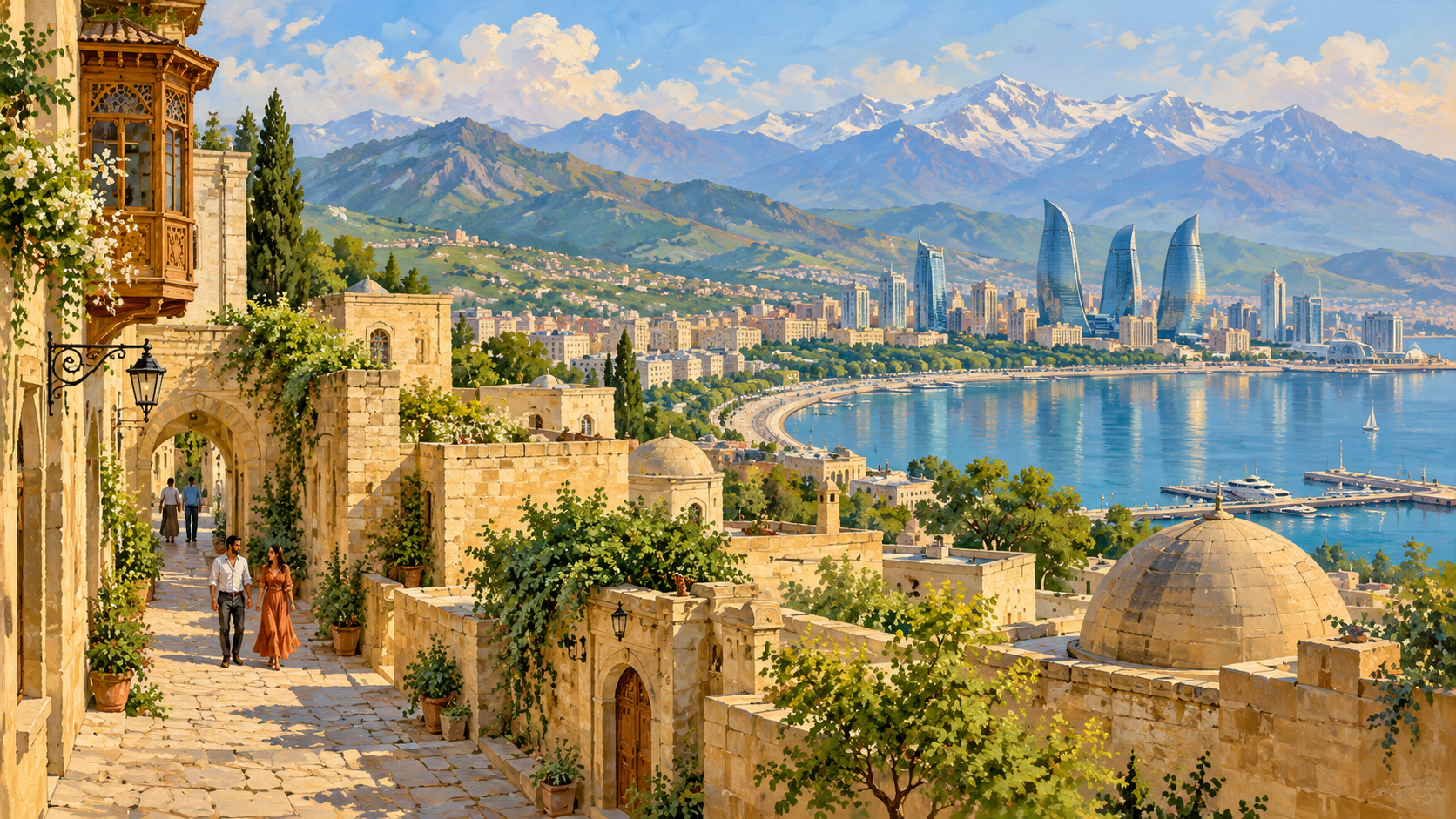
Where is Azerbaijan, what is it famous for, and how do the Caspian Sea, mountain landscapes and regional connections shape everyday life? Azerbaijan is in the South Caucasus, on the western shore of the Caspian Sea. Baku is its capital. Its geography includes lowlands, mountains and the separate Nakhchivan Autonomous Republic, whose location makes connections with neighbouring countries particularly important.
The country is often introduced through oil and gas, Baku’s waterfront, carpets, mugham music and historic architecture. It is also a place of schools, farms, businesses, neighbourhoods and changing public services. This guide connects cultural and physical geography with contemporary institutions while distinguishing constitutional descriptions, observed practice and official policy ambitions. Its account of conflict and displacement uses dated sources and keeps human consequences visible.
Azerbaijan at a glance
- Official name: Republic of Azerbaijan.
- Region: the South Caucasus, with connections across the Caspian and wider Eurasia.
- Capital: Baku.
- Main language: Azerbaijani, a Turkic language.
- Currency: Azerbaijani manat, code AZN.
- Coast: the Caspian Sea, an enclosed inland body of water rather than an open-ocean coastline.
- Land neighbours: Russia, Georgia, Armenia and Iran; Nakhchivan also borders Türkiye.
- Distinct territorial feature: Nakhchivan is separated from the main part of Azerbaijan.
- Government: presidential republic; the constitutional framework and the way political institutions operate are discussed separately below.
- Modern independence: restored in 1991 following the Soviet period; the 1918 republic is an earlier chapter in modern statehood.
- Known for: Caspian energy, Baku, carpets, mugham, historic towns, varied landscapes and regional transport connections.
- Reading date: 20 October 2026 in Singapore. Statistical observations and diplomatic statements retain their own dates.
Keep three distinctions in mind: a border on a map does not guarantee an open passenger crossing; a proposed transport route is not an operating service; and an initialled diplomatic text is not automatically a ratified and fully implemented settlement. These distinctions matter when reading about Azerbaijan’s geography and its changing regional relationships.
Cover illustration: an original artistic interpretation of Azerbaijani Caspian waterfronts, mountain landscapes and city life, not a literal geographic view.
Choose your route through Azerbaijan
- 1. Azerbaijan on the map: a Caspian country in the South Caucasus
- 2. Mountains, lowlands and the country’s contrasting landscapes
- 3. Water and climate: why one national weather description is insufficient
- 4. People, languages and diversity
- 5. Early history: settlement, kingdoms and changing empires
- 6. The modern state: republic, Soviet rule, independence and conflict
- 7. Government and administration: institutions and political practice
- 8. Baku and the regional cities
- 9. The economy: oil, gas and the challenge of diversification
- 10. Agriculture, trade and the geography of connections
- 11. Transport, railways, ports and borders
- 12. Electricity, water and the infrastructure of daily life
- 13. Education, examinations and routes into adulthood
- 14. Healthcare and what mandatory insurance actually covers
- 15. Daily life, housing, work and public services
- 16. Food, tea and the geography of the table
- 17. Music, literature, performance and sport
- 18. UNESCO heritage: five different ways to read a country
- 19. Nature, climate and the changing Caspian
- 20. International ties and the current peace process
1. Azerbaijan on the map: a Caspian country in the South Caucasus
Start with the sea, then trace the neighbours
Azerbaijan lies in the South Caucasus on the Caspian Sea. Baku is the capital, and the officially reported area is 86,600 square kilometres. Its main territory borders Russia, Georgia, Armenia and Iran; Nakhchivan also borders Türkiye. Azerbaijani is the official language and the manat is the currency. Azerbaijan Ministry of Foreign Affairs: General information.
The Caspian is the world’s largest enclosed inland water body. Although called a sea, it does not provide the same direct ocean access as the Mediterranean or Indian Ocean. Azerbaijan therefore has a long maritime frontage while remaining landlocked in the ocean-trade sense. The coast supports ports, fisheries and offshore energy activity, but a cargo ship leaving Baku cannot simply continue into the open ocean. Connections across neighbouring countries and between transport modes are fundamental to understanding the national map. UNEP: Tehran Convention overview.
Why Nakhchivan matters
The Nakhchivan Autonomous Republic is an exclave: it belongs to Azerbaijan but is separated from the main territory by Armenia. It borders Armenia, Iran and Türkiye. Its position helps explain why a short line on a regional map can become an important transport question. The 1921 Moscow and Kars treaties are central historical documents behind its autonomous status in association with Azerbaijan. Nakhchivan should not be confused with Nagorno-Karabakh, a different region within the main body of Azerbaijan. Presidential Library: Nakhchivan treaties.
Read the map at more than one scale
At the continental scale, Azerbaijan connects the Caucasus with the Caspian basin. At the national scale, mountains, river plains and an offshore energy zone organise settlement and production. At the local scale, a mountain village, a coastal suburb and an irrigated farming district face very different practical conditions. A useful first map exercise is to mark Baku, the Caspian, the Kura River and Nakhchivan before adding cities and roads. This prevents a common misunderstanding: political connection does not always mean geographical continuity, and a border on paper does not tell us whether a particular crossing is open.
2. Mountains, lowlands and the country’s contrasting landscapes
Three mountain systems and a broad central plain
The Greater Caucasus rises across the north, the Lesser Caucasus shapes much of the west, and the Talysh Mountains stand in the southeast. Between these uplands lies the extensive Kura–Aras lowland. The contrast is sharp: some Caspian coastal land lies below global sea level, while mountain terrain climbs far above the plains. Rivers descending from the uplands carry water and sediment towards the lowlands. This is a landscape of connected elevations, not a country of either mountains or flat agricultural land alone. Library of Congress country study: Physical environment.
The central plain gives relatively continuous space for farms, roads and settlements. Mountain districts have more fragmented ground, where slopes, valleys and passes shape the location of buildings and routes. This distinction helps a reader interpret travel distances: two settlements that appear close on a small map may be separated by substantial relief. It also explains why altitude belongs beside rainfall and soil on an agricultural map. A flat field and a steep pasture offer different possibilities even when they fall within the same national boundary.
The forested southeast
Near Lankaran and Astara, the environment changes again. Azerbaijan’s part of the Hyrcanian forest belt connects with forests in northern Iran. UNESCO describes these broad-leaved forests as remnants of a much older forest system, with unusual ecological continuity and many rare or locally distinctive species. The Azerbaijani components of the transnational World Heritage property are within Hirkan National Park. Their presence challenges the impression that Azerbaijan is uniformly dry because so many photographs show Baku, semi-desert or exposed rock. UNESCO: Hyrcanian Forests.
A landscape can also be a working system
The UNESCO-listed landscape of the Khinalig people combines a high-mountain village, summer pastures, lowland winter grazing and the roughly 200-kilometre Köç Yolu migration route. This is transhumance: livestock and herders move seasonally between elevations. The whole route matters, because protecting only the picturesque village would leave out the grazing grounds and movement that help sustain its way of life. The example makes the relationship between physical and human geography visible. A mountain landscape is also a network of livelihoods, knowledge and shared access. UNESCO: Khinalig and Köç Yolu.
3. Water and climate: why one national weather description is insufficient
Dry plains, humid coastal pockets and colder uplands
Azerbaijan’s climate varies with altitude, exposure to air masses and proximity to the Caspian. Much of the Kura–Aras lowland and the Absheron Peninsula has dry conditions, while the Lankaran area is substantially wetter. Higher mountains experience colder conditions than the plains. Nakhchivan, removed from the sea and enclosed by mountains, has a more continental pattern, including colder winters. On Absheron, the northerly khazri and warmer gilavar are well-known winds. These contrasts are more useful than treating a single temperature for Baku as a national average. Azerbaijan embassy: Nature and resources.
A familiar promotional phrase says Azerbaijan contains nine climate types. Such a count depends on the classification being used. For learning, the stronger question is what changes from place to place: temperature, rainfall, snow cover, wind and the length of the growing season. A coastal city may have a different daily experience from an upland village even during the same month. Weather is the short-term event; climate describes the pattern over many years. Keeping the two separate improves both geography writing and practical planning.
The Kura and Araz connect the country to its neighbours
The Kura, known as Kür in Azerbaijani and Mtkvari in Georgia, and the Araz, also written Aras, are the main river names to learn. The Araz joins the Kura before the combined flow reaches the Caspian. A State Statistical Committee presentation hosted by UNECE identifies the Kura basin as the dominant water system and notes that much of Azerbaijan’s water originates outside its borders. Water security therefore involves upstream use and cooperation as well as domestic reservoirs and canals. UNECE: Azerbaijan water resources presentation.
UNECE’s country dialogue records work on water management, environmental flows and cooperation with Georgia, alongside Azerbaijan’s approval of a National Water Strategy in 2024. The practical challenge is to connect water supply with farming, household needs, industry and healthy ecosystems. Building a reservoir alone cannot answer every question: seasonal availability, water quality, losses in distribution and the needs of people downstream all affect the result. UNECE: Azerbaijan water policy dialogue.
A changing Caspian shoreline
UNEP reports that the Caspian is shrinking, with warming and associated evaporation contributing to declining water levels. The consequences reach beyond the appearance of a beach: ports can become harder to access, coastal habitats can move or contract, and fishing communities can lose convenient access to water. A coastline is therefore not an unchanging edge on the map. For Azerbaijan, coastal planning must consider environmental change together with the infrastructure already built around the sea. UNEP: The race to save the vanishing Caspian Sea.
4. People, languages and diversity
Use population figures with their dates
Official population tables report 10,262,400 residents at the beginning of 2026, with 54.3 percent living in urban places and 45.7 percent in rural places. This is a dated official national figure, not a live count or an estimate for every later year. A national total is useful for scale, but it cannot show how people are distributed between a metropolitan area, a farming plain and a sparsely settled mountain district. Whenever two population figures disagree, first check their reference dates, geographical coverage and whether they are census results or subsequent estimates. Presidency of Azerbaijan: Population tables, beginning of 2026.
Azerbaijani and the multilingual setting
Azerbaijani belongs to the Oghuz branch of the Turkic language family, alongside Turkish and Turkmen. Its relationship with Turkish explains recognizable words and some mutual comprehension, but the languages should not be treated as identical. Modern Azerbaijani in the republic uses a Latin-based alphabet, following earlier Arabic-based and Soviet-era writing systems. The historical changes help explain why older documents, family records and publications can appear in different scripts. Language history is one way to see the effects of political change on everyday communication. Library of Congress country study: Language.
The official 2019 census tables distinguish ethnicity, native language and ability to speak other languages. They include communities such as Lezgins, Talysh, Russians, Avars, Tats and Udis alongside the Azerbaijani majority. These categories answer different questions. A person can identify with one ethnic community, speak Azerbaijani in public life and use another language at home. A census table is consequently not a complete portrait of an individual’s identity, and figures collected before the September 2023 displacement from Karabakh cannot be read as a present-day description of that region. State Statistical Committee: Statistical yearbook 2024, 2019 census tables.
Diversity includes rights and participation
The Council of Europe’s fifth monitoring opinion, published in November 2024, recognised support for minority traditions and the teaching of several minority languages. It also reported weaknesses in minority-rights legislation and serious restrictions affecting expression, association and participation. A balanced account should include both cultural presence and the conditions under which people can maintain and express it. Celebrating a dance, craft or festival does not by itself establish that every language community has equal opportunities in education, media and public life. Council of Europe: Fifth Opinion on Azerbaijan.
For readers, the useful habit is to separate citizenship, ethnicity, language and religion. They overlap in many lives but are not interchangeable labels. Nor does a shared label imply that everyone has the same outlook, degree of religious observance or relationship to national history. Asking which community, place and generation a description refers to is more informative than describing the entire population through a single cultural stereotype.
5. Early history: settlement, kingdoms and changing empires
Evidence before modern national borders
Gobustan provides a long view of human activity through rock engravings, caves, settlements and burials. UNESCO records more than 6,000 engravings in the World Heritage landscape, with evidence extending across many periods. These remains reveal hunting, animals and changing ways of life. They should be read as archaeological evidence of people living in this region, rather than as proof that a present-day state or identity existed unchanged in prehistory. The distinction allows ancient history to be interesting without making it serve a modern border argument. UNESCO: Gobustan Rock Art Cultural Landscape.
Islam, Turkic languages and the Shirvanshahs
The region came under successive imperial and local powers. Arab expansion brought Islam, while migrations and political changes involving Turkic-speaking groups, including the Oghuz and Seljuks, helped reshape its linguistic landscape. Medieval society developed through the interaction of these influences with existing communities. Persian literary and political traditions, Turkic speech and local Caucasian histories were not sealed into separate compartments. Understanding their interaction is more accurate than imagining a single cultural influence replacing everything that preceded it. Library of Congress country study: Islam and Turkic language.
The Shirvanshahs are especially visible in the historical landscape of Baku. Their palace complex and the Maiden Tower form part of the UNESCO-listed Walled City. Within the surviving urban fabric, defensive walls, residences, religious buildings and trading spaces record different uses and periods. The palace belongs to the history of a regional ruling dynasty; the surrounding city belongs equally to the history of merchants, craftspeople and residents. Baku’s older layers are an important counterpoint to its more familiar modern skyline. UNESCO: Walled City of Baku.
Khanates and incorporation into the Russian Empire
By the nineteenth century, wars between the Russian and Persian empires transformed political control in the South Caucasus. The treaties of Gulistan in 1813 and Turkmenchay in 1828 were major steps in placing the territories of present-day Azerbaijan under Russian rule. Local khanates gave way to imperial administrative arrangements. These changes also left Azerbaijani-speaking populations on different sides of an international frontier. The modern Republic of Azerbaijan and the broader historical or cultural use of the name Azerbaijan should therefore be distinguished carefully. Library of Congress country study: Within the Russian Empire.
Baku’s oil boom later added another layer to the imperial-era city. The national tourism board’s architectural route connects major buildings associated with the late nineteenth- and early twentieth-century urban transformation, including cultural institutions and prominent residences. These buildings make economic history visible: wealth from a resource industry helped reshape the streets people used and the institutions they built. Reading the city in this way connects an international commodity to local architecture, rather than treating economic history and cultural history as unrelated subjects. Azerbaijan Tourism Board: Oil-boom architecture.
6. The modern state: republic, Soviet rule, independence and conflict
1918, 1920 and 1991
The Azerbaijan Democratic Republic was proclaimed on 28 May 1918 after the collapse of the Russian Empire. It established parliamentary institutions and political rights that included women’s suffrage. Its independent existence ended when Bolshevik forces took control in April 1920. Modern Azerbaijan’s constitutional act restoring independence was adopted on 18 October 1991. The two independence dates refer to different events: the first republic’s founding and the recovery of independent statehood as the Soviet Union broke apart. Presidency of Azerbaijan: History.
Soviet Azerbaijan initially formed part of a Transcaucasian federation with Armenia and Georgia. In 1936 it became a separate union republic within the USSR. This administrative status did not make it an independent country. Soviet borders and autonomous arrangements became especially consequential when the union dissolved, because boundaries formerly managed inside one state became the borders and territorial disputes of independent states. Library of Congress country study: Soviet period.
The first Karabakh war and displacement
Nagorno-Karabakh lay within Azerbaijan’s internationally recognised borders but had an ethnic Armenian majority in the late Soviet period. Conflict intensified from the late 1980s and became war as Soviet authority collapsed. A 1999 UN report documents displacement of Azerbaijanis and Kurds from areas captured by Armenian forces and displacement of Armenians during Azerbaijani offensives. By the 1994 ceasefire, Armenian forces controlled most of Nagorno-Karabakh and surrounding Azerbaijani districts. The human consequences included loss of homes and livelihoods across communities. United Nations: Representative on internally displaced persons, 1999 Azerbaijan report.
UN Security Council Resolution 874, adopted in 1993, called for implementation of negotiated steps, withdrawal from recently occupied territories, humanitarian access and the safe return of displaced people. International recognition of territory, control on the ground and the rights of residents are related but distinct issues. Treating one as the complete answer to the others obscures the history and the suffering of civilians. UN Security Council Resolution 874 (1993).
2020 and September 2023
Renewed war in 2020 changed territorial control. The trilateral statement effective on 10 November 2020 stopped the fighting, provided for the return of specified districts to Azerbaijan and deployed Russian peacekeepers along the remaining contact line and Lachin corridor. It also addressed displaced people, detainees and transport links. This was a ceasefire arrangement with specific provisions, rather than a reason to assume that every humanitarian and political question had been settled. Trilateral statement of 10 November 2020.
During 2023, a blockade obstructed the Lachin corridor, the main road linking the ethnic Armenian population of Nagorno-Karabakh with Armenia. UN Security Council discussions addressed the resulting humanitarian crisis. This context is important to the subsequent sequence of military action and mass flight. United Nations: Security Council 2023 retrospective.
On 19 September 2023, Azerbaijan launched a military operation in Nagorno-Karabakh. The resulting collapse of the local ethnic Armenian administration brought the remaining territory under Azerbaijani control. UNHCR records that more than 100,000 refugees reached Armenia from Karabakh in about a week that September. This mass displacement is essential to any accurate account of the change in control; it must not disappear behind descriptions of military or diplomatic outcomes. UN Security Council briefing, 21 September 2023. UNHCR Armenia: Refugee response and coordination. Council of Europe: Fifth Opinion on Azerbaijan.
In November 2023, the International Court of Justice ordered provisional measures concerning safe return for those wishing to return, departure for those wishing to leave and protection against force or intimidation for those remaining or returning. Provisional measures are protective court orders, not a final judgment on every allegation in a case. The later peace process and foreign relations are discussed in Chapter 20. International Court of Justice: Order summary, 17 November 2023.
7. Government and administration: institutions and political practice
What the constitution establishes
The constitution, adopted in 1995 and subsequently amended, describes Azerbaijan as a secular, unitary republic. It assigns executive power to the president, legislation to the Milli Majlis and judicial power to the courts. The president is elected for a seven-year term. The single-chamber Milli Majlis has 125 deputies. The constitution also provides for a Cabinet of Ministers and distinguishes national institutions from local government arrangements. These are the formal rules for how state authority is organised. Constitution of Azerbaijan.
Local executive heads are appointed and dismissed by the president, while municipalities are the constitutional institutions of local self-government. Nakhchivan has autonomous republican institutions within Azerbaijan’s constitutional order. This combination matters: a municipality, a district executive authority and the autonomous republic are different kinds of public body, with different responsibilities. Their names should not be treated as interchangeable simply because each operates below the national level. Constitution of Azerbaijan.
The political system in practice
As checked in October 2026, Ilham Aliyev is president; he first took office in 2003. A leader’s official biography establishes dates and positions, but it does not independently assess political competition. For that, election observation and rights monitoring provide a different kind of evidence. Reading these sources alongside the legal framework avoids confusing the existence of elections and institutions with an assessment of how freely citizens can contest power. Presidency of Azerbaijan: Ilham Aliyev biography.
In its 5 March 2025 summary of the final reports, OSCE/ODIHR found that Azerbaijan’s 2024 presidential and parliamentary elections took place in a restrictive environment with no genuine political alternatives. It acknowledged efficient preparation but raised serious concerns about irregularities, safeguards and restrictions on fundamental freedoms. This distinction is important for an atlas: the constitutional description of democracy is a statement of the legal framework, while observers’ findings address actual electoral conditions. Both should be identified for what they are. OSCE/ODIHR: Final reports on Azerbaijan’s 2024 elections.
Administrative boundaries and regional planning
The State Statistical Committee’s 2025 yearbook lists one autonomous republic and 64 districts, alongside towns and other settlement categories. Older government profile pages can show different totals, so a district count should always retain its date. Administrative boundaries also differ from historical regions, tourism groupings and economic planning regions. A place may appear under different groupings without having moved. The question is which purpose the grouping serves: delivering public services, organising statistics, describing cultural history or planning investment. State Statistical Committee: Azerbaijan agriculture yearbook 2025.
8. Baku and the regional cities
The capital is a useful starting point, not the whole country
Baku’s location on the Absheron Peninsula makes the relationship between city, coast and energy immediately visible. Its old walled core offers a compact historical setting, while the wider metropolitan landscape reflects much more recent development. A photograph of the palace quarter and a photograph of a modern waterfront can both be accurate without showing the same urban experience. Read a city through several layers: where people live, where they work, how they travel and which parts are preserved or redeveloped. Azerbaijan Tourism Board: Baku’s urban heritage.
Ganja and Sumgayit show different urban roles
Ganja, in western Azerbaijan, is closely associated with the poet Nizami and retains buildings from different political periods. The national tourism material draws attention to architecture linked to the khanate, Russian imperial and Soviet eras, alongside earlier religious and bathing buildings. This makes Ganja useful for understanding continuity outside the capital. Its historical identity is not simply a smaller version of Baku’s; it belongs to a different regional setting and network of cultural connections. Azerbaijan Tourism Board: Ganja.
Sumgayit illustrates the industrial side of urban development. In May 2025, the Ministry of Economy reported new manufacturing operations in its Chemical Industrial Park, including construction chemicals and vehicle assembly. Such examples are more informative than a vague claim that an economy is diversifying. They identify actual products, production sites and links to suppliers. At the same time, an industrial announcement cannot alone show how benefits are distributed across workers, neighbourhoods or smaller firms. Ministry of Economy: Sumgayit Chemical Industrial Park, May 2025.
Water, silk and regional character
Mingachevir lies on the Kura and is associated with the country’s largest reservoir. It is a useful example of a city whose identity is strongly linked to water infrastructure and the river landscape. The presence of a reservoir connects questions that are often studied separately: electricity, irrigation, recreation and settlement. A map of the city becomes more meaningful when its waterways and dams are included rather than only roads and buildings. Azerbaijan Tourism Board: Mingachevir.
Sheki sits at the foot of the Greater Caucasus. UNESCO explains that its historical centre was rebuilt after an eighteenth-century mudflow and that silk production and trade helped shape its merchant houses and urban form. High roofs, gardens and water systems were part of a working town as well as an attractive streetscape. Regional comparison therefore reveals different organising forces: coastal energy in Baku, industrial manufacturing in Sumgayit, reservoir infrastructure in Mingachevir and trade-linked heritage in Sheki. UNESCO: Historic Centre of Sheki.
9. The economy: oil, gas and the challenge of diversification
Follow energy from the field to the customer
Oil and gas are central to Azerbaijan’s economic structure. SOCAR, the State Oil Company of Azerbaijan Republic, is wholly state-owned and operates across extraction, processing, transport and sales. Its activities should be distinguished from those of international operating partnerships and from the government’s wider fiscal accounts. The energy industry includes offshore platforms, terminals, pipelines, engineering and services; it is much more than a well producing a raw commodity. SOCAR: Consolidated financial statements 2023.
The Baku–Tbilisi–Ceyhan pipeline carries oil from the Sangachal terminal area through Georgia to Türkiye’s Mediterranean coast. Its route shows how a Caspian producer reaches an ocean-connected export terminal. Gas follows a different system. On 31 December 2020, the Shah Deniz consortium began commercial deliveries to Europe through the completed Southern Gas Corridor, whose linked pipelines cross several jurisdictions. Oil routes and gas routes should be traced separately rather than combined into a single generic energy line. BP: Azerbaijan sustainability report 2009, BTC route. BP: Shah Deniz gas deliveries to Europe, 31 December 2020.
Revenue today and assets for the future
SOFAZ, the State Oil Fund of Azerbaijan, has the stated mission of turning finite hydrocarbon wealth into financial assets for current and future generations. It is distinct from SOCAR: one is a sovereign wealth fund managing revenues and investments; the other is an operating energy company. The distinction helps explain why production, export earnings, fund assets and annual government spending are different measurements. A rise in one should not automatically be described as an equivalent rise in household income. SOFAZ: Mission and objectives.
What diversification actually requires
The World Bank identifies diversification beyond hydrocarbons as a continuing priority. Its country overview connects that goal with agribusiness, access to finance, transport and other non-energy activity. In its account of 2025, real GDP growth was 1.4 percent, with weaker hydrocarbon output and slower non-hydrocarbon growth. This dated result is a reminder that national growth depends both on the energy sector and on the ability of other activities to expand productively. World Bank: Azerbaijan overview.
Diversification is best judged through concrete questions. Can a food processor sell reliably abroad? Can a small business obtain finance and compete on fair terms? Do logistics improvements save customers time? Are workers developing skills that remain valuable when commodity prices change? New buildings and large investment totals may contribute, but they are not the entire outcome. For an energy-producing country, the durable objective is a wider range of productive work and income sources, with public finances able to withstand changes in energy markets.
10. Agriculture, trade and the geography of connections
Different crops belong to different environments
Farming reflects Azerbaijan’s environmental variety. The FAO country report places tea, citrus and early vegetables in the Lankaran–Astara region; cotton and cereals in the Kura–Aras lowland; nuts in the Sheki–Zagatala area; and fruit and vegetables in the northeast. Grapes, orchard crops and livestock add further variety. These are broad agricultural patterns rather than rigid boundaries. Soil, water, market access and farm decisions all affect what an individual holding can grow profitably. FAO: Azerbaijan plant genetic resources country report.
Hazelnuts provide a concrete example of agriculture connected to export markets. FAO’s 2024 account of work with Azerbaijani smallholders emphasises productivity, crop handling and food safety. The commercial chain continues after harvesting: drying, storage, processing and testing can determine whether a product meets a buyer’s requirements. Better farming is therefore not only a matter of producing more tonnes. Reducing losses and maintaining consistent quality can be just as important to the income earned from a harvest. FAO: Sustainable hazelnut production, June 2024.
A farming country can still need food imports
FAO’s April 2026 country brief identifies wheat and barley as major cereals and reports continued cereal import requirements. Domestic production and food imports are not contradictory. The balance depends on the harvest, consumption, stocks and the types or qualities of grain needed. It is useful to distinguish a calendar-year harvest from a marketing year, which can cross two calendar years. Without that distinction, figures for production and imports can be compared incorrectly. FAO GIEWS: Azerbaijan country brief, 30 April 2026.
Ports and railways turn location into usable access
The modern Port of Baku at Alat lies about 70 kilometres from the capital, near major rail and road connections. Ferry, roll-on/roll-off and general cargo facilities make it an interchange between sea and land transport. Its name can be confusing on a map: the main modern cargo port is outside central Baku. The location demonstrates how port development depends on room for terminals and efficient inland connections as well as access to water. Azerbaijan Transit Council: Maritime transport and ports.
The World Bank describes the Middle Corridor as a combination of rail and maritime links between Asian and European markets through Central Asia and the South Caucasus. Azerbaijan, Kazakhstan and Georgia are core countries in its analysis. The opportunity depends on coordinated operations: border procedures, ships, train capacity and reliable timetables must work together. A line drawn between two continents is only a potential route. It becomes useful trade infrastructure when goods can complete every transfer predictably, at a competitive cost. World Bank: Middle Trade and Transport Corridor.
11. Transport, railways, ports and borders
Azerbaijan’s transport geography operates at two scales. One is the everyday journey between a home, school, market and workplace. The other is the movement of freight between the Caspian, the Caucasus and larger Eurasian markets. A country can be an important cargo crossroads while still imposing substantial restrictions on individual travellers. Keeping these scales separate makes its transport map much easier to understand.
Rail and the Caspian connection
The Baku–Tbilisi–Kars railway links Azerbaijan with Georgia and Türkiye and was commissioned in 2017. Azerbaijan’s Transit Council reports that reconstruction in the Georgian section raised annual freight capacity to five million tonnes in 2024. Capacity describes what infrastructure can handle; it is not the amount actually carried. At Alat, south of central Baku, the port connects maritime movements with inland rail and road journeys. This creates a transfer point where goods change transport mode rather than simply continue along one uninterrupted railway. Azerbaijan Transit Council: railways; Azerbaijan Transit Council: maritime transport and ports.
The wider Middle Corridor combines rail and shipping through Central Asia and the South Caucasus. Its commercial value depends on port handling, compatible documents, predictable border procedures and coordination between operators as well as track and cranes. The World Bank’s corridor study therefore treats better logistics and investment as complementary tasks. It also stresses regional trade: the route matters to producers within Azerbaijan, Georgia and Kazakhstan, not only to containers travelling between China and Europe. World Bank Middle Corridor study.
Getting around the capital
Baku’s metro provides an important urban alternative to road travel. Its Red, Green and Purple lines form a network with operating patterns that deserve attention: the Red and Green services share part of their route, so the destination on the train matters. The operator’s line guide is more useful for understanding transfers than assuming each colour is a completely separate railway. For a resident, the practical transport question is the whole journey, including the walk to a station and the last connection home. Baku Metro line guide.
A border line is not a travel permission
As checked on 19 October 2026, UK government advice describes entry by land or sea as restricted and identifies special-authorisation arrangements for some British nationals arriving from Iran. It also describes the Armenia border as closed. These are dated, nationality-specific travel facts, not a guarantee for every passport or crossing. Before an overland journey, confirm the exact crossing, direction, nationality, visa and current permission requirements with the relevant authorities. A working freight route or a diplomatic announcement does not establish an unrestricted passenger crossing. UK government entry guidance; UK government regional travel advice.
12. Electricity, water and the infrastructure of daily life
An energy producer still has a domestic energy system
Oil and gas exports are prominent in Azerbaijan’s economy, but households depend on a more immediate network of generation plants, substations, distribution lines and meters. The IEA’s 2023 profile reported that natural gas produced more than 90 percent of electricity in 2022. That is a historical benchmark, not a claim about the exact mix today. Energy abundance also does not make efficiency irrelevant: an insulated home, a reliable distribution connection and a well-maintained appliance affect household comfort separately from national fuel reserves. IEA Azerbaijan energy profile.
The Energy Ministry’s operational figures for January–June 2025 recorded about 13.85 billion kilowatt-hours of total generation, including about 2.33 billion from sources it classified as renewable. Hydropower supplied most of that renewable amount, alongside solar, wind and waste-based generation. The figures show a changing mix, but a six-month result should not be presented as a full-year share or a guarantee of future output. Rainfall affects hydropower, while new equipment takes time to move from an announced investment to reliable generation. Energy Ministry first-half 2025 generation figures.
Water requires treatment, pipes and maintenance
Azerbaijan inherited extensive water infrastructure, much of which needed rehabilitation after years of deterioration. A World Bank project completed in 2019 improved supply and sanitation for more than 324,000 people across eight districts. The reported improvement to near-continuous service concerned those project areas, not every home in Azerbaijan. This distinction matters because a national access statistic can conceal differences in continuity, pressure, treatment and wastewater disposal. A connection to a pipe and a dependable service are related measures, but they are not identical. World Bank water-project results.
The country’s water-security problem also extends beyond individual utilities. A 2024 World Bank assessment highlights dependence on transboundary water and growing scarcity. Water for settlements, agriculture and ecosystems must be considered together. Repairing leaks can help, but so can better measurement, irrigation management and cooperation across river basins. Reservoir construction by itself cannot settle every question of demand or environmental quality. World Bank water-security assessment.
Digital connections belong in the same picture
World Bank country data report internet use at 91 percent of the population for 2025. This is a useful indicator of how widely digital communication has spread; it does not establish equal connection quality, affordability or digital skills in every district. A useful way to assess infrastructure is to ask what it enables: studying remotely, obtaining a document, running a small business or reaching a doctor. The strongest systems connect physical services with usable information, rather than assuming that a new website removes all barriers. World Bank Azerbaijan data.
13. Education, examinations and routes into adulthood
Understanding the school pathway
Azerbaijan’s general-school structure is commonly described as eleven grades: primary education in grades I–IV, general secondary in V–IX and complete secondary in X–XI. The distinction between completing grade IX and completing grade XI matters when comparing qualifications internationally. It also reminds families that education is a sequence of transitions rather than a single exam. A student’s next step may involve upper-secondary study, vocational learning or another recognised programme, with entry rules attached to the chosen route. NEPC-commissioned Azerbaijan education profile.
For an international reader, the safest comparison is by curriculum and qualification, not by translating a school-year label literally. A grade name that resembles one used elsewhere may cover a different age range, subject combination or leaving certificate. Students moving between countries should ask the receiving institution how it recognises the actual record of study. This is especially important when a family is choosing subjects that affect later admission.
University admission is a structured competition
The State Examination Center describes centralised undergraduate admission through a two-stage process, with a first stage covering the language of instruction, a foreign language and mathematics, followed by assessment associated with groups of intended specialisms. State-funded and fee-paying places both exist. The important lesson is to work backwards from the intended programme: check its current admission route, required subjects, language and funding conditions. The examination centre’s annual announcements should govern an actual application because detailed arrangements and exceptions can change. State Examination Center undergraduate guide.
Access before school and inclusion within school
Early education is an active area of expansion. UNESCO describes a community-based preschool initiative established in 2017 that created centres mainly in remote villages and regions, reaching about 16,000 children aged three to five. Such models are important where a conventional kindergarten may be too distant or costly to provide. They also show why school readiness is partly an infrastructure question: a capable teacher needs a place, materials and a workable arrangement for families. UNESCO preschool-access account.
UNICEF’s report on 2023 recorded expansion of supported inclusive education from 22 to 40 schools, serving more than 250 children with disabilities, alongside teacher training. Those figures describe a particular programme at that time, not universal access or the current national total. Meaningful inclusion requires accessible buildings, teaching adjustments, specialist support and acceptance by classmates. It is more informative to ask whether a child can participate and learn than to count a school place alone. UNICEF Azerbaijan results for 2023.
14. Healthcare and what mandatory insurance actually covers
A broad system with a defined benefits package
Azerbaijan completed nationwide implementation of mandatory health insurance in 2021, according to the US International Trade Administration’s January 2026 healthcare review. The system covers categories including primary, inpatient, emergency and specialist outpatient care. That is a substantial institutional change, but the existence of insurance should never be read as a promise that every treatment, medicine or provider is free. Eligibility, the benefit catalogue and the route through which care is obtained all matter. US International Trade Administration healthcare review.
The insurance agency’s catalogue, last updated in June 2025 on the page consulted, lists 3,315 services across primary care, emergency care, specialist consultations, laboratory work, physiotherapy, radiology, surgery and inpatient treatment. The count describes listed services, not 3,315 universally available facilities. For a real treatment decision, the exact service name and conditions are more useful than the headline total. Separate state programmes can also fund services outside this particular insurance catalogue. State insurance agency benefit-package catalogue.
A decree dated 19 October 2026 placed TƏBİB under the Ministry of Health and set out transitional governance and registration steps. This records the legal change without assuming every administrative transition was already complete. Presidential decree on TƏBİB governance.
Eligibility, referrals and exclusions need checking
The agency’s June 2025 guide identifies Azerbaijani citizens, specified protected refugee groups, and contributing foreign or stateless residents with the required residence documentation among eligible groups. It describes referral arrangements for contracted private facilities when the required covered service cannot be provided in the relevant public network. Directly choosing private care without the required referral can create a personal bill, with emergency exceptions. The guide also lists exclusions such as dental services, cosmetic procedures and assisted reproduction, and specifies a co-payment for outpatient MRI and CT. These rules should be rechecked before care; visitor status alone is not evidence of entitlement. State insurance agency coverage guide.
Coverage and practical access are different questions
The January 2026 commercial review also notes continuing staffing and infrastructure challenges in rural healthcare. A patient may therefore have formal coverage yet still need to travel for a specialist or an investigation. This is why transport, appointment systems and clear referral information belong in a discussion of health services. Families comparing facilities should ask what is provided locally and what requires another centre. US International Trade Administration healthcare review.
WHO’s 2024–2025 account highlights work on rehabilitation and assistive technologies, including support for older people and people with disabilities. It describes assessment, training and efforts to integrate these needs into health and social-protection systems. The wider lesson is that healthcare is not only hospital treatment: preserving mobility, managing long-term illness and enabling daily independence are also measures of a functioning system. Published reforms show direction, while the patient’s actual access remains the test. WHO Azerbaijan results profile.
15. Daily life, housing, work and public services
The neighbourhood matters as much as the skyline
Azerbaijan cannot be understood through Baku’s most photographed buildings alone. Even within the capital, historic urban fabric and contemporary redevelopment offer different surroundings for daily life. An October 2026 urban-study programme documented by UN-Habitat used routes through White City, Icherisheher and other districts to examine those contrasts. It focused on the relationship between homes, public spaces, infrastructure and environmental conditions. For a resident, those connections shape a day more directly than the height or visual drama of a landmark. UN-Habitat: reading Baku through its neighbourhoods.
Housing is therefore best understood as more than a dwelling. A home needs workable access to employment, schools, transport and services. Baku hosted the thirteenth World Urban Forum in May 2026, whose stakeholder-led Call to Action made this integrated approach a central theme. The document is a statement of shared priorities, not proof that all local housing problems have been resolved. It provides a useful question for any neighbourhood: does development improve the everyday choices available to the people who live there? UN-Habitat Baku Call to Action.
An oil economy contains many kinds of work
A country’s biggest export sector is not necessarily where most people earn their living. World Bank data based on ILO modelling put agricultural employment at roughly 34 percent of total employment in Azerbaijan in 2025. This estimate helps explain why rural livelihoods, farm productivity and access to markets remain important alongside urban services and energy. A discussion of prosperity needs to include seasonal earnings and the quality of work, rather than assuming that export revenue automatically reaches households evenly. World Bank/ILO agricultural employment data.
Workplace opportunity also varies by gender and caring responsibilities. An ILO workshop in June 2026 addressed equal pay, occupational segregation, unpaid care and access to career progression in Azerbaijan. These are practical family issues: the availability of childcare, suitable hours and a reliable journey can affect whether a person can take a job or remain in it. The existence of a reform or workshop signals attention to the issue; it does not establish that the gap has disappeared. ILO pay-equity discussion in Azerbaijan.
Everyday administration
ASAN service centres bring many public transactions into a shared service system. The official directory includes identity documents, civil-status registration, driving-licence renewal, notary services, real-estate transactions and other procedures. For someone settling into daily life, knowing which office or service handles a task can save more time than knowing a national headline statistic. The current directory and the specific service requirements should guide an application, because documents, eligibility and fees differ by procedure. ASAN public-service directory.
16. Food, tea and the geography of the table
Plov is a family of dishes
Azerbaijani plov demonstrates how a familiar ingredient can support many different dishes. Rice may be steamed and served with a separately prepared accompaniment, with saffron, dried fruit, chestnuts or meat contributing different flavours and textures. The Tourism Board distinguishes methods such as dashma, suzme and dosheme rather than reducing plov to one fixed recipe. Looking at the cooking method is useful: how rice is drained, layered and steamed can matter as much as the list of ingredients. Azerbaijan Tourism Board: plov.
A meal also provides a way to read the landscape. Fresh herbs, orchard fruit, rice and preserved ingredients connect cooking with seasonal availability and household preparation. A country’s food is not frozen in a restaurant menu: families adjust recipes, occasions call for different dishes, and regional versions can share a name while tasting quite different. For a student, comparing two versions of a dish is a simple way to investigate how place and tradition interact.
Making and sharing
UNESCO inscribed Azerbaijan’s dolma-making and sharing tradition in 2017. Its account includes fillings wrapped in leaves or placed inside fruit and vegetables, with ingredients and methods varying between communities. The heritage element concerns the knowledge, relationships and occasions surrounding the food as well as the finished dish. It is not an exclusive ownership ruling over every stuffed-leaf recipe found across neighbouring cuisines. Preparing and sharing a dish can transmit skills between generations while leaving room for variation. UNESCO dolma tradition.
Qutab, a stuffed flatbread, and kükü, an herb-rich preparation resembling an omelette, show other familiar combinations of dough, greens and cooking skill. In the south, Lankaran’s food culture includes dishes such as sirdag, described in a Tourism Board account through its eggplant, tomato and garlic ingredients. These examples make regional food more concrete than a generic description of rich cuisine. They also encourage attention to vegetables and herbs alongside the better-known rice and meat dishes. Azerbaijan Tourism Board culinary presentation; Azerbaijan Tourism Board Lankaran food account.
Tea is a social practice
Tea culture was inscribed jointly for Azerbaijan and Türkiye on UNESCO’s intangible-heritage list in 2022. Freshly brewed tea, often served in pear-shaped vessels with sweets, lemon, jam or dried fruit, creates time for conversation and hospitality. The practice involves more people than the person pouring: growers, sellers, makers of utensils and preparers of accompaniments all contribute. Understanding that chain helps explain why an ordinary drink can be culturally important. It joins agricultural production, craftsmanship and social life in a small, repeatable ritual. UNESCO tea culture.
17. Music, literature, performance and sport
Tradition can be highly inventive
Mugham is a musical tradition in which accomplished performers work creatively within inherited forms. UNESCO’s account emphasises improvisation and the historical exchanges connecting Azerbaijani music with neighbouring cultures. Listening for the unfolding relationship between voice and instruments offers a better introduction than treating mugham as background sound. A performance can be rooted in an established tradition while remaining different each time, because interpretation is part of the art rather than a departure from it. UNESCO Azerbaijani mugham.
Ashiq performance brings together poetry, storytelling, song, instrumental music and sometimes dance, with the saz as a characteristic accompanying instrument. UNESCO describes a tradition sustained across community gatherings, public stages and modern broadcasting. Its repertoire carries language and narrative as well as melody. The performer occupies a role that crosses categories which a school timetable might separate into literature, music and drama. This makes Ashiq art an especially useful example of how oral knowledge can survive through active performance. UNESCO art of Azerbaijani Ashiq.
Twentieth-century Azerbaijani music also produced jazz-mugham. The Tourism Board’s guide to Vagif Mustafazade’s house museum identifies him with this fusion and describes the musical legacy continued by his daughter Aziza. Their example illustrates how cultural continuity can involve new combinations. An inherited musical vocabulary can travel into another form without becoming merely an imitation of it. Azerbaijan Tourism Board: Vagif Mustafazade.
Literature connects several historical worlds
The National Museum of Azerbaijani Literature in Baku offers a route through writers and works associated with different periods. Its collections include material connected with Fuzuli, Khurshidbanu Natavan, Mirza Fatali Akhundzade and other major figures. These names open different questions: poetic language, literary patronage, social criticism and the changing forms in which people tell stories. A museum display is an entry point rather than the whole literary history. Reading a poem or a translated passage alongside its historical setting gives a richer understanding than learning a list of celebrated names. Azerbaijan Tourism Board literature-museum guide.
Competition and international visibility
Sport provides another meeting point between local institutions and international identity. Hidayat Heydarov’s judo gold at Paris 2024 is documented by Azerbaijan’s Olympic Committee, while FIDE records Baku’s hosting of the 2016 Chess Olympiad. These examples show different forms of sporting achievement: individual performance, organised training and the ability to host a major event. They should also be separated from everyday participation. A medal demonstrates exceptional competitive success; it does not by itself measure access to safe, affordable sport for every child. Azerbaijan Olympic Committee: Paris 2024 judo gold; FIDE report from the Baku Chess Olympiad.
18. UNESCO heritage: five different ways to read a country
As checked in October 2026, UNESCO lists five World Heritage properties for Azerbaijan: four cultural and one natural. They range from urban neighbourhoods to rock art, a seasonal pastoral route and ancient forest ecosystems. A tentative-list entry is a possible future nomination, not an inscription. Intangible-heritage entries, such as music and tea culture, belong to a separate UNESCO framework. UNESCO Azerbaijan World Heritage list.
Baku and Gobustan
The Walled City of Baku includes the Shirvanshahs’ Palace, Maiden Tower, streets and domestic buildings. UNESCO’s description emphasises the urban ensemble and its living community, not just isolated monuments. Conservation therefore involves the scale of surrounding development, original street views and the character of ordinary houses. The city’s heritage value is partly in how buildings relate to one another and continue to be used. UNESCO Walled City of Baku.
Gobustan’s rock-art landscape preserves more than 6,000 engravings together with caves, settlements and burial remains. The relationship between images and archaeological setting is crucial. A carved figure is evidence within a wider landscape of human activity, rather than a decoration detached from its place. Reading the site carefully means asking what material survives, how it is dated and how environmental conditions changed over time. UNESCO Gobustan Rock Art Cultural Landscape.
Sheki and Khinalig
Sheki’s historic centre and Khan’s Palace connect architecture with silk production, trade and a mountain-valley setting. High roofs, gardens, waterways and commercial buildings reveal how a town’s economy shaped its form. The heritage is therefore larger than the palace interior. Domestic buildings and working landscapes help explain the city’s development and are also vulnerable to poorly managed changes. UNESCO Historic Centre of Sheki.
The Khinalig cultural landscape includes the high-mountain settlement, summer and winter pastures, terraces and the roughly 200-kilometre Köç Yolu transhumance route. Its significance lies in an interconnected seasonal way of life. Protecting a village façade alone would miss the movements, land use and knowledge that make the landscape coherent. This is heritage in motion, sustained by people making practical decisions about animals, weather and pasture. UNESCO Khinalig and Köç Yolu.
The Hyrcanian Forests
The Hyrcanian Forests are a transnational property shared with Iran. The Azerbaijani components were added in 2023 and lie within Hirkan National Park. These broad-leaved forests preserve exceptional ecological continuity and many relict or restricted-range species. Their protection concerns habitats, ecological connections and the management of human use. The inscription does not mean that every forest in the wider region is inside the property, nor that all its components are open for unrestricted recreation. UNESCO Hyrcanian Forests.
Taken together, the five properties suggest a useful approach to heritage: look for relationships. A monument relates to streets and residents; a carving to archaeological evidence; a house to production; a pastoral route to seasonal movement; and a forest to an ecosystem. That approach turns a checklist of famous places into a more thoughtful reading of the country.
19. Nature, climate and the changing Caspian
A small map contains strong environmental contrasts
Azerbaijan’s climate varies with altitude, topography and proximity to the Caspian. The World Bank and Asian Development Bank’s climate-risk profile contrasts generally cooler, wetter mountains with the hotter and drier central lowlands and much of the coast. A national average therefore has limited use for understanding a particular valley or season. Climate describes a longer-term pattern; the forecast for a mountain outing is a different, immediate piece of information that must be checked separately. World Bank/ADB Azerbaijan climate-risk profile.
The southern Lankaran region provides a clear contrast with the dry landscapes around Baku. Between the Caspian and the Talysh Mountains, it is associated with lush vegetation, tea cultivation and citrus growing. Its wetlands and forests add further variety to the country’s habitats. This helps explain why a journey across Azerbaijan can connect visibly different forms of farming and settlement without covering a continental distance. Regional geography is part of the explanation for the diversity of the table as well as the scenery. Azerbaijan Tourism Board Lankaran guide.
Habitats and migration
Shirvan National Park protects a lowland landscape known for goitered gazelles and birdlife. Its location along the Caspian migration route makes it important for birds using the region to breed, rest or spend the winter. Conservation here is not only about rare animals in a distant wilderness. It involves maintaining habitat within a wider landscape used for roads, settlements and economic activity. Seasonal timing also changes what can be observed, so a species recorded in a park is not a promise that every visitor will see it. Azerbaijan Tourism Board Shirvan National Park guide.
The Caspian is an enclosed water system
The Caspian is the world’s largest inland body of water, and its declining level is a major regional concern. UNEP’s November 2024 working paper explains that temperatures, winds, evaporation, rainfall, river discharge and human water use interact. The direction and pace of change require coordinated scientific monitoring. Global ocean-level rise should not be mechanically applied to the Caspian: it has a different water balance. Equally, an exact future shoreline should not be presented as certain when it depends on scenarios and complex processes. UNEP Caspian Sea working paper.
A retreating shoreline can affect ports, fishing communities, coastal habitats and the infrastructure built to reach the water. UNEP also highlights risks for threatened sturgeon and their access to river breeding environments. The consequences connect ecology with livelihoods: protecting biodiversity and keeping a transport system usable are not entirely separate subjects. Cooperation among the five coastal countries matters because the sea cannot be managed effectively as five unrelated national edges. UNEP: the shrinking Caspian Sea.
20. International ties and the current peace process
Several relationships shape foreign policy
Azerbaijan joined the United Nations on 2 March 1992. Its international relations now connect neighbouring states, energy customers, transport partners and multilateral institutions. Türkiye is a particularly close partner: the June 2021 Shusha Declaration formalised the intention to raise bilateral relations to an alliance level. Geography also makes relations with Georgia, Russia, Iran and the other Caspian states important. These relationships address overlapping but different questions, from security and transit to trade and shared environmental systems. United Nations: Azerbaijan membership; Türkiye Foreign Ministry bilateral-relations overview.
European links extend beyond energy
The European Union’s relationship with Azerbaijan rests on a Partnership and Cooperation Agreement in force since 1999. Energy is prominent, but the framework also addresses economic cooperation, institutions and other areas. In their 11 March 2026 joint statement, the two sides called for completion of negotiations on a new comprehensive agreement and discussed transport, renewable energy and regional connectivity. An announced ambition to expand cooperation is distinct from a completed treaty or a commissioned infrastructure project. Council of the EU Azerbaijan relations; EU–Azerbaijan joint statement.
What the Armenia–Azerbaijan documents establish
The peace-agreement text was initialled on 8 August 2025 and published by mutual agreement three days later. Initialling confirms an agreed text at that stage; it should not be casually described as completed ratification. The published document provides for entry into force after the exchange of instruments confirming completion of domestic procedures. A joint anniversary statement published by Azerbaijan’s Foreign Ministry on 10 August 2026 still refers to the draft agreement. Published initialled Armenia–Azerbaijan agreement; Azerbaijan MFA: joint anniversary statement.
The text addresses mutual respect for sovereignty and borders, non-use of force, border commissions and possible cooperation in areas including transport. Those provisions are important because reconciliation requires workable institutions as well as a public declaration. They also underline why a peace process cannot be reduced to a single photograph or headline. Border arrangements, confidence-building and the practical handling of unresolved human consequences require sustained work. Published initialled Armenia–Azerbaijan agreement.
A proposed route is not an operating route
TRIPP, the Trump Route for International Peace and Prosperity initiative, is associated with plans for regional connectivity through Armenia. The Armenian government’s 17 September 2026 implementation update described work on draft company-charter and shareholders’ agreement documents for the TRIPP Development Company. That is evidence of organisational preparation, not evidence that a completed road or railway was carrying unrestricted traffic. For readers following the region, the useful habit is to ask which stage a claim describes: political agreement, legal framework, financing, construction, operation or public access. Armenian government TRIPP implementation update.
Frequently asked questions about Azerbaijan
Where is Azerbaijan?
In the South Caucasus, on the western side of the Caspian Sea. The Nakhchivan Autonomous Republic is separated from the country’s main territory.
What is Azerbaijan’s capital?
Baku. It is the principal national institutional and economic centre, but other cities and regions have their own roles and histories.
Is Azerbaijan in Europe or Asia?
The South Caucasus sits within different geographic and political definitions of Europe and Asia. Naming the South Caucasus is more precise than pretending that every framework uses the same boundary.
What language is spoken in Azerbaijan?
Azerbaijani is the state language. Other languages are spoken in particular communities and settings; a national-language label should not erase that diversity.
What currency does Azerbaijan use?
The Azerbaijani manat, coded AZN. A current currency conversion needs a dated exchange-rate source.
Is the Caspian Sea an ocean?
No. It is an enclosed inland body of water. Its shipping, ecology, fisheries and shoreline relationships differ from those of an open ocean.
What is Nakhchivan?
An autonomous republic within Azerbaijan, separated from the main national territory. Its location affects transport, trade and connections with neighbouring states.
Does Azerbaijan border Türkiye?
Yes, through Nakhchivan. A general map focused only on the main territory can hide this short border.
Why are oil and gas important?
They are central to exports, revenue and international energy connections. Their importance does not mean every household works in energy or benefits equally from changes in commodity markets.
What is mugham?
A musical tradition recognised in Azerbaijan’s cultural life, involving structured modal practices and performance traditions. It is better understood through musicians and listening than through a single national stereotype.
Are all famous Azerbaijani places UNESCO World Heritage properties?
No. Inscribed properties, tentative-list places and intangible cultural traditions belong to different categories. The heritage chapter identifies their status rather than applying one label to everything.
Are all land borders open to visitors?
No such assumption is safe. Entry rules and transport services depend on the crossing, nationality, purpose and date. Check current official requirements before making plans.
Does an initialled peace agreement mean a settlement is fully in force?
No. Initialling, signature, ratification, entry into force and practical implementation are different stages. This guide uses the status stated by dated sources.
Does a proposed transit route already carry ordinary passenger services?
Not necessarily. Agreements, planning, company formation, construction and actual operations are separate steps. Freight arrangements also do not establish general passenger access.
Is Azerbaijan’s healthcare insurance the same as every service being free?
No. Covered services, referrals, providers, eligibility and payment rules need to be distinguished. Individual cases require current information from the relevant health authority.
Is this guide travel-safety, immigration, legal or medical advice?
It is an educational country atlas. Individual decisions require current official information and, where appropriate, qualified professional advice. Conditions can vary by place and change over time.
Continue reading: Azerbaijan’s specialist guides
- How Azerbaijan Works: government, energy, Caspian trade and public services.
- How Education System of Azerbaijan Works: school stages and university entry.
- How Ministry of Education for Azerbaijan Works: education agencies and responsibilities.
- Schools of Azerbaijan: school institutions and pathways.
- What Is Taught in School | Azerbaijan: curriculum and learning.
- Tutors of Azerbaijan: learning support and examinations.
- Top 10 Places to Visit When Touring Azerbaijan: landscapes and heritage.
- Top 10 Things to Eat in Azerbaijan: food traditions.
Explore the Everything About Countries archive for national overviews and How Countries Work for institutional explanations. The How Singapore Works | Civilisation collection provides another national case study with different geography and institutions. For the complete alphabetical country directory, use How Countries Work | A–Z Guide.
Understanding Azerbaijan through connections and everyday life
Azerbaijan’s energy infrastructure and regional diplomacy are important, but they do not replace the lives of people in towns, villages and cities. A school qualification, a dependable water supply, an accessible health service and a journey to work are also part of how the country is understood.
The most useful country overview keeps several layers together: landscape, cultural continuity, difficult history, present institutions and proposals for the future. Distinguishing evidence from aspiration makes that picture clearer. It also leaves space for differences between places and people rather than reducing the country to a skyline, a resource or a dispute.
Sources and further evidence
Sources were checked for this edition in October 2026. Each statistical observation, policy statement and historical record retains its own date. Government announcements describe stated programmes; they do not alone establish completed outcomes.
- Azerbaijan Ministry of Foreign Affairs: General information
- UNEP: Tehran Convention overview
- Presidential Library: Nakhchivan treaties
- Library of Congress country study: Physical environment
- UNESCO Hyrcanian Forests
- UNESCO Khinalig and Köç Yolu
- Azerbaijan embassy: Nature and resources
- UNECE: Azerbaijan water resources presentation
- UNECE: Azerbaijan water policy dialogue
- UNEP: the shrinking Caspian Sea
- Presidency of Azerbaijan: Population tables, beginning of 2026
- Library of Congress country study: Language
- State Statistical Committee: Statistical yearbook 2024, 2019 census tables
- Council of Europe: Fifth Opinion on Azerbaijan
- UNESCO Gobustan Rock Art Cultural Landscape
- Library of Congress country study: Islam and Turkic language
- UNESCO Walled City of Baku
- Library of Congress country study: Within the Russian Empire
- Azerbaijan Tourism Board: Oil-boom architecture
- Presidency of Azerbaijan: History
- Library of Congress country study: Soviet period
- United Nations: Representative on internally displaced persons, 1999 Azerbaijan report
- UN Security Council Resolution 874 (1993)
- Trilateral statement of 10 November 2020
- United Nations: Security Council 2023 retrospective
- UN Security Council briefing, 21 September 2023
- UNHCR Armenia: Refugee response and coordination
- International Court of Justice: Order summary, 17 November 2023
- Constitution of Azerbaijan
- Presidency of Azerbaijan: Ilham Aliyev biography
- OSCE/ODIHR: Final reports on Azerbaijan’s 2024 elections
- State Statistical Committee: Azerbaijan agriculture yearbook 2025
- Azerbaijan Tourism Board: Baku’s urban heritage
- Azerbaijan Tourism Board: Ganja
- Ministry of Economy: Sumgayit Chemical Industrial Park, May 2025
- Azerbaijan Tourism Board: Mingachevir
- UNESCO Historic Centre of Sheki
- SOCAR: Consolidated financial statements 2023
- BP: Azerbaijan sustainability report 2009, BTC route
- BP: Shah Deniz gas deliveries to Europe, 31 December 2020
- SOFAZ: Mission and objectives
- World Bank: Azerbaijan overview
- FAO: Azerbaijan plant genetic resources country report
- FAO: Sustainable hazelnut production, June 2024
- FAO GIEWS: Azerbaijan country brief, 30 April 2026
- Azerbaijan Transit Council: maritime transport and ports
- World Bank Middle Corridor study
- Azerbaijan Transit Council: railways
- Baku Metro line guide
- UK government entry guidance
- UK government regional travel advice
- IEA Azerbaijan energy profile
- Energy Ministry first-half 2025 generation figures
- World Bank water-project results
- World Bank water-security assessment
- World Bank Azerbaijan data
- NEPC-commissioned Azerbaijan education profile
- State Examination Center undergraduate guide
- UNESCO preschool-access account
- UNICEF Azerbaijan results for 2023
- US International Trade Administration healthcare review
- State insurance agency benefit-package catalogue
- Presidential decree on TƏBİB governance
- State insurance agency coverage guide
- WHO Azerbaijan results profile
- UN-Habitat: reading Baku through its neighbourhoods
- UN-Habitat Baku Call to Action
- World Bank/ILO agricultural employment data
- ILO pay-equity discussion in Azerbaijan
- ASAN public-service directory
- Azerbaijan Tourism Board: plov
- UNESCO dolma tradition
- Azerbaijan Tourism Board culinary presentation
- Azerbaijan Tourism Board Lankaran food account
- UNESCO tea culture
- UNESCO Azerbaijani mugham
- UNESCO art of Azerbaijani Ashiq
- Azerbaijan Tourism Board: Vagif Mustafazade
- Azerbaijan Tourism Board literature-museum guide
- Azerbaijan Olympic Committee: Paris 2024 judo gold
- FIDE report from the Baku Chess Olympiad
- UNESCO Azerbaijan World Heritage list
- World Bank/ADB Azerbaijan climate-risk profile
- Azerbaijan Tourism Board Lankaran guide
- Azerbaijan Tourism Board Shirvan National Park guide
- UNEP Caspian Sea working paper
- United Nations: Azerbaijan membership
- Türkiye Foreign Ministry bilateral-relations overview
- Council of the EU Azerbaijan relations
- EU–Azerbaijan joint statement
- Published initialled Armenia–Azerbaijan agreement
- Azerbaijan MFA: joint anniversary statement
- Armenian government TRIPP implementation update