
Where is Kiribati, what is it famous for and why is it important? Kiribati is a Pacific country of widely dispersed coral islands, with South Tarawa as its main capital area. This long-form guide connects its ocean geography, human history, language, schools, government, fisheries, food, infrastructure, art, conservation and international relationships. It offers twenty substantial chapters rather than only attractions or quick facts.
Use the chapter directory to begin with the topic that interests you, then explore frequently asked questions and related specialist guides at the end. Current policy examples are dated to 2026; historical evidence and projections are identified rather than silently presented as present fact.
Kiribati at a glance
- Region: Micronesia, Oceania
- Capital area: South Tarawa
- Islands: Traditionally counted as 33 across the Gilbert, Phoenix and Line groups, including Banaba
- Currency: Australian dollar (AUD), alongside Kiribati coins
- Languages: Kiribati (Gilbertese) and English
- Independence: 12 July 1979
- UN membership: 14 September 1999
- Political system: Constitutional republic with President (Beretitenti) and unicameral Parliament
Introductory facts follow the DFAT Kiribati country brief, UNData and the Constitution. This is educational material rather than individual travel, legal, clinical or financial advice.
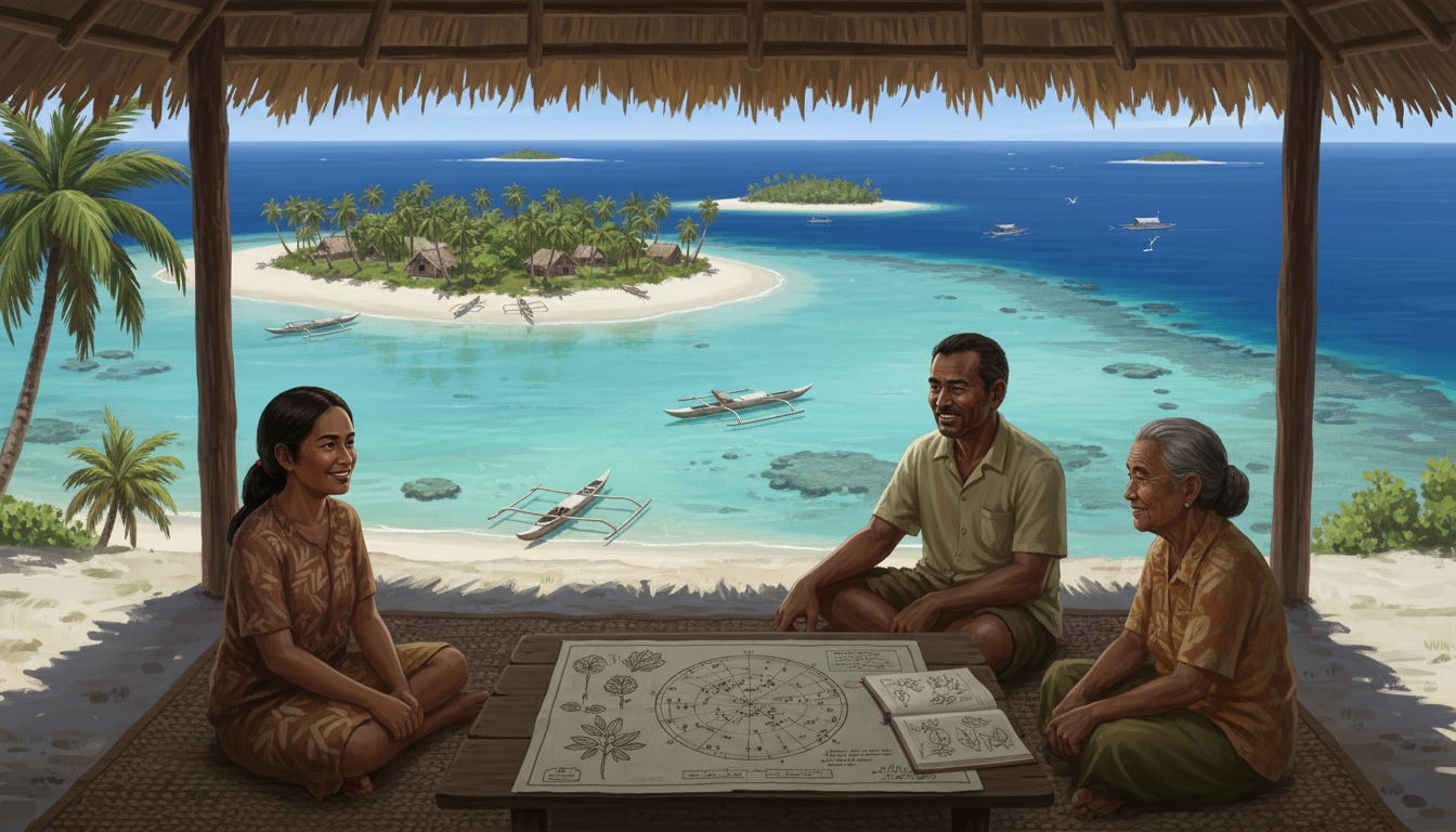
Cover: The original AI-generated illustration is an artistic composite of an imagined I-Kiribati reading and navigation scene. It is not a photograph of any one island or a prediction of its future shoreline.
Choose your route through Kiribati
Place, history and communities
- 1. Geography, Atolls and Three Island Groups
- 2. Settlement, Navigation and Early Island Networks
- 3. Colonial Rule, World War II and Independence
- 4. Constitution, Elections and Island Councils
- 5. People, Language and Community Life
Education, livelihoods and homes
- 6. Education, Assessment and Skills
- 7. Science, Research and Digital Services
- 8. Economy, Fisheries Revenue and Employment
- 9. Fishing, Agriculture and Food Security
- 10. South Tarawa, Homes and Community Services
Services and living culture
- 11. Transport, Ships, Air Links and Infrastructure
- 12. Health, Sanitation and Family Wellbeing
- 13. Everyday Food and Culinary Heritage
- 14. Craft, Weaving and Built Design
- 15. Music, Dance, Literature and Storytelling
Environment and wider connections
- 16. Heritage, Archives and Historic Sites
- 17. Marine Biodiversity and the Phoenix Islands
- 18. Freshwater, Sea-Level Change and Energy
- 19. Sport, Recreation and Community
- 20. Kiribati, Singapore and the Wider Pacific
1. Geography, Atolls and Three Island Groups
A country whose territory is mostly ocean
Kiribati is a sovereign Pacific country in Micronesia, composed of widely separated islands across a vast stretch of ocean. It is commonly counted as thirty-three islands in the Gilbert, Phoenix and Line groups, with Banaba a raised coral island unlike the low-lying atolls associated with the country. South Tarawa is the main capital area. Measuring Kiribati by square kilometres of dry land alone conceals its maritime responsibilities and the scale of distance between communities. A world map at continental scale makes some of its islands hard to see; a detailed Pacific map changes the picture. A person travelling between islands may need a flight or boat journey, weather permitting, rather than a short road trip. The ocean is therefore neither empty space nor merely scenery. It connects families, commerce and government while also sustaining reef ecosystems and tuna fisheries. This geographic fact is the starting point for explaining why the national economy, schools, health services and environmental responsibilities differ from those of a compact land-based country. (Australian DFAT: Kiribati country brief; UNICEF: Kiribati field office)
Coral reefs, lagoons and changing shorelines
Atolls form through long relationships among coral growth, ocean processes, waves and sediment movement. Many inhabited parts of Kiribati are narrow strips of land between lagoon and ocean. Their shape makes everyday activities depend on coastal conditions: homes, roads, trees and groundwater can be close to salty water. Such islands are not static drawings on a map. Sand may accumulate in one location while another loses shoreline, and storms can alter the distribution of sediment. Rising sea level changes the baseline upon which tides and waves act, increasing risks to coasts and shallow freshwater lenses, even where an individual island remains visible. An aerial photograph shows a moment, not a long-term erosion rate. Good science compares dated surveys, wave records and local observations before making causal claims. An atoll should be understood simultaneously as a developing geological environment, a complex ecosystem, a site of human knowledge and a place where people make practical decisions about home. (Pacific Community: Atoll Water Security; UNICEF: Kiribati field office)
Banaba, Kiritimati and the calendar
The islands of Kiribati are geographically diverse despite their common political identity. Banaba is raised limestone and its phosphate history sets it apart from many sandy atolls. Kiritimati, also called Christmas Island, is part of the Line Islands and has a particularly large coral-atoll land area. The Gilbert Islands include Tarawa, where much national administration and urban life are concentrated. The island groups occupy different Pacific time zones, with the Line Islands using UTC+14. Kiribati moved the International Date Line arrangement in the 1990s so the country could share a more coherent calendar despite its broad longitudinal reach. These distinctions matter to communication, transport scheduling and what it means for a new date to arrive. Readers can compare a route from South Tarawa to Kiritimati with one between villages on Tarawa and ask how the same country faces different geographical scales. A country’s name never guarantees its islands have identical landforms, settlement patterns or connections. (Australian DFAT: Kiribati country brief; UNData: Kiribati)
2. Settlement, Navigation and Early Island Networks
Families, oral histories and settlement
The islands that became Kiribati had long histories of settlement, kinship, exchange and local organisation before British colonial rule. Historical narratives include oral traditions and family knowledge, while archaeological and linguistic studies can address different aspects of population movement and island relationships. One founding account should not be treated as the only history of every island. Conditions for living and voyaging differed: reef passages, rainfall, winds, freshwater and access to building materials mattered greatly. Families could share cultural ties even when separated by ocean distances. A careful educational account asks how a source knows what it claims, rather than presenting all ancient island history as a legend or pretending that a single excavation tells the full story. Oral testimony may explain names and social relationships that material objects cannot reveal, while dated artifacts can help test a historical sequence. Studying both provides a more complete method of understanding how human lives developed across this dispersed geography. (Pacific Community: Navigation and learning; Australian DFAT: Kiribati country brief)
Reading stars, waves and weather
Ocean navigation is a sophisticated practical knowledge system. Experienced navigators may work with stars, clouds, birds, wind and sea motion, supported by knowledge taught through families and communities. A Pacific Community teaching resource recounts a Kiribati woman’s experience of learning navigation and weather judgment from her father, beginning with constellations. It is an individual account, not proof that every I-Kiribati person learns identical methods. Some navigation expertise may be closely held, and a researcher should respect what practitioners choose to share. Comparing traditional observation with modern forecasts can help students distinguish different information sources rather than implying that technology automatically makes earlier knowledge irrelevant. Knowing the stars is not the same as reading an official marine weather warning, yet both may contribute to planning in appropriate contexts. The deeper lesson is that science involves prolonged observation, the ability to notice patterns and honest awareness of uncertainty. (Pacific Community: Navigation and learning; Pacific Community: Atoll Water Security)
The maneaba as social architecture
The maneaba is a traditional meeting structure associated with community life in Kiribati. Its importance involves gathering and social protocol as much as roof, posts and materials. Practices differ by place and historical period, so it would be careless to describe one seating rule or form of participation as universal. Community meetings also exist alongside contemporary churches, schools, local councils and national political institutions. The name of the national legislature, Maneaba ni Maungatabu, echoes this cultural language while its formal legal authority comes from the Constitution. A thoughtful comparison therefore distinguishes social custom from the rules of a modern Parliament. To study a maneaba, ask how it is used, who is expected to attend and what kinds of decisions are discussed, while allowing people within the community to explain their own practices. Architecture here connects material engineering with social relationships, demonstrating why a built structure can also be a centre for memory and public life. (Kiribati Parliament: Legislative Assembly; Kiribati Development Plan 2024–2027)
3. Colonial Rule, World War II and Independence
The Gilbert and Ellice Islands era
British administration joined the Gilbert and Ellice Islands under colonial arrangements that changed local governance and linked distant communities for imperial purposes. The Gilbert Islands later became central to independent Kiribati, while the Ellice Islands became Tuvalu. Colonial administrative names are useful for understanding historic documents, but they should not replace the identities of modern sovereign countries. Commercial interests, churches, education and outside law had different effects on particular islands and families. Written colonial reports preserve officials’ decisions and assumptions rather than the full range of residents’ experiences. A good historical inquiry compares them with local accounts, research and changes in settlement or trade. When building a timeline, identify the period in which each political label was in use. This simple discipline prevents a frequent misunderstanding in which the present-day countries appear to have emerged unchanged from a single old map. (Australian DFAT: Kiribati country brief; UNData: Kiribati)
Phosphate extraction and Banaban displacement
Banaba’s phosphate reserves made the island important to colonial extraction. Mining altered its physical landscape and raised enduring questions about revenue, environmental change, land ownership and decision-making. The relocation of many Banabans to Rabi Island in Fiji created an enduring community outside Kiribati’s present geographical territory. Their experience illustrates how belonging may include ancestral land, diaspora communities and claims rooted in specific historical events. The Kiribati Constitution addresses Banaba and its political representation. This past is not simply an example of industrial production; it involves people whose experiences cannot be reduced to tonnage or a mine’s balance sheet. Comparing Banaba with modern conversations about environmental mobility requires great care: relocation for extractive-industrial reasons is not the same historical or legal process as movement motivated by climate, jobs or education. What connects them as research questions is the importance of rights, consent, culture and attachment to a place that can survive displacement. (Kiribati Constitution; Australian DFAT: Kiribati country brief)
Tarawa in wartime, Kiribati as a republic
The Battle of Tarawa in November 1943 was a major and costly part of the Pacific War, fought around islands that were also home to civilian communities. Military histories describe the combat, but understanding the consequences requires attention to local people, wartime changes and memorialisation. Kiribati gained independence from the United Kingdom on 12 July 1979 and joined the United Nations on 14 September 1999. These are two different milestones: the country was sovereign before it obtained UN membership. National government then faced the continuing task of delivering services over an unusually dispersed archipelago. The independence date does not mean all institutions, supply chains and external partnerships appeared overnight. A classroom timeline can separate precolonial networks, colonial administrative change, the war, constitutional development, independence and later international participation. Each stage answers a different historical question, and the dates should not be blended into a single simplified story. (Australian DFAT: Kiribati country brief; UNData: Kiribati)
4. Constitution, Elections and Island Councils
The Beretitenti and executive responsibilities
Kiribati’s President is known as the Beretitenti and is both head of state and head of government. Under the constitutional system, parliamentary members nominate a group of presidential candidates from among their number, and the electorate chooses the President in a separate national vote. This is an important distinction from systems in which presidential candidates qualify through an entirely independent route or in which Parliament alone selects the executive leader. The Constitution defines the Cabinet’s composition and responsibilities, and national institutions operate according to legislation and public administration. A policy speech or press release should not be described as a law without checking what formal steps have occurred. Students can examine the proposed construction of a clinic by asking who recommends it, who authorises spending and who must maintain the finished facility. Knowing the name of the officeholder is less useful than understanding the procedures and responsibilities of the institutions involved. (Kiribati Constitution; Kiribati Parliament: Legislative Assembly)
How the Maneaba ni Maungatabu works
The national legislature, the Maneaba ni Maungatabu, has one chamber. Its roles include making laws, debating public policy, reviewing budgets and scrutinising the executive, as explained by the Parliament’s official website. Parliamentary arrangements involve elections and constitutionally described procedures for government formation and confidence. Specific seat numbers may be revised through law, so readers should check a dated official record rather than copy a decade-old table. The formal name resonates with I-Kiribati meeting traditions, but Parliament’s legal powers are established by the Constitution rather than by identical customs operating in each village. When researching a law, distinguish a bill, parliamentary passage, assent, publication and implementation. These stages may occur at different dates. The institution is not simply a building in South Tarawa: it is part of a process through which representatives consider country-wide needs, including those of people living far from the capital. (Kiribati Parliament: Legislative Assembly; Kiribati Constitution)
Local administration over long distances
Island and national administrations share the challenge of providing services across water rather than across a continuous road network. Council responsibilities, ministry programmes and external development partnerships may intersect when delivering water, transport, housing or community facilities. The Kiribati Development Plan 2024–2027 lays out objectives and measures of progress, while the 2026 Budget identifies authorised financial priorities. Neither document by itself establishes that a particular household has gained reliable access to a service. To understand implementation, follow procurement, local installation, maintenance and user experience. A water system may be financed nationally but still require island-level technical capacity for routine repairs. A school may have the same official curriculum as another but lack the same classrooms or transport options. Government becomes meaningful when its divisions of responsibility are connected to daily tasks and verifiable local outcomes. (Kiribati Development Plan 2024–2027; Kiribati 2026 national budget)
5. People, Language and Community Life
Speaking I-Kiribati and English
I-Kiribati language, also described in English as Gilbertese, is central to many families, stories and everyday conversations. English is also used in official settings and education, though practical fluency and language choice vary. A local word can carry historical meanings or social conventions that do not transfer automatically into translation. For important public information—health instructions, school admissions or island notices—comprehension may depend on whether the message is available in a familiar language. Treating English skill as a direct measure of education or intelligence would obscure the value of multilingual knowledge. Place-names may also appear in more than one spelling or translated form, so a reader should check which name and island a document means. Language is not an optional cultural decoration: it shapes participation, safety, family relationships and the ability to use government services. (Australian DFAT: Kiribati country brief; Kiribati Development Plan 2024–2027)
Family, religious life and the wider diaspora
Families, congregations and community organisations are significant in I-Kiribati life, but household structures and individual religious experiences are diverse. Kin may be spread across outer islands, South Tarawa and overseas destinations. Seafarers and other workers can support households through remittances while living far from home. The Banaban community in Fiji demonstrates the depth of cultural connections that can endure across national borders. Not every person who emigrates does so because of sea-level change; education, work, family opportunities and historical displacement are different reasons for movement. Economic statistics can estimate national remittance patterns but do not explain the obligations or emotions of every family. A respectful article avoids treating all islanders as representatives of one faith, one job or one attitude towards relocation. The social geography of Kiribati includes networks of care that extend beyond the land visible on a map. (Australian DFAT: Kiribati country brief; Kiribati Constitution)
South Tarawa is not every island
South Tarawa contains concentrated administrative functions and population, contributing to pressure on land, housing, roads, water sources and sanitation. Outer islands have other difficulties, such as sparse transport services, smaller medical facilities and limited access to specialist education. Neither set of experiences can be treated as the standard for every citizen. UNICEF’s Kiribati programme documents the geographic dispersion that complicates service delivery, while development investments target particular islands and groups. Consider a parent seeking specialist medical care: a facility may be available nationally yet require a journey that is expensive or difficult during bad weather. A pupil’s opportunity to use a computer laboratory may likewise depend on electricity and staff training. National averages are useful first impressions, but real understanding needs island-specific conditions and the voices of people who live there. (UNICEF: Kiribati field office; Kiribati Development Plan 2024–2027)
6. Education, Assessment and Learning Pathways
Education across ocean distances
Education in Kiribati includes early childhood programmes, primary learning, junior secondary and senior secondary study, and further training routes. Distance matters because a pupil on an outer island may lack a nearby school offering the desired subjects or may need accommodation elsewhere. Families consider transport, safety, cost and personal support as well as the official curriculum. The Kiribati Development Plan 2024–2027 names teacher development, stronger school leadership, inclusive teaching and improved digital access as priorities. A government’s planned improvement is different from an outcome that has been verified in a classroom. For an educational comparison, ask whether students have enough instructional time, suitable teachers, textbooks, sanitation and disability access. These everyday conditions help explain why comparable national curricula do not always create comparable learning opportunities. The point is not to rank children according to where they live, but to understand what practical investments allow talent to develop. (Kiribati Development Plan 2024–2027; UNICEF Kiribati country programme)
What do KCBE, KSCE, KSSC and STAKI mean?
Kiribati’s development plan identifies assessment systems including STAKI, KCBE, KSCE and KSSC. The acronyms relate to different tests or qualifications, so they should not be interpreted as four names for one examination. A reader comparing routes should use the current Ministry’s documents to check the learner’s stage, the award issued and what the result permits next. Older guides may omit new rules or confuse monitoring assessments with final certificates. An overseas university or training provider may also interpret qualifications according to its own entrance criteria. Parents should therefore ask which subjects were assessed, the grade or certificate level, the issuing body and whether a particular destination recognises it. Similar terminology does not establish automatic equivalence with examinations elsewhere. Explaining these details is more helpful than giving every learner the same generic advice. (Kiribati Development Plan 2024–2027; ADB Kiribati country and education)
What is being funded in 2025–2026
The Asian Development Bank reports financing in 2025 to strengthen secondary schooling, with attention to the outer Gilbert Islands. Intended improvements include resilient and accessible classrooms, digital laboratories, school dormitories, curriculum review and professional development for teachers. These are project commitments and plans, not proof that all facilities were completed by October 2026. A digital laboratory needs dependable power and knowledgeable teaching, while a dormitory needs safety and ongoing maintenance. Progress should be checked through construction records, student use, accessible design and learning measures. For a particular pupil, further study might mean local technical training or education abroad, each with different financial and family considerations. The quality of a pathway depends not only on its formal name but also on the realistic supports that allow the learner to complete it. (ADB Kiribati country and education; Kiribati Development Plan 2024–2027)
7. Science, Research and Digital Services
Turning ocean observations into evidence
Kiribati’s marine geography creates important research questions about reef health, coastal change, fish stocks and sea conditions. These questions require different methods: a tide record, satellite image, water-quality sample and fisher’s log each reveal different information. One photograph of a flooded road cannot measure decades of sea-level rise, and one successful fishing trip cannot show that an entire stock is healthy. Scientific estimates are stronger when their dates, assumptions, sampling area and uncertainty are clear. Islanders’ experience of local shorelines may direct researchers towards useful sites or events, while repeated measurements are needed to test long-term patterns. A student can compare two dated images of an atoll and describe observed differences, then list other evidence required before explaining their causes. This discipline matters when climate science is used to guide expensive or socially sensitive decisions. (Pacific Community atoll water security; IMF Kiribati 2026 Article IV)
Digital connections and their limitations
Digital technology offers ways to link classrooms, clinics and public offices across water. But a reliable service depends on coverage, electricity, maintenance, prices and people with the necessary training. Government plans for school connectivity must therefore be evaluated through actual usage and educational outcomes. A video lesson may help a remote learner but cannot automatically replace local teachers, suitable assessment or equipment for practical subjects. Likewise, remote health communication does not remove the need for physical referrals and confidentiality. A useful evaluation asks who can access the system, whether it works during bad weather and whether people with disabilities can use it. Students should distinguish a project announcing new connectivity from evidence that remote households receive affordable, dependable service. Innovation is most meaningful when it solves a real problem within local constraints. (Kiribati Development Plan 2024–2027; ADB Kiribati country and education)
Research and public decision-making
Public decisions about water, energy, fisheries and healthcare need good observations and realistic budgets. A rainfall model cannot alone establish whether an individual household’s water lens is safe; direct testing and working infrastructure remain necessary. A fisheries study may suggest changing tuna patterns without determining the fair distribution of licensing revenue. Kiribati’s national development planning and international economic reviews use indicators to frame decisions, but an indicator is not proof that the targeted improvement has occurred. Readers can draw a table that separates research questions, measurements, policy proposals and verified implementation outcomes. It helps to consider who carries the costs if an assumption is wrong and whether local experience is included in monitoring. These habits connect classroom scientific reasoning to public accountability rather than treating science as an isolated collection of fascinating facts. (IMF Kiribati 2026 Article IV; Kiribati Development Plan 2024–2027)
8. Economy, Fishing Revenue and Employment
Offshore fishing revenue
Fishing licence fees are a crucial source of Kiribati government revenue because the country controls access to extensive Pacific waters. The IMF’s 2026 economic review also examines attempts to expand fish processing and value added from the marine sector. However, licence fees, the value of tuna exports and the actual income received by a household are different measurements. Receipts can fluctuate as fleets respond to fish distribution, market conditions and regional management rules. National revenue must then be budgeted, spent and audited before it reaches particular services. A reader comparing years should check whether a figure reports agreements, catch, exports or fiscal receipts and what currency and period were used. This is a richer explanation than assuming that a high annual fishing receipt automatically makes every resident prosperous or that one poor year proves fisheries have disappeared. (IMF Kiribati 2026 Article IV; Australian DFAT Kiribati)
What the RERF does
Kiribati’s Revenue Equalisation Reserve Fund, known as the RERF, traces its origins to phosphate-era income and serves as a national financial reserve. Investments may help smooth difficult periods or supplement government funds, but portfolio values change with markets and withdrawals involve policy choices. The value shown on a fund’s balance sheet is not the same as cash already spent on clinics, food or school equipment. The Australian country brief and national development material explain why managing revenue volatility matters for a small economy dependent on resources and external shocks. To analyse the fund, compare its valuation date with the authorised budget and actual spending records. An increase in asset value is not a guarantee of future returns. This example helps learners distinguish public savings, annual income and the practical delivery of public services. (Australian DFAT Kiribati; Kiribati Development Plan 2024–2027)
Remittances, imports and small firms
Trade and employment are influenced by isolation and small domestic markets. Kiribati imports fuels, manufactured goods and many everyday products; local livelihoods also include fishing, coconut production, services and small businesses. Seafarers and other people working abroad can send money to relatives. These family transfers matter but are not received equally by everyone. When an outer-island store needs a replacement machine part, transport cost and delivery frequency may matter as much as the item’s purchase price. Plans to diversify seafood processing and other activities should be evaluated by jobs, profit, sustainability and access to finance rather than publicity alone. A company can exist without providing secure or widely shared employment. Economic analysis therefore follows supply chains and household constraints, not only national output or the number of announced investments. (Australian DFAT Kiribati; IMF Kiribati 2026 Article IV)
9. Fishing, Coconut Agriculture and Food Security
Reef fishing and offshore tuna
Ocean livelihoods operate at different scales. A family may fish near a lagoon or reef to feed relatives, while an industrial tuna vessel operates across a large marine area under licensing arrangements. Each has different equipment, operating costs, ecological risks and responsibilities. Kiribati’s coastal fisheries roadmap recognises the importance of managing resources for local livelihoods. A national figure for offshore fishing revenue tells us little about the abundance of reef fish in one village. That question calls for local ecological monitoring and discussion with fishers. An educational case study can compare where each fishing activity occurs, what species are involved and which authority or community practice affects access. Good management must consider the rights and needs of users without assuming that all parts of Kiribati’s ocean can be governed by one identical rule. (Kiribati national fisheries and agriculture strategies; IMF Kiribati 2026 Article IV)
Growing food with thin soils and limited water
Coconut, breadfruit, pandanus and some other crops form part of food and livelihood systems in Kiribati, though conditions vary between islands. Coral-derived soils can be shallow, and salty groundwater or ocean spray can limit what grows. Copra, dried coconut flesh, has commercial significance, but transport and international prices affect its value. National agricultural strategies address food security and resilience rather than promising that every island can immediately produce all the food it uses. Gardening techniques such as composting, shade and careful water management must be adapted locally. In science class, students can compare the growth of seedlings in different soils or salinity levels, recording results instead of assuming one solution works everywhere. Household income, access to seeds and seasonal weather remain part of the practical equation. (Kiribati national fisheries and agriculture strategies; Kiribati Development Plan 2024–2027)
Food security means reliable access
Food security involves the availability and affordability of safe, nutritious food throughout the year. A household may fish locally while depending on imported staples and goods delivered by ship. Delayed transport, low rainfall, damaged gardens or rising prices can all affect meals. Government plans may record new equipment or seedlings distributed, but those outputs do not automatically show that diets improved. A meaningful evaluation follows whether crops survived, fish stocks remained healthy and families could pay for food after project support ended. This is why water, transport, fisheries management and public health cannot be studied in isolation. The conditions of densely populated South Tarawa differ from those of an outer island with fewer shops and less frequent shipping. Strategies should acknowledge these differences rather than equating all household food systems. (Kiribati Development Plan 2024–2027; Kiribati national fisheries and agriculture strategies; UNICEF water sanitation hygiene)
10. South Tarawa, Homes and Community Services
Urban pressures on a narrow atoll
South Tarawa concentrates administrative functions, commerce, schools and healthcare along narrow connected islets. Land scarcity and population density add pressure to housing, roads and sanitation, but living conditions are not identical in every neighbourhood. Close access to a lagoon or ocean does not mean that drinking water is reliably safe. An aerial image can show where buildings cluster while revealing little about costs, maintenance or family routines. UNICEF’s Kiribati field programme describes why geography complicates access to basic services. A practical study might follow a child’s route from home to school, recording safe crossings, weather exposure, toilet facilities and water access. This concrete approach creates a fairer picture than judging a community solely from a dramatic coastal photograph or a single national statistic. (UNICEF Kiribati country programme; Pacific Community atoll water security)
Buildings on outer islands
A school, clinic or home on a distant island may require materials or specialist equipment shipped from far away. Salty air, storms and strong sunshine can increase the need for upkeep. Project design must account for spare parts, trained repair workers and the cost of future maintenance, not merely the opening-day construction budget. A solar unit or water pump can help greatly when reliable, but failure may be prolonged if essential components cannot be delivered. Education infrastructure investments increasingly address climate resilience and disability access, which are practical requirements rather than decorative design features. Students can compare two building options through expected life span, energy use, repairability and community access. A structure is genuinely useful when it continues serving residents over years. (ADB Kiribati country and education; Kiribati Development Plan 2024–2027)
Water, waste and public health
On narrow islands, household sanitation and water supply can affect the same fragile environment. Shallow groundwater may be contaminated by waste or salt, while rainfall collection needs safe storage and care. UNICEF’s Pacific data describe serious disparities in sanitation and water service, especially in remote communities. A reported percentage with basic drinking water access is not a guarantee that all samples are safe or that supply works every day. Waste collection, drainage and toilets also influence the use of public space. A student can trace rain from a roof through collection, storage, treatment and household use, noting where contamination could occur. Public infrastructure should be judged by safe, sustained delivery rather than the number of tanks or taps purchased. (UNICEF water sanitation hygiene; Pacific Community atoll water security)
11. Transport, Ships, Air Links and Infrastructure
Why ships matter for daily life
Ships connect islands with fuel, food, construction materials, household products and public supplies. Kiribati’s geography means that the cost and reliability of inter-island maritime services shape much more than tourism. A family may wait for essential medicine, while a shop plans stock according to anticipated vessel calls. Wharf capacity, port safety, weather, maintenance and shipping schedules can all affect economic activity. The Australian government’s Kiribati brief notes high transport costs and a small market as constraints on private enterprise. The 2026 Budget includes infrastructure priorities but an allocation is different from an operating service. A transport investigation can track an imported water-pump component from its overseas supplier through the port, inter-island delivery, local installation and future repairs. This reveals why an isolated infrastructure investment is only as useful as the logistics and workforce that support it. (Australia DFAT Kiribati country brief; Kiribati 2026 national budget)
Air travel and distant islands
Air connections can make long inter-island journeys possible, yet distance, weather, frequency and price affect access. South Tarawa and Kiritimati lie far apart, and the country’s geographic spread makes travel planning more complicated than in many compact states. Air access has implications for specialist medical referral, education, government visits and moving perishable goods. A new airport facility does not automatically make regular flights affordable, and the existence of an international runway should not be used to infer an up-to-date timetable. National development work includes efforts to improve public infrastructure and economic resilience, but students should check operator information for current schedules. A useful comparison follows one journey by air and one by sea, adding the land transport required before and after the main crossing. Door-to-door cost and reliability reveal more than straight-line distance. (Australia DFAT Kiribati country brief; Asian Development Bank Kiribati 2026)
Electricity, water and long-term service quality
In Kiribati, infrastructure systems are closely linked. A water-treatment plant needs energy, spare parts and trained staff; digital connectivity needs reliable electricity; health facilities require safe storage and communication. The World Bank’s 2026 restructuring paper for the South Tarawa Water Supply Project shows how public investment can change course during implementation. A project redesign or procurement update should not be described as completed household delivery. Maintenance and institutional capacity may determine whether an asset continues to work after initial construction. Students can analyse a water point by naming its source, treatment, storage, distribution, operating costs and the authority responsible for repairs. The same method applies to electricity or port equipment. Infrastructure works through connected services, not simply through installing an impressive machine. (World Bank South Tarawa Water Supply Project 2026; Asian Development Bank Kiribati 2026)
12. Health, Sanitation and Family Wellbeing
Care where distance shapes access
Kiribati’s health system serves an island population with varied access to clinics, hospitals and specialist care. Remote communities may face long journeys or limited transport options for referral. The World Health Organization identifies noncommunicable diseases, tuberculosis and other infectious threats as important health concerns, alongside constraints on medical personnel and service delivery. National disease statistics may be estimates based on incomplete records, so the WHO cautions against treating them as exact censuses or easy measures of programme success. Good health policy involves prevention, trained staff, medicine supply and functioning laboratories as well as buildings. A family seeking care may depend on boat timetables and communication equipment; a new policy must be judged by whether people can actually use the service. This chapter is an explanation of systems, not medical advice for any particular patient. (WHO work in Kiribati and Pacific health services; WHO Kiribati health profile)
Water, hygiene and disease prevention
On coral islands, the water supply can be vulnerable to drought, contamination and seawater intrusion, while poor sanitation may create additional risks for households and children. UNICEF’s Pacific water and sanitation programme documents gaps in basic drinking water, safe sanitation and handwashing facilities, including in Kiribati. A percentage reported for basic water access does not prove that every source is uncontaminated or available at all hours. Public health depends on safe treatment, storage, waste collection and accessible hygiene services. For students, the important distinction is between a disease risk and a diagnosis: polluted water increases the need for prevention without proving that an individual person is ill. Measurements of access and quality should also include the reporting year and differences between South Tarawa and outer islands. (UNICEF Pacific water and sanitation; UNICEF Kiribati field office)
Chronic illness, families and public support
WHO’s Kiribati profile highlights significant burdens from cardiovascular disease, diabetes and other noncommunicable conditions as well as infectious diseases. Prevention involves nutrition, physical activity, access to reliable primary care, appropriate medicine and clear public information, but no single behaviour or campaign explains every outcome. Healthcare also intersects with disability support, maternal care, child development and mental wellbeing. Families may provide essential daily care while facing time and travel costs, and community organisations can help with information and practical support. Public programmes must be evaluated through who receives care and whether continuity is achieved, not only the number of people registered. Because national health estimates have uncertainty and older sources may not capture current conditions, a careful country guide names the source and avoids comparing unsupported percentages as if they were equally precise. (WHO Kiribati health profile; WHO work in Kiribati and Pacific health services)
13. Food, Meals and Island Culinary Traditions
Seafood, coconut and everyday variation
Food traditions in Kiribati are shaped by the ocean, coconut palms, limited soils and the changing availability of imported ingredients. Fish can be prepared in different ways, while coconut flesh and milk are used in many island foods. Breadfruit, pandanus and locally available root crops may contribute to meals in particular communities and seasons. There is no single obligatory national menu, and household practices can vary with cost, religion, family history and personal preference. A reader should distinguish a food associated with cultural celebrations from something eaten every day by most households. The Kiribati government’s fisheries and agriculture strategies provide useful background on local products but are not a complete catalogue of family recipes. To learn from a meal, ask where ingredients came from, who prepared them and what knowledge of fishing or cultivation is involved. (Kiribati national agriculture and fisheries strategies; Kiribati Development Plan 2024–2027)
Food knowledge, safety and transmission
Traditional food preparation is part of living heritage because it passes on skills, vocabulary and understanding of plants or marine products. Family members may teach how to select, store or combine ingredients through repeated practice. However, a historical food practice should not be treated as proof of a health effect or universal safety; those claims require separate evidence. Water quality, sanitation and refrigeration also influence the conditions in which food can be prepared safely. In a classroom, students can document a recipe with the cook’s permission, identify each ingredient’s origin and compare what changes when a dish is prepared with locally harvested versus imported materials. Food culture is neither frozen in the past nor fully determined by tourism marketing. It develops as families adapt to markets, environmental conditions and new preferences while preserving elements they value. (Kiribati Development Plan 2024–2027; UNICEF Pacific water and sanitation)
A meal’s supply chain
Consider a simple meal that combines fish with a starch and coconut. Its components may involve reef access, fishing equipment, market exchange, imported fuel, household water and work by different family members. Bad weather may restrict fishing or delay shipping, while prices may influence the choice of ingredients. Food security therefore connects nutrition with geography, infrastructure and economics. A new wharf or cold-storage facility can change how products travel, but its success also depends on maintenance, affordability and sustainable marine resources. Students can map the chain from sea or garden to plate, identifying where the most significant risks arise and which facts need further research. This helps explain why an agricultural programme, by itself, cannot guarantee a nutritious diet for every island household. (Kiribati national agriculture and fisheries strategies; Australia DFAT Kiribati country brief)
14. Craft, Weaving and Built Design
Working with pandanus, palms and local fibres
Weaving and other fibre-based crafts draw on materials such as pandanus and coconut in island communities. Mats, baskets and objects for household or ceremonial use can require careful selection, preparation and repeated hand skills. Their meanings and techniques may differ by family and island, so no single design should be called the unchanging style of every I-Kiribati maker. Commercial sales may provide income while altering the colours, sizes or products people choose to make. A responsible account identifies the craftsperson and local context where possible rather than treating craft as anonymous decoration. Studying material culture can also involve engineering questions: why are certain fibres flexible, how do drying and moisture affect them, and what makes a woven item strong? The combination of function, aesthetic choice and social knowledge is central to understanding design. (Kiribati Development Plan 2024–2027; Kiribati Tourism Authority opportunities)
Canoes and knowledge of construction
Traditional canoe design connects wood and fibre materials, balance, hull shape and the conditions of lagoon or open-ocean use. The specific form of a vessel depends on its purpose and the resources available to its builders. Techniques may be transmitted within families or specialist groups, and not every detail will be appropriate for outsiders to copy or publish. The Pacific Community’s navigation learning material helps demonstrate how vessel use is linked with sophisticated observation of weather, stars and waves. A school design project can compare model hulls in a safe controlled setting without claiming to reproduce the complexity of an experienced builder’s craft. Knowing how to construct a canoe is different from knowing when it is safe to sail; both types of knowledge deserve recognition. (Pacific Community Kiribati navigation account; Kiribati Development Plan 2024–2027)
The maneaba as climate-responsive design
A maneaba-inspired communal structure can demonstrate how shade, ventilation, shared space and social arrangement influence architecture. Open-sided buildings may respond to hot humid conditions, although their engineering depends on specific materials and local practice. The cultural role of meeting together matters as much as the physical shelter, and a design cannot be evaluated solely through its appearance to visitors. Contemporary construction also involves imported materials, storm resilience, maintenance and accessibility. A planner designing a modern community facility should consider who will gather there, how they move through the space and what happens when wind or rain makes an area difficult to use. Comparing traditional knowledge and modern engineering is most productive when it identifies practical functions and community preferences rather than assuming either approach is inherently superior. (Kiribati Development Plan 2024–2027; Kiribati 2026 national budget)
15. Music, Dance, Literature and Storytelling
Performance in family and community settings
Music and dance have important social roles in many I-Kiribati communities, including celebrations, gatherings and the transmission of stories. Performances may involve coordinated movement, vocal traditions and carefully learned conventions. Yet the country contains different island experiences, and it would be misleading to claim that every community uses the same choreography or that each performance has an identical meaning. Tourism presentations may show selected examples without capturing the broader contexts in which people practice the arts. A careful student asks who the performers are, which occasion is being marked and whether the explanation comes from practitioners themselves. Art is not merely evidence of a historical past; it is contemporary expression shaped by new generations, education and encounters with wider audiences. (Kiribati Tourism Authority opportunities; Kiribati Development Plan 2024–2027)
Oral literature and living language
Stories may be shared through speech, song, family accounts and community gatherings, preserving connections with places and relationships. Their meanings can depend on the storyteller and occasion, and translation may lose wordplay or cultural references. That does not prevent meaningful cross-cultural learning, but it places responsibilities on anyone recording or republishing a narrative. Seek permission, acknowledge sources and avoid suggesting that a single story explains the worldview of everyone in Kiribati. Oral tradition and written historical records are complementary but not interchangeable types of evidence. A classroom activity can compare a translated passage with a narrator’s explanation and mark which information concerns an event, a moral lesson or a family memory. This treats storytelling as intellectual and artistic practice rather than as folklore without authors or context. (Kiribati Development Plan 2024–2027; Pacific Community Kiribati navigation account)
Film, recording and cultural change
Audio recording, photography, video and digital publishing can help share performances and family histories across islands and diaspora communities. They also raise questions about ownership, privacy, editing and consent. A clip may accurately show a dance but carry a misleading location or date in its later caption. Students should learn to identify the original performer, uploader, event and context before using media as evidence about a country. Modern creators may choose to combine inherited styles with new music or visual techniques; change does not automatically mean cultural loss. Technology can make work visible to distant relatives, but maintaining access also depends on devices, power and skills. Treating cultural media critically supports both appreciation of creative practice and responsible digital citizenship. (Kiribati Development Plan 2024–2027; Asian Development Bank Kiribati 2026)
16. Heritage, Archives and Historic Sites
Remembering place through records and people
Heritage in Kiribati includes places, speech, family histories, buildings and practices that communities choose to preserve. A national history may begin with independence in 1979, but local memories and older ocean networks extend well beyond that date. Colonial documents are valuable for their dates and administrative decisions, yet they were written from particular viewpoints. An oral narrative may illuminate experiences and relationships absent from an official report while also requiring care with translation and context. Schools can preserve learning by asking permission to record an elder’s account, documenting names and avoiding the assumption that one person speaks for an entire island. Archival care also matters when photographs or recordings are stored digitally, because power, devices and access rights affect whether future generations can use them. The goal is not to make tradition unchanging, but to make knowledge available with respect for those who hold it. (DFAT Kiribati historical and economic overview; Kiribati 2024–2027 Development Plan)
Banaba and the consequences of extraction
Banaba shows why physical heritage and human rights cannot easily be separated. Phosphate extraction altered the raised island, and the movement of Banaban people to Rabi Island in Fiji had long-lasting cultural and political consequences. The history raises questions about the distribution of benefits from natural resources and the ability of people to make decisions about ancestral land. Kiribati’s constitutional framework recognises Banaban representation, reminding readers that a community’s identity may reach beyond the borders of its state. A conservation discussion should consider damaged landscapes, memories, ownership and livelihoods rather than treating old mining features as the entire story. The case also helps students compare evidence: government records may establish mining dates while testimonies describe what displacement meant to families. Neither source type should silently substitute for the other. (DFAT Kiribati historical and economic overview; Kiribati Parliament constitutional institutions)
Why protection must include living communities
A historic structure, dance, canoe technique or oral account has value partly because of the people who maintain and interpret it. Tourism programmes may promote selected traditions, but a performance prepared for visitors is not necessarily the only setting in which a practice exists. Heritage work needs consent, accurate attribution, appropriate compensation and ways for younger people to learn if they choose. A community meeting structure can continue serving residents while its design changes for safety or maintenance. Similarly, a protected marine place may be important to a wider ecological system and to local livelihoods. Readers can evaluate any conservation proposal by asking what is being protected, who manages it and how success will be measured. A designation is the beginning of sustained responsibility, not evidence that every object, site or practice is secure forever. (Kiribati culture and tourism government; Kiribati 2024–2027 Development Plan; UNESCO Phoenix Islands World Heritage)
17. Marine Biodiversity and the Phoenix Islands
The Phoenix Islands Protected Area
Kiribati’s Phoenix Islands Protected Area is a UNESCO natural World Heritage property inscribed in 2010. It covers roughly 408,250 square kilometres of marine and terrestrial environments, with coral reefs, deep seamounts, oceanic habitats, seabirds and numerous marine species. Its value is not limited to a picture of shallow turquoise water; deep-sea features and ecological connectivity are central to the designation. The area belongs to one of Kiribati’s three widely separated island groups. UNESCO recognition concerns outstanding universal value under specific criteria and does not mean every fish or island across the entire republic has identical protection. Students can explore the difference between a World Heritage property, a national protected area, a wider exclusive economic zone and the high seas. Each refers to different geographic boundaries and management questions. (UNESCO Phoenix Islands World Heritage; Kiribati 2024–2027 Development Plan)
Why 2026 conservation rules matter
The latest UNESCO World Heritage Committee decision, adopted in 2026, is essential for an accurate account of the Phoenix Islands. It records that the 2015 closure of the property to commercial fishing was repealed in 2021, and that Kiribati is developing a marine spatial planning approach with areas for conservation, commercial fishing, research and potentially limited ecotourism. The Committee raised concerns about how the change could affect the site’s outstanding universal value and called for further assessment and monitoring. It requested an updated conservation report by 1 February 2027. It would therefore be inaccurate to describe the entire protected property in October 2026 as an uninterrupted, permanently closed no-take zone. A student’s investigation should separate the site’s World Heritage status from the changing management measures that apply inside it. Conservation choices involve evidence, funding, enforcement and public trade-offs. (UNESCO 2026 PIPA conservation decision; UNESCO Phoenix Islands World Heritage)
Life in reefs and the open sea
Corals, fish, seabirds, marine mammals and less visible organisms occupy different parts of Kiribati’s vast marine environments. A reef fish depends on habitat conditions that differ from those of tuna moving across the open ocean, while seabirds use island nesting sites and waters over substantial distances. Changes to fishing pressure, ocean temperature or pollution do not affect every species in identical ways. UNESCO’s records describe the ecological richness of the Phoenix Islands, but a species list is not a substitute for current surveys and management outcomes. Research may involve underwater observations, vessel monitoring, species records and remote sensing. Students should ask what a particular survey counted, how often it was repeated and whether its findings can be generalised beyond the sampled location. Preserving biodiversity is a long-term evidence-based task, not a guarantee supplied by a prestigious label. (UNESCO Phoenix Islands World Heritage; UNESCO 2026 PIPA conservation decision)
18. Freshwater, Sea-Level Change and Energy
The freshwater lens and changing rainfall
Many coral islands depend in part on rainwater and limited groundwater stored above denser seawater. These freshwater lenses can be affected by drought, saltwater intrusion and contamination from waste. The Pacific Community’s atoll water-security programme and UNICEF’s country work describe the importance of managing water quality as well as quantity. A rainwater tank and a desalination system answer different parts of the problem, and neither is reliable without maintenance and appropriate sanitation. A household may live surrounded by ocean yet face scarcity of safely drinkable water. Climate variability adds uncertainty, so information about past rainfall should not be treated as a guarantee of future supply. A classroom diagram can trace rain through soil, groundwater, collection and treatment while identifying how human choices influence contamination risk. This explains why water security is a public-health question as much as a geographical one. (Pacific Community atoll water security; UNICEF Kiribati water and children)
Sea-level rise without fatalistic predictions
Low elevation exposes Kiribati’s communities to rising sea levels, saltwater intrusion, erosion and damaging coastal events. Scientific risk increases as ocean levels rise, but island landforms and human decisions do not change in one uniform way. Some shorelines accrete sand while others retreat; local elevation, reefs, construction and groundwater conditions all matter. It is therefore irresponsible to assign one inevitable date on which the whole country will disappear based on a news headline. At a September 2026 United Nations discussion, Kiribati spoke of sea-level rise in connection with its ocean territory, sovereignty and statehood. This adds a legal and political dimension to the physical risks: a country’s rights and identity should not be treated as vanishing automatically with altered shorelines. Adaptation includes practical infrastructure and public choices, but must be informed by the priorities of affected communities. (United Nations General Assembly 2026 sea-level rise plenary; Pacific Community atoll water security; Kiribati 2024–2027 Development Plan)
Solar power, storage and the transition
Kiribati’s reliance on imported fuel makes renewable energy development significant for cost and resilience. The Asian Development Bank’s South Tarawa Renewable Energy Project and its second phase address solar power, battery storage, electrical networks and technical capacity, including floating photovoltaic proposals. The phase-two project remained active in 2026; it should not be described as fully operational merely because financing or procurement has been announced. Reliable electricity also depends on grid integration, maintenance and whether users can afford service. The benefits may include better functioning water systems, schools and businesses, but those improvements require their own evidence. A student can compare installed generation capacity with actual electricity supplied, noting that a solar-panel nameplate rating is not an around-the-clock guarantee. Island geography makes engineering reliability and workforce training essential parts of an energy transition. (ADB South Tarawa renewable energy phase two; ADB Kiribati country development)
19. Sport, Recreation and Community Activity
Active lives beyond international competitions
Sport and physical activity in Kiribati occur through community recreation, schools, informal games and organised competitions. National participation in international events can be inspiring, but an Olympic delegation or a medal table does not tell us whether every island has safe facilities for children. Transport, equipment, disability access, coaching and weather conditions influence what opportunities residents can use. A football game on a local field and an athlete preparing for international competition meet different needs and require different kinds of support. Public policy should balance elite development with enjoyment, physical education and inclusive participation. To study a sports system fairly, compare facility access, opportunities for girls and boys, and school-level safeguarding with results from national teams. These are different indicators of success. (Kiribati 2024–2027 Development Plan; ADB Kiribati country development)
Ocean recreation and safety
Swimming, boating and other sea-related activities can be important parts of island recreation and livelihood skills. Yet experience in a lagoon does not automatically prepare someone for open-ocean currents, changing weather or difficult reef passages. Specialist local knowledge and current safety information matter. This article is not a source of operational navigation or swimming advice. For educational purposes, students can distinguish organised sport, work-related boating and cultural ocean activities, asking which skills are developed and which institutions support them. Access to equipment, supervision and safe facilities may vary across islands. Appreciating the ocean’s place in community life should not lead to the stereotype that every I-Kiribati child is a competitive swimmer or expert navigator. Individuals have different interests and abilities. (Pacific Community canoe navigation learning; Kiribati 2024–2027 Development Plan)
Sport, education and belonging
Recreation can bring families and communities together while teaching cooperation, responsibility and persistence. A school sports programme may support wellbeing and learning, but safe participation requires rest, fair expectations and protection from harm. Activities are also shaped by time and economic resources: children may have duties at home, and long journeys to a venue can limit participation. An inclusive sports policy should consider disability, gender, age and local facilities instead of measuring success only through the number of tournaments held. A practical exercise is to trace how a child joins a sporting activity from their home, noting costs and barriers along the route. This links sport with transport, education and community planning, reinforcing the value of seeing Kiribati as a country of active everyday lives rather than only a case study in climate change. (Kiribati 2024–2027 Development Plan; WHO Kiribati health and wellbeing)
20. Kiribati, Singapore and the Wider Pacific
Two island states with very different geography
Kiribati and Singapore are both sovereign island countries, but the resemblance does not extend to physical scale or service arrangements. Singapore is a densely built city-state with concentrated transport and infrastructure, while Kiribati spans widely separated oceanic island groups with very small land areas. Directly copying the same public-service design would ignore essential geography and institutional capacity. Yet both countries offer lessons about water management, trade, education, communications and the need to plan for environmental change. A fair comparison defines the same measure and year before claiming one country’s performance is better than another’s. For example, daily reliability of safe household water is more informative than merely counting desalination plants. The goal of comparison is to understand practical choices within context rather than rank whole societies. (Singapore MFA Kiribati country page; UNICEF Kiribati water and children)
Working through the Pacific Islands Forum
Singapore became a Dialogue Partner of the Pacific Islands Forum in January 2022, an organisation that includes Kiribati among its members. Singapore’s Ministry of Foreign Affairs described common interests with Pacific island countries, including climate change and sustainable development, and referred to training officials under the Singapore Cooperation Programme. Dialogue-partner status establishes a regional relationship, not proof that every Kiribati household has participated in a particular training programme. Regional forums allow countries with different populations and economies to discuss common challenges, but projects and benefits require their own documented evidence. A student can distinguish membership, dialogue partnership, a political declaration and a funded, completed project as different levels of cooperation. This makes international relations intelligible beyond diplomatic photographs and ceremonial statements. (Singapore MFA Pacific Islands Forum partnership; Kiribati 2024–2027 Development Plan)
Learning, sovereignty and international attention
Kiribati’s position in global discussions is not determined by its population size. It can participate in the United Nations and regional negotiations on ocean management, climate impacts, public health and development finance. Singapore’s Pacific engagement provides one example of dialogue between states with different geographic circumstances but overlapping concerns. During a 2026 UN discussion on sea-level rise, Kiribati emphasised the relationship between its maritime geography, sovereignty and continuing statehood. These questions illustrate why rising seas are not solely an engineering problem; they also touch law, identity, rights and international cooperation. A useful educational response compares evidence about a physical hazard with documents describing the legal and political response. Respecting the people and decisions involved matters more than using the country as a symbol in an apocalyptic forecast. (United Nations General Assembly 2026 sea-level rise plenary; Singapore MFA Pacific Islands Forum partnership; DFAT Kiribati historical and economic overview)
Frequently asked questions about Kiribati
Where exactly is Kiribati?
Kiribati is in the central Pacific within Micronesia, Oceania. It includes the Gilbert, Phoenix and Line island groups. Its main capital area is South Tarawa. (DFAT Kiribati historical and economic overview; UNData Kiribati)
How many islands does Kiribati have?
Kiribati is commonly counted as thirty-three islands, including raised Banaba. The precise counting convention can vary with whether reef features and uninhabited islets are treated separately. (UNICEF Kiribati water and children; DFAT Kiribati historical and economic overview)
Why are there three time zones?
The Gilbert, Phoenix and Line groups span a large ocean area and use different time zones. The Line Islands use UTC+14, which places them early in the international calendar day. (DFAT Kiribati historical and economic overview)
Is Kiribati the same as Christmas Island?
No. Kiritimati, often called Christmas Island, is one part of the Republic of Kiribati’s Line Islands. It is not the whole country. (DFAT Kiribati historical and economic overview)
When did Kiribati become independent?
On 12 July 1979. It joined the United Nations on 14 September 1999, which is a separate historical milestone. (UNData Kiribati; DFAT Kiribati historical and economic overview)
What is the maneaba?
A maneaba is a traditional community meeting structure. The national Parliament’s name, Maneaba ni Maungatabu, draws on this cultural language, but its legal powers are set out by the Constitution. (Kiribati Parliament constitutional institutions)
How is Kiribati’s President chosen?
The Beretitenti is elected in a national vote from candidates nominated by members of Parliament, as specified by the Constitution. (Kiribati Parliament constitutional institutions)
What money does Kiribati use?
The Australian dollar is legal tender, while Kiribati has also issued its own coins. Check the date before using any financial conversion. (DFAT Kiribati historical and economic overview; UNData Kiribati)
What supports the national economy?
Fishing licences are especially important to public revenue. Other activities include local fisheries, copra, services and work overseas, alongside public investment and external assistance. (IMF Kiribati 2026 economic review; DFAT Kiribati historical and economic overview)
Why is clean water difficult on some islands?
Thin low-lying land, salt exposure, limited freshwater storage, contamination risks and variable rainfall create challenges that require treatment, storage and maintenance. (Pacific Community atoll water security; UNICEF Kiribati water and children)
Is the Phoenix Islands Protected Area closed to all commercial fishing?
No. The 2015 full closure was repealed in 2021; the 2026 UNESCO decision discusses a proposed marine spatial planning approach and continued conservation concerns. (UNESCO 2026 PIPA conservation decision)
Is Kiribati inevitably going to disappear on a fixed date?
No scientifically justified single date describes the fate of every island. Sea-level rise presents serious risks, but shoreline response, freshwater, adaptation, sovereignty and community decisions require separate analysis. (United Nations General Assembly 2026 sea-level rise plenary; Pacific Community atoll water security)
Is the 2026 solar project already fully built?
The ADB’s second-phase South Tarawa renewable energy project was active in 2026. Planned capacity and procurement are not evidence that every planned facility was already operational. (ADB South Tarawa renewable energy phase two)
What is Kiribati’s connection with Singapore?
Singapore is a Dialogue Partner of the Pacific Islands Forum, which includes Kiribati. Both countries engage in wider discussions involving island states, climate and development. (Singapore MFA Pacific Islands Forum partnership)
Four classroom investigations to connect the chapters
1. A map of one country and three island groups
Find South Tarawa, Banaba, Kanton and Kiritimati on an accurate Pacific map. Note which places belong to the Gilbert, Phoenix and Line groups and how distance affects transport, time zones and administration. Then compare the size of dry land with the much larger ocean area through which Kiribati maintains interests. Explain why a map showing only land may make the country appear less important than it is. Consult the DFAT country brief and describe which facts come from the map and which require independent evidence.
2. A household water systems diagram
Draw rain, groundwater, storage tanks, treatment, pipes and households. Mark where salt or waste might contaminate the supply and which components require maintenance. Then identify whether a statistics table measures basic access, safely managed services, water quality or uninterrupted supply. The Pacific Community water work gives a research starting point. Finish with two questions that would need local testing before making a claim about one settlement.
3. A heritage and ocean-conservation evidence audit
Read the 2010 UNESCO World Heritage description and the 2026 conservation decision for the Phoenix Islands. Separate the property’s continuing inscription from fishing-management rules and assess what changed in 2021. Write down which measures were planned rather than completed by October 2026. This is an example of why a source describing a site at one point in time can be accurate historically but misleading as an account of the present.
4. Comparing Kiribati and Singapore
Choose one practical service, such as education, clean drinking water or transporting goods. Define an outcome that would be fair to measure in both countries, identify geography and costs, and compare dated evidence. Use the Singapore Pacific Islands Forum dialogue statement to distinguish regional cooperation from specific bilateral infrastructure projects. Conclude by explaining why a small island nation with dispersed atolls does not operate under the same physical constraints as a dense city-state.
Continue reading: Kiribati specialist guides
These further guides expand particular topics without replacing the country-wide account. The systems and education guides provide specialised explanations; the vocabulary pages support language learning.
- How Kiribati Works | Atolls, Ocean, Climate Change and Freshwater
- Education in Kiribati | School Stages, Examinations and Further Study
- Top 100 Canoe Navigation Vocabulary Words | Kiribati
- Top 10 Things to Learn While Visiting Kiribati
- Top 10 Things to Eat When Visiting Kiribati
- How Countries Work | A–Z Guide to 195 Countries and Everyday Life
- Everything About Countries | Main Series Archive
- How Singapore Works | Civilisation
Evidence, uncertainty and responsible comparisons
To use this guide accurately, separate geography from prediction, government priorities from completed programmes, research from personal testimony, and protected-area designation from the changing rules within a protected place. Financial reports may concern different years and currencies; a World Heritage inscription may remain valid while a management plan is under review. School reforms may be underway before every learner experiences them. A household’s access to water cannot be inferred from a satellite image. These distinctions are especially important when Kiribati is discussed internationally through simplified disaster narratives.
The people of Kiribati have political institutions, rich knowledge, different livelihoods and choices about their future. Environmental danger is serious without erasing their agency. A good country guide should help a reader investigate these relationships with care. Whenever two sources appear to conflict, check which time period, place, definition and measurement each addresses before deciding which explanation is appropriate.
Sources and further evidence
- Australian DFAT, Kiribati country brief
- UNData Kiribati country profile
- Kiribati Parliament, legislative system
- Kiribati Government, 2024–2027 Development Plan
- Kiribati 2026 Budget
- UNICEF Kiribati field office
- Pacific Community Atoll Water Security
- Kiribati investment and tourism authority
- UNESCO World Heritage: Phoenix Islands Protected Area
- UNESCO World Heritage Committee 2026 conservation decision
- ADB Kiribati country programmes
- ADB South Tarawa Solar Renewable Energy Phase 2
- WHO Kiribati regional health programme
- International Monetary Fund 2026 consultation
- UN General Assembly 2026 sea-level rise plenary
- Singapore MFA Pacific Islands Forum Dialogue Partnership
- Singapore MFA Kiribati country information
- SPC canoe-navigation and culture learning resource