
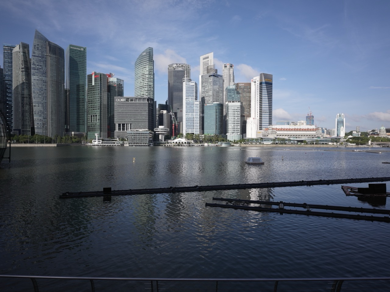
History of Singapore | Downtown Core begins with a river mouth and a coastline that no longer sits where earlier residents knew it. The district now gathers offices, civic buildings, markets, museums, transport connections and waterfront spaces. Its history explains how these different activities came together, and why the centre of a city is never simply a collection of tall buildings.
There is more than one beginning. Archaeology reaches behind the British settlement of 1819. Colonial plans reorganised an inhabited maritime landscape. Reclamation moved the shore. Public institutions, migrant communities and working people made the developing town function. Later, finance, redevelopment, rail and cultural venues changed both the buildings and the reasons people came here.
The modern planning area provides this article’s frame, not an ancient boundary. Downtown Core, the Central Business District, the Civic District, the Central Area, Marina Bay and the Singapore River are overlapping but different geographical ideas. Wider connections are identified as such rather than quietly counted as places inside one polygon.
The contemporary checkpoint is 1 October 2026. A completed project is distinguished from an announced plan, and a historical source is read for the period it describes. That allows the old waterfront and the changing present to remain in the same story without mixing their dates.
Which Downtown Are We Reading?
URA’s Downtown Core urban-design guidelines describe several different urban settings. Raffles Place and the Shenton Way, Robinson Road and Cecil Street corridors belong to the business centre; City Hall contains major civic and cultural institutions; Bugis and Marina Centre have their own combinations of commercial, hotel and public uses. The variety is part of the planning area’s identity. It should not be flattened into an office district that becomes historically interesting only when a skyscraper appears. Read URA’s Downtown Core guidelines.
For a useful mental map, separate three lines. One is the current planning boundary. Another is an earlier shoreline. A third marks the practical reach of an activity, such as commerce, administration or daily travel. These lines need not coincide. A bank can serve customers beyond its immediate district, while a reclamation project can reshape the view from a building whose address stays the same.
This is why familiar nearby places require careful wording. An account of the Singapore River can explain trade at its mouth without claiming that every quay lies in Downtown Core. A Marina Bay project can affect the business district without placing the entire bay, Marina South or Bay East inside this article’s administrative frame. Local history becomes clearer when connections are explained rather than converted into ownership of the whole surrounding city.
Before 1819: Evidence Beneath the Civic Waterfront
The ISEAS research report on Empress Place describes fourteenth-century deposits and places the site within Temasek’s maritime setting. It also discusses the subtler evidence of later settlement and regional connections. This establishes a past before the British settlement without supplying a population census or a complete map of medieval Singapore. Read the Empress Place research report.
The excavation report records work between 2 February and 12 April 2015 during redevelopment of the lawn in front of Victoria Theatre and Concert Hall. It explains why rescue archaeology was needed and what could be investigated within the available site and time. This is history being recovered during another episode of urban change, not a fully visible ancient town preserved untouched beneath the present pavement. Read the research report’s introduction.
The connection is powerful precisely because it is specific. A modern project creates an opportunity to investigate an older layer; the recovered material then changes what can be said about the place. The historian’s task is to retain both the discovery and its limits. Evidence of activity is meaningful without filling every gap between the surviving fragments with an invented scene.
The Singapore Stone and the Cost of Losing Evidence
NHB’s account of the Singapore Stone describes an inscribed boulder once standing near the river mouth and its destruction during colonial works in 1843. A surviving fragment preserves an inscription that remains undeciphered. Legends about the stone are part of the history of its interpretation, but they do not supply a verified translation, author or precise date. Explore the Singapore Stone account.
The stone introduces a different kind of historical change: the loss of material that might have answered questions later generations would ask. An expanding city does not simply add layers. It also removes, damages, moves and reinterprets them. What survives therefore reflects decisions as well as chance.
For a student, the fragment is a reminder that uncertainty can be a serious conclusion. Saying that a text has not been securely deciphered is more accurate than turning a memorable legend into an explanation. The absence of a confident answer does not make the object unimportant. It tells us where the evidence ends and why protecting the remaining evidence matters.
Commercial Square Was Made, Not Merely Named
NLB traces Commercial Square to the 1822 town-planning exercise, with earthworks linking the levelling of a hill, the filling of low ground and the creation of a commercial waterfront. The square was officially renamed Raffles Place on 8 March 1858. Its earlier activities included merchants, shops and offices, rather than the office-only identity a modern visitor might assume. Read NLB’s Raffles Place history.
Making a commercial centre involved much more than drawing a rectangle on a plan. Ground had to be prepared, buildings made usable, access organised and businesses connected with the movement of goods and information. A planning document can reveal the intended order, while later records show how occupation and use developed within it.
The distinction also guards against reading colonial plans as perfect descriptions of lived society. A plan can allocate spaces and express the priorities of its authors; it does not establish that people’s movements, relationships and livelihoods followed those categories without complication. Downtown history needs the records of commerce and administration, but also evidence of the people whose work made their plans possible.
A Coastline Moving Outwards
NLB’s reclamation history notes that Telok Ayer Street and Beach Road were once coastal. It identifies Collyer Quay reclamation between 1859 and 1864 and another Telok Ayer phase between 1879 and 1897. These were distinct changes to the waterfront, not one operation called “reclamation”. Old coastal references consequently need to be read against the shoreline of their own period. Read NLB’s reclamation history.
A street can remain in place while its relationship with the sea changes completely. What was once a waterfront address may later stand behind newer roads and buildings. This helps explain why an old photograph can seem geographically puzzling even when its building has been identified correctly.
Compare two dated maps by tracing their coastlines before comparing their street names. Then ask which places changed position relative to the water and which remained fixed. Do not combine land-area totals from different projects unless their boundaries and dates match. A large number can sound authoritative while measuring a different piece of the city from the one under discussion.
Labour Beneath the Monuments
NLB’s account of colonial convict labour dates the first overseas convict arrivals to April 1825 and explains the contribution of coerced Indian labour to public works. This history requires care: coercion should not disappear behind a cheerful story of construction, and the labour on a particular building should be identified only where a reliable record supports it. Read NLB’s history of convict labour.
The detailed national-monument account of the former Empress Place Building provides one such connection. It records construction using Indian convict labour from June 1864 to December 1867. The building accommodated government departments and later functions involving citizenship, immigration and civil registration. Its administrative importance therefore extended into ordinary people’s dealings with the state, not just the appearance of a grand waterfront façade. Read the Empress Place monument history.
A building’s elegance and the conditions under which it was produced are different historical questions. Appreciating craftsmanship does not require overlooking coercion. Equally, recognising the labour history does not tell us every worker’s individual experience. The responsible account makes people visible while remaining precise about what the surviving record establishes.
A Port Needed Community as Well as Commerce
Yueh Hai Ching Temple on Philip Street connects maritime thanksgiving with Teochew community life. NHB’s account treats its early foundation tradition cautiously and documents rebuilding between 1852 and 1855. It also follows Ngee Ann Kongsi’s management and a later restoration. The temple shows that the commercial centre contained institutions of belief, support and belonging alongside offices and exchange. Read the temple’s monument account.
It is useful to ask what a migrant needed beyond a place to work. Information, introductions, assistance, language and familiar practices could matter as much as a trading address. The particular forms of support require institutional evidence; they should not be imagined from decorative features alone. A temple’s history is more than a description of its roof.
This also changes how we read contrasts in the present streetscape. A smaller religious building among larger commercial structures is not necessarily an accidental remnant outside the story of business. It can preserve evidence of the social arrangements within which business and migration developed. Its continued presence allows those relationships to remain part of the district’s history.
Banks, Ships and Information
An NLB archival photograph of the Chartered Bank at Battery Road records an earlier scale of the banking district. Its accompanying metadata traces the bank’s Singapore operation from February 1859 through successive premises. The photograph and the written chronology do different jobs: the image shows a particular appearance, while the metadata supplies events that cannot be read directly from the façade. Examine NLB’s Battery Road photograph record.
The former Fullerton Building adds communications to this commercial landscape. NHB records the building’s opening on 27 June 1928 and its combination of postal, commercial and government functions. The site also had an earlier fort history. Today’s hotel use should not be projected backwards onto a building originally important to the movement of mail and the work of several institutions. Read the former Fullerton Building history.
Put the bank and post office beside the port in your mind. Goods can move physically while the information and arrangements supporting them travel differently. A message, a payment and a shipment are related, but they do not perform the same task. This is an interpretive way to understand the concentration of activities near the waterfront, rather than a claim about the dealings of any named merchant.
Piers Linked the Shore With a Wider World
NHB’s detailed pier history dates Johnston’s Pier’s official opening to 13 March 1856 and Clifford Pier’s to 3 June 1933. It connects the red-beacon identity with passenger journeys, vessels offshore and everyday activity around the waterfront. The last bumboat departed Clifford Pier on 1 April 2006 before services moved to Marina South Pier. These dates distinguish successive transport places and uses; they do not make one pier an unchanged institution from the nineteenth century onward. Read the history of Johnston’s and Clifford Pier.
A pier is an interface between kinds of movement. People reach it from streets, then leave through a water network that a road map may barely explain. Its importance can extend far beyond the amount of land it occupies. When the surrounding transport system changes, retaining a pier’s building does not necessarily retain its former job.
This gives a family a useful question when looking at a conserved waterfront structure: what once passed through here? Answer with records of documented activity, not an invented scene of a particular arrival. The point is to recover function as well as form. Otherwise, a place that once organised movement risks becoming only a picturesque object in a photograph.
From Waterfront Market to Lau Pa Sat
The first Telok Ayer Market opened by the waterfront in 1823. NHB distinguishes that origin from the surviving structure, completed in 1894 after relocation and rebuilding. The institution later changed from a wet market to a hawker centre, and the structure was dismantled and reassembled around MRT works before receiving the Lau Pa Sat name in 1989. The present building is not the unchanged timber market of 1823. Read the market’s monument history.
Food places connect the history of major projects with the history of an ordinary day. Offices and transport infrastructure attract attention, but people still need to eat, buy necessities and pause between tasks. A market’s changing use can reveal a change in the surrounding population and working rhythm, although any precise claim about customers needs evidence of its own.
Here, continuity does not mean that nothing changed. It means that an institution, a structure, a name and a function can each continue or change at different times. Asking for one birthday for the whole place is less useful than following those separate histories. The result is a more accurate story and a better explanation of why the place still matters.
The Civic Plain and the Governing City
The Padang’s national-monument account follows an open space that acquired recreational, ceremonial and political meanings. Its importance includes major gatherings and the republic’s first National Day Parade in 1966; it was gazetted as a national monument on 9 August 2022. A piece of open ground can therefore hold a dense institutional history without needing to be filled with buildings. Read NHB’s Padang account.
Nearby, the Municipal Building, completed in 1929, housed the council responsible for important city services. Its later identity as City Hall should not obscure that municipal work. Water, electricity, gas and infrastructure belong in the history of the civic district alongside the ceremonies more often associated with its steps and chambers. Read the former City Hall history.
Public space can display authority, but it can also become a place where the meaning of authority changes. A ceremony uses buildings and open ground as a setting; later events may invest the same setting with a different political significance. That is an interpretation to be tested through particular events, rather than a claim that a space has one permanent symbolic meaning.
War, Surrender and the Duty to Remember
National Gallery Singapore identifies the City Hall Chamber as the location where Japanese surrender documents were signed on 12 September 1945. This must be distinguished from the British surrender in February 1942 at the Ford Factory, a different event and site. Similar words can conceal profoundly different moments if dates and participants are removed. Read the Gallery’s City Hall Chamber history.
NHB’s Civilian War Memorial account explains how discoveries of mass graves in 1962 contributed to the drive for a memorial. Unveiled on 15 February 1967, it commemorates civilian victims of the Japanese Occupation. Its history belongs first to loss and remembrance. Treating it merely as a recognisable feature near shopping and hotels would leave out the reason it exists. Read the Civilian War Memorial history.
The memorials in Esplanade Park do not all commemorate the same subject. NHB distinguishes the Tan Kim Seng Fountain’s association with waterworks philanthropy, the Cenotaph’s commemoration of military deaths and the Lim Bo Seng Memorial’s remembrance of an anti-Japanese resistance figure. Reading the individual inscriptions and histories is more meaningful than grouping them into one generic war story. Explore the Esplanade Park memorials.
When studying difficult history with children, begin with the purpose of remembrance and the evidence being used. There is no need to invent a victim’s thoughts or turn suffering into a dramatic scene. Clear language and a respectful pause can communicate more than sensational detail. The civic landscape asks visitors to remember different forms of service, sacrifice and loss without making them interchangeable.
The Same Buildings, a Different Political Future
The Gallery records the swearing-in of Singapore’s first cabinet in the City Hall Chamber on 5 June 1959. That date is distinct from the 3 June self-government milestone recorded by NAS. NHB’s Padang history also records the space’s role in the 1963 merger period and later national commemoration. These events allow the buildings and open ground to be read through political change, rather than only through their original colonial purposes. City Hall Chamber and the Padang provide the relevant institutional accounts.
The interpretation is not that stone itself changed political allegiance. People used the inherited setting for new acts of government and public life. The old architecture remained visible while the institutions and meanings associated with it developed. This is one reason reuse can be historically more revealing than a completely new building: different periods remain in conversation through the same place.
A timeline helps, provided its labels remain exact. “Self-government”, “cabinet sworn in”, “merger” and “first National Day Parade” identify different events. Replacing all of them with “independence” would make the sequence simpler but wrong. Local history can teach national history precisely by making those distinctions visible at a particular site.
Shenton Way and the Remaking of Golden Shoe
NLB records Shenton Way on reclaimed ground, with the road officially opening in 1951. It also traces the Golden Shoe redevelopment zone and the policy changes affecting older rent-controlled premises. These are stages in the transformation of the commercial district, not evidence that the modern skyline arrived all at once. The historical Golden Shoe frame is also different from the whole present Downtown Core planning area. Read the Shenton Way history.
NLB’s separate account of the financial centre examines the land-sale programmes of 1967, 1968 and 1969, alongside infrastructure, development incentives and design requirements. It makes clear that redevelopment involved land assembly and the movement or rehousing of existing activities, not merely permission to build taller. Read the Golden Shoe transformation.
This is the point at which a skyline photograph needs to be supplemented by other records. Height is visible; the ownership arrangements, public works, financing, regulation and effects on existing occupants are much less so. A history concerned only with striking buildings would describe the result while missing much of the process that produced it.
The changes also involved choices about what should remain close together. Commercial concentration can connect firms with services and clients, but a district is still used by workers and visitors with needs beyond office space. Later efforts to introduce more varied uses can be understood against this earlier emphasis, without pretending that one model is permanently right for every stage of the city.
One Commercial Site, Several Buildings
A 2011 Ministry of Finance opening speech for Ocean Financial Centre traced earlier Ocean Buildings dated 1864, 1923 and 1974. It contrasted an earlier shipping-related commercial setting with later financial, legal and multinational-company activity. The speech is a dated official interpretation of the site’s economic changes, not a current tenancy register. Read the Ocean Financial Centre opening speech.
Following one site through successive buildings is a useful alternative to touring a list of architectural firsts. It asks why the location retained value while the structure and its occupants changed. Access, neighbouring activity and the uses permitted on the land may all be relevant questions; each particular explanation still needs evidence.
The approach also makes demolition part of the record. A newer building does not mean there is no history to study there. Earlier photographs, plans and business records can restore the sequence. What matters is that the article identifies which version it is describing, rather than allowing a familiar name to hide several different buildings.
Bugis and Beach Road: More Than a Business Skyline
NLB’s social history of Bugis Street follows changing street names and alignments, hawkers, entertainment and communities, including the visibility of transgender people in the old nightlife scene. It records demolition and redevelopment in 1985 and the later Bugis Junction development. Today’s commercial branding should not be mistaken for an unchanged survival of the earlier street. The history can be described respectfully without repeating sensational language used in some older accounts. Read NLB’s Bugis Street history.
At the former Beach Road Camp, NHB describes a different sequence: military and volunteer uses, closure in 2000, conservation of selected buildings and the NCO Club in 2002, and later integration into South Beach. Here, some historic structures survived within a substantially changed development. Read the former Beach Road Camp account.
Set these cases side by side and “redevelopment” becomes a question rather than a complete explanation. What was demolished? What was retained? Which activities moved? Which memories remained visible in the new place? The answers can differ even within a relatively compact part of the city. A single cheerful or mournful verdict would conceal those differences.
Marina Centre: New Ground, New Purposes
URA’s Marina Bay history dates the major city-expansion reclamation programme to 1971 and identifies a final Bayfront phase in 1994. This is a wider Marina Bay account, extending beyond Downtown Core. It establishes that the modern waterfront resulted from a long programme rather than the arrival of one famous hotel or attraction. Different sources describe different project extents, so their land-area totals should not be casually combined. Read URA’s Marina Bay history.
The National Archives holds Lee Kuan Yew’s speech for the grand opening of the Singapore International Convention and Exhibition Centre on 30 August 1995. The speech describes the Suntec project’s background and its intended role in conventions, trade and exhibitions. It establishes that opening occasion, not the completion of every tower associated with the wider development. Read the contemporary Suntec opening speech.
Reclaimed land still needs an urban purpose. A convention centre, hotel, office or public venue attracts different movements and requires different supporting spaces. The long history of making the waterfront consequently has two linked parts: producing usable ground and deciding how the expanded city should work on it.
This also explains why maps and opening records belong together. A map can show where new land appeared, while a later institutional record shows when a particular activity began there. The gap between the two is not empty history. It contains planning, infrastructure and construction, even when a short visitor guide compresses it into one sentence.
Cleaning the River and Changing the Water
NHB’s Singapore River account dates the start of the ten-year Singapore River and Kallang Basin cleanup programme to 1977 and its official completion to 2 September 1987. The history concerns a connected urban and water environment, not only the appearance of the stretch beside a particular building. The river system and its planning area extend beyond Downtown Core. Read the Singapore River cleanup history.
PUB distinguishes Marina Barrage’s opening on 31 October 2008 from the commissioning of Marina Reservoir as freshwater storage on 20 November 2010. Its account also separates water supply, flood management and recreation. These dates and functions belong to a wider Marina system connected with the core; they should not be collapsed into one event or used to claim the barrage as a landmark inside this planning area. Read PUB’s Marina Barrage account.
The distinction helps students see that an engineering structure and the condition of the water around it have related but different histories. Completing a barrier does not, by itself, tell us that every subsequent process is finished. Likewise, improving a river involves more than changing the view from its banks. The useful question is which activities, flows and controls had to change together.
Culture and Public Space on the Waterfront
NHB records Esplanade Park’s opening in 1953 and explains Queen Elizabeth Walk’s association with the coronation. This twentieth-century park date should not be mistaken for the beginning of all use of the older Esplanade or civic plain. Names and landscapes can continue while their design and public roles change. Read the Esplanade Park heritage account.
Esplanade’s organisational history dates its official opening to 12 October 2002. Its value to a local history is as a working arts institution with a public purpose, rather than simply a building with a memorable shape. This does not mean that cultural life began when the venue opened; it identifies one important addition to a much older civic and performance landscape. Read Esplanade’s own history.
NHB’s Merlion account describes a statue made in 1972 by Lim Nang Seng from Kwan Sai Kheong’s blueprint and its relocation to One Fullerton in 2002. It belongs to modern image-making and tourism history. It is not evidence of an ancient animal or an unchanged medieval monument at the present site. Read the history of the Merlion.
These examples show different ways a waterfront becomes meaningful: through leisure, organised arts and a recognisable symbol. None replaces the earlier port history. Instead, new reasons to visit and use the area are added to a place whose physical and economic relationships have already changed several times.
Old Civic Buildings Became Places to Learn
National Gallery Singapore opened to the public on 24 November 2015 after years of planning, restoration and art research. Its opening release establishes the achieved public milestone rather than an earlier predicted date. The new use places art and learning inside buildings with substantial governmental histories. Read the Gallery’s opening announcement.
Adaptive reuse is more than finding another tenant for an old shell. Different uses ask different things of circulation, interpretation and public access. To understand a particular project, compare the earlier functions with what the institution now invites people to do, while using current visitor information for practical arrangements.
The historical opportunity is that the building and the collection can both be read. A visitor can study a work of art and also ask how the room, chamber or façade acquired its present role. Neither reading has to overwhelm the other. Together they make the civic district a place where the past is not confined to objects displayed behind glass.
The Core Continues to Change in 2026
LTA’s current project record states that Circle Line 6 opened for passenger service on 12 July 2026, adding Keppel, Cantonment and Prince Edward Road to complete the connection between HarbourFront and Marina Bay. This is an operating milestone by this article’s checkpoint, not a future target. The network connection matters to the core even though the new stations should not all be assumed to lie inside its planning boundary. Read LTA’s Circle Line 6 record.
LTA’s August 2026 wayfinding response explains the use and refinement of clockwise and anticlockwise directions on the completed loop. A network change therefore produces an information-design problem as well as new track: people need to understand which way to travel through a system whose shape has changed. Read the operating network’s wayfinding update.
URA’s current downtown strategy emphasises a wider mixture of offices, homes, hospitality, arts, recreation and active public spaces. Its account includes completed examples and prospective changes, which need to remain distinct. The historical interest lies in a changing idea of what the business centre should provide over a whole day, rather than only during office hours. Read URA’s downtown renewal account.
URA’s CBD Incentive 2.0 is a planning mechanism encouraging eligible redevelopment with a broader mix of uses. It is subject to requirements and approvals; it is not evidence that every eligible site has already changed. This article describes its place in urban history, not advice about a property’s development rights. See the official incentive framework.
The distinction between intention and operation remains essential. URA’s Central Area green-and-blue-spaces plan includes a Marina Centre–Bay East Garden pedestrian and cycling bridge targeted for 2029. That is a prospective connection, not a route this article invites a reader to use now. The adopted Master Plan 2025 supplies the wider planning framework, but a plan’s adoption is not the completion of every project illustrated within it. Read the planned connections and the plan’s gazette circular.
Read One Building Through Four Dates
Choose one building discussed here and separate the beginning of its institution, completion of the structure, a change of use and any documented preservation milestone. Some categories may not apply, and some dates may remain uncertain. The exercise is to explain the difference, not to force every place into four filled boxes.
Then compare a photograph, a historical account and an institutional record. The photograph may show physical form; the account may explain a sequence; the record may establish an opening or designation. Ask which source supports each sentence of your explanation. This turns a landmark from something merely recognisable into something understandable.
Families can do this from published records without visiting private or restricted premises. If visiting public venues, check current hours and access separately, use ordinary public routes and avoid active construction. No historical source should be read as permission to enter a building or waterfront worksite.
Downtown Core and the eduKateSG Knowledge Block
The Singapore Atlas connects this planning-area account with the wider island. How Singapore Works helps explain the institutions and infrastructure behind the places. Read them together to connect a waterfront market, a civic chamber or a rail connection with national change.
Local learning routes include Learning Raffles Place, Learning City Hall, Learning Esplanade and Learning Bugis. These are educational routes, not proof that all places carrying those names share one administrative boundary.
English learning benefits from exact verbs and careful attribution. Mathematics can compare dates and units without merging different project extents. Geography examines the moving shoreline and the distinction between functional and planning boundaries. History brings these together by asking why the relationships changed and whose experiences the surviving records reveal.
A Compact Downtown Core Timeline
- Fourteenth century: Empress Place archaeology provides evidence of activity before the British settlement.
- 1822: Commercial Square appears in the town-planning sequence later associated with Raffles Place.
- 1843: the Singapore Stone was broken during colonial works.
- 1858: Commercial Square was officially renamed Raffles Place.
- 1864–1867: construction of the government offices at Empress Place.
- 1894: completion of the surviving Telok Ayer Market structure.
- 1928 and 1929: the Fullerton and Municipal Buildings were completed in successive civic and commercial developments.
- 1933: Clifford Pier officially opened.
- 12 September 1945: surrender documents were signed in the City Hall Chamber.
- 5 June 1959: Singapore’s first cabinet was sworn in there.
- 1966 and 1967: the first National Day Parade at the Padang and the unveiling of the Civilian War Memorial marked different forms of national public memory.
- 1971 onward: Marina Bay’s major city-expansion reclamation programme developed through stages.
- 1987: official completion of the river cleanup programme.
- 1995: the Suntec convention and exhibition centre’s grand opening.
- 2002: Esplanade opened and the Merlion moved to One Fullerton.
- 2015: rescue archaeology at Empress Place and the National Gallery’s public opening added different ways of learning about the past.
- 12 July 2026: Circle Line 6 opened for passenger service.
Each entry belongs to the source linked in its corresponding chapter. The timeline deliberately keeps an archaeological period, an institutional opening, an engineering milestone and a political event from becoming the same kind of date.
Frequently Asked Questions
Is Downtown Core the same as Marina Bay or the Central Area?
No. The terms describe different planning, geographic and functional frames. A project can influence Downtown Core without lying wholly inside it. Identify the boundary relevant to the claim before using a familiar name as if it describes one fixed area.
Does this history begin in 1819?
No. Archaeology establishes an older past while leaving gaps. The British settlement marks a major turning point, rather than the beginning of all activity here.
Why do old waterfront descriptions seem to place the sea in the wrong location?
Successive reclamation projects changed the relationship between streets and the shoreline. Compare maps from the relevant periods rather than judging an old description against today’s coast. The street may have stayed while the waterfront moved.
Is a preserved building still doing its original job?
Not necessarily. A structure, institution, name and function can have different continuities. Read the particular building’s history and current institutional information instead of assuming that a familiar façade establishes an unchanged use.
What makes this a good area for learning history?
Many different kinds of evidence can be compared within one connected narrative: archaeology, maps, buildings, photographs, speeches, institutional records and current plans. The value lies in explaining what each contributes, rather than collecting the greatest number of landmark names.
Helpful Reading and Primary Routes
- URA: Downtown Core urban-design framework
- ISEAS/NUS: Empress Place archaeology report
- NLB: the reclamation story
- NHB: the Padang
- National Gallery: City Hall Chamber
- NLB: Golden Shoe and the financial centre
- PUB: Marina Barrage and the freshwater reservoir
- LTA: Circle Line 6
- URA: downtown renewal
History of Singapore | Downtown Core
Downtown Core’s history is the history of changing connections. The shore moved; institutions changed; buildings were lost, retained and reused; people found new reasons to work, gather and learn in the centre. The skyline is one visible result of that longer sequence.
Read the district through its layers and it becomes more than a set of famous addresses. A market explains an ordinary working day. A memorial asks for a particular act of remembrance. A pier reveals an older transport network. An excavation restores a history that a grand colonial building cannot tell by itself.
The centre of Singapore is still being made. Understanding what came before helps us read the changes with greater care, and with more interest in the people and purposes behind them.
Continue Learning with eduKateSG
Continue through the Singapore Atlas, explore the Singapore Knowledge Hub, or use Learning City Hall to begin a manageable evidence-led learning activity.