
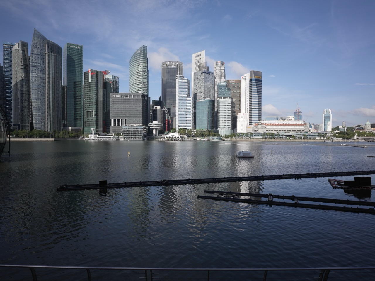
A map tells you where things are.
A digital twin tries to tell you what those things are, how they relate and what might happen if conditions change.
Did you know that Singapore refreshed its national digital-twin capability through the National 3D Mapping Programme, using high-precision geospatial data to support planning, operations, safety and risk management?
This article targets digital twin Singapore, geospatial Singapore, Virtual Singapore, 3D mapping Singapore and smart city simulation Singapore.
Official information was checked on 5 October 2026. Worked examples are fictional.
Did You Know? Singapore’s National 3D Mapping Programme Now Feeds a Refreshed Digital Twin
In 2026, Singapore officials highlighted the refreshed Singapore Digital Twin under the National 3D Mapping Programme as a source of high-precision geospatial data for detailed planning and operations across government.
Official reference: MinLaw — Geo Connect Asia 2026 Opening Address.
What Is a Digital Twin?
A digital twin is a digital representation of a physical place, asset or system that combines geometry with information.
For a city, that can include buildings, roads, terrain, underground infrastructure, environmental data and other layers.
The value appears when people use the model to test a decision before changing the real city.
Singapore’s Geospatial Foundation Is National Infrastructure
SLA is Singapore’s national geospatial agency and maintains the national spatial-data infrastructure, land surveys and OneMap.
Official reference: GeospatialSG — About Singapore’s Geospatial Infrastructure.
The geospatial layer becomes a common coordinate system for many government and commercial decisions.
The National 3D Mapping Programme Is Designed as a Continuing Capability
SLA says the programme was not built as a one-off mapping exercise.
Major aerial mapping exercises were carried out in 2014, 2019 and 2024, with the third exercise completed in September 2025.
Official reference: SLA — The Lines that Define Singapore.
A digital twin is useful only if the physical city and the digital model do not drift too far apart.
The Latest Mapping Exercise Was Extremely Detailed
SLA reported that the third national aerial mapping exercise covered about 98% of Singapore, captured more than 18 billion points, over 130,000 images and more than 80 TB of raw data.
Official reference: SLA — National 3D Mapping Programme.
The economic point is not the data volume itself.
It is the number of planning and engineering decisions that can reuse one trusted national dataset.
Worked Example: Measure Once, Reuse Many Times
Imagine five agencies each need a 3D model of the same district.
If each agency commissions separate surveys, the city pays five times for overlapping work.
A shared national geospatial foundation lets many users build on one trusted base layer.
Common infrastructure reduces duplicated information cost.
OneMap Is the Public-Facing National Map
SLA describes OneMap as Singapore’s authoritative national map platform.
Its current platform provides location, property, school, transport and demographic information and APIs for developers.
Official reference: GeospatialSG — OneMap.
The map therefore serves both citizens and software systems.
OneMap Supports More Than 100 Government and Private Applications
GeospatialSG says OneMap is used in more than 100 government and private applications and services and contains more than 110 thematic layers.
Official reference: GeoWorks — OneMap.
This is a useful example of public digital infrastructure creating private-sector application opportunities.
Digital Twins Can Simulate Urban Heat
Planners can combine building geometry, materials, vegetation and weather data to compare heat outcomes between different planning scenarios.
URA is already using urban-climate modelling to assess heat resilience.
See Making Singapore Rich | Urban Heat Mitigation, Cool Roofs and Thermal Comfort.
Digital Twins Can Simulate Flood Risk
Elevation, drainage, rainfall and coastal information can be combined to model where water may flow.
SLA explicitly cites flood modelling as one use of national 3D mapping data.
See Making Singapore Rich | Stormwater Drainage, Flood Management and ABC Waters.
Digital Twins Can Support Aviation Safety
Accurate terrain and building data help identify potential obstructions around flight paths.
SLA says its 3D mapping data supports aviation-safety use cases.
See Making Singapore Rich | Air Traffic Management, Aviation Systems and Airport Technology.
The Underground Is Becoming a Digital Twin Too
Singapore’s subsurface contains water pipes, gas lines, electrical cables, telecom cables, sewers and MRT tunnels.
SLA has worked with the Singapore-ETH Centre to develop a more reliable digital-twin ecosystem for underground utilities.
Official reference: SLA — Underground Mapping.
The invisible city is economically as important as the visible one.
Worked Example: Underground Data Can Prevent a Costly Strike
Imagine a contractor excavates a trench and hits an unrecorded power cable.
The damage stops work, disrupts electricity and creates a safety incident.
Better utility mapping does not make excavation free.
It reduces uncertainty before digging begins.
Digital Twins Create a Simulation Economy
Urban planners can test traffic changes.
Engineers can assess infrastructure routes.
Property teams can study shadow and visibility.
Emergency planners can model access.
The same base city model supports many specialised simulations.
The digital twin becomes a shared laboratory.
Geospatial Data Supports Location-Based Businesses
SLA licenses digitised land information for uses such as GIS, maps, fleet management, navigation, spatial analysis and business intelligence.
Official reference: SLA — Digitised Land Information.
Public geospatial infrastructure therefore supports commercial products as well as public planning.
Fleet Management Depends on Geospatial Precision
Delivery companies need accurate addresses, routing and travel-time estimates.
Autonomous vehicles need much more precise positioning and maps.
See Making Singapore Rich | Urban Freight, Last-Mile Delivery and Parcel Lockers.
Location intelligence becomes part of logistics productivity.
Digital Twins Connect to Space Technology
Earth-observation satellites, aerial mapping and GNSS all supply geospatial data.
See Making Singapore Rich | Space Technology, Satellites and Geospatial Services.
The city twin is partly built from measurements made far above the city.
The Risk: A Digital Twin Can Be Precisely Wrong
A model may be beautifully rendered and still contain outdated or inaccurate information.
High visual realism can create false confidence.
Data currency, accuracy and provenance matter more than graphics.
A trustworthy twin needs continuous maintenance.
The Risk: More Layers Create More Governance
Building geometry may be public.
Utility locations or security-sensitive facilities may not be.
A rich digital twin needs rules about who can access which data.
Useful integration does not mean unrestricted access.
The Risk: Simulation Is Not Reality
A model can compare scenarios.
It cannot predict every human behaviour, construction problem or weather event.
Simulation improves decisions by reducing uncertainty, not by eliminating uncertainty.
The final decision still needs professional judgment.
The Risk: Standards Matter
If every agency stores 3D information in incompatible formats, the digital twin fragments.
Common data models and geospatial standards allow layers to work together.
See Making Singapore Rich | Standards, Accreditation and Quality Infrastructure.
Digital Twins Connect to Smart Buildings
A city-scale digital twin and a building-management system operate at different scales.
Connecting them can create richer planning and asset-management insights.
See Making Singapore Rich | Smart Buildings, Building Management Systems and PropTech.
Education Builds Geospatial Capability
The sector needs surveyors, GIS specialists, software engineers, planners, remote-sensing experts and data scientists.
Students can learn geometry, coordinates, maps and modelling through geospatial examples.
See Making Singapore Rich | Education, Skills and Human Capital.
A Guided Classroom Investigation
Give students a simple map of a school campus.
Ask them to create a 2D route map, then add building heights and shaded areas.
Discuss what new decisions become possible once the map gains a third dimension.
The exercise teaches how data layers change usefulness.
Independent Practice: Map or Twin?
A static map shows roads and buildings.
A live model also contains traffic, temperature and construction updates.
Ask students which one qualifies more closely as a digital twin and why.
The learning goal is distinguishing representation from dynamic system modelling.
What Progress Should Look Like
A stronger digital-twin economy should create more up-to-date national data, reliable underground mapping, commercial geospatial services and better simulation tools for climate, infrastructure and mobility decisions.
A stronger learner should distinguish a map from a digital twin, data volume from data quality and simulation from certainty.
Frequently Asked Questions
What is Singapore’s digital twin?
It is a high-resolution digital representation of the country built from national geospatial and 3D mapping data and used for planning, modelling and operational applications.
What is the National 3D Mapping Programme?
It is SLA’s long-running programme to capture and maintain high-quality 3D geospatial data across Singapore.
How current is the latest mapping exercise?
SLA says the third aerial mapping exercise began in March 2024 and was completed in September 2025.
What is OneMap?
OneMap is Singapore’s authoritative national map platform and API service maintained by SLA.
How do digital twins make Singapore richer?
They reduce duplicated surveying and planning work, improve infrastructure decisions and create commercial geospatial, simulation and location-intelligence services.
Helpful Reading and Singapore Graph Connections
- MinLaw — Geo Connect Asia 2026
- SLA — National 3D Mapping and Digital Underground
- GeospatialSG — OneMap
- Making Singapore Rich | Space Technology, Satellites and Geospatial Services
Making Singapore Rich: Build the City Twice
Did you know that Singapore can test parts of tomorrow’s city without first pouring concrete?
Surveying measures the city.
3D mapping reconstructs it digitally.
Simulation tests alternatives.
Geospatial APIs let businesses reuse the same foundation.
Singapore becomes richer when the digital copy helps the physical city make fewer expensive mistakes.
The first city is made of concrete and steel.
The second city is made of data.