
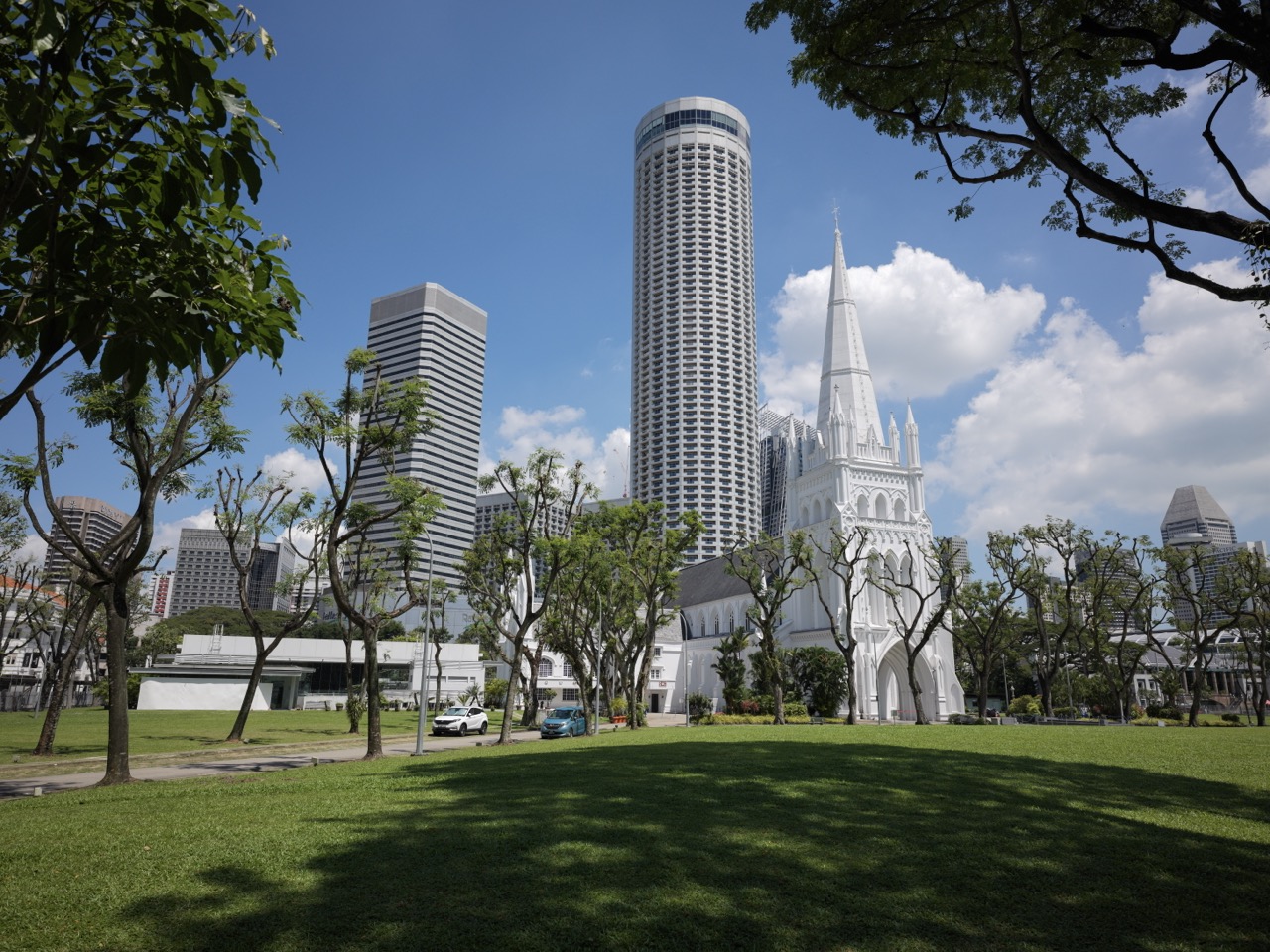
Singapore in the World by eduKateSG’s Civilisation Atlas
Connecting 700 Years of Island History to the Malay World, Southeast Asia and Global Civilisation
Singapore’s history becomes smaller when it is confined to Singapore.
The island can be drawn clearly on a modern map. Its coastline can be outlined, its borders coloured, and its history arranged into a national timeline. Yet for most of the past 700 years, the forces shaping Singapore did not remain inside those borders.
They arrived by sea.
They came from Johor, Riau, Lingga, Palembang, Java, Melaka, Aceh, Siam, China, India, Arabia, Europe, Japan and eventually the United States-led global economy.
People crossed the waters carrying ceramics, metals, food, languages, religions, commercial knowledge, political loyalties and military power. Singapore received these flows, reorganised them and sent something back into the system.
Its history must therefore be read at several scales at once:
Singapore was an island settlement, a Malay port, an archipelagic junction, a Southeast Asian node, an Asian entrepôt and eventually a control point inside the global economy.
This does not weaken Singapore’s national history.
It explains how Singapore became possible.
The Problem with Beginning at the Border
Modern national history usually begins by drawing the country first.
Once the border has been drawn, the historian looks backwards and asks:
What happened inside this territory?
That method works reasonably well for recent political history. It becomes increasingly misleading as we travel backwards.
Malaysia, Indonesia and Singapore did not exist in their present national forms through most of the period covered by Singapore’s 700-year history. The waters between them were not simply borders separating different national stories. They were routes joining courts, ports, islands, river systems and communities.
Singapore and the Riau-Lingga archipelago, for example, once belonged to the same Johor political world. That realm emerged after the Portuguese seizure of Melaka in 1511 and was eventually divided into British and Dutch spheres through the Anglo-Dutch Treaty of 1824. (BiblioAsia)
The national border is therefore one layer of the story, but it cannot be the first layer imposed upon every earlier century.
The chronological reconstruction must begin with the systems that existed at the time.
The Chronological Cone
The history can be built as a widening chronological cone.
At every period, we begin with the island and move outward:
Singapore ↓Johor–Riau–Lingga and the southern Malay Peninsula ↓The wider Malay-Indonesian maritime world ↓Southeast Asia ↓China, India and the greater Asian system ↓The Indian Ocean, Europe and the world
The cone changes shape over time.
Sometimes Singapore sits near the centre of activity.
Sometimes Melaka, Johor, Riau, Batavia, Penang or another port becomes more important.
Sometimes the most powerful force arrives from farther away: Ming China, Portuguese Goa, Dutch Batavia, British India, industrial Europe, imperial Japan or the global economy.
Singapore’s importance does not rise continuously in a straight line. It expands, contracts, disappears from parts of the written record and is reconstructed under different political systems.
The continuity is not an unbroken state.
The continuity lies in a recurring strategic function:
This small area repeatedly becomes useful when people organise movement between the Indian Ocean, the Straits of Malacca, the South China Sea and the surrounding archipelago.
Before Singapore: The Maritime System That Made It Possible
Before approximately 1300
Singapore did not create the sea routes around it.
The sea routes created the conditions under which a port at Singapore could become valuable.
Long before the rise of fourteenth-century Temasek, maritime Southeast Asia already connected several major civilisational zones:
China ↕South China Sea ↕Southeast Asian ports and islands ↕Straits of Malacca ↕Bay of Bengal and Indian Ocean ↕India, Arabia and lands farther west
The region was not a passive gap between China and India. Southeast Asian rulers, merchants, sailors and port communities organised the intermediate stages of exchange. They collected regional products, provisioned ships, managed harbour access, established political alliances and redistributed imported goods.
The Straits were therefore not merely water between land masses. They were an operating corridor.
During the Song period, Chinese maritime commerce with Southeast Asia expanded. Changes in Chinese trading policy reduced dependence on one dominant entrepôt at Palembang and contributed to the development of multiple port-polities that could trade more directly with China. This wider reorganisation helped create the environment in which Temasek could emerge. (BiblioAsia)
Singapore’s first historical lesson therefore appears before Singapore itself:
Geography creates potential, but a port appears only when political authority, commercial demand, maritime knowledge and regional security align around that geography.
The island had the location.
The surrounding civilisations activated it.
Temasek Appears Inside an Asian Maritime Network
Approximately 1300–1400
By the fourteenth century, a significant settlement existed around present-day Fort Canning Hill and the Singapore River.
This was not merely a small fishing village accidentally discovered by later powers.
Archaeological work at Fort Canning has recovered more than 30,000 artefacts. Pottery found there suggests that the hill was occupied by relatively affluent Malays, including members of an elite who had access to valuable imported Chinese ceramics. (Roots)
The physical arrangement appears to have contained at least two connected zones:
- an elevated centre associated with political authority and elite residence;
- a lower port and commercial settlement around the river.
The island therefore already displayed an early version of a pattern that would recur:
Political coordination +Protected anchorage +Commercial population +External trading connections =Port-polity
Temasek served as a gateway for products originating in southern Johor and the Riau Archipelago, making them available to traders arriving from wider Asian networks. (National Library Board)
Material evidence connects the settlement to China and Java. Javanese-style gold jewellery from the fourteenth century was discovered at Fort Canning, while Chinese ceramics and similar objects recovered from terrestrial sites and the Temasek shipwreck demonstrate participation in regional exchange. (Roots)
Singapore at this point can be viewed through five simultaneous maps.
The island map
Fort Canning, the Singapore River, coastal settlements and protected waters.
The immediate regional map
Southern Johor, Bintan, Batam, Riau and eastern Sumatra.
The Southeast Asian political map
Siamese power to the north, Javanese power to the south and competing port-polities throughout the archipelago.
The Asian trade map
China, India and the interconnected ports of maritime Asia.
The civilisational map
Malay political traditions, Javanese connections, Chinese trade, Indian influences and maritime communities meeting in one settlement.
Temasek was therefore not yet the Singapore of today.
But neither was it disconnected from today’s larger logic.
It already operated as a translation point between a local hinterland and a transregional network.
The Centre Moves to Melaka
Approximately 1400–1511
Ports do not possess permanent importance merely because their geography is favourable.
They must hold ships, merchants, political confidence and commercial flows. When another port combines these functions more successfully, the centre can move.
During the fifteenth century, Melaka rose into the leading port and political centre of the Straits. Singapore’s earlier prominence declined as commercial and royal power became concentrated farther north.
This should not be represented as the disappearance of Singapore followed by an unrelated story about Malaysia.
Melaka inherited and enlarged a system in which Singapore had already participated.
The route remained.
The commercial logic remained.
The Malay maritime world remained.
The principal coordinating port changed.
Melaka’s position allowed it to organise exchange between the Malay Archipelago, China, India and the wider Indian Ocean. Its historical landscape reflects centuries of commercial and cultural contact between Asian and later European worlds. (UNESCO World Heritage Centre)
Singapore now occupied a secondary position within a wider Melaka-centred system.
This reveals another important civilisational pattern:
A strategic corridor may remain constant even as its principal city changes.
The historical unit is therefore not only “Singapore” or “Melaka.”
The larger unit is the Straits system.
Within that system, ports compete, cooperate, specialise and replace one another.
The Portuguese Break into the Straits System
1511–1641
The Portuguese conquest of Melaka in 1511 introduced a new kind of pressure into the region.
European merchants had entered an Asian trading world that long predated them. But the Portuguese combined commerce with fortified bases, naval weapons and imperial claims over maritime passages.
Their arrival did not instantly replace Asian trade.
It inserted a new armed network into the existing system.
The fall of Melaka produced several consequences.
The Malay royal and political tradition continued through the Johor Sultanate. Trading activity dispersed across other ports. Aceh rose as a powerful competitor. Merchants could redirect themselves around Portuguese-controlled Melaka.
Singapore came under the influence of Johor, while the larger region became shaped by a prolonged contest involving Johor, Aceh and Portuguese Melaka. (BiblioAsia)
The world map had now expanded:
Singapore and nearby waters ↓Johor, Riau and the Malay Peninsula ↓Aceh, Java and the Southeast Asian port system ↓India and the Indian Ocean ↓Portuguese bases extending toward Europe
A conflict in the Straits could now connect to decisions made in Goa, Lisbon and other parts of the Portuguese imperial system.
This was an early phase of globalisation through force.
The Portuguese were not merely transporting products. They attempted to alter the rules governing circulation.
This distinction matters.
A civilisation may participate in trade without controlling the corridor through which trade passes. Once an external power seeks military control of the corridor, the balance between local autonomy and global connection changes.
Singapore Inside the Johor–Riau–Lingga World
1641–1819
The Dutch capture of Melaka from the Portuguese in 1641 did not create a stable, centrally controlled Southeast Asian system.
Power continued to move through overlapping networks:
- the Johor court;
- Riau and Lingga;
- Dutch Melaka and Batavia;
- Bugis commercial and political networks;
- Malay aristocratic lineages;
- Orang Laut maritime communities;
- regional Chinese merchants;
- European trading companies.
Singapore belonged geographically and politically to this archipelagic environment.
It should not be imagined as an isolated island sitting between what would later become Malaysia and Indonesia.
The surrounding seas formed the connective tissue of the political world.
The Orang Laut and other maritime populations could provide navigation, transport, intelligence and military support. Their knowledge of channels, islands, tides and coastal resources made them important to Malay rulers and to the functioning of the region. NLB records note the presence of several Orang Laut groups in Singapore in 1819 and situate them within the wider Johor-Singapore-Riau area. (National Library Board)
This is a different spatial imagination from the modern land-based map.
A terrestrial map makes the sea appear empty.
An archipelagic map treats the sea as inhabited infrastructure.
Modern map:Land = territorySea = separationArchipelagic map:Islands = stationsSea = routePorts = switching pointsMaritime communities = connective system
This period also corrects the idea that Singapore was entirely inactive before the British arrived.
Evidence from a seventeenth-century navigational chart indicates the presence of a shahbandar, or harbour master, on Singapore island. That suggests some continuing administrative or maritime function even during the centuries for which the historical record remains incomplete. (National Library Exhibitions)
Singapore may not have been the commanding emporium of fourteenth-century Temasek.
But absence from a dominant narrative is not the same as absence from the regional system.
1819: Not the Beginning, but a Major Reconfiguration
1819–1869
The British establishment of a settlement in 1819 transformed Singapore profoundly.
But the event must be placed inside at least three pre-existing systems.
The Johor political system
Raffles did not make an agreement with an unclaimed territory. On 6 February 1819, representatives of the British East India Company entered into a treaty with Sultan Hussein Shah and Temenggong Abdul Rahman. (National Library Board)
The agreement operated inside a contested Johor succession and a divided Malay political world. Tengku Hussein was brought from Riau and installed as a rival sultan as part of the arrangement enabling the British position in Singapore. (BiblioAsia)
The British Indian system
Singapore was initially an East India Company settlement. Its administrative, military and commercial connections ran through British India.
It was therefore not simply a British possession in Southeast Asia.
It was one component of an expanding British Asian network connecting India, the Malay Peninsula and the China trade.
The European imperial system
Britain and the Netherlands were competing for commercial and strategic position in maritime Southeast Asia.
Their 1824 treaty formalised separate spheres and divided a previously connected Malay world. Singapore and much of the Malay Peninsula fell on the British side, while Riau-Lingga and much of the Indonesian archipelago fell on the Dutch side. (BiblioAsia)
This division hardened over time into a political boundary whose descendants can still be seen between modern Malaysia, Singapore and Indonesia.
The treaty did not merely allocate colonial possessions.
It cut across older patterns of movement, authority and affiliation.
The Free Port as an Engine
British Singapore expanded rapidly because it combined geography with a particular commercial arrangement.
Its development as a free port encouraged merchants to call, exchange and redistribute goods with comparatively few trade restrictions.
The port linked:
- Malay and Indonesian produce;
- Chinese merchants and markets;
- Indian capital, labour and administration;
- Arab trading communities;
- European shipping and finance;
- regional populations seeking opportunity or refuge.
Singapore, Penang and Melaka were joined as the Straits Settlements in 1826. In 1867, the Straits Settlements became a Crown Colony administered directly through the British Colonial Office rather than through British India. (BiblioAsia)
The state machinery around the port gradually expanded:
- courts;
- policing;
- taxation;
- harbour administration;
- land allocation;
- postal services;
- roads;
- warehouses;
- docks;
- municipal systems.
This demonstrates a recurring Singapore principle:
A harbour creates an opening, but institutions convert maritime traffic into a durable city.
The port drew the world inward.
The administration attempted to stabilise what arrived.
Singapore and the First Industrial Globalisation
1869–1914
The opening of the Suez Canal in 1869 changed Singapore’s relationship with Europe.
Together with steam-powered shipping, it shortened journeys and increased the movement of ships, travellers and commercial activity between Europe and Asia. More steamships began calling at Singapore, supporting the growth of docks, ship repair and related services. (BiblioAsia)
The change was not merely an increase in traffic.
It altered time itself.
Sailing-era network:Long journeysSeasonal dependenceDelayed informationHigh uncertaintySteam-and-canal network:Shorter journeysMore regular schedulesGreater cargo volumeFaster imperial coordination
In 1872, Singapore was connected to an expanding submarine telegraph network, allowing messages to travel rapidly between Singapore, London and intermediate centres. (BiblioAsia)
The port was no longer connected only through moving ships.
It was connected through information moving independently of ships.
This created a new kind of control tower.
Commercial actors could receive prices, instructions and political information before physical cargo arrived. Finance, insurance, shipping schedules and commodity markets could be coordinated across greater distances.
At the same time, Singapore became deeply linked to the economic development of British Malaya and the Netherlands East Indies.
Rubber, tin, petroleum and other regional commodities moved through Singapore even when they were not produced on the island. These became pillars of the port economy because Singapore supplied the commercial, warehousing, financial and shipping functions around them. (BiblioAsia)
The island’s economic geography had expanded well beyond its physical land area.
Its functional territory included:
- mines in Malaya;
- plantations across the region;
- shipping lanes through the Straits;
- banks and insurers;
- migrant recruitment networks;
- warehouses and processing facilities;
- markets in Europe, America and Asia.
This is why Singapore cannot be understood simply by studying what it produced.
Its major product was increasingly coordination.
Migration as Civilisational Infrastructure
The global port required people.
Large numbers of migrants arrived from southern China, India, the Malay Archipelago, the Middle East and other parts of Asia.
They did not enter an empty social container.
They built:
- businesses;
- religious institutions;
- clan associations;
- schools;
- newspapers;
- mutual-aid organisations;
- labour networks;
- food systems;
- neighbourhoods;
- families and hybrid cultures.
Singapore became locally rooted precisely because it was globally connected.
The city’s diversity was not an ornamental side effect of trade. It was part of the operating system that allowed the port to connect different commercial and cultural worlds.
A merchant needed translators, credit, trust, lodging, labour, information and community contacts.
A migrant community could supply these functions.
Civilisation accumulated through repeated settlement:
Arrival ↓Community formation ↓Institution building ↓Intergenerational memory ↓Permanent contribution to the city
Singapore was becoming more than a place through which people passed.
It was becoming a place in which different parts of the world stayed.
Regional Production, Global Consequences
1914–1941
By the early twentieth century, Singapore occupied a critical position inside an increasingly integrated regional economy.
Malaya supplied major shares of the world’s rubber and tin. Singapore served as an entrepôt, financial centre, processing location and shipping point for the resulting commodity flows. (BiblioAsia)
Its prosperity therefore depended on systems located far beyond the island:
European and American industrial demand ↓Rubber and tin prices ↓Plantations and mines in Malaya ↓Railways, roads and the Causeway ↓Singapore banks, merchants and docks ↓Global shipping
This made Singapore powerful but exposed.
When the international system weakened, Singapore felt the disturbance.
A decline in world demand could reduce commodity prices, business activity, employment and migration. The Great Depression demonstrated how quickly a globally connected economy could transmit crisis into the port and its surrounding society.
The port was not merely connected to world prosperity.
It was connected to world instability.
That is one of the permanent costs of becoming a network node.
World War Arrives Through the Malay Peninsula
1941–1945
The Second World War is often remembered locally through the Battle of Singapore and the Japanese Occupation.
Yet the fall of Singapore cannot be understood by looking only at the island.
Japan’s advance formed part of a much larger imperial strategy extending through China, French Indochina, Malaya, the Philippines, Indonesia and the Pacific.
The attack reached Singapore through the Malay Peninsula.
The Causeway, created to connect Singapore and Johor economically, became strategically important during the invasion and occupation. (National Archives of Singapore)
The British surrender took place on 15 February 1942 after Japanese forces had advanced rapidly through Malaya. The National Archives describes it as the largest British surrender in history. (National Archives of Singapore)
Singapore’s defence had been designed through an imperial frame. Britain regarded it as a strategic base for protecting its interests in Asia.
But an imperial defence system built across enormous distances could fail when:
- air and naval superiority were lost;
- assumptions about the direction of attack proved wrong;
- reinforcements were unavailable;
- the surrounding territory had already collapsed;
- the wider empire was fighting in several theatres.
This exposes a crucial difference between being important to an empire and being secure within one.
Singapore’s strategic value made it worth defending, but it also made it worth capturing.
During the Japanese Occupation, Singapore was renamed Syonan-to. The occupation brought violence, fear, scarcity, coercion and profound disruption to ordinary life. (ACRA)
The war also damaged the credibility of European colonial rule.
An empire that had appeared permanent had been defeated.
The political future of Singapore and the surrounding region could no longer simply return to its pre-war condition.
Decolonisation Connects Singapore Back to Malaya
1945–1963
After the war, Singapore did not move directly and inevitably toward separate nationhood.
Its future was debated through several overlapping possibilities:
- continued British colonial rule;
- greater self-government;
- independence;
- merger with Malaya;
- participation in a larger Malaysian federation;
- different socialist, nationalist and anti-colonial programmes.
Singapore and Malaya remained economically and socially connected.
The Causeway joined the island to the peninsula. Food, water, labour, commodities, families and businesses crossed between them.
The argument for merger was therefore not strange.
From one perspective, separate political territories had been imposed upon a historically connected economic space. Reuniting Singapore and Malaya appeared capable of creating a common market, resolving Singapore’s uncertain constitutional position and completing decolonisation.
Yet Singapore’s political world was also connected to broader forces:
- British strategic withdrawal;
- anti-colonial movements;
- the Cold War;
- communist and socialist organising;
- Indonesian opposition to Malaysia;
- political change across Southeast Asia.
The question “What should Singapore become?” was simultaneously local, Malayan, regional and global.
Malaysia and the Limits of Reintegration
1963–1965
The Federation of Malaysia was formed on 16 September 1963, bringing together Malaya, Singapore, Sabah and Sarawak. (National Library Board)
This created a new political structure across territories connected by colonial history, regional security and economic interest.
But historical connection did not automatically produce political compatibility.
Disputes developed over:
- revenue;
- the common market;
- political organisation;
- communal representation;
- the distribution of authority;
- the competing visions of the Singapore and federal governments.
Indonesia’s Konfrontasi also placed the new federation inside a regional conflict. Indonesia opposed the formation of Malaysia, while the broader Cold War intensified concerns about political alignment and internal security. (National Library Board)
On 9 August 1965, Singapore separated from Malaysia and became an independent sovereign state. The union had lasted fewer than 23 months. (National Library Board)
This is often treated as the decisive point at which Singapore became separate from its region.
A more useful interpretation is different:
Political separation did not remove regional interdependence. It required Singapore to manage that interdependence through state-to-state systems.
Before independence, many connections operated within empires, sultanates or federations.
After independence, they had to be negotiated through diplomacy, treaties, border controls, trade relations and regional institutions.
The connection continued.
Its administrative form changed.
Independence: Building Internal Systems to Remain Externally Connected
1965–1990
Singapore entered independence with limited land, no large domestic market and deep dependence on external supplies and trade.
Its answer was not withdrawal from the world.
It was organised exposure.
The state developed internal systems capable of allowing Singapore to remain highly open without becoming entirely unmanageable.
These included:
- industrial estates;
- public housing;
- water infrastructure;
- mass education;
- defence;
- transport;
- port development;
- workforce training;
- economic agencies;
- diplomatic networks;
- legal and administrative reliability.
The Economic Development Board had been established before independence, and Singapore developed the Jurong industrial area while seeking large-scale employment creation. After 1965, the country intensified export-oriented industrialisation and the attraction of foreign investment. (Economic Development Board)
This produced a new arrangement:
Foreign capital and markets ↓Singapore institutions ↓Factories, skills and employment ↓Exports into the global economy ↓Revenue for further state capacity
The island converted external demand into internal development.
But it could do so only by creating sufficient order, infrastructure and human capability to make global firms willing to operate there.
Singapore’s domestic systems were therefore not separate from its foreign policy or economic geography.
They were interfaces with the world.
ASEAN: Rebuilding Southeast Asia as a Cooperative System
Singapore was one of the five founding members of ASEAN in 1967, alongside Indonesia, Malaysia, Thailand and the Philippines. (Ministry of Foreign Affairs)
The organisation emerged in a Southeast Asia marked by Cold War tensions, recent confrontation, border disputes and deep mutual suspicion. (Geneva UN)
ASEAN represented a different answer to the region’s historical fragmentation.
Earlier systems had been organised through:
- tributary relations;
- maritime empires;
- colonial divisions;
- military competition;
- great-power influence.
ASEAN attempted to create a regional layer based on sovereign states cooperating while preserving their independence.
For Singapore, this was especially important.
A small state cannot enlarge its territory easily.
But it can enlarge the stable system around it.
Regional peace makes trade routes safer. Economic development creates neighbouring markets. Diplomatic habits reduce uncertainty. Shared institutions allow smaller states to avoid dealing with every external power alone.
ASEAN therefore became part of Singapore’s national infrastructure even though it existed outside the country.
Containerisation and the Rebuilding of the Port
Singapore could not assume that its historical position would protect it.
New technologies can move trade away from old ports as easily as they can strengthen them.
Containerisation changed how cargo was packed, transferred, stored and transported. Ports unable to handle the new system risked becoming obsolete.
Singapore invested early. Its first container terminal opened at Tanjong Pagar in 1972, making it one of the earliest container ports in Asia. (Maritime and Port Authority of Singapore)
This decision illustrates a wider principle behind Singapore’s continuity.
The island did not preserve its port by preserving an old port.
It preserved its function by repeatedly replacing the machinery through which the function was performed.
Fourteenth century:Seasonal ships, river port and regional entrepôtNineteenth century:Steamships, docks, coal and telegraphTwentieth century:Containers, cranes, industrial estates and global shipping linesTwenty-first century:Automated terminals, maritime services, data and integrated logistics
Continuity required transformation.
Singapore Changes from Junction to Control Tower
1990–2008
As production networks spread across Asia, Singapore’s role became more complex.
Some lower-cost manufacturing shifted elsewhere. At the same time, the country expanded into activities requiring greater coordination, capital, trust and specialist knowledge:
- finance;
- advanced manufacturing;
- aviation;
- logistics;
- maritime services;
- arbitration and law;
- technology;
- regional headquarters;
- research and development;
- professional services.
Singapore was no longer useful only because cargo could pass through its harbour.
It became useful because decisions could pass through its institutions.
This marks the difference between a junction and a control tower.
A junction
Receives flows and redirects them.
A control tower
Monitors several flows, anticipates conflict, allocates capacity, manages timing and reduces uncertainty across the system.
Singapore increasingly performed both functions.
Its port, airport, financial system, legal institutions, communications infrastructure and government agencies formed a coordinated platform.
The physical island remained small.
Its operating radius became global.
Singapore Inside the Stressed World System
2008 to the present
The twenty-first-century global system has revealed the risks built into extreme interdependence.
These include:
- financial crises;
- pandemics;
- disrupted shipping;
- geopolitical competition;
- climate change;
- food insecurity;
- energy shocks;
- cyber threats;
- technological disruption;
- pressure on global rules and institutions.
Singapore cannot eliminate these external forces.
Its strategic problem is to remain connected without becoming fragile.
That requires redundancy and diversification:
One supplier→ multiple suppliersOne route→ alternative routesOne industry→ a portfolio of capabilitiesOne major-power relationship→ multiple external relationshipsEfficient system→ efficient system with reserves
This does not mean Singapore can become independent of the world.
Its historical role makes complete separation neither realistic nor desirable.
The challenge is to build enough internal capability to absorb disturbance while keeping the external network open.
Singapore’s current maritime position still rests on strategic location, port infrastructure, connectivity, specialist services and trust. Contemporary maritime planning now also has to respond to decarbonisation, digitalisation, supply-chain change and geopolitical uncertainty. (Maritime and Port Authority of Singapore)
The tools have changed.
The civilisational problem remains recognisable.
Malaysia and Indonesia Are Not Side Stories
Once the chronology is expanded properly, Malaysia and Indonesia stop appearing as neighbouring chapters added onto Singapore’s history.
They become structural parts of it.
Malaysia
The Malay Peninsula supplied hinterland, food, water, labour, commodities, security depth and political context.
Johor repeatedly formed part of the immediate system around Singapore. Melaka inherited and expanded the Straits’ port function. British Malaya supplied rubber and tin to the colonial economy. The Causeway physically joined Singapore and Johor. Merger and separation shaped the modern state.
Malaysia is therefore not simply Singapore’s nearest country.
It occupies several historical roles:
- civilisational relative;
- economic hinterland;
- former political partner;
- resource connection;
- strategic neighbour;
- competitor;
- collaborator.
Indonesia
Sumatra, Riau, Lingga, Java and the surrounding islands were deeply connected to Singapore long before Indonesia existed as a modern republic.
They supplied products, people, political lineages, commercial routes and maritime knowledge. Palembang and Srivijaya belonged to the earlier history of the Straits. Majapahit influenced the regional political world. Riau-Lingga formed part of the Johor realm. Dutch colonial expansion separated this world administratively from British Singapore.
Indonesia is therefore not merely the large country south of Singapore.
It is part of the archipelagic environment from which Singapore emerged.
Southeast Asia
The wider region supplied the field in which Singapore could survive.
Siam, Aceh, Java, Vietnam, Burma, the Philippines and Borneo affected regional balances of trade and power. Later, colonialism divided the region among several empires. War crossed those divisions. Decolonisation created new states. ASEAN then attempted to make coexistence more stable.
Southeast Asia is not Singapore’s background.
It is Singapore’s operating environment.
The World Does Not Arrive Only from the West
Connecting Singapore to world history must not produce another distortion in which the global story begins only when Europeans arrive.
Before Portuguese, Dutch and British expansion, Singapore and the Straits were already connected to:
- Chinese dynastic trade;
- Indian merchants and cultural systems;
- Islamic trading networks;
- Javanese power;
- Sumatran port-polities;
- Siamese competition;
- maritime communities across the archipelago.
The world had already reached Singapore from several directions.
European imperialism later changed the scale, weapons, administrative structures and industrial power involved. But it entered an existing world rather than creating global connection from nothing.
Singapore’s history is therefore not a simple transition from local isolation to European globalisation.
It is a succession of globalisations:
- Asian maritime integration
- Islamic and Malay commercial expansion
- European armed trading empires
- Steam, telegraph and industrial imperialism
- Global war and decolonisation
- Containerisation and multinational production
- Finance, data and planetary networks
Each globalisation used Singapore differently.
Each left infrastructure, institutions, communities and vulnerabilities behind.
Reading Singapore Through Flows
The traditional timeline asks:
Who ruled Singapore?
The Civilisation Atlas must ask additional questions:
What was moving through Singapore?
Where did it come from?
Who controlled its movement?
What infrastructure made the movement possible?
What did Singapore retain from the flow?
What risk entered with it?
That produces a more complete historical record.
| Flow | Examples |
|---|---|
| Material | Ceramics, metal, spices, rubber, tin, oil, manufactured goods |
| Human | Sailors, merchants, labourers, officials, soldiers, refugees, professionals |
| Political | Royal authority, colonial administration, nationalism, diplomacy |
| Cultural | Language, religion, food, law, education, artistic forms |
| Technological | Ships, weapons, steam engines, telegraph, containers, digital systems |
| Financial | Credit, insurance, investment, remittances, commodity pricing |
| Informational | Navigation knowledge, commercial intelligence, news, data |
| Risk | Invasion, disease, market collapse, piracy, supply disruption, geopolitical pressure |
Singapore’s development can then be understood as the accumulation of interfaces for handling these flows.
A port handles cargo.
A city handles people.
A legal system handles disputes.
A financial centre handles capital.
A state handles risk.
A civilisation handles memory and transmits what has been learned.
The Artefacts Show the Connections
The world relationship must also be visible through objects.
Each artefact should be read in at least two directions.
Inward direction
What external civilisation, technology or network brought this object to Singapore?
Outward direction
What does the object reveal about Singapore’s role in the larger system?
Examples include:
Chinese ceramics at Fort Canning
These indicate access to long-distance trade and the presence of an elite able to obtain valuable imported goods.
Javanese-style gold
This connects fourteenth-century Singapore to the cultural and political field of Java.
The Singapore Stone
This points toward a literate or inscribed precolonial world, even though much about its writing remains unresolved.
Portuguese and Dutch maps
These reveal how European powers attempted to convert maritime knowledge into navigational and imperial control.
The 1819 treaty
This records not a solitary British founding act, but a negotiation involving the East India Company and competing Johor authorities.
Telegraph infrastructure
This shows Singapore entering an information network in which instructions could move faster than ships.
Rubber contracts and warehouse records
These connect distant plantations, world commodity prices, local merchants and industrial markets.
Wartime remains
These reveal how global military strategy entered local roads, factories, reservoirs, beaches and neighbourhoods.
Container cranes
These represent the conversion of Singapore from a colonial entrepôt into a modern logistics platform.
The artefact is therefore not merely evidence that something happened.
It is a surviving interface between Singapore and the world.
A New Shape for the Civilisation Atlas
The complete atlas should not store Singapore’s history as one isolated line.
It should store each period as a layered record:
period: date_range: singapore_condition: principal_settlements: political_authority: immediate_malay_world: malaysia_connection: indonesia_connection: southeast_asian_context: greater_asian_context: global_context: incoming_flows: outgoing_flows: infrastructure: controlling_institutions: major_dependencies: system_vulnerabilities: artefacts: documentary_sources: competing_interpretations: confidence_level: transition_to_next_period:
This creates a crosswalk between national, regional and world history.
A user could begin with Singapore and move outward.
Or begin with a world event and move inward.
For example:
Opening of the Suez Canal ↓Acceleration of Europe–Asia shipping ↓More steamship calls in Singapore ↓Expansion of docks and repair facilities ↓More employment, migration and urban growth ↓Greater exposure to imperial markets
Or:
Rubber plantation in Malaya ↓Rail and road transport ↓Singapore warehouse and merchant ↓Bank, insurer and shipping company ↓Factory in Europe or America ↓Global industrial demand
The system can therefore trace causation across scale.
The Larger Conclusion
Singapore’s 700-year history is not the history of one unchanged civilisation occupying one unchanged state.
It is the history of a strategic habitat repeatedly activated by different systems.
Temasek was not colonial Singapore.
Colonial Singapore was not independent Singapore.
Independent Singapore is not simply a larger version of the fourteenth-century port.
The rulers changed.
The population changed.
The institutions changed.
The technologies changed.
The scale of connection changed.
Yet a recognisable problem returned:
How can a small settlement positioned between larger worlds organise movement, create trust, protect itself and preserve enough value to remain viable?
The answer was never geography alone.
Singapore survived when it could combine geography with capability.
Location +Connectivity +Political coordination +Infrastructure +Human knowledge +External usefulness +Risk management =Strategic continuity
The island was shaped by the Malay world.
The Malay world was shaped by Southeast Asia.
Southeast Asia was connected to China, India and the Indian Ocean.
These systems were later drawn into European empires, industrial capitalism, world war, decolonisation, the Cold War and global production.
Singapore did not stand outside these transformations.
It condensed them.
That is why Singapore can be used as an entry point into world history.
Follow one ceramic fragment outward and it reaches China.
Follow one gold ornament outward and it reaches Java.
Follow the royal lineage outward and it reaches Palembang, Melaka, Johor and Riau.
Follow the 1819 treaty outward and it reaches British India, the Netherlands and European imperial rivalry.
Follow a bale of rubber outward and it reaches Malayan plantations, Singapore merchants and global factories.
Follow the Japanese invasion outward and it reaches China, Southeast Asia, the Pacific and the Second World War.
Follow the container outward and it reaches the modern planetary economy.
Singapore’s history is therefore not only the story of what happened on one island.
It is:
the history of the world passing through Singapore, and of Singapore repeatedly rebuilding itself to remain capable of meeting that world.
How Singapore Works | History
Article 1 — Before Temasek: The Maritime World That Made Singapore Possible
Civilisation Atlas ID: HSG-WORLD-01
Chronological range: Prehistory to approximately 1300 CE
Primary scale: Singapore → Straits of Malacca → Malay Archipelago → Southeast Asia → China and the Indian Ocean
Historical confidence: Mixed; strong for the larger maritime system, limited for Singapore island itself before the late thirteenth century
Singapore’s History Begins Before Singapore Appears
The earliest substantial evidence for Temasek belongs mainly to the late thirteenth and fourteenth centuries.
But the conditions that made Temasek possible were already centuries old.
Long before a major settlement appeared near the Singapore River, sailors were moving through the seas connecting China, the Malay Archipelago, the Bay of Bengal, India and lands farther west. Ports had arisen and declined. Maritime rulers had attempted to organise trade. Merchants had learned to travel with seasonal winds. Coastal communities had accumulated navigational knowledge across generations.
Singapore did not create this system.
It appeared inside it.
The first question in a world-connected history of Singapore is therefore not:
Who founded Singapore?
It is:
What kind of world already existed that could make a port at Singapore valuable?
That changes the starting point completely.
Singapore’s history no longer begins with a ruler arriving on an empty island. It begins with a much larger maritime civilisation gradually creating the conditions under which the island’s geography could be activated.
The Evidence Floor
The history of Singapore before approximately 1300 must be handled carefully.
There is strong evidence that maritime trade connected Southeast Asia with India, China and the wider Indian Ocean long before Temasek’s rise. There is also substantial evidence for major regional powers such as Srivijaya and for commercial activity across the Malay Peninsula and Indonesian archipelago. (OUP Academic)
What is much harder to prove is precisely what was happening on Singapore island during every century of that larger development.
Archaeology and documentary sources presently support Singapore’s emergence as a regional and international trading port from around the late thirteenth or fourteenth century. They do not provide an equally detailed continuous record for the preceding millennium. (Cambridge Resolve)
The Atlas must therefore separate three categories.
confirmed: - Large maritime networks crossed Southeast Asia before Temasek. - The Malay Peninsula and Sumatra occupied strategic positions between major seas. - Srivijaya became an important maritime-oriented power. - Chinese, Indian and Southeast Asian commercial systems interacted.probable_or_contextual: - Waters around Singapore were known and traversed within regional sailing networks. - Nearby islands and coasts supported navigation, provisioning and redistribution. - Singapore's later rise drew upon older routes and maritime knowledge.unproven: - A continuously operating major Singapore port throughout the first millennium. - Continuous rule of Singapore by any one named empire across the entire period. - Direct identification of every early foreign place-name with Singapore.
This does not weaken the history.
It makes the reconstruction trustworthy.
The Atlas is not supposed to fill every blank with certainty. It is supposed to place each fragment inside the largest coherent picture the evidence permits.
The Geographic Machine
Singapore sits near the southern end of the Malay Peninsula, where several maritime spaces converge:
- the Straits of Malacca to the west;
- the Singapore Strait and Riau Archipelago to the south;
- the South China Sea to the east;
- the Java Sea and wider Indonesian archipelago beyond;
- the Bay of Bengal and Indian Ocean farther west.
On a modern political map, this area appears divided among Singapore, Malaysia and Indonesia.
On a maritime map, it appears as a single field of channels, islands, river mouths, anchorages and coastal settlements.
Bay of Bengal ↓Northern Straits of Malacca ↓Melaka and the Malay Peninsula ↓Southern Straits ↓Singapore–Riau passage ↓South China Sea and Java Sea
A vessel travelling between the Indian Ocean and the South China Sea did not simply cross one uninterrupted body of water. It moved through a sequence of environmental and human systems.
It needed:
- routes through reefs and narrow channels;
- knowledge of currents and tides;
- water and food;
- repairs;
- protection;
- interpreters;
- commercial contacts;
- information about markets and political conditions.
This made strategic locations useful, but it did not guarantee the success of any particular port.
A port required more than a coastline.
Strategic location +Navigational access +Political protection +Commercial demand +Local provisioning +Merchant confidence =Active maritime node
Singapore possessed geographic potential.
The regional maritime world had to supply the remaining parts.
The Monsoon Was an Operating System
The ancient maritime economy was shaped by seasonal wind patterns.
Sailors could use the shifting monsoons to travel across parts of the Indian Ocean and return when the wind direction changed. Voyages were therefore organised around recurring environmental windows rather than modern engines and fixed timetables. (Wiley Online Library)
This created a distinctive rhythm.
Favourable sailing season ↓Ships leave their home ports ↓Cargo moves through several intermediate ports ↓Merchants wait, exchange or redistribute goods ↓Wind direction changes ↓Return or onward voyage becomes possible
The waiting period was important.
Merchants and sailors might remain in a port for weeks or months. During that time they required accommodation, food, warehouses, repair services, credit, translators and personal protection.
A port could therefore accumulate much more than cargo.
It accumulated:
- resident foreign communities;
- mixed languages;
- religious institutions;
- commercial customs;
- navigational intelligence;
- diplomatic relationships;
- knowledge of distant demand.
The monsoon did not merely move ships.
It produced port societies.
This helps explain why maritime Southeast Asia became a zone of cultural exchange rather than a narrow transport corridor. Historical research increasingly emphasises that Southeast Asian sailors, local watercraft and indigenous commercial communities were active organisers of these networks, not passive intermediaries between India and China. (OUP Academic)
Southeast Asia Was Not Empty Space Between Civilisations
Older world histories sometimes presented Southeast Asia as a region upon which larger civilisations acted.
India supposedly supplied religion and political ideas.
China supplied goods and diplomatic power.
The Middle East supplied later Islamic networks.
Europe eventually supplied imperial organisation.
Such a picture treats Southeast Asia as a recipient.
The maritime evidence supports a different interpretation.
Southeast Asian societies:
- built and operated ships;
- controlled river mouths and passages;
- gathered forest and marine products;
- established ports;
- negotiated with foreign merchants;
- maintained regional trading circuits;
- adapted foreign ideas into local political and cultural systems.
The Thai-Malay Peninsula had already become a nodal zone connecting the Bay of Bengal and the South China Sea in the early Indian Ocean trading world. Archaeological evidence from the peninsula shows imported goods, metalworking and settlements linked to wider maritime exchange. (Cambridge University Press)
The region’s value did not derive only from its position between two larger markets.
It also produced highly desired goods, including:
- aromatic woods;
- resins;
- camphor;
- spices;
- gold;
- tin;
- forest products;
- animal products;
- marine resources.
The maritime system was therefore not simply:
India → Southeast Asia → China
It was a web:
China ↕Mainland Southeast Asia ↕Malay Peninsula ↔ Sumatra ↔ Java ↔ Borneo ↕Bay of Bengal ↕India and Sri Lanka ↕Arabian Sea and western Indian Ocean
Goods could move in several stages.
A merchant did not necessarily travel from one end of the entire system to the other. Cargo might be transferred repeatedly between regional specialists.
The world network was assembled from overlapping shorter networks.
That is the same web-like architecture the Civilisation Atlas is designed to capture.
The Archipelago Was Infrastructure
To understand the world before Temasek, the sea must be treated as occupied space.
Thousands of islands across maritime Southeast Asia provided:
- shelter;
- food;
- freshwater;
- timber;
- observation points;
- staging grounds;
- local markets;
- access to river systems;
- alternative routes.
Coastal and maritime communities held knowledge that could not easily be seen on a written map.
They knew:
- which channel could be crossed at a particular tide;
- where reefs narrowed the passage;
- where storms could be avoided;
- where water could be obtained;
- which ruler controlled a harbour;
- which communities could supply pilots or protection.
The archipelago functioned as distributed infrastructure.
Island = provisioning stationRiver mouth = hinterland interfacePort = exchange and governance pointMaritime community = navigation and information networkSea lane = transport corridor
This explains why control of maritime Southeast Asia did not always resemble control of a continuous land empire.
Power could depend upon securing alliances among ports, river settlements, island communities and mobile maritime populations.
A ruler did not need to administer every square kilometre.
The ruler needed enough influence over the points through which valuable movement passed.
India, Sri Lanka and the Bay of Bengal
Commercial connections between South Asia and Southeast Asia developed over many centuries.
Indian merchants, religious specialists, artisans and political ideas moved eastward, while Southeast Asian goods moved westward. These exchanges were seasonal, cumulative and mediated by local societies rather than produced by a single one-way colonisation. (Scholar Hub)
The Bay of Bengal formed a central zone linking:
- eastern India;
- Sri Lanka;
- Burma;
- the Malay Peninsula;
- Sumatra;
- the wider archipelago.
Sanskrit vocabulary, Buddhist and Hindu ideas, artistic forms and models of kingship became visible across Southeast Asia.
But these were not copied unchanged.
Regional rulers used external symbols to strengthen local authority. Communities combined imported religious systems with existing beliefs. Artisans adapted forms to local materials and aesthetics.
This produced something more complex than “Indian influence.”
It produced Southeast Asian civilisations that could participate in several worlds simultaneously.
External idea ↓Local selection ↓Adaptation ↓Institutional use ↓New regional form
The same process would occur repeatedly in Singapore’s later history.
Singapore would rarely invent every component of its operating system locally.
Its strength would lie in receiving external systems, adapting them and making them work under local conditions.
China and the Southern Seas
Chinese trade with Southeast Asia changed across dynasties and policy regimes.
At some times, foreign merchants carried goods to Chinese ports. At others, Chinese merchants travelled more extensively into Southeast Asian waters. Court regulations, political stability, shipping technology and market demand all affected the scale and direction of movement. (National Library Board)
Chinese demand helped make Southeast Asian products valuable.
Chinese ceramics later became especially important archaeological evidence because they can often be connected to particular production periods and kiln traditions.
A ceramic fragment found in Southeast Asia may therefore reveal several systems simultaneously:
Chinese kiln production ↓Merchant acquisition ↓Maritime transport ↓Regional port exchange ↓Local ownership and use ↓Archaeological recovery
The object is not only a bowl or jar.
It is evidence of a supply chain.
By the thirteenth century, Chinese policies permitting greater private maritime activity contributed to increasing prosperity among Malay ports. This widening of direct commercial participation helped reduce dependence on one dominant regional entrepôt and created opportunities for additional port-polities. (National Library Board)
Temasek’s eventual rise belongs inside that transformation.
Srivijaya and the Organisation of the Straits
From around the late seventh century, the maritime-oriented polity commonly known as Srivijaya emerged around Palembang in southern Sumatra.
Its location allowed it to participate in and influence traffic moving through the Straits of Malacca and Sunda Strait. It developed relationships with ports and polities extending across Sumatra, the Malay Peninsula and parts of the wider maritime region. (OUP Academic)
Srivijaya should not automatically be imagined as a modern territorially uniform state.
Its power was maritime and relational.
It could be exercised through:
- strategic ports;
- river systems;
- diplomatic recognition;
- commercial privileges;
- naval capability;
- alliances;
- tributary relationships;
- control or influence over passage points.
Srivijaya’s success was connected to its ability to gather regional goods and place itself between merchants travelling across the wider Asian system. It also became a significant Buddhist centre with connections extending toward India and China. (OUP Academic)
Its functional architecture can be represented as:
Sumatran river systems and products +Malay Peninsula passage points +Straits navigation +Foreign merchant relationships +Chinese diplomatic and trading access =Maritime coordinating power
Srivijaya demonstrates that a civilisation can derive power less from occupying a large continuous landmass than from coordinating movement among dispersed places.
That principle is highly relevant to Singapore.
Was Singapore Part of Srivijaya?
This question requires precision.
Singapore’s waters were situated within the broad maritime field in which Srivijaya operated. Later Singapore traditions also connect the island’s royal origins to Palembang. However, the exact political status of Singapore island during every phase of Srivijaya’s history cannot presently be reconstructed with confidence.
It would therefore be too strong to write:
Srivijaya continuously ruled Singapore for several centuries.
A safer formulation is:
The area around Singapore lay within the wider southern Straits system shaped by Sumatran, peninsular and archipelagic maritime powers, of which Srivijaya was the most prominent during much of the first millennium’s later centuries.
This distinction is important.
The Atlas connects Singapore to Srivijaya without converting regional context into unsupported direct rule.
relationship: direct_rule: uncertain maritime_context: strong geographic_connection: strong later_palembang_traditions: present continuous_local_record: absent
This is how a civilisation map should handle incomplete evidence.
It preserves the connection while keeping the uncertainty visible.
Maritime Power Could Be Disrupted
The networks surrounding Srivijaya were not permanently stable.
Trade created wealth, but it also created competition.
South Indian Chola expeditions attacked ports associated with Srivijaya during the eleventh century. Scholars continue to debate their exact causes and consequences, partly because the surviving evidence is fragmentary. The expeditions are nevertheless understood within the wider struggle over Indian Ocean commerce and direct connections among South India, Southeast Asia and Song China. (ISEAS Publishing)
This reveals that the maritime system was never merely peaceful exchange.
Ports faced:
- naval attack;
- piracy and raiding;
- political rivalry;
- disrupted alliances;
- changing trade policies;
- shifting river conditions;
- competition from alternative routes.
A port’s rise could therefore depend upon a disturbance elsewhere.
Dominant centre weakens ↓Merchants seek alternatives ↓Secondary ports expand ↓Trade becomes distributed ↓New political nodes emerge
The decline or fragmentation of one coordinating power did not necessarily destroy the whole network.
It could reorganise it.
That reorganisation is central to Temasek’s eventual emergence.
From One Dominant Entrepôt to Multiple Ports
Under the Song dynasty, Chinese maritime trade with Southeast Asia grew substantially.
Commercial liberalisation increasingly allowed Chinese traders to make voyages into Southeast Asian waters. By the thirteenth century, private Chinese merchants had greater freedom to travel abroad, contributing to the prosperity of Malay ports. (National Library Board)
This changed the geometry of trade.
Earlier systems could depend heavily upon a dominant intermediary such as Srivijaya.
A more distributed system allowed additional ports to communicate more directly with Chinese merchants and markets.
Earlier geometry:China ↓Major regional entrepôt ↓Secondary portsEmerging geometry:China ↙ ↓ ↘Port A Port B Port C ↕ ↕ ↕Local and regional networks
The second geometry created more openings.
A location that could offer secure anchorage, valuable products, political protection and access to surrounding supply networks had a chance to become commercially important.
Temasek arose from this changed field.
Singapore did not suddenly become geographically strategic in the late thirteenth century.
Its geography was activated because the surrounding network had become more favourable to a new port.
The Immediate World Around Singapore
The island could not have operated without its surrounding environment.
Its immediate system included:
- the southern Malay Peninsula;
- the Johor river systems;
- Bintan;
- Batam;
- the Riau islands;
- eastern Sumatra;
- nearby fishing and maritime communities;
- channels leading east and west.
A later NLB reconstruction describes Temasek as a gateway through which products from southern Johor and the Riau Archipelago could reach wider traders. (National Library Board)
This relationship probably rested on an older regional logic.
A port at Singapore would not produce every commodity passing through it.
Instead, it could assemble goods arriving from surrounding territories.
Forest and marine products ↓Local river and island networks ↓Collection points ↓Singapore harbour ↓Long-distance merchants
Singapore was therefore not a port floating independently in the sea.
It was the seaward interface of a larger productive region.
This hinterland-sea relationship would recur throughout its history.
- Temasek connected regional products to Asian trade.
- Colonial Singapore connected Malayan and Indonesian commodities to world markets.
- Industrial Singapore connected imported materials and labour to multinational production.
- Contemporary Singapore connects regional economic activity to finance, law, logistics and information networks.
The scale changed.
The interface function remained.
Why the Singapore River Mattered
When Temasek eventually emerged, the area around the Singapore River provided a useful combination of features:
- a river mouth opening onto busy maritime passages;
- access to freshwater;
- sheltered places for anchorage and landing;
- defensible higher ground at Fort Canning;
- proximity to surrounding islands and peninsular supply zones.
Archaeological work places the major early settlement around Fort Canning and the Singapore River, with evidence of elite occupation on the hill and commercial activity below. (Curiocity)
The settlement’s form appears to have connected authority with exchange.
Fort Canning:political authorityelite residenceritual and administrative functionsSingapore River:merchant populationwarehouses and workshopslanding and exchangeregional connection
This was not accidental urban form.
A port needed both an opening to the world and an institution capable of ordering what entered.
The river brought flows inward.
The hill represented control above them.
The Late-Thirteenth-Century Threshold
Evidence from the Temasek shipwreck and other discoveries indicates that Singapore was engaged in regional and international trade by the late thirteenth and fourteenth centuries. (Roots)
The port’s appearance can be understood as the convergence of several long-term processes.
Centuries of regional navigation +Indian Ocean–Southeast Asian exchange +Chinese commercial expansion +Weakening of one-centre Srivijayan control +Growth of autonomous Malay port-polities +Singapore's strategic local geography =Conditions for Temasek
No single factor founded Temasek.
Not geography alone.
Not one prince.
Not China.
Not Srivijaya.
Not foreign trade.
Temasek emerged when several systems aligned.
This is the deeper civilisational explanation.
A Port Is a Temporary Achievement
Singapore’s later success can make its port function appear inevitable.
It was not.
Many strategically located settlements failed to become major ports. Others prospered briefly and disappeared. Rivers silted. Political protection collapsed. Trade policies changed. Merchants chose alternative routes. Warfare made a harbour unsafe.
A port exists only while several relationships remain active.
port_viability: physical_access: required navigational_knowledge: required regional_goods: required political_security: required merchant_trust: required external_demand: required competitive_position: variable
Singapore’s geography created an opportunity that could be activated, lost and reactivated.
This explains why the island could be important in the fourteenth century, become less visible during later periods, and then be reorganised into a major port again after 1819.
The constant was not uninterrupted dominance.
The constant was recoverable strategic potential.
What Passed Through the Pre-Temasek World?
The larger maritime system moved more than luxury objects.
Material flows
- ceramics;
- textiles;
- metals;
- beads;
- spices;
- aromatic woods;
- resins;
- forest produce;
- marine produce;
- food;
- precious materials.
Human flows
- sailors;
- merchants;
- pilots;
- religious specialists;
- artisans;
- emissaries;
- settlers;
- captives and coerced labour.
Knowledge flows
- navigation;
- shipbuilding;
- astronomy;
- market information;
- languages;
- law and commercial practice;
- diplomatic protocol.
Cultural flows
- Buddhism;
- Hindu traditions;
- Sanskrit terminology;
- artistic forms;
- political symbols;
- ritual practices.
Risk flows
- disease;
- raiding;
- warfare;
- shipwreck;
- political instability;
- market collapse;
- environmental danger.
The port was therefore a civilisation filter.
It received flows, selected among them, redistributed some and retained others.
The First Singapore World Coordinate
The Atlas can now place pre-Temasek Singapore within a provisional civilisation coordinate.
civilisation_coordinate: period: "Before approximately 1300 CE" singapore_status: major_port: "not yet securely evidenced for most of the period" human_presence: "probable, but incompletely documented" strategic_geography: "high" direct_written_record: "very low" immediate_system: - southern Malay Peninsula - Riau Archipelago - eastern Sumatra - Singapore Strait regional_system: - Malay maritime networks - Srivijaya and related port-polities - Java - Thai-Malay Peninsula - South China Sea networks greater_asian_system: - Song and earlier Chinese maritime trade - Bay of Bengal - India and Sri Lanka - Arabian and western Indian Ocean networks primary_motion: - increasing maritime integration - decentralisation into multiple port-polities - growth of direct Chinese commercial participation singapore_vector: direction: "toward node activation" confidence: "medium as system inference; low for detailed local reconstruction"
This is not yet the coordinate of a fully visible city.
It is the coordinate of a strategic location approaching activation.
The Civilisation Atlas Contribution
A conventional Singapore history has difficulty describing this period because the local documentary record is thin.
It may reduce everything before Temasek to a short introduction.
The Civilisation Atlas can do more because it does not require every historical process to originate inside the modern border.
It reconstructs the surrounding system first.
Sparse Singapore evidence +Strong regional evidence +Strong maritime-system evidence +Geographic continuity +Later archaeological emergence =Bounded historical reconstruction
The result is neither complete certainty nor an empty page.
It is a large, lower-resolution picture.
We can see the brush strokes:
- the monsoon routes;
- the archipelagic communities;
- the Bay of Bengal connection;
- Chinese commercial expansion;
- Srivijayan coordination;
- competition among ports;
- the gradual opening for Temasek.
The Atlas does not pretend that the missing details have been recovered.
It shows the world in which those missing details belonged.
Conclusion: The World Built the Door Before Singapore Opened It
Before Temasek became visible, the entrance had already been constructed.
Not a physical doorway, but a civilisational one.
The winds created recurring movement.
Sailors turned movement into routes.
Communities turned routes into knowledge.
Ports turned knowledge into exchange.
Rulers turned exchange into political power.
Merchants connected the separate ports into a wider market.
China, India, Sumatra, the Malay Peninsula and the surrounding archipelago gradually formed a web in which a strategically positioned new port could become valuable.
Singapore’s first historical function was therefore inherited before it was locally organised.
The island did not create the maritime world. The maritime world created the possibility of Singapore.
Temasek was the moment when that possibility became visible in the archaeological and documentary record.
How Singapore Works | History
Article 2 — Temasek in the Sumatra–Java–Siam–China World
Civilisation Atlas ID: HSG-WORLD-02
Chronological range: Approximately 1290–1400 CE
Primary scale: Temasek → Johor–Riau–Sumatra → Java and Siam → China and the Asian maritime system
Core transition: Strategic location → functioning port-polity
Historical confidence: Strong for the existence of a substantial fourteenth-century settlement and international trade; mixed for its precise rulers, political status and final collapse
When Singapore Becomes Visible
Before the late thirteenth century, Singapore appears mainly as a strategically positioned location inside a much older maritime world.
During the fourteenth century, that changes.
A settlement becomes visible.
Imported ceramics accumulate around the Singapore River and Fort Canning. Metalworking and specialised production appear. Chinese visitors record local communities, traded goods and political conflict. Javanese texts include Temasek within Majapahit’s claimed world. Regional traditions connect Singapore’s rulers to Palembang, Bintan, Melaka and Johor.
Singapore has moved from geographic possibility to organised activity.
Before Temasek:A useful position inside maritime routesFourteenth-century Temasek:A governed settlement using that positionCivilisational transition:location → node → port-polity
This does not mean that every detail of fourteenth-century Singapore is known.
It means enough fragments now survive to reveal the broad structure.
Temasek was no longer merely an island passed by ships.
It had become a place to which ships travelled.
The Evidence Must Be Assembled Across Civilisations
No single surviving source provides a complete history of Temasek.
The reconstruction depends upon several different evidence systems:
- Chinese travel accounts;
- Vietnamese court records;
- Javanese political literature;
- later Malay historical traditions;
- archaeological excavation;
- shipwreck archaeology;
- regional comparison;
- geographical reconstruction.
The name Temasek appears in a Vietnamese record dated 1330, in Wang Dayuan’s Chinese account completed in 1349 and in the Majapahit court poem Nagarakretagama of 1365. Fourteenth-century sources consistently used forms of “Temasek”; the exact point at which “Singapura” replaced it remains uncertain. (National Library Board)
Each evidence family sees a different part of the settlement.
chinese_accounts: strongest_for: - trade - local products - settlements - navigation - regional conflictjavanese_sources: strongest_for: - Majapahit political claims - Temasek's place in Java's imagined regional ordermalay_traditions: strongest_for: - royal genealogy - political memory - connections to Palembang, Bintan, Melaka and Johorarchaeology: strongest_for: - settlement scale - wealth differences - imported goods - production - everyday material lifeshipwrecks: strongest_for: - cargo routes - trading volume - maritime technology - direct connection to Asian production centres
These sources do not always agree.
That disagreement is not a system failure.
It reveals that Temasek belonged simultaneously to several political and cultural worlds.
The Local City: Hill, River and Strait
Fourteenth-century Temasek appears to have been organised across three connected geographic zones.
Banzu and Fort Canning
Wang Dayuan described a hill settlement called Banzu. The name may derive from the Malay word pancur, referring to a spring or flowing water. It is commonly associated with present-day Fort Canning Hill, although interpretations of early place names remain open to revision. (National Library Board)
Archaeological excavations beginning in 1984 have recovered more than 30,000 artefacts from Fort Canning. These include local pottery, imported Chinese ceramics and Song-period coins. The finer imported ceramics suggest that at least some inhabitants belonged to an affluent or elite community. (Roots)
The hill was useful because it combined several functions:
Height → visibility and defenceSpring → freshwaterTerraces → organised settlementSeparation from waterfront → political and social distinctionPosition above river → supervision of the port
Fort Canning was therefore not merely a scenic elevation beside the settlement.
It was likely part of its governing architecture.
The Singapore River settlement
Below the hill, settlements around the river mouth connected inland administration to maritime exchange.
Excavations at sites around the Civic District have uncovered earthenware and imported material associated with regional links to Sumatra, Java, Borneo and China. The material found near the river was generally less refined than much of the elite material recovered from the hill, suggesting social and functional differentiation within the settlement. (BiblioAsia)
The river zone probably contained combinations of:
- landing points;
- commercial dwellings;
- storage areas;
- workshops;
- markets;
- maritime labour;
- visiting merchant communities.
Longyamen
Wang also described Longyamen, or “Dragon’s Tooth Strait”. It is generally associated with the passage between present-day Labrador Point and Sentosa, although its precise extent remains debated. The waterway was marked by a prominent rock formation known in Malay as Batu Berlayar. (National Library Board)
Longyamen was not identical to Banzu.
One was primarily a maritime passage and coastal community.
The other was a governed hill settlement associated with a chief, specialised production and greater security.
Together they reveal a distributed port system:
Longyamen:navigationtransitmaritime exchangecoastal riskSingapore River:landingcommercestorageproductionBanzu:authorityelite residenceprotectionfreshwater
Fourteenth-century Singapore was therefore probably not one compact town surrounded by empty forest.
It was a cluster of specialised zones joined by water, movement and political authority.
The Temasek Port-Polity
A port-polity is not simply a settlement with ships nearby.
It is a political system built around the organisation of maritime exchange.
Temasek appears to have possessed several necessary components.
temasek_port_polity: authority: - a recognised chief or ruling elite defence: - elevated governing centre - possible earthworks and moat - ability to resist external attack production: - salt - fermented beverages - metalworking - possible specialist craft activity exports: - hornbill casques - lakawood - regional forest and marine products imports: - Chinese ceramics - textiles - iron goods - prestige objects currency_and_exchange: - gold - imported and regional trade goods population: - local maritime communities - merchants - artisans - political elite - foreign residents or visitors
Wang Dayuan’s account differentiates between Longyamen and Banzu, describes a local chief and mentions occupations such as salt production and rice-wine fermentation. He also records trade in textiles, iron, ceramics, hornbill casques and aromatic wood. (National Library Board)
The combination matters more than any individual product.
Salt production alone does not make a port-polity.
Imported porcelain alone does not prove government.
A chief alone does not prove international trade.
Together, however, the fragments reveal a settlement that governed people, produced goods, protected exchange and interacted with distant markets.
Singapore’s Immediate World Was Johor–Riau–Sumatra
Temasek’s economy could not have depended entirely upon resources produced on the island.
Singapore possesses limited agricultural land and no large internal river basin. Its port would therefore have required a surrounding collection network.
That network extended into:
- southern Johor;
- the rivers of the Malay Peninsula;
- Bintan and the Riau islands;
- eastern Sumatra;
- nearby maritime communities;
- routes toward the Java Sea and South China Sea.
Regional forests, rivers and seas ↓Small collecting communities ↓Island and river-mouth markets ↓Temasek ↓Chinese and international merchants
Lakawood, hornbill casques and other regional products could be assembled at Temasek even when their natural sources lay elsewhere. Fourteenth-century Singapore’s prominence therefore rested partly on its ability to serve as an interface between the surrounding resource world and long-distance trade. (BiblioAsia)
This immediate geography crossed today’s national borders.
Modern Singapore, Malaysia and Indonesia now occupy separate states.
Fourteenth-century merchants encountered a connected maritime field.
The useful historical unit is therefore not the present Republic of Singapore alone.
It is:
Singapore–Johor–Riau–eastern Sumatra as an interacting southern Straits system.
Temasek was one node inside that larger habitat.
The Palembang Connection
Later Malay tradition connects Singapore’s ruling line to Palembang.
The Malay Annals tells of Sri Tri Buana, also known as Sang Nila Utama, travelling from the Palembang world through Bintan before establishing Singapura. The text was compiled centuries after the events it describes and cannot be treated as a straightforward fourteenth-century administrative record. It nevertheless preserves a powerful memory that linked Singapore’s kingship to Palembang, Bintan, Melaka and the wider Malay royal tradition. (BiblioAsia)
The story performs several functions.
It gives the ruler prestigious ancestry
Palembang carried memories of Srivijaya and of an older centre of Malay maritime authority.
It connects Singapore to Bintan and Riau
The ruler does not arrive directly from a distant abstract kingdom. His route passes through the immediate archipelagic world surrounding Singapore.
It places Singapore inside a royal succession
The Singapore settlement becomes one stage in a political lineage that later continues through Melaka and Johor.
The Atlas should therefore classify the Palembang connection carefully:
palembang_connection: direct_contemporary_documentation: limited later_malay_tradition: strong regional_plausibility: substantial precise_genealogy: uncertain civilisational_significance: high
Even where the literal biography remains uncertain, the political geography is meaningful.
Singapore’s royal memory pointed west and south toward Sumatra and Riau—not only north toward the later Malay Peninsula.
Java and the Majapahit World
During the fourteenth century, Majapahit became one of the most influential political powers in maritime Southeast Asia.
The Javanese court poem Nagarakretagama, completed in 1365, includes Tumasik among places placed within Majapahit’s claimed sphere. Another Javanese tradition associates Temasek with the territories targeted in Gajah Mada’s expansionary oath. These texts reveal how Majapahit’s court imagined the regional order, but they do not by themselves prove continuous, direct administration from Java. (National Library Board)
This distinction is essential.
Claimed allegiance≠Permanent occupationCultural influence≠Direct administrationTribute or recognition≠Modern territorial sovereignty
Majapahit may have exercised hegemony or political pressure over Temasek during parts of the century. Singapore also lay within a wider zone in which Javanese prestige, objects, merchants and political ideas circulated. NLB’s historical synthesis places Temasek within Majapahit’s political and cultural ambit, while acknowledging the complexity of the evidence. (Roots)
The strongest material connection is the cache of gold ornaments discovered at Fort Canning in 1928.
The surviving pieces display styles associated with East Java and the Majapahit period. Singapore has no native gold deposits, so the material or completed objects must have entered from elsewhere. Whether the ornaments were royal regalia, diplomatic gifts, imported luxury goods or the work of travelling artisans remains unresolved. (BiblioAsia)
The gold provides several possible connections:
Java or another gold-working centre ↓Artisan, merchant or diplomatic network ↓Temasek ruling community ↓Display of status and authority
It does not prove that a Majapahit governor ruled permanently from Fort Canning.
It proves that Temasek’s elite participated in a prestige world extending into Java and Sumatra.
Siam and the Northern Pressure
Temasek also faced pressure from the north.
During Wang Dayuan’s era, Siamese power was expanding down the Malay Peninsula. Wang records that forces identified as Xian—associated with Siam—attacked Temasek with a substantial fleet around 1330. The settlement resisted for approximately a month before the attackers withdrew when a Chinese imperial mission passed nearby. (National Library Board)
The account is important for several reasons.
Temasek was worth attacking
A fleet would not ordinarily be sent against a settlement with no economic or strategic value.
Temasek possessed organised defences
The description refers to gates, a moat or defensive boundary and a community capable of sustained resistance.
Singapore was caught between larger powers
Temasek faced Javanese influence from the south and Siamese pressure moving through the peninsula.
China affected the regional balance without necessarily ruling Singapore
The appearance of a Chinese mission was reportedly enough to alter the attackers’ behaviour.
Temasek’s political geometry can therefore be modelled as:
                    Siam
                     ↓
Malay Peninsula → Temasek ← South China Sea trade
                     ↑
              Sumatra and Riau
                     ↑
                Java/Majapahit
Singapore’s vulnerability was inseparable from its value.
The same location that attracted trade also exposed the settlement to competing powers seeking access, tribute or control.
Temasek Was Not Simply a Majapahit–Siam Border Post
It would be easy to reduce fourteenth-century Singapore to a small territory trapped between Siam and Java.
That would miss its agency.
Temasek had its own ruling community, commercial relationships and defensive capability. It could bargain, resist, redirect trade and possibly recognise different superior powers under changing circumstances.
Premodern maritime political relationships were often layered.
A port could:
- pay tribute to one ruler;
- trade mainly with another region;
- receive migrants from a third;
- claim ancestry from a fourth;
- remain locally governed.
This produces a political structure unlike the modern nation-state.
possible_temasek_relationships: local_rule: present siamese_pressure: present majapahit_claim_or_hegemony: possible palembang_royal_memory: present chinese_trade_connection: strong exclusive_external_sovereignty: not established
Temasek’s position may therefore have been deliberately flexible.
A small port could survive by fitting itself among several larger systems rather than belonging completely to only one.
China and the Yuan Maritime Economy
Temasek’s most visible long-distance commercial relationship was with China.
Chinese maritime trade expanded significantly during the preceding Song period, when private merchants gained greater opportunities to participate in overseas commerce. This weakened dependence on a single central entrepôt and created openings for autonomous Malay port-polities to trade more directly with Chinese markets. (BiblioAsia)
By the Yuan era, Chinese merchants were travelling through Southeast Asian waters.
Wang Dayuan himself appears to have travelled as a merchant rather than as a conquering official. He made two major voyages between 1330 and 1339 and later incorporated his observations into the Daoyi Zhilue. (National Library Board)
His presence illustrates the network directly:
Chinese production centres ↓Ports such as Quanzhou ↓Merchant ships ↓South China Sea ↓Temasek ↓Malay-Indonesian regional goods
The trade was not one-way.
China exported:
- ceramic wares;
- textiles;
- metal objects;
- manufactured products.
Temasek and its surrounding region supplied:
- aromatic wood;
- hornbill casques;
- forest produce;
- marine products;
- other commodities gathered through regional networks.
The port translated one market into another.
The Temasek Wreck: A Supply Chain Frozen Underwater
The discovery of the Temasek Wreck provides a remarkable material connection between fourteenth-century Singapore and Chinese production.
The vessel sank near Pedra Branca around the middle of the fourteenth century. Its location and cargo have led researchers to conclude that it was probably travelling toward Temasek rather than continuing south to a Majapahit port. (ISEAS Yusof Ishak Institute)
The wreck contained a major cargo of Chinese ceramics, including more Yuan-period blue-and-white porcelain than any other documented shipwreck known at the time of publication. (ISEAS Yusof Ishak Institute)
The cargo allows the trade network to be reconstructed almost step by step:
Chinese kilns ↓Regional collection and loading ↓Shipboard cargo organisation ↓South China Sea voyage ↓Approach to Temasek ↓Intended redistribution through the port
Because the ship sank, the final stages never occurred.
Yet the wreck still reveals the scale and quality of material moving toward Singapore.
The ceramics were not accidental personal possessions carried by one traveller.
They were commercial cargo.
This changes the historical picture.
Temasek was not merely receiving an occasional imported bowl.
It was connected to organised, bulk maritime distribution.
Imported Ceramics as Social Evidence
Chinese ceramics found at Fort Canning and around the river do more than confirm trade.
Their quality and distribution help reveal the settlement’s internal structure.
Finer imported pieces were concentrated on the hill, while more ordinary wares and local earthenware appeared around the commercial waterfront. Archaeologists therefore infer differences in status, access and function between the elite zone and the lower port settlement. (Roots)
A ceramic fragment can answer several questions at once.
ceramic_evidence: origin: - where the object was manufactured chronology: - approximately when it entered circulation trade: - the routes connecting source and destination wealth: - who could obtain higher-quality imports settlement_structure: - where different social groups lived consumption: - how imported goods entered local daily or ceremonial life
The archaeology therefore transforms Temasek from a name in foreign texts into a physically differentiated community.
It had inequality.
It had preferences.
It had access networks.
It had people using objects from distant production systems.
Gold, Currency and Elite Authority
Gold appears to have played more than an ornamental role.
Wang’s account indicates that a form of “red gold” was used in exchange at Longyamen and Banzu. Gold fragments and ornaments have also been recovered from several archaeological sites in Singapore’s Civic District. (BiblioAsia)
Gold could perform several functions simultaneously:
- store concentrated value;
- facilitate high-level exchange;
- demonstrate elite status;
- support diplomatic gifting;
- mark ritual authority;
- provide material for local reworking.
The presence of gold does not mean Temasek had a modern standardised currency system.
It indicates participation in a wider Asian value network where metal, textiles, ceramics and other goods could serve as media of exchange.
The Fort Canning ornaments are especially important because prestige goods often reveal political relationships invisible in ordinary trade.
Commercial ceramic:evidence of market connectionPrestige gold:possible evidence of elite connection,diplomacy, marriage, tribute or rulership
The exact route of the ornaments remains uncertain.
Their existence nevertheless places the Temasek court inside a Southeast Asian elite culture extending well beyond the island.
Metalworking and the Productive City
Temasek was not merely a warehouse for goods made elsewhere.
Archaeological study has identified evidence of metalworking and specialist production in fourteenth-century Singapore. Research on metal finds treats Temasek as a Malay port-city with an internally organised economic and social structure, rather than only as a passive transshipment point. (Cambridge University Press)
A functioning port needed local production and repair.
Ships and commercial populations required:
- tools;
- fasteners;
- blades;
- cooking equipment;
- ornaments;
- replacement parts;
- containers;
- construction materials.
Some goods may have been imported as raw material or semi-finished products and then reworked locally.
This creates a more complete economic chain:
Imported material ↓Temasek workshop ↓Local specialist labour ↓Finished or repaired object ↓Resident, merchant or ship
Value was therefore added inside the settlement.
Temasek did not survive only by taxing passing cargo.
It likely supported people who transformed, repaired, provisioned and redistributed what moved through the port.
The Maritime Communities
Wang’s description of Longyamen is sharply ambivalent.
He records interaction with Chinese residents or merchants, but also warns of coastal raiding and attacks upon passing vessels. Banzu, by contrast, appears as a more orderly settlement under a chief. (National Library Board)
The difference should not be converted too quickly into a simple division between “pirates” and “civilised townspeople”.
In a fragmented maritime environment, the same community might engage at different times in:
- fishing;
- piloting;
- trade;
- protection;
- tribute collection;
- raiding;
- military service.
Labels such as trader, naval ally and pirate could depend on who was describing the encounter.
A vessel operating with the approval of one ruler might be treated as a legitimate defender.
A competing merchant could describe the same vessel as a pirate.
The more useful Civilisation Atlas category is:
maritime control actor
Such actors could influence who moved through a passage, under what protection and at what cost.
Temasek’s rulers may have needed cooperation from mobile coastal communities whose navigational knowledge exceeded that of the inland or hill-based elite.
Ruling centre +Merchant port +Maritime communities =Control of a dispersed sea territory
The state was therefore not only the fortified hill.
It extended through relationships across the water.
A Cosmopolitan Settlement, but Not a Modern Nation
Temasek’s trade brought together people from different regions.
Chinese merchants or residents interacted with Malay maritime populations. Javanese-style objects reached the elite. Regional earthenware linked Singapore to Sumatra, Java and Borneo. Goods arrived from production systems farther west and north.
But fourteenth-century cosmopolitanism should not be mistaken for modern multicultural citizenship.
People may have been organised through:
- occupation;
- place of origin;
- language;
- commercial association;
- kinship;
- loyalty to a chief;
- religious community;
- status within the court.
The settlement’s diversity was primarily functional.
Different groups brought different capabilities into the port:
Sailor:navigationMerchant:capital and market accessInterpreter:cross-cultural exchangeArtisan:production and repairMaritime community:local route knowledgeRuler:protection and adjudicationForeign envoy:diplomatic connection
Temasek’s cosmopolitan character arose because a port needed these different human networks to operate.
Diversity was infrastructure.
The India and Indian Ocean Connection
Chinese ceramics are especially visible in Singapore’s archaeology, but Temasek was not connected only eastward.
The Straits formed part of the maritime passage between the South China Sea and the Indian Ocean. Goods, merchants and cultural systems travelled through ports across Sumatra, the Malay Peninsula, the Bay of Bengal, India and Sri Lanka.
Some of these connections reached Temasek indirectly.
A merchant arriving from China might exchange goods with regional traders carrying products already moved through several earlier ports. A textile originating in India might reach Singapore through a Sumatran or peninsular intermediary. A Sanskrit political title might travel separately from the object or merchant that first carried it.
The network therefore worked through relays:
India ↓Bay of Bengal port ↓Northern Sumatra or Malay Peninsula ↓Southern Straits ↓Temasek ↓South China Sea ↓China
Not every ship travelled the entire route.
Temasek’s value lay partly in joining overlapping regional circuits into a longer civilisational chain.
The World Coordinate of Fourteenth-Century Temasek
The Civilisation Atlas can now assign Temasek a provisional multidimensional coordinate.
civilisation_coordinate: entity: "Temasek" period: "approximately 1290–1400 CE" settlement_form: type: "maritime port-polity" confidence: "high" principal_local_zones: - Banzu / Fort Canning elite and governing centre - Singapore River commercial settlement - Longyamen maritime passage and coastal community immediate_habitat: - southern Johor - Bintan - Riau Archipelago - eastern Sumatra - Singapore Strait political_geometry: local_authority: "present" palembang_connection: "preserved in later Malay tradition" majapahit_influence: "probable or intermittent; precise form uncertain" siamese_pressure: "documented" chinese_rule: "not indicated" chinese_commercial_connection: "strong" economic_function: - collection of regional goods - transshipment - provisioning - craft and metal production - exchange of Chinese and Southeast Asian goods social_structure: - ruling elite - commercial population - artisans - maritime communities - foreign traders evidence_base: - Chinese texts - Javanese texts - later Malay traditions - urban archaeology - shipwreck archaeology system_motion: direction: "rapid node activation and regional competition" vulnerability: "high"
This coordinate is more useful than merely saying that “Singapore was a trading port”.
It shows what kind of port it was, who surrounded it, what entered it and what pressures threatened it.
Temasek as a Civilisational Switching Point
Temasek did not dominate China, Java, Sumatra or Siam.
Its power came from sitting between them.
Regional products ↓Temasek ↓Chinese marketChinese manufactures ↓Temasek ↓Malay-Indonesian distributionJavanese prestige systems ↓Temasek eliteSiamese expansion ↓Temasek defencePalembang royal memory ↓Temasek legitimacy
The island converted several external relationships into one local operating system.
That is the central architecture of a switching point.
A switching point does not need to produce every flow.
It needs to:
- receive them;
- distinguish them;
- protect them;
- combine them;
- redirect them;
- retain enough value to support itself.
Fourteenth-century Temasek appears to have achieved this.
Why Temasek Was Vulnerable
The port’s success depended on relationships it could not completely control.
It depended on external demand
If Chinese or regional merchants chose another port, traffic could decline.
It depended on a regional supply field
The island alone could not supply all the food and commodities required by the settlement.
It depended on political security
Siamese attack or Javanese intervention could disrupt trade and elite authority.
It depended on navigational confidence
Merchants had to believe the passage and harbour were sufficiently safe.
It faced competing ports
A better-protected or better-connected harbour could redirect the network.
temasek_dependency_profile: food: external export_goods: substantially regional long_distance_market: external military_security: contested merchant_confidence: essential political_continuity: fragile
This reveals a structural law that will recur throughout Singapore’s history:
The more useful Singapore becomes to external networks, the more strongly its internal survival depends upon the condition of those networks.
Connection generates opportunity.
Connection also imports risk.
The End of the Fourteenth-Century System
Something significant changed near the end of the fourteenth century.
Later Malay and Portuguese traditions provide different versions of political collapse, flight and succession. Some connect the final ruler of Singapore to Melaka. Other interpretations distinguish between the ruler remembered in the Malay Annals and Parameswara, the figure usually associated with Melaka’s foundation.
Majapahit attack, Siamese pressure, elite conflict and shifting commercial routes all appear within the wider body of traditions and scholarly reconstruction. The precise sequence remains contested. (Cambridge Resolve)
The Atlas should therefore avoid a falsely precise ending such as:
In one known year, one named army destroyed all of Temasek and everyone moved to Melaka.
The more defensible conclusion is:
By around the turn of the fifteenth century, the political and commercial centre of gravity was moving away from Temasek, while Melaka was emerging as the stronger organising port of the Straits.
Temasek’s decline may have resulted from several interacting causes:
External military pressure +Political succession instability +Regional competition +Merchant redirection +Rise of Melaka =Loss of central port function
The port system did not disappear.
Its centre moved.
What Moved from Temasek to Melaka?
The transition should not be interpreted simply as the failure of Singapore and the unrelated success of another city.
Several civilisational components continued:
- Malay royal tradition;
- Palembang-linked legitimacy;
- archipelagic maritime networks;
- Chinese commerce;
- Indian Ocean exchange;
- competition with Siam and Java;
- dependence upon merchant confidence;
- port governance;
- the collection of regional products.
Melaka gathered these components on a much larger scale.
Temasek ↓Royal and political continuity ↓Melaka ↓Stronger harbour governance ↓Expanded Malay and Islamic trading system
The river, hill and port of Temasek were therefore not a dead end.
They formed one earlier experiment in organising the Straits.
Melaka became the next and more powerful version.
What This Article Proves
The reconstructed picture is not high-definition in every detail.
We cannot confidently name every ruler.
We cannot map every building.
We cannot define Temasek’s exact constitutional relationship with Majapahit or Siam.
But the main structure is coherent.
high_confidence: - Temasek was a substantial fourteenth-century settlement. - Fort Canning contained an affluent or elite community. - A commercial settlement operated near the Singapore River. - Singapore participated in international maritime trade. - Chinese ceramics arrived in significant quantities. - Regional goods were exchanged through the port. - Temasek faced Siamese military pressure. - Java influenced its political and elite material world.medium_confidence: - Banzu corresponds closely to Fort Canning. - Longyamen corresponds to the Labrador–Sentosa passage. - Majapahit exercised some form of hegemony. - defensive earthworks relate to the city described in foreign accounts.low_or_contested_confidence: - exact royal genealogy - exact date of the name change to Singapura - precise identity of the final ruler - exact circumstances of Temasek's political decline
This is precisely where the Civilisation Atlas becomes useful.
It does not force uncertain fragments into one rigid national legend.
It holds multiple source traditions together while distinguishing their confidence levels.
Conclusion: Singapore’s First Full Activation
Fourteenth-century Temasek was not modern Singapore in miniature.
It possessed no modern nation-state, container port, financial centre or permanent border.
But its underlying operating problem is recognisable.
A small settlement stood between larger civilisations.
It lacked a large internal resource base.
It needed merchants to trust its harbour.
It needed political authority to organise the waterfront.
It needed surrounding territories to supply goods.
It needed maritime communities to navigate and secure the passages.
It needed enough flexibility to survive among larger powers.
Local authority +Regional hinterland +Maritime communities +Foreign merchants +Asian demand +Strategic geography =Temasek
The island became important not by separating itself from Sumatra, Java, Siam and China.
It became important by connecting them.
That is Singapore’s first clearly visible civilisational form:
Temasek was a locally governed Malay port-polity built from regional resources, archipelagic knowledge, Chinese commerce and the political pressures of a wider Southeast Asian world.
Its rise proves that Singapore’s geography could be activated.
Its decline proves that the activation was never permanent.
The centre of the Straits was about to move.
How Singapore Works | History
Article 3 — Singapore and the Rise of the Melaka System
Civilisation Atlas ID: HSG-WORLD-03
Chronological range: Approximately 1400–1511
Primary scale: Singapore → Melaka → Malay Peninsula and Sumatra → Southeast Asia → China, India, Arabia and the Indian Ocean
Core transition: Temasek-centred port → Melaka-centred maritime system
Historical confidence: High for Melaka’s emergence as a major international entrepôt; mixed for the precise identity, chronology and religious conversion of its founder
When the Centre of the Straits Moved
Fourteenth-century Temasek had demonstrated that a strategically positioned Malay port-polity could connect the surrounding archipelago with China and the wider Asian maritime economy.
Yet Temasek did not retain that central position.
Around the beginning of the fifteenth century, the organising centre of the Straits moved northward to Melaka.
This was not simply the story of one city failing and another appearing.
It was the reassembly of an existing civilisational system around a stronger node.
Temasek weakens ↓Ruling and maritime networks move ↓Melaka secures a protected river port ↓China recognises the new polity ↓Merchants concentrate there ↓Law, administration and security expand ↓Melaka becomes the principal entrepôt of the Straits
Melaka inherited many of the relationships that had made Temasek possible:
- Malay and Sumatran political traditions;
- connections through Bintan and the Riau Archipelago;
- Orang Laut maritime knowledge;
- Chinese commercial demand;
- Indian Ocean trading networks;
- regional forest and mineral products;
- the monsoon rhythm;
- competition from Siam and Java.
What changed was the scale and effectiveness of their coordination.
Melaka did not invent the Straits system.
It became its most powerful fifteenth-century operating centre.
The Evidence Floor: Who Founded Melaka?
The founding of Melaka survives through several traditions that do not align perfectly.
Later Malay traditions connect the final phase of Singapura with Iskandar Shah and describe a royal movement from Singapore toward Melaka. Early Portuguese writers more commonly identify the founder as Parameswara, a Palembang prince connected to Java who seized power in Singapore, was later expelled and then established Melaka. One Portuguese account instead presents the final ruler of Singapura and first ruler of Melaka as Iskandar Shah. (NLB)
The differences are significant.
They affect:
- whether Parameswara had already ruled Singapore;
- whether Parameswara and Iskandar Shah were the same person;
- when the founder adopted Islam;
- whether conversion occurred during the founder’s reign or under a successor;
- the exact sequence connecting Palembang, Singapore, Muar and Melaka.
The Atlas should therefore avoid creating false certainty.
melaka_foundation: approximate_date: "around 1400" broad_sequence: - political displacement from the Palembang–Java world - a period in Singapore - departure from Singapore - movement along the Malay Peninsula - establishment of a new settlement at Melaka founder_name: Parameswara: "strong in Portuguese traditions" Iskandar_Shah: "strong in Malay tradition and some Portuguese writing" exact_identity_relationship: "contested" connection_to_singapore: historical_significance: "high" exact_personal_sequence: "uncertain"
The uncertainty does not erase the connection.
Nearly all major traditions place Melaka’s origin inside the same political geography:
Palembang, Java, Singapore, Bintan, the Malay Peninsula and the Straits belonged to one interacting world.
Melaka was not founded outside Singapore’s history.
It emerged from a regional reorganisation in which Singapore had been an earlier centre.
Singapore as the Mother Port
Premodern European accounts sometimes described Singapore as the predecessor or “mother” of Melaka. Portuguese knowledge collected after the 1511 conquest preserved a sequence in which Parameswara passed through Singapore before founding the more famous port. That information subsequently circulated through European travel and geographical literature. (BiblioAsia)
The relationship should not be understood as a simple transfer of an entire population from one city to another.
What moved was more likely a combination of:
- political lineage;
- followers and retainers;
- accumulated knowledge about port government;
- relationships with maritime communities;
- commercial contacts;
- ideas of Malay kingship;
- experience gained from Temasek’s successes and vulnerabilities.
What Temasek had learned:How to collect regional goodsHow to receive foreign merchantsHow to defend a river portHow to coordinate hill, river and seaHow to operate between larger powersHow quickly trade could move elsewhere
Melaka could build upon this inherited knowledge while avoiding some of Temasek’s limitations.
It was, in this sense, not the replacement of Singapore by a wholly different civilisation.
It was the next iteration of the same Straits problem.
Why Melaka Could Become Larger Than Temasek
The Strait of Melaka was one of the principal maritime passages linking the Indian Ocean with the South China Sea. The Malay Peninsula sat between India and China and between the Indian and Pacific maritime worlds. Seasonal monsoon winds brought vessels from different directions at different parts of the year, encouraging merchants to wait, trade and form communities at suitable entrepôts. (Cambridge Resolve)
Melaka combined this large-scale position with useful local geography.
The settlement developed beside a river opening onto the strait. The river could serve as:
- a landing zone;
- a protected inner harbour;
- a source of water;
- an access route into the surrounding hinterland;
- a line along which warehouses, markets and settlements could develop.
Melaka also stood sufficiently far north to receive peninsular products and traffic from the northern strait while retaining access to Sumatra and the archipelago.
Melaka River +Strait access +Sumatran proximity +Malay Peninsula hinterland +Monsoon shipping =Potential international entrepôt
But Temasek had possessed useful geography too.
Melaka became larger because geography was combined with a more extensive political and administrative machine.
From Refuge to Governed Port
A new port faces a circular problem.
Merchants will not arrive in large numbers until a port is secure and useful.
A ruler cannot finance strong security and administration until merchants arrive.
Melaka had to break this circle.
Initial ruler and followers ↓Alliance with local maritime communities ↓Safer coastal environment ↓Early merchant arrivals ↓Revenue, goods and population ↓Stronger administration ↓Greater merchant confidence
Accounts of Melaka’s rise give an important role to the Orang Laut and other maritime communities occupying the surrounding coasts and waters. These groups possessed local navigational knowledge and could provide transport, intelligence, military support and control over nearby passages. One modern synthesis describes Orang Laut assistance in keeping the waters around the emerging port safe enough for Arab, Persian, Indian and Chinese merchants to trade there. (OpenStax)
The wording “pirate” must still be used cautiously.
Maritime groups could operate as:
- traders;
- fishers;
- pilots;
- royal naval supporters;
- toll collectors;
- raiders;
- protectors of recognised shipping.
Their political status depended partly on their relationship with the ruler.
What mattered to Melaka was that mobile maritime capability became aligned with the port.
The ruler governed the town.
The maritime communities extended that authority across the water.
The First Strategic Shield: Ming China
Melaka’s early relationship with Ming China was one of the decisive factors in its survival.
The Melaka state chronology records Chinese contact in the first decade of the fifteenth century, followed by Melakan missions to China, visits by Zheng He and a royal delegation to the Yongle emperor in 1411. The exact interpretation of tributary relations requires care, but the relationship gave the new polity recognition inside the Ming diplomatic order. (Melaka Council)
This recognition was strategically valuable because Melaka remained vulnerable to pressure from Siam.
The Ming relationship communicated that Melaka was not merely an unprotected coastal settlement that a larger regional power could absorb without consequence. A historical synthesis of the sultanate describes Ming intervention warning Ayutthaya against attacking Melaka; later in the century, Melaka became strong enough to repel further Siamese attacks through its own regional capability. (OpenStax)
The relationship can be understood as a strategic triangle:
                  Ming China
                 /          \
       recognition          trade
               /              \
            Melaka ← pressure — Siam
China did not need to administer Melaka directly.
Melaka did not become a Chinese province.
Instead, Ming recognition altered the risk calculation facing surrounding powers.
This is an early example of a small port using a relationship with a distant great power to balance a nearer threat.
Diplomatic Recognition Became Commercial Confidence
The Ming relationship did more than provide political protection.
It also connected Melaka to voyages, envoys, merchants and information moving through the Chinese maritime system. Cambridge’s global history of the Indian Ocean describes China as relying upon Melaka from the first decade of the fifteenth century as Ming fleets worked to secure the straits and stabilise long-distance movement. (Cambridge University Press)
For a merchant, diplomatic recognition could signal that:
- the port had a recognised ruler;
- envoys could travel safely;
- the settlement was known to a major market;
- political disruption might provoke wider consequences;
- Chinese ships were likely to call there;
- goods unloaded in Melaka could find onward buyers.
This creates a network effect.
Chinese recognition ↓More Chinese traffic ↓More goods available in Melaka ↓More Indian Ocean merchants attracted ↓Greater market depth ↓More regional suppliers choose Melaka ↓Melaka becomes still more useful to China
The port did not grow only because ships happened to pass nearby.
It grew because each new trading community increased its usefulness to the others.
Melaka Became a Two-Ocean Marketplace
Melaka stood between two very large commercial worlds.
From the east
Ships and cargo arrived from:
- China;
- Champa and mainland Southeast Asia;
- Java;
- the eastern Indonesian archipelago;
- the spice-producing islands;
- Borneo and the South China Sea.
From the west
Merchants and goods arrived from:
- Sumatra;
- Bengal;
- the Coromandel and Malabar coasts;
- Gujarat;
- Sri Lanka;
- Persia;
- Arabia;
- the wider western Indian Ocean.
The Strait and surrounding Riau-Lingga passages formed the principal safe maritime connection linking East and West Asian routes, while the monsoons brought vessels from China and the Indian subcontinent in different seasons. (Cambridge Resolve)
Melaka’s function was not to send one fleet across the entire known world.
It connected overlapping circuits.
Chinese circuit ↓Melaka ↑Java and spice-island circuitIndian circuit ↓Melaka ↑Sumatran and Malay circuitArabian–Persian circuit ↓Indian intermediary ports ↓Melaka
A Chinese merchant did not need to sail to Arabia.
A Gujarati merchant did not need to visit every spice-producing island.
Melaka allowed each to meet the commercial consequences of the other.
Goods Were Reassembled at Melaka
The port gathered products that originated across an enormous area.
From China came commodities such as:
- ceramics;
- silk;
- metal manufactures;
- other finished goods.
From India came:
- cotton textiles;
- cloth in different qualities and designs;
- commercial credit and merchant connections.
From the Indonesian archipelago came:
- cloves;
- nutmeg and mace;
- pepper;
- aromatic woods;
- forest and marine products.
From the Malay Peninsula and nearby territories came:
- tin;
- gold from connected regions;
- food and forest produce;
- timber and other supplies.
Melaka became particularly important as a market joining Indian textiles, Chinese porcelain and silks, and the spices and products of the Malay-Indonesian world. (OpenStax)
The port’s main product was not any single commodity.
Its main product was commercial coincidence.
The buyer arrivesat the same placeas the sellerThe cargo from one oceanmeets the cargo from anotherThe port reducesthe distance between marketswithout reducing geography
Melaka compressed the trading world.
The Monsoon Created a Resident City
Because sailing depended heavily on seasonal winds, merchants often could not arrive, exchange goods and leave immediately.
They had to wait.
Waiting changed the settlement.
A temporary anchorage could become a commercial city because merchants required:
- accommodation;
- food;
- worship;
- warehouses;
- translators;
- labour;
- protection;
- credit;
- dispute resolution;
- information about prices and routes.
Melaka’s commercial population therefore included both temporary visitors and longer-term residents. Arab, Persian, Indian and Chinese merchants traded there, and some established durable communities. (OpenStax)
The city’s cosmopolitanism was not decorative.
It solved practical problems.
merchant_community_functions: language: - translation - negotiation - contract interpretation finance: - credit - partnership - remittance logistics: - warehousing - cargo handling - provisioning trust: - reputation - community guarantees - dispute mediation culture: - worship - food - family formation - education
A port becomes durable when foreign networks become locally anchored.
Melaka was not merely a place ships visited.
It became a place where parts of the wider world took up residence.
The Shahbandar System
One of Melaka’s most important institutional innovations was the organisation of foreign commerce through shahbandars, or harbour masters.
Tomé Pires, writing shortly after the Portuguese conquest, described four shahbandars, each responsible for merchants from different geographical communities. Their responsibilities included receiving ship captains, presenting them to senior authorities, assigning warehouses, arranging the handling of merchandise and providing lodging and transport. (NLB)
This arrangement did something highly sophisticated.
It divided complexity into manageable channels.
One diverse port ↓Merchant populations grouped by trading region ↓A shahbandar familiar with each community ↓Communication with the Melakan court ↓Warehousing, lodging, taxation and dispute handling
The shahbandar was more than a customs officer.
The office acted as an interface between:
- foreign merchant;
- ship captain;
- warehouse;
- market;
- court;
- local population;
- legal authority.
This reduced uncertainty.
A newly arrived captain did not need to understand the entire Melakan state personally.
The shahbandar translated the port for the merchant and the merchant for the state.
Melaka’s Administrative Advantage
The success of a port depends on whether movement can be converted into order.
Melaka developed a governing structure around the sultan and senior officials, with commercial, military, judicial and administrative responsibilities distributed through recognised offices. The fifteenth-century state chronology particularly associates the Bendahara Tun Perak with Melaka’s administrative consolidation and regional rise. (Melaka Council)
At the port level, the operating chain could be understood as:
Sultan ↓Senior court and administrative officers ↓Shahbandars and port officials ↓Merchant captains and community leaders ↓Sailors, labourers, artisans and traders
The hierarchy did not eliminate informal relationships, patronage or factional struggle.
But it provided a recognisable route through which foreign commerce could reach political authority.
That mattered because merchants were not merely seeking the lowest tax.
They needed confidence that:
- cargo could be unloaded;
- storage would be available;
- rules would be understood;
- disputes could be heard;
- theft would be punished;
- the ruler would not arbitrarily destroy the market;
- ships could depart safely.
Melaka became valuable because it organised these conditions at unusually large scale.
Law as Port Infrastructure
Melaka’s legal tradition included the Undang-Undang Melaka and the Undang-Undang Laut Melaka, or Maritime Laws of Melaka.
The surviving texts were transmitted and copied over time, so individual manuscripts should not automatically be treated as untouched documents from one precise year. Nevertheless, the legal tradition reflects the need to govern international commerce, shipboard hierarchy, criminal conduct, trade and maritime responsibility. A recent academic study describes the maritime code as combining local custom and Islamic elements while responding to the economic and political complexity generated by international trade. (Katha)
The maritime code addressed relationships aboard a vessel and commercial conduct when ships entered port. Historical summaries describe provisions governing the authority of the captain, trading order, quarrels, theft and the conduct of merchants and sailors. (OpenStax)
Law therefore operated as invisible harbour equipment.
Physical port infrastructure:riverjettywarehouseshiproadInstitutional port infrastructure:lawofficeprocedureauthorityrecordtrust
A harbour can hold a ship.
A legal system can hold a commercial relationship.
Melaka required both.
The Ship as a Small State
The Maritime Laws reveal that a merchant vessel was not treated merely as a floating container.
It was an organised political and commercial community.
A ship contained:
- a captain;
- navigation specialists;
- crew;
- merchants;
- cargo owners;
- investors;
- passengers;
- weapons;
- food and water;
- rules about space and conduct.
Once at sea, poor coordination could kill everyone aboard.
shipboard_problem: limited_space: true delayed_external_help: true shared_environmental_risk: true valuable_cargo: true mixed_commercial_interests: true need_for_clear_authority: extreme
Maritime law therefore had to define authority before an emergency.
The ship became a compressed version of the port-polity:
- command at the top;
- specialised roles beneath;
- commercial interests requiring rules;
- a shared exposure to external danger.
Melaka’s legal intelligence extended beyond its riverbanks and into the vessels connecting it to the world.
Islam and the Merchant Sultanate
Melaka’s rise occurred during the wider expansion of Islam through the trading ports of maritime Southeast Asia.
The exact date and ruler associated with Melaka’s first royal conversion remain debated. Official Melaka tradition identifies Parameswara with Sultan Iskandar Shah after conversion, while other historical reconstructions place clearer Islamisation under later rulers. What is not seriously in doubt is that Melaka developed into a major Muslim sultanate and a leading Islamic centre in fifteenth-century Southeast Asia. (Melaka Council)
Islam connected Melaka to merchant communities stretching across:
- northern Sumatra;
- Gujarat;
- the Coromandel coast;
- Bengal;
- Persia;
- Arabia;
- the wider Indian Ocean.
Conversion could facilitate commercial trust, shared legal concepts, marriage ties, scholarship and diplomatic relationships. Muslim merchants also formed part of the networks through which textiles, spices, credit and information circulated. (OpenStax)
But Islam should not be reduced to a business strategy.
It also changed:
- royal legitimacy;
- law;
- ritual;
- education;
- writing;
- concepts of morality;
- relations with other Muslim courts;
- the cultural identity of the sultanate.
Trade helped carry Islam ↓Islam helped organise relationships ↓The court adopted Islamic authority ↓Melaka became a centre of learning and legitimacy ↓Malay Muslim political culture spread outward
Commerce carried the connection.
Civilisation deepened it.
Islam Did Not Erase the Earlier Malay World
Melaka’s Islamisation did not remove every Hindu-Buddhist, local or pre-Islamic element.
The sultanate remained a Southeast Asian court formed from multiple inheritances:
- Malay customary practice;
- Palembang and Srivijayan political memory;
- Sanskrit-derived titles and court ideas;
- local maritime traditions;
- Islamic law and kingship;
- Indian Ocean commercial culture;
- Chinese diplomatic relationships.
The result was not a simple replacement:
Old Malay world XIslamic world
It was an adaptive combination:
Malay kingship +Islamic legitimacy +Archipelagic custom +International commerce =Melakan political civilisation
The Maritime Laws themselves reflect this layering by combining Islamic elements with local customs and the practical requirements of Southeast Asian seafaring. (Katha)
Melaka’s power came partly from its ability to absorb external systems without ceasing to be locally intelligible.
Malay Became a Commercial Interface
As Melaka expanded, the Malay language became increasingly important as a medium of trade, diplomacy, government and cultural transmission across maritime Southeast Asia.
Historical synthesis links Melaka’s commercial dominance with the wider use of Malay in coastal trading regions and with the development of a written literary culture using an Arabic-derived script. (OpenStax)
This was another form of compression.
A multilingual port cannot require every person to learn every other language.
It benefits from an interface language.
Gujarati merchantChinese merchantJavanese sailorSumatran traderMalay officialArab scholar ↓A shared commercial Malay layer
The participants did not abandon their own languages.
Malay allowed them to operate across difference.
In this respect, language performed the same function as the shahbandar:
- it reduced transaction friction;
- made negotiation more possible;
- transmitted rules;
- allowed information to travel;
- connected communities without making them identical.
Melaka was not only a marketplace of goods.
It was a marketplace that required a common language of movement.
Melaka as a Knowledge Port
Every vessel entering Melaka carried information.
Merchants brought reports about:
- prices;
- wars;
- rulers;
- harvests;
- storms;
- piracy;
- changes in taxation;
- demand in distant markets;
- safe and unsafe passages.
The port assembled this information just as it assembled cargo.
Ship from China:ceramics + silk + market intelligenceShip from Gujarat:textiles + credit + Indian Ocean newsShip from Java:rice + craft goods + political informationShip from the spice islands:spices + route knowledge + production conditions
A merchant able to compare several reports could decide:
- what to buy;
- what to delay selling;
- which route to take;
- which political alliance mattered;
- whether a port was becoming dangerous.
Melaka consequently functioned as a premodern information exchange.
Its political leadership also benefited.
A port that heard from many regions could see changes earlier than an inland court with fewer external contacts.
Commercial cosmopolitanism became strategic intelligence.
The Market Was Also a Diplomatic Assembly
Foreign merchants did not arrive as completely private individuals.
Some had relationships with rulers, courts, guilds, ship captains or religious communities. Envoys and commercial delegations could travel through the same maritime routes.
Melaka therefore hosted several layers of exchange at once:
| Layer | What moved |
|---|---|
| Commercial | Goods, credit and contracts |
| Diplomatic | Envoys, tribute and recognition |
| Political | Alliances, intelligence and royal marriages |
| Religious | Scholars, texts and institutions |
| Social | Migrants, families and resident communities |
| Technological | Ship knowledge, weapons and production skills |
A commercial disagreement could become a diplomatic matter.
A royal alliance could redirect trade.
A religious relationship could support commercial trust.
A resident merchant community could become an intermediary between Melaka and a distant ruler.
The port was not an economy beside a state.
The port was where economy, diplomacy and state formation met.
Melaka’s Regional Expansion
By the later fifteenth century, Melaka had become more than a city receiving ships.
It had developed influence over territories and ports across parts of the Malay Peninsula and Sumatra. Historical summaries associate the height of Melaka’s power with the reigns of Sultan Mansur Shah and Sultan Alauddin Riayat Shah, during which the sultanate expanded its political reach and secured recognition from neighbouring states. (OpenStax)
Melaka’s wider system included different kinds of relationship:
- directly governed territory;
- tributary or subordinate rulers;
- dynastic marriages;
- allied ports;
- areas influenced through commerce;
- maritime communities loyal to the court;
- places adopting Melakan legal and royal forms.
This was not necessarily a modern uniform territorial empire.
Modern territorial model:one borderone administrationone sovereigntycontinuous controlMelakan maritime model:core cityriver and coastal territoriesdependent portsallied rulersmaritime loyaltiescommercial influence
Power weakened with distance and depended on relationships.
Melaka did not need to station a large permanent bureaucracy in every connected settlement.
It needed enough recognition to protect trade, obtain resources and prevent a rival from controlling the same network.
The Orang Laut as Distributed Naval Infrastructure
The port’s regional influence required capability at sea.
A ruler in Melaka could issue commands, but those commands became meaningful only when people could:
- carry messages;
- guide ships;
- patrol passages;
- intercept hostile vessels;
- move warriors;
- observe rival fleets;
- provision expeditions.
Maritime communities supplied a distributed system that fixed fortifications could not replace.
Court authority ↓Maritime alliance ↓Mobile knowledge of islands and channels ↓Early warning, transport and force ↓Practical control of the sea corridor
Research into state formation in the Melaka Straits emphasises that naval capabilities, political organisation and changes in the wider Asian maritime economy developed together. Malay port-polities survived not through land power alone but through strategies adapted to littoral and archipelagic conditions. (Cambridge University Press)
The sea was not an empty moat around the state.
It was the state’s moving territory.
What Happened to Singapore?
The rise of Melaka reduced Singapore’s importance as the leading international port of the southern Straits.
But Singapore did not disappear.
Evidence indicates that trade continued on the island during the fifteenth and sixteenth centuries. Archaeologists have recovered fifteenth-century Thai ceramics and later Chinese porcelain from the Singapore and Kallang river areas. A later Portuguese map identifies a shahbandar’s office on the island, suggesting continued port administration. (BiblioAsia)
Singapore also supplied regional products through the Melaka system. Historical research notes blackwood exported from Singapore to Melaka and then purchased by Chinese traders for shipment to China. (BiblioAsia)
The flow can be represented as:
Singapore and surrounding resource zone ↓Local collection and minor transshipment ↓Melaka ↓Chinese merchant network ↓China
Singapore had shifted from primary node to supporting node.
It remained inside the system.
Singapore Became Part of the Melaka Sultanate
An exhibition guide produced by Singapore’s National Library places Singapore within the Melaka Sultanate during the fifteenth century. Other historical reconstructions similarly treat the island as one of the territories or dependencies connected to Melaka’s political world. (National Library Exhibitions)
The important transformation is:
Fourteenth century:Temasek organises its own international port systemFifteenth century:Melaka becomes the dominant organiserSingapore operates within the larger Melakan system
This does not mean that every activity on Singapore island was directed daily from Melaka.
Premodern sovereignty was not a modern administrative grid.
Singapore could possess:
- a local chief or official;
- a shahbandar;
- maritime communities;
- local production;
- passing trade;
- strategic military significance.
But the island’s international role was now subordinated to a larger port hierarchy centred on Melaka.
The centre had moved, while the corridor remained connected.
The Singapore–Melaka Relationship Was Not a Zero-Sum Contest
It is tempting to imagine Singapore and Melaka as permanent rivals competing for the same ships.
Sometimes ports did compete directly.
But a maritime system can also contain hierarchy and specialisation.
Melaka:principal international marketplaceroyal courtlarge resident merchant communitiesdiplomatic centremajor redistribution hubSingapore:southern passageresource collectionminor port administrationtransshipmentmaritime observation and local exchange
A ship moving toward Melaka still had to pass through or near the waters around Singapore.
Products gathered near Singapore could enter Melaka’s international market.
Melaka’s security and merchant concentration could increase opportunities for smaller connected ports.
The stronger centre did not necessarily eliminate every subordinate node.
It reorganised their functions.
Melaka, Johor and the Future Malay Political Line
Melaka’s later importance cannot be measured only by the city’s wealth before 1511.
It created a political and cultural model that survived the Portuguese conquest.
The Melakan royal tradition continued through successor states, especially Johor and Perak. Court offices, legal ideas, genealogies, Malay literary traditions and claims to legitimate kingship were carried into new centres.
Singapore would later become part of the Johor political world.
This means the line is not:
Temasek endsMelaka beginsMelaka endsJohor begins
It is better represented as:
Temasek/Singapura ↓Melaka ↓Johor–Riau–Lingga ↓Later Malay states and traditions
Each transition involved fracture.
But each also transported artefacts of legitimacy and institutional memory.
Melaka became a civilisational bridge between ancient Singapore and the Johor world that would later shape the political conditions of 1819.
Melaka and Indonesia Cannot Be Separated
Modern maps place Melaka in Malaysia and most of Sumatra and the surrounding archipelago in Indonesia.
The fifteenth-century system crossed that division continuously.
Melaka’s history involved:
- Palembang political ancestry;
- Bintan and Riau maritime connections;
- Pasai and other Sumatran Muslim trading states;
- Javanese merchants and political relationships;
- spice-producing islands farther east;
- resource zones on both sides of the strait.
The port could not have become an international emporium using only products from the modern Malaysian side.
Its marketplace depended on the Malay-Indonesian archipelago.
Melaka city ↔ east-coast Sumatra ↔ northern Sumatra ↔ Riau islands ↔ Java ↔ Borneo ↔ Moluccas and Banda
Indonesia is therefore not an external addition to Melaka’s history.
The lands and seas now forming Indonesia were major productive, political and maritime components of the Melaka system.
Melaka Connected Southeast Asia to India
Indian merchants were central to Melaka’s commercial rise.
The Indian subcontinent supplied textiles that could be exchanged across Southeast Asia for spices and other products. Gujarati and other Muslim merchants also connected Melaka to financial, legal, religious and commercial networks extending across the Indian Ocean. (OpenStax)
Indian cloth was especially important because it had broad demand and could function as an exchange commodity across very different markets.
Indian textile production ↓Merchant and shipping networks ↓Melaka warehouses ↓Regional redistribution ↓Exchange for spices and other goods
The movement was not merely material.
South Asian connections also brought:
- religious scholarship;
- legal concepts;
- vocabulary;
- artistic forms;
- commercial techniques;
- people forming permanent communities.
Melaka was geographically Southeast Asian but operationally part of the Indian Ocean world.
Melaka Connected Southeast Asia to China
The Chinese relationship supplied Melaka with both market access and diplomatic recognition.
Chinese ships carried high-value manufactured goods into the port, while Melaka and its surrounding network provided commodities demanded in China. Ming voyages and diplomatic missions placed the new polity inside a formal relationship with the imperial court. (Melaka Council)
Melaka’s strength lay in converting this distant Chinese relationship into regional advantage.
Ming recognition +Chinese commercial traffic +Melakan administration +Archipelagic goods =A stronger regional port
China did not need to rule the archipelago directly.
Melaka made the regional market legible and accessible to Chinese actors.
Melaka did not need to manufacture Chinese ceramics.
It needed to gather enough buyers and regional products to ensure that ceramic cargoes could be exchanged profitably.
Each side used the port differently.
The port’s success came from satisfying both.
Melaka Connected Southeast Asia to the Islamic World
The Islamic commercial network did not form a single centrally managed empire.
It consisted of overlapping communities extending through:
- Arabia;
- the Red Sea and Persian Gulf;
- Persia;
- western India;
- Gujarat;
- Bengal;
- northern Sumatra;
- Southeast Asian ports.
Shared religious affiliation could support trust, legal understanding, education, marriage and hospitality across long distances. Melaka’s transformation into an Islamic centre placed it within this broad commercial and intellectual world. (Cambridge Resolve)
This allowed an idea, text or scholar to move along much the same routes as a bale of cloth.
Commercial route =Religious route =Information route =Migration route
The same ship could carry all four.
That is how ports become civilisational accelerators.
They concentrate different flows in the same physical corridor.
The Melaka Operating System
Melaka can now be reconstructed as an integrated machine.
melaka_operating_system: geographic_layer: - river harbour - central position in the strait - access to Malay Peninsula and Sumatra - monsoon-based East-West route political_layer: - sultan - court officials - regional alliances - dependent ports and territories maritime_layer: - Orang Laut alliances - pilots - naval and transport capability - route security commercial_layer: - resident merchant communities - warehouses - transshipment - regional redistribution administrative_layer: - shahbandars - merchant reception - accommodation - cargo organisation - revenue collection legal_layer: - Undang-Undang Melaka - Undang-Undang Laut Melaka - local custom - Islamic legal influence diplomatic_layer: - Ming recognition - relations with Muslim states - marriage and tributary relationships - negotiation with regional powers cultural_layer: - Malay language - Islamic scholarship - court literature - plural merchant communities
No single layer explains Melaka.
Its success came from alignment.
Why Merchants Chose Melaka
A merchant might choose one port over another for several reasons.
Can I enter safely?Can I find a buyer?Can I find the goods I need?Can I store my cargo?Can I obtain food and repairs?Can I communicate with officials?Can a dispute be resolved?Will the ruler preserve the market?Can I leave when the winds change?
Melaka’s advantage was that it could answer many of these questions at once.
This is why port growth is nonlinear.
A modest improvement in one function may produce only modest growth.
But when security, market depth, administration, diplomacy and law reinforce each other, merchants begin choosing the port because other merchants have already chosen it.
More merchants ↓More products ↓More buyers ↓Better information ↓Greater revenue ↓Stronger security and administration ↓Still more merchants
Melaka entered a self-reinforcing rise.
Temasek had activated the node.
Melaka scaled the network.
The Difference Between a Port and a Port System
Temasek had been a functioning port-polity.
Melaka became the centre of a port system.
A port receives ships.
A port system coordinates:
- feeder ports;
- producing regions;
- long-distance merchants;
- legal rules;
- naval relationships;
- political dependencies;
- diplomatic recognition;
- resident commercial communities.
Port:one useful harbourPort system:harbour+ hinterland+ feeder nodes+ rules+ security+ information+ political reach
Melaka’s power cannot be found only inside the city.
It extended through the places that supplied it, depended upon it, imitated it or recognised its ruler.
Singapore was one such place.
The Limits of Melaka’s Strength
Melaka’s success also produced vulnerabilities.
Dependence on imported food
A large commercial city needed regular provisioning from surrounding territories and overseas producers.
Dependence on merchant confidence
Trade could move when merchants believed another port was safer or more favourable.
Dependence on maritime alliances
A ruler unable to command loyalty across the water could lose control of the approaches.
Dependence on political succession
Court conflict could weaken the trust and decisiveness required to govern a cosmopolitan market.
Dependence on external balance
Melaka survived partly by navigating relations with China, Siam, Java, Sumatra and other powers.
Concentration risk
The greater the wealth assembled in one port, the more attractive that port became to conquest.
melaka_risk_profile: external_trade_dependency: very_high merchant_mobility: high territorial_depth: limited naval_security_requirement: high court_cohesion_requirement: high attractiveness_to_attack: increasing
The same machine that generated wealth made Melaka a strategic prize.
The World Was Changing Beyond Melaka
While Melaka was reaching its height, another maritime expansion was developing far to the west.
Portuguese navigators had moved down the Atlantic coast of Africa, rounded the Cape of Good Hope and entered the Indian Ocean. Their objective was not only to participate in Asian trade.
They sought to redirect and control important parts of it.
A Portuguese fleet under Diogo Lopes de Sequeira reached Melaka in 1509. Relations deteriorated, and some Portuguese were captured. In 1511, Afonso de Albuquerque would return from Portuguese India with a heavily armed force. (Melaka Council)
This was not yet merely another merchant community requesting a shahbandar.
It represented an armed imperial network linking:
Lisbon ↓Atlantic route ↓Cape of Good Hope ↓East African and Indian bases ↓Goa ↓Melaka ↓China and the spice islands
For the first time, Melaka faced a power attempting to join Atlantic Europe directly to the Asian maritime system through fortified naval expansion.
The rules of the corridor were about to change.
The Civilisation Atlas Coordinate
civilisation_coordinate: entity: "Melaka Sultanate" period: "approximately 1400–1511" historical_role: type: "Malay Muslim merchant sultanate" primary_function: "principal entrepot of the Melaka Strait" predecessor_relationship: temasek: political_continuity: "probable but historically contested in detail" commercial_precedence: "strong" civilisational_link: "high" immediate_world: - Singapore - Johor and the southern Malay Peninsula - Riau and Bintan - eastern Sumatra - northern Strait of Melaka regional_world: - Siam and the Malay Peninsula - Pasai and Sumatran ports - Java - Borneo - spice-producing eastern archipelago - mainland Southeast Asian ports greater_asian_world: - Ming China - Gujarat - Coromandel and Bengal - Sri Lanka - Persia and Arabia - Indian Ocean merchant networks internal_capabilities: - shahbandar administration - maritime law - resident merchant communities - Orang Laut alliances - diplomatic recognition - Malay commercial language - Islamic royal legitimacy principal_flows: incoming: - Indian textiles - Chinese ceramics and silk - spices - merchants - scholars - diplomatic missions - commercial intelligence outgoing: - redistributed Asian goods - tin and regional products - Malay political culture - Islamic scholarship and institutions - legal and maritime models singapore_status: - subordinate regional node - minor transshipment port - producer and collector of regional goods - continuing site of international trade - territory within the Melakan political system system_motion: direction: "rapid concentration and expansion" terminal_pressure: "Portuguese armed maritime intrusion"
What Melaka Teaches Us About Singapore
Melaka is not a detour away from Singapore’s 700-year history.
It explains several recurring Singapore patterns.
A port can lose its central position
Temasek’s location remained strategic, but merchants and political capability concentrated at Melaka.
Geography requires institutions
Melaka became dominant because it added administration, law, diplomacy and maritime security to geographic advantage.
A small polity survives through external relationships
Ming recognition helped protect the emerging port while Melaka developed its own strength.
Diversity is operational capacity
Merchant communities connected the city to different languages, markets, credit systems and regions.
Law is economic infrastructure
Commercial trust depended upon predictable procedures, not only ships and warehouses.
The hinterland crosses borders
Melaka’s functional territory extended across what are now Malaysia, Indonesia and Singapore.
Success attracts force
Once a node accumulates enough wealth, larger powers attempt to capture or redirect it.
These are not only lessons about Melaka.
They are recurring laws of the Singapore–Straits system.
Conclusion: Temasek Activated the Route; Melaka Organised the World Around It
Fourteenth-century Temasek proved that Singapore’s position could sustain a substantial international port.
Fifteenth-century Melaka demonstrated what happened when that port logic was expanded into a complete regional system.
Melaka combined:
Temasek’s inherited port knowledge +Palembang and Malay royal traditions +Orang Laut maritime capability +Ming diplomatic recognition +Indian Ocean merchant networks +Chinese commercial demand +Islamic law and legitimacy +Shahbandar administration =The Melaka system
Singapore did not leave the story.
Its role changed.
The island became a smaller node supplying products, administering passing trade and occupying the southern gateway of a system whose political and commercial centre now stood at Melaka.
Malaysia, Indonesia and Singapore were not yet separate national histories.
They were different parts of one archipelagic machine.
Melaka’s rise therefore represents a civilisational enlargement:
Temasek connected several trading worlds. Melaka built an institution capable of gathering those worlds into one governed marketplace.
That institution became powerful enough to shape the Malay world long after the city itself was conquered.
But its success also made it impossible for expanding European maritime power to ignore.
How Singapore Works | History
Article 4 — Johor, Aceh and Portugal: The First Global Battle for the Straits
Civilisation Atlas ID: HSG-WORLD-04
Chronological range: 1511–1641
Primary scale: Singapore → Johor–Riau → Aceh and Sumatra → Portuguese Melaka and India → Europe and the emerging global maritime system
Core transition: Unified Melaka system → contested multi-centre Straits system
Historical confidence: High for the principal rulers, wars and political changes; more limited for Singapore’s population and settlement pattern during parts of the period
The Conquest of Melaka Did Not Conquer the Malay World
In 1511, Portuguese forces under Afonso de Albuquerque captured Melaka.
The conquest gave Portugal possession of the fortified city and one of Asia’s best-known commercial ports. The Portuguese constructed a stone fortress around St Paul’s Hill and incorporated Melaka into the wider seaborne imperial system they were building across Africa, India and Asia.
But capturing Melaka did not mean capturing the entire network that had made Melaka valuable.
The Portuguese obtained:
- the harbour;
- the city’s physical position;
- its warehouses and commercial infrastructure;
- a fortified base in the Strait;
- access to existing information about regional trade.
They did not automatically obtain:
- the loyalty of the Malay court;
- control of every merchant community;
- the surrounding islands and river systems;
- the allegiance of the Orang Laut;
- the whole pepper trade;
- permanent command of every route through the Strait.
The distinction is fundamental:
Capturing the port ≠Capturing the network
The Melaka Sultanate had been a relationship system.
When the city fell, many of those relationships moved elsewhere.
Merchants changed ports. The royal court fled south. Regional rulers competed to inherit Melaka’s commercial and political position. The Strait ceased to possess one undisputed centre and became a field of several rival centres.
The Portuguese conquest fractured the system.
It did not end it.
Why This Was a Global Battle
This was not the first war in Southeast Asian history, nor the first conflict involving distant societies.
It was the first sustained global contest in this Singapore chronology in which military, commercial and political systems extending across several continents became directly entangled in the struggle for the Straits.
Lisbon ↓Atlantic Ocean ↓Cape of Good Hope ↓East Africa ↓Goa and Portuguese India ↓Melaka ↓Singapore and the southern Straits ↓China and the Indonesian archipelago
Portugal entered Southeast Asia through a chain of fortified bases, fleets and administrative centres. Melaka became one link in a wider maritime empire rather than an independent regional sultanate.
At the same time:
- Johor attempted to restore the Melakan royal system;
- Aceh sought commercial and political supremacy from northern Sumatra;
- regional merchants redirected cargo around Portuguese control;
- Asian rulers acquired and adapted new weapons and naval technologies;
- the Dutch later entered with another European commercial-military organisation;
- Singapore’s channels became operational terrain within these struggles.
The conflict was therefore simultaneously:
A Malay succession struggleA Sumatran–peninsular rivalryAn Islamic commercial contestA Portuguese imperial campaignAn Indian Ocean trade conflictA Southeast Asian naval warAn early global struggle over a maritime chokepoint
None of these explanations is sufficient alone.
They are different scales of the same event.
The Melakan Court Goes into Motion
The last sultan of Melaka, Sultan Mahmud Shah, escaped with members of his court and supporters after the Portuguese conquest.
The displaced court moved through several locations and eventually established itself on Bintan. The royal line continued to claim authority over the territories and relationships that had belonged to Melaka.
This meant that the Portuguese possessed Melaka city while a rival Melakan political system survived outside it.
Portuguese Melaka:fortressharbourimperial garrisonEuropean administrationDisplaced Melakan court:royal legitimacyMalay political loyaltyregional relationshipsmaritime followersclaim to the old kingdom
Two different forms of power now occupied the same historical space.
Portugal controlled the material centre.
The displaced dynasty carried the political memory.
This is why 1511 should not be treated as the simple end of the Melaka Sultanate followed by an unrelated Johor history.
Johor was the reconstruction of Melaka’s political system under new geographic conditions.
The Rise of Johor
Sultan Mahmud’s son, Sultan Alauddin Riayat Shah II, established a new royal centre along the Johor River. He initially resided at Pekan Tua and later moved to Kota Batu, subsequently known as Johor Lama, in 1535. Johor claimed authority over territories that had belonged to Melaka.
The river location gave the new kingdom several advantages.
Distance from Portuguese Melaka
The court was removed from direct Portuguese control while remaining close enough to challenge the Portuguese position.
Access to the southern Straits
Johor could influence waters around Singapore, Riau and the routes joining the South China Sea to the Strait of Melaka.
Defensive depth
An inland river capital was harder for a sea-based attacker to reach than a completely exposed coastal port.
Connection to Riau and Bintan
The kingdom remained linked to the archipelagic networks that had supported earlier Malay courts.
Johor’s early system can be represented as:
Johor River court +Singapore passage +Riau–Bintan islands +Orang Laut relationships +Melakan royal legitimacy =Successor state to Melaka
Johor did not reproduce Melaka in the same location.
It distributed the old Melakan functions across rivers, islands, ports and mobile maritime communities.
Singapore Became Part of Johor’s Strategic Core
After Melaka fell, Singapore came under the influence of the Johor Sultanate. The island and its surrounding channels formed part of the maritime territory connecting the Johor River, Riau, the South China Sea and the Strait of Melaka.
Singapore was no longer the principal royal or commercial centre.
Its importance now came from its position inside Johor’s distributed system.
Johor River ↓Johor Strait ↓Singapore Island ↓Old and New Singapore Straits ↓Riau Archipelago ↓South China Sea and Melaka Strait
Ships travelling between Johor’s centres and the wider world had to navigate these waters.
Singapore could support:
- harbour administration;
- local provisioning;
- observation of passing vessels;
- communication between Johor and foreign fleets;
- control of narrow passages;
- anchorage and transshipment;
- maritime defence.
The island was not absent from history.
Its function had changed from major entrepôt to strategic interface.
The 1604 Map Shows an Operating Singapore
A Portuguese map drawn in 1604 identifies recognisable places around precolonial Singapore, including forms of Bedok, Tanah Merah, Tanjong Rhu and Blakang Mati, now Sentosa.
The map also marks a place called Xabandaria, indicating a shahbandar’s compound. A shahbandar was responsible for foreign merchants and maritime vessels. It further distinguishes an Old Strait close to Singapore from a New Strait farther south.
This evidence is significant because it shows several things at once.
singapore_1604: named_coastal_places: present navigational_routes: mapped harbour_administration: present foreign_maritime_interest: high relationship_to_johor: active
Singapore was not simply an uninhabited island lying between Johor and Riau.
It possessed enough administrative and navigational significance to be recorded by a Portuguese cartographer familiar with the region.
The map presents Singapore as an operational landscape.
The Shahbandar of Singapore Becomes a Diplomatic Gateway
In 1606, the shahbandar of Singapore met the Dutch admiral Cornelis Matelief de Jonge and brought him to Sultan Alauddin Riayat Shah III of Johor.
That meeting helped form a Dutch–Johor alliance against Portuguese Melaka.
The sequence is revealing:
Dutch fleet enters Singapore waters ↓Shahbandar makes contact ↓Dutch admiral is connected to Johor’s ruler ↓Negotiation takes place ↓Military-commercial alliance develops
Singapore was acting as more than a geographical passage.
It was a political interface.
The island’s harbour official could identify an arriving foreign fleet, establish communication and connect that fleet with the Johor court.
This is an early form of the function Singapore would repeatedly perform:
Receive an external actor, interpret its purpose, and route it into the appropriate regional system.
Portugal’s New Model: Armed Commerce
Melaka before 1511 had depended heavily on attracting merchants through market depth, administration, diplomatic relationships and commercial law.
Portugal added a more openly militarised layer.
Portuguese power rested upon:
- heavily armed oceangoing ships;
- cannon;
- fortified bases;
- naval patrols;
- seizure of hostile or unauthorised vessels;
- control of selected maritime passages;
- links to reinforcements and supplies from Portuguese India.
Research on Southeast Asian maritime raiding notes that Portuguese naval forces used superior force to capture regional merchant vessels and compel local shipowners.
The Portuguese objective was not necessarily to administer every producing region.
It was to control enough strategic points to shape how valuable goods moved.
Control the port +Control selected routes +License or pressure shipping +Intercept competitors =Influence the commercial system
This was an armed network laid across an existing Asian commercial web.
But the web could bend around the armed points.
Why Trade Did Not Remain Captive in Melaka
Merchants were mobile.
If Portuguese rules, conflict or insecurity made Melaka unattractive, cargo could be redirected through other ports.
Trade dispersed toward places such as:
- Aceh and northern Sumatra;
- Johor and Riau;
- Patani and mainland Southeast Asian routes;
- Banten and western Java;
- other ports across the Indonesian archipelago.
UNESCO educational material describes the Portuguese capture as a costly victory: Melaka declined while merchants and commercial flows moved elsewhere.
This produced a new network shape.
Before 1511:Regional ports ↓ Melaka ↓Long-distance tradeAfter 1511:Johor ← regional trade → Aceh ↘ ↙ Portuguese Melaka ↗ ↖Patani, Banten and other ports
Portugal had captured the centre.
Its conquest encouraged the creation of alternatives to that centre.
This is a recurring network law:
When control becomes too concentrated or costly, flows search for another route.
Aceh Rises from Northern Sumatra
Aceh occupied the northern end of Sumatra near the entrance to the Strait of Melaka.
Its location allowed it to connect:
- Sumatran pepper-producing regions;
- the Bay of Bengal;
- merchants from India and the wider Islamic world;
- traffic entering or leaving the Strait;
- political relationships across the Malay Peninsula.
During the sixteenth century, Aceh became one of the most powerful port-states in the region and a major rival to both Portuguese Melaka and Johor. For almost a century before 1629, it was the most formidable indigenous power on either side of the Strait.
Aceh’s rise was not simply a reaction against European conquest.
It had its own objectives:
- dominate regional commerce;
- control pepper and other valuable flows;
- expand political influence;
- draw merchants away from Portuguese Melaka;
- subordinate rival Sumatran and peninsular ports;
- establish itself as a leading Muslim court.
Aceh was therefore both a resistance power and an expansionary power.
It opposed Portuguese control while also competing with Johor for regional supremacy.
The Three-Cornered Struggle
The post-1511 Straits system is often described as a triangular contest among:
Portuguese MelakaJohorAceh
But the triangle was not formed by three permanent alliances or fixed ideological camps.
Each centre wanted control over commerce, maritime communities and dependent territories.
Portuguese Melaka wanted
- to preserve the fortress;
- maintain access to Asian goods;
- protect shipping connected to Portuguese India;
- prevent a rival from restoring Melaka’s old regional dominance.
Johor wanted
- to inherit the Melakan political system;
- control Singapore, Riau and the southern passages;
- regain commercial leadership;
- prevent Aceh from dominating the Strait;
- eventually remove the Portuguese.
Aceh wanted
- to dominate northern Sumatra and the Strait;
- attract Indian Ocean trade;
- weaken Portuguese Melaka;
- prevent Johor from becoming the restored centre of the Malay world.
These objectives overlapped and collided.
Johor opposed PortugalAceh opposed PortugalJohor opposed AcehPortugal sometimes opposed bothPortugal sometimes worked with Johor against AcehJohor later worked with the Dutch against Portugal
The conflict was not a simple two-sided war.
It was a continuously recalculated balance.
Religion Mattered, but Did Not Determine Every Alliance
Portuguese Melaka was governed by a Catholic European power.
Johor and Aceh were Muslim sultanates.
Religion influenced legitimacy, identity, diplomacy and commercial trust. Portuguese construction and religious policy visibly changed the captured city, while Aceh and Johor belonged to the expanding Muslim political world of maritime Southeast Asia.
Yet the actual alliances cannot be explained as a permanent Christian–Muslim division.
By 1536, Portuguese Melaka found it necessary to cooperate with Johor against the growing power of Aceh.
This is a crucial correction.
Shared religiondoes not eliminatepolitical rivalryReligious differencedoes not preventtemporary cooperation
Johor and Portuguese Melaka could fight one another while recognising that Aceh posed a greater immediate threat.
The system was governed by survival, trade and power as well as belief.
Johor Was Attacked from Both Directions
Johor’s claim to the Melakan inheritance made it a target for both Portugal and Aceh.
The kingdom was attacked repeatedly throughout the sixteenth century. In 1564, Acehnese forces captured Johor Lama and Sultan Alauddin Riayat Shah II was taken and executed. In 1587, Portuguese forces destroyed Johor Lama, after which the Johor court established a new centre at Batu Sawar.
Johor’s capital therefore moved repeatedly.
This was not merely evidence of weakness.
Movement could be a survival strategy.
Fixed capital:strong infrastructurevisible legitimacyconcentrated administrationbut easy to locate and attackMobile or relocated court:lost infrastructurepolitical disruptionbut dynasty and network survive
Johor was not one city.
It was a transferable political system.
The ruler, court officers, royal lineage, maritime alliances and commercial relationships could be rebuilt at another river site.
The state survived because its institutional identity was not completely tied to one fortress.
Aceh Attacks Portuguese Melaka
Aceh repeatedly attempted to capture Portuguese Melaka.
The 1568 siege involved substantial naval forces, artillery and complex siege operations. The surviving visual and written evidence shows that Southeast Asian states had incorporated major gunpowder technologies and large war vessels into their military systems.
Aceh attacked again on a much larger scale in 1629.
The campaign ended in a devastating defeat, with much of Aceh’s fleet and expeditionary force destroyed. The failure weakened Aceh’s ability to impose control over the entire Strait.
The repeated sieges show that Portuguese possession of the fortress was neither uncontested nor secure.
Portuguese advantage:fortificationcannonrelief fleets from Indiadefensive concentrationAcehnese advantage:regional scalelarge naval mobilisationSumatran resourcesability to threaten surrounding routes
Neither side could easily convert military strength into complete regional control.
Portugal could hold the city.
Aceh could remain powerful outside it.
The stalemate endured because the port and the network obeyed different military rules.
Fortresses Versus Networks
Portuguese Melaka represented concentrated power.
Its stone walls, artillery and garrison allowed a comparatively limited force to defend a strategic urban position. The fortress enclosed government, religious institutions and other colonial infrastructure around St Paul’s Hill.
Johor and Aceh depended more heavily on distributed systems:
- river capitals;
- mobile fleets;
- coastal allies;
- feeder ports;
- maritime populations;
- regional production;
- political relationships spread over large areas.
Portuguese model:fortified nodeJohor–Aceh model:distributed network
The fortified node was difficult to destroy.
The distributed network was difficult to capture.
This produced a long conflict in which no participant could easily eliminate all the others.
Portugal might burn a capital without ending Johor.
Aceh might besiege Melaka without capturing the fortress.
Johor might disrupt Portuguese commerce without possessing the city.
The struggle continued because each system could regenerate from a different base.
Firearms Became a Regional Technology
European arrival did not create a permanent monopoly over gunpowder warfare.
Southeast Asian states acquired, manufactured and adapted artillery, firearms and new vessel designs. Research into early modern warships shows interaction between Mediterranean-derived technologies and Southeast Asian naval traditions. The Portuguese at times allied with Johor against Aceh, while Johor later assisted the Dutch conquest of Portuguese Melaka.
Technology moved through:
- captured weapons;
- foreign specialists;
- migrant communities;
- commercial purchase;
- imitation;
- local manufacture;
- diplomatic exchange.
External weapon ↓Local observation ↓Adaptation ↓Regional production ↓Use by several competing powers
The military advantage supplied by a new technology could therefore narrow over time.
A civilisation that encountered a powerful foreign tool did not always remain technologically passive.
It could learn.
Singapore’s Waters Became a Naval Corridor
Singapore’s Old and New Straits gave fleets alternative passages through the southern end of the Malay Peninsula.
The 1604 Portuguese map records these channels because they mattered to navigation and strategy. The Old Strait near Singapore remained an important route for early European mariners before other passages became more common.
Control of Singapore’s waters could affect:
- access to Johor;
- movement between Melaka and the South China Sea;
- contact with Riau;
- opportunities for ambush;
- convoy routes;
- naval intelligence;
- diplomatic encounters.
Singapore was therefore part of the battlefield even when no large capital stood on the island.
singapore_role_1511_1641: primary_city: false royal_capital: false strategic_passage: true harbour_administration: true johor_interface: true foreign_fleet_contact_point: true navigational_importance: very_high
The island’s importance lay in routing.
The Arrival of the Dutch
By the early seventeenth century, Dutch commercial and military fleets were entering Southeast Asian waters.
They were not simply individual merchants.
They operated through the Dutch East India Company, which combined commercial goals with the ability to negotiate treaties, deploy armed fleets and seize strategic ports.
For Johor, the Dutch offered something valuable:
A distant maritime power strong enough to help remove Portugal, but not yet occupying the same regional position as Johor.
For the Dutch, Johor offered:
- regional intelligence;
- access to local pilots and waters;
- a political ally against Portugal;
- support near Melaka and Singapore;
- legitimacy for operations in the Strait.
The Singapore shahbandar’s 1606 meeting with Admiral Matelief was therefore the beginning of a larger strategic alignment.
Singapore as the Doorway to an Alliance
The 1606 episode allows us to see Singapore’s operating architecture clearly.
Foreign fleet ↓Singapore passage ↓Local harbour authority ↓Johor court ↓Treaty and alliance ↓Joint military action against Melaka
The island did not need to be the capital to influence the regional system.
It sat at the point where external movement could be converted into political connection.
This is a deeper continuity in Singapore’s history.
Its value repeatedly comes from the ability to turn passage into coordination.
Why the First Dutch Attacks Failed
Early Dutch–Johor attempts against Portuguese Melaka did not immediately succeed.
The fortress remained formidable, Portuguese forces could receive assistance through their wider Asian network, and cooperation among allies did not eliminate differences in priorities.
This illustrates another system law:
Shared enemy ≠Shared end state
Johor wanted restoration of regional influence.
The Dutch wanted commercial advantage and the weakening of Portuguese power.
Their objectives overlapped enough to cooperate but were not identical.
Alliance reduced the cost of action.
It did not remove competition over what would follow victory.
The Wider World Was Closing Around Portugal
Portuguese Melaka was no longer challenged only by nearby Malay and Sumatran powers.
Portugal also faced Dutch attacks across the Indian Ocean and Indonesian archipelago. The Dutch established Batavia on Java and increasingly sought to redirect or control commercial flows through their own network.
The scale widened again:
Johor and Singapore ↓Portuguese Melaka ↓Goa and Portuguese India ↓Portuguese imperial networkJohor and Singapore ↓Dutch fleets ↓Batavia ↓Dutch company network ↓European capital and markets
The struggle over Melaka had become part of a larger Dutch–Portuguese contest extending across Asia.
Local alliances now affected imperial warfare.
Imperial warfare now affected local succession and commerce.
The scales were locked together.
1641: Portuguese Melaka Falls
Dutch and allied forces besieged Portuguese Melaka for approximately five and a half months.
On 14 January 1641, the Portuguese surrendered. The loss was one of the greatest blows suffered by Portugal’s Asian empire.
Johor’s assistance was important to the Dutch victory.
After the conquest, Johor received favourable political and commercial treatment from the Dutch and used the alliance to rebuild influence over maritime traffic in the Strait.
The outcome can be represented as:
Dutch naval and siege power +Johor regional support +Portuguese strategic weakness =Fall of Portuguese Melaka
But victory did not restore the fifteenth-century Melaka Sultanate.
The Dutch occupied Melaka.
Johor remained a separate regional kingdom.
The Straits system had changed again.
The Dutch Did Not Simply Give Melaka Back to Johor
Johor helped defeat Portugal, but the Dutch retained Melaka.
This reveals the limit of alliance.
Johor removed one European rival but did not regain the old capital.
The Dutch viewed Melaka within a wider commercial system centred increasingly on Batavia. UNESCO’s historical assessment notes that after taking Melaka, the Dutch treated it as a strategic peninsular base rather than allowing it to compete fully with Batavia.
The system after 1641 was therefore:
Dutch:Melaka fortressBatavia-centred company networkcommercial and naval powerJohor:Malay royal legitimacysouthern Straits and Riau networksregional trading centrealliance privilegesAceh:weakened but still significant Sumatran powerSingapore:Johor-controlled strategic passage
The centre had not returned to its 1511 form.
A new division of functions had emerged.
The Fall of Portuguese Melaka Changed Singapore’s Trade
One historical reconstruction argues that Singapore’s trade declined further after the Dutch conquest because the Dutch increasingly directed Indian Ocean–South China Sea commerce toward Batavia and the Sunda Strait rather than allowing the old Melaka–Singapore corridor to recover fully.
This is another reminder that control of one port can alter the fortunes of surrounding nodes.
Trade redirected toward Batavia ↓Reduced importance of Melaka ↓Reduced traffic through connected southern nodes ↓Singapore becomes less visible commercially
Singapore’s geography remained.
The active network moved elsewhere.
A strategic location can therefore become dormant when the system no longer chooses to use it at full scale.
Malaysia and Indonesia Were One Conflict Field
Modern borders divide this history among Malaysia, Indonesia and Singapore.
The actual conflict crossed those divisions continuously.
The Malaysian side included
- Melaka;
- the Johor River;
- Johor Lama;
- Batu Sawar;
- peninsular producing regions;
- coastal and river settlements.
The Indonesian side included
- Aceh;
- eastern and northern Sumatra;
- Bintan;
- Riau;
- Lingga;
- regional pepper ports;
- island-based maritime communities.
Singapore supplied
- the passage between the peninsula and archipelago;
- harbour administration;
- contact points for foreign fleets;
- routes into Johor;
- surveillance over southern maritime movement.
The map should therefore be drawn as water-connected rather than border-separated.
Aceh ↕Strait of Melaka ↕Portuguese/Dutch Melaka ↕Johor River ↔Singapore ↔Riau–Bintan–Lingga ↕Java Sea and South China Sea
This was one conflict field containing several courts and empires.
The Indian Ocean Was Inside the Conflict
Aceh’s commercial power rested partly on its access to the Bay of Bengal and Indian Ocean.
Portuguese Melaka depended on its relationship with Goa and Portuguese India.
Johor sought merchants who could trade through Indian, Chinese and archipelagic networks.
The struggle therefore reached far beyond the Strait itself.
A battle near Melaka could affect:
- Indian textile merchants;
- pepper producers in Sumatra;
- Portuguese administrators in Goa;
- shipping toward China;
- merchants in Java;
- European investors;
- sailors and labourers recruited throughout Asia.
Local siege ↓Regional shipping disruption ↓Changes in merchant route ↓Commodity shortage or price movement ↓Consequences thousands of kilometres away
The conflict was global because the network carrying its effects was global.
The Human World Behind the Fleets
The contest was not fought only by Portuguese, Johoreans, Acehnese and Dutch people as four neat national blocs.
Fleets and port populations could include:
- Malays;
- Acehnese;
- Javanese;
- people from other Sumatran societies;
- Orang Laut;
- Chinese merchants;
- Indian merchants and soldiers;
- Portuguese;
- mixed Portuguese-Asian communities;
- Dutch sailors;
- mercenaries and specialists from several regions;
- enslaved and coerced labourers.
Early modern empires were assembled from mixed human networks.
A Portuguese ship in Asia was not necessarily crewed only by Europeans.
A Southeast Asian ruler could employ foreign gunners.
A merchant could trade across political divisions that armies were attempting to enforce.
The labels identify the commanding institutions.
They do not describe every person inside them.
Commerce Continued Across Enemy Lines
War did not cause all trade between rivals to stop.
Research based on early seventeenth-century accounts shows that trade could continue between Portuguese Melaka and Johor even while their political and military relationship remained hostile or unstable.
This apparent contradiction is normal in a highly connected commercial system.
States can be enemieswhile merchants remain customersFleets can fightwhile ports exchange necessitiesRulers can threaten embargoeswhile local actors evade them
Political borders attempted to divide the system.
Economic dependency repeatedly reconnected it.
This is why the Straits conflict lasted so long without producing complete separation.
The participants needed parts of the same network they were fighting to control.
The Civilisational Fracture Map
The 1511–1641 period can be understood as the fracture of one integrated Melakan system into several competing control centres.
fracture_map: original_system: centre: "Melaka Sultanate" organising_logic: - Malay royal authority - merchant concentration - shahbandar administration - Islamic commercial networks - Chinese and Indian Ocean connections fracture_1511: physical_port: controller: "Portugal" royal_legitimacy: controller: "displaced Melakan dynasty and later Johor" northern_straits_power: controller: "Aceh" southern_routes: controller: "Johor, Singapore, Riau and maritime allies" global_imperial_connection: controller: "Portuguese Estado da Índia" later_entry: dutch_company_network: role: "ally, competitor and eventual conqueror of Melaka"
No actor received the whole inheritance.
Each controlled a part.
The wars were attempts to reunify the system under a new centre.
The Civilisation Atlas Coordinate
civilisation_coordinate: period: "1511–1641" singapore_status: political_system: "part of Johor" primary_function: - maritime passage - harbour administration - diplomatic interface - access route to Johor - naval and commercial observation point international_visibility: "moderate" local_evidence: "limited but significant" principal_regional_powers: - Johor - Aceh - Portuguese Melaka - later Dutch VOC and Batavia political_geometry: type: "three-cornered regional contest expanding into European imperial rivalry" alliances: "shifting" exclusive_control_of_straits: "none" major_incoming_capabilities: - Portuguese fortress warfare - oceangoing armed fleets - gunpowder weapons - European company organisation - new mapping and navigational records regional_adaptations: - Southeast Asian artillery - large war fleets - mobile river capitals - distributed maritime alliances - strategic cooperation with foreign powers primary_flows: - pepper - textiles - ceramics - spices - metals - weapons - religious and political ideas - military intelligence system_motion: 1511: "Melaka system fractures" 1520s_to_1580s: "Johor and Aceh consolidate as rivals" early_1600s: "Dutch enter through alliance with Johor" 1629: "Aceh suffers major naval defeat" 1641: "Portuguese Melaka falls to Dutch-Johor forces" transition: destination: "Dutch Melaka and the Johor–Riau archipelagic system"
What This Period Teaches Us
A city and its network are not the same thing
Portugal captured Melaka but could not automatically capture every relationship feeding the city.
Political legitimacy can move
The Melakan dynasty survived by carrying kingship into Bintan and Johor.
Capitals can be replaced
Johor’s court moved when attacked, preserving the state even when cities were destroyed.
Maritime routes create distributed power
Singapore, Riau and the Johor River mattered because together they controlled access, information and movement.
Foreign power does not erase regional agency
Johor and Aceh fought, negotiated, adapted technology and selected foreign allies according to their own interests.
Alliances are temporary intersections
Johor could cooperate with Portugal against Aceh and later with the Dutch against Portugal.
New technology spreads
Fortresses and cannon altered warfare, but Southeast Asian societies adopted and adapted gunpowder systems.
Globalisation can intensify local conflict
The arrival of Portuguese and Dutch networks did not replace regional rivalry. It supplied those rivalries with new partners, weapons and scales of consequence.
Singapore’s Role Was Small but Structurally Important
Singapore was not the leading port, imperial fortress or royal capital during this period.
Yet removing it from the map would break several connections.
Without Singapore:
- the approach to the Johor River becomes harder to explain;
- the southern routes between the Strait and South China Sea disappear;
- the 1606 Dutch–Johor contact loses its physical gateway;
- Johor’s relationship with Riau appears artificially separated;
- the maritime geometry of the conflict becomes incomplete.
Singapore’s importance was not measured by the size of its city.
It was measured by its position within the system.
Not the centrebut part of the route that joined the centresNot the largest portbut a point through which fleets and messages passedNot the royal courtbut a gateway into the royal network
This is a lower-resolution Singapore history, but it is still coherent.
The island was a strategic organ inside Johor’s wider body.
Conclusion: The Strait Could No Longer Be Ruled from One City
Before 1511, Melaka had gathered a large part of the Strait’s commerce, diplomacy and political authority into one dominant port system.
The Portuguese conquest broke that concentration.
The following 130 years were an effort by competing powers to reconstruct control.
Portugal held the fortress.Johor carried the dynasty.Aceh challenged for commercial supremacy.Singapore guarded and connected the southern passages.The Dutch entered through alliance and company power.
No participant was merely local.
Johor depended on Riau, Singapore and international trade.
Aceh connected Sumatra to India and the wider Islamic commercial world.
Portuguese Melaka connected the Strait to Goa and Lisbon.
The Dutch connected Johor’s regional contest to Batavia and European capital.
The result was a new historical condition:
The Straits became a battlefield where local geography, Malay kingship, Sumatran power, Asian commerce and European maritime empires collided inside one connected system.
Singapore’s role in that struggle was quieter than Melaka’s, Johor’s or Aceh’s.
But it was not absent.
It served as the passage, harbour and diplomatic doorway through which Johor connected to the wider contest.
In 1511, the centre fractured.
In 1641, Portugal lost Melaka.
But the struggle over who would organise the archipelagic world was far from over.
How Singapore Works | History
Article 5 — Singapore in the Johor–Riau–Lingga Archipelagic World
Civilisation Atlas ID: HSG-WORLD-05
Chronological range: 1641–1819
Primary scale: Singapore → Johor River → Riau and Lingga → eastern Sumatra and the Malay Peninsula → Dutch and British Asian networks
Core transition: Johor’s seventeenth-century recovery → dynastic fracture → Bugis–Malay dual government → imperial intervention
Historical confidence: High for the major political transitions; moderate for the scale and distribution of Singapore’s population and economic activity before 1819
Singapore Did Not Stand Between Johor and Riau
It stood inside them.
Today, Singapore, Malaysia and Indonesia appear as three sovereign states separated by international boundaries.
That is not the political map that existed between 1641 and 1819.
During this period, Singapore formed part of a dispersed Malay kingdom connecting:
- the Johor River and southern Malay Peninsula;
- Singapore and its surrounding islands;
- Bintan and the Riau Archipelago;
- Lingga;
- parts of eastern Sumatra;
- islands extending toward the South China Sea.
Singapore and the Riau-Lingga islands were components of the old Johor realm that emerged from the displaced Melakan political tradition. The formal colonial division of this world did not occur until the Anglo-Dutch Treaty of 1824. (BiblioAsia)
The correct historical shape is therefore not:
Malaysia |Singapore |Indonesia
It is:
Johor River ↕Singapore and surrounding waters ↕Bintan–Riau–Penyengat ↕Lingga and eastern Sumatra
The sea did not separate the kingdom.
The sea was the space through which the kingdom operated.
A Note on the Name
The label Johor–Riau–Lingga is useful for describing the complete archipelagic world examined in this article.
However, its political arrangement changed over time.
During much of the seventeenth century, the state is most accurately called the Johor Sultanate or Johor Empire. Riau became increasingly important as a political and commercial centre during the eighteenth century, while Lingga became the principal residence of the Malay sultan toward the end of that century.
The later formal Riau-Lingga Sultanate emerged after the Anglo-Dutch Treaty divided the older Johor realm in 1824.
The names should therefore be read chronologically:
Seventeenth century:Johor kingdom with river, island and maritime centresEighteenth century:Johor–Riau political and commercial systemLate eighteenth to early nineteenth century:Riau–Lingga dual-centred court within the wider Johor realmAfter 1824:Separate British-oriented Johor-Singapore and Dutch-oriented Riau-Lingga systems
The geography remained connected longer than the political labels suggest.
After 1641: Johor Recovers
The Dutch–Johor conquest of Portuguese Melaka in 1641 changed the balance within the Strait.
The Dutch retained Melaka, but Johor received political and commercial privileges from its new ally. Dutch support also improved Johor’s access to military supplies and helped it reassert influence over maritime traffic during the later seventeenth century. (National Library Board)
Johor did not recover by rebuilding fifteenth-century Melaka in one location.
It developed a distributed system.
Johor River capitals +Riau and Bintan ports +Singapore passage +Orang Laut alliances +Malay royal legitimacy +Dutch commercial relationship =Recovered Johor power
The court could reside along the Johor River.
Merchants could gather at Riau.
Maritime populations could patrol or navigate surrounding waters.
Singapore could connect the river system with the southern passages.
The kingdom’s strength lay in the coordination of several places rather than in the overwhelming size of one city.
Johor Became an Entrepôt Again
During the seventeenth century, Johor recovered part of the commercial importance once held by Melaka.
Its ports attracted Asian merchants trading in:
- pepper;
- tin;
- gold;
- textiles;
- ceramics;
- spices;
- forest products;
- regional food supplies.
Research on Southeast Asian port cities identifies seventeenth-century Johor as one of the region’s successful long-distance entrepôts, followed in the eighteenth century by its Bugis–Malay commercial centre at Riau. (ISEAS Yusof Ishak Institute)
Johor’s renewed commercial position was possible because it offered an alternative to Dutch Melaka.
Merchants did not necessarily wish to place all their cargo under the control of the Dutch East India Company. They could trade through Johor’s ports while still accessing routes toward India, China, Java and the wider Indonesian archipelago.
Dutch Melaka:fortified European-company portJohor–Riau:Malay-ruled archipelagic entrepôtBoth:competing for overlapping commercial flows
Johor’s recovery shows that European possession of Melaka did not end autonomous Asian port government.
Regional systems could rebuild beside imperial ones.
The Kingdom Was Larger Than Its Court
A modern state is normally imagined as a continuous territory administered from one capital.
Johor did not operate in that way.
Authority was distributed across:
- the sultan;
- the Bendahara or chief minister;
- the Temenggong;
- the Laksamana;
- regional chiefs;
- wealthy nobles;
- island and river communities;
- Orang Laut groups;
- merchant leaders.
Different officials controlled different functions and areas.
johor_governance: sultan: function: - supreme royal legitimacy - allocation of offices - diplomatic authority bendahara: function: - senior minister - dynastic and administrative continuity - authority in Pahang in later arrangements temenggong: function: - security - territorial administration - authority in Johor and Singapore laksamana: function: - naval leadership - maritime enforcement maritime_allies: function: - navigation - intelligence - transport - defence
Power did not descend evenly through a single bureaucracy.
It moved through recognised relationships.
This made the kingdom flexible, but it also allowed different offices to become semi-independent when royal authority weakened.
Singapore Was a Maritime Junction Within Johor
Singapore was not the leading Johor capital during this period.
But it remained structurally important.
The island stood between:
- the Johor River system;
- the Riau Archipelago;
- the Strait of Melaka;
- the South China Sea;
- the routes toward Java and the eastern archipelago.
Its coastal passages had already been mapped by Portuguese and Dutch navigators. A 1604 Portuguese map identified Singapore place names, the Old and New Straits, and a shahbandar’s compound. In 1606, the Singapore shahbandar helped connect a Dutch admiral with the Johor court. (BiblioAsia)
After 1641, the underlying function continued:
Foreign ship ↓Singapore waters ↓Local maritime authority ↓Johor political network ↓Riau, Johor River or wider regional market
Singapore did not have to be the largest city to perform this role.
It was a routing point within a distributed state.
Singapore’s Sea Was an Inhabited Landscape
The communities living in Singapore’s waters were not peripheral to the kingdom.
Orang Laut groups had long supplied Malay rulers with navigational knowledge, maritime transport, intelligence and military assistance. They helped guard shipping lanes, steer traders and maintain the practical connection among dispersed royal centres. (National Library Board)
Several groups occupied the waters around Singapore and southern Johor, including:
- Orang Seletar;
- Orang Kallang;
- Orang Gelam;
- other island and boat-based communities.
The Orang Seletar, for example, lived for centuries around the Tebrau or Johor Strait, moving along the coasts, mangroves and rivers north of Singapore and south of the peninsula. Their boats could serve simultaneously as transport, workplaces and family homes. (BiblioAsia)
A land-based map makes such communities difficult to see.
An archipelagic map places them at the centre.
Land-based reading:people live on fixed territoryboats move between territoriesArchipelagic reading:boats are homeswater is living spacechannels are neighbourhoodsmobility is territorial knowledge
Singapore’s earliest inhabitants did not merely occupy land near the sea.
Many occupied the sea itself.
The Orang Laut Were Political Infrastructure
The Orang Laut are sometimes described only as sea nomads, fishers or pirates.
Those labels are incomplete.
Their value to a Malay ruler lay in their ability to make scattered authority operational.
They could:
- guide royal vessels;
- observe unfamiliar ships;
- carry messages;
- escort merchants;
- mobilise for war;
- collect marine resources;
- identify safe passages;
- prevent rivals from using particular channels;
- move between the court and island communities.
Royal command ↓Orang Laut network ↓Islands, channels and anchorages ↓Practical maritime control
The ruler possessed recognised sovereignty.
The maritime communities supplied much of the mobility through which that sovereignty could be expressed.
This helps explain why dynastic legitimacy and Orang Laut loyalty were closely connected.
A ruler who lost the confidence of the maritime communities could hold a royal title while losing the network that made the title effective.
The Johor River, Riau and Singapore Formed One System
Each location supplied a different function.
Johor River
- royal courts;
- inland defensive depth;
- access to peninsular resources;
- administrative continuity.
Riau and Bintan
- international commerce;
- anchorage;
- resident merchant communities;
- access to Java, Sumatra and the eastern archipelago.
Singapore
- passage control;
- connection to Johor;
- communication with foreign vessels;
- local settlement and provisioning;
- access between western and eastern sea routes.
Lingga
- protected royal base;
- connection toward the southern archipelago;
- later residence of the Malay sultan;
- distance from concentrated Dutch pressure at Riau.
The kingdom operated by assigning different functions across the archipelago.
Court does not have to equal market.Market does not have to equal naval base.Naval base does not have to equal royal residence.The state exists in the connections among them.
This was not administrative incompleteness.
It was a form of environmental adaptation.
Riau Becomes the Commercial Centre
Riau’s position near Bintan and the channels south of Singapore made it highly suitable as an entrepôt.
It could receive traders from:
- the Malay Peninsula;
- eastern Sumatra;
- Java;
- Sulawesi;
- Borneo;
- the spice-producing eastern islands;
- China;
- India;
- European trading settlements.
Scholars describe eighteenth-century Johor-Riau as an integrated economic zone and emphasise Riau’s historical importance as the commercial centre connecting territories now divided among Indonesia, Malaysia and Singapore. (Cambridge Resolve)
Its economic system did not require Riau itself to produce every commodity.
Pepper from regional producing zonesSpices from the eastern archipelagoTextiles from IndiaCeramics and other goods from ChinaTin and forest products from the peninsula and Sumatra ↓Riau market ↓Regional and long-distance redistribution
Riau became useful because many networks converged there.
That is the same commercial mechanism previously seen at Temasek and Melaka.
The geography changed.
The switching function remained.
The Johor System Was Not Simply Malay Versus Dutch
Johor and the Dutch maintained an alliance after 1641, but they were also commercial competitors.
The Dutch East India Company wanted to:
- control valuable commodities;
- limit the activities of rival European traders;
- enforce treaties favouring Dutch commerce;
- protect Batavia and Melaka;
- prevent independent ports from undermining company monopolies.
Johor wanted to:
- preserve royal autonomy;
- attract as many merchants as possible;
- trade with several foreign powers;
- control regional ports;
- prevent Dutch influence from becoming sovereignty.
Johor needed Dutch powerbut did not want Dutch control.The Dutch needed Johor cooperationbut did not want unrestricted Johor competition.
Their alliance was therefore a negotiated tension.
The two systems could cooperate against a common enemy while competing over the rules of commerce.
1699: The Dynastic Centre Breaks
In 1699, Sultan Mahmud Shah II was assassinated by members of his own nobility.
He died without a recognised direct heir.
His death ended the ruling line that had claimed descent through Johor and Melaka from the older Melakan dynasty. The Bendahara, Abdul Jalil, was then installed as Sultan Abdul Jalil Riayat Shah IV. (BiblioAsia)
This was much more than the death of one ruler.
It created a crisis of legitimacy.
Before 1699:royal authority rests on Melakan dynastic descentAfter 1699:senior minister becomes rulerbut cannot inherit every loyalty automatically
The Bendahara possessed high office, administrative experience and elite support.
What he lacked was an uncontested blood connection to the old royal line.
Some regions and communities accepted the new dynasty.
Others did not.
The kingdom’s administrative machinery survived.
Its symbolic centre fractured.
Why Dynastic Legitimacy Mattered
In a modern bureaucracy, the death of a leader does not normally invalidate the state.
Johor’s political order depended more heavily on personal relationships, inherited status and recognised royal sacredness.
The sultan was not merely the chief executive.
He was the point through which:
- offices were legitimised;
- loyalties were organised;
- tributary relationships were justified;
- royal alliances were formed;
- Orang Laut obligations were understood;
- the political world connected itself to Melaka’s prestigious past.
The replacement of the Melakan line with the Bendahara dynasty therefore created questions that administration alone could not answer.
Can a chief minister become the sacred ruler?Does loyalty to the old dynasty transfer to him?Do dependent territories still owe allegiance?Can another claimant reactivate the older royal network?
The answer to the final question would soon be yes.
Raja Kecil Challenges the New Dynasty
A Minangkabau-associated prince known as Raja Kecil emerged from Siak in eastern Sumatra claiming to be a posthumous son of Sultan Mahmud II.
Whether the claim was genealogically true is less important than the political force it acquired.
It offered dissatisfied groups a route back to the old Melakan line.
Raja Kecil seized control of Johor in 1718, displaced the Bendahara dynasty and ruled as Sultan Abdul Jalil Rahmat Shah. The previous ruler was later killed. (BiblioAsia)
The conflict reorganised the entire region.
Bendahara dynasty versusclaimant to old Melakan bloodlineJohor and Pahang elites versusSiak and Minangkabau supportExisting court versusnew coalition
The crisis could no longer be resolved from within the old Johor hierarchy.
Another mobile regional power was invited into the system.
The Bugis Enter Johor Politics
Raja Sulaiman, a son of the displaced Bendahara ruler, sought help from Bugis warrior-princes.
The Bugis originated from Sulawesi but had developed extensive commercial, migrant and military networks across maritime Southeast Asia.
With Bugis assistance, Raja Kecil was driven from Riau. Raja Sulaiman was installed as sultan in 1722, while the Bugis leaders secured a permanent position within Johor’s political order. (BiblioAsia)
The bargain altered the state:
Malay claimant receives:military restorationroyal thronedynastic survivalBugis allies receive:recognised political officecommercial privilegespermanent influencecontrol of major military capability
The Bugis were not temporary mercenaries who returned home after victory.
They became co-builders of the reconstructed Johor-Riau system.
The Yang Dipertuan Muda
The principal Bugis leader received the title Yang Dipertuan Muda, commonly translated as viceroy.
The Malay sultan remained the supreme royal ruler.
The Bugis viceroy exercised major practical power, particularly in:
- military affairs;
- Riau administration;
- commerce;
- regional diplomacy;
- management of Bugis networks.
Over time, the kingdom developed two linked political centres:
Malay Sultan |royal legitimacy and dynastic centre |Johor–Riau–Lingga realm |Bugis Yang Dipertuan Muda |military-commercial power centred in Riau
Later, the sultan’s headquarters became associated with Lingga, while the Bugis viceroy’s establishment was associated with Riau and Penyengat. (BiblioAsia)
This was not a neat division between symbolic and real power.
Both sides possessed important capabilities.
The system functioned when Malay kingship and Bugis military-commercial organisation cooperated.
It became unstable when they did not.
A Dual Government, Not Two Separate States
The Johor-Riau order is sometimes simplified as:
The Malay sultan had the title while the Bugis controlled everything.
That is too crude.
The political system included several centres of authority:
- the sultan;
- the Yang Dipertuan Muda;
- the Bendahara in Pahang;
- the Temenggong in Johor and Singapore;
- other royal and noble households;
- regional chiefs;
- Orang Laut communities;
- wealthy merchant groups.
Each controlled different assets.
distributed_power: sultan: asset: "royal legitimacy" bugis_viceroy: asset: "military and commercial networks" bendahara: asset: "Pahang authority and senior Malay office" temenggong: asset: "Johor-Singapore territorial administration" orang_laut: asset: "maritime mobility and route knowledge" merchants: asset: "capital, shipping and market access"
No single participant could easily replace all the others.
The kingdom was held together through negotiated interdependence.
The Bugis Were a Network Civilisation
The Bugis contribution cannot be understood only through palace politics.
Bugis communities had spread widely across the archipelago.
They operated as:
- merchants;
- sailors;
- settlers;
- shipowners;
- military leaders;
- political intermediaries;
- founders of new settlements.
Their networks connected Johor-Riau with:
- Sulawesi;
- Java;
- Borneo;
- Sumbawa;
- Sumatra;
- the Malay Peninsula;
- other commercial centres.
The Bugis chiefs built Johor-Riau into a formidable regional power by drawing upon both military capability and extensive economic connections across the Malay seas. (BiblioAsia)
The system therefore gained something beyond armed force.
It gained distributed access.
Bugis settlement in one port ↕Bugis kin or commercial partners elsewhere ↕information, cargo, credit and ships ↕Riau entrepôt
A diaspora can function as infrastructure.
The network moved with people rather than remaining fixed in one capital.
Riau Becomes a Bugis–Malay Entrepôt
Under the reconstructed eighteenth-century order, Riau prospered as a major port.
Its market connected:
- Malay rulers and producers;
- Bugis traders;
- Chinese merchants and settlers;
- Indian textile networks;
- English private traders;
- Dutch commerce;
- regional shipping.
Eighteenth-century Riau is identified as an economically important centre within the integrated Johor-Riau zone, while scholarship on Southeast Asian ports describes its Bugis–Malay iteration as a successful long-distance entrepôt. (Cambridge Resolve)
Its diversity was practical.
Malay political legitimacy +Bugis shipping and military power +Chinese commercial participation +Indian textiles +European buyers and suppliers =Riau market depth
Merchants came because Riau offered access to other merchants.
Every new network increased the value of the port to the existing ones.
Chinese Settlement and Production Expand
Chinese merchants and settlers became increasingly important within the Riau economic system.
Research places early Chinese settlements in Riau by the mid-eighteenth century. These communities contributed to agriculture, mining, trade, revenue systems and commercial exchange. (Cambridge University Press)
Their presence illustrates the difference between a visiting merchant port and a productive migrant economy.
Visiting ship:brings cargoconducts exchangedepartsResident community:cultivates landbuilds shopsorganises creditcreates local demandforms families and institutions
Riau was becoming more than a place where finished goods were exchanged.
It was accumulating resident economic capability.
This same transition would later accelerate dramatically in British Singapore.
Singapore Remained Within the Riau Market Field
Singapore did not compete with Riau at equal scale during most of the eighteenth century.
Riau was the larger international marketplace.
Singapore’s settlements supported the surrounding system through:
- fishing;
- marine collection;
- small-scale cultivation;
- local exchange;
- navigation;
- harbour services;
- territorial administration;
- communication with Johor and Riau.
The Singapore River area remained associated with Orang Laut communities, while other settlements occupied the Kallang Basin, northern waterways and coastal areas. (National Library Board)
The relationship can be represented as:
Singapore:local settlement and strategic passage ↓Riau:principal regional market ↓Asian and European commercial networks
Singapore was not economically empty.
It occupied a lower level in the port hierarchy.
Port Importance Can Move Without Geography Moving
The same island had supported fourteenth-century Temasek.
It would later support nineteenth-century British Singapore.
Yet during much of the eighteenth century, the larger port stood at Riau.
This demonstrates an important principle:
Location creates possibility.Institutions, security and merchant concentrationdetermine where the active centre forms.
Singapore’s passage remained strategically valuable.
Riau possessed the stronger market network.
The active node had moved south into the archipelago without leaving Singapore disconnected.
The Wider Malay World Remained Fluid
The Johor-Riau system interacted continuously with:
- Siak;
- Selangor;
- Pahang;
- Perak;
- Jambi;
- Palembang;
- the Minangkabau world;
- Kalimantan;
- Java;
- Sulawesi;
- Sulu;
- the South China Sea ports.
Political and commercial identity did not always follow a fixed border.
A Bugis chief could become part of a Malay court.
A Minangkabau claimant could present himself as heir to Johor.
A Hadhrami Arab family could enter local royal and commercial relationships.
Chinese communities could become embedded in regional production and revenue systems.
Scholarship on eighteenth-century maritime Southeast Asia describes Johor-Riau as an epicentre into which mobile outsiders could be accommodated through kinship, commercial relationships and political service. (Cambridge University Press)
The Malay world was not closed.
It possessed mechanisms for incorporating useful external capability.
The State Could Absorb Foreign Power
Johor-Riau repeatedly strengthened itself by incorporating mobile groups.
Orang Laut:maritime knowledgeMinangkabau:political and migration networksBugis:military and commercial capabilityChinese:production, trade and creditIndian and Arab merchants:textiles, finance and religious connectionsEuropean traders:weapons, shipping and market access
This did not mean that integration was peaceful.
New groups could challenge existing elites, form factions or redirect commercial power.
But the system’s resilience partly came from its capacity to turn outsiders into participants.
The state did not survive by remaining culturally or economically sealed.
It survived by governing connection.
The Dutch Saw Riau as a Commercial Threat
The Dutch East India Company’s relationship with Johor-Riau became increasingly strained during the eighteenth century.
The company wanted treaties that favoured Dutch interests and restricted trade with competitors. Riau’s Bugis-connected merchants, however, traded with English and other private merchants, including in commodities that the Dutch sought to control. (ISEAS Yusof Ishak Institute)
The conflict was structural.
Riau prospers by:welcoming several trading networksVOC profits by:restricting trade to preferred channels
The more successful Riau became as an open regional market, the more it could undermine Dutch monopoly strategies.
Alliance gradually moved toward confrontation.
Raja Haji and the War with the Dutch
Raja Haji, the fourth Yang Dipertuan Muda, became one of the most powerful Bugis leaders within Johor-Riau.
Conflict with the Dutch intensified during the early 1780s. Raja Haji led forces against Dutch Melaka and was killed at Teluk Ketapang in 1784. (BiblioAsia)
His death was a major turning point.
Before 1784:Bugis viceroyalty possesses strong military-commercial positionAfter 1784:Dutch naval victoryBugis leadership disruptedRiau subjected to stronger Dutch pressureMalay sultan forced to reconsider the kingdom’s centre
The Dutch did not merely defeat one commander.
They attempted to restructure the political relationship between Riau and the company.
The 1784 Defeat Did Not End Resistance
Dutch victory produced a treaty and a stronger Dutch presence at Riau.
But Sultan Mahmud Riayat Shah did not accept permanent subordination as the natural conclusion of the war.
The political centre later moved toward Daik on Lingga. Lingga offered greater distance from the Dutch position at Riau and access to the southern and eastern archipelagic networks. The movement was associated with renewed resistance and the expulsion of Dutch forces from Riau in 1787. (Dinas Kebudayaan Kepri)
The relocation demonstrates the continuing flexibility of the archipelagic state.
Riau becomes exposed ↓Royal centre moves to Lingga ↓State preserves distance and mobility ↓Resistance can continue from another node
The capital was not the kingdom.
When one centre became too vulnerable, another could be activated.
Lingga Was Not a Remote Edge
From a Singapore-centred modern map, Lingga may appear distant and peripheral.
Within the eighteenth-century maritime system, it offered:
- protected anchorages;
- island resources;
- access toward Sumatra and the Java Sea;
- connections with maritime populations;
- distance from Dutch Melaka;
- a base from which royal authority could continue.
Pulau Lingga later served as the sultan’s headquarters, while Riau remained associated with the Bugis chiefs and commercial administration. (BiblioAsia)
The move created a dual geography:
Lingga:Malay sultan and royal householdRiau–Penyengat:Bugis viceroy and commercial-political centreSingapore–Johor:Temenggong’s domain and northern passagePahang:Bendahara’s authority
The Johor realm increasingly resembled a federation of powerful offices held together by shared history and negotiated allegiance.
One Kingdom, Several Control Towers
By the late eighteenth century, the sultan did not personally administer every part of the realm.
The principal office-holders had accumulated territorial bases.
The Bendahara exercised authority in Pahang.
The Temenggong controlled important areas around Johor and Singapore.
The Bugis Yang Dipertuan Muda governed much of Riau’s political and commercial machinery.
The Malay sultan resided at Lingga. (BiblioAsia)
This arrangement can be modelled as:
late_johor_riau_system: lingga: authority: "Malay sultan" riau_penyengat: authority: "Bugis Yang Dipertuan Muda" pahang: authority: "Bendahara" johor_singapore: authority: "Temenggong" binding_elements: - royal tradition - shared offices - kinship - Islam - Malay political culture - trade - maritime interdependence
This distributed order could survive major shocks.
It was also vulnerable to an external power recognising one office-holder against another.
That vulnerability became decisive in 1819.
Singapore Comes Under the Temenggong’s Local Authority
Immediately before British intervention, Singapore formed part of the Temenggong’s sphere within the Johor-Riau-Lingga realm.
Temenggong Abdul Rahman governed settlements on the island that included Orang Laut, Orang Seletar and Orang Kallang communities. (National Library Board)
The island contained several distinct settlement environments:
- the Singapore River mouth;
- the Kallang Basin;
- coastal and island communities;
- northern waterways;
- the Temenggong’s followers;
- small groups engaged in fishing, cultivation and trade.
This was not a large international entrepôt comparable with Riau.
But it was not an uninhabited island.
Approximately One Thousand People Were Already There
A historical synthesis from the National Library estimates that when Raffles arrived in January 1819, Singapore was home to approximately 1,000 Chinese, Malay and Orang Laut inhabitants. (BiblioAsia)
Population estimates for small, mobile and scattered communities must be treated cautiously.
The figure nevertheless establishes the main point:
British Singapore was founded beside existing settlements and within an existing political jurisdiction.
The people on the island already possessed:
- homes;
- leaders;
- occupations;
- routes;
- relationships with Johor and Riau;
- claims to coastal and maritime spaces.
The island was not empty because it lacked a large European-style city.
Singapore Was Economically Smaller Than Riau
The later growth of Singapore can distort the earlier picture.
Before 1819, Riau was the more important regional commercial centre.
Singapore remained a subordinate settlement under the Temenggong.
This matters because Raffles did not select the leading indigenous port and simply inherit its trade.
He selected a strategically positioned island whose commercial potential had not been organised at the same scale as Riau.
Riau in the eighteenth century:established entrepôtmerchant communitiesBugis political-commercial administrationSingapore before 1819:smaller settlementsstrategic channelslocal authorityrecoverable port potential
The British project would attempt to redirect flows from the existing Riau-Dutch system toward a new Singapore free port.
Europe’s Wars Alter the Archipelago
The political balance changed again because of events far beyond Southeast Asia.
In 1795, revolutionary France occupied the Netherlands. Britain subsequently took control of Dutch colonial possessions in Asia to prevent them from falling under French influence. After the Napoleonic Wars, Britain agreed to restore many of these possessions to the Dutch. (Ministry of Foreign Affairs)
This global conflict affected the Malay world directly.
War in Europe ↓Dutch state weakened and reorganised ↓British occupy Dutch Asian possessions ↓British gain temporary regional access ↓possessions later returned ↓Anglo-Dutch competition re-emerges
The local political system did not generate the European war.
But it had to absorb its consequences.
British and Dutch Networks Overlap
By the early nineteenth century, Britain possessed:
- India;
- Penang;
- major commercial interests in China;
- naval capability in the Indian Ocean;
- a growing need for a secure port east of the Strait.
The Dutch were restoring:
- Melaka;
- their positions in Java and the Indonesian archipelago;
- political influence at Riau;
- company and colonial relationships with the Johor-Riau court.
Singapore lay close to the line along which these two systems would collide.
British network:India → Penang → China tradeDutch network:Batavia → Riau → MelakaPotential junction:Singapore
The island’s value was no longer only regional.
It had become relevant to rival European systems attempting to organise commerce across Asia.
Sultan Mahmud Shah III Dies
Sultan Mahmud Shah III, also known as Sultan Mahmud Riayat Shah, died at Lingga in 1811.
His death opened a succession dispute between his sons Tengku Hussein and Tengku Abdul Rahman. Tengku Hussein was the elder, but he was away in Pahang when the succession was decided. Tengku Abdul Rahman was installed as sultan with the support of powerful Bugis interests. (National Library Board)
The dispute exposed the divided architecture of the kingdom.
Tengku Hussein:elder sonsupport among sections of the Malay eliteconnection to Pahangnot present at Lingga successionTengku Abdul Rahman:younger half-brotherpresent within the Riau-Lingga political fieldsupported by Bugis leadershiplater recognised by the Dutch
There was no neutral central bureaucracy capable of resolving the disagreement independently of faction and foreign influence.
The Royal Regalia Mattered
Malay kingship was not established only by announcing a name.
Royal regalia represented legitimate sovereignty and dynastic continuity.
Engku Puteri Raja Hamidah, Sultan Mahmud’s royal consort, held important regalia and became a significant figure within the succession struggle.
The disagreement was therefore not simply:
Which brother was older?
It involved:
- presence at the royal death;
- support from senior office-holders;
- control of ceremonial objects;
- Bugis recognition;
- Malay custom;
- foreign diplomatic recognition.
A throne existed at the intersection of these systems.
No one component could settle the matter completely.
The Dutch Recognise Abdul Rahman
The restored Dutch authorities supported Tengku Abdul Rahman as the ruler of the Johor-Riau system.
In 1818, Dutch representatives concluded an agreement reinforcing their position in Riau and their relationship with the sultanate. The Dutch and the Bugis political establishment were therefore unlikely to approve a British base within the realm. (BiblioAsia)
From the Dutch perspective, Singapore formed part of the Johor-Riau-Lingga empire governed through the recognised sultan.
From the British perspective, the unresolved succession created an opening.
Dutch argument:Abdul Rahman is the recognised sultanSingapore belongs within his realmBritish have no right to establish a postBritish opportunity:Hussein has a competing claimTemenggong controls Singapore locallya new agreement can bypass the Dutch-aligned court
The kingdom’s internal fracture had become an imperial entry point.
The Temenggong Moves Toward Singapore
Temenggong Abdul Rahman maintained authority over Johor-Singapore settlements and was based in Singapore by the time of Raffles’ arrival.
His position did not make him the sovereign sultan.
But he possessed something Raffles needed:
Local authority on the island.
The Temenggong could negotiate regarding settlement and access.
He could not, however, remove every dispute over the British presence because the island still belonged to the wider Johor-Riau political world.
This is why the British sought Tengku Hussein.
They needed to combine:
Temenggong:local territorial authorityTengku Hussein:rival royal legitimacyBritish East India Company:military and commercial power
The arrangement would manufacture a new political pathway into Singapore.
Raffles Did Not Discover an Empty Harbour
When Stamford Raffles and William Farquhar arrived on 28 January 1819, they entered:
- the Temenggong’s local domain;
- the wider Johor-Riau succession dispute;
- a Dutch-recognised sultanate;
- an established archipelagic economic system;
- a populated maritime environment;
- an Anglo-Dutch imperial rivalry.
Raffles and the Temenggong reached a provisional agreement on 30 January permitting a British trading post, provided the arrangement received approval from an appropriate sultan. (Roots)
The problem was therefore not finding Singapore.
It was constructing an authority capable of granting what Britain wanted.
Tengku Hussein Is Brought to Singapore
Tengku Hussein was brought from Riau to Singapore.
On 6 February 1819, the British recognised him as Sultan Hussein Shah. He and Temenggong Abdul Rahman then signed a treaty allowing the East India Company to establish a trading post in Singapore. (BiblioAsia)
This did not resolve the succession dispute according to one universally accepted Malay constitutional procedure.
It created a rival political settlement supported by British power.
Riau-Lingga:Sultan Abdul RahmanBugis supportDutch recognitionSingapore:Sultan HusseinTemenggong supportBritish recognition
The old Johor realm now possessed two externally supported royal centres.
The political break of 1819 preceded the formal imperial partition of 1824.
1819 Was an Internal and External Event
The establishment of British Singapore can be interpreted at several scales.
Singapore scale
A British trading settlement was established beside existing communities.
Johor scale
The Temenggong used his local authority to negotiate with a foreign company.
Royal scale
Tengku Hussein’s claim was activated against his younger brother.
Riau scale
The British attempted to draw merchants away from the Dutch-aligned port system.
Regional scale
A new free port entered the competition among Penang, Melaka, Riau, Batavia and other Asian ports.
Global scale
The East India Company strengthened the route between British India and the China trade.
The event was not purely colonial or purely indigenous.
It emerged from the interaction of both systems.
Britain Entered Through a Fracture
Raffles’ central strategic insight was not only that Singapore had a good harbour.
That geography had been known for centuries.
His opportunity came from the political fracture within Johor-Riau.
Strategic island +Temenggong with local authority +disputed succession +elder prince needing recognition +British commercial-military power =1819 settlement
Remove any one of these components and the outcome becomes less likely.
Singapore’s geography made the island useful.
Johor-Riau’s internal division made British entry possible.
The British Did Not Yet Own the Whole Island
The 1819 treaty gave the East India Company the right to establish a trading post.
It did not immediately transfer full sovereignty over the whole island to Britain.
The legal and political position remained contested, particularly by the Dutch and the Riau-Lingga establishment. Britain’s wider control was expanded through later agreements, while the Anglo-Dutch Treaty of 1824 internationally formalised the division of the old Johor-Riau world. (National Library Board)
The chronological distinction matters:
1819:British foothold1824:Anglo-Dutch imperial divisionand broader British control arrangementsLater:colonial Singapore consolidated
The founding was a process, not a single completed act.
The World Before 1819 Was Not Waiting for Singapore
The common founding narrative makes the surrounding world appear static until the British arrived.
The actual world was already active.
Before 1819:
- Riau had functioned as a major entrepôt;
- Bugis networks crossed the archipelago;
- Chinese communities participated in trade and production;
- Lingga housed the Malay court;
- the Temenggong governed settlements in Singapore;
- Orang Laut groups occupied the waters;
- Dutch power operated through Riau and Melaka;
- British commerce moved through India and Penang;
- the succession of the Johor ruler remained disputed.
Singapore entered modern global port history by redirecting this moving system.
It did not create movement from nothing.
Malaysia, Indonesia and Singapore Were Still One Historical Field
This period cannot be separated into three national narratives without losing its structure.
What is now Malaysia supplied
- Johor;
- Pahang;
- the Bendahara;
- the Temenggong’s peninsular domains;
- Selangor;
- Melaka;
- regional food and resources.
What is now Indonesia supplied
- Riau;
- Bintan;
- Penyengat;
- Lingga;
- Siak;
- eastern Sumatra;
- Bugis networks extending from Sulawesi;
- major commercial and political centres.
What is now Singapore supplied
- the gateway between Johor and Riau;
- local settlements;
- strategic passages;
- Orang Laut communities;
- the Temenggong’s base;
- the future location of the British port.
The system crossed all three.
Malaysia was not outside Singapore’s history.Indonesia was not outside Singapore’s history.Modern Singapore emerged from the divisionof a world containing all three.
The Archipelagic State and the Modern Nation-State
The Johor-Riau world organised space differently from a modern country.
| Archipelagic political order | Modern nation-state |
|---|---|
| Authority follows rulers, offices and relationships | Authority follows territorial borders |
| Sea connects political centres | Sea commonly marks international separation |
| Capitals can move between islands and rivers | Capital is normally fixed |
| Sovereignty may overlap | Sovereignty is expected to be exclusive |
| Mobile communities carry state capability | Population is administratively tied to territory |
| External recognition can vary by faction | Government is expected to have one recognised diplomatic identity |
This difference helps explain why European treaties later had such drastic effects.
The colonial powers drew exclusive lines through a political world built upon overlapping connections.
The System’s Strength Was Also Its Weakness
Johor-Riau survived repeated invasions, dynastic change and commercial rivalry because it could move.
Its offices, fleets and communities were distributed.
But this distribution also produced vulnerability.
strength: - multiple centres - movable court - diverse commercial networks - adaptable alliances - dispersed maritime communitiesweakness: - rival office-holders - contested succession - uneven authority - factional foreign alliances - no single institution capable of preventing external partition
The same flexibility that allowed the state to survive a destroyed capital made it difficult to present one unified response when Britain and the Netherlands intervened.
The Civilisation Atlas Fracture Map
fracture_map: original_system: name: "Johor-Riau-Lingga archipelagic realm" connected_centres: - Lingga royal court - Riau-Penyengat Bugis administration - Pahang Bendahara - Johor-Singapore Temenggong - Orang Laut maritime networks internal_fractures: - end of Melakan dynastic line in 1699 - Bendahara succession - Raja Kecil challenge - Malay-Bugis power sharing - competing territorial office-holders - succession dispute after Sultan Mahmud III external_pressures: - Dutch commercial restrictions - Dutch military intervention - British commercial expansion - European wars - competing imperial recognition singapore_entry_point: - Temenggong local authority - Tengku Hussein rival royal claim - British East India Company support immediate_result: - British settlement in Singapore - two rival sultans - accelerated division of the archipelagic realm
Singapore’s Coordinate Immediately Before British Intervention
civilisation_coordinate: entity: "Singapore within Johor-Riau-Lingga" date: "January 1819" political_status: sovereign_state: false wider_realm: "Johor-Riau-Lingga" local_authority: "Temenggong Abdul Rahman" recognised_sultan_at_riau_lingga: "Tengku Abdul Rahman" rival_claimant: "Tengku Hussein" settlement: approximate_population: "around 1,000, treated as an estimate" communities: - Malays - Chinese - Orang Laut - Orang Seletar - Orang Kallang - Temenggong's followers economic_status: principal_regional_entrepot: false larger_nearby_market: "Riau" local_functions: - fishing - collection of marine products - small-scale trade - cultivation - passage services - harbour and territorial administration strategic_status: strait_position: "very high" british_interest: "very high" dutch_objection: "very high" immediate_system: north: "Johor and Malay Peninsula" south: "Riau-Bintan-Lingga" west: "Melaka Strait and British India routes" east: "South China Sea and China trade" system_motion: direction: "toward externally accelerated political fracture"
What This Period Teaches Us
Singapore’s history is archipelagic
The island cannot be understood separately from Johor, Riau and Lingga.
A capital is not the whole civilisation
Johor survived because courts, markets and military capabilities could move among several centres.
Mobile communities can be infrastructure
The Orang Laut and Bugis connected places that a fixed land administration could not easily govern.
Legitimacy is an operating capability
The 1699 dynastic break destabilised alliances even though the offices of government survived.
Diasporas can build states
Bugis military and commercial networks helped reconstruct Johor-Riau after civil conflict.
A successful port is a network effect
Riau grew because Malay, Bugis, Chinese, Indian and European commercial systems met there.
Foreign intervention enters through local structure
The British did not act outside Johor politics. They used the Temenggong’s authority and Tengku Hussein’s dynastic claim.
Modern borders can conceal older coherence
Singapore, Johor and Riau were once organs of the same political body.
What the Civilisation Atlas Adds
A conventional national history might classify this period as a quiet interval between ancient Singapore and 1819.
The Atlas shows that it was not quiet.
Singapore’s own urban centre was smaller, but the surrounding civilisation was active.
Low local visibility does not meanlow system activity.
The Atlas reconstructs:
- who controlled the island;
- which court Singapore belonged to;
- where the principal market had moved;
- which maritime communities connected the territory;
- how royal legitimacy fractured;
- why Bugis power entered the kingdom;
- how Dutch commercial pressure affected Riau;
- why the sultan moved to Lingga;
- how a European war changed the regional balance;
- why Raffles found a political opening in 1819.
The island becomes understandable again when its wider system is restored.
Conclusion: Singapore Was an Island Inside a Moving Kingdom
Between 1641 and 1819, Singapore was not the central city of the Straits.
Johor’s royal authority moved through river capitals.
Riau became the principal commercial marketplace.
Bugis leaders organised military and trading networks.
Lingga became the residence of the Malay sultan.
The Bendahara ruled from Pahang.
The Temenggong governed Johor and Singapore.
Orang Laut communities connected the waters between them.
Johor supplied the river world.Riau supplied the market.Lingga supplied the royal refuge.Bugis networks supplied mobile commercial power.The Orang Laut supplied the sea routes.Singapore supplied the junction.
This was not an empty space waiting for British organisation.
It was an existing archipelagic civilisation whose authority had become distributed across several centres.
That distribution had preserved the kingdom for generations.
It also exposed the system to manipulation.
When Sultan Mahmud III died, two brothers competed for the throne.
The Dutch recognised one.
The British recognised the other.
The Temenggong controlled Singapore locally.
Raffles converted these fractures into a British foothold.
The deeper meaning of 1819 is therefore not:
Britain found an unused island and created Singapore.
It is:
Britain entered an existing Johor–Riau–Lingga world, activated one side of its succession dispute, and began redirecting the archipelago’s commercial flows through Singapore.
The island’s ancient strategic potential was about to be reactivated once again.
This time, it would be attached to British India, the China trade and an expanding industrial imperial system.
How Singapore Works | History
Article 6 — 1819 in World Context: Britain, India, China and the Malay World
Civilisation Atlas ID: HSG-WORLD-06
Chronological range: 1819–1869
Primary scale: Singapore → Johor–Riau and the Malay Archipelago → British India → China → the expanding British imperial economy
Core transition: Subordinate Johor-Riau junction → British free-port entrepôt
Historical confidence: High for the principal treaties, administrative changes and commercial growth; mixed for some early population estimates and the motives attributed to individual actors
1819 Was Not the Beginning of Singapore
It was the beginning of a new Singapore operating system.
Before the British arrived, the island already belonged to the Johor–Riau–Lingga political world. It contained Malay, Chinese and Orang Laut settlements. Temenggong Abdul Rahman exercised local authority, while the wider sultanate was divided by a succession dispute between Tengku Hussein and Tengku Abdul Rahman.
Singapore also occupied a geography that had already supported:
- fourteenth-century Temasek;
- Melakan and Johor maritime systems;
- harbour administration;
- regional trade;
- Orang Laut settlements;
- naval and diplomatic movement through the southern Straits.
The British did not create the island’s strategic position.
They attached that position to a new network:
British India ↓Singapore ↓Malay Archipelago ↓South China Sea ↓China
That attachment transformed Singapore’s scale, institutions, population and economic direction.
The correct historical statement is therefore:
1819 was not Singapore’s first activation. It was the beginning of Singapore’s British imperial activation.
The British Did Not Arrive Directly from Britain
The British project in Singapore was organised through Asia.
Stamford Raffles was an officer of the British East India Company. His expedition was connected to British administration in India and to the Company’s existing establishments in Penang and Bencoolen. His superiors, military protection, funding and diplomatic authority all came through an imperial system whose Asian centre lay in India rather than London.
Singapore was therefore founded operationally from the eastward extension of British India.
London ↓East India Company ↓Calcutta and British India ↓Penang and Bencoolen ↓Singapore
The Company had been acquiring positions around the Strait of Melaka since the late eighteenth century to strengthen British participation in the India–China and Southeast Asian trades. Penang was acquired in 1786, Singapore was entered in 1819, and Melaka was later transferred to Britain under the Anglo-Dutch settlement of 1824.
This was not yet the later British Empire ruled entirely through the Colonial Office.
It was a company-state using soldiers, treaties, trade monopolies, administrators and locally recruited labour to construct a connected Asian commercial system.
Why Britain Needed Another Port
Britain already possessed Penang.
It also had Bencoolen on Sumatra.
But neither position completely solved the strategic problem facing British commerce.
British ships travelling between India and China required:
- secure passage through or near the Strait of Melaka;
- provisions and repairs;
- information about regional conditions;
- access to the Malay Archipelago;
- protection from Dutch commercial restrictions;
- a port close to the southern entrance of the South China Sea.
Raffles believed that a British position south of Melaka was needed to counter Dutch influence and protect the route joining India with China. His letters defending Singapore show that the settlement remained controversial within the East India Company and that the Dutch opposed it as an intrusion into the Riau political sphere.
The geographical problem can be represented as:
British India ↓Bay of Bengal ↓Strait of Melaka ↓Singapore Strait ↓South China Sea ↓Canton
Singapore stood near the point where the western and eastern sections of that route met.
A British-controlled port there could support ships travelling through the corridor while also opening access to the Indonesian and Malay trading worlds.
The China Trade Was a System, Not One Commodity
China supplied British and European markets with goods such as tea, silk and porcelain.
Britain faced a persistent commercial problem because Chinese demand for British manufactured products was comparatively limited. Silver flowed toward China, while the East India Company increasingly relied on Indian opium and other forms of exchange to help balance the trade.
Singapore was established along this India–China route during a period when opium formed a large share of Bengal’s exports to the East Indies and China. Opium consequently became deeply embedded in early colonial Singapore’s trade and revenue system.
The underlying circuit was:
British-controlled India ↓Opium, textiles and other goods ↓Singapore and regional markets ↓China trade ↓Tea, silk and manufactures ↓Britain and global consumers
Singapore did not produce the opium.
It organised part of the route through which the commodity moved.
This distinction would become central to Singapore’s economy:
The island often became important not because it produced the principal commodity, but because it coordinated the commodity’s movement.
The Malay World Created the Opening
British global strategy explains why Singapore was desirable.
It does not explain how Britain acquired permission to establish itself there.
For that, we must return to the Johor–Riau succession dispute.
After Sultan Mahmud Shah III died in 1811, two of his sons possessed competing claims:
- Tengku Hussein, the elder son;
- Tengku Abdul Rahman, the younger half-brother installed at Lingga with Bugis support and later recognised by the Dutch.
Temenggong Abdul Rahman exercised local authority over Singapore, but he was not the sovereign sultan.
The British therefore combined three different capabilities:
Temenggong Abdul Rahman= local territorial authorityTengku Hussein= rival royal legitimacyEast India Company= external military and commercial power
This produced the agreement that the British required.
The settlement was not created by British will alone.
It was created through British intervention inside an existing Malay political fracture.
Arrival at Singapore
Raffles’ expedition anchored near St John’s Island on 28 January 1819 before proceeding toward the Singapore River. The British representatives then negotiated with Temenggong Abdul Rahman, reaching a preliminary agreement on 30 January. Tengku Hussein was brought from Riau so that a ruler with a competing claim to the Johor throne could participate in the final arrangement.
On 6 February 1819, Raffles, Sultan Hussein Shah and Temenggong Abdul Rahman signed the Singapore Treaty.
The treaty allowed the East India Company to establish a trading post or factory in Singapore. Sultan Hussein was to receive an annual payment of 5,000 Spanish dollars, while the Temenggong was to receive 3,000 Spanish dollars annually.
The British flag was raised.
But Britain did not yet possess complete sovereignty over the entire island.
What the 1819 Treaty Actually Did
The 1819 agreement is often described as though the Malay rulers handed Singapore completely to Britain.
Its terms were more limited.
The East India Company obtained permission to establish a commercial settlement. Sultan Hussein and the Temenggong retained significant authority, including interests in land and revenue. John Crawfurd later observed that the treaty amounted mainly to permission to establish a British factory and did not provide an unambiguous territorial cession or complete legislative authority.
The initial arrangement therefore looked more like shared or overlapping authority:
singapore_1819: east_india_company: - trading settlement - military presence - commercial administration sultan_hussein: - royal title - recognised political position - annual payment - continuing authority temenggong: - local territorial following - annual payment - continuing authority unresolved: - full sovereignty - legal jurisdiction - revenue distribution - Dutch objections
The ambiguity was useful in February 1819 because it allowed the settlement to begin.
It soon became a source of conflict.
Singapore Was Already Populated
The island did not contain a European-style city when Raffles arrived.
It nevertheless supported established communities.
One NLB reconstruction estimates that approximately 1,000 people were living on or around Singapore in January 1819, including Orang Kallang, Orang Seletar, Orang Gelam and other Orang Laut communities, as well as Malays connected to the Temenggong and a smaller number of Chinese settlers.
They occupied different environments:
- the Singapore River;
- the Kallang Basin;
- northern waterways;
- coastal settlements;
- boats and island communities;
- small agricultural clearings.
The British settlement was founded beside and increasingly over these existing social landscapes.
The description of Singapore as an empty fishing village is therefore inaccurate in two ways.
It underestimates the population.
It also treats mobile maritime societies as though they did not count because they did not resemble a fixed colonial town.
Raffles Designed the Strategic Model
Raffles’ principal contribution was strategic.
He identified the opportunity to establish a British-controlled commercial port at Singapore and linked it to a larger doctrine of regional free trade.
His intended system can be summarised as:
Strategic location +British protection +No restrictive customs barriers +Access for merchants of many nations +Regional redistribution =British commercial counterweight to Dutch monopoly
Raffles did not expect Singapore to succeed by producing large quantities of goods internally.
He expected merchants to choose it because they could exchange goods there more freely than at ports governed by restrictive company monopolies.
Singapore would compete by lowering friction.
Farquhar Built the First Working Settlement
Raffles left Singapore the day after the February treaty.
William Farquhar remained as Resident and Commandant.
Farquhar possessed long experience in the Malay world, including knowledge of regional languages, rulers and commercial practices. He wrote to courts and merchants across the region, promoting Singapore’s harbour, free-trade status and access to the eastern archipelago. He sought trade with Brunei and Siam and imagined Singapore surpassing Batavia as a regional emporium.
The practical sequence was:
Raffles:selects the sitecreates the political openingdefines the free-port ambitionFarquhar:maintains local relationsattracts merchantsbuilds elementary administrationestablishes policingorganises the early settlement
Singapore’s rapid growth cannot be explained through one founder.
It resulted from a chain of people performing different functions.
The First Merchants Did Not Need to Be Invented
The British did not have to create a merchant population from nothing.
They redirected networks that already existed.
Regional traders were already moving among:
- Riau;
- Sulawesi;
- Java;
- Sumatra;
- Borneo;
- the Malay Peninsula;
- Siam;
- China;
- India.
What Singapore offered was a new meeting point with fewer restrictions and British protection.
Farquhar’s communications advertised the settlement to existing networks. The port then grew as merchants informed partners that Singapore offered a useful place to sell, purchase, store and redistribute cargo.
Existing Asian commercial web ↓New low-friction node ↓Merchants test Singapore ↓Profitable exchange occurs ↓Information travels outward ↓More merchants arrive
The British established the platform.
Asian traders supplied most of the network activity that made the platform valuable.
The Bugis Shift from Riau to Singapore
The Bugis provide one of the clearest examples.
They had been deeply involved in the Johor-Riau commercial and political system. When Dutch pressure returned to Riau, some Bugis merchants relocated their activity toward the new free port.
In February 1819, a group of around 500 Bugis led by Arong Bilawa arrived in Singapore. By 1824, approximately 90 Bugis ships were reported to have called at the port, and around 1,851 Bugis residents formed more than one-tenth of Singapore’s population.
Their vessels connected Singapore to:
- Sulawesi;
- the Moluccas;
- Borneo;
- Java;
- the Lesser Sunda Islands;
- other eastern archipelagic markets.
They brought products including spices, gold dust, camphor and tortoiseshell and returned with goods such as Indian and European textiles, iron, tobacco and opium.
Singapore’s early growth was therefore partly the transfer of existing Riau-linked commercial capability into a new British-protected node.
The Port Redirected the Johor–Riau System
Singapore’s rise reduced Riau’s commercial centrality.
The British did not physically move Riau’s harbour.
They changed the incentives facing merchants.
Riau:Dutch influencecommercial restrictionspolitical uncertaintySingapore:free entryBritish naval protectionlow port chargesaccess to India and China
A merchant did not need to support British imperial ideology to choose Singapore.
The merchant needed only to decide that Singapore offered a safer, more profitable or more flexible exchange point.
This is how a port changes a regional system.
It does not command every ship to arrive.
It makes arrival increasingly advantageous.
The Free Port Was Singapore’s Primary Engine
Singapore’s free-port status is often described as though the settlement simply had no government interference.
That is not quite correct.
The key policy was that goods could enter and leave without the customs burdens and monopoly restrictions imposed at many competing ports.
John Crawfurd later abolished anchorage and other port charges, strengthening Singapore’s position as a port largely free from tariffs and harbour fees.
This reduced the cost of commercial circulation.
Higher port charges ↓Lower merchant margin ↓Fewer attractive transactionsLow or absent port charges ↓More cargo can be traded profitably ↓More merchants and products arrive ↓Market depth expands
The free port did not create demand.
It allowed existing demand to meet supply with fewer barriers.
Free Trade Still Required Government Revenue
A port could not operate without:
- officials;
- police;
- courts;
- roads;
- harbour services;
- defence;
- sanitation;
- public works.
If the government did not collect customs duties, it needed other sources of money.
The early settlement therefore relied on revenue farms and licences connected to activities including opium and alcohol sales, gambling and other regulated businesses. Farquhar viewed licensing partly as a means of financing policing, while Raffles also authorised opium licences and wished to protect the East India Company’s wider opium trade. Opium farms later became colonial Singapore’s largest single revenue source for much of the period from 1824 to 1910.
The economic architecture was therefore:
Free movement of trade goods +Revenue from controlled consumption =Commercial openness financed indirectly
Singapore was a free port.
It was not a state without extraction.
Opium Reveals the Contradiction
Opium connected several layers of the early settlement.
It was an imperial commodity
Opium produced under British-controlled systems in India helped finance commerce with China.
It was a regional trading good
Singapore merchants redistributed it into the Malay Archipelago and surrounding markets.
It was a colonial revenue source
Licences and revenue farms generated funds for the settlement’s administration.
It was a social harm
Opium addiction produced long-term damage among sections of the population.
The commodity therefore supported both commercial growth and human suffering.
opium_system: source: "British India" route: "Singapore and regional networks" destination: "Southeast Asian and Chinese markets" state_function: "revenue" merchant_function: "profit" social_consequence: "dependency and harm"
The early Singapore economy should not be romanticised as frictionless free trade producing universal prosperity.
Its commercial machinery included coercive and damaging systems as well as opportunity.
Singapore Became a Cargo Exchange
Ships began arriving from several commercial directions.
Chinese junks brought products such as:
- porcelain;
- silk;
- tea;
- food;
- manufactured goods.
Vessels from Siam and mainland Southeast Asia brought:
- rice;
- forest products;
- regional commodities.
Prahus from the Indonesian archipelago brought:
- coffee;
- spices;
- gold dust;
- marine and forest products.
Ships connected to India carried:
- cotton textiles;
- opium;
- wheat;
- jute;
- silver and commercial capital.
They departed with different combinations of regional produce and imported manufactures.
Singapore’s role was to break cargo apart and reassemble it into new routes.
Ship A arrives from Indiawith textiles and opiumShip B arrives from Sulawesiwith spices and marine produceShip C arrives from Chinawith ceramics and silkSingapore market:each cargo is exchanged,stored, financed and redirected
This is the architecture of an entrepôt.
An Entrepôt Does Not Need a Large Domestic Market
Singapore’s local population was initially small.
Its regional commercial reach was not.
A normal town market depends heavily on residents buying goods for local use.
An entrepôt market also depends on merchants purchasing goods for resale somewhere else.
Domestic market:goods arrive for local consumptionEntrepôt:goods arriveare exchanged or processedand leave for another market
This allowed Singapore’s trade to grow much faster than its internal purchasing power.
By 1822, the settlement’s recorded trade had reached approximately eight million Spanish dollars, largely involving regional produce. Major items included opium, Indian textiles, silver coins and tin.
The port’s effective market was the surrounding world.
Population Followed Commercial Opportunity
Singapore’s population rose rapidly because the port created work and reduced barriers to entry.
Merchants required:
- clerks;
- translators;
- boatmen;
- warehouse workers;
- builders;
- artisans;
- moneylenders;
- food suppliers;
- domestic workers;
- security personnel;
- sailors;
- shopkeepers.
People arrived from the Malay Archipelago, China, India, Arabia, Europe and elsewhere.
The first recognised census recorded a population of 10,683 in 1824. By 1860, the population had reached 81,734.
This was not merely demographic expansion.
Every migrant carried some combination of:
- labour;
- language;
- capital;
- commercial contacts;
- technical knowledge;
- religious practice;
- family relationships;
- information about another market.
Migration enlarged Singapore’s operating capacity.
British India Entered Singapore Through People
Singapore’s connection to India was administrative, military, commercial and human.
Raffles’ initial party included Bengal sepoys and civilians performing occupations required by the settlement. Narayana Pillai arrived with Raffles and became a contractor, merchant, translator and community figure. Other Indian migrants entered as traders, clerks, soldiers, labourers, professionals and later convicts.
Indian merchant communities linked Singapore to:
- Calcutta;
- Bengal;
- the Coromandel Coast;
- Gujarat;
- Malabar;
- Ceylon;
- other Indian Ocean ports.
The port’s Indian relationship was therefore not only:
India governs Singapore
It was also:
Indian merchants finance tradeIndian textiles enter regional marketsIndian workers build infrastructureIndian soldiers guard the settlementIndian clerks operate administrationIndian communities establish institutions
British imperial expansion enlarged older Indian Ocean movements rather than creating the India–Southeast Asia connection for the first time.
China Entered Singapore Through Commercial Communities
Chinese settlers were present before 1819, but the free port greatly accelerated migration.
Merchants, artisans and labourers arrived from southern China and from established Chinese communities elsewhere in Southeast Asia.
They participated in:
- regional trade;
- retail;
- agriculture;
- shipping;
- craft production;
- construction;
- revenue farming;
- credit and brokerage.
By 1824, Singapore contained 3,317 Chinese residents, almost one-third of its recorded population.
The China connection therefore had two forms.
Long-distance China trade
Ships and commodities moved between Singapore and Chinese ports.
Chinese diaspora networks
People based in Singapore connected the island to families, firms, dialect communities and markets distributed across Asia.
The second form would become at least as important as the first.
Malay and Indonesian Networks Did Not Disappear
British colonial history is sometimes written as though Asian networks were replaced by European shipping.
In the early decades, the opposite was closer to the truth.
Singapore depended heavily on regional Malay, Bugis, Javanese, Sumatran, Baweanese and other archipelagic traders. Their vessels could reach shallow rivers, small islands and dispersed markets that European ships could not serve efficiently.
They collected goods from smaller nodes and brought them to Singapore.
Small island or river settlement ↓Regional vessel ↓Singapore warehouse and market ↓Larger regional or ocean-going ship ↓India, China or Europe
European shipping connected Singapore to long-distance systems.
Asian vessels supplied much of the fine-grained regional network that fed the port.
The Port Was Built by Layered Labour
A harbour does not become a city merely because ships arrive.
The early settlement needed:
- timber and brick;
- roads;
- drains;
- warehouses;
- homes;
- markets;
- jetties;
- government buildings;
- military facilities.
Labour came through multiple systems:
- paid migrants;
- artisans;
- soldiers;
- bonded workers;
- convicts transported from India;
- local and regional labour networks.
Indian convicts began arriving in Singapore in 1825 and were used extensively in the construction and maintenance of colonial infrastructure.
The built city therefore rested upon unequal degrees of freedom.
Some people migrated voluntarily to seek opportunity.
Others were moved through coercive colonial systems.
The Singapore River Became the Commercial Spine
The river connected the roadstead to warehouses, markets and the growing town.
Cargo could be moved from larger ships into smaller boats and carried toward godowns along the riverbanks.
The spatial chain was:
Ocean-going vessel ↓Roadstead ↓Lighter or cargo boat ↓Singapore River ↓Warehouse ↓Merchant office and market
The river mouth became the central switching area between sea transport and land-based commercial activity.
The colonial settlement grew around an older geographic logic already visible during Temasek:
Authority occupied the surrounding high ground while commerce gathered around the river.
The machinery changed.
The local interface remained recognisable.
Farquhar and Raffles Disagreed About the City
Raffles and Farquhar shared the objective of making Singapore successful.
They disagreed over how the settlement should be governed.
Farquhar generally prioritised rapid growth, practical accommodation with local customs and immediate revenue.
Raffles wanted a more ordered colonial town shaped through formal planning, legal regulation and his own vision of commercial and social organisation.
When Raffles returned in 1822, he objected to parts of Farquhar’s administration and settlement pattern. Farquhar was subsequently replaced by John Crawfurd in 1823. Historical reconstruction credits Farquhar with much of the practical work behind Singapore’s early commercial growth, while Raffles supplied the strategic founding vision.
The disagreement reveals two different system priorities:
Rapid activation:accept disorderuse existing practicesattract flows quicklyLong-term institutionalisation:standardise land useformalise authorityreduce ambiguityimpose planned order
A successful city ultimately required both.
The Town Plan Attempted to Organise Diversity
Raffles’ planning system divided parts of the settlement into districts associated with different communities and functions.
European government and commercial zones were separated from areas assigned to Chinese, Chulia or South Indian, Malay, Bugis and other populations.
The plan attempted to make a fast-growing multicultural settlement administratively legible.
Population diversity ↓Colonial classification ↓Assigned quarters ↓Easier surveillance, taxation and planning
But lived communities did not remain perfectly contained.
Businesses overlapped.
People moved.
Commercial districts expanded.
Religious and occupational networks crossed the official divisions.
Research on Indian business communities notes both the colonial attempt to assign ethnic spaces and the many later overlaps among commercial and residential areas.
The plan influenced the city.
It never fully controlled it.
1824: The Regional World Is Formally Divided
Two different treaties in 1824 consolidated British Singapore.
They must not be confused.
The Anglo-Dutch Treaty
Signed on 17 March 1824, it divided British and Dutch spheres in maritime Southeast Asia.
Britain transferred Bencoolen and its Sumatran possessions to the Netherlands.
The Dutch transferred Melaka and withdrew their claim to Singapore.
The agreement helped produce the later geopolitical division between the British-oriented Malay Peninsula and the Dutch-controlled Indonesian archipelago.
The Singapore cession treaty
On 2 August 1824, Sultan Hussein, Temenggong Abdul Rahman and the East India Company signed a separate Treaty of Friendship and Alliance.
Singapore and its surrounding islands were ceded to the Company, giving the British much broader authority than they possessed under the 1819 agreement.
The sequence was:
March 1824:Britain and the Netherlands divide imperial spheresAugust 1824:Britain secures full cession fromSultan Hussein and the Temenggong
The first treaty addressed European rivalry.
The second transformed authority inside Singapore.
The 1824 Cession Was Not a Neutral Purchase
Sultan Hussein and the Temenggong received lump-sum payments and increased allowances in return for ceding Singapore.
However, the agreement was concluded after financial and military pressure had been applied. Their stipends had been withheld during the negotiations, and the East India Company demonstrated its control by sending an armed vessel around Singapore’s waters.
The treaty removed their remaining political authority over the island.
It also disrupted older Malay port practices through which rulers received gifts, maintained followers and accumulated the patronage needed to exercise power.
The transformation was therefore not simply:
Land sold ↓British ownership
It was:
Malay political authority weakened +financial dependence increased +British military superiority displayed +colonial sovereignty consolidated
The free port expanded opportunity for many merchants.
Its territorial foundation was created through unequal power.
The Anglo-Dutch Treaty Fractured the Malay World
The 1824 treaty line cut through an older Johor–Riau–Lingga political system.
Under the emerging imperial arrangement:
- Singapore and the Malay Peninsula entered the British sphere;
- Riau, Lingga and much of the Indonesian archipelago entered the Dutch sphere.
The sea that had once connected the Johor realm increasingly became an international boundary.
Before 1824:Johor ↔ Singapore ↔ Riau ↔ LinggaAfter 1824:British sphereJohor ↔ Singapore BORDERDutch sphereRiau ↔ Lingga
People, kinship and trade continued crossing the division.
Political sovereignty was being reorganised around exclusive European territorial claims.
Modern Malaysia, Singapore and Indonesia inherited part of this colonial fracture.
John Crawfurd Consolidates the Port
John Crawfurd replaced Farquhar as Resident in 1823.
His period of administration helped convert the provisional settlement into a more clearly British-controlled port.
Crawfurd:
- negotiated the 1824 cession;
- strengthened free-trade policies;
- removed anchorage and several port charges;
- expanded administrative authority;
- developed revenue systems outside ordinary customs duties.
Singapore became unusual as a port that charged neither normal tariffs nor many of the harbour dues imposed elsewhere.
The political and economic systems now reinforced one another.
Fuller British control ↓More consistent port rules ↓Greater merchant confidence ↓More trade and settlement ↓Higher value of British control
The uncertain outpost was becoming institutionalised.
Singapore Joined Penang and Melaka
In 1826, Singapore, Penang and Melaka were combined into the Straits Settlements under East India Company administration.
The new unit linked Britain’s principal possessions around the Strait of Melaka.
Their functions overlapped but were not identical.
Penang
Connected northern Strait routes, Kedah, the Bay of Bengal and regional trade.
Melaka
Provided an established port, historical prestige and a strategic position on the central Strait.
Singapore
Connected the southern Strait, the Malay Archipelago, the South China Sea and the China route.
Penang ↓Melaka ↓Singapore ↓South China Sea
Singapore’s commercial growth soon made it the dominant settlement within this administrative group.
The Straits Settlements Were Governed from India
For much of the period between 1826 and 1867, Singapore remained within administrative systems centred on British India.
In 1833, decision-making became still more concentrated through the Indian government. In 1851, the Straits Settlements were transferred from Bengal’s immediate charge to the direct supervision of India’s governor-general. After the East India Company was dissolved in 1858, the settlements remained under the India Office until their transfer to the Colonial Office in 1867.
This arrangement generated tension.
Singapore’s merchants often believed that administrators in India:
- understood local conditions poorly;
- responded too slowly;
- underinvested in infrastructure;
- imposed policies unsuited to a trading port;
- treated Singapore as a peripheral concern.
The port was globally connected.
Its government remained bureaucratically distant.
Administrative Distance Created Infrastructure Gaps
Singapore’s population and commerce grew faster than its public systems.
The settlement struggled with:
- water supply;
- sanitation;
- roads;
- policing;
- fire;
- disease;
- overcrowding;
- inadequate public finance.
In 1823, Crawfurd proposed a reservoir, but the scheme was not realised. Decades later, when Tan Kim Seng donated money for a water system, authorities in Calcutta initially refused to approve the full expenditure. The delay occurred while Singapore’s population was expanding rapidly and residents were relying on contaminated wells and streams.
This produced a widening gap:
Commercial flows grow rapidly ↓Population rises ↓Infrastructure demand expands ↓Distant administration responds slowly ↓Urban risk accumulates
The free port activated growth.
It did not automatically build a healthy city.
Private Wealth Filled Some Public Gaps
Merchants and community leaders frequently financed institutions that the colonial government did not provide adequately.
They contributed to:
- temples;
- mosques;
- schools;
- burial grounds;
- hospitals;
- water systems;
- mutual-aid organisations;
- community housing;
- charitable support.
This was partly philanthropy.
It was also self-organisation.
A migrant community could not wait indefinitely for the colonial government to build every institution needed for settled life.
Trade creates private wealth ↓Community requires durable institutions ↓Merchants fund religious and social infrastructure ↓Temporary migrants become rooted residents
Singapore’s civilisation was built through both colonial administration and non-state community capability.
The Port Produced New Social Floors
Rapid economic growth did not affect every inhabitant equally.
The city contained:
- wealthy European agency houses;
- Chinese and Indian merchants;
- Bugis shipowners;
- Arab commercial families;
- artisans and shopkeepers;
- wage labourers;
- domestic workers;
- convicts;
- debt-bonded people;
- enslaved people during the early period;
- impoverished migrants.
The same port that allowed some people to accumulate fortunes could expose others to:
- dangerous work;
- overcrowding;
- disease;
- addiction;
- violence;
- insecure employment;
- coercive labour.
Singapore’s early colonial success should therefore be read across two coordinates:
Network performance:rapidly improvingHuman floor:uneven, insecure and frequently neglected
A civilisation can become commercially powerful before it becomes socially protective.
Singapore and Regional Slavery
Slavery and debt bondage were established parts of several precolonial and early colonial economic systems in Southeast Asia.
The Bugis and other regional traders sometimes carried enslaved people alongside ordinary commodities. British authorities objected selectively to some Malay practices while tolerating, benefiting from or slowly dismantling other coercive labour systems under their own control. Bugis trading records, for example, include enslaved people from several parts of the archipelago among the cargoes moved through regional networks.
This complicates any simple contrast between a free British port and an unfree indigenous world.
Singapore’s port was commercially open.
Many of the labour systems feeding it were not fully free.
Commerce Created Information Power
Every arriving ship carried news.
Merchants brought information about:
- prices in Canton;
- harvests in Java;
- pepper supplies in Sumatra;
- political changes in Johor;
- Dutch regulations;
- piracy;
- wars;
- monsoon conditions;
- credit availability in Calcutta.
Singapore concentrated this intelligence.
Many routes ↓One port ↓Information comparison ↓Better commercial decisions
A merchant based in Singapore could obtain a wider regional picture than a merchant operating from an isolated producing settlement.
The port therefore traded in information as much as cargo.
This made it increasingly valuable as a regional coordination centre.
Law Became a Commercial Technology
Merchants needed predictable methods for resolving:
- debt;
- partnership disputes;
- cargo claims;
- property ownership;
- ship damage;
- employment conflicts;
- inheritance;
- fraud.
British legal institutions gradually created a more formal framework for commercial adjudication.
However, the early system contained overlapping sources of authority:
- East India Company regulations;
- English legal ideas;
- Indian administrative precedents;
- Malay custom;
- religious law;
- merchant community practices.
The colonial legal system did not arrive fully formed in 1819.
It accumulated through disputes, regulations, courts and administrative change.
Singapore became commercially trusted partly because this legal architecture gradually reduced uncertainty.
The Port Converted Trust into Scale
Merchants did not need to believe that every official was honest or every contract perfectly enforceable.
They needed sufficient confidence that:
- ships could enter;
- goods would not be arbitrarily seized;
- disputes had some route toward resolution;
- the port would remain open;
- foreign merchants would continue arriving;
- British power could deter a major external attack.
Once that threshold was crossed, network effects began to strengthen the port.
Merchant confidence ↓More ships ↓More cargo varieties ↓Greater chance of finding a buyer ↓Higher merchant confidence
The British military flag alone did not produce this loop.
It worked because regional and international merchant communities repeatedly chose to participate.
Singapore Did Not Replace the Region
It reorganised the region’s flows.
The port depended upon:
- rice from surrounding countries;
- tin from the Malay Peninsula;
- pepper and forest produce from Sumatra and Borneo;
- spices from the eastern archipelago;
- textiles and opium from India;
- manufactured goods from China and Europe;
- labour from several migration systems.
Singapore’s commercial reach was larger than its sovereign territory from the beginning.
functional_singapore: food_hinterland: - Siam - Java - Malay Peninsula - surrounding islands commodity_hinterland: - Sumatra - Borneo - Sulawesi - Maluku - Malay states capital_and_textiles: - India - European agency networks manufactured_goods: - China - India - Europe local_function: - exchange - storage - finance - information - redistribution
The city’s land was small.
Its economic habitat was archipelagic and increasingly global.
Malaysia and Indonesia Were Inside Colonial Singapore’s Economy
The modern national map again creates false separation.
Early British Singapore depended heavily on products and traders from territories that later became Malaysia and Indonesia.
The Malay Peninsula supplied
- tin;
- forest produce;
- food;
- commercial routes;
- migrant labour;
- political connections through Johor and other Malay states.
Sumatra and the Indonesian archipelago supplied
- pepper;
- coffee;
- spices;
- sago;
- gold dust;
- camphor;
- marine products;
- Bugis and other maritime trading networks.
Singapore supplied
- a low-friction marketplace;
- British protection;
- warehouses;
- imported textiles and manufactures;
- credit;
- access to India and China.
The economic shape was:
Regional production ↓Singapore ↓Asian and global marketsGlobal manufactures and capital ↓Singapore ↓Regional distribution
Singapore’s colonial growth was not an island-only achievement.
It was a new layer placed over Southeast Asia’s existing productive web.
The Port Also Reoriented Johor
The British settlement altered the Temenggong’s position.
Although the 1824 treaty removed the Temenggong’s political authority in Singapore, his family continued to possess influence and relationships in Johor.
The commercial success of Singapore affected the surrounding peninsula by creating:
- demand for food;
- markets for forest products;
- access to imported goods;
- new revenue opportunities;
- incentives for agricultural expansion.
Singapore and Johor were politically separated but economically connected.
The colonial border changed the terms of the relationship.
It did not remove the relationship.
The British Port Became a New Centre of Gravity
Before 1819, Riau had been the more important entrepôt.
Within a few years, Singapore had drawn substantial traffic away from Dutch-influenced regional ports.
The centre moved because Singapore combined:
Strategic geography +free-port rules +British naval protection +Indian commercial connection +China-route access +existing Asian merchant networks =rapid port concentration
This resembles earlier historical transitions.
- Temasek rose when Asian maritime trade became favourable to a new node.
- Melaka surpassed Temasek by combining geography with superior institutions.
- Riau later concentrated Johor’s eighteenth-century commerce.
- British Singapore redirected the network once again.
The port hierarchy was never permanent.
Singapore’s First Colonial Stage Was Still Pre-Industrial
The Singapore of the 1820s and 1830s was globally connected, but it was not yet the later steamship, telegraph and industrial port.
Much of its regional trade still depended on:
- monsoon winds;
- sailing ships;
- prahus;
- junks;
- manual cargo transfer;
- human messengers;
- paper records;
- warehouses beside the river.
Early colonial Singapore:global reachpre-industrial operating speedLater nineteenth-century Singapore:global reachindustrial operating speed
This distinction matters.
The port had already acquired the network.
The technological acceleration would come later.
The Human City Outgrew the Port Plan
By the middle of the nineteenth century, Singapore was no longer a small trading station.
Its population had expanded into a complex urban society with:
- permanent neighbourhoods;
- religious institutions;
- commercial associations;
- plantations;
- shipyards;
- markets;
- schools;
- presses and newspapers;
- hospitals;
- courts;
- diverse migrant communities.
But growth remained uneven.
The colonial government had initially designed Singapore primarily as a commercial platform.
It was now responsible for a city.
Trading post requirements:harboursecuritywarehousesmerchant rulesCity requirements:watersanitationhousingpublic healtheducationtransportsocial order
The transformation from port to city created institutional demands that the original free-trade model had not fully anticipated.
Plantation Production Existed Beside Entrepôt Trade
Singapore is commonly described only as a transshipment economy.
Agriculture also played a role during the early colonial period.
Pepper and gambier plantations expanded, particularly through Chinese agricultural and commercial networks. These plantations required land, labour, capital and access to export markets.
The pattern created environmental and social costs:
- forest clearing;
- soil exhaustion;
- movement toward new agricultural land;
- dependence on migrant labour;
- expansion into the island’s interior.
Singapore was not only coordinating goods produced elsewhere.
It was also temporarily producing export commodities within its own territory.
The entrepôt and plantation systems developed together rather than as complete alternatives.
Britain’s Indian Administration Became a Constraint
By the 1840s and 1850s, many Singapore merchants wanted administration transferred away from India.
They argued that the Indian government:
- paid insufficient attention to Straits commerce;
- delayed legislation;
- failed to provide adequate security and infrastructure;
- attempted unsuitable currency or administrative policies;
- did not represent local mercantile interests.
The 1857 uprising in India strengthened the case for separating the Straits Settlements from Indian administration. European merchants petitioned for direct Colonial Office rule, claiming that the Indian government had neglected local needs.
The system Singapore had once needed was becoming too distant for the settlement’s new scale.
1867: Singapore Becomes a Crown Colony Centre
On 1 April 1867, the Straits Settlements were transferred from the India Office to the British Colonial Office and became a Crown Colony.
The governor was based in Singapore, while Penang and Melaka were administered through subordinate officials. A legislative council and more distinct Straits civil administration were established.
The administrative transition can be represented as:
1819–1826:individual East India Company settlement1826–1867:Straits Settlements governed through British IndiaFrom 1867:Crown Colony governed through Colonial Officewith Singapore as administrative centre
Singapore was no longer merely an outlying Company trading post.
It had become the leading political and commercial centre of a formal British colony.
Why 1867 Marks the End of the First Colonial Phase
The first phase began with an experimental foothold.
It ended with an institutionalised port-city.
Across those 48 years, Singapore acquired:
- full British territorial control;
- free-port status;
- a rapidly expanding population;
- regional commercial dominance;
- membership in the Straits Settlements;
- more formal courts and administration;
- a growing urban infrastructure;
- direct importance to British imperial policy.
The system had moved through several stages:
Political opening ↓Commercial activation ↓Territorial consolidation ↓Population concentration ↓Administrative institutionalisation
Singapore had become durable enough to survive the departure of the individuals who founded it.
That is the difference between a project and an institution.
The Civilisation Atlas Coordinate
civilisation_coordinate: entity: "British Singapore" period: "1819–1869" predecessor_system: - Johor-Riau-Lingga realm - Temenggong authority - Malay and Orang Laut settlements - regional Asian merchant networks political_transition: 1819: "permission for East India Company trading settlement" 1824_march: "Anglo-Dutch imperial sphere division" 1824_august: "cession of Singapore to East India Company" 1826: "incorporation into Straits Settlements" 1867: "Crown Colony under Colonial Office" primary_external_systems: - British India - China trade - Malay Archipelago - Indian Ocean commerce - expanding British imperial network port_model: type: "free-port entrepot" principal_function: - transshipment - redistribution - warehousing - market coordination - commercial information - regional access incoming_flows: - Indian textiles and opium - Chinese ceramics, silk, tea and food - Southeast Asian spices and forest produce - silver and commercial capital - migrants, soldiers and administrators outgoing_flows: - redistributed manufactured goods - tin - pepper - spices - sago - regional forest and marine products - market and political information internal_capabilities: - harbour - British military protection - free-port rules - warehouses - merchant communities - gradually formalised courts - increasingly organised urban administration structural_dependencies: food: "external" commodities: "mostly regional" capital: "external and diasporic" labour: "migrant and partly coercive" defence: "British imperial" market_demand: "regional and global" social_condition: commercial_opportunity: "rapidly expanding" infrastructure: "lagging behind growth" inequality: "high" coercive_labour: "significant" cultural_diversity: "rapidly increasing" system_motion: direction: "rapid concentration and institutionalisation" next_transition: "industrial-era acceleration after 1869"
The Fracture Map of 1819–1824
fracture_map: original_world: name: "Johor-Riau-Lingga archipelagic system" internal_division: - Tengku Hussein succession claim - Tengku Abdul Rahman succession claim - Temenggong local authority - Bugis and Dutch support at Riau-Lingga british_intervention: - recognition of Sultan Hussein - treaty with Hussein and Temenggong - establishment of trading settlement imperial_partition: british_sphere: - Singapore - Malay Peninsula - later Melaka dutch_sphere: - Riau - Lingga - much of Indonesian archipelago local_consequence: - Singapore detached from former political system - Malay rulers lose authority over island - regional trade redirected toward British port
1819 as a World-System Event
At the Singapore scale, 1819 was a treaty and the establishment of a trading settlement.
At the Malay-world scale, it was British intervention in a Johor-Riau succession dispute.
At the Southeast Asian scale, it introduced a new free-port competitor to Dutch-controlled commerce.
At the Indian scale, it extended East India Company administration and trade farther east.
At the Chinese scale, it strengthened the maritime route supporting British commerce with Canton.
At the global scale, it added another node to the expanding British imperial economy.
Local treaty ↓Regional port competition ↓Imperial route consolidation ↓Global commercial consequence
The same event existed at every scale simultaneously.
What 1819 Changed
1819 changed Singapore in profound ways.
It changed:
- the island’s governing power;
- the rules under which trade operated;
- the direction of migration;
- the scale of commercial activity;
- the relationship with Riau;
- the island’s connection to India and China;
- the institutional form of the port;
- the speed at which population and urban development accumulated.
It eventually moved Singapore from a subordinate junction within Johor-Riau to the leading entrepôt of the region.
That is a genuine historical transformation.
What 1819 Did Not Change
The British did not alter the island’s geographic position.
They did not create the Strait.
They did not invent Malay, Bugis, Chinese or Indian maritime trade.
They did not create Singapore’s first settlement.
They did not produce every commodity passing through the port.
They did not build the city alone.
The British system succeeded because it attached itself to older capabilities:
Ancient strategic geography +Johor-Riau political opening +Malay and Orang Laut local knowledge +Bugis and archipelagic trade +Indian merchants and administration +Chinese commercial networks +British military and legal power =Colonial Singapore
The new system was British-led.
It was not British-only.
The Difference Between Founding and Reactivation
A founding story seeks one beginning.
A civilisation map recognises repeated activation.
Fourteenth century:Temasek activates Singaporeinside Asian maritime tradeFifteenth to eighteenth centuries:the main centre moves throughMelaka, Johor and Riau1819:Britain reactivates Singaporeinside the India–China imperial route
This does not reduce the significance of Raffles, Farquhar or the East India Company.
It places their work inside the complete chronological system.
They did not begin the island’s history.
They began a new institutional layer whose consequences remain visible today.
The Central Argument
The success of British Singapore did not arise from geography alone.
The island had possessed the same broad geography for centuries.
It did not arise from free trade alone.
Trade required security, administration, labour, warehouses, information and merchant trust.
It did not arise from British power alone.
British power needed Asian merchants and regional goods.
It did not arise from migration alone.
Migration required a platform capable of converting human capability into durable institutions.
The operating equation was:
Strategic position +regional political fracture +British imperial protection +free-port rules +Asian merchant networks +Indian and Chinese connections +migrant labour and institution building =Singapore’s nineteenth-century activation
Every element mattered.
Conclusion: Britain Built a New Control Layer Across an Older Maritime World
In 1819, Singapore was a populated island under the Temenggong’s authority inside a fractured Johor–Riau–Lingga realm.
By 1869, it had become:
- the leading port of the Straits Settlements;
- a major entrepôt connecting India, China and Southeast Asia;
- a rapidly growing migrant city;
- a British Crown Colony centre;
- a marketplace through which regional products entered global trade;
- a new political boundary between the Malay Peninsula and the Indonesian archipelago.
The transformation was enormous.
But the deeper geography had not changed.
Singapore still performed the function visible during Temasek:
It gathered regional goods, foreign merchants, political authority and maritime routes into one switching point.
The difference was scale.
Temasek operated inside an Asian maritime network.
British Singapore operated inside an Asian network overlaid by expanding European imperial power.
Temasek:regional port-polityMelaka:Straits-wide merchant sultanateJohor–Riau:distributed archipelagic kingdomBritish Singapore:imperial free-port entrepôt
Each system inherited the same strategic habitat and rebuilt it using different institutions.
The central meaning of 1819 is therefore:
Britain did not create Singapore’s importance. It captured, reorganised and greatly expanded a strategic function that the Malay and wider Asian maritime worlds had activated centuries earlier.
By the late 1860s, the political and commercial platform was in place.
The next transformation would come from technology.
Steamships, the Suez Canal, submarine telegraphy, industrial commodity production and modern finance would compress time and distance across the world.
Singapore was about to move from a successful sailing-era entrepôt into one of the principal switching stations of the first industrial global economy.
How Singapore Works | History
Article 7 — Singapore and the First Global Industrial Network
Civilisation Atlas ID: HSG-WORLD-07
Chronological range: 1869–1914
Primary scale: Singapore → British Malaya and the Netherlands East Indies → India and China → Europe, North America and the industrial world
Core transition: Sailing-era regional entrepôt → steam-powered global switching station
Historical confidence: High for the main technological, commercial and institutional changes; mixed for the experiences of poorly documented labouring and mobile populations
The World Did Not Suddenly Become Smaller
It became faster.
Before 1869, Singapore was already connected to India, China, Europe and the Malay-Indonesian archipelago.
Ships had carried merchants and cargo across those routes for centuries. The British free port had greatly expanded those movements after 1819. Yet much of the system still depended on wind, long voyages, irregular information and cargo handled almost entirely by human labour.
The opening of the Suez Canal in 1869, together with improving steamship technology, altered that operating environment.
Ships travelling between Europe and Asia no longer had to make the much longer voyage around the Cape of Good Hope. Journeys became faster, more regular and increasingly organised through scheduled steamship services. Singapore received more vessels, travellers, capital and commercial pressure as European and Asian markets became more tightly connected. (BiblioAsia)
The transformation can be represented as:
Sailing-era globalisation:long travel timeseasonal uncertaintyslow informationsmall coordination windowIndustrial globalisation:steam propulsioncanal passagescheduled servicestelegraph communicationlarger cargo systemsfaster financial decisions
Singapore had already become a regional exchange point.
It was now being inserted into the first industrial network operating at near-global scale.
1869 Was a Change in System Speed
The Suez Canal did not move Singapore geographically closer to Europe.
It reduced the operational distance.
That distinction matters.
Geographical distance is measured in kilometres.
Operational distance is measured through:
- time;
- fuel;
- cost;
- risk;
- communication delay;
- predictability.
Same physical distance +shorter journey +more reliable schedule =smaller operational world
A London merchant could send cargo east more quickly.
A European manufacturer could receive Southeast Asian materials sooner.
A traveller could reach Singapore without rounding southern Africa.
A shipping company could use its vessels more frequently because each voyage occupied less time.
Singapore’s strategic position therefore became more valuable, even though the island had not moved.
Steamships Changed What a Port Needed
A sailing ship mainly required:
- favourable winds;
- anchorage;
- water;
- food;
- repairs;
- cargo and crew.
A steamship required a much larger technical support system.
It needed:
- coal;
- engines and boilers;
- mechanical repair;
- dry docks;
- workshops;
- replacement components;
- deeper berths;
- regular provisioning;
- dependable schedules.
Singapore could no longer remain merely a marketplace beside a sheltered roadstead.
It had to become a servicing machine for industrial vessels.
Sailing port:anchorexchange cargowait for winddepartSteam port:berthcoalinspect machineryrepair hullload cargocoordinate timetabledepart
More steamships called after the canal opened, and Singapore’s dock businesses became increasingly profitable. New Harbour and Tanjong Pagar expanded their repair and docking facilities to meet rising demand. (BiblioAsia)
Coal Became Stored Movement
Steamships converted coal into distance.
A ship could possess an engine and still be useless if it could not obtain fuel along its route.
Coal therefore became part of Singapore’s strategic infrastructure.
Coal in warehouse ↓coal carried to ship ↓boiler produces steam ↓engine turns propeller ↓ship continues to next port
Singapore’s location became valuable not only because ships passed nearby, but because the port could help them continue passing.
Coal had to be:
- imported;
- stored;
- priced;
- protected from weather;
- carried to vessels;
- loaded rapidly;
- supplied in predictable quantities.
The port’s labour force turned mineral fuel into maritime mobility.
Historical images of dock workers loading coal show the human effort hidden beneath the apparent efficiency of steam transport. Chinese and South Asian labourers performed physically punishing work transferring fuel and cargo through the docks. (Roots)
Industrial Speed Still Rested on Human Bodies
A steamship appeared modern.
The labour supporting it often remained brutally manual.
Workers carried coal in baskets.
Cargo was unloaded through lighters and smaller vessels.
Labourers moved goods between ships, warehouses, carts and river godowns.
The faster industrial system did not eliminate physical work.
It increased demand for it.
Machine speed depends onhuman loading speed depends onlarge labour supply
Singapore’s industrial-era growth therefore combined advanced machinery with highly unequal labour conditions.
The modern port was not created when machines replaced people.
It emerged when machines and large concentrations of low-paid labour were organised together.
New Harbour Became the Steamship Interface
The Singapore River had served the early free-port economy well.
But it was shallow, crowded and dependent on small craft carrying cargo between ocean-going ships and riverside warehouses.
Steamships required larger docks and deeper water.
New Harbour—later associated with Keppel Harbour—provided a better location for modern docking and repair facilities.
Singapore’s first graving dock had opened there in 1859, before the Suez Canal. Dock capacity then expanded rapidly as steamship traffic increased. Albert Dock opened in 1879, while the various harbour businesses were gradually consolidated around the Tanjong Pagar Dock Company. (Roots)
The port was developing two linked systems:
Singapore River:merchant officesgodownssmall craftlocal exchangefinancial and commercial administrationNew Harbour and Tanjong Pagar:steamshipscoaldry docksrepair yardslarge-scale cargo handling
One handled much of the commercial coordination.
The other handled the industrial vessel.
A Dry Dock Was a Port Capability
A dry dock allowed a ship to be brought into an enclosed basin from which the water could be drained.
The exposed hull could then be:
- inspected;
- cleaned;
- repaired;
- repainted;
- strengthened.
A port with dry-docking capacity could retain ships longer and capture more value from each visit.
Port without repair capability:ship stops only when necessaryPort with repair capability:ship stopscrew purchases suppliescompany pays for technical workcargo may be exchangedfuture visits become more likely
The dock therefore produced a relationship between the shipping line and the port.
Singapore was no longer only selling space in a market.
It was selling operational continuity.
Tanjong Pagar Became an Industrial Waterfront
Dock facilities, workshops, roads, coal stores, labour settlements and warehouses accumulated around Tanjong Pagar and New Harbour.
Tanjong Pagar Road linked the docks to commercial storage areas and the older town. Historical images show sailing vessels, steamships, cranes, scaffolding and dense crowds operating in the same waterfront environment. (Roots)
This represented a transitional world:
Wooden sailing shipbesideiron steamshipmanual cranebesidemechanical workshopregional lighterbesideocean-going liner
Technological eras did not replace one another immediately.
They overlapped.
Singapore became powerful partly because it could service old and new maritime systems simultaneously.
The Port Had to Keep Enlarging Itself
Industrial shipping created a staircase of infrastructure.
More ships ↓more cargo and repair demand ↓larger docks ↓larger ships become serviceable ↓more shipping lines choose Singapore ↓still greater demand
By 1913, King’s Dock had opened at Keppel Harbour. It was promoted as the largest dock east of Suez and was then the second-largest dry dock in the world. (Roots)
This was a major civilisational change.
Fourteenth-century Temasek had used a river, anchorage and maritime community.
Early British Singapore had used warehouses, sailing vessels and small cargo boats.
Industrial Singapore now required enormous fixed installations built to the scale of global shipping.
The node had become capital-intensive.
The Telegraph Separated Information from the Ship
Before cable telegraphy, commercial information generally travelled no faster than the vessel carrying it.
A ship might bring news that was already weeks or months old:
- commodity prices;
- political changes;
- insurance conditions;
- market demand;
- shipping losses;
- war;
- harvest failure.
In 1872, Singapore was connected to the Eastern Telegraph Company’s submarine cable network. Messages could then move between Singapore, London and intermediate points far more quickly than physical cargo. Singapore became an important Southeast Asian communications hub. (BiblioAsia)
This created a revolutionary separation:
Before telegraph:cargo and information travel togetherAfter telegraph:information can arrive before cargo
That changed nearly every commercial decision.
Information Could Now Control Matter
A merchant in Singapore could receive a cable indicating that tin prices had risen in London.
The merchant could then:
- buy more tin;
- hold existing stocks;
- charter space;
- arrange insurance;
- contact a supplier;
- borrow funds.
The physical tin might still require weeks to reach Europe.
But the decision governing it could be made within hours.
London price signal ↓telegraph cable ↓Singapore merchant ↓regional purchase decision ↓cargo assembled ↓steamship departure
The industrial network therefore contained two speeds.
Information speed
Increasingly electrical.
Material speed
Steam-powered, but still constrained by distance, harbour capacity and physical labour.
The port that joined these speeds gained a major advantage.
Singapore Became a Communications Switching Point
The telegraph did not merely allow Singapore to communicate with London.
It placed the island inside an expanding web connecting:
- British India;
- Ceylon;
- the Middle East;
- Europe;
- Hong Kong;
- China;
- regional colonial centres.
Singapore could relay information between Southeast Asian markets and larger imperial systems.
Regional report ↓Singapore ↓India or LondonLondon instruction ↓Singapore ↓regional merchant or government
Singapore’s historic switching function had entered a new technological layer.
Temasek switched cargo.
Melaka switched cargo, language and diplomacy.
British industrial Singapore switched cargo, capital and electrical information.
Steam and Telegraph Created the Timetable Economy
The sailing world was organised around seasonal opportunity.
The industrial world increasingly operated through schedules.
Shipping companies published arrival and departure times.
Merchants planned cargo around expected vessels.
Hotels, railways, post, banking and dock labour adjusted themselves to more regular flows.
Monsoon rhythm:wait for suitable environmental windowIndustrial timetable:prepare for scheduled mechanical arrival
Weather and mechanical failure still caused disruption.
But predictable scheduling allowed more complex coordination.
A cargo could be timed to meet a vessel.
A passenger could plan a connection.
A commercial house could borrow money for a more clearly defined period.
A port appointment was becoming part of a global sequence.
Singapore Entered the First Global Supply Chains
Industrial cities in Europe and North America required enormous quantities of raw materials.
Southeast Asia supplied products that increasingly entered these manufacturing systems.
Singapore connected regional production to industrial demand.
The main flows included:
- tin;
- rubber;
- pepper;
- copra;
- sugar;
- coffee;
- rice;
- spices;
- petroleum products;
- forest and marine produce.
Research on Singapore’s global port history identifies primary commodities such as tin, rubber, copra and sugar as major items transshipped through the nineteenth-century port. (Cambridge Resolve)
The flow was no longer merely regional exchange.
Mine or plantation in Southeast Asia ↓river, road or coastal vessel ↓Singapore warehouse ↓sorting, financing and shipment ↓industrial factory overseas ↓manufactured product ↓global consumer
Singapore occupied the middle of the chain.
British Malaya Became Singapore’s Industrial Hinterland
The growth of mining and plantation production in the Malay Peninsula greatly expanded Singapore’s commercial base.
Tin mining developed rapidly in places such as Perak and Selangor. Roads, railways and colonial administrative systems increasingly connected producing districts with coastal ports and international markets.
During the decade beginning in 1886, Singapore’s recorded tin exports quadrupled from approximately 8,100 tons to 32,900 tons, while exports of tropical produce also rose substantially. (Cambridge University Press)
This created a continental-archipelagic chain:
Malayan mine ↓local transport ↓peninsular port or overland route ↓Singapore merchant and warehouse ↓ocean-going steamship ↓industrial market
Singapore’s sovereignty did not extend across Malaya.
Its commercial system did.
Tin Connected Malaya to the Industrial World
Tin had long been traded in Southeast Asia.
Industrialisation greatly enlarged its uses and demand.
Tin was required for products including:
- tinplate;
- food containers;
- alloys;
- solder;
- industrial and household goods.
The mining landscape in Malaya was therefore connected to factories and consumers far beyond Southeast Asia.
Malayan earth ↓mining labour and capital ↓ore transport ↓Singapore trade and finance ↓smelting and manufacturing systems ↓industrial consumer market
Singapore did not need to own every mine to benefit.
It could earn value through:
- brokerage;
- credit;
- insurance;
- storage;
- shipping;
- information;
- exchange.
Its central product was coordination.
Rubber Created a New Industrial Geography
The emergence of plantation rubber around the turn of the twentieth century produced another transformation.
Rubber demand expanded alongside:
- bicycles;
- electrical insulation;
- machinery;
- industrial belts and hoses;
- medical products;
- motor vehicles and tyres.
Plantation cultivation spread across Malaya and the Netherlands East Indies. By 1910, dozens of European and Chinese companies were cultivating rubber across large areas of Malaya. (NLB)
Singapore became a centre through which rubber could be:
- collected;
- graded;
- sold;
- financed;
- packed;
- exported;
- connected to shipping schedules and overseas buyers.
The island was becoming a commercial control room for an industry rooted in other territories.
Rubber Joined Singapore to the United States
Tin connected Singapore strongly to European industrial production.
Rubber increasingly connected it to the United States as well.
The growth of the automobile industry generated enormous demand for tyres. American companies and consumers therefore became connected to plantations in Malaya and the Indonesian archipelago through trading centres such as Singapore.
American motor industry ↓ demandSingapore market and shipping ↓Malayan and Indonesian plantations
The direction could also be read from the plantation outward:
Rubber tree ↓plantation worker ↓processing and transport ↓Singapore broker ↓steamship ↓foreign factory ↓motor vehicle
A consumer driving a car thousands of kilometres away was participating in a system that reached into Southeast Asian forests and labour regimes.
Rubber Also Accelerated Migration
Plantations and related commercial activity required workers.
The rubber industry became a major stimulus for migration into British Malaya and contributed to Singapore’s own population growth as workers, traders, recruiters and service providers passed through or settled in the port. (Cambridge University Press)
Singapore therefore functioned as:
- destination;
- transit point;
- labour market;
- information centre;
- financial gateway.
A migrant might arrive in Singapore and remain.
Another might be recruited onward to a plantation, mine or construction site in Malaya.
Village in China or India ↓migration broker and ship ↓Singapore ↓city employment orMalayan mine and plantation
The port moved people as well as commodities.
The Netherlands East Indies Formed the Southern Hinterland
Singapore’s industrial economy also depended upon territories now forming Indonesia.
The Netherlands East Indies supplied products including:
- petroleum;
- coffee;
- sugar;
- tobacco;
- rubber;
- spices;
- copra;
- forest and marine produce.
Dutch ports and commercial regulations competed with Singapore, but geographical and merchant networks continued to connect the islands to the British free port.
Bugis, Javanese, Sumatran, Chinese and other trading communities moved goods across formal imperial divisions.
Dutch colonial territory ↓regional trader ↓British Singapore ↓global shipping line
The colonial border could influence trade.
It could not fully contain the archipelago’s commercial web.
Singapore Sat Between Two Colonial Production Systems
By the late nineteenth century, Singapore occupied a distinctive position between:
British Malaya
- tin mines;
- rubber and other plantations;
- growing road and railway networks;
- British political influence.
Netherlands East Indies
- plantation and extractive economies;
- Dutch colonial ports and regulations;
- extensive Indonesian maritime trading systems.
Singapore served both as competitor and connector.
British Malaya ↘ Singapore ↗Netherlands East Indies
The island gained from the productive expansion of both colonial regions without becoming identical to either.
This is one reason Singapore should not be understood only as a British colonial city.
Its working economy was Southeast Asian.
Singapore Was Industrial Without Being an Industrial City
Factories did exist.
Local processing and manufacturing included:
- tin-related activity;
- rubber preparation;
- pineapple canning;
- ship repair;
- sawmills;
- printing;
- food processing;
- construction materials.
Pineapple cultivation and canning, for example, developed into a significant export business in Singapore and Malaya by the early twentieth century. In 1907, Singapore exported hundreds of thousands of cases of preserved pineapples. (BiblioAsia)
Yet Singapore was not industrialised in the same way as Manchester, Birmingham or the Ruhr.
Its primary function remained trade and coordination. Scholarship on colonial technology notes that Singapore was not principally an industrial city even later in the colonial era; industrial activity was closely tied to trade, port services and primary commodity exports. (Cambridge Resolve)
The more accurate description is:
Singapore was an industrial-network city before it became a fully industrial-production city.
The Island Manufactured Movement
Singapore’s most important industrial output was not a single physical product.
It manufactured reliable movement.
Cargo arrives irregularly ↓Singapore stores and sorts it ↓merchant matches it to a buyer ↓bank finances the transaction ↓insurer prices the risk ↓dock loads the vessel ↓telegraph confirms the movement ↓cargo departs on schedule
The port added value by reducing disorder.
It converted many scattered flows into a legible sequence.
Finance Grew Around the Cargo
A larger trade system required larger financial institutions.
Merchants needed:
- short-term credit;
- bills of exchange;
- currency conversion;
- trade finance;
- secure deposits;
- remittance services;
- payment across long distances.
Banks and agency houses established offices around Commercial Square, Battery Road and Collyer Quay.
The Chartered Bank had operated in Singapore since the nineteenth century and was authorised to issue banknotes during part of that period. The Hongkong and Shanghai Bank erected a prominent building at Collyer Quay in 1892. (Monetary Authority of Singapore)
The waterfront was becoming a financial interface:
Warehouse behind harbour +merchant office +bank +insurance and shipping agent =commercial control district
Money followed the port because cargo required financing.
Finance Allowed Time to Be Bought
A merchant might purchase tin before receiving payment from an overseas buyer.
A plantation might need money months before its crop could be exported.
A shipowner might require credit to repair a vessel before completing the next voyage.
Finance bridged the delay.
Cost now ↓credit ↓commercial activity ↓payment later
The bank did not create the tin, rubber or ship.
It made their movement financially possible before the transaction was complete.
This was another form of time compression.
Steam shortened voyage time.
Telegraph shortened information time.
Credit shortened waiting time.
The Currency System Had to Connect Several Worlds
Singapore’s trade brought together multiple currencies and monetary traditions.
Silver dollars played an important role in the nineteenth and early twentieth-century economy, linking local prices and international exchange. Banks, traders and colonial authorities had to manage payments involving different coinages and changing silver values. (Monetary Authority of Singapore)
A regional trader might think in one currency.
A European agency house might account in another.
An Indian merchant might hold credit through a separate financial network.
The port had to translate value as well as language.
Goods from several regions ↓prices in several monetary systems ↓Singapore exchange and banking ↓one commercially workable transaction
Money was another interface technology.
Insurance Converted Danger into a Price
Industrial shipping remained risky.
A vessel could face:
- collision;
- fire;
- storm;
- mechanical failure;
- piracy;
- cargo damage;
- political conflict;
- disease-related delay.
Insurance did not remove these dangers.
It converted uncertain loss into a defined commercial cost.
Possible catastrophic loss ↓risk assessment ↓insurance premium ↓loss distributed across wider financial system
A merchant was more willing to send valuable cargo when the entire fortune of the business did not depend upon one ship arriving safely.
Insurance therefore enlarged the network’s appetite for movement.
Collyer Quay Became the Visible Control Tower
As trade and finance expanded, substantial commercial buildings rose along Collyer Quay and the nearby waterfront.
They housed:
- banks;
- agency houses;
- shipping companies;
- insurers;
- brokers;
- commercial offices.
The architecture represented a change in Singapore’s function.
The river remained physically important.
But increasingly, the decisions directing cargo were made from offices overlooking it.
Below:boats, cargo and labourAbove:accounts, telegrams and contracts
The industrial port separated command from physical handling.
One group moved the goods.
Another group controlled the information and capital governing them.
Global Singapore Was Built by Asian Commercial Networks
European shipping firms and agency houses played major roles.
They did not operate alone.
Chinese, Indian, Malay, Arab, Bugis and other Asian merchants supplied:
- regional market knowledge;
- credit relationships;
- labour recruitment;
- local distribution;
- language capability;
- shipping connections;
- trust across diaspora communities.
Scholarship on colonial Singapore describes Chinese, Indian, Malay, Arab, European and other mercantile groups settling within the port and participating in its commercial structure. Indian firms and intermediaries worked alongside European and Chinese actors as agents, brokers, traders and retailers. (Cambridge University Press)
The industrial global network was imperial.
It was also deeply diasporic.
Diaspora Networks Were Commercial Infrastructure
A trader could rely on relatives, clan members, religious communities or business partners in several ports.
These networks could supply:
- credit;
- accommodation;
- employment;
- market information;
- introductions;
- dispute mediation;
- trusted agents.
Singapore merchant ↕family or partner in Penang ↕associate in Rangoon or Calcutta ↕supplier in China or India ↕buyer elsewhere in Southeast Asia
The telegraph accelerated these relationships.
It did not replace them.
Technology transmitted the message.
Trust determined whether the message was acted upon.
Mass Migration Became Part of the Industrial System
Industrial commodity production and port growth created enormous demand for labour.
Chinese migration through Singapore increased sharply from the 1870s. Tens of thousands arrived annually during that decade, with numbers rising further by the turn of the century. Many came from Fujian, Guangdong and Hainan. (BiblioAsia)
Indian migrants arrived as:
- merchants;
- clerks;
- policemen;
- soldiers;
- municipal workers;
- dock labourers;
- domestic workers;
- transport workers.
People also continued arriving from Malaya, Java, Sumatra, Sulawesi, the Arab world and other parts of Asia. (Cambridge University Press)
Singapore became a migration switchboard.
The Port Did Not Merely Receive Migrants
It classified and redirected them.
A migrant arriving at Singapore might be routed toward:
- a dock;
- warehouse employment;
- domestic service;
- a plantation;
- a Malayan mine;
- municipal work;
- a commercial firm;
- onward passage elsewhere.
Human arrival ↓broker, employer or community contact ↓employment assignment ↓city or regional destination
This produced opportunity.
It also enabled exploitation.
The Credit-Ticket System Turned Passage into Debt
Some Chinese labourers travelled under credit arrangements in which passage and other expenses were advanced before arrival.
The debt then had to be repaid through work.
This could place migrants under the control of brokers, contractors or employers.
Accounts describe overcrowded voyages, detention in holding houses and poor sanitation. Officially licensed accommodation frequently contained more people than regulations allowed. (BiblioAsia)
The system can be represented as:
Poverty or limited opportunity at home ↓broker advances travel cost ↓migrant reaches Singapore in debt ↓labour assigned or sold through contract ↓wages used to repay obligation
The migrant moved through a supposedly free port without necessarily possessing full freedom.
The Word “Coolie” Concealed Different Lives
Colonial sources often grouped large numbers of low-paid Asian workers under the term “coolie”.
The label could include:
- dock workers;
- coal carriers;
- construction labourers;
- plantation workers;
- mine workers;
- rickshaw pullers;
- warehouse labourers.
Their contractual conditions differed.
Some were wage labourers.
Some were heavily indebted.
Some worked under coercive arrangements.
The broad label made the labour force administratively visible while making individual lives less visible.
The Atlas should therefore treat “coolie” as a historical labour classification rather than a complete description of a person.
The Labourer Was Part of the Supply Chain
A commodity did not move from plantation to ship by itself.
Consider a bale or sheet of rubber:
Plantation worker collects latex ↓workers process and dry material ↓cart, boat or rail moves it ↓warehouse labourer unloads it ↓clerk records it ↓grader evaluates it ↓broker sells it ↓dock worker loads it ↓steamship crew carries it
Every stage depended on specialised human effort.
The industrial network appears mechanical when viewed from far away.
Up close, it was a chain of bodies, skills and relationships.
Commercial Growth Outran the Human Floor
Singapore’s harbour and financial systems expanded rapidly.
Housing, sanitation, water supply and public health frequently lagged.
Crowded quarters and labour-holding stations exposed residents to:
- disease;
- fire;
- poor ventilation;
- contaminated water;
- violence;
- unsafe work;
- exploitation by intermediaries.
Colonial authorities often left communities to organise many of their own affairs. This produced strong mutual-aid systems, but it also allowed secret societies, abusive labour practices and private coercion to develop under conditions of limited official oversight. (Cambridge University Press)
The port’s upper systems were improving faster than its human floor.
Shipping capability:rapidly modernisingFinancial capability:rapidly expandingLabour protection:unevenHousing and health:frequently inadequate
This imbalance is central to the history.
Community Institutions Stabilised the Migrant City
Migrants and merchants built institutions that helped make settlement durable.
These included:
- temples;
- mosques;
- churches;
- schools;
- clan associations;
- burial grounds;
- charitable organisations;
- business chambers;
- mutual-aid societies;
- hospitals and dispensaries.
Such organisations helped newcomers find:
- shelter;
- employment;
- credit;
- worship;
- education;
- mediation;
- funeral support.
The city’s social order was not supplied only by the colonial state.
It was co-produced by communities adapting to a fast-moving port economy.
Language Became a Layered Interface
Commercial Singapore contained several working languages.
Malay continued to function widely across regional maritime trade.
Different Chinese language communities organised migration, business and social life.
Tamil and other South Asian languages connected Indian communities.
English increasingly governed colonial administration, courts and European commercial firms.
English:imperial administration and formal commerceMalay:regional movement and maritime exchangeChinese languages:diaspora trade and community networksSouth Asian languages:merchant, labour and institutional networks
No single language completely governed the port.
Singapore operated through translation.
The Industrial Network Changed the Physical Island
Harbour expansion, plantations, settlement and infrastructure altered Singapore’s environment.
By the late nineteenth century, much of the island’s primary forest had been cleared for agriculture, timber, roads and the needs of an expanding population. (BiblioAsia)
The port’s ecological footprint extended beyond the island.
Tin mining transformed rivers and landscapes in Malaya.
Rubber plantations replaced forests.
Coal extraction occurred elsewhere but produced smoke and waste in Singapore.
Industrial demand overseas ↓resource extraction in Southeast Asia ↓transport through Singapore ↓local harbour expansion and pollution
The global network reorganised ecosystems at every point along the chain.
Singapore Imported the Consequences of Distant Consumption
A European consumer buying canned food could contribute indirectly to Malayan tin demand.
An American motorist could increase rubber planting in Southeast Asia.
A shipping company’s timetable could increase coal handling in Singapore.
The consumer and worker rarely saw one another.
The supply chain connected them anyway.
Distant consumer choice ↓industrial demand ↓commodity price ↓plantation or mining expansion ↓migration and labour recruitment ↓Singapore shipping and finance
Industrial globalisation created causal relationships without creating social visibility.
Singapore’s Functional Territory Expanded Beyond Its Borders
By 1914, the island’s commercial habitat included:
- mines in Malaya;
- plantations in Johor, Selangor and Perak;
- producing zones in Sumatra, Java and Borneo;
- Indian textile and financial networks;
- Chinese markets and migrant communities;
- European and American industrial consumers;
- shipping routes through Suez.
functional_singapore: physical_territory: - Singapore island - harbour and surrounding islands productive_hinterland: - British Malaya - Netherlands East Indies - wider Southeast Asia financial_hinterland: - London - Calcutta - Bombay - Hong Kong - regional merchant networks consumer_hinterland: - Europe - North America - China - Asian urban markets
Its political territory remained small.
Its operating territory had become planetary.
Malaysia Was the Mine and Plantation Floor
The territories later forming Malaysia supplied much of the material base behind Singapore’s growth.
They contributed:
- tin;
- rubber;
- forest products;
- agricultural produce;
- labour;
- transport connections.
Singapore supplied:
- market access;
- shipping;
- banks;
- brokerage;
- insurance;
- information;
- imported machinery and consumer goods.
Malaya produces ↓Singapore coordinates ↓world consumesWorld manufactures ↓Singapore distributes ↓Malaya uses
Neither side operated independently.
British Malaya and Singapore formed a joint economic system even though their administrative arrangements were not identical.
Indonesia Was the Archipelagic Commodity Floor
The Netherlands East Indies and independent regional traders supplied Singapore with:
- petroleum;
- coffee;
- sugar;
- spices;
- rubber;
- copra;
- sago;
- forest and marine products.
Singapore supplied an alternative marketplace to Dutch-controlled ports and connected Indonesian commodities to British, Indian and Chinese commercial networks.
This was not always legal or officially encouraged.
Merchants could evade monopolies, redirect cargo or use kinship networks to move goods across colonial boundaries.
Colonial border:attempts to control movementMerchant network:searches for profitable route
The older archipelagic web persisted beneath the imperial map.
India Remained the Administrative and Commercial Bridge
Singapore had become a Crown Colony in 1867, but its ties with India remained deep.
India supplied:
- merchants;
- clerks;
- labourers;
- soldiers;
- textiles;
- rice and other goods;
- commercial finance;
- shipping connections.
Indian business communities participated in trade and credit alongside British and Chinese firms. (Cambridge University Press)
The Suez route also strengthened the chain linking Britain, India and Singapore.
Britain ↓Suez ↓India and Ceylon ↓Singapore ↓China and Southeast Asia
India was not simply an intermediate stop.
It was an active civilisational and economic component of Singapore’s port.
China Was Market, Labour Source and Commercial Network
China influenced industrial Singapore through several channels.
As a market
Singapore traded goods with Chinese ports.
As a source of manufactured products
Chinese goods entered the regional distribution system.
As a migration origin
Large numbers of workers and merchants arrived from southern China.
As a diaspora network
Singapore-based communities maintained business and family links across Southeast Asia and China.
Chinese migration and enterprise became deeply embedded in Singapore’s port economy, from low-paid dock labour to large-scale trading and industrial ventures. (BiblioAsia)
The China relationship was no longer only ship-to-port trade.
It had become a human network distributed through the city.
Europe Supplied Capital, Machinery and Imperial Power
European actors supplied important components of the industrial system:
- steamship technology;
- marine engineering;
- telegraph companies;
- banks;
- insurance;
- shipping lines;
- investment capital;
- imperial naval protection;
- industrial demand.
But Europe did not supply the whole operating system.
The port depended on Asian labour, traders, producers and communities at every level.
European industrial capability +Asian productive and commercial networks =Singapore’s global port system
Calling Singapore a British imperial port is correct.
Treating it as a purely European creation is not.
The Port Became a British Imperial Symbol
By the early twentieth century, Singapore was frequently presented as one of the leading ports of the British maritime empire and was sometimes described as the “Liverpool of the East”.
Royal and imperial visits displayed:
- ships;
- docks;
- public buildings;
- commercial wealth;
- colonial ceremony;
- naval power.
Scholarship on these visits shows how Singapore’s port identity was used to represent Britain’s maritime system in Asia. (Cambridge University Press)
The symbol contained a political message:
Britain could connect distant colonies, markets and seas through one organised imperial network.
The labouring and regional foundations beneath that claim were less prominently displayed.
Singapore Was Both Gateway and Observation Post
A major port allows goods to enter.
It also allows authority to observe movement.
The colonial government could use Singapore to monitor:
- shipping;
- regional politics;
- commercial activity;
- migration;
- disease;
- anti-colonial movements;
- rival imperial powers.
Gateway:movement enters systemControl point:movement becomes visible to authority
Telegraphy strengthened this role.
Information gathered locally could be transmitted rapidly through the imperial network.
The port became both marketplace and surveillance node.
The Free Port Was Becoming More Organised
Singapore continued to benefit from relatively open trade.
But the late nineteenth-century city was not governed through complete laissez-faire.
Authorities increasingly regulated:
- harbour movement;
- labour recruitment;
- sanitation;
- immigration;
- shipping safety;
- land use;
- policing;
- public health.
The system had grown too complex for minimal administration.
Early free port:remove barriers and attract merchantsIndustrial port:keep trade openwhile governing congestion, disease,labour and infrastructure
Openness required a stronger operating state.
The Port’s Success Created Congestion
Every improvement attracted more movement.
More ships meant:
- crowded anchorages;
- greater collision risk;
- pressure on docks;
- larger labour demand;
- more warehouses;
- traffic through town;
- greater fire and sanitation risk.
More migrants meant:
- more housing demand;
- more food imports;
- expanded water requirements;
- larger community institutions;
- greater public-health pressure.
Success ↓concentration ↓congestion ↓need for more infrastructure
Growth did not solve the port’s problems.
It enlarged them faster.
Singapore’s Strength Was Dependence
The port became powerful because it connected many systems.
It was also dependent upon them.
Singapore depended on:
- coal imported from elsewhere;
- food from regional producers;
- commodities grown or mined outside the island;
- foreign capital;
- migrant labour;
- shipping routes;
- world industrial demand;
- political stability in distant markets.
industrial_singapore_dependency: food: external fuel: external export_commodities: mainly external capital: heavily external labour: heavily migrant markets: international security: imperial
Singapore’s internal strength rested upon external continuity.
That was both its advantage and its vulnerability.
Commodity Prices Transmitted Distant Crises
When rubber, tin or other prices rose, activity expanded:
- plantations opened;
- labour demand increased;
- shipping grew;
- credit expanded;
- merchants accumulated wealth.
When prices fell, the system reversed:
- inventories lost value;
- firms failed;
- workers lost employment;
- migration slowed or changed direction;
- credit tightened.
Historical analysis of Singapore’s 700-year trading role notes that volatility in world commodity prices, especially rubber, revealed the risk of dependence on external markets. (BiblioAsia)
The port imported global demand.
It also imported global instability.
A Network Node Does Not Control the Network
Singapore could improve docks, banking and communications.
It could not control:
- European recessions;
- American industrial demand;
- Chinese political instability;
- harvests in Southeast Asia;
- wars;
- commodity speculation;
- changes in shipping technology.
Singapore controls:its interface capabilitySingapore cannot control:the entire system feeding the interface
This distinction is central to the Civilisation Atlas.
A highly capable node may still be structurally vulnerable because the network surrounding it is larger than the node.
The First Industrial Globalisation Was Unequal
The network produced enormous commercial growth.
The gains were distributed unevenly.
Beneficiaries included:
- colonial governments;
- shipping companies;
- banks;
- agency houses;
- plantation and mine owners;
- successful Asian merchants;
- property holders.
Others experienced:
- debt;
- dangerous labour;
- low wages;
- overcrowding;
- illness;
- environmental damage;
- coercive recruitment;
- displacement.
The system should therefore not be judged only by cargo volume.
Port throughputis not the same ashuman welfare.
Singapore’s network capability advanced much faster than universal social protection.
The Lower-Floor Law Appears Again
Every upper industrial capability depended on a lower floor.
Telegraphdepends on cable workers and maintenanceSteamshipdepends on coal and engine labourCommodity exchangedepends on plantation and mine workersBankingdepends on cargo being physically producedPort administrationdepends on food, housing and public health
The visible modernity of the harbour rested on less visible ecological and human systems.
When the lower floor weakened, the upper system became unstable.
Singapore Became a Control Node, Not the Universal Centre
By the early twentieth century, Singapore was one of the busiest and most important ports in the British imperial network. (Cambridge University Press)
But the island did not control every stage of production or consumption.
It was positioned between them.
Producer region ↓Singapore control node ↓industrial consumerIndustrial manufacturer ↓Singapore distribution node ↓regional market
Its influence came from coordinating flows owned and produced by others.
This remains one of the clearest explanations of how a small territory could acquire global importance.
The Industrial Singapore Operating System
industrial_port_operating_system: transport_layer: - Suez Canal route - steamship services - regional sailing vessels - lighters and river craft - expanding peninsular rail and road connections energy_layer: - imported coal - coaling stations - storage and dock labour harbour_layer: - New Harbour - Tanjong Pagar docks - dry docks - workshops - warehouses - Singapore River information_layer: - telegraph cables - newspapers - shipping notices - commodity-price information - postal services financial_layer: - banks - agency houses - bills of exchange - insurance - credit - currency exchange productive_hinterland: - Malayan tin - Malayan and Indonesian rubber - Indonesian and regional plantation products - Southeast Asian food and forest products human_layer: - migrants - merchants - dock workers - clerks - engineers - sailors - artisans - community institutions political_layer: - Crown Colony administration - British imperial security - harbour regulation - regional colonial relationships
No single component created industrial Singapore.
The system emerged from their alignment.
The Civilisation Atlas Coordinate
civilisation_coordinate: entity: "Singapore" period: "1869–1914" capability_stage: primary: "industrial and mass-institution transition" port_specific: "global steam, cable and commodity node" lifecycle_phase: - rapid expansion - infrastructure scaling - institutional consolidation habitat_independence: food: "very low" energy: "low" commodities: "low" finance: "externally connected" transport: "high as an interface, low as an autonomous system" principal_external_systems: - British Malaya - Netherlands East Indies - British India - China - Europe - United States industrial market - British maritime empire incoming_flows: - coal - textiles - machinery - manufactured goods - migrants - capital - telegrams - shipping technology outgoing_flows: - tin - rubber - spices - copra - pineapple products - sugar and coffee - forest products - commercial information internal_capabilities: - steamship servicing - dry-dock repair - warehousing - trade finance - insurance - telegraph coordination - multilingual brokerage - migrant labour organisation lower_floor_condition: labour_protection: "weak and uneven" housing: "under pressure" public_health: "lagging" ecological_condition: "rapidly transformed" inequality: "high" control_geometry: type: "imperial-commercial control node" local_autonomy: "limited under colonial rule" regional_influence: "very high" global_influence: "high through intermediation" system_motion: direction: "accelerating global integration" terminal_pressure: "world war and imperial rivalry"
The Chronological World Cone
The widening chronology now looks like this:
Singapore harbour ↓Johor and British Malaya ↓Sumatra, Java and the Netherlands East Indies ↓India and China ↓Suez and the Mediterranean ↓Europe and North America ↓global industrial demand
The direction also worked inward:
Industrial demand overseas ↓commodity price ↓plantation and mine expansion ↓migration and labour recruitment ↓Singapore finance and shipping ↓urban growth and social pressure
World history entered Singapore through a price, cable, vessel or migrant.
Singapore entered world history by redirecting them.
What Changed After 1869?
Distance changed operationally
Europe became faster to reach.
Shipping changed technologically
Steam propulsion required coal, docks and mechanical expertise.
Communication changed electrically
Commercial information could arrive before physical cargo.
Production changed regionally
Malayan and Indonesian mines and plantations expanded for world markets.
Labour changed demographically
Mass migration supplied the port and its hinterland.
Finance changed institutionally
Banks, credit and insurance became essential to large-scale trade.
Singapore changed functionally
It became more than an entrepôt.
It became a control node within an industrial network.
What Did Not Change?
Singapore remained dependent on the surrounding world.
It still needed:
- regional producers;
- foreign merchants;
- outside food;
- external energy;
- maritime routes;
- migrant skill and labour;
- political protection.
Its ancient operating logic remained recognisable:
Gather flows ↓organise them ↓reduce uncertainty ↓redirect them ↓retain part of the value
The technology was new.
The switching function was old.
The Deeper Continuity
Fourteenth-century Temasek had connected regional products with Chinese trade.
Fifteenth-century Melaka had connected the Indian Ocean, China and the Malay-Indonesian world through law, diplomacy and merchant administration.
Johor-Riau had distributed political and commercial functions across rivers and islands.
British free-port Singapore had redirected Asian trade through an imperial node.
Industrial Singapore then added:
- steam;
- coal;
- telegraphy;
- large docks;
- banks;
- insurance;
- global commodity markets.
Temasek:maritime switching pointMelaka:governed international marketplaceJohor–Riau:distributed archipelagic networkEarly British Singapore:free-port entrepôtIndustrial Singapore:steam-powered global control node
Singapore did not abandon its historical architecture.
It added harder layers to it.
The Approaching Fracture
By 1914, Singapore was deeply integrated into a global system held together by:
- British imperial naval power;
- commercial expectations;
- telegraph cables;
- scheduled shipping;
- international credit;
- commodity demand.
This system could appear stable because it was large and interconnected.
Its very integration also created a new kind of danger.
Highly connected system ↓local disturbance travels farther ↓global conflict disrupts many nodes at once
War in Europe could interrupt shipping in Asia.
A naval threat could alter insurance and trade.
Enemy merchants could become security suspects.
Food and fuel routes could be disrupted.
Singapore’s global usefulness would make it strategically valuable in war as well as trade.
Conclusion: Singapore Learned to Coordinate Industrial Time
The Suez Canal shortened voyages.
Steamships made movement more regular.
Coal converted stored energy into distance.
Dry docks kept ships operational.
Telegraph cables separated information from cargo.
Banks moved capital across time.
Insurance distributed risk.
Migrant workers handled the physical flows.
Malayan and Indonesian mines and plantations supplied the commodities.
Factories and consumers in Europe and North America supplied demand.
Singapore stood between them.
Regional resources +industrial transport +electrical information +financial coordination +mass labour =global industrial Singapore
The island had not become globally important because it possessed enormous natural resources.
It had become globally important because it could coordinate the places that did.
This was a new scale of an old function.
Singapore’s first industrial age transformed it from a port where the world exchanged goods into a control node where the world coordinated movement, information, capital and time.
But the system had been optimised for circulation rather than universal human security.
Its labour floor remained fragile.
Its food and fuel remained external.
Its fortunes depended on commodity prices and distant markets.
Its defence depended on the British Empire.
The network looked powerful.
It was also exposed.
In 1914, a European war began to spread through the same routes that had carried Singapore’s prosperity.
How Singapore Works | History
Article 8 — Singapore Inside the Age of World Wars and Empires
Civilisation Atlas ID: HSG-WORLD-08
Chronological range: 1914–1945
Primary scale: Singapore → British Malaya and the Netherlands East Indies → India, China and Japan → Europe, the Pacific and the global industrial-war system
Core transition: Secure imperial commercial node → exposed military fortress → occupied city → fractured colonial order
Historical confidence: High for the principal military, political and economic events; variable for casualty totals, personal motivations and experiences preserved mainly through later testimony
The Network That Carried Prosperity Also Carried War
By 1914, Singapore had become one of the great switching stations of the industrial world.
Steamships carried rubber, tin, oil, food, textiles, machinery and people through its harbour. Telegraph cables connected merchants and officials to distant capitals. Banks and insurers translated physical cargo into financial transactions. British naval power protected the routes upon which the port depended.
The system appeared strong because it was extensive.
But every connection created another pathway through which disruption could arrive.
Commercial network:shipscablesbanksportscoloniescommodity marketsWar network:warshipsmilitary cablestroop transportsfuel depotsfortressesstrategic ports
The infrastructure was often the same.
A steamship could carry merchants in peace and troops in war.
A telegraph cable could transmit prices or military orders.
A dock could repair a cargo vessel or a battleship.
A commodity port could become a strategic target.
The world wars did not impose an entirely separate system upon Singapore.
They converted its commercial system into a military one.
Singapore Was Far from Europe, but Not Outside the First World War
When the First World War began in Europe in August 1914, no major land battle reached Singapore.
The island nevertheless entered the conflict immediately because it belonged to the British Empire.
German businesses and residents came under suspicion and restrictions. Shipping routes had to be protected. Volunteer forces guarded harbour facilities and operated defence lights. Commercial firms subscribed to imperial war funds, while some trade and agricultural exports were disrupted by wartime restrictions.
The German cruiser Emden created considerable alarm by attacking Allied shipping across the Indian Ocean, although it did not enter Singapore waters. Its presence demonstrated that one mobile enemy vessel could threaten insurance, shipping schedules and confidence across an enormous commercial region.
Singapore experienced the war principally through systems rather than trenches:
War in Europe ↓imperial shipping risk ↓insurance and route disruption ↓security measures in Singapore ↓effects on trade, residents and labour
A battlefield did not have to reach the island physically for the war to alter life there.
The Empire Defended Singapore with Indian Soldiers
The British Empire did not defend Singapore using only troops sent from Britain.
Indian soldiers formed a major part of the imperial military system across Asia, Africa and the Middle East.
In October 1914, the 5th Light Infantry Regiment of the British Indian Army was sent to Singapore to strengthen the colony’s defences. The regiment contained around 800 Indian soldiers, many of them Muslim Rajputs from northern India.
Their presence revealed Singapore’s military geography:
Britain ↓ authorityBritish India ↓ soldiers and military administrationSingapore ↓ strategic imperial garrison
The island’s defence depended on people recruited from another colonised society and commanded through a hierarchy whose upper levels were dominated by British officers.
That structure appeared reliable while obedience held.
In February 1915, it broke.
The 1915 Singapore Mutiny
On 15 February 1915, members of the 5th Light Infantry mutinied.
The uprising lasted for several days and resulted in the deaths of British military personnel, civilians and local Chinese and Malay residents. More than 200 sepoys were subsequently tried by court martial, and dozens were executed, including in public firing-squad proceedings at Outram Prison.
No single cause fully explains the mutiny.
Factors included:
- fears and rumours that the soldiers might be sent to fight the Ottoman Empire;
- religious concerns among Muslim sepoys;
- wartime propaganda and misinformation;
- resentment toward officers;
- internal regimental tensions;
- anxiety over overseas deployment;
- wider anti-colonial influences.
Contemporary letters and later reconstructions show that some soldiers believed they would be required to fight fellow Muslims, even though the regiment was formally being transferred to Hong Kong. Rumour and distrust spread faster than reliable information.
The mutiny was therefore simultaneously:
A military breakdownA crisis of imperial loyaltyA religious and political anxietyAn information failureAn Indian event in SingaporeA local episode of a global war
It cannot be understood solely as an isolated act of indiscipline.
Global Allegiances Collided Inside One Regiment
The sepoys occupied several identities at once.
They were:
- professional soldiers;
- subjects of British India;
- members of local and regional communities;
- Muslims or members of other religious traditions;
- men with families and connections in India;
- imperial troops stationed far from home.
The war forced these layers into conflict.
Military oath to Britain versusreligious solidarityRegimental discipline versusfear of deploymentImperial command versusanti-colonial influence
The British system expected military identity to override the others.
The mutiny demonstrated that human allegiance could not always be organised so cleanly.
The Mutiny Revealed the Colony’s Thin Security Floor
Singapore was a major imperial port, but its internal security resources were limited.
The suppression of the mutiny required a combination of local volunteers, loyal military personnel and help connected to Allied ships and forces in the region.
This exposed a structural contradiction:
Singapore’s commercial value:very highSingapore’s locally available defence depth:comparatively limited
The island had become important faster than it had become independently defensible.
Its security relied on an empire capable of moving forces across long distances.
That same assumption would later shape the naval strategy that failed in 1942.
The Punishment Restored Order, Not Trust
The trials and executions restored British military control.
They did not erase the deeper questions raised by the episode.
The mutiny had shown that:
- colonial soldiers could interpret the world differently from their commanders;
- religious and political ideas crossed borders;
- rumours could destabilise highly disciplined organisations;
- the defence of Singapore depended upon imperial subjects whose loyalty could not be treated as mechanical;
- events in Turkey, India and Europe could generate violence on the island.
Singapore’s defence problem was already global.
The First World War Did Not Destroy Singapore’s Port
Unlike many European cities, Singapore was not physically devastated between 1914 and 1918.
Shipping continued, although commerce faced wartime interruptions and uncertainty. After the war, the city experienced another wave of commercial and physical expansion. The decade after 1918 produced a substantial transformation of Singapore’s waterfront and commercial skyline.
This created an important contrast:
Europe:industrial war destroys cities and populationsSingapore:industrial war disrupts trade,but the port largely survivesand later benefits from renewed commerce
Singapore’s distance from the principal battlefields had protected it.
That protection would not hold during the next world war.
The Interwar Port Becomes More Closely Joined to Malaya
During the 1920s, Singapore’s economic relationship with the Malay Peninsula became still more integrated.
The Causeway connecting Johor and Singapore opened in 1924. Before its construction, much traffic between the peninsula and Singapore travelled by sea. The permanent land connection allowed rail and road movement to feed more directly into the island’s port.
The system became:
Malayan mine or plantation ↓rail and road ↓Johor Causeway ↓Singapore warehouse and market ↓global shipping
The Causeway was commercial infrastructure.
It was also strategic infrastructure.
In peace, it moved workers, passengers and cargo.
In war, it could move armies and supplies.
Rubber and Tin Bound Singapore to the American and European Economies
Singapore’s prosperity remained closely tied to Malayan rubber and tin.
The island produced little of these commodities itself, yet they formed major pillars of its export trade because banks, brokers, warehouses and shipping firms in Singapore coordinated their international movement.
Rubber demand was strongly influenced by the motor industry.
Tin demand was shaped by industrial manufacturing and food canning.
This created a long causal chain:
Factory or motorist overseas ↓commodity demand ↓Malayan plantation or mine ↓migrant labour ↓Singapore trade and finance ↓ocean shipping
The city’s prosperity depended on decisions made by consumers and companies that might know little about Singapore or Malaya.
The Great Depression Reached Singapore Through Prices
The global financial and economic crisis beginning in 1929 struck directly at Singapore’s coordinating function.
Demand for rubber and tin collapsed. Between 1929 and 1932, the value of Singapore’s rubber exports fell by 84 percent, while tin exports declined by 68 percent. Rubber prices dropped sharply as the American motor industry contracted. Shops closed, credit tightened, property development slowed and unemployment spread across social groups.
The Depression travelled without an invading army:
Financial crisis overseas ↓industrial demand falls ↓rubber and tin prices collapse ↓Malayan production contracts ↓Singapore trade declines ↓firms fail and workers lose incomes
This was economic warfare without an enemy commander.
The network transmitted failure automatically.
Singapore’s Strength Became Its Exposure
Singapore had grown powerful by linking itself to the world economy.
It had not developed a large protected domestic market capable of replacing lost international demand.
depression_vulnerability: dependence_on_external_trade: very_high control_over_world_prices: very_low regional_commodity_concentration: high worker_income_security: weak public_welfare_capacity: limited
The port could process more trade than almost any city in the region.
It could not compel the world to continue buying.
The Great Depression demonstrated a recurring Singapore law:
A node can control the efficiency of exchange without controlling the demand that makes exchange valuable.
The Human Floor Absorbed the Shock
The Depression affected planters, miners, merchants, shopkeepers, clerks, hawkers, labourers and school leavers. Hundreds of shops closed, while living costs and rents remained burdensome for many households despite falling business activity.
For workers and migrants, the crisis could mean:
- job loss;
- reduced wages;
- debt;
- crowded housing;
- delayed marriage or family formation;
- return migration;
- dependence on community charity.
Singapore’s commercial statistics fell from the top.
The hardship travelled downward.
Commodity price ↓merchant revenue ↓business activity ↓employment ↓food, rent and family security
The human floor carried the weight of a system it did not control.
Recovery Did Not Remove Strategic Anxiety
Commodity trade recovered during the later 1930s, but the international political environment became more dangerous.
Japan had industrialised rapidly and expanded its military power. It occupied Manchuria in 1931 and pursued a wider war in China from 1937. In 1941, Japan occupied French Indochina; the United States responded by freezing Japanese assets and cutting its access to American oil.
Japan faced a strategic choice.
It could retreat from its expansion.
Or it could move south toward territories containing:
- oil;
- rubber;
- tin;
- food;
- shipping routes;
- colonial military bases.
British Malaya and the Netherlands East Indies contained precisely the resources Japan’s war economy required.
Singapore sat at the centre of the route toward them.
Singapore Becomes a Fortress Concept
British planners increasingly imagined Singapore as the principal naval stronghold protecting their interests in East and Southeast Asia.
Construction of the Sembawang Naval Base began during the 1920s. Work proceeded unevenly but accelerated as Japanese expansion increased concern. The base officially opened in 1938 and contained the enormous King George VI Dock, built to service major warships.
The base included:
- docks;
- workshops;
- fuel storage;
- ammunition facilities;
- barracks;
- communications;
- housing;
- technical training;
- harbour defences.
It was intended to turn Singapore into a major naval support centre rather than merely a commercial harbour.
The Singapore Strategy
The broad British plan was commonly known as the Singapore Strategy.
Its underlying logic was:
Japan threatens British Asian possessions ↓Singapore base holds out ↓major British fleet sails from Europe ↓fleet uses Singapore for fuel and repair ↓Japanese maritime expansion is defeated
Britain did not intend to maintain its largest fleet permanently in Singapore.
The naval base was the prepared platform to which a powerful fleet would supposedly be dispatched during a crisis.
The strategy depended on several assumptions:
- Britain would receive enough warning;
- a fleet would be available;
- the Mediterranean and European theatres would permit its release;
- Singapore could resist until the fleet arrived;
- airfields and sea lanes could be protected;
- Malaya would not collapse first.
By 1941, nearly all of these assumptions were under pressure.
The Fortress Had a Missing Component
The naval base was physically impressive.
But a naval base without an adequate fleet is a support system waiting for its main instrument.
Dockfuelammunitionworkshopsdefensive guns +no sufficiently powerful fleet =incomplete naval system
Britain entered the Second World War in Europe in 1939.
Its forces were required in:
- the Atlantic;
- the Mediterranean;
- home waters;
- the Middle East;
- other imperial theatres.
The fleet that Singapore’s strategy required could not simply be detached without consequences elsewhere.
Singapore’s defence was therefore dependent on a global allocation decision over which the island had no control.
Guns Alone Did Not Make an Island Secure
Singapore possessed coastal artillery and fortified positions.
However, the defence of the island depended on a complete system:
- naval control;
- air superiority;
- intelligence;
- trained land forces;
- protected supply lines;
- the defence of the Malay Peninsula;
- water and fuel;
- effective coordination.
The popular claim that Singapore fell merely because all its guns faced the sea is misleading. The deeper failure involved the collapse of the combined imperial system intended to prevent an enemy from reaching the island through Malaya.
A fortress cannot be understood by counting its weapons.
It must be understood by tracing the flows that keep those weapons useful.
Singapore and Malaya Were One Defence Space
The island could not be defended at the shoreline alone.
Japanese aircraft based in or near Malaya could bomb Singapore.
Enemy forces moving down the peninsula could reach Johor and cross the narrow strait.
Malayan airfields, roads, railways and ports were therefore part of Singapore’s defence perimeter.
Northern Malaya ↓central peninsula ↓Johor ↓Singapore
The history of Singapore’s fall begins not on the island in February 1942.
It begins with the invasion of Malaya in December 1941.
Malaysia and Singapore were one battlefield before they became separate national war histories.
The Global War Reaches Southeast Asia
On 8 December 1941 local time, Japanese forces landed in northern Malaya and southern Thailand. Japanese aircraft also carried out the first bombing of Singapore that day. The operation occurred within the same broad offensive that included the attack on Pearl Harbor and assaults on the Philippines and other Allied positions across Asia and the Pacific.
Singapore was no longer experiencing a distant war through trade or military rumours.
The industrial-war system had reached the island directly.
Japan ↓China and Indochina expansion ↓Malaya, Philippines and Pacific attacks ↓Singapore ↓Dutch East Indies resource zone
Japan’s strategy was regional in movement and global in consequence.
Singapore Was Part of a Resource War
Japan’s southern offensive sought to defeat Western colonial forces and secure access to strategic resources, especially those available in Malaya and the Netherlands East Indies.
The region contained:
- Malayan rubber and tin;
- oil from the Dutch East Indies and Borneo;
- food-producing regions;
- major shipping passages;
- airfields and naval bases.
Singapore itself handled the storage and distribution of oil from the Dutch East Indies and Borneo and served as the key port for commodities from Malaya.
The island was valuable not mainly because of what lay beneath its soil.
It was valuable because it coordinated the resource system Japan intended to capture.
Force Z Arrives Without Adequate Air Protection
Britain sent the battleship HMS Prince of Wales and the battlecruiser HMS Repulse to Singapore as the core of a naval force intended to deter Japanese action.
On 10 December 1941, Japanese land-based bombers and torpedo aircraft sank both ships off the Malayan coast as they attempted to intercept Japanese invasion forces.
The sinking was strategically devastating.
British assumption:capital ships provide maritime deterrenceJapanese response:aircraft attack ships without air coverResult:two major warships destroyedregional naval confidence collapses
The event demonstrated that naval power could no longer be organised around battleships without adequate air support.
The Singapore Strategy had lost its most visible fleet element only days into the war.
Air Power Reshaped the Geography of War
Aircraft allowed military power to cross the sea without controlling every point on it.
Japanese bombers could attack:
- ships;
- airfields;
- fuel stores;
- roads;
- docks;
- urban areas.
The harbour that had made Singapore commercially accessible also made its infrastructure visible and targetable.
Industrial port concentration ↓large docks, fuel tanks and warehouses ↓high strategic value ↓high bombing value
The same concentration that produced efficiency in peace produced vulnerability in war.
The Japanese Advance Down Malaya
Japanese forces moved rapidly through the peninsula using coordinated infantry, armour, air power, engineering and transport. Bicycles allowed troops to use Malaya’s road network with speed while reducing dependence on motor fuel for every movement. The National Archives records how Japanese air and sea success, together with rapid ground movement, surprised the British-led defenders.
British, Indian, Australian, Malay and other Allied forces fought through successive retreats.
But the defensive system suffered from:
- inadequate air support;
- command and communication difficulties;
- unfamiliarity with Japanese tactics;
- repeated loss of airfields and positions;
- damaged morale;
- pressure on transport and supply lines.
By the end of January 1942, the surviving British Commonwealth forces had withdrawn across the Causeway into Singapore.
The Causeway Changes Function
The Causeway had been built to strengthen economic movement between Singapore and Malaya.
During the retreat, British forces destroyed a section of it in an attempt to delay the Japanese advance.
Its historical function changed within hours:
Peace:railwayroadwater pipelinespeople and cargoWar:military withdrawal routeobstacledemolition targetlater Japanese supply connection
After the invasion, the Japanese repaired and used the Causeway to move forces, equipment and supplies between Singapore and Malaya.
Infrastructure has no permanent political allegiance.
Whoever controls it can redirect its function.
Singapore Becomes an Overcrowded Refuge
As the Japanese advanced through Malaya, civilians and troops moved southward.
Singapore’s population rose sharply as refugees and military personnel entered the island. The 1939 population had been estimated at around 767,700, while wartime estimates became much higher. Singapore already imported most of its food, so the sudden population increase placed severe pressure on supplies.
The fortress was accumulating people faster than it could protect or feed them.
Retreat from Malaya ↓more civilians and soldiers in Singapore ↓greater food, water and housing demand ↓bombing and transport disruption ↓human-floor pressure
A military stronghold can become weaker when it must suddenly absorb a large displaced population.
Civilians Prepare for a War They Cannot Control
Before and during the invasion, residents:
- stockpiled food;
- dug or entered shelters;
- joined volunteer organisations;
- trained in air-raid precautions;
- moved families away from exposed urban districts;
- joined defence units such as the Singapore Volunteer Corps and Dalforce.
Oral histories record families fleeing toward rural areas when the first bombs fell, while local volunteers trained for combat, harbour defence and civil-protection work.
The population was not simply waiting passively for the outcome.
But civilian preparation could not compensate for the collapse of naval, air and land defence across the wider region.
The Battle Moves onto the Island
Japanese troops crossed the Johor Strait and landed on Singapore’s northwestern coast during the night of 8–9 February 1942. Australian units were among the first major defending forces to meet the assault.
The main landings occurred in an area where mangroves, tidal conditions and broken ground complicated defence.
Once Japanese forces established bridgeheads, they advanced toward key positions including Bukit Timah.
Bukit Timah was strategically important because it lay near:
- road connections;
- supply depots;
- food and fuel stores;
- access routes toward the city;
- water infrastructure.
The battle compressed Singapore’s entire strategic system into a rapidly shrinking area.
Singapore’s Water System Became a Military Factor
Water had always been one of Singapore’s structural dependencies.
During the fighting, reservoirs, pumping facilities and damaged pipelines became central to the decision over whether the defenders could continue.
By 15 February, Allied forces had lost or were at serious risk of losing control of crucial water infrastructure.
The logic was severe:
Army can continue fightingonly whilesoldiers and civilians receive waterWater system fails ↓military endurance collapses ↓civilian catastrophe approaches
The fall of a fortress can therefore be caused not only by destroyed weapons but by a failing lower floor.
The Surrender
On 15 February 1942, Lieutenant-General Arthur Percival surrendered the British-led forces in Singapore to Lieutenant-General Tomoyuki Yamashita at the Ford Factory in Bukit Timah.
The defeat became the largest British surrender in history.
The surrender followed approximately one week of direct fighting on the island and a Malayan campaign lasting just over two months.
The British had lost:
- control of the peninsula;
- major warships;
- effective air superiority;
- strategic mobility;
- key supply positions;
- confidence in reinforcement;
- the ability to guarantee water and civilian survival.
The fortress had not failed at one point.
The entire defence network had unravelled.
Why Singapore Fell
No single explanation is sufficient.
The fleet system failed
The main fleet assumed by the Singapore Strategy was unavailable. The smaller force that arrived lost its two capital ships almost immediately.
Air power was inadequate
Japanese air superiority exposed ships, airfields, roads and urban areas.
Malaya was lost
Singapore depended upon the peninsula as strategic depth. Once the Japanese reached Johor, the island became directly vulnerable.
Command was fragmented
The defenders included units from several imperial and colonial forces operating under difficult communications and deteriorating conditions.
Intelligence and assumptions failed
British planners underestimated Japanese operational ability and the speed with which forces could move through Malaya.
Infrastructure became vulnerable
Water, fuel, roads, depots and the Causeway became decisive parts of the battle.
Global priorities constrained local defence
Britain was fighting simultaneously in Europe, the Atlantic, North Africa and elsewhere.
The complete failure equation was:
No major relief fleet +Japanese air and operational superiority +collapse of Malaya +weak coordination +damaged supply and water systems +global British overstretch =Fall of Singapore
The defeat was military.
Its causes were systemic.
Strategic Importance Did Not Guarantee Protection
Singapore had been described as one of Britain’s most important bases in Asia.
Its docks, fortress installations and port made it strategically valuable.
But value and protection are not the same.
High strategic value meansworth defendingHigh strategic value also meansworth attacking
The more essential Singapore became to the British imperial network, the more attractive it became to an enemy seeking to destroy that network.
The Myth of Imperial Permanence Breaks
Before 1942, British rule had often appeared durable and technologically superior.
The naval base, warships, government buildings and imperial ceremonies reinforced this image.
The rapid Japanese victory shattered it.
A European empire had been defeated by an Asian power across Malaya and Singapore.
This transformed political imagination throughout the region.
Before the defeat:British power appears permanentAfter the defeat:colonial power appears contingentand militarily vulnerable
Britain would return in 1945.
Its authority would not return in exactly the same form.
Singapore Becomes Syonan-to
After the surrender, the Japanese administration renamed Singapore Syonan-to, commonly translated as “Light of the South”.
The occupation lasted until September 1945 and brought severe violence, scarcity, coercion and uncertainty.
Japan presented its expansion through the language of Asian liberation from Western colonialism.
In practice, Singapore was subjected to military rule serving Japan’s imperial war.
The flag changed.
The port remained subordinated to an external empire.
The Occupation Was Not One Uniform Experience
People experienced Japanese rule differently according to:
- ethnicity;
- occupation;
- political history;
- class;
- gender;
- age;
- location;
- relationship with the authorities;
- access to food and protected work.
Some were targeted for violence.
Some became prisoners.
Some collaborated willingly or under pressure.
Some entered resistance networks.
Some joined organisations aligned with Japan for nationalist reasons.
Many concentrated primarily on survival.
The occupation cannot be reduced to a single collective experience.
But insecurity reached nearly everyone.
Sook Ching and the Targeting of the Chinese Community
Soon after the British surrender, the Japanese military carried out mass screenings aimed at identifying people regarded as anti-Japanese.
The operation became known as Sook Ching.
The Chinese community was subjected to collective suspicion and punishment, and thousands of Chinese men were killed at execution sites around Singapore and Malaya. Exact totals remain disputed because the evidence is incomplete.
The targeting was connected to the wider war in China and to support that overseas Chinese communities had given to anti-Japanese causes.
A conflict that had begun elsewhere in Asia entered Singapore through ethnicity, political memory and military revenge.
Japanese war in China ↓suspicion of overseas Chinese resistance ↓screening in occupied Singapore ↓mass detention and killing
World history became local terror.
Allied Prisoners Enter a Forced-Labour System
Large numbers of Allied military personnel became prisoners of war after the surrender.
Many were held in camps such as Changi before being transported to forced-labour projects elsewhere in the Japanese-occupied region, including the Thailand–Burma Railway.
Prisoners suffered from:
- malnutrition;
- disease;
- violence;
- overcrowding;
- inadequate medical supplies;
- forced labour.
Singapore functioned as both a detention centre and a routing point within the Japanese military labour system.
The port that had once distributed commodities now helped distribute coerced human labour.
The Food Network Breaks
Prewar Singapore relied heavily on imported food.
Rice and other essentials arrived through shipping and rail systems connecting the island to Burma, Thailand, Malaya, Java and other producing regions.
War disrupted those routes.
Ships and trains were diverted for military use, security controls slowed movement, and agricultural production elsewhere was damaged. Japan had also been a major prewar supplier of ordinary consumer goods, but its economy had shifted onto a war footing.
The result was chronic scarcity.
Imported-food dependency +war-damaged transport +military seizure of supplies +larger wartime population =food crisis
Singapore’s prewar efficiency had depended on open circulation.
Occupation restricted circulation and prioritised the military.
Rationing Could Not Fully Replace the Market
The Japanese administration introduced household registration and rationing.
Controlled prices were announced, but official supplies were frequently insufficient. Rations declined as the war continued, and residents queued for poor-quality rice and other essentials.
People adapted by:
- eating tapioca and sweet potatoes;
- growing vegetables wherever land was available;
- substituting ingredients;
- bartering possessions;
- purchasing from black markets;
- relying on personal and community networks.
The Padang and school grounds were among spaces converted to food cultivation.
The port-city population was being forced to rebuild a local food floor that industrial-era Singapore had allowed to remain comparatively small.
Food Became More Reliable Than Money
The Japanese military issued currency commonly known as banana money.
As the administration printed increasing quantities to fund expenditure, inflation accelerated and the currency lost much of its value. Black-market prices rose dramatically, while gold, jewellery, hidden Straits dollars and food became more trusted stores of value.
The monetary system fractured:
Official currency expands ↓confidence falls ↓prices rise ↓people prefer food, gold and goods ↓money loses coordinating power
A sophisticated commercial city had reverted toward barter and survival exchange.
Occupation Reversed Singapore’s Normal Flow Logic
Before the war, Singapore imported goods because its port could pay for and redistribute them.
During the occupation:
- shipping contracted;
- markets fragmented;
- military organisations controlled distribution;
- scarcity replaced abundance;
- black markets replaced transparent exchange;
- fear replaced commercial trust.
Prewar port:many suppliersmany buyersprice informationcommercial lawregular shippingOccupied port:restricted suppliersmilitary allocationscarcityinflationcoercion
The physical harbour remained.
The institutional conditions that made it productive had collapsed.
The Death Rate Rose with Malnutrition and Disease
Singapore did not experience complete famine, but food shortages contributed to malnutrition, disease and substantially increased mortality.
BiblioAsia’s reconstruction records that the combined number of male and female deaths more than doubled between 1942 and 1945.
This reveals the lower-floor consequence of network failure.
Shipping failure ↓food scarcity ↓malnutrition ↓disease vulnerability ↓higher mortality
A port can lose people without losing every building.
The Japanese Also Reorganised Education and Public Culture
The occupation authorities attempted to reshape language, schooling, public ceremony and political identity.
Japanese-language instruction was promoted, and institutions were renamed or placed under new control. Archival material records Japanese-language classes and official efforts to transform residents into subjects of the new order.
The occupation was therefore not limited to military administration.
It attempted to alter:
- memory;
- allegiance;
- language;
- public behaviour;
- ideas about Asia’s political future.
Control of a civilisation requires more than controlling its port.
It requires controlling the meanings through which people understand power.
Singapore Becomes a Base for Indian Anti-Colonial Nationalism
The Japanese victory also opened a different political pathway.
Large numbers of Indian soldiers captured after the British surrender were encouraged to join the Indian National Army, which aimed to fight British rule in India.
Subhas Chandra Bose arrived in Singapore in July 1943 and took command of the INA and the Indian Independence League. In October 1943, he announced the Provisional Government of Free India, or Azad Hind, at the Cathay Building.
Singapore was now linked to India in a new way:
Earlier Singapore–India connection:British administrationIndian soldierstrade and migrationOccupation-era connection:anti-British Indian nationalismINA organisationAzad Hind government
The same diaspora and military networks that had supported the British Empire could be redirected against it.
The Rani of Jhansi Regiment
Under Bose’s leadership, the INA established the Rani of Jhansi Regiment, a women’s unit commanded by Dr Lakshmi Sahgal.
Women from Singapore, Malaya and Burma joined the regiment, including young women from plantation and working-class families. They received military training, although most did not enter frontline combat.
The regiment connected several struggles:
- Indian independence;
- women’s political participation;
- diaspora identity;
- Japanese wartime strategy;
- resistance to British colonial rule.
The organisation existed within a Japanese-supported war system, yet many recruits understood their participation through a genuine desire for Indian independence.
Historical agency remained complicated.
People could oppose one empire while depending upon another.
Occupied Singapore Became a Competing Imperial Capital
The Japanese intended Singapore to operate as an administrative and military centre for their southern empire.
At the same time, Bose used the city as a centre for an Indian independence project.
Singapore therefore housed several overlapping political visions:
Japanese military empire:Singapore as Syonan,southern administrative baseAzad Hind:Singapore as launching pointfor Indian liberationLocal residents:Singapore as occupied hometo be survived or resisted
The city had become a platform on which different futures for Asia were announced.
None was fully controlled by Singapore’s residents.
Resistance Continued Through Regional Networks
Resistance took several forms.
People:
- gathered intelligence;
- hid fugitives;
- supported guerrilla movements;
- maintained secret communications;
- refused cooperation;
- preserved prewar currency and records;
- helped Allied prisoners;
- joined armed resistance in Malaya.
The resistance geography crossed the Singapore–Malaya boundary.
Jungle movements, coastal routes, radio links and family networks connected the island to the peninsula and the wider Allied war.
Once again, Singapore’s history could not be separated from Malaya.
Singapore Was Inside the Pacific War, Not Beside It
Japanese control of Singapore formed part of a much larger military system extending across:
- Malaya;
- the Netherlands East Indies;
- the Philippines;
- Burma;
- China;
- Pacific islands;
- sea routes toward India and Australia.
The conquest of the Netherlands East Indies supplied access to oil and other resources, while Singapore served as an important port and administrative position within the occupied southern region.
The island was no longer primarily connected westward through British India and Suez.
Its wartime orientation had been forcibly redirected toward Japan’s imperial centre.
The War Turns Against Japan
From 1942 onward, Allied industrial and military power began to reverse Japanese expansion.
Japan’s shipping losses increased.
Sea routes became less secure.
Resources from Southeast Asia became harder to transport to the Japanese home islands.
Bombing, submarine warfare and Allied advances weakened the regional military economy.
For Singapore residents, this did not immediately produce relief.
A weakening occupying empire could become more extractive because it possessed fewer supplies.
Japanese military setbacks ↓shipping and resource shortage ↓less available for occupied civilians ↓greater scarcity and inflation
The final phase of occupation was therefore often among the hardest for ordinary people.
Japan Surrenders
Japan announced its acceptance of surrender in August 1945 following the atomic bombings of Hiroshima and Nagasaki and the Soviet entry into the war against Japan.
Allied forces returned to Singapore in September.
The formal surrender ceremony in Singapore took place at the Municipal Building on 12 September 1945, ending three years and seven months of Japanese rule.
The city emerged with:
- damaged infrastructure;
- severe shortages;
- disrupted trade;
- inflation;
- traumatised communities;
- returning prisoners;
- contested memories;
- weakened colonial legitimacy.
Military occupation had ended.
Normal civilisation had not yet been restored.
Liberation Did Not Immediately Restore the Prewar System
Shipping, food supplies, currency, employment and administration had to be rebuilt.
The British Military Administration faced black markets, shortages and a population whose confidence in imperial competence had been badly damaged. National Archives files from the immediate postwar period record continuing problems with controlled foodstuffs, smuggling and essential goods.
The transition looked like:
Japanese military administration ends ↓British military administration begins ↓currency and food systems reorganised ↓prisoners and displaced people return ↓civil government gradually restored
The return of the British flag did not reverse four years of damage overnight.
The Old Colonial Story Could Not Be Reassembled Completely
Britain returned as the victorious imperial power.
But the prewar political imagination had changed.
People had seen:
- British forces defeated;
- Japan proclaim Asian leadership;
- the violence of Japanese empire;
- Indian nationalism organised from Singapore;
- resistance movements operating across Malaya;
- communities surviving through their own institutions;
- global empires treating Southeast Asia as a strategic resource zone.
The political question was no longer simply:
How should Britain govern Singapore?
It was increasingly:
Why should an external empire continue governing Singapore at all?
The First and Second World Wars Were Different Singapore Events
First World War
- no direct invasion;
- trade and shipping disruption;
- heightened security;
- the 1915 mutiny;
- continued British imperial control;
- postwar commercial growth.
Second World War
- aerial bombardment;
- collapse of Malaya;
- direct battle on the island;
- British surrender;
- Japanese occupation;
- mass violence and scarcity;
- destruction of colonial prestige.
1914–1918:war reaches Singapore through empire1941–1945:war captures Singapore and replaces the empire
The difference reflects the changing scale of Asian military power and industrial warfare.
Malaysia, Indonesia, India and China Were Inside Singapore’s War
Malaya
The invasion route ran down the peninsula. Malayan airfields, roads, railways, plantations and cities formed the battlefield preceding Singapore’s fall.
Indonesia
Oil and other resources from the Netherlands East Indies formed major objectives of Japan’s southern expansion. Singapore sat near the routes connecting these resources to the wider Japanese war economy.
India
Indian soldiers defended Singapore, became prisoners, joined or resisted recruitment into the INA, and participated in competing visions of imperial loyalty and national independence.
China
The Japanese war in China shaped anti-Japanese mobilisation in Singapore and contributed to the targeting of the Chinese community during Sook Ching.
Europe and the Atlantic
Britain’s war against Germany constrained the forces available for Singapore and made the promised major relief fleet unrealistic.
The United States and Pacific
Pearl Harbor, the oil embargo, American industrial mobilisation and the Pacific counteroffensive changed the military balance determining Singapore’s fate.
Singapore’s war was therefore nested:
Battle for Singapore insideMalayan Campaign insideJapanese southern offensive insideAsia-Pacific War insideSecond World War
The Imperial Defence Fracture Map
fracture_map: prewar_system: centre: - Singapore naval base - British imperial authority dependencies: - British fleet - Malayan territorial defence - Allied air power - imported food - external fuel - imperial communications first_fractures: - Japanese air attacks - invasion of Malaya - loss of northern airfields - sinking of Prince of Wales and Repulse accelerating_failure: - retreat through Malaya - refugee and troop concentration - damaged supply systems - Causeway demolition - Japanese landings on Singapore terminal_failure: - loss of military mobility - threat to reservoirs and water - collapse of reinforcement expectation - surrender on 15 February 1942 occupation_system: - Japanese military rule - coercive screening and violence - restricted trade - food rationing - inflation - forced labour - imperial cultural reorganisation
The Civilisation Atlas Coordinate
civilisation_coordinate: entity: "Singapore" period: "1914–1945" opening_condition: political_status: "British Crown Colony" economic_role: "global commodity, shipping and financial node" security_model: "British imperial protection" first_world_war: direct_invasion: false trade_disruption: true imperial_military_tension: high major_local_fracture: "1915 Singapore Mutiny" interwar_condition: commercial_role: - rubber and tin entrepot - oil storage and distribution - shipping and finance regional_integration: - British Malaya - Netherlands East Indies - India - China major_vulnerability: - dependence on world demand - exposed during Great Depression defence_architecture: - Sembawang Naval Base - King George VI Dock - coastal artillery - airfields - Causeway - imperial garrison defence_dependencies: - fleet from Europe - air support - control of Malaya - imported food - functioning water system - global British military capacity system_failure_1941_1942: - Japanese air and land superiority - sinking of capital ships - collapse of Malayan defence - island invasion - infrastructure pressure - British surrender occupation_condition: name: "Syonan-to" political_system: "Japanese military administration" human_floor: violence: "extreme" food_security: "severely degraded" currency_stability: "collapsed" health: "severely degraded" freedom: "highly restricted" competing_political_movements: - Japanese imperial order - Indian National Army - Azad Hind - Malayan and Allied resistance - surviving British imperial claims terminal_condition_1945: military_occupation: "ended" colonial_rule: "restored but delegitimised" economy: "damaged" society: "traumatised" political_vector: "toward decolonisation"
The Lower-Floor Law of War
Singapore’s fall demonstrates that upper-stage military technology cannot survive without lower systems.
Battleshipdepends onair cover, fuel and intelligenceFortress gundepends onammunition, command and supplyArmydepends onfood, water and transportCitydepends onshipping and regional agricultureGovernmentdepends onpublic confidence and institutional legitimacy
Britain had built one of the world’s great naval bases.
It could not supply the complete system needed to make that base decisive.
The Japanese captured the city.
They could not maintain the commercial and food networks needed to preserve civilian life at its prewar level.
Both imperial systems encountered the same law:
Upper capability fails when its supporting floors are cut away.
Singapore Was Not Defeated Alone
The phrase “Fall of Singapore” can make the event sound like the isolated loss of one island.
The actual sequence involved the failure of an entire regional architecture.
Thailand and northern Malaya ↓peninsular airfields and roads ↓Kuala Lumpur and central Malaya ↓Johor ↓Causeway ↓Singapore
Singapore’s fall was the final compression of the Malayan Campaign.
The island was not a separate fortress behind Malaya.
It was the southern terminal of the same defence system.
The War Exposed Singapore’s Habitat Dependence
The occupation made several pre-existing dependencies unmistakable.
Food
Singapore imported most of what its population ate.
Fuel
The port relied on external supplies.
Defence
The island depended on forces allocated through a distant empire.
Markets
Commercial prosperity depended on global circulation.
Political authority
Colonial legitimacy rested partly on the belief that Britain could protect the settlement.
All five systems failed or weakened during the war.
wartime_dependency_test: food: failed fuel_and_shipping: severely disrupted defence: failed trade: collapsed colonial_legitimacy: fractured
The war was a complete stress test of Singapore’s civilisation architecture.
The Deeper Historical Continuity
Singapore’s earlier port systems had repeatedly prospered when they could coordinate external flows.
They had repeatedly weakened when larger powers disrupted those flows.
Temasek:vulnerable to regional political competitionMelaka:captured because its port concentrated wealthJohor–Riau:fractured by dynastic and imperial interventionBritish Singapore:captured because its port concentratedimperial strategic capability
The scale had changed from premodern fleets to industrial total war.
The structural problem remained recognisable.
A junction between large worlds becomes powerful through connection.
It also becomes a target through connection.
What Changed Permanently in 1942–1945?
British invincibility disappeared
The empire could be defeated.
Singapore’s identity became more local
Communities had survived through their own efforts and shared hardships rather than through reliable colonial protection.
Asian political alternatives became visible
Japanese imperialism, Indian nationalism and Malayan resistance presented competing futures.
Security became a foundational question
The fall demonstrated the danger of depending entirely on external defence decisions.
Food and supply vulnerability became historical memory
The occupation showed what happened when maritime circulation stopped.
Decolonisation accelerated
The return of British government no longer appeared to be the natural final state of history.
The Central Argument
Singapore did not fall because it was unimportant.
It fell partly because it was extremely important.
It was:
- the naval base of British power in the region;
- the commercial outlet for Malayan rubber and tin;
- a storage and distribution centre for regional oil;
- a transport connection between the Indian and Pacific systems;
- a symbolic fortress of European empire in Asia.
Japan’s victory sought to remove that British control layer and replace it with its own.
British imperial node ↓ conquestJapanese imperial node ↓ defeatpostwar political opening
The two empires fought over Singapore.
The people living there absorbed the consequences.
Conclusion: The Global System Passed Through Singapore as War
Between 1869 and 1914, Singapore had learned to coordinate industrial time.
Between 1914 and 1945, it learned that the same network could coordinate destruction.
The First World War brought:
- shipping risk;
- imperial surveillance;
- commercial interruption;
- the 1915 mutiny.
The interwar period brought:
- commodity recovery;
- the Great Depression;
- the Causeway;
- the Sembawang Naval Base;
- growing fear of Japan.
The Second World War brought:
- bombing;
- the invasion of Malaya;
- the destruction of British naval power;
- the battle for the island;
- surrender;
- Japanese occupation;
- mass violence;
- starvation pressure;
- currency collapse;
- competing Asian nationalisms.
The complete movement was:
Commercial globalisation ↓imperial military concentration ↓regional invasion ↓network collapse ↓occupation and human-floor failure ↓colonial delegitimisation
Singapore had been built as a city through which goods, people, money and information could move.
During war, those flows were interrupted or militarised.
Ships became troop transports.
Docks became strategic targets.
The Causeway became an invasion route.
Warehouses became military supplies.
Population became labour and surveillance categories.
Food became power.
Money became paper.
Ethnicity became suspicion.
The port that had connected the world could no longer protect its residents from the world.
That is the deeper meaning of 1942:
Singapore’s fall was not merely the defeat of a fortress. It was the collapse of an imperial network whose military, logistical and political promises could no longer be sustained.
When Britain returned in 1945, it recovered the territory.
It did not recover unquestioned authority.
The next struggle would not principally concern which foreign empire should control Singapore.
It would concern whether Singapore belonged with Malaya, how colonial rule should end, what political community should replace it, and whether the island could survive as a self-governing society.

How Singapore Works | History
Article 9 — Decolonisation, Malaya, Malaysia and Singapore
Civilisation Atlas ID: HSG-WORLD-09
Chronological range: 1945–1965
Primary scale: Singapore → Malaya and Borneo → Indonesia and Southeast Asia → Britain, China and the Cold War world
Core transition: Restored colony → self-governing state → state of Malaysia → independent republic
Historical confidence: High for the constitutional sequence and principal events; contested in several areas involving political detention, communist organisation, responsibility for communal violence and the private process leading to separation
Britain Returned, but the Old World Did Not
When British forces returned to Singapore in September 1945, they recovered the island from Japanese occupation.
They did not recover the political world that had existed before the war.
The Japanese conquest had demonstrated that British power could collapse. Residents had endured food shortages, violence, inflation and administrative failure. Indian nationalism had organised from Singapore. Resistance movements had operated across Malaya. Communities had survived partly through their own networks rather than through colonial protection.
British government returned physically.
British permanence did not return psychologically.
Before 1942:colonial rule appears durable1942–1945:British rule disappearsJapanese rule becomes coercive and destructiveAfter 1945:British administration returnsbut its right and ability to rule are questioned
Singapore’s next twenty years would therefore not be a simple reconstruction of the colonial port.
They would be a struggle over what political system should replace empire.
The First Postwar Problem Was Survival
Liberation did not immediately restore ordinary life.
Singapore faced:
- food shortages;
- damaged infrastructure;
- disrupted shipping;
- inflation;
- unemployment;
- black markets;
- overcrowding;
- housing scarcity;
- weakened public health;
- returning prisoners and displaced families.
Rice supplies remained dangerously limited across postwar Southeast Asia. The colonial administration introduced communal feeding schemes that provided low-cost meals and became an early foundation for Singapore’s later welfare system. A Social Welfare Department was established in 1946, initially focusing heavily on food scarcity and malnutrition. (National Library Board)
The basic recovery sequence was:
Military liberation ↓food and currency crisis ↓emergency welfare ↓restoration of shipping and employment ↓reconstruction of civil administration
Political legitimacy could not be restored merely by raising the British flag.
People needed food, work, housing and security.
The Port Reopened Faster Than the Human Floor Recovered
Singapore’s harbour resumed activity as regional trade returned.
But ordinary households continued to face high food prices, poor accommodation and unstable employment. Wartime population displacement had worsened an existing housing shortage, while squatter settlements and overcrowded urban districts expanded during the immediate postwar years. (National Library Board)
This created two different recovery speeds:
Commercial recovery:shipswarehousestradebusiness revenueHuman recovery:foodhousingwageshealthfamily stability
The first could improve while the second remained weak.
That gap supplied much of the social pressure behind postwar politics.
Singapore Was Separated from Malaya in 1946
The British did not restore the prewar Straits Settlements as a single unit.
On 1 April 1946:
- Singapore became a separate Crown Colony;
- Penang and Melaka were incorporated into the Malayan Union;
- the nine Malay states were also brought into that new Malayan structure.
Singapore was excluded partly because Britain regarded its port and naval base as strategically important, and partly because its large Chinese-majority population complicated the political balance of the proposed Malayan Union. When the Malayan Union was replaced by the Federation of Malaya in 1948, Singapore remained outside it. (National Library Board)
The political map now looked like:
British Singapore:separate Crown Colonymajor port and military baseFederation of Malaya:Malay statesPenangMelakaseparate constitutional path
This separation was colonial administration, not a natural civilisational boundary.
Singapore and Malaya remained economically and socially interdependent.
Singapore and Malaya Were Politically Separate but Structurally Joined
Singapore depended on Malaya for:
- food;
- water;
- rubber and tin trade;
- railway and road connections;
- labour;
- commercial demand;
- strategic depth;
- family and community relationships.
Malaya depended on Singapore for:
- international shipping;
- finance;
- insurance;
- warehousing;
- commodity marketing;
- imported goods;
- access to global commercial networks.
Malayan production ↓Singapore coordination ↓world marketWorld manufactures and capital ↓Singapore ↓Malayan distribution
The colonial boundary separated government.
It did not separate the operating system.
This was one reason merger remained a recurring political objective from the 1940s onward.
Decolonisation Was Happening Across Asia
Singapore’s political awakening belonged to a much larger collapse of European empire.
India and Pakistan became independent in 1947.
Indonesia fought the Netherlands and secured international recognition of its independence in 1949.
The Chinese Communist Party established the People’s Republic of China in 1949.
Vietnamese, Burmese, Filipino and Malayan movements pursued different forms of national liberation and postcolonial government.
Singapore therefore entered decolonisation inside an Asia already being reorganised.
European colonial order weakens ↓national and revolutionary movements expand ↓new states emerge ↓Cold War powers compete over their direction
The question was no longer whether political change would occur.
It was which movement would control it, how quickly Britain would withdraw, and whether Singapore’s future lay alone or with Malaya.
The Cold War Entered Through Local Politics
Postwar political conflict was not simply Britain against Singapore nationalism.
Several forces overlapped:
- constitutional nationalists;
- social democrats;
- trade unions;
- Chinese-school student movements;
- communists and communist-linked organisations;
- Malay nationalists;
- Indian political organisations;
- business and professional groups;
- British colonial authorities;
- the governments of Malaya and later Malaysia.
The Malayan Communist Party had fought the Japanese but later entered armed conflict against the British colonial order. The Malayan Emergency began in 1948 and continued formally until 1960, while communist influence and anti-colonial mobilisation also operated through unions, schools and political organisations in Singapore. (National Library Board)
The political field therefore had two overlapping axes:
Axis 1:colonial ruleversusself-government and independenceAxis 2:communism and revolutionary politicsversusanti-communist constitutional government
A person could oppose British colonialism without being communist.
A communist organisation could also operate through genuine grievances over wages, education and colonial inequality.
The axes intersected but were not identical.
Labour Became a Political Engine
Postwar inflation and poor working conditions encouraged rapid trade-union growth.
Workers organised around:
- wages;
- recognition of unions;
- working hours;
- dismissal;
- colonial labour regulations;
- political representation;
- anti-colonial demands.
Transport workers were particularly important because strikes could interrupt the city’s movement. The mid-1950s brought repeated disputes involving bus companies, including the Hock Lee bus strike and riot and the prolonged Singapore Traction Company strike. In 1955 alone, dozens of labour disputes involved transport workers. (National Library Board)
The port-city logic made organised labour powerful:
Workers stop ↓transport slows ↓business and daily life are disrupted ↓political pressure rises
The same concentration that made Singapore economically efficient made mass action highly visible.
Chinese-School Students Enter Politics
Chinese middle-school students became a major component of postwar mobilisation.
They were concerned about:
- colonial education policy;
- recognition of Chinese-language education;
- employment prospects;
- compulsory national service;
- anti-colonial politics;
- the arrest of student and union leaders.
The introduction of the National Service Ordinance in 1954 triggered demonstrations by students who viewed conscription into a colonial defence system as unjust and disruptive to their studies. Students later participated in labour pickets and political movements, including the unrest surrounding the Hock Lee dispute. (Roots)
Schools were no longer only educational institutions.
They had become political networks.
Communal Identity Could Also Become Violent
Singapore’s political awakening did not automatically produce unity.
The Maria Hertogh riots of December 1950 demonstrated how religious identity, colonial courts, press coverage and community anxiety could escalate into violence.
The dispute concerned the custody and religious upbringing of a girl who had lived with a Malay Muslim foster family before being returned by court decision to her Dutch Catholic biological parents. Public anger intensified, and rioting resulted in deaths, injuries and widespread fear.
The episode revealed that a multicultural port could connect communities economically while remaining socially fragile.
Legal dispute ↓religious interpretation ↓media and public mobilisation ↓communal fear ↓street violence
Decolonisation therefore required more than transferring authority from British officials to elected local politicians.
It required constructing a political community capable of surviving its internal differences.
The First Elections Were Limited
Singapore’s first postwar Legislative Council election was held in 1948.
Only six of the 22 council seats were elected, and voting rights were restricted. The Singapore Progressive Party won half of the contested seats, while many anti-colonial organisations regarded the arrangement as too narrow to represent genuine self-government. (National Library Board)
The system remained fundamentally colonial:
government_1948: elected_members: limited appointed_and_official_members: dominant defence: British foreign_affairs: British internal_security: British executive_power: colonial
Election had entered the system.
Popular government had not.
Constitutional Change Accelerates
The Rendel Commission was established in 1953 to recommend a larger measure of local participation.
Its proposals produced a 32-member Legislative Assembly:
- 25 elected representatives;
- four nominated members;
- three ex-officio colonial officials.
The party commanding a majority would help form a council of ministers, but the British retained control over defence, foreign affairs and important security functions. The resulting election on 2 April 1955 was the first in which a majority of the legislature was chosen by popular vote. (National Library Board)
The constitutional staircase was becoming visible:
1948:small elected minority1955:elected majority and local ministers1959:fully elected legislatureand internal self-government1963:constitutional independence through Malaysia1965:independent sovereign republic
Decolonisation was a sequence of transferred functions rather than one instantaneous event.
David Marshall Becomes the First Chief Minister
The Labour Front emerged as the leading party in the 1955 election and formed a coalition government.
Its leader, David Marshall, became Singapore’s first chief minister. The office represented a major political advance, but it remained constrained by colonial powers over security and constitutional authority. (National Library Board)
Marshall attempted to govern during a period of intense unrest.
He faced:
- militant trade unions;
- student demonstrations;
- British suspicion of communist influence;
- demands for rapid independence;
- a constitution that gave him responsibility without complete authority.
This was the central problem of partial self-government:
Local leader receives public expectations +colonial government retains decisive powers =responsibility without full control
Marshall could be blamed for disorder even when key security decisions remained outside his authority.
The Hock Lee Riot Tests the New Government
The Hock Lee bus dispute began as a conflict over workers, union recognition and employment conditions.
It developed into a larger confrontation involving union activists, students, police and the Labour Front government. Violence on 12 May 1955 resulted in deaths and injuries.
The event placed Marshall between incompatible pressures:
- workers demanded protection and recognition;
- colonial officials demanded a stronger security response;
- students and left-wing organisations framed the conflict as anti-colonial struggle;
- businesses and residents demanded public order.
British officials increasingly questioned Marshall’s willingness or ability to suppress militant unions and communist-linked activism. (National Library Board)
The riot demonstrated that electoral legitimacy alone did not create state capacity.
Marshall’s Independence Mission Fails
In 1956, Marshall led an all-party delegation to London seeking full internal self-government.
The talks failed largely because Britain was unwilling to transfer internal-security control while it remained concerned about communist organisation and political violence.
Marshall had promised to resign if the mission failed, and he did so.
His resignation demonstrated that Britain still controlled the pace and conditions of constitutional change. (BiblioAsia)
Singapore delegation:demands self-governmentBritish government:demands security safeguardsNo agreement ↓Marshall resigns
Decolonisation could be negotiated, but the colonial power still decided which risks it was willing to release.
Lim Yew Hock Takes a Harder Security Approach
Lim Yew Hock succeeded Marshall as chief minister.
His government acted more forcefully against communist-linked organisations, unions and Chinese-school student movements. The British regarded this as evidence that a local government could maintain internal security sufficiently to justify further constitutional transfer. (BiblioAsia)
Lim subsequently led delegations to London in 1957 and 1958.
These negotiations succeeded in securing a constitution for internal self-government.
The contrast was politically significant:
Marshall:greater resistance to sweeping security actiontalks failLim Yew Hock:strong security suppressiontalks succeed
Constitutional progress was linked to anti-communist credibility.
That connection would shape Singapore politics for years.
The People’s Action Party Emerges
The People’s Action Party was founded in 1954 as an anti-colonial political alliance.
Its early membership included:
- English-educated lawyers and professionals;
- Chinese-educated organisers;
- trade unionists;
- socialists;
- anti-colonial activists;
- individuals of differing positions on communism.
The alliance was effective because its different wings reached different parts of Singapore society.
English-educated leadership +Chinese-language mass organisers +union and student networks =broad anti-colonial political coalition
But the same ideological breadth that gave the PAP reach would later produce a severe internal split.
1959: Internal Self-Government
The 1958 State of Singapore Constitution created:
- a fully elected 51-seat Legislative Assembly;
- the office of prime minister;
- a locally appointed head of state, the Yang di-Pertuan Negara;
- elected control over most domestic affairs.
Britain retained responsibility for external defence and foreign affairs and retained influence over internal security through the Internal Security Council. (BiblioAsia)
The election of 30 May 1959 produced a decisive PAP victory:
- 43 of 51 seats;
- 53.4 percent of votes cast;
- Lee Kuan Yew became Singapore’s first prime minister.
Voting had been made compulsory, and the expanded citizenship rules allowed large numbers of locally resident, foreign-born people to enter the electorate. (National Library Board)
Singapore now possessed a government chosen by nearly the entire adult electorate.
It did not yet possess full sovereignty.
The 1959 Government Had to Prove Self-Government Could Work
The new administration inherited severe structural problems:
- unemployment;
- rapid population growth;
- overcrowding;
- housing shortage;
- labour unrest;
- fragmented education;
- communal tension;
- dependence on entrepôt trade;
- limited industrial production.
Its immediate task was not only to campaign for independence.
It had to make local government credible.
Political legitimacy must becomeadministrative capability
The government pursued housing, education, industrial development, anti-corruption measures and administrative reorganisation.
These domestic programmes also carried a political message:
Singaporeans could govern Singapore without permanent colonial supervision.
The National Symbols Arrive Before Full Independence
In 1959, Singapore adopted:
- a state flag;
- a state crest;
- a national anthem;
- a locally appointed head of state.
Yusof bin Ishak became the first Yang di-Pertuan Negara in December 1959. The flag adopted during self-government remained Singapore’s flag during merger and after independence. (Roots)
The constitutional position remained incomplete, but a distinct political identity was forming.
Colony ↓self-governing state ↓symbols of nationhood ↓search for complete independence
Singapore was becoming a nation before it became a sovereign state.
Why Independence Was Expected to Come Through Malaya
Many political leaders believed that Singapore could not survive alone.
The island lacked:
- extensive natural resources;
- a large domestic market;
- agricultural self-sufficiency;
- independent defence capability;
- a secure political hinterland.
Its economy remained closely connected to Malaya.
Merger therefore appeared to offer:
- independence from Britain;
- a common market;
- a larger economic territory;
- access to Malayan resources;
- shared defence;
- political reunification of spaces separated in 1946.
Merger had been advocated by several political leaders before the PAP government, including David Marshall and Lim Yew Hock. (National Library Board)
The basic argument was:
Singapore port and industry +Malayan land, resources and market =viable postcolonial economy
At the time, independent city-statehood appeared to many as the riskier and less natural outcome.
Why Malaya Initially Resisted Merger
The Federation of Malaya became independent in 1957.
Its prime minister, Tunku Abdul Rahman, was initially cautious about accepting Singapore.
He was concerned about:
- communist and left-wing strength in Singapore;
- internal-security risks;
- Singapore’s large Chinese-majority population;
- the effect on the federation’s communal and electoral balance;
- competition between political parties.
Singapore’s population could alter the demographic balance between Malays and non-Malays within the federation.
Merger was therefore not only an economic question.
It was a problem of political geometry.
Singapore asks:Can we survive without Malaya?Malayan leadership asks:Can the federation remain stable after absorbing Singapore?
The same merger could appear necessary from one side and dangerous from the other.
The Greater Malaysia Proposal Changes the Balance
On 27 May 1961, Tunku Abdul Rahman publicly proposed a larger federation that could include:
- the Federation of Malaya;
- Singapore;
- Sarawak;
- North Borneo, later Sabah;
- Brunei.
Adding the Borneo territories altered the demographic and political balance that had made a direct Singapore–Malaya merger unattractive. It also offered Britain a framework through which to decolonise several territories while maintaining a friendly regional federation. (National Library Board)
The structure became:
Not:Malaya + SingaporeBut:Malaya+ Singapore+ Sarawak+ North Borneo+ possibly Brunei
Merger had become part of a larger Southeast Asian state-building project.
Merger Splits the PAP
The proposed terms of merger intensified ideological conflict inside the PAP.
The party’s leadership regarded merger as:
- the path to complete independence;
- a means of achieving a common market;
- a way to stabilise internal security;
- a defence against communist political control.
The party’s left wing argued that the proposed arrangement did not provide full democratic equality for Singapore citizens and could strengthen anti-communist detention powers. Thirteen PAP assembly members broke with the party in 1961, and many branch and union organisers followed them into the newly formed Barisan Sosialis. (National Library Board)
The split divided the anti-colonial movement:
PAP leadership:merger on negotiated termsBarisan Sosialis:different merger termsor opposition to the proposed arrangementBoth:claim to represent genuine anti-colonial independence
The political struggle was not merely merger versus no merger.
It concerned what kind of merger and whose political system it would protect.
The Government Nearly Falls
After the PAP split, its legislative majority became extremely narrow.
In July 1961, the government survived a confidence vote by 26 votes to 25. The decisive vote came from an assemblywoman who left hospital to attend. (National Library Board)
This narrow survival revealed how uncertain Singapore’s political direction remained.
One votecould determine:government survivalmerger negotiationsconstitutional directionSingapore’s future state
Later historical stability can make the outcome appear inevitable.
It was not.
The Merger Referendum
A referendum was held on 1 September 1962.
Voters were asked to choose among three forms of merger rather than between a simple yes and no. The option supported by the PAP government received approximately 71 percent of votes cast. Barisan Sosialis urged voters to submit blank ballots, arguing that no option represented complete rejection of the government’s terms. (National Library Board)
The referendum therefore supplied a mandate but did not end disagreement.
referendum_1962: government_interpretation: result: mandate for negotiated merger opposition_interpretation: criticism: - no straightforward rejection option - unequal citizenship and representation - continued security detention powers political_consequence: - merger process continues - opposition remains mobilised
Democracy produced a decision.
It did not produce one shared interpretation of that decision.
Operation Coldstore
On 2 February 1963, the Internal Security Council authorised Operation Coldstore.
More than 100 politicians, unionists, journalists and activists were arrested under security legislation. Those detained included major Barisan Sosialis figures such as Lim Chin Siong and Lim Hock Siew. (National Library Board)
The official position was that communist organisations had penetrated political and labour movements, were prepared to use disorder or violence, and posed a threat to the formation and security of Malaysia. Support for the December 1962 Brunei revolt was presented as further evidence of danger. (National Library Board)
The detainees and their supporters argued that the operation was intended to remove legitimate anti-colonial opposition before merger and the 1963 election.
The interpretation remains contested.
Security interpretation:prevent communist subversionand political violenceOpposition interpretation:remove powerful constitutional opponentsbefore mergerHistorical problem:political and security objectivesmay have overlapped
The Atlas should preserve this dispute rather than forcing one complete narrative over the evidence.
Malaysia Required Borneo as Well as Singapore
The proposed federation could not be understood only through Singapore and Malaya.
Sarawak and North Borneo had their own:
- political movements;
- ethnic and indigenous communities;
- colonial histories;
- constitutional demands;
- concerns about Malayan dominance;
- debates over the pace of independence.
The Cobbold Commission was established to examine opinion in the Borneo territories. Its findings indicated a mixture of support, conditional support and preference for independence before merger. Safeguards were consequently negotiated for Sabah and Sarawak. Brunei ultimately withdrew from the federation plan. (National Library Board)
The new country was therefore an attempted integration of several distinct colonial spaces:
Independent MalayaBritish SingaporeBritish SarawakBritish North Borneopossible Brunei ↓Federation of Malaysia
It was simultaneously decolonisation and federation-building.
Indonesia Opposes Malaysia
Indonesia under President Sukarno viewed the proposed federation as a British-supported neo-colonial construction.
From 1963, Indonesia pursued Konfrontasi, or Confrontation, involving:
- political pressure;
- trade restrictions;
- propaganda;
- military incursions;
- sabotage;
- bomb attacks.
Singapore entered Malaysia while facing hostility from its largest archipelagic neighbour. Indonesia’s campaign targeted the federation across Borneo, the Malay Peninsula and Singapore. (Roots)
The regional geometry was now:
Malaysia:British-supported federationseeking postcolonial stabilityIndonesia:revolutionary republicopposing Malaysia as neo-colonialBritain and Commonwealth:defending the new federationCold War powers:observing the regional balance
Decolonisation had not produced a peaceful regional order.
It had produced competing postcolonial visions.
The Philippines Also Objects
The Philippines opposed the inclusion of North Borneo because of its claim to Sabah.
Indonesia and the Philippines sought further international examination of opinion in the Borneo territories, contributing to the postponement of Malaysia’s formation from 31 August to 16 September 1963. A United Nations fact-finding mission subsequently reported majority support for joining the federation. (National Library Board)
Malaysia was therefore born amid disputes over:
- territorial legitimacy;
- popular consent;
- colonial inheritance;
- regional power;
- international recognition.
The federation was never merely a domestic constitutional adjustment.
It was an international event.
Singapore Joins Malaysia
On 16 September 1963, the Federation of Malaysia was formed from:
- the Federation of Malaya;
- Singapore;
- Sarawak;
- North Borneo, renamed Sabah.
Brunei did not join. (National Library Board)
Singapore ceased to be a British colony and became a state of Malaysia.
It retained substantial control over:
- education;
- labour;
- local administration;
- its legislature and executive.
The federal government controlled:
- foreign affairs;
- defence;
- internal security;
- important financial and constitutional matters. (BiblioAsia)
The result was neither complete absorption nor loose association.
It was an asymmetric federal arrangement.
Singapore Entered Malaysia with Reduced Federal Representation
Singapore’s merger terms differed from those of the existing Malayan states.
Singapore citizens did not receive exactly the same political arrangements as citizens in the peninsula, and the state received fewer federal parliamentary seats than its population alone might have suggested.
The structure was designed partly to limit Singapore’s influence over federal political balances.
Singapore receives:independence through federationlocal autonomyaccess to the promise of a common marketSingapore accepts:limited federal representationspecial citizenship arrangementsfederal control of security and defence
Merger was a compromise assembled around mutual fears.
That made it possible.
It also made it fragile.
The Common Market Does Not Arrive as Expected
Singapore expected merger to open a common market with the peninsula.
Its leaders hoped Singapore-based manufacturers would gain access to a larger protected market, supporting industrialisation and employment.
The implementation proved slower and more contentious than expected.
Disputes developed over:
- tariffs;
- tax collection;
- Singapore’s financial contribution to the federal government;
- industrial licences;
- revenue sharing;
- the pace and terms of common-market integration.
Singapore’s government increasingly concluded that the economic gains used to justify merger were not materialising. The federal government was concerned about Singapore’s commercial power and political ambitions. (BiblioAsia)
The expected equation failed to close:
Political merger was expected to produceeconomic integrationPolitical merger occurred buteconomic integration remained contested
The federation existed constitutionally before it worked economically.
Political Parties Cross the Causeway
The PAP and the Alliance had initially expected to remain largely within their respective political territories.
That understanding broke down.
UMNO-linked organisations contested Singapore politics.
The PAP then contested seats in the 1964 Malaysian general election, winning one federal seat.
The federal leadership regarded the PAP’s move into peninsula politics as a challenge to the Alliance’s position, particularly among non-Malay voters. The PAP increasingly promoted the idea of a “Malaysian Malaysia”, opposing a political order organised around communal party representation and differentiated group status.
UMNO leaders and supporters interpreted this as a threat to Malay political primacy and the federation’s established balance.
PAP model:multi-ethnic Malaysian citizenshipand non-communal political competitionAlliance model:coalition among communal partieswith recognised Malay special positionCollision:different definitions of the federation itself
The dispute had moved beyond tax and administration.
It concerned who Malaysia was for.
Political Language Becomes Communal Pressure
In 1964, political conflict increasingly used ethnic categories.
UMNO activists accused Singapore’s PAP government of neglecting or oppressing the Malay community.
The PAP disputed those claims and accused political opponents of inflaming communal feeling.
Newspapers, rallies and political speeches amplified fear.
The social geometry became dangerous:
Federal-state political conflict ↓ethnic claims and accusations ↓community insecurity ↓street-level suspicion
Political institutions had begun transmitting their conflict into ordinary neighbourhoods.
The July 1964 Riots
On 21 July 1964, violence broke out during a procession commemorating the Prophet Muhammad’s birthday.
Clashes between Malays and Chinese spread through parts of Singapore. Curfews were imposed, and security forces attempted to restore control.
A second period of communal violence began in September after the killing of a Malay trishaw rider in Geylang Serai.
The riots occurred amid Konfrontasi and worsening conflict between the PAP government in Singapore and the UMNO-led federal Alliance. They became the most serious and prolonged communal violence in postwar Singapore. (National Library Board)
The riots were not one simple spontaneous event.
They emerged from several layers:
real social inequalities +political competition +communal campaigning +rumour and fear +regional insecurity =mass violence
Ordinary residents paid the price for political systems that could no longer contain their conflict.
The Riots Changed the Merger Calculation
Before the riots, merger could still be treated primarily as a difficult economic and constitutional arrangement.
After the riots, the survival of the political community itself was at stake.
The violence demonstrated that federal-state competition could activate communal conflict on the streets.
Political disagreement becomesracial mobilisation becomesdeath and public disorder
The cost of remaining together was no longer measured only through lost revenue or delayed markets.
It was measured through human life and the risk of recurring civil violence.
The riots became one of the critical forces pushing both sides toward separation. (BiblioAsia)
Konfrontasi Makes the Federation a War Zone
At the same time, Singapore remained exposed to Indonesia’s undeclared campaign.
Indonesian operatives carried out sabotage and infiltrations. Trade with Indonesia was disrupted, affecting people and firms whose livelihoods depended on archipelagic commerce. Singapore’s economy suffered, though the effects were less catastrophic than initially feared. (BiblioAsia)
On 10 March 1965, a bomb exploded at MacDonald House on Orchard Road.
The attack killed three civilians and injured at least 33 others. Two Indonesian marines operating in civilian clothing were later convicted for carrying out the bombing. (Ministry of Foreign Affairs)
The attack demonstrated that regional state conflict could enter the centre of civilian Singapore.
Indonesia–Malaysia geopolitical conflict ↓covert operative enters Singapore ↓commercial building is bombed ↓ordinary civilians are killed
The archipelago had become a battlefield of sovereign states rather than a shared maritime realm.
Singapore Begins Building Military Capability Inside Malaysia
Singapore formed its first regular infantry units while it was self-governing and during the Malaysian period.
Singaporean soldiers were deployed to different parts of Malaysia, including Sabah, as part of the defence against Konfrontasi. Some were still serving elsewhere in the federation when separation occurred in August 1965. (National Library Board)
This created a difficult transition:
Before separation:Singapore troops form part of Malaysian defenceAfter separation:those forces must becomethe core of an independent Singapore military
Security institutions were being divided while the external threat remained active.
The Malaysian Solidarity Convention
In 1965, the PAP joined with several opposition parties from the peninsula, Sabah and Sarawak to form the Malaysian Solidarity Convention.
The convention promoted a non-communal concept of Malaysian citizenship and challenged the Alliance’s political model.
To the PAP, this was an attempt to preserve a multiracial Malaysia.
To the federal leadership, it appeared to be the construction of an opposition coalition capable of threatening the governing Alliance throughout the federation.
The political conflict had become national.
Singapore was no longer simply a difficult state seeking different economic terms.
It had become an alternative political centre.
Two Control Towers Compete Inside One Federation
By mid-1965, Malaysia contained two governments with different political logics.
federal_government: centre: Kuala Lumpur governing_coalition: Alliance political_architecture: - communal party representation - Malay special position - federal control of key powerssingapore_government: centre: Singapore governing_party: PAP political_architecture: - multiracial national citizenship - strong state-led development - expansion into federal politics
Each feared that the other’s success would alter the whole federation.
The conflict could no longer be contained as a disagreement between one central government and one subordinate state.
It had become competition between two possible Malaysian futures.
Separation Was Publicly Sudden but Privately Negotiated
The popular account often says that Singapore was simply expelled from Malaysia.
The federal parliament did vote to remove Singapore, and the public announcement on 9 August 1965 was abrupt and emotionally devastating.
However, records now available show a more complicated private process.
By July 1965, Tunku Abdul Rahman had concluded that separation might be necessary to protect the rest of the federation. Singapore Finance Minister Goh Keng Swee independently reached a similar conclusion and opened discussions with Malaysian leaders including Tun Abdul Razak and Dr Ismail Abdul Rahman. The separation mechanism was negotiated secretly by senior figures from both sides. (BiblioAsia)
The more accurate shape is:
Public level:Singapore appears suddenly separatedPrivate level:leaders on both sides concludethe federation may no longer be workableLegal level:documents and constitutional changesare prepared in secrecyPolitical level:separation is presented as necessaryto prevent deeper conflict
It was both expulsion and negotiated disengagement, depending on which layer is being described.
Why Secrecy Was Considered Necessary
Open negotiations could have triggered:
- market panic;
- communal mobilisation;
- opposition from ministers and party members;
- foreign intervention;
- security problems;
- a constitutional crisis;
- attempts to block the arrangement.
Several Singapore ministers were not initially included in the earliest negotiations.
The decision-making group was kept extremely small.
High political danger ↓small negotiating circle ↓documents prepared before disclosure ↓public learns after agreement is effectively complete
The method protected the operation from interruption.
It also meant that independence arrived without a normal public constitutional process.
The Legal Separation
Edmund W. Barker drafted the principal legal documents establishing Singapore’s new status.
On 9 August 1965:
- Singapore ceased to be a state of Malaysia;
- Malaysia recognised it as independent and sovereign;
- Singapore issued its own proclamation of independence;
- federal constitutional amendments formalised the separation.
Singapore’s proclamation declared the country a sovereign, democratic and independent nation founded on liberty and justice and seeking the welfare and happiness of its people. (National Archives of Singapore)
This was not the independence route most leaders had planned.
It was the constitutional result of merger’s failure.
The Television Announcement
Prime Minister Lee Kuan Yew announced the separation publicly on 9 August 1965.
His emotional response reflected more than personal disappointment.
Merger had been presented for years as:
- Singapore’s natural political future;
- its route to independence;
- its economic necessity;
- the reunification of Singapore with Malaya.
That historical strategy had collapsed after fewer than 23 months. (National Archives of Singapore)
The new question was no longer:
How should Singapore operate inside Malaysia?
It was:
Can Singapore survive outside it?
Independence Arrived with Active Threats
Singapore became independent while facing:
- Konfrontasi;
- communal distrust;
- unemployment;
- housing pressure;
- uncertain access to the Malaysian market;
- dependence on imported food and water;
- no fully independent defence system;
- limited diplomatic recognition;
- British military bases still operating on the island;
- political opposition and detention controversies.
independence_1965: territory: small hinterland: external natural_resources: limited defence: incomplete food_security: external water_dependency: partly external regional_relations: unstable economic_future: uncertain
Sovereignty was achieved before self-sufficiency.
That made independence a capability-building emergency.
Singapore and Malaysia Did Not Become Unconnected
Political separation did not erase:
- the Causeway;
- water agreements;
- family relationships;
- trade;
- labour movement;
- shared security concerns;
- linked transport systems;
- historical and cultural connections.
The relationship was converted from an internal federal arrangement into an international one.
Before 9 August 1965:state-to-federation relationshipAfter 9 August 1965:sovereign state-to-state relationship
The connection continued.
The rules governing it changed.
This is the recurring history of Singapore’s borders: older flows survive while political systems are rebuilt around them.
Indonesia Did Not Immediately Become a Normal Neighbour
Konfrontasi formally continued beyond Singapore’s separation.
Singapore therefore entered independence with hostile Indonesian operations still active in the region.
Relations improved only after political change in Indonesia weakened Sukarno’s position and the confrontation ended in 1966.
Singapore would then have to rebuild relations with a country whose operatives had recently carried out lethal attacks on its territory. This later reconciliation would become one foundation for the creation of ASEAN in 1967. (Ministry of Foreign Affairs)
The regional transition was extraordinary:
1965:bombing and confrontation1966:formal end of confrontation1967:Singapore and Indonesiabecome founding members of ASEAN
Regional institutions would be built directly over recent conflict.
Britain Was Still Inside Independent Singapore
Independence did not cause British forces and installations to disappear immediately.
British military bases remained economically and strategically important.
They provided:
- employment;
- spending;
- technical activity;
- defence support;
- access to Commonwealth military systems.
This gave Singapore time to develop its own capabilities, but it also preserved dependence on the former colonial power.
Political independence:achieved immediatelyDefence and economic independence:must be constructed over time
The end of formal empire was therefore not the immediate end of imperial infrastructure.
Decolonisation Did Not Produce One Unified Movement
The period is often simplified into:
Singaporeans united against colonialism and eventually achieved independence.
The actual field was more complicated.
Different political groups disagreed over:
- whether independence should come through Malaysia;
- the role of communism;
- detention without trial;
- labour militancy;
- the relationship between ethnic communities;
- the economic model;
- the degree of cooperation with Britain;
- whether parliamentary politics was sufficient;
- the constitutional terms of merger.
Shared objective:end colonial ruleCompeting answers:what replaces it?who governs?with whom?under which economic and security system?
Decolonisation removed the colonial centre.
It did not eliminate conflict over the successor order.
The Cold War Was Localised
Singapore’s politics were shaped by the global Cold War, but local actors were not merely pieces moved by Washington, London, Beijing or Moscow.
They used global ideas to pursue local objectives.
Britain
Wanted an orderly transfer that protected military bases, trade and a non-communist regional order.
Malayan leaders
Wanted security against communist expansion and a federation whose communal and political balance remained manageable.
PAP leaders
Wanted independence, economic development and control of a state they believed was threatened by communist organisation.
Barisan Sosialis and left-wing movements
Presented themselves as anti-colonial socialists opposing unequal merger terms and security repression.
Indonesia under Sukarno
Presented Malaysia as a neo-colonial project and sought a different regional order.
Global Cold War ↓translated throughlocal history, ethnicity,class, colonialism and nationalism
The Cold War supplied pressure and language.
Southeast Asian actors supplied the actual political geometry.
Malaysia Was a Decolonisation Machine
Malaysia should not be understood only as an unsuccessful container for Singapore.
It was also a mechanism through which Britain transferred sovereignty over:
- Singapore;
- Sarawak;
- North Borneo.
For Malaya, it expanded the federation.
For Britain, it created a larger friendly state capable of assuming security responsibility.
For Singapore, it delivered constitutional independence.
For Sabah and Sarawak, it offered federation with negotiated safeguards, though political debate over those terms continued.
Malaysia succeeded at ending colonial status.
It failed to contain all the political contradictions assembled within it.
Singapore Was Both Decolonised and Detached
Singapore’s path was unusual.
1946:detached from Malayaas separate British Crown Colony1963:rejoined Malayainside Malaysiaand left British colonial rule1965:detached from Malaysiaas sovereign republic
The island moved through separation, reunification and separation again within nineteen years.
Each boundary change served a different political system:
- British colonial administration;
- postcolonial federation;
- sovereign nation-state.
The territory remained in place.
The constitutional world around it changed repeatedly.
Malaysia, Indonesia and Singapore Were Creating Modern Borders
The earlier Malay world had connected Johor, Singapore, Riau and Lingga through courts, maritime communities and overlapping sovereignty.
By the 1960s:
- Malaysia had inherited much of British Malaya and northern Borneo;
- Indonesia had inherited most of the Netherlands East Indies;
- Singapore had become an independent island state;
- exclusive borders increasingly defined citizenship, defence and political authority.
Earlier archipelagic world:overlapping courtsmobile communitiesshared waterwaysModern Southeast Asia:exclusive sovereigntypassportsnational armiesinternational borders
Konfrontasi represented one violent stage in deciding whether those postcolonial borders would survive.
Singapore’s independence completed another.
The Human Floor of Decolonisation
The grand constitutional sequence can hide ordinary life.
Between 1945 and 1965, residents experienced:
- food queues;
- crowded housing;
- strikes;
- school protests;
- police action;
- detention;
- elections;
- communal violence;
- military threat;
- rapidly changing flags and political identities.
A person born in Singapore in 1940 could have lived under:
British Crown Colony ↓Japanese occupation ↓British Military Administration ↓separate Crown Colony ↓partially self-governing colony ↓self-governing State of Singapore ↓State of Malaysia ↓Republic of Singapore
This was not abstract constitutional evolution.
It was repeated restructuring within one childhood and early adulthood.
Citizenship Had to Be Constructed
Colonial Singapore contained large migrant populations whose legal status had not always been tied permanently to the island.
The expansion of citizenship before the 1959 election helped convert residents into voters with political membership in Singapore. Compulsory voting further reinforced the idea that citizenship involved participation rather than passive residence. (National Library Board)
Merger then created another citizenship layer inside Malaysia.
Separation required Singapore citizenship to become the basis of an independent nation.
Port resident ↓colonial subject ↓Singapore citizen ↓Malaysian citizen ↓citizen of independent Singapore
Nationhood required people to redirect political loyalty toward a state whose permanent existence had not previously been expected.
The State Had to Replace the Missing Hinterland
Before separation, merger had been expected to provide:
- a common market;
- shared defence;
- territorial depth;
- political scale.
After separation, Singapore had to reproduce as many of those functions as possible through internal institutions and external agreements.
Missing large territory must be compensated byhigh institutional capabilityMissing domestic market must be compensated byglobal market accessMissing natural resources must be compensated bytrade, skill and infrastructureMissing defence depth must be compensated bymilitary readiness and diplomacy
This would define the next stage of Singapore’s history.
The Decolonisation Fracture Map
fracture_map: colonial_system_1945: controller: Britain regional_structure: - Singapore Crown Colony - Malaya under separate constitutional arrangements - British Borneo territories postwar_pressures: - food and housing crisis - labour mobilisation - student politics - communist organisation - communal tension - Asian decolonisation - Cold War rivalry constitutional_transfer: 1948: - limited election 1955: - elected legislative majority - chief minister 1959: - internal self-government - elected prime minister - local head of state political_split: - PAP leadership - Barisan Sosialis - dispute over merger and security regional_federation: 1963: - Malaya - Singapore - Sabah - Sarawak - Federation of Malaysia federal_fractures: - common-market dispute - revenue conflict - electoral competition - communal political mobilisation - 1964 riots - Konfrontasi - competing national models terminal_transition: date: 9 August 1965 result: - Singapore leaves Malaysia - sovereign Republic of Singapore
The Civilisation Atlas Coordinate
civilisation_coordinate: entity: "Singapore" period: "1945–1965" opening_status: political_system: "restored British colony" economy: "damaged entrepot" human_floor: food: "scarce" housing: "severely constrained" employment: "unstable" public_confidence: "low" principal_external_systems: - British Empire and Commonwealth - Federation of Malaya - Indonesian Republic - China and Chinese diaspora politics - global Cold War - Asian decolonisation - Borneo territories internal_movements: - labour unions - Chinese-school student organisations - constitutional political parties - communist and left-wing networks - communal and religious organisations - business and professional associations constitutional_stage: 1945: "colony under military recovery" 1946: "separate Crown Colony" 1955: "partial internal government" 1959: "internal self-government" 1963: "state within Malaysia" 1965: "independent sovereign republic" economic_problem: - unemployment - weak industrial base - dependence on entrepot trade - need for Malayan market - inadequate housing and infrastructure political_geometry: 1959_to_1961: "broad PAP anti-colonial coalition" 1961_to_1963: "PAP-Barisan polarisation" 1963_to_1965: "Singapore-federal confrontation inside Malaysia" security_geometry: - Malayan Emergency - internal-security detention - Konfrontasi - communal riots - British and Commonwealth military presence terminal_status: sovereignty: "achieved" economic_security: "uncertain" defence_independence: "incomplete" regional_relations: "dangerous" national_identity: "under construction" system_motion: direction: "from imperial dependency to high-risk sovereign capability building"
What This Period Proves
Decolonisation was an engineering problem
Removing colonial authority was only the first step.
A functioning successor system required:
- elections;
- citizenship;
- courts;
- administration;
- security;
- housing;
- employment;
- social trust;
- international recognition.
Economic geography shaped political geography
Singapore sought merger because its economy and survival appeared inseparable from Malaya.
Regional federation did not guarantee regional unity
Malaysia brought territories together constitutionally while political and communal conflicts drove Singapore out.
The Cold War worked through local structures
Communist organisation, anti-colonial nationalism and Western security policy interacted with Singapore’s own class, language and ethnic divisions.
Borders became harder
The old Singapore–Johor–Riau world was transformed into sovereign Malaysia, Indonesia and Singapore.
Independence can arrive through failure
Singapore became sovereign not because its planned merger strategy succeeded, but because it failed.
The Meaning of Merger
Merger should not be dismissed as a historical mistake that sensible leaders should never have attempted.
At the time, it addressed real structural problems:
- colonial rule;
- small territorial scale;
- lack of natural resources;
- economic dependence on Malaya;
- unemployment;
- defence;
- communist and regional security concerns.
It also reflected hundreds of years of connection between Singapore and the peninsula.
The failure lay not in recognising interdependence.
It lay in the inability of the federal structure to reconcile:
- different political systems;
- communal expectations;
- economic interests;
- party competition;
- constitutional power.
Merger was historically logical.
It was politically unstable.
The Meaning of Separation
Separation should also not be reduced to one dramatic moment.
It was the endpoint of several accumulating failures:
common market delayed +revenue disputes +political competition +different national visions +communal campaigning +1964 riots +regional war pressure =federation becomes unsustainable
The public announcement occurred on one day.
The system had been breaking for much longer.
New archival material further shows that leaders on both sides negotiated the exit after separately concluding that continued union could impose greater political and human costs. (BiblioAsia)
Singapore’s Independence Was Not Isolation
Singapore did not become independent by escaping the world.
It became independent while remaining deeply dependent on it.
The island still required:
- Malaysia for water, trade and land connections;
- Indonesia for regional stability and archipelagic commerce;
- Britain and the Commonwealth for transitional defence;
- global markets for employment and revenue;
- diplomatic recognition;
- imported food and energy;
- migrant and international knowledge.
Political autonomy did not creatematerial autonomy
The purpose of the new state would therefore not be to become disconnected.
It would be to govern connection without surrendering sovereignty.
The Deeper Chronological Continuity
The recurring Singapore problem had changed form again.
Temasek:survive among Siam, Java,Sumatra and ChinaMelaka:organise Indian Ocean,Chinese and Malay tradeJohor–Riau:hold a distributed archipelago togetherBritish Singapore:coordinate empire and global commerceWartime Singapore:survive collapse and occupationPostwar Singapore:replace empire with legitimate local governmentIndependent Singapore:remain viable without a territorial hinterland
The external worlds changed.
The core challenge remained:
How can a small strategic node retain enough internal capability to survive among larger systems?
Conclusion: Singapore Became a Nation When Its Expected Future Collapsed
In 1945, Singapore was a damaged British colony.
In 1959, it became internally self-governing.
In 1963, it entered Malaysia and achieved constitutional independence from Britain.
In 1965, it left Malaysia and became a sovereign republic.
The twenty-year movement was:
Occupation ends ↓colonial government returns ↓social and political mobilisation ↓elected government ↓merger and decolonisation ↓federal conflict ↓separation ↓independent Singapore
None of the major stages was inevitable.
Britain might have transferred power differently.
The left might have won greater political control.
Merger might have taken another form.
Malaysia might have survived with Singapore inside it.
Communal violence might have become worse.
Indonesia’s Confrontation might have expanded.
Instead, Singapore reached independence through a narrow and dangerous corridor.
The central historical meaning is:
Singapore did not become independent because it had completed the construction of a self-sufficient nation. It became independent because the colonial system had ended and the Malaysian system could no longer contain its political contradictions.
Sovereignty arrived first.
The systems required to make sovereignty durable had to be built afterward.
Singapore now faced its hardest civilisational test:
- create employment without a common market;
- build defence without strategic depth;
- secure food and water without natural abundance;
- maintain multiracial trust after communal riots;
- establish diplomacy while Konfrontasi continued;
- transform a port economy into a viable national economy;
- persuade residents that an accidental state could become a permanent home.
The next stage would therefore not primarily be the history of achieving independence.
It would be the history of making independence work.
How Singapore Works | History
Article 10 — From Independent Island to Planetary Network Node
Civilisation Atlas ID: HSG-WORLD-10
Chronological range: 1965–present
Primary scale: Singapore → Malaysia and Indonesia → ASEAN → Asia → planetary production, transport, finance and information networks
Core transition: Vulnerable postcolonial island → industrial coordination state → global network node
Historical confidence: High for the principal institutional and infrastructural developments; interpretation remains necessary when evaluating political trade-offs, social costs and future resilience
Independence Did Not Solve Singapore’s Problems
It transferred responsibility for them.
On 9 August 1965, Singapore possessed sovereignty but lacked many of the capabilities usually associated with a secure state.
It had:
- a small domestic market;
- limited land;
- no substantial natural-resource base;
- high unemployment;
- severe housing pressure;
- continuing Konfrontasi;
- dependence on imported food and water;
- an incomplete defence force;
- an economy still tied heavily to entrepôt trade;
- uncertain access to the Malaysian market.
Singapore also depended on British military expenditure and employment. Before the withdrawal of British forces, the bases supported a substantial part of the economy and directly employed a significant share of the labour force. Britain announced in January 1968 that its forces east of Suez would be withdrawn by the end of 1971, bringing forward an economic and security shock that Singapore had expected to manage over a longer period. (NLB)
The new state therefore faced several emergencies simultaneously:
Sovereignty withouteconomic securityPolitical borders withoutdefence depthA large population withoutadequate housingA strategic port withouta guaranteed hinterlandIndependence withoutcertainty of survival
The central post-1965 problem was not merely how to govern Singapore.
It was:
How can a small island replace the security normally supplied by territory, resources and scale with systems, capability and connection?
Singapore Did Not Attempt to Become Self-Sufficient
It attempted to become indispensable.
Complete material self-sufficiency was unrealistic.
The island could not produce all the food, fuel, water, raw materials, machinery and technology required by its population and economy.
Isolation would have made Singapore poorer and more vulnerable.
The alternative was organised dependence:
Remain open to external flows +build strong internal institutions +diversify suppliers and markets +retain critical reserves +increase local human capability =survive through managed interdependence
Singapore’s strategy was therefore not to escape the world.
It was to build enough capability to remain useful to many parts of the world at once.
The State Became the Primary Integrator
Colonial Singapore had been designed principally as a port and commercial platform.
Independent Singapore needed a state capable of coordinating:
- housing;
- jobs;
- education;
- defence;
- water;
- industrial land;
- transport;
- public health;
- diplomacy;
- finance;
- social integration.
These systems could not be built independently.
A factory required workers.
Workers required housing and transport.
Housing required water, electricity and schools.
Foreign investors required political stability, law and infrastructure.
Defence required citizens, industry and public finance.
Housing ↕Education ↕Industry ↕Transport ↕Defence ↕External trade
The state’s most important product was therefore not one policy.
It was system alignment.
The Human Floor Had to Be Built First
Singapore could not operate as an advanced port while large parts of its population lived in overcrowded, insecure or dangerous conditions.
The Housing & Development Board had been established in 1960 amid an acute housing shortage. After independence, public housing construction became one of the principal mechanisms through which the state stabilised families, reorganised urban space and constructed new towns. (HDB)
Housing solved several problems at once.
public_housing: shelter: - safer homes - sanitation - electricity - piped water planning: - organised land use - roads and public transport - schools and clinics - commercial centres social: - settled communities - reduced overcrowding - shared public environments economic: - construction employment - household stability - worker mobility - long-term asset formation
A housing block was therefore not merely accommodation.
It was a piece of national infrastructure.
Housing Converted a Port Population into a Settled Citizenry
Colonial port populations could be mobile, temporary and organised strongly through migrant, clan or occupational communities.
Independent Singapore required residents to see the island as a permanent home.
Public housing contributed to this transition.
Migrant or temporary resident ↓family household ↓neighbourhood and town ↓school, workplace and civic institution ↓citizen with a long-term stake
Home ownership was supported through the Central Provident Fund, allowing eligible members to use savings from their Ordinary Accounts toward housing purchases and mortgage payments. (Central Provident Fund)
Housing connected private security to national stability.
A citizen with a home, family, school and neighbourhood possessed more than a mailing address.
The citizen possessed something to defend and a reason to believe that national continuity mattered.
New Towns Were Miniature Operating Systems
The public-housing programme did not simply place apartment blocks wherever land was available.
New towns were developed with combinations of:
- schools;
- markets;
- clinics;
- parks;
- transport;
- places of worship;
- employment access;
- community facilities.
Home +school +transport +shop +clinic +public space =functional town
Singapore was effectively reproducing the city in distributed modules.
This allowed population growth and urban renewal to occur without concentrating every new resident around the old colonial centre.
The national city became a network of towns.
Employment Was the Next Survival Floor
Housing could stabilise the population.
It could not finance itself without jobs.
Singapore’s earlier economy depended heavily on trade, port services and British military expenditure. The government therefore accelerated industrialisation and actively sought manufacturing investment.
The Economic Development Board had been established in 1961. Early industrial development focused on Jurong, while post-independence policy increasingly sought foreign companies capable of supplying capital, production systems, export access and large numbers of jobs. In 1968, National Semiconductor became one of the major early electronics investors that helped establish Singapore’s long-term role in global manufacturing. (Economic Development Board)
The industrialisation equation was:
Industrial land +foreign investment +trainable labour +political stability +export access =employment and productive capability
Singapore did not wait to develop a complete domestic industrial class before entering manufacturing.
It imported parts of the industrial system and learned through participation.
Jurong Was a Deliberate Geographic Rewrite
Jurong had previously contained swamps, plantations, small settlements and extractive activities.
It was transformed into an industrial estate with:
- factories;
- roads;
- utilities;
- port facilities;
- worker housing;
- training institutions;
- supporting services.
JTC’s institutional history identifies Jurong as the foundation of Singapore’s industrial development during the 1960s and 1970s. (JTC)
The transformation was physical and economic:
Marginal western landscape ↓prepared industrial land ↓factories and port access ↓employment concentration ↓new residential and transport systems
Singapore was not merely allocating land to companies.
It was manufacturing an industrial habitat.
Foreign Companies Became Capability Carriers
A multinational company brought more than a factory building.
It could bring:
- production processes;
- management systems;
- engineering standards;
- quality control;
- supplier relationships;
- access to overseas buyers;
- technology;
- worker training.
External company arrives ↓local workers enter production system ↓skills and standards accumulate ↓supporting suppliers develop ↓economy gains new capability
This created dependency on foreign firms.
It also created a route by which Singapore could acquire industrial knowledge faster than if every capability had to be invented domestically.
The strategic objective was not simply to host companies.
It was to embed more of their operations, skills and decision-making within Singapore over time.
Manufacturing Was Built as a Staircase
Early factories produced relatively simple goods requiring large amounts of labour.
As wages, education and capability increased, Singapore moved toward higher-value sectors.
Labour-intensive assembly ↓electronics ↓precision engineering ↓petrochemicals ↓pharmaceuticals ↓advanced semiconductors ↓research, design and complex manufacturing
JTC’s history notes the movement from low-cost products such as fish hooks and mosquito coils toward electronics, petrochemicals and later technology-intensive production. (JTC)
The objective was not to preserve every first-generation factory permanently.
It was to keep replacing activities that could be performed more cheaply elsewhere with activities requiring more capability.
The British Withdrawal Became a Conversion Project
The departure of British forces threatened both defence and employment.
Singapore responded by converting former military infrastructure into civilian economic assets.
Bases, workshops and land could support:
- ship repair;
- commercial aviation;
- industry;
- housing;
- port development;
- training.
Military dependency ↓external withdrawal ↓idle land and facilities ↓civilian conversion ↓new economic capability
This was a recurring Singapore pattern:
When an external system withdraws, preserve the useful infrastructure and rebuild its purpose.
The withdrawal remained dangerous.
But it also accelerated the transfer of strategic functions from imperial control to the independent state.
Defence Had to Become Locally Reproducible
Singapore could not assume that another country would always send the necessary forces during a crisis.
The historical memory of 1942 made that dependence especially dangerous.
The Singapore Armed Forces was established following independence, and National Service was introduced in 1967 to create a defence force from a small population. (Ministry of Defence)
The basic defence problem was:
Small population +small territory +no strategic depth =need for rapid mobilisationand technological leverage
National Service allowed the country to maintain a small permanent force supported by a much larger trained reserve.
Singapore transformed population into mobilisation capacity.
National Service Was Also a Nation-Building Interface
Conscription brought young men from different:
- ethnic groups;
- language backgrounds;
- schools;
- neighbourhoods;
- social classes
into shared institutions.
Its principal purpose was defence.
But it also created common experience.
Citizen ↓training ↓unit ↓shared responsibility ↓reserve obligation
This did not erase social differences.
It created another layer above them: a direct relationship between the individual and the state’s survival.
The military became part of citizenship architecture.
Defence Required More Than Soldiers
A viable defence system required:
- intelligence;
- air and maritime capability;
- logistics;
- communications;
- engineering;
- civil defence;
- economic continuity;
- diplomatic partnerships.
national_defence: military: - armed forces - reserves - equipment - training civil: - emergency services - shelters - medical response - public preparedness economic: - supply continuity - transport - energy - industry diplomatic: - regional stability - partnerships - international law
The deeper lesson of 1942 was that a fortress fails when the surrounding system fails.
Singapore therefore had to build defence as a whole-of-society capability rather than as a collection of weapons.
Regional Peace Became National Infrastructure
Singapore could strengthen its military.
It could not enlarge its territory or move away from Malaysia and Indonesia.
Its survival therefore depended on building a more stable regional environment.
On 8 August 1967, Singapore joined Indonesia, Malaysia, Thailand and the Philippines in founding ASEAN. The organisation emerged from a region recently marked by Konfrontasi, territorial disputes, insurgency and Cold War conflict. (ASEAN)
ASEAN’s importance to Singapore can be represented as:
Regional distrust ↓regular diplomatic contact ↓habits of consultation ↓lower probability of conflict ↓greater space for trade and development
ASEAN did not eliminate disagreement.
It created procedures through which disagreement did not automatically become war.
Singapore Could Not Become Secure in an Insecure Southeast Asia
A port depends on movement.
Movement depends on surrounding stability.
Conflict in Malaysia, Indonesia, the South China Sea or the principal maritime routes could damage Singapore even without an attack on the island.
ASEAN therefore enlarged Singapore’s functional security perimeter.
National defence:protect the islandRegional diplomacy:reduce the chancethat the island must be defended
For a small state, international order is not an abstract ideal.
It is part of physical survival.
Malaysia Remained Inside Singapore’s Operating System
Separation did not make Malaysia irrelevant.
Singapore continued to depend upon connections involving:
- water;
- food;
- land transport;
- labour;
- electricity and energy cooperation;
- manufacturing supply chains;
- tourism;
- family networks;
- cross-border investment.
The Causeway remained both border and bridge.
Independent Singapore ↔independent MalaysiaSeparate sovereignty +continuing material interdependence
The relationship changed from an internal federation to one requiring treaties, customs, diplomacy and border management.
The historical connection persisted under a new control layer.
Indonesia Remained the Archipelagic Environment
Indonesia surrounded Singapore’s southern approaches and occupied much of the resource-rich archipelago from which Singapore had drawn trade for centuries.
Post-Konfrontasi reconciliation allowed the two states to rebuild:
- trade;
- shipping;
- investment;
- tourism;
- security cooperation;
- ASEAN diplomacy.
Singapore’s port, energy, aviation and commercial systems continued to interact deeply with Indonesian production and markets.
Indonesia:large territoryresourcespopulationarchipelagic routesSingapore:capitallogisticsfinanceservicesglobal market connection
The relationship could be cooperative, competitive and asymmetric at the same time.
Neither country’s role cancelled the other.
Water Became a National Capability Programme
Singapore’s water vulnerability was both physical and political.
The country possessed limited land for natural catchment and remained dependent on imported water from Johor.
The long-term response was not to remove every external connection immediately.
It was to diversify.
PUB’s Four National Taps are:
- local catchment water;
- imported water;
- NEWater;
- desalinated water. (Publications.sg
)
The system can be read as a resilience ladder:
One major source ↓multiple sources ↓recycling ↓weather-resilient production ↓greater strategic flexibility
Singapore transformed water from a fixed natural endowment into an engineering and governance system.
NEWater Changed the Meaning of Waste
NEWater recycles treated used water into ultra-clean, high-grade reclaimed water. It supplies industry and can also be introduced into reservoirs for indirect potable use after further treatment. (Publications.sg)
The process creates a circular flow:
Water used ↓wastewater collected ↓treated ↓advanced purification ↓industrial use or reservoir ↓water used again
This is a civilisational shift.
The old system treated used water as waste to be removed.
The new system treats it as a resource stream to be recovered.
Desalination Lifted Part of the Water Floor Off the Land
Desalination converts seawater into drinking water through energy-intensive treatment processes. Singapore’s first desalination plant opened in 2005, establishing the fourth National Tap. (Publications.sg)
The strategic gain is clear:
Island surrounded by seawater +desalination technology +energy =water source not dependent on rainfallor another country
The dependency was not eliminated.
It changed form.
Desalination reduces dependence on freshwater geography while increasing dependence on energy, infrastructure and technology.
This is not independence from the lower floor.
It is movement from one lower floor to another.
Education Became the Main Resource-Generation System
Singapore could not mine a large domestic resource base.
It could increase the capability of its population.
The education system therefore had to perform several functions:
- literacy and numeracy;
- common civic formation;
- language connection;
- technical preparation;
- professional development;
- social mobility;
- adaptation to changing industries.
The bilingual policy made English a shared working language while students also learned an official Mother Tongue Language. The policy was developed to connect different communities internally while preserving cultural links and enabling participation in international commerce. (Ministry of Education)
English =shared national and global interfaceMother Tongue Languages =cultural continuity and Asian connection
Language policy was therefore simultaneously economic, social and civilisational infrastructure.
English Became a Neutral Commercial Layer
English did not belong ancestrally to Singapore’s principal Asian communities.
That gave it a particular political function.
It could serve as:
- an administrative language;
- a business language;
- a medium of technical education;
- a link to science and global markets;
- a common interface among local communities.
Different home languages ↓common English layer ↓shared school and workplace communication
The policy did not erase Malay, Mandarin, Tamil or other languages.
It created a common operational layer above them.
This resembles the historical role of Malay in the Melaka system: a language becomes powerful when it reduces friction among different networks.
Technical Education Connected School to Industry
Industrialisation required more than university graduates.
It needed:
- technicians;
- machinists;
- electricians;
- process operators;
- maintenance specialists;
- logistics workers;
- engineering assistants.
Singapore’s vocational and technical education system evolved alongside the economy, with the Institute of Technical Education becoming a principal provider of career and technical education and national skills certification. (Institute of Technical Education)
The workforce pipeline became:
School ↓technical or professional training ↓industry-relevant skill ↓productive employment ↓economic upgrading
Education was not treated as separate from industrial policy.
It was one of its input systems.
Human Capability Had to Be Continuously Rebuilt
A skill suitable for one stage of industrialisation could become obsolete in the next.
Singapore therefore moved gradually from the idea of education ending in youth toward lifelong capability renewal.
SkillsFuture was launched in 2015 as a national movement supporting continuing skills development across working life. (SkillsFuture)
Initial education +work experience +retraining +new technology exposure =renewable human capability
A small country cannot afford to discard large parts of its workforce whenever technology changes.
It must attempt to upgrade people as well as machines.
Containerisation Could Have Bypassed Singapore
Containerisation reorganised global shipping.
Standardised containers allowed cargo to move more efficiently between:
- ship;
- truck;
- rail;
- warehouse.
Ports unable to handle containers risked becoming obsolete.
Singapore chose to invest before regional demand had become fully certain. Tanjong Pagar Container Terminal opened in 1972 with three berths and was only the second container terminal in Asia. (Maritime and Port Authority of Singapore)
The strategic decision was:
Wait for container trade and risk being bypassedorBuild container capability early and be ready when traffic arrives
Singapore built for the second future.
The Container Was a Universal Interface
Before containerisation, cargoes required different forms of packing, storage and handling.
The standard container reduced that variation.
Factory ↓container ↓truck or rail ↓port ↓ship ↓another port ↓truck or rail ↓customer
The container acted like a physical data packet.
The port did not need to open and reorganise every item inside it.
It needed to route the standardised unit correctly.
Singapore’s port became more powerful because it could process enormous numbers of interchangeable units at high speed.
Transshipment Became the Modern Version of Entrepôt Trade
Most containers passing through Singapore are not consumed locally.
They are transferred between ships and sent onward.
In 2024, approximately 90 per cent of Singapore’s container throughput consisted of transshipment cargo. (Maritime and Port Authority of Singapore)
The historical continuity is direct:
Temasek:regional goods transferredbetween Asian tradersMelaka:cargo redistributedbetween monsoon systemsColonial Singapore:goods stored and re-exportedContainer Singapore:standardised boxes transferredbetween global shipping services
The object changed.
The switching function did not.
The Port Became a Maritime Control Ecosystem
Modern maritime capability extends beyond cranes and berths.
It includes:
- bunkering;
- ship repair;
- classification;
- insurance;
- maritime law;
- finance;
- broking;
- ship management;
- digital scheduling;
- safety regulation.
Physical port +professional services +capital +law +information =international maritime centre
Singapore therefore sought not only to handle ships.
It sought to host the organisations that decide how shipping operates.
The Port Continued Moving West
As ships grew larger and the city expanded, container operations shifted from Tanjong Pagar toward Keppel, Brani, Pasir Panjang and eventually Tuas.
Tuas Port is being developed in phases as a highly automated next-generation port. When completed, it is planned to contain 66 berths over a 26-kilometre waterfront and handle the world’s largest container vessels. (Maritime and Port Authority of Singapore)
Singapore River ↓Tanjong Pagar ↓Keppel and Brani ↓Pasir Panjang ↓Tuas
Singapore preserved the port function by repeatedly replacing the physical port.
Continuity required relocation.
Aviation Added a Second Global Switching Layer
Sea transport connected Singapore to cargo and maritime trade.
Aviation connected it to:
- executives;
- tourists;
- migrant workers;
- urgent freight;
- high-value goods;
- regional headquarters;
- global services.
Changi Airport commenced commercial operations in July 1981 after the relocation of major airport activity from Paya Lebar. It was built to support rising air demand and strengthen Singapore’s position as an international aviation hub. (Changi Airport)
The city now possessed two major external interfaces:
Port:large-volume material movementAirport:high-speed human,information and high-value cargo movement
Together, they reduced Singapore’s effective distance from the world.
Changi Was Designed as More Than a Runway
An airport hub requires:
- runways;
- terminals;
- air-traffic control;
- ground handling;
- maintenance;
- cargo facilities;
- immigration;
- retail;
- road connections;
- airline networks;
- transfer reliability.
Aircraft arrives ↓passengers and cargo transfer ↓connecting flight departs
Like a transshipment port, a hub airport gains value when travellers can reach many destinations through it.
The traveller does not need Singapore to be the final destination.
Singapore becomes useful because it is a dependable intermediate one.
The Airport and Port Formed a Dual-Hub State
The maritime and aviation hubs served different flows but depended on similar capabilities.
dual_hub: port: moves: - containers - energy - bulk commodities - vessels airport: moves: - people - high-value cargo - urgent goods - aviation services shared_requirements: - reliability - security - connectivity - maintenance - information - international trust
Singapore was no longer merely located on a sea route.
It had become a designed interchange across several transport modes.
Finance Became Another Form of Routing
Singapore’s financial development accelerated alongside trade and industry.
The Monetary Authority of Singapore began operations in 1971. The Asian Dollar Market helped place Singapore on the international financial map by allowing offshore foreign-currency activity to develop within the city. (Monetary Authority of Singapore)
The financial node performed a function similar to the port:
Savings and capital ↓financial institution ↓borrower, investment or transaction ↓regional and global activity
A port routes containers.
A financial centre routes capital and risk.
Finance Allowed Singapore to Coordinate Beyond Its Own Wealth
Singapore did not need to own all the money moving through its institutions.
It needed a trusted environment in which:
- banks could operate;
- currencies could be exchanged;
- assets could be managed;
- risks could be insured;
- transactions could be settled;
- disputes could be resolved.
Capital from one country ↓Singapore financial system ↓investment or payment elsewhere
The island’s small domestic economy could therefore support a financial sector whose operating field extended throughout Asia and beyond.
Law and Predictability Became Exportable Capabilities
International firms and financial institutions required confidence that:
- contracts would be recognised;
- property would be protected;
- regulations would be understandable;
- corruption would be controlled;
- disputes could be resolved;
- policies would not change arbitrarily.
Singapore’s competitive advantage was therefore partly institutional.
Trust is converted intolower uncertaintyLower uncertainty is converted intomore investment and transactions
The state was not merely regulating the market.
Its regulatory reliability had become part of what the market was purchasing.
Energy and Chemicals Added Another Network Layer
Singapore lacked domestic oil reserves but developed major refining, storage, bunkering and petrochemical capabilities.
International oil companies established refining activity from the 1960s onward. Singapore later developed Jurong Island by joining seven smaller islands into an integrated energy and chemicals complex. (JTC)
The system operated as:
Crude oil from external producer ↓Singapore storage and refining ↓fuel or chemical feedstock ↓ship, aircraft, factory or overseas market
Once again, Singapore created value without owning the original natural resource.
It specialised in transformation, coordination and distribution.
Land Itself Became Engineered Infrastructure
Jurong Island demonstrates that Singapore did not treat land as a completely fixed natural limit.
Reclamation and consolidation produced a specialised industrial geography with:
- shared utilities;
- pipelines;
- jetties;
- safety zones;
- integrated plants;
- common services.
Separate small islands ↓reclamation and connection ↓one industrial platform ↓clustered energy and chemical ecosystem
The island state could not create unlimited territory.
It could redesign limited territory for higher system value.
The 1980s Required Economic Upgrading
By the 1980s, labour-intensive manufacturing faced stronger competition from lower-cost locations.
Singapore could not remain competitive by holding wages permanently down.
The alternative was to increase:
- productivity;
- automation;
- skill;
- technology;
- management capability;
- service-sector depth.
The economy moved further into electronics, data-storage manufacturing, petrochemicals, finance and specialised services. JTC records that Singapore became a leading producer of hard disk drives during this phase. (JTC)
Higher wages must be supported byhigher value created per worker
Upgrading was not optional.
The success of the first industrial model made the first industrial model obsolete.
Singapore Became a Production Control Node
A multinational product could have components designed, fabricated, assembled, tested and sold across several countries.
Singapore could host selected high-value stages:
Research ↓component manufacturing ↓precision assembly ↓testing ↓regional logistics ↓global distribution
The country was no longer trying to produce every part of every product.
It was positioning itself at stages where reliability, skill and coordination mattered most.
The Globalisation of the 1990s Expanded the Operating Radius
The end of the Cold War and rapid Asian economic growth expanded:
- cross-border investment;
- regional manufacturing;
- tourism;
- aviation;
- finance;
- electronics;
- headquarters activity.
Singapore increasingly became a platform from which companies could manage Southeast Asian and Asian operations.
Company from outside Asia ↓Singapore headquarters or control office ↓operations across Southeast Asia
Singapore’s value was no longer only that goods passed through it.
Decisions about goods, investment and regional strategy increasingly passed through it.
The Asian Financial Crisis Tested the Regional System
The 1997 Asian Financial Crisis destabilised currencies, banks and economies across the region.
Singapore was not isolated from the contraction. Trade, investment and confidence weakened, while political and economic upheaval affected neighbouring countries. Singapore later also faced the 2008 Global Financial Crisis, the dot-com downturn and other external shocks. (Ministry of Trade and Industry)
The transmission chain was:
Financial stress in one market ↓currency and capital disruption ↓regional investment falls ↓trade and demand weaken ↓Singapore is affected
A financial node benefits when capital moves.
It becomes exposed when capital flees.
Crisis Management Became a Repeated Institutional Function
Singapore’s post-independence history included successive shocks:
- oil crises;
- the 1985 recession;
- the Asian Financial Crisis;
- the dot-com downturn;
- the 2003 SARS outbreak;
- the Global Financial Crisis;
- COVID-19;
- continuing geopolitical and supply-chain disruption.
Official economic assessments describe these crises as repeated points at which Singapore had to learn, adapt and reposition. (Ministry of Trade and Industry)
The response pattern became:
External shock ↓rapid coordination ↓stabilise the human and financial floor ↓identify structural weakness ↓rebuild for the next environment
Resilience was not the prevention of every crisis.
It was the capacity to remain functional while being changed by one.
SARS Exposed the Biological Cost of Connectivity
Singapore’s role as an international travel hub made it vulnerable to imported infectious disease.
The 2003 SARS outbreak showed how rapidly a disease could enter through global movement and affect:
- hospitals;
- aviation;
- tourism;
- workplaces;
- public confidence.
Singapore’s later crisis-management architecture drew lessons from SARS, and those institutional arrangements influenced its response to COVID-19. (Civil Service College)
High connectivity =economic advantageHigh connectivity also =faster biological exposure
The airport and port could screen cargo and travellers.
They could not make Singapore biologically separate from the world.
Digital Networks Added a New Habitat
The internet and digital communications reduced the need for every interaction to involve physical transport.
Singapore developed capabilities in:
- telecommunications;
- data centres;
- digital government;
- cybersecurity;
- electronic payments;
- cloud services;
- platform businesses;
- artificial intelligence.
The Smart Nation initiative is a whole-of-nation programme intended to use digital capability for economic growth, public services and social connection. (Smart Nation Singapore)
The island acquired a fourth major interface:
Port:physical goodsAirport:people and urgent cargoFinancial centre:capital and riskDigital network:data, software and computation
Singapore was becoming a multi-domain switching system.
Data Changed the Meaning of Distance Again
A digital transaction can cross the world without a ship or aircraft.
User request ↓network ↓server or platform ↓computation ↓response
This allows a small state to participate in services and industries whose output is not limited by the physical volume of its land.
But digital participation introduces new dependencies:
- electricity;
- undersea cables;
- cloud providers;
- cybersecurity;
- semiconductors;
- data governance;
- trusted digital identity.
The dependency floor did not disappear.
It became less visible.
Semiconductors Place Singapore Inside the Planetary Machine
Semiconductors are essential to:
- communications;
- transport;
- defence;
- computing;
- medical devices;
- automation;
- artificial intelligence.
Singapore has developed an integrated semiconductor ecosystem spanning manufacturing, equipment, assembly, testing and advanced packaging. Official industry material states that Singapore contributes about one in ten chips worldwide and roughly one-fifth of global semiconductor-equipment production. (Economic Development Board)
The chain can include:
Design in one country ↓equipment produced in Singapore ↓wafer fabrication in Singapore or elsewhere ↓assembly and advanced packaging ↓global electronics manufacturer ↓device used worldwide
Singapore is not the sole centre of the semiconductor world.
It is one critical node whose reliability affects many other nodes.
Advanced Manufacturing Is Networked Sovereignty
Hosting essential industrial capability does not make Singapore materially independent.
The industry still relies on:
- imported energy;
- specialised machinery;
- foreign technology;
- global talent;
- overseas customers;
- international supply chains.
But local production capability provides:
- skilled employment;
- technical knowledge;
- industrial depth;
- strategic relevance;
- stronger links to major economies.
Complete self-sufficiency:impossibleNo domestic capability:dangerousStrategic participation:build selected capabilitiesthat make exclusion costly
Singapore’s sovereignty is strengthened not by producing everything, but by producing some things that matter greatly to the wider system.
COVID-19 Was a Planetary Network Stress Test
Singapore confirmed its first COVID-19 case on 23 January 2020 and experienced multiple waves of infection as the pandemic spread globally. (Ministry of Health)
The pandemic attacked the systems through which Singapore normally operated:
- air travel;
- labour mobility;
- tourism;
- face-to-face services;
- global production;
- port schedules;
- public health;
- migrant-worker housing.
Global connectivity ↓virus transmissionBorder controls ↓trade and labour disruptionPublic-health measures ↓economic and social cost
The same openness that supported prosperity created exposure.
The Pandemic Revealed Uneven Protection
Singapore’s national systems were able to mobilise:
- contact tracing;
- testing;
- quarantine;
- medical capacity;
- economic support;
- vaccination;
- digital coordination.
However, major outbreaks in migrant-worker dormitories exposed the vulnerability of populations living in dense accommodation and separated from the housing standards enjoyed by much of the resident population.
This reproduced the historical pattern seen in the industrial port:
Highly capable upper system +weaker protection for some labour groups =fracture under stress
A network node cannot be fully resilient when essential workers remain outside its strongest human-protection floors.
COVID-19 Also Demonstrated Institutional Memory
Singapore established a multi-ministry task force before its first confirmed imported case and used whole-of-government crisis structures that had evolved through earlier emergencies, including SARS. (Civil Service College)
The response illustrates how institutional memory operates:
Past crisis ↓after-action learning ↓standing coordination mechanism ↓new crisis ↓faster activation
History becomes capability when lessons are stored in institutions rather than only remembered culturally.
The Port Remained Active During Global Disruption
The pandemic, trade disputes and geopolitical conflicts demonstrated the continuing importance of logistics nodes.
Singapore’s container sector remained resilient through the pandemic and later dealt with congestion and route disruptions connected to conditions such as instability in the Red Sea. (Maritime and Port Authority of Singapore)
The port had to perform two functions simultaneously:
Efficiency:move cargo quickly at low costResilience:retain capacity when routes,schedules or labour systems are disrupted
A system optimised only for maximum efficiency can fail when every spare margin has been removed.
The modern port increasingly requires reserves, alternative berths, digital visibility and operational flexibility.
Singapore’s Present Maritime Scale
In 2025, Singapore recorded 44.66 million twenty-foot equivalent units of container throughput and 3.22 billion gross tons of vessel arrivals. It also remained a major bunkering centre and was connected to more than 600 ports worldwide, with over 200 international shipping groups based in the country. (Maritime and Port Authority of Singapore)
These numbers should not be read only as signs of size.
They indicate network position.
Many shipping services ↓many possible connections ↓greater value to each user ↓more services choose Singapore
Connectivity produces a maritime network effect.
Singapore’s Present Financial Scale
Singapore remains a leading international financial centre and an important location for foreign exchange, asset management, banking, insurance and financial technology. MAS reported that Singapore retained its position as the world’s third-largest foreign-exchange centre in 2025. (Monetary Authority of Singapore)
The financial system connects:
- Asian savings;
- global investors;
- regional companies;
- currencies;
- commodities;
- shipping;
- insurance;
- wealth management.
Commercial node becomesfinancial nodeFinancial node strengthenscommercial node
The port attracts finance because trade requires capital.
Finance attracts business because capital can be accessed and moved.
Singapore’s Present Digital Scale
By 2026, Singapore’s Smart Nation programme described the country as a whole-of-nation digital system focused on trust, growth and social connection. Its official indicators placed Singapore highly in international digital-competitiveness and electronic-government assessments. (Smart Nation Singapore)
The digital state now supports activities such as:
- identity verification;
- public-service transactions;
- payments;
- business registration;
- health systems;
- transport information;
- crisis communication.
Digital government reduces transaction time.
It also concentrates risk in software, identity systems and cyber infrastructure.
Singapore Has Become a Planetary Network Node
A planetary node is more than a global city.
It is a location where several worldwide systems overlap and are actively coordinated.
planetary_node: maritime: - shipping - bunkering - transshipment - maritime services aviation: - passenger transfer - air cargo - aircraft services - tourism manufacturing: - semiconductors - pharmaceuticals - precision engineering - energy and chemicals financial: - banking - foreign exchange - insurance - asset management digital: - data - cloud services - electronic government - cybersecurity - artificial intelligence diplomatic: - ASEAN - international organisations - major-power relationships - rule-based trade
Singapore does not control these planetary systems.
It helps them operate.
A Node Is Not an Empire
Singapore’s global importance should not be confused with global dominance.
The country cannot command:
- world demand;
- major-power behaviour;
- shipping routes outside its territory;
- climate stability;
- foreign technology supply;
- international capital flows;
- pandemics;
- wars.
Node power:coordinate and influence flowsImperial power:command territories and actorsSingapore possesses much of the first,not the second.
Its strength comes from being useful, trusted and difficult to replace quickly.
That strength remains conditional.
Malaysia and Indonesia Remain Inside the Modern System
Singapore’s success is sometimes represented as though the island separated itself from a less organised region and connected directly to the world.
The actual structure is different.
Singapore’s world role depends partly on its Southeast Asian location.
Malaysia and Indonesia supply:
- markets;
- workers;
- food;
- industrial inputs;
- manufacturing sites;
- energy connections;
- tourism;
- maritime space;
- regional political scale.
Singapore supplies:
- finance;
- logistics;
- professional services;
- advanced production;
- market access;
- infrastructure;
- capital and coordination.
Southeast Asian production and markets ↕Singapore coordination node ↕global capital and demand
Singapore is global because it is regional.
It is not global instead of being regional.
ASEAN Enlarges Singapore’s Effective Market and Voice
Singapore’s domestic population and market are limited.
ASEAN provides a wider field of:
- trade;
- investment;
- production;
- diplomatic cooperation;
- connectivity;
- collective negotiation.
The association now contains a much larger combined population and economic space than Singapore could ever create internally.
Small national scale +regional institution =larger diplomatic and economic operating field
ASEAN does not operate as one unified state.
Its imperfect cooperation still gives Singapore more regional depth than bilateral relationships alone could supply.
Major-Power Competition Creates New Pressure
Singapore maintains important relationships with:
- China;
- the United States;
- India;
- Japan;
- Europe;
- Australia;
- neighbouring Southeast Asian states.
When major powers cooperate, Singapore benefits from open trade and investment.
When they divide the world into rival technological, military or commercial blocs, Singapore faces pressure to choose between systems upon which it depends simultaneously.
One major power:security and technology relationshipAnother major power:trade and regional economic relationshipSingapore:must preserve room to work with bothwithout surrendering autonomy
The old Temasek problem has returned at planetary scale.
A small node again sits among larger powers.
Globalisation Is Becoming Less Frictionless
The late twentieth-century model assumed that companies would organise production mainly for efficiency.
The twenty-first-century system increasingly also values:
- security;
- resilience;
- political alignment;
- supply-chain redundancy;
- technological control;
- trusted partners.
This creates both risk and opportunity for Singapore.
Old question:Where can production be cheapest?New questions:Where is production trusted?Where can it continue during conflict?Who controls the technology?Which route remains open?
Singapore’s future value may depend less on being the cheapest node than on being a dependable one.
Climate Change Attacks the Physical Habitat
Singapore’s strategic systems are concentrated close to the coast.
Climate change introduces risks involving:
- sea-level rise;
- extreme rainfall;
- heat;
- water demand;
- food disruption;
- maritime decarbonisation;
- energy transition.
PUB now manages water security together with inland and coastal flood resilience, while national water planning increasingly recognises the energy costs of weather-resilient supplies such as desalination and NEWater. (Publications.sg)
The physical problem is:
Global emissions ↓planetary climate change ↓local coastal and heat risk ↓national infrastructure response
Singapore can adapt locally.
It cannot stabilise the planetary climate alone.
The Energy Floor Remains External
Singapore imports almost all of the primary energy required to power its economy.
Its refineries, data centres, transport systems, desalination plants and advanced factories depend on reliable energy.
The energy transition therefore creates several simultaneous demands:
- maintain affordability;
- preserve supply security;
- reduce emissions;
- support industry;
- adopt lower-carbon technologies;
- avoid dependence on one solution.
Energy security +economic competitiveness +climate responsibility =difficult three-way optimisation
A cleaner system must still remain operational.
A secure system must eventually become cleaner.
Food Security Remains a Network Problem
Singapore imports most of its food.
That creates exposure to:
- export restrictions;
- disease outbreaks;
- climate shocks;
- shipping disruption;
- energy prices;
- geopolitical conflict.
The response resembles the water strategy:
Diversify source countries +maintain logistics +develop local capability where useful +hold reserves +reduce waste =greater food resilience
Singapore cannot grow every food item domestically.
It can avoid allowing one disrupted source to become a complete national failure.
Demography Changes the Internal Operating System
Longer lives and low birth rates alter:
- healthcare demand;
- retirement systems;
- housing needs;
- labour supply;
- immigration;
- intergenerational support.
The same systems that helped a young, rapidly growing population in the 1960s must be redesigned for an ageing society.
Earlier problem:too many young families,too few homes and jobsEmerging problem:older population,smaller cohorts,greater care needs
Civilisational success changes the problem set.
A system built to survive scarcity must learn to manage longevity, complexity and accumulated assets.
Success Produces New Inequalities
Singapore’s network economy generates high-value activity.
The benefits are not distributed equally.
Differences arise through:
- education;
- occupation;
- housing assets;
- citizenship status;
- capital ownership;
- access to professional networks;
- exposure to technological displacement.
Global node createshigh-value opportunitiesBut participation depends onskill, capital and position
A civilisation cannot be judged only by the strength of its upper network layers.
It must also be judged by whether ordinary people can remain secure and capable within them.
The Migrant-Labour Floor Remains Essential
Modern Singapore depends on foreign workers across:
- construction;
- domestic care;
- shipyards;
- logistics;
- services;
- healthcare;
- technology;
- finance.
These groups occupy very different income and protection levels.
The pandemic showed that a highly advanced state can still contain labour systems with weaker housing, bargaining and social-integration floors.
Essential labour +unequal protection =structural fracture risk
A planetary node does not become mature merely by attracting global talent.
It must also govern the conditions of the workers who physically maintain the node.
The Lower-Floor Law Still Governs Singapore
Every advanced capability rests on a more basic one.
Artificial intelligencedepends onchips, electricity and dataFinancedepends onlaw, trust and social stabilityShippingdepends onports, workers and open sea lanesDesalinationdepends onenergy and maintained plantsDefencedepends onpopulation, economy and legitimacyEconomic growthdepends onhousing, health and education
Singapore has not escaped the lower floor.
It has made the floor more engineered, distributed and internationally connected.
The State’s Core Product Is Reliability
Singapore does not possess the largest:
- territory;
- population;
- military;
- domestic market;
- resource base.
Its value depends heavily on reliability.
reliability: port: - cargo moves as expected airport: - connections operate as expected finance: - transactions settle as expected law: - rules are applied as expected infrastructure: - water, power and transport function government: - commitments remain credible
Reliability reduces the risk faced by every actor using the node.
That reduction in risk is economically valuable.
Reliability Can Become Rigidity
The systems that produce predictability can also create dangers:
- excessive centralisation;
- weak experimentation;
- dependence on established institutions;
- fear of failure;
- reduced political adaptability;
- insufficient tolerance for local variation.
Order can becomeinflexibilityCoordination can becomeoverconcentrationEfficiency can removeredundancy
The future Singapore problem is therefore not only how to preserve reliability.
It is how to preserve reliability while remaining capable of changing direction.
The State Must Move from Correction to Self-Correction
A system can be efficient because leaders repeatedly make correct decisions.
A more mature system remains viable even when leaders make mistakes.
That requires:
- feedback;
- transparent evidence;
- institutional review;
- distributed expertise;
- public trust;
- correction mechanisms;
- room for experimentation.
Strong state:can execute a chosen planSelf-correcting state:can detect when the plan is wrongand change before failure becomes terminal
Singapore’s early survival required concentrated execution.
Its future resilience increasingly depends on learning and correction.
The Planetary Node Has Several Identities
Singapore is simultaneously:
singapore: nation: - citizens - shared institutions - political sovereignty city: - homes - neighbourhoods - local culture - everyday life port: - maritime transshipment - shipping services airport: - aviation hub - passenger and cargo transfer factory: - advanced manufacturing - energy and chemicals bank: - financial coordination - risk and capital management server: - digital services - data and computation diplomatic_node: - ASEAN - major-power relationships - international law
No single identity explains the system.
Singapore works because the identities reinforce one another.
The Full Post-Independence Operating System
singapore_operating_system: human_floor: - housing - healthcare - education - employment - social stability resource_floor: - Four National Taps - food diversification - energy imports - land reclamation - waste recovery security_floor: - National Service - Singapore Armed Forces - civil defence - reserves - diplomacy production_layer: - advanced manufacturing - electronics - semiconductors - pharmaceuticals - chemicals - precision engineering transport_layer: - global port - Changi Airport - roads and public transport - cross-border links coordination_layer: - finance - law - government - digital platforms - professional services regional_layer: - Malaysia - Indonesia - ASEAN - Asian production systems planetary_layer: - world shipping - global capital - technology networks - international markets - climate and geopolitical systems
The country is not one machine.
It is a stack of interdependent systems.
The Civilisation Atlas Coordinate
civilisation_coordinate: entity: "Republic of Singapore" period: "1965–present" capability_stage: 1965: - early industrial state - incomplete sovereign capability 1970s_to_1980s: - export manufacturing - container and aviation hub - national defence institutionalisation 1990s_to_2000s: - advanced industrial and service economy - regional headquarters and financial node 2010s_to_present: - digital, advanced-manufacturing and planetary coordination node lifecycle_phase: opening: "high-risk state construction" middle: "rapid scaling and upgrading" current: "mature capability with complex renewal pressures" habitat_independence: food: "low" primary_energy: "very low" natural_resources: "very low" water: "partially engineered and diversified" industrial_capability: "high in selected fields" defence_capability: "high relative to national scale" financial_capability: "very high" digital_capability: "high" immediate_system: - Malaysia - Indonesia - Straits of Melaka and Singapore - ASEAN greater_asian_system: - China - India - Japan - South Korea - Australia - Gulf energy systems planetary_system: - global shipping - aviation - finance - semiconductor supply chains - digital networks - climate system - major-power competition control_geometry: type: "small sovereign state with high internal coordination and extensive external dependency" primary_strength: - reliability - connectivity - institutional execution - human capability - strategic usefulness primary_vulnerabilities: - external food and energy dependence - geopolitical fragmentation - climate exposure - demographic ageing - inequality - technological disruption - concentrated infrastructure motion_vector: direction: "from efficient global node toward resilient, regenerative and self-correcting node"
The Singapore Fracture Map
fracture_map: economic: - overdependence on external demand - sector concentration - technological displacement - global financial contagion physical: - sea-level rise - heat - flood risk - land scarcity - energy dependence social: - inequality - ageing - migrant-worker separation - housing affordability - identity fragmentation security: - major-power conflict - cyberattack - disrupted sea lanes - supply-chain coercion - terrorism and pandemics institutional: - overcentralisation - reduced feedback - policy rigidity - loss of public trust
The fractures are not proof of failure.
They are locations where stress is likely to enter.
The Singapore Repair Map
repair_map: stabilise_human_floor: - affordable housing - healthcare access - employment transition - social protection - fair labour conditions diversify_external_flows: - food sources - energy pathways - markets - technologies - transport routes strengthen_internal_capability: - education - research - defence - digital security - industrial depth preserve_regional_system: - ASEAN cooperation - Malaysia relations - Indonesia relations - maritime stability increase_adaptability: - experimentation - institutional feedback - distributed expertise - transparent correction regenerate_lower_floors: - water circularity - energy transition - ecological restoration - lower-carbon infrastructure
The repair map shows the next stage.
Singapore no longer needs only to expand.
It needs to renew the systems that made expansion possible.
Singapore Has Not Escaped Geography
Technology has enlarged Singapore’s reach.
It has not abolished the island’s location.
Singapore remains:
- beside Malaysia;
- opposite Indonesia;
- between the Indian Ocean and South China Sea;
- dependent on navigable straits;
- exposed to tropical weather and rising seas;
- surrounded by a dynamic Southeast Asia.
Digital networkdoes not removemaritime geography.Financedoes not removefood and energy needs.Advanced technologydoes not removeneighbourhood and regional relations.
The planetary node remains an island in the Malay world.
Singapore Has Not Escaped History
The ancient pattern remains visible.
Temasek
Connected local and archipelagic products to China and Asian trade.
Melaka
Organised the Straits through law, diplomacy, language and merchant administration.
Johor–Riau–Lingga
Distributed authority across rivers, islands, courts and maritime communities.
British Singapore
Connected the Malay world to India, China and industrial empire.
Independent Singapore
Connected sovereign Southeast Asia to global production, finance, transport and information.
The tools change.The scale changes.The governing problem returns.
Singapore repeatedly receives external flows, reorganises them and attempts to retain enough value and capability to preserve itself.
The Difference Is That Singapore Now Controls the Interface
Earlier Singapore systems were frequently governed through wider empires or sultanates.
Independent Singapore possesses sovereign control over much of its own interface architecture:
- port rules;
- airport policy;
- national currency;
- defence;
- education;
- land planning;
- taxation;
- diplomatic relations;
- digital government.
It does not control the entire network.
It controls the point at which the network enters and passes through the national system.
Sovereignty =the capacity to decidehow external flows interactwith the internal system
That is the deepest post-1965 transformation.
The Central Achievement
Singapore’s post-independence achievement was not that it eliminated vulnerability.
It converted vulnerability into design requirements.
No large hinterland ↓global market accessNo natural-resource base ↓human and institutional capabilityNo strategic depth ↓defence, diplomacy and mobilisationLimited water ↓recycling, catchment and desalinationSmall domestic market ↓regional and planetary connectivityLimited land ↓dense planning and reclamation
The constraint did not vanish.
It became the reason a stronger system was built.
The Central Risk
The same architecture can produce a dangerous illusion.
Because Singapore has solved many earlier problems, it may appear that every future problem can be solved through better engineering, management or technology.
But some risks are larger than the island:
- climate change;
- major-power conflict;
- global financial fracture;
- technological exclusion;
- pandemics;
- ecological decline.
High capability is notcomplete control.
The mature Singapore problem is to know where national engineering ends and planetary cooperation becomes essential.
The World Cone Reaches Its Widest Point
The 700-year chronology can now be read as a complete expanding cone:
Singapore settlement ↓Johor–Riau and the Malay world ↓Southeast Asia ↓China, India and Asian maritime systems ↓European empires and industrial globalisation ↓world wars and decolonisation ↓ASEAN and global production ↓finance, aviation and digital networks ↓planetary climate, technology and geopolitical systems
Singapore’s history began as one port inside the maritime world.
It now operates inside systems reaching nearly every civilisation and continent.
What Singapore Sends Back into the World
Singapore does not only receive external flows.
It exports:
- manufactured goods;
- logistics;
- financial services;
- aviation services;
- maritime expertise;
- legal and arbitration capability;
- urban-planning knowledge;
- water technology;
- education and training;
- digital systems;
- diplomatic initiatives;
- investment.
World sends:capital, energy, technology,food, people and demandSingapore returns:coordination, processing,reliability, services and capability
A node survives when the surrounding network receives enough value from keeping it active.
From Strategic Habitat to Civilisational Runtime
Singapore’s continuity does not rest on one unbroken dynasty, population or institution.
Its continuity lies in a recurring habitat and function:
persistent_habitat: location: - southern end of Malay Peninsula - gateway between major seas - junction of archipelagic routesrecurring_function: - gather flows - organise diversity - provide security - translate between systems - redistribute goods and information - retain capabilitychanging_runtime: - Temasek port-polity - Melakan system - Johor-Riau archipelago - British free port - industrial colony - independent developmental state - planetary network node
The habitat persists.
The runtime is repeatedly replaced.
Conclusion: Singapore Became Larger Than Its Territory
In 1965, Singapore possessed a sovereign border.
It did not yet possess a complete sovereign operating system.
Over the following decades, it built:
- mass housing;
- industrial estates;
- an export-manufacturing economy;
- National Service and the armed forces;
- ASEAN diplomacy;
- diversified water systems;
- schools and technical institutions;
- container ports;
- Changi Airport;
- financial markets;
- advanced manufacturing;
- digital government;
- crisis-management capacity.
The island remained physically small.
Its functional territory expanded through the systems it coordinated.
Physical Singapore:one small island stateFunctional Singapore:ports across the worldair routes across continentsfactories across supply chainscapital across marketsdata across networksrelationships across ASEAN
This is the meaning of a planetary node.
Singapore does not govern the planet.
It occupies a position where planetary systems become locally visible, actionable and interconnected.
A disruption in the Red Sea can affect its port.
A chip shortage can affect its factories.
A virus can arrive through its airport.
A drought in another country can affect its food.
A major-power conflict can divide its markets.
A climate process created worldwide can reach its coastline.
The world does not remain outside Singapore.
It enters continuously.
Singapore’s modern achievement has been to build institutions capable of receiving that world without being dissolved by it.
The complete 700-year movement is therefore:
Strategic location ↓maritime settlement ↓port-polity ↓regional entrepôt ↓imperial control node ↓industrial global port ↓sovereign coordination state ↓planetary network node
Singapore has become one of the clearest examples of how a small civilisation-scale system can substitute organisation for territory and connectivity for natural abundance.
But the work is not complete.
The next stage cannot be only more throughput, more buildings, more finance or more data.
It must be:
- more resilient;
- more regenerative;
- more socially secure;
- more capable of correction;
- less destructive to its ecological floor;
- better able to survive planetary disruption.
The final historical lesson is therefore:
Singapore survived by connecting itself to the world. Its future depends on whether it can keep those connections open while repairing the human, ecological and institutional floors beneath them.
Chronological World Spine Complete
This article completes the first outward chronological sequence:
HSG-WORLD-01: title: "Before Temasek" scale: "maritime world that made Singapore possible"HSG-WORLD-02: title: "Temasek" scale: "Sumatra–Java–Siam–China system"HSG-WORLD-03: title: "The Melaka System" scale: "Malay, Islamic and Asian entrepôt"HSG-WORLD-04: title: "Johor, Aceh and Portugal" scale: "first global battle for the Straits"HSG-WORLD-05: title: "Johor–Riau–Lingga" scale: "archipelagic political world"HSG-WORLD-06: title: "1819 in World Context" scale: "Britain, India, China and the Malay world"HSG-WORLD-07: title: "First Industrial Global Network" scale: "steam, cable, commodities and finance"HSG-WORLD-08: title: "World Wars and Empires" scale: "global industrial conflict"HSG-WORLD-09: title: "Decolonisation and Malaysia" scale: "Cold War Southeast Asian state formation"HSG-WORLD-10: title: "Planetary Network Node" scale: "modern global coordination state"
How Singapore Works | History
Here is the control-tower article binding the ten-part chronological sequence into one usable historical runtime.
Article 11 — The 700-Year Singapore World Control Map
Civilisation Atlas ID: HSG-WORLD-CT-01
Runtime type: Historical control tower
Chronological range: Before 1300 CE to the present
Primary function: Route any Singapore historical object, event, person, place or question into its correct chronological, geographic and civilisational position
Parent sequence: HSG-WORLD-01 to HSG-WORLD-10
Core principle: Singapore’s history is not one isolated national timeline. It is a changing strategic node inside progressively wider regional and planetary systems.
The Control Problem
The ten preceding articles reconstructed Singapore’s history chronologically.
They moved through:
- the pre-Temasek maritime world;
- fourteenth-century Temasek;
- the Melaka Sultanate;
- Johor, Aceh and Portuguese competition;
- the Johor–Riau–Lingga archipelagic realm;
- the British free-port transformation;
- industrial globalisation;
- the world wars;
- decolonisation and Malaysia;
- independent Singapore’s rise as a planetary network node.
The complete picture is large.
Without a control layer, its parts can become scattered again.
A person may search for:
- a ceramic fragment;
- an Orang Laut community;
- a treaty;
- a shipwreck;
- a sultan;
- an industrial estate;
- a riot;
- a port technology;
- a political speech;
- a modern supply-chain disruption.
Each item may appear to belong to a different subject.
The Control Map asks a different question:
Where does this item sit inside Singapore’s complete historical operating system?
The Control Map is therefore not another narrative chapter.
It is the routing architecture that binds the chapters together.
The Master Historical Thesis
Singapore does not possess one unchanged civilisation extending continuously across 700 years.
Its rulers, institutions, populations, political boundaries, economic systems and identities repeatedly changed.
The deeper continuity lies elsewhere.
persistent_continuity: geography: - southern end of the Malay Peninsula - junction between the Indian Ocean and South China Sea - gateway into the Malay-Indonesian archipelago recurring_function: - receive flows - organise exchange - connect larger systems - reduce uncertainty - redirect goods, people, information and capital - retain sufficient value and capability to survive recurring_vulnerability: - dependence on external supplies - dependence on merchant or network confidence - exposure to larger powers - competition from alternative nodes - imported crises
The operating system changed repeatedly.
The strategic habitat remained recoverable.
The World Cone
Singapore’s history should be read as a widening chronological cone.
Time moves downward.
Geographic and systemic scale widen outward.
Singapore settlement ↓Johor–Riau and the Malay world ↓Southeast Asia ↓China, India and wider Asian systems ↓European maritime empires ↓global industrial networks ↓world wars and decolonisation ↓ASEAN and postcolonial Asia ↓planetary finance, logistics,technology and climate systems
Every period must therefore be read through five simultaneous rings.
historical_rings: ring_1: name: Singapore question: What was happening on the island and in its immediate waters? ring_2: name: Immediate Malay world question: How was Singapore connected to Johor, Melaka, Riau, Lingga, Sumatra, Bintan and surrounding maritime communities? ring_3: name: Southeast Asia question: Which regional powers, ports, peoples and production systems affected Singapore? ring_4: name: Greater Asia question: How did China, India, Arabia, Persia, the Bay of Bengal and the South China Sea connect to the period? ring_5: name: World system question: Which global economic, imperial, technological, military or ecological systems shaped the outcome?
No major Singapore event belongs only to Ring 1.
The Ten Historical Runtime Layers
HSG-WORLD-01: period: "Before approximately 1300 CE" runtime_name: "Maritime possibility" singapore_state: "Strategic habitat not yet securely evidenced as a major port" dominant_system: - monsoon navigation - Srivijayan and post-Srivijayan maritime networks - China–Southeast Asia–India exchange central_question: "What world made Temasek possible?"HSG-WORLD-02: period: "Approximately 1290–1400" runtime_name: "Temasek activation" singapore_state: "Malay port-polity" dominant_system: - Singapore River - Fort Canning - Longyamen - Chinese trade - Siamese and Javanese pressure central_question: "How did Singapore become a functioning node?"HSG-WORLD-03: period: "Approximately 1400–1511" runtime_name: "Melaka concentration" singapore_state: "Subordinate or supporting node within the Melaka system" dominant_system: - Melaka Sultanate - Islamic merchant networks - Ming recognition - shahbandar administration - Indian Ocean–China trade central_question: "Why did the main Straits centre move away from Singapore?"HSG-WORLD-04: period: "1511–1641" runtime_name: "Fractured Straits" singapore_state: "Strategic passage and Johor interface" dominant_system: - Portuguese Melaka - Johor - Aceh - Dutch intervention - shifting alliances central_question: "What happens when one port is captured but its network escapes?"HSG-WORLD-05: period: "1641–1819" runtime_name: "Archipelagic Johor–Riau–Lingga" singapore_state: "Temenggong-administered junction inside a distributed kingdom" dominant_system: - Johor River - Riau commercial centre - Lingga royal centre - Bugis political-commercial power - Orang Laut maritime infrastructure central_question: "How did Singapore function inside a moving island-and-river state?"HSG-WORLD-06: period: "1819–1869" runtime_name: "British free-port activation" singapore_state: "East India Company settlement becoming Crown Colony centre" dominant_system: - British India - China trade - Johor-Riau succession dispute - Asian merchant networks - free-port commerce central_question: "How did Britain redirect existing regional flows through Singapore?"HSG-WORLD-07: period: "1869–1914" runtime_name: "Industrial global switching" singapore_state: "Steam, cable, commodity and finance node" dominant_system: - Suez Canal - steamships - telegraph - docks - Malayan tin and rubber - Indonesian commodities central_question: "How did industrial technology change the speed and scale of Singapore?"HSG-WORLD-08: period: "1914–1945" runtime_name: "Imperial war and system collapse" singapore_state: "British fortress, defeated colony and occupied city" dominant_system: - First World War - 1915 mutiny - Great Depression - Singapore Strategy - Japanese expansion - occupation central_question: "How did the global system convert Singapore’s connectivity into vulnerability?"HSG-WORLD-09: period: "1945–1965" runtime_name: "Decolonisation and state formation" singapore_state: "Colony, self-governing state, Malaysian state and independent republic" dominant_system: - British withdrawal - labour and student politics - Cold War - Malayan Emergency - Malaysia - Konfrontasi - separation central_question: "What political order could replace empire?"HSG-WORLD-10: period: "1965–present" runtime_name: "Sovereign planetary node" singapore_state: "High-capability independent coordination state" dominant_system: - industrialisation - housing - defence - ASEAN - containers - aviation - finance - digital and technological networks central_question: "How can a small sovereign node remain viable inside planetary systems?"
The Master Chronological Spine
MARITIME WORLD ↓TEMASEK ↓MELAKA SYSTEM ↓PORTUGUESE–JOHOR–ACEH FRACTURE ↓JOHOR–RIAU–LINGGA ↓BRITISH FREE PORT ↓INDUSTRIAL GLOBAL PORT ↓WORLD-WAR FORTRESS AND OCCUPATION ↓DECOLONISATION AND MALAYSIA ↓INDEPENDENT PLANETARY NODE
This is not merely a sequence of governments.
Each transition replaces the method through which Singapore is connected to the world.
Runtime 1 — Before Temasek
State of the island
The island possessed strategic geography, but the archaeological and documentary record does not securely establish a continuous major port through most of the first millennium.
Dominant external systems
- monsoon winds;
- Malay Peninsula crossing points;
- Sumatra and Srivijaya;
- Indian Ocean trade;
- Chinese maritime expansion;
- archipelagic provisioning and navigation.
Main Atlas coordinate
coordinate: local_visibility: low regional_system_visibility: high strategic_potential: high node_activation: approaching
Routing rule
Any object or question involving:
- Srivijaya;
- early monsoon trade;
- pre-fourteenth-century Singapore;
- Indian influence;
- early Chinese maritime exchange;
- ancient Malay Peninsula archaeology
should route first to HSG-WORLD-01.
Transition trigger
Older maritime routes +greater Chinese commercial access +distributed Malay port growth +Singapore’s geography =Temasek activation
Runtime 2 — Temasek
State of Singapore
A functioning fourteenth-century Malay port-polity with differentiated zones at Fort Canning, the Singapore River and surrounding maritime passages.
Core components
temasek: authority: - local ruler or chief - elite centre at Fort Canning commerce: - Singapore River settlement - imported Chinese ceramics - regional products - metalworking and specialist labour maritime_interface: - Longyamen - Orang Laut and coastal communities - southern Straits routes external_pressure: - Siam - Majapahit and Java - Palembang political memory - Chinese market demand
Routing rule
Objects involving:
- Fort Canning archaeology;
- Yuan ceramics;
- Wang Dayuan;
- Longyamen;
- Banzu;
- Temasek Wreck;
- Majapahit gold;
- fourteenth-century Singapore
route to HSG-WORLD-02.
System function
Regional products ↓Temasek ↓Chinese and Asian markets
Transition trigger
The commercial and political centre shifts toward Melaka because Melaka assembles a larger, more secure and more administratively capable port system.
Runtime 3 — The Melaka System
State of Singapore
Singapore remains inhabited and commercially useful, but the leading organising centre of the Straits moves to Melaka.
Core components
- Malay royal succession from the Palembang–Singapore world;
- Ming diplomatic recognition;
- Orang Laut maritime support;
- Islamic legitimacy;
- shahbandar administration;
- Malay as a commercial language;
- Indian textiles;
- Chinese manufactures;
- archipelagic spices and products.
Control geometry
Regional feeder ports ↓Melaka ↓Indian Ocean and China systems
Singapore’s role
singapore: position: - southern gateway - resource and collection zone - minor trade and administrative node - part of the Melakan political world
Routing rule
Questions involving:
- Parameswara;
- Sultan Iskandar Shah;
- Zheng He;
- Melaka Sultanate;
- Islamic spread through trade;
- maritime law;
- shahbandars;
- Malay lingua franca
route to HSG-WORLD-03.
Transition trigger
Portugal captures Melaka city in 1511.
The port is captured.
The network fractures and moves.
Runtime 4 — The First Global Battle for the Straits
State of Singapore
Singapore is part of Johor’s strategic southern system and functions as a passage, harbour and diplomatic interface.
Main actors
actors: portuguese_melaka: power: "fortress, cannon and Indian Ocean imperial connection" johor: power: "Melakan royal legitimacy, river capitals and southern maritime network" aceh: power: "Sumatran resources, pepper and Indian Ocean Muslim networks" dutch: power: "company fleets, Batavia and commercial-military organisation"
Central fracture
Melaka city → PortugalMalay royal legitimacy → JohorNorthern Straits pressure → AcehSouthern routes → Johor, Singapore and RiauLater European company intervention → Dutch
Routing rule
Objects involving:
- Portuguese Melaka;
- Acehnese sieges;
- Johor Lama;
- 1604 Singapore map;
- Singapore shahbandar;
- Dutch–Johor alliance;
- 1641 conquest
route to HSG-WORLD-04.
Transition trigger
The Dutch and Johor remove Portuguese control in 1641, but the old Melaka system is not restored.
Johor and Riau rise within a new distributed archipelagic order.
Runtime 5 — Johor–Riau–Lingga
State of Singapore
Singapore operates inside a dispersed kingdom whose political and commercial functions are divided among Johor, Riau, Lingga, Pahang and maritime communities.
Core geometry
LinggaMalay sultan ↕Riau–PenyengatBugis viceroy and commercial centre ↕Singapore–JohorTemenggong and northern passage ↕PahangBendahara
Key systems
- Orang Laut route knowledge;
- Bugis diaspora trade;
- Malay royal legitimacy;
- Chinese settlement and production;
- Dutch company pressure;
- shifting capitals;
- succession crisis after 1811.
Routing rule
Questions involving:
- Sultan Mahmud II;
- 1699 regicide;
- Raja Kecil;
- Bugis entry;
- Yang Dipertuan Muda;
- Riau entrepôt;
- Lingga court;
- Temenggong Abdul Rahman;
- pre-1819 Singapore settlements
route to HSG-WORLD-05.
Transition trigger
Strategic Singapore +Temenggong’s local authority +disputed Johor succession +British East India Company power =1819 British foothold
Runtime 6 — British Free-Port Singapore
State of Singapore
A British settlement is established within an existing Malay political world and rapidly becomes a free-port entrepôt.
External connection
British India ↓Singapore ↓Malay Archipelago ↓South China Sea ↓China
Core capabilities
- British military protection;
- free-port rules;
- Asian merchant networks;
- warehouses;
- Singapore River;
- East India Company administration;
- gradually formalised courts;
- population growth through migration.
Core contradiction
Commercial freedom +territorial acquisition under unequal power +revenue from controlled consumption +coercive and indebted labour
Routing rule
Questions involving:
- Raffles;
- Farquhar;
- Sultan Hussein;
- 1819 treaty;
- 1824 cession;
- Anglo-Dutch Treaty;
- free-port policy;
- Straits Settlements;
- early Chinese, Indian and Bugis migration
route to HSG-WORLD-06.
Transition trigger
The Suez Canal, steamship, telegraph, industrial commodity demand and dock expansion change Singapore from a sailing-era port into an industrial network node.
Runtime 7 — Industrial Global Singapore
State of Singapore
Singapore becomes a steam-powered port servicing global shipping and coordinating commodities, information, finance and labour.
Industrial stack
industrial_stack: transport: - Suez Canal - steamships - regional vessels - docks energy: - coal - coaling stations information: - submarine telegraph - newspapers - shipping schedules finance: - banks - credit - insurance - currency exchange hinterland: - Malayan tin - Malayan and Indonesian rubber - regional agricultural commodities labour: - Chinese migrants - Indian migrants - Malay and Indonesian workers - dock labour and transport workers
Main function
Commodity production ↓Singapore sorting, finance and shipment ↓industrial consumer markets
Routing rule
Questions involving:
- Suez Canal;
- Tanjong Pagar docks;
- Keppel Harbour;
- telegraph;
- tin;
- rubber;
- coal;
- banks;
- migration;
- colonial labour;
- Causeway planning
route to HSG-WORLD-07.
Transition trigger
The same global network becomes militarised through world war, imperial competition and Japanese expansion.
Runtime 8 — World Wars and Empires
State of Singapore
A commercial imperial node becomes a military fortress, then collapses into occupation.
First World War layer
- shipping risk;
- German commercial restrictions;
- imperial defence;
- 1915 Singapore Mutiny.
Interwar layer
- rubber and tin dependence;
- Great Depression;
- Causeway;
- Sembawang Naval Base;
- Singapore Strategy.
Second World War layer
Japanese expansion ↓Malayan Campaign ↓collapse of British air and naval defence ↓Singapore invasion ↓surrender ↓Japanese occupation
Occupation layer
- Sook Ching;
- food shortage;
- banana money;
- forced labour;
- prisoners of war;
- Indian National Army;
- Azad Hind;
- resistance.
Routing rule
Questions involving:
- 1915 mutiny;
- Great Depression;
- Sembawang;
- Prince of Wales and Repulse;
- Malayan Campaign;
- fall of Singapore;
- Syonan-to;
- Sook Ching;
- occupation food;
- INA
route to HSG-WORLD-08.
Transition trigger
Japan is defeated.
Britain returns territorially but cannot restore unquestioned colonial legitimacy.
Runtime 9 — Decolonisation, Malaya and Malaysia
State of Singapore
Singapore passes through repeated constitutional forms within twenty years.
British Military Administration ↓Crown Colony ↓partial self-government ↓internal self-government ↓state of Malaysia ↓independent republic
Political forces
- labour unions;
- Chinese-school students;
- constitutional parties;
- PAP;
- Barisan Sosialis;
- communist and anti-communist networks;
- British colonial authorities;
- Malayan and Malaysian federal leadership;
- Indonesian Konfrontasi.
Main structural problem
Singapore and Malaya are economically connected but politically difficult to combine.
Main fracture
Common-market dispute +federal-state competition +different national models +communal mobilisation +1964 riots +Konfrontasi =separation in 1965
Routing rule
Questions involving:
- Crown Colony separation in 1946;
- Malayan Emergency;
- David Marshall;
- Lim Yew Hock;
- PAP formation;
- 1959 election;
- merger referendum;
- Operation Coldstore;
- Malaysia;
- Konfrontasi;
- 1964 riots;
- separation
route to HSG-WORLD-09.
Transition trigger
Sovereignty arrives before economic, military and resource security.
The new state must construct the systems required to remain viable.
Runtime 10 — Sovereign Planetary Node
State of Singapore
Singapore becomes a sovereign state whose influence greatly exceeds its physical size because it coordinates several international systems.
Capability stack
capabilities: human: - public housing - education - healthcare - employment systems sovereign: - diplomacy - National Service - armed forces - currency - law industrial: - Jurong - manufacturing - semiconductors - pharmaceuticals - energy and chemicals transport: - container port - Tuas - Changi Airport resource: - water catchment - imported water - NEWater - desalination - food diversification coordination: - finance - maritime services - digital government - professional services - ASEAN diplomacy
Modern operating equation
External resources +internal institutional capability +regional stability +global connectivity =sovereign viability
Routing rule
Questions involving:
- industrialisation;
- EDB;
- Jurong;
- HDB;
- National Service;
- ASEAN;
- containerisation;
- Changi;
- water security;
- finance;
- Smart Nation;
- semiconductors;
- COVID-19;
- climate resilience
route to HSG-WORLD-10.
Current transition vector
Efficient global node ↓resilient node ↓regenerative node ↓self-correcting node
The Master Entity Registry
Any historical item should be assigned an entity class.
entity_classes: polity: examples: - Temasek - Melaka Sultanate - Johor Sultanate - Aceh Sultanate - Portuguese Melaka - British Singapore - Malaysia - Republic of Singapore person: examples: - Wang Dayuan - Parameswara - Sultan Mahmud II - Temenggong Abdul Rahman - Stamford Raffles - David Marshall - Lee Kuan Yew community: examples: - Orang Laut - Bugis - Chinese merchant communities - Indian merchant communities - migrant labour groups place: examples: - Fort Canning - Singapore River - Longyamen - Melaka - Johor River - Riau - Lingga - Jurong - Changi artefact: examples: - ceramic fragment - gold ornament - map - treaty - seal - shipwreck cargo - telegraph cable - container institution: examples: - shahbandar - East India Company - HDB - EDB - ASEAN - MAS - SAF flow: examples: - spices - tin - rubber - migration - capital - information - water - data event: examples: - Portuguese conquest - 1819 treaty - fall of Singapore - merger - separation - SARS - COVID-19 technology: examples: - monsoon sailing - cannon - steamship - telegraph - container - semiconductor - desalination
The Master Flow Registry
Singapore’s history can be reconstructed through recurring flow categories.
flows: material: - ceramics - textiles - spices - tin - rubber - oil - food - machinery - containers human: - sailors - merchants - soldiers - settlers - refugees - labourers - professionals - tourists political: - tribute - royal legitimacy - treaties - diplomatic recognition - sovereignty - alliances cultural: - language - religion - legal ideas - education - identity - memory technological: - navigation - artillery - steam - telegraph - aviation - digital systems - water engineering financial: - credit - currency - insurance - foreign exchange - investment - asset management risk: - piracy - war - disease - food shortage - price collapse - political fracture - climate change
A historical object becomes more meaningful when the Control Map identifies which flows it carried.
The Artefact Interface Rule
An artefact is not only an object.
It is an interface into a larger system.
Example: Chinese ceramic fragment
artefact: type: ceramic local_site: Fort Canning production_origin: China probable_period: fourteenth century reveals: - international trade - elite consumption - maritime transport - settlement hierarchy route_to: - HSG-WORLD-02
Example: 1819 treaty
artefact: type: political document reveals: - East India Company strategy - Johor succession fracture - Temenggong local authority - British imperial entry route_to: - HSG-WORLD-05 - HSG-WORLD-06
Example: shipping container
artefact: type: logistics technology reveals: - standardisation - transshipment - global supply chains - port automation route_to: - HSG-WORLD-10
The Control Map should always ask:
Which systems become visible through this artefact?
The Evidence Confidence Layer
Not all historical claims possess equal certainty.
The Control Tower must preserve this visibly.
confidence_levels: high: meaning: "Supported by strong contemporary documentation, archaeology or several reliable source families." medium: meaning: "Supported by reasonable evidence but containing unresolved chronology, identification or interpretation." low: meaning: "Possible or preserved mainly through later tradition, limited evidence or contested inference." unknown: meaning: "The available record does not support a responsible conclusion."
Example
temasek: existence_as_major_fourteenth_century_settlement: high Banzu_equals_Fort_Canning: medium exact_royal_genealogy: low continuous_major_port_before_1200: unknown
The Atlas does not lose authority by displaying uncertainty.
It gains authority by refusing to hide it.
The Contradiction Protocol
Historical sources may disagree.
The Control Map should not automatically select one and erase the others.
contradiction_protocol: step_1: action: Identify the source families. step_2: action: Determine what each source was designed to record. step_3: action: Separate shared facts from conflicting interpretation. step_4: action: Assign confidence to each claim. step_5: action: Preserve unresolved alternatives. step_6: action: State what evidence would help resolve the disagreement.
Example: founder of Melaka
claim_A: founder: Parameswara source_family: Portuguese accountsclaim_B: founder: Iskandar Shah source_family: Malay tradition and some related accountsshared_structure: - Palembang connection - period in Singapore - movement toward Melaka - founding around 1400unresolved: - whether the two names refer to one person - exact conversion chronology
The system preserves the usable historical structure without inventing false precision.
The Modern-Border Warning
The Control Tower must never project current national borders backward without qualification.
border_warning: present_states: - Singapore - Malaysia - Indonesia historical_systems_crossing_them: - Srivijayan maritime field - Melaka Sultanate - Johor-Riau-Lingga - Bugis networks - Orang Laut territories - colonial commodity systems
When discussing periods before modern state formation, use terms such as:
- Malay world;
- southern Straits;
- Johor–Riau system;
- eastern Sumatra;
- Malay Peninsula;
- archipelagic Southeast Asia.
Modern state names may be used for geographical orientation, but not as though their present borders and national identities already governed the period.
The Main Transition Types
Every historical transition in the Control Map belongs to one or more structural categories.
transition_types: node_activation: example: "rise of Temasek" centre_shift: example: "Temasek to Melaka" conquest: example: "Portuguese capture of Melaka" network_escape: example: "merchants and royal legitimacy move away from captured Melaka" distributed_reconstruction: example: "Johor-Riau-Lingga" imperial_overlay: example: "British free port placed over Malay and Asian networks" technological_acceleration: example: "steamship, Suez and telegraph" system_militarisation: example: "commercial port becomes fortress" legitimacy_collapse: example: "British defeat in 1942" decolonisation: example: "constitutional transfer after 1945" federal_integration: example: "Malaysia in 1963" sovereign separation: example: "Singapore in 1965" capability substitution: example: "institutions compensate for small territory and limited resources"
This allows transitions from different centuries to be compared structurally.
The Recurring Singapore Laws
1. The Strategic-Habitat Law
Geography creates recurring opportunity but does not guarantee success.
Useful location ≠successful port
A port also requires protection, merchants, provisioning, institutions and external demand.
2. The Movable-Centre Law
The strategic corridor can remain important while its principal port moves.
Temasek ↓Melaka ↓Riau ↓British Singapore
The network persists while the active centre changes.
3. The Captured-Port Law
Capturing a city does not automatically capture its network.
Portugal captured Melaka in 1511, but merchants, rulers and maritime relationships moved elsewhere.
4. The Distributed-State Law
A maritime civilisation may divide court, market, military and administrative functions across several locations.
Johor–Riau–Lingga is the clearest example.
5. The Merchant-Confidence Law
Merchants choose ports where exchange is sufficiently safe, predictable and profitable.
A port loses centrality when confidence moves elsewhere.
6. The Lower-Floor Law
Every upper capability depends on human, ecological, material and institutional foundations.
Portdepends onworkers, food, water and securityFinancedepends onlaw, trust and productive activityDefencedepends onsupply, population and legitimacyDigital systemsdepend onenergy, chips and physical infrastructure
7. The Imported-Risk Law
The systems that carry prosperity also carry crisis.
Examples include:
- commodity-price collapse;
- world war;
- pandemic;
- financial contagion;
- climate disruption.
8. The Capability-Substitution Law
Singapore repeatedly compensates for missing territory or resources through organisation.
Limited land ↓dense planningLimited water ↓recycling and desalinationSmall market ↓global market accessNo strategic depth ↓defence and diplomacy
9. The Interface-Sovereignty Law
Modern Singapore does not control the whole network.
It controls much of the interface through which the network meets the state.
This includes:
- port regulation;
- airport policy;
- finance;
- law;
- customs;
- digital identity;
- land use;
- national security.
10. The Self-Correction Law
A mature system must do more than execute plans efficiently.
It must detect failure and change direction before the failure becomes terminal.
The Master Fracture Timeline
fractures: pre_1300: - limited local evidence - uncertain settlement continuity late_1300s: - Temasek loses centrality - political pressure from larger powers 1511: - Portuguese conquest of Melaka - port and network separated 1699: - assassination of Sultan Mahmud II - end of old Melakan dynastic line 1784: - Dutch defeat of Raja Haji - stronger pressure on Riau 1811_to_1819: - Johor succession dispute - British entry through competing claims 1824: - Anglo-Dutch division - older archipelagic realm cut into colonial spheres 1929_to_1932: - commodity collapse - unemployment and financial contraction 1942: - British defence failure - Japanese occupation 1945_to_1959: - colonial legitimacy breakdown - labour and political conflict 1963_to_1965: - federal conflict - communal violence - separation current: - geopolitical fragmentation - climate exposure - demographic ageing - inequality - technological disruption
The Master Repair Timeline
repairs: Temasek: method: - local rule - trade coordination - defensive settlement Melaka: method: - law - shahbandars - diplomacy - religious and linguistic integration Johor_Riau: method: - movable capitals - maritime alliances - distributed offices - Bugis commercial capability British_Singapore: method: - free port - military protection - legal and commercial institutions - migration industrial_Singapore: method: - docks - telegraph - finance - steamship servicing postwar_Singapore: method: - welfare - elections - self-government - political mobilisation independent_Singapore: method: - housing - industrialisation - education - defence - ASEAN - infrastructure - water diversification - crisis management future: method: - ecological regeneration - social protection - distributed resilience - institutional self-correction
The AI Routing Runtime
When an item enters the Atlas, the following sequence should be applied.
routing_runtime: input: - object - question - place - person - event - document - image - archaeological find step_1_identify_time: output: approximate date or range step_2_identify_entity: output: - polity - person - community - place - artefact - institution - flow - event - technology step_3_identify_geographic_rings: output: - Singapore - immediate Malay world - Southeast Asia - greater Asia - world system step_4_identify_runtime: output: - HSG-WORLD-01 - HSG-WORLD-02 - HSG-WORLD-03 - HSG-WORLD-04 - HSG-WORLD-05 - HSG-WORLD-06 - HSG-WORLD-07 - HSG-WORLD-08 - HSG-WORLD-09 - HSG-WORLD-10 step_5_identify_flows: output: - material - human - political - cultural - technological - financial - risk step_6_identify_relationship: output: - caused - enabled - constrained - connected - replaced - inherited - fractured - repaired step_7_assign_confidence: output: - high - medium - low - unknown step_8_generate_edges: output: graph connections to related entities step_9_generate_human_summary: output: plain-language historical explanation step_10_generate_machine_record: output: structured Atlas entry
Standard Machine Record
atlas_record: atlas_id: title: date_range: entity_type: primary_runtime: secondary_runtimes: singapore_location: immediate_malay_world: southeast_asian_context: greater_asian_context: world_context: incoming_flows: outgoing_flows: political_dependencies: economic_dependencies: cultural_transfers: technological_transfers: military_pressures: environmental_conditions: local_transformation: predecessor_system: successor_system: fracture_points: repair_mechanisms: evidence_sources: evidence_confidence: unresolved_questions: related_article_ids:
Example Runtime — A Fort Canning Ceramic
atlas_record: atlas_id: "HSG-ART-CER-14C-001" title: "Fourteenth-Century Chinese Ceramic from Fort Canning" date_range: "1300s" entity_type: "artefact" primary_runtime: "HSG-WORLD-02" secondary_runtimes: - "HSG-WORLD-01" singapore_location: - Fort Canning - probable elite settlement zone immediate_malay_world: - Johor - Riau - Sumatra greater_asian_context: - Chinese ceramic production - Yuan maritime commerce incoming_flows: - manufactured ceramic - merchant shipping local_transformation: - elite consumption - evidence of settlement hierarchy evidence_confidence: high unresolved_questions: - exact ownership - exact voyage route
Example Runtime — The 1824 Anglo-Dutch Treaty
atlas_record: atlas_id: "HSG-TREATY-1824-AD" title: "Anglo-Dutch Treaty of 1824" date_range: "1824" entity_type: "political document" primary_runtime: "HSG-WORLD-06" secondary_runtimes: - "HSG-WORLD-05" immediate_malay_world: - Johor - Singapore - Riau - Lingga world_context: - British-Dutch imperial competition - post-Napoleonic settlement political_transformation: - British and Dutch spheres formalised - older Johor-Riau world divided fracture_points: - Singapore separated politically from Riau-Lingga - sea becomes international boundary evidence_confidence: high
Example Runtime — The Container Port
atlas_record: atlas_id: "HSG-TECH-CONTAINER-1972" title: "Opening of Tanjong Pagar Container Terminal" date_range: "1972" entity_type: "technology and institution" primary_runtime: "HSG-WORLD-10" secondary_runtimes: - "HSG-WORLD-07" world_context: - global containerisation - standardised intermodal transport local_transformation: - Singapore becomes major container transshipment node - port geography shifts toward larger terminals incoming_flows: - containers - shipping services - industrial cargo outgoing_flows: - routed containers - maritime services - logistics information evidence_confidence: high
The Graph-Edge Vocabulary
The Control Map needs a consistent set of relationships.
graph_edges: LOCATED_IN: example: "Fort Canning LOCATED_IN Singapore" PART_OF: example: "Singapore PART_OF Johor-Riau-Lingga before 1819" CONNECTED_TO: example: "Temasek CONNECTED_TO Yuan China" SUCCEEDED_BY: example: "Temasek-centred system SUCCEEDED_BY Melaka-centred system" INHERITED_FROM: example: "Johor royal legitimacy INHERITED_FROM Melaka" SUPPLIED_BY: example: "Industrial Singapore SUPPLIED_BY Malayan tin and rubber" PROTECTED_BY: example: "Early British Singapore PROTECTED_BY East India Company power" FRACTURED_BY: example: "Melaka system FRACTURED_BY Portuguese conquest" REPAIRED_BY: example: "Postwar housing floor REPAIRED_BY HDB construction" ENABLED_BY: example: "Industrial globalisation ENABLED_BY steam and telegraph" CONSTRAINED_BY: example: "Independent Singapore CONSTRAINED_BY limited land and resources" TRANSFORMED_INTO: example: "Colonial port TRANSFORMED_INTO sovereign coordination state"
The same vocabulary allows archaeology, political history and modern infrastructure to exist in one graph.
The Museum-Bucket Principle
Museums already collect:
- artefacts;
- maps;
- oral histories;
- documents;
- photographs;
- buildings;
- personal objects.
The problem is not a lack of objects.
The problem is that objects may remain separated by:
- collection;
- institution;
- discipline;
- historical period;
- modern national border.
The Control Map acts as the organising bucket.
Museum object ↓date and entity classification ↓historical runtime ↓geographic rings ↓flow connections ↓larger civilisation picture
The result will not recover every missing detail.
It will create a broad and coherent brush-stroke picture.
The Brush-Stroke Standard
A historical reconstruction does not need to become false high definition in order to be useful.
It may contain:
- strong outlines;
- confirmed major events;
- approximate movements;
- incomplete biographies;
- uncertain political relationships;
- missing ordinary lives.
The Control Map should distinguish resolution from truth.
resolution: high: example: "Treaty date and signatories are documented." medium: example: "Political relationship is visible but exact constitutional form is uncertain." low: example: "Regional context is clear but local details are sparse."truth_requirement: - never present low-resolution inference as detailed fact - never erase uncertainty - preserve the broad system when the broad system is supported
A low-resolution map can still be accurate.
The Full 700-Year Coordinate
singapore_700_year_coordinate: persistent_location: - southern Malay Peninsula - Singapore Strait - junction of major maritime systems repeated_forms: - strategic habitat - Malay port-polity - subordinate Melakan node - Johor maritime gateway - British free port - industrial imperial port - occupied fortress - self-governing state - Malaysian state - independent republic - planetary network node repeated_strengths: - connectivity - adaptability - diversity - institutional borrowing - routing capability - external usefulness repeated_dependencies: - food - water - energy - regional producers - foreign markets - external security systems - international stability repeated_fractures: - centre shifts - conquest - dynastic conflict - imperial partition - world war - communal conflict - global economic shocks repeated_repairs: - rebuild the port - redirect the network - create new institutions - diversify external ties - strengthen the human floor
The Complete Historical Equation
Persistent strategic habitat +changing regional systems +external demand +local institutional capability +migrant and maritime knowledge +repeated adaptation after fracture =Singapore’s 700-year historical continuity
The continuity does not lie in one state.
It lies in repeated reorganisation.
The Central Control-Tower Reading
Singapore’s history is not:
small fishing village ↓Raffles ↓modern city
It is:
ancient maritime networks ↓Temasek port-polity ↓Melaka-centred world ↓Johor–Riau archipelago ↓British imperial free port ↓industrial global node ↓war and occupation ↓decolonisation and Malaysia ↓sovereign planetary coordination state
The second sequence explains much more.
It restores:
- the Malay world;
- Indonesia and the archipelago;
- China and India;
- maritime communities;
- Asian merchants;
- colonial systems;
- technology;
- labour;
- modern global networks.
What the Control Map Prevents
It prevents Singapore’s history from becoming:
Founder-only history
The island existed before 1819.
Island-only history
Its systems repeatedly extended into Malaysia, Indonesia and the wider world.
Empire-only history
Asian merchants, rulers, workers and communities actively built the port systems.
Trade-only history
Law, religion, identity, labour, coercion, war and ecology also shaped the outcome.
Success-only history
Each period contained fracture, inequality and dependency.
Nation-state-only history
Much of the history occurred before modern borders existed.
What the Control Map Enables
It enables AI, museums, researchers and readers to:
- route unfamiliar artefacts into the correct period;
- connect Singapore history with regional histories;
- identify missing evidence;
- preserve disagreements;
- compare different port systems;
- trace one commodity through several centuries;
- trace one place through changing political regimes;
- reconstruct broad patterns from scattered fragments;
- detect recurring vulnerabilities;
- connect historical lessons to present policy.
The Atlas becomes more than an archive.
It becomes an operating map.
The Final Control-Tower Instruction
When any new historical item enters the system, do not ask only:
What is this?
Ask:
When is it?Where is it?Which Singapore runtime does it belong to?Which wider systems surround it?What flows pass through it?What earlier system did it inherit?What later system did it influence?What fracture does it reveal?What repair followed?How certain is the evidence?
Those questions convert an isolated item into civilisation knowledge.
Conclusion: Singapore’s History Is the History of a Junction Repeatedly Rebuilt
Across 700 years, Singapore repeatedly changed its political and institutional form.
It was:
- a strategic location inside older maritime exchange;
- Temasek;
- part of the Melaka system;
- a gateway within Johor;
- a British free port;
- an industrial imperial node;
- a wartime fortress;
- an occupied city;
- a self-governing state;
- part of Malaysia;
- an independent republic;
- a planetary coordination node.
No one form lasted forever.
The deeper function persisted.
Receive the world ↓organise the world locally ↓redirect the world ↓retain enough capability to survive
That is Singapore’s recurring civilisational runtime.
The island’s history is therefore not the story of one civilisation remaining unchanged for 700 years.
It is the story of one strategic habitat repeatedly receiving new civilisational operating systems.
Each system inherited something from the last.
Each system added something new.
Each system eventually encountered a fracture.
Each surviving system rebuilt the junction again.
The Civilisation Atlas now has the complete control architecture required to hold this history together:
control_tower_complete: chronology: true geographic_rings: true entity_registry: true flow_registry: true evidence_confidence: true contradiction_protocol: true fracture_map: true repair_map: true AI_routing_runtime: true graph_edge_vocabulary: true
The historical brush-stroke picture is now coherent.
Not every detail is known.
Not every argument is settled.
But the large form can be seen:
Singapore is a small place repeatedly enlarged by the systems it connects—and repeatedly forced to rebuild itself when those systems change.