
Citizen science lets ordinary people support real research, from Singapore biodiversity watches to classifying astronomical images online. It succeeds when observations are recorded consistently, uncertainty is acknowledged and people protect the wildlife, locations and personal information connected with their contributions.
This guide explains the NParks programmes updated in August 2026, how a field survey differs from an online classification task, what useful records contain and why survey effort matters. Its worked example compares eight sightings in twenty minutes with twelve sightings in an hour, showing why bigger raw totals do not necessarily mean more animals.
The article belongs to The Gold Standard | eduKate Singapore, linking to Birdwatching, Geocaching, Volunteering and the sensitive-nest location case study. This guide focuses specifically on evidence collection and ecological data ethics.
The citizen-science essentials before contributing
- Choose a genuine research programme and learn its specific protocol.
- Confirm legal access, training needs, dates and participant suitability.
- Record observation conditions and effort as well as counts.
- Mark identification uncertainty honestly rather than guessing a rare species.
- Protect sensitive wildlife coordinates and information visible within photos.
- Submit by the required method and accept professional verification.
- Interpret individual records within their scientific limitations.
Find the citizen-science chapter you need
1. Citizen science is research participation, not just an outdoor photograph
Citizen science invites members of the public to contribute observations, classifications or other work to scientific research. Some projects involve biodiversity surveys, while others ask volunteers to classify astronomical images, transcribe old records or help researchers analyse environmental data. The gold standard is not a person collecting the most photographs or posting the rarest animal. It is work that matches a genuine research question and can be used appropriately.
Imagine a Singapore family that enjoys walking through a public garden and photographing birds. That is a worthwhile recreational activity. To contribute to a structured citizen-science survey, they need to know what to observe, how to record it and where the project expects information to be submitted. Merely owning photographs does not establish that the survey’s data requirements have been met.
The quality of a contribution depends on purpose, training, method, consent, accuracy, environmental care, privacy and the way observations are interpreted. Reliable citizens make science stronger by understanding both what their records can tell researchers and what they cannot.
2. Choose a real programme with a defined scientific question
A citizen-science programme should make clear what information researchers want and why the task has been assigned to volunteers. It may aim to monitor a species, map a type of habitat, identify patterns in existing photographs or transcribe a collection. Each project has different data formats and quality requirements.
The NParks BiodiversitySG citizen-science page, updated on 11 August 2026, identifies biodiversity watches for herons, dragonflies, garden birds, butterflies and intertidal organisms, as well as BioBlitz activities and other programmes. These are examples of structured opportunities, not a guarantee that every registration window remains open.
Before applying, check the current programme description, eligibility, training requirements, survey method and dates. The relevant task may be a fixed event rather than a year-round self-guided activity. Good participation begins by learning what the research team actually needs.
3. Singapore’s biodiversity watches do not all use the same protocol
Birds, butterflies, dragonflies and intertidal organisms occupy different environments and are observed through different methods. A walking count in a garden cannot automatically be copied into a coastal shore survey. The time of day, tidal conditions, route, identification standards and required training may differ.
The NParks Heron Watch page describes how trained volunteers have contributed observations of herons, egrets and bitterns. Its July 2026 survey period and preceding registration and training dates are historical by October 2026, not live enrolment availability.
A participant should use the current instructions for the selected programme rather than combining several schemes into an improvised methodology. Different scientific questions require different observations. A high-quality count cannot be judged solely from how many names appear in the notebook.
4. Desktop citizen science is an alternative to field surveys
A person does not need to enter a nature area to contribute to every research project. The Zooniverse platform supports volunteer classifications of material such as astronomical images, historical records and wildlife observations collected by researchers. Participants can help analyse real research data through computer-based tasks.
According to Zooniverse’s volunteer guidance, contributors can begin by selecting a project and following its task instructions without a fixed minimum weekly commitment. Actual projects have specific learning materials and may include different requirements or availability.
This route may suit people with mobility limitations, those who cannot travel to a survey site or students interested in other research disciplines. Accessibility is a question of matching the individual and the task rather than presenting outdoor fieldwork as the only authentic form of science.
5. Understand how a scientific protocol creates comparable data
A protocol defines what to observe, how, for how long and how the result should be recorded. If volunteers count birds from different places for wildly different durations, the raw totals cannot be compared as though effort were identical. Method consistency is central to making the eventual dataset interpretable.
NParks’ BioBlitz toolkit recommends selecting a suitable site, planning date and survey duration, reviewing the route, training participants and following an agreed procedure. Those tasks may feel less glamorous than discovering a rare species, but they are what make the observations useful.
A beginner can write a concise protocol checklist before participating: location appropriate, time window, duration, target observations, submission route and safety instructions. Then follow the actual programme, not a personal shortcut invented halfway through the survey.
6. Build the fieldwork plan before leaving home
Field plans should specify permitted access, transport, weather alternatives, adult supervision where applicable and how the team will contact help. A survey that enters sensitive habitat or a closed park is not acceptable simply because more species might be visible. The project must coexist with local environmental and visitor rules.
Singapore’s NParks visitor guidance requires people in protected areas to remain on designated trails, respect animals and follow opening-hour and weather restrictions. Organised research may have separate authorisations, which participants must establish rather than assume.
A good survey route has safe crossings, accessible stopping points where needed and a clear finish. The strongest plan is one that remains worthwhile even if rain or an unexpected closure forces a change.
7. Record observations, not imagined certainty
A useful record can include an organism’s observed characteristics, a date and time, an appropriately handled location, observer information required by the project and a clear statement of identification confidence. If the species cannot be reliably identified, a broader category or an ‘unknown’ label may be more accurate than a highly specific guess.
A photograph can support identification when taken lawfully from a respectful distance, but one poorly lit image may not contain enough detail. Distinguish what the observer actually saw from what a phone recognition app suggested. A guessed identification should be treated as a hypothesis until checked through the project’s appropriate process.
Data quality grows when participants feel able to be uncertain. A volunteer who marks ‘unidentified bird’ honestly may provide more useful information than one who enters a rare species solely because it seems exciting.
Jump to citizen-science questions
8. Species identification should use observable features
Bird and insect identification may involve shape, pattern, movement, call, habitat and season. No single feature always proves identity. A novice may confuse two similar birds, especially when they are viewed at a distance or in poor light.
Compare observable details with a trustworthy field guide or programme training materials. Record which features are visible and what remains uncertain. For example: ‘small brown bird, pale underside, short call, species unconfirmed’ is a factual starting point, not a failed report.
Some platforms use community identifications to refine records. The iNaturalist project guidance describes how observations can be grouped in projects, but membership or inclusion is not proof that each taxonomic identification has been independently validated.
9. Survey effort belongs beside every count
Consider two fictional volunteer groups. Group A reports eight bird sightings during a twenty-minute session. Group B reports twelve sightings during sixty minutes. Looking only at eight versus twelve makes Group B seem to have observed more. But the survey effort is different by a factor of three.
As a simple calculation, Group A observed 8 ÷ 20 = 0.4 sightings per minute. Group B recorded 12 ÷ 60 = 0.2 sightings per minute. In this hypothetical record, Group A has a higher recorded rate, although Group B’s raw total is larger. This comparison is arithmetic, not a reliable population estimate.
Detection conditions, observer experience, habitat and repeated sightings may differ. A more sophisticated analysis would need consistent survey methods and perhaps other corrections. The lesson is that recorded totals become meaningful only alongside how the observations were collected.
10. A sighting is not necessarily a different individual animal
If the same bird moves across a trail several times, a participant could photograph it repeatedly. Those photographs are not automatically observations of different birds. Similarly, several people in one group may record the same animal. The project’s protocol determines whether to count encounters, individuals or something else.
Note when repeat sightings are possible and follow the programme’s rules for avoiding duplicate records. Do not artificially inflate numbers to make the group’s effort look more successful. A careful record of one individual may be more scientifically valuable than several duplicated entries with ambiguous meaning.
A contributor should understand the counting unit. ‘Twelve sightings’, ‘twelve distinct animals’ and ‘twelve photographs’ are different claims. Mixing them makes downstream comparison unreliable.
11. Look for sampling and detectability bias
Volunteers tend to visit convenient parks, accessible trails and attractive sites, while some habitats receive less effort. Weather, season, time and observer experience can also affect how easily organisms are detected. A difference in records is therefore not always a difference in the underlying population.
For instance, a noisy dawn walk and a quiet evening survey cannot be compared uncritically if the organisms behave differently under those conditions. A volunteer may also learn to recognise calls over time, increasing their later count without any increase in animals.
Scientific teams design protocols and analyses to reduce these limitations. The volunteer’s responsibility is to collect accurate information and disclose conditions, not to overstate a population trend from a handful of casual visits.
12. Protect wildlife instead of chasing the perfect photograph
Observation should be non-invasive unless a properly authorised scientific protocol explicitly permits an intervention. Do not handle, feed, trap, relocate or disturb organisms simply to obtain a closer view. Nesting birds, sensitive plants and young animals can be harmed when people crowd them for photographs.
Stay within legally permitted areas, keep appropriate distance and respect quiet environments. A sighting that can be recorded only by breaking branches or entering a closed habitat is not a responsible contribution. The environment exists independently of the data the observer hopes to gather.
A reliable survey team knows when to leave without an image. Environmental protection takes priority over completing a personal checklist.
13. Sensitive species locations should not automatically be public
An exact location can expose threatened wildlife to collection, poaching or repeated disturbance. In Singapore, a precise nest location may be especially sensitive because relatively accessible urban spaces allow many people to reach a small area. A public map can unintentionally concentrate attention on the very animal a project aims to protect.
The iNaturalist sensitive-species guidance updated July 2026 explains public location settings of Open, Obscured and Private, and automatic obscuration for certain taxa. A public obscured point is deliberately different from the true coordinates.
Check what the selected platform actually reveals and who may receive hidden coordinates. Do not publish precise locations of vulnerable species in article text, captions or maps simply because the observation was made by a volunteer. Protecting the subject is part of data stewardship.
Jump to citizen-science questions
14. An image can reveal location even if the map pin is hidden
A photograph may show distinctive bridges, signs, buildings or trails that make a sensitive site identifiable. Some image files can also carry location metadata, depending on the device and export process. Hiding a displayed latitude and longitude is not sufficient if the photo itself exposes the same place.
Inspect the image and permitted information before submission or public sharing. Use platform privacy controls and the research team’s guidance, and avoid unnecessary publicity for vulnerable nest sites. For school projects, additional rules may protect children’s images and regular routines.
eduKate’s Gold Standard Case Study 57 illustrates how a citizen-science map can inadvertently make a sensitive nest easy to find. The practical lesson is to review combined map and image disclosure, not just the text of the observation.
15. Protect volunteers’ personal information as well
Location information can reveal more than wildlife. A public observation may expose a volunteer’s home garden, routine walking path, school or identity. Platform usernames and geotagged photographs can become linked across many records. Consider whether that disclosure is necessary for the scientific purpose.
Review account privacy options and understand the research project’s data-sharing terms. The iNaturalist help page on trusted access explains that observers may grant project curators or trusted people access to hidden coordinates. Trust settings require informed decisions, not simply clicking an option to complete registration faster.
Parents and schools should supervise young people’s participation and decide how to submit observations without revealing unnecessary private details. A learner can contribute scientifically without displaying a precise home address to the public.
16. Record your observations in the project’s required format
Different research teams may request time, location, effort, species, photograph, behaviour or environmental conditions. A volunteer should follow those fields exactly rather than invent a personal spreadsheet that cannot be integrated with the study. When a field is uncertain, use an allowed uncertainty marker rather than a fabricated answer.
The Zooniverse FAQ explains that many projects combine classifications by multiple volunteers to produce research outputs. Its tasks may ask for markings or classifications rather than original outdoor counts. Submission requirements therefore depend on the project.
Before pressing submit, review the record against the actual instructions. Does the time use the intended timezone? Does the count describe the correct unit? Are location permissions and species privacy appropriate? Good data stewardship begins before the research team receives the file.
17. Accept that verification may change an initial identification
A contributor may mark an object as a particular animal or classify an image based on their best evidence. Researchers and community identifiers may later determine that another classification is more appropriate. This is not necessarily evidence that the volunteer was careless; science routinely checks and revises provisional information.
Zooniverse uses multiple volunteer assessments and project workflows to help research teams combine judgments. The Zooniverse workflow design guidance emphasises making tasks clear for volunteers and avoiding overloading them with unnecessary complexity.
An honest scientific habit is to preserve the history of a corrected record where the platform supports it. Never conceal uncertainty or edit an observation merely to preserve a high personal accuracy score.
18. Know what the data can and cannot establish
A small collection of sightings can contribute to a larger dataset, but it cannot alone demonstrate a national population change, ecosystem recovery or cause-and-effect relationship. The relevant researchers must consider sampling coverage, repeated measurement, quality and analytical methods.
NParks’ May 2026 citizen-science impact explanation describes how structured volunteer data support conservation monitoring, research publications and knowledge of biodiversity. This is a practical value for participation without claiming every single submitted photograph will enter a published scientific paper.
Volunteers can be proud of accurate contributions while respecting research limitations. A survey count is an observation; an explanation of why a species is changing requires more evidence.
19. Return results and credit to the community appropriately
An ethical programme should help volunteers understand how their work contributes to research. Clear training, correction guidance and communication encourage useful participation. A contributor may be motivated by curiosity, community service or the pleasure of learning about nature; those motivations deserve respect.
The Zooniverse AI Ethics Framework introduced in 2026 recommends transparency when volunteer work is used with machine learning, including explaining intended data use, appropriate quality controls and pathways for feedback. It also states that external generative AI tools should not be used for classification unless a project explicitly permits them.
That principle extends beyond one platform: do not secretly replace requested human observations with synthetic data or automated labels. Science depends on knowing how its evidence was produced.
Jump to citizen-science questions
20. Build an accessible and safe introduction for students
Schools may use a supervised BioBlitz-like activity to teach observation, taxonomy, measurement and environmental care. Choose an approved site, seek relevant permissions and keep children within appropriate supervision. A child can learn by identifying a tree’s broad form or recording weather without approaching a protected nest.
Some students may prefer desktop classification instead of outdoor fieldwork because of mobility, sensory, health or travel constraints. A well-designed class can offer meaningful alternative tasks while remaining clear that they contribute different kinds of evidence.
Do not demand that students publish precise personal or wildlife coordinates for a grade. Evaluate the stated learning aim—accurate description, careful method and reasoned uncertainty—rather than rewarding the most spectacular animal photograph.
21. A four-stage citizen-science learner pathway
Stage one chooses a legitimate programme and reads its current protocol. Stage two learns the relevant method, location or classification task with appropriate supervision. Stage three records and submits a small, truthful contribution using required privacy settings. Stage four reviews any feedback and explains what the data can and cannot show.
The stages do not promise that a survey or Zooniverse project has open registration during a given week. Some NParks watches operate on announced dates and require prior training. A participant should check current availability and eligibility directly from the organiser.
Keep the reflection concise: what was observed, how long it took, how confident the identification was, any conditions that limited detection and what to do differently next time. The aim is better evidence, not a larger personal count.
22. The gold standard is public curiosity serving trustworthy research
Citizen science works when the effort of interested people becomes useful evidence under a sound research process. It is not a substitute for trained researchers, nor does scientific participation authorise trespassing, disturbing wildlife or exposing sensitive sites.
A responsible participant understands the programme, records method and effort, remains honest about uncertainty, protects locations and accepts verification. A responsible organiser designs accessible tasks, supports volunteers and communicates how data will be used.
The Gold Standard of Citizen Science is careful observation combined with good stewardship. A single accurate record can be a meaningful contribution when it protects the subject and fits a trustworthy larger research question.
Worked comparison: the count is not the whole observation
All data are fictional. The table compares recorded sighting rates only; it cannot infer animal abundance, population change or different species densities.
| Field record | Group A | Group B |
|---|---|---|
| Recorded sightings | 8 | 12 |
| Survey duration | 20 minutes | 60 minutes |
| Calculation | 8 ÷ 20 | 12 ÷ 60 |
| Recorded rate | 0.4 sightings/minute | 0.2 sightings/minute |
| What this shows | Higher recorded rate in this example | Higher raw total |
| What remains unknown | Species detectability, repeated individuals, habitat, observers and survey protocol differences | |
Frequently asked questions
How do I join citizen science in Singapore?
Check the current NParks BiodiversitySG programme listings for Garden Bird Watch, Heron Watch, Butterfly Watch and other surveys. Some programmes have specific registration and training periods.
Can I contribute without going outdoors?
Yes. Research platforms such as Zooniverse invite volunteers to classify scientific material remotely, with project-specific instructions and no general fixed minimum time commitment.
What should I record in a field observation?
Follow the actual protocol. Common elements include date, local time, allowed location detail, observation description, effort and appropriate identification confidence.
Why not compare raw sightings from different survey durations?
A count of eight in twenty minutes and twelve in sixty minutes represents different effort. Rates of 0.4 and 0.2 sightings per minute illustrate one limitation but do not prove population differences.
Should I publish exact coordinates of a rare nest?
Not by default. Sensitive locations may be vulnerable to disturbance or poaching; review species geoprivacy, photographs, trusted users and project rules first.
Can I use AI to classify Zooniverse data?
Zooniverse’s 2026 AI Ethics Framework says volunteers must not use outside generative AI assistance for classifications unless the project explicitly permits it.
Current Singapore programmes and research data guidance
- NParks BiodiversitySG: Citizen Science Programmes (11 August 2026)
- NParks: Planning and Conducting a BioBlitz
- NParks: Scientific Use of Citizen Data (May 2026)
- Zooniverse: People-Powered Research
- Zooniverse: Data Classification and Research Use
- Zooniverse: 2026 AI Ethics Framework
- iNaturalist: Sensitive Species Geoprivacy (July 2026)
- eduKate: Birdwatching
- eduKate: Citizen-Science Sensitive-Nest Location Case Study
- eduKate: Gold Standard Master Hub
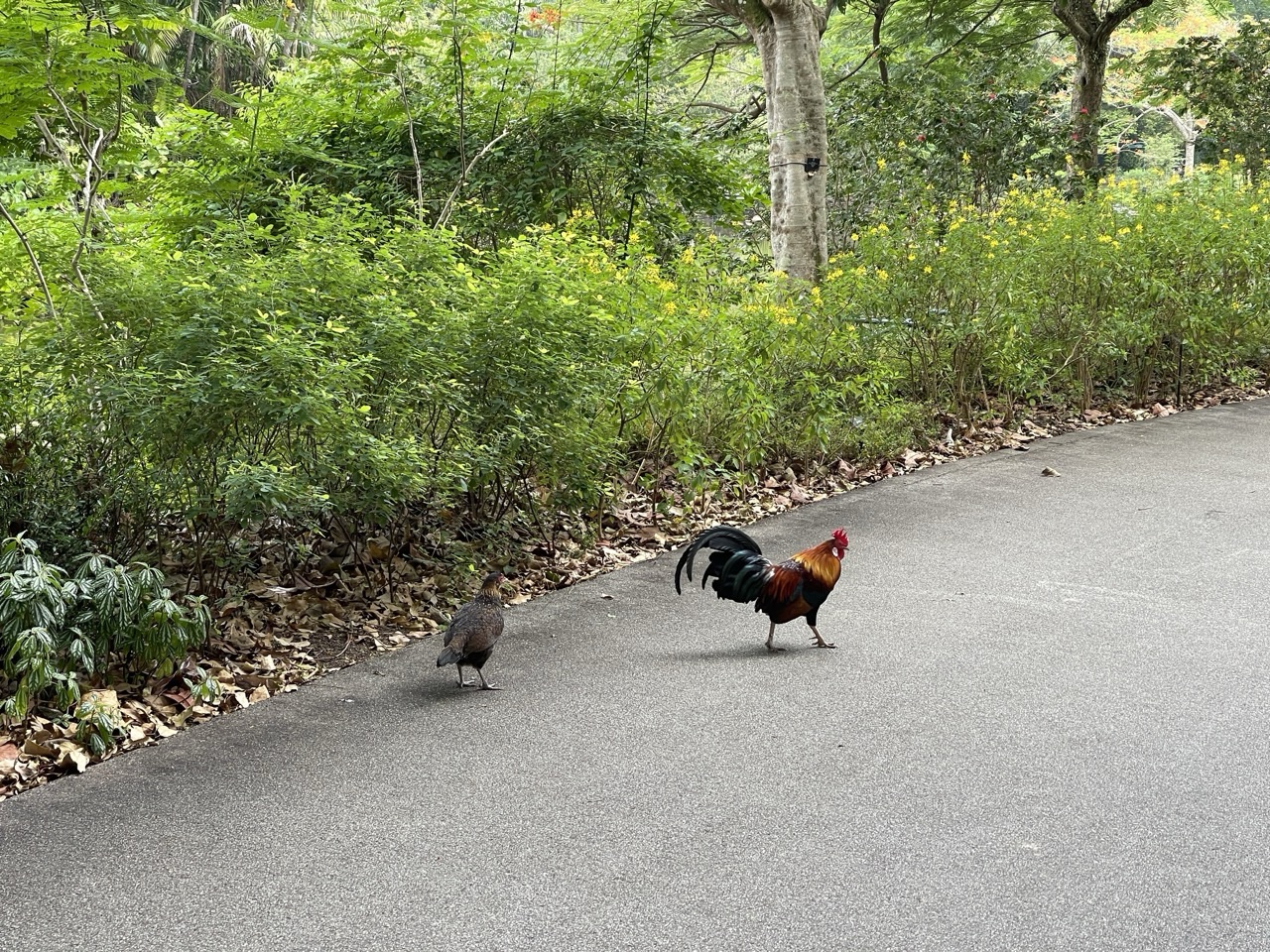
The featured photograph of free-roaming chickens in Singapore Botanic Gardens illustrates observation of living animals, not a verified record from NParks’ formal watches or the worked fictional survey. Current programme windows and site rules must be checked directly. Never publish sensitive wildlife locations simply to provide a dramatic example.