
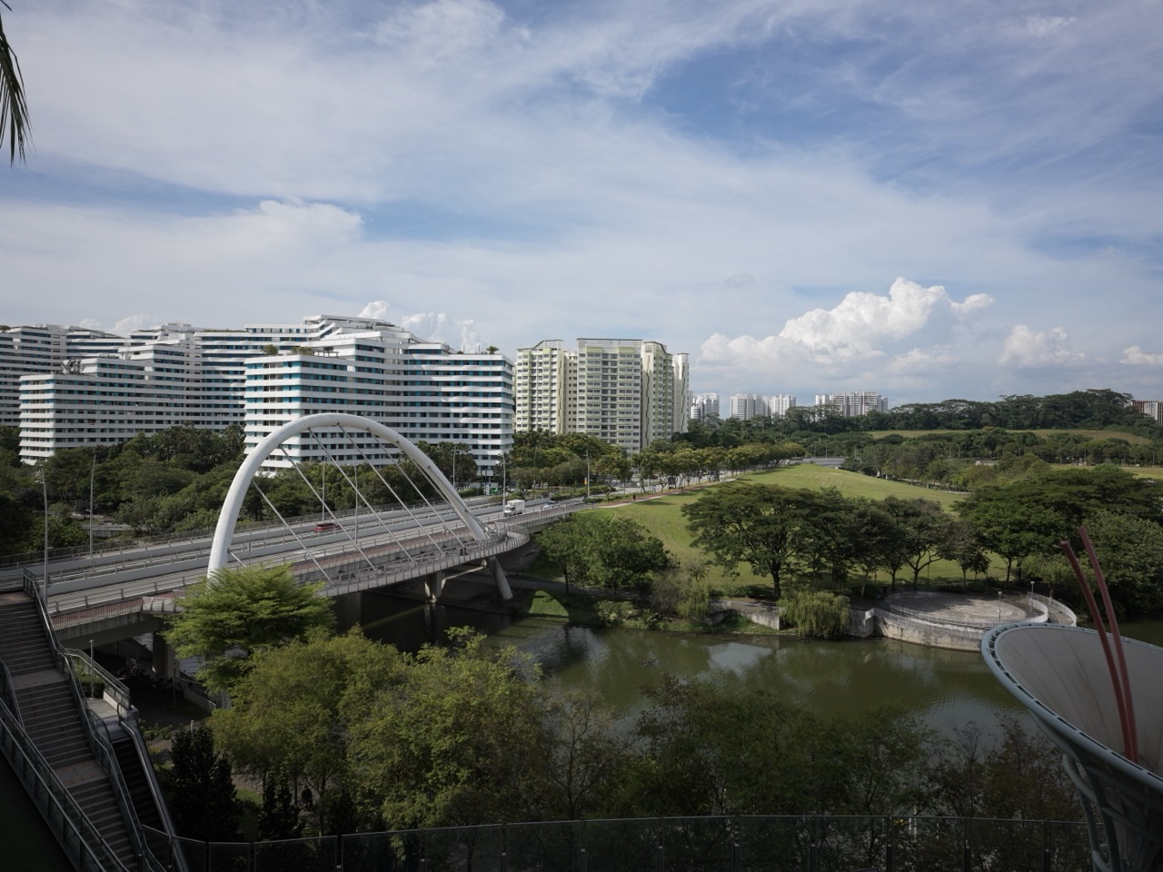
You can explore Punggol without a car by using two North East Line MRT stations, the Punggol LRT’s East and West loops and two bus interchanges. Punggol MRT (NE17) connects with the established town centre, Waterway Point, the LRT and Punggol Bus Interchange. Punggol Coast MRT (NE18) serves the Digital District, Punggol Coast Mall and the integrated Punggol Coast Bus Interchange. Within the estate, the driverless Punggol LRT serves 14 stations across two loops and links residential neighbourhoods to Punggol MRT.
The most useful planning habit is to choose the actual building or entrance first, then select the station or bus interchange. ‘Punggol’ is not one compact destination: Waterway Point, One Punggol, Northshore Plaza, Oasis Terraces and Punggol Coast Mall sit in different parts of the town. This guide explains how the transport network fits together, how to avoid confusing NE17 with NE18, when the LRT is useful, how to use the two bus interchanges and what to check for a stroller, wheelchair or late return journey.
Quick transport guide:
- Punggol MRT (NE17): town-centre interchange, Waterway Point, Punggol LRT and Punggol Bus Interchange.
- Punggol Coast MRT (NE18): Punggol Digital District, SIT campus vicinity, Comics & Games Library and Punggol Coast Mall.
- Punggol LRT: 14 stations across East (PE) and West (PW) loops, connecting neighbourhoods to NE17.
- Punggol Bus Interchange: town-centre bus connections beside Punggol MRT.
- Punggol Coast Bus Interchange: integrated with NE18 and Punggol Coast Mall.
- Sam Kee LRT: useful for One Punggol and ActiveSG Punggol Sport Centre.
- Oasis LRT: useful for Oasis Terraces and Punggol Polyclinic.
- Samudera LRT: useful for Northshore Plaza.
- Riviera LRT: useful for Punggol Promenade Riverside Walk and Tebing Lane area.
- Live routes: check current departures and disruptions using MyTransport.SG or the operator’s official service tools.
Two MRT stations, two different parts of Punggol
Punggol MRT (NE17) is the established town-centre station on the North East Line. It is the obvious rail destination for Waterway Point and the Punggol bus interchange. From there, the Punggol LRT provides local connections around the residential estate. Visitors who say only ‘meet at Punggol MRT’ should specify a mall entrance, station exit or public landmark when a precise meeting point matters.
Punggol Coast MRT (NE18) is the next North East Line station north of Punggol. It serves Punggol Digital District and is integrated with Punggol Coast Bus Interchange and Punggol Coast Mall. It is a more direct rail anchor for the public mural, the Comics & Games Library and parts of the SIT campus-side district. Do not confuse Punggol Coast MRT with Samudera or Teck Lee LRT: they serve different parts of the wider north-western area.
For a visitor arriving from central Singapore on the North East Line, the simplest strategy is often to remain on the MRT until the station that matches the intended destination. Changing at Punggol to the LRT may be useful for a local neighbourhood address, but it is unnecessary if NE18 is the direct stop for the destination.
Punggol LRT: why the two loops matter
The Land Transport Authority describes the Punggol LRT as a driverless system opened in 2005, linking residential areas with Punggol MRT and its bus interchange. It serves 14 stations across two loops. Station codes beginning PE belong to the East loop, while those beginning PW belong to the West loop.
The East loop serves Cove, Meridian, Coral Edge, Riviera, Kadaloor, Oasis and Damai. The West loop serves Sam Kee, Teck Lee, Punggol Point, Samudera, Nibong, Sumang and Soo Teck. Both loops connect with the main station at Punggol. Before boarding, check the destination display and direction, especially if you are unfamiliar with the system.
A common mistake is assuming that because two stations appear close on a map, a train on one loop will travel directly to the other. The loops are distinct paths around the estate. If the station is on the opposite loop, the correct transfer may be at Punggol. Use the route map or a live journey planner rather than guessing from the station names.
Punggol Bus Interchange: the town-centre gateway
Punggol Bus Interchange sits beside Punggol MRT and Waterway Point. It handles bus connections for the established town centre and links local neighbourhoods with other parts of Singapore. For a visitor, this is a practical arrival point when the final destination is Waterway Point or a nearby town-centre location.
Do not assume that every bus serving Punggol stops at every LRT station or that the route you used last month has not changed. Service numbers, stopping patterns and operating times can be adjusted. Check the live route and the bus stop code or interchange boarding point on the day.
If a bus is intended to take you to a specific residential block, compare its actual stop with the building address. A bus that enters the correct neighbourhood may still leave a substantial walk, and a nearby LRT station may be more convenient depending on the weather and mobility needs.
Punggol Coast Bus Interchange: the newer integrated transport hub
LTA identifies Punggol Coast Bus Interchange as an integrated interchange linked to Punggol Coast MRT (NE18) and Punggol Coast Mall. It is located in Punggol Digital District, supporting commuters heading to and from the JTC business parks and Singapore Institute of Technology campus. The interchange opened in June 2025.
This makes the northern district much easier to reach by public transport. A visitor to the mural or mall can use NE18, while someone arriving by bus can transfer within the integrated hub. The exact exit, mall entrance or campus route still matters; a large development may have multiple buildings and public approaches.
Do not confuse the new interchange with the established Punggol Bus Interchange beside Waterway Point. They are at different MRT stations, and selecting the wrong one can add unnecessary travel.
Which station or interchange for common Punggol destinations?
| Destination | Useful public transport anchor | Why |
|---|---|---|
| Waterway Point | Punggol MRT NE17 / Punggol Bus Interchange | Direct town-centre connection |
| One Punggol and ActiveSG Sport Centre | Sam Kee LRT PW1 | Local connection to the community hub and sports complex |
| Oasis Terraces / Punggol Polyclinic | Oasis LRT PE6 | Neighbourhood mall and healthcare destination |
| Punggol Plaza / Punggol 21 CC | Coral Edge LRT PE3 | Local access to community and retail facilities |
| Riverside Walk / Tebing Lane | Riviera LRT PE4 | Useful reference for the promenade area |
| Northshore Plaza | Samudera LRT PW4 | Neighbourhood plaza connection |
| Punggol Coast Mall / public mural | Punggol Coast MRT NE18 / Bus Interchange | Integrated Digital District access |
| SIT campus | Punggol Coast MRT NE18 or Teck Lee LRT PW2 | Choose based on the campus building and public entrance |
How to plan the last kilometre
Singapore’s public transport system can bring you into Punggol, but the final walk may still determine whether the trip is convenient. Use the exact postal address or building name, not simply ‘Punggol’. Check which station exit has the more direct pedestrian path and whether a covered link exists. In a hot afternoon or heavy rain, a shorter sheltered route can be more useful than a route that looks shorter in a straight line.
For destinations beside the waterway, identify the correct bridge or park entrance. The park runs through the estate, so the nearest station depends on the particular section. If you are heading to Coney Island, check the official island entrance and opening hours; do not assume that the nearest LRT station puts you at the park gate.
For a mall or integrated development, identify the correct wing, tower, entrance and unit. This is particularly helpful at Waterway Point, Northshore Plaza I and II, and Punggol Coast Mall, where the same development name can cover several levels or buildings.
Using MyTransport.SG and live route information
Use LTA’s MyTransport.SG tools or the relevant public transport operator’s live services to check journey options, bus arrival information and train service notices. Static articles are useful for understanding the network but cannot guarantee a bus arrival time, live train frequency or a disruption-free journey.
Before leaving, check the origin and exact destination, the station or bus stop, any transfer and the walking portion. If an interchange or lift is affected by a disruption, follow the operator’s instructions and use a confirmed alternative. Do not rely on a third-party map alone when an official service advisory is active.
Strollers, wheelchairs and accessible travel
When travelling with a stroller or wheelchair, plan the full route: home or hotel to station, the correct lift, the transfer, the exit and the footpath to the destination. A station being accessible does not prove that every nearby shortcut is step-free. Check LTA and operator information for lift availability if the route depends on a particular lift.
For a visit to One Punggol or a shopping mall, the integrated building environment can make a sheltered journey easier. For a nature outing, individual park sections may have different surfaces and gradients. NParks’ general accessibility label should not be interpreted as a guarantee that every remote trail or connector is suitable for every mobility device.
Late evenings and return journeys
A mall, cinema, public library or outdoor park may have different closing times. The train, LRT and bus timetable is a separate system. Check the return service before beginning a late activity, particularly if you plan to visit an outdoor park or a restaurant away from the town centre.
For an event at Punggol Coast, do not assume the interchange has the same passenger pattern as NE17. Confirm the bus or MRT route back to your destination and allow time to reach the right platform. A clear end-of-evening plan avoids unnecessary rushing.
Common transport mistakes in Punggol
- Confusing Punggol MRT (NE17) and Punggol Coast MRT (NE18).
- Using the Punggol Bus Interchange when the destination is beside the Punggol Coast Interchange.
- Assuming the East and West LRT loops serve the same stations in one direction.
- Choosing an LRT stop from a straight-line map without checking the actual pedestrian crossing.
- Confusing Teck Lee LRT with Punggol Coast MRT.
- Assuming the nearest station to Coney Island is directly at an entrance.
- Relying on an old bus route or departure time without checking live information.
- Forgetting to plan the return from a late movie, meal or event.
- Assuming every park path or mall shortcut is step-free.
Frequently asked questions
How many MRT stations serve Punggol?
Two North East Line stations are relevant: Punggol (NE17) and Punggol Coast (NE18).
How many Punggol LRT stations are there?
LTA lists 14 stations on two loops.
Where is the main Punggol Bus Interchange?
Beside Punggol MRT and Waterway Point in the town centre.
Where is Punggol Coast Bus Interchange?
It is integrated with Punggol Coast MRT and Punggol Coast Mall in Punggol Digital District.
Which station is best for Waterway Point?
Punggol MRT (NE17).
Which station is best for Punggol Coast Mall?
Punggol Coast MRT (NE18).
Which LRT is best for One Punggol?
Sam Kee (PW1) is a useful nearby station reference.
Can I use the LRT to reach Oasis Terraces?
Yes. Oasis (PE6) is the neighbourhood LRT stop.
Does Punggol Coast MRT connect to the LRT?
It is a separate North East Line station. Use Punggol MRT for transfers to the Punggol LRT loops.
Where do I check current bus timings?
Use MyTransport.SG or the relevant operator’s official live service information.
Is Punggol easy to explore without a car?
Yes. The MRT, LRT, bus interchanges and park connectors provide several ways to move around, though you should check the last-mile walk.
Official transport sources and connected eduKate guides
- LTA — Punggol and Sengkang LRT loops
- LTA — Punggol Coast integrated bus interchange
- LTA — MyTransport.SG planning and live information
- SBS Transit — current service updates
- NParks — Waterway Park entrances and paths
- JTC — Digital District visitor information
- eduKateSG — what to see near every LRT station
- eduKateSG — one-day MRT/LRT itinerary
- eduKateSG — Punggol Digital District public walk
Transport information reviewed 15 November 2026. Routes, service hours, lift operations and bus departures may change. Confirm live services before travel. This guide explains the network and does not provide real-time departure predictions.