
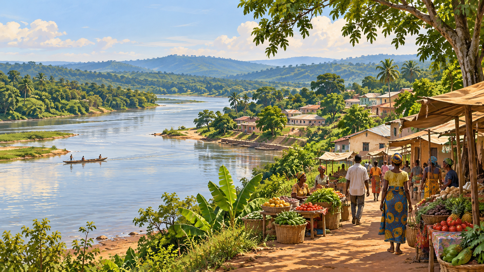
Did you know that the Central African Republic connects two very different natural worlds: the humid Congo Basin forest in the southwest and broad savanna landscapes farther north? The most revealing places to explore on a map are Bangui, Notre-Dame Cathedral, the Barthélemy Boganda National Museum, the Oubangui riverfront, Boali Falls, the Bouar megaliths, Bayanga, Dzanga Bai, Bai Hokou and Manovo-Gounda St Floris National Park.
Before treating this Central African Republic travel guide as an itinerary, read the important distinction. On 11 October 2026, UK FCDO advice advises against all travel throughout the country except Bangui, where it advises against all but essential travel, including the airport. These ten places are therefore a heritage and geography guide, not a recommendation for a leisure tour under current conditions.
For understanding the best-known Central African Republic attractions, begin with Bangui’s civic, religious and river settings, then separate the western archaeological landscape from the southwestern forest and northeastern national park. Several entries belong to one wider destination rather than ten independent journeys. That distinction makes the country easier to understand without turning a beautiful photograph into a misleading promise of access.
Find your route through Central African Republic
Start with the overview to locate each place. Read places 1–4 for the capital, 5–6 for water and archaeology, 7–9 for the southwest forest landscape, and 10 for the northern savanna. The planning section explains why these are reading routes rather than recommended travel routes today.
Compare the ten places · Explore the full guide · Plan by region · Answer quick questions · Check official information
Ten places at a glance
| Place | What it offers | Region |
|---|---|---|
| 1. Bangui | Capital-city context and everyday urban life | Southern capital |
| 2. Notre-Dame Cathedral of Bangui | Living religious heritage | Bangui |
| 3. Barthélemy Boganda National Museum | Arts, traditions and national memory | Bangui |
| 4. The Oubangui riverfront in Bangui | River geography and the capital’s setting | Bangui |
| 5. Boali Falls | Waterfall scenery and the link between water and energy | West of Bangui |
| 6. The Bouar megaliths | Archaeological questions and stone-built heritage | Western country |
| 7. Bayanga | Human context for the Sangha forest landscape | Southwest |
| 8. Dzanga Bai | Forest elephants and the ecology of a clearing | Dzanga-Sangha, southwest |
| 9. Bai Hokou | Gorilla research and managed forest observation | Dzanga-Sangha, southwest |
| 10. Manovo-Gounda St Floris National Park | Savanna heritage and the challenge of conservation | Northeast |
Open the full reading index
1. Bangui
2. Notre-Dame Cathedral of Bangui
3. Barthélemy Boganda National Museum
4. The Oubangui riverfront in Bangui
5. Boali Falls
6. The Bouar megaliths
7. Bayanga
8. Dzanga Bai
9. Bai Hokou
10. Manovo-Gounda St Floris National Park
Read the country through rivers, forest and memory
Planning and regional choices
Frequently asked questions
Sources and further reading
Read the country through rivers, forest and memory
A good map is a surprisingly helpful travelling companion, even when the journey must remain on the page. Bangui lies beside the Oubangui, also written Ubangi. Bayanga belongs to the southwestern Sangha forest landscape. Bouar is in the west, while Manovo-Gounda St Floris is far to the northeast. These positions matter more than the order of a numbered list.
The country’s people are not background scenery for its protected areas. Urban life, religious communities, artisans, farmers and Indigenous forest communities all deserve attention in their own right. A thoughtful account can appreciate wildlife while asking who protects it, whose knowledge makes conservation possible and how local livelihoods are affected.
This guide deliberately separates historical significance from present visitor operations. A museum’s existence does not confirm that its galleries are open; a park website offering activities does not overturn government advice. Where a detail cannot be reliably confirmed, the honest answer is to leave it conditional rather than invent opening hours, fares or an easy road transfer.
Bangui is the sensible starting point for understanding the country because it brings government, commerce, worship and river geography into one urban setting. Think of it as the introduction to the rest of the guide, not simply an airport stop before wildlife country.
The most useful first observation is how a capital works beside a major river. A map makes the connection immediately visible: the Oubangui is part of the city’s setting, while the opposite bank belongs to the Democratic Republic of the Congo. National borders and everyday economic connections coexist.
If authorised essential travel eventually makes a visit appropriate, choose a small number of confirmed appointments rather than an open-ended walking programme. A museum discussion, a religious landmark and a locally guided explanation of city history can offer more substance than collecting distant viewpoints.
Ask local hosts which stories they would like visitors to understand. Questions about language, education, work and contemporary art often reveal a city more accurately than a checklist of monuments. Avoid expecting one person to speak for every community in a diverse country.
Photography requires particular judgement. People at work, private homes and public institutions are not automatically available subjects. Ask before taking a portrait, accept a refusal comfortably and never treat a photograph as more important than someone’s privacy or security.
Bangui’s place in this selection is about orientation. It gives readers the human scale that a national park map cannot provide, and it reminds us that a country is a lived home before it becomes a travel destination.
Notre-Dame Cathedral offers a different way to read the capital: through worship, community and the presence of a prominent religious institution. The African Caucus city guide identifies it as Bangui’s main Catholic place of worship and the seat of the archdiocese.
Its value is not limited to architectural appearance. A cathedral is a place where people gather for ordinary services and significant moments in family life. That living role should shape the tone of any future visit more than the search for a picturesque facade.
Start with context rather than technical labels. Ask how the building relates to its neighbourhood and what role the congregation plays in the wider city. You do not need to know every architectural term to appreciate the relationship between a public landmark and its users.
Do not infer visitor access from a photograph or an old guidebook. Worship schedules, private ceremonies and restrictions may change. A confirmed welcome from the appropriate staff or parish contact is the right foundation for an interior visit.
Dress and behaviour should reflect the setting. Quiet conversation, permission before photographing and space for worshippers are simple habits that make a real difference. Observing from outside may be the appropriate choice if a service or ceremony is taking place.
For readers comparing the ten entries, the cathedral represents spiritual and communal heritage. It complements the museum’s material history and the river’s geographic story, giving Bangui several distinct layers rather than reducing it to one capital-city headline.
The Barthélemy Boganda National Museum belongs in a country guide because objects can make broad historical questions feel tangible. The African Caucus guide describes its focus on arts and popular traditions. Its name also draws attention to a central figure in the country’s political history.
The most rewarding museum question is often wonderfully simple: what was this object for? A tool, textile or musical instrument can open a discussion about skilled work, ceremony, exchange or domestic life. Everyday purposes prevent heritage from becoming an abstract collection of dates.
Look for the connection between an object and its community of origin, where reliable interpretation is available. Materials, making techniques and use may be just as revealing as visual decoration. Different communities should not be collapsed into a single national style.
Treat any published description of the collection as background, not a guarantee of the current display. This guide does not confirm opening hours, staffing, the condition of individual galleries or whether every item mentioned in earlier accounts remains accessible.
For a future permitted visit, ask for an informed guide or curator discussion if available. A short, well-explained selection of objects is preferable to racing through a room and leaving with attractive photographs but little understanding.
For learning from home, the museum provides a useful starting question: how does a country preserve its diverse cultural inheritance through periods of change? That question connects the collection to living artists, educators and families rather than leaving history behind glass.
The Oubangui riverfront helps explain why location matters. A river is more than the blue line on a map: it creates boundaries, connects settlements and influences where people work and build. Bangui’s riverside position is central to understanding its geography.
Begin by distinguishing looking at the river from travelling on it. A riverfront view, a boat journey and an international crossing are three different activities with different practical requirements. None should be assumed available because another is possible.
A useful observation exercise is to compare the shape of the waterfront with a street map. Where does the built city meet the water? Which connections are visible, and which require local explanation? This gives geography a human dimension without inventing a specific activity.
For any future appropriate visit, use a location and arrangements confirmed by responsible local hosts. This is not an invitation to wander along unfamiliar banks, enter working areas or negotiate an unplanned crossing. The opening travel conditions remain decisive.
Water also changes the meaning of distance. Two points that appear close across a channel can be separated by administrative, transport and safety considerations. A straight line across a map should never be mistaken for a simple transfer.
The riverfront’s contribution to the list is clarity. It anchors Bangui in a wider basin and makes the relationship between city, border and landscape easier to grasp before readers move to the forest and savanna chapters.
Boali Falls is one of the country’s widely recognised natural landmarks. The African Caucus guide places it on the Mbali River near Boali. Here, the story shifts from the capital’s river setting to the visible force of moving water.
Waterfalls invite an immediate emotional response: sound, movement and the contrast between flowing water and fixed rock. They also invite a practical question. What does the river do for communities beyond providing scenery? Boali’s broader setting makes water and energy a useful theme to explore.
An image cannot tell you how the falls will appear on a particular day. Water volume, visibility and access conditions are variables, not permanent features of a tourism photograph. Avoid choosing a date solely because an old picture looks dramatic.
The falls are outside the capital exception described in the opening advice. Their inclusion is therefore for geographic understanding and future consideration if conditions change, not a suggested excursion from Bangui in the current situation.
If a future visit becomes appropriate, confirm official access and the condition of designated viewing areas. Wet surfaces, edges and rushing water deserve caution even at an otherwise accessible waterfall. Swimming or approaching the drop should never be inferred from the word “attraction”.
Boali adds an important contrast to the forest chapters. It shows the country through water in motion and encourages readers to connect a beautiful landscape with infrastructure, settlement and the practical needs of daily life.
Did you know that the Bouar area has megalithic heritage? UNESCO records Les mégalithes de Bouar on the country’s Tentative List. That is a proposal-stage recognition, not the same status as an inscribed World Heritage property.
The appeal is the invitation to think carefully about evidence. Stone arrangements raise questions about construction, use and the communities that made them. They do not license a guide to supply a confident date, identity or purpose where scholarly interpretation remains uncertain.
A good archaeological reading begins with what can actually be observed and documented. How are stones arranged? How does a site relate to its terrain? What evidence supports an interpretation? These questions are more rewarding than applying a familiar comparison too quickly.
Avoid treating the phrase “megaliths of Bouar” as the name of a single ticketed attraction with one entrance. It refers to an archaeological landscape. This guide does not establish a present visitor centre, a fixed access route or current guided operations.
Any future appropriate field visit would need qualified local guidance, permissions and care for the sites. Stones and surrounding material should be left undisturbed; taking a fragment would remove evidence from the place that gives it meaning.
Bouar earns its place by broadening the country’s story beyond wildlife. It introduces deep human history and a valuable habit for travellers: enjoying a mystery without turning uncertainty into a sensational claim.
Bayanga is the settlement context for the southwestern Dzanga-Sangha landscape. Including it separately from the wildlife sites is intentional: a conservation destination is also a place where people live, work, organise transport and make decisions about their future.
Start with the relationship between settlement and forest rather than expecting a conventional resort town. The wider area brings together conservation activity, local livelihoods and the needs of Indigenous communities. No single visitor experience can represent all of those relationships.
Community encounters should be voluntary and locally shaped. If a future appropriate visit includes cultural learning, ask who organises it, who benefits and whether participants have chosen the terms. Hospitality is not permission to photograph every household or personal activity.
The vocabulary matters too. Use the community names preferred by the people concerned, and avoid presenting contemporary residents as relics of an unchanged past. Knowledge, language and livelihoods continue to develop, just as they do anywhere else.
Bayanga, Dzanga Bai and Bai Hokou belong to one broader southwestern context. They are not three independent regions that can be casually inserted into a national road tour. Their separate chapters explain different themes: people, elephant observation and forest research.
For readers today, Bayanga is a reminder to keep the human story visible. A place associated with remarkable wildlife should also be understood through the people whose labour and knowledge make its conservation possible.
Dzanga Bai is a forest clearing associated with the observation of forest elephants. The Dzanga-Sangha protected-area website describes a viewing platform at the clearing’s edge. The setting is striking because an opening in dense forest can reveal wildlife that is otherwise difficult to see.
The word “bai” is useful here: it describes a clearing, not an entire national park. A clearing, surrounding forest and wider protected-area system operate at different scales. Keeping those terms separate makes the destination much easier to understand.
Dzanga-Ndoki National Park is the Central African Republic component of the UNESCO Sangha Trinational property, shared with Cameroon and the Republic of the Congo. The neighbouring reserve belongs to its broader buffer landscape; the names should not be treated as interchangeable.
The rewarding idea is patience. Where authorised observation operates, animals arrive on their own terms. A quiet wait can reveal interactions and movement that a rushed search for one perfect photograph would miss. A wildlife appearance is never something a guide can honestly guarantee.
Future access would require current confirmation from protected-area management and would still depend on the travel conditions explained above. An existing activity description is not evidence that a particular departure, platform or transfer is available today.
Dzanga Bai’s place in the list is ecological as much as visual. It encourages readers to see a clearing as part of a connected living system, rather than treating elephants as isolated attractions set against a decorative forest backdrop.
Bai Hokou is associated with western lowland gorilla research and managed tracking in the Dzanga-Sangha landscape. It offers a different forest story from Dzanga Bai: less about watching a clearing and more about understanding patient fieldwork in dense habitat.
Research is the foundation of that story. Habituation, monitoring and trained interpretation take time and expertise. A visitor-facing activity, where available, rests on work that cannot be replaced by an independent walk through the forest.
Do not imagine gorillas as animals waiting at a fixed viewpoint. Forest conditions and their movements shape what can be observed. Any future authorised programme would need to explain the physical demands, limitations and possibility of changes clearly before a booking.
Animal welfare should lead the experience. Follow the current instructions on distance, group size and health precautions issued by the programme, rather than assuming an old blog’s rules still apply. Never pressure a guide to shorten a distance or extend contact.
This guide does not repeat named gorilla groups or infant details from older web copy. Those particulars can become outdated quickly. The more durable information is the place’s relationship to research, conservation and carefully controlled observation.
Bai Hokou complements the elephant-clearing chapter without duplicating it. Together they show that “forest wildlife” contains several different kinds of habitat, knowledge and visitor management, all deserving more care than a simple promise to see animals.
Manovo-Gounda St Floris National Park shifts the map decisively away from the southwestern rainforest. UNESCO recognises its natural heritage, and the property is on the List of World Heritage in Danger. Those two facts should be read together.
Recognition explains significance; the danger listing draws attention to conservation pressures. Neither status says that an ordinary safari operation is available. The park belongs in a national landscape guide without being presented as a currently practical holiday choice.
The most useful comparison is with Dzanga-Sangha. Different habitats create different ecological questions. A savanna park and a humid forest protected area are not interchangeable versions of “African wildlife”, and moving between them is not a small local excursion.
Avoid repeating historic wildlife lists as promises of present sightings. Species records, population conditions and visitor access require contemporary evidence. An honest guide can discuss why a protected landscape matters without claiming that every animal described decades ago is visible now.
For learning from home, read the heritage description alongside conservation reporting. Ask what protection means in practice: monitoring, local cooperation, staffing and the ability to maintain a functioning landscape. A designation on a map is only the beginning.
This final entry widens the country’s portrait. It leaves readers with both admiration and responsibility: important places deserve informed attention even when the right decision is to study them, support credible conservation and postpone a physical visit.
Planning and regional choices
Begin with the decision not to book
For a leisure trip under the advice checked for this guide, postponement is the appropriate starting point. Read your own government’s guidance too. A photograph, conference brochure or operator offer cannot establish that a journey is suitable for you. Keep heritage interest separate from a decision to travel.
Keep four geographic clusters separate
Bangui’s entries form one capital cluster. Boali and Bouar introduce different western settings. Bayanga, Dzanga Bai and Bai Hokou share the southwestern forest context. Manovo-Gounda St Floris belongs to the northeast. This is a useful study map, not a proposed four-region journey or a promise that roads connect these places conveniently.
Understand park and heritage names
Dzanga-Sangha is the wider protected-area context; Dzanga-Ndoki is a national park within it; Dzanga Bai is a specific clearing. Sangha Trinational crosses three countries. Bouar’s megaliths are on a Tentative List, while Manovo-Gounda St Floris is inscribed World Heritage in Danger. Those distinctions help prevent misleading comparisons.
Do not assume present operations
Opening hours, guides, transport, communications and medical arrangements are not confirmed by this article. Anyone undertaking legitimately necessary travel needs current, professionally assessed arrangements, appropriate permissions and a clear contingency plan. General travel copy cannot substitute for those checks or for specialist advice.
Keep people and animals out of a checklist
Ask before photographing people, use locally agreed cultural programmes and respect the right not to participate. In wildlife settings, accept programme limits and changes without argument. Paying for an activity does not buy control over a community, a researcher’s work or an animal’s behaviour.
Make a worthwhile journey of learning now
Compare the UNESCO records, explore maps and read protected-area research. Choose one question—forest clearings, archaeology, river cities or conservation—and follow it carefully. You can develop a richer understanding today without manufacturing an itinerary that ignores present conditions. A postponed journey can still begin with thoughtful curiosity.
Frequently asked questions
Is this a recommended holiday itinerary?
No. It is a guide to ten important places and their geographic context. The opening advice makes clear why a leisure tour is not recommended under the conditions checked.
Are all ten places in different regions?
No. Four entries are in Bangui, and three relate to the southwestern forest landscape. The separate chapters explain distinct places and themes, not ten distant overnight stops.
Is Bouar an inscribed World Heritage Site?
The megaliths are recorded on UNESCO’s Tentative List. Do not confuse a tentative entry with completed inscription on the World Heritage List.
Is Dzanga-Sangha the same as Sangha Trinational?
No. The broader names overlap in context but are not identical. Sangha Trinational includes national parks in three countries; the Central African Republic component is Dzanga-Ndoki.
Can wildlife sightings be guaranteed?
No. The guide makes no promise of sightings, and it does not confirm current visitor operations. Wildlife observation depends on animal behaviour and the programme’s conditions.
How can I use the guide without travelling?
Follow the regional reading order, compare official heritage descriptions and explore the sources below. It is especially useful for learning how rivers, forest and savanna shape different places.
Sources and further reading
Sources checked in October 2026. Recheck government advice, site access and operator information before making any booking.
UK FCDO: Central African Republic travel advice
African Caucus 2025: Bangui city guide (historical visitor context, PDF)
UNESCO: Les mégalithes de Bouar, Tentative List
Dzanga-Sangha Protected Areas: landscape and conservation
Dzanga-Sangha: activity descriptions (reconfirm operations)
UNESCO: Manovo-Gounda St Floris National Park
Keep exploring Central African Republic
Top 10 Things to Learn When Visiting and Touring Central African Republic
Top 10 Things to Do When Visiting and Touring Central African Republic