
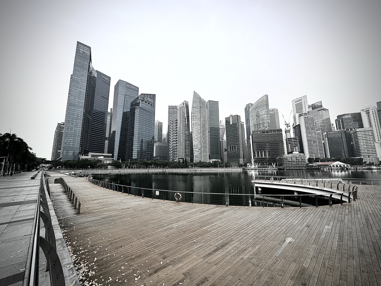
What to do in Singapore when you want to understand how a dense island city can contain homes, workplaces, parks, trains, hospitals, ports and public spaces without everything becoming a confusing jumble? Visit Singapore City Gallery at the Urban Redevelopment Authority Centre. Its large-scale city model and interactive exhibits reveal how planning decisions shape daily life.
A good Singapore City Gallery outing is not about memorising the names of hundreds of buildings. It is about learning to think in systems. Where should a town put its schools? How do rail lines connect homes with work? What happens when a growing population needs both housing and greenery? How do planners consider the needs of people who cannot use every route in the same way?
The URA Singapore City Gallery visitor page lists the gallery at 45 Maxwell Road, Singapore 069118, with free admission, normal opening 9 a.m. to 5 p.m. Mondays to Saturdays, and closure on Sundays and public holidays. Important 2026–2027 update: URA announced a partial gallery closure from 1 December 2026 to 30 April 2027, followed by a full closure from 1 May 2027, with reopening planned for the fourth quarter of 2027. Plan a visit using the dates that actually apply instead of relying on a long-outdated listing.
The quick answer: choose one part of the city and follow its connections
Begin with the central city model or an urban-systems exhibit. Choose a place you know, then investigate what helps people live, work and move there.
- Start with a map: locate a familiar neighbourhood or central district.
- Identify functions: homes, employment areas, education, health, transport, parks and essential utilities.
- Ask about connections: what links one function to another, and what happens if the connection fails?
- Examine trade-offs: the same area of land cannot support every possible use simultaneously.
- Observe change: use the Gallery’s historical comparisons to see how the built environment evolved.
- Consider different users: children, older residents, workers, wheelchair users and visitors may need different routes.
- Read the status: check the current open exhibits, the December 2026 partial closure and the 2027 full closure.
- Finish with one explanation: identify a planning decision and what it could improve or make more difficult.
A single well-explained city block or transport link can provide a more meaningful lesson than trying to learn the whole island in one sitting.
What is urban planning?
Urban planning concerns how land and buildings are organised to support people and their activities.
It can involve housing, industry, commerce, green spaces, schools, transport, healthcare, drainage, heritage conservation and long-term development.
The process is not simply drawing attractive roads between buildings. A town needs infrastructure, access and maintenance. The decisions also affect people with different incomes, work routines and mobility needs.
Some planning choices take years to implement, while other needs change unexpectedly. Good planning therefore involves evidence, alternatives and continual adjustment.
The URA Singapore City Gallery is a useful introduction because it makes several of these relationships visible through models and interactive exhibits.
Why Singapore is an interesting planning case
Singapore is a small island with a large population and many important functions. Land is limited, and some uses require very different environments.
Homes need access to services. Factories and logistics facilities need transport and operating space. Nature areas require protection. Airports, ports and water infrastructure occupy land while supporting the wider economy.
The key issue is not simply how to fit more buildings into a fixed boundary. It is how to balance functions so that people can live and the city can remain resilient.
The Gallery helps visitors see that one decision may influence many others.
A road can improve access but also change the character of a neighbourhood. A green space can support recreation, cooling and biodiversity while also occupying valuable land.
The large city model: a powerful first stop
The URA gallery description features a large architectural model and a projection-mapping presentation highlighting Singapore’s planning strategies and key landmarks.
A model allows you to understand scale and position in ways a street-level photograph cannot. Tall buildings, transport corridors, open spaces and shorelines can be seen together.
But a model is still a representation. It may show selected buildings, planned developments or simplified features depending on the presentation.
Read its current labels and do not assume every depicted project has already been completed or is available for visitors.
The first question should be: What is this model showing, at what date, and for what purpose?
Models help us change scale
From the pavement, you might see a single building, bus stop or crossing. From a city model, you can see how that feature fits within a larger network.
This shift helps explain why planning choices cannot be evaluated solely from one viewpoint.
A rail station may be useful because of its connections to other stations and streets. A park might matter because it serves several nearby residential areas.
Look for relationships rather than simply locating famous landmarks.
Then return to a smaller scale. How does a person actually walk from the station to the nearest facility?
Understanding both perspectives is essential to thoughtful urban planning.
A map is not the same as a lived journey
A map line makes two places look connected, but the actual journey may involve steps, crossings, weather, crowds and waiting.
For a person using a wheelchair or stroller, the route may be different from the most direct path shown on a diagram.
For a worker travelling late, public transport operating hours matter. For a child, safe crossings and school access matter.
A good visitor asks whether an apparent connection is convenient for the people who need it.
This is why practical planning requires field observations and data as well as beautiful models.
How to understand the projection mapping show
URA describes a roughly three-minute projection-mapping presentation that highlights urban-planning strategies and city landmarks.
A short show can help orient visitors, but it should not be mistaken for a comprehensive evaluation of every project.
Pay attention to what it emphasises. Does it show transport, housing, greenery or major districts? What seems connected across the island?
Afterwards, pick one feature and investigate it more carefully rather than claiming the three-minute presentation explains the full city.
A good model show introduces questions and makes relationships visible. Deeper understanding requires supporting information.
What does land scarcity really mean?
Land scarcity means there are limits to the area available for different purposes, especially when some uses cannot easily coexist.
An airport requires particular runway and safety conditions. A water catchment has different environmental constraints. Homes and schools require access, while industry may need logistics and separation from sensitive uses.
This creates trade-offs. Using one site for a major facility may mean another use must be located elsewhere or designed differently.
But scarcity does not automatically prove that every open space should be built over. The value of land includes ecological, social and infrastructure functions that cannot be measured solely by building height.
A mature planning discussion asks what each proposed use contributes and what it could displace.
The problem of choosing between competing needs
Imagine a fictional empty plot near a new town. Some people want a park, others a school, some housing and others a transport facility.
Each option can serve a legitimate purpose. The right decision depends on actual demand, surrounding services, environmental constraints and alternative locations.
A student can list the evidence needed before choosing: population projections, existing school capacity, transport access, ecological value and community feedback.
Do not pretend there is one universally correct answer without that information.
This exercise demonstrates why urban planning is about judgement supported by evidence rather than the simple drawing of colourful zones on a map.
Urban planning is a long-term process
Buildings and transport lines can remain in service for decades, so many planning decisions must consider future needs.
However, future demand is uncertain. Population patterns, technology, economic activity and climate conditions may change.
A city therefore needs a balance between long-term direction and the ability to adapt.
The Gallery’s historical comparisons show how earlier plans and buildings relate to today’s Singapore.
A useful question is which decisions still serve their original purpose and which have been revised.
The lesson is that a city is continually managed rather than completed once and for all.
Historical comparison: what changed?
The gallery’s interactive displays include ways to compare images of conserved buildings and structures from the past with how they look today.
This can reveal both physical continuity and urban change.
Choose one example and ask what remains recognizable. Have surrounding roads, uses or buildings changed? Does a conserved structure now serve a new public or commercial function?
Avoid assuming that one photograph documents the entire history of a site.
A later image can reveal what survives, but to understand why a decision occurred you may need planning records and historical research.
What is adaptive reuse?
Adaptive reuse involves giving an existing building a new function while addressing its physical condition and, where relevant, its heritage value.
A former government building might become a cultural institution. An old shophouse might accommodate a modern business.
Such change can preserve visible history while making a site useful today, but technical and legal constraints may apply.
The Gallery’s conservation comparisons provide a starting point for asking how urban renewal can coexist with heritage.
Do not assume every older building must remain in its original use, or that every old-looking façade has the same conservation status.
Each site needs an appropriate and verified explanation.
Conservation involves more than preserving a picture
An old building may have architectural significance, but it may also be associated with workplaces, communities and memories.
Physical conservation protects selected material features, while the living activities around a building can change.
That creates questions about how heritage and urban needs can coexist.
For example, a conserved street may attract new businesses while former residents or trades have already moved away.
A thoughtful visitor recognises that buildings and communities are related but not interchangeable.
This is why historical photographs, oral histories and present-day observation can be used together rather than relying on one attractive façade.
Transport planning: movement creates opportunity
A city depends on people being able to reach jobs, schools, healthcare, homes and recreation.
Rail networks, buses, roads, pedestrian paths and cycling links each serve different movement needs.
The quality of these connections affects how people use time and which opportunities are practically accessible.
At the Gallery, locate a major transport corridor on the model and ask what districts it links.
Then imagine the actual journey. A direct line between two stations does not describe the distance from each home or workplace to the platform.
Transport planning is therefore connected with land use and accessibility.
Why a rail station changes nearby land use
A rail station can make a location more accessible by connecting it to other parts of the city.
That may influence where businesses, homes and services are placed. However, the actual effect depends on demand, planning rules and surrounding conditions.
A student can investigate whether a station is near residential blocks, offices or community facilities.
Do not conclude that a particular building was constructed solely because of the station unless you have evidence.
The broader principle is that transport and land use influence one another.
This is a central mechanism of urban planning in any large city, not only Singapore.
The difference between transport capacity and convenience
A system may carry many passengers while still being inconvenient for some people.
Convenience depends on route coverage, walking distance, frequency, reliability, crowding and individual needs.
For example, a train service may be frequent, but someone with a mobility aid may need a longer accessible route to the entrance.
A Gallery visit can encourage students to look beyond headline network length and ask how transport actually serves different groups.
Good analysis considers capacity and lived experience, not just infrastructure size.
The two forms of evidence complement one another.
Housing: blocks do not make a complete town
A housing development provides dwellings, but a functioning neighbourhood needs transport, services, greenery and public spaces.
This is why HDB town planning involves more than erecting apartment towers.
The relationship between housing and surrounding amenities can influence residents’ daily travel and community life.
At the City Gallery, identify how residential areas connect with schools, shops, parks and other uses.
Do not assume every neighbourhood contains identical facilities or that a shared space guarantees friendship among residents.
A planned town creates opportunities; actual social outcomes depend on many additional factors.
Public housing and long-term change
Singapore’s public housing system developed through changing demands, building methods and social priorities.
Earlier developments often emphasised rapid provision of homes, while later projects added different forms of communal and environmental design.
But newer does not automatically mean better for every person in every respect.
Ask which needs changed and what evidence would help evaluate different designs.
For a separate detailed example, see What to do in Singapore | Learn How HDB Towns Work in Toa Payoh.
A Gallery visit can provide the city-scale explanation; a town walk can reveal what that explanation means on the ground.
Parks are infrastructure too
A park may offer recreation and rest, but green spaces can also influence biodiversity, local climate, drainage and the character of a neighbourhood.
They should not be seen only as decoration added after buildings have been arranged.
A green corridor may connect habitats. A neighbourhood park may provide public gathering space. A wetland may help manage water or support wildlife.
The actual environmental benefit depends on design and conditions, and should not be assumed from the colour green on a plan.
Ask which function a particular public green area is intended to serve and which evidence would demonstrate success.
Green corridors create ecological connections
Animals and plants do not always remain inside the boundaries of individual parks.
Connections between green areas can help some organisms move between habitats, but the effectiveness of a corridor depends on species, landscape conditions and disturbance.
A city model can show green networks that may be difficult to perceive from one street.
However, a drawn connection is not automatically proof that every animal can safely use it.
The ecological effects require scientific study and management.
This is another reason planners must combine geographical information with biological evidence rather than treat land as empty rectangles.
Hidden infrastructure: what a city needs beneath the surface
The URA gallery overview highlights the hidden networks that keep daily life working.
Water supply, used-water systems, drainage, electricity and communications may be less visible than roads and towers, but they are essential.
A town cannot function reliably if buildings are completed while basic services are missing.
Ask a child what happens to water after it leaves a tap, or how electricity reaches an apartment.
The answers involve networks, treatment, storage, maintenance and other systems that a visitor may never see directly.
A city is as much about hidden connections as famous landmarks.
Drainage and urban rainfall
Heavy rainfall creates runoff, especially where streets and buildings cover land.
Drainage networks guide water through designed channels and systems, while other infrastructure may help manage flood risks.
A Gallery exhibit can illustrate the general planning issue, but the operation of a particular drain or pump requires authoritative technical information.
Do not infer that one visible canal can prevent every flood.
Ask what happens when rainfall is unusually intense and why maintenance, monitoring and land elevation matter.
This connects City Gallery learning with the Marina Barrage water story.
Electricity is more than a power station
A city needs generation, transmission, distribution and maintenance to deliver electricity where people use it.
The electricity system also has to respond to changing demand while managing reliability and safety.
A modern building may include solar panels or energy-saving equipment, but those do not automatically make the entire district self-sufficient.
Ask what information planners and operators need when considering future demand.
The goal is to understand electricity as an interconnected public service rather than simply a switch on the wall.
Urban systems thinking becomes useful when it reveals dependencies that are otherwise easy to overlook.
Water supply and the Four National Taps
Singapore’s water strategy includes local catchment water, imported water, NEWater and desalination.
Those sources rely on different physical and institutional arrangements.
A city-scale planning perspective asks where infrastructure can be located, how water is distributed and how supply interacts with land and environmental needs.
Avoid reducing water security to a single reservoir or treatment plant.
The PUB water story can supplement the Gallery’s introduction with more technical detail.
This is a good example of one problem that requires many coordinated elements.
Economic activity needs space and connections
Shops, offices, warehouses, ports and factories have different spatial requirements.
Some businesses benefit from being near major transport connections, while others need larger sites or specific operating conditions.
A balanced city must consider these differences alongside housing and ecological needs.
At the Gallery’s model, examine where major employment areas sit relative to residential districts and transport routes.
Do not assume that geographic closeness alone determines where everyone works.
The useful question is how different activities interact and what trade-offs arise when planners allocate limited land.
The port and airport are special land uses
Ports and airports support trade and travel but also require significant land, access and safety arrangements.
Their needs differ from those of an ordinary office building or neighbourhood park.
A city planner must think about transport, environmental impacts, surrounding uses and long-term demand.
The Gallery can help visitors see how these facilities fit into the wider island, even if it does not explain every operational detail.
A student interested in shipping can continue with What to do in Singapore | Discover the Maritime Story.
The city model and a specialised maritime gallery answer complementary questions.
A planning proposal is not the same as a completed project
Maps and models may show future ideas, proposed developments or different planning scenarios.
These are not automatically promises that a building or rail line has already been constructed or that the completion date is fixed.
Read the date and status of a project carefully.
Words such as proposed, under study, planned, approved, under construction and operational represent different stages.
This distinction is especially important in a rapidly changing city.
A good visitor should leave able to ask what has actually happened and what remains a future decision.
How to interpret a planning timeline
A timeline can show historical milestones and future phases, but the significance of an event depends on context.
Ask why a new district was developed or why a particular transport investment was proposed.
What demand was it addressing? Which existing constraints were relevant? Who might benefit or be affected?
A timeline is a useful framework but cannot by itself explain every decision.
Use other appropriate sources for detailed policy or technical claims rather than making up a simple cause-and-effect story from two adjacent dates.
Historical precision is part of good civic education.
The difference between planning and prediction
Planning involves deciding how to prepare for possible future needs, while prediction attempts to estimate what may happen.
A plan may be based on forecasts, but forecasts can be wrong or revised when new evidence appears.
For example, patterns of employment or technology can change the demand for particular types of space.
A resilient plan may provide flexibility without guaranteeing every future outcome.
This is a valuable lesson for students: uncertainty is not evidence that planning is useless.
It means decisions should be evaluated and updated as circumstances change.
The December 2026 revamp is a real constraint
The URA visitor page, updated 5 October 2026, announces partial closure from 1 December 2026 until 30 April 2027.
During that period, do not assume all three floors or every model and display will be available.
The Gallery is scheduled to close completely from 1 May 2027, with a refreshed opening planned for Q4 2027.
Those are dated operational arrangements, not permanent features of the museum.
A teacher organising a 2027 field trip must check which period applies before promising students access to a specific exhibit.
Why a revamp can be part of a museum’s mission
Urban planning changes, and a public education gallery must sometimes update its interpretation and technology.
A revamp can improve how the institution presents new challenges, but it also temporarily limits visitor access.
This illustrates another kind of planning trade-off: maintenance and improvement require time and resources, and may disrupt normal services.
Do not treat the expected reopening quarter as a guaranteed date for a particular event or programme.
When planning a visit well in advance, check official progress updates and be ready to choose a suitable alternative.
The museum itself is an example of how public institutions adapt.
Current visitor hours and admission
Before the announced revamp restrictions take effect, Singapore City Gallery normally opens Mondays to Saturdays, 9 a.m. to 5 p.m. and closes Sundays and public holidays.
Admission is free.
Do not confuse the URA Centre’s location with an around-the-clock commercial attraction. A Saturday visit may be possible, while an ordinary Sunday visit is not.
Check current public-holiday arrangements and exceptional closures if travelling for a particular programme.
The official page is the source to use rather than an older tourism review.
Large groups must book
URA requires groups of more than twenty visitors to reserve a time slot in advance.
The official group guidance allows up to fifty visitors per time slot and asks larger groups to make multiple bookings.
Groups arriving without a valid reservation may be asked to leave if the Gallery is crowded.
This matters for school visits, clubs and organised learning journeys.
A teacher should confirm numbers, arrival time, supervision and the expected duration before announcing the excursion.
A self-guided family group has a simpler visit, but still needs to follow the venue’s ordinary rules.
The Gallery is designed for self-discovery
According to URA’s visitor guidance, Singapore City Gallery is designed as a self-guided experience with multimedia and interactive displays.
The general visitor information does not promise a routine free personal guide for every arrival.
If an organised group wants a guided experience, URA suggests using an appropriately licensed tourist guide.
A self-guided visit can still be excellent. Choose a clear question and let the model and exhibits provide evidence.
The strongest experience is not necessarily the one with the most verbal explanation, but the one that helps visitors understand the connections.
How to reach the URA Centre
Singapore City Gallery is at 45 Maxwell Road, with a public transport approach from nearby central-city stations, subject to the actual route chosen.
Use the URA visitor page for the building address, pickup and entry information.
Do not assume one MRT exit is automatically most convenient for everyone.
Check crossings, lift access, walking exposure and the complete journey home, especially for visitors with mobility needs.
A short city-centre destination can still feel demanding in tropical heat when the route and rest points have not been planned.
Accessibility and family facilities
The official visitor information identifies step-free access by lift to all gallery levels, accessible toilets on each floor, a manual wheelchair available on request and a nursing room.
These are useful features for families and people with mobility needs.
However, a particular interactive exhibit may have different viewing or participation requirements.
Ask staff for help if necessary, and choose a route that allows comfortable participation rather than requiring everyone to stand at one display for the same amount of time.
A good city-planning institution should also invite reflection about accessibility in the city outside its own building.
What an inclusive city needs
An inclusive urban environment should be usable by people with different abilities, ages and circumstances.
That can involve step-free routes, accessible public transport, readable signs, seating, suitable crossings and toilets.
But no one design element automatically makes an entire district accessible. The complete journey must work.
At the Gallery, ask a child to imagine someone using a wheelchair travelling between a home and a clinic.
Which connections would matter? Where could barriers occur?
This exercise turns a broad planning principle into a concrete question about daily life.
A Primary-school scavenger hunt
Give a child five categories: home, school, transport, park, and water.
Ask them to locate visible examples on an appropriate model or map.
Then explain how one category connects with another. A home needs access to school; a park is easier to enjoy when people can reach it safely.
Keep the activity short and flexible.
Do not require children to know every district name or remember complex policy terminology.
The purpose is beginning to understand that cities work through relationships.
A Secondary Geography investigation
Ask: “How can a dense city balance competing land uses while maintaining public access?”
Choose two planning examples from the Gallery. Identify the stated purpose of each, the users affected and one potential trade-off.
Use official URA descriptions and clearly distinguish your own reasoning from documented policies.
A strong response does not claim that every planning decision was universally beneficial.
It examines why planners may favour one option and what information would be needed to evaluate results.
This is Geography applied to a real city rather than a fictional planning diagram.
A Secondary Mathematics activity
Choose a simple model of travel or land use and construct a hypothetical calculation.
For example, a school is two kilometres from a fictional home, and a transport improvement reduces the route to 1.5 kilometres. The distance saved is 0.5 kilometre, or twenty-five percent of the original route.
Those numbers are examples, not verified distances in Singapore.
Then ask what the calculation leaves out: travel speed, safety, slope and waiting time.
This teaches that correct arithmetic can still produce an incomplete answer when the model omits important factors.
Planning uses mathematics and judgement together.
A design and technology investigation
Choose a digital display or projection-mapping model and ask what information it communicates visually.
How do colours distinguish land uses? Which labels help the reader? What might be confusing to someone with limited planning vocabulary or colour-vision differences?
Try sketching a clearer version of one diagram.
This connects the Gallery with information design, user experience and accessible communication.
A city model is useful only when visitors can interpret it accurately.
The lesson can be applied to maps, apps and public signs in everyday life.
One city, many neighbourhood experiences
Singapore contains mature towns, newer neighbourhoods, commercial centres, industrial areas and protected green spaces.
A resident of Toa Payoh may have a different daily route from someone working near Marina Bay or living in Punggol.
A city-wide model can show how these places fit together, but it should not imply that everyone experiences the benefits and difficulties in the same way.
Ask whose daily routines are represented by a planning proposal and which users might face different consequences.
This encourages nuanced understanding without turning the discussion into a simplistic claim that every resident has identical needs.
How public feedback fits into planning
Planning institutions may gather information through studies, consultations and feedback as part of different decision processes.
Public feedback can reveal concerns that a technical map does not communicate, such as a dangerous crossing or a loss of familiar community space.
But feedback also varies; residents can have legitimate disagreements over the same land use.
A good decision requires considering evidence, goals, legal rules and competing impacts.
The Gallery can begin a conversation about civic participation without promising that every suggestion will become policy.
Responsible participation means explaining a concern clearly and understanding the trade-offs.
Planning for climate resilience
Cities must consider rainfall, heat and other environmental pressures alongside housing and transport.
A green area may help with shade or biodiversity, while drainage infrastructure manages runoff. Coastal protection may require additional measures.
No one feature solves every environmental problem.
Ask how different systems work together and what data would show whether a particular intervention is successful.
This is why urban resilience is often about coordination rather than one dramatic structure.
The Gallery’s systems perspective supports that broader understanding.
Public spaces provide more than scenery
An open square, park, waterfront promenade or void deck may support recreation, community activities and everyday social encounters.
But a public space’s value depends on its accessibility, maintenance and actual use.
A design that looks attractive from above may feel uncomfortable in intense sun or difficult for someone using a mobility aid.
When studying a model, ask how you would experience the space at ground level.
This encourages a more human approach to planning.
Public-space design succeeds when the environment works for real people, not just in architectural presentation images.
A short one-hour gallery visit
Begin with the large model or projection presentation and choose one familiar location.
Identify its transport connections, main land uses and nearby green spaces.
Then visit one urban-systems or historical comparison exhibit to learn about an aspect not visible on the model.
Write a short explanation of what connects the place together.
If time permits, investigate one further planning challenge; otherwise, the hour can already be complete.
The schedule is illustrative rather than a fixed museum requirement.
A focused visit is better than attempting every display without a clear question.
A family half-day
Start with the model, let children find familiar neighbourhoods and explore an interactive display appropriate to their age.
Take a break and allow older learners to investigate a specific issue such as housing, transport or conservation.
Finish with a conversation about one feature that makes the group’s own neighbourhood convenient or inconvenient.
Do not force everyone through lengthy technical labels. Different ages can engage with the same model at different levels.
The main outcome is an improved ability to understand everyday urban surroundings.
A three-generation city-planning conversation
A grandparent may remember an older market, a bus interchange before a rail line or a neighbourhood before redevelopment.
A parent may recognise newer infrastructure, while a child sees the city model as a collection of fascinating shapes.
Invite each person to describe one change or question, but distinguish personal memory from documented historical records.
Do not assume everyone of a certain age has the same mobility or historical knowledge.
A comfortable Gallery visit can create a valuable discussion about how Singapore changed through different generations.
Connecting the Gallery to a real street
After the visit, choose one appropriate public area near the URA Centre for a short observation.
Look for a pedestrian crossing, public transport stop, conserved building or green feature.
Ask how it relates to the planning principles you saw inside.
Do not block a busy road or stand in an unsafe place to recreate the model’s viewpoint.
A field observation helps connect an abstract map with the real environment.
The most useful learning happens when a concept from the gallery becomes something you can recognise outside.
A low-cost outing with genuine educational value
Admission is free under current Gallery arrangements. The main costs are likely to be transport, food and any optional activities.
You do not need to purchase a specialist tour to benefit from the self-guided exhibits.
Choose one learning question and consider whether a short walk or meal afterwards would improve the experience.
If the Gallery is closed on your intended date, avoid travelling unnecessarily and choose an appropriate alternative.
A successful low-cost day depends on reliable logistics and meaningful content rather than simply avoiding ticket fees.
Food and rest arrangements
The Gallery is inside a working government and commercial district, where shops and food businesses have their own operating schedules.
Do not assume a particular nearby stall will be open or suitable for every diet.
Plan a meal or snack at an appropriate time and consider the needs of children, older relatives and visitors who may require rest.
Follow the Gallery’s rules about eating and drinking in exhibition areas.
A calm outing supports better learning because people can concentrate on what the displays explain.
Weather and the route to the building
Singapore City Gallery is indoors, but the approach from public transport may be exposed to rain and heat.
Check NEA weather information, especially when combining the visit with a neighbourhood walk.
During lightning or hazardous storms, seek appropriate substantial shelter rather than rushing across exposed streets to preserve an itinerary.
A free museum outing is easy to reschedule. Safety should not depend on entering the Gallery at one exact minute.
The weather also provides a useful subject for discussing how climate influences city design.
What to do if the Gallery is closed
The ordinary schedule excludes Sundays and public holidays. From December 2026 the planned partial revamp changes what can be visited, and a full closure is scheduled from May 2027.
Do not assume the same galleries will remain available throughout the work.
If the City Gallery is unavailable, alternatives for related learning could include the HDB LIVINGSPACE Gallery or a self-guided public-space study of a neighbourhood, subject to their own hours and access conditions.
Do not present those alternatives as replacements for every specific URA exhibit.
The aim is to preserve the educational question when the preferred venue cannot be used.
A vocabulary activity about city design
Choose land use, infrastructure, accessibility, conservation, and resilience.
Land use describes how space is allocated or occupied. Infrastructure includes systems needed for everyday services. Accessibility concerns people’s ability to use and reach places. Conservation involves protecting recognised heritage or natural resources. Resilience concerns the capacity to respond to and recover from changing conditions.
Ask a learner to identify one example of each in a model or a nearby public area.
Precise vocabulary helps make planning questions clearer.
The words are useful tools for evaluating real-world decisions, not merely definitions to memorise.
A simple five-part urban systems notebook
Record one place, its main uses, the connections linking it to other places, one constraint and one question.
For example, a town centre might contain shops and homes, depend on MRT and bus links, face limits on available land and raise a question about better pedestrian access.
Distinguish the actual observations from your interpretation. Do not assume a model provides all the data needed to evaluate a planning project.
After the visit, write one explanation of how two systems interact.
This format can be reused for a school, library, transport hub, port or neighbourhood.
What not to do at Singapore City Gallery
Do not arrive on an ordinary Sunday or public holiday assuming the Gallery opens.
Do not plan full access after the December 2026 revamp begins or promise a visit during the full closure from May 2027.
Do not treat future planning scenarios as completed projects.
Do not describe an attractive model as proof that a neighbourhood functions perfectly for every resident.
Do not ignore the advance booking rule for large groups.
Do not block display areas or interfere with other visitors using interactive exhibits.
The best Gallery experience combines curiosity with accurate reading of evidence and practical conditions.
Frequently asked questions
Where is Singapore City Gallery?
At 45 Maxwell Road, The URA Centre, Singapore 069118.
Is Singapore City Gallery free?
Yes. URA currently lists free admission to its public exhibition areas.
What are the normal opening hours?
Mondays to Saturdays, 9 a.m. to 5 p.m. The Gallery closes Sundays and public holidays, subject to exceptional notices.
What happens during the 2026–2027 revamp?
URA announced partial closure from 1 December 2026 to 30 April 2027 and full closure from 1 May 2027, with reopening planned for Q4 2027.
Can children enjoy the Gallery?
Yes. The city model and multimedia exhibits can introduce housing, transport and urban systems through age-appropriate observation tasks.
Must large groups book?
Yes. URA requires groups of more than twenty visitors to book a time slot. Up to fifty visitors can be accommodated in one booked slot under current arrangements.
Is the entire building accessible?
URA lists step-free access by lift to all Gallery levels and accessible toilets, but individual visitor needs and current closures should still be checked.
Is the City Gallery the same as HDB LIVINGSPACE?
No. Singapore City Gallery focuses on island-wide planning and urban systems, while HDB LIVINGSPACE focuses on public housing and town development. They are complementary but separate venues.
Does the large model show only completed buildings?
Do not assume so. Models and multimedia displays can depict current and planned development; read the dates and status of each representation.
Official sources and connected eduKate reading
Use URA Singapore City Gallery overview, visit planner and October 2026 revamp notice, URA land planning information, URA conservation guidance, PUB’s Water Story, and NEA weather.
Continue with Touring Singapore | Things to Do and Places A–Z, What to do in Singapore | Learn How HDB Towns Work in Toa Payoh, What to do in Singapore | Discover the Water Story at Marina Barrage and What to do in Singapore | Explore the Rail Corridor Without Rushing.
The lesson worth taking home
Singapore City Gallery helps explain that a city is not just a collection of buildings. It is a set of interacting systems, shaped by people who must make decisions under constraints and adapt as needs change.
Choose a place you know, follow its connections and consider the trade-offs of allocating land and services. If you leave able to explain how planning influences one ordinary journey or neighbourhood, the visit has achieved something lasting.