
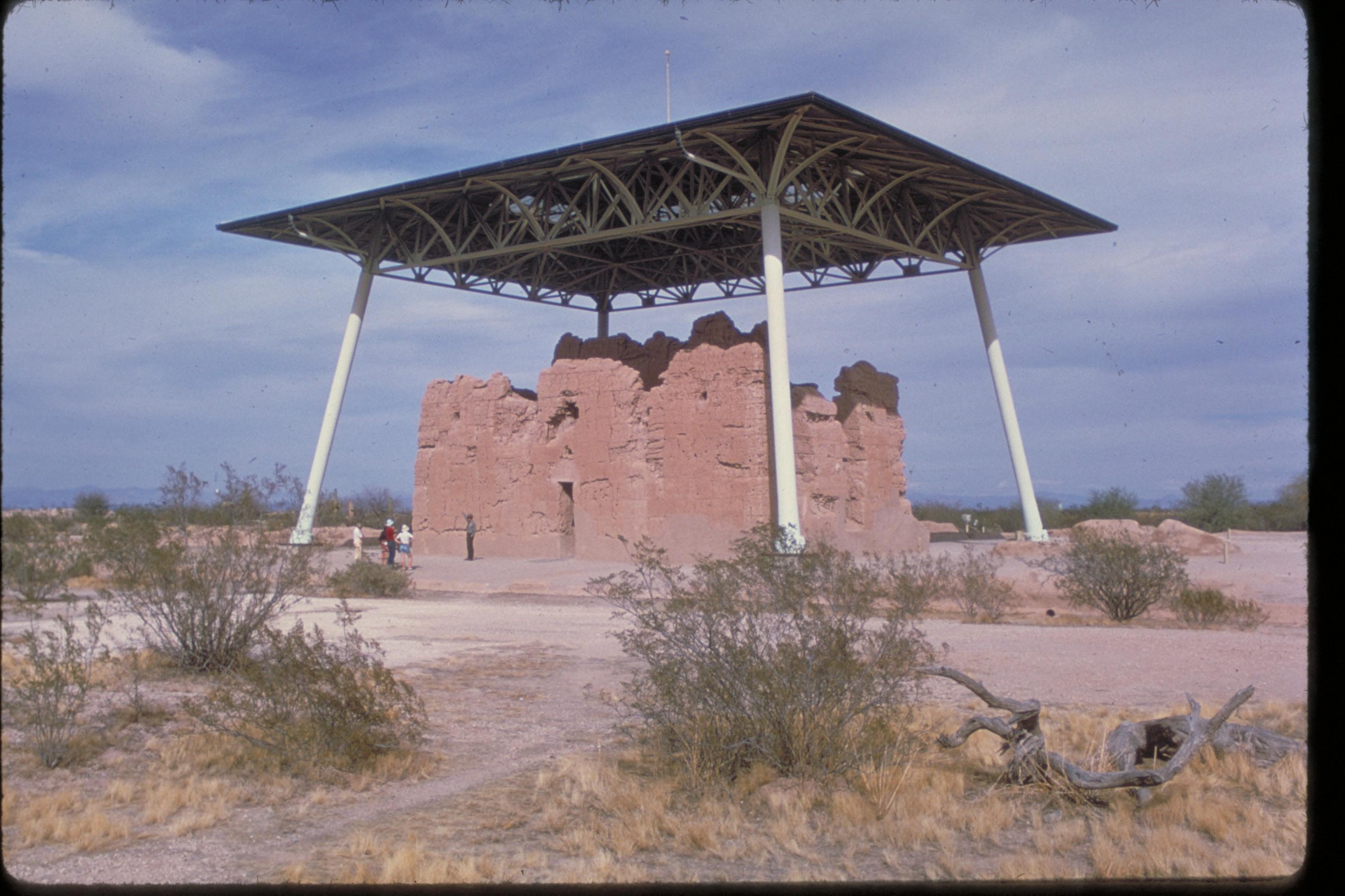
What will happen to civilisation if a farming community depends on an enormous irrigation network for centuries, but the way its settlements and institutions operate begins to change? The ancient canals of Arizona’s Sonoran Desert offer a remarkable answer. Before modern Phoenix existed, Indigenous engineers and farmers developed complex canals, cultivated crops and built long-lived communities along the Salt and Gila rivers.
Did you know? Archaeologists have traditionally used the label Hohokam for these material and settlement patterns. The term is not the name of a tribe that vanished. Descendant communities—including Akimel O’odham and Tohono O’odham people—are living peoples whose histories, identities and relationships to the landscape continue today.
This guide examines ancient Sonoran Desert irrigation, canal maintenance, environmental change, settlement transformation and what future cities can learn from long-term engineering. It is not a claim that all ancestral villages were abandoned together or that a single drought explains a complex history.
The Ancestral Sonoran Desert story in one minute
| Question | Quick answer |
|---|---|
| Where did these communities live? | In southern Arizona, especially along the Salt and Gila rivers and related Sonoran Desert valleys. |
| What is meant by ‘Hohokam’? | An archaeological term for a broad cultural and material pattern, not a modern tribal identity. |
| What was their great achievement? | Extensive irrigation canals, productive farming, long-lasting villages and distinctive social and architectural traditions. |
| When did important changes occur? | Major settlement and material changes occurred in the fourteenth and fifteenth centuries CE, at different rates across localities. |
| Did drought or flood end the system? | Both are studied among multiple possible contributors; no universal single-cause explanation is established. |
| Did Indigenous people disappear? | No. Descendant O’odham and other Indigenous communities maintain connections to this history. |
| What is the future lesson? | An engineering network needs social cooperation, skilled maintenance, water access and institutions capable of change. |
A desert that supported complex farming
The Sonoran Desert can be extremely hot and dry. Rivers flowing from larger watersheds made agriculture possible across some valleys, and Indigenous communities learned to move water through extensive channels to fields and villages.
The US National Park Service overview describes the canal networks along the Salt and Gila rivers as among the most extensive pre-colonial irrigation systems north of Peru. Villages also contained ballcourts, later platform mounds and complex patterns of occupation.
The archaeological evidence makes clear that these were knowledgeable engineers and farmers. Maintaining kilometres of channels requires understanding elevation, slopes, erosion, sediment, labour and the useful timing of water delivery. Farmers also need to decide how land and water will be shared.
A canal does not by itself raise a crop. Fields need suitable soil, planting decisions and continued labour. Tools and construction materials must be repaired. People need access to food and safe dwellings while the next season is being prepared.
That combination of engineering and cooperation is the feature worth studying. It is easier to photograph an old canal than to reconstruct the social relationships that kept water moving year after year.
Did you know? Some settlements lasted for centuries
The National Park Service notes the exceptional duration of some ancestral villages in southern Arizona. Certain communities endured through many generations while architecture, ceremonial practices and regional relationships changed.
The Arizona State Museum’s cultural history explains that archaeological patterns conventionally grouped under ‘Hohokam’ include pottery, shellwork, irrigated crops and changing community design. Maize, beans, squash and cotton were among important cultivated plants, alongside the gathering or cultivation of other useful desert resources.
This is not a story of one uniform city controlling every farm. Settlements along shared canal systems probably needed some coordination, but scholars debate how integrated different communities and districts actually were.
It would therefore be misleading to describe one king ordering all canals to be built, or to claim that every village belonged to an empire in the same political sense as ancient Rome. The archaeological labels reflect research traditions, not a fully known constitution.
A working canal is an ongoing responsibility
Imagine a canal bringing water to farmland over many seasons. Sediment gradually accumulates. A flood damages part of the bank. An upstream change alters downstream flows. People must inspect the route, organise labour, determine priorities and resolve competing claims.
Different kinds of water stress require different responses. During low flows, farmers must decide how scarce water is shared. During high flows, protective banks and channels may be damaged. A network designed for one pattern can be strained by changing conditions.
The City of Phoenix’s S’edav Va’aki Museum and Archaeological Park describes a village occupied from around AD 500 over a period of more than a thousand years, with surviving canals, a platform mound and a ballcourt. It also notes that after AD 1400 people relocated into smaller communities.
S’edav Va’aki is more than an archaeological label. Phoenix acknowledges the continued presence of Akimel O’odham descendants in the region. That living continuity is central to understanding what happened when settlement patterns changed.
Why did ancestral settlement patterns change?
Across the later centuries of the pre-colonial period, archaeological evidence documents changing village size, ritual structures and ways of making and using pottery. In the Phoenix Basin, larger settlements and some of the established canal networks lost their previous functions.
The Arizona State Museum describes social disruption during the later fourteenth century, with drought, flooding and warfare among hypotheses. The nature of interaction across communities and the causes of change remain subjects of research.
At some sites, settlements shrank or dispersed. Other places developed different patterns. A regional label can conceal this variation. If an archaeological tradition ends in the record, that does not mean the people themselves ceased to exist.
The National Park Service explicitly cautions that the cause of the transformation is uncertain and that descendants include Pima and Tohono O’odham peoples. The latter names refer to living Indigenous communities; they should not be treated merely as footnotes to an imagined lost civilisation.
Disentangling environment and institutions is difficult. Canal systems may have required more labour than communities could continue organising. Population changes could reduce maintenance. Alternatively, damage or water shortages could encourage movement. Both processes can reinforce each other.
The term ‘Hohokam’ needs an important explanation
The label Hohokam is used frequently in archaeological publications to describe a regional cultural sequence. It should not be treated as though modern Indigenous peoples chose that as their collective name.
A 2017 American Antiquity article by Chris Loendorf and Barnaby V. Lewis, researchers associated with the Gila River Indian Community, examines the relationships between Akimel O’odham cultural traditions and the archaeological record. It challenges assumptions that archaeological changes prove a total break between ancient residents and living communities.
A 2024 Arizona public-radio report further explains that ‘Hohokam’ is an archaeological label, not a tribal name, and discusses how ancestral canal routes influenced later water infrastructure.
Historical language matters because words can quietly erase people. Saying that a particular material tradition changed is more accurate than announcing that a vanished people left behind canals for modern society to discover.
How could climate, water and institutions interact?
- Water availability: drought or altered river flow may reduce what a canal delivers to fields.
- Physical damage: floods can create sediment, erosion or bank failures needing significant repair.
- Shared labour: maintaining a long network requires enough skilled people and accepted agreements.
- Household incentives: residents may adjust crops, move fields, trade more widely or change settlement locations.
- Social relationships: disputes over water or authority can raise the costs of cooperation.
- Long-term reorganisation: communities may adopt smaller settlements and different arrangements while preserving cultural knowledge.
Every link must be tested through archaeology, environmental evidence and Indigenous knowledge. A broken canal is evidence of physical change; it does not directly reveal the motives or fate of its former users.
Is this the same lesson as Angkor? Not quite
Angkor in Cambodia is famous for monumental reservoirs and a large engineered water landscape. Ancestral Sonoran Desert communities also developed impressive hydraulic infrastructure, but they lived in different geography with different political and cultural institutions.
The valuable comparison is not that both civilizations ‘overbuilt and failed’. It is that infrastructure requires reliable operation and social coordination, and both depend on how a society responds to changing conditions.
There are important contrasts, too. Archaeologists study different scales of governance, different irrigation needs and different settlement chronologies. A theory about a Khmer imperial capital cannot simply be imposed on desert villages in Arizona.
What can modern Phoenix learn from its ancient landscape?
Modern Phoenix uses reservoirs, canals, electrical pumps, treatment facilities, legal water arrangements and extensive metropolitan infrastructure. Some modern canal corridors are historically connected to or influenced by ancient irrigation routes, but present engineering and water demand are very different.
The S’edav Va’aki Museum helps visitors understand the deep Indigenous history of this urban region. That history belongs alongside modern technical discussions of water, not as an exotic curiosity.
For any contemporary city, it is sensible to ask whether water allocation agreements are understood, repair work is funded, infrastructure can withstand different climate conditions and Indigenous communities participate meaningfully where decisions affect their lands and heritage.
Four possible futures for desert settlements
Scenario A: effective maintenance protects continuity
Hypothetical. A desert city invests in replacing ageing equipment, monitoring supply conditions and maintaining trained operators. More efficient use reduces demand on shared water sources. Residents receive reliable information, and services continue despite difficult dry years.
Scenario B: average supply hides unequal access
Hypothetical. A region has sufficient water in aggregate but some districts experience repeated low pressure, poor quality or unaffordable bills. Technical repairs help, but fair allocation and household support are equally necessary. A city can be functional on paper while vulnerable people remain exposed.
Scenario C: floods and droughts strain the same network
Hypothetical. Prolonged low flow reduces stored water. Later intense storms damage embankments and increase sediment. The network needs spare capacity for both kinds of risk. If budgets and responsibilities are unclear, one disruption can become a longer crisis.
Scenario D: communities change where and how they live
Hypothetical. Some high-exposure neighbourhoods shrink while new settlements develop with different water and transport patterns. Knowledge, institutions and cultural communities continue across the transition, but displaced households need genuine options and support.
These scenarios illustrate possible decisions and consequences; they are not a forecast for Arizona or any named modern community.
How to tell if a water civilisation is becoming vulnerable
- Maintenance: inspect backlogs, sediment removal and replacement of ageing components.
- Water quality: measure safe drinking-water access for every neighbourhood.
- Redundancy: identify whether all backup supplies depend on the same vulnerable river or electricity source.
- Institutional cooperation: ask whether upstream and downstream users have reliable, accountable agreements.
- Social inclusion: consider whose livelihood and heritage are affected by new water decisions.
- Education: protect the ability to teach engineering, local ecology and histories across generations.
- Adaptation: provide realistic choices when environmental conditions and community needs change.
A sophisticated civilisation can be threatened by neglecting routine work. Conversely, strong maintenance alone cannot solve every social issue. Infrastructure exists within a wider set of human agreements.
Five questions to ask at a historic canal
Where did its water come from? How was the slope designed? What crops or households depended on it? Who maintained the channel and resolved disagreements? And where do the descendants of the people who built it live today?
Those last questions are as important as the engineering. A canal is a structure in the ground, but its history also belongs to people, institutions, knowledge and living communities.
Frequently asked questions
Who built the ancient canals around Phoenix?
Ancestral Indigenous farming communities of the Sonoran Desert, commonly grouped under the archaeological label ‘Hohokam’, built extensive irrigation systems.
Did the Hohokam people disappear?
No. The archaeological pattern changed, but descendant Indigenous communities, including Akimel O’odham and Tohono O’odham people, have living traditions and ongoing relationships with the region.
Why did the large canal-based settlements change?
The causes remain debated. Researchers examine environmental pressures, flood and drought patterns, settlement changes, possible conflict and the organisation of canal maintenance.
Are ancient canals exactly the same as modern Phoenix canals?
No. Modern systems use substantially different technologies and rules, though some routes and the area’s long water-management history are linked.
What is the greatest civilisational lesson?
A remarkable engineering system needs maintained infrastructure, effective cooperation and respect for the people whose lives depend on it.
Continue exploring civilisation
- When Water Systems Fail: Lessons from Angkor — a different hydraulic landscape.
- When People Leave Chaco Canyon — continuity after regional settlement change.
- When Cities Empty: Cahokia and Urban Change.
- Do Civilisations Collapse or Transform?.
- Civilisation | The Beginner’s Guide.
Sources and further reading
- US National Park Service — Hohokam Culture, canal engineering, settlement and continuity.
- Arizona State Museum — Culture History of Southern Arizona, archaeological periods and evidence.
- City of Phoenix — S’edav Va’aki Museum and Archaeological Park, contemporary descendant community connections.
- Loendorf and Lewis — Ancestral O’odham: Akimel O’odham Cultural Traditions and the Archaeological Record, American Antiquity (2017).
- KJZZ — Ancient farmers dug canals that shaped Phoenix’s modern water system, 2024.
- National Park Service — Casa Grande Ruins heritage photograph, public domain.

Reviewed 24 October 2026. The featured photograph shows Sivan Vah’Ki / Casa Grande Ruins under a modern protective roof, not a view of the ancient canals in operation. US National Park Service, public domain. Historical evidence is distinguished from future scenarios.