
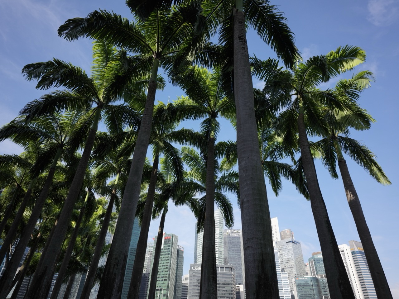
Why Singaporeans love Straits View is not a conventional neighbourhood story. Straits View is a small, strategic planning area at the southern edge of the city. URA describes it as supporting Singapore’s role as a maritime hub while offering potential for further expansion of the Central Business District.
Its importance comes from position. Straits View sits between the Downtown Core and the Greater Southern Waterfront, helping connect two major urban growth areas. It is therefore easier to understand as an interface than as a finished town with one established centre.
URA’s longer-term planning also identifies Marina South, Marina East and Straits View as areas where more homes could support the seamless growth of the city as part of the Greater Southern Waterfront. That is future-oriented planning, not a statement that a completed residential neighbourhood already exists here.
This guide explains possible reasons people may value Straits View: its maritime position, its role in the next chapter of the city and the way it makes long-term planning visible. It does not pretend that every future use is settled or operating today.
Explore the Singapore Area Learning Article Index · Arrange a parent–student consultation with eduKate Singapore
Start with the Correct Map: Straits View Is Its Own Planning Area
This article uses Straits View as the planning-area reference. It should not be merged casually with Downtown Core, Marina South or the entire Greater Southern Waterfront. Use URA’s planning-area boundaries when classifying a particular location.
This is especially important because large planning concepts overlap in everyday language. “Marina Bay”, “CBD”, “southern waterfront” and “Straits View” can all appear in discussions of the same broad geography while referring to different scales.
A student should therefore ask: what is the noun in this sentence—a planning area, a business district, a waterfront corridor or a future development zone?
The First Reason: Straits View Makes the City’s Southern Transition Visible
URA’s Straits View guide describes the area as a transition between the Downtown Core and the Greater Southern Waterfront. That makes the district valuable as a piece of urban connective tissue.
The concept of transition is more useful than a simple list of attractions. A transitional district must help different urban systems meet: existing employment areas, future development, transport, public space and the waterfront.
For students, draw two large circles labelled “Downtown Core” and “Greater Southern Waterfront”, then place Straits View between them. Ask what kinds of connections would need to work for the transition to feel seamless.
The Second Reason: It Keeps Singapore’s Maritime Identity in the City Story
URA explicitly links Straits View with Singapore’s role as a maritime hub. That matters because the city’s economic story is not only about offices, technology and finance. It is also about the sea, port activity, shipping and the geography that made maritime connections important.
A skyline photograph can easily make the maritime system disappear. Students should ask what lies beyond the buildings: shipping routes, anchorages, port facilities and coastal infrastructure that connect Singapore with the wider world.
Do not assume every maritime facility belongs inside Straits View. The planning area’s value is in helping explain the relationship between the city and its maritime edge, not in claiming ownership of every port function.
The Third Reason: Straits View Shows How a CBD Can Expand Rather Than Simply Get Denser
URA describes Straits View as offering potential for further expansion of the Central Business District. That phrase is deliberately future-facing. It does not mean every parcel is already developed or that a single fixed plan has been completed.
The interesting planning question is why a city might need more room. Jobs change, businesses require different floor plates and infrastructure, and a mature core may face physical constraints. Expansion creates another option besides placing every new function inside the existing footprint.
For Mathematics, this can become a capacity problem. If the existing core has a certain amount of usable space and future demand grows, planners can add density, expand geographically or combine both strategies. The correct solution depends on constraints, not on one universal formula.
The Fourth Reason: Future Housing Could Change the Character of the Area
URA’s long-term housing material identifies Marina South, Marina East and Straits View as areas intended to support more homes as part of the Greater Southern Waterfront and the city’s growth.
A district with more residents behaves differently from one dominated by offices or infrastructure. Residents need groceries, everyday services, schools, healthcare access, rest spaces and reliable routes at different times of day.
That means “live-work-play” should not be treated as a slogan. Each verb creates real requirements. A neighbourhood becomes convincing when the ordinary functions are connected, not only when the artist impression looks attractive.
The Fifth Reason: Greater Southern Waterfront Gives Straits View a Larger Story
URA states that the consolidation of port activities at Tuas will eventually free approximately 1,000 hectares of land and 30 kilometres of coastline along Singapore’s southern coast for the Greater Southern Waterfront.
Straits View is relevant because it helps join the existing city with that future transformation. It is not the whole Greater Southern Waterfront. It is one strategic piece in a much larger coastal system.
Students can learn scale by comparing these terms. Planning area. Corridor. Regional transformation. Each is a different unit of geography.
The Sixth Reason: The Southern Coast Is Also a Resilience Question
URA’s 2025 climate-resilience update says the City-East Coast study recommended potential coastal barriers for the Greater Southern Waterfront, alongside other measures for the eastern coast. Detailed plans remain under further study.
This is another place where tense matters. “Recommended potential measures” is not the same as “construction has begun”. Climate planning often proceeds through studies, options, design development and eventual implementation.
For Science, ask which hazard is being addressed and what evidence the study uses. Avoid turning every coastal project into the same solution.
The Seventh Reason: Straits View Is a Lesson in Interfaces
An interface is where two systems meet. Straits View is interesting because it sits at several interfaces: city and sea, existing CBD and future waterfront, work and potential residential life.
Interfaces are often where friction appears. A beautiful district can still fail if people cannot cross a road comfortably, reach transit, understand a route or access ordinary services.
That makes the area useful for students. Ask where the handover occurs. What must the first system provide so the next system can work?
Worked Mathematics: Expansion Changes Area, Not Automatically Capacity
This is an invented urban model, not Straits View development data. Suppose an existing business district has 100 hectares of land and an average usable floor-area ratio in the model that produces 600 units of floor space.
A new 20-hectare extension with the same simplified intensity would add 120 units, taking the model to 720 units. That is a 20% increase in land area and also a 20% increase in floor space only because the example assumes identical intensity.
If the new area uses a different intensity, the percentages diverge. The student must not assume that 20% more land always produces 20% more usable floor space.
Worked Geography: A Transition Zone Is Not an Empty Zone
Imagine two neighbourhoods connected by a corridor. Calling the corridor a “transition” does not mean nothing happens there. It may contain transport, public space, jobs or future development that allows the larger system to work.
Ask the student to draw arrows through the corridor: people, goods, information, water or transport. The exercise changes the map from coloured shapes into relationships.
Worked English: “Potential” Is a Strong Word Because It Limits the Claim
URA says Straits View offers “potential” for further expansion of the CBD. Removing that word changes the claim. “The CBD has expanded into Straits View” describes a completed outcome; “Straits View offers potential for expansion” describes an opportunity.
Ask students to identify modal words such as “could”, “may”, “planned” and “potential”. These are not weak writing when they accurately represent uncertainty.
Straits View’s Learning Theme: The Interface Can Determine Whether Two Good Systems Work Together
A strong city core and a strong new waterfront can still feel disconnected if the space between them is difficult to use. The interface matters.
The same applies to learning. A student may understand a formula and understand a word problem separately, yet fail at the interface—translating the words into the mathematical relationship.
Good teaching finds that handover point and makes it explicit.
How eduKate Connects This with Learning
eduKateSG tutorials are limited to three students and run for 1.5 hours weekly, with materials and guided corrections. The small-group format helps a tutor identify whether knowledge exists but fails to transfer into the next stage of the problem.
The centre is at 8 Fourth Avenue, near Sixth Avenue MRT, by appointment. This Straits View guide does not imply an eduKate branch in Straits View.
Continue through History of Singapore | Straits View, Fun Facts About Singapore | Straits View, Why Singaporeans Love Downtown Core and Why Singaporeans Love Marina South.
Continue Through the eduKate Ecosystem
History of Singapore | Straits View · Fun Facts About Singapore | Straits View · 55-Area Learning & Tuition Hub
Frequently Asked Questions About Straits View
Is Straits View part of Downtown Core?
No. It is a separate planning area. URA describes it as a transitional district between the Downtown Core and Greater Southern Waterfront.
Is Straits View already a complete residential neighbourhood?
No. URA’s long-term material identifies potential for more homes in Straits View alongside Marina South and Marina East. Future housing should not be described as a completed current neighbourhood.
Why does URA call it important for the maritime hub?
Its location at the southern edge of the city allows the planning area to support the relationship between Singapore’s central business functions and its maritime geography.
Is Straits View the same as the Greater Southern Waterfront?
No. The Greater Southern Waterfront is a much larger transformation along the southern coast. Straits View is one planning area positioned at its connection with the existing city.
Sources and Current Checks
Planning role: URA Straits View. Greater Southern Waterfront: URA Central Region. Future housing context: URA More Homes. Coastal resilience context: URA urban resilience update.
References were checked for this October 2026 edition. Long-term plans and coastal strategies can evolve. The worked area-and-capacity calculation is a fictional teaching model.
Why Straits View Matters
Straits View matters because cities do not grow only by adding isolated destinations. They also need places that connect old centres with new ones, land with water, and present functions with future possibilities.
For a student, the area offers a strong systems lesson: whenever two capable parts fail to work together, inspect the interface.
Arrange a Parent–Student Consultation
Contact eduKate Singapore · Chat on WhatsApp
eduKateSG
8 Fourth Avenue, Singapore 268674
Near Sixth Avenue MRT
Maximum three students per group · 1.5-hour weekly tutorials
By appointment