
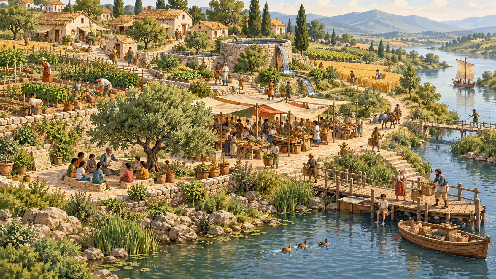
Did you know that choosing the first place to live can determine how much work a community must do every single day? A river may offer water and transport but also flood the nearest houses. A sheltered coast may welcome trade while exposing stores to storms. A fertile valley may grow excellent crops yet leave residents trapped when a bridge fails. The geography beneath a civilisation is not merely scenery: it shapes the options, costs and risks of nearly everything people build.
This is the second instalment in eduKate’s Components of a Civilisation learning series. The first guide, How to Build a Civilisation from Connected Systems, introduced a functional map of the major components. Here we zoom into the first physical component: land, rivers, climate and the selection of a settlement site. Our question is not ‘Which terrain produces the grandest empire?’ but ‘How can people choose a place responsibly, understand what it can and cannot provide, and keep it liveable across generations?’
Parents can treat this article as a bank of clear explanations, questions and drawing activities. Tutors can use its worked comparisons, map reading tasks, mathematical exercises, case studies and answer guides across many lessons. The intended progression is from identifying landforms, to tracing how water and people move, to making a defendable land-use decision, to understanding why advanced societies need capable institutions for maintaining places as conditions change.
Our running settlement is Tidal Reach, a fictional community of 240 residents in 60 illustrative four-person households. It sits in an imaginary basin with a winding river, flood-prone flatland, a wooded upper slope and a coast several kilometres away. Its maps, quantities and options are invented solely for reasoning. They are not historical reconstructions, engineering standards, climate forecasts, real property advice or emergency instructions. Whenever we discuss a real archaeological site or Singapore planning, the factual material is attributed separately to official sources.
Illustration disclosure: the featured image is an AI-generated conceptual picture from eduKate’s existing Riverbend educational collection, reused to help learners imagine connected settlement features. It does not portray Tidal Reach as a real site and should not be mistaken for a photograph or archaeological reconstruction. Its library alternative text describes the pictured riverside homes, fields, market and people; the caption identifies its fictional educational role.
Quick answer: how do geography and land shape civilisation?
Geography influences water access, agriculture, transport, material supply, shelter, health, hazards and relationships with neighbouring communities. It does not dictate a single destiny. People change landscapes through farming, paths, buildings, waterworks and conservation; they also learn from existing ecological knowledge and adapt by moving or changing their livelihoods. A suitable site is not simply the flattest or greenest place. It is a place whose opportunities, exposures, social responsibilities and future upkeep can be understood and managed.
- Start with people: who will live here and what daily tasks must be possible?
- Read the whole landscape: terrain, rivers, soils, ecology, seasons, routes and neighbouring communities.
- Choose between actual trade-offs: easy access may bring exposure; defensible high ground may bring distance and effort.
- Protect access and dignity: a convenient central site is not successful if children or disabled residents cannot reach essential services.
- Plan for change: rivers move, rainfall varies, population shifts and structures require repair.
- Test every assumption: a tidy toy map is useful for thinking, not proof of real-world safety.
Reading routes and article map
How the landscape model works · 1–8: reading terrain and resources · 9–16: people, land and responsibility · 17–24: planning a real working settlement model · Historical landscape comparisons · Worked scenario laboratory · Teaching sequence · Questions and answers · Evidence and further reading.
The geography-first method: observe, map, decide and revisit
A reader looking at a bird’s-eye drawing will naturally focus on the objects: boats, roofs, a bridge, a water channel. A geographer asks another set of questions. What is uphill? Where does rain move? Which surfaces absorb water and which redirect it? Who can cross the river when it rises? Why does a path exist where it does? How do people know which places change during different seasons? The map becomes useful when it represents relationships rather than decorative geography.
We will make every claim belong to one of five categories: observed feature, historical evidence, model assumption, proposed explanation, or value decision. In a classroom, students must never turn a fictional elevation, weather event or population figure into a factual claim about a real civilisation. Conversely, an official description of an archaeological site may support a limited factual comparison, but it does not automatically reveal what every individual thought or felt.
Map literacy can begin with four simple symbols. A blue line represents a watercourse; close brown curves or shading suggest higher and lower ground; green shading represents an invented vegetation type; dotted paths represent possible movement. Ask the learner to describe the legend before deciding where homes belong. A map without a scale, orientation, date or explanation can look authoritative while concealing a crucial absence of information.
Our fictional basin contains three candidate places. High Shelf lies on raised ground beside a woodland but is relatively far from the main river. River Bend has flat land and convenient access to a crossing but receives overflow during some imagined high-water periods. Coastal Gate is close to a sheltered inlet and imagined trade route but farther from reliable local food land and may be exposed to coastal hazards. None is objectively best on one criterion. Choosing among them is the centre of the study.
| Site | Clear opportunity | Important question | Initial interpretation |
|---|---|---|---|
| High Shelf | Higher ground, possible room for homes | How will water and food be transported? | Better separation from some lowland hazards, but longer daily journeys |
| River Bend | Short trips to fields and a river crossing | What happens when water rises? | Strong everyday access with serious exposure questions |
| Coastal Gate | Potential boat connections and exchange | What if weather stops arrivals? | Network opportunities alongside coastal and supply dependencies |
The categories above are qualitative descriptions, not site safety rankings or claims about geology. We deliberately leave many questions unanswered. An actual planner would need measured terrain, flood histories, hydrological information, environmental assessment, rights and ownership information, transport needs and qualified professional evaluation. A good classroom answer often begins with ‘We cannot decide yet because…’ and then asks for the missing evidence.
The Tidal Reach decision board
Give every team the same invented starting figures: 240 residents, 60 illustrative households, three candidate places and an annual planning review. Assume they can protect or develop only a limited amount of common land in the first phase. The decision board tracks four needs: safe and accessible housing; water and sanitation pathways; productive and ecologically suitable land; and movement among households, learning, care and exchange. A fifth question asks what can be repaired if conditions change.
A classroom model can contain numbers but should not pretend that assigning high marks makes a real site safe. Suppose each place receives a score from 1 to 5 for relative everyday access and relative estimated exposure, invented by the class. These are preference and assumption scores; they are not validated hazard probabilities. Ask which criteria deserve more weight and whose experiences set those weights. A model ranking that improves when disability access is ignored has taught a useful warning: numerical neatness can hide ethical failure.
Separate short-term need from long-term commitment. An early group might use temporary or movable facilities while monitoring a landscape, whereas a costly permanent building requires stronger evidence. This is not a claim that real early peoples followed that sequence everywhere; many forms of mobile or seasonally adjusted life are sophisticated adaptations in their own right. The exercise asks what level of commitment the current evidence justifies.
In the next chapters, learners should keep a single landscape notebook. On one page record the question; on a second, an annotated map; on a third, an explanation of alternatives; and on a fourth, what remains uncertain. Parents may photograph changing arrangements of paper pieces. Tutors may ask pupils to revise a diagram after receiving new information. The important progress is not making the first plan elaborate. It is becoming able to explain a better second plan.
Inside the Warehouse: a child-led civilisation mapping studio
To make a long series memorable, eduKate uses a fictional learning studio called the Warehouse. It is a safe imaginative classroom, not a real settlement, a historical site or a claim that software can govern people. Children become the decision-makers. Three named learning roles help them inspect a changing map: Rainbolt, the geography scout; WintourV1.0, the evidence and fairness editor; and CivDJ Master, the shared systems board where choices are brought together. The characters supply questions and prompts, not verified answers or authority over the learners.
Rainbolt’s assignment: survey the model landscape before anyone builds. Point out ridges, waterways, route crossings, seasonal gaps and missing map information. Every suggested site receives a question such as ‘What happens during another season?’ or ‘Where is the evidence for that safe route?’ The scout must sometimes report ‘unknown’. A useful map-reading agent does not invent survey results to make a drawing look complete.
WintourV1.0’s assignment: stop the planning meeting at important points and ask whose life the decision affects. Check factual claims against sources, mark the difference between a reported observation and a conjecture, notice unsupported numbers and invite perspectives absent from the central map. The role also keeps a revision record: what changed, why, who benefits and what still needs checking. This is the governance habit children carry into later chapters.
CivDJ Master’s assignment: combine the other components on one imaginary mixing board. A child can turn down access to the river crossing, increase food-store distance or introduce a seasonal interruption and observe which arrows on the systems map are affected. The board does not decide what is fair or safe. It shows connections so that human learners can compare alternatives, correct errors and defend choices. A simple whiteboard with string and labelled cards can serve this purpose without any digital platform.
The Warehouse progression: Level 1, survey the land; Level 2, connect essential services; Level 3, test an ordinary disruption; Level 4, review evidence and repair; Level 5, teach a future group how to maintain and revise the plan. Each new article can revisit the same fictional town with deeper tools. Rotate the scout, editor and system-board responsibilities among children so that no pupil always gives instructions while others merely follow. The outcome is growing judgement, not the fastest or most elaborate city.
Part I: Eight landscape components to investigate before building
Landscape component 01: Landforms and relief: the shape of possibility
What it does. A slope is not merely difficult ground; it changes movement, runoff, building choices and the distribution of daily effort. A community must understand what is high, what is low, where water collects and which connections are interrupted during different conditions. A map that labels a hill without explaining its relationship to roads and rainfall is only half useful. Even apparently gentle terrain can contain hidden constraints that require site-specific investigation.
Draw it into the settlement
For the imaginary basin, draw a high shelf, a middle terrace, a flat floodplain and a coastal strip. Mark which are connected by steep routes and which by shallow routes. Imagine an older resident travelling to the central meeting place, a worker carrying a grain basket and a child visiting the learning area. The shortest geometric route may not be the easiest usable path for every traveller.
Look for a hidden trade-off
The council moves all storage to the highest point after a fictional flood. The stores are now farther from water, boats and everyday food exchange. The plan reduces one exposure but increases workload and may make assistance harder to reach. Ask the learner to defend two linked decisions: where to place the building and how people will reach it repeatedly.
Teach, test and revise
Draw a simple cross-section rather than an overhead map. Label the top, slope, valley floor and coast. Then mark where rain may move in a simplified model. A younger child explains in words. A secondary student distinguishes slope steepness from height and lists data necessary before claiming a real area is stable.
Longer-range insight: A mature answer recognises that terrain creates constraints without prescribing a single inevitable settlement form. People can adapt structures, seasonal movement and social arrangements, while each adaptation changes cost and risk.
Landscape component 02: Watersheds and catchments: the land beyond the town
What it does. A watershed is an area where water drains towards a shared outlet or network. Its significance is that a village can be affected by conditions far outside its walls. Rain falling on an upper slope may eventually move through gullies, streams and rivers used by people downstream. Vegetation, soil, land cover and engineered surfaces can affect runoff and water quality, although real behaviour requires measured study.
Draw it into the settlement
Place a ridge at the north of the Tidal Reach map, tributaries on both sides and the principal river in the lower basin. Shade the imaginary upstream catchment. Ask where farming, paths or clearance beyond the settlement could influence water movement. This introduces an essential civilisational idea: governing only the central built area may be inadequate when the life-supporting process extends across political or administrative boundaries.
Look for a hidden trade-off
A new waste-handling practice begins upstream, and people downstream notice a change in water appearance. The drawing suggests one possible connection, but appearance alone proves neither cause nor safety. Learners should propose observation and reporting, while understanding that actual water-quality decisions belong to qualified authorities. Never turn a paper catchment exercise into instructions to drink untreated water.
Teach, test and revise
With pencils, mark arrows from small tributaries to a main river. Cut one arrow and discuss whether the whole watershed disappears; it does not. Tutors can ask older pupils to identify the difference between a watershed boundary and a municipal boundary. The mismatch explains why cooperation can be needed among communities.
Longer-range insight: The advanced question is how a civilisation creates institutions that match the scale of its ecological dependencies. A river does not stop following physical processes at a border; accountable coordination must consider those downstream.
Landscape component 03: Rivers as both connectors and hazards
What it does. Rivers can carry water, sediment, nutrients, people and goods. They can also change course, overflow and complicate crossing. A river’s value should not be confused with unconditional safety. The same location that makes trade convenient during ordinary conditions may be inconvenient or dangerous at other times. Natural rivers are dynamic systems, not immovable straight lines on a neat educational map.
Draw it into the settlement
Place the main fictional crossing at River Bend. Mark farmland on one bank, family housing on the other and the main store near the high shelf. Ask how many daily crossings are required for food, care and school access. Imagine the crossing becomes unavailable for three days. Which services are still reachable? Which need an alternative? This teaches route dependence without requiring any construction techniques.
Look for a hidden trade-off
A proposed straight channel appears to shorten boat travel on the toy map. But changing a river’s path could have serious ecological and hydrological consequences. A child should not assume the attractive straight line is a practical plan. First identify questions about downstream effects, surrounding land and who bears risks. In the real world such work requires qualified investigation and lawful approval.
Teach, test and revise
Give children blue string to represent two versions of a river. Draw settlements near both and ask how crossings change. Older students can distinguish river width from flow conditions, sediment movement and bank stability at a conceptual level. Remind them that no classroom diagram provides a real flood forecast.
Longer-range insight: A strong civilisation does not merely gain access to a river. It builds the ability to understand the river’s variability, protect people exposed to it and revise its systems when knowledge changes.
Landscape component 04: Soils, fertility and the limits of a simple field map
What it does. Soil is a living and physical resource with properties that affect vegetation and farming. Texture, structure, water movement, nutrients, erosion and land management all matter. A field labelled ‘fertile’ on a map is not guaranteed to produce enough food every season. Real agricultural decisions depend on local study and knowledge. Soil can also take long periods to develop and can be damaged by unsustainable practice.
Draw it into the settlement
Give Tidal Reach two imaginary fields. Field A is close to the river with easy access but subject to occasional waterlogging. Field B is farther away on a gentle terrace but needs more transport effort. Ask what factors might affect the choice of crops, labour allocation and storage. Avoid pretending that colour alone establishes soil suitability or a crop recommendation.
Look for a hidden trade-off
A council counts increasing harvest tokens for three model seasons and concludes that soil will remain productive forever. Introduce an erosion warning and a shorter growing period in a fourth invented season. Pupils should identify what needs checking. The point is that recent output is not proof of unlimited future capacity, not that any particular farming technique will always fail.
Teach, test and revise
Parents can compare how water behaves in two sealed trays containing different safe everyday materials, strictly as a small illustrative model, not a soil-health or water-quality experiment. Tutors may ask children to distinguish texture, moisture and fertility instead of using them as synonyms. For older students, study the concept of renewable and slowly renewed resources.
Longer-range insight: In an advanced setting, soil health connects ecology, water management, food security, land rights and the skills passed between generations. Treat protecting that capacity as an ongoing service, not a decorative green symbol.
Landscape component 05: Climate, weather and the calendar of everyday life
What it does. Weather is what a place experiences over short periods; climate describes longer-term patterns and variability. Both affect human activity, but a single rainy afternoon does not establish a climate trend. Communities learn when to plant, travel, prepare stores, build shade or manage seasonal water. A useful geography model distinguishes typical conditions, exceptional events and the uncertainty of predictions.
Draw it into the settlement
Invent two seasons for Tidal Reach: a wetter period with more difficult river crossings and a drier period with longer walks to some collection points. Do not present these as a real regional climate. Plot a planning calendar showing tasks such as checking routes, preparing food stores and confirming how residents receive warnings. Students should see that the same place behaves differently across the year.
Look for a hidden trade-off
A government schedules every important delivery on one fixed day because last year’s conditions were favourable. When a seasonal disruption occurs, an avoidable backlog develops. The underlying failure is not that weather is always predictable. It is an absence of flexible planning, reserves, communication and review. Ask what early information would justify changing the timetable.
Teach, test and revise
At home, compare a week’s real weather observations only as a short record and discuss why they cannot by themselves describe long-term climate. Tutors can provide invented monthly rainfall bars and ask which month is highest, what the chart omits and why averages do not guarantee conditions on a particular day.
Longer-range insight: At an advanced stage, planning has to account for changing risk, uncertainty and long service life. A road or school built for decades demands more careful evidence than a one-week classroom activity.
Landscape component 06: Coasts, estuaries and trading access
What it does. A coast may connect distant communities by boat, provide livelihoods and support rich habitats. But not every coast functions as a safe port, and a sheltered-looking inlet on a drawing says little about navigation or hazards. Coastal planning interacts with land elevation, tides, river discharge, erosion, ecosystems, livelihoods and outside networks. A civilisation may prosper through maritime connections while becoming dependent on distant routes.
Draw it into the settlement
In the fictional setting, Coastal Gate can receive small boats during favourable conditions. Place an inland farm and a high-ground store on the map, then trace the route connecting them to the landing place. Ask whether a trading site must also become the residential centre. A town may separate facilities while keeping accessible connections.
Look for a hidden trade-off
When the coastal route is unavailable for several imaginary days, a market relying on incoming goods may face shortages. The response cannot be simply ‘buy faster boats’. It must investigate what is critical, how goods are stored, whether alternate sources exist and how families are informed. Avoid building a false equivalence between all maritime communities; their contexts and knowledge differ.
Teach, test and revise
Children can build a model with paper coastlines and move an exchange token between regions. Tutors should ask which resource needs to travel and which might be provided locally, and invite an alternative that involves cooperation rather than isolation. Older pupils can compare the risks of a single trade route with a network of routes.
Longer-range insight: The strongest historical lesson is not that every advanced society needs an ocean port. It is that location shapes interactions, and that prosperous networks produce both opportunities and obligations.
Landscape component 07: Habitats, biodiversity and land stewardship
What it does. Land is not empty just because no human buildings are drawn on it. Forest, wetland, grassland and river habitats contain living relationships that contribute to ecosystem function and provide meaning, material and livelihood to people. Converting habitat for one use can reduce its ability to support others. A responsible settlement plan asks what ecological processes exist and what rights and responsibilities people have towards them.
Draw it into the settlement
Put a forest patch between High Shelf and the river. A direct road would shorten daily travel through the patch, while a longer route would leave more of it undisturbed in our imagined map. Learners should ask what species, drainage patterns and community uses might be affected. Our paper exercise cannot answer those questions, so a responsible decision may be to gather evidence rather than immediately choose.
Look for a hidden trade-off
A leader calls an area ‘unused land’ because it has no permanent houses. Families may use it seasonally, animals may depend on it, or it may connect different habitats. The phrase can erase both ecological roles and people’s relationships to place. A strong design review requires actual observation, local knowledge, lawful processes and consideration of alternatives.
Teach, test and revise
At home, choose a familiar park or garden and list things that would be missed by drawing only buildings. Younger children can record plants and pathways. Tutors can ask how certainty changes when observations cover only one time of day. Older pupils may analyse how land conversion redistributes benefits and harms.
Longer-range insight: Long-term stewardship becomes more complex as population and technology grow, but the basic responsibility remains: do not count all undeveloped space as an unlimited resource waiting to be used.
Landscape component 08: Hazard exposure, vulnerability and recovery
What it does. A hazard is not identical to a disaster. Harm depends on exposure, the vulnerability of people and systems, preparations, timing and the ability to respond. Floods, fires, slope instability, extreme heat and coastal events present different kinds of questions. A student should resist ranking sites from a pretty image or an invented one-number risk score. Responsible real-world planning requires measured evidence and qualified specialists.
Draw it into the settlement
Create three coloured overlays for the Tidal Reach map: possible disruption to the river route, possible isolation of the coastal landing and possible loss of the steep upland path. These are explicitly fictional events. Ask which components each overlay affects. Students should notice that a facility can remain intact while becoming unreachable because a dependent connection is interrupted.
Look for a hidden trade-off
A town builds all essential stores in one convenient warehouse. A single fictional event isolates it. The failure arises partly from concentration. An alternative may distribute reserves across suitably evaluated places, but duplication has costs and can introduce new access burdens. Learners must compare trade-offs rather than assume that more buildings always mean more safety.
Teach, test and revise
Parents can ask who might need extra help to evacuate or access care in a generic fictional scenario. Tutors can practise writing clear, calm messages that report an uncertainty without offering real emergency directives. Older students should distinguish likelihood, severity, exposure and confidence in the evidence.
Longer-range insight: The advanced lesson is that resilience includes institutions, trust, inclusive communication, maintained systems and the freedom to change course. No one wall, bridge or algorithm guarantees safety.
Checkpoint I: which map is more truthful?
Draw the same fictional basin twice. On Map A, show only attractive assets: river, fields, harbour and woodland. On Map B, include access difficulties, exposed places, seasonal changes, relationships with downstream neighbours, and areas where you simply do not know enough. Ask which map makes the site look better and which would help residents make a more responsible decision. A truthful map is not necessarily a pessimistic map; it includes opportunities alongside limits.
A child who identifies the high ground and river has started well. A stronger learner explains how water, food, access, shelter and care depend on the same geography. An older student questions the base map itself: its scale, missing season, author, data source and uncertainty. The most important accomplishment is to make a map that someone else can interpret and challenge, rather than one the designer merely finds beautiful.
Part II: People, places and the responsibility to belong
A map’s most revealing omission is often the people who already have relationships with a place. A field drawn as open land may be a seasonal gathering area; a riverside path may be the only accessible link between families; a forest may carry memory, knowledge and livelihood that do not show up on a developer’s blank sheet. When students learn to plan a civilisation, they should not begin by pretending every site has no prior occupants. A classroom can safely investigate conflicting needs without endorsing seizure of land or a story in which one group’s progress justifies another group’s erasure.
Here we examine eight human components of location choice. They are not merely ethics appended to geography. They affect information quality, cooperation, long-term maintenance and the ability to adjust when the landscape changes. A technically sophisticated plan can fail because it has ignored lived knowledge or denied people a fair way to challenge it. Children benefit from encountering these questions early, when the stakes are simple enough to discuss and the habit of listening can still be practised openly.
People and place 01: Mobility, seasonal use and the myth of one inevitable settlement path
Why this matters: People have lived successfully in many forms, including mobile, seasonally shifting, village-based, maritime and urban communities. Settlement permanence is not a universal measure of intelligence, civilisation or social worth. Groups may move in response to seasonal resources, family obligations, hazards, pastoral practice or chosen ways of life. Archaeological evidence illuminates some practices but cannot be arranged into one moral staircase from ‘primitive’ to ‘advanced’.
The Tidal Reach decision
Imagine that a neighbouring community uses the lower Tidal Reach valley only during part of the year. It may maintain cultural and practical ties to the land even when its homes are not present on the classroom map. A planning team that declares the valley empty misunderstands the situation. Ask what information should be gathered about seasonal movement, land use and agreements before proposing new permanent structures.
Make the issue visible to children
Make two calendars: one for a fixed community and another for a group using different locations across the year. Ask how food access, learning, family life and knowledge transmission operate in both. Do not presume that a mobile community has no institutions. Consider how movement itself can function as an adaptation to ecological opportunities and constraints.
Where a seemingly good plan goes wrong
A learner may say ‘We will make everyone stay at the central town so the system is easier to organise.’ Ask whose choice that serves and what valued practices would be lost. A better model considers whether a shared market, agreed seasonal use or multiple sites may preserve access without forcing one lifestyle on every group.
For advanced learners: For older pupils, compare evidence from a permanent archaeological settlement with evidence of a wider seasonal landscape. What material traces might not survive? Which kinds of written or oral accounts might help? A strong answer respects uncertainties instead of treating missing buildings as proof of an absent society.
People and place 02: Land rights, consent and prior relationships
Why this matters: Land-use plans distribute benefits and burdens. They also affect homes, identities, livelihoods and memory. An area that seems ideal for a new store or school may already be used or valued by others. A civilisational component is therefore not only the physical location but also the social agreement about who may use it, under what conditions, and how grievances are heard. Historical empires often built impressive projects through unequal power; studying that fact does not require endorsing it.
The Tidal Reach decision
Add three fictitious users to a parcel on High Shelf: a household garden, a community meeting place and a walking route used by a neighbouring group. A new warehouse proposal overlaps all three. Students must identify the interests and propose a process before deciding. It might involve changing the building location, retaining shared access, providing consent and a fair agreement, or deciding that the site should not be developed.
Make the issue visible to children
In pairs, give one pupil the planning map and another a set of ‘lived-use’ cards. The first designs quickly, then learns of the uses that were not shown. Reward the student who revises the proposal rather than the one who defends a blank-map assumption. Ask what happens if a powerful speaker claims to represent everyone without actually consulting them.
Where a seemingly good plan goes wrong
A failure occurs when planners invite comments after the main choice is effectively irreversible. Participation becomes theatre. Another occurs when people are asked for consent without clear information about consequences. Good processes make proposals understandable, create opportunities to refuse or revise, and maintain accessible methods to address harm.
For advanced learners: For older students, research the difference between recording land on a map and establishing a fair right to control it. Legal systems and local customs vary, so avoid claiming one universal historical ownership rule. Examine evidence, power, voice, duties and the possibility that multiple groups hold legitimate relationships with the same place.
People and place 03: Daily journeys and the hidden cost of distance
Why this matters: A location is experienced as a collection of journeys. The route from a child’s home to learning, from a carer’s house to assistance, or from a farm to the food store is repeated many times. A site that looks economical from the air may impose hours of daily effort on particular residents. Distance is not just kilometres: slope, obstacles, weather, load, mobility and time all affect whether a route is usable.
The Tidal Reach decision
For the imaginary model, assign High Shelf a path of 1.2 abstract distance units to the water point and River Bend a path of 0.4 units. Do not translate these into an actual walking-time claim. Have pupils calculate three round trips: High Shelf requires 3 × 2 × 1.2 = 7.2 distance units; River Bend requires 2.4. Then introduce a flooded crossing that removes the shorter route for some days and ask whether the apparent advantage holds year-round.
Make the issue visible to children
A child with a heavy school bag, a parent with an infant and a resident using a mobility aid may experience the same path differently. Have students annotate one route with shade, crossing points, gradient and places to rest in the imagined design. The task is not to assign disability to a single fictional character and consider inclusion solved; it is to recognise variety as a normal planning condition.
Where a seemingly good plan goes wrong
The failure mode is relying on averages. If most people live close to the market, the mean journey can look short while a few residents face an impassable route to essential care. A responsible assessment looks at who cannot make the trip, not just the mean. Repairs may include more access points, safer paths, outreach services or revisiting a building location.
For advanced learners: Older learners can design a route matrix with households down the rows and services across the columns. Use ordinal accessibility ratings with explicitly invented assumptions. Compare total travel effort with minimum access guarantees and explain why optimising one statistic may worsen another.
People and place 04: Common places, shared facilities and the meaning of a centre
Why this matters: Civilisations need places where people meet, learn, exchange, deliberate, celebrate, receive care and sometimes disagree. These may be central squares, shaded courtyards, market streets, schoolrooms or temporary gathering sites. Public space can strengthen trust but does not do so automatically. Who may enter, speak, trade, rest, perform music or use a space matters as much as its geometry.
The Tidal Reach decision
Give Tidal Reach a small commons near the centre of the middle terrace. Ask which uses can share time and space, which need quiet or privacy, and which activities require safe separation. A school and a market may benefit from proximity, yet noise and delivery traffic can create conflicts. A meeting place on high ground may be easier to use during floods but less convenient for households near the river.
Make the issue visible to children
Children can arrange paper icons for a clinic, learning room, market area, rest space and council meeting. Ask them to explain each neighbourly relationship with ‘because’. Then introduce a household that arrives through a different entrance and a person who cannot use stairs. This forces the design to consider lived access rather than simple symmetry.
Where a seemingly good plan goes wrong
A square may be visually impressive but function as a symbol of exclusion if gatherings require fees, one group controls entry or notices appear only in one language. Repair is not merely widening the square. It may require governance, inclusive communication, safer routes and fair scheduling. Good public places are operated, not simply constructed.
For advanced learners: At advanced level, compare a single grand centre with a network of smaller community spaces. The former may focus resources and create a clear landmark; the latter may improve local access and redundancy. Strong students analyse the trade-offs instead of assuming monumentality equals civic quality.
People and place 05: Local knowledge, observation and respectful investigation
Why this matters: Residents often hold detailed knowledge of seasons, vegetation, routes, fishing grounds, flood memories and daily hazards. Some of it is recorded; some is learned through practice or story. Scientific investigation can test hypotheses and improve evidence, but it should not automatically dismiss knowledge because it is oral or unfamiliar to an outside planner. Conversely, traditional or recent claims should not be treated as infallible without investigation.
The Tidal Reach decision
Assign a Tidal Reach resident the role of an experienced farmer who remembers a seasonal stream where the new road is proposed. Another character has recent but brief measurements that do not show the stream flowing. Ask learners how both pieces of information can contribute to a better investigation. A dry observation does not prove water never arrives; a recollection identifies a question requiring appropriate study.
Make the issue visible to children
Use three evidence cards: a memory of water on a path, a current photograph during a dry week and a fictional map showing a shallow channel. The student must write which claims each card supports, why they might disagree and what further evidence could help. Encourage the phrase ‘I would want to check…’ as a sign of rigorous thought.
Where a seemingly good plan goes wrong
A failed institution accepts only one format of evidence and therefore misses predictable difficulties. Another failure occurs when leaders use a respected elder’s testimony as a substitute for testing a safety-critical claim. The constructive response combines listening, measured investigation, clear uncertainty and appropriate expertise.
For advanced learners: Secondary students can compare reliability, scale and context across oral testimony, satellite imagery, field notes and published archaeological reports. A good response identifies potential bias without reducing anyone to a stereotype or treating modern digital imagery as a magical final answer.
People and place 06: Livelihoods and the geography of useful work
Why this matters: Where people live affects the effort involved in farming, gathering, fishing, making, transporting, teaching and caring. An efficient work location for one activity may disrupt another. A market near a river may help boat deliveries; a kiln near a settlement may raise different questions about smoke, fuel and materials. A school in a prestigious location may remain inaccessible to children living far away.
The Tidal Reach decision
Draw five livelihood cards for Tidal Reach: river transport, terrace farming, woodworking, teaching and care. Ask learners to place each on the map and describe at least two connections. An activity can be near a resource while still needing access to people, infrastructure and repair. Encourage young learners to include household care and unpaid work in their map of necessary labour.
Make the issue visible to children
Give two teams the same workshop location. One optimises travel from raw materials; the other optimises access for users. They propose different places. The correct teaching outcome is not an arbitrary winner but a clear comparison of journeys, risks, shared services and future repair. Consider how an improved road might change one comparison without changing the whole landscape.
Where a seemingly good plan goes wrong
A leader may build a celebrated specialised district that separates workers from housing and care with long daily journeys. Output numbers can rise while quality of life and social trust decline. This reveals why productivity is important but incomplete. A solution might involve distributed services, better transport or revisiting where an activity is located.
For advanced learners: Older students can calculate fictional trips per week for each role and consider the burden on workers. The strongest answers identify hidden labour and ask what must happen when a specialist is sick or weather closes the main route.
People and place 07: Neighbours, shared resources and boundaries
Why this matters: A river catchment, mountain pass or coastline may connect people whose political boundaries differ. A settlement can benefit from nearby farms, access to stone, traded goods, language exchange and coordinated warnings. It can also create conflict over access, pollution or scarcity. Geography does not dictate hostility or cooperation; institutions and choices influence how relationships develop.
The Tidal Reach decision
Place an upstream village called Pine Ford and a coastal community called Harbourfield on the imaginary map. Tidal Reach needs access to transport expertise from Harbourfield while Pine Ford shares use of part of the river’s upper basin. Learners should draft a short agreement on reporting changes, respectful exchange and responding when one route becomes unusable. Do not present this paper exercise as a legal treaty.
Make the issue visible to children
Ask one team to think only about Tidal Reach’s convenience, while the other represents households downstream. Compare their proposed land-use plans. If a road or waste site solves a local problem by creating a downstream problem, it may be a transfer of burden rather than a net improvement. Ask students to revise the plan so affected neighbours have a real role.
Where a seemingly good plan goes wrong
A fault appears when communities treat the river or coastline as a border that makes ecological consequences someone else’s problem. Effective cooperation begins by recognising shared dependence, acknowledging uncertainty and agreeing how new evidence should change behaviour. Trade partners also need ways to resolve errors without immediate blame.
For advanced learners: Advanced learners should analyse the difference between voluntary exchange, unequal power and coercive extraction. A wider network can make life more capable while also creating dependency; its ethics belong in geography as well as politics.
People and place 08: Environmental justice and the people outside the picture
Why this matters: A location decision can move risk from one group to another. Houses on higher ground may be protected while lower-income workers remain near an exposed landing place. Land clearance may benefit new residents while removing the livelihood of long-standing users. An upstream improvement can impose a cost on downstream households. To assess a plan fairly, ask where benefits and burdens fall, who had influence and who is missing from the record.
The Tidal Reach decision
The fictional council proposes putting noisy service facilities beside a small cluster of households because their complaints have little political influence. Students should not merely calculate a shorter transport route. They must identify the missing voices, consider alternative arrangements, and propose a review that records impacts and enables correction.
Make the issue visible to children
Invite learners to redraw the Tidal Reach map from a child’s perspective, a worker’s perspective, an upstream resident’s and the viewpoint of someone living near the coast. The land is unchanged, but the journeys and exposures look different. A fair design incorporates more than one perspective without claiming that any one speaker can represent an entire group.
Where a seemingly good plan goes wrong
A classic planning error is to present the final solution as a neutral map while hiding the earlier choices about whose convenience counted. Quantitative models are especially vulnerable when their weights are not explained. Ask what variables have been omitted and who selected the success measure. Publish the assumptions in the classroom model.
For advanced learners: Older students can compare two proposals through a distributional impact table. They should distinguish equality of outcomes, fairness of process and minimal safety or rights guarantees. A high average benefit does not automatically justify an avoidable severe harm to a small group.
Checkpoint II: write the settlement’s social permission statement
Before claiming that a map has been approved, give children a statement to complete: ‘Our chosen site makes these daily tasks easier… It may make these other tasks harder… We spoke to or considered these groups… We still need to learn these things… We will review the plan if this evidence changes…’ Even a six-sentence statement introduces accountability and the difference between a decision and an irreversible command.
The strongest plans will sometimes reject the seemingly most efficient building position because the social or ecological cost is too high. Such a choice is not a failure of systems thinking; it demonstrates that people have recognised more of the system. No ancient society is made morally superior by a high-level drawing, and no modern planning process is complete merely because its map is polished. People, place and evidence must remain connected.
For a more demanding written response, ask: ‘Who should have authority to decide when a site supports competing claims, and how can the process be checked?’ There is no one universal historical institution that supplies every answer. The learner can compare participation, transparent reasons, lawful procedures, consent, protection for vulnerable groups and the practical problem of maintaining an agreement across generations. The aim is to ask better civic questions, not to memorise the name of a preferred governing system.
Part III: Turn the landscape reading into a working settlement plan
The first sixteen components showed why a location decision cannot be reduced to placing a building symbol on a map. We now bring the analysis together into an operational plan for the imagined settlement. The aim is not to produce a real construction proposal, which would require professional information and approval. It is to make children practise the logic of civilisational design: a place must provide everyday services, preserve reasonable access, function through foreseeable changes and support institutional learning.
Treat a plan as a set of relationships with responsibilities attached. Who needs the service? Where does it operate? What does it receive from other systems? What must stay open for it to work? Who observes performance and maintains it? What evidence would show that the choice is harming someone? Each chapter uses a ‘service card’ that students can reproduce on paper, on a whiteboard or in a simple spreadsheet. A plan that cannot answer these questions is still a sketch, not a tested learning model.
Settlement design 01: Water collection, sanitation and the geography of safe access
The service behind the place. Water planning concerns an entire service chain: source protection, professional evaluation where needed, suitable treatment and distribution, reliable access, sanitation separation, reporting and maintenance. A river beside the market does not automatically provide safe household water. Geography affects who can reach a source and what flows towards it, while institutions determine whether information becomes safe public action.
Place the function on the map
Place three differently shaded areas on the Tidal Reach board: the upstream catchment, the low crossing and the high shelf. Ask where people live, work, store goods and gather. Then draw separate arrows for hypothetical clean supply and potentially contaminated outflows. These arrows are conceptual, not a technical sanitation plan. Highlight every location where one pathway could plausibly interfere with another and write ‘requires evidence’ next to the concern.
Calculation or a concrete model
Assume 240 residents and an illustrative worksheet value of 10 litres per person per day for one simplified collection task. The arithmetic is 240 × 10 = 2,400 litres. A scenario with a three-day access interruption would represent 7,200 litres under the same constant assumption. This deliberately excludes many real water uses and is not a consumption recommendation or a storage specification. Students should learn why a correct number can be inadequate for a real decision.
Test the awkward day, not just opening day
A pupil might recommend putting every residence directly beside the river to shorten travel. Introduce a fictional period when the bank route cannot be used. The shorter routine journey no longer guarantees service. Ask whether distributed access, safer evaluated locations, alternate routes, reliable communication or a different site layout would address the dependency. Do not let children infer that a chosen illustration is physically safe.
A ready-to-use teaching activity
Parents may ask a child to trace a service chain from landscape to household in five arrows. Tutors can require units, assumptions and a sentence about unequal access. The advanced question is how catchment-level cooperation, technical standards and public trust work together when a water source serves more than one community.
For advanced learners: undefined
Settlement design 02: Food landscapes, storage and the routes between them
The service behind the place. A settlement’s food geography includes production areas, gathering practices, seasonal variation, preparation, storage, transport and access. Where a town sits changes the work needed to move food and the exposures of stores. The oldest visible building is not necessarily the most important: a well-maintained small path can connect a year’s work in the fields to families who depend on it. Farming is one possible arrangement, not the only route to a complex social system.
Place the function on the map
Mark imaginary fields on a middle terrace, a woodland used carefully for permitted gathering and an outside trade link. Place a store on slightly higher ground, but do not declare it safe without investigation. Trace the route from each food source to the store and from the store to homes. Assign a symbol for places where the route passes through a single bridge or exposed path.
Calculation or a concrete model
In the educational scenario, assume a particular grain item is used at 0.5 kilograms per resident per day. The model produces 120 kilograms per day for 240 residents. The 30-day quantity is 3,600 kilograms before considering loss. A hypothetical ten per cent loss would leave only 3,240 kilograms if exactly 3,600 were stored. This is one commodity, not a complete diet or a public ration target. Ask which other foods and distribution questions have been excluded.
Test the awkward day, not just opening day
A field yields more grain than expected, but the sole granary path is closed in the wet season. Increasing production alone does not solve transport. A second problem is a very full granary from which some households cannot obtain essential supplies. One requires access and logistics; the other also raises fairness, trust and governance. A good geographic plan can identify both without pretending one tool fixes every cause.
A ready-to-use teaching activity
For younger pupils, move food tokens through the route map and remove one path. Older students can compare distances, stock calculations and alternative locations. Advanced students can explain how landscape diversity and trading relationships affect resilience without assuming that autarky or maximum trade is always best.
For advanced learners: undefined
Settlement design 03: Housing patterns, shade, ventilation and everyday proximity
The service behind the place. Housing needs protection, privacy, rest, social support and suitable access. Its arrangement also affects exposure to terrain, pathways, services and environmental conditions. A highly ordered grid on paper may be inappropriate in a landscape of slopes or waterways. Houses may be clustered, dispersed, raised, seasonally used or connected through shared open space, depending on real historical conditions and lawful present-day choices.
Place the function on the map
Give Tidal Reach sixty household symbols, then ask the class to place them in small clusters near safe routes to care and learning. Acknowledge that a four-person household is only an invented average for the worksheet. Mark routes for children, carers, workers and visitors. Test a design with a closed crossing, then ask whether residents are isolated from basic services. The focus is access and relationships, not unverified advice about structural safety.
Calculation or a concrete model
A student fits every home on one compact riverfront because travel is shortest. Ask what the design overlooks when water levels change, space for sanitation is needed, or residents require more privacy and accessible common areas. Conversely, spreading homes very widely can increase travel time and maintenance burden. The best classroom recommendation names benefits and costs rather than claiming one density is morally superior.
Test the awkward day, not just opening day
Parents can arrange blocks into three different neighbourhood forms and narrate journeys through each. Tutors may compare the number of required crossings, the accessibility of the learning space and the amount of common land left. Older pupils can distinguish a land-use diagram from a regulated, engineered housing proposal.
A ready-to-use teaching activity
The advanced question is how an existing neighbourhood can be improved without treating established residents as obstacles. Retrofitting routes, public services and climate-responsive features may be more responsible than assuming complete demolition and relocation are always justified.
For advanced learners: undefined
Settlement design 04: Routes, bridges, boats and the geography of time
The service behind the place. Transport connects locations but imposes maintenance and coordination needs. A bridge that joins banks may transform the daily geography of a community, yet also become a single point of failure. A boat landing depends on conditions not visible in a static diagram. Paths must be judged by who can use them, how often they remain open, what loads they carry and whether there are meaningful alternatives.
Place the function on the map
Draw a simple network with High Shelf, River Bend, Coastal Gate, the school and the granary as nodes. Let students give every connection a non-real unit of travel effort. Do not claim that abstract units are minutes. They can find a shortest path on an ordinary day, remove a link and find a route that remains. Discuss why a longer route may be more dependable or accessible for some users.
Calculation or a concrete model
Give a hypothetical crossing a capacity of 12 paper food crates per trip and a fictional transport plan needing 30 crates. The arithmetic requires three trips if each may carry at most 12 crates and partial loading is allowed. But an efficient schedule still depends on loading, unloading, staffing and whether the crossing operates. A mathematically correct trip count does not validate a real crossing’s capacity.
Test the awkward day, not just opening day
When planners widen a road but neglect the only bridge, they may move congestion to the crossing rather than eliminate it. When they add a boat without trained operators and maintenance, they own equipment without dependable transport capability. Ask students to identify the actual constraint before choosing their favourite technological improvement.
A ready-to-use teaching activity
Parents can play with string routes and counters. Tutors should ask for an arrow diagram, an accessibility note and a maintenance responsibility. Advanced learners may distinguish average journey cost from worst-case isolation and present both before recommending an investment.
For advanced learners: undefined
Settlement design 05: Shared spaces, schools, care and a working civic centre
The service behind the place. A civilisation’s centre is a network of social functions, not necessarily a palace or monumental square. Communities need sites for exchange, learning, healthcare access, gatherings and decisions. Some activities benefit from proximity; others need appropriate separation or privacy. The location of a school matters because the learning system depends on children reaching it, tutors arriving, materials being delivered and families being able to participate.
Place the function on the map
Design a shared zone at the meeting point of two accessible routes. Place a classroom, a meeting area, a shaded public rest place and a small market nearby. Do not solve accessibility by drawing one grand staircase. Ask different fictional residents to describe their journeys and whether the uses conflict. Let learners adjust routes, opening arrangements or location when a need emerges.
Calculation or a concrete model
A beautiful centre is built far from most households because its hilltop view is impressive. Attendance is low and small meetings move back to the market. This is not proof that culture or learning are unimportant; it may show that architecture and operation were poorly connected. A second failure occurs when a central venue excludes speakers of minority languages.
Test the awkward day, not just opening day
For primary children, create a paper schedule showing that the same safe room can host different activities at different times. Tutors can ask students to identify reasons for a school and a care point to be near some services and separated from others. Older learners may compare a central facility with distributed neighbourhood services and analyse equity, budget and resilience.
A ready-to-use teaching activity
A mature planning system checks actual use and feedback after opening. The act of building does not prove that the service is working; attendance, access, maintenance and the experience of excluded groups matter.
For advanced learners: undefined
Settlement design 06: Buffers, green space and the land that should not be filled
The service behind the place. Many plans focus on assigning every rectangle of land a visible output: houses, market, fields, workshops. Yet undeveloped areas may support habitats, water movement, recreation, cooling, memory or future flexibility. Leaving appropriate space can be an active planning choice rather than a lack of ambition. The relevant ecological and safety functions depend on local evidence, so the classroom should avoid prescribing universal buffer widths.
Place the function on the map
Mark a stretch of the imaginary wetland as an area under study rather than instantly converting it to buildings. Ask whether a new path can avoid fragmenting the habitat, whether alternative sites could serve the same function, and who needs access to nature. Students should distinguish a ‘reserved for evidence-based review’ area from a blank space with no purpose.
Calculation or a concrete model
A council uses every last parcel for construction because the settlement has grown. Later it finds no accessible space for a necessary new service or safer alternative route. The apparent success of maximizing developed area concealed lost flexibility. The opposite error is to declare a green area protected without recognising legitimate community use or providing fair access and stewardship.
Test the awkward day, not just opening day
Parents can give a child ten paper squares and forbid building on two until their possible functions are considered. Tutors can ask for arguments grounded in ecology, access and uncertainty rather than treating green as a universal solution. Older pupils can explore a trade-off between local park space and the need for housing without using simplistic slogans.
A ready-to-use teaching activity
For an advanced civilisation, protecting space and ecological processes may require sophisticated institutions and long-term monitoring. The strongest evidence of stewardship is not the greenness of a marketing picture but the outcomes for people and habitats.
For advanced learners: undefined
Settlement design 07: Maintenance routes, inspection and the geography of repair
The service behind the place. A built system is never finished. Paths erode, roofs leak, drainage routes become blocked, and records become out of date. Maintenance workers need access to facilities, appropriate tools, spare materials, accurate records and clear authority to report defects. The best location for a component must be assessed across its life, not only on opening day.
Place the function on the map
In Tidal Reach, place the repair workshop near a usable year-round route with a connection to the granary, water service and public buildings. Give a worker a fictional inspection list and ask how they travel when one crossing is closed. A centrally positioned workshop may be convenient, but it can become difficult to reach if all routes converge on the same exposed point.
Calculation or a concrete model
The class budgets a large sum of imaginary tokens for a bridge and nothing for its upkeep. The map looks more advanced but the service grows fragile. Ask what information a maintenance plan requires: responsible people, inspection cadence, material availability, reporting and a review. Avoid letting untrained pupils inspect or operate real infrastructure.
Test the awkward day, not just opening day
Parents can practise keeping a simple checklist for harmless household organisation, then connect the idea to shared responsibility. Tutors may give a fictional asset register and ask students to prioritise checks based on stated observations, without declaring professional safety thresholds. Older learners can discuss institutional incentives for truthful defect reporting.
A ready-to-use teaching activity
Long-term strength includes the ability to make repair work visible and respected. A society that celebrates only new construction may gradually lose the competence to keep older achievements functioning.
For advanced learners: undefined
Settlement design 08: Scalability, future options and knowing when not to expand
The service behind the place. Expansion adds demands to nearly every component. A site that serves a modest community may need different transport, sanitation, food supply, learning and emergency arrangements as more people arrive. ‘Growth’ is not one number and not automatically a measure of human welfare. The question is how present and future residents can continue to obtain essential services and make choices without exhausting the environment.
Place the function on the map
Keep Tidal Reach at 240 residents for the first map. Now add 24 people in six hypothetical households. The population becomes 264. Under a deliberately simplified ten-litre water worksheet, the total changes from 2,400 to 2,640 litres per day. This is just an arithmetic demonstration. Ask which routes, care needs, learning spaces and institutions require reconsideration beyond the single water figure.
Calculation or a concrete model
If a plan adds housing but assumes the old single pathway and one instructor can serve everyone indefinitely, service quality may deteriorate. Adding a second centre or changing distribution may help, but it has costs and requires oversight. Another possible choice is not to expand in the same location. Planned mobility or cooperation with neighbouring settlements may be more suitable than unlimited growth.
Test the awkward day, not just opening day
Give pupils two phases of the same map and require them to identify at least three changed dependencies. Tutors can ask older children why a change in head count alone fails to capture age distribution, disability access or seasonal movement. Advanced students should discuss how relocation decisions intersect with rights, consent and cultural continuity.
A ready-to-use teaching activity
An advanced civilisation is not defined by its maximum geographic size. Its deeper capability is to recognise when its arrangements remain suitable, when repairs suffice, when more evidence is necessary and when a different relationship with the landscape should be chosen.
For advanced learners: undefined
Worked settlement choice: High Shelf, River Bend or Coastal Gate?
We now compare the three candidate sites using invented criteria rather than pretend that terrain alone selects a winner. Assume the class assigns ratings from 1 (less suitable for this particular worksheet) to 5 (more suitable) on four dimensions: everyday access to essential services; plausible room for housing without a known constraint; connection to different food and material sources; and remaining options when one route is disrupted. The ratings are invented and depend on the assumptions of the classroom. They are not hazard probabilities, property valuations or professional suitability scores.
For one trial, High Shelf receives 3, 4, 3 and 4. River Bend receives 5, 3, 4 and 2. Coastal Gate receives 3, 3, 4 and 3. If all four criteria are given equal weight, their arithmetic totals are 14, 14 and 13. The tie between High Shelf and River Bend is not a planning failure. It exposes the limits of the chosen criteria and the importance of further evidence. The high everyday access of River Bend must be considered alongside its weaker assumed route redundancy.
Now invite the class to change weights, explaining whose needs motivate the change. Suppose access is given twice the weight of each other category. The computed totals become 17 for High Shelf, 19 for River Bend and 16 for Coastal Gate. River Bend appears preferable under that arbitrary preference. If route resilience becomes more important than average everyday access, a different order can result. Children should not be taught to produce the ‘correct’ winner. They should learn to explain how a ranking changes when values or uncertain assumptions change.
Finally add a non-negotiable question: are any essential access or environmental protections inadequately evidenced? If so, pause the choice even when the score is high. Real planning involves law, rights, technical and environmental assessment and ongoing community engagement. A classroom’s highest-scoring cell is an invitation to ask better questions, never permission to build.
Copyable decision record for parents and tutors
- Proposal: We are considering this site and these functions.
- Benefits: These people and activities gain easier access.
- Exposures: These routes, land uses or groups face identifiable difficulties.
- Evidence: These observations or reputable sources support our claims.
- Assumptions: These invented figures and scenarios have not been verified.
- Alternatives: We considered a different location, different layout or different timing.
- Responsibilities: Named fictional roles will explain, maintain and review the choice.
- Review trigger: If this new evidence appears, we will revise the proposal.
In a tutorial, invite each student to complete the record for one of the three sites, then exchange records with a partner. The partner’s job is to ask a respectful question that tests the most important assumption. On revision, students should mark at least one specific change and explain why. A child who abandons an attractive but poorly supported idea may demonstrate more learning than one who defends the first drawing to the end.
Part IV: Five real-world landscape comparisons, carefully separated from the fictional model
A historical comparison should sharpen the child’s question, not turn a complicated society into a mascot for one design principle. Archaeological sites preserve selected traces: buildings, objects, sediments, inscriptions or later descriptions. They do not usually preserve every person’s daily choices. Modern planning documents likewise describe objectives, policies and processes without guaranteeing how every resident experiences them. The five cases below are distinct in time, scale and evidence. We use them to compare relationships among land, water, movement and institutions, not to place societies in a league table.
Every case uses an official source as an entry point. The source’s own account may include broad descriptions and a particular editorial vocabulary. Students should learn to quote or paraphrase its specific evidence, then state where an interpretation goes further. For the imaginative exercises, do not transport a detail from a historical place to Tidal Reach and pretend the two are equivalent. Instead ask: ‘What question from this case should we test in our model?’
Historical case 1: Çatalhöyük and the geography of daily movement
The UNESCO World Heritage Centre description of the Neolithic Site of Çatalhöyük documents a long-lived settlement on the Southern Anatolian Plateau in present-day Türkiye. UNESCO identifies multiple levels of Neolithic occupation in the eastern mound, dating from roughly 7400 to 6200 BCE, and later occupation represented by the western mound. Excavations reveal clustered houses and a striking arrangement in which access to buildings could be through roofs rather than through an ordinary street grid. Those observations make the site a powerful example for teaching the diversity of settlement forms.
Children frequently draw a town with parallel roads between rows of houses because modern layouts are familiar. Çatalhöyük challenges that default. Ask a pupil to redraw the neighbourhood as attached structures with roof access, marking the different ways people may move. Then ask what additional evidence would be needed to understand why those choices were made, who could navigate the spaces, how goods were transferred and whether all residents experienced access equally. The physical form is evidence; a simple claim about everyone’s intention is not.
The site’s occupation layers also prompt a long-term question. A settlement’s layout is not created once and frozen forever. Archaeology can document changes over long spans, and the continuing use of a place may create many overlapping phases of building and adaptation. A student can place successive paper house outlines on transparent sheets and compare what changes when new homes, rooms or pathways are added. The model demonstrates possible cumulative decisions without copying the exact history of the excavated site.
An important correction concerns the term progress. A streetless layout is not an unfinished version of a modern city. It reflects a particular settlement form whose organisation must be studied on its own terms. Children should not assume roof entry was chosen because residents failed to invent roads. The right historical posture is to observe the layout and evaluate interpretations using the available archaeological research.
Parent question: ‘If a settlement does not look like the neighbourhood where we live, what else can reveal whether its people coordinated daily life?’ Tutor question: ‘Which of your conclusions follows from the excavated houses, and which is a conjecture about social relationships?’ Advanced question: ‘How might preservation and excavation limits bias our picture of the complete community?’
Historical case 2: Ban Chiang and the relationship among place, farming and technology
The UNESCO World Heritage description of Ban Chiang Archaeological Site concerns a prehistoric earthen mound in present-day northeastern Thailand. UNESCO presents evidence of a long period of occupation, agriculture, ceramics and metal-related technologies, while also explaining that the site’s chronology has been refined as dating research progressed. This makes Ban Chiang particularly useful for Southeast Asian readers. It connects social life, landscapes and material practice without treating one monument as the sole achievement of a community.
Notice that the archaeological record at Ban Chiang includes not just a town outline but layers containing artifacts and burial evidence. The educational question is what those different traces can reveal. Ceramics may inform investigations into materials, craft techniques and use. Agriculture-related evidence can contribute to reconstructing livelihoods. Burials can support carefully qualified interpretations of community practices, but a grave good does not tell us everything about a person’s beliefs or status.
For the Tidal Reach comparison, let children design three record cards: food production, craft and cultural memory. On each card ask what material traces an archaeologist might find centuries later and what could be lost. A wooden container may decay where ceramic survives. An important spoken tradition may leave no direct inscription. This exercise develops respect for evidence that is unevenly preserved, rather than mistaking surviving material for the entire culture.
Ban Chiang also gives tutors a ready example of scientific revision. UNESCO notes that dating interpretations have changed with advances in chronometric understanding. A reliable historian does not refuse to revise an earlier conclusion when better evidence appears. Ask learners why a date range matters and why archaeological claims often contain uncertainty. The educational achievement is not memorising one date; it is understanding how dates are supported.
Parent question: ‘What does a pot tell us about a household, and what does it not tell us?’ Tutor question: ‘How do burial evidence, agricultural remains and settlement layers answer different questions?’ Advanced question: ‘What should a careful writer do when newer dating evidence revises a familiar textbook claim?’
Historical case 3: Moenjodaro and the relationship between town planning and water
The UNESCO World Heritage Centre account of the Archaeological Ruins at Moenjodaro describes evidence of an early planned urban settlement in the Indus valley. The description notes a highly ordered arrangement of streets and buildings along with wells, drains and sanitation-related features. For our geography study, the central question is not ‘How modern did this city look?’ but ‘What kinds of coordinated work are visible when we examine the surviving built environment?’
Ask learners to compare a deliberately unorganised paper settlement with a model featuring pathways and known service locations. An ordered street network can help people understand circulation, but it does not prove that every resident had equal access. A drain shows evidence of a physical service system; it does not tell us whether everyone was healthy. This distinction matters because readers often leap from an impressive archaeological feature to a sweeping judgement about an entire society.
UNESCO also describes the conservation challenges facing the archaeological remains, including salinity and water-related risks. Those modern preservation issues make an important second lesson. A historical site is a changing physical place today, not just a photograph of the past. The ruins require monitoring, resources and skilled care. Students can ask how conserving old materials differs from designing a new building and why neither activity can be completed responsibly from a classroom toy model.
Moenjodaro enables an excellent evidence-chain lesson. Start with a visible street or drainage feature. Ask what it directly shows. Next invite an inference about coordinated construction. Then ask what further sources would be needed for claims about law, public responsibility, maintenance or distribution. At each step, separate physical remains from the historian’s interpretation. This habit also improves how children evaluate confident statements in online articles.
Parent question: ‘Can you tell whether all residents were treated fairly just by looking at a well-planned street?’ Tutor question: ‘Which features are physical evidence of coordinated labour, and which conclusions need independent sources?’ Advanced question: ‘How do present-day conservation threats change the responsibilities associated with ancient heritage?’
Historical case 4: Angkor and the scale of a water landscape
The UNESCO description of Angkor in Cambodia presents a vast archaeological landscape containing temples and urban remains as well as hydraulic structures, reservoirs, dykes, canals and communication routes. Its complex illustrates that prominent architecture may depend on a much wider system of landscape management. A visitor who focuses only on a famous temple can overlook the infrastructure, land and labour that shaped the surrounding world.
Here is a valuable exercise: draw a monumental building at the centre of an empty paper. Ask what the picture fails to explain. Children can add settlements, routes, water features, food-production areas and people doing maintenance. The model is not a reconstruction of Angkor; it is a way to notice that a landmark cannot be understood independently from surrounding services. The real site’s technologies, changing environments and political history require archaeological scholarship, not a generic collapse legend.
UNESCO also discusses safeguarding Angkor and the pressures associated with its continued use. Teach the distinction between ancient functioning and present conservation. A large hydraulic feature may have been created for historic purposes, while its preservation now involves different communities, institutions, knowledge and environmental responsibilities. Archaeology and current governance are related but not interchangeable kinds of evidence.
The danger is the overly simple claim that one drought or one broken canal ‘ended’ a civilisation. Large societies have histories of political, ecological and social change that cannot responsibly be reduced to a classroom’s single-cause drama. Students can explore how infrastructure and climate may interact with institutions, while reserving judgement about a historical cause until appropriate evidence is examined.
Parent question: ‘What lies beyond the famous building?’ Tutor question: ‘Which parts of this landscape are confirmed by the source, and which have we supplied imaginatively?’ Advanced question: ‘How can the scale of a network create both capability and difficult maintenance responsibilities?’
Contemporary comparison: Singapore and long-horizon land-use decisions
Singapore offers a familiar modern context for the geography-and-settlement component without being an exact comparison to a prehistoric town. The Urban Redevelopment Authority’s official land-planning guidance describes an approach balancing economic, social and environmental considerations. Its Long-Term Plan looks across decades, while the Master Plan addresses more detailed medium-term land-use decisions. These documents make it possible to study planning as a continuing public institution.
The key lesson for young readers is not to memorise every planning document. It is to notice that limited space must support competing needs: homes, industry, education, transport, greenery, heritage, safety and future options. A decision that seems attractive from one neighbourhood’s perspective may have broader consequences, and future residents will inherit some of today’s arrangements. Modern planning also involves laws, evidence and public processes that should not be silently projected onto ancient communities.
Ask a child to name three services they used on the same day: a transport connection, a school and access to clean water. Where do those services obtain land or space? Which connect beyond a single building? How might their operation change over decades? Discuss Singapore as an example of real institutional planning, not as proof that every contemporary planning outcome is perfect. The ability to critique and improve is part of the lesson.
For an advanced class, compare the roles of strategic long-term planning and site-level decisions. A broad land-use plan identifies directions and reservations; a specific facility still requires suitable evaluation and ongoing management. Tutors can ask learners to write one question for URA’s planning material and another that would require a different kind of evidence or institution. This helps students recognise the limits of individual sources.
The geographical component is also connected to water. Singapore’s national water agency, PUB explains water systems and resilience. Unlike a classroom’s fictional river, real municipal water services depend on extensive treatment, infrastructure, monitoring, institutions and technical expertise. The useful comparison is that a water source is only one part of a functioning service. Children should never infer household drinking-water advice from an ancient settlement exercise.
How to compare history without flattening cultures
A careless comparison asks which civilisation was ‘most advanced’ because it had bigger buildings, older dates or a denser street grid. A more thoughtful comparison uses explicit questions: what landscape was involved, which material features are documented, what kinds of work are visible, what remains uncertain, and how did people respond to changing conditions? The aim is a better inquiry, not a universal ranking.
- Çatalhöyük: examine clustered built form and access patterns; do not assert residents lacked sophisticated organisation merely because they did not have a familiar street layout.
- Ban Chiang: investigate settlement layers, craft and agriculture; do not treat an artifact as a complete description of every household or tradition.
- Moenjodaro: connect planning and surviving water infrastructure; do not assume identical access or social equality without further evidence.
- Angkor: study a large interconnected landscape; do not turn complex historical change into one unsupported cause-and-effect slogan.
- Singapore: investigate documented contemporary planning institutions; do not project their structure backwards onto ancient societies.
A source-checking exercise that works across all five comparisons
Give the student three claims. Claim A: ‘UNESCO describes a characteristic roof-access arrangement at Çatalhöyük.’ Claim B: ‘Every resident of Çatalhöyük liked the arrangement.’ Claim C: ‘Roof access may have affected how people moved through the settlement.’ Ask which is directly supported by the cited site description, which requires missing personal testimony, and which is an interpretation that must be evaluated. The exercise shows that statements differ in what evidence they demand.
Then repeat with Moenjodaro. Claim A: ‘Archaeological remains include drainage features.’ Claim B: ‘Everyone enjoyed the same level of sanitation.’ Claim C: ‘Constructing and maintaining urban features may have required organised labour.’ Again ask for evidence status. A student’s willingness to say ‘We do not know from this source’ should be recognised as intellectual discipline. The same structure applies when pupils read scientific news, school materials or internet explanations.
For an extended project, compare two official site descriptions and describe differences in what survived, what was documented and what is interpreted. Avoid extracting numbers without checking what they measure. A site area, excavation area, chronological span and population estimate are not interchangeable quantities. Teach units and provenance together, especially when an article contains impressive-looking statistics.
Finally ask children to write a compassionate limitation statement: ‘The surviving buildings and objects cannot tell us the full experience of every child, worker, visitor or family who lived here.’ That sentence does not diminish archaeology. It demonstrates respect for the people behind its evidence and for the difficult work of building carefully supported historical knowledge.
At the Warehouse story table, the child may ask Rainbolt to inspect the terrain, WintourV1.0 to challenge the evidence or fairness, and CivDJ Master to show which connections change after a decision. These are role prompts: the student must supply and defend the answer. During an unresolved question, the role should say what needs investigation, not fabricate a confident solution.
Part V: Eighteen settlement-design challenges with worked reasoning
These cases combine geography with mathematics, fairness, historical thinking and the practical problem of maintaining a settlement. Every story, calculation and community named in the scenarios is invented for learning. They are not professional planning evaluations or guidance for real hazards. A parent can use a scenario as a five-minute conversation; a tutor can require a written model, a comparison of alternatives and an answer that acknowledges uncertainty.
Use a six-move method for every case. First identify who needs what. Second mark the physical constraint on a map. Third draw dependencies and note whether a failure concerns the resource or the route to it. Fourth state the invented assumptions and any arithmetic needed. Fifth propose a proportionate response, noticing whom it might harm or exclude. Sixth explain what new observation would cause you to revise your position. Award credit for thoughtful questions when the scenario does not supply enough information for a categorical decision.
Scenario 01: High ground protects the store but lengthens the daily journey
Situation: The Tidal Reach class moves the imaginary food store from River Bend to High Shelf to reduce exposure to an invented high-water scenario. A family that previously walked 0.3 map-distance units to collect supplies now faces 0.9 units. The council praises the decision as entirely beneficial.
Trace what is actually happening: The risk of disruption may have changed, but daily access has also changed. One round trip used to be 0.6 units and is now 1.8 units: the additional effort is 1.2 abstract units per trip, assuming the paths and effort measure are comparable. This is not a time or fatigue prediction; it is a way to make a hidden burden visible. Ask which residents make that trip most often and who can carry supplies.
Worked response: A stronger proposal preserves the reason for placing essential stock away from an exposed location while evaluating distributed delivery, accessible routes, local collection points or alternative storage arrangements. It checks whether an additional system introduces new costs or hazards. The answer should state that no toy map proves High Shelf safe without real evidence.
Parent-and-tutor transfer: Give children three household cards with different mobility and care responsibilities. Ask whether the same increase in map distance produces the same lived effect. A secondary student should propose a data table separating daily effort, interruption exposure, operating cost and distribution fairness.
Scenario 02: The river is close but the crossing is unreliable
Situation: The learning centre is on one bank, while half the model households are on the other. During an imaginary wet period, the only crossing is unusable for five school days. A council member says the school location cannot be the problem because the distance between homes and classrooms has not changed.
Trace what is actually happening: Geographic access changes when a connecting link becomes unavailable, even if straight-line distance is constant. Learners should map actual usable routes rather than measure through water. A location can have excellent normal-day proximity but very poor continuity. The problem connects river dynamics, school attendance, bridges, governance and communication.
Worked response: Possible responses include evaluating an accessible alternative location, lawful transport arrangements, distributed teaching during interruption or a better-informed crossing strategy developed by appropriate professionals. It may be reasonable to reorganise the service instead of demanding immediate construction. Students should not invent real river-crossing safety techniques.
Parent-and-tutor transfer: For a tutor assessment, compare the school’s location against two criteria: typical travel burden and days of potential isolation under stated hypothetical assumptions. Ask why neither single number fully describes education access.
Scenario 03: The generous farmland produces food no one can reach
Situation: Farm plots to the west have abundant imaginary harvest tokens. A warehouse near the east side of the basin runs low because a hillside route has become inaccessible. The mayor orders more farmland to be cleared, treating the shortfall as a production problem.
Trace what is actually happening: The case deliberately separates physical supply from usable access. If harvest exists but cannot reach storage, increasing the amount grown may leave the original bottleneck untouched and impose additional land-use costs. First check the supply chain, alternate routes, storage locations and whether households can receive what is available.
Worked response: A proportionate solution may focus on reconnecting suitable routes, adjusting storage geography, organising alternative distribution or improving recordkeeping. Do not infer that all farmers or residents have equal access. A good response also examines whether the blocked path serves care, education and other components besides food.
Parent-and-tutor transfer: At home, build a paper chain farm → route → store → home. Remove one link and ask the child to say which stock remains present but inaccessible. Older pupils can analyse how a single-point failure differs from a general resource shortage.
Scenario 04: A rainfall chart is used to justify a risky location
Situation: A fictional chart gives a river-adjacent site six monthly rainfall values. Five are low and one is very high. A student calculates the average and declares that every month can be treated as an average month in the settlement design.
Trace what is actually happening: An average summarises data; it does not erase variation or reveal the sequence, intensity or location of individual events. The chart alone does not establish inundation, drainage performance or a suitable building location. The intellectually honest move is to ask what the monthly totals measure, whether the data are representative and which hazards require specialist investigation.
Worked response: A stronger classroom answer may show the range and discuss the difference between typical and extreme conditions, while avoiding fabricated probabilities. Teach that a model needs the right variables for the question. A map and rainfall total can both be correct yet inadequate for real safety decisions.
Parent-and-tutor transfer: Tutors can give six invented readings of 2, 3, 4, 5, 6 and 20 units. Their mean is 40 ÷ 6, approximately 6.67 units, while the median is the average of 4 and 5, or 4.5. Ask what the two summaries tell us and what they cannot tell us.
Scenario 05: A shortcut would cut through the wetland
Situation: A new path could connect High Shelf to Coastal Gate in four map units instead of seven. Its proposed alignment crosses an imagined wetland. A group celebrates a three-unit saving without asking whether the area provides ecological services or holds community significance.
Trace what is actually happening: A correct arithmetic saving does not settle whether conversion is justified. The classroom must ask what habitats, water processes, access rights, construction impacts and alternative alignments require investigation. ‘Unused land’ is a claim about observed use, not a synonym for ‘contains no buildings’.
Worked response: The recommendation is to map the wetland’s functions and community relationships, evaluate alternatives and make a documented decision under appropriate lawful and expert processes. The path might be rerouted or the service arranged differently. The student is not expected to design a real wetland crossing.
Parent-and-tutor transfer: Parents can place a fragile green paper zone between two model villages. A tutor can ask pupils to compare a shorter route and a less disruptive one while listing unanswered questions. Reward recognition of uncertainty over an unsupported confident verdict.
Scenario 06: The coastal trade centre depends on one arrival day
Situation: Coastal Gate hosts a fictional market that receives supplies on one scheduled boat each week. A storm delays one arrival. Residents have no shared record of alternative goods, outstanding promises or what may be distributed from local stores.
Trace what is actually happening: The geographic problem includes an external route, but the consequences depend on records, storage, food diversity and communication. A delayed boat is not automatically a general shortage, and a thriving market does not guarantee that every household can obtain essentials. Ask what is genuinely delayed and what can still operate.
Worked response: A sound response gathers accurate information, preserves essential access through lawful alternatives, explains changes clearly and considers future diversification. Buying a larger boat could miss the root cause. The repair may require more than equipment because trust and planning are part of the supply system.
Parent-and-tutor transfer: Younger children move weekly delivery cards on a calendar. Tutors ask older students to compare a one-source system with several routes, including the costs of redundancy. Students should not present any imagined transport operation as real-world maritime safety advice.
Scenario 07: A seasonal path is mistaken for abandoned land
Situation: Tidal Reach proposes a workshop on a strip of land that a nearby group uses only in a different season. Because nobody is currently present, the class describes it as empty and approves construction without consultation.
Trace what is actually happening: Absence from one observation is not evidence of absence of rights, attachment or historical use. The missing information is social as well as geographic. A map reflects the time at which it was made and the viewpoint of its author. Responsible planning begins by recognising the possible interests of people who are not standing at the proposed site today.
Worked response: A better plan pauses to investigate legitimate uses and relationships, communicates the proposal and explores consent, access arrangements and alternatives. This protects both the neighbouring group and the quality of the information used by the settlement council.
Parent-and-tutor transfer: Ask a child to compare ‘nobody is here now’ with ‘nobody ever uses this place’. Tutors can model the difference between an observation and an unjustified generalisation with several seasonal examples.
Scenario 08: A popular market conceals inaccessible care
Situation: The school and market are placed centrally near River Bend. Most residents find the arrangement convenient. A resident on High Shelf cannot reach the only care point without using a steep path. The council’s average travel-distance chart still looks favourable.
Trace what is actually happening: Averages can conceal inability to access a critical service. A fair geography study asks who is excluded, how severe the consequence may be, and whether a different location or distributed service would address it. ‘Most residents’ is useful information but not a complete definition of success.
Worked response: Possible responses include evaluating an additional access point, accessible route, appropriate outreach provision or reconsidering the care location. The plan must also consider staffing and continuity. A student should explain an access benefit and a resource cost rather than merely draw a new building.
Parent-and-tutor transfer: Parents can ask a child to put a toy person on the least convenient household location and trace a viable journey. Tutors can ask older pupils to report both typical access and the experience of the least well-served groups.
Scenario 09: A village chooses the cheapest land without asking why
Situation: A group compares three land parcels with fictional prices. The least expensive is beside an uncertain drainage route and far from the existing food distribution system. The team declares victory because its purchase cost is smallest.
Trace what is actually happening: Price is one component of a decision, not evidence of suitability. Operating expenses, access, lawful uses, ecological obligations, exposure and long-term maintenance can all alter the true cost. Some constraints cannot responsibly be converted into one arbitrary monetary score. A neat budget does not make missing safety evidence disappear.
Worked response: The student should ask for site assessment by relevant professionals in a real context and compare lifecycle demands rather than only acquisition cost. For the fictional map, a sensible next step may be more evidence, an alternative parcel or revisiting what service needs to be located there.
Parent-and-tutor transfer: Tutors can use three paper cost columns labelled initial, repeated and possible interruption. Older students should distinguish known costs from uncertain estimates and avoid presenting invented numbers as market data.
Scenario 10: A new road changes where people choose to live
Situation: A useful link between High Shelf and River Bend becomes easier to travel in the toy model. Households previously considered isolated begin to prefer nearby sites. A student says the road has only reduced journey time and therefore has no other consequences.
Trace what is actually happening: Transport affects land value, access patterns, employment, housing choices and the pressure placed on ecosystems. Changes in one network link can reshape settlement geography beyond the initial purpose. Even a small route may become a catalyst for further land-use decisions that were not included in the original plan.
Worked response: A better analysis identifies possible secondary effects, consults affected residents and tracks whether new access worsens another problem such as habitat conversion or unequal costs. The lesson is not to reject better routes; it is to observe the whole system and change the plan when consequences appear.
Parent-and-tutor transfer: Have pupils redraw housing preferences before and after adding a string road. Tutors can ask which differences are actual deductions from the game rules and which would need real observations.
Scenario 11: The official map leaves out an old river channel
Situation: An attractive fictional development map shows a flat terrace. An older locally kept drawing marks a former watercourse across the parcel. Neither map contains enough measurements to prove the present-day condition. The council wants to ignore the older drawing because the newest map is more polished.
Trace what is actually happening: The older drawing identifies a question; it does not automatically establish a current hazard. The newer map may contain valuable measured evidence but might omit historical features that matter. Compare each source’s purpose, date, provenance, scale and possible gaps. Do not treat image quality or date alone as proof of truth.
Worked response: A responsible response preserves both pieces of evidence, asks why they differ and seeks appropriate further investigation before a real site decision. In the classroom, identify a hypothetical field observation that would distinguish the alternatives without telling children to explore hazardous places.
Parent-and-tutor transfer: Tutors can ask for an evidence matrix: observed, inferred, unknown and requiring expert study. A parent can ask ‘What made you change your mind about the site?’ and celebrate a defensible revision.
Scenario 12: A workshop needs timber faster than the forest may replace it
Situation: A fictional woodworking group proposes doubling output. The imaginary nearby woodland provides most of the material. The team’s ledger counts finished goods but does not track the condition of the woodland or the effort required to obtain replacement supplies.
Trace what is actually happening: The geography of production includes resource renewal and ecological limits. A short-term rise in output can be mistaken for greater long-term security if stocks and supporting ecological processes are ignored. One hypothetical tree count cannot establish an actual sustainable harvest rate; that requires knowledge of species, habitat, growth and local conditions.
Worked response: An improved design reviews actual need, possible material efficiency, reuse, alternative sources and landscape impacts. It also checks the rights of people who use the woodland for other purposes. The response links industry, education, governance and ecosystems without pretending every material must be harvested locally.
Parent-and-tutor transfer: Ask children to make a simple input-output diagram that includes the remaining resource after each round. Tutors can use invented numbers to teach conservation accounting while stressing their limited ecological meaning.
Scenario 13: The most attractive hill becomes a bottleneck
Situation: Several institutions choose the same High Shelf location because it appears favourable on the classroom map. The school, archive, emergency store and meeting hall now all depend on a narrow connecting path. A fictional landslip blocks it for two days.
Trace what is actually happening: Co-locating important functions can reduce some routine journeys, but concentration also creates shared exposure. The buildings may remain intact while their users, workers and supplies cannot arrive. A planner must consider connectivity, spare routes, people with mobility constraints and the need for access during interruption.
Worked response: A considered response compares distributed placement with duplication of routes, services or small essential reserves. Each option involves land, material and maintenance costs. Do not advise real slope engineering from the fictional case. Evaluate what can be learned and what remains unknown.
Parent-and-tutor transfer: Use string to connect four paper service cards to the same road. Cut one string and ask how many services are affected. An older student can explain the difference between a common cause failure and four unrelated failures.
Scenario 14: Flood memory and recent measurements disagree
Situation: An experienced fictional fisher remembers water reaching a high marker during an earlier season. A short modern record has no such event. A planner dismisses the memory because it is not in the small dataset.
Trace what is actually happening: The two claims may refer to different time windows. Lack of an event during a short observation period is not proof that it cannot occur. Yet memory itself may contain uncertainty about dates or levels. The right habit is respectful comparison, contextualisation and a search for stronger evidence.
Worked response: A useful response records the testimony accurately, checks for independent corroboration and seeks qualified assessment of real hazards where necessary. For teaching, children can list possible reasons for the disagreement without inventing a false reconciliation.
Parent-and-tutor transfer: Parents can compare a short diary with an older family recollection about a harmless event. Tutors should discuss source limits and avoid training pupils to choose either official numbers or personal testimony automatically.
Scenario 15: A growing settlement forgets its seasonal workers
Situation: The Tidal Reach census records 240 permanent residents. During part of the year, a further imaginary group comes to trade, farm or visit family. Food storage, sanitation and learning plans use only the permanent figure.
Trace what is actually happening: A model population figure is a boundary choice, not a complete description of everyone who relies on the settlement. Seasonal presence may change demand, access and responsibility. Counting people only when they sleep in one permanent house may miss significant needs and contributions.
Worked response: A better study identifies the different forms of presence and asks what services require capacity review. It avoids assuming seasonal residents are problems, and it provides fair consultation and realistic data definitions. Any recalculation should show its assumptions explicitly.
Parent-and-tutor transfer: Older pupils can compare a fixed population chart with an invented monthly occupancy chart. Ask why a mean occupancy value may not describe the busiest period and why people should not be reduced to ‘extra demand’.
Scenario 16: A solution for one bank creates a problem downstream
Situation: The fictional upstream community straightens a small water route on its paper map to improve travel. Downstream Tidal Reach residents fear that water and sediment movement may change, but no appropriate technical study has been done.
Trace what is actually happening: Upstream and downstream interests are connected by a physical system. The imagined alteration could have consequences, but the exercise does not establish their type, scale or likelihood. The responsible lesson is to identify affected stakeholders and seek evidence, not to deliver a confident amateur hydrological prediction.
Worked response: A better process coordinates affected communities, explores alternatives, commissions appropriate investigation in any real setting and makes reasons transparent. Students should compare a local optimisation with a catchment-wide perspective.
Parent-and-tutor transfer: Tutors can have pupils draw two administrative boundaries across a watershed and explain why water movement may cross them. The advanced response distinguishes jurisdiction from ecological dependence.
Scenario 17: The council refuses to revise the original map
Situation: Several sessions into the project, pupils find a better route and learn that one public facility excludes some residents. The class leader rejects all proposed changes because the initial plan won a prize.
Trace what is actually happening: A map is a hypothesis about how a place might function. Treating it as untouchable can convert earlier success into present fragility. Evidence that reveals a weakness does not erase the original learning; it invites a better solution. The emotional skill of revision supports scientific thinking and accountable governance.
Worked response: A mature settlement model keeps a change log: what evidence arrived, which assumption changed, who is affected, what revision was made and what remains uncertain. Disagreements can be documented respectfully. The strongest design process remains open to correction without changing rules arbitrarily.
Parent-and-tutor transfer: Parents can show two versions of a child’s earlier drawing and ask what improved. Tutors can praise a well-explained revision and ask students to transfer the same reasoning to a different location.
Scenario 18: The settlement survives but its historical story becomes a myth
Situation: A fictional museum exhibit claims that Tidal Reach succeeded entirely because its founders selected the correct river bend. It ignores labour, knowledge from neighbouring groups, changing institutions, disasters, repairs and the experience of less visible residents.
Trace what is actually happening: The exhibit mistakes a geographic condition for a complete cause. Geography can create opportunities and constraints, while collective choices, external networks, social power and adaptation shape what follows. Historians need evidence for claims about people, dates and outcomes; a later heroic story may be a source about memory rather than a complete factual account.
Worked response: A stronger exhibit says the river bend was one relevant physical feature, then asks how food, routes, institutions and neighbours connected over time. It attributes uncertainty and avoids inventing biographies or portraying one society as destined to become superior.
Parent-and-tutor transfer: Children can rewrite the museum caption in three sentences: one established fact from the fictional model, one reasoned interpretation and one unanswered question. For real history, repeat with an official archaeological source and cite it.
Assessing the eighteen scenarios without turning children into statistics
A tutor might grade a response in five plain-language dimensions rather than rank children by whose picture looks most sophisticated. Geographical literacy: does the learner correctly identify the physical relationship? Systems explanation: do at least two services or groups connect through a credible cause-and-effect chain? Evidence: does the learner distinguish given facts, assumptions and missing measurements? Fairness: are the costs to less visible people considered? Revision: does the plan include a condition under which the learner would change the proposal?
Young learners may demonstrate these competencies orally with drawings. Older children can submit a two-paragraph recommendation and annotated map. Advanced students can add a limitation section and compare a second feasible option. A response can be mathematically correct but socially or physically incomplete; explain the gap kindly and ask a targeted follow-up question. The purpose of assessment is to discover which reasoning move to practise next.
An efficient feedback formula is: ‘Your map shows the problem clearly. Your calculation uses the stated assumptions. Now explain how the plan changes for someone unable to use the alternative route.’ Another is: ‘You noticed a possible risk. What evidence would distinguish that risk from a guess?’ Avoid rewarding dramatic certainty when the problem genuinely needs further information.
Part VI: Teaching the geography of civilisation from the first picture to advanced analysis
This teaching programme is a sequence of invitations, not an instruction to make a young child read a very long article at once. A parent may use one picture and a five-minute exchange; a tutor can turn the same topic into a full lesson with evidence, mathematics, source reading and a written conclusion. The distinctive goal is to teach how to think with the landscape rather than only naming geographical features.
For each session, prepare paper, pencils, four colours and movable counters or blocks. Keep a page headed ‘What we know’, another headed ‘What we assume’, and a third headed ‘What we should investigate’. If using real photographs or an online map, respect privacy and do not treat internet imagery as a substitute for safe site evaluation. All physical building, flood, slope and water examples should remain drawings or other harmless simulations unless appropriately supervised by professionals in a genuinely suitable setting.
Tutors can make the imaginary Warehouse practical without software: one student acts as Rainbolt, identifying physical evidence; another acts as WintourV1.0, listening for missing voices and unsupported claims; a third operates CivDJ Master’s string-and-card dependency board. Rotate all three roles. The next lesson begins by reading the last revision record, not by assuming the town’s previous model was perfect.
Age and readiness routes
Preschool and early primary: begin with everyday needs: a safe place to rest, food, people who help and ways to reach them. Children can draw a river, hill and path and explain why some locations may be easier for particular activities. Do not require map scales or dates. Ask the learner to move a house symbol and narrate one consequence. Respect a short attention span and return later.
Middle primary: introduce map keys, direction, simple table comparisons and causal arrows. Students can explore why a route or service stops working when one connecting element is removed. Use invented numbers for counting and multiplication. Give a question about access to a child or older resident to challenge an overly tidy plan.
Upper primary: add source comparisons, longer explanatory paragraphs, basic statistics and trade-offs involving land uses. Students should write the assumption below each calculation and distinguish a proposal from a fact. Invite them to compare their original and revised plan and give a reason for the change.
Secondary: study the geography of networks, watershed and land-use trade-offs, institutional accountability, rights, evidence bias and long-term uncertainty. Require multiple representations of the same problem: a map, a diagram, a table and an argument. Use real archaeological sources carefully, without claiming that a model can explain all societies through one sequence.
Sixteen session plans with teaching prompts, checks and extensions
Lesson 01: Read a landscape before moving anything
Opening and activity: Open with a blank paper and ask a child to draw a hill, river, low flat area and forest patch. Do not add buildings yet. Ask what water might do in a simplified model and why a traveller might prefer one route. Have the child create a colour key for each landscape feature. The physical relationships should be explained in ordinary words before the learner attempts a technical term.
How to assess and extend: Checkpoint: the student can point to a feature and state a plausible relationship with movement or water without claiming that the diagram is a real hazard map. Extension: introduce a second season and ask what might change.
Lesson 02: Invent three sites and make a comparison
Opening and activity: Draw High Shelf, River Bend and Coastal Gate. Give learners cards saying ‘short everyday journey’, ‘uncertain overflow’, ‘trade opportunity’, ‘remote from water source’ and ‘possible alternate route’. Ask which cards may apply to which site and why. Make the child defend a choice with at least two criteria, then introduce a reason to reconsider.
How to assess and extend: Checkpoint: a developing learner chooses on one attractive feature; a stronger learner can explain at least one cost of the chosen site. Extension: show that the best choice changes when different residents’ needs are included.
Lesson 03: Build a watershed using arrows
Opening and activity: Draw an imaginary ridge, two tributaries and the main river. Let pupils add arrows showing a possible flow of rainwater towards a common outlet. Ask why an upstream change might matter to people outside the town. Emphasise that the arrows illustrate the concept, not a real hydrological calculation.
How to assess and extend: Checkpoint: the learner knows the difference between the town’s boundary and a water-system boundary. Extension: add a neighbouring community and ask what kind of information sharing might be valuable.
Lesson 04: Put movement into a river map
Opening and activity: Use string to connect houses, fields, market and a learning area. Ask pupils to move tokens along the routes and count the connections. Remove an imaginary crossing, then require a new plan. Distinguish a river as a route for some activities and a barrier for others.
How to assess and extend: Checkpoint: the child explains why straight-line distance is not sufficient when a crossing is unavailable. Extension: ask for a diagram showing both the normal route and the backup.
Lesson 05: Soil is more than coloured ground
Opening and activity: Make two model fields with distinct access distances and a labelled difference in fictional soil conditions. Ask what the settlement would need to know before choosing where to farm. Avoid asking children to certify soil fertility from appearance. Create a small list of observations that would need appropriate evidence.
How to assess and extend: Checkpoint: the student identifies more than one factor affecting production. Extension: connect food land to ecology, water, labour, storage and routes in a systems diagram.
Lesson 06: A simple calendar can reveal a hidden season
Opening and activity: Give pupils an imaginary calendar containing wetter and drier periods. Let them place cards for food deliveries, path checks and community gatherings. Introduce an event that changes the schedule. Discuss why a plan that works in one season might need an alternative later.
How to assess and extend: Checkpoint: the learner does not confuse a fictional seasonal description with a real climate forecast. Extension: compare weather measurements with the evidence needed to describe a longer-term pattern.
Lesson 07: Count the cost of an extra trip
Opening and activity: Use the invented distances 0.4 and 1.2 map units between households and a service. Ask for a three-trip round-trip calculation, then explain which people travel and why. The learner should label the units and recognise that map units are not physical exertion, minutes or professional transport estimates.
How to assess and extend: Checkpoint: multiplication is correctly shown and interpreted within the model. Extension: introduce varied mobility needs and ask why an identical distance may not be an identical burden.
Lesson 08: A town map can hide people
Opening and activity: Place a ‘vacant’ zone on a mock map, then reveal a card describing seasonal use or a route valued by a neighbour. Ask the student to name what the first map omitted. Rewrite the proposed plan without treating the area as automatically available.
How to assess and extend: Checkpoint: the child can separate ‘not visible now’ from ‘not present or valued at any time’. Extension: discuss consent, customary practices and how multiple groups might share a place.
Lesson 09: Design an accessible civic centre
Opening and activity: Provide symbols for school, care, market and public meeting. Ask the pupil to position them on a map and trace the journeys from several households. Include someone with mobility constraints as a normal resident whose needs matter, not as an exceptional obstacle.
How to assess and extend: Checkpoint: the learner recognises practical access and can name a missing route or facility. Extension: compare distributed neighbourhood services with one large central complex.
Lesson 10: Move food from production to homes
Opening and activity: Connect a model farm, store and several households. Give the class twelve food counters and remove one route. Ask what remains available but inaccessible. Make the child distinguish the production problem from the delivery problem, then invite a redesign.
How to assess and extend: Checkpoint: the student can explain the bottleneck with ‘because’ and identify who is affected. Extension: calculate a hypothetical storage duration while keeping assumptions clearly stated.
Lesson 11: Ask whose land use has been ignored
Opening and activity: Let one group propose a workshop on a site while another holds cards about existing paths, cultural use and ecological functions. The planning group must listen, revise and explain what changed. Stress that the classroom simulation is not a substitute for real land rights.
How to assess and extend: Checkpoint: the learner can name a legitimate conflict and propose a fair process for gathering information. Extension: examine the difference between a map showing use and a lawful right to make decisions.
Lesson 12: Use a score without worshipping the score
Opening and activity: Show the three fictional site ratings used earlier. Have pupils sum them, then give more weight to one category and sum again. Ask why the ranking changes and who chose the weights. Introduce a non-negotiable missing evidence condition that pauses selection.
How to assess and extend: Checkpoint: the arithmetic is correct and the child understands the numbers are invented preferences, not safety ratings. Extension: investigate how changing weights can conceal or reveal unfair treatment.
Lesson 13: Read a real archaeological source carefully
Opening and activity: Use a short, age-appropriate excerpt from UNESCO’s descriptions of Çatalhöyük, Ban Chiang or Moenjodaro, citing its source. Ask which part describes a surviving feature and which part offers an interpretation. Invite the learner to write one statement beginning ‘The source shows…’ and another beginning ‘We would need more evidence to know…’
How to assess and extend: Checkpoint: students do not claim a famous building reveals every resident’s wellbeing. Extension: compare the limitations of a physical object, a site plan and a later written source.
Lesson 14: Build the maintenance team into the map
Opening and activity: Draw an imaginary path to a bridge, a granary roof and a school building. Add a repair workshop and a record keeper. Ask how maintenance workers reach the sites and what happens when their tools or records become inaccessible.
How to assess and extend: Checkpoint: the learner understands that a built object is not the same as a dependable long-term service. Extension: make a fictional asset register with named roles and check dates, not real technical safety ratings.
Lesson 15: Debate an improvement with a real trade-off
Opening and activity: Offer two ideas: a shorter road through a possible habitat or a longer route that uses more daily travel effort. Ask teams to state what they know, what remains uncertain and whose lives may be affected. Require each speaker to summarise another viewpoint fairly before responding.
How to assess and extend: Checkpoint: the answer contains reasons, evidence limits and an alternative rather than slogans. Extension: write a decision memo that explains why more information might be necessary before approval.
Lesson 16: Present the civilisation’s first geography charter
Opening and activity: Ask the child or group to display a completed Tidal Reach model with essential routes, land uses, environmental considerations, a seasonal complication and a record of revisions. Each student gives a short explanation of one settlement choice and one reason it might need to change. Peers ask one respectful question.
How to assess and extend: Checkpoint: the learner can transfer the reasoning to a new site, not simply defend familiar symbols. Extension: move the same community into a different fictional landscape and redesign two services without assuming that a single historical path must be followed.
The complete geography capstone: six pieces of evidence
A parent can accept a spoken explanation recorded alongside the child’s drawing; a tutor can demand a formal project portfolio with maps and references. The capstone should contain: a geographical sketch with a clear legend and invented features; a comparison of three candidate sites; a network of at least eight meaningful dependencies; one clearly labelled arithmetic problem; an account of one affected resident who might be overlooked; and a final revision explaining how new evidence changed the choice. There is no need to force every student to work at the same reading level.
The final map needs three kinds of annotation. Physical features such as river, high ground and wetland should be visually separate from service locations such as store, school and meeting place. Potential uncertainties should be visible rather than erased. A proposed change should be distinct from existing features, perhaps by using a different shape or colour. This makes it possible for another pupil to tell whether a detail is an observation, assumption or future intention.
The explanatory report can follow a short six-paragraph structure. Paragraph one states the choice. Paragraph two describes the landscape evidence. Paragraph three traces everyday service connections. Paragraph four examines an important risk or trade-off. Paragraph five considers access, rights and another affected group. Paragraph six gives a decision, its limitations and a condition for revision. Older students should add an evidence note with linked sources. Younger children can use one sentence for each idea.
For a practical oral presentation, assign three questions from other students: ‘What if the main crossing closes?’, ‘Whose journey is now more difficult?’, and ‘What evidence would you collect before making a permanent decision?’ The learner does not need to have a magical answer. If the map cannot support the proposed plan, invite revision. Mark an improvement when the second plan addresses a real constraint that the first neglected.
Keep the original and revised versions side by side. The difference between them is a visible learning record. Ask the child to name one idea that stayed useful and one idea that needed to change. Civilisational intelligence in this series means building the habit of repairable reasoning: retaining what works, questioning what does not, and passing understandable knowledge to others.
Simple marking guide for tutorials
Map reading: Emerging learners name features. Developing learners describe how a feature affects a journey or task. Strong learners connect several landscape features to competing uses and identify missing information. A tutor might say, ‘You identified the high shelf. Now explain how that location changes food access and who notices the difference.’
Systems thinking: Emerging learners draw a list of buildings. Developing learners connect buildings with arrows. Strong learners explain why those arrows represent flows, responsibilities or dependencies. Use the prompt, ‘What happens to the store when the path closes but the harvest stays the same?’
Mathematics: Emerging learners copy a number. Developing learners perform the stated operation correctly. Strong learners label units, maintain assumptions, check the interpretation and resist unsupported claims. Ask, ‘Does your new total measure food, time, journey effort or something else?’
Evidence: Emerging learners repeat a striking claim. Developing learners identify a source. Strong learners distinguish the source’s observation from inference and uncertainty. Ask, ‘Can UNESCO’s site plan tell us how every child felt?’ and expect the careful answer that the source alone does not establish that.
Inclusion and ethics: Emerging learners select the most convenient site for a single user. Developing learners notice additional people. Strong learners compare distributed impacts, rights, informed participation and possible solutions. Ask, ‘Who did not get to explain their needs before this map was approved?’
Long-term stewardship: Emerging learners propose a new building. Developing learners identify a maintenance responsibility. Strong learners include a repair route, evidence review, training and a way to change the plan. Ask, ‘Who will know how to keep this service operating next year?’
Conversation prompts for parents and tutors
Ask one question at a time. ‘What makes this place attractive?’ Then: ‘What would make daily life hard here?’ Then: ‘Who do we need to listen to?’ Finally: ‘What might we learn next that would change the decision?’ This progression lets a child construct understanding rather than receive a finished lecture. It also creates a safe intellectual atmosphere for uncertainty and respectful disagreement.
If the child says that the river will always supply water, answer with curiosity: ‘How could we find out when it changes, and who can check that it is safe?’ If the child says a neat road grid is automatically better, ask whether everyone can use the paths and whether they fit the terrain. If the learner says an older community was less intelligent because its town looked different, return to evidence, environmental fit and the danger of ranking human societies from appearance.
For language development, encourage the sequence because, however, therefore, unless. ‘I would build near the crossing because it helps movement; however, the route may close at some times; therefore, I would study alternatives unless suitable evidence shows this is not the main constraint.’ The student need not sound like a professional planner, but these connectors cultivate nuanced explanation across geography, mathematics, science and composition.
Frequently asked questions
Does civilisation always start beside a river?
Rivers have supported many settlements, but there is no rule that every complex society must begin beside one. People have adapted to uplands, coasts, islands, grasslands and many other environments. The useful question is how a community obtains essentials, moves resources, cooperates with neighbours and sustains knowledge. A river is an opportunity and a changing condition, not a destiny.
Is flat land automatically best for a village?
Flat terrain can make some activities convenient, yet suitability also depends on water movement, access, ecology, land rights and other conditions. The visually easiest parcel can have hidden costs. Teach the child to identify both benefits and evidence gaps. For real site safety, the responsible answer requires measured information and qualified professional evaluation, not a classroom diagram.
Why not build every important service on high ground?
Higher ground may reduce exposure to some lowland conditions, but the site can be farther from resources, difficult for some users to reach or vulnerable to other issues. The aim is not to prescribe a universal location. It is to compare everyday access, different hazards, rights and the ability to maintain essential services when something changes.
Are cities with straight roads more advanced?
Road geometry is an arrangement shaped by land, history, transport and cultural choices. Archaeological examples include markedly different layouts, such as Çatalhöyük’s tightly clustered buildings and Moenjodaro’s organised street patterns. A familiar grid does not by itself establish wellbeing, social complexity or moral superiority. Teach children to explain function and evidence rather than rank shapes.
How much history should a geography lesson include?
Enough to show that real communities made diverse choices and to practise reading evidence. One authoritative source and one carefully limited question are often better than a long list of unsupported stories. Children can study the geography of a famous archaeological site while remembering that material remains leave many aspects of life unknown.
What is the difference between a map and a plan?
A map represents selected information about a place. A plan adds choices about intended uses, responsibilities and future action. Both can omit critical details. Ask who made the map, what it measures, when the observations were made and what the plan assumes. A model that looks exact can still be deeply uncertain.
Why teach land rights alongside rivers and soils?
Because the use of land affects the lives, livelihoods, knowledge and attachments of people. A proposed road may be convenient to its builders but harmful to prior users or neighbouring communities. Good civilisation-building reasoning includes physical relationships and the legitimate interests of those affected. The fact that a place is not covered in houses does not mean it lacks value or use.
Can my child use a game or drawing app instead of paper?
Yes, if the learner can explain what the game represents and what it omits. Games often simplify flood risk, resource renewal, transport and rights to keep play manageable. Use those simplifications as discussion prompts. The output is a learning model, not evidence about real construction feasibility.
Does a larger settlement mean a better civilisation?
Size can create opportunities for specialisation and networks while also requiring more coordination, materials and care. A smaller community may support sophisticated knowledge and meaningful relationships. In this series, improvement means greater capability to meet needs fairly, understand consequences, transfer knowledge and repair systems, not simply more buildings or people.
What does a watershed mean for children?
It is a land area whose water generally drains towards a shared outlet or network. A simple way to teach it is to draw hills and streams leading towards a river. The lesson is that what happens upstream can matter downstream, even across town boundaries. Real watersheds are more complex, so the drawing is an entry point rather than a scientific survey.
When should a child learn settlement mathematics?
Begin when arithmetic helps make a relationship visible. Younger pupils may count houses or paths. Older children can calculate invented route units or storage amounts. Teenagers can compare averages, uncertainty and different weighting of criteria. Always state units and assumptions. Mathematical precision does not turn an invented value into a real safety standard.
What if a student gives a different site choice from the teacher?
Ask for the reasons and check whether the student understands trade-offs and evidence limits. Different choices may be defensible under different assumptions. A strong answer identifies who benefits, what may fail, who is burdened and what information is missing. Reward reasoned disagreement and willingness to revise, not obedience to an unexplained preferred answer.
What can Singapore contribute to this topic?
Singapore’s real urban-planning resources illustrate how land is allocated for competing uses and how decisions involve both long-term strategy and shorter-term regulation. Parents can explore official URA explanations with older children. This contemporary comparison should not be treated as the template by which all historical societies must be judged.
What if the geography creates a serious hazard?
Do not use a children’s drawing, informal map or article like this to decide whether real land is safe. In a classroom, mark unknowns and discuss why official evidence and professional assessments are needed. Follow local authorities and qualified experts for real hazards, environmental evaluation and emergency planning. The educational goal is recognising limits, not improvising technical instructions.
How do we know the learner understands rather than memorises?
Give the child a new fictional basin with different routes and ask them to transfer the method. Can they identify a dependency, defend a choice, notice an overlooked person and explain what would change their mind? If they can, the idea has moved beyond a memorised list of definitions. Review the child’s first and revised maps to show growth.
What is the next component after choosing a location?
A useful next investigation is how a settlement actually provides water, food, sanitation and dependable transport under changing conditions. These components arise together rather than waiting in a rigid historical order. The first settlement decision should already anticipate them. Follow the connected systems guide and then deepen one service chain with a specialised article.
Vocabulary children can use to explain land, people and systems
Landform: a distinct feature of the Earth’s surface such as a hill, valley or plain. Relief: differences in elevation across an area. Slope: how steeply the land rises or falls. Watershed: the area contributing runoff towards a shared drainage outlet. Catchment: an area from which water is collected or drains towards a particular system, depending on context. Tributary: a stream joining another watercourse.
Floodplain: land beside a river that may experience flooding. Terrace: a relatively level step or bench in a landscape. Estuary: an area where river water and sea water interact. Habitat: an environment supporting organisms. Erosion: movement of soil or rock by processes such as water or wind. Stewardship: responsible care of a resource or place over time.
Access: the practical ability to reach and use something. Exposure: the presence of people or assets where a hazard could affect them. Vulnerability: susceptibility to harm, shaped partly by conditions and access to support. Redundancy: an additional route or capacity that can help preserve service if one fails. Maintenance: work to keep an asset or service functioning. Trade-off: a choice with benefits and costs that cannot all be removed.
Observation: something documented or measured. Inference: an explanation drawn from evidence. Assumption: a condition accepted temporarily for the model. Provenance: where a claim or record came from. Bias: a tendency that shapes what is observed, selected or presented. Revision: changing an explanation or plan because reasons or evidence have changed.
Sources, internal reading and evidence boundaries
Official archaeology and heritage resources: UNESCO: Neolithic Site of Çatalhöyük; UNESCO: Ban Chiang Archaeological Site; UNESCO: Archaeological Ruins at Moenjodaro; UNESCO: Angkor. These support the specific historical features discussed above. They do not provide data for the invented Tidal Reach decisions, and their descriptions must not be extended into unsupported personal narratives.
Contemporary Singapore planning: URA Land Planning; URA Long-Term Plan; URA Master Plan; and PUB, Singapore’s national water agency. These are modern institutional resources with purposes very different from archaeological descriptions. Tutors should ask students to explain those differences explicitly.
More from eduKate’s Civilisation ecosystem: begin with Components of a Civilisation | How to Build a Civilisation from Connected Systems and its companion Civilisation Building | How to Build a Civilisation. For topic deep-dives, use Ancient Homes Built for Climate and Community, Ancient Cisterns and Reservoirs, Ancient Fishing and Coastal Communities, and Ancient Weights, Lengths and Time.
Image and originality statement: the featured editorial illustration is AI-generated and conceptual, selected from an existing eduKate educational media item. It depicts a fictional riverside settlement; it is not a photograph of any real archaeological place, nor does it validate construction feasibility. Source links are provided to distinguish recorded history from model assumptions. Captions and alt descriptions support accessibility rather than repeating search terms or pretending that generated scenery is a historical source.
Scope and safety note: this guide is for education and discussion, not engineering design, flood assessment, medical advice, land acquisition, environmental approval or real evacuation planning. Numbers for inhabitants, routes and supplies are deliberately fictional. Real geographic decisions must follow current laws, reliable data, the rights of affected people and appropriate professional assessment. Historical complexity and technological achievement should never be confused with moral superiority.
What children take from the first geography component
The first task in civilisation building is not to place the most impressive structure at the centre of a map. It is to learn how place influences people and how people change and care for a place. Geography offers options and constraints. It does not give a single perfect answer. A thoughtful community studies the landscape, listens to people, notices dependencies, maintains its services and changes its mind when evidence warrants a change.
Begin with a river, a hill and a household. Add the journeys to water, food, learning and care. Ask what happens in a different season. Add the needs of a neighbour who was not in the first drawing. Then ask what would make the model more truthful. This sequence can support a child’s first map, a primary-school word problem or a secondary student’s extended argument about geography and civilisation.
A mature civilisation knows something an inexperienced builder may forget: finding a good place is not the same as finishing the work. The place must remain understandable, accessible, repairable and respectful of both people and ecological processes. The next part of the series will use that foundation to examine the networks that bring essential resources and services into daily life.