
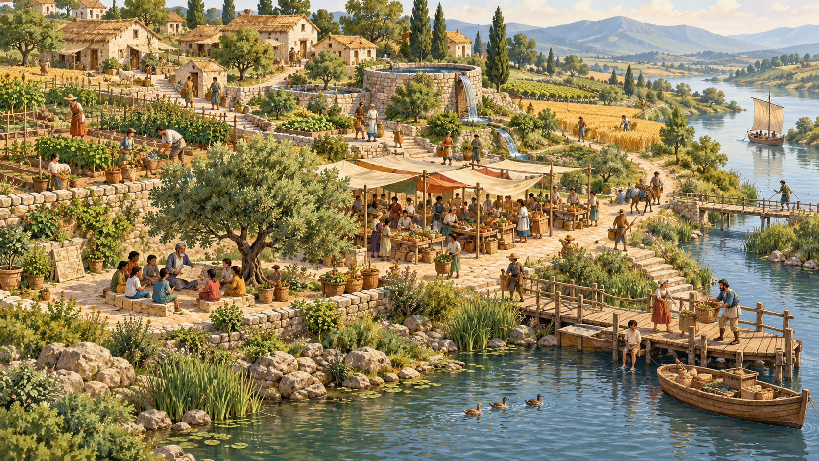
Quick answer for parents and tutors: A river-valley civilisation is a community or network whose everyday organisation is shaped by a river and its surrounding land. Rivers can bring water, fertile sediments, fish, routes and opportunities for farming and trade. They also bring floods, drought, erosion, disease risks and disputes. To build a reliable fictional river civilisation, children must map the whole catchment, protect drinking water, plan food and storage, create fair water-sharing rules, teach future maintainers, and practise repairing a system after it fails. River-based societies are one type of civilisation, not the only origin of complex human life or a rung on a ladder of human worth.
Did you know? A settlement can be only a few metres from a river and still have unsafe water. It can harvest plenty of grain and still lose food to damp storage. It can dig a channel for one farm while quietly reducing the water available to a neighbour downstream. When we move beyond the picture of ‘a city next to a river’, we begin to see civilisation as a network of decisions that must keep working after the first enthusiastic builders have gone home.
This is the second practical guide in eduKateSG’s Types of a Civilisation learning route, following How to Build a Civilisation. It focuses deeply on river valleys and agricultural networks rather than repeating the overview. The classroom activity story is fictional; historical examples are identified separately and supported with source links. The evidence reviewer is the child-friendly explanation and fairness guide, the assumption checker is the mapping and ground-check guide, and the lesson facilitator is a classroom tool for mixing choices and testing trade-offs. They are fictional educational characters, not claims that autonomous software agents run the public world.
Important distinction: Throughout this guide, ‘advanced’ means more reliable, humane, evidence-based capability, not a label for superior peoples. Rivers do not cause every city to form, and impressive architecture does not prove that everybody in a society was safe or free. A river community may be highly skilled yet small, mobile, connected to pastoral neighbours, or part of a huge political network. The type describes its relationship with land and water. It does not judge human worth.
Read this guide in a way that fits your child
- Parents with five minutes: see the first map, build six reliable layers, and ask the weekly review questions.
- Primary students: start with the fictional Riverbend, build a paper river, label the safe parts, and practise explaining one change in three sentences.
- Secondary students: use the worked ratios and flow diagrams to compare water access, food reserves, water-quality risks, trade and governance.
- Tutors: begin at the lesson plan, assign one module at a time, and assess the quality of evidence rather than the size of the drawing.
- Long-form readers: explore the river-system atlas, historical case files, design missions, correction rounds and advanced comparison.
The opening classroom activity scene: where will Riverbend live?
At the lesson facilitator, the assumption checker projects an imaginary river curling through a broad plain. The evidence reviewer invites twelve children to make a decision as a community. On the north bank is flat, productive soil; on the south bank is a higher rocky ridge; upstream a narrow valley supplies much of the water; downstream the river divides into wetland channels before meeting the sea. The children can place homes anywhere on the fictional map. They are given a cheerful market, a school, farms and a clinic as cardboard pieces, but they cannot place everything at once.
The first team puts the market beside the sparkling water, because that is where boats can reach it. The second puts every house on the high ridge, because the ridge looks safer in floods. The third puts all the fields close to the river, but forgets that people need paths to get between houses, tools, water points and the school. The evidence reviewer asks: ‘Which people have you made travel farther for care?’ the assumption checker adds a blue line for a seasonal flood and asks: ‘If the water rose to this line, which essential service would be lost first?’
No team is immediately declared the winner. A river town involves several dimensions that can conflict. Close to water can mean easier access and greater flood exposure. High ground may protect homes but make water delivery harder. A straight route may be efficient in a dry season but become impassable during rain. The children learn that a civilisation is a set of choices under constraints, and the right first move is to draw what they know, label uncertainty and listen to the people affected.
On the lesson facilitator the settlement has five dials: Life measures essential access, Knowledge measures evidence and teaching, Trust measures fairness and accountability, Systems measures coordination and maintenance, and Repair measures the ability to detect and correct failure. A pretty riverfront cannot compensate for an unsafe well. A powerful irrigation system cannot compensate for removing an entire neighbourhood’s right to clean water. The dials are learning prompts, not a scientific index of civilisations.
The whole river is the classroom, not just the town
A catchment, sometimes called a drainage basin, includes the land from which rainwater flows toward a river or connected water body. The river you can see from a bridge is therefore only part of the system. Hills, streams, soil, vegetation, wetlands and built surfaces determine when water arrives, how fast it flows and what it carries. A change far upstream can affect homes downstream. A flooded building may be the final visible problem in a much larger network of runoff.
A parent can demonstrate the idea with a crumpled sheet of paper used as an imaginary landscape: mark a high ridge, draw small stream lines on the folds, and trace where their paths meet. No need to pour water over electrical devices, roads or classroom floors; an arrow diagram works well. On a second sheet, place trees, fields, impermeable roofs and ponds. Ask how each change could influence the movement of water. The exercise is not a model of real flood depths. It teaches children to notice connected surfaces.
Tutors should distinguish water quantity, water quality, accessibility and reliability. A river can contain abundant water that is unsafe to drink without appropriate treatment. A well may provide safer water but be too far away or inaccessible to some residents. A large reservoir may offer storage while depending on inspection, governance and functioning delivery pipes. Students who name these differences are already reasoning beyond ‘water is nearby, therefore life is easy’.
Six layers every river civilisation must maintain
| Layer | Build question | Evidence the children should provide |
|---|---|---|
| Land and hazard | Where can people live and travel safely? | Contour or elevation sketch, seasonal warnings, accessible routes |
| Water and sanitation | Who can reach safe drinking water and where does waste go? | Separated systems, inspection notes, usable alternatives |
| Food and storage | How much food is produced, stored and lost? | Daily demand, crop calendar, reserves, loss assumptions |
| Work and knowledge | Who maintains, teaches and checks each system? | Rota, training notes, clear public instructions |
| Rules and exchange | Who decides, who benefits and who can appeal? | Water-sharing process, transparent records, safe trade |
| Repair and adaptation | What happens if the first design fails? | Alert, responsible team, backup, tested correction, record |
Every layer connects with another. Food production needs water. The water system needs energy, drainage or maintenance as appropriate. Maintenance needs trained people, spare materials and funds. Training needs a way to preserve knowledge. A rule can assign responsibilities, but the rule must remain open to evidence and correction. This is why river civilisations are rich learning examples: the dependencies are easy to draw, yet difficult to manage well.
River-valley types are not one fixed model
Several overlapping patterns may be useful. A seasonal floodplain depends on the rise and recession of water; a canal-fed farming zone depends on operating and maintaining channels; a delta must work with changing branches, salinity and wetlands; a rain-fed agricultural valley relies on rainfall rather than the same irrigation arrangements; a river trading city depends on boats and roads as well as farms; and a modern urban catchment includes engineered drains, reservoirs, buildings and emergency warnings. Different types can appear together, and their combination can change over centuries.
In the historical record, river valleys often offered attractive places to settle, but there is no universal sequence in which river → irrigation → monarchy → empire. Societies have different histories of land rights, conflict, mutual aid, technical skill and environmental change. The children should compare mechanisms and evidence instead of imagining that one political system or culture was a necessary result of having water.
For example, a British Museum teaching resource on Mesopotamia describes agriculture along the Tigris–Euphrates, including why some southern communities relied on canals where local rainfall was less dependable. A UNESCO description of Moenjodaro highlights city planning, wells and drainage in an Indus civilisation setting. These are useful points of comparison, not evidence that every ancient river city worked alike.
How to avoid the four most tempting misconceptions
- Misconception 1: every ancient civilisation grew from a river. In fact, there were major coastal, highland and other forms of social complexity, and many societies combined different environments.
- Misconception 2: irrigation proves there was one all-powerful ruler. Water systems could require coordination, but the institutions and power relations were historically diverse and must be investigated rather than assumed.
- Misconception 3: a high crop yield proves all residents had enough to eat. Losses, unequal access, trade commitments and crises can separate production from wellbeing.
- Misconception 4: ancient means simple and modern means automatically safe. Engineering, oral knowledge and ecological management can be sophisticated across eras, while modern cities still face failures of design, upkeep and governance.
The strongest question for every chapter is simple: what can we observe, what might explain it, which people experienced it differently, and how would we know whether a change worked? The evidence reviewer insists the children understand the language. The assumption checker insists that the map and numbers match the claim. At the end, the lesson facilitator asks for a repair log.
Module map: follow one river civilisation from first farm to advanced networks
The twelve lessons below are organised for teaching, not as fixed chronological stages of world history. A family can stop after any module and return a week later. Some topics may be more suitable for older students, especially discussions of water rights, evidence quality and public safety. Never present a fictional planning exercise as professional advice for actual drainage, water treatment, building construction or emergency response.
- 01 — Locate the watershed and safe settlement
- 02 — Understand floods and seasons
- 03 — Protect drinking water and sanitation
- 04 — Select crops, soil and farming methods
- 05 — Build food reserves and granaries
- 06 — Design canals, reservoirs and maintenance
- 07 — Include fishing, wetlands and biodiversity
- 08 — Use roads, boats and markets
- 09 — Develop crafts, measures and records
- 10 — Govern fairly across upstream and downstream
- 11 — Survive drought, contamination and cascading failure
- 12 — Build a climate-adaptive advanced river system
Cover-image note: this article uses an existing original eduKate AI-generated conceptual illustration of Riverbend, a fictional riverside learning community. The image is not a photograph, an exact reconstruction of Mesopotamia, Egypt, the Indus or any other real place, nor a technical engineering plan. Its media-library record includes descriptive alt text and provenance information. Distinguish fictional diagrams, archaeological facts and modern policy examples throughout.
Mission 01: Locate the watershed and a safe first settlement
The question: Where does the river’s water come from? classroom activity opening: The classroom activity opens with a map that only shows a blue river and three attractive places to build. Children prefer the green flat bank because the market can stand beside the boats. The assumption checker reveals that the river rises from rainfall in distant hills and smaller streams that are missing from the map. The evidence reviewer asks whether the attractive place is still the best choice for a school, a grain store and a clinic when the river changes course or rises after rain.
The science and history beneath the picture
A river valley is connected to an upstream catchment and downstream land. Rain travels as runoff, infiltration, evaporation and stored water; the balance changes with terrain and ground cover. Riverbanks may be productive, yet the low ground near water can be vulnerable to flooding or erosion. Higher land may offer some protection but can increase travel or distribution distance. Wetlands can influence water movement and support wildlife. Settlement location must be studied as a network of hazards, services and routes, never chosen by scenery alone.
A useful civilisation lesson separates description from explanation. A child may accurately notice that two villages stand near a river; this does not show that the river caused every difference between them. Historical evidence has dates, locations and missing voices. A classroom model has invented boundaries that make learning manageable. Treat both forms of knowledge honestly: one asks what happened in a real place, while the other asks what consequences follow from a stated set of assumptions.
Build the system before decorating it
Give students a blank A3 map containing a tributary, main river, high ground, low ground, a possible wetland and a crossing. Ask them to place six icons: homes, a school, a clinic, a clean-water collection point, a food store and a public meeting place. They must draw an ordinary access route and an alternate safe route for each essential service. Then overlay a fictional high-water zone in light pencil. Buildings intersecting the zone need a reason for their location and a safer operating plan.
Keep this as a paper planning exercise: real flood elevations, soil stability, water quality and safe construction need professional assessment. In the children’s model, a route is not ‘safe’ merely because it is shorter. It must be available to a caregiver carrying a child, to a person with reduced mobility and to workers transporting supplies. Where the plan uses a footbridge, the child should explain who checks its condition and what happens when it closes.
At the lesson facilitator, every arrow on the blueprint needs a named meaning. Is it water, a path, food, information, money or an agreed responsibility? A learner should be able to explain the arrow without the person who drew it standing beside the board. If the design cannot be understood by an absent teammate, the first improvement may be better instructions rather than more infrastructure. This is also why drawings, vocabulary and writing matter in a civilisation project.
Mathematics lab: show your assumptions
The fictional settlement has 120 homes. Seventy can reach the water point along a 300-metre path, while fifty must walk 900 metres. The mean distance is (70 × 300 + 50 × 900) ÷ 120 = 550 metres. Is the mean a fair description for the fifty households travelling much farther? Ask why a second water point might matter more than a small reduction in average distance.
The mathematical habits are deliberately transferable: write quantities with units, check the operation, explain what the result means, and test whether the conclusion follows. Where an average hides unequal access, compare groups as well as totals. Where a percentage is offered, ask ‘percentage of what?’ Where a historical figure is used, seek its origin and uncertainty. The child should learn that a neatly calculated answer is one ingredient of judgment, not a substitute for it.
The assumption checker’s field interruption
Heavy rain upstream raises the river after a sunny morning in the town. A footpath between the clinic and half the homes is no longer usable. There has been no local rain, so some families are confused by the warning.
Plan A trusts local observations: ‘It looks dry here.’ Plan B follows the connected catchment and keeps warning and access alternatives available. The evidence reviewer asks the children to explain the difference to a younger learner without frightening them. The assumption checker asks which upstream measurements or credible warnings might justify changing the route.
When the classroom activity scenario pauses, each team must propose a response in three parts. First, protect essential human needs without improvising unsafe real-world procedures. Second, identify who can check what happened and where the evidence should be recorded. Third, design an improvement that survives the departure of today’s most knowledgeable student. A repair that only its designer can operate is not a reliable communal inheritance.
The evidence reviewer’s fairness check
A central meeting room may be convenient for confident adults but difficult for carers or those with mobility barriers. A school that is safe in a flood may still be inaccessible because its road is cut. The map should identify the people who need additional assistance, not merely add a universal arrow labelled ‘evacuate’.
Invite two voices that might otherwise remain unheard: someone for whom the proposed service is difficult to access, and someone who must carry out the maintenance work. Their views may complicate a quick majority decision. That complication is valuable because a river civilisation is more than a diagram of land and water. It is a community with care responsibilities, inequalities, diverse knowledge and legitimate disagreements. Record the revised decision and the reason in language a child can understand.
Do it at home or in a small-group tutorial
At home: Draw a river with three tributaries on a large sheet of paper. The parent names a sudden rainstorm in one upper branch, and the child traces which parts of the fictional town should listen for warnings. Ask the child to move one cardboard service to a more resilient location and explain its new disadvantage.
With a tutor: For Primary pupils, ask for a labelled diagram and one sentence about why river proximity is not sufficient. For Secondary pupils, calculate the mean path distance, discuss distribution and model two site choices using a risk-versus-access matrix. Stronger learners should describe which missing measurement might overturn their conclusion.
A practical 25-minute version is to spend five minutes understanding the word ‘where does the river’s water come from?’, ten minutes drawing or calculating, five minutes receiving an unexpected change from the assumption checker, and five minutes explaining the revision to the evidence reviewer. For older students, ask for a written source check or a second possible explanation. For a child who is still developing reading confidence, oral reasoning with labels can come before a full paragraph.
Exit ticket and connection
Does the team understand the whole drainage basin, or only the riverbank nearest the school? Could a newly arriving household use the route? What would change after one year of flood records? A strong exit answer names a limit to the map and a practical way to check it.
Carry one idea into the next mission. A team that has improved this system should now ask which other layer may be affected by that improvement. The classroom activity is cumulative: maps, calculations, fair rules and corrections remain visible from one session to another. For connected reading, visit Ancient Civilisations and Geography.
Mission 02: Understand floods, seasons and changing river levels
The question: A fertile floodplain can also be a dangerous floodplain classroom activity opening: Riverbend’s harvest festival is approaching. The children’s first calendar shows twelve cheerful months, but their farms have no planting season, storage season or high-water season. The evidence reviewer puts empty squares on the calendar so families can record what they notice. The assumption checker asks the children to compare three fictional years: one with a useful flood, one with too little water and one with too much.
The science and history beneath the picture
Flooding is not a single event with a single outcome. In some landscapes, seasonal flooding can deposit sediment or replenish wetlands, while damaging homes, spreading hazards or interrupting planting when timing is unfavourable. Water levels are shaped by rainfall, tributaries, upstream storage, land cover and the river’s shape. Historical and present-day river regimes differ, particularly where dams, diversion and major land changes influence flow. Avoid drawing one typical river season and calling it universal.
A useful civilisation lesson separates description from explanation. A child may accurately notice that two villages stand near a river; this does not show that the river caused every difference between them. Historical evidence has dates, locations and missing voices. A classroom model has invented boundaries that make learning manageable. Treat both forms of knowledge honestly: one asks what happened in a real place, while the other asks what consequences follow from a stated set of assumptions.
Build the system before decorating it
Create a twelve-month fictional seasonal wheel without copying the modern behaviour of a named ancient river. Mark rain, river level, likely work on fields, harvest and storage as separate lines. Then revise the wheel for a second year. Have two teams compare their calendars and explain which assumptions they share. Students should notice that the same water level can be helpful for a field at one moment and hazardous for a home or road at another.
Define an alert chain in plain language. Who notices the higher water? Where is the observation written? Who checks whether the information is current? How will different households hear a warning? Who is permitted to close a risky path? These are governance questions as much as weather questions. Children’s maps may show an alert system, but real flood warnings and emergency procedures must come from responsible authorities.
At the lesson facilitator, every arrow on the blueprint needs a named meaning. Is it water, a path, food, information, money or an agreed responsibility? A learner should be able to explain the arrow without the person who drew it standing beside the board. If the design cannot be understood by an absent teammate, the first improvement may be better instructions rather than more infrastructure. This is also why drawings, vocabulary and writing matter in a civilisation project.
Mathematics lab: show your assumptions
In the teaching model, river levels relative to a marked reference line are 1.1 m, 1.4 m, 1.9 m and 2.3 m over four observations. The increase from 1.1 m to 2.3 m is 1.2 m. That does not mean ‘the whole valley will flood 1.2 metres’: river-gauge changes and flood depths on land are different measurements. Ask learners to say what the numbers show and what they do not show.
The mathematical habits are deliberately transferable: write quantities with units, check the operation, explain what the result means, and test whether the conclusion follows. Where an average hides unequal access, compare groups as well as totals. Where a percentage is offered, ask ‘percentage of what?’ Where a historical figure is used, seek its origin and uncertainty. The child should learn that a neatly calculated answer is one ingredient of judgment, not a substitute for it.
The assumption checker’s field interruption
A year after a successful harvest, the town assumes next season will be identical. Rain begins earlier and one storage building’s floor becomes damp. A market group wants to celebrate ‘record rainfall’ without inspecting the grain.
Plan A makes a public promise that more rain always means more food. Plan B inspects fields and stores, checks changing conditions and treats storage safety as a separate responsibility. The evidence reviewer asks which message would help parents make decisions. The assumption checker checks whether the observations support claims about yield.
When the classroom activity scenario pauses, each team must propose a response in three parts. First, protect essential human needs without improvising unsafe real-world procedures. Second, identify who can check what happened and where the evidence should be recorded. Third, design an improvement that survives the departure of today’s most knowledgeable student. A repair that only its designer can operate is not a reliable communal inheritance.
The evidence reviewer’s fairness check
Families with access to boats and high-ground storage may recover differently from families whose food and tools are stored in low homes. A flood-warning practice that exists only online or in one language excludes people. Children’s plans should include accessible communication and realistic support for those with fewer resources.
Invite two voices that might otherwise remain unheard: someone for whom the proposed service is difficult to access, and someone who must carry out the maintenance work. Their views may complicate a quick majority decision. That complication is valuable because a river civilisation is more than a diagram of land and water. It is a community with care responsibilities, inequalities, diverse knowledge and legitimate disagreements. Record the revised decision and the reason in language a child can understand.
Do it at home or in a small-group tutorial
At home: Colour a three-year calendar with different imaginary rain and flood patterns. Ask which jobs move between months. Each child explains why a crop plan should be adjusted rather than copied mechanically from a good year.
With a tutor: Primary learners can sequence ‘before, during and after’ in an illustrated calendar. Secondary learners can distinguish observations, averages, variation, warning thresholds and uncertainty. Ask students to compare two years without claiming that the same pattern must recur.
A practical 25-minute version is to spend five minutes understanding the word ‘a fertile floodplain can also be a dangerous floodplain’, ten minutes drawing or calculating, five minutes receiving an unexpected change from the assumption checker, and five minutes explaining the revision to the evidence reviewer. For older students, ask for a written source check or a second possible explanation. For a child who is still developing reading confidence, oral reasoning with labels can come before a full paragraph.
Exit ticket and connection
Do the records include unusual years, or only the last successful one? Which observation could warn of an approaching problem? Does the plan separate useful floodwater, unsafe water and access to services?
Carry one idea into the next mission. A team that has improved this system should now ask which other layer may be affected by that improvement. The classroom activity is cumulative: maps, calculations, fair rules and corrections remain visible from one session to another. For connected reading, visit When Nile Floods Change.
Mission 03: Protect drinking water, public health and sanitation
The question: Water in a river is not automatically drinking water classroom activity opening: Children at the classroom activity proudly build a well next to the settlement, then place animal pens, washing areas and a crowded market beside it. The evidence reviewer invites them to imagine carrying water home for a younger sibling. The assumption checker asks which activities might contaminate the source and which pathways could move polluted water through the town. The team’s attractive blue river begins to look like a system that needs careful boundaries.
The science and history beneath the picture
Human communities need water of appropriate quality for drinking, cooking and hygiene. Water quality cannot be reliably judged by whether water looks clear, and real drinking water should come from known safe supplies or be treated according to competent public-health guidance. Human waste, agricultural runoff, sediments and other contaminants may travel along different routes. A safe water system also needs ongoing sampling or appropriate monitoring, protected distribution and a plan for interruptions. The ancient evidence for wells and drains should not be mistaken for modern water-safety certification.
A useful civilisation lesson separates description from explanation. A child may accurately notice that two villages stand near a river; this does not show that the river caused every difference between them. Historical evidence has dates, locations and missing voices. A classroom model has invented boundaries that make learning manageable. Treat both forms of knowledge honestly: one asks what happened in a real place, while the other asks what consequences follow from a stated set of assumptions.
Build the system before decorating it
Divide the fictional map into a clean-water access layer and a used-water or waste layer. The first shows protected supply points, households and carers; the second shows places that could cause contamination and arrangements to keep wastes from reaching the supply. Have learners draw arrows representing possible movement after rain. Where lines appear to intersect, label the uncertainty and ask what trained inspectors would have to test.
Some real places have separate sewerage and rainwater systems; others use different arrangements. Children should learn that separation, inspection and maintenance are design principles, not a licence to build a water treatment plant at home. Never turn the exercise into an unsupervised test of unknown water sources, sewage or pathogens. Safe classrooms use paper, icons and fictional tokens rather than untreated water.
At the lesson facilitator, every arrow on the blueprint needs a named meaning. Is it water, a path, food, information, money or an agreed responsibility? A learner should be able to explain the arrow without the person who drew it standing beside the board. If the design cannot be understood by an absent teammate, the first improvement may be better instructions rather than more infrastructure. This is also why drawings, vocabulary and writing matter in a civilisation project.
Mathematics lab: show your assumptions
The town serves 180 residents. In the paper model each resident needs 4 clean-water tokens per day for a defined imaginary task, so total demand is 720 tokens. If the working supply point provides 600, the gap is 120. Students must propose a backup and explain why no one should be forced to drink water of uncertain quality merely to close the arithmetic gap.
The mathematical habits are deliberately transferable: write quantities with units, check the operation, explain what the result means, and test whether the conclusion follows. Where an average hides unequal access, compare groups as well as totals. Where a percentage is offered, ask ‘percentage of what?’ Where a historical figure is used, seek its origin and uncertainty. The child should learn that a neatly calculated answer is one ingredient of judgment, not a substitute for it.
The assumption checker’s field interruption
After rainfall, muddy water enters a damaged pipe segment. Some families report a change in water appearance, while others notice nothing. A rumour spreads that a clear-looking alternative is definitely safe.
Plan A tells the community to judge water by appearance. Plan B promptly follows responsible health and water-provider guidance, communicates the uncertainty and arranges safe alternative supplies. The evidence reviewer tests whether the notice is understandable to children and parents. The assumption checker asks how the notice is dated, corrected and verified.
When the classroom activity scenario pauses, each team must propose a response in three parts. First, protect essential human needs without improvising unsafe real-world procedures. Second, identify who can check what happened and where the evidence should be recorded. Third, design an improvement that survives the departure of today’s most knowledgeable student. A repair that only its designer can operate is not a reliable communal inheritance.
The evidence reviewer’s fairness check
A water station at the far edge of town may meet a total capacity target while placing disproportionate burdens on people with mobility limitations, infants, caregivers and those whose jobs restrict travel time. Ask who can actually collect water, at what times and with what assistance.
Invite two voices that might otherwise remain unheard: someone for whom the proposed service is difficult to access, and someone who must carry out the maintenance work. Their views may complicate a quick majority decision. That complication is valuable because a river civilisation is more than a diagram of land and water. It is a community with care responsibilities, inequalities, diverse knowledge and legitimate disagreements. Record the revised decision and the reason in language a child can understand.
Do it at home or in a small-group tutorial
At home: Use two coloured pencils to show the route of a fictional safe-water line and a waste line. Place a card marked ‘heavy rain’ and trace where risk might increase. The child should propose one inspection question rather than pretending to test safety with a homemade experiment.
With a tutor: Primary pupils sort activities into ‘protect water’ and ‘could pollute water’ and explain why ‘clear’ is not the same as ‘safe’. Secondary pupils work with demand, capacity, distributions and a clearly bounded public-health scenario.
A practical 25-minute version is to spend five minutes understanding the word ‘water in a river is not automatically drinking water’, ten minutes drawing or calculating, five minutes receiving an unexpected change from the assumption checker, and five minutes explaining the revision to the evidence reviewer. For older students, ask for a written source check or a second possible explanation. For a child who is still developing reading confidence, oral reasoning with labels can come before a full paragraph.
Exit ticket and connection
Has the plan protected the source, distribution route and users? Does it include people who cannot travel to a central station? Which questions require a qualified professional rather than a classroom guess?
Carry one idea into the next mission. A team that has improved this system should now ask which other layer may be affected by that improvement. The classroom activity is cumulative: maps, calculations, fair rules and corrections remain visible from one session to another. For connected reading, visit How Ancient Cisterns and Reservoirs Kept Cities Supplied.
Mission 04: Select crops, understand soil and diversify food
The question: Farming is more than putting seeds beside a river classroom activity opening: The evidence reviewer’s group plants all its imagined farms with one fast-growing crop because it gives the largest initial harvest in the game. The assumption checker adds a new season with pests, a dry period and one field that becomes waterlogged. The children discover the difference between optimising the best year and keeping families fed across many years. A farmer’s knowledge of local soils suddenly becomes as valuable to the classroom as the biggest number in a spreadsheet.
The science and history beneath the picture
Agriculture depends on the interaction of crops, soils, sunlight, water, labour, equipment and time. Some floodplain soils receive useful sediments, but fertility and suitability vary enormously. Too little moisture, excess water, erosion, salt accumulation, poor drainage or repeated removal of nutrients can reduce productivity. Crop diversity can reduce dependence on a single harvest, although diversification involves its own labour, water and market trade-offs. A tutor should never teach ‘river soil is always fertile’ as a scientific rule.
A useful civilisation lesson separates description from explanation. A child may accurately notice that two villages stand near a river; this does not show that the river caused every difference between them. Historical evidence has dates, locations and missing voices. A classroom model has invented boundaries that make learning manageable. Treat both forms of knowledge honestly: one asks what happened in a real place, while the other asks what consequences follow from a stated set of assumptions.
Build the system before decorating it
Design three fictional plots: well-drained higher ground, a lower field receiving periodic moisture, and a plot with uncertain salt or drainage conditions. Give the group a set of crops with different invented growth requirements. Students assign crops, note the assumptions and predict which field needs protection or monitoring. After the first round, change the rainfall or soil condition and ask for a revised planting decision rather than a claim that one crop is best everywhere.
A field plan requires paths for farmers, access to tools, safe storage for supplies and a practical arrangement for soil care. Trees, hedges or appropriate ground cover may reduce some kinds of erosion, but choices depend on place. Agricultural advice in real settings needs local expertise; classroom tasks should be described as simplified systems-thinking exercises.
At the lesson facilitator, every arrow on the blueprint needs a named meaning. Is it water, a path, food, information, money or an agreed responsibility? A learner should be able to explain the arrow without the person who drew it standing beside the board. If the design cannot be understood by an absent teammate, the first improvement may be better instructions rather than more infrastructure. This is also why drawings, vocabulary and writing matter in a civilisation project.
Mathematics lab: show your assumptions
In a fictional harvest, Plot A produces 90 food units, Plot B 70 and Plot C 40: total 200. A pest removes half the output of Plot A while the others remain unaffected. The revised total is 45 + 70 + 40 = 155, a loss of 45 units or 22.5 per cent of the original. Compare this with a different crop mix and ask whether invented yields reflect evidence or merely the rules of the game.
The mathematical habits are deliberately transferable: write quantities with units, check the operation, explain what the result means, and test whether the conclusion follows. Where an average hides unequal access, compare groups as well as totals. Where a percentage is offered, ask ‘percentage of what?’ Where a historical figure is used, seek its origin and uncertainty. The child should learn that a neatly calculated answer is one ingredient of judgment, not a substitute for it.
The assumption checker’s field interruption
The market offers a high price for the most productive crop. The group considers replacing all remaining fields with it. At the same time, the town’s seed store depends on next year’s crop success.
Plan A pursues the highest possible single-season sales without holding seed or food reserves. Plan B identifies minimum community needs, seed security, soil protection and market opportunities, then balances the remaining land. The evidence reviewer asks whose labour and meals are affected; the assumption checker runs the model for a poor season as well as a good one.
When the classroom activity scenario pauses, each team must propose a response in three parts. First, protect essential human needs without improvising unsafe real-world procedures. Second, identify who can check what happened and where the evidence should be recorded. Third, design an improvement that survives the departure of today’s most knowledgeable student. A repair that only its designer can operate is not a reliable communal inheritance.
The evidence reviewer’s fairness check
Surplus is meaningful only when people can access nutritious food and the workers producing it are treated fairly. Consider land tenure, market prices, children’s education and the burden of unpaid labour. Avoid teaching that agricultural work is less intellectually complex than urban employment.
Invite two voices that might otherwise remain unheard: someone for whom the proposed service is difficult to access, and someone who must carry out the maintenance work. Their views may complicate a quick majority decision. That complication is valuable because a river civilisation is more than a diagram of land and water. It is a community with care responsibilities, inequalities, diverse knowledge and legitimate disagreements. Record the revised decision and the reason in language a child can understand.
Do it at home or in a small-group tutorial
At home: Draw three coloured plots and assign different imaginary crop cards. Have the parent announce a dry season or pest event. The child revises the crop mix and explains one benefit and one remaining uncertainty.
With a tutor: For Primary learners, practise addition, subtraction and a simple bar chart of plots. For Secondary learners, calculate percentage losses, compare scenarios and write a short evidence-based argument about risk diversification.
A practical 25-minute version is to spend five minutes understanding the word ‘farming is more than putting seeds beside a river’, ten minutes drawing or calculating, five minutes receiving an unexpected change from the assumption checker, and five minutes explaining the revision to the evidence reviewer. For older students, ask for a written source check or a second possible explanation. For a child who is still developing reading confidence, oral reasoning with labels can come before a full paragraph.
Exit ticket and connection
Does the plan protect land for future seasons? Is crop diversity chosen for a reason rather than as a slogan? What evidence would distinguish a temporary bad harvest from a worsening soil problem?
Carry one idea into the next mission. A team that has improved this system should now ask which other layer may be affected by that improvement. The classroom activity is cumulative: maps, calculations, fair rules and corrections remain visible from one session to another. For connected reading, visit Fishing and River Food Systems.
Mission 05: Build dependable food stores and sensible buffers
Core question: How long can our town eat if the harvest is interrupted? Opening scene: One team fills Riverbend’s newest storehouse with paper grain tokens and proudly declares that the settlement has become prosperous. The evidence reviewer asks the group to explain the daily meals of the people who live farthest from the store. The assumption checker removes the imaginary roof after a storm and reveals that some food has spoiled. A large pile of tokens suddenly looks less reassuring when the children translate it into days of available supply.
Look under the surface
Agricultural output is only one part of food security. Harvests must be transported, dried or otherwise preserved appropriately, stored against spoilage and pests, allocated through understandable rules, and renewed by future production. Food can be abundant in one location while inaccessible to others. A stored reserve has value because it creates time to respond when ordinary deliveries fail. But a nominal reserve also deteriorates unless the group plans rotation, inspection and fair access.
The historical task is to ask what sources from a particular community show, not to assert that everybody in every river valley followed the same practice. The learning task is to build a simplified model with clearly stated assumptions. These are related, but they are not interchangeable. When a child uses a diagram from a fictional town to interpret an archaeological site, the tutor should ask which features are supported by evidence and which are teaching inventions.
The classroom activity build specification
Begin with a ledger: starting stock, harvested additions, ordinary consumption, losses, shared exchanges and ending stock. Draw three physical areas in the fictional granary: intake, properly protected storage and checked distribution. Ask who is trained to notice damaged containers and who records an actual shortage. Then add the public-facing part: families should know where to ask for help without revealing unnecessary private information or being shamed for needing support.
Do not let the students make claims about how to preserve real food from an ancient technology illustration. Real storage safety depends on conditions, food type, contaminants and trained procedures. In the paper model, protect stock from floodwater, distinguish edible from uninspected items, and keep a clear route for access. Students can discuss safe food-management principles and the work of granary staff without handling mould or spoiled foods.
Invite the children to test two ways of accomplishing the same goal. They should explain what each plan provides, who would operate it, and which hazard or limitation it leaves unresolved. Even where one plan seems better, ask whether the other plan might suit a different environment or resource constraint. That question protects against treating an appealing classroom design as a universal blueprint.
Calculate, explain and verify
For a simplified exercise, 240 residents each need two food units daily: 480 units per day. The store holds 2,400 units, so its nominal buffer is five days. A simulated 15 per cent loss removes 360 units, leaving 2,040, which covers 4.25 days at the same use rate. Ask students why saying ‘five days of food’ without an inspection would be misleading. Never confuse teaching units with actual dietary guidance.
Notice how changing the units changes the question. A stock measured in crates is different from days of demand; a percentage is different from an absolute shortage; the number of deliveries is different from the certainty of arrival. Encourage the learner to show the first line of working, then narrate the significance of the result. An exact number inside an imaginary model can still rest on invented assumptions. Good mathematical literacy makes those assumptions visible.
What happens when the first plan stops working?
A storm damages the road, the next shipment will not arrive on the expected day and a damp section of the granary may have spoiled. The wealthy quarter proposes buying the remaining stock in advance.
Plan A records only the original stock and distributes entirely to those who can pay first. Plan B first checks actual usable quantities with qualified adult oversight in the fictional setting, publicly communicates the shortage, protects essential needs and establishes a transparent distribution and replenishment plan with appeal. The evidence reviewer asks whether hungry children without bargaining power are protected. The assumption checker checks the arithmetic and whether the plan relies on an impossible delivery.
The evidence reviewer asks each group to write one public sentence explaining the problem without blaming a community before evidence is gathered. The assumption checker asks for a practical check that would distinguish competing explanations. The lesson facilitator then requires a repair action, a named responsible group and a later verification step. The team is not rewarded for promising that the incident can never occur again; it is rewarded for reducing avoidable harm and preparing for future uncertainty.
Who counts in the answer?
Who can reach the granary? Are residents with disabilities, caregiving burdens or long working hours able to collect supplies? Does the store serve visiting traders and refugees under a crisis policy? A moral claim about fairness must be translated into accessible operating arrangements; otherwise the neatly drawn food store may become a source of exclusion.
A planner can increase the total output of a system while leaving a minority without safe access. A family can measure the time saved by a new road while failing to notice whose environment was altered. A trading network can carry many goods while concealing unsafe work. Ask learners to mark benefits and burdens separately, consider alternatives, and explain how the community would hear and respond to a complaint.
A parent-and-tutor lesson that fits real attention spans
At home: Use twenty counters as an imaginary store, make a fictional daily consumption rule and remove several counters as a ‘damaged storage’ scenario. Ask the child to say how many days remain, then redesign the store’s location and record keeping.
For tutors: Primary students divide totals into daily groups and narrate the difference between quantity and duration. Secondary students calculate percentage losses, compare reserve targets and defend distribution principles under uncertainty. Advanced pupils should distinguish food volume, nutrition, accessibility and fairness as separate dimensions.
The ideal response combines a labelled picture, a short calculation or observation, a spoken reason and one revision after feedback. For younger learners, avoid assigning a lengthy essay before they can explain their design aloud. Older students can add source evaluation, comparison of scenarios and a paragraph that anticipates objections. Both age groups should finish able to describe why the system matters in the daily life of a family.
Exit ticket and next connection
Did the team count stock that had already been lost? Who is responsible for inspection? Does the plan still work if an expert is away? What public information would make a worried family more confident without promising certainty?
When students finish, ask them to teach the lesson to a child who missed the activity. If they can explain the system without pointing vaguely at the whole map, the idea is becoming transferable knowledge. Extend the route through How Ancient Granaries Protected Food Supplies.
Mission 06: Design canals, reservoirs and long-term maintenance
Core question: A canal is a promise to maintain a system, not a single excavation Opening scene: The children build a paper canal that carries blue arrows from an imaginary river to three fields. Everyone celebrates until the assumption checker draws sediment, weeds and a broken section at the inlet. Water no longer reaches the last field. The evidence reviewer notices that the child assigned to the downstream farm did not attend the planning meeting. The team realises that even a technically elegant channel can produce an unfair arrangement.
Look under the surface
An irrigation channel or reservoir links hydrology, landscape, agricultural demand and institutions. Water movement changes with channel shape, slope, obstruction, evaporation, seepage, sediment and competing withdrawals. Some systems store rainfall, some divert part of a river, and some rely on local groundwater or seasonal flow. Historical engineering arrangements were diverse. An ancient canal should not be described as a modern safety-certified facility, and apparent water abundance never removes the need for downstream ecological care.
The historical task is to ask what sources from a particular community show, not to assert that everybody in every river valley followed the same practice. The learning task is to build a simplified model with clearly stated assumptions. These are related, but they are not interchangeable. When a child uses a diagram from a fictional town to interpret an archaeological site, the tutor should ask which features are supported by evidence and which are teaching inventions.
The classroom activity build specification
Draw the river, its intake, three branches and a return route or downstream flow. Record who requests water, who checks conditions, who may authorise changes and how the schedule is communicated. Now add the invisible pieces: tools, workers, maintenance time, spare materials and a process for resolving disputes. Build a separate ‘during interruption’ diagram; it should not be a copy of the sunny-day diagram with the word ’emergency’ at the top.
Treat the canal as a model, not an instruction to dig waterways, alter drains or construct dams. Real water engineering involves professional design, permits, ecology and public safety. For learning, paper channels or arrows are enough. Children can test the concept of a blocked branch by covering a line and tracing who loses access, then explain what an inspector would have to verify before a real channel was reopened.
Invite the children to test two ways of accomplishing the same goal. They should explain what each plan provides, who would operate it, and which hazard or limitation it leaves unresolved. Even where one plan seems better, ask whether the other plan might suit a different environment or resource constraint. That question protects against treating an appealing classroom design as a universal blueprint.
Calculate, explain and verify
The fictional intake provides 240 water tokens per day, initially divided into 110 for Field A, 90 for Field B and 40 for Field C. A new 15 per cent simulated distribution loss leaves 204 tokens for users. The previous allocations total 240, so they cannot all continue unchanged. Ask students to build two allocation rules, state what each protects, and explain why the reduction must not be hidden in the final ledger.
Notice how changing the units changes the question. A stock measured in crates is different from days of demand; a percentage is different from an absolute shortage; the number of deliveries is different from the certainty of arrival. Encourage the learner to show the first line of working, then narrate the significance of the result. An exact number inside an imaginary model can still rest on invented assumptions. Good mathematical literacy makes those assumptions visible.
What happens when the first plan stops working?
An upstream landowner closes a gate to protect their crop and the downstream field receives almost nothing. At the same time, the canal needs repair after an unexpected blockage.
Plan A assumes whoever reaches the gate first can take what they want. Plan B creates a transparent, revisable allocation and maintenance plan that protects essential needs and records downstream effects. The evidence reviewer asks whose voice is missing and how an appeal will be heard. The assumption checker marks the location of the blocked branch and requires an observation rather than a rumour before assigning blame.
The evidence reviewer asks each group to write one public sentence explaining the problem without blaming a community before evidence is gathered. The assumption checker asks for a practical check that would distinguish competing explanations. The lesson facilitator then requires a repair action, a named responsible group and a later verification step. The team is not rewarded for promising that the incident can never occur again; it is rewarded for reducing avoidable harm and preparing for future uncertainty.
Who counts in the answer?
An equitable system must account for people, farms and living ecosystems downstream. Powerful residents should not be allowed to relocate water risk onto less powerful neighbours. Maintenance workers need safe work practices, proper authority and training. A community can teach fairness in water allocation without pretending that a child’s simulation replaces legal water rights.
A planner can increase the total output of a system while leaving a minority without safe access. A family can measure the time saved by a new road while failing to notice whose environment was altered. A trading network can carry many goods while concealing unsafe work. Ask learners to mark benefits and burdens separately, consider alternatives, and explain how the community would hear and respond to a complaint.
A parent-and-tutor lesson that fits real attention spans
At home: Use coloured string on paper to draw three channels; place a paper square over one branch to show a blockage. Ask which fields remain supplied and what information the team needs to decide where to respond first.
For tutors: For Primary Mathematics, work with total 240 and parts 110, 90 and 40. For Secondary Mathematics, calculate a 15 per cent loss and compare proportional and priority-based allocation. For Geography, ask how the location of an intake changes downstream access.
The ideal response combines a labelled picture, a short calculation or observation, a spoken reason and one revision after feedback. For younger learners, avoid assigning a lengthy essay before they can explain their design aloud. Older students can add source evaluation, comparison of scenarios and a paragraph that anticipates objections. Both age groups should finish able to describe why the system matters in the daily life of a family.
Exit ticket and next connection
Have students named both everyday maintenance and emergency actions? Can they explain why the sum of promised supplies cannot exceed what exists? What would they need to know about the river’s ecology before approving a real diversion?
When students finish, ask them to teach the lesson to a child who missed the activity. If they can explain the system without pointing vaguely at the whole map, the idea is becoming transferable knowledge. Extend the route through How Roads, Canals and Drains Kept Civilisations Working.
Mission 07: Understand fishing, wetlands and river ecology
Core question: An ecosystem is part of the settlement’s infrastructure Opening scene: The classroom activity map gains a wetland at the edge of Riverbend. At first the children call it empty land and want to fill it with houses. The assumption checker shows a drawing of fish nurseries, water birds, reeds and slow-moving water. The evidence reviewer asks whether the villagers who collect fish, plants or ecological knowledge were invited to the housing meeting. The apparent empty space becomes a place with many functions, though its exact role needs local evidence.
Look under the surface
Rivers support habitats, food webs and living systems that extend beyond the main water channel. Fish and other organisms depend on suitable water quality, temperature, flow and connections between habitats. Wetlands can store or slow water in some circumstances, retain sediment and support biodiversity, but their benefits vary by location. Overharvesting, pollution, habitat fragmentation and changed river flow can create ecological and livelihood problems. The lesson should avoid the claim that every wetland prevents floods or that every fishing practice is sustainable.
The historical task is to ask what sources from a particular community show, not to assert that everybody in every river valley followed the same practice. The learning task is to build a simplified model with clearly stated assumptions. These are related, but they are not interchangeable. When a child uses a diagram from a fictional town to interpret an archaeological site, the tutor should ask which features are supported by evidence and which are teaching inventions.
The classroom activity build specification
Add an ecology layer to the settlement plan. Mark imagined fish breeding areas, a seasonal wetland, agricultural runoff points, boats, shoreline gardens and habitats needing protection. Give each layer a function and a possible disturbance. Ask students to decide where a boardwalk, market or road might fit, but require them to identify evidence the decision would need in a real place.
Environmental design cannot be judged solely by aesthetic preference. Children should learn to ask about species, soil, water levels, human access and long-term monitoring. The activity is not permission to capture wildlife, enter wetlands, disturb breeding sites or test unknown water. A careful classroom model can develop ecological reasoning without physical interference with the local environment.
Invite the children to test two ways of accomplishing the same goal. They should explain what each plan provides, who would operate it, and which hazard or limitation it leaves unresolved. Even where one plan seems better, ask whether the other plan might suit a different environment or resource constraint. That question protects against treating an appealing classroom design as a universal blueprint.
Calculate, explain and verify
A fictional fishery reports catches of 80, 74, 68 and 61 fish tokens in four periods while effort stays fixed in the classroom model. The reduction from 80 to 61 is 19 tokens, or 23.75 per cent of the initial value. Does this prove that the fish population has declined by exactly 23.75 per cent? No. Catch is affected by many factors; the number is a warning to investigate, not a complete population estimate.
Notice how changing the units changes the question. A stock measured in crates is different from days of demand; a percentage is different from an absolute shortage; the number of deliveries is different from the certainty of arrival. Encourage the learner to show the first line of working, then narrate the significance of the result. An exact number inside an imaginary model can still rest on invented assumptions. Good mathematical literacy makes those assumptions visible.
What happens when the first plan stops working?
A new road proposal crosses the wetland and makes market transport shorter. Fishers report changes in access and the town’s flood committee assumes there will be no wider effect.
Plan A values only the reduced road distance and treats the wetland as unused land. Plan B compares access benefits with habitat effects, hydrological changes, community livelihoods and realistic alternatives. The evidence reviewer asks who would lose a valued practice. The assumption checker requests site-specific observations rather than declaring every wetland untouchable in every circumstance.
The evidence reviewer asks each group to write one public sentence explaining the problem without blaming a community before evidence is gathered. The assumption checker asks for a practical check that would distinguish competing explanations. The lesson facilitator then requires a repair action, a named responsible group and a later verification step. The team is not rewarded for promising that the incident can never occur again; it is rewarded for reducing avoidable harm and preparing for future uncertainty.
Who counts in the answer?
People may depend on rivers for food, cultural meaning, income and recreation. Ecological stewardship should involve local knowledge holders while recognising that some knowledge is sensitive and should not be published without consent. Conservation must also consider people who require safe access to livelihoods and services, rather than drawing a fence and forgetting them.
A planner can increase the total output of a system while leaving a minority without safe access. A family can measure the time saved by a new road while failing to notice whose environment was altered. A trading network can carry many goods while concealing unsafe work. Ask learners to mark benefits and burdens separately, consider alternatives, and explain how the community would hear and respond to a complaint.
A parent-and-tutor lesson that fits real attention spans
At home: Create a food-web diagram with fictional plants, insects, fish and birds. The parent removes one habitat card and asks the child what questions need investigation. Focus on plausible connections, not a dramatic chain reaction that must happen everywhere.
For tutors: Primary Science learners identify living and nonliving components of an ecosystem. Secondary students distinguish catch data from population estimates, discuss sampling limitations and evaluate alternative road plans. Geography students compare land-use claims and environmental evidence.
The ideal response combines a labelled picture, a short calculation or observation, a spoken reason and one revision after feedback. For younger learners, avoid assigning a lengthy essay before they can explain their design aloud. Older students can add source evaluation, comparison of scenarios and a paragraph that anticipates objections. Both age groups should finish able to describe why the system matters in the daily life of a family.
Exit ticket and next connection
Does the plan respect wildlife and local livelihoods? Are habitat functions treated as measured facts or classroom assumptions? Which information should be collected before the community makes a permanent land-use decision?
When students finish, ask them to teach the lesson to a child who missed the activity. If they can explain the system without pointing vaguely at the whole map, the idea is becoming transferable knowledge. Extend the route through How Ancient Fishing Fed River and Coastal Communities.
Mission 08: Connect boats, roads, markets and exchange
Core question: A river route links people but can also create dependency Opening scene: Boats arrive at Riverbend carrying tools, pottery and food from a distant community. A new market opens, and the children quickly decide that every household should specialise in one good for trade. The assumption checker closes one imaginary boat route for a week. The evidence reviewer asks whether the settlement retained the skills to repair its own essentials and whether distant traders understand the rules.
Look under the surface
Rivers can support movement of people, goods and knowledge, but navigation depends on channels, vessels, seasons, hazards and connections to land routes. A successful trading centre also needs fair measurement, storage, trustworthy communication and mechanisms for resolving disputes. Not everything should be imported merely because trade is possible, yet complete self-sufficiency may also leave a settlement fragile. A good network balances specialisation, cooperation and viable alternatives.
The historical task is to ask what sources from a particular community show, not to assert that everybody in every river valley followed the same practice. The learning task is to build a simplified model with clearly stated assumptions. These are related, but they are not interchangeable. When a child uses a diagram from a fictional town to interpret an archaeological site, the tutor should ask which features are supported by evidence and which are teaching inventions.
The classroom activity build specification
Give Riverbend three partner towns, each with a different imaginary product and need. Draw one water route and one land route where plausible. Students must record every trade: item, quantity, unit, sender, receiver, expected arrival and evidence that the goods were usable. Then introduce a missed shipment and ask whether the network can keep essential services running while obligations are renegotiated.
Boat travel and transport safety belong to trained operators and responsible rules; the children’s plan is a mapping exercise. Ask the team to distinguish a river’s presence from a reliably navigable route. Some rivers have shallow sections, variable flows or other constraints. A bridge can connect banks but may also change travel patterns and require maintenance. Neither boats nor roads remove the need for safe loading, storage and communication.
Invite the children to test two ways of accomplishing the same goal. They should explain what each plan provides, who would operate it, and which hazard or limitation it leaves unresolved. Even where one plan seems better, ask whether the other plan might suit a different environment or resource constraint. That question protects against treating an appealing classroom design as a universal blueprint.
Calculate, explain and verify
Three imaginary boats each bring 25 food crates, a planned total of 75. One cannot sail, leaving 50 crates, a shortfall of 25 or one-third of the plan. If the settlement has a local reserve of 30 crates, it may cover the volume gap for this exercise, but ask whether the reserve belongs to food that can be safely substituted and who decides when to use it.
Notice how changing the units changes the question. A stock measured in crates is different from days of demand; a percentage is different from an absolute shortage; the number of deliveries is different from the certainty of arrival. Encourage the learner to show the first line of working, then narrate the significance of the result. An exact number inside an imaginary model can still rest on invented assumptions. Good mathematical literacy makes those assumptions visible.
What happens when the first plan stops working?
A bridge is unavailable and a trader claims Riverbend has no food left. Some market stallholders begin charging sharply higher prices before checking actual stocks. In another part of town, supplies are sitting in a warehouse but no one has updated the public records.
Plan A repeats the rumour because it sounds urgent. Plan B checks dated inventories, communicates what is known and uncertain, protects essential needs and opens a negotiated alternative route. The evidence reviewer ensures the notice reaches people with limited literacy. The assumption checker checks the physical route and the records rather than simply accepting the loudest trader.
The evidence reviewer asks each group to write one public sentence explaining the problem without blaming a community before evidence is gathered. The assumption checker asks for a practical check that would distinguish competing explanations. The lesson facilitator then requires a repair action, a named responsible group and a later verification step. The team is not rewarded for promising that the incident can never occur again; it is rewarded for reducing avoidable harm and preparing for future uncertainty.
Who counts in the answer?
Trade systems depend on workers whose roles are easily overlooked: boat crews, porters, craft makers, cleaners, warehouse keepers and interpreters. Ask whose time and safety costs are hidden when customers see only a final price. Fair exchange requires transparent measures, honest weights and protection from coercion.
A planner can increase the total output of a system while leaving a minority without safe access. A family can measure the time saved by a new road while failing to notice whose environment was altered. A trading network can carry many goods while concealing unsafe work. Ask learners to mark benefits and burdens separately, consider alternatives, and explain how the community would hear and respond to a complaint.
A parent-and-tutor lesson that fits real attention spans
At home: Draw three cardboard villages around a blue ribbon river. Let children exchange paper goods and write simple receipts. Remove one route and ask how truthful information and alternative suppliers change the outcome.
For tutors: Primary pupils practise multiplication, subtraction and reading tables. Secondary pupils calculate a one-third supply reduction, analyse inventory claims and write a balanced explanation of why trade and local buffers complement one another.
The ideal response combines a labelled picture, a short calculation or observation, a spoken reason and one revision after feedback. For younger learners, avoid assigning a lengthy essay before they can explain their design aloud. Older students can add source evaluation, comparison of scenarios and a paragraph that anticipates objections. Both age groups should finish able to describe why the system matters in the daily life of a family.
Exit ticket and next connection
Does the town know which goods are essential and which are optional? Can all traders understand the units and rules? Is the market resilient to one failed delivery, and can a resident appeal an unfair allocation?
When students finish, ask them to teach the lesson to a child who missed the activity. If they can explain the system without pointing vaguely at the whole map, the idea is becoming transferable knowledge. Extend the route through How Ancient Markets Connected Everyday Life.
Mission 09: Build craft skills, shared measures and reliable records
The question: How does a river settlement remember how its systems work? classroom activity episode: At the classroom activity, a child wants to build a second granary after seeing an attractive drawing. The first granary’s mason has moved away, and nobody recorded which materials were used or how the building should be checked. Nearby, two traders use the word ‘basket’ for containers of different sizes. The evidence reviewer notices that a disagreement about fairness is partly a disagreement about language. The assumption checker asks the team to test the units.
What the civilisation must understand
Specialisation often becomes useful as food production and exchange support people with different occupations. Potters, boat builders, carpenters, metalworkers in some contexts, healers, teachers, traders and administrators rely on skills that must be transferred. Common measures can reduce some disputes, but their fairness depends on trustworthy use and enforcement. Records can preserve transactions, seasonal observations and maintenance details; oral histories, demonstration and apprenticeship can preserve sophisticated knowledge too. Writing is not the only form of memory.
When comparing societies, separate the type of system from its period, location and institutions. A river community may be agricultural, commercial, industrial, digital or hybrid at different times. The definition does not guarantee that one political structure will arise or that a complex system will protect everybody automatically. Good historical analysis asks what can be demonstrated from material remains and documents; good classroom design asks what follows from explicitly chosen assumptions.
Design an operating system for ordinary life
Create three artefacts for Riverbend: a labelled grain-storage container, a fair measure used by the imaginary marketplace, and a maintenance card for a public bridge. Specify the quantity or feature each object is meant to standardise. Then invite another team to use the artefacts without speaking to their creators. Record what was misunderstood and revise the instructions. The class should discover why standards and training are practical public resources.
A record is not magically true because it is written down. Dates, sources, errors, copying and access rights matter. A repair diary should identify who observed the issue, what was done and how the fix was checked, without exposing unnecessary sensitive personal details. A common unit should be tested against a reference; students can investigate what happens when a measuring container has a different shape or is not filled consistently.
At the lesson facilitator, the children must show their mechanism, not simply name an invention. An arrow marked ‘supplies’ needs a source, a route, a person who maintains it and a way to detect failure. A rule marked ‘fair’ needs understandable criteria, consultation, inspection and appeal. An idea marked ‘sustainable’ needs a clear account of resources used and consequences over time. These questions make imaginative work rigorous without suppressing curiosity.
A calculation that changes how the story is read
Seller A calls a 3-litre basket ‘one unit’ and Seller B calls a 4-litre basket ‘one unit’. A buyer purchasing ten so-called units receives 30 litres from A or 40 from B, a difference of 10 litres. Ask learners to explain why the disagreement is not solved by counting baskets alone. For a fair comparison, the common volume must be agreed and accurately measured.
For each number, practise three checks: identify the unit, identify the time period, and identify the people or objects counted. If the question concerns real history, add a fourth check: which source supports the estimate, and how certain is it? A correct sum is welcome, but it does not settle whether allocation, safety or ecological outcomes are acceptable. When a learner can explain the limitation, the arithmetic has become part of sound reasoning.
Challenge, response and verified repair
A flood destroys the only copy of a bridge inspection log. An experienced maintainer retires and the new team cannot tell whether the structure was checked last month or last year.
Plan A trusts that somebody will remember the instructions. Plan B maintains accessible records, appropriate backups and practical apprenticeships, including who may correct the record. The evidence reviewer tests whether a younger reader can use the guidance; the assumption checker checks which measurements are missing before the bridge’s imagined reopening.
The classroom activity rewards a sequence rather than a heroic slogan. Say what happened, state what is known, protect immediate needs, seek competent help as required, choose a measurable response and check its effects. An incomplete repair log should be left clearly incomplete. Confidence is not proof. A plan that admits uncertainty and provides a sensible next check is more valuable than a confident but unverifiable promise.
The people and environment behind the diagram
A record held only by one elite group may strengthen exclusion rather than trust. People need an understandable way to check the units that affect wages, taxes and food. Communities have historically preserved knowledge through many formats; the task is to value relevant expertise rather than treating literacy in one script as the only evidence of intelligence.
Ask three human questions during each iteration. Which residents receive the benefit first? Which residents bear a cost they did not choose? How can someone challenge a mistaken decision safely? A good discussion also remembers nonhuman systems: wetlands, soils, fish, downstream flows and longer-term resource renewal are not decorations. They may support daily livelihoods and public safety in ways a simple financial budget misses.
Home investigation and small-group teaching
Family version: Measure the same safe dry objects using two different paper ‘basket’ sizes and compare answers. Invite the child to write a clearer label with the number and unit.
Tutor version: Teach conversion, consistency of units, a dated observation log and the difference between a primary record and a later summary. Older students can debate which information should be public and which needs careful protection.
End the exercise by exchanging maps with a classmate. The reviewer should try to use the plan without speaking to its creator, ask one genuine question and record one possible failure. The designer then makes a visible revision. This simple procedure builds communication, careful criticism and the ability to transfer knowledge. It also prevents the most fluent speaker from being mistaken for the student with the most reliable model.
Reflection and connected learning
What if the original expert leaves? Can another learner repeat a measurement? Does the record explain uncertainty? What stops someone from changing a public quantity silently?
See also How Ancient People Measured Weights, Lengths and Time. On the next reading route, compare this river-based lesson with a maritime, highland, dryland or digital civilisation. A useful principle should transfer where the underlying problem is similar, while the specific design must change with terrain, climate, culture, technology and evidence.
Mission 10: Govern fairly across upstream and downstream communities
The question: Who gets to decide when the same water supports different people? classroom activity episode: the lesson facilitator expands Riverbend into four settlements along one river. An upstream farming area, a market city, a marshland fishing community and a coastal settlement each depend on the flowing water. A proposal to retain more water upstream sounds beneficial when presented to the first group, but the assumption checker traces its possible effects downstream. The evidence reviewer invites each community to describe the costs that are invisible from the centre.
What the civilisation must understand
Water governance includes rules, rights, obligations, institutions, negotiations and ways to resolve conflict. There is no single ancient or modern arrangement. Some decisions can be managed locally; others require coordination across a catchment or political boundary. Water allocation must recognise drinking and health needs, agriculture, ecology, industry and changing conditions. Historical states sometimes built impressive works while also engaging in extraction or exclusion; engineering success should not substitute for ethical assessment.
When comparing societies, separate the type of system from its period, location and institutions. A river community may be agricultural, commercial, industrial, digital or hybrid at different times. The definition does not guarantee that one political structure will arise or that a complex system will protect everybody automatically. Good historical analysis asks what can be demonstrated from material remains and documents; good classroom design asks what follows from explicitly chosen assumptions.
Design an operating system for ordinary life
Place four community councils on the river map, each with a short needs card and one evidence card. Invite the children to make a provisional water-sharing plan. The plan must identify the decision makers, the information used, the groups consulted, the dispute procedure and how restrictions might change in drought. Without those elements, the map shows distribution but not trustworthy governance.
No toy council can settle real water rights or legal duties. In real life, authorities, experts and communities need robust rules and site-specific evidence. A fair classroom simulation should be explicit that children are evaluating policy principles. They should not be taught that the first claimant, largest city or wealthiest group automatically owns all shared water.
At the lesson facilitator, the children must show their mechanism, not simply name an invention. An arrow marked ‘supplies’ needs a source, a route, a person who maintains it and a way to detect failure. A rule marked ‘fair’ needs understandable criteria, consultation, inspection and appeal. An idea marked ‘sustainable’ needs a clear account of resources used and consequences over time. These questions make imaginative work rigorous without suppressing curiosity.
A calculation that changes how the story is read
Four districts request 90, 70, 60 and 50 imaginary water tokens each day, a combined request of 270. Only 220 are available in the dry-season model, producing a gap of 50. A flat reduction of 12.5 per district is mathematically equal, but may not be equitable if clinics, household drinking needs and less essential uses are mixed together. Ask for a transparent priority rule and test its consequences.
For each number, practise three checks: identify the unit, identify the time period, and identify the people or objects counted. If the question concerns real history, add a fourth check: which source supports the estimate, and how certain is it? A correct sum is welcome, but it does not settle whether allocation, safety or ecological outcomes are acceptable. When a learner can explain the limitation, the arithmetic has become part of sound reasoning.
Challenge, response and verified repair
The upstream council announces an allocation without informing the downstream wetland community. Its report shows increased local production, while the final river section experiences new shortages.
Plan A declares success using only the upstream harvest. Plan B checks whole-catchment consequences, invites affected communities to challenge the figures and modifies the allocation with credible monitoring. The evidence reviewer asks who has a seat at the meeting and what language the decision uses. The assumption checker checks whether the sum of promises exceeds actual water availability.
The classroom activity rewards a sequence rather than a heroic slogan. Say what happened, state what is known, protect immediate needs, seek competent help as required, choose a measurable response and check its effects. An incomplete repair log should be left clearly incomplete. Confidence is not proof. A plan that admits uncertainty and provides a sensible next check is more valuable than a confident but unverifiable promise.
The people and environment behind the diagram
Listening to affected communities is not a decorative step. Their testimony may reveal local impacts missing from the standard dataset. But testimony and measurement both need careful interpretation. Decisions should protect essential needs and dignity while avoiding simplistic blame between communities that may each face genuine limits.
Ask three human questions during each iteration. Which residents receive the benefit first? Which residents bear a cost they did not choose? How can someone challenge a mistaken decision safely? A good discussion also remembers nonhuman systems: wetlands, soils, fish, downstream flows and longer-term resource renewal are not decorations. They may support daily livelihoods and public safety in ways a simple financial budget misses.
Home investigation and small-group teaching
Family version: Let family members represent four imaginary river towns, each with one need and one risk. Hold a short meeting and require a written rule about how to reopen the decision if conditions change.
Tutor version: Compare equal shares, proportional reductions and needs-based priorities. Invite learners to defend one rule, then identify a plausible counterexample and an appeal mechanism.
End the exercise by exchanging maps with a classmate. The reviewer should try to use the plan without speaking to its creator, ask one genuine question and record one possible failure. The designer then makes a visible revision. This simple procedure builds communication, careful criticism and the ability to transfer knowledge. It also prevents the most fluent speaker from being mistaken for the student with the most reliable model.
Reflection and connected learning
Do downstream people have meaningful representation? Are future seasons and ecological needs considered? Which part of the rule becomes unfair as conditions change? Who can call for review?
See also Cooperation Between Civilisations. On the next reading route, compare this river-based lesson with a maritime, highland, dryland or digital civilisation. A useful principle should transfer where the underlying problem is similar, while the specific design must change with terrain, climate, culture, technology and evidence.
Mission 11: Test drought, contamination and cascading system failure
The question: Can a river civilisation continue caring for people when two systems fail together? classroom activity episode: On a calm morning Riverbend appears comfortable. The class has a working farm, a water point, a bridge, a clinic and a granary. The assumption checker turns the ‘surprise’ dial: rainfall has been lower, an access road is blocked and a rumour about the backup well spreads. The evidence reviewer stops the children from declaring the town doomed or safe. The group must identify which facts are confirmed, which services remain available and which people need immediate support.
What the civilisation must understand
A cascading failure occurs when an interruption in one system causes trouble in others. Loss of transport may delay supplies; unreliable power may affect pumps or communications; contamination warnings may increase demand for alternative drinking water; a poor harvest may stress food stores and markets. These connections are not inevitable in every case, but they can be represented as dependency arrows and tested. Resilience requires more than an emergency list: it requires prepared maintainers, honest communication, support for vulnerable users and learning after the event.
When comparing societies, separate the type of system from its period, location and institutions. A river community may be agricultural, commercial, industrial, digital or hybrid at different times. The definition does not guarantee that one political structure will arise or that a complex system will protect everybody automatically. Good historical analysis asks what can be demonstrated from material remains and documents; good classroom design asks what follows from explicitly chosen assumptions.
Design an operating system for ordinary life
Make a dependency diagram with eight nodes: watershed, water treatment or safe supply, distribution, farm, food store, bridge, clinic and school. Draw directed arrows only when a real dependency can be explained. Give each node a responsible team and one fallback. Then remove one node and trace what stops working. In a second round, remove a different node and ask whether the same response plan still makes sense.
Treat every public-health, flood and infrastructure problem as a paper simulation. Children should not be instructed to test contaminated water, walk through floods or operate emergency systems. The safe lesson is about evidence, warnings, priorities and handoffs. Genuine emergencies require guidance from recognised authorities and qualified responders. A calm public message should say what is known, what action the responsible bodies advise and where verified updates can be found.
At the lesson facilitator, the children must show their mechanism, not simply name an invention. An arrow marked ‘supplies’ needs a source, a route, a person who maintains it and a way to detect failure. A rule marked ‘fair’ needs understandable criteria, consultation, inspection and appeal. An idea marked ‘sustainable’ needs a clear account of resources used and consequences over time. These questions make imaginative work rigorous without suppressing curiosity.
A calculation that changes how the story is read
A reserve provides 1,800 usable food tokens. Normal daily use is 300, so the buffer lasts six days. During the classroom disruption, temporary demand rises to 360 a day; at that rate the same reserve lasts five days. The team must not silently retain the original six-day claim. Ask which assumption changed and what information families need before making plans.
For each number, practise three checks: identify the unit, identify the time period, and identify the people or objects counted. If the question concerns real history, add a fourth check: which source supports the estimate, and how certain is it? A correct sum is welcome, but it does not settle whether allocation, safety or ecological outcomes are acceptable. When a learner can explain the limitation, the arithmetic has become part of sound reasoning.
Challenge, response and verified repair
A second disruption hits while the first is still being addressed. The only backup route passes a service that also needs repair, and the town’s sole inspection expert is away.
Plan A promises full recovery ‘very soon’ without evidence. Plan B declares the known constraints, coordinates essential priorities, seeks qualified help and tracks verified repairs. The evidence reviewer checks the message for false reassurance. The assumption checker checks for hidden shared dependencies between the original route and the supposed backup.
The classroom activity rewards a sequence rather than a heroic slogan. Say what happened, state what is known, protect immediate needs, seek competent help as required, choose a measurable response and check its effects. An incomplete repair log should be left clearly incomplete. Confidence is not proof. A plan that admits uncertainty and provides a sensible next check is more valuable than a confident but unverifiable promise.
The people and environment behind the diagram
Residents differ in ability to store supplies, travel, receive messages and seek care. Plans that assume everyone has a vehicle, phone or cash reserve are likely to fail the fairness test. Mutual aid should be organised responsibly with safeguarding and a clear path for people to request help.
Ask three human questions during each iteration. Which residents receive the benefit first? Which residents bear a cost they did not choose? How can someone challenge a mistaken decision safely? A good discussion also remembers nonhuman systems: wetlands, soils, fish, downstream flows and longer-term resource renewal are not decorations. They may support daily livelihoods and public safety in ways a simple financial budget misses.
Home investigation and small-group teaching
Family version: Draw a seven-node domino diagram on paper. The parent removes the bridge card and asks what else might be affected. The child chooses a backup and explains what evidence would confirm it works.
Tutor version: Teach conditional reasoning, time buffers, ratio changes, source checking and a concise incident report. Secondary learners can draw a dependency graph and identify common-cause failure between two services.
End the exercise by exchanging maps with a classmate. The reviewer should try to use the plan without speaking to its creator, ask one genuine question and record one possible failure. The designer then makes a visible revision. This simple procedure builds communication, careful criticism and the ability to transfer knowledge. It also prevents the most fluent speaker from being mistaken for the student with the most reliable model.
Reflection and connected learning
Which essential function is most fragile? Have the children mistaken having a backup on paper for having one that has been tested? What instruction should be preserved for the next generation of maintainers?
See also Advanced Civilisations and Long-Term Resilience. On the next reading route, compare this river-based lesson with a maritime, highland, dryland or digital civilisation. A useful principle should transfer where the underlying problem is similar, while the specific design must change with terrain, climate, culture, technology and evidence.
Mission 12: Create an advanced, climate-adaptive river civilisation
The question: What does better capability look like when the river and the people both change? classroom activity episode: The final classroom activity screen shows Riverbend grown into a connected region with farms, schools, workshops, a hospital, digital communications, public transport, ecological corridors and clean-energy systems. The children can unlock spectacular buildings, but the assumption checker returns to an ordinary question: ‘Who can drink safely today, who can reach the clinic, and who will maintain the old bridge?’ the evidence reviewer asks whether future children can read the planning decisions and correct mistakes without needing the original team.
What the civilisation must understand
Advanced river systems are layered and adaptive. They combine hazard monitoring, public health, infrastructure, science, ecological stewardship, accountable institutions and transparent learning. A contemporary river city’s drains and reservoirs may manage rainfall in ways different from ancient irrigation, and its digital systems can improve observation while creating new dependencies on power, maintenance and secure data. Progress should be evaluated through health, access, reliability, opportunity and the ability to detect and repair mistakes, not through a catalogue of expensive devices.
When comparing societies, separate the type of system from its period, location and institutions. A river community may be agricultural, commercial, industrial, digital or hybrid at different times. The definition does not guarantee that one political structure will arise or that a complex system will protect everybody automatically. Good historical analysis asks what can be demonstrated from material remains and documents; good classroom design asks what follows from explicitly chosen assumptions.
Design an operating system for ordinary life
Keep the original Riverbend map visible and create a second map a century later. Include a denser urban district, protected river corridor, accessible transport, safe water supply, waste handling, a learning and research centre, backup communications and a maintenance budget. Every new system must connect to its inputs and outputs. Ask which old knowledge remains useful and which old practice should be revised because evidence, needs or technology have changed.
A modern flood-resilience lens separates where rain falls, where water moves and where it may affect people. Singapore’s PUB describes a Source–Pathway–Receptor approach, combining runoff management, drainage pathways and protections for exposed sites. This is a real contemporary example of layered planning. It is not a design manual for our fictional town, and children should not copy engineering standards without qualified advice.
At the lesson facilitator, the children must show their mechanism, not simply name an invention. An arrow marked ‘supplies’ needs a source, a route, a person who maintains it and a way to detect failure. A rule marked ‘fair’ needs understandable criteria, consultation, inspection and appeal. An idea marked ‘sustainable’ needs a clear account of resources used and consequences over time. These questions make imaginative work rigorous without suppressing curiosity.
A calculation that changes how the story is read
the lesson facilitator scores five learning dimensions from 0 to 4: Life 4, Knowledge 4, Trust 3, Systems 4 and Repair 1. The total is 16 out of 20, yet a repair score of 1 reveals a critical weakness. A design with scores 3, 3, 3, 3 and 3 totals 15 but has no similarly low dimension. Ask students why a single total cannot safely summarise the quality of a civilisation.
For each number, practise three checks: identify the unit, identify the time period, and identify the people or objects counted. If the question concerns real history, add a fourth check: which source supports the estimate, and how certain is it? A correct sum is welcome, but it does not settle whether allocation, safety or ecological outcomes are acceptable. When a learner can explain the limitation, the arithmetic has become part of sound reasoning.
Challenge, response and verified repair
A new digital monitoring system reports that the town is safer than ever, but one sensor was never inspected and an old warning route has been removed because the technology seemed reliable. During a storm, some residents do not receive the new alert.
Plan A adds another colourful dashboard and announces ‘100 per cent smart’. Plan B audits the device, verifies warnings, restores accessible communication, documents fallback procedures and teaches humans to recognise when the system’s claim is wrong. The evidence reviewer tests the instructions with children and elderly residents. The assumption checker checks whether independent observations match the automated feed.
The classroom activity rewards a sequence rather than a heroic slogan. Say what happened, state what is known, protect immediate needs, seek competent help as required, choose a measurable response and check its effects. An incomplete repair log should be left clearly incomplete. Confidence is not proof. A plan that admits uncertainty and provides a sensible next check is more valuable than a confident but unverifiable promise.
The people and environment behind the diagram
Advanced technology does not erase unequal access. People without smartphones, those with disabilities, non-native readers and families who cannot afford private backups should be included in the service design. Research, automation and data collection also need privacy, accountability and a way to contest mistakes. Otherwise a technically sophisticated settlement can become less humane while looking more efficient.
Ask three human questions during each iteration. Which residents receive the benefit first? Which residents bear a cost they did not choose? How can someone challenge a mistaken decision safely? A good discussion also remembers nonhuman systems: wetlands, soils, fish, downstream flows and longer-term resource renewal are not decorations. They may support daily livelihoods and public safety in ways a simple financial budget misses.
Home investigation and small-group teaching
Family version: Have the child redraw the original Riverbend with one advanced feature and one old-fashioned backup. Ask whether the new design would still help people if power and internet were temporarily unavailable.
Tutor version: Combine systems diagrams, error checking, a simple multi-criteria score and evidence appraisal. Ask advanced learners to critique the limits of the 0–4 scale and propose a threshold below which a safety-critical dimension triggers review regardless of the total score.
End the exercise by exchanging maps with a classmate. The reviewer should try to use the plan without speaking to its creator, ask one genuine question and record one possible failure. The designer then makes a visible revision. This simple procedure builds communication, careful criticism and the ability to transfer knowledge. It also prevents the most fluent speaker from being mistaken for the student with the most reliable model.
Reflection and connected learning
Does the settlement remain learnable, maintainable and fair to people who were not alive when it was planned? Has the team kept science separate from prediction and marketing? What does success mean during ordinary life, an interruption and a generation later?
See also Designing and Testing an Advanced Civilisation. On the next reading route, compare this river-based lesson with a maritime, highland, dryland or digital civilisation. A useful principle should transfer where the underlying problem is similar, while the specific design must change with terrain, climate, culture, technology and evidence.
Evidence notebooks: six real cases to compare without flattening history
Children do better with real history when we do not turn five thousand years and several continents into a single sequence. The case files below offer starting points for comparison. They identify what a credible source says, what a classroom can reasonably infer, and where a good tutor should leave the question open. They are not reconstructions of every inhabitant’s daily routine, and they do not pretend that one society invented the abilities of every other.
The classroom roles adopt two separate notebooks. The assumption checker’s Source and Map Notebook asks for a location, date, observation, uncertainty and a checkable reference. The evidence reviewer’s People and Learning Notebook asks who uses the system, who might be excluded, which words require explanation and how the idea can be understood by a ten-year-old. The best historical lesson uses both, but it does not force an ethical judgement about a fictional town onto an ancient culture without evidence.
1. Mesopotamia: southern irrigation and connected towns
The region between the Tigris and Euphrates is often introduced as an archetypal river-valley civilisation, but the phrase hides many regions, periods and communities. The British Museum’s school resource explains that northern Mesopotamia offered opportunities for farming with different rainfall conditions from the drier south, where irrigation canals helped bring river water to fields. Villages, towns, cities and trade networks developed through long historical processes, not a single invention of a canal.
Verified starting source: British Museum: Mesopotamia background for school visitors. The link gives a concrete place to begin, but it should be read for what it actually supports rather than cited as a stamp of certainty over every claim about a civilisation.
What can be observed?
A useful observation is that water sometimes had to be moved or managed to support agricultural fields. A related observation is that cities needed food and resources beyond their central buildings. The classroom can investigate these connections by drawing a settlement’s fields, storage, canal branches, marketplaces and transport routes. Ask which links are confirmed for a particular site and which ones the children have invented as a general model.
A useful diagram divides its content into three kinds of annotation: a feature that the source directly describes, an explanation that interprets those features, and an imaginative classroom addition. Use different symbols or three columns in a notebook. This habit stops a child from mistaking an appealing painting for archaeological evidence or assuming that an attractive fictional city is an accurate reconstruction of a named historical site.
What must not be assumed?
Do not tell pupils that every settlement in Mesopotamia was Sumerian, that all residents lived in cities, or that irrigation by itself inevitably produced kings and empires. The Sumerians, Akkadians, Babylonians, Assyrians and many other groups belong to different histories that overlap and change. The children’s imaginary canal-sharing rule is a lesson in present-day ethical reasoning, not an authentic transcript of ancient Mesopotamian law.
Parents and tutors can demonstrate careful uncertainty without making a lesson feel empty. ‘We do not know for certain’ can be followed by ‘Here is the kind of evidence we would need’. That move turns uncertainty into a research question. Distinguish disagreements over the interpretation of a particular object from well-supported geographic facts, and do not give every speculative theory the same weight as a strongly supported observation.
The ordinary-life lens
A household needed food and water, tools and containers, and access to neighbours, markets or institutions. The labour behind a canal, harvest or storage system matters as much as the monument that may survive in archaeology. Some workers might move materials, maintain channels, process grain or travel to trade; specialists could transfer practical knowledge by demonstration and practice. A source that celebrates a ruler might give less attention to these ordinary actors, so ask which perspectives are missing.
Choose one everyday function rather than asking a child to list famous rulers. How could someone obtain food and water, move through the settlement, learn a skill, carry goods or seek care? Where would repairs and cleaning have happened? Different groups might experience the same institution very differently. The question should be specific enough to investigate while leaving room for evidence that challenges the first idea.
A small Mathematics exercise
In a fictional model inspired by the general problem, four farms need 40, 35, 25 and 20 water tokens. The demand is 120. A canal carries 100 usable tokens after losses. The shortage is 20, but its distribution depends on which needs are essential and which arrangement is fair. Ask students to compare equal reductions with a negotiated seasonal schedule.
Use the calculation to practise a clear explanation: first state the invented quantities, then the operation, then the result, and finally what the result cannot establish. If a real ancient figure is later introduced, label the date and provenance. This is the difference between using Mathematics to clarify a problem and using impressive numerals to disguise weak evidence.
The evidence reviewer and the assumption checker’s two-person audit
The assumption checker uses the river map to demonstrate why an upstream gate can affect a downstream plot. The evidence reviewer asks who can challenge the gate’s operation and whether the rule is readable by a child from another neighbourhood. Neither agent assigns motives to people who lived millennia ago. The present exercise asks the learner to articulate a system and explain its trade-offs; a separate history assignment asks what a documented source supports.
An advanced response names the visible irrigation benefit and the invisible obligations: repairs, labour, ecological flow, conflict resolution and succession. A more historical response compares dated evidence from a particular place and avoids turning ‘Mesopotamia’ into one timeless government. Ask students to practise that distinction in a two-column notebook labelled ‘documented’ and ‘classroom model’.
At home, in the tutorial, and on the next reading route
Draw three canal branches with string. Let the parent block one; the child should identify who loses water and propose a peaceful information-gathering process before deciding how to reopen it.
Carry forward: The central lesson is that a complex water system is simultaneously physical, social and informational. The channel itself cannot guarantee a fair or reliable outcome.
A strong exit ticket names one documented feature, one unsolved historical question and one transferable design idea. This three-part format is especially helpful for children who have learned a lively story but need practice separating the claims it contained. Older students should also record one source limitation or a question about who created the original account.
2. Ancient Egypt: the rhythm and uncertainty of the Nile
A teaching resource from the Metropolitan Museum of Art describes how annual inundation historically shaped much of Egypt’s Nile valley and floodplain agriculture before modern dam regulation. Seasonal water brought sediments to alluvial land, while unusually high or low floods could threaten production and ordinary life. This offers a valuable example of a river season being both productive and risky, without teaching that the water behaved identically in every historical period.
Verified starting source: The Metropolitan Museum of Art: The Art of Ancient Egypt, educator resource. The link gives a concrete place to begin, but it should be read for what it actually supports rather than cited as a stamp of certainty over every claim about a civilisation.
What can be observed?
Ask students to draw a yearly cycle with water rising, floodplain use, water receding, planting and harvest as distinct ideas. A month-by-month calendar is useful, but do not import an exact ancient date into a modern lesson without evidence. The metre-by-metre conditions of a particular flood were shaped by more than local weather in a village, so the classroom must look up-river as well as at its immediate banks.
A useful diagram divides its content into three kinds of annotation: a feature that the source directly describes, an explanation that interprets those features, and an imaginative classroom addition. Use different symbols or three columns in a notebook. This habit stops a child from mistaking an appealing painting for archaeological evidence or assuming that an attractive fictional city is an accurate reconstruction of a named historical site.
What must not be assumed?
Avoid saying the ancient Egyptians faced either perfectly predictable or constantly disastrous floods. The idea of seasonal expectation and the possibility of damaging variation can both be true. Also avoid treating Egypt as culturally static across thousands of years. The museum’s resource emphasises historical change; a lesson covering multiple dynasties must say which time and place a claim concerns.
Parents and tutors can demonstrate careful uncertainty without making a lesson feel empty. ‘We do not know for certain’ can be followed by ‘Here is the kind of evidence we would need’. That move turns uncertainty into a research question. Distinguish disagreements over the interpretation of a particular object from well-supported geographic facts, and do not give every speculative theory the same weight as a strongly supported observation.
The ordinary-life lens
Farming along a seasonally changing river required decisions about planting, storage, land access and animals, while towns needed craft skills, exchange and social institutions. The land’s seasonal rhythm did not eliminate inequalities or political disputes. A field plan that provides a large harvest does not tell us directly whether all households received food or whether labour was fair.
Choose one everyday function rather than asking a child to list famous rulers. How could someone obtain food and water, move through the settlement, learn a skill, carry goods or seek care? Where would repairs and cleaning have happened? Different groups might experience the same institution very differently. The question should be specific enough to investigate while leaving room for evidence that challenges the first idea.
A small Mathematics exercise
Use a made-up flood-recession calendar. Suppose a plot can be planted in month 1 of the model and harvested after four months, and the family must reserve one month’s consumption as seed and food buffer. Ask children to show how changing the sowing date affects the availability of the next harvest. The model illustrates timing, not a literal ancient Egyptian agricultural calendar.
Use the calculation to practise a clear explanation: first state the invented quantities, then the operation, then the result, and finally what the result cannot establish. If a real ancient figure is later introduced, label the date and provenance. This is the difference between using Mathematics to clarify a problem and using impressive numerals to disguise weak evidence.
The evidence reviewer and the assumption checker’s two-person audit
The assumption checker draws three seasonal scenarios: suitable water, an unusually low flood and an unusually high flood. The evidence reviewer asks how each scenario changes the messages given to farmers, children and people living on lower land. A second team must check whether the story’s confident statement about harvest has actual evidence. One good year may demonstrate an opportunity but cannot guarantee next year’s safety.
A respectful history lesson attends to religious belief, artistic expression, family life and work alongside farming. It does not reduce ancient people to a hydraulic mechanism. Sources from elite contexts can be informative but incomplete about everyone else. Ask whose voices might be hard to recover and how archaeologists can use objects or environmental evidence to broaden the picture.
At home, in the tutorial, and on the next reading route
Draw an imaginary river alongside three seasonal cards. The parent selects a season, and the child explains which work the community can do and which future problem needs planning.
Carry forward: The Nile lesson teaches time literacy: knowing a river’s seasonal rhythm is powerful, but planning must still account for extremes, maintenance, people and historical change.
A strong exit ticket names one documented feature, one unsolved historical question and one transferable design idea. This three-part format is especially helpful for children who have learned a lively story but need practice separating the claims it contained. Older students should also record one source limitation or a question about who created the original account.
3. Indus civilisation: city planning, wells and drainage at Moenjodaro
UNESCO identifies the archaeological ruins at Moenjodaro in present-day Pakistan as a major Indus civilisation urban site, with planned streets, wells and sophisticated drainage. The physical remains invite students to think about sanitation, building materials, neighbourhood planning and shared responsibilities. This case is valuable precisely because it shifts attention from famous palaces toward the everyday systems visible in urban archaeology.
Verified starting source: UNESCO World Heritage Centre: Archaeological Ruins at Moenjodaro. The link gives a concrete place to begin, but it should be read for what it actually supports rather than cited as a stamp of certainty over every claim about a civilisation.
What can be observed?
Students can compare the layout of a street and a water or drainage feature without pretending that a modern engineer has certified an ancient installation. The archaeology provides evidence of planning and construction. Whether a particular physical space was used for one precise social purpose may be debated, so ask where interpretation begins. A plan of excavated remains is a source; an illustration of how residents might have moved through the streets is an interpretation.
A useful diagram divides its content into three kinds of annotation: a feature that the source directly describes, an explanation that interprets those features, and an imaginative classroom addition. Use different symbols or three columns in a notebook. This habit stops a child from mistaking an appealing painting for archaeological evidence or assuming that an attractive fictional city is an accurate reconstruction of a named historical site.
What must not be assumed?
Do not assume that a street grid proves a particular political constitution, that every feature was in use at the same moment, or that the present site preserves an undisturbed picture of daily life. Archaeology is partial; excavation and conservation influence what can be seen today. The Indus script remains undeciphered, and that limit matters when interpreting institutions and beliefs. A high-quality article states uncertainty rather than filling every gap with an exciting story.
Parents and tutors can demonstrate careful uncertainty without making a lesson feel empty. ‘We do not know for certain’ can be followed by ‘Here is the kind of evidence we would need’. That move turns uncertainty into a research question. Distinguish disagreements over the interpretation of a particular object from well-supported geographic facts, and do not give every speculative theory the same weight as a strongly supported observation.
The ordinary-life lens
A resident in an urban settlement depends on access to routes, water, waste arrangements, food, craft work and trusted social relationships. The ruins can help students ask how parts of these needs were supported. They cannot automatically tell us the individual life story of every household. Encourage careful questions about labour, gender, social difference and the people whose experiences are not directly recorded.
Choose one everyday function rather than asking a child to list famous rulers. How could someone obtain food and water, move through the settlement, learn a skill, carry goods or seek care? Where would repairs and cleaning have happened? Different groups might experience the same institution very differently. The question should be specific enough to investigate while leaving room for evidence that challenges the first idea.
A small Mathematics exercise
In the fictional city, four lanes have 12, 18, 15 and 20 households needing access to a shared service. The total is 65 households. If one service point is unavailable, a tutor can ask students to redistribute capacity or compare alternate routes. This is not a measured population figure for Moenjodaro; label it as a classroom demand problem.
Use the calculation to practise a clear explanation: first state the invented quantities, then the operation, then the result, and finally what the result cannot establish. If a real ancient figure is later introduced, label the date and provenance. This is the difference between using Mathematics to clarify a problem and using impressive numerals to disguise weak evidence.
The evidence reviewer and the assumption checker’s two-person audit
The classroom activity children build a grid and discover that straight streets alone cannot guarantee a healthy town. The evidence reviewer asks about people who need step-free or short routes; the assumption checker asks where clean supply and waste movement cross. The students then mark what is directly observable in the UNESCO description and what belongs only to their imagined Riverbend.
Respectful historical enquiry refuses both romantic perfection and dismissal of ancient ingenuity. The visible infrastructure is impressive, but no amount of urban order licenses unsupported claims that all residents were equal, safe or governed in one known way. The aim is to find questions that archaeology can genuinely answer.
At home, in the tutorial, and on the next reading route
Use square paper to draw streets and service points. Trace a fictional household’s path to water and to market, then close one route and examine the alternate.
Carry forward: The Indus lesson highlights urban design and the discipline of source interpretation: sophisticated material systems can be documented even when some political and linguistic questions remain open.
A strong exit ticket names one documented feature, one unsolved historical question and one transferable design idea. This three-part format is especially helpful for children who have learned a lively story but need practice separating the claims it contained. Older students should also record one source limitation or a question about who created the original account.
4. The Yellow River: sediment, farming and changing settlement
National Geographic’s education resource describes the Huang He, or Yellow River, as a major setting in early Chinese history. Its name is associated with sediment, and the river’s flood risks have shaped life in the North China Plain. The lesson is not that every part of Chinese civilisation began in exactly the same place or grew from the same crop. Historical development also involved different regions, cultures, technologies and networks across what is now China.
Verified starting source: National Geographic Education: Huang He Valley. The link gives a concrete place to begin, but it should be read for what it actually supports rather than cited as a stamp of certainty over every claim about a civilisation.
What can be observed?
Start with the visible difference between river water and river sediment. Fine particles can be transported and deposited, contributing to changing landforms and agricultural possibilities. Yet sediment can also affect channels and flood behaviour. Students should distinguish a river’s drainage basin, its floodplain and the human settlements within them. None of these areas has one fixed boundary for all time.
A useful diagram divides its content into three kinds of annotation: a feature that the source directly describes, an explanation that interprets those features, and an imaginative classroom addition. Use different symbols or three columns in a notebook. This habit stops a child from mistaking an appealing painting for archaeological evidence or assuming that an attractive fictional city is an accurate reconstruction of a named historical site.
What must not be assumed?
A sentence such as ‘the Yellow River created Chinese civilisation’ may be memorable but too broad if taken literally. A tutor should use it as a claim to refine: which archaeological cultures, historical periods, technologies and regions are being discussed? The ancient development of farming, political institutions and cultural traditions was diverse. We can acknowledge the river’s importance without asserting a single exclusive origin story.
Parents and tutors can demonstrate careful uncertainty without making a lesson feel empty. ‘We do not know for certain’ can be followed by ‘Here is the kind of evidence we would need’. That move turns uncertainty into a research question. Distinguish disagreements over the interpretation of a particular object from well-supported geographic facts, and do not give every speculative theory the same weight as a strongly supported observation.
The ordinary-life lens
A settlement’s food supply might depend on crops, storage, exchange and labour suited to local conditions. Flood and sediment management can affect people living in different parts of a basin. Larger political projects may change waterways and require maintenance; their benefits, burdens and social meanings depend on the historical case. Ask students to compare the regional perspective with the experience of one hypothetical family.
Choose one everyday function rather than asking a child to list famous rulers. How could someone obtain food and water, move through the settlement, learn a skill, carry goods or seek care? Where would repairs and cleaning have happened? Different groups might experience the same institution very differently. The question should be specific enough to investigate while leaving room for evidence that challenges the first idea.
A small Mathematics exercise
On a fictional map, a stretch of river grows from 8 map units to 11 after a newly drawn bend is recognised. The change is 3 units, or 37.5 per cent of the first sketch’s length. Does this prove the river physically grew 37.5 per cent? No: the measurement may have changed because the map became more detailed. This is a lesson about scale and evidence, not real river measurements.
Use the calculation to practise a clear explanation: first state the invented quantities, then the operation, then the result, and finally what the result cannot establish. If a real ancient figure is later introduced, label the date and provenance. This is the difference between using Mathematics to clarify a problem and using impressive numerals to disguise weak evidence.
The evidence reviewer and the assumption checker’s two-person audit
The assumption checker uses two maps of the same fictional channel: one simplified and one with tributaries. The evidence reviewer asks students to explain why different maps can serve different purposes without making one deliberately dishonest. Then she asks which claim about agriculture can be supported from a map alone and which would require dated archaeological evidence.
A respectful cross-cultural curriculum does not divide the world into a handful of supposedly isolated geniuses. It recognises regional diversity, exchange, migration and changes through time. Encourage students to credit specific communities and avoid treating a current national boundary as if it described every ancient society in the region.
At home, in the tutorial, and on the next reading route
Draw two versions of a river: a simple curve and a more detailed channel. Ask how the description of a settlement’s location changes when smaller branches appear.
Carry forward: The Yellow River lesson shows that environmental processes and interpretation of evidence are both important: a river may shape opportunities while maps and narratives shape what later readers think it meant.
A strong exit ticket names one documented feature, one unsolved historical question and one transferable design idea. This three-part format is especially helpful for children who have learned a lively story but need practice separating the claims it contained. Older students should also record one source limitation or a question about who created the original account.
5. Mekong and Tonle Sap: seasonal connection, fisheries and Southeast Asian life
A UNESCO account of Cambodia’s Tonle Sap Biosphere Reserve describes a large freshwater ecosystem connected with the Mekong River and subject to strong seasonal change, including a regular seasonal reversal of flow in the Tonle Sap River. Its floodplains and wetlands support habitats and livelihoods that cannot be understood by looking only at a conventional grid of crop fields. This case expands the notion of river-based civilisation to include seasonal water, fisheries and floodplain ecology.
Verified starting source: UNESCO: Tonle Sap Biosphere Reserve. The link gives a concrete place to begin, but it should be read for what it actually supports rather than cited as a stamp of certainty over every claim about a civilisation.
What can be observed?
At one time of year, water and wetland conditions differ markedly from those in another. Students can draw a seasonal pair of maps rather than a single permanent shoreline. The point is that humans and other species interact with a changing mosaic of waterways, habitats and land uses. Drawings that freeze the ecosystem in a single season may conceal much of its economic and ecological function.
A useful diagram divides its content into three kinds of annotation: a feature that the source directly describes, an explanation that interprets those features, and an imaginative classroom addition. Use different symbols or three columns in a notebook. This habit stops a child from mistaking an appealing painting for archaeological evidence or assuming that an attractive fictional city is an accurate reconstruction of a named historical site.
What must not be assumed?
Tonle Sap’s modern ecology must not be treated as a timeless snapshot of every historic Khmer settlement. Another UNESCO page describes Angkor’s extensive hydraulic infrastructure, including reservoirs and canals, but the functions, dates and relationships among particular works require careful archaeological interpretation. Separate the contemporary biosphere reserve, historical Angkor and the fictional Riverbend model rather than merging them into one undated story.
Parents and tutors can demonstrate careful uncertainty without making a lesson feel empty. ‘We do not know for certain’ can be followed by ‘Here is the kind of evidence we would need’. That move turns uncertainty into a research question. Distinguish disagreements over the interpretation of a particular object from well-supported geographic facts, and do not give every speculative theory the same weight as a strongly supported observation.
The ordinary-life lens
For families whose livelihoods depend on fishing, farms, trade or tourism, the meaning of seasonal water may be very different. A child can explore how working routes, habitat access and food preservation change through a year without suggesting that one community has a single uniform way of life. Protecting wetlands can be an issue of livelihoods, biodiversity, cultural knowledge and future options.
Choose one everyday function rather than asking a child to list famous rulers. How could someone obtain food and water, move through the settlement, learn a skill, carry goods or seek care? Where would repairs and cleaning have happened? Different groups might experience the same institution very differently. The question should be specific enough to investigate while leaving room for evidence that challenges the first idea.
A small Mathematics exercise
The fictional lake on the classroom activity map covers 100 grid squares in a dry season and 300 in a wet season. The drawn area is three times as large. This classroom figure is not a claim about Tonle Sap’s actual seasonal ratio; pupils should compare the hypothetical ratio with an authoritative measurement rather than copying numbers from the game.
Use the calculation to practise a clear explanation: first state the invented quantities, then the operation, then the result, and finally what the result cannot establish. If a real ancient figure is later introduced, label the date and provenance. This is the difference between using Mathematics to clarify a problem and using impressive numerals to disguise weak evidence.
The evidence reviewer and the assumption checker’s two-person audit
The evidence reviewer asks children to explain how the ‘best place’ for a market or footpath changes when water boundaries move. The assumption checker examines whether the fishery’s route, drinking-water supply and ecological habitat are represented separately. The group may conclude that a seasonal system needs more than one map and more than one public plan.
Ask who gains from new roads, tourism, fishing restrictions or land-use changes, and who loses. Respect protected environments, conservation rules and community knowledge. A claim to improve efficiency should include the consequences for those whose skills and work depend on seasonal patterns. Avoid treating residents as passive victims of a landscape.
At home, in the tutorial, and on the next reading route
Use two transparent sheets over the same imaginary basin: one for a dry season and one for a wet season. Mark which paths and activities change and which public services need an alternative.
Carry forward: The Southeast Asian case teaches that a civilisation may organise itself around seasonal flexibility, ecosystems and exchange rather than a fixed water level. See also UNESCO: Angkor for a distinct historic example of hydraulic and urban systems.
A strong exit ticket names one documented feature, one unsolved historical question and one transferable design idea. This three-part format is especially helpful for children who have learned a lively story but need practice separating the claims it contained. Older students should also record one source limitation or a question about who created the original account.
6. Singapore today: managing an urban catchment as a connected system
A contemporary contrast helps Singapore children see that river and water planning did not end in ancient history. PUB, Singapore’s National Water Agency, explains that Singapore collects rainwater through a network of drains, canals and rivers leading toward reservoirs, with water treated for supply. PUB also describes a Source–Pathway–Receptor approach to stormwater management. The point is not that ancient river societies and modern Singapore use identical engineering, but that water systems still require coordination, protection and maintenance.
Verified starting source: PUB: Stormwater Management and the Source–Pathway–Receptor Approach. The link gives a concrete place to begin, but it should be read for what it actually supports rather than cited as a stamp of certainty over every claim about a civilisation.
What can be observed?
Source measures work with runoff where rain falls, pathway measures concern drainage routes, and receptor measures protect places and infrastructure potentially affected by floodwaters. This framework helps students draw a causal chain instead of treating a flood at one road as an entirely isolated event. PUB’s official materials also describe routine drainage upkeep. Read the current agency guidance before quoting specifications or treating an old picture as a present-day safety map.
A useful diagram divides its content into three kinds of annotation: a feature that the source directly describes, an explanation that interprets those features, and an imaginative classroom addition. Use different symbols or three columns in a notebook. This habit stops a child from mistaking an appealing painting for archaeological evidence or assuming that an attractive fictional city is an accurate reconstruction of a named historical site.
What must not be assumed?
The word ‘catchment’ should not be confused with a claim that the rain falling into an ordinary roadside drain is safe to drink. PUB distinguishes rainwater collection and used-water systems, with treatment and proper operational infrastructure. Children must not attempt to use or manipulate drains or reservoirs, and should never use a classroom diagram as emergency advice.
Parents and tutors can demonstrate careful uncertainty without making a lesson feel empty. ‘We do not know for certain’ can be followed by ‘Here is the kind of evidence we would need’. That move turns uncertainty into a research question. Distinguish disagreements over the interpretation of a particular object from well-supported geographic facts, and do not give every speculative theory the same weight as a strongly supported observation.
The ordinary-life lens
The modern city needs commuters, schools, shops, clinics, roads and buildings to work through changing weather. A flooding risk affects not only vehicles but also essential access, business continuity and vulnerable people. A drainage project may reduce some risks while leaving others to be managed through planning, maintenance and preparation. The lesson can be familiar to Singapore families without assuming that every location faces the same hazard.
Choose one everyday function rather than asking a child to list famous rulers. How could someone obtain food and water, move through the settlement, learn a skill, carry goods or seek care? Where would repairs and cleaning have happened? Different groups might experience the same institution very differently. The question should be specific enough to investigate while leaving room for evidence that challenges the first idea.
A small Mathematics exercise
In a fictional neighbourhood, a rainfall event sends 100 runoff tokens towards a route. A simplified on-site detention feature holds 25 for later controlled release, leaving 75 immediate tokens. Does that prove that a particular real road will not flood? No. It omits timing, location, capacity, flow and many engineering variables. Tutors should emphasise the distinction between a teaching concept and a real hydraulic model.
Use the calculation to practise a clear explanation: first state the invented quantities, then the operation, then the result, and finally what the result cannot establish. If a real ancient figure is later introduced, label the date and provenance. This is the difference between using Mathematics to clarify a problem and using impressive numerals to disguise weak evidence.
The evidence reviewer and the assumption checker’s two-person audit
The assumption checker invites teams to place protective measures on a source–pathway–receptor diagram and explain which part each measure addresses. The evidence reviewer asks whether public messages are clear, how residents find verified information and what a child must never do during flood conditions. The children learn to ask for current official advice while still practising independent reasoning about systems.
Engineered resilience should be judged partly by who remains protected and who can reach services. Older residents, people with disabilities and parents supervising young children may need accessible instructions and routes. Residents should be able to understand the limits of a plan rather than receiving an impossible guarantee that all extreme rain can be prevented from causing disruption.
At home, in the tutorial, and on the next reading route
On paper, draw your imaginary neighbourhood with roofs, a green area, a drain, a canal and a public building. Put a rain cloud upstream and ask how water could move. Verify actual local warnings only through trusted official information.
Carry forward: Modern Singapore shows why water systems remain part of the civilisation story. Read PUB: Water from Local Catchment for further context, and remember that water supply and flood control are related but not identical operations.
A strong exit ticket names one documented feature, one unsolved historical question and one transferable design idea. This three-part format is especially helpful for children who have learned a lively story but need practice separating the claims it contained. Older students should also record one source limitation or a question about who created the original account.
A teaching route for families and small-group tutors
A twenty-thousand-word reference should not become a twenty-thousand-word homework assignment for a primary pupil. The practical method is to teach one question at a time, use the warehouse map as a cumulative record and let a child’s first drawing become more accurate over several weeks. Read aloud when needed, use diagrams and real objects only where safe, and favour a short explain-and-revise exercise over copying long paragraphs. Advanced learners can explore the historical case files after the system itself is understood.
A typical session can be organised as five minutes of a simple story, ten minutes of drawing or mapping, ten minutes of number work or source reading, ten minutes of a surprise-and-repair challenge, and five minutes of teach-back. A tutor can extend any segment to suit the student’s age and curriculum. The important outcome is that the child can say what was assumed, why a choice was made and what observation would trigger an improvement.
| Session | Child’s visible product | Main subject connection |
|---|---|---|
| 1 — The river and the town | A labelled watershed and safe-route sketch | Geography, directional language, accessibility |
| 2 — Seasons and hazards | Three fictional seasonal calendars | Science, variation, time and observations |
| 3 — Clean supply and waste | Two separated water-system layers | Science, health literacy, diagram reading |
| 4 — Crops and soil | Three-plot crop plan with a revised scenario | Biology, percentage change, decision trade-offs |
| 5 — Storage and food | A reserve calculation and inspection record | Arithmetic, division, transparency |
| 6 — Irrigation and allocation | Canal map, two sharing rules and a conflict appeal | Ratios, civic reasoning, fair procedures |
| 7 — Wetlands and fishing | Habitat map and an evidence checklist | Ecology, sampling and uncertainty |
| 8 — Trade and measurement | Signed mock receipts and a comparison of supply routes | Units, literacy, commercial trust |
| 9 — Historical evidence | Two sourced facts, one interpretation and one open question | History, reading comprehension, citation |
| 10 — Advanced design | Two maps, a tested failure response and a repair log | Systems thinking, communication, evaluation |
The learner’s portfolio can be a simple folder: first map, revised map, two calculations, short explanation of a public rule, evidence note, failure scenario and final teach-back. A record of revision is central. If the original map shows the clinic in a flood-exposed location and the later one corrects it, the improvement illustrates learning. We do not need a child to pretend the first idea was perfect.
A practical assessment rubric that avoids ranking cultures
Assess the student’s reasoning process, not which historical civilisation they chose. Each dimension uses 0 to 4: 0 is absent; 1 names the idea; 2 explains a plausible mechanism; 3 supports an option with evidence and checks; and 4 also explains limitations, alternatives and a verified revision. Show the rubric before the activity. It is a learning tool, not a universal scientific index of human societies.
| Dimension | What parents and tutors should look for | Typical sign of mature reasoning |
|---|---|---|
| Life | Water, food, safe routes and essential help | Names vulnerable users and an interruption plan |
| Evidence | Distinguishes fact, source, inference and classroom fiction | Says which new observation might change the answer |
| Quantities | Calculations show units, assumptions and meaningful interpretations | Checks a result against practical needs and distribution |
| Fairness | Rules include affected people, responsibilities and appeal | Names who may bear a hidden cost |
| Networks | Maps show inputs, outputs and dependencies | Identifies an actual single point of failure |
| Repair | Plan contains checks, a responsible team and learning | Records a correction another learner could repeat |
Do not hide a crucial weakness inside an average. A model scoring high on creative design and trade may still fail the minimum conditions for a humane settlement if water access is unsafe or a critical failure has no response plan. The evidence reviewer can help children explain the problem clearly; the assumption checker can help them test it. Give full credit for finding and improving a flaw that the student originally introduced.
Weekly family check: ten questions that reveal real understanding
- Where does the river’s water come from? Trace the wider catchment rather than saying only ‘the river’.
- What is the difference between water being present and water being safe for a particular use? Mention quality, treatment and reliable delivery.
- Who cannot reach the system easily? Consider young children, older people, people with disabilities and those far from services.
- What changes from season to season? Show a calendar or a map with different conditions.
- How much food or water is available relative to demand? Convert a total into a meaningful rate, duration or shortfall.
- Who does the hidden maintenance work? Identify a role and how the skill can be transferred.
- How can two neighbours disagree without losing trust? Name evidence, a fair rule, consultation and review.
- Which data in our story are invented? Label teaching numbers rather than presenting them as archaeological facts.
- What would happen if this route or service stopped working? Describe a second route or credible fallback.
- What did we change after the last test? Point to a written or drawn revision and explain why it improves the plan.
A child who can answer three of these questions thoughtfully may be ready for a new module. A child who can repeat a dozen vocabulary words but cannot explain one water dependency would benefit from a smaller, slower activity. The objective is not a performance of complexity. It is knowledge the learner can retrieve, apply and revise.
Frequently asked questions for parents and students
Were all early civilisations founded by rivers?
No. River valleys supported many important urban and agricultural systems, but complex human societies developed in diverse environments. River proximity alone does not define a political institution, a culture or a stage of human worth.
Is irrigation the same as a civilisation?
No. Irrigation is one possible way to manage water for land or crops. A civilisation also includes people, work, learning, exchange, rules, care, ecology and long-term maintenance. Different communities may rely on rainfall, groundwater, wetlands or other arrangements.
Why is floodwater sometimes helpful and sometimes harmful?
The effect depends on timing, location, sediment, depth, exposure and water quality. Water may support some fields or wetlands while threatening houses, roads and people. Avoid the blanket phrase ‘good floods’ or ‘bad floods’ without context.
Does a river automatically provide safe drinking water?
No. Appearance and proximity are not enough to establish safety. Real drinking-water advice and treatment must come from qualified authorities and competent providers.
Which ancient civilisation was the most advanced?
There is no neutral single ranking. Different societies developed different capabilities under different constraints. A meaningful comparison names the dimension, evidence and time period without ranking people’s value.
Does having writing prove a society was intelligent?
Writing preserves some kinds of records and supports particular institutions, but sophisticated knowledge may also be preserved through oral traditions, apprenticeship, craft and other media.
Could a small village have advanced knowledge?
Yes. Knowledge and skill are not restricted to large cities. A small community may have highly developed ecological, navigational or agricultural expertise.
Why study a modern city in an ancient-civilisation article?
It offers a clearly marked comparison. The same broad questions—access, maintenance, fair rules, dependency and adaptation—remain useful while the technologies, institutions and conditions differ greatly.
Are Riverbend, the classroom activity and the lesson facilitator historical places?
No. Riverbend is a fictional teaching town; the classroom activity is the imagined learning setting; the evidence reviewer and the assumption checker are fictional guide characters. They make reasoning exercises engaging, not historically factual.
How should my child use the long article?
Read one problem or module, draw or explain it, check one calculation or source and then revise the idea after a challenge. Use the full article as a reference rather than demanding a single uninterrupted reading.
Vocabulary bank: words worth teaching carefully
| Word | Child-friendly meaning |
|---|---|
| Catchment | The land where rainwater drains towards a common water system |
| Tributary | A smaller river or stream flowing into a larger one |
| Floodplain | Land near a river that can be covered during flooding |
| Sediment | Tiny pieces of material moved and deposited by water, air or ice |
| Alluvial | Related to material deposited by flowing water |
| Irrigation | Supplying water to land or crops by an organised method |
| Runoff | Water moving across land instead of soaking fully into it |
| Infiltration | Water entering the ground through soil or other surface material |
| Watershed | Often used for a drainage-basin boundary or a basin, depending on context |
| Sanitation | Safe systems and practices for waste and public hygiene |
| Potable | Suitable for drinking under relevant safety standards |
| Granary | A place designed for storing harvested grain |
| Buffer | Extra supply, time or capacity available when normal arrangements fail |
| Reserve | Resources set aside for future use or interruption |
| Allocation | A decision about how limited resources are shared |
| Demand | The quantity needed or requested within a stated period |
| Maintenance | Work that keeps a system safe and functioning |
| Redundancy | An additional way to provide an essential function if one component fails |
| Dependency | Something a service needs in order to function |
| Ecology | Relationships among living things and their surroundings |
| Source | The original information, material or location from which something comes |
| Evidence | Checkable support for or against an explanation |
| Inference | A conclusion drawn from evidence and reasoning |
| Governance | How common decisions are made, reviewed and corrected |
| Appeal | A fair process for asking that a decision be reconsidered |
| Resilience | The capacity to prepare, adapt, respond and recover while protecting essentials |
| Stewardship | Taking informed responsibility for a shared resource over time |
Continue the Types of a Civilisation learning series
A river-valley system is only one way a human society may organise the relationship between its environment and its institutions. The next useful comparison is a maritime or port-connected civilisation, where the river route becomes an open-water network, navigation and harbours matter differently, and food and materials often travel across longer distances. That change in geography alters the technical plan but does not remove the need for life safety, fair rules, knowledge transfer and repair.
Return to Types of a Civilisation | How to Build a Civilisation for the full comparative atlas. The connected Civilisation Building | From Settlement to a Reliable Town guide develops the operating systems. Why Types Are Not Levels explains the ethics of classification.
Sources, content boundaries and illustration transparency
This article separates evidence from the invented classroom activity model. Source summaries are simplified for education; the linked museum, heritage and water-agency materials should be consulted when a tutor wants to make a specific historical or current-infrastructure claim. Dates, archaeological interpretations, scientific findings and public guidance can change. Avoid using the classroom examples as safety, legal, construction or public-health advice.
- British Museum: Mesopotamia background and agriculture
- The Metropolitan Museum of Art: The Art of Ancient Egypt
- UNESCO: Archaeological Ruins at Moenjodaro
- National Geographic Education: Huang He Valley
- UNESCO: Tonle Sap Biosphere Reserve
- UNESCO: Angkor archaeological and hydraulic landscape
- PUB Singapore: Stormwater Management
- PUB Singapore: Water from Local Catchment
- Google Search Central: Image Metadata and Digital Source Type
Image disclosure: The featured image is an existing eduKate AI-generated conceptual illustration of the fictional Riverbend settlement, reused for continuity with the learning series. Its WordPress media record states that it includes embedded IPTC XMP DigitalSourceType information indicating trainedAlgorithmicMedia. It has a meaningful alt description and is not presented as a photograph, a named archaeological site or a certified plan. Google may use supported metadata to show information about an image’s origin, but metadata does not guarantee display or ranking.
The Riverbend numbers, scenarios, dialogue, the lesson facilitator sliders and activities were created for teaching. An invented daily water token is not a real drinking-water standard. An imagined emergency response is not instruction for a real emergency. When a child researches a genuine historical community, require independent sources, accurate dating and respect for people whose stories are being studied.
Final classroom activity question: If Riverbend’s river were different fifty years from now, could its children still understand how water, food, care, work, knowledge and fair rules fit together? A civilisation becomes more reliable when it passes down more than buildings: it passes down the capacity to notice changing conditions, protect one another, correct mistakes and teach the next people how the system works.