
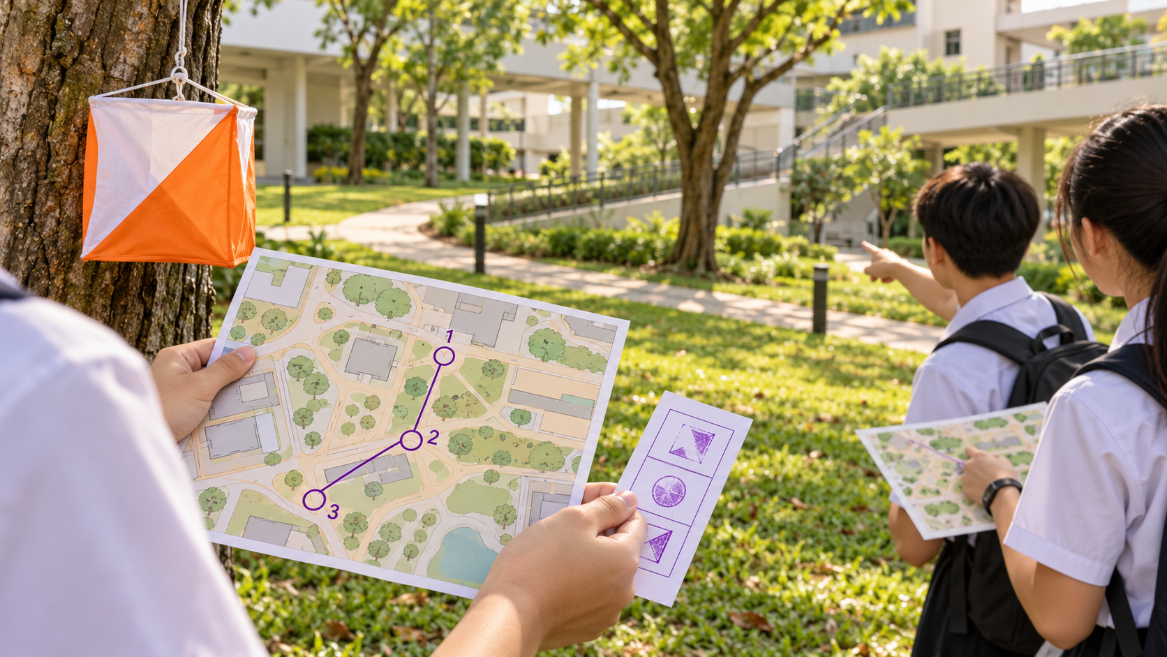
Maps can change a civilisation’s decisions without moving a single mountain. A line on paper may influence where people walk, which route delivers food, how a port operates or whose community appears on a government’s records. Yet a map is not the land itself. It is a selective representation made for a purpose, at a particular scale, using evidence of a particular date. This guide explains how geographic knowledge and navigation work from adaptive human worlds to contemporary global networks and clearly labelled hypothetical future habitats.
The important fact comes first: there is no universally compulsory sequence of nine civilisation stages. The eduKate Civilisation Atlas proposes Foundation 0 followed by eight numbered coordinates to help learners examine what people and institutions can maintain. The first stages raise questions about settlement, recorded administration, industry and planetary interdependence. Stage 5 is a proposed regenerative threshold; Stages 6–8 are hypothetical future human capabilities beyond Earth. This is a teaching framework, not a measure of anyone’s dignity, intelligence or right to belong.
This chapter investigates spatial knowledge rather than revisiting the general history of transport. It explains why route choice, map projection, observations of a coastline, indigenous navigational knowledge, place names, survey quality and digital data all carry different responsibilities. A good navigator can explain not just where a symbol points, but what the source cannot guarantee. Cultural knowledge, permission and safety are relevant even where a map’s geometry is excellent.

Read this guide efficiently
If you need an answer quickly, begin with the first explanation in each numbered chapter. Use the source notes for factual references and the nine-stage comparisons to examine different operating conditions. Each imaginary school model is explicitly invented. Children should use printed diagrams, counters, invented institutions and hypothetical choices rather than real hazardous routes, accounts, passwords or personal details. Parents may use the worked examples for comprehension and mathematics; tutors can ask students to revise a conclusion after a counterexample.
What the international evidence actually establishes
NOAA, What are nautical charts?
A nautical chart is a navigation aid that depicts relevant maritime information and requires careful interpretation; it is not an image that authorises a student to sail. Read the original institutional source: NOAA, What are nautical charts?. The date, defined population or technical edition belongs to that source. Its evidence does not confer official recognition on the separate educational stage model. A published standard is not proof of uniform implementation in every place, nor is a scientific experiment proof of complete civilisational capacity.
NOAA, A History of Charting Our Nation’s Waters
The historical development of coastal surveys and charting includes evolving instruments and the need to correct incomplete or dangerous hydrographic information. Read the original institutional source: NOAA, A History of Charting Our Nation’s Waters. The date, defined population or technical edition belongs to that source. Its evidence does not confer official recognition on the separate educational stage model. A published standard is not proof of uniform implementation in every place, nor is a scientific experiment proof of complete civilisational capacity.
NOAA, Nautical Charts and Electronic Navigational Charts
Current NOAA nautical chart information includes shoreline, water depth, landmarks and navigational aids; electronic chart data supports defined operational uses. Read the original institutional source: NOAA, Nautical Charts and Electronic Navigational Charts. The date, defined population or technical edition belongs to that source. Its evidence does not confer official recognition on the separate educational stage model. A published standard is not proof of uniform implementation in every place, nor is a scientific experiment proof of complete civilisational capacity.
IHO, ENC and ECDIS Standards, May 2026
The International Hydrographic Organization’s 2026 information identifies the S-100 universal hydrographic data model and S-101 electronic navigational chart specifications, with edition and effective dates. Read the original institutional source: IHO, ENC and ECDIS Standards, May 2026. The date, defined population or technical edition belongs to that source. Its evidence does not confer official recognition on the separate educational stage model. A published standard is not proof of uniform implementation in every place, nor is a scientific experiment proof of complete civilisational capacity.
UNESCO, About the Silk Roads
The Silk Roads were diverse land and sea routes carrying people, goods, skills and ideas; not one fixed linear trail. Read the original institutional source: UNESCO, About the Silk Roads. The date, defined population or technical edition belongs to that source. Its evidence does not confer official recognition on the separate educational stage model. A published standard is not proof of uniform implementation in every place, nor is a scientific experiment proof of complete civilisational capacity.
NOAA, Historical Chart Collection
The historical archive supplies authentic chart evidence for study while explicitly cautioning that historical charts are not suitable for current navigation. Read the original institutional source: NOAA, Historical Chart Collection. The date, defined population or technical edition belongs to that source. Its evidence does not confer official recognition on the separate educational stage model. A published standard is not proof of uniform implementation in every place, nor is a scientific experiment proof of complete civilisational capacity.
IMO, Hydrographic Data and Nautical Charts
International maritime safety requirements address adequate and up-to-date charts and the importance of hydrographic information for navigation. Read the original institutional source: IMO, Hydrographic Data and Nautical Charts. The date, defined population or technical edition belongs to that source. Its evidence does not confer official recognition on the separate educational stage model. A published standard is not proof of uniform implementation in every place, nor is a scientific experiment proof of complete civilisational capacity.
The nine coordinates: what we would look for
Foundation 0: Adaptive Human Worlds. The scene is a mobile or seasonally flexible community learning its surroundings through observation, testimony and practical participation. The operational test is knowledge that another person can learn and adapt without requiring permanent architecture or written records. A good research question asks what happens when a new generation encounters unfamiliar conditions after the most experienced practitioner leaves. Boundary: absence of monumental material remains does not imply absence of intelligence, ethics, navigation or organised cooperation. This is historically investigable human adaptation, never a lesser kind of humanity; it should not be read as an inevitable chronology.
Stage 1: Settlement and Surplus. The scene is a settlement with recurring food provision, family dwellings, stores and routes that must work across ordinary seasonal change. The operational test is a continued local function maintained beyond one fortunate day. A good research question asks what happens when a seasonal interruption blocks the route or service that a shared reserve depends upon. Boundary: one harvest or building does not establish permanent reliability or fairly shared benefits. This is a category of settlement capability, not a required next step for every culture; it should not be read as an inevitable chronology.
Stage 2: Administrative and Recorded Systems. The scene is a town whose stewards exchange durable accounts, maps, messages and responsibilities between institutions. The operational test is traceable responsibility and decisions that survive an ordinary handover. A good research question asks what happens when an official record disagrees with a household, user or second independently kept account. Boundary: preserved records can privilege administrators and omit people whose knowledge was conveyed differently. This is a historically investigable form of coordination whose fairness must be separately checked; it should not be read as an inevitable chronology.
Stage 3: Industrial and Mass Institutions. The scene is an industrial district with specialised workers, transport, regulated services and complex equipment. The operational test is repeatable provision through competent practice, quality controls and maintained infrastructure. A good research question asks what happens when an apparently modern system operates at scale but fails a safety or accessibility check. Boundary: a device, factory or professional institution alone cannot establish universal access or wellbeing. This is a historically investigable industrial function rather than a moral achievement; it should not be read as an inevitable chronology.
Stage 4: Planetary Network Civilisation. The scene is world regions linked through important long-distance goods, data, people and institutional cooperation. The operational test is consequential cross-border connections that remain functional and accountable through disruption. A good research question asks what happens when a change far from the intended recipient exposes a hidden dependency in the local service. Boundary: connected networks do not make every region or resident equally connected, secure or influential. This is an investigable global-network capacity with nonuniform access; it should not be read as an inevitable chronology.
Stage 5: Regenerative and Self-Correcting Civilisation. The scene is an imagined region attempting to discover harm, repair the causes, monitor later outcomes and revise policy. The operational test is a proposed ability to demonstrate durable improvement instead of declaring success from one attractive metric. A good research question asks what happens when one local improvement creates unmeasured costs for another community or the environment. Boundary: a well-designed project is not evidence that this proposed threshold has been reached by all civilisation. This is an explicitly proposed teaching threshold, not an official international classification; it should not be read as an inevitable chronology.
Stage 6: Multi-World Extension. The scene is a fictional inhabited outpost away from Earth still reliant on Earth for critical deliveries, experts and technical parts. The operational test is continuing human presence outside Earth with its support and dependence carefully documented. A good research question asks what happens when a required resupply cannot arrive within the assumed time window. Boundary: spacecraft, robots and planned habitats do not establish an existing, continuing second-world human community. This is a hypothetical human capability not established by current space exploration; it should not be read as an inevitable chronology.
Stage 7: Autonomous Multi-World Civilisation. The scene is a speculative off-Earth settlement trying to maintain health, industry, education and essential resources without regular Earth help. The operational test is substantial, demonstrable local independence across multiple life-supporting functions. A good research question asks what happens when one apparently independent service proves dependent on an irreplaceable imported component. Boundary: a successful local experiment does not establish broad inhabited autonomy. This is a hypothetical human state not achieved by a functioning off-Earth society; it should not be read as an inevitable chronology.
Stage 8: Distributed Interplanetary Civilisation. The scene is several imaginary inhabited worlds that can communicate only with significant delays. The operational test is maintained essential functions at different centres combined with accountable cooperation and lawful decisions. A good research question asks what happens when instructions become outdated before reaching the location expected to follow them. Boundary: robotic communication networks and probes are evidence of technology, not inhabited interplanetary communities. This is a speculative distributed human civilisation threshold; it should not be read as an inevitable chronology.
The 16–17 mechanisms: evidence, teaching and stage-by-stage comparison
The next chapters are deliberately mechanism-specific. Each one begins with what the system is meant to do and a realistic failure that a student can reason about using safe paper tools. The stage comparisons are fictional applications of that mechanism to different capacities. They do not claim that one invented event occurred in a real ancient population. Their job is to reveal assumptions, show how an apparently sound result might fail, and teach a child to explain the precise evidence needed to make a justified claim.
1. Spatial knowledge before a written map: the essential explanation
The purpose is to explain how communities learn landscape features and recurring routes through experienced observation. This matters because spatial knowledge before a written map is easily mistaken for a single object, number or announcement. Picture the following invented situation: a learner remembers a path but cannot explain which changing landmark made it safe. A stronger explanation identifies the practical service, the people affected, the resources or responsibilities required and the point at which a conclusion could be tested. It must not assume that the same cultural, geographic or financial arrangements existed in every past society. What is demonstrated locally may not generalise to an entire region.
A responsible investigator would seek oral testimony handled with context, landscape observations and scholarly records and select a measurable quantity such as a usable route learned without relying on one expert. But check people whose environmental knowledge is omitted from written maps before accepting a favourable total. The tempting overclaim is assuming spatial intelligence requires printed maps; a serious alternative is that one unrecorded route may reflect a deliberate cultural choice rather than ignorance. Students should be able to tell these explanations apart rather than simply choose the one that sounds modern. The first classroom exercise is to create a fictional seasonal landscape and ask a second group to explain the safest permitted walking route, then separate a successful journey from dependable transferable wayfinding. Never put students into genuine danger or ask them to share real personal information to complete the exercise.
Spatial knowledge before a written map — Foundation 0: Adaptive Human Worlds
What the mechanism would require. Imagine a mobile or seasonally flexible community learning its surroundings through observation, testimony and practical participation. The operating purpose here is to explain how communities learn landscape features and recurring routes through experienced observation. Now suppose a learner remembers a path but cannot explain which changing landmark made it safe. The question is not whether the community has a famous monument or impressive technology, but whether it can demonstrate knowledge that another person can learn and adapt without requiring permanent architecture or written records. Describe the actual sequence from a person’s need to a delivered function, including the human knowledge, material input and authority required. Then introduce the stage-specific interruption: a new generation encounters unfamiliar conditions after the most experienced practitioner leaves. This changes the evidence a careful observer should seek. An intact object or a planned activity is not the same as a service that keeps operating when circumstances change.
Evidence, limits and fair access. Consider oral testimony handled with context, landscape observations and scholarly records and the candidate outcome a usable route learned without relying on one expert. For people whose environmental knowledge is omitted from written maps, the published records may leave out precisely the people we should ask about. A weak claim would be assuming spatial intelligence requires printed maps. A competing explanation is that one unrecorded route may reflect a deliberate cultural choice rather than ignorance. Each interpretation predicts a different observation, so the student should state what further information could distinguish them. absence of monumental material remains does not imply absence of intelligence, ethics, navigation or organised cooperation. In this framework, this is historically investigable human adaptation, never a lesser kind of humanity. The label itself neither proves a fact nor decides human worth; actual source quality and scope do that work.
How to teach it. Use a completely imaginary model and invite students to create a fictional seasonal landscape and ask a second group to explain the safest permitted walking route. Have a second group check whether the first group’s method still holds when a new generation encounters unfamiliar conditions after the most experienced practitioner leaves. Give a third group the task of identifying which people, conditions or data points were excluded. All findings should be written as limited statements about a defined period and place. The most important final action is to separate a successful journey from dependable transferable wayfinding. If the students discover a flaw, they should publish the correction within their fictional report, not conceal it. The strongest answer may be that the required capability has not been demonstrated.
Spatial knowledge before a written map — Stage 1: Settlement and Surplus
What the mechanism would require. Imagine a settlement with recurring food provision, family dwellings, stores and routes that must work across ordinary seasonal change. The operating purpose here is to explain how communities learn landscape features and recurring routes through experienced observation. Now suppose a learner remembers a path but cannot explain which changing landmark made it safe. The question is not whether the community has a famous monument or impressive technology, but whether it can demonstrate a continued local function maintained beyond one fortunate day. Describe the actual sequence from a person’s need to a delivered function, including the human knowledge, material input and authority required. Then introduce the stage-specific interruption: a seasonal interruption blocks the route or service that a shared reserve depends upon. This changes the evidence a careful observer should seek. An intact object or a planned activity is not the same as a service that keeps operating when circumstances change.
Evidence, limits and fair access. Consider oral testimony handled with context, landscape observations and scholarly records and the candidate outcome a usable route learned without relying on one expert. For people whose environmental knowledge is omitted from written maps, the published records may leave out precisely the people we should ask about. A weak claim would be assuming spatial intelligence requires printed maps. A competing explanation is that one unrecorded route may reflect a deliberate cultural choice rather than ignorance. Each interpretation predicts a different observation, so the student should state what further information could distinguish them. one harvest or building does not establish permanent reliability or fairly shared benefits. In this framework, this is a category of settlement capability, not a required next step for every culture. The label itself neither proves a fact nor decides human worth; actual source quality and scope do that work.
How to teach it. Use a completely imaginary model and invite students to create a fictional seasonal landscape and ask a second group to explain the safest permitted walking route. Have a second group check whether the first group’s method still holds when a seasonal interruption blocks the route or service that a shared reserve depends upon. Give a third group the task of identifying which people, conditions or data points were excluded. All findings should be written as limited statements about a defined period and place. The most important final action is to separate a successful journey from dependable transferable wayfinding. If the students discover a flaw, they should publish the correction within their fictional report, not conceal it. The strongest answer may be that the required capability has not been demonstrated.
Spatial knowledge before a written map — Stage 2: Administrative and Recorded Systems
What the mechanism would require. Imagine a town whose stewards exchange durable accounts, maps, messages and responsibilities between institutions. The operating purpose here is to explain how communities learn landscape features and recurring routes through experienced observation. Now suppose a learner remembers a path but cannot explain which changing landmark made it safe. The question is not whether the community has a famous monument or impressive technology, but whether it can demonstrate traceable responsibility and decisions that survive an ordinary handover. Describe the actual sequence from a person’s need to a delivered function, including the human knowledge, material input and authority required. Then introduce the stage-specific interruption: an official record disagrees with a household, user or second independently kept account. This changes the evidence a careful observer should seek. An intact object or a planned activity is not the same as a service that keeps operating when circumstances change.
Evidence, limits and fair access. Consider oral testimony handled with context, landscape observations and scholarly records and the candidate outcome a usable route learned without relying on one expert. For people whose environmental knowledge is omitted from written maps, the published records may leave out precisely the people we should ask about. A weak claim would be assuming spatial intelligence requires printed maps. A competing explanation is that one unrecorded route may reflect a deliberate cultural choice rather than ignorance. Each interpretation predicts a different observation, so the student should state what further information could distinguish them. preserved records can privilege administrators and omit people whose knowledge was conveyed differently. In this framework, this is a historically investigable form of coordination whose fairness must be separately checked. The label itself neither proves a fact nor decides human worth; actual source quality and scope do that work.
How to teach it. Use a completely imaginary model and invite students to create a fictional seasonal landscape and ask a second group to explain the safest permitted walking route. Have a second group check whether the first group’s method still holds when an official record disagrees with a household, user or second independently kept account. Give a third group the task of identifying which people, conditions or data points were excluded. All findings should be written as limited statements about a defined period and place. The most important final action is to separate a successful journey from dependable transferable wayfinding. If the students discover a flaw, they should publish the correction within their fictional report, not conceal it. The strongest answer may be that the required capability has not been demonstrated.
Spatial knowledge before a written map — Stage 3: Industrial and Mass Institutions
What the mechanism would require. Imagine an industrial district with specialised workers, transport, regulated services and complex equipment. The operating purpose here is to explain how communities learn landscape features and recurring routes through experienced observation. Now suppose a learner remembers a path but cannot explain which changing landmark made it safe. The question is not whether the community has a famous monument or impressive technology, but whether it can demonstrate repeatable provision through competent practice, quality controls and maintained infrastructure. Describe the actual sequence from a person’s need to a delivered function, including the human knowledge, material input and authority required. Then introduce the stage-specific interruption: an apparently modern system operates at scale but fails a safety or accessibility check. This changes the evidence a careful observer should seek. An intact object or a planned activity is not the same as a service that keeps operating when circumstances change.
Evidence, limits and fair access. Consider oral testimony handled with context, landscape observations and scholarly records and the candidate outcome a usable route learned without relying on one expert. For people whose environmental knowledge is omitted from written maps, the published records may leave out precisely the people we should ask about. A weak claim would be assuming spatial intelligence requires printed maps. A competing explanation is that one unrecorded route may reflect a deliberate cultural choice rather than ignorance. Each interpretation predicts a different observation, so the student should state what further information could distinguish them. a device, factory or professional institution alone cannot establish universal access or wellbeing. In this framework, this is a historically investigable industrial function rather than a moral achievement. The label itself neither proves a fact nor decides human worth; actual source quality and scope do that work.
How to teach it. Use a completely imaginary model and invite students to create a fictional seasonal landscape and ask a second group to explain the safest permitted walking route. Have a second group check whether the first group’s method still holds when an apparently modern system operates at scale but fails a safety or accessibility check. Give a third group the task of identifying which people, conditions or data points were excluded. All findings should be written as limited statements about a defined period and place. The most important final action is to separate a successful journey from dependable transferable wayfinding. If the students discover a flaw, they should publish the correction within their fictional report, not conceal it. The strongest answer may be that the required capability has not been demonstrated.
Spatial knowledge before a written map — Stage 4: Planetary Network Civilisation
What the mechanism would require. Imagine world regions linked through important long-distance goods, data, people and institutional cooperation. The operating purpose here is to explain how communities learn landscape features and recurring routes through experienced observation. Now suppose a learner remembers a path but cannot explain which changing landmark made it safe. The question is not whether the community has a famous monument or impressive technology, but whether it can demonstrate consequential cross-border connections that remain functional and accountable through disruption. Describe the actual sequence from a person’s need to a delivered function, including the human knowledge, material input and authority required. Then introduce the stage-specific interruption: a change far from the intended recipient exposes a hidden dependency in the local service. This changes the evidence a careful observer should seek. An intact object or a planned activity is not the same as a service that keeps operating when circumstances change.
Evidence, limits and fair access. Consider oral testimony handled with context, landscape observations and scholarly records and the candidate outcome a usable route learned without relying on one expert. For people whose environmental knowledge is omitted from written maps, the published records may leave out precisely the people we should ask about. A weak claim would be assuming spatial intelligence requires printed maps. A competing explanation is that one unrecorded route may reflect a deliberate cultural choice rather than ignorance. Each interpretation predicts a different observation, so the student should state what further information could distinguish them. connected networks do not make every region or resident equally connected, secure or influential. In this framework, this is an investigable global-network capacity with nonuniform access. The label itself neither proves a fact nor decides human worth; actual source quality and scope do that work.
How to teach it. Use a completely imaginary model and invite students to create a fictional seasonal landscape and ask a second group to explain the safest permitted walking route. Have a second group check whether the first group’s method still holds when a change far from the intended recipient exposes a hidden dependency in the local service. Give a third group the task of identifying which people, conditions or data points were excluded. All findings should be written as limited statements about a defined period and place. The most important final action is to separate a successful journey from dependable transferable wayfinding. If the students discover a flaw, they should publish the correction within their fictional report, not conceal it. The strongest answer may be that the required capability has not been demonstrated.
Spatial knowledge before a written map — Stage 5: Regenerative and Self-Correcting Civilisation
What the mechanism would require. Imagine an imagined region attempting to discover harm, repair the causes, monitor later outcomes and revise policy. The operating purpose here is to explain how communities learn landscape features and recurring routes through experienced observation. Now suppose a learner remembers a path but cannot explain which changing landmark made it safe. The question is not whether the community has a famous monument or impressive technology, but whether it can demonstrate a proposed ability to demonstrate durable improvement instead of declaring success from one attractive metric. Describe the actual sequence from a person’s need to a delivered function, including the human knowledge, material input and authority required. Then introduce the stage-specific interruption: one local improvement creates unmeasured costs for another community or the environment. This changes the evidence a careful observer should seek. An intact object or a planned activity is not the same as a service that keeps operating when circumstances change.
Evidence, limits and fair access. Consider oral testimony handled with context, landscape observations and scholarly records and the candidate outcome a usable route learned without relying on one expert. For people whose environmental knowledge is omitted from written maps, the published records may leave out precisely the people we should ask about. A weak claim would be assuming spatial intelligence requires printed maps. A competing explanation is that one unrecorded route may reflect a deliberate cultural choice rather than ignorance. Each interpretation predicts a different observation, so the student should state what further information could distinguish them. a well-designed project is not evidence that this proposed threshold has been reached by all civilisation. In this framework, this is an explicitly proposed teaching threshold, not an official international classification. The label itself neither proves a fact nor decides human worth; actual source quality and scope do that work.
How to teach it. Use a completely imaginary model and invite students to create a fictional seasonal landscape and ask a second group to explain the safest permitted walking route. Have a second group check whether the first group’s method still holds when one local improvement creates unmeasured costs for another community or the environment. Give a third group the task of identifying which people, conditions or data points were excluded. All findings should be written as limited statements about a defined period and place. The most important final action is to separate a successful journey from dependable transferable wayfinding. If the students discover a flaw, they should publish the correction within their fictional report, not conceal it. The strongest answer may be that the required capability has not been demonstrated.
Spatial knowledge before a written map — Stage 6: Multi-World Extension
What the mechanism would require. Imagine a fictional inhabited outpost away from Earth still reliant on Earth for critical deliveries, experts and technical parts. The operating purpose here is to explain how communities learn landscape features and recurring routes through experienced observation. Now suppose a learner remembers a path but cannot explain which changing landmark made it safe. The question is not whether the community has a famous monument or impressive technology, but whether it can demonstrate continuing human presence outside Earth with its support and dependence carefully documented. Describe the actual sequence from a person’s need to a delivered function, including the human knowledge, material input and authority required. Then introduce the stage-specific interruption: a required resupply cannot arrive within the assumed time window. This changes the evidence a careful observer should seek. An intact object or a planned activity is not the same as a service that keeps operating when circumstances change.
Evidence, limits and fair access. Consider oral testimony handled with context, landscape observations and scholarly records and the candidate outcome a usable route learned without relying on one expert. For people whose environmental knowledge is omitted from written maps, the published records may leave out precisely the people we should ask about. A weak claim would be assuming spatial intelligence requires printed maps. A competing explanation is that one unrecorded route may reflect a deliberate cultural choice rather than ignorance. Each interpretation predicts a different observation, so the student should state what further information could distinguish them. spacecraft, robots and planned habitats do not establish an existing, continuing second-world human community. In this framework, this is a hypothetical human capability not established by current space exploration. The label itself neither proves a fact nor decides human worth; actual source quality and scope do that work.
How to teach it. Use a completely imaginary model and invite students to create a fictional seasonal landscape and ask a second group to explain the safest permitted walking route. Have a second group check whether the first group’s method still holds when a required resupply cannot arrive within the assumed time window. Give a third group the task of identifying which people, conditions or data points were excluded. All findings should be written as limited statements about a defined period and place. The most important final action is to separate a successful journey from dependable transferable wayfinding. If the students discover a flaw, they should publish the correction within their fictional report, not conceal it. The strongest answer may be that the required capability has not been demonstrated.
Spatial knowledge before a written map — Stage 7: Autonomous Multi-World Civilisation
What the mechanism would require. Imagine a speculative off-Earth settlement trying to maintain health, industry, education and essential resources without regular Earth help. The operating purpose here is to explain how communities learn landscape features and recurring routes through experienced observation. Now suppose a learner remembers a path but cannot explain which changing landmark made it safe. The question is not whether the community has a famous monument or impressive technology, but whether it can demonstrate substantial, demonstrable local independence across multiple life-supporting functions. Describe the actual sequence from a person’s need to a delivered function, including the human knowledge, material input and authority required. Then introduce the stage-specific interruption: one apparently independent service proves dependent on an irreplaceable imported component. This changes the evidence a careful observer should seek. An intact object or a planned activity is not the same as a service that keeps operating when circumstances change.
Evidence, limits and fair access. Consider oral testimony handled with context, landscape observations and scholarly records and the candidate outcome a usable route learned without relying on one expert. For people whose environmental knowledge is omitted from written maps, the published records may leave out precisely the people we should ask about. A weak claim would be assuming spatial intelligence requires printed maps. A competing explanation is that one unrecorded route may reflect a deliberate cultural choice rather than ignorance. Each interpretation predicts a different observation, so the student should state what further information could distinguish them. a successful local experiment does not establish broad inhabited autonomy. In this framework, this is a hypothetical human state not achieved by a functioning off-Earth society. The label itself neither proves a fact nor decides human worth; actual source quality and scope do that work.
How to teach it. Use a completely imaginary model and invite students to create a fictional seasonal landscape and ask a second group to explain the safest permitted walking route. Have a second group check whether the first group’s method still holds when one apparently independent service proves dependent on an irreplaceable imported component. Give a third group the task of identifying which people, conditions or data points were excluded. All findings should be written as limited statements about a defined period and place. The most important final action is to separate a successful journey from dependable transferable wayfinding. If the students discover a flaw, they should publish the correction within their fictional report, not conceal it. The strongest answer may be that the required capability has not been demonstrated.
Spatial knowledge before a written map — Stage 8: Distributed Interplanetary Civilisation
What the mechanism would require. Imagine several imaginary inhabited worlds that can communicate only with significant delays. The operating purpose here is to explain how communities learn landscape features and recurring routes through experienced observation. Now suppose a learner remembers a path but cannot explain which changing landmark made it safe. The question is not whether the community has a famous monument or impressive technology, but whether it can demonstrate maintained essential functions at different centres combined with accountable cooperation and lawful decisions. Describe the actual sequence from a person’s need to a delivered function, including the human knowledge, material input and authority required. Then introduce the stage-specific interruption: instructions become outdated before reaching the location expected to follow them. This changes the evidence a careful observer should seek. An intact object or a planned activity is not the same as a service that keeps operating when circumstances change.
Evidence, limits and fair access. Consider oral testimony handled with context, landscape observations and scholarly records and the candidate outcome a usable route learned without relying on one expert. For people whose environmental knowledge is omitted from written maps, the published records may leave out precisely the people we should ask about. A weak claim would be assuming spatial intelligence requires printed maps. A competing explanation is that one unrecorded route may reflect a deliberate cultural choice rather than ignorance. Each interpretation predicts a different observation, so the student should state what further information could distinguish them. robotic communication networks and probes are evidence of technology, not inhabited interplanetary communities. In this framework, this is a speculative distributed human civilisation threshold. The label itself neither proves a fact nor decides human worth; actual source quality and scope do that work.
How to teach it. Use a completely imaginary model and invite students to create a fictional seasonal landscape and ask a second group to explain the safest permitted walking route. Have a second group check whether the first group’s method still holds when instructions become outdated before reaching the location expected to follow them. Give a third group the task of identifying which people, conditions or data points were excluded. All findings should be written as limited statements about a defined period and place. The most important final action is to separate a successful journey from dependable transferable wayfinding. If the students discover a flaw, they should publish the correction within their fictional report, not conceal it. The strongest answer may be that the required capability has not been demonstrated.
Worked calculation: why the numerator alone is not enough
In this made-up classroom register, the plan calls for 48 instances of a usable route learned without relying on one expert during one named period. The team verifies 42 instances, leaving a shortfall of 6. Another 2 reports have uncertain status. The confirmed share is 42/48, approximately 87.5%. The ambiguous reports must not be counted as confirmed successes or deducted twice from the total. The arithmetic may be correct while the practical claim remains weak, especially if people whose environmental knowledge is omitted from written maps were excluded from the plan itself.
Ask the learner to alter one assumption. Suppose one unrecorded route may reflect a deliberate cultural choice rather than ignorance. Would the same verified count still support the initial conclusion? What evidence would be needed to distinguish it from assuming spatial intelligence requires printed maps? A good school answer defines the unit, place, period, eligible population and limitations before stating a percentage. This is why the calculation is paired with a source question: numbers can verify a narrow operation, but they cannot prove equality, historical inevitability or complete civilisation-wide performance without further evidence.
2. Map scale, proportion and the real distance: the essential explanation
The purpose is to understand how shrinking distances onto a page changes the interpretation of what can be measured. This matters because map scale, proportion and the real distance is easily mistaken for a single object, number or announcement. Picture the following invented situation: two groups treat one centimetre on maps with different scales as the same real distance. A stronger explanation identifies the practical service, the people affected, the resources or responsibilities required and the point at which a conclusion could be tested. It must not assume that the same cultural, geographic or financial arrangements existed in every past society. What is demonstrated locally may not generalise to an entire region.
A responsible investigator would seek printed scale, labelled units, actual distances and an independent arithmetic check and select a measurable quantity such as real-world distance derived from an explicitly stated scale. But check children who cannot interpret ratios or a map legend before accepting a favourable total. The tempting overclaim is reading a long-looking line as a long real journey; a serious alternative is that a map could be stretched or printed at the wrong size. Students should be able to tell these explanations apart rather than simply choose the one that sounds modern. The first classroom exercise is to on a 1:10,000 fictional map convert 3 centimetres into 300 metres and verify the unit conversion, then teach that a calculation is valid only for a preserved scale and the indicated unit. Never put students into genuine danger or ask them to share real personal information to complete the exercise.
Map scale, proportion and the real distance — Foundation 0: Adaptive Human Worlds
What the mechanism would require. Imagine a mobile or seasonally flexible community learning its surroundings through observation, testimony and practical participation. The operating purpose here is to understand how shrinking distances onto a page changes the interpretation of what can be measured. Now suppose two groups treat one centimetre on maps with different scales as the same real distance. The question is not whether the community has a famous monument or impressive technology, but whether it can demonstrate knowledge that another person can learn and adapt without requiring permanent architecture or written records. Describe the actual sequence from a person’s need to a delivered function, including the human knowledge, material input and authority required. Then introduce the stage-specific interruption: a new generation encounters unfamiliar conditions after the most experienced practitioner leaves. This changes the evidence a careful observer should seek. An intact object or a planned activity is not the same as a service that keeps operating when circumstances change.
Evidence, limits and fair access. Consider printed scale, labelled units, actual distances and an independent arithmetic check and the candidate outcome real-world distance derived from an explicitly stated scale. For children who cannot interpret ratios or a map legend, the published records may leave out precisely the people we should ask about. A weak claim would be reading a long-looking line as a long real journey. A competing explanation is that a map could be stretched or printed at the wrong size. Each interpretation predicts a different observation, so the student should state what further information could distinguish them. absence of monumental material remains does not imply absence of intelligence, ethics, navigation or organised cooperation. In this framework, this is historically investigable human adaptation, never a lesser kind of humanity. The label itself neither proves a fact nor decides human worth; actual source quality and scope do that work.
How to teach it. Use a completely imaginary model and invite students to on a 1:10,000 fictional map convert 3 centimetres into 300 metres and verify the unit conversion. Have a second group check whether the first group’s method still holds when a new generation encounters unfamiliar conditions after the most experienced practitioner leaves. Give a third group the task of identifying which people, conditions or data points were excluded. All findings should be written as limited statements about a defined period and place. The most important final action is to teach that a calculation is valid only for a preserved scale and the indicated unit. If the students discover a flaw, they should publish the correction within their fictional report, not conceal it. The strongest answer may be that the required capability has not been demonstrated.
Map scale, proportion and the real distance — Stage 1: Settlement and Surplus
What the mechanism would require. Imagine a settlement with recurring food provision, family dwellings, stores and routes that must work across ordinary seasonal change. The operating purpose here is to understand how shrinking distances onto a page changes the interpretation of what can be measured. Now suppose two groups treat one centimetre on maps with different scales as the same real distance. The question is not whether the community has a famous monument or impressive technology, but whether it can demonstrate a continued local function maintained beyond one fortunate day. Describe the actual sequence from a person’s need to a delivered function, including the human knowledge, material input and authority required. Then introduce the stage-specific interruption: a seasonal interruption blocks the route or service that a shared reserve depends upon. This changes the evidence a careful observer should seek. An intact object or a planned activity is not the same as a service that keeps operating when circumstances change.
Evidence, limits and fair access. Consider printed scale, labelled units, actual distances and an independent arithmetic check and the candidate outcome real-world distance derived from an explicitly stated scale. For children who cannot interpret ratios or a map legend, the published records may leave out precisely the people we should ask about. A weak claim would be reading a long-looking line as a long real journey. A competing explanation is that a map could be stretched or printed at the wrong size. Each interpretation predicts a different observation, so the student should state what further information could distinguish them. one harvest or building does not establish permanent reliability or fairly shared benefits. In this framework, this is a category of settlement capability, not a required next step for every culture. The label itself neither proves a fact nor decides human worth; actual source quality and scope do that work.
How to teach it. Use a completely imaginary model and invite students to on a 1:10,000 fictional map convert 3 centimetres into 300 metres and verify the unit conversion. Have a second group check whether the first group’s method still holds when a seasonal interruption blocks the route or service that a shared reserve depends upon. Give a third group the task of identifying which people, conditions or data points were excluded. All findings should be written as limited statements about a defined period and place. The most important final action is to teach that a calculation is valid only for a preserved scale and the indicated unit. If the students discover a flaw, they should publish the correction within their fictional report, not conceal it. The strongest answer may be that the required capability has not been demonstrated.
Map scale, proportion and the real distance — Stage 2: Administrative and Recorded Systems
What the mechanism would require. Imagine a town whose stewards exchange durable accounts, maps, messages and responsibilities between institutions. The operating purpose here is to understand how shrinking distances onto a page changes the interpretation of what can be measured. Now suppose two groups treat one centimetre on maps with different scales as the same real distance. The question is not whether the community has a famous monument or impressive technology, but whether it can demonstrate traceable responsibility and decisions that survive an ordinary handover. Describe the actual sequence from a person’s need to a delivered function, including the human knowledge, material input and authority required. Then introduce the stage-specific interruption: an official record disagrees with a household, user or second independently kept account. This changes the evidence a careful observer should seek. An intact object or a planned activity is not the same as a service that keeps operating when circumstances change.
Evidence, limits and fair access. Consider printed scale, labelled units, actual distances and an independent arithmetic check and the candidate outcome real-world distance derived from an explicitly stated scale. For children who cannot interpret ratios or a map legend, the published records may leave out precisely the people we should ask about. A weak claim would be reading a long-looking line as a long real journey. A competing explanation is that a map could be stretched or printed at the wrong size. Each interpretation predicts a different observation, so the student should state what further information could distinguish them. preserved records can privilege administrators and omit people whose knowledge was conveyed differently. In this framework, this is a historically investigable form of coordination whose fairness must be separately checked. The label itself neither proves a fact nor decides human worth; actual source quality and scope do that work.
How to teach it. Use a completely imaginary model and invite students to on a 1:10,000 fictional map convert 3 centimetres into 300 metres and verify the unit conversion. Have a second group check whether the first group’s method still holds when an official record disagrees with a household, user or second independently kept account. Give a third group the task of identifying which people, conditions or data points were excluded. All findings should be written as limited statements about a defined period and place. The most important final action is to teach that a calculation is valid only for a preserved scale and the indicated unit. If the students discover a flaw, they should publish the correction within their fictional report, not conceal it. The strongest answer may be that the required capability has not been demonstrated.
Map scale, proportion and the real distance — Stage 3: Industrial and Mass Institutions
What the mechanism would require. Imagine an industrial district with specialised workers, transport, regulated services and complex equipment. The operating purpose here is to understand how shrinking distances onto a page changes the interpretation of what can be measured. Now suppose two groups treat one centimetre on maps with different scales as the same real distance. The question is not whether the community has a famous monument or impressive technology, but whether it can demonstrate repeatable provision through competent practice, quality controls and maintained infrastructure. Describe the actual sequence from a person’s need to a delivered function, including the human knowledge, material input and authority required. Then introduce the stage-specific interruption: an apparently modern system operates at scale but fails a safety or accessibility check. This changes the evidence a careful observer should seek. An intact object or a planned activity is not the same as a service that keeps operating when circumstances change.
Evidence, limits and fair access. Consider printed scale, labelled units, actual distances and an independent arithmetic check and the candidate outcome real-world distance derived from an explicitly stated scale. For children who cannot interpret ratios or a map legend, the published records may leave out precisely the people we should ask about. A weak claim would be reading a long-looking line as a long real journey. A competing explanation is that a map could be stretched or printed at the wrong size. Each interpretation predicts a different observation, so the student should state what further information could distinguish them. a device, factory or professional institution alone cannot establish universal access or wellbeing. In this framework, this is a historically investigable industrial function rather than a moral achievement. The label itself neither proves a fact nor decides human worth; actual source quality and scope do that work.
How to teach it. Use a completely imaginary model and invite students to on a 1:10,000 fictional map convert 3 centimetres into 300 metres and verify the unit conversion. Have a second group check whether the first group’s method still holds when an apparently modern system operates at scale but fails a safety or accessibility check. Give a third group the task of identifying which people, conditions or data points were excluded. All findings should be written as limited statements about a defined period and place. The most important final action is to teach that a calculation is valid only for a preserved scale and the indicated unit. If the students discover a flaw, they should publish the correction within their fictional report, not conceal it. The strongest answer may be that the required capability has not been demonstrated.
Map scale, proportion and the real distance — Stage 4: Planetary Network Civilisation
What the mechanism would require. Imagine world regions linked through important long-distance goods, data, people and institutional cooperation. The operating purpose here is to understand how shrinking distances onto a page changes the interpretation of what can be measured. Now suppose two groups treat one centimetre on maps with different scales as the same real distance. The question is not whether the community has a famous monument or impressive technology, but whether it can demonstrate consequential cross-border connections that remain functional and accountable through disruption. Describe the actual sequence from a person’s need to a delivered function, including the human knowledge, material input and authority required. Then introduce the stage-specific interruption: a change far from the intended recipient exposes a hidden dependency in the local service. This changes the evidence a careful observer should seek. An intact object or a planned activity is not the same as a service that keeps operating when circumstances change.
Evidence, limits and fair access. Consider printed scale, labelled units, actual distances and an independent arithmetic check and the candidate outcome real-world distance derived from an explicitly stated scale. For children who cannot interpret ratios or a map legend, the published records may leave out precisely the people we should ask about. A weak claim would be reading a long-looking line as a long real journey. A competing explanation is that a map could be stretched or printed at the wrong size. Each interpretation predicts a different observation, so the student should state what further information could distinguish them. connected networks do not make every region or resident equally connected, secure or influential. In this framework, this is an investigable global-network capacity with nonuniform access. The label itself neither proves a fact nor decides human worth; actual source quality and scope do that work.
How to teach it. Use a completely imaginary model and invite students to on a 1:10,000 fictional map convert 3 centimetres into 300 metres and verify the unit conversion. Have a second group check whether the first group’s method still holds when a change far from the intended recipient exposes a hidden dependency in the local service. Give a third group the task of identifying which people, conditions or data points were excluded. All findings should be written as limited statements about a defined period and place. The most important final action is to teach that a calculation is valid only for a preserved scale and the indicated unit. If the students discover a flaw, they should publish the correction within their fictional report, not conceal it. The strongest answer may be that the required capability has not been demonstrated.
Map scale, proportion and the real distance — Stage 5: Regenerative and Self-Correcting Civilisation
What the mechanism would require. Imagine an imagined region attempting to discover harm, repair the causes, monitor later outcomes and revise policy. The operating purpose here is to understand how shrinking distances onto a page changes the interpretation of what can be measured. Now suppose two groups treat one centimetre on maps with different scales as the same real distance. The question is not whether the community has a famous monument or impressive technology, but whether it can demonstrate a proposed ability to demonstrate durable improvement instead of declaring success from one attractive metric. Describe the actual sequence from a person’s need to a delivered function, including the human knowledge, material input and authority required. Then introduce the stage-specific interruption: one local improvement creates unmeasured costs for another community or the environment. This changes the evidence a careful observer should seek. An intact object or a planned activity is not the same as a service that keeps operating when circumstances change.
Evidence, limits and fair access. Consider printed scale, labelled units, actual distances and an independent arithmetic check and the candidate outcome real-world distance derived from an explicitly stated scale. For children who cannot interpret ratios or a map legend, the published records may leave out precisely the people we should ask about. A weak claim would be reading a long-looking line as a long real journey. A competing explanation is that a map could be stretched or printed at the wrong size. Each interpretation predicts a different observation, so the student should state what further information could distinguish them. a well-designed project is not evidence that this proposed threshold has been reached by all civilisation. In this framework, this is an explicitly proposed teaching threshold, not an official international classification. The label itself neither proves a fact nor decides human worth; actual source quality and scope do that work.
How to teach it. Use a completely imaginary model and invite students to on a 1:10,000 fictional map convert 3 centimetres into 300 metres and verify the unit conversion. Have a second group check whether the first group’s method still holds when one local improvement creates unmeasured costs for another community or the environment. Give a third group the task of identifying which people, conditions or data points were excluded. All findings should be written as limited statements about a defined period and place. The most important final action is to teach that a calculation is valid only for a preserved scale and the indicated unit. If the students discover a flaw, they should publish the correction within their fictional report, not conceal it. The strongest answer may be that the required capability has not been demonstrated.
Map scale, proportion and the real distance — Stage 6: Multi-World Extension
What the mechanism would require. Imagine a fictional inhabited outpost away from Earth still reliant on Earth for critical deliveries, experts and technical parts. The operating purpose here is to understand how shrinking distances onto a page changes the interpretation of what can be measured. Now suppose two groups treat one centimetre on maps with different scales as the same real distance. The question is not whether the community has a famous monument or impressive technology, but whether it can demonstrate continuing human presence outside Earth with its support and dependence carefully documented. Describe the actual sequence from a person’s need to a delivered function, including the human knowledge, material input and authority required. Then introduce the stage-specific interruption: a required resupply cannot arrive within the assumed time window. This changes the evidence a careful observer should seek. An intact object or a planned activity is not the same as a service that keeps operating when circumstances change.
Evidence, limits and fair access. Consider printed scale, labelled units, actual distances and an independent arithmetic check and the candidate outcome real-world distance derived from an explicitly stated scale. For children who cannot interpret ratios or a map legend, the published records may leave out precisely the people we should ask about. A weak claim would be reading a long-looking line as a long real journey. A competing explanation is that a map could be stretched or printed at the wrong size. Each interpretation predicts a different observation, so the student should state what further information could distinguish them. spacecraft, robots and planned habitats do not establish an existing, continuing second-world human community. In this framework, this is a hypothetical human capability not established by current space exploration. The label itself neither proves a fact nor decides human worth; actual source quality and scope do that work.
How to teach it. Use a completely imaginary model and invite students to on a 1:10,000 fictional map convert 3 centimetres into 300 metres and verify the unit conversion. Have a second group check whether the first group’s method still holds when a required resupply cannot arrive within the assumed time window. Give a third group the task of identifying which people, conditions or data points were excluded. All findings should be written as limited statements about a defined period and place. The most important final action is to teach that a calculation is valid only for a preserved scale and the indicated unit. If the students discover a flaw, they should publish the correction within their fictional report, not conceal it. The strongest answer may be that the required capability has not been demonstrated.
Map scale, proportion and the real distance — Stage 7: Autonomous Multi-World Civilisation
What the mechanism would require. Imagine a speculative off-Earth settlement trying to maintain health, industry, education and essential resources without regular Earth help. The operating purpose here is to understand how shrinking distances onto a page changes the interpretation of what can be measured. Now suppose two groups treat one centimetre on maps with different scales as the same real distance. The question is not whether the community has a famous monument or impressive technology, but whether it can demonstrate substantial, demonstrable local independence across multiple life-supporting functions. Describe the actual sequence from a person’s need to a delivered function, including the human knowledge, material input and authority required. Then introduce the stage-specific interruption: one apparently independent service proves dependent on an irreplaceable imported component. This changes the evidence a careful observer should seek. An intact object or a planned activity is not the same as a service that keeps operating when circumstances change.
Evidence, limits and fair access. Consider printed scale, labelled units, actual distances and an independent arithmetic check and the candidate outcome real-world distance derived from an explicitly stated scale. For children who cannot interpret ratios or a map legend, the published records may leave out precisely the people we should ask about. A weak claim would be reading a long-looking line as a long real journey. A competing explanation is that a map could be stretched or printed at the wrong size. Each interpretation predicts a different observation, so the student should state what further information could distinguish them. a successful local experiment does not establish broad inhabited autonomy. In this framework, this is a hypothetical human state not achieved by a functioning off-Earth society. The label itself neither proves a fact nor decides human worth; actual source quality and scope do that work.
How to teach it. Use a completely imaginary model and invite students to on a 1:10,000 fictional map convert 3 centimetres into 300 metres and verify the unit conversion. Have a second group check whether the first group’s method still holds when one apparently independent service proves dependent on an irreplaceable imported component. Give a third group the task of identifying which people, conditions or data points were excluded. All findings should be written as limited statements about a defined period and place. The most important final action is to teach that a calculation is valid only for a preserved scale and the indicated unit. If the students discover a flaw, they should publish the correction within their fictional report, not conceal it. The strongest answer may be that the required capability has not been demonstrated.
Map scale, proportion and the real distance — Stage 8: Distributed Interplanetary Civilisation
What the mechanism would require. Imagine several imaginary inhabited worlds that can communicate only with significant delays. The operating purpose here is to understand how shrinking distances onto a page changes the interpretation of what can be measured. Now suppose two groups treat one centimetre on maps with different scales as the same real distance. The question is not whether the community has a famous monument or impressive technology, but whether it can demonstrate maintained essential functions at different centres combined with accountable cooperation and lawful decisions. Describe the actual sequence from a person’s need to a delivered function, including the human knowledge, material input and authority required. Then introduce the stage-specific interruption: instructions become outdated before reaching the location expected to follow them. This changes the evidence a careful observer should seek. An intact object or a planned activity is not the same as a service that keeps operating when circumstances change.
Evidence, limits and fair access. Consider printed scale, labelled units, actual distances and an independent arithmetic check and the candidate outcome real-world distance derived from an explicitly stated scale. For children who cannot interpret ratios or a map legend, the published records may leave out precisely the people we should ask about. A weak claim would be reading a long-looking line as a long real journey. A competing explanation is that a map could be stretched or printed at the wrong size. Each interpretation predicts a different observation, so the student should state what further information could distinguish them. robotic communication networks and probes are evidence of technology, not inhabited interplanetary communities. In this framework, this is a speculative distributed human civilisation threshold. The label itself neither proves a fact nor decides human worth; actual source quality and scope do that work.
How to teach it. Use a completely imaginary model and invite students to on a 1:10,000 fictional map convert 3 centimetres into 300 metres and verify the unit conversion. Have a second group check whether the first group’s method still holds when instructions become outdated before reaching the location expected to follow them. Give a third group the task of identifying which people, conditions or data points were excluded. All findings should be written as limited statements about a defined period and place. The most important final action is to teach that a calculation is valid only for a preserved scale and the indicated unit. If the students discover a flaw, they should publish the correction within their fictional report, not conceal it. The strongest answer may be that the required capability has not been demonstrated.
Worked calculation: why the numerator alone is not enough
In this made-up classroom register, the plan calls for 57 instances of real-world distance derived from an explicitly stated scale during one named period. The team verifies 49 instances, leaving a shortfall of 8. Another 3 reports have uncertain status. The confirmed share is 49/57, approximately 86.0%. The ambiguous reports must not be counted as confirmed successes or deducted twice from the total. The arithmetic may be correct while the practical claim remains weak, especially if children who cannot interpret ratios or a map legend were excluded from the plan itself.
Ask the learner to alter one assumption. Suppose a map could be stretched or printed at the wrong size. Would the same verified count still support the initial conclusion? What evidence would be needed to distinguish it from reading a long-looking line as a long real journey? A good school answer defines the unit, place, period, eligible population and limitations before stating a percentage. This is why the calculation is paired with a source question: numbers can verify a narrow operation, but they cannot prove equality, historical inevitability or complete civilisation-wide performance without further evidence.
3. Symbols, legends and missing places: the essential explanation
The purpose is to read cartographic symbols as designed conventions rather than unquestioned facts. This matters because symbols, legends and missing places is easily mistaken for a single object, number or announcement. Picture the following invented situation: a map’s icon for a service appears but the site is no longer open or usable. A stronger explanation identifies the practical service, the people affected, the resources or responsibilities required and the point at which a conclusion could be tested. It must not assume that the same cultural, geographic or financial arrangements existed in every past society. What is demonstrated locally may not generalise to an entire region.
A responsible investigator would seek map key, publication date, source details and current institutional confirmation and select a measurable quantity such as correct interpretations of symbols and their limits. But check users unfamiliar with the language or not represented by standard icons before accepting a favourable total. The tempting overclaim is treating a symbol as proof the represented facility is available; a serious alternative is that the feature may have changed since the last survey. Students should be able to tell these explanations apart rather than simply choose the one that sounds modern. The first classroom exercise is to create invented icons for water, bridges and shelters and test whether another class can read them, then teach that an up-to-date status check can matter more than graphic beauty. Never put students into genuine danger or ask them to share real personal information to complete the exercise.
Symbols, legends and missing places — Foundation 0: Adaptive Human Worlds
What the mechanism would require. Imagine a mobile or seasonally flexible community learning its surroundings through observation, testimony and practical participation. The operating purpose here is to read cartographic symbols as designed conventions rather than unquestioned facts. Now suppose a map’s icon for a service appears but the site is no longer open or usable. The question is not whether the community has a famous monument or impressive technology, but whether it can demonstrate knowledge that another person can learn and adapt without requiring permanent architecture or written records. Describe the actual sequence from a person’s need to a delivered function, including the human knowledge, material input and authority required. Then introduce the stage-specific interruption: a new generation encounters unfamiliar conditions after the most experienced practitioner leaves. This changes the evidence a careful observer should seek. An intact object or a planned activity is not the same as a service that keeps operating when circumstances change.
Evidence, limits and fair access. Consider map key, publication date, source details and current institutional confirmation and the candidate outcome correct interpretations of symbols and their limits. For users unfamiliar with the language or not represented by standard icons, the published records may leave out precisely the people we should ask about. A weak claim would be treating a symbol as proof the represented facility is available. A competing explanation is that the feature may have changed since the last survey. Each interpretation predicts a different observation, so the student should state what further information could distinguish them. absence of monumental material remains does not imply absence of intelligence, ethics, navigation or organised cooperation. In this framework, this is historically investigable human adaptation, never a lesser kind of humanity. The label itself neither proves a fact nor decides human worth; actual source quality and scope do that work.
How to teach it. Use a completely imaginary model and invite students to create invented icons for water, bridges and shelters and test whether another class can read them. Have a second group check whether the first group’s method still holds when a new generation encounters unfamiliar conditions after the most experienced practitioner leaves. Give a third group the task of identifying which people, conditions or data points were excluded. All findings should be written as limited statements about a defined period and place. The most important final action is to teach that an up-to-date status check can matter more than graphic beauty. If the students discover a flaw, they should publish the correction within their fictional report, not conceal it. The strongest answer may be that the required capability has not been demonstrated.
Symbols, legends and missing places — Stage 1: Settlement and Surplus
What the mechanism would require. Imagine a settlement with recurring food provision, family dwellings, stores and routes that must work across ordinary seasonal change. The operating purpose here is to read cartographic symbols as designed conventions rather than unquestioned facts. Now suppose a map’s icon for a service appears but the site is no longer open or usable. The question is not whether the community has a famous monument or impressive technology, but whether it can demonstrate a continued local function maintained beyond one fortunate day. Describe the actual sequence from a person’s need to a delivered function, including the human knowledge, material input and authority required. Then introduce the stage-specific interruption: a seasonal interruption blocks the route or service that a shared reserve depends upon. This changes the evidence a careful observer should seek. An intact object or a planned activity is not the same as a service that keeps operating when circumstances change.
Evidence, limits and fair access. Consider map key, publication date, source details and current institutional confirmation and the candidate outcome correct interpretations of symbols and their limits. For users unfamiliar with the language or not represented by standard icons, the published records may leave out precisely the people we should ask about. A weak claim would be treating a symbol as proof the represented facility is available. A competing explanation is that the feature may have changed since the last survey. Each interpretation predicts a different observation, so the student should state what further information could distinguish them. one harvest or building does not establish permanent reliability or fairly shared benefits. In this framework, this is a category of settlement capability, not a required next step for every culture. The label itself neither proves a fact nor decides human worth; actual source quality and scope do that work.
How to teach it. Use a completely imaginary model and invite students to create invented icons for water, bridges and shelters and test whether another class can read them. Have a second group check whether the first group’s method still holds when a seasonal interruption blocks the route or service that a shared reserve depends upon. Give a third group the task of identifying which people, conditions or data points were excluded. All findings should be written as limited statements about a defined period and place. The most important final action is to teach that an up-to-date status check can matter more than graphic beauty. If the students discover a flaw, they should publish the correction within their fictional report, not conceal it. The strongest answer may be that the required capability has not been demonstrated.
Symbols, legends and missing places — Stage 2: Administrative and Recorded Systems
What the mechanism would require. Imagine a town whose stewards exchange durable accounts, maps, messages and responsibilities between institutions. The operating purpose here is to read cartographic symbols as designed conventions rather than unquestioned facts. Now suppose a map’s icon for a service appears but the site is no longer open or usable. The question is not whether the community has a famous monument or impressive technology, but whether it can demonstrate traceable responsibility and decisions that survive an ordinary handover. Describe the actual sequence from a person’s need to a delivered function, including the human knowledge, material input and authority required. Then introduce the stage-specific interruption: an official record disagrees with a household, user or second independently kept account. This changes the evidence a careful observer should seek. An intact object or a planned activity is not the same as a service that keeps operating when circumstances change.
Evidence, limits and fair access. Consider map key, publication date, source details and current institutional confirmation and the candidate outcome correct interpretations of symbols and their limits. For users unfamiliar with the language or not represented by standard icons, the published records may leave out precisely the people we should ask about. A weak claim would be treating a symbol as proof the represented facility is available. A competing explanation is that the feature may have changed since the last survey. Each interpretation predicts a different observation, so the student should state what further information could distinguish them. preserved records can privilege administrators and omit people whose knowledge was conveyed differently. In this framework, this is a historically investigable form of coordination whose fairness must be separately checked. The label itself neither proves a fact nor decides human worth; actual source quality and scope do that work.
How to teach it. Use a completely imaginary model and invite students to create invented icons for water, bridges and shelters and test whether another class can read them. Have a second group check whether the first group’s method still holds when an official record disagrees with a household, user or second independently kept account. Give a third group the task of identifying which people, conditions or data points were excluded. All findings should be written as limited statements about a defined period and place. The most important final action is to teach that an up-to-date status check can matter more than graphic beauty. If the students discover a flaw, they should publish the correction within their fictional report, not conceal it. The strongest answer may be that the required capability has not been demonstrated.
Symbols, legends and missing places — Stage 3: Industrial and Mass Institutions
What the mechanism would require. Imagine an industrial district with specialised workers, transport, regulated services and complex equipment. The operating purpose here is to read cartographic symbols as designed conventions rather than unquestioned facts. Now suppose a map’s icon for a service appears but the site is no longer open or usable. The question is not whether the community has a famous monument or impressive technology, but whether it can demonstrate repeatable provision through competent practice, quality controls and maintained infrastructure. Describe the actual sequence from a person’s need to a delivered function, including the human knowledge, material input and authority required. Then introduce the stage-specific interruption: an apparently modern system operates at scale but fails a safety or accessibility check. This changes the evidence a careful observer should seek. An intact object or a planned activity is not the same as a service that keeps operating when circumstances change.
Evidence, limits and fair access. Consider map key, publication date, source details and current institutional confirmation and the candidate outcome correct interpretations of symbols and their limits. For users unfamiliar with the language or not represented by standard icons, the published records may leave out precisely the people we should ask about. A weak claim would be treating a symbol as proof the represented facility is available. A competing explanation is that the feature may have changed since the last survey. Each interpretation predicts a different observation, so the student should state what further information could distinguish them. a device, factory or professional institution alone cannot establish universal access or wellbeing. In this framework, this is a historically investigable industrial function rather than a moral achievement. The label itself neither proves a fact nor decides human worth; actual source quality and scope do that work.
How to teach it. Use a completely imaginary model and invite students to create invented icons for water, bridges and shelters and test whether another class can read them. Have a second group check whether the first group’s method still holds when an apparently modern system operates at scale but fails a safety or accessibility check. Give a third group the task of identifying which people, conditions or data points were excluded. All findings should be written as limited statements about a defined period and place. The most important final action is to teach that an up-to-date status check can matter more than graphic beauty. If the students discover a flaw, they should publish the correction within their fictional report, not conceal it. The strongest answer may be that the required capability has not been demonstrated.
Symbols, legends and missing places — Stage 4: Planetary Network Civilisation
What the mechanism would require. Imagine world regions linked through important long-distance goods, data, people and institutional cooperation. The operating purpose here is to read cartographic symbols as designed conventions rather than unquestioned facts. Now suppose a map’s icon for a service appears but the site is no longer open or usable. The question is not whether the community has a famous monument or impressive technology, but whether it can demonstrate consequential cross-border connections that remain functional and accountable through disruption. Describe the actual sequence from a person’s need to a delivered function, including the human knowledge, material input and authority required. Then introduce the stage-specific interruption: a change far from the intended recipient exposes a hidden dependency in the local service. This changes the evidence a careful observer should seek. An intact object or a planned activity is not the same as a service that keeps operating when circumstances change.
Evidence, limits and fair access. Consider map key, publication date, source details and current institutional confirmation and the candidate outcome correct interpretations of symbols and their limits. For users unfamiliar with the language or not represented by standard icons, the published records may leave out precisely the people we should ask about. A weak claim would be treating a symbol as proof the represented facility is available. A competing explanation is that the feature may have changed since the last survey. Each interpretation predicts a different observation, so the student should state what further information could distinguish them. connected networks do not make every region or resident equally connected, secure or influential. In this framework, this is an investigable global-network capacity with nonuniform access. The label itself neither proves a fact nor decides human worth; actual source quality and scope do that work.
How to teach it. Use a completely imaginary model and invite students to create invented icons for water, bridges and shelters and test whether another class can read them. Have a second group check whether the first group’s method still holds when a change far from the intended recipient exposes a hidden dependency in the local service. Give a third group the task of identifying which people, conditions or data points were excluded. All findings should be written as limited statements about a defined period and place. The most important final action is to teach that an up-to-date status check can matter more than graphic beauty. If the students discover a flaw, they should publish the correction within their fictional report, not conceal it. The strongest answer may be that the required capability has not been demonstrated.
Symbols, legends and missing places — Stage 5: Regenerative and Self-Correcting Civilisation
What the mechanism would require. Imagine an imagined region attempting to discover harm, repair the causes, monitor later outcomes and revise policy. The operating purpose here is to read cartographic symbols as designed conventions rather than unquestioned facts. Now suppose a map’s icon for a service appears but the site is no longer open or usable. The question is not whether the community has a famous monument or impressive technology, but whether it can demonstrate a proposed ability to demonstrate durable improvement instead of declaring success from one attractive metric. Describe the actual sequence from a person’s need to a delivered function, including the human knowledge, material input and authority required. Then introduce the stage-specific interruption: one local improvement creates unmeasured costs for another community or the environment. This changes the evidence a careful observer should seek. An intact object or a planned activity is not the same as a service that keeps operating when circumstances change.
Evidence, limits and fair access. Consider map key, publication date, source details and current institutional confirmation and the candidate outcome correct interpretations of symbols and their limits. For users unfamiliar with the language or not represented by standard icons, the published records may leave out precisely the people we should ask about. A weak claim would be treating a symbol as proof the represented facility is available. A competing explanation is that the feature may have changed since the last survey. Each interpretation predicts a different observation, so the student should state what further information could distinguish them. a well-designed project is not evidence that this proposed threshold has been reached by all civilisation. In this framework, this is an explicitly proposed teaching threshold, not an official international classification. The label itself neither proves a fact nor decides human worth; actual source quality and scope do that work.
How to teach it. Use a completely imaginary model and invite students to create invented icons for water, bridges and shelters and test whether another class can read them. Have a second group check whether the first group’s method still holds when one local improvement creates unmeasured costs for another community or the environment. Give a third group the task of identifying which people, conditions or data points were excluded. All findings should be written as limited statements about a defined period and place. The most important final action is to teach that an up-to-date status check can matter more than graphic beauty. If the students discover a flaw, they should publish the correction within their fictional report, not conceal it. The strongest answer may be that the required capability has not been demonstrated.
Symbols, legends and missing places — Stage 6: Multi-World Extension
What the mechanism would require. Imagine a fictional inhabited outpost away from Earth still reliant on Earth for critical deliveries, experts and technical parts. The operating purpose here is to read cartographic symbols as designed conventions rather than unquestioned facts. Now suppose a map’s icon for a service appears but the site is no longer open or usable. The question is not whether the community has a famous monument or impressive technology, but whether it can demonstrate continuing human presence outside Earth with its support and dependence carefully documented. Describe the actual sequence from a person’s need to a delivered function, including the human knowledge, material input and authority required. Then introduce the stage-specific interruption: a required resupply cannot arrive within the assumed time window. This changes the evidence a careful observer should seek. An intact object or a planned activity is not the same as a service that keeps operating when circumstances change.
Evidence, limits and fair access. Consider map key, publication date, source details and current institutional confirmation and the candidate outcome correct interpretations of symbols and their limits. For users unfamiliar with the language or not represented by standard icons, the published records may leave out precisely the people we should ask about. A weak claim would be treating a symbol as proof the represented facility is available. A competing explanation is that the feature may have changed since the last survey. Each interpretation predicts a different observation, so the student should state what further information could distinguish them. spacecraft, robots and planned habitats do not establish an existing, continuing second-world human community. In this framework, this is a hypothetical human capability not established by current space exploration. The label itself neither proves a fact nor decides human worth; actual source quality and scope do that work.
How to teach it. Use a completely imaginary model and invite students to create invented icons for water, bridges and shelters and test whether another class can read them. Have a second group check whether the first group’s method still holds when a required resupply cannot arrive within the assumed time window. Give a third group the task of identifying which people, conditions or data points were excluded. All findings should be written as limited statements about a defined period and place. The most important final action is to teach that an up-to-date status check can matter more than graphic beauty. If the students discover a flaw, they should publish the correction within their fictional report, not conceal it. The strongest answer may be that the required capability has not been demonstrated.
Symbols, legends and missing places — Stage 7: Autonomous Multi-World Civilisation
What the mechanism would require. Imagine a speculative off-Earth settlement trying to maintain health, industry, education and essential resources without regular Earth help. The operating purpose here is to read cartographic symbols as designed conventions rather than unquestioned facts. Now suppose a map’s icon for a service appears but the site is no longer open or usable. The question is not whether the community has a famous monument or impressive technology, but whether it can demonstrate substantial, demonstrable local independence across multiple life-supporting functions. Describe the actual sequence from a person’s need to a delivered function, including the human knowledge, material input and authority required. Then introduce the stage-specific interruption: one apparently independent service proves dependent on an irreplaceable imported component. This changes the evidence a careful observer should seek. An intact object or a planned activity is not the same as a service that keeps operating when circumstances change.
Evidence, limits and fair access. Consider map key, publication date, source details and current institutional confirmation and the candidate outcome correct interpretations of symbols and their limits. For users unfamiliar with the language or not represented by standard icons, the published records may leave out precisely the people we should ask about. A weak claim would be treating a symbol as proof the represented facility is available. A competing explanation is that the feature may have changed since the last survey. Each interpretation predicts a different observation, so the student should state what further information could distinguish them. a successful local experiment does not establish broad inhabited autonomy. In this framework, this is a hypothetical human state not achieved by a functioning off-Earth society. The label itself neither proves a fact nor decides human worth; actual source quality and scope do that work.
How to teach it. Use a completely imaginary model and invite students to create invented icons for water, bridges and shelters and test whether another class can read them. Have a second group check whether the first group’s method still holds when one apparently independent service proves dependent on an irreplaceable imported component. Give a third group the task of identifying which people, conditions or data points were excluded. All findings should be written as limited statements about a defined period and place. The most important final action is to teach that an up-to-date status check can matter more than graphic beauty. If the students discover a flaw, they should publish the correction within their fictional report, not conceal it. The strongest answer may be that the required capability has not been demonstrated.
Symbols, legends and missing places — Stage 8: Distributed Interplanetary Civilisation
What the mechanism would require. Imagine several imaginary inhabited worlds that can communicate only with significant delays. The operating purpose here is to read cartographic symbols as designed conventions rather than unquestioned facts. Now suppose a map’s icon for a service appears but the site is no longer open or usable. The question is not whether the community has a famous monument or impressive technology, but whether it can demonstrate maintained essential functions at different centres combined with accountable cooperation and lawful decisions. Describe the actual sequence from a person’s need to a delivered function, including the human knowledge, material input and authority required. Then introduce the stage-specific interruption: instructions become outdated before reaching the location expected to follow them. This changes the evidence a careful observer should seek. An intact object or a planned activity is not the same as a service that keeps operating when circumstances change.
Evidence, limits and fair access. Consider map key, publication date, source details and current institutional confirmation and the candidate outcome correct interpretations of symbols and their limits. For users unfamiliar with the language or not represented by standard icons, the published records may leave out precisely the people we should ask about. A weak claim would be treating a symbol as proof the represented facility is available. A competing explanation is that the feature may have changed since the last survey. Each interpretation predicts a different observation, so the student should state what further information could distinguish them. robotic communication networks and probes are evidence of technology, not inhabited interplanetary communities. In this framework, this is a speculative distributed human civilisation threshold. The label itself neither proves a fact nor decides human worth; actual source quality and scope do that work.
How to teach it. Use a completely imaginary model and invite students to create invented icons for water, bridges and shelters and test whether another class can read them. Have a second group check whether the first group’s method still holds when instructions become outdated before reaching the location expected to follow them. Give a third group the task of identifying which people, conditions or data points were excluded. All findings should be written as limited statements about a defined period and place. The most important final action is to teach that an up-to-date status check can matter more than graphic beauty. If the students discover a flaw, they should publish the correction within their fictional report, not conceal it. The strongest answer may be that the required capability has not been demonstrated.
Worked calculation: why the numerator alone is not enough
In this made-up classroom register, the plan calls for 66 instances of correct interpretations of symbols and their limits during one named period. The team verifies 56 instances, leaving a shortfall of 10. Another 4 reports have uncertain status. The confirmed share is 56/66, approximately 84.8%. The ambiguous reports must not be counted as confirmed successes or deducted twice from the total. The arithmetic may be correct while the practical claim remains weak, especially if users unfamiliar with the language or not represented by standard icons were excluded from the plan itself.
Ask the learner to alter one assumption. Suppose the feature may have changed since the last survey. Would the same verified count still support the initial conclusion? What evidence would be needed to distinguish it from treating a symbol as proof the represented facility is available? A good school answer defines the unit, place, period, eligible population and limitations before stating a percentage. This is why the calculation is paired with a source question: numbers can verify a narrow operation, but they cannot prove equality, historical inevitability or complete civilisation-wide performance without further evidence.
4. Route distance versus travel time: the essential explanation
The purpose is to distinguish straight-line distance from terrain, access, delay and meaningful human travel. This matters because route distance versus travel time is easily mistaken for a single object, number or announcement. Picture the following invented situation: the nearest facility on paper requires a blocked crossing or inaccessible stairs. A stronger explanation identifies the practical service, the people affected, the resources or responsibilities required and the point at which a conclusion could be tested. It must not assume that the same cultural, geographic or financial arrangements existed in every past society. What is demonstrated locally may not generalise to an entire region.
A responsible investigator would seek route observations, authorised access information and properly scoped travel data and select a measurable quantity such as usable door-to-door journeys under stated conditions. But check people using wheelchairs, young children and carers before accepting a favourable total. The tempting overclaim is choosing the shortest line always gives the best route; a serious alternative is that a longer route may be safer or possible for more people. Students should be able to tell these explanations apart rather than simply choose the one that sounds modern. The first classroom exercise is to compare fictional routes with distance, crossings and one access restriction, then show how constraints transform geometry into a practical network problem. Never put students into genuine danger or ask them to share real personal information to complete the exercise.
Route distance versus travel time — Foundation 0: Adaptive Human Worlds
What the mechanism would require. Imagine a mobile or seasonally flexible community learning its surroundings through observation, testimony and practical participation. The operating purpose here is to distinguish straight-line distance from terrain, access, delay and meaningful human travel. Now suppose the nearest facility on paper requires a blocked crossing or inaccessible stairs. The question is not whether the community has a famous monument or impressive technology, but whether it can demonstrate knowledge that another person can learn and adapt without requiring permanent architecture or written records. Describe the actual sequence from a person’s need to a delivered function, including the human knowledge, material input and authority required. Then introduce the stage-specific interruption: a new generation encounters unfamiliar conditions after the most experienced practitioner leaves. This changes the evidence a careful observer should seek. An intact object or a planned activity is not the same as a service that keeps operating when circumstances change.
Evidence, limits and fair access. Consider route observations, authorised access information and properly scoped travel data and the candidate outcome usable door-to-door journeys under stated conditions. For people using wheelchairs, young children and carers, the published records may leave out precisely the people we should ask about. A weak claim would be choosing the shortest line always gives the best route. A competing explanation is that a longer route may be safer or possible for more people. Each interpretation predicts a different observation, so the student should state what further information could distinguish them. absence of monumental material remains does not imply absence of intelligence, ethics, navigation or organised cooperation. In this framework, this is historically investigable human adaptation, never a lesser kind of humanity. The label itself neither proves a fact nor decides human worth; actual source quality and scope do that work.
How to teach it. Use a completely imaginary model and invite students to compare fictional routes with distance, crossings and one access restriction. Have a second group check whether the first group’s method still holds when a new generation encounters unfamiliar conditions after the most experienced practitioner leaves. Give a third group the task of identifying which people, conditions or data points were excluded. All findings should be written as limited statements about a defined period and place. The most important final action is to show how constraints transform geometry into a practical network problem. If the students discover a flaw, they should publish the correction within their fictional report, not conceal it. The strongest answer may be that the required capability has not been demonstrated.
Route distance versus travel time — Stage 1: Settlement and Surplus
What the mechanism would require. Imagine a settlement with recurring food provision, family dwellings, stores and routes that must work across ordinary seasonal change. The operating purpose here is to distinguish straight-line distance from terrain, access, delay and meaningful human travel. Now suppose the nearest facility on paper requires a blocked crossing or inaccessible stairs. The question is not whether the community has a famous monument or impressive technology, but whether it can demonstrate a continued local function maintained beyond one fortunate day. Describe the actual sequence from a person’s need to a delivered function, including the human knowledge, material input and authority required. Then introduce the stage-specific interruption: a seasonal interruption blocks the route or service that a shared reserve depends upon. This changes the evidence a careful observer should seek. An intact object or a planned activity is not the same as a service that keeps operating when circumstances change.
Evidence, limits and fair access. Consider route observations, authorised access information and properly scoped travel data and the candidate outcome usable door-to-door journeys under stated conditions. For people using wheelchairs, young children and carers, the published records may leave out precisely the people we should ask about. A weak claim would be choosing the shortest line always gives the best route. A competing explanation is that a longer route may be safer or possible for more people. Each interpretation predicts a different observation, so the student should state what further information could distinguish them. one harvest or building does not establish permanent reliability or fairly shared benefits. In this framework, this is a category of settlement capability, not a required next step for every culture. The label itself neither proves a fact nor decides human worth; actual source quality and scope do that work.
How to teach it. Use a completely imaginary model and invite students to compare fictional routes with distance, crossings and one access restriction. Have a second group check whether the first group’s method still holds when a seasonal interruption blocks the route or service that a shared reserve depends upon. Give a third group the task of identifying which people, conditions or data points were excluded. All findings should be written as limited statements about a defined period and place. The most important final action is to show how constraints transform geometry into a practical network problem. If the students discover a flaw, they should publish the correction within their fictional report, not conceal it. The strongest answer may be that the required capability has not been demonstrated.
Route distance versus travel time — Stage 2: Administrative and Recorded Systems
What the mechanism would require. Imagine a town whose stewards exchange durable accounts, maps, messages and responsibilities between institutions. The operating purpose here is to distinguish straight-line distance from terrain, access, delay and meaningful human travel. Now suppose the nearest facility on paper requires a blocked crossing or inaccessible stairs. The question is not whether the community has a famous monument or impressive technology, but whether it can demonstrate traceable responsibility and decisions that survive an ordinary handover. Describe the actual sequence from a person’s need to a delivered function, including the human knowledge, material input and authority required. Then introduce the stage-specific interruption: an official record disagrees with a household, user or second independently kept account. This changes the evidence a careful observer should seek. An intact object or a planned activity is not the same as a service that keeps operating when circumstances change.
Evidence, limits and fair access. Consider route observations, authorised access information and properly scoped travel data and the candidate outcome usable door-to-door journeys under stated conditions. For people using wheelchairs, young children and carers, the published records may leave out precisely the people we should ask about. A weak claim would be choosing the shortest line always gives the best route. A competing explanation is that a longer route may be safer or possible for more people. Each interpretation predicts a different observation, so the student should state what further information could distinguish them. preserved records can privilege administrators and omit people whose knowledge was conveyed differently. In this framework, this is a historically investigable form of coordination whose fairness must be separately checked. The label itself neither proves a fact nor decides human worth; actual source quality and scope do that work.
How to teach it. Use a completely imaginary model and invite students to compare fictional routes with distance, crossings and one access restriction. Have a second group check whether the first group’s method still holds when an official record disagrees with a household, user or second independently kept account. Give a third group the task of identifying which people, conditions or data points were excluded. All findings should be written as limited statements about a defined period and place. The most important final action is to show how constraints transform geometry into a practical network problem. If the students discover a flaw, they should publish the correction within their fictional report, not conceal it. The strongest answer may be that the required capability has not been demonstrated.
Route distance versus travel time — Stage 3: Industrial and Mass Institutions
What the mechanism would require. Imagine an industrial district with specialised workers, transport, regulated services and complex equipment. The operating purpose here is to distinguish straight-line distance from terrain, access, delay and meaningful human travel. Now suppose the nearest facility on paper requires a blocked crossing or inaccessible stairs. The question is not whether the community has a famous monument or impressive technology, but whether it can demonstrate repeatable provision through competent practice, quality controls and maintained infrastructure. Describe the actual sequence from a person’s need to a delivered function, including the human knowledge, material input and authority required. Then introduce the stage-specific interruption: an apparently modern system operates at scale but fails a safety or accessibility check. This changes the evidence a careful observer should seek. An intact object or a planned activity is not the same as a service that keeps operating when circumstances change.
Evidence, limits and fair access. Consider route observations, authorised access information and properly scoped travel data and the candidate outcome usable door-to-door journeys under stated conditions. For people using wheelchairs, young children and carers, the published records may leave out precisely the people we should ask about. A weak claim would be choosing the shortest line always gives the best route. A competing explanation is that a longer route may be safer or possible for more people. Each interpretation predicts a different observation, so the student should state what further information could distinguish them. a device, factory or professional institution alone cannot establish universal access or wellbeing. In this framework, this is a historically investigable industrial function rather than a moral achievement. The label itself neither proves a fact nor decides human worth; actual source quality and scope do that work.
How to teach it. Use a completely imaginary model and invite students to compare fictional routes with distance, crossings and one access restriction. Have a second group check whether the first group’s method still holds when an apparently modern system operates at scale but fails a safety or accessibility check. Give a third group the task of identifying which people, conditions or data points were excluded. All findings should be written as limited statements about a defined period and place. The most important final action is to show how constraints transform geometry into a practical network problem. If the students discover a flaw, they should publish the correction within their fictional report, not conceal it. The strongest answer may be that the required capability has not been demonstrated.
Route distance versus travel time — Stage 4: Planetary Network Civilisation
What the mechanism would require. Imagine world regions linked through important long-distance goods, data, people and institutional cooperation. The operating purpose here is to distinguish straight-line distance from terrain, access, delay and meaningful human travel. Now suppose the nearest facility on paper requires a blocked crossing or inaccessible stairs. The question is not whether the community has a famous monument or impressive technology, but whether it can demonstrate consequential cross-border connections that remain functional and accountable through disruption. Describe the actual sequence from a person’s need to a delivered function, including the human knowledge, material input and authority required. Then introduce the stage-specific interruption: a change far from the intended recipient exposes a hidden dependency in the local service. This changes the evidence a careful observer should seek. An intact object or a planned activity is not the same as a service that keeps operating when circumstances change.
Evidence, limits and fair access. Consider route observations, authorised access information and properly scoped travel data and the candidate outcome usable door-to-door journeys under stated conditions. For people using wheelchairs, young children and carers, the published records may leave out precisely the people we should ask about. A weak claim would be choosing the shortest line always gives the best route. A competing explanation is that a longer route may be safer or possible for more people. Each interpretation predicts a different observation, so the student should state what further information could distinguish them. connected networks do not make every region or resident equally connected, secure or influential. In this framework, this is an investigable global-network capacity with nonuniform access. The label itself neither proves a fact nor decides human worth; actual source quality and scope do that work.
How to teach it. Use a completely imaginary model and invite students to compare fictional routes with distance, crossings and one access restriction. Have a second group check whether the first group’s method still holds when a change far from the intended recipient exposes a hidden dependency in the local service. Give a third group the task of identifying which people, conditions or data points were excluded. All findings should be written as limited statements about a defined period and place. The most important final action is to show how constraints transform geometry into a practical network problem. If the students discover a flaw, they should publish the correction within their fictional report, not conceal it. The strongest answer may be that the required capability has not been demonstrated.
Route distance versus travel time — Stage 5: Regenerative and Self-Correcting Civilisation
What the mechanism would require. Imagine an imagined region attempting to discover harm, repair the causes, monitor later outcomes and revise policy. The operating purpose here is to distinguish straight-line distance from terrain, access, delay and meaningful human travel. Now suppose the nearest facility on paper requires a blocked crossing or inaccessible stairs. The question is not whether the community has a famous monument or impressive technology, but whether it can demonstrate a proposed ability to demonstrate durable improvement instead of declaring success from one attractive metric. Describe the actual sequence from a person’s need to a delivered function, including the human knowledge, material input and authority required. Then introduce the stage-specific interruption: one local improvement creates unmeasured costs for another community or the environment. This changes the evidence a careful observer should seek. An intact object or a planned activity is not the same as a service that keeps operating when circumstances change.
Evidence, limits and fair access. Consider route observations, authorised access information and properly scoped travel data and the candidate outcome usable door-to-door journeys under stated conditions. For people using wheelchairs, young children and carers, the published records may leave out precisely the people we should ask about. A weak claim would be choosing the shortest line always gives the best route. A competing explanation is that a longer route may be safer or possible for more people. Each interpretation predicts a different observation, so the student should state what further information could distinguish them. a well-designed project is not evidence that this proposed threshold has been reached by all civilisation. In this framework, this is an explicitly proposed teaching threshold, not an official international classification. The label itself neither proves a fact nor decides human worth; actual source quality and scope do that work.
How to teach it. Use a completely imaginary model and invite students to compare fictional routes with distance, crossings and one access restriction. Have a second group check whether the first group’s method still holds when one local improvement creates unmeasured costs for another community or the environment. Give a third group the task of identifying which people, conditions or data points were excluded. All findings should be written as limited statements about a defined period and place. The most important final action is to show how constraints transform geometry into a practical network problem. If the students discover a flaw, they should publish the correction within their fictional report, not conceal it. The strongest answer may be that the required capability has not been demonstrated.
Route distance versus travel time — Stage 6: Multi-World Extension
What the mechanism would require. Imagine a fictional inhabited outpost away from Earth still reliant on Earth for critical deliveries, experts and technical parts. The operating purpose here is to distinguish straight-line distance from terrain, access, delay and meaningful human travel. Now suppose the nearest facility on paper requires a blocked crossing or inaccessible stairs. The question is not whether the community has a famous monument or impressive technology, but whether it can demonstrate continuing human presence outside Earth with its support and dependence carefully documented. Describe the actual sequence from a person’s need to a delivered function, including the human knowledge, material input and authority required. Then introduce the stage-specific interruption: a required resupply cannot arrive within the assumed time window. This changes the evidence a careful observer should seek. An intact object or a planned activity is not the same as a service that keeps operating when circumstances change.
Evidence, limits and fair access. Consider route observations, authorised access information and properly scoped travel data and the candidate outcome usable door-to-door journeys under stated conditions. For people using wheelchairs, young children and carers, the published records may leave out precisely the people we should ask about. A weak claim would be choosing the shortest line always gives the best route. A competing explanation is that a longer route may be safer or possible for more people. Each interpretation predicts a different observation, so the student should state what further information could distinguish them. spacecraft, robots and planned habitats do not establish an existing, continuing second-world human community. In this framework, this is a hypothetical human capability not established by current space exploration. The label itself neither proves a fact nor decides human worth; actual source quality and scope do that work.
How to teach it. Use a completely imaginary model and invite students to compare fictional routes with distance, crossings and one access restriction. Have a second group check whether the first group’s method still holds when a required resupply cannot arrive within the assumed time window. Give a third group the task of identifying which people, conditions or data points were excluded. All findings should be written as limited statements about a defined period and place. The most important final action is to show how constraints transform geometry into a practical network problem. If the students discover a flaw, they should publish the correction within their fictional report, not conceal it. The strongest answer may be that the required capability has not been demonstrated.
Route distance versus travel time — Stage 7: Autonomous Multi-World Civilisation
What the mechanism would require. Imagine a speculative off-Earth settlement trying to maintain health, industry, education and essential resources without regular Earth help. The operating purpose here is to distinguish straight-line distance from terrain, access, delay and meaningful human travel. Now suppose the nearest facility on paper requires a blocked crossing or inaccessible stairs. The question is not whether the community has a famous monument or impressive technology, but whether it can demonstrate substantial, demonstrable local independence across multiple life-supporting functions. Describe the actual sequence from a person’s need to a delivered function, including the human knowledge, material input and authority required. Then introduce the stage-specific interruption: one apparently independent service proves dependent on an irreplaceable imported component. This changes the evidence a careful observer should seek. An intact object or a planned activity is not the same as a service that keeps operating when circumstances change.
Evidence, limits and fair access. Consider route observations, authorised access information and properly scoped travel data and the candidate outcome usable door-to-door journeys under stated conditions. For people using wheelchairs, young children and carers, the published records may leave out precisely the people we should ask about. A weak claim would be choosing the shortest line always gives the best route. A competing explanation is that a longer route may be safer or possible for more people. Each interpretation predicts a different observation, so the student should state what further information could distinguish them. a successful local experiment does not establish broad inhabited autonomy. In this framework, this is a hypothetical human state not achieved by a functioning off-Earth society. The label itself neither proves a fact nor decides human worth; actual source quality and scope do that work.
How to teach it. Use a completely imaginary model and invite students to compare fictional routes with distance, crossings and one access restriction. Have a second group check whether the first group’s method still holds when one apparently independent service proves dependent on an irreplaceable imported component. Give a third group the task of identifying which people, conditions or data points were excluded. All findings should be written as limited statements about a defined period and place. The most important final action is to show how constraints transform geometry into a practical network problem. If the students discover a flaw, they should publish the correction within their fictional report, not conceal it. The strongest answer may be that the required capability has not been demonstrated.
Route distance versus travel time — Stage 8: Distributed Interplanetary Civilisation
What the mechanism would require. Imagine several imaginary inhabited worlds that can communicate only with significant delays. The operating purpose here is to distinguish straight-line distance from terrain, access, delay and meaningful human travel. Now suppose the nearest facility on paper requires a blocked crossing or inaccessible stairs. The question is not whether the community has a famous monument or impressive technology, but whether it can demonstrate maintained essential functions at different centres combined with accountable cooperation and lawful decisions. Describe the actual sequence from a person’s need to a delivered function, including the human knowledge, material input and authority required. Then introduce the stage-specific interruption: instructions become outdated before reaching the location expected to follow them. This changes the evidence a careful observer should seek. An intact object or a planned activity is not the same as a service that keeps operating when circumstances change.
Evidence, limits and fair access. Consider route observations, authorised access information and properly scoped travel data and the candidate outcome usable door-to-door journeys under stated conditions. For people using wheelchairs, young children and carers, the published records may leave out precisely the people we should ask about. A weak claim would be choosing the shortest line always gives the best route. A competing explanation is that a longer route may be safer or possible for more people. Each interpretation predicts a different observation, so the student should state what further information could distinguish them. robotic communication networks and probes are evidence of technology, not inhabited interplanetary communities. In this framework, this is a speculative distributed human civilisation threshold. The label itself neither proves a fact nor decides human worth; actual source quality and scope do that work.
How to teach it. Use a completely imaginary model and invite students to compare fictional routes with distance, crossings and one access restriction. Have a second group check whether the first group’s method still holds when instructions become outdated before reaching the location expected to follow them. Give a third group the task of identifying which people, conditions or data points were excluded. All findings should be written as limited statements about a defined period and place. The most important final action is to show how constraints transform geometry into a practical network problem. If the students discover a flaw, they should publish the correction within their fictional report, not conceal it. The strongest answer may be that the required capability has not been demonstrated.
Worked calculation: why the numerator alone is not enough
In this made-up classroom register, the plan calls for 75 instances of usable door-to-door journeys under stated conditions during one named period. The team verifies 63 instances, leaving a shortfall of 12. Another 5 reports have uncertain status. The confirmed share is 63/75, approximately 84.0%. The ambiguous reports must not be counted as confirmed successes or deducted twice from the total. The arithmetic may be correct while the practical claim remains weak, especially if people using wheelchairs, young children and carers were excluded from the plan itself.
Ask the learner to alter one assumption. Suppose a longer route may be safer or possible for more people. Would the same verified count still support the initial conclusion? What evidence would be needed to distinguish it from choosing the shortest line always gives the best route? A good school answer defines the unit, place, period, eligible population and limitations before stating a percentage. This is why the calculation is paired with a source question: numbers can verify a narrow operation, but they cannot prove equality, historical inevitability or complete civilisation-wide performance without further evidence.
5. Direction, orientation and reference points: the essential explanation
The purpose is to explain the role of reference directions and consistent local observations in route instructions. This matters because direction, orientation and reference points is easily mistaken for a single object, number or announcement. Picture the following invented situation: a drawing is rotated without an arrow and two teams disagree about a left turn. A stronger explanation identifies the practical service, the people affected, the resources or responsibilities required and the point at which a conclusion could be tested. It must not assume that the same cultural, geographic or financial arrangements existed in every past society. What is demonstrated locally may not generalise to an entire region.
A responsible investigator would seek map orientation, reliable reference features and independent route confirmation and select a measurable quantity such as instructions that can be repeated by a new user. But check learners who rely on unfamiliar visual conventions before accepting a favourable total. The tempting overclaim is assuming top of page always points north; a serious alternative is that the real route may have been described in another local reference system. Students should be able to tell these explanations apart rather than simply choose the one that sounds modern. The first classroom exercise is to rotate a fictional school map and test whether descriptions still work with a clear north arrow, then require the learner to name the reference before giving directions. Never put students into genuine danger or ask them to share real personal information to complete the exercise.
Direction, orientation and reference points — Foundation 0: Adaptive Human Worlds
What the mechanism would require. Imagine a mobile or seasonally flexible community learning its surroundings through observation, testimony and practical participation. The operating purpose here is to explain the role of reference directions and consistent local observations in route instructions. Now suppose a drawing is rotated without an arrow and two teams disagree about a left turn. The question is not whether the community has a famous monument or impressive technology, but whether it can demonstrate knowledge that another person can learn and adapt without requiring permanent architecture or written records. Describe the actual sequence from a person’s need to a delivered function, including the human knowledge, material input and authority required. Then introduce the stage-specific interruption: a new generation encounters unfamiliar conditions after the most experienced practitioner leaves. This changes the evidence a careful observer should seek. An intact object or a planned activity is not the same as a service that keeps operating when circumstances change.
Evidence, limits and fair access. Consider map orientation, reliable reference features and independent route confirmation and the candidate outcome instructions that can be repeated by a new user. For learners who rely on unfamiliar visual conventions, the published records may leave out precisely the people we should ask about. A weak claim would be assuming top of page always points north. A competing explanation is that the real route may have been described in another local reference system. Each interpretation predicts a different observation, so the student should state what further information could distinguish them. absence of monumental material remains does not imply absence of intelligence, ethics, navigation or organised cooperation. In this framework, this is historically investigable human adaptation, never a lesser kind of humanity. The label itself neither proves a fact nor decides human worth; actual source quality and scope do that work.
How to teach it. Use a completely imaginary model and invite students to rotate a fictional school map and test whether descriptions still work with a clear north arrow. Have a second group check whether the first group’s method still holds when a new generation encounters unfamiliar conditions after the most experienced practitioner leaves. Give a third group the task of identifying which people, conditions or data points were excluded. All findings should be written as limited statements about a defined period and place. The most important final action is to require the learner to name the reference before giving directions. If the students discover a flaw, they should publish the correction within their fictional report, not conceal it. The strongest answer may be that the required capability has not been demonstrated.
Direction, orientation and reference points — Stage 1: Settlement and Surplus
What the mechanism would require. Imagine a settlement with recurring food provision, family dwellings, stores and routes that must work across ordinary seasonal change. The operating purpose here is to explain the role of reference directions and consistent local observations in route instructions. Now suppose a drawing is rotated without an arrow and two teams disagree about a left turn. The question is not whether the community has a famous monument or impressive technology, but whether it can demonstrate a continued local function maintained beyond one fortunate day. Describe the actual sequence from a person’s need to a delivered function, including the human knowledge, material input and authority required. Then introduce the stage-specific interruption: a seasonal interruption blocks the route or service that a shared reserve depends upon. This changes the evidence a careful observer should seek. An intact object or a planned activity is not the same as a service that keeps operating when circumstances change.
Evidence, limits and fair access. Consider map orientation, reliable reference features and independent route confirmation and the candidate outcome instructions that can be repeated by a new user. For learners who rely on unfamiliar visual conventions, the published records may leave out precisely the people we should ask about. A weak claim would be assuming top of page always points north. A competing explanation is that the real route may have been described in another local reference system. Each interpretation predicts a different observation, so the student should state what further information could distinguish them. one harvest or building does not establish permanent reliability or fairly shared benefits. In this framework, this is a category of settlement capability, not a required next step for every culture. The label itself neither proves a fact nor decides human worth; actual source quality and scope do that work.
How to teach it. Use a completely imaginary model and invite students to rotate a fictional school map and test whether descriptions still work with a clear north arrow. Have a second group check whether the first group’s method still holds when a seasonal interruption blocks the route or service that a shared reserve depends upon. Give a third group the task of identifying which people, conditions or data points were excluded. All findings should be written as limited statements about a defined period and place. The most important final action is to require the learner to name the reference before giving directions. If the students discover a flaw, they should publish the correction within their fictional report, not conceal it. The strongest answer may be that the required capability has not been demonstrated.
Direction, orientation and reference points — Stage 2: Administrative and Recorded Systems
What the mechanism would require. Imagine a town whose stewards exchange durable accounts, maps, messages and responsibilities between institutions. The operating purpose here is to explain the role of reference directions and consistent local observations in route instructions. Now suppose a drawing is rotated without an arrow and two teams disagree about a left turn. The question is not whether the community has a famous monument or impressive technology, but whether it can demonstrate traceable responsibility and decisions that survive an ordinary handover. Describe the actual sequence from a person’s need to a delivered function, including the human knowledge, material input and authority required. Then introduce the stage-specific interruption: an official record disagrees with a household, user or second independently kept account. This changes the evidence a careful observer should seek. An intact object or a planned activity is not the same as a service that keeps operating when circumstances change.
Evidence, limits and fair access. Consider map orientation, reliable reference features and independent route confirmation and the candidate outcome instructions that can be repeated by a new user. For learners who rely on unfamiliar visual conventions, the published records may leave out precisely the people we should ask about. A weak claim would be assuming top of page always points north. A competing explanation is that the real route may have been described in another local reference system. Each interpretation predicts a different observation, so the student should state what further information could distinguish them. preserved records can privilege administrators and omit people whose knowledge was conveyed differently. In this framework, this is a historically investigable form of coordination whose fairness must be separately checked. The label itself neither proves a fact nor decides human worth; actual source quality and scope do that work.
How to teach it. Use a completely imaginary model and invite students to rotate a fictional school map and test whether descriptions still work with a clear north arrow. Have a second group check whether the first group’s method still holds when an official record disagrees with a household, user or second independently kept account. Give a third group the task of identifying which people, conditions or data points were excluded. All findings should be written as limited statements about a defined period and place. The most important final action is to require the learner to name the reference before giving directions. If the students discover a flaw, they should publish the correction within their fictional report, not conceal it. The strongest answer may be that the required capability has not been demonstrated.
Direction, orientation and reference points — Stage 3: Industrial and Mass Institutions
What the mechanism would require. Imagine an industrial district with specialised workers, transport, regulated services and complex equipment. The operating purpose here is to explain the role of reference directions and consistent local observations in route instructions. Now suppose a drawing is rotated without an arrow and two teams disagree about a left turn. The question is not whether the community has a famous monument or impressive technology, but whether it can demonstrate repeatable provision through competent practice, quality controls and maintained infrastructure. Describe the actual sequence from a person’s need to a delivered function, including the human knowledge, material input and authority required. Then introduce the stage-specific interruption: an apparently modern system operates at scale but fails a safety or accessibility check. This changes the evidence a careful observer should seek. An intact object or a planned activity is not the same as a service that keeps operating when circumstances change.
Evidence, limits and fair access. Consider map orientation, reliable reference features and independent route confirmation and the candidate outcome instructions that can be repeated by a new user. For learners who rely on unfamiliar visual conventions, the published records may leave out precisely the people we should ask about. A weak claim would be assuming top of page always points north. A competing explanation is that the real route may have been described in another local reference system. Each interpretation predicts a different observation, so the student should state what further information could distinguish them. a device, factory or professional institution alone cannot establish universal access or wellbeing. In this framework, this is a historically investigable industrial function rather than a moral achievement. The label itself neither proves a fact nor decides human worth; actual source quality and scope do that work.
How to teach it. Use a completely imaginary model and invite students to rotate a fictional school map and test whether descriptions still work with a clear north arrow. Have a second group check whether the first group’s method still holds when an apparently modern system operates at scale but fails a safety or accessibility check. Give a third group the task of identifying which people, conditions or data points were excluded. All findings should be written as limited statements about a defined period and place. The most important final action is to require the learner to name the reference before giving directions. If the students discover a flaw, they should publish the correction within their fictional report, not conceal it. The strongest answer may be that the required capability has not been demonstrated.
Direction, orientation and reference points — Stage 4: Planetary Network Civilisation
What the mechanism would require. Imagine world regions linked through important long-distance goods, data, people and institutional cooperation. The operating purpose here is to explain the role of reference directions and consistent local observations in route instructions. Now suppose a drawing is rotated without an arrow and two teams disagree about a left turn. The question is not whether the community has a famous monument or impressive technology, but whether it can demonstrate consequential cross-border connections that remain functional and accountable through disruption. Describe the actual sequence from a person’s need to a delivered function, including the human knowledge, material input and authority required. Then introduce the stage-specific interruption: a change far from the intended recipient exposes a hidden dependency in the local service. This changes the evidence a careful observer should seek. An intact object or a planned activity is not the same as a service that keeps operating when circumstances change.
Evidence, limits and fair access. Consider map orientation, reliable reference features and independent route confirmation and the candidate outcome instructions that can be repeated by a new user. For learners who rely on unfamiliar visual conventions, the published records may leave out precisely the people we should ask about. A weak claim would be assuming top of page always points north. A competing explanation is that the real route may have been described in another local reference system. Each interpretation predicts a different observation, so the student should state what further information could distinguish them. connected networks do not make every region or resident equally connected, secure or influential. In this framework, this is an investigable global-network capacity with nonuniform access. The label itself neither proves a fact nor decides human worth; actual source quality and scope do that work.
How to teach it. Use a completely imaginary model and invite students to rotate a fictional school map and test whether descriptions still work with a clear north arrow. Have a second group check whether the first group’s method still holds when a change far from the intended recipient exposes a hidden dependency in the local service. Give a third group the task of identifying which people, conditions or data points were excluded. All findings should be written as limited statements about a defined period and place. The most important final action is to require the learner to name the reference before giving directions. If the students discover a flaw, they should publish the correction within their fictional report, not conceal it. The strongest answer may be that the required capability has not been demonstrated.
Direction, orientation and reference points — Stage 5: Regenerative and Self-Correcting Civilisation
What the mechanism would require. Imagine an imagined region attempting to discover harm, repair the causes, monitor later outcomes and revise policy. The operating purpose here is to explain the role of reference directions and consistent local observations in route instructions. Now suppose a drawing is rotated without an arrow and two teams disagree about a left turn. The question is not whether the community has a famous monument or impressive technology, but whether it can demonstrate a proposed ability to demonstrate durable improvement instead of declaring success from one attractive metric. Describe the actual sequence from a person’s need to a delivered function, including the human knowledge, material input and authority required. Then introduce the stage-specific interruption: one local improvement creates unmeasured costs for another community or the environment. This changes the evidence a careful observer should seek. An intact object or a planned activity is not the same as a service that keeps operating when circumstances change.
Evidence, limits and fair access. Consider map orientation, reliable reference features and independent route confirmation and the candidate outcome instructions that can be repeated by a new user. For learners who rely on unfamiliar visual conventions, the published records may leave out precisely the people we should ask about. A weak claim would be assuming top of page always points north. A competing explanation is that the real route may have been described in another local reference system. Each interpretation predicts a different observation, so the student should state what further information could distinguish them. a well-designed project is not evidence that this proposed threshold has been reached by all civilisation. In this framework, this is an explicitly proposed teaching threshold, not an official international classification. The label itself neither proves a fact nor decides human worth; actual source quality and scope do that work.
How to teach it. Use a completely imaginary model and invite students to rotate a fictional school map and test whether descriptions still work with a clear north arrow. Have a second group check whether the first group’s method still holds when one local improvement creates unmeasured costs for another community or the environment. Give a third group the task of identifying which people, conditions or data points were excluded. All findings should be written as limited statements about a defined period and place. The most important final action is to require the learner to name the reference before giving directions. If the students discover a flaw, they should publish the correction within their fictional report, not conceal it. The strongest answer may be that the required capability has not been demonstrated.
Direction, orientation and reference points — Stage 6: Multi-World Extension
What the mechanism would require. Imagine a fictional inhabited outpost away from Earth still reliant on Earth for critical deliveries, experts and technical parts. The operating purpose here is to explain the role of reference directions and consistent local observations in route instructions. Now suppose a drawing is rotated without an arrow and two teams disagree about a left turn. The question is not whether the community has a famous monument or impressive technology, but whether it can demonstrate continuing human presence outside Earth with its support and dependence carefully documented. Describe the actual sequence from a person’s need to a delivered function, including the human knowledge, material input and authority required. Then introduce the stage-specific interruption: a required resupply cannot arrive within the assumed time window. This changes the evidence a careful observer should seek. An intact object or a planned activity is not the same as a service that keeps operating when circumstances change.
Evidence, limits and fair access. Consider map orientation, reliable reference features and independent route confirmation and the candidate outcome instructions that can be repeated by a new user. For learners who rely on unfamiliar visual conventions, the published records may leave out precisely the people we should ask about. A weak claim would be assuming top of page always points north. A competing explanation is that the real route may have been described in another local reference system. Each interpretation predicts a different observation, so the student should state what further information could distinguish them. spacecraft, robots and planned habitats do not establish an existing, continuing second-world human community. In this framework, this is a hypothetical human capability not established by current space exploration. The label itself neither proves a fact nor decides human worth; actual source quality and scope do that work.
How to teach it. Use a completely imaginary model and invite students to rotate a fictional school map and test whether descriptions still work with a clear north arrow. Have a second group check whether the first group’s method still holds when a required resupply cannot arrive within the assumed time window. Give a third group the task of identifying which people, conditions or data points were excluded. All findings should be written as limited statements about a defined period and place. The most important final action is to require the learner to name the reference before giving directions. If the students discover a flaw, they should publish the correction within their fictional report, not conceal it. The strongest answer may be that the required capability has not been demonstrated.
Direction, orientation and reference points — Stage 7: Autonomous Multi-World Civilisation
What the mechanism would require. Imagine a speculative off-Earth settlement trying to maintain health, industry, education and essential resources without regular Earth help. The operating purpose here is to explain the role of reference directions and consistent local observations in route instructions. Now suppose a drawing is rotated without an arrow and two teams disagree about a left turn. The question is not whether the community has a famous monument or impressive technology, but whether it can demonstrate substantial, demonstrable local independence across multiple life-supporting functions. Describe the actual sequence from a person’s need to a delivered function, including the human knowledge, material input and authority required. Then introduce the stage-specific interruption: one apparently independent service proves dependent on an irreplaceable imported component. This changes the evidence a careful observer should seek. An intact object or a planned activity is not the same as a service that keeps operating when circumstances change.
Evidence, limits and fair access. Consider map orientation, reliable reference features and independent route confirmation and the candidate outcome instructions that can be repeated by a new user. For learners who rely on unfamiliar visual conventions, the published records may leave out precisely the people we should ask about. A weak claim would be assuming top of page always points north. A competing explanation is that the real route may have been described in another local reference system. Each interpretation predicts a different observation, so the student should state what further information could distinguish them. a successful local experiment does not establish broad inhabited autonomy. In this framework, this is a hypothetical human state not achieved by a functioning off-Earth society. The label itself neither proves a fact nor decides human worth; actual source quality and scope do that work.
How to teach it. Use a completely imaginary model and invite students to rotate a fictional school map and test whether descriptions still work with a clear north arrow. Have a second group check whether the first group’s method still holds when one apparently independent service proves dependent on an irreplaceable imported component. Give a third group the task of identifying which people, conditions or data points were excluded. All findings should be written as limited statements about a defined period and place. The most important final action is to require the learner to name the reference before giving directions. If the students discover a flaw, they should publish the correction within their fictional report, not conceal it. The strongest answer may be that the required capability has not been demonstrated.
Direction, orientation and reference points — Stage 8: Distributed Interplanetary Civilisation
What the mechanism would require. Imagine several imaginary inhabited worlds that can communicate only with significant delays. The operating purpose here is to explain the role of reference directions and consistent local observations in route instructions. Now suppose a drawing is rotated without an arrow and two teams disagree about a left turn. The question is not whether the community has a famous monument or impressive technology, but whether it can demonstrate maintained essential functions at different centres combined with accountable cooperation and lawful decisions. Describe the actual sequence from a person’s need to a delivered function, including the human knowledge, material input and authority required. Then introduce the stage-specific interruption: instructions become outdated before reaching the location expected to follow them. This changes the evidence a careful observer should seek. An intact object or a planned activity is not the same as a service that keeps operating when circumstances change.
Evidence, limits and fair access. Consider map orientation, reliable reference features and independent route confirmation and the candidate outcome instructions that can be repeated by a new user. For learners who rely on unfamiliar visual conventions, the published records may leave out precisely the people we should ask about. A weak claim would be assuming top of page always points north. A competing explanation is that the real route may have been described in another local reference system. Each interpretation predicts a different observation, so the student should state what further information could distinguish them. robotic communication networks and probes are evidence of technology, not inhabited interplanetary communities. In this framework, this is a speculative distributed human civilisation threshold. The label itself neither proves a fact nor decides human worth; actual source quality and scope do that work.
How to teach it. Use a completely imaginary model and invite students to rotate a fictional school map and test whether descriptions still work with a clear north arrow. Have a second group check whether the first group’s method still holds when instructions become outdated before reaching the location expected to follow them. Give a third group the task of identifying which people, conditions or data points were excluded. All findings should be written as limited statements about a defined period and place. The most important final action is to require the learner to name the reference before giving directions. If the students discover a flaw, they should publish the correction within their fictional report, not conceal it. The strongest answer may be that the required capability has not been demonstrated.
Worked calculation: why the numerator alone is not enough
In this made-up classroom register, the plan calls for 84 instances of instructions that can be repeated by a new user during one named period. The team verifies 70 instances, leaving a shortfall of 14. Another 2 reports have uncertain status. The confirmed share is 70/84, approximately 83.3%. The ambiguous reports must not be counted as confirmed successes or deducted twice from the total. The arithmetic may be correct while the practical claim remains weak, especially if learners who rely on unfamiliar visual conventions were excluded from the plan itself.
Ask the learner to alter one assumption. Suppose the real route may have been described in another local reference system. Would the same verified count still support the initial conclusion? What evidence would be needed to distinguish it from assuming top of page always points north? A good school answer defines the unit, place, period, eligible population and limitations before stating a percentage. This is why the calculation is paired with a source question: numbers can verify a narrow operation, but they cannot prove equality, historical inevitability or complete civilisation-wide performance without further evidence.
6. Contours, elevation and terrain: the essential explanation
The purpose is to reason about how height and steepness influence routes, drainage and accessibility. This matters because contours, elevation and terrain is easily mistaken for a single object, number or announcement. Picture the following invented situation: a planner estimates a short walkway without recognising a steep slope. A stronger explanation identifies the practical service, the people affected, the resources or responsibilities required and the point at which a conclusion could be tested. It must not assume that the same cultural, geographic or financial arrangements existed in every past society. What is demonstrated locally may not generalise to an entire region.
A responsible investigator would seek contour intervals, topographic survey evidence and ground-truth observations and select a measurable quantity such as routes evaluated for slope and use, not just length. But check residents with mobility limitations and service vehicles before accepting a favourable total. The tempting overclaim is equating closely spaced contours with long horizontal distance; a serious alternative is that a line may be short on paper but demanding in vertical change. Students should be able to tell these explanations apart rather than simply choose the one that sounds modern. The first classroom exercise is to draw contours on a fictional hill and compare two safe route options, then connect the mathematics of gradients to fair accessibility. Never put students into genuine danger or ask them to share real personal information to complete the exercise.
Contours, elevation and terrain — Foundation 0: Adaptive Human Worlds
What the mechanism would require. Imagine a mobile or seasonally flexible community learning its surroundings through observation, testimony and practical participation. The operating purpose here is to reason about how height and steepness influence routes, drainage and accessibility. Now suppose a planner estimates a short walkway without recognising a steep slope. The question is not whether the community has a famous monument or impressive technology, but whether it can demonstrate knowledge that another person can learn and adapt without requiring permanent architecture or written records. Describe the actual sequence from a person’s need to a delivered function, including the human knowledge, material input and authority required. Then introduce the stage-specific interruption: a new generation encounters unfamiliar conditions after the most experienced practitioner leaves. This changes the evidence a careful observer should seek. An intact object or a planned activity is not the same as a service that keeps operating when circumstances change.
Evidence, limits and fair access. Consider contour intervals, topographic survey evidence and ground-truth observations and the candidate outcome routes evaluated for slope and use, not just length. For residents with mobility limitations and service vehicles, the published records may leave out precisely the people we should ask about. A weak claim would be equating closely spaced contours with long horizontal distance. A competing explanation is that a line may be short on paper but demanding in vertical change. Each interpretation predicts a different observation, so the student should state what further information could distinguish them. absence of monumental material remains does not imply absence of intelligence, ethics, navigation or organised cooperation. In this framework, this is historically investigable human adaptation, never a lesser kind of humanity. The label itself neither proves a fact nor decides human worth; actual source quality and scope do that work.
How to teach it. Use a completely imaginary model and invite students to draw contours on a fictional hill and compare two safe route options. Have a second group check whether the first group’s method still holds when a new generation encounters unfamiliar conditions after the most experienced practitioner leaves. Give a third group the task of identifying which people, conditions or data points were excluded. All findings should be written as limited statements about a defined period and place. The most important final action is to connect the mathematics of gradients to fair accessibility. If the students discover a flaw, they should publish the correction within their fictional report, not conceal it. The strongest answer may be that the required capability has not been demonstrated.
Contours, elevation and terrain — Stage 1: Settlement and Surplus
What the mechanism would require. Imagine a settlement with recurring food provision, family dwellings, stores and routes that must work across ordinary seasonal change. The operating purpose here is to reason about how height and steepness influence routes, drainage and accessibility. Now suppose a planner estimates a short walkway without recognising a steep slope. The question is not whether the community has a famous monument or impressive technology, but whether it can demonstrate a continued local function maintained beyond one fortunate day. Describe the actual sequence from a person’s need to a delivered function, including the human knowledge, material input and authority required. Then introduce the stage-specific interruption: a seasonal interruption blocks the route or service that a shared reserve depends upon. This changes the evidence a careful observer should seek. An intact object or a planned activity is not the same as a service that keeps operating when circumstances change.
Evidence, limits and fair access. Consider contour intervals, topographic survey evidence and ground-truth observations and the candidate outcome routes evaluated for slope and use, not just length. For residents with mobility limitations and service vehicles, the published records may leave out precisely the people we should ask about. A weak claim would be equating closely spaced contours with long horizontal distance. A competing explanation is that a line may be short on paper but demanding in vertical change. Each interpretation predicts a different observation, so the student should state what further information could distinguish them. one harvest or building does not establish permanent reliability or fairly shared benefits. In this framework, this is a category of settlement capability, not a required next step for every culture. The label itself neither proves a fact nor decides human worth; actual source quality and scope do that work.
How to teach it. Use a completely imaginary model and invite students to draw contours on a fictional hill and compare two safe route options. Have a second group check whether the first group’s method still holds when a seasonal interruption blocks the route or service that a shared reserve depends upon. Give a third group the task of identifying which people, conditions or data points were excluded. All findings should be written as limited statements about a defined period and place. The most important final action is to connect the mathematics of gradients to fair accessibility. If the students discover a flaw, they should publish the correction within their fictional report, not conceal it. The strongest answer may be that the required capability has not been demonstrated.
Contours, elevation and terrain — Stage 2: Administrative and Recorded Systems
What the mechanism would require. Imagine a town whose stewards exchange durable accounts, maps, messages and responsibilities between institutions. The operating purpose here is to reason about how height and steepness influence routes, drainage and accessibility. Now suppose a planner estimates a short walkway without recognising a steep slope. The question is not whether the community has a famous monument or impressive technology, but whether it can demonstrate traceable responsibility and decisions that survive an ordinary handover. Describe the actual sequence from a person’s need to a delivered function, including the human knowledge, material input and authority required. Then introduce the stage-specific interruption: an official record disagrees with a household, user or second independently kept account. This changes the evidence a careful observer should seek. An intact object or a planned activity is not the same as a service that keeps operating when circumstances change.
Evidence, limits and fair access. Consider contour intervals, topographic survey evidence and ground-truth observations and the candidate outcome routes evaluated for slope and use, not just length. For residents with mobility limitations and service vehicles, the published records may leave out precisely the people we should ask about. A weak claim would be equating closely spaced contours with long horizontal distance. A competing explanation is that a line may be short on paper but demanding in vertical change. Each interpretation predicts a different observation, so the student should state what further information could distinguish them. preserved records can privilege administrators and omit people whose knowledge was conveyed differently. In this framework, this is a historically investigable form of coordination whose fairness must be separately checked. The label itself neither proves a fact nor decides human worth; actual source quality and scope do that work.
How to teach it. Use a completely imaginary model and invite students to draw contours on a fictional hill and compare two safe route options. Have a second group check whether the first group’s method still holds when an official record disagrees with a household, user or second independently kept account. Give a third group the task of identifying which people, conditions or data points were excluded. All findings should be written as limited statements about a defined period and place. The most important final action is to connect the mathematics of gradients to fair accessibility. If the students discover a flaw, they should publish the correction within their fictional report, not conceal it. The strongest answer may be that the required capability has not been demonstrated.
Contours, elevation and terrain — Stage 3: Industrial and Mass Institutions
What the mechanism would require. Imagine an industrial district with specialised workers, transport, regulated services and complex equipment. The operating purpose here is to reason about how height and steepness influence routes, drainage and accessibility. Now suppose a planner estimates a short walkway without recognising a steep slope. The question is not whether the community has a famous monument or impressive technology, but whether it can demonstrate repeatable provision through competent practice, quality controls and maintained infrastructure. Describe the actual sequence from a person’s need to a delivered function, including the human knowledge, material input and authority required. Then introduce the stage-specific interruption: an apparently modern system operates at scale but fails a safety or accessibility check. This changes the evidence a careful observer should seek. An intact object or a planned activity is not the same as a service that keeps operating when circumstances change.
Evidence, limits and fair access. Consider contour intervals, topographic survey evidence and ground-truth observations and the candidate outcome routes evaluated for slope and use, not just length. For residents with mobility limitations and service vehicles, the published records may leave out precisely the people we should ask about. A weak claim would be equating closely spaced contours with long horizontal distance. A competing explanation is that a line may be short on paper but demanding in vertical change. Each interpretation predicts a different observation, so the student should state what further information could distinguish them. a device, factory or professional institution alone cannot establish universal access or wellbeing. In this framework, this is a historically investigable industrial function rather than a moral achievement. The label itself neither proves a fact nor decides human worth; actual source quality and scope do that work.
How to teach it. Use a completely imaginary model and invite students to draw contours on a fictional hill and compare two safe route options. Have a second group check whether the first group’s method still holds when an apparently modern system operates at scale but fails a safety or accessibility check. Give a third group the task of identifying which people, conditions or data points were excluded. All findings should be written as limited statements about a defined period and place. The most important final action is to connect the mathematics of gradients to fair accessibility. If the students discover a flaw, they should publish the correction within their fictional report, not conceal it. The strongest answer may be that the required capability has not been demonstrated.
Contours, elevation and terrain — Stage 4: Planetary Network Civilisation
What the mechanism would require. Imagine world regions linked through important long-distance goods, data, people and institutional cooperation. The operating purpose here is to reason about how height and steepness influence routes, drainage and accessibility. Now suppose a planner estimates a short walkway without recognising a steep slope. The question is not whether the community has a famous monument or impressive technology, but whether it can demonstrate consequential cross-border connections that remain functional and accountable through disruption. Describe the actual sequence from a person’s need to a delivered function, including the human knowledge, material input and authority required. Then introduce the stage-specific interruption: a change far from the intended recipient exposes a hidden dependency in the local service. This changes the evidence a careful observer should seek. An intact object or a planned activity is not the same as a service that keeps operating when circumstances change.
Evidence, limits and fair access. Consider contour intervals, topographic survey evidence and ground-truth observations and the candidate outcome routes evaluated for slope and use, not just length. For residents with mobility limitations and service vehicles, the published records may leave out precisely the people we should ask about. A weak claim would be equating closely spaced contours with long horizontal distance. A competing explanation is that a line may be short on paper but demanding in vertical change. Each interpretation predicts a different observation, so the student should state what further information could distinguish them. connected networks do not make every region or resident equally connected, secure or influential. In this framework, this is an investigable global-network capacity with nonuniform access. The label itself neither proves a fact nor decides human worth; actual source quality and scope do that work.
How to teach it. Use a completely imaginary model and invite students to draw contours on a fictional hill and compare two safe route options. Have a second group check whether the first group’s method still holds when a change far from the intended recipient exposes a hidden dependency in the local service. Give a third group the task of identifying which people, conditions or data points were excluded. All findings should be written as limited statements about a defined period and place. The most important final action is to connect the mathematics of gradients to fair accessibility. If the students discover a flaw, they should publish the correction within their fictional report, not conceal it. The strongest answer may be that the required capability has not been demonstrated.
Contours, elevation and terrain — Stage 5: Regenerative and Self-Correcting Civilisation
What the mechanism would require. Imagine an imagined region attempting to discover harm, repair the causes, monitor later outcomes and revise policy. The operating purpose here is to reason about how height and steepness influence routes, drainage and accessibility. Now suppose a planner estimates a short walkway without recognising a steep slope. The question is not whether the community has a famous monument or impressive technology, but whether it can demonstrate a proposed ability to demonstrate durable improvement instead of declaring success from one attractive metric. Describe the actual sequence from a person’s need to a delivered function, including the human knowledge, material input and authority required. Then introduce the stage-specific interruption: one local improvement creates unmeasured costs for another community or the environment. This changes the evidence a careful observer should seek. An intact object or a planned activity is not the same as a service that keeps operating when circumstances change.
Evidence, limits and fair access. Consider contour intervals, topographic survey evidence and ground-truth observations and the candidate outcome routes evaluated for slope and use, not just length. For residents with mobility limitations and service vehicles, the published records may leave out precisely the people we should ask about. A weak claim would be equating closely spaced contours with long horizontal distance. A competing explanation is that a line may be short on paper but demanding in vertical change. Each interpretation predicts a different observation, so the student should state what further information could distinguish them. a well-designed project is not evidence that this proposed threshold has been reached by all civilisation. In this framework, this is an explicitly proposed teaching threshold, not an official international classification. The label itself neither proves a fact nor decides human worth; actual source quality and scope do that work.
How to teach it. Use a completely imaginary model and invite students to draw contours on a fictional hill and compare two safe route options. Have a second group check whether the first group’s method still holds when one local improvement creates unmeasured costs for another community or the environment. Give a third group the task of identifying which people, conditions or data points were excluded. All findings should be written as limited statements about a defined period and place. The most important final action is to connect the mathematics of gradients to fair accessibility. If the students discover a flaw, they should publish the correction within their fictional report, not conceal it. The strongest answer may be that the required capability has not been demonstrated.
Contours, elevation and terrain — Stage 6: Multi-World Extension
What the mechanism would require. Imagine a fictional inhabited outpost away from Earth still reliant on Earth for critical deliveries, experts and technical parts. The operating purpose here is to reason about how height and steepness influence routes, drainage and accessibility. Now suppose a planner estimates a short walkway without recognising a steep slope. The question is not whether the community has a famous monument or impressive technology, but whether it can demonstrate continuing human presence outside Earth with its support and dependence carefully documented. Describe the actual sequence from a person’s need to a delivered function, including the human knowledge, material input and authority required. Then introduce the stage-specific interruption: a required resupply cannot arrive within the assumed time window. This changes the evidence a careful observer should seek. An intact object or a planned activity is not the same as a service that keeps operating when circumstances change.
Evidence, limits and fair access. Consider contour intervals, topographic survey evidence and ground-truth observations and the candidate outcome routes evaluated for slope and use, not just length. For residents with mobility limitations and service vehicles, the published records may leave out precisely the people we should ask about. A weak claim would be equating closely spaced contours with long horizontal distance. A competing explanation is that a line may be short on paper but demanding in vertical change. Each interpretation predicts a different observation, so the student should state what further information could distinguish them. spacecraft, robots and planned habitats do not establish an existing, continuing second-world human community. In this framework, this is a hypothetical human capability not established by current space exploration. The label itself neither proves a fact nor decides human worth; actual source quality and scope do that work.
How to teach it. Use a completely imaginary model and invite students to draw contours on a fictional hill and compare two safe route options. Have a second group check whether the first group’s method still holds when a required resupply cannot arrive within the assumed time window. Give a third group the task of identifying which people, conditions or data points were excluded. All findings should be written as limited statements about a defined period and place. The most important final action is to connect the mathematics of gradients to fair accessibility. If the students discover a flaw, they should publish the correction within their fictional report, not conceal it. The strongest answer may be that the required capability has not been demonstrated.
Contours, elevation and terrain — Stage 7: Autonomous Multi-World Civilisation
What the mechanism would require. Imagine a speculative off-Earth settlement trying to maintain health, industry, education and essential resources without regular Earth help. The operating purpose here is to reason about how height and steepness influence routes, drainage and accessibility. Now suppose a planner estimates a short walkway without recognising a steep slope. The question is not whether the community has a famous monument or impressive technology, but whether it can demonstrate substantial, demonstrable local independence across multiple life-supporting functions. Describe the actual sequence from a person’s need to a delivered function, including the human knowledge, material input and authority required. Then introduce the stage-specific interruption: one apparently independent service proves dependent on an irreplaceable imported component. This changes the evidence a careful observer should seek. An intact object or a planned activity is not the same as a service that keeps operating when circumstances change.
Evidence, limits and fair access. Consider contour intervals, topographic survey evidence and ground-truth observations and the candidate outcome routes evaluated for slope and use, not just length. For residents with mobility limitations and service vehicles, the published records may leave out precisely the people we should ask about. A weak claim would be equating closely spaced contours with long horizontal distance. A competing explanation is that a line may be short on paper but demanding in vertical change. Each interpretation predicts a different observation, so the student should state what further information could distinguish them. a successful local experiment does not establish broad inhabited autonomy. In this framework, this is a hypothetical human state not achieved by a functioning off-Earth society. The label itself neither proves a fact nor decides human worth; actual source quality and scope do that work.
How to teach it. Use a completely imaginary model and invite students to draw contours on a fictional hill and compare two safe route options. Have a second group check whether the first group’s method still holds when one apparently independent service proves dependent on an irreplaceable imported component. Give a third group the task of identifying which people, conditions or data points were excluded. All findings should be written as limited statements about a defined period and place. The most important final action is to connect the mathematics of gradients to fair accessibility. If the students discover a flaw, they should publish the correction within their fictional report, not conceal it. The strongest answer may be that the required capability has not been demonstrated.
Contours, elevation and terrain — Stage 8: Distributed Interplanetary Civilisation
What the mechanism would require. Imagine several imaginary inhabited worlds that can communicate only with significant delays. The operating purpose here is to reason about how height and steepness influence routes, drainage and accessibility. Now suppose a planner estimates a short walkway without recognising a steep slope. The question is not whether the community has a famous monument or impressive technology, but whether it can demonstrate maintained essential functions at different centres combined with accountable cooperation and lawful decisions. Describe the actual sequence from a person’s need to a delivered function, including the human knowledge, material input and authority required. Then introduce the stage-specific interruption: instructions become outdated before reaching the location expected to follow them. This changes the evidence a careful observer should seek. An intact object or a planned activity is not the same as a service that keeps operating when circumstances change.
Evidence, limits and fair access. Consider contour intervals, topographic survey evidence and ground-truth observations and the candidate outcome routes evaluated for slope and use, not just length. For residents with mobility limitations and service vehicles, the published records may leave out precisely the people we should ask about. A weak claim would be equating closely spaced contours with long horizontal distance. A competing explanation is that a line may be short on paper but demanding in vertical change. Each interpretation predicts a different observation, so the student should state what further information could distinguish them. robotic communication networks and probes are evidence of technology, not inhabited interplanetary communities. In this framework, this is a speculative distributed human civilisation threshold. The label itself neither proves a fact nor decides human worth; actual source quality and scope do that work.
How to teach it. Use a completely imaginary model and invite students to draw contours on a fictional hill and compare two safe route options. Have a second group check whether the first group’s method still holds when instructions become outdated before reaching the location expected to follow them. Give a third group the task of identifying which people, conditions or data points were excluded. All findings should be written as limited statements about a defined period and place. The most important final action is to connect the mathematics of gradients to fair accessibility. If the students discover a flaw, they should publish the correction within their fictional report, not conceal it. The strongest answer may be that the required capability has not been demonstrated.
Worked calculation: why the numerator alone is not enough
In this made-up classroom register, the plan calls for 93 instances of routes evaluated for slope and use, not just length during one named period. The team verifies 77 instances, leaving a shortfall of 16. Another 3 reports have uncertain status. The confirmed share is 77/93, approximately 82.8%. The ambiguous reports must not be counted as confirmed successes or deducted twice from the total. The arithmetic may be correct while the practical claim remains weak, especially if residents with mobility limitations and service vehicles were excluded from the plan itself.
Ask the learner to alter one assumption. Suppose a line may be short on paper but demanding in vertical change. Would the same verified count still support the initial conclusion? What evidence would be needed to distinguish it from equating closely spaced contours with long horizontal distance? A good school answer defines the unit, place, period, eligible population and limitations before stating a percentage. This is why the calculation is paired with a source question: numbers can verify a narrow operation, but they cannot prove equality, historical inevitability or complete civilisation-wide performance without further evidence.
7. Rivers, coastlines and changing features: the essential explanation
The purpose is to recognise that physical geography is dynamic and source dates matter. This matters because rivers, coastlines and changing features is easily mistaken for a single object, number or announcement. Picture the following invented situation: an older map shows a river channel differently from a new survey. A stronger explanation identifies the practical service, the people affected, the resources or responsibilities required and the point at which a conclusion could be tested. It must not assume that the same cultural, geographic or financial arrangements existed in every past society. What is demonstrated locally may not generalise to an entire region.
A responsible investigator would seek dated shoreline or river observations and source-specific survey methods and select a measurable quantity such as accurate recognition of changes within stated uncertainty. But check riverbank households and people using local water routes before accepting a favourable total. The tempting overclaim is calling one unchanged line a permanent natural boundary; a serious alternative is that sediment movement, seasonal flows or map method differences may explain discrepancies. Students should be able to tell these explanations apart rather than simply choose the one that sounds modern. The first classroom exercise is to overlay two invented river maps and label what is observed versus inferred, then distinguish physical change from revision in mapping technique. Never put students into genuine danger or ask them to share real personal information to complete the exercise.
Rivers, coastlines and changing features — Foundation 0: Adaptive Human Worlds
What the mechanism would require. Imagine a mobile or seasonally flexible community learning its surroundings through observation, testimony and practical participation. The operating purpose here is to recognise that physical geography is dynamic and source dates matter. Now suppose an older map shows a river channel differently from a new survey. The question is not whether the community has a famous monument or impressive technology, but whether it can demonstrate knowledge that another person can learn and adapt without requiring permanent architecture or written records. Describe the actual sequence from a person’s need to a delivered function, including the human knowledge, material input and authority required. Then introduce the stage-specific interruption: a new generation encounters unfamiliar conditions after the most experienced practitioner leaves. This changes the evidence a careful observer should seek. An intact object or a planned activity is not the same as a service that keeps operating when circumstances change.
Evidence, limits and fair access. Consider dated shoreline or river observations and source-specific survey methods and the candidate outcome accurate recognition of changes within stated uncertainty. For riverbank households and people using local water routes, the published records may leave out precisely the people we should ask about. A weak claim would be calling one unchanged line a permanent natural boundary. A competing explanation is that sediment movement, seasonal flows or map method differences may explain discrepancies. Each interpretation predicts a different observation, so the student should state what further information could distinguish them. absence of monumental material remains does not imply absence of intelligence, ethics, navigation or organised cooperation. In this framework, this is historically investigable human adaptation, never a lesser kind of humanity. The label itself neither proves a fact nor decides human worth; actual source quality and scope do that work.
How to teach it. Use a completely imaginary model and invite students to overlay two invented river maps and label what is observed versus inferred. Have a second group check whether the first group’s method still holds when a new generation encounters unfamiliar conditions after the most experienced practitioner leaves. Give a third group the task of identifying which people, conditions or data points were excluded. All findings should be written as limited statements about a defined period and place. The most important final action is to distinguish physical change from revision in mapping technique. If the students discover a flaw, they should publish the correction within their fictional report, not conceal it. The strongest answer may be that the required capability has not been demonstrated.
Rivers, coastlines and changing features — Stage 1: Settlement and Surplus
What the mechanism would require. Imagine a settlement with recurring food provision, family dwellings, stores and routes that must work across ordinary seasonal change. The operating purpose here is to recognise that physical geography is dynamic and source dates matter. Now suppose an older map shows a river channel differently from a new survey. The question is not whether the community has a famous monument or impressive technology, but whether it can demonstrate a continued local function maintained beyond one fortunate day. Describe the actual sequence from a person’s need to a delivered function, including the human knowledge, material input and authority required. Then introduce the stage-specific interruption: a seasonal interruption blocks the route or service that a shared reserve depends upon. This changes the evidence a careful observer should seek. An intact object or a planned activity is not the same as a service that keeps operating when circumstances change.
Evidence, limits and fair access. Consider dated shoreline or river observations and source-specific survey methods and the candidate outcome accurate recognition of changes within stated uncertainty. For riverbank households and people using local water routes, the published records may leave out precisely the people we should ask about. A weak claim would be calling one unchanged line a permanent natural boundary. A competing explanation is that sediment movement, seasonal flows or map method differences may explain discrepancies. Each interpretation predicts a different observation, so the student should state what further information could distinguish them. one harvest or building does not establish permanent reliability or fairly shared benefits. In this framework, this is a category of settlement capability, not a required next step for every culture. The label itself neither proves a fact nor decides human worth; actual source quality and scope do that work.
How to teach it. Use a completely imaginary model and invite students to overlay two invented river maps and label what is observed versus inferred. Have a second group check whether the first group’s method still holds when a seasonal interruption blocks the route or service that a shared reserve depends upon. Give a third group the task of identifying which people, conditions or data points were excluded. All findings should be written as limited statements about a defined period and place. The most important final action is to distinguish physical change from revision in mapping technique. If the students discover a flaw, they should publish the correction within their fictional report, not conceal it. The strongest answer may be that the required capability has not been demonstrated.
Rivers, coastlines and changing features — Stage 2: Administrative and Recorded Systems
What the mechanism would require. Imagine a town whose stewards exchange durable accounts, maps, messages and responsibilities between institutions. The operating purpose here is to recognise that physical geography is dynamic and source dates matter. Now suppose an older map shows a river channel differently from a new survey. The question is not whether the community has a famous monument or impressive technology, but whether it can demonstrate traceable responsibility and decisions that survive an ordinary handover. Describe the actual sequence from a person’s need to a delivered function, including the human knowledge, material input and authority required. Then introduce the stage-specific interruption: an official record disagrees with a household, user or second independently kept account. This changes the evidence a careful observer should seek. An intact object or a planned activity is not the same as a service that keeps operating when circumstances change.
Evidence, limits and fair access. Consider dated shoreline or river observations and source-specific survey methods and the candidate outcome accurate recognition of changes within stated uncertainty. For riverbank households and people using local water routes, the published records may leave out precisely the people we should ask about. A weak claim would be calling one unchanged line a permanent natural boundary. A competing explanation is that sediment movement, seasonal flows or map method differences may explain discrepancies. Each interpretation predicts a different observation, so the student should state what further information could distinguish them. preserved records can privilege administrators and omit people whose knowledge was conveyed differently. In this framework, this is a historically investigable form of coordination whose fairness must be separately checked. The label itself neither proves a fact nor decides human worth; actual source quality and scope do that work.
How to teach it. Use a completely imaginary model and invite students to overlay two invented river maps and label what is observed versus inferred. Have a second group check whether the first group’s method still holds when an official record disagrees with a household, user or second independently kept account. Give a third group the task of identifying which people, conditions or data points were excluded. All findings should be written as limited statements about a defined period and place. The most important final action is to distinguish physical change from revision in mapping technique. If the students discover a flaw, they should publish the correction within their fictional report, not conceal it. The strongest answer may be that the required capability has not been demonstrated.
Rivers, coastlines and changing features — Stage 3: Industrial and Mass Institutions
What the mechanism would require. Imagine an industrial district with specialised workers, transport, regulated services and complex equipment. The operating purpose here is to recognise that physical geography is dynamic and source dates matter. Now suppose an older map shows a river channel differently from a new survey. The question is not whether the community has a famous monument or impressive technology, but whether it can demonstrate repeatable provision through competent practice, quality controls and maintained infrastructure. Describe the actual sequence from a person’s need to a delivered function, including the human knowledge, material input and authority required. Then introduce the stage-specific interruption: an apparently modern system operates at scale but fails a safety or accessibility check. This changes the evidence a careful observer should seek. An intact object or a planned activity is not the same as a service that keeps operating when circumstances change.
Evidence, limits and fair access. Consider dated shoreline or river observations and source-specific survey methods and the candidate outcome accurate recognition of changes within stated uncertainty. For riverbank households and people using local water routes, the published records may leave out precisely the people we should ask about. A weak claim would be calling one unchanged line a permanent natural boundary. A competing explanation is that sediment movement, seasonal flows or map method differences may explain discrepancies. Each interpretation predicts a different observation, so the student should state what further information could distinguish them. a device, factory or professional institution alone cannot establish universal access or wellbeing. In this framework, this is a historically investigable industrial function rather than a moral achievement. The label itself neither proves a fact nor decides human worth; actual source quality and scope do that work.
How to teach it. Use a completely imaginary model and invite students to overlay two invented river maps and label what is observed versus inferred. Have a second group check whether the first group’s method still holds when an apparently modern system operates at scale but fails a safety or accessibility check. Give a third group the task of identifying which people, conditions or data points were excluded. All findings should be written as limited statements about a defined period and place. The most important final action is to distinguish physical change from revision in mapping technique. If the students discover a flaw, they should publish the correction within their fictional report, not conceal it. The strongest answer may be that the required capability has not been demonstrated.
Rivers, coastlines and changing features — Stage 4: Planetary Network Civilisation
What the mechanism would require. Imagine world regions linked through important long-distance goods, data, people and institutional cooperation. The operating purpose here is to recognise that physical geography is dynamic and source dates matter. Now suppose an older map shows a river channel differently from a new survey. The question is not whether the community has a famous monument or impressive technology, but whether it can demonstrate consequential cross-border connections that remain functional and accountable through disruption. Describe the actual sequence from a person’s need to a delivered function, including the human knowledge, material input and authority required. Then introduce the stage-specific interruption: a change far from the intended recipient exposes a hidden dependency in the local service. This changes the evidence a careful observer should seek. An intact object or a planned activity is not the same as a service that keeps operating when circumstances change.
Evidence, limits and fair access. Consider dated shoreline or river observations and source-specific survey methods and the candidate outcome accurate recognition of changes within stated uncertainty. For riverbank households and people using local water routes, the published records may leave out precisely the people we should ask about. A weak claim would be calling one unchanged line a permanent natural boundary. A competing explanation is that sediment movement, seasonal flows or map method differences may explain discrepancies. Each interpretation predicts a different observation, so the student should state what further information could distinguish them. connected networks do not make every region or resident equally connected, secure or influential. In this framework, this is an investigable global-network capacity with nonuniform access. The label itself neither proves a fact nor decides human worth; actual source quality and scope do that work.
How to teach it. Use a completely imaginary model and invite students to overlay two invented river maps and label what is observed versus inferred. Have a second group check whether the first group’s method still holds when a change far from the intended recipient exposes a hidden dependency in the local service. Give a third group the task of identifying which people, conditions or data points were excluded. All findings should be written as limited statements about a defined period and place. The most important final action is to distinguish physical change from revision in mapping technique. If the students discover a flaw, they should publish the correction within their fictional report, not conceal it. The strongest answer may be that the required capability has not been demonstrated.
Rivers, coastlines and changing features — Stage 5: Regenerative and Self-Correcting Civilisation
What the mechanism would require. Imagine an imagined region attempting to discover harm, repair the causes, monitor later outcomes and revise policy. The operating purpose here is to recognise that physical geography is dynamic and source dates matter. Now suppose an older map shows a river channel differently from a new survey. The question is not whether the community has a famous monument or impressive technology, but whether it can demonstrate a proposed ability to demonstrate durable improvement instead of declaring success from one attractive metric. Describe the actual sequence from a person’s need to a delivered function, including the human knowledge, material input and authority required. Then introduce the stage-specific interruption: one local improvement creates unmeasured costs for another community or the environment. This changes the evidence a careful observer should seek. An intact object or a planned activity is not the same as a service that keeps operating when circumstances change.
Evidence, limits and fair access. Consider dated shoreline or river observations and source-specific survey methods and the candidate outcome accurate recognition of changes within stated uncertainty. For riverbank households and people using local water routes, the published records may leave out precisely the people we should ask about. A weak claim would be calling one unchanged line a permanent natural boundary. A competing explanation is that sediment movement, seasonal flows or map method differences may explain discrepancies. Each interpretation predicts a different observation, so the student should state what further information could distinguish them. a well-designed project is not evidence that this proposed threshold has been reached by all civilisation. In this framework, this is an explicitly proposed teaching threshold, not an official international classification. The label itself neither proves a fact nor decides human worth; actual source quality and scope do that work.
How to teach it. Use a completely imaginary model and invite students to overlay two invented river maps and label what is observed versus inferred. Have a second group check whether the first group’s method still holds when one local improvement creates unmeasured costs for another community or the environment. Give a third group the task of identifying which people, conditions or data points were excluded. All findings should be written as limited statements about a defined period and place. The most important final action is to distinguish physical change from revision in mapping technique. If the students discover a flaw, they should publish the correction within their fictional report, not conceal it. The strongest answer may be that the required capability has not been demonstrated.
Rivers, coastlines and changing features — Stage 6: Multi-World Extension
What the mechanism would require. Imagine a fictional inhabited outpost away from Earth still reliant on Earth for critical deliveries, experts and technical parts. The operating purpose here is to recognise that physical geography is dynamic and source dates matter. Now suppose an older map shows a river channel differently from a new survey. The question is not whether the community has a famous monument or impressive technology, but whether it can demonstrate continuing human presence outside Earth with its support and dependence carefully documented. Describe the actual sequence from a person’s need to a delivered function, including the human knowledge, material input and authority required. Then introduce the stage-specific interruption: a required resupply cannot arrive within the assumed time window. This changes the evidence a careful observer should seek. An intact object or a planned activity is not the same as a service that keeps operating when circumstances change.
Evidence, limits and fair access. Consider dated shoreline or river observations and source-specific survey methods and the candidate outcome accurate recognition of changes within stated uncertainty. For riverbank households and people using local water routes, the published records may leave out precisely the people we should ask about. A weak claim would be calling one unchanged line a permanent natural boundary. A competing explanation is that sediment movement, seasonal flows or map method differences may explain discrepancies. Each interpretation predicts a different observation, so the student should state what further information could distinguish them. spacecraft, robots and planned habitats do not establish an existing, continuing second-world human community. In this framework, this is a hypothetical human capability not established by current space exploration. The label itself neither proves a fact nor decides human worth; actual source quality and scope do that work.
How to teach it. Use a completely imaginary model and invite students to overlay two invented river maps and label what is observed versus inferred. Have a second group check whether the first group’s method still holds when a required resupply cannot arrive within the assumed time window. Give a third group the task of identifying which people, conditions or data points were excluded. All findings should be written as limited statements about a defined period and place. The most important final action is to distinguish physical change from revision in mapping technique. If the students discover a flaw, they should publish the correction within their fictional report, not conceal it. The strongest answer may be that the required capability has not been demonstrated.
Rivers, coastlines and changing features — Stage 7: Autonomous Multi-World Civilisation
What the mechanism would require. Imagine a speculative off-Earth settlement trying to maintain health, industry, education and essential resources without regular Earth help. The operating purpose here is to recognise that physical geography is dynamic and source dates matter. Now suppose an older map shows a river channel differently from a new survey. The question is not whether the community has a famous monument or impressive technology, but whether it can demonstrate substantial, demonstrable local independence across multiple life-supporting functions. Describe the actual sequence from a person’s need to a delivered function, including the human knowledge, material input and authority required. Then introduce the stage-specific interruption: one apparently independent service proves dependent on an irreplaceable imported component. This changes the evidence a careful observer should seek. An intact object or a planned activity is not the same as a service that keeps operating when circumstances change.
Evidence, limits and fair access. Consider dated shoreline or river observations and source-specific survey methods and the candidate outcome accurate recognition of changes within stated uncertainty. For riverbank households and people using local water routes, the published records may leave out precisely the people we should ask about. A weak claim would be calling one unchanged line a permanent natural boundary. A competing explanation is that sediment movement, seasonal flows or map method differences may explain discrepancies. Each interpretation predicts a different observation, so the student should state what further information could distinguish them. a successful local experiment does not establish broad inhabited autonomy. In this framework, this is a hypothetical human state not achieved by a functioning off-Earth society. The label itself neither proves a fact nor decides human worth; actual source quality and scope do that work.
How to teach it. Use a completely imaginary model and invite students to overlay two invented river maps and label what is observed versus inferred. Have a second group check whether the first group’s method still holds when one apparently independent service proves dependent on an irreplaceable imported component. Give a third group the task of identifying which people, conditions or data points were excluded. All findings should be written as limited statements about a defined period and place. The most important final action is to distinguish physical change from revision in mapping technique. If the students discover a flaw, they should publish the correction within their fictional report, not conceal it. The strongest answer may be that the required capability has not been demonstrated.
Rivers, coastlines and changing features — Stage 8: Distributed Interplanetary Civilisation
What the mechanism would require. Imagine several imaginary inhabited worlds that can communicate only with significant delays. The operating purpose here is to recognise that physical geography is dynamic and source dates matter. Now suppose an older map shows a river channel differently from a new survey. The question is not whether the community has a famous monument or impressive technology, but whether it can demonstrate maintained essential functions at different centres combined with accountable cooperation and lawful decisions. Describe the actual sequence from a person’s need to a delivered function, including the human knowledge, material input and authority required. Then introduce the stage-specific interruption: instructions become outdated before reaching the location expected to follow them. This changes the evidence a careful observer should seek. An intact object or a planned activity is not the same as a service that keeps operating when circumstances change.
Evidence, limits and fair access. Consider dated shoreline or river observations and source-specific survey methods and the candidate outcome accurate recognition of changes within stated uncertainty. For riverbank households and people using local water routes, the published records may leave out precisely the people we should ask about. A weak claim would be calling one unchanged line a permanent natural boundary. A competing explanation is that sediment movement, seasonal flows or map method differences may explain discrepancies. Each interpretation predicts a different observation, so the student should state what further information could distinguish them. robotic communication networks and probes are evidence of technology, not inhabited interplanetary communities. In this framework, this is a speculative distributed human civilisation threshold. The label itself neither proves a fact nor decides human worth; actual source quality and scope do that work.
How to teach it. Use a completely imaginary model and invite students to overlay two invented river maps and label what is observed versus inferred. Have a second group check whether the first group’s method still holds when instructions become outdated before reaching the location expected to follow them. Give a third group the task of identifying which people, conditions or data points were excluded. All findings should be written as limited statements about a defined period and place. The most important final action is to distinguish physical change from revision in mapping technique. If the students discover a flaw, they should publish the correction within their fictional report, not conceal it. The strongest answer may be that the required capability has not been demonstrated.
Worked calculation: why the numerator alone is not enough
In this made-up classroom register, the plan calls for 102 instances of accurate recognition of changes within stated uncertainty during one named period. The team verifies 96 instances, leaving a shortfall of 6. Another 4 reports have uncertain status. The confirmed share is 96/102, approximately 94.1%. The ambiguous reports must not be counted as confirmed successes or deducted twice from the total. The arithmetic may be correct while the practical claim remains weak, especially if riverbank households and people using local water routes were excluded from the plan itself.
Ask the learner to alter one assumption. Suppose sediment movement, seasonal flows or map method differences may explain discrepancies. Would the same verified count still support the initial conclusion? What evidence would be needed to distinguish it from calling one unchanged line a permanent natural boundary? A good school answer defines the unit, place, period, eligible population and limitations before stating a percentage. This is why the calculation is paired with a source question: numbers can verify a narrow operation, but they cannot prove equality, historical inevitability or complete civilisation-wide performance without further evidence.
8. Traditional maritime knowledge and ethical recognition: the essential explanation
The purpose is to recognise that navigation practices can be learned through environment, experience and relationships. This matters because traditional maritime knowledge and ethical recognition is easily mistaken for a single object, number or announcement. Picture the following invented situation: a school lesson credits only the device and ignores practitioners who taught a route. A stronger explanation identifies the practical service, the people affected, the resources or responsibilities required and the point at which a conclusion could be tested. It must not assume that the same cultural, geographic or financial arrangements existed in every past society. What is demonstrated locally may not generalise to an entire region.
A responsible investigator would seek carefully contextualised histories and knowledgeable community accounts with respectful attribution and select a measurable quantity such as effective knowledge transfer with correct recognition of practitioners. But check communities whose knowledge is underrepresented in formal charts before accepting a favourable total. The tempting overclaim is claiming a navigational tradition is less rigorous because it predates GPS; a serious alternative is that different evidence practices may solve similar challenges in different environments. Students should be able to tell these explanations apart rather than simply choose the one that sounds modern. The first classroom exercise is to compare a hypothetical shoreline observation notebook with a digital-style symbol guide, then avoid portraying living cultures as fossils of a primitive past. Never put students into genuine danger or ask them to share real personal information to complete the exercise.
Traditional maritime knowledge and ethical recognition — Foundation 0: Adaptive Human Worlds
What the mechanism would require. Imagine a mobile or seasonally flexible community learning its surroundings through observation, testimony and practical participation. The operating purpose here is to recognise that navigation practices can be learned through environment, experience and relationships. Now suppose a school lesson credits only the device and ignores practitioners who taught a route. The question is not whether the community has a famous monument or impressive technology, but whether it can demonstrate knowledge that another person can learn and adapt without requiring permanent architecture or written records. Describe the actual sequence from a person’s need to a delivered function, including the human knowledge, material input and authority required. Then introduce the stage-specific interruption: a new generation encounters unfamiliar conditions after the most experienced practitioner leaves. This changes the evidence a careful observer should seek. An intact object or a planned activity is not the same as a service that keeps operating when circumstances change.
Evidence, limits and fair access. Consider carefully contextualised histories and knowledgeable community accounts with respectful attribution and the candidate outcome effective knowledge transfer with correct recognition of practitioners. For communities whose knowledge is underrepresented in formal charts, the published records may leave out precisely the people we should ask about. A weak claim would be claiming a navigational tradition is less rigorous because it predates GPS. A competing explanation is that different evidence practices may solve similar challenges in different environments. Each interpretation predicts a different observation, so the student should state what further information could distinguish them. absence of monumental material remains does not imply absence of intelligence, ethics, navigation or organised cooperation. In this framework, this is historically investigable human adaptation, never a lesser kind of humanity. The label itself neither proves a fact nor decides human worth; actual source quality and scope do that work.
How to teach it. Use a completely imaginary model and invite students to compare a hypothetical shoreline observation notebook with a digital-style symbol guide. Have a second group check whether the first group’s method still holds when a new generation encounters unfamiliar conditions after the most experienced practitioner leaves. Give a third group the task of identifying which people, conditions or data points were excluded. All findings should be written as limited statements about a defined period and place. The most important final action is to avoid portraying living cultures as fossils of a primitive past. If the students discover a flaw, they should publish the correction within their fictional report, not conceal it. The strongest answer may be that the required capability has not been demonstrated.
Traditional maritime knowledge and ethical recognition — Stage 1: Settlement and Surplus
What the mechanism would require. Imagine a settlement with recurring food provision, family dwellings, stores and routes that must work across ordinary seasonal change. The operating purpose here is to recognise that navigation practices can be learned through environment, experience and relationships. Now suppose a school lesson credits only the device and ignores practitioners who taught a route. The question is not whether the community has a famous monument or impressive technology, but whether it can demonstrate a continued local function maintained beyond one fortunate day. Describe the actual sequence from a person’s need to a delivered function, including the human knowledge, material input and authority required. Then introduce the stage-specific interruption: a seasonal interruption blocks the route or service that a shared reserve depends upon. This changes the evidence a careful observer should seek. An intact object or a planned activity is not the same as a service that keeps operating when circumstances change.
Evidence, limits and fair access. Consider carefully contextualised histories and knowledgeable community accounts with respectful attribution and the candidate outcome effective knowledge transfer with correct recognition of practitioners. For communities whose knowledge is underrepresented in formal charts, the published records may leave out precisely the people we should ask about. A weak claim would be claiming a navigational tradition is less rigorous because it predates GPS. A competing explanation is that different evidence practices may solve similar challenges in different environments. Each interpretation predicts a different observation, so the student should state what further information could distinguish them. one harvest or building does not establish permanent reliability or fairly shared benefits. In this framework, this is a category of settlement capability, not a required next step for every culture. The label itself neither proves a fact nor decides human worth; actual source quality and scope do that work.
How to teach it. Use a completely imaginary model and invite students to compare a hypothetical shoreline observation notebook with a digital-style symbol guide. Have a second group check whether the first group’s method still holds when a seasonal interruption blocks the route or service that a shared reserve depends upon. Give a third group the task of identifying which people, conditions or data points were excluded. All findings should be written as limited statements about a defined period and place. The most important final action is to avoid portraying living cultures as fossils of a primitive past. If the students discover a flaw, they should publish the correction within their fictional report, not conceal it. The strongest answer may be that the required capability has not been demonstrated.
Traditional maritime knowledge and ethical recognition — Stage 2: Administrative and Recorded Systems
What the mechanism would require. Imagine a town whose stewards exchange durable accounts, maps, messages and responsibilities between institutions. The operating purpose here is to recognise that navigation practices can be learned through environment, experience and relationships. Now suppose a school lesson credits only the device and ignores practitioners who taught a route. The question is not whether the community has a famous monument or impressive technology, but whether it can demonstrate traceable responsibility and decisions that survive an ordinary handover. Describe the actual sequence from a person’s need to a delivered function, including the human knowledge, material input and authority required. Then introduce the stage-specific interruption: an official record disagrees with a household, user or second independently kept account. This changes the evidence a careful observer should seek. An intact object or a planned activity is not the same as a service that keeps operating when circumstances change.
Evidence, limits and fair access. Consider carefully contextualised histories and knowledgeable community accounts with respectful attribution and the candidate outcome effective knowledge transfer with correct recognition of practitioners. For communities whose knowledge is underrepresented in formal charts, the published records may leave out precisely the people we should ask about. A weak claim would be claiming a navigational tradition is less rigorous because it predates GPS. A competing explanation is that different evidence practices may solve similar challenges in different environments. Each interpretation predicts a different observation, so the student should state what further information could distinguish them. preserved records can privilege administrators and omit people whose knowledge was conveyed differently. In this framework, this is a historically investigable form of coordination whose fairness must be separately checked. The label itself neither proves a fact nor decides human worth; actual source quality and scope do that work.
How to teach it. Use a completely imaginary model and invite students to compare a hypothetical shoreline observation notebook with a digital-style symbol guide. Have a second group check whether the first group’s method still holds when an official record disagrees with a household, user or second independently kept account. Give a third group the task of identifying which people, conditions or data points were excluded. All findings should be written as limited statements about a defined period and place. The most important final action is to avoid portraying living cultures as fossils of a primitive past. If the students discover a flaw, they should publish the correction within their fictional report, not conceal it. The strongest answer may be that the required capability has not been demonstrated.
Traditional maritime knowledge and ethical recognition — Stage 3: Industrial and Mass Institutions
What the mechanism would require. Imagine an industrial district with specialised workers, transport, regulated services and complex equipment. The operating purpose here is to recognise that navigation practices can be learned through environment, experience and relationships. Now suppose a school lesson credits only the device and ignores practitioners who taught a route. The question is not whether the community has a famous monument or impressive technology, but whether it can demonstrate repeatable provision through competent practice, quality controls and maintained infrastructure. Describe the actual sequence from a person’s need to a delivered function, including the human knowledge, material input and authority required. Then introduce the stage-specific interruption: an apparently modern system operates at scale but fails a safety or accessibility check. This changes the evidence a careful observer should seek. An intact object or a planned activity is not the same as a service that keeps operating when circumstances change.
Evidence, limits and fair access. Consider carefully contextualised histories and knowledgeable community accounts with respectful attribution and the candidate outcome effective knowledge transfer with correct recognition of practitioners. For communities whose knowledge is underrepresented in formal charts, the published records may leave out precisely the people we should ask about. A weak claim would be claiming a navigational tradition is less rigorous because it predates GPS. A competing explanation is that different evidence practices may solve similar challenges in different environments. Each interpretation predicts a different observation, so the student should state what further information could distinguish them. a device, factory or professional institution alone cannot establish universal access or wellbeing. In this framework, this is a historically investigable industrial function rather than a moral achievement. The label itself neither proves a fact nor decides human worth; actual source quality and scope do that work.
How to teach it. Use a completely imaginary model and invite students to compare a hypothetical shoreline observation notebook with a digital-style symbol guide. Have a second group check whether the first group’s method still holds when an apparently modern system operates at scale but fails a safety or accessibility check. Give a third group the task of identifying which people, conditions or data points were excluded. All findings should be written as limited statements about a defined period and place. The most important final action is to avoid portraying living cultures as fossils of a primitive past. If the students discover a flaw, they should publish the correction within their fictional report, not conceal it. The strongest answer may be that the required capability has not been demonstrated.
Traditional maritime knowledge and ethical recognition — Stage 4: Planetary Network Civilisation
What the mechanism would require. Imagine world regions linked through important long-distance goods, data, people and institutional cooperation. The operating purpose here is to recognise that navigation practices can be learned through environment, experience and relationships. Now suppose a school lesson credits only the device and ignores practitioners who taught a route. The question is not whether the community has a famous monument or impressive technology, but whether it can demonstrate consequential cross-border connections that remain functional and accountable through disruption. Describe the actual sequence from a person’s need to a delivered function, including the human knowledge, material input and authority required. Then introduce the stage-specific interruption: a change far from the intended recipient exposes a hidden dependency in the local service. This changes the evidence a careful observer should seek. An intact object or a planned activity is not the same as a service that keeps operating when circumstances change.
Evidence, limits and fair access. Consider carefully contextualised histories and knowledgeable community accounts with respectful attribution and the candidate outcome effective knowledge transfer with correct recognition of practitioners. For communities whose knowledge is underrepresented in formal charts, the published records may leave out precisely the people we should ask about. A weak claim would be claiming a navigational tradition is less rigorous because it predates GPS. A competing explanation is that different evidence practices may solve similar challenges in different environments. Each interpretation predicts a different observation, so the student should state what further information could distinguish them. connected networks do not make every region or resident equally connected, secure or influential. In this framework, this is an investigable global-network capacity with nonuniform access. The label itself neither proves a fact nor decides human worth; actual source quality and scope do that work.
How to teach it. Use a completely imaginary model and invite students to compare a hypothetical shoreline observation notebook with a digital-style symbol guide. Have a second group check whether the first group’s method still holds when a change far from the intended recipient exposes a hidden dependency in the local service. Give a third group the task of identifying which people, conditions or data points were excluded. All findings should be written as limited statements about a defined period and place. The most important final action is to avoid portraying living cultures as fossils of a primitive past. If the students discover a flaw, they should publish the correction within their fictional report, not conceal it. The strongest answer may be that the required capability has not been demonstrated.
Traditional maritime knowledge and ethical recognition — Stage 5: Regenerative and Self-Correcting Civilisation
What the mechanism would require. Imagine an imagined region attempting to discover harm, repair the causes, monitor later outcomes and revise policy. The operating purpose here is to recognise that navigation practices can be learned through environment, experience and relationships. Now suppose a school lesson credits only the device and ignores practitioners who taught a route. The question is not whether the community has a famous monument or impressive technology, but whether it can demonstrate a proposed ability to demonstrate durable improvement instead of declaring success from one attractive metric. Describe the actual sequence from a person’s need to a delivered function, including the human knowledge, material input and authority required. Then introduce the stage-specific interruption: one local improvement creates unmeasured costs for another community or the environment. This changes the evidence a careful observer should seek. An intact object or a planned activity is not the same as a service that keeps operating when circumstances change.
Evidence, limits and fair access. Consider carefully contextualised histories and knowledgeable community accounts with respectful attribution and the candidate outcome effective knowledge transfer with correct recognition of practitioners. For communities whose knowledge is underrepresented in formal charts, the published records may leave out precisely the people we should ask about. A weak claim would be claiming a navigational tradition is less rigorous because it predates GPS. A competing explanation is that different evidence practices may solve similar challenges in different environments. Each interpretation predicts a different observation, so the student should state what further information could distinguish them. a well-designed project is not evidence that this proposed threshold has been reached by all civilisation. In this framework, this is an explicitly proposed teaching threshold, not an official international classification. The label itself neither proves a fact nor decides human worth; actual source quality and scope do that work.
How to teach it. Use a completely imaginary model and invite students to compare a hypothetical shoreline observation notebook with a digital-style symbol guide. Have a second group check whether the first group’s method still holds when one local improvement creates unmeasured costs for another community or the environment. Give a third group the task of identifying which people, conditions or data points were excluded. All findings should be written as limited statements about a defined period and place. The most important final action is to avoid portraying living cultures as fossils of a primitive past. If the students discover a flaw, they should publish the correction within their fictional report, not conceal it. The strongest answer may be that the required capability has not been demonstrated.
Traditional maritime knowledge and ethical recognition — Stage 6: Multi-World Extension
What the mechanism would require. Imagine a fictional inhabited outpost away from Earth still reliant on Earth for critical deliveries, experts and technical parts. The operating purpose here is to recognise that navigation practices can be learned through environment, experience and relationships. Now suppose a school lesson credits only the device and ignores practitioners who taught a route. The question is not whether the community has a famous monument or impressive technology, but whether it can demonstrate continuing human presence outside Earth with its support and dependence carefully documented. Describe the actual sequence from a person’s need to a delivered function, including the human knowledge, material input and authority required. Then introduce the stage-specific interruption: a required resupply cannot arrive within the assumed time window. This changes the evidence a careful observer should seek. An intact object or a planned activity is not the same as a service that keeps operating when circumstances change.
Evidence, limits and fair access. Consider carefully contextualised histories and knowledgeable community accounts with respectful attribution and the candidate outcome effective knowledge transfer with correct recognition of practitioners. For communities whose knowledge is underrepresented in formal charts, the published records may leave out precisely the people we should ask about. A weak claim would be claiming a navigational tradition is less rigorous because it predates GPS. A competing explanation is that different evidence practices may solve similar challenges in different environments. Each interpretation predicts a different observation, so the student should state what further information could distinguish them. spacecraft, robots and planned habitats do not establish an existing, continuing second-world human community. In this framework, this is a hypothetical human capability not established by current space exploration. The label itself neither proves a fact nor decides human worth; actual source quality and scope do that work.
How to teach it. Use a completely imaginary model and invite students to compare a hypothetical shoreline observation notebook with a digital-style symbol guide. Have a second group check whether the first group’s method still holds when a required resupply cannot arrive within the assumed time window. Give a third group the task of identifying which people, conditions or data points were excluded. All findings should be written as limited statements about a defined period and place. The most important final action is to avoid portraying living cultures as fossils of a primitive past. If the students discover a flaw, they should publish the correction within their fictional report, not conceal it. The strongest answer may be that the required capability has not been demonstrated.
Traditional maritime knowledge and ethical recognition — Stage 7: Autonomous Multi-World Civilisation
What the mechanism would require. Imagine a speculative off-Earth settlement trying to maintain health, industry, education and essential resources without regular Earth help. The operating purpose here is to recognise that navigation practices can be learned through environment, experience and relationships. Now suppose a school lesson credits only the device and ignores practitioners who taught a route. The question is not whether the community has a famous monument or impressive technology, but whether it can demonstrate substantial, demonstrable local independence across multiple life-supporting functions. Describe the actual sequence from a person’s need to a delivered function, including the human knowledge, material input and authority required. Then introduce the stage-specific interruption: one apparently independent service proves dependent on an irreplaceable imported component. This changes the evidence a careful observer should seek. An intact object or a planned activity is not the same as a service that keeps operating when circumstances change.
Evidence, limits and fair access. Consider carefully contextualised histories and knowledgeable community accounts with respectful attribution and the candidate outcome effective knowledge transfer with correct recognition of practitioners. For communities whose knowledge is underrepresented in formal charts, the published records may leave out precisely the people we should ask about. A weak claim would be claiming a navigational tradition is less rigorous because it predates GPS. A competing explanation is that different evidence practices may solve similar challenges in different environments. Each interpretation predicts a different observation, so the student should state what further information could distinguish them. a successful local experiment does not establish broad inhabited autonomy. In this framework, this is a hypothetical human state not achieved by a functioning off-Earth society. The label itself neither proves a fact nor decides human worth; actual source quality and scope do that work.
How to teach it. Use a completely imaginary model and invite students to compare a hypothetical shoreline observation notebook with a digital-style symbol guide. Have a second group check whether the first group’s method still holds when one apparently independent service proves dependent on an irreplaceable imported component. Give a third group the task of identifying which people, conditions or data points were excluded. All findings should be written as limited statements about a defined period and place. The most important final action is to avoid portraying living cultures as fossils of a primitive past. If the students discover a flaw, they should publish the correction within their fictional report, not conceal it. The strongest answer may be that the required capability has not been demonstrated.
Traditional maritime knowledge and ethical recognition — Stage 8: Distributed Interplanetary Civilisation
What the mechanism would require. Imagine several imaginary inhabited worlds that can communicate only with significant delays. The operating purpose here is to recognise that navigation practices can be learned through environment, experience and relationships. Now suppose a school lesson credits only the device and ignores practitioners who taught a route. The question is not whether the community has a famous monument or impressive technology, but whether it can demonstrate maintained essential functions at different centres combined with accountable cooperation and lawful decisions. Describe the actual sequence from a person’s need to a delivered function, including the human knowledge, material input and authority required. Then introduce the stage-specific interruption: instructions become outdated before reaching the location expected to follow them. This changes the evidence a careful observer should seek. An intact object or a planned activity is not the same as a service that keeps operating when circumstances change.
Evidence, limits and fair access. Consider carefully contextualised histories and knowledgeable community accounts with respectful attribution and the candidate outcome effective knowledge transfer with correct recognition of practitioners. For communities whose knowledge is underrepresented in formal charts, the published records may leave out precisely the people we should ask about. A weak claim would be claiming a navigational tradition is less rigorous because it predates GPS. A competing explanation is that different evidence practices may solve similar challenges in different environments. Each interpretation predicts a different observation, so the student should state what further information could distinguish them. robotic communication networks and probes are evidence of technology, not inhabited interplanetary communities. In this framework, this is a speculative distributed human civilisation threshold. The label itself neither proves a fact nor decides human worth; actual source quality and scope do that work.
How to teach it. Use a completely imaginary model and invite students to compare a hypothetical shoreline observation notebook with a digital-style symbol guide. Have a second group check whether the first group’s method still holds when instructions become outdated before reaching the location expected to follow them. Give a third group the task of identifying which people, conditions or data points were excluded. All findings should be written as limited statements about a defined period and place. The most important final action is to avoid portraying living cultures as fossils of a primitive past. If the students discover a flaw, they should publish the correction within their fictional report, not conceal it. The strongest answer may be that the required capability has not been demonstrated.
Worked calculation: why the numerator alone is not enough
In this made-up classroom register, the plan calls for 111 instances of effective knowledge transfer with correct recognition of practitioners during one named period. The team verifies 103 instances, leaving a shortfall of 8. Another 5 reports have uncertain status. The confirmed share is 103/111, approximately 92.8%. The ambiguous reports must not be counted as confirmed successes or deducted twice from the total. The arithmetic may be correct while the practical claim remains weak, especially if communities whose knowledge is underrepresented in formal charts were excluded from the plan itself.
Ask the learner to alter one assumption. Suppose different evidence practices may solve similar challenges in different environments. Would the same verified count still support the initial conclusion? What evidence would be needed to distinguish it from claiming a navigational tradition is less rigorous because it predates GPS? A good school answer defines the unit, place, period, eligible population and limitations before stating a percentage. This is why the calculation is paired with a source question: numbers can verify a narrow operation, but they cannot prove equality, historical inevitability or complete civilisation-wide performance without further evidence.
9. Ports, nautical charts and chart limitations: the essential explanation
The purpose is to understand why maritime navigation requires current source-specific information about hazards and depths. This matters because ports, nautical charts and chart limitations is easily mistaken for a single object, number or announcement. Picture the following invented situation: an old chart omits a newly surveyed obstruction at a fictional harbour entrance. A stronger explanation identifies the practical service, the people affected, the resources or responsibilities required and the point at which a conclusion could be tested. It must not assume that the same cultural, geographic or financial arrangements existed in every past society. What is demonstrated locally may not generalise to an entire region.
A responsible investigator would seek NOAA and IMO documentation, current chart status and competent hydrographic surveys and select a measurable quantity such as interpretation of chart purpose and update status. But check small operators without appropriate training or tools before accepting a favourable total. The tempting overclaim is using a historical chart to plan an actual voyage; a serious alternative is that hydrographic sources may have different survey dates and resolutions. Students should be able to tell these explanations apart rather than simply choose the one that sounds modern. The first classroom exercise is to compare a fabricated historic chart with a clearly labelled current educational chart legend, then explain why only qualified current charts belong in real navigation. Never put students into genuine danger or ask them to share real personal information to complete the exercise.
Ports, nautical charts and chart limitations — Foundation 0: Adaptive Human Worlds
What the mechanism would require. Imagine a mobile or seasonally flexible community learning its surroundings through observation, testimony and practical participation. The operating purpose here is to understand why maritime navigation requires current source-specific information about hazards and depths. Now suppose an old chart omits a newly surveyed obstruction at a fictional harbour entrance. The question is not whether the community has a famous monument or impressive technology, but whether it can demonstrate knowledge that another person can learn and adapt without requiring permanent architecture or written records. Describe the actual sequence from a person’s need to a delivered function, including the human knowledge, material input and authority required. Then introduce the stage-specific interruption: a new generation encounters unfamiliar conditions after the most experienced practitioner leaves. This changes the evidence a careful observer should seek. An intact object or a planned activity is not the same as a service that keeps operating when circumstances change.
Evidence, limits and fair access. Consider NOAA and IMO documentation, current chart status and competent hydrographic surveys and the candidate outcome interpretation of chart purpose and update status. For small operators without appropriate training or tools, the published records may leave out precisely the people we should ask about. A weak claim would be using a historical chart to plan an actual voyage. A competing explanation is that hydrographic sources may have different survey dates and resolutions. Each interpretation predicts a different observation, so the student should state what further information could distinguish them. absence of monumental material remains does not imply absence of intelligence, ethics, navigation or organised cooperation. In this framework, this is historically investigable human adaptation, never a lesser kind of humanity. The label itself neither proves a fact nor decides human worth; actual source quality and scope do that work.
How to teach it. Use a completely imaginary model and invite students to compare a fabricated historic chart with a clearly labelled current educational chart legend. Have a second group check whether the first group’s method still holds when a new generation encounters unfamiliar conditions after the most experienced practitioner leaves. Give a third group the task of identifying which people, conditions or data points were excluded. All findings should be written as limited statements about a defined period and place. The most important final action is to explain why only qualified current charts belong in real navigation. If the students discover a flaw, they should publish the correction within their fictional report, not conceal it. The strongest answer may be that the required capability has not been demonstrated.
Ports, nautical charts and chart limitations — Stage 1: Settlement and Surplus
What the mechanism would require. Imagine a settlement with recurring food provision, family dwellings, stores and routes that must work across ordinary seasonal change. The operating purpose here is to understand why maritime navigation requires current source-specific information about hazards and depths. Now suppose an old chart omits a newly surveyed obstruction at a fictional harbour entrance. The question is not whether the community has a famous monument or impressive technology, but whether it can demonstrate a continued local function maintained beyond one fortunate day. Describe the actual sequence from a person’s need to a delivered function, including the human knowledge, material input and authority required. Then introduce the stage-specific interruption: a seasonal interruption blocks the route or service that a shared reserve depends upon. This changes the evidence a careful observer should seek. An intact object or a planned activity is not the same as a service that keeps operating when circumstances change.
Evidence, limits and fair access. Consider NOAA and IMO documentation, current chart status and competent hydrographic surveys and the candidate outcome interpretation of chart purpose and update status. For small operators without appropriate training or tools, the published records may leave out precisely the people we should ask about. A weak claim would be using a historical chart to plan an actual voyage. A competing explanation is that hydrographic sources may have different survey dates and resolutions. Each interpretation predicts a different observation, so the student should state what further information could distinguish them. one harvest or building does not establish permanent reliability or fairly shared benefits. In this framework, this is a category of settlement capability, not a required next step for every culture. The label itself neither proves a fact nor decides human worth; actual source quality and scope do that work.
How to teach it. Use a completely imaginary model and invite students to compare a fabricated historic chart with a clearly labelled current educational chart legend. Have a second group check whether the first group’s method still holds when a seasonal interruption blocks the route or service that a shared reserve depends upon. Give a third group the task of identifying which people, conditions or data points were excluded. All findings should be written as limited statements about a defined period and place. The most important final action is to explain why only qualified current charts belong in real navigation. If the students discover a flaw, they should publish the correction within their fictional report, not conceal it. The strongest answer may be that the required capability has not been demonstrated.
Ports, nautical charts and chart limitations — Stage 2: Administrative and Recorded Systems
What the mechanism would require. Imagine a town whose stewards exchange durable accounts, maps, messages and responsibilities between institutions. The operating purpose here is to understand why maritime navigation requires current source-specific information about hazards and depths. Now suppose an old chart omits a newly surveyed obstruction at a fictional harbour entrance. The question is not whether the community has a famous monument or impressive technology, but whether it can demonstrate traceable responsibility and decisions that survive an ordinary handover. Describe the actual sequence from a person’s need to a delivered function, including the human knowledge, material input and authority required. Then introduce the stage-specific interruption: an official record disagrees with a household, user or second independently kept account. This changes the evidence a careful observer should seek. An intact object or a planned activity is not the same as a service that keeps operating when circumstances change.
Evidence, limits and fair access. Consider NOAA and IMO documentation, current chart status and competent hydrographic surveys and the candidate outcome interpretation of chart purpose and update status. For small operators without appropriate training or tools, the published records may leave out precisely the people we should ask about. A weak claim would be using a historical chart to plan an actual voyage. A competing explanation is that hydrographic sources may have different survey dates and resolutions. Each interpretation predicts a different observation, so the student should state what further information could distinguish them. preserved records can privilege administrators and omit people whose knowledge was conveyed differently. In this framework, this is a historically investigable form of coordination whose fairness must be separately checked. The label itself neither proves a fact nor decides human worth; actual source quality and scope do that work.
How to teach it. Use a completely imaginary model and invite students to compare a fabricated historic chart with a clearly labelled current educational chart legend. Have a second group check whether the first group’s method still holds when an official record disagrees with a household, user or second independently kept account. Give a third group the task of identifying which people, conditions or data points were excluded. All findings should be written as limited statements about a defined period and place. The most important final action is to explain why only qualified current charts belong in real navigation. If the students discover a flaw, they should publish the correction within their fictional report, not conceal it. The strongest answer may be that the required capability has not been demonstrated.
Ports, nautical charts and chart limitations — Stage 3: Industrial and Mass Institutions
What the mechanism would require. Imagine an industrial district with specialised workers, transport, regulated services and complex equipment. The operating purpose here is to understand why maritime navigation requires current source-specific information about hazards and depths. Now suppose an old chart omits a newly surveyed obstruction at a fictional harbour entrance. The question is not whether the community has a famous monument or impressive technology, but whether it can demonstrate repeatable provision through competent practice, quality controls and maintained infrastructure. Describe the actual sequence from a person’s need to a delivered function, including the human knowledge, material input and authority required. Then introduce the stage-specific interruption: an apparently modern system operates at scale but fails a safety or accessibility check. This changes the evidence a careful observer should seek. An intact object or a planned activity is not the same as a service that keeps operating when circumstances change.
Evidence, limits and fair access. Consider NOAA and IMO documentation, current chart status and competent hydrographic surveys and the candidate outcome interpretation of chart purpose and update status. For small operators without appropriate training or tools, the published records may leave out precisely the people we should ask about. A weak claim would be using a historical chart to plan an actual voyage. A competing explanation is that hydrographic sources may have different survey dates and resolutions. Each interpretation predicts a different observation, so the student should state what further information could distinguish them. a device, factory or professional institution alone cannot establish universal access or wellbeing. In this framework, this is a historically investigable industrial function rather than a moral achievement. The label itself neither proves a fact nor decides human worth; actual source quality and scope do that work.
How to teach it. Use a completely imaginary model and invite students to compare a fabricated historic chart with a clearly labelled current educational chart legend. Have a second group check whether the first group’s method still holds when an apparently modern system operates at scale but fails a safety or accessibility check. Give a third group the task of identifying which people, conditions or data points were excluded. All findings should be written as limited statements about a defined period and place. The most important final action is to explain why only qualified current charts belong in real navigation. If the students discover a flaw, they should publish the correction within their fictional report, not conceal it. The strongest answer may be that the required capability has not been demonstrated.
Ports, nautical charts and chart limitations — Stage 4: Planetary Network Civilisation
What the mechanism would require. Imagine world regions linked through important long-distance goods, data, people and institutional cooperation. The operating purpose here is to understand why maritime navigation requires current source-specific information about hazards and depths. Now suppose an old chart omits a newly surveyed obstruction at a fictional harbour entrance. The question is not whether the community has a famous monument or impressive technology, but whether it can demonstrate consequential cross-border connections that remain functional and accountable through disruption. Describe the actual sequence from a person’s need to a delivered function, including the human knowledge, material input and authority required. Then introduce the stage-specific interruption: a change far from the intended recipient exposes a hidden dependency in the local service. This changes the evidence a careful observer should seek. An intact object or a planned activity is not the same as a service that keeps operating when circumstances change.
Evidence, limits and fair access. Consider NOAA and IMO documentation, current chart status and competent hydrographic surveys and the candidate outcome interpretation of chart purpose and update status. For small operators without appropriate training or tools, the published records may leave out precisely the people we should ask about. A weak claim would be using a historical chart to plan an actual voyage. A competing explanation is that hydrographic sources may have different survey dates and resolutions. Each interpretation predicts a different observation, so the student should state what further information could distinguish them. connected networks do not make every region or resident equally connected, secure or influential. In this framework, this is an investigable global-network capacity with nonuniform access. The label itself neither proves a fact nor decides human worth; actual source quality and scope do that work.
How to teach it. Use a completely imaginary model and invite students to compare a fabricated historic chart with a clearly labelled current educational chart legend. Have a second group check whether the first group’s method still holds when a change far from the intended recipient exposes a hidden dependency in the local service. Give a third group the task of identifying which people, conditions or data points were excluded. All findings should be written as limited statements about a defined period and place. The most important final action is to explain why only qualified current charts belong in real navigation. If the students discover a flaw, they should publish the correction within their fictional report, not conceal it. The strongest answer may be that the required capability has not been demonstrated.
Ports, nautical charts and chart limitations — Stage 5: Regenerative and Self-Correcting Civilisation
What the mechanism would require. Imagine an imagined region attempting to discover harm, repair the causes, monitor later outcomes and revise policy. The operating purpose here is to understand why maritime navigation requires current source-specific information about hazards and depths. Now suppose an old chart omits a newly surveyed obstruction at a fictional harbour entrance. The question is not whether the community has a famous monument or impressive technology, but whether it can demonstrate a proposed ability to demonstrate durable improvement instead of declaring success from one attractive metric. Describe the actual sequence from a person’s need to a delivered function, including the human knowledge, material input and authority required. Then introduce the stage-specific interruption: one local improvement creates unmeasured costs for another community or the environment. This changes the evidence a careful observer should seek. An intact object or a planned activity is not the same as a service that keeps operating when circumstances change.
Evidence, limits and fair access. Consider NOAA and IMO documentation, current chart status and competent hydrographic surveys and the candidate outcome interpretation of chart purpose and update status. For small operators without appropriate training or tools, the published records may leave out precisely the people we should ask about. A weak claim would be using a historical chart to plan an actual voyage. A competing explanation is that hydrographic sources may have different survey dates and resolutions. Each interpretation predicts a different observation, so the student should state what further information could distinguish them. a well-designed project is not evidence that this proposed threshold has been reached by all civilisation. In this framework, this is an explicitly proposed teaching threshold, not an official international classification. The label itself neither proves a fact nor decides human worth; actual source quality and scope do that work.
How to teach it. Use a completely imaginary model and invite students to compare a fabricated historic chart with a clearly labelled current educational chart legend. Have a second group check whether the first group’s method still holds when one local improvement creates unmeasured costs for another community or the environment. Give a third group the task of identifying which people, conditions or data points were excluded. All findings should be written as limited statements about a defined period and place. The most important final action is to explain why only qualified current charts belong in real navigation. If the students discover a flaw, they should publish the correction within their fictional report, not conceal it. The strongest answer may be that the required capability has not been demonstrated.
Ports, nautical charts and chart limitations — Stage 6: Multi-World Extension
What the mechanism would require. Imagine a fictional inhabited outpost away from Earth still reliant on Earth for critical deliveries, experts and technical parts. The operating purpose here is to understand why maritime navigation requires current source-specific information about hazards and depths. Now suppose an old chart omits a newly surveyed obstruction at a fictional harbour entrance. The question is not whether the community has a famous monument or impressive technology, but whether it can demonstrate continuing human presence outside Earth with its support and dependence carefully documented. Describe the actual sequence from a person’s need to a delivered function, including the human knowledge, material input and authority required. Then introduce the stage-specific interruption: a required resupply cannot arrive within the assumed time window. This changes the evidence a careful observer should seek. An intact object or a planned activity is not the same as a service that keeps operating when circumstances change.
Evidence, limits and fair access. Consider NOAA and IMO documentation, current chart status and competent hydrographic surveys and the candidate outcome interpretation of chart purpose and update status. For small operators without appropriate training or tools, the published records may leave out precisely the people we should ask about. A weak claim would be using a historical chart to plan an actual voyage. A competing explanation is that hydrographic sources may have different survey dates and resolutions. Each interpretation predicts a different observation, so the student should state what further information could distinguish them. spacecraft, robots and planned habitats do not establish an existing, continuing second-world human community. In this framework, this is a hypothetical human capability not established by current space exploration. The label itself neither proves a fact nor decides human worth; actual source quality and scope do that work.
How to teach it. Use a completely imaginary model and invite students to compare a fabricated historic chart with a clearly labelled current educational chart legend. Have a second group check whether the first group’s method still holds when a required resupply cannot arrive within the assumed time window. Give a third group the task of identifying which people, conditions or data points were excluded. All findings should be written as limited statements about a defined period and place. The most important final action is to explain why only qualified current charts belong in real navigation. If the students discover a flaw, they should publish the correction within their fictional report, not conceal it. The strongest answer may be that the required capability has not been demonstrated.
Ports, nautical charts and chart limitations — Stage 7: Autonomous Multi-World Civilisation
What the mechanism would require. Imagine a speculative off-Earth settlement trying to maintain health, industry, education and essential resources without regular Earth help. The operating purpose here is to understand why maritime navigation requires current source-specific information about hazards and depths. Now suppose an old chart omits a newly surveyed obstruction at a fictional harbour entrance. The question is not whether the community has a famous monument or impressive technology, but whether it can demonstrate substantial, demonstrable local independence across multiple life-supporting functions. Describe the actual sequence from a person’s need to a delivered function, including the human knowledge, material input and authority required. Then introduce the stage-specific interruption: one apparently independent service proves dependent on an irreplaceable imported component. This changes the evidence a careful observer should seek. An intact object or a planned activity is not the same as a service that keeps operating when circumstances change.
Evidence, limits and fair access. Consider NOAA and IMO documentation, current chart status and competent hydrographic surveys and the candidate outcome interpretation of chart purpose and update status. For small operators without appropriate training or tools, the published records may leave out precisely the people we should ask about. A weak claim would be using a historical chart to plan an actual voyage. A competing explanation is that hydrographic sources may have different survey dates and resolutions. Each interpretation predicts a different observation, so the student should state what further information could distinguish them. a successful local experiment does not establish broad inhabited autonomy. In this framework, this is a hypothetical human state not achieved by a functioning off-Earth society. The label itself neither proves a fact nor decides human worth; actual source quality and scope do that work.
How to teach it. Use a completely imaginary model and invite students to compare a fabricated historic chart with a clearly labelled current educational chart legend. Have a second group check whether the first group’s method still holds when one apparently independent service proves dependent on an irreplaceable imported component. Give a third group the task of identifying which people, conditions or data points were excluded. All findings should be written as limited statements about a defined period and place. The most important final action is to explain why only qualified current charts belong in real navigation. If the students discover a flaw, they should publish the correction within their fictional report, not conceal it. The strongest answer may be that the required capability has not been demonstrated.
Ports, nautical charts and chart limitations — Stage 8: Distributed Interplanetary Civilisation
What the mechanism would require. Imagine several imaginary inhabited worlds that can communicate only with significant delays. The operating purpose here is to understand why maritime navigation requires current source-specific information about hazards and depths. Now suppose an old chart omits a newly surveyed obstruction at a fictional harbour entrance. The question is not whether the community has a famous monument or impressive technology, but whether it can demonstrate maintained essential functions at different centres combined with accountable cooperation and lawful decisions. Describe the actual sequence from a person’s need to a delivered function, including the human knowledge, material input and authority required. Then introduce the stage-specific interruption: instructions become outdated before reaching the location expected to follow them. This changes the evidence a careful observer should seek. An intact object or a planned activity is not the same as a service that keeps operating when circumstances change.
Evidence, limits and fair access. Consider NOAA and IMO documentation, current chart status and competent hydrographic surveys and the candidate outcome interpretation of chart purpose and update status. For small operators without appropriate training or tools, the published records may leave out precisely the people we should ask about. A weak claim would be using a historical chart to plan an actual voyage. A competing explanation is that hydrographic sources may have different survey dates and resolutions. Each interpretation predicts a different observation, so the student should state what further information could distinguish them. robotic communication networks and probes are evidence of technology, not inhabited interplanetary communities. In this framework, this is a speculative distributed human civilisation threshold. The label itself neither proves a fact nor decides human worth; actual source quality and scope do that work.
How to teach it. Use a completely imaginary model and invite students to compare a fabricated historic chart with a clearly labelled current educational chart legend. Have a second group check whether the first group’s method still holds when instructions become outdated before reaching the location expected to follow them. Give a third group the task of identifying which people, conditions or data points were excluded. All findings should be written as limited statements about a defined period and place. The most important final action is to explain why only qualified current charts belong in real navigation. If the students discover a flaw, they should publish the correction within their fictional report, not conceal it. The strongest answer may be that the required capability has not been demonstrated.
Worked calculation: why the numerator alone is not enough
In this made-up classroom register, the plan calls for 120 instances of interpretation of chart purpose and update status during one named period. The team verifies 110 instances, leaving a shortfall of 10. Another 2 reports have uncertain status. The confirmed share is 110/120, approximately 91.7%. The ambiguous reports must not be counted as confirmed successes or deducted twice from the total. The arithmetic may be correct while the practical claim remains weak, especially if small operators without appropriate training or tools were excluded from the plan itself.
Ask the learner to alter one assumption. Suppose hydrographic sources may have different survey dates and resolutions. Would the same verified count still support the initial conclusion? What evidence would be needed to distinguish it from using a historical chart to plan an actual voyage? A good school answer defines the unit, place, period, eligible population and limitations before stating a percentage. This is why the calculation is paired with a source question: numbers can verify a narrow operation, but they cannot prove equality, historical inevitability or complete civilisation-wide performance without further evidence.
10. Surveys, instruments and documented uncertainty: the essential explanation
The purpose is to analyse how position, depth and distance depend on measurement quality and the source of a record. This matters because surveys, instruments and documented uncertainty is easily mistaken for a single object, number or announcement. Picture the following invented situation: two survey teams agree on a coordinate but disagree on what physical point it represents. A stronger explanation identifies the practical service, the people affected, the resources or responsibilities required and the point at which a conclusion could be tested. It must not assume that the same cultural, geographic or financial arrangements existed in every past society. What is demonstrated locally may not generalise to an entire region.
A responsible investigator would seek survey methods, geodetic reference and published accuracy and uncertainty information and select a measurable quantity such as coordinates tied to a documented method and reference. But check small communities outside surveyed areas before accepting a favourable total. The tempting overclaim is more decimal places mean the underlying observation is more certain; a serious alternative is that two datasets may use different reference frames. Students should be able to tell these explanations apart rather than simply choose the one that sounds modern. The first classroom exercise is to audit fictional coordinate labels for datum, date and unit omissions, then teach students to ask what a reading measured before comparing its digits. Never put students into genuine danger or ask them to share real personal information to complete the exercise.
Surveys, instruments and documented uncertainty — Foundation 0: Adaptive Human Worlds
What the mechanism would require. Imagine a mobile or seasonally flexible community learning its surroundings through observation, testimony and practical participation. The operating purpose here is to analyse how position, depth and distance depend on measurement quality and the source of a record. Now suppose two survey teams agree on a coordinate but disagree on what physical point it represents. The question is not whether the community has a famous monument or impressive technology, but whether it can demonstrate knowledge that another person can learn and adapt without requiring permanent architecture or written records. Describe the actual sequence from a person’s need to a delivered function, including the human knowledge, material input and authority required. Then introduce the stage-specific interruption: a new generation encounters unfamiliar conditions after the most experienced practitioner leaves. This changes the evidence a careful observer should seek. An intact object or a planned activity is not the same as a service that keeps operating when circumstances change.
Evidence, limits and fair access. Consider survey methods, geodetic reference and published accuracy and uncertainty information and the candidate outcome coordinates tied to a documented method and reference. For small communities outside surveyed areas, the published records may leave out precisely the people we should ask about. A weak claim would be more decimal places mean the underlying observation is more certain. A competing explanation is that two datasets may use different reference frames. Each interpretation predicts a different observation, so the student should state what further information could distinguish them. absence of monumental material remains does not imply absence of intelligence, ethics, navigation or organised cooperation. In this framework, this is historically investigable human adaptation, never a lesser kind of humanity. The label itself neither proves a fact nor decides human worth; actual source quality and scope do that work.
How to teach it. Use a completely imaginary model and invite students to audit fictional coordinate labels for datum, date and unit omissions. Have a second group check whether the first group’s method still holds when a new generation encounters unfamiliar conditions after the most experienced practitioner leaves. Give a third group the task of identifying which people, conditions or data points were excluded. All findings should be written as limited statements about a defined period and place. The most important final action is to teach students to ask what a reading measured before comparing its digits. If the students discover a flaw, they should publish the correction within their fictional report, not conceal it. The strongest answer may be that the required capability has not been demonstrated.
Surveys, instruments and documented uncertainty — Stage 1: Settlement and Surplus
What the mechanism would require. Imagine a settlement with recurring food provision, family dwellings, stores and routes that must work across ordinary seasonal change. The operating purpose here is to analyse how position, depth and distance depend on measurement quality and the source of a record. Now suppose two survey teams agree on a coordinate but disagree on what physical point it represents. The question is not whether the community has a famous monument or impressive technology, but whether it can demonstrate a continued local function maintained beyond one fortunate day. Describe the actual sequence from a person’s need to a delivered function, including the human knowledge, material input and authority required. Then introduce the stage-specific interruption: a seasonal interruption blocks the route or service that a shared reserve depends upon. This changes the evidence a careful observer should seek. An intact object or a planned activity is not the same as a service that keeps operating when circumstances change.
Evidence, limits and fair access. Consider survey methods, geodetic reference and published accuracy and uncertainty information and the candidate outcome coordinates tied to a documented method and reference. For small communities outside surveyed areas, the published records may leave out precisely the people we should ask about. A weak claim would be more decimal places mean the underlying observation is more certain. A competing explanation is that two datasets may use different reference frames. Each interpretation predicts a different observation, so the student should state what further information could distinguish them. one harvest or building does not establish permanent reliability or fairly shared benefits. In this framework, this is a category of settlement capability, not a required next step for every culture. The label itself neither proves a fact nor decides human worth; actual source quality and scope do that work.
How to teach it. Use a completely imaginary model and invite students to audit fictional coordinate labels for datum, date and unit omissions. Have a second group check whether the first group’s method still holds when a seasonal interruption blocks the route or service that a shared reserve depends upon. Give a third group the task of identifying which people, conditions or data points were excluded. All findings should be written as limited statements about a defined period and place. The most important final action is to teach students to ask what a reading measured before comparing its digits. If the students discover a flaw, they should publish the correction within their fictional report, not conceal it. The strongest answer may be that the required capability has not been demonstrated.
Surveys, instruments and documented uncertainty — Stage 2: Administrative and Recorded Systems
What the mechanism would require. Imagine a town whose stewards exchange durable accounts, maps, messages and responsibilities between institutions. The operating purpose here is to analyse how position, depth and distance depend on measurement quality and the source of a record. Now suppose two survey teams agree on a coordinate but disagree on what physical point it represents. The question is not whether the community has a famous monument or impressive technology, but whether it can demonstrate traceable responsibility and decisions that survive an ordinary handover. Describe the actual sequence from a person’s need to a delivered function, including the human knowledge, material input and authority required. Then introduce the stage-specific interruption: an official record disagrees with a household, user or second independently kept account. This changes the evidence a careful observer should seek. An intact object or a planned activity is not the same as a service that keeps operating when circumstances change.
Evidence, limits and fair access. Consider survey methods, geodetic reference and published accuracy and uncertainty information and the candidate outcome coordinates tied to a documented method and reference. For small communities outside surveyed areas, the published records may leave out precisely the people we should ask about. A weak claim would be more decimal places mean the underlying observation is more certain. A competing explanation is that two datasets may use different reference frames. Each interpretation predicts a different observation, so the student should state what further information could distinguish them. preserved records can privilege administrators and omit people whose knowledge was conveyed differently. In this framework, this is a historically investigable form of coordination whose fairness must be separately checked. The label itself neither proves a fact nor decides human worth; actual source quality and scope do that work.
How to teach it. Use a completely imaginary model and invite students to audit fictional coordinate labels for datum, date and unit omissions. Have a second group check whether the first group’s method still holds when an official record disagrees with a household, user or second independently kept account. Give a third group the task of identifying which people, conditions or data points were excluded. All findings should be written as limited statements about a defined period and place. The most important final action is to teach students to ask what a reading measured before comparing its digits. If the students discover a flaw, they should publish the correction within their fictional report, not conceal it. The strongest answer may be that the required capability has not been demonstrated.
Surveys, instruments and documented uncertainty — Stage 3: Industrial and Mass Institutions
What the mechanism would require. Imagine an industrial district with specialised workers, transport, regulated services and complex equipment. The operating purpose here is to analyse how position, depth and distance depend on measurement quality and the source of a record. Now suppose two survey teams agree on a coordinate but disagree on what physical point it represents. The question is not whether the community has a famous monument or impressive technology, but whether it can demonstrate repeatable provision through competent practice, quality controls and maintained infrastructure. Describe the actual sequence from a person’s need to a delivered function, including the human knowledge, material input and authority required. Then introduce the stage-specific interruption: an apparently modern system operates at scale but fails a safety or accessibility check. This changes the evidence a careful observer should seek. An intact object or a planned activity is not the same as a service that keeps operating when circumstances change.
Evidence, limits and fair access. Consider survey methods, geodetic reference and published accuracy and uncertainty information and the candidate outcome coordinates tied to a documented method and reference. For small communities outside surveyed areas, the published records may leave out precisely the people we should ask about. A weak claim would be more decimal places mean the underlying observation is more certain. A competing explanation is that two datasets may use different reference frames. Each interpretation predicts a different observation, so the student should state what further information could distinguish them. a device, factory or professional institution alone cannot establish universal access or wellbeing. In this framework, this is a historically investigable industrial function rather than a moral achievement. The label itself neither proves a fact nor decides human worth; actual source quality and scope do that work.
How to teach it. Use a completely imaginary model and invite students to audit fictional coordinate labels for datum, date and unit omissions. Have a second group check whether the first group’s method still holds when an apparently modern system operates at scale but fails a safety or accessibility check. Give a third group the task of identifying which people, conditions or data points were excluded. All findings should be written as limited statements about a defined period and place. The most important final action is to teach students to ask what a reading measured before comparing its digits. If the students discover a flaw, they should publish the correction within their fictional report, not conceal it. The strongest answer may be that the required capability has not been demonstrated.
Surveys, instruments and documented uncertainty — Stage 4: Planetary Network Civilisation
What the mechanism would require. Imagine world regions linked through important long-distance goods, data, people and institutional cooperation. The operating purpose here is to analyse how position, depth and distance depend on measurement quality and the source of a record. Now suppose two survey teams agree on a coordinate but disagree on what physical point it represents. The question is not whether the community has a famous monument or impressive technology, but whether it can demonstrate consequential cross-border connections that remain functional and accountable through disruption. Describe the actual sequence from a person’s need to a delivered function, including the human knowledge, material input and authority required. Then introduce the stage-specific interruption: a change far from the intended recipient exposes a hidden dependency in the local service. This changes the evidence a careful observer should seek. An intact object or a planned activity is not the same as a service that keeps operating when circumstances change.
Evidence, limits and fair access. Consider survey methods, geodetic reference and published accuracy and uncertainty information and the candidate outcome coordinates tied to a documented method and reference. For small communities outside surveyed areas, the published records may leave out precisely the people we should ask about. A weak claim would be more decimal places mean the underlying observation is more certain. A competing explanation is that two datasets may use different reference frames. Each interpretation predicts a different observation, so the student should state what further information could distinguish them. connected networks do not make every region or resident equally connected, secure or influential. In this framework, this is an investigable global-network capacity with nonuniform access. The label itself neither proves a fact nor decides human worth; actual source quality and scope do that work.
How to teach it. Use a completely imaginary model and invite students to audit fictional coordinate labels for datum, date and unit omissions. Have a second group check whether the first group’s method still holds when a change far from the intended recipient exposes a hidden dependency in the local service. Give a third group the task of identifying which people, conditions or data points were excluded. All findings should be written as limited statements about a defined period and place. The most important final action is to teach students to ask what a reading measured before comparing its digits. If the students discover a flaw, they should publish the correction within their fictional report, not conceal it. The strongest answer may be that the required capability has not been demonstrated.
Surveys, instruments and documented uncertainty — Stage 5: Regenerative and Self-Correcting Civilisation
What the mechanism would require. Imagine an imagined region attempting to discover harm, repair the causes, monitor later outcomes and revise policy. The operating purpose here is to analyse how position, depth and distance depend on measurement quality and the source of a record. Now suppose two survey teams agree on a coordinate but disagree on what physical point it represents. The question is not whether the community has a famous monument or impressive technology, but whether it can demonstrate a proposed ability to demonstrate durable improvement instead of declaring success from one attractive metric. Describe the actual sequence from a person’s need to a delivered function, including the human knowledge, material input and authority required. Then introduce the stage-specific interruption: one local improvement creates unmeasured costs for another community or the environment. This changes the evidence a careful observer should seek. An intact object or a planned activity is not the same as a service that keeps operating when circumstances change.
Evidence, limits and fair access. Consider survey methods, geodetic reference and published accuracy and uncertainty information and the candidate outcome coordinates tied to a documented method and reference. For small communities outside surveyed areas, the published records may leave out precisely the people we should ask about. A weak claim would be more decimal places mean the underlying observation is more certain. A competing explanation is that two datasets may use different reference frames. Each interpretation predicts a different observation, so the student should state what further information could distinguish them. a well-designed project is not evidence that this proposed threshold has been reached by all civilisation. In this framework, this is an explicitly proposed teaching threshold, not an official international classification. The label itself neither proves a fact nor decides human worth; actual source quality and scope do that work.
How to teach it. Use a completely imaginary model and invite students to audit fictional coordinate labels for datum, date and unit omissions. Have a second group check whether the first group’s method still holds when one local improvement creates unmeasured costs for another community or the environment. Give a third group the task of identifying which people, conditions or data points were excluded. All findings should be written as limited statements about a defined period and place. The most important final action is to teach students to ask what a reading measured before comparing its digits. If the students discover a flaw, they should publish the correction within their fictional report, not conceal it. The strongest answer may be that the required capability has not been demonstrated.
Surveys, instruments and documented uncertainty — Stage 6: Multi-World Extension
What the mechanism would require. Imagine a fictional inhabited outpost away from Earth still reliant on Earth for critical deliveries, experts and technical parts. The operating purpose here is to analyse how position, depth and distance depend on measurement quality and the source of a record. Now suppose two survey teams agree on a coordinate but disagree on what physical point it represents. The question is not whether the community has a famous monument or impressive technology, but whether it can demonstrate continuing human presence outside Earth with its support and dependence carefully documented. Describe the actual sequence from a person’s need to a delivered function, including the human knowledge, material input and authority required. Then introduce the stage-specific interruption: a required resupply cannot arrive within the assumed time window. This changes the evidence a careful observer should seek. An intact object or a planned activity is not the same as a service that keeps operating when circumstances change.
Evidence, limits and fair access. Consider survey methods, geodetic reference and published accuracy and uncertainty information and the candidate outcome coordinates tied to a documented method and reference. For small communities outside surveyed areas, the published records may leave out precisely the people we should ask about. A weak claim would be more decimal places mean the underlying observation is more certain. A competing explanation is that two datasets may use different reference frames. Each interpretation predicts a different observation, so the student should state what further information could distinguish them. spacecraft, robots and planned habitats do not establish an existing, continuing second-world human community. In this framework, this is a hypothetical human capability not established by current space exploration. The label itself neither proves a fact nor decides human worth; actual source quality and scope do that work.
How to teach it. Use a completely imaginary model and invite students to audit fictional coordinate labels for datum, date and unit omissions. Have a second group check whether the first group’s method still holds when a required resupply cannot arrive within the assumed time window. Give a third group the task of identifying which people, conditions or data points were excluded. All findings should be written as limited statements about a defined period and place. The most important final action is to teach students to ask what a reading measured before comparing its digits. If the students discover a flaw, they should publish the correction within their fictional report, not conceal it. The strongest answer may be that the required capability has not been demonstrated.
Surveys, instruments and documented uncertainty — Stage 7: Autonomous Multi-World Civilisation
What the mechanism would require. Imagine a speculative off-Earth settlement trying to maintain health, industry, education and essential resources without regular Earth help. The operating purpose here is to analyse how position, depth and distance depend on measurement quality and the source of a record. Now suppose two survey teams agree on a coordinate but disagree on what physical point it represents. The question is not whether the community has a famous monument or impressive technology, but whether it can demonstrate substantial, demonstrable local independence across multiple life-supporting functions. Describe the actual sequence from a person’s need to a delivered function, including the human knowledge, material input and authority required. Then introduce the stage-specific interruption: one apparently independent service proves dependent on an irreplaceable imported component. This changes the evidence a careful observer should seek. An intact object or a planned activity is not the same as a service that keeps operating when circumstances change.
Evidence, limits and fair access. Consider survey methods, geodetic reference and published accuracy and uncertainty information and the candidate outcome coordinates tied to a documented method and reference. For small communities outside surveyed areas, the published records may leave out precisely the people we should ask about. A weak claim would be more decimal places mean the underlying observation is more certain. A competing explanation is that two datasets may use different reference frames. Each interpretation predicts a different observation, so the student should state what further information could distinguish them. a successful local experiment does not establish broad inhabited autonomy. In this framework, this is a hypothetical human state not achieved by a functioning off-Earth society. The label itself neither proves a fact nor decides human worth; actual source quality and scope do that work.
How to teach it. Use a completely imaginary model and invite students to audit fictional coordinate labels for datum, date and unit omissions. Have a second group check whether the first group’s method still holds when one apparently independent service proves dependent on an irreplaceable imported component. Give a third group the task of identifying which people, conditions or data points were excluded. All findings should be written as limited statements about a defined period and place. The most important final action is to teach students to ask what a reading measured before comparing its digits. If the students discover a flaw, they should publish the correction within their fictional report, not conceal it. The strongest answer may be that the required capability has not been demonstrated.
Surveys, instruments and documented uncertainty — Stage 8: Distributed Interplanetary Civilisation
What the mechanism would require. Imagine several imaginary inhabited worlds that can communicate only with significant delays. The operating purpose here is to analyse how position, depth and distance depend on measurement quality and the source of a record. Now suppose two survey teams agree on a coordinate but disagree on what physical point it represents. The question is not whether the community has a famous monument or impressive technology, but whether it can demonstrate maintained essential functions at different centres combined with accountable cooperation and lawful decisions. Describe the actual sequence from a person’s need to a delivered function, including the human knowledge, material input and authority required. Then introduce the stage-specific interruption: instructions become outdated before reaching the location expected to follow them. This changes the evidence a careful observer should seek. An intact object or a planned activity is not the same as a service that keeps operating when circumstances change.
Evidence, limits and fair access. Consider survey methods, geodetic reference and published accuracy and uncertainty information and the candidate outcome coordinates tied to a documented method and reference. For small communities outside surveyed areas, the published records may leave out precisely the people we should ask about. A weak claim would be more decimal places mean the underlying observation is more certain. A competing explanation is that two datasets may use different reference frames. Each interpretation predicts a different observation, so the student should state what further information could distinguish them. robotic communication networks and probes are evidence of technology, not inhabited interplanetary communities. In this framework, this is a speculative distributed human civilisation threshold. The label itself neither proves a fact nor decides human worth; actual source quality and scope do that work.
How to teach it. Use a completely imaginary model and invite students to audit fictional coordinate labels for datum, date and unit omissions. Have a second group check whether the first group’s method still holds when instructions become outdated before reaching the location expected to follow them. Give a third group the task of identifying which people, conditions or data points were excluded. All findings should be written as limited statements about a defined period and place. The most important final action is to teach students to ask what a reading measured before comparing its digits. If the students discover a flaw, they should publish the correction within their fictional report, not conceal it. The strongest answer may be that the required capability has not been demonstrated.
Worked calculation: why the numerator alone is not enough
In this made-up classroom register, the plan calls for 129 instances of coordinates tied to a documented method and reference during one named period. The team verifies 117 instances, leaving a shortfall of 12. Another 3 reports have uncertain status. The confirmed share is 117/129, approximately 90.7%. The ambiguous reports must not be counted as confirmed successes or deducted twice from the total. The arithmetic may be correct while the practical claim remains weak, especially if small communities outside surveyed areas were excluded from the plan itself.
Ask the learner to alter one assumption. Suppose two datasets may use different reference frames. Would the same verified count still support the initial conclusion? What evidence would be needed to distinguish it from more decimal places mean the underlying observation is more certain? A good school answer defines the unit, place, period, eligible population and limitations before stating a percentage. This is why the calculation is paired with a source question: numbers can verify a narrow operation, but they cannot prove equality, historical inevitability or complete civilisation-wide performance without further evidence.
11. Borders, labels and mapping authority: the essential explanation
The purpose is to understand maps as both spatial documents and representations of human claims and institutions. This matters because borders, labels and mapping authority is easily mistaken for a single object, number or announcement. Picture the following invented situation: a map redraws a boundary without documenting the decision or affected residents. A stronger explanation identifies the practical service, the people affected, the resources or responsibilities required and the point at which a conclusion could be tested. It must not assume that the same cultural, geographic or financial arrangements existed in every past society. What is demonstrated locally may not generalise to an entire region.
A responsible investigator would seek dated authoritative records, recognised map sources and plural accounts of disputed claims and select a measurable quantity such as clearly attributed representations and acknowledged uncertainty. But check people whose names or customary places are left off the map before accepting a favourable total. The tempting overclaim is a coloured area on one map settles all legal or cultural claims; a serious alternative is that the map may represent a proposal, historical period or contested interpretation. Students should be able to tell these explanations apart rather than simply choose the one that sounds modern. The first classroom exercise is to compare invented place labels from different fictional communities and write a neutral legend, then keep cartographic description separate from political or legal endorsement. Never put students into genuine danger or ask them to share real personal information to complete the exercise.
Borders, labels and mapping authority — Foundation 0: Adaptive Human Worlds
What the mechanism would require. Imagine a mobile or seasonally flexible community learning its surroundings through observation, testimony and practical participation. The operating purpose here is to understand maps as both spatial documents and representations of human claims and institutions. Now suppose a map redraws a boundary without documenting the decision or affected residents. The question is not whether the community has a famous monument or impressive technology, but whether it can demonstrate knowledge that another person can learn and adapt without requiring permanent architecture or written records. Describe the actual sequence from a person’s need to a delivered function, including the human knowledge, material input and authority required. Then introduce the stage-specific interruption: a new generation encounters unfamiliar conditions after the most experienced practitioner leaves. This changes the evidence a careful observer should seek. An intact object or a planned activity is not the same as a service that keeps operating when circumstances change.
Evidence, limits and fair access. Consider dated authoritative records, recognised map sources and plural accounts of disputed claims and the candidate outcome clearly attributed representations and acknowledged uncertainty. For people whose names or customary places are left off the map, the published records may leave out precisely the people we should ask about. A weak claim would be a coloured area on one map settles all legal or cultural claims. A competing explanation is that the map may represent a proposal, historical period or contested interpretation. Each interpretation predicts a different observation, so the student should state what further information could distinguish them. absence of monumental material remains does not imply absence of intelligence, ethics, navigation or organised cooperation. In this framework, this is historically investigable human adaptation, never a lesser kind of humanity. The label itself neither proves a fact nor decides human worth; actual source quality and scope do that work.
How to teach it. Use a completely imaginary model and invite students to compare invented place labels from different fictional communities and write a neutral legend. Have a second group check whether the first group’s method still holds when a new generation encounters unfamiliar conditions after the most experienced practitioner leaves. Give a third group the task of identifying which people, conditions or data points were excluded. All findings should be written as limited statements about a defined period and place. The most important final action is to keep cartographic description separate from political or legal endorsement. If the students discover a flaw, they should publish the correction within their fictional report, not conceal it. The strongest answer may be that the required capability has not been demonstrated.
Borders, labels and mapping authority — Stage 1: Settlement and Surplus
What the mechanism would require. Imagine a settlement with recurring food provision, family dwellings, stores and routes that must work across ordinary seasonal change. The operating purpose here is to understand maps as both spatial documents and representations of human claims and institutions. Now suppose a map redraws a boundary without documenting the decision or affected residents. The question is not whether the community has a famous monument or impressive technology, but whether it can demonstrate a continued local function maintained beyond one fortunate day. Describe the actual sequence from a person’s need to a delivered function, including the human knowledge, material input and authority required. Then introduce the stage-specific interruption: a seasonal interruption blocks the route or service that a shared reserve depends upon. This changes the evidence a careful observer should seek. An intact object or a planned activity is not the same as a service that keeps operating when circumstances change.
Evidence, limits and fair access. Consider dated authoritative records, recognised map sources and plural accounts of disputed claims and the candidate outcome clearly attributed representations and acknowledged uncertainty. For people whose names or customary places are left off the map, the published records may leave out precisely the people we should ask about. A weak claim would be a coloured area on one map settles all legal or cultural claims. A competing explanation is that the map may represent a proposal, historical period or contested interpretation. Each interpretation predicts a different observation, so the student should state what further information could distinguish them. one harvest or building does not establish permanent reliability or fairly shared benefits. In this framework, this is a category of settlement capability, not a required next step for every culture. The label itself neither proves a fact nor decides human worth; actual source quality and scope do that work.
How to teach it. Use a completely imaginary model and invite students to compare invented place labels from different fictional communities and write a neutral legend. Have a second group check whether the first group’s method still holds when a seasonal interruption blocks the route or service that a shared reserve depends upon. Give a third group the task of identifying which people, conditions or data points were excluded. All findings should be written as limited statements about a defined period and place. The most important final action is to keep cartographic description separate from political or legal endorsement. If the students discover a flaw, they should publish the correction within their fictional report, not conceal it. The strongest answer may be that the required capability has not been demonstrated.
Borders, labels and mapping authority — Stage 2: Administrative and Recorded Systems
What the mechanism would require. Imagine a town whose stewards exchange durable accounts, maps, messages and responsibilities between institutions. The operating purpose here is to understand maps as both spatial documents and representations of human claims and institutions. Now suppose a map redraws a boundary without documenting the decision or affected residents. The question is not whether the community has a famous monument or impressive technology, but whether it can demonstrate traceable responsibility and decisions that survive an ordinary handover. Describe the actual sequence from a person’s need to a delivered function, including the human knowledge, material input and authority required. Then introduce the stage-specific interruption: an official record disagrees with a household, user or second independently kept account. This changes the evidence a careful observer should seek. An intact object or a planned activity is not the same as a service that keeps operating when circumstances change.
Evidence, limits and fair access. Consider dated authoritative records, recognised map sources and plural accounts of disputed claims and the candidate outcome clearly attributed representations and acknowledged uncertainty. For people whose names or customary places are left off the map, the published records may leave out precisely the people we should ask about. A weak claim would be a coloured area on one map settles all legal or cultural claims. A competing explanation is that the map may represent a proposal, historical period or contested interpretation. Each interpretation predicts a different observation, so the student should state what further information could distinguish them. preserved records can privilege administrators and omit people whose knowledge was conveyed differently. In this framework, this is a historically investigable form of coordination whose fairness must be separately checked. The label itself neither proves a fact nor decides human worth; actual source quality and scope do that work.
How to teach it. Use a completely imaginary model and invite students to compare invented place labels from different fictional communities and write a neutral legend. Have a second group check whether the first group’s method still holds when an official record disagrees with a household, user or second independently kept account. Give a third group the task of identifying which people, conditions or data points were excluded. All findings should be written as limited statements about a defined period and place. The most important final action is to keep cartographic description separate from political or legal endorsement. If the students discover a flaw, they should publish the correction within their fictional report, not conceal it. The strongest answer may be that the required capability has not been demonstrated.
Borders, labels and mapping authority — Stage 3: Industrial and Mass Institutions
What the mechanism would require. Imagine an industrial district with specialised workers, transport, regulated services and complex equipment. The operating purpose here is to understand maps as both spatial documents and representations of human claims and institutions. Now suppose a map redraws a boundary without documenting the decision or affected residents. The question is not whether the community has a famous monument or impressive technology, but whether it can demonstrate repeatable provision through competent practice, quality controls and maintained infrastructure. Describe the actual sequence from a person’s need to a delivered function, including the human knowledge, material input and authority required. Then introduce the stage-specific interruption: an apparently modern system operates at scale but fails a safety or accessibility check. This changes the evidence a careful observer should seek. An intact object or a planned activity is not the same as a service that keeps operating when circumstances change.
Evidence, limits and fair access. Consider dated authoritative records, recognised map sources and plural accounts of disputed claims and the candidate outcome clearly attributed representations and acknowledged uncertainty. For people whose names or customary places are left off the map, the published records may leave out precisely the people we should ask about. A weak claim would be a coloured area on one map settles all legal or cultural claims. A competing explanation is that the map may represent a proposal, historical period or contested interpretation. Each interpretation predicts a different observation, so the student should state what further information could distinguish them. a device, factory or professional institution alone cannot establish universal access or wellbeing. In this framework, this is a historically investigable industrial function rather than a moral achievement. The label itself neither proves a fact nor decides human worth; actual source quality and scope do that work.
How to teach it. Use a completely imaginary model and invite students to compare invented place labels from different fictional communities and write a neutral legend. Have a second group check whether the first group’s method still holds when an apparently modern system operates at scale but fails a safety or accessibility check. Give a third group the task of identifying which people, conditions or data points were excluded. All findings should be written as limited statements about a defined period and place. The most important final action is to keep cartographic description separate from political or legal endorsement. If the students discover a flaw, they should publish the correction within their fictional report, not conceal it. The strongest answer may be that the required capability has not been demonstrated.
Borders, labels and mapping authority — Stage 4: Planetary Network Civilisation
What the mechanism would require. Imagine world regions linked through important long-distance goods, data, people and institutional cooperation. The operating purpose here is to understand maps as both spatial documents and representations of human claims and institutions. Now suppose a map redraws a boundary without documenting the decision or affected residents. The question is not whether the community has a famous monument or impressive technology, but whether it can demonstrate consequential cross-border connections that remain functional and accountable through disruption. Describe the actual sequence from a person’s need to a delivered function, including the human knowledge, material input and authority required. Then introduce the stage-specific interruption: a change far from the intended recipient exposes a hidden dependency in the local service. This changes the evidence a careful observer should seek. An intact object or a planned activity is not the same as a service that keeps operating when circumstances change.
Evidence, limits and fair access. Consider dated authoritative records, recognised map sources and plural accounts of disputed claims and the candidate outcome clearly attributed representations and acknowledged uncertainty. For people whose names or customary places are left off the map, the published records may leave out precisely the people we should ask about. A weak claim would be a coloured area on one map settles all legal or cultural claims. A competing explanation is that the map may represent a proposal, historical period or contested interpretation. Each interpretation predicts a different observation, so the student should state what further information could distinguish them. connected networks do not make every region or resident equally connected, secure or influential. In this framework, this is an investigable global-network capacity with nonuniform access. The label itself neither proves a fact nor decides human worth; actual source quality and scope do that work.
How to teach it. Use a completely imaginary model and invite students to compare invented place labels from different fictional communities and write a neutral legend. Have a second group check whether the first group’s method still holds when a change far from the intended recipient exposes a hidden dependency in the local service. Give a third group the task of identifying which people, conditions or data points were excluded. All findings should be written as limited statements about a defined period and place. The most important final action is to keep cartographic description separate from political or legal endorsement. If the students discover a flaw, they should publish the correction within their fictional report, not conceal it. The strongest answer may be that the required capability has not been demonstrated.
Borders, labels and mapping authority — Stage 5: Regenerative and Self-Correcting Civilisation
What the mechanism would require. Imagine an imagined region attempting to discover harm, repair the causes, monitor later outcomes and revise policy. The operating purpose here is to understand maps as both spatial documents and representations of human claims and institutions. Now suppose a map redraws a boundary without documenting the decision or affected residents. The question is not whether the community has a famous monument or impressive technology, but whether it can demonstrate a proposed ability to demonstrate durable improvement instead of declaring success from one attractive metric. Describe the actual sequence from a person’s need to a delivered function, including the human knowledge, material input and authority required. Then introduce the stage-specific interruption: one local improvement creates unmeasured costs for another community or the environment. This changes the evidence a careful observer should seek. An intact object or a planned activity is not the same as a service that keeps operating when circumstances change.
Evidence, limits and fair access. Consider dated authoritative records, recognised map sources and plural accounts of disputed claims and the candidate outcome clearly attributed representations and acknowledged uncertainty. For people whose names or customary places are left off the map, the published records may leave out precisely the people we should ask about. A weak claim would be a coloured area on one map settles all legal or cultural claims. A competing explanation is that the map may represent a proposal, historical period or contested interpretation. Each interpretation predicts a different observation, so the student should state what further information could distinguish them. a well-designed project is not evidence that this proposed threshold has been reached by all civilisation. In this framework, this is an explicitly proposed teaching threshold, not an official international classification. The label itself neither proves a fact nor decides human worth; actual source quality and scope do that work.
How to teach it. Use a completely imaginary model and invite students to compare invented place labels from different fictional communities and write a neutral legend. Have a second group check whether the first group’s method still holds when one local improvement creates unmeasured costs for another community or the environment. Give a third group the task of identifying which people, conditions or data points were excluded. All findings should be written as limited statements about a defined period and place. The most important final action is to keep cartographic description separate from political or legal endorsement. If the students discover a flaw, they should publish the correction within their fictional report, not conceal it. The strongest answer may be that the required capability has not been demonstrated.
Borders, labels and mapping authority — Stage 6: Multi-World Extension
What the mechanism would require. Imagine a fictional inhabited outpost away from Earth still reliant on Earth for critical deliveries, experts and technical parts. The operating purpose here is to understand maps as both spatial documents and representations of human claims and institutions. Now suppose a map redraws a boundary without documenting the decision or affected residents. The question is not whether the community has a famous monument or impressive technology, but whether it can demonstrate continuing human presence outside Earth with its support and dependence carefully documented. Describe the actual sequence from a person’s need to a delivered function, including the human knowledge, material input and authority required. Then introduce the stage-specific interruption: a required resupply cannot arrive within the assumed time window. This changes the evidence a careful observer should seek. An intact object or a planned activity is not the same as a service that keeps operating when circumstances change.
Evidence, limits and fair access. Consider dated authoritative records, recognised map sources and plural accounts of disputed claims and the candidate outcome clearly attributed representations and acknowledged uncertainty. For people whose names or customary places are left off the map, the published records may leave out precisely the people we should ask about. A weak claim would be a coloured area on one map settles all legal or cultural claims. A competing explanation is that the map may represent a proposal, historical period or contested interpretation. Each interpretation predicts a different observation, so the student should state what further information could distinguish them. spacecraft, robots and planned habitats do not establish an existing, continuing second-world human community. In this framework, this is a hypothetical human capability not established by current space exploration. The label itself neither proves a fact nor decides human worth; actual source quality and scope do that work.
How to teach it. Use a completely imaginary model and invite students to compare invented place labels from different fictional communities and write a neutral legend. Have a second group check whether the first group’s method still holds when a required resupply cannot arrive within the assumed time window. Give a third group the task of identifying which people, conditions or data points were excluded. All findings should be written as limited statements about a defined period and place. The most important final action is to keep cartographic description separate from political or legal endorsement. If the students discover a flaw, they should publish the correction within their fictional report, not conceal it. The strongest answer may be that the required capability has not been demonstrated.
Borders, labels and mapping authority — Stage 7: Autonomous Multi-World Civilisation
What the mechanism would require. Imagine a speculative off-Earth settlement trying to maintain health, industry, education and essential resources without regular Earth help. The operating purpose here is to understand maps as both spatial documents and representations of human claims and institutions. Now suppose a map redraws a boundary without documenting the decision or affected residents. The question is not whether the community has a famous monument or impressive technology, but whether it can demonstrate substantial, demonstrable local independence across multiple life-supporting functions. Describe the actual sequence from a person’s need to a delivered function, including the human knowledge, material input and authority required. Then introduce the stage-specific interruption: one apparently independent service proves dependent on an irreplaceable imported component. This changes the evidence a careful observer should seek. An intact object or a planned activity is not the same as a service that keeps operating when circumstances change.
Evidence, limits and fair access. Consider dated authoritative records, recognised map sources and plural accounts of disputed claims and the candidate outcome clearly attributed representations and acknowledged uncertainty. For people whose names or customary places are left off the map, the published records may leave out precisely the people we should ask about. A weak claim would be a coloured area on one map settles all legal or cultural claims. A competing explanation is that the map may represent a proposal, historical period or contested interpretation. Each interpretation predicts a different observation, so the student should state what further information could distinguish them. a successful local experiment does not establish broad inhabited autonomy. In this framework, this is a hypothetical human state not achieved by a functioning off-Earth society. The label itself neither proves a fact nor decides human worth; actual source quality and scope do that work.
How to teach it. Use a completely imaginary model and invite students to compare invented place labels from different fictional communities and write a neutral legend. Have a second group check whether the first group’s method still holds when one apparently independent service proves dependent on an irreplaceable imported component. Give a third group the task of identifying which people, conditions or data points were excluded. All findings should be written as limited statements about a defined period and place. The most important final action is to keep cartographic description separate from political or legal endorsement. If the students discover a flaw, they should publish the correction within their fictional report, not conceal it. The strongest answer may be that the required capability has not been demonstrated.
Borders, labels and mapping authority — Stage 8: Distributed Interplanetary Civilisation
What the mechanism would require. Imagine several imaginary inhabited worlds that can communicate only with significant delays. The operating purpose here is to understand maps as both spatial documents and representations of human claims and institutions. Now suppose a map redraws a boundary without documenting the decision or affected residents. The question is not whether the community has a famous monument or impressive technology, but whether it can demonstrate maintained essential functions at different centres combined with accountable cooperation and lawful decisions. Describe the actual sequence from a person’s need to a delivered function, including the human knowledge, material input and authority required. Then introduce the stage-specific interruption: instructions become outdated before reaching the location expected to follow them. This changes the evidence a careful observer should seek. An intact object or a planned activity is not the same as a service that keeps operating when circumstances change.
Evidence, limits and fair access. Consider dated authoritative records, recognised map sources and plural accounts of disputed claims and the candidate outcome clearly attributed representations and acknowledged uncertainty. For people whose names or customary places are left off the map, the published records may leave out precisely the people we should ask about. A weak claim would be a coloured area on one map settles all legal or cultural claims. A competing explanation is that the map may represent a proposal, historical period or contested interpretation. Each interpretation predicts a different observation, so the student should state what further information could distinguish them. robotic communication networks and probes are evidence of technology, not inhabited interplanetary communities. In this framework, this is a speculative distributed human civilisation threshold. The label itself neither proves a fact nor decides human worth; actual source quality and scope do that work.
How to teach it. Use a completely imaginary model and invite students to compare invented place labels from different fictional communities and write a neutral legend. Have a second group check whether the first group’s method still holds when instructions become outdated before reaching the location expected to follow them. Give a third group the task of identifying which people, conditions or data points were excluded. All findings should be written as limited statements about a defined period and place. The most important final action is to keep cartographic description separate from political or legal endorsement. If the students discover a flaw, they should publish the correction within their fictional report, not conceal it. The strongest answer may be that the required capability has not been demonstrated.
Worked calculation: why the numerator alone is not enough
In this made-up classroom register, the plan calls for 138 instances of clearly attributed representations and acknowledged uncertainty during one named period. The team verifies 124 instances, leaving a shortfall of 14. Another 4 reports have uncertain status. The confirmed share is 124/138, approximately 89.9%. The ambiguous reports must not be counted as confirmed successes or deducted twice from the total. The arithmetic may be correct while the practical claim remains weak, especially if people whose names or customary places are left off the map were excluded from the plan itself.
Ask the learner to alter one assumption. Suppose the map may represent a proposal, historical period or contested interpretation. Would the same verified count still support the initial conclusion? What evidence would be needed to distinguish it from a coloured area on one map settles all legal or cultural claims? A good school answer defines the unit, place, period, eligible population and limitations before stating a percentage. This is why the calculation is paired with a source question: numbers can verify a narrow operation, but they cannot prove equality, historical inevitability or complete civilisation-wide performance without further evidence.
12. Mapping settlements and service access: the essential explanation
The purpose is to make spatial data useful for homes, schools, clinics and daily journeys. This matters because mapping settlements and service access is easily mistaken for a single object, number or announcement. Picture the following invented situation: an apparently well-served neighbourhood has one area cut off by an inaccessible crossing. A stronger explanation identifies the practical service, the people affected, the resources or responsibilities required and the point at which a conclusion could be tested. It must not assume that the same cultural, geographic or financial arrangements existed in every past society. What is demonstrated locally may not generalise to an entire region.
A responsible investigator would seek dated transport maps, service status and actual access surveys and select a measurable quantity such as residents who can reach necessary services. But check people living beyond the mapped urban core before accepting a favourable total. The tempting overclaim is counting map markers equals counting accessible services; a serious alternative is that a facility may have insufficient capacity or unsuitable hours. Students should be able to tell these explanations apart rather than simply choose the one that sounds modern. The first classroom exercise is to design a fictional school catchment with two safe walking routes and a gap, then use spatial analysis to ask who was omitted, not just what was built. Never put students into genuine danger or ask them to share real personal information to complete the exercise.
Mapping settlements and service access — Foundation 0: Adaptive Human Worlds
What the mechanism would require. Imagine a mobile or seasonally flexible community learning its surroundings through observation, testimony and practical participation. The operating purpose here is to make spatial data useful for homes, schools, clinics and daily journeys. Now suppose an apparently well-served neighbourhood has one area cut off by an inaccessible crossing. The question is not whether the community has a famous monument or impressive technology, but whether it can demonstrate knowledge that another person can learn and adapt without requiring permanent architecture or written records. Describe the actual sequence from a person’s need to a delivered function, including the human knowledge, material input and authority required. Then introduce the stage-specific interruption: a new generation encounters unfamiliar conditions after the most experienced practitioner leaves. This changes the evidence a careful observer should seek. An intact object or a planned activity is not the same as a service that keeps operating when circumstances change.
Evidence, limits and fair access. Consider dated transport maps, service status and actual access surveys and the candidate outcome residents who can reach necessary services. For people living beyond the mapped urban core, the published records may leave out precisely the people we should ask about. A weak claim would be counting map markers equals counting accessible services. A competing explanation is that a facility may have insufficient capacity or unsuitable hours. Each interpretation predicts a different observation, so the student should state what further information could distinguish them. absence of monumental material remains does not imply absence of intelligence, ethics, navigation or organised cooperation. In this framework, this is historically investigable human adaptation, never a lesser kind of humanity. The label itself neither proves a fact nor decides human worth; actual source quality and scope do that work.
How to teach it. Use a completely imaginary model and invite students to design a fictional school catchment with two safe walking routes and a gap. Have a second group check whether the first group’s method still holds when a new generation encounters unfamiliar conditions after the most experienced practitioner leaves. Give a third group the task of identifying which people, conditions or data points were excluded. All findings should be written as limited statements about a defined period and place. The most important final action is to use spatial analysis to ask who was omitted, not just what was built. If the students discover a flaw, they should publish the correction within their fictional report, not conceal it. The strongest answer may be that the required capability has not been demonstrated.
Mapping settlements and service access — Stage 1: Settlement and Surplus
What the mechanism would require. Imagine a settlement with recurring food provision, family dwellings, stores and routes that must work across ordinary seasonal change. The operating purpose here is to make spatial data useful for homes, schools, clinics and daily journeys. Now suppose an apparently well-served neighbourhood has one area cut off by an inaccessible crossing. The question is not whether the community has a famous monument or impressive technology, but whether it can demonstrate a continued local function maintained beyond one fortunate day. Describe the actual sequence from a person’s need to a delivered function, including the human knowledge, material input and authority required. Then introduce the stage-specific interruption: a seasonal interruption blocks the route or service that a shared reserve depends upon. This changes the evidence a careful observer should seek. An intact object or a planned activity is not the same as a service that keeps operating when circumstances change.
Evidence, limits and fair access. Consider dated transport maps, service status and actual access surveys and the candidate outcome residents who can reach necessary services. For people living beyond the mapped urban core, the published records may leave out precisely the people we should ask about. A weak claim would be counting map markers equals counting accessible services. A competing explanation is that a facility may have insufficient capacity or unsuitable hours. Each interpretation predicts a different observation, so the student should state what further information could distinguish them. one harvest or building does not establish permanent reliability or fairly shared benefits. In this framework, this is a category of settlement capability, not a required next step for every culture. The label itself neither proves a fact nor decides human worth; actual source quality and scope do that work.
How to teach it. Use a completely imaginary model and invite students to design a fictional school catchment with two safe walking routes and a gap. Have a second group check whether the first group’s method still holds when a seasonal interruption blocks the route or service that a shared reserve depends upon. Give a third group the task of identifying which people, conditions or data points were excluded. All findings should be written as limited statements about a defined period and place. The most important final action is to use spatial analysis to ask who was omitted, not just what was built. If the students discover a flaw, they should publish the correction within their fictional report, not conceal it. The strongest answer may be that the required capability has not been demonstrated.
Mapping settlements and service access — Stage 2: Administrative and Recorded Systems
What the mechanism would require. Imagine a town whose stewards exchange durable accounts, maps, messages and responsibilities between institutions. The operating purpose here is to make spatial data useful for homes, schools, clinics and daily journeys. Now suppose an apparently well-served neighbourhood has one area cut off by an inaccessible crossing. The question is not whether the community has a famous monument or impressive technology, but whether it can demonstrate traceable responsibility and decisions that survive an ordinary handover. Describe the actual sequence from a person’s need to a delivered function, including the human knowledge, material input and authority required. Then introduce the stage-specific interruption: an official record disagrees with a household, user or second independently kept account. This changes the evidence a careful observer should seek. An intact object or a planned activity is not the same as a service that keeps operating when circumstances change.
Evidence, limits and fair access. Consider dated transport maps, service status and actual access surveys and the candidate outcome residents who can reach necessary services. For people living beyond the mapped urban core, the published records may leave out precisely the people we should ask about. A weak claim would be counting map markers equals counting accessible services. A competing explanation is that a facility may have insufficient capacity or unsuitable hours. Each interpretation predicts a different observation, so the student should state what further information could distinguish them. preserved records can privilege administrators and omit people whose knowledge was conveyed differently. In this framework, this is a historically investigable form of coordination whose fairness must be separately checked. The label itself neither proves a fact nor decides human worth; actual source quality and scope do that work.
How to teach it. Use a completely imaginary model and invite students to design a fictional school catchment with two safe walking routes and a gap. Have a second group check whether the first group’s method still holds when an official record disagrees with a household, user or second independently kept account. Give a third group the task of identifying which people, conditions or data points were excluded. All findings should be written as limited statements about a defined period and place. The most important final action is to use spatial analysis to ask who was omitted, not just what was built. If the students discover a flaw, they should publish the correction within their fictional report, not conceal it. The strongest answer may be that the required capability has not been demonstrated.
Mapping settlements and service access — Stage 3: Industrial and Mass Institutions
What the mechanism would require. Imagine an industrial district with specialised workers, transport, regulated services and complex equipment. The operating purpose here is to make spatial data useful for homes, schools, clinics and daily journeys. Now suppose an apparently well-served neighbourhood has one area cut off by an inaccessible crossing. The question is not whether the community has a famous monument or impressive technology, but whether it can demonstrate repeatable provision through competent practice, quality controls and maintained infrastructure. Describe the actual sequence from a person’s need to a delivered function, including the human knowledge, material input and authority required. Then introduce the stage-specific interruption: an apparently modern system operates at scale but fails a safety or accessibility check. This changes the evidence a careful observer should seek. An intact object or a planned activity is not the same as a service that keeps operating when circumstances change.
Evidence, limits and fair access. Consider dated transport maps, service status and actual access surveys and the candidate outcome residents who can reach necessary services. For people living beyond the mapped urban core, the published records may leave out precisely the people we should ask about. A weak claim would be counting map markers equals counting accessible services. A competing explanation is that a facility may have insufficient capacity or unsuitable hours. Each interpretation predicts a different observation, so the student should state what further information could distinguish them. a device, factory or professional institution alone cannot establish universal access or wellbeing. In this framework, this is a historically investigable industrial function rather than a moral achievement. The label itself neither proves a fact nor decides human worth; actual source quality and scope do that work.
How to teach it. Use a completely imaginary model and invite students to design a fictional school catchment with two safe walking routes and a gap. Have a second group check whether the first group’s method still holds when an apparently modern system operates at scale but fails a safety or accessibility check. Give a third group the task of identifying which people, conditions or data points were excluded. All findings should be written as limited statements about a defined period and place. The most important final action is to use spatial analysis to ask who was omitted, not just what was built. If the students discover a flaw, they should publish the correction within their fictional report, not conceal it. The strongest answer may be that the required capability has not been demonstrated.
Mapping settlements and service access — Stage 4: Planetary Network Civilisation
What the mechanism would require. Imagine world regions linked through important long-distance goods, data, people and institutional cooperation. The operating purpose here is to make spatial data useful for homes, schools, clinics and daily journeys. Now suppose an apparently well-served neighbourhood has one area cut off by an inaccessible crossing. The question is not whether the community has a famous monument or impressive technology, but whether it can demonstrate consequential cross-border connections that remain functional and accountable through disruption. Describe the actual sequence from a person’s need to a delivered function, including the human knowledge, material input and authority required. Then introduce the stage-specific interruption: a change far from the intended recipient exposes a hidden dependency in the local service. This changes the evidence a careful observer should seek. An intact object or a planned activity is not the same as a service that keeps operating when circumstances change.
Evidence, limits and fair access. Consider dated transport maps, service status and actual access surveys and the candidate outcome residents who can reach necessary services. For people living beyond the mapped urban core, the published records may leave out precisely the people we should ask about. A weak claim would be counting map markers equals counting accessible services. A competing explanation is that a facility may have insufficient capacity or unsuitable hours. Each interpretation predicts a different observation, so the student should state what further information could distinguish them. connected networks do not make every region or resident equally connected, secure or influential. In this framework, this is an investigable global-network capacity with nonuniform access. The label itself neither proves a fact nor decides human worth; actual source quality and scope do that work.
How to teach it. Use a completely imaginary model and invite students to design a fictional school catchment with two safe walking routes and a gap. Have a second group check whether the first group’s method still holds when a change far from the intended recipient exposes a hidden dependency in the local service. Give a third group the task of identifying which people, conditions or data points were excluded. All findings should be written as limited statements about a defined period and place. The most important final action is to use spatial analysis to ask who was omitted, not just what was built. If the students discover a flaw, they should publish the correction within their fictional report, not conceal it. The strongest answer may be that the required capability has not been demonstrated.
Mapping settlements and service access — Stage 5: Regenerative and Self-Correcting Civilisation
What the mechanism would require. Imagine an imagined region attempting to discover harm, repair the causes, monitor later outcomes and revise policy. The operating purpose here is to make spatial data useful for homes, schools, clinics and daily journeys. Now suppose an apparently well-served neighbourhood has one area cut off by an inaccessible crossing. The question is not whether the community has a famous monument or impressive technology, but whether it can demonstrate a proposed ability to demonstrate durable improvement instead of declaring success from one attractive metric. Describe the actual sequence from a person’s need to a delivered function, including the human knowledge, material input and authority required. Then introduce the stage-specific interruption: one local improvement creates unmeasured costs for another community or the environment. This changes the evidence a careful observer should seek. An intact object or a planned activity is not the same as a service that keeps operating when circumstances change.
Evidence, limits and fair access. Consider dated transport maps, service status and actual access surveys and the candidate outcome residents who can reach necessary services. For people living beyond the mapped urban core, the published records may leave out precisely the people we should ask about. A weak claim would be counting map markers equals counting accessible services. A competing explanation is that a facility may have insufficient capacity or unsuitable hours. Each interpretation predicts a different observation, so the student should state what further information could distinguish them. a well-designed project is not evidence that this proposed threshold has been reached by all civilisation. In this framework, this is an explicitly proposed teaching threshold, not an official international classification. The label itself neither proves a fact nor decides human worth; actual source quality and scope do that work.
How to teach it. Use a completely imaginary model and invite students to design a fictional school catchment with two safe walking routes and a gap. Have a second group check whether the first group’s method still holds when one local improvement creates unmeasured costs for another community or the environment. Give a third group the task of identifying which people, conditions or data points were excluded. All findings should be written as limited statements about a defined period and place. The most important final action is to use spatial analysis to ask who was omitted, not just what was built. If the students discover a flaw, they should publish the correction within their fictional report, not conceal it. The strongest answer may be that the required capability has not been demonstrated.
Mapping settlements and service access — Stage 6: Multi-World Extension
What the mechanism would require. Imagine a fictional inhabited outpost away from Earth still reliant on Earth for critical deliveries, experts and technical parts. The operating purpose here is to make spatial data useful for homes, schools, clinics and daily journeys. Now suppose an apparently well-served neighbourhood has one area cut off by an inaccessible crossing. The question is not whether the community has a famous monument or impressive technology, but whether it can demonstrate continuing human presence outside Earth with its support and dependence carefully documented. Describe the actual sequence from a person’s need to a delivered function, including the human knowledge, material input and authority required. Then introduce the stage-specific interruption: a required resupply cannot arrive within the assumed time window. This changes the evidence a careful observer should seek. An intact object or a planned activity is not the same as a service that keeps operating when circumstances change.
Evidence, limits and fair access. Consider dated transport maps, service status and actual access surveys and the candidate outcome residents who can reach necessary services. For people living beyond the mapped urban core, the published records may leave out precisely the people we should ask about. A weak claim would be counting map markers equals counting accessible services. A competing explanation is that a facility may have insufficient capacity or unsuitable hours. Each interpretation predicts a different observation, so the student should state what further information could distinguish them. spacecraft, robots and planned habitats do not establish an existing, continuing second-world human community. In this framework, this is a hypothetical human capability not established by current space exploration. The label itself neither proves a fact nor decides human worth; actual source quality and scope do that work.
How to teach it. Use a completely imaginary model and invite students to design a fictional school catchment with two safe walking routes and a gap. Have a second group check whether the first group’s method still holds when a required resupply cannot arrive within the assumed time window. Give a third group the task of identifying which people, conditions or data points were excluded. All findings should be written as limited statements about a defined period and place. The most important final action is to use spatial analysis to ask who was omitted, not just what was built. If the students discover a flaw, they should publish the correction within their fictional report, not conceal it. The strongest answer may be that the required capability has not been demonstrated.
Mapping settlements and service access — Stage 7: Autonomous Multi-World Civilisation
What the mechanism would require. Imagine a speculative off-Earth settlement trying to maintain health, industry, education and essential resources without regular Earth help. The operating purpose here is to make spatial data useful for homes, schools, clinics and daily journeys. Now suppose an apparently well-served neighbourhood has one area cut off by an inaccessible crossing. The question is not whether the community has a famous monument or impressive technology, but whether it can demonstrate substantial, demonstrable local independence across multiple life-supporting functions. Describe the actual sequence from a person’s need to a delivered function, including the human knowledge, material input and authority required. Then introduce the stage-specific interruption: one apparently independent service proves dependent on an irreplaceable imported component. This changes the evidence a careful observer should seek. An intact object or a planned activity is not the same as a service that keeps operating when circumstances change.
Evidence, limits and fair access. Consider dated transport maps, service status and actual access surveys and the candidate outcome residents who can reach necessary services. For people living beyond the mapped urban core, the published records may leave out precisely the people we should ask about. A weak claim would be counting map markers equals counting accessible services. A competing explanation is that a facility may have insufficient capacity or unsuitable hours. Each interpretation predicts a different observation, so the student should state what further information could distinguish them. a successful local experiment does not establish broad inhabited autonomy. In this framework, this is a hypothetical human state not achieved by a functioning off-Earth society. The label itself neither proves a fact nor decides human worth; actual source quality and scope do that work.
How to teach it. Use a completely imaginary model and invite students to design a fictional school catchment with two safe walking routes and a gap. Have a second group check whether the first group’s method still holds when one apparently independent service proves dependent on an irreplaceable imported component. Give a third group the task of identifying which people, conditions or data points were excluded. All findings should be written as limited statements about a defined period and place. The most important final action is to use spatial analysis to ask who was omitted, not just what was built. If the students discover a flaw, they should publish the correction within their fictional report, not conceal it. The strongest answer may be that the required capability has not been demonstrated.
Mapping settlements and service access — Stage 8: Distributed Interplanetary Civilisation
What the mechanism would require. Imagine several imaginary inhabited worlds that can communicate only with significant delays. The operating purpose here is to make spatial data useful for homes, schools, clinics and daily journeys. Now suppose an apparently well-served neighbourhood has one area cut off by an inaccessible crossing. The question is not whether the community has a famous monument or impressive technology, but whether it can demonstrate maintained essential functions at different centres combined with accountable cooperation and lawful decisions. Describe the actual sequence from a person’s need to a delivered function, including the human knowledge, material input and authority required. Then introduce the stage-specific interruption: instructions become outdated before reaching the location expected to follow them. This changes the evidence a careful observer should seek. An intact object or a planned activity is not the same as a service that keeps operating when circumstances change.
Evidence, limits and fair access. Consider dated transport maps, service status and actual access surveys and the candidate outcome residents who can reach necessary services. For people living beyond the mapped urban core, the published records may leave out precisely the people we should ask about. A weak claim would be counting map markers equals counting accessible services. A competing explanation is that a facility may have insufficient capacity or unsuitable hours. Each interpretation predicts a different observation, so the student should state what further information could distinguish them. robotic communication networks and probes are evidence of technology, not inhabited interplanetary communities. In this framework, this is a speculative distributed human civilisation threshold. The label itself neither proves a fact nor decides human worth; actual source quality and scope do that work.
How to teach it. Use a completely imaginary model and invite students to design a fictional school catchment with two safe walking routes and a gap. Have a second group check whether the first group’s method still holds when instructions become outdated before reaching the location expected to follow them. Give a third group the task of identifying which people, conditions or data points were excluded. All findings should be written as limited statements about a defined period and place. The most important final action is to use spatial analysis to ask who was omitted, not just what was built. If the students discover a flaw, they should publish the correction within their fictional report, not conceal it. The strongest answer may be that the required capability has not been demonstrated.
Worked calculation: why the numerator alone is not enough
In this made-up classroom register, the plan calls for 147 instances of residents who can reach necessary services during one named period. The team verifies 131 instances, leaving a shortfall of 16. Another 5 reports have uncertain status. The confirmed share is 131/147, approximately 89.1%. The ambiguous reports must not be counted as confirmed successes or deducted twice from the total. The arithmetic may be correct while the practical claim remains weak, especially if people living beyond the mapped urban core were excluded from the plan itself.
Ask the learner to alter one assumption. Suppose a facility may have insufficient capacity or unsuitable hours. Would the same verified count still support the initial conclusion? What evidence would be needed to distinguish it from counting map markers equals counting accessible services? A good school answer defines the unit, place, period, eligible population and limitations before stating a percentage. This is why the calculation is paired with a source question: numbers can verify a narrow operation, but they cannot prove equality, historical inevitability or complete civilisation-wide performance without further evidence.
13. Global route networks and changing dependencies: the essential explanation
The purpose is to trace intercontinental paths, logistics and cultural contacts without turning historical networks into a single highway. This matters because global route networks and changing dependencies is easily mistaken for a single object, number or announcement. Picture the following invented situation: a route map joins distant cities but hides all the intermediate transfers and legal contexts. A stronger explanation identifies the practical service, the people affected, the resources or responsibilities required and the point at which a conclusion could be tested. It must not assume that the same cultural, geographic or financial arrangements existed in every past society. What is demonstrated locally may not generalise to an entire region.
A responsible investigator would seek UNESCO historical corridor evidence and documented exchange networks and select a measurable quantity such as connected handovers with traceable route alternatives. But check communities bypassed or harmed by historic expansion before accepting a favourable total. The tempting overclaim is the Silk Roads were one continuous fixed road controlled by one culture; a serious alternative is that different routes could carry different things in different centuries. Students should be able to tell these explanations apart rather than simply choose the one that sounds modern. The first classroom exercise is to construct paper network links among fictional ports and inland towns with a disruption card, then recognise network history without inventing one universal trajectory. Never put students into genuine danger or ask them to share real personal information to complete the exercise.
Global route networks and changing dependencies — Foundation 0: Adaptive Human Worlds
What the mechanism would require. Imagine a mobile or seasonally flexible community learning its surroundings through observation, testimony and practical participation. The operating purpose here is to trace intercontinental paths, logistics and cultural contacts without turning historical networks into a single highway. Now suppose a route map joins distant cities but hides all the intermediate transfers and legal contexts. The question is not whether the community has a famous monument or impressive technology, but whether it can demonstrate knowledge that another person can learn and adapt without requiring permanent architecture or written records. Describe the actual sequence from a person’s need to a delivered function, including the human knowledge, material input and authority required. Then introduce the stage-specific interruption: a new generation encounters unfamiliar conditions after the most experienced practitioner leaves. This changes the evidence a careful observer should seek. An intact object or a planned activity is not the same as a service that keeps operating when circumstances change.
Evidence, limits and fair access. Consider UNESCO historical corridor evidence and documented exchange networks and the candidate outcome connected handovers with traceable route alternatives. For communities bypassed or harmed by historic expansion, the published records may leave out precisely the people we should ask about. A weak claim would be the Silk Roads were one continuous fixed road controlled by one culture. A competing explanation is that different routes could carry different things in different centuries. Each interpretation predicts a different observation, so the student should state what further information could distinguish them. absence of monumental material remains does not imply absence of intelligence, ethics, navigation or organised cooperation. In this framework, this is historically investigable human adaptation, never a lesser kind of humanity. The label itself neither proves a fact nor decides human worth; actual source quality and scope do that work.
How to teach it. Use a completely imaginary model and invite students to construct paper network links among fictional ports and inland towns with a disruption card. Have a second group check whether the first group’s method still holds when a new generation encounters unfamiliar conditions after the most experienced practitioner leaves. Give a third group the task of identifying which people, conditions or data points were excluded. All findings should be written as limited statements about a defined period and place. The most important final action is to recognise network history without inventing one universal trajectory. If the students discover a flaw, they should publish the correction within their fictional report, not conceal it. The strongest answer may be that the required capability has not been demonstrated.
Global route networks and changing dependencies — Stage 1: Settlement and Surplus
What the mechanism would require. Imagine a settlement with recurring food provision, family dwellings, stores and routes that must work across ordinary seasonal change. The operating purpose here is to trace intercontinental paths, logistics and cultural contacts without turning historical networks into a single highway. Now suppose a route map joins distant cities but hides all the intermediate transfers and legal contexts. The question is not whether the community has a famous monument or impressive technology, but whether it can demonstrate a continued local function maintained beyond one fortunate day. Describe the actual sequence from a person’s need to a delivered function, including the human knowledge, material input and authority required. Then introduce the stage-specific interruption: a seasonal interruption blocks the route or service that a shared reserve depends upon. This changes the evidence a careful observer should seek. An intact object or a planned activity is not the same as a service that keeps operating when circumstances change.
Evidence, limits and fair access. Consider UNESCO historical corridor evidence and documented exchange networks and the candidate outcome connected handovers with traceable route alternatives. For communities bypassed or harmed by historic expansion, the published records may leave out precisely the people we should ask about. A weak claim would be the Silk Roads were one continuous fixed road controlled by one culture. A competing explanation is that different routes could carry different things in different centuries. Each interpretation predicts a different observation, so the student should state what further information could distinguish them. one harvest or building does not establish permanent reliability or fairly shared benefits. In this framework, this is a category of settlement capability, not a required next step for every culture. The label itself neither proves a fact nor decides human worth; actual source quality and scope do that work.
How to teach it. Use a completely imaginary model and invite students to construct paper network links among fictional ports and inland towns with a disruption card. Have a second group check whether the first group’s method still holds when a seasonal interruption blocks the route or service that a shared reserve depends upon. Give a third group the task of identifying which people, conditions or data points were excluded. All findings should be written as limited statements about a defined period and place. The most important final action is to recognise network history without inventing one universal trajectory. If the students discover a flaw, they should publish the correction within their fictional report, not conceal it. The strongest answer may be that the required capability has not been demonstrated.
Global route networks and changing dependencies — Stage 2: Administrative and Recorded Systems
What the mechanism would require. Imagine a town whose stewards exchange durable accounts, maps, messages and responsibilities between institutions. The operating purpose here is to trace intercontinental paths, logistics and cultural contacts without turning historical networks into a single highway. Now suppose a route map joins distant cities but hides all the intermediate transfers and legal contexts. The question is not whether the community has a famous monument or impressive technology, but whether it can demonstrate traceable responsibility and decisions that survive an ordinary handover. Describe the actual sequence from a person’s need to a delivered function, including the human knowledge, material input and authority required. Then introduce the stage-specific interruption: an official record disagrees with a household, user or second independently kept account. This changes the evidence a careful observer should seek. An intact object or a planned activity is not the same as a service that keeps operating when circumstances change.
Evidence, limits and fair access. Consider UNESCO historical corridor evidence and documented exchange networks and the candidate outcome connected handovers with traceable route alternatives. For communities bypassed or harmed by historic expansion, the published records may leave out precisely the people we should ask about. A weak claim would be the Silk Roads were one continuous fixed road controlled by one culture. A competing explanation is that different routes could carry different things in different centuries. Each interpretation predicts a different observation, so the student should state what further information could distinguish them. preserved records can privilege administrators and omit people whose knowledge was conveyed differently. In this framework, this is a historically investigable form of coordination whose fairness must be separately checked. The label itself neither proves a fact nor decides human worth; actual source quality and scope do that work.
How to teach it. Use a completely imaginary model and invite students to construct paper network links among fictional ports and inland towns with a disruption card. Have a second group check whether the first group’s method still holds when an official record disagrees with a household, user or second independently kept account. Give a third group the task of identifying which people, conditions or data points were excluded. All findings should be written as limited statements about a defined period and place. The most important final action is to recognise network history without inventing one universal trajectory. If the students discover a flaw, they should publish the correction within their fictional report, not conceal it. The strongest answer may be that the required capability has not been demonstrated.
Global route networks and changing dependencies — Stage 3: Industrial and Mass Institutions
What the mechanism would require. Imagine an industrial district with specialised workers, transport, regulated services and complex equipment. The operating purpose here is to trace intercontinental paths, logistics and cultural contacts without turning historical networks into a single highway. Now suppose a route map joins distant cities but hides all the intermediate transfers and legal contexts. The question is not whether the community has a famous monument or impressive technology, but whether it can demonstrate repeatable provision through competent practice, quality controls and maintained infrastructure. Describe the actual sequence from a person’s need to a delivered function, including the human knowledge, material input and authority required. Then introduce the stage-specific interruption: an apparently modern system operates at scale but fails a safety or accessibility check. This changes the evidence a careful observer should seek. An intact object or a planned activity is not the same as a service that keeps operating when circumstances change.
Evidence, limits and fair access. Consider UNESCO historical corridor evidence and documented exchange networks and the candidate outcome connected handovers with traceable route alternatives. For communities bypassed or harmed by historic expansion, the published records may leave out precisely the people we should ask about. A weak claim would be the Silk Roads were one continuous fixed road controlled by one culture. A competing explanation is that different routes could carry different things in different centuries. Each interpretation predicts a different observation, so the student should state what further information could distinguish them. a device, factory or professional institution alone cannot establish universal access or wellbeing. In this framework, this is a historically investigable industrial function rather than a moral achievement. The label itself neither proves a fact nor decides human worth; actual source quality and scope do that work.
How to teach it. Use a completely imaginary model and invite students to construct paper network links among fictional ports and inland towns with a disruption card. Have a second group check whether the first group’s method still holds when an apparently modern system operates at scale but fails a safety or accessibility check. Give a third group the task of identifying which people, conditions or data points were excluded. All findings should be written as limited statements about a defined period and place. The most important final action is to recognise network history without inventing one universal trajectory. If the students discover a flaw, they should publish the correction within their fictional report, not conceal it. The strongest answer may be that the required capability has not been demonstrated.
Global route networks and changing dependencies — Stage 4: Planetary Network Civilisation
What the mechanism would require. Imagine world regions linked through important long-distance goods, data, people and institutional cooperation. The operating purpose here is to trace intercontinental paths, logistics and cultural contacts without turning historical networks into a single highway. Now suppose a route map joins distant cities but hides all the intermediate transfers and legal contexts. The question is not whether the community has a famous monument or impressive technology, but whether it can demonstrate consequential cross-border connections that remain functional and accountable through disruption. Describe the actual sequence from a person’s need to a delivered function, including the human knowledge, material input and authority required. Then introduce the stage-specific interruption: a change far from the intended recipient exposes a hidden dependency in the local service. This changes the evidence a careful observer should seek. An intact object or a planned activity is not the same as a service that keeps operating when circumstances change.
Evidence, limits and fair access. Consider UNESCO historical corridor evidence and documented exchange networks and the candidate outcome connected handovers with traceable route alternatives. For communities bypassed or harmed by historic expansion, the published records may leave out precisely the people we should ask about. A weak claim would be the Silk Roads were one continuous fixed road controlled by one culture. A competing explanation is that different routes could carry different things in different centuries. Each interpretation predicts a different observation, so the student should state what further information could distinguish them. connected networks do not make every region or resident equally connected, secure or influential. In this framework, this is an investigable global-network capacity with nonuniform access. The label itself neither proves a fact nor decides human worth; actual source quality and scope do that work.
How to teach it. Use a completely imaginary model and invite students to construct paper network links among fictional ports and inland towns with a disruption card. Have a second group check whether the first group’s method still holds when a change far from the intended recipient exposes a hidden dependency in the local service. Give a third group the task of identifying which people, conditions or data points were excluded. All findings should be written as limited statements about a defined period and place. The most important final action is to recognise network history without inventing one universal trajectory. If the students discover a flaw, they should publish the correction within their fictional report, not conceal it. The strongest answer may be that the required capability has not been demonstrated.
Global route networks and changing dependencies — Stage 5: Regenerative and Self-Correcting Civilisation
What the mechanism would require. Imagine an imagined region attempting to discover harm, repair the causes, monitor later outcomes and revise policy. The operating purpose here is to trace intercontinental paths, logistics and cultural contacts without turning historical networks into a single highway. Now suppose a route map joins distant cities but hides all the intermediate transfers and legal contexts. The question is not whether the community has a famous monument or impressive technology, but whether it can demonstrate a proposed ability to demonstrate durable improvement instead of declaring success from one attractive metric. Describe the actual sequence from a person’s need to a delivered function, including the human knowledge, material input and authority required. Then introduce the stage-specific interruption: one local improvement creates unmeasured costs for another community or the environment. This changes the evidence a careful observer should seek. An intact object or a planned activity is not the same as a service that keeps operating when circumstances change.
Evidence, limits and fair access. Consider UNESCO historical corridor evidence and documented exchange networks and the candidate outcome connected handovers with traceable route alternatives. For communities bypassed or harmed by historic expansion, the published records may leave out precisely the people we should ask about. A weak claim would be the Silk Roads were one continuous fixed road controlled by one culture. A competing explanation is that different routes could carry different things in different centuries. Each interpretation predicts a different observation, so the student should state what further information could distinguish them. a well-designed project is not evidence that this proposed threshold has been reached by all civilisation. In this framework, this is an explicitly proposed teaching threshold, not an official international classification. The label itself neither proves a fact nor decides human worth; actual source quality and scope do that work.
How to teach it. Use a completely imaginary model and invite students to construct paper network links among fictional ports and inland towns with a disruption card. Have a second group check whether the first group’s method still holds when one local improvement creates unmeasured costs for another community or the environment. Give a third group the task of identifying which people, conditions or data points were excluded. All findings should be written as limited statements about a defined period and place. The most important final action is to recognise network history without inventing one universal trajectory. If the students discover a flaw, they should publish the correction within their fictional report, not conceal it. The strongest answer may be that the required capability has not been demonstrated.
Global route networks and changing dependencies — Stage 6: Multi-World Extension
What the mechanism would require. Imagine a fictional inhabited outpost away from Earth still reliant on Earth for critical deliveries, experts and technical parts. The operating purpose here is to trace intercontinental paths, logistics and cultural contacts without turning historical networks into a single highway. Now suppose a route map joins distant cities but hides all the intermediate transfers and legal contexts. The question is not whether the community has a famous monument or impressive technology, but whether it can demonstrate continuing human presence outside Earth with its support and dependence carefully documented. Describe the actual sequence from a person’s need to a delivered function, including the human knowledge, material input and authority required. Then introduce the stage-specific interruption: a required resupply cannot arrive within the assumed time window. This changes the evidence a careful observer should seek. An intact object or a planned activity is not the same as a service that keeps operating when circumstances change.
Evidence, limits and fair access. Consider UNESCO historical corridor evidence and documented exchange networks and the candidate outcome connected handovers with traceable route alternatives. For communities bypassed or harmed by historic expansion, the published records may leave out precisely the people we should ask about. A weak claim would be the Silk Roads were one continuous fixed road controlled by one culture. A competing explanation is that different routes could carry different things in different centuries. Each interpretation predicts a different observation, so the student should state what further information could distinguish them. spacecraft, robots and planned habitats do not establish an existing, continuing second-world human community. In this framework, this is a hypothetical human capability not established by current space exploration. The label itself neither proves a fact nor decides human worth; actual source quality and scope do that work.
How to teach it. Use a completely imaginary model and invite students to construct paper network links among fictional ports and inland towns with a disruption card. Have a second group check whether the first group’s method still holds when a required resupply cannot arrive within the assumed time window. Give a third group the task of identifying which people, conditions or data points were excluded. All findings should be written as limited statements about a defined period and place. The most important final action is to recognise network history without inventing one universal trajectory. If the students discover a flaw, they should publish the correction within their fictional report, not conceal it. The strongest answer may be that the required capability has not been demonstrated.
Global route networks and changing dependencies — Stage 7: Autonomous Multi-World Civilisation
What the mechanism would require. Imagine a speculative off-Earth settlement trying to maintain health, industry, education and essential resources without regular Earth help. The operating purpose here is to trace intercontinental paths, logistics and cultural contacts without turning historical networks into a single highway. Now suppose a route map joins distant cities but hides all the intermediate transfers and legal contexts. The question is not whether the community has a famous monument or impressive technology, but whether it can demonstrate substantial, demonstrable local independence across multiple life-supporting functions. Describe the actual sequence from a person’s need to a delivered function, including the human knowledge, material input and authority required. Then introduce the stage-specific interruption: one apparently independent service proves dependent on an irreplaceable imported component. This changes the evidence a careful observer should seek. An intact object or a planned activity is not the same as a service that keeps operating when circumstances change.
Evidence, limits and fair access. Consider UNESCO historical corridor evidence and documented exchange networks and the candidate outcome connected handovers with traceable route alternatives. For communities bypassed or harmed by historic expansion, the published records may leave out precisely the people we should ask about. A weak claim would be the Silk Roads were one continuous fixed road controlled by one culture. A competing explanation is that different routes could carry different things in different centuries. Each interpretation predicts a different observation, so the student should state what further information could distinguish them. a successful local experiment does not establish broad inhabited autonomy. In this framework, this is a hypothetical human state not achieved by a functioning off-Earth society. The label itself neither proves a fact nor decides human worth; actual source quality and scope do that work.
How to teach it. Use a completely imaginary model and invite students to construct paper network links among fictional ports and inland towns with a disruption card. Have a second group check whether the first group’s method still holds when one apparently independent service proves dependent on an irreplaceable imported component. Give a third group the task of identifying which people, conditions or data points were excluded. All findings should be written as limited statements about a defined period and place. The most important final action is to recognise network history without inventing one universal trajectory. If the students discover a flaw, they should publish the correction within their fictional report, not conceal it. The strongest answer may be that the required capability has not been demonstrated.
Global route networks and changing dependencies — Stage 8: Distributed Interplanetary Civilisation
What the mechanism would require. Imagine several imaginary inhabited worlds that can communicate only with significant delays. The operating purpose here is to trace intercontinental paths, logistics and cultural contacts without turning historical networks into a single highway. Now suppose a route map joins distant cities but hides all the intermediate transfers and legal contexts. The question is not whether the community has a famous monument or impressive technology, but whether it can demonstrate maintained essential functions at different centres combined with accountable cooperation and lawful decisions. Describe the actual sequence from a person’s need to a delivered function, including the human knowledge, material input and authority required. Then introduce the stage-specific interruption: instructions become outdated before reaching the location expected to follow them. This changes the evidence a careful observer should seek. An intact object or a planned activity is not the same as a service that keeps operating when circumstances change.
Evidence, limits and fair access. Consider UNESCO historical corridor evidence and documented exchange networks and the candidate outcome connected handovers with traceable route alternatives. For communities bypassed or harmed by historic expansion, the published records may leave out precisely the people we should ask about. A weak claim would be the Silk Roads were one continuous fixed road controlled by one culture. A competing explanation is that different routes could carry different things in different centuries. Each interpretation predicts a different observation, so the student should state what further information could distinguish them. robotic communication networks and probes are evidence of technology, not inhabited interplanetary communities. In this framework, this is a speculative distributed human civilisation threshold. The label itself neither proves a fact nor decides human worth; actual source quality and scope do that work.
How to teach it. Use a completely imaginary model and invite students to construct paper network links among fictional ports and inland towns with a disruption card. Have a second group check whether the first group’s method still holds when instructions become outdated before reaching the location expected to follow them. Give a third group the task of identifying which people, conditions or data points were excluded. All findings should be written as limited statements about a defined period and place. The most important final action is to recognise network history without inventing one universal trajectory. If the students discover a flaw, they should publish the correction within their fictional report, not conceal it. The strongest answer may be that the required capability has not been demonstrated.
Worked calculation: why the numerator alone is not enough
In this made-up classroom register, the plan calls for 156 instances of connected handovers with traceable route alternatives during one named period. The team verifies 150 instances, leaving a shortfall of 6. Another 2 reports have uncertain status. The confirmed share is 150/156, approximately 96.2%. The ambiguous reports must not be counted as confirmed successes or deducted twice from the total. The arithmetic may be correct while the practical claim remains weak, especially if communities bypassed or harmed by historic expansion were excluded from the plan itself.
Ask the learner to alter one assumption. Suppose different routes could carry different things in different centuries. Would the same verified count still support the initial conclusion? What evidence would be needed to distinguish it from the Silk Roads were one continuous fixed road controlled by one culture? A good school answer defines the unit, place, period, eligible population and limitations before stating a percentage. This is why the calculation is paired with a source question: numbers can verify a narrow operation, but they cannot prove equality, historical inevitability or complete civilisation-wide performance without further evidence.
14. Digital geographic information and human oversight: the essential explanation
The purpose is to see how digital maps are updated, combined and misinterpreted in modern services. This matters because digital geographic information and human oversight is easily mistaken for a single object, number or announcement. Picture the following invented situation: a route application displays an obsolete facility or silently chooses a path unsuitable for one user. A stronger explanation identifies the practical service, the people affected, the resources or responsibilities required and the point at which a conclusion could be tested. It must not assume that the same cultural, geographic or financial arrangements existed in every past society. What is demonstrated locally may not generalise to an entire region.
A responsible investigator would seek authoritative datasets, update logs and verified accessibility information and select a measurable quantity such as relevant geospatial decisions that survive independent checking. But check users with limited connectivity or differing access needs before accepting a favourable total. The tempting overclaim is algorithms automatically know the correct route for every person; a serious alternative is that a technically available connection can still produce a misleading answer. Students should be able to tell these explanations apart rather than simply choose the one that sounds modern. The first classroom exercise is to compare a printed fictional map with a revised digital version and record what changed, then make data provenance and user needs part of technical quality. Never put students into genuine danger or ask them to share real personal information to complete the exercise.
Digital geographic information and human oversight — Foundation 0: Adaptive Human Worlds
What the mechanism would require. Imagine a mobile or seasonally flexible community learning its surroundings through observation, testimony and practical participation. The operating purpose here is to see how digital maps are updated, combined and misinterpreted in modern services. Now suppose a route application displays an obsolete facility or silently chooses a path unsuitable for one user. The question is not whether the community has a famous monument or impressive technology, but whether it can demonstrate knowledge that another person can learn and adapt without requiring permanent architecture or written records. Describe the actual sequence from a person’s need to a delivered function, including the human knowledge, material input and authority required. Then introduce the stage-specific interruption: a new generation encounters unfamiliar conditions after the most experienced practitioner leaves. This changes the evidence a careful observer should seek. An intact object or a planned activity is not the same as a service that keeps operating when circumstances change.
Evidence, limits and fair access. Consider authoritative datasets, update logs and verified accessibility information and the candidate outcome relevant geospatial decisions that survive independent checking. For users with limited connectivity or differing access needs, the published records may leave out precisely the people we should ask about. A weak claim would be algorithms automatically know the correct route for every person. A competing explanation is that a technically available connection can still produce a misleading answer. Each interpretation predicts a different observation, so the student should state what further information could distinguish them. absence of monumental material remains does not imply absence of intelligence, ethics, navigation or organised cooperation. In this framework, this is historically investigable human adaptation, never a lesser kind of humanity. The label itself neither proves a fact nor decides human worth; actual source quality and scope do that work.
How to teach it. Use a completely imaginary model and invite students to compare a printed fictional map with a revised digital version and record what changed. Have a second group check whether the first group’s method still holds when a new generation encounters unfamiliar conditions after the most experienced practitioner leaves. Give a third group the task of identifying which people, conditions or data points were excluded. All findings should be written as limited statements about a defined period and place. The most important final action is to make data provenance and user needs part of technical quality. If the students discover a flaw, they should publish the correction within their fictional report, not conceal it. The strongest answer may be that the required capability has not been demonstrated.
Digital geographic information and human oversight — Stage 1: Settlement and Surplus
What the mechanism would require. Imagine a settlement with recurring food provision, family dwellings, stores and routes that must work across ordinary seasonal change. The operating purpose here is to see how digital maps are updated, combined and misinterpreted in modern services. Now suppose a route application displays an obsolete facility or silently chooses a path unsuitable for one user. The question is not whether the community has a famous monument or impressive technology, but whether it can demonstrate a continued local function maintained beyond one fortunate day. Describe the actual sequence from a person’s need to a delivered function, including the human knowledge, material input and authority required. Then introduce the stage-specific interruption: a seasonal interruption blocks the route or service that a shared reserve depends upon. This changes the evidence a careful observer should seek. An intact object or a planned activity is not the same as a service that keeps operating when circumstances change.
Evidence, limits and fair access. Consider authoritative datasets, update logs and verified accessibility information and the candidate outcome relevant geospatial decisions that survive independent checking. For users with limited connectivity or differing access needs, the published records may leave out precisely the people we should ask about. A weak claim would be algorithms automatically know the correct route for every person. A competing explanation is that a technically available connection can still produce a misleading answer. Each interpretation predicts a different observation, so the student should state what further information could distinguish them. one harvest or building does not establish permanent reliability or fairly shared benefits. In this framework, this is a category of settlement capability, not a required next step for every culture. The label itself neither proves a fact nor decides human worth; actual source quality and scope do that work.
How to teach it. Use a completely imaginary model and invite students to compare a printed fictional map with a revised digital version and record what changed. Have a second group check whether the first group’s method still holds when a seasonal interruption blocks the route or service that a shared reserve depends upon. Give a third group the task of identifying which people, conditions or data points were excluded. All findings should be written as limited statements about a defined period and place. The most important final action is to make data provenance and user needs part of technical quality. If the students discover a flaw, they should publish the correction within their fictional report, not conceal it. The strongest answer may be that the required capability has not been demonstrated.
Digital geographic information and human oversight — Stage 2: Administrative and Recorded Systems
What the mechanism would require. Imagine a town whose stewards exchange durable accounts, maps, messages and responsibilities between institutions. The operating purpose here is to see how digital maps are updated, combined and misinterpreted in modern services. Now suppose a route application displays an obsolete facility or silently chooses a path unsuitable for one user. The question is not whether the community has a famous monument or impressive technology, but whether it can demonstrate traceable responsibility and decisions that survive an ordinary handover. Describe the actual sequence from a person’s need to a delivered function, including the human knowledge, material input and authority required. Then introduce the stage-specific interruption: an official record disagrees with a household, user or second independently kept account. This changes the evidence a careful observer should seek. An intact object or a planned activity is not the same as a service that keeps operating when circumstances change.
Evidence, limits and fair access. Consider authoritative datasets, update logs and verified accessibility information and the candidate outcome relevant geospatial decisions that survive independent checking. For users with limited connectivity or differing access needs, the published records may leave out precisely the people we should ask about. A weak claim would be algorithms automatically know the correct route for every person. A competing explanation is that a technically available connection can still produce a misleading answer. Each interpretation predicts a different observation, so the student should state what further information could distinguish them. preserved records can privilege administrators and omit people whose knowledge was conveyed differently. In this framework, this is a historically investigable form of coordination whose fairness must be separately checked. The label itself neither proves a fact nor decides human worth; actual source quality and scope do that work.
How to teach it. Use a completely imaginary model and invite students to compare a printed fictional map with a revised digital version and record what changed. Have a second group check whether the first group’s method still holds when an official record disagrees with a household, user or second independently kept account. Give a third group the task of identifying which people, conditions or data points were excluded. All findings should be written as limited statements about a defined period and place. The most important final action is to make data provenance and user needs part of technical quality. If the students discover a flaw, they should publish the correction within their fictional report, not conceal it. The strongest answer may be that the required capability has not been demonstrated.
Digital geographic information and human oversight — Stage 3: Industrial and Mass Institutions
What the mechanism would require. Imagine an industrial district with specialised workers, transport, regulated services and complex equipment. The operating purpose here is to see how digital maps are updated, combined and misinterpreted in modern services. Now suppose a route application displays an obsolete facility or silently chooses a path unsuitable for one user. The question is not whether the community has a famous monument or impressive technology, but whether it can demonstrate repeatable provision through competent practice, quality controls and maintained infrastructure. Describe the actual sequence from a person’s need to a delivered function, including the human knowledge, material input and authority required. Then introduce the stage-specific interruption: an apparently modern system operates at scale but fails a safety or accessibility check. This changes the evidence a careful observer should seek. An intact object or a planned activity is not the same as a service that keeps operating when circumstances change.
Evidence, limits and fair access. Consider authoritative datasets, update logs and verified accessibility information and the candidate outcome relevant geospatial decisions that survive independent checking. For users with limited connectivity or differing access needs, the published records may leave out precisely the people we should ask about. A weak claim would be algorithms automatically know the correct route for every person. A competing explanation is that a technically available connection can still produce a misleading answer. Each interpretation predicts a different observation, so the student should state what further information could distinguish them. a device, factory or professional institution alone cannot establish universal access or wellbeing. In this framework, this is a historically investigable industrial function rather than a moral achievement. The label itself neither proves a fact nor decides human worth; actual source quality and scope do that work.
How to teach it. Use a completely imaginary model and invite students to compare a printed fictional map with a revised digital version and record what changed. Have a second group check whether the first group’s method still holds when an apparently modern system operates at scale but fails a safety or accessibility check. Give a third group the task of identifying which people, conditions or data points were excluded. All findings should be written as limited statements about a defined period and place. The most important final action is to make data provenance and user needs part of technical quality. If the students discover a flaw, they should publish the correction within their fictional report, not conceal it. The strongest answer may be that the required capability has not been demonstrated.
Digital geographic information and human oversight — Stage 4: Planetary Network Civilisation
What the mechanism would require. Imagine world regions linked through important long-distance goods, data, people and institutional cooperation. The operating purpose here is to see how digital maps are updated, combined and misinterpreted in modern services. Now suppose a route application displays an obsolete facility or silently chooses a path unsuitable for one user. The question is not whether the community has a famous monument or impressive technology, but whether it can demonstrate consequential cross-border connections that remain functional and accountable through disruption. Describe the actual sequence from a person’s need to a delivered function, including the human knowledge, material input and authority required. Then introduce the stage-specific interruption: a change far from the intended recipient exposes a hidden dependency in the local service. This changes the evidence a careful observer should seek. An intact object or a planned activity is not the same as a service that keeps operating when circumstances change.
Evidence, limits and fair access. Consider authoritative datasets, update logs and verified accessibility information and the candidate outcome relevant geospatial decisions that survive independent checking. For users with limited connectivity or differing access needs, the published records may leave out precisely the people we should ask about. A weak claim would be algorithms automatically know the correct route for every person. A competing explanation is that a technically available connection can still produce a misleading answer. Each interpretation predicts a different observation, so the student should state what further information could distinguish them. connected networks do not make every region or resident equally connected, secure or influential. In this framework, this is an investigable global-network capacity with nonuniform access. The label itself neither proves a fact nor decides human worth; actual source quality and scope do that work.
How to teach it. Use a completely imaginary model and invite students to compare a printed fictional map with a revised digital version and record what changed. Have a second group check whether the first group’s method still holds when a change far from the intended recipient exposes a hidden dependency in the local service. Give a third group the task of identifying which people, conditions or data points were excluded. All findings should be written as limited statements about a defined period and place. The most important final action is to make data provenance and user needs part of technical quality. If the students discover a flaw, they should publish the correction within their fictional report, not conceal it. The strongest answer may be that the required capability has not been demonstrated.
Digital geographic information and human oversight — Stage 5: Regenerative and Self-Correcting Civilisation
What the mechanism would require. Imagine an imagined region attempting to discover harm, repair the causes, monitor later outcomes and revise policy. The operating purpose here is to see how digital maps are updated, combined and misinterpreted in modern services. Now suppose a route application displays an obsolete facility or silently chooses a path unsuitable for one user. The question is not whether the community has a famous monument or impressive technology, but whether it can demonstrate a proposed ability to demonstrate durable improvement instead of declaring success from one attractive metric. Describe the actual sequence from a person’s need to a delivered function, including the human knowledge, material input and authority required. Then introduce the stage-specific interruption: one local improvement creates unmeasured costs for another community or the environment. This changes the evidence a careful observer should seek. An intact object or a planned activity is not the same as a service that keeps operating when circumstances change.
Evidence, limits and fair access. Consider authoritative datasets, update logs and verified accessibility information and the candidate outcome relevant geospatial decisions that survive independent checking. For users with limited connectivity or differing access needs, the published records may leave out precisely the people we should ask about. A weak claim would be algorithms automatically know the correct route for every person. A competing explanation is that a technically available connection can still produce a misleading answer. Each interpretation predicts a different observation, so the student should state what further information could distinguish them. a well-designed project is not evidence that this proposed threshold has been reached by all civilisation. In this framework, this is an explicitly proposed teaching threshold, not an official international classification. The label itself neither proves a fact nor decides human worth; actual source quality and scope do that work.
How to teach it. Use a completely imaginary model and invite students to compare a printed fictional map with a revised digital version and record what changed. Have a second group check whether the first group’s method still holds when one local improvement creates unmeasured costs for another community or the environment. Give a third group the task of identifying which people, conditions or data points were excluded. All findings should be written as limited statements about a defined period and place. The most important final action is to make data provenance and user needs part of technical quality. If the students discover a flaw, they should publish the correction within their fictional report, not conceal it. The strongest answer may be that the required capability has not been demonstrated.
Digital geographic information and human oversight — Stage 6: Multi-World Extension
What the mechanism would require. Imagine a fictional inhabited outpost away from Earth still reliant on Earth for critical deliveries, experts and technical parts. The operating purpose here is to see how digital maps are updated, combined and misinterpreted in modern services. Now suppose a route application displays an obsolete facility or silently chooses a path unsuitable for one user. The question is not whether the community has a famous monument or impressive technology, but whether it can demonstrate continuing human presence outside Earth with its support and dependence carefully documented. Describe the actual sequence from a person’s need to a delivered function, including the human knowledge, material input and authority required. Then introduce the stage-specific interruption: a required resupply cannot arrive within the assumed time window. This changes the evidence a careful observer should seek. An intact object or a planned activity is not the same as a service that keeps operating when circumstances change.
Evidence, limits and fair access. Consider authoritative datasets, update logs and verified accessibility information and the candidate outcome relevant geospatial decisions that survive independent checking. For users with limited connectivity or differing access needs, the published records may leave out precisely the people we should ask about. A weak claim would be algorithms automatically know the correct route for every person. A competing explanation is that a technically available connection can still produce a misleading answer. Each interpretation predicts a different observation, so the student should state what further information could distinguish them. spacecraft, robots and planned habitats do not establish an existing, continuing second-world human community. In this framework, this is a hypothetical human capability not established by current space exploration. The label itself neither proves a fact nor decides human worth; actual source quality and scope do that work.
How to teach it. Use a completely imaginary model and invite students to compare a printed fictional map with a revised digital version and record what changed. Have a second group check whether the first group’s method still holds when a required resupply cannot arrive within the assumed time window. Give a third group the task of identifying which people, conditions or data points were excluded. All findings should be written as limited statements about a defined period and place. The most important final action is to make data provenance and user needs part of technical quality. If the students discover a flaw, they should publish the correction within their fictional report, not conceal it. The strongest answer may be that the required capability has not been demonstrated.
Digital geographic information and human oversight — Stage 7: Autonomous Multi-World Civilisation
What the mechanism would require. Imagine a speculative off-Earth settlement trying to maintain health, industry, education and essential resources without regular Earth help. The operating purpose here is to see how digital maps are updated, combined and misinterpreted in modern services. Now suppose a route application displays an obsolete facility or silently chooses a path unsuitable for one user. The question is not whether the community has a famous monument or impressive technology, but whether it can demonstrate substantial, demonstrable local independence across multiple life-supporting functions. Describe the actual sequence from a person’s need to a delivered function, including the human knowledge, material input and authority required. Then introduce the stage-specific interruption: one apparently independent service proves dependent on an irreplaceable imported component. This changes the evidence a careful observer should seek. An intact object or a planned activity is not the same as a service that keeps operating when circumstances change.
Evidence, limits and fair access. Consider authoritative datasets, update logs and verified accessibility information and the candidate outcome relevant geospatial decisions that survive independent checking. For users with limited connectivity or differing access needs, the published records may leave out precisely the people we should ask about. A weak claim would be algorithms automatically know the correct route for every person. A competing explanation is that a technically available connection can still produce a misleading answer. Each interpretation predicts a different observation, so the student should state what further information could distinguish them. a successful local experiment does not establish broad inhabited autonomy. In this framework, this is a hypothetical human state not achieved by a functioning off-Earth society. The label itself neither proves a fact nor decides human worth; actual source quality and scope do that work.
How to teach it. Use a completely imaginary model and invite students to compare a printed fictional map with a revised digital version and record what changed. Have a second group check whether the first group’s method still holds when one apparently independent service proves dependent on an irreplaceable imported component. Give a third group the task of identifying which people, conditions or data points were excluded. All findings should be written as limited statements about a defined period and place. The most important final action is to make data provenance and user needs part of technical quality. If the students discover a flaw, they should publish the correction within their fictional report, not conceal it. The strongest answer may be that the required capability has not been demonstrated.
Digital geographic information and human oversight — Stage 8: Distributed Interplanetary Civilisation
What the mechanism would require. Imagine several imaginary inhabited worlds that can communicate only with significant delays. The operating purpose here is to see how digital maps are updated, combined and misinterpreted in modern services. Now suppose a route application displays an obsolete facility or silently chooses a path unsuitable for one user. The question is not whether the community has a famous monument or impressive technology, but whether it can demonstrate maintained essential functions at different centres combined with accountable cooperation and lawful decisions. Describe the actual sequence from a person’s need to a delivered function, including the human knowledge, material input and authority required. Then introduce the stage-specific interruption: instructions become outdated before reaching the location expected to follow them. This changes the evidence a careful observer should seek. An intact object or a planned activity is not the same as a service that keeps operating when circumstances change.
Evidence, limits and fair access. Consider authoritative datasets, update logs and verified accessibility information and the candidate outcome relevant geospatial decisions that survive independent checking. For users with limited connectivity or differing access needs, the published records may leave out precisely the people we should ask about. A weak claim would be algorithms automatically know the correct route for every person. A competing explanation is that a technically available connection can still produce a misleading answer. Each interpretation predicts a different observation, so the student should state what further information could distinguish them. robotic communication networks and probes are evidence of technology, not inhabited interplanetary communities. In this framework, this is a speculative distributed human civilisation threshold. The label itself neither proves a fact nor decides human worth; actual source quality and scope do that work.
How to teach it. Use a completely imaginary model and invite students to compare a printed fictional map with a revised digital version and record what changed. Have a second group check whether the first group’s method still holds when instructions become outdated before reaching the location expected to follow them. Give a third group the task of identifying which people, conditions or data points were excluded. All findings should be written as limited statements about a defined period and place. The most important final action is to make data provenance and user needs part of technical quality. If the students discover a flaw, they should publish the correction within their fictional report, not conceal it. The strongest answer may be that the required capability has not been demonstrated.
Worked calculation: why the numerator alone is not enough
In this made-up classroom register, the plan calls for 165 instances of relevant geospatial decisions that survive independent checking during one named period. The team verifies 157 instances, leaving a shortfall of 8. Another 3 reports have uncertain status. The confirmed share is 157/165, approximately 95.2%. The ambiguous reports must not be counted as confirmed successes or deducted twice from the total. The arithmetic may be correct while the practical claim remains weak, especially if users with limited connectivity or differing access needs were excluded from the plan itself.
Ask the learner to alter one assumption. Suppose a technically available connection can still produce a misleading answer. Would the same verified count still support the initial conclusion? What evidence would be needed to distinguish it from algorithms automatically know the correct route for every person? A good school answer defines the unit, place, period, eligible population and limitations before stating a percentage. This is why the calculation is paired with a source question: numbers can verify a narrow operation, but they cannot prove equality, historical inevitability or complete civilisation-wide performance without further evidence.
15. Maps, hazards and responsible uncertainty: the essential explanation
The purpose is to distinguish scenario mapping from direct prediction of a single parcel’s future. This matters because maps, hazards and responsible uncertainty is easily mistaken for a single object, number or announcement. Picture the following invented situation: a fictional hazard map is presented as an exact forecast for every home. A stronger explanation identifies the practical service, the people affected, the resources or responsibilities required and the point at which a conclusion could be tested. It must not assume that the same cultural, geographic or financial arrangements existed in every past society. What is demonstrated locally may not generalise to an entire region.
A responsible investigator would seek reliable hazard models, stated confidence and qualified local assessments and select a measurable quantity such as well-communicated risk zones with appropriate limits. But check residents with different exposure and coping capacity before accepting a favourable total. The tempting overclaim is a map colour guarantees a specific future event; a serious alternative is that one map may show a chosen scenario rather than a verified present condition. Students should be able to tell these explanations apart rather than simply choose the one that sounds modern. The first classroom exercise is to add uncertainty shading to a fabricated flood zone and discuss what it cannot decide, then tie risk decisions to institutional guidance rather than student guesses. Never put students into genuine danger or ask them to share real personal information to complete the exercise.
Maps, hazards and responsible uncertainty — Foundation 0: Adaptive Human Worlds
What the mechanism would require. Imagine a mobile or seasonally flexible community learning its surroundings through observation, testimony and practical participation. The operating purpose here is to distinguish scenario mapping from direct prediction of a single parcel’s future. Now suppose a fictional hazard map is presented as an exact forecast for every home. The question is not whether the community has a famous monument or impressive technology, but whether it can demonstrate knowledge that another person can learn and adapt without requiring permanent architecture or written records. Describe the actual sequence from a person’s need to a delivered function, including the human knowledge, material input and authority required. Then introduce the stage-specific interruption: a new generation encounters unfamiliar conditions after the most experienced practitioner leaves. This changes the evidence a careful observer should seek. An intact object or a planned activity is not the same as a service that keeps operating when circumstances change.
Evidence, limits and fair access. Consider reliable hazard models, stated confidence and qualified local assessments and the candidate outcome well-communicated risk zones with appropriate limits. For residents with different exposure and coping capacity, the published records may leave out precisely the people we should ask about. A weak claim would be a map colour guarantees a specific future event. A competing explanation is that one map may show a chosen scenario rather than a verified present condition. Each interpretation predicts a different observation, so the student should state what further information could distinguish them. absence of monumental material remains does not imply absence of intelligence, ethics, navigation or organised cooperation. In this framework, this is historically investigable human adaptation, never a lesser kind of humanity. The label itself neither proves a fact nor decides human worth; actual source quality and scope do that work.
How to teach it. Use a completely imaginary model and invite students to add uncertainty shading to a fabricated flood zone and discuss what it cannot decide. Have a second group check whether the first group’s method still holds when a new generation encounters unfamiliar conditions after the most experienced practitioner leaves. Give a third group the task of identifying which people, conditions or data points were excluded. All findings should be written as limited statements about a defined period and place. The most important final action is to tie risk decisions to institutional guidance rather than student guesses. If the students discover a flaw, they should publish the correction within their fictional report, not conceal it. The strongest answer may be that the required capability has not been demonstrated.
Maps, hazards and responsible uncertainty — Stage 1: Settlement and Surplus
What the mechanism would require. Imagine a settlement with recurring food provision, family dwellings, stores and routes that must work across ordinary seasonal change. The operating purpose here is to distinguish scenario mapping from direct prediction of a single parcel’s future. Now suppose a fictional hazard map is presented as an exact forecast for every home. The question is not whether the community has a famous monument or impressive technology, but whether it can demonstrate a continued local function maintained beyond one fortunate day. Describe the actual sequence from a person’s need to a delivered function, including the human knowledge, material input and authority required. Then introduce the stage-specific interruption: a seasonal interruption blocks the route or service that a shared reserve depends upon. This changes the evidence a careful observer should seek. An intact object or a planned activity is not the same as a service that keeps operating when circumstances change.
Evidence, limits and fair access. Consider reliable hazard models, stated confidence and qualified local assessments and the candidate outcome well-communicated risk zones with appropriate limits. For residents with different exposure and coping capacity, the published records may leave out precisely the people we should ask about. A weak claim would be a map colour guarantees a specific future event. A competing explanation is that one map may show a chosen scenario rather than a verified present condition. Each interpretation predicts a different observation, so the student should state what further information could distinguish them. one harvest or building does not establish permanent reliability or fairly shared benefits. In this framework, this is a category of settlement capability, not a required next step for every culture. The label itself neither proves a fact nor decides human worth; actual source quality and scope do that work.
How to teach it. Use a completely imaginary model and invite students to add uncertainty shading to a fabricated flood zone and discuss what it cannot decide. Have a second group check whether the first group’s method still holds when a seasonal interruption blocks the route or service that a shared reserve depends upon. Give a third group the task of identifying which people, conditions or data points were excluded. All findings should be written as limited statements about a defined period and place. The most important final action is to tie risk decisions to institutional guidance rather than student guesses. If the students discover a flaw, they should publish the correction within their fictional report, not conceal it. The strongest answer may be that the required capability has not been demonstrated.
Maps, hazards and responsible uncertainty — Stage 2: Administrative and Recorded Systems
What the mechanism would require. Imagine a town whose stewards exchange durable accounts, maps, messages and responsibilities between institutions. The operating purpose here is to distinguish scenario mapping from direct prediction of a single parcel’s future. Now suppose a fictional hazard map is presented as an exact forecast for every home. The question is not whether the community has a famous monument or impressive technology, but whether it can demonstrate traceable responsibility and decisions that survive an ordinary handover. Describe the actual sequence from a person’s need to a delivered function, including the human knowledge, material input and authority required. Then introduce the stage-specific interruption: an official record disagrees with a household, user or second independently kept account. This changes the evidence a careful observer should seek. An intact object or a planned activity is not the same as a service that keeps operating when circumstances change.
Evidence, limits and fair access. Consider reliable hazard models, stated confidence and qualified local assessments and the candidate outcome well-communicated risk zones with appropriate limits. For residents with different exposure and coping capacity, the published records may leave out precisely the people we should ask about. A weak claim would be a map colour guarantees a specific future event. A competing explanation is that one map may show a chosen scenario rather than a verified present condition. Each interpretation predicts a different observation, so the student should state what further information could distinguish them. preserved records can privilege administrators and omit people whose knowledge was conveyed differently. In this framework, this is a historically investigable form of coordination whose fairness must be separately checked. The label itself neither proves a fact nor decides human worth; actual source quality and scope do that work.
How to teach it. Use a completely imaginary model and invite students to add uncertainty shading to a fabricated flood zone and discuss what it cannot decide. Have a second group check whether the first group’s method still holds when an official record disagrees with a household, user or second independently kept account. Give a third group the task of identifying which people, conditions or data points were excluded. All findings should be written as limited statements about a defined period and place. The most important final action is to tie risk decisions to institutional guidance rather than student guesses. If the students discover a flaw, they should publish the correction within their fictional report, not conceal it. The strongest answer may be that the required capability has not been demonstrated.
Maps, hazards and responsible uncertainty — Stage 3: Industrial and Mass Institutions
What the mechanism would require. Imagine an industrial district with specialised workers, transport, regulated services and complex equipment. The operating purpose here is to distinguish scenario mapping from direct prediction of a single parcel’s future. Now suppose a fictional hazard map is presented as an exact forecast for every home. The question is not whether the community has a famous monument or impressive technology, but whether it can demonstrate repeatable provision through competent practice, quality controls and maintained infrastructure. Describe the actual sequence from a person’s need to a delivered function, including the human knowledge, material input and authority required. Then introduce the stage-specific interruption: an apparently modern system operates at scale but fails a safety or accessibility check. This changes the evidence a careful observer should seek. An intact object or a planned activity is not the same as a service that keeps operating when circumstances change.
Evidence, limits and fair access. Consider reliable hazard models, stated confidence and qualified local assessments and the candidate outcome well-communicated risk zones with appropriate limits. For residents with different exposure and coping capacity, the published records may leave out precisely the people we should ask about. A weak claim would be a map colour guarantees a specific future event. A competing explanation is that one map may show a chosen scenario rather than a verified present condition. Each interpretation predicts a different observation, so the student should state what further information could distinguish them. a device, factory or professional institution alone cannot establish universal access or wellbeing. In this framework, this is a historically investigable industrial function rather than a moral achievement. The label itself neither proves a fact nor decides human worth; actual source quality and scope do that work.
How to teach it. Use a completely imaginary model and invite students to add uncertainty shading to a fabricated flood zone and discuss what it cannot decide. Have a second group check whether the first group’s method still holds when an apparently modern system operates at scale but fails a safety or accessibility check. Give a third group the task of identifying which people, conditions or data points were excluded. All findings should be written as limited statements about a defined period and place. The most important final action is to tie risk decisions to institutional guidance rather than student guesses. If the students discover a flaw, they should publish the correction within their fictional report, not conceal it. The strongest answer may be that the required capability has not been demonstrated.
Maps, hazards and responsible uncertainty — Stage 4: Planetary Network Civilisation
What the mechanism would require. Imagine world regions linked through important long-distance goods, data, people and institutional cooperation. The operating purpose here is to distinguish scenario mapping from direct prediction of a single parcel’s future. Now suppose a fictional hazard map is presented as an exact forecast for every home. The question is not whether the community has a famous monument or impressive technology, but whether it can demonstrate consequential cross-border connections that remain functional and accountable through disruption. Describe the actual sequence from a person’s need to a delivered function, including the human knowledge, material input and authority required. Then introduce the stage-specific interruption: a change far from the intended recipient exposes a hidden dependency in the local service. This changes the evidence a careful observer should seek. An intact object or a planned activity is not the same as a service that keeps operating when circumstances change.
Evidence, limits and fair access. Consider reliable hazard models, stated confidence and qualified local assessments and the candidate outcome well-communicated risk zones with appropriate limits. For residents with different exposure and coping capacity, the published records may leave out precisely the people we should ask about. A weak claim would be a map colour guarantees a specific future event. A competing explanation is that one map may show a chosen scenario rather than a verified present condition. Each interpretation predicts a different observation, so the student should state what further information could distinguish them. connected networks do not make every region or resident equally connected, secure or influential. In this framework, this is an investigable global-network capacity with nonuniform access. The label itself neither proves a fact nor decides human worth; actual source quality and scope do that work.
How to teach it. Use a completely imaginary model and invite students to add uncertainty shading to a fabricated flood zone and discuss what it cannot decide. Have a second group check whether the first group’s method still holds when a change far from the intended recipient exposes a hidden dependency in the local service. Give a third group the task of identifying which people, conditions or data points were excluded. All findings should be written as limited statements about a defined period and place. The most important final action is to tie risk decisions to institutional guidance rather than student guesses. If the students discover a flaw, they should publish the correction within their fictional report, not conceal it. The strongest answer may be that the required capability has not been demonstrated.
Maps, hazards and responsible uncertainty — Stage 5: Regenerative and Self-Correcting Civilisation
What the mechanism would require. Imagine an imagined region attempting to discover harm, repair the causes, monitor later outcomes and revise policy. The operating purpose here is to distinguish scenario mapping from direct prediction of a single parcel’s future. Now suppose a fictional hazard map is presented as an exact forecast for every home. The question is not whether the community has a famous monument or impressive technology, but whether it can demonstrate a proposed ability to demonstrate durable improvement instead of declaring success from one attractive metric. Describe the actual sequence from a person’s need to a delivered function, including the human knowledge, material input and authority required. Then introduce the stage-specific interruption: one local improvement creates unmeasured costs for another community or the environment. This changes the evidence a careful observer should seek. An intact object or a planned activity is not the same as a service that keeps operating when circumstances change.
Evidence, limits and fair access. Consider reliable hazard models, stated confidence and qualified local assessments and the candidate outcome well-communicated risk zones with appropriate limits. For residents with different exposure and coping capacity, the published records may leave out precisely the people we should ask about. A weak claim would be a map colour guarantees a specific future event. A competing explanation is that one map may show a chosen scenario rather than a verified present condition. Each interpretation predicts a different observation, so the student should state what further information could distinguish them. a well-designed project is not evidence that this proposed threshold has been reached by all civilisation. In this framework, this is an explicitly proposed teaching threshold, not an official international classification. The label itself neither proves a fact nor decides human worth; actual source quality and scope do that work.
How to teach it. Use a completely imaginary model and invite students to add uncertainty shading to a fabricated flood zone and discuss what it cannot decide. Have a second group check whether the first group’s method still holds when one local improvement creates unmeasured costs for another community or the environment. Give a third group the task of identifying which people, conditions or data points were excluded. All findings should be written as limited statements about a defined period and place. The most important final action is to tie risk decisions to institutional guidance rather than student guesses. If the students discover a flaw, they should publish the correction within their fictional report, not conceal it. The strongest answer may be that the required capability has not been demonstrated.
Maps, hazards and responsible uncertainty — Stage 6: Multi-World Extension
What the mechanism would require. Imagine a fictional inhabited outpost away from Earth still reliant on Earth for critical deliveries, experts and technical parts. The operating purpose here is to distinguish scenario mapping from direct prediction of a single parcel’s future. Now suppose a fictional hazard map is presented as an exact forecast for every home. The question is not whether the community has a famous monument or impressive technology, but whether it can demonstrate continuing human presence outside Earth with its support and dependence carefully documented. Describe the actual sequence from a person’s need to a delivered function, including the human knowledge, material input and authority required. Then introduce the stage-specific interruption: a required resupply cannot arrive within the assumed time window. This changes the evidence a careful observer should seek. An intact object or a planned activity is not the same as a service that keeps operating when circumstances change.
Evidence, limits and fair access. Consider reliable hazard models, stated confidence and qualified local assessments and the candidate outcome well-communicated risk zones with appropriate limits. For residents with different exposure and coping capacity, the published records may leave out precisely the people we should ask about. A weak claim would be a map colour guarantees a specific future event. A competing explanation is that one map may show a chosen scenario rather than a verified present condition. Each interpretation predicts a different observation, so the student should state what further information could distinguish them. spacecraft, robots and planned habitats do not establish an existing, continuing second-world human community. In this framework, this is a hypothetical human capability not established by current space exploration. The label itself neither proves a fact nor decides human worth; actual source quality and scope do that work.
How to teach it. Use a completely imaginary model and invite students to add uncertainty shading to a fabricated flood zone and discuss what it cannot decide. Have a second group check whether the first group’s method still holds when a required resupply cannot arrive within the assumed time window. Give a third group the task of identifying which people, conditions or data points were excluded. All findings should be written as limited statements about a defined period and place. The most important final action is to tie risk decisions to institutional guidance rather than student guesses. If the students discover a flaw, they should publish the correction within their fictional report, not conceal it. The strongest answer may be that the required capability has not been demonstrated.
Maps, hazards and responsible uncertainty — Stage 7: Autonomous Multi-World Civilisation
What the mechanism would require. Imagine a speculative off-Earth settlement trying to maintain health, industry, education and essential resources without regular Earth help. The operating purpose here is to distinguish scenario mapping from direct prediction of a single parcel’s future. Now suppose a fictional hazard map is presented as an exact forecast for every home. The question is not whether the community has a famous monument or impressive technology, but whether it can demonstrate substantial, demonstrable local independence across multiple life-supporting functions. Describe the actual sequence from a person’s need to a delivered function, including the human knowledge, material input and authority required. Then introduce the stage-specific interruption: one apparently independent service proves dependent on an irreplaceable imported component. This changes the evidence a careful observer should seek. An intact object or a planned activity is not the same as a service that keeps operating when circumstances change.
Evidence, limits and fair access. Consider reliable hazard models, stated confidence and qualified local assessments and the candidate outcome well-communicated risk zones with appropriate limits. For residents with different exposure and coping capacity, the published records may leave out precisely the people we should ask about. A weak claim would be a map colour guarantees a specific future event. A competing explanation is that one map may show a chosen scenario rather than a verified present condition. Each interpretation predicts a different observation, so the student should state what further information could distinguish them. a successful local experiment does not establish broad inhabited autonomy. In this framework, this is a hypothetical human state not achieved by a functioning off-Earth society. The label itself neither proves a fact nor decides human worth; actual source quality and scope do that work.
How to teach it. Use a completely imaginary model and invite students to add uncertainty shading to a fabricated flood zone and discuss what it cannot decide. Have a second group check whether the first group’s method still holds when one apparently independent service proves dependent on an irreplaceable imported component. Give a third group the task of identifying which people, conditions or data points were excluded. All findings should be written as limited statements about a defined period and place. The most important final action is to tie risk decisions to institutional guidance rather than student guesses. If the students discover a flaw, they should publish the correction within their fictional report, not conceal it. The strongest answer may be that the required capability has not been demonstrated.
Maps, hazards and responsible uncertainty — Stage 8: Distributed Interplanetary Civilisation
What the mechanism would require. Imagine several imaginary inhabited worlds that can communicate only with significant delays. The operating purpose here is to distinguish scenario mapping from direct prediction of a single parcel’s future. Now suppose a fictional hazard map is presented as an exact forecast for every home. The question is not whether the community has a famous monument or impressive technology, but whether it can demonstrate maintained essential functions at different centres combined with accountable cooperation and lawful decisions. Describe the actual sequence from a person’s need to a delivered function, including the human knowledge, material input and authority required. Then introduce the stage-specific interruption: instructions become outdated before reaching the location expected to follow them. This changes the evidence a careful observer should seek. An intact object or a planned activity is not the same as a service that keeps operating when circumstances change.
Evidence, limits and fair access. Consider reliable hazard models, stated confidence and qualified local assessments and the candidate outcome well-communicated risk zones with appropriate limits. For residents with different exposure and coping capacity, the published records may leave out precisely the people we should ask about. A weak claim would be a map colour guarantees a specific future event. A competing explanation is that one map may show a chosen scenario rather than a verified present condition. Each interpretation predicts a different observation, so the student should state what further information could distinguish them. robotic communication networks and probes are evidence of technology, not inhabited interplanetary communities. In this framework, this is a speculative distributed human civilisation threshold. The label itself neither proves a fact nor decides human worth; actual source quality and scope do that work.
How to teach it. Use a completely imaginary model and invite students to add uncertainty shading to a fabricated flood zone and discuss what it cannot decide. Have a second group check whether the first group’s method still holds when instructions become outdated before reaching the location expected to follow them. Give a third group the task of identifying which people, conditions or data points were excluded. All findings should be written as limited statements about a defined period and place. The most important final action is to tie risk decisions to institutional guidance rather than student guesses. If the students discover a flaw, they should publish the correction within their fictional report, not conceal it. The strongest answer may be that the required capability has not been demonstrated.
Worked calculation: why the numerator alone is not enough
In this made-up classroom register, the plan calls for 174 instances of well-communicated risk zones with appropriate limits during one named period. The team verifies 164 instances, leaving a shortfall of 10. Another 4 reports have uncertain status. The confirmed share is 164/174, approximately 94.3%. The ambiguous reports must not be counted as confirmed successes or deducted twice from the total. The arithmetic may be correct while the practical claim remains weak, especially if residents with different exposure and coping capacity were excluded from the plan itself.
Ask the learner to alter one assumption. Suppose one map may show a chosen scenario rather than a verified present condition. Would the same verified count still support the initial conclusion? What evidence would be needed to distinguish it from a map colour guarantees a specific future event? A good school answer defines the unit, place, period, eligible population and limitations before stating a percentage. This is why the calculation is paired with a source question: numbers can verify a narrow operation, but they cannot prove equality, historical inevitability or complete civilisation-wide performance without further evidence.
16. Interplanetary mapping and the boundary of settlement: the essential explanation
The purpose is to examine real space mapping science without confusing robotic surveys with inhabited communities. This matters because interplanetary mapping and the boundary of settlement is easily mistaken for a single object, number or announcement. Picture the following invented situation: a fictional second-world site looks ideal on a computer but has unknown supplies and repair capability. A stronger explanation identifies the practical service, the people affected, the resources or responsibilities required and the point at which a conclusion could be tested. It must not assume that the same cultural, geographic or financial arrangements existed in every past society. What is demonstrated locally may not generalise to an entire region.
A responsible investigator would seek NASA mission records and clearly labelled simulations rather than stylised concept art and select a measurable quantity such as adequately understood candidate conditions as distinct from demonstrated habitation. But check imagined residents with no say in remote site decisions before accepting a favourable total. The tempting overclaim is an orbital image proves humans can live independently in the place shown; a serious alternative is that imagery may reveal features without establishing life-supporting conditions. Students should be able to tell these explanations apart rather than simply choose the one that sounds modern. The first classroom exercise is to design a paper remote-world map listing unknown hazards and required local services, then explain which new kinds of evidence would be required before claims of enduring settlement. Never put students into genuine danger or ask them to share real personal information to complete the exercise.
Interplanetary mapping and the boundary of settlement — Foundation 0: Adaptive Human Worlds
What the mechanism would require. Imagine a mobile or seasonally flexible community learning its surroundings through observation, testimony and practical participation. The operating purpose here is to examine real space mapping science without confusing robotic surveys with inhabited communities. Now suppose a fictional second-world site looks ideal on a computer but has unknown supplies and repair capability. The question is not whether the community has a famous monument or impressive technology, but whether it can demonstrate knowledge that another person can learn and adapt without requiring permanent architecture or written records. Describe the actual sequence from a person’s need to a delivered function, including the human knowledge, material input and authority required. Then introduce the stage-specific interruption: a new generation encounters unfamiliar conditions after the most experienced practitioner leaves. This changes the evidence a careful observer should seek. An intact object or a planned activity is not the same as a service that keeps operating when circumstances change.
Evidence, limits and fair access. Consider NASA mission records and clearly labelled simulations rather than stylised concept art and the candidate outcome adequately understood candidate conditions as distinct from demonstrated habitation. For imagined residents with no say in remote site decisions, the published records may leave out precisely the people we should ask about. A weak claim would be an orbital image proves humans can live independently in the place shown. A competing explanation is that imagery may reveal features without establishing life-supporting conditions. Each interpretation predicts a different observation, so the student should state what further information could distinguish them. absence of monumental material remains does not imply absence of intelligence, ethics, navigation or organised cooperation. In this framework, this is historically investigable human adaptation, never a lesser kind of humanity. The label itself neither proves a fact nor decides human worth; actual source quality and scope do that work.
How to teach it. Use a completely imaginary model and invite students to design a paper remote-world map listing unknown hazards and required local services. Have a second group check whether the first group’s method still holds when a new generation encounters unfamiliar conditions after the most experienced practitioner leaves. Give a third group the task of identifying which people, conditions or data points were excluded. All findings should be written as limited statements about a defined period and place. The most important final action is to explain which new kinds of evidence would be required before claims of enduring settlement. If the students discover a flaw, they should publish the correction within their fictional report, not conceal it. The strongest answer may be that the required capability has not been demonstrated.
Interplanetary mapping and the boundary of settlement — Stage 1: Settlement and Surplus
What the mechanism would require. Imagine a settlement with recurring food provision, family dwellings, stores and routes that must work across ordinary seasonal change. The operating purpose here is to examine real space mapping science without confusing robotic surveys with inhabited communities. Now suppose a fictional second-world site looks ideal on a computer but has unknown supplies and repair capability. The question is not whether the community has a famous monument or impressive technology, but whether it can demonstrate a continued local function maintained beyond one fortunate day. Describe the actual sequence from a person’s need to a delivered function, including the human knowledge, material input and authority required. Then introduce the stage-specific interruption: a seasonal interruption blocks the route or service that a shared reserve depends upon. This changes the evidence a careful observer should seek. An intact object or a planned activity is not the same as a service that keeps operating when circumstances change.
Evidence, limits and fair access. Consider NASA mission records and clearly labelled simulations rather than stylised concept art and the candidate outcome adequately understood candidate conditions as distinct from demonstrated habitation. For imagined residents with no say in remote site decisions, the published records may leave out precisely the people we should ask about. A weak claim would be an orbital image proves humans can live independently in the place shown. A competing explanation is that imagery may reveal features without establishing life-supporting conditions. Each interpretation predicts a different observation, so the student should state what further information could distinguish them. one harvest or building does not establish permanent reliability or fairly shared benefits. In this framework, this is a category of settlement capability, not a required next step for every culture. The label itself neither proves a fact nor decides human worth; actual source quality and scope do that work.
How to teach it. Use a completely imaginary model and invite students to design a paper remote-world map listing unknown hazards and required local services. Have a second group check whether the first group’s method still holds when a seasonal interruption blocks the route or service that a shared reserve depends upon. Give a third group the task of identifying which people, conditions or data points were excluded. All findings should be written as limited statements about a defined period and place. The most important final action is to explain which new kinds of evidence would be required before claims of enduring settlement. If the students discover a flaw, they should publish the correction within their fictional report, not conceal it. The strongest answer may be that the required capability has not been demonstrated.
Interplanetary mapping and the boundary of settlement — Stage 2: Administrative and Recorded Systems
What the mechanism would require. Imagine a town whose stewards exchange durable accounts, maps, messages and responsibilities between institutions. The operating purpose here is to examine real space mapping science without confusing robotic surveys with inhabited communities. Now suppose a fictional second-world site looks ideal on a computer but has unknown supplies and repair capability. The question is not whether the community has a famous monument or impressive technology, but whether it can demonstrate traceable responsibility and decisions that survive an ordinary handover. Describe the actual sequence from a person’s need to a delivered function, including the human knowledge, material input and authority required. Then introduce the stage-specific interruption: an official record disagrees with a household, user or second independently kept account. This changes the evidence a careful observer should seek. An intact object or a planned activity is not the same as a service that keeps operating when circumstances change.
Evidence, limits and fair access. Consider NASA mission records and clearly labelled simulations rather than stylised concept art and the candidate outcome adequately understood candidate conditions as distinct from demonstrated habitation. For imagined residents with no say in remote site decisions, the published records may leave out precisely the people we should ask about. A weak claim would be an orbital image proves humans can live independently in the place shown. A competing explanation is that imagery may reveal features without establishing life-supporting conditions. Each interpretation predicts a different observation, so the student should state what further information could distinguish them. preserved records can privilege administrators and omit people whose knowledge was conveyed differently. In this framework, this is a historically investigable form of coordination whose fairness must be separately checked. The label itself neither proves a fact nor decides human worth; actual source quality and scope do that work.
How to teach it. Use a completely imaginary model and invite students to design a paper remote-world map listing unknown hazards and required local services. Have a second group check whether the first group’s method still holds when an official record disagrees with a household, user or second independently kept account. Give a third group the task of identifying which people, conditions or data points were excluded. All findings should be written as limited statements about a defined period and place. The most important final action is to explain which new kinds of evidence would be required before claims of enduring settlement. If the students discover a flaw, they should publish the correction within their fictional report, not conceal it. The strongest answer may be that the required capability has not been demonstrated.
Interplanetary mapping and the boundary of settlement — Stage 3: Industrial and Mass Institutions
What the mechanism would require. Imagine an industrial district with specialised workers, transport, regulated services and complex equipment. The operating purpose here is to examine real space mapping science without confusing robotic surveys with inhabited communities. Now suppose a fictional second-world site looks ideal on a computer but has unknown supplies and repair capability. The question is not whether the community has a famous monument or impressive technology, but whether it can demonstrate repeatable provision through competent practice, quality controls and maintained infrastructure. Describe the actual sequence from a person’s need to a delivered function, including the human knowledge, material input and authority required. Then introduce the stage-specific interruption: an apparently modern system operates at scale but fails a safety or accessibility check. This changes the evidence a careful observer should seek. An intact object or a planned activity is not the same as a service that keeps operating when circumstances change.
Evidence, limits and fair access. Consider NASA mission records and clearly labelled simulations rather than stylised concept art and the candidate outcome adequately understood candidate conditions as distinct from demonstrated habitation. For imagined residents with no say in remote site decisions, the published records may leave out precisely the people we should ask about. A weak claim would be an orbital image proves humans can live independently in the place shown. A competing explanation is that imagery may reveal features without establishing life-supporting conditions. Each interpretation predicts a different observation, so the student should state what further information could distinguish them. a device, factory or professional institution alone cannot establish universal access or wellbeing. In this framework, this is a historically investigable industrial function rather than a moral achievement. The label itself neither proves a fact nor decides human worth; actual source quality and scope do that work.
How to teach it. Use a completely imaginary model and invite students to design a paper remote-world map listing unknown hazards and required local services. Have a second group check whether the first group’s method still holds when an apparently modern system operates at scale but fails a safety or accessibility check. Give a third group the task of identifying which people, conditions or data points were excluded. All findings should be written as limited statements about a defined period and place. The most important final action is to explain which new kinds of evidence would be required before claims of enduring settlement. If the students discover a flaw, they should publish the correction within their fictional report, not conceal it. The strongest answer may be that the required capability has not been demonstrated.
Interplanetary mapping and the boundary of settlement — Stage 4: Planetary Network Civilisation
What the mechanism would require. Imagine world regions linked through important long-distance goods, data, people and institutional cooperation. The operating purpose here is to examine real space mapping science without confusing robotic surveys with inhabited communities. Now suppose a fictional second-world site looks ideal on a computer but has unknown supplies and repair capability. The question is not whether the community has a famous monument or impressive technology, but whether it can demonstrate consequential cross-border connections that remain functional and accountable through disruption. Describe the actual sequence from a person’s need to a delivered function, including the human knowledge, material input and authority required. Then introduce the stage-specific interruption: a change far from the intended recipient exposes a hidden dependency in the local service. This changes the evidence a careful observer should seek. An intact object or a planned activity is not the same as a service that keeps operating when circumstances change.
Evidence, limits and fair access. Consider NASA mission records and clearly labelled simulations rather than stylised concept art and the candidate outcome adequately understood candidate conditions as distinct from demonstrated habitation. For imagined residents with no say in remote site decisions, the published records may leave out precisely the people we should ask about. A weak claim would be an orbital image proves humans can live independently in the place shown. A competing explanation is that imagery may reveal features without establishing life-supporting conditions. Each interpretation predicts a different observation, so the student should state what further information could distinguish them. connected networks do not make every region or resident equally connected, secure or influential. In this framework, this is an investigable global-network capacity with nonuniform access. The label itself neither proves a fact nor decides human worth; actual source quality and scope do that work.
How to teach it. Use a completely imaginary model and invite students to design a paper remote-world map listing unknown hazards and required local services. Have a second group check whether the first group’s method still holds when a change far from the intended recipient exposes a hidden dependency in the local service. Give a third group the task of identifying which people, conditions or data points were excluded. All findings should be written as limited statements about a defined period and place. The most important final action is to explain which new kinds of evidence would be required before claims of enduring settlement. If the students discover a flaw, they should publish the correction within their fictional report, not conceal it. The strongest answer may be that the required capability has not been demonstrated.
Interplanetary mapping and the boundary of settlement — Stage 5: Regenerative and Self-Correcting Civilisation
What the mechanism would require. Imagine an imagined region attempting to discover harm, repair the causes, monitor later outcomes and revise policy. The operating purpose here is to examine real space mapping science without confusing robotic surveys with inhabited communities. Now suppose a fictional second-world site looks ideal on a computer but has unknown supplies and repair capability. The question is not whether the community has a famous monument or impressive technology, but whether it can demonstrate a proposed ability to demonstrate durable improvement instead of declaring success from one attractive metric. Describe the actual sequence from a person’s need to a delivered function, including the human knowledge, material input and authority required. Then introduce the stage-specific interruption: one local improvement creates unmeasured costs for another community or the environment. This changes the evidence a careful observer should seek. An intact object or a planned activity is not the same as a service that keeps operating when circumstances change.
Evidence, limits and fair access. Consider NASA mission records and clearly labelled simulations rather than stylised concept art and the candidate outcome adequately understood candidate conditions as distinct from demonstrated habitation. For imagined residents with no say in remote site decisions, the published records may leave out precisely the people we should ask about. A weak claim would be an orbital image proves humans can live independently in the place shown. A competing explanation is that imagery may reveal features without establishing life-supporting conditions. Each interpretation predicts a different observation, so the student should state what further information could distinguish them. a well-designed project is not evidence that this proposed threshold has been reached by all civilisation. In this framework, this is an explicitly proposed teaching threshold, not an official international classification. The label itself neither proves a fact nor decides human worth; actual source quality and scope do that work.
How to teach it. Use a completely imaginary model and invite students to design a paper remote-world map listing unknown hazards and required local services. Have a second group check whether the first group’s method still holds when one local improvement creates unmeasured costs for another community or the environment. Give a third group the task of identifying which people, conditions or data points were excluded. All findings should be written as limited statements about a defined period and place. The most important final action is to explain which new kinds of evidence would be required before claims of enduring settlement. If the students discover a flaw, they should publish the correction within their fictional report, not conceal it. The strongest answer may be that the required capability has not been demonstrated.
Interplanetary mapping and the boundary of settlement — Stage 6: Multi-World Extension
What the mechanism would require. Imagine a fictional inhabited outpost away from Earth still reliant on Earth for critical deliveries, experts and technical parts. The operating purpose here is to examine real space mapping science without confusing robotic surveys with inhabited communities. Now suppose a fictional second-world site looks ideal on a computer but has unknown supplies and repair capability. The question is not whether the community has a famous monument or impressive technology, but whether it can demonstrate continuing human presence outside Earth with its support and dependence carefully documented. Describe the actual sequence from a person’s need to a delivered function, including the human knowledge, material input and authority required. Then introduce the stage-specific interruption: a required resupply cannot arrive within the assumed time window. This changes the evidence a careful observer should seek. An intact object or a planned activity is not the same as a service that keeps operating when circumstances change.
Evidence, limits and fair access. Consider NASA mission records and clearly labelled simulations rather than stylised concept art and the candidate outcome adequately understood candidate conditions as distinct from demonstrated habitation. For imagined residents with no say in remote site decisions, the published records may leave out precisely the people we should ask about. A weak claim would be an orbital image proves humans can live independently in the place shown. A competing explanation is that imagery may reveal features without establishing life-supporting conditions. Each interpretation predicts a different observation, so the student should state what further information could distinguish them. spacecraft, robots and planned habitats do not establish an existing, continuing second-world human community. In this framework, this is a hypothetical human capability not established by current space exploration. The label itself neither proves a fact nor decides human worth; actual source quality and scope do that work.
How to teach it. Use a completely imaginary model and invite students to design a paper remote-world map listing unknown hazards and required local services. Have a second group check whether the first group’s method still holds when a required resupply cannot arrive within the assumed time window. Give a third group the task of identifying which people, conditions or data points were excluded. All findings should be written as limited statements about a defined period and place. The most important final action is to explain which new kinds of evidence would be required before claims of enduring settlement. If the students discover a flaw, they should publish the correction within their fictional report, not conceal it. The strongest answer may be that the required capability has not been demonstrated.
Interplanetary mapping and the boundary of settlement — Stage 7: Autonomous Multi-World Civilisation
What the mechanism would require. Imagine a speculative off-Earth settlement trying to maintain health, industry, education and essential resources without regular Earth help. The operating purpose here is to examine real space mapping science without confusing robotic surveys with inhabited communities. Now suppose a fictional second-world site looks ideal on a computer but has unknown supplies and repair capability. The question is not whether the community has a famous monument or impressive technology, but whether it can demonstrate substantial, demonstrable local independence across multiple life-supporting functions. Describe the actual sequence from a person’s need to a delivered function, including the human knowledge, material input and authority required. Then introduce the stage-specific interruption: one apparently independent service proves dependent on an irreplaceable imported component. This changes the evidence a careful observer should seek. An intact object or a planned activity is not the same as a service that keeps operating when circumstances change.
Evidence, limits and fair access. Consider NASA mission records and clearly labelled simulations rather than stylised concept art and the candidate outcome adequately understood candidate conditions as distinct from demonstrated habitation. For imagined residents with no say in remote site decisions, the published records may leave out precisely the people we should ask about. A weak claim would be an orbital image proves humans can live independently in the place shown. A competing explanation is that imagery may reveal features without establishing life-supporting conditions. Each interpretation predicts a different observation, so the student should state what further information could distinguish them. a successful local experiment does not establish broad inhabited autonomy. In this framework, this is a hypothetical human state not achieved by a functioning off-Earth society. The label itself neither proves a fact nor decides human worth; actual source quality and scope do that work.
How to teach it. Use a completely imaginary model and invite students to design a paper remote-world map listing unknown hazards and required local services. Have a second group check whether the first group’s method still holds when one apparently independent service proves dependent on an irreplaceable imported component. Give a third group the task of identifying which people, conditions or data points were excluded. All findings should be written as limited statements about a defined period and place. The most important final action is to explain which new kinds of evidence would be required before claims of enduring settlement. If the students discover a flaw, they should publish the correction within their fictional report, not conceal it. The strongest answer may be that the required capability has not been demonstrated.
Interplanetary mapping and the boundary of settlement — Stage 8: Distributed Interplanetary Civilisation
What the mechanism would require. Imagine several imaginary inhabited worlds that can communicate only with significant delays. The operating purpose here is to examine real space mapping science without confusing robotic surveys with inhabited communities. Now suppose a fictional second-world site looks ideal on a computer but has unknown supplies and repair capability. The question is not whether the community has a famous monument or impressive technology, but whether it can demonstrate maintained essential functions at different centres combined with accountable cooperation and lawful decisions. Describe the actual sequence from a person’s need to a delivered function, including the human knowledge, material input and authority required. Then introduce the stage-specific interruption: instructions become outdated before reaching the location expected to follow them. This changes the evidence a careful observer should seek. An intact object or a planned activity is not the same as a service that keeps operating when circumstances change.
Evidence, limits and fair access. Consider NASA mission records and clearly labelled simulations rather than stylised concept art and the candidate outcome adequately understood candidate conditions as distinct from demonstrated habitation. For imagined residents with no say in remote site decisions, the published records may leave out precisely the people we should ask about. A weak claim would be an orbital image proves humans can live independently in the place shown. A competing explanation is that imagery may reveal features without establishing life-supporting conditions. Each interpretation predicts a different observation, so the student should state what further information could distinguish them. robotic communication networks and probes are evidence of technology, not inhabited interplanetary communities. In this framework, this is a speculative distributed human civilisation threshold. The label itself neither proves a fact nor decides human worth; actual source quality and scope do that work.
How to teach it. Use a completely imaginary model and invite students to design a paper remote-world map listing unknown hazards and required local services. Have a second group check whether the first group’s method still holds when instructions become outdated before reaching the location expected to follow them. Give a third group the task of identifying which people, conditions or data points were excluded. All findings should be written as limited statements about a defined period and place. The most important final action is to explain which new kinds of evidence would be required before claims of enduring settlement. If the students discover a flaw, they should publish the correction within their fictional report, not conceal it. The strongest answer may be that the required capability has not been demonstrated.
Worked calculation: why the numerator alone is not enough
In this made-up classroom register, the plan calls for 183 instances of adequately understood candidate conditions as distinct from demonstrated habitation during one named period. The team verifies 171 instances, leaving a shortfall of 12. Another 5 reports have uncertain status. The confirmed share is 171/183, approximately 93.4%. The ambiguous reports must not be counted as confirmed successes or deducted twice from the total. The arithmetic may be correct while the practical claim remains weak, especially if imagined residents with no say in remote site decisions were excluded from the plan itself.
Ask the learner to alter one assumption. Suppose imagery may reveal features without establishing life-supporting conditions. Would the same verified count still support the initial conclusion? What evidence would be needed to distinguish it from an orbital image proves humans can live independently in the place shown? A good school answer defines the unit, place, period, eligible population and limitations before stating a percentage. This is why the calculation is paired with a source question: numbers can verify a narrow operation, but they cannot prove equality, historical inevitability or complete civilisation-wide performance without further evidence.
Nine connected learning studios
Studio 1: Foundation 0: Adaptive Human Worlds
Imagine a mobile or seasonally flexible community learning its surroundings through observation, testimony and practical participation. The class combines spatial knowledge before a written map with map scale, proportion and the real distance. Group A draws an operating process, identifying each person or institution responsible. Group B chooses a source and asks how it might be mistaken. Group C checks the lived experience of people whose environmental knowledge is omitted from written maps. Introduce a new constraint: a new generation encounters unfamiliar conditions after the most experienced practitioner leaves. The teams must revise their diagram, leave an audit note and explain whether the original claim about a usable route learned without relying on one expert still holds. The scenario is fiction and must not be cited as an actual event.
Each group finishes with a provisional judgement, a counterexample and one measurement it would need in order to revise its judgement. absence of monumental material remains does not imply absence of intelligence, ethics, navigation or organised cooperation. Invite the class to compare a technically successful system with one that produces a meaningful and fair outcome for the people using it. The aim is not to announce a superior society. It is to demonstrate transferable source literacy, quantitative reasoning, respectful disagreement and an understanding that maintenance, access and uncertainty belong in the explanation.
Studio 2: Stage 1: Settlement and Surplus
Imagine a settlement with recurring food provision, family dwellings, stores and routes that must work across ordinary seasonal change. The class combines route distance versus travel time with direction, orientation and reference points. Group A draws an operating process, identifying each person or institution responsible. Group B chooses a source and asks how it might be mistaken. Group C checks the lived experience of people using wheelchairs, young children and carers. Introduce a new constraint: a seasonal interruption blocks the route or service that a shared reserve depends upon. The teams must revise their diagram, leave an audit note and explain whether the original claim about usable door-to-door journeys under stated conditions still holds. The scenario is fiction and must not be cited as an actual event.
Each group finishes with a provisional judgement, a counterexample and one measurement it would need in order to revise its judgement. one harvest or building does not establish permanent reliability or fairly shared benefits. Invite the class to compare a technically successful system with one that produces a meaningful and fair outcome for the people using it. The aim is not to announce a superior society. It is to demonstrate transferable source literacy, quantitative reasoning, respectful disagreement and an understanding that maintenance, access and uncertainty belong in the explanation.
Studio 3: Stage 2: Administrative and Recorded Systems
Imagine a town whose stewards exchange durable accounts, maps, messages and responsibilities between institutions. The class combines rivers, coastlines and changing features with traditional maritime knowledge and ethical recognition. Group A draws an operating process, identifying each person or institution responsible. Group B chooses a source and asks how it might be mistaken. Group C checks the lived experience of riverbank households and people using local water routes. Introduce a new constraint: an official record disagrees with a household, user or second independently kept account. The teams must revise their diagram, leave an audit note and explain whether the original claim about accurate recognition of changes within stated uncertainty still holds. The scenario is fiction and must not be cited as an actual event.
Each group finishes with a provisional judgement, a counterexample and one measurement it would need in order to revise its judgement. preserved records can privilege administrators and omit people whose knowledge was conveyed differently. Invite the class to compare a technically successful system with one that produces a meaningful and fair outcome for the people using it. The aim is not to announce a superior society. It is to demonstrate transferable source literacy, quantitative reasoning, respectful disagreement and an understanding that maintenance, access and uncertainty belong in the explanation.
Studio 4: Stage 3: Industrial and Mass Institutions
Imagine an industrial district with specialised workers, transport, regulated services and complex equipment. The class combines surveys, instruments and documented uncertainty with borders, labels and mapping authority. Group A draws an operating process, identifying each person or institution responsible. Group B chooses a source and asks how it might be mistaken. Group C checks the lived experience of small communities outside surveyed areas. Introduce a new constraint: an apparently modern system operates at scale but fails a safety or accessibility check. The teams must revise their diagram, leave an audit note and explain whether the original claim about coordinates tied to a documented method and reference still holds. The scenario is fiction and must not be cited as an actual event.
Each group finishes with a provisional judgement, a counterexample and one measurement it would need in order to revise its judgement. a device, factory or professional institution alone cannot establish universal access or wellbeing. Invite the class to compare a technically successful system with one that produces a meaningful and fair outcome for the people using it. The aim is not to announce a superior society. It is to demonstrate transferable source literacy, quantitative reasoning, respectful disagreement and an understanding that maintenance, access and uncertainty belong in the explanation.
Studio 5: Stage 4: Planetary Network Civilisation
Imagine world regions linked through important long-distance goods, data, people and institutional cooperation. The class combines global route networks and changing dependencies with digital geographic information and human oversight. Group A draws an operating process, identifying each person or institution responsible. Group B chooses a source and asks how it might be mistaken. Group C checks the lived experience of communities bypassed or harmed by historic expansion. Introduce a new constraint: a change far from the intended recipient exposes a hidden dependency in the local service. The teams must revise their diagram, leave an audit note and explain whether the original claim about connected handovers with traceable route alternatives still holds. The scenario is fiction and must not be cited as an actual event.
Each group finishes with a provisional judgement, a counterexample and one measurement it would need in order to revise its judgement. connected networks do not make every region or resident equally connected, secure or influential. Invite the class to compare a technically successful system with one that produces a meaningful and fair outcome for the people using it. The aim is not to announce a superior society. It is to demonstrate transferable source literacy, quantitative reasoning, respectful disagreement and an understanding that maintenance, access and uncertainty belong in the explanation.
Studio 6: Stage 5: Regenerative and Self-Correcting Civilisation
Imagine an imagined region attempting to discover harm, repair the causes, monitor later outcomes and revise policy. The class combines interplanetary mapping and the boundary of settlement with spatial knowledge before a written map. Group A draws an operating process, identifying each person or institution responsible. Group B chooses a source and asks how it might be mistaken. Group C checks the lived experience of imagined residents with no say in remote site decisions. Introduce a new constraint: one local improvement creates unmeasured costs for another community or the environment. The teams must revise their diagram, leave an audit note and explain whether the original claim about adequately understood candidate conditions as distinct from demonstrated habitation still holds. The scenario is fiction and must not be cited as an actual event.
Each group finishes with a provisional judgement, a counterexample and one measurement it would need in order to revise its judgement. a well-designed project is not evidence that this proposed threshold has been reached by all civilisation. Invite the class to compare a technically successful system with one that produces a meaningful and fair outcome for the people using it. The aim is not to announce a superior society. It is to demonstrate transferable source literacy, quantitative reasoning, respectful disagreement and an understanding that maintenance, access and uncertainty belong in the explanation.
Studio 7: Stage 6: Multi-World Extension
Imagine a fictional inhabited outpost away from Earth still reliant on Earth for critical deliveries, experts and technical parts. The class combines symbols, legends and missing places with route distance versus travel time. Group A draws an operating process, identifying each person or institution responsible. Group B chooses a source and asks how it might be mistaken. Group C checks the lived experience of users unfamiliar with the language or not represented by standard icons. Introduce a new constraint: a required resupply cannot arrive within the assumed time window. The teams must revise their diagram, leave an audit note and explain whether the original claim about correct interpretations of symbols and their limits still holds. The scenario is fiction and must not be cited as an actual event.
Each group finishes with a provisional judgement, a counterexample and one measurement it would need in order to revise its judgement. spacecraft, robots and planned habitats do not establish an existing, continuing second-world human community. Invite the class to compare a technically successful system with one that produces a meaningful and fair outcome for the people using it. The aim is not to announce a superior society. It is to demonstrate transferable source literacy, quantitative reasoning, respectful disagreement and an understanding that maintenance, access and uncertainty belong in the explanation.
Studio 8: Stage 7: Autonomous Multi-World Civilisation
Imagine a speculative off-Earth settlement trying to maintain health, industry, education and essential resources without regular Earth help. The class combines contours, elevation and terrain with rivers, coastlines and changing features. Group A draws an operating process, identifying each person or institution responsible. Group B chooses a source and asks how it might be mistaken. Group C checks the lived experience of residents with mobility limitations and service vehicles. Introduce a new constraint: one apparently independent service proves dependent on an irreplaceable imported component. The teams must revise their diagram, leave an audit note and explain whether the original claim about routes evaluated for slope and use, not just length still holds. The scenario is fiction and must not be cited as an actual event.
Each group finishes with a provisional judgement, a counterexample and one measurement it would need in order to revise its judgement. a successful local experiment does not establish broad inhabited autonomy. Invite the class to compare a technically successful system with one that produces a meaningful and fair outcome for the people using it. The aim is not to announce a superior society. It is to demonstrate transferable source literacy, quantitative reasoning, respectful disagreement and an understanding that maintenance, access and uncertainty belong in the explanation.
Studio 9: Stage 8: Distributed Interplanetary Civilisation
Imagine several imaginary inhabited worlds that can communicate only with significant delays. The class combines ports, nautical charts and chart limitations with surveys, instruments and documented uncertainty. Group A draws an operating process, identifying each person or institution responsible. Group B chooses a source and asks how it might be mistaken. Group C checks the lived experience of small operators without appropriate training or tools. Introduce a new constraint: instructions become outdated before reaching the location expected to follow them. The teams must revise their diagram, leave an audit note and explain whether the original claim about interpretation of chart purpose and update status still holds. The scenario is fiction and must not be cited as an actual event.
Each group finishes with a provisional judgement, a counterexample and one measurement it would need in order to revise its judgement. robotic communication networks and probes are evidence of technology, not inhabited interplanetary communities. Invite the class to compare a technically successful system with one that produces a meaningful and fair outcome for the people using it. The aim is not to announce a superior society. It is to demonstrate transferable source literacy, quantitative reasoning, respectful disagreement and an understanding that maintenance, access and uncertainty belong in the explanation.
Assessment rubric for parents and tutors
Beginning: the learner recognises the visible object or headline but cannot describe its function. Developing: the learner can identify the operation and one relevant source, though still confuses intention with verified performance. Secure: the learner defines the relevant population, checks a working mechanism and notices one source limitation. Advanced: the learner tests an alternative explanation, checks excluded users, audits an arithmetic claim and explains how to revise a mistaken interpretation. The highest level requires openness to a result such as ‘not yet established’ rather than an impressive guess.
Common questions
Is this a universal ladder of historical civilisations?
No. It is a defined educational model. Different cultures retain different strengths and cannot be ranked by intelligence or human rights through a single technology or monument.
What makes a strong source claim?
Define the object or population, place, date, source method, scope and uncertainty, then show what the evidence supports and where it stops.
Do we need to use exactly nine stages?
No universal number exists. The Atlas uses Foundation 0 plus eight stages as one way of organising questions about capability; a researcher may need another classification.
Can a technologically sophisticated system still fail basic tests?
Yes. A global network can be inaccessible locally, and an advanced device can be unusable without trained people, safe materials or correct records.
Do Stages 6 to 8 describe existing human populations outside Earth?
No. They are hypothetical thought experiments. Research missions and spacecraft data are evidence for particular technical achievements, not independent multi-world human civilisations.
Why use fictional calculations?
They teach proportional reasoning and evidence checking without inventing real demographic, historical, financial or environmental statistics.
What should a tutor assess first?
Ask whether a student can state a clear claim, match it to suitable evidence and identify at least one way the conclusion could be wrong.
Related eduKate Civilisation Atlas reading
- The Civilisation Atlas: How to Build and Recognise a Stage
- Stages of a Civilisation | Evidence Atlas and Confidence
- Stages of a Civilisation | Capability, Lifecycle and Habitat Independence
- Stages of a Civilisation | Transitions, Branches and Skipped Stages
- Stages of a Civilisation | Trade, Markets and Working Life
- Stages of a Civilisation | Measurement, Standards and Interoperability
- Stages of a Civilisation | Migration, Settlement and Cultural Exchange
- Stages of a Civilisation | Risk, Reserves and the Design of Resilience
Primary institutional reading and verification
- NOAA, What are nautical charts?
- NOAA, A History of Charting Our Nation’s Waters
- NOAA, Nautical Charts and Electronic Navigational Charts
- IHO, ENC and ECDIS Standards, May 2026
- UNESCO, About the Silk Roads
- NOAA, Historical Chart Collection
- IMO, Hydrographic Data and Nautical Charts
Source notes refer to official or otherwise authoritative institutional documents available by 29 October 2026. Technical standards and economic reporting conventions can be updated; readers should check their dated primary publication for precise applications. The stage map is eduKate’s own pedagogical model, not a classification endorsed by those institutions. All classroom populations, amounts, places, maps, operations and space habitats are hypothetical and are never a substitute for qualified professional practice.
Conclusion: show the system, the people and the proof
To understand maps, navigation and geographic knowledge, begin with its useful function and the people who need it. Ask how its knowledge is transmitted, how its records can be checked, what interrupts its work, which alternative explanations have been tested, and whether an independently observed repair genuinely lasts. A claim becomes stronger when it is accurately bounded, not when it sounds more advanced.
The final stage label is only a shorthand for a much richer explanation. Foundation 0 recognises human adaptation, the historically investigable stages refer to different institutions and networks, Stage 5 is a proposed threshold, and Stages 6–8 remain imaginary human futures. Keeping the boundary between fact, inference, plan and speculation is itself a major educational capability.