
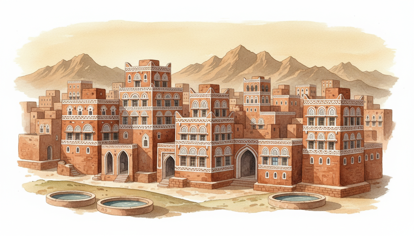
Where is Yemen, why is it important, and what is Yemen famous for? Yemen is a country at the southwestern tip of the Arabian Peninsula, beside the Red Sea, Gulf of Aden and Arabian Sea. It borders Saudi Arabia and Oman. Sana’a is the constitutional capital, while the internationally recognised government’s institutions operate mainly from Aden. Yemen is known for the ancient Kingdom of Saba, the distinctive tower houses of Sana’a and Shibam, the port and coffee history of Mocha, the spectacular biodiversity of Socotra, mountain terrace farming and centuries of connections across the Red Sea and Indian Ocean. Yemen is also experiencing a severe and renewed conflict that has disrupted its economy, schools, health system and the daily lives of millions.
Everything about Yemen, explained in one guide: a country is not just its government, a famous monument or a conflict headline. Yemen has mountains, coastal plains, desert basins, islands, cities, villages, farming communities, trading families, many cultural traditions and people trying to sustain education, work and care under difficult conditions. As of October 2026, political authority is divided, prices and currency conditions vary by area, and humanitarian agencies report widespread food and water insecurity. Here we answer the main questions immediately, explain what has changed and what has not, and connect readers to the existing detailed eduKateSG guides on how Yemen works, water, education and historic places.
Yemen at a glance: essential country facts
- Where is Yemen? Western Asia, at the southern end of the Arabian Peninsula.
- What countries border Yemen? Saudi Arabia to the north and Oman to the east.
- What seas surround Yemen? The Red Sea to the west, Gulf of Aden to the south and Arabian Sea and Indian Ocean waters around its wider southern and island geography.
- Capital: Sana’a under Yemen’s constitutional designation; the internationally recognised government principally operates from Aden because of the conflict.
- Area: approximately 527,968 square kilometres, according to UN Data.
- Population: the UN’s 2025 population estimate was 41.774 million; this is a dated model estimate, not an exact census of residents on 21 October 2026.
- Official language: Arabic. Yemen is also home to other languages, including Soqotri and Mehri, whose distinctive histories matter.
- Currency: Yemeni rial (YER); exchange-rate and banking conditions are fragmented by area and institutional arrangements.
- Time zone: Arabia Standard Time, UTC+03:00.
- Independence and unification: North and South Yemen had separate modern political histories; the Republic of Yemen was proclaimed on 22 May 1990.
- Present political reality: an internationally recognised governing structure, Houthi de facto control in much of the northwest, and other local and regional authorities; actual control is not identical to international recognition.
- Key economic activities: agriculture, fishing, commerce, services, remittances, and historically important petroleum and gas activity.
- Humanitarian conditions: the UN’s March 2026 response plan estimated more than 22 million people needed humanitarian assistance, including 18.3 million facing acute food insecurity.
- World Heritage: five UNESCO-inscribed properties: the Old City of Sana’a, Old Walled City of Shibam, Historic Town of Zabid, Landmarks of the Ancient Kingdom of Saba at Marib and the natural Socotra Archipelago.
- Travel safety: official government advisories, including UK and Australian advice checked in October 2026, warn against all travel, including Socotra.
Readers should keep two time scales separate. Geography, archaeological evidence and the historical existence of cities endure. Front lines, public-service access, humanitarian numbers, prices and travel conditions can change quickly. See UN Data’s Yemen profile, the UN’s 2026 humanitarian plan, and UNESCO’s heritage register for the underlying categories.
1. Where exactly is Yemen on the map?
Find the Red Sea between northeast Africa and western Arabia. Yemen sits at the southern end of that sea, next to the narrow Bab el-Mandeb Strait and beside the Gulf of Aden. This position connects Yemen to maritime routes toward the Suez Canal in one direction and the Indian Ocean in the other. Along the land boundary, Saudi Arabia lies to the north and Oman to the east. The location has encouraged long histories of sea trade, fishing, port activity and contact with Africa and Asia.
Yemen’s coastline is not its whole geography. Inland are mountain systems, high plateaus, valleys, watercourses that may be seasonal, arid regions and agricultural terraces. The Socotra Archipelago lies farther into the Indian Ocean, near the Horn of Africa. Those islands belong to Yemen but have unique ecological and cultural characteristics. A country can have the sea on two sides yet face severe local shortages of fresh drinking water.
Is Yemen in Asia or Africa?
Yemen is in Asia, specifically Western Asia and the Arabian Peninsula. It has close historical and practical connections with the Horn of Africa through shipping, family relationships, trade and migration. That does not make Yemen geographically an African country. Regional labels should clarify a location rather than erase multiple kinds of connection.
Does Yemen share a border with Somalia or Djibouti?
Not a land border. Djibouti is across the Bab el-Mandeb Strait and Gulf of Aden region, while Somalia lies across surrounding waters of the Gulf of Aden and Indian Ocean. Shipping, migration and historical trading networks cross these waters. Crossing by boat is a maritime journey with its own security, legal and humanitarian conditions, not the equivalent of driving through a land checkpoint.
Why is the Bab el-Mandeb Strait important?
It connects the Red Sea and the Gulf of Aden, making it strategically important to commercial shipping between the Mediterranean-Suez route and the Indian Ocean. A disruption can affect shipping choices, insurance costs, schedules and delivery times far beyond Yemen. But geopolitical importance should not make us forget the coastal communities living near these waters. They depend on fishing, transport, safety and functioning markets.
How large is Yemen?
UN Data reports an area of approximately 527,968 square kilometres. Area is a useful comparison but a weak predictor of journey time or service coverage: mountains, damaged bridges, administrative boundaries, security conditions and access constraints can greatly change the practical map. A district reachable on paper may be difficult to reach today.
2. Why are Yemen’s mountains, terraces and wadis important?
Western Yemen contains high mountains where settlement, agriculture and traditional architecture have adapted to steep terrain. Cultivated terraces can conserve soil and provide growing areas on slopes where fields would otherwise be difficult to maintain. Their stability depends on retaining walls, drainage, care and suitable water availability. The mountain environment also influences local climate and the routes between communities.
A wadi is a valley or channel that can carry seasonal floodwater, even if it is dry much of the time. Yemen’s wadis have helped support irrigation and agriculture historically, but they can also carry destructive flows after intense rainfall. Water can be scarce over a long season and dangerous during a short storm. That is not a contradiction; it is a central feature of arid and mountain environments.
Why are terrace farms impressive?
A terrace is not simply a step cut into a mountain. Its walls must support soil and drainage, and the farmer must manage fertility and water. When well maintained, terrace systems can help slow runoff and make steep land more usable. But they can also be damaged by neglect, heavy rain or loss of labour. The lesson is that landscape knowledge is stored in maintenance and community practice as well as stonework.
Does Yemen have permanent rivers?
Yemen is largely arid or semi-arid and is strongly associated with wadis and seasonal watercourses rather than the kind of large permanent river network found in some wetter countries. Water sources include rainfall, springs and aquifers. The useful question for a community is not whether a blue river line appears on an atlas, but how much safe, affordable water reaches households and farms throughout the year.
Why can floods occur in a country facing water shortages?
A flash flood may deliver a large volume of water quickly through a steep or constricted channel, damaging homes and infrastructure. That water is not automatically captured, treated or safely stored for later use. Repeated groundwater depletion can still occur despite spectacular flooding. A climate and water plan therefore needs both flood protection and sustainable supply management.
A worked example: two villages on the same mountain
Imagine two settlements receiving similar rainfall. One has maintained terraces, functioning storage and a safe road; the other has damaged retaining walls, unreliable pumps and a road washed out seasonally. Their farmers’ opportunities can differ substantially. These are hypothetical settlements, not survey findings. The example shows why a national rain total does not tell us who can actually use water.
3. Why is the Socotra Archipelago so famous?
Socotra is one of the world’s most unusual island ecosystems. The archipelago belongs to Yemen and includes four islands and two rocky islets. Its long geographic isolation has contributed to exceptionally high levels of species found nowhere else. UNESCO describes about 37% of its plant species, 90% of its reptiles and 95% of land snails as endemic in the designated World Heritage property. The characteristic dragon’s-blood tree is a widely recognised example of its vegetation.
UNESCO inscribed the Socotra Archipelago as a natural World Heritage property in 2008. This is evidence of its ecological significance, not a certificate that travel is safe or that every landscape may be visited without restrictions. As of October 2026, Australian government advice explicitly includes Socotra in its ‘do not travel’ warning for Yemen.
What is a dragon’s-blood tree?
Dracaena cinnabari is a tree native to Socotra, known for its characteristic broad, umbrella-shaped crown and red resin. The unusual shape is part of its ecological story, though individual trees differ. The red resin’s historical uses are distinct from any verified modern medical treatment. A natural product should not be promoted as a medicine simply because it has a traditional reputation.
Why do so many species live only on Socotra?
Isolation, long ecological history and varied habitats have helped species evolve in particular ways. An endemic species occurs naturally in a limited geographic area. Such species can be vulnerable because they cannot simply be found in equivalent populations across the world. Threats may involve invasive species, unsustainable resource use, habitat pressure and climate change. UNESCO’s discussion of invasive species explains some of the conservation concerns.
Are Socotra’s people part of the island story?
Yes. Socotri communities have local languages, histories and land- and sea-based knowledge. Soqotri is not just an eccentric name for Arabic; it belongs to the Modern South Arabian language group. Island biodiversity and cultural continuity should be understood together. Protecting habitat responsibly requires consideration of local lives and livelihoods.
4. What are Yemen’s five UNESCO World Heritage Sites?
Yemen has five properties inscribed on the World Heritage List: four cultural and one natural. They represent different chapters of history and ecology. Some have also been placed on the List of World Heritage in Danger because of threats including conflict, deterioration and maintenance difficulties. ‘In danger’ is not the same as ‘delisted’, nor is a tentative nomination an already inscribed property.
| Property | Why it matters | Inscribed |
|---|---|---|
| Old Walled City of Shibam | Earthen tower houses and compact high-rise settlement | 1982 |
| Old City of Sana’a | Decorated tower houses and historic urban fabric in a mountain valley | 1986 |
| Historic Town of Zabid | Islamic scholarship and historic urban form | 1993 |
| Socotra Archipelago | Endemic plants, animals and distinctive island ecology | 2008 |
| Landmarks of the Ancient Kingdom of Saba, Marib | Ancient settlements, temples, fortifications and irrigation | 2023 |
The official record is UNESCO World Heritage: Yemen. Its conservation reports can be read by year and property.
Why are Sana’a’s buildings instantly recognisable?
Many traditional Sana’a houses rise several storeys above stone bases and feature decorative brick and white gypsum designs. UNESCO describes the Old City in a mountain valley around 2,200 metres above sea level. The houses reflect building knowledge, materials, urban settlement patterns and centuries of community life. A tower house is not simply a decorative photograph: it must be supported, maintained, kept habitable and protected against damage.
Why is Shibam called the ‘Manhattan of the Desert’?
Shibam in Wadi Hadramawt is known for tall multi-storey mudbrick houses packed within a walled settlement. The nickname is a comparison of vertical townscapes, not a claim that its architecture or economy originated in modern New York. UNESCO describes the sixteenth-century walled city’s high-rise construction and links it to the valley’s environment and trade history. See the Shibam property record.
How do earthen towers survive, and why are they vulnerable?
Earth-based construction can be technically sophisticated. Good material selection, foundations, plaster, drainage, roof maintenance and repairs help protect it. However, floodwater, prolonged neglect, conflict damage and inappropriate modifications can threaten buildings. Heritage conservation means working with local expertise, sound engineering and communities, not merely painting historic façades.
What made the Kingdom of Saba significant?
The ancient South Arabian Kingdom of Saba was involved in far-reaching trade networks, including the incense trade. Its settlements, temples, inscriptions and water-management systems show a complex society adapting to semi-arid conditions. UNESCO’s Marib Saba property covers seven archaeological sites, demonstrating urban planning, technology and historical administration.
Is Saba the same thing as the Queen of Sheba?
The Queen of Sheba is an important figure in religious and literary traditions. Researchers study the ancient South Arabian kingdom using archaeology, inscriptions and historical evidence. The existence of the kingdom does not independently prove every detail of later stories about an individual queen. A careful article can explain both traditions while distinguishing narrative from archaeologically established findings.
5. How did Yemen’s history develop?
Yemen’s history is not only the modern civil war. Its territory contains evidence of ancient South Arabian polities, hydraulic engineering, incense routes, port commerce, Islamic centres of scholarship, mountain political formations, maritime contact with the Indian Ocean and a modern history of different states and eventual unification. The term ‘Yemen’ has long geographical and cultural uses, but a modern united republic did not exist unchanged through all those periods.
- Ancient South Arabian period: Saba and other kingdoms developed towns, trade networks and irrigation systems, including in Marib.
- Late antiquity: political and religious changes connected Yemen to wider Arabian, African and Mediterranean worlds.
- Islamic centuries: religious scholarship, trade and urban centres became significant, while regional forms of political rule differed.
- Medieval and early modern eras: mountain and coastal areas experienced different dynasties, commerce and competing authorities.
- Ottoman and British periods: the north and the southern port of Aden developed under differing external influences and local political forces.
- Twentieth century: separate states and political systems emerged in northern and southern Yemen.
- 22 May 1990: the Yemen Arab Republic (North Yemen) and People’s Democratic Republic of Yemen (South Yemen) united to form the Republic of Yemen.
- 2011 onward: mass protests and political transition occurred amid long-standing disputes.
- 2014: the Houthi movement took control of Sana’a, reshaping the political balance.
- 2015: the conflict escalated with the intervention of a Saudi-led coalition in support of the internationally recognised government.
- 2022: a UN-brokered truce reduced some hostilities, though it did not resolve every political issue.
- 2026: renewed armed escalation, including in and around Taiz, has caused additional civilian harm and displacement.
The dates above orient readers to major changes. They do not imply that all Yemeni citizens supported the same political actors, that conflict occurred everywhere identically or that one party’s perspective is sufficient. A useful history pairs institutions and battles with the experiences of families, traders, teachers and people displaced from their homes.
Why was Aden important historically?
Aden has a strategic position near the Gulf of Aden and the maritime route linking the Red Sea to the Indian Ocean. Its port helped connect different trading worlds and later became important under British imperial control. The city’s modern importance includes its role as a major port and as a principal base of internationally recognised government institutions during the conflict. Port activity, city life and political administration are three related but distinct subjects.
What was different about North and South Yemen?
The two states had separate political histories and institutions before unification in 1990. The north and south also contained enormous local diversity within their boundaries. Unification brought formal integration but did not automatically remove disputes about power, resources and regional representation. Those unresolved tensions are part of understanding more recent history without assuming everyone viewed unification in the same way.
Why is a modern conflict not Yemen’s entire identity?
Because a country also consists of its languages, art, food, farming methods, towns, commerce and ordinary people. Recognising the grave consequences of war does not require erasing Yemen’s creative and cultural life. Both facts can be true: millions face serious risks today, and Yemen has an exceptionally rich history worth studying and protecting.
6. Who are Yemen’s people, and what languages do they speak?
Yemenis live in cities, mountain villages, farming valleys, ports, desert-edge towns and islands. Their family histories, local traditions and livelihoods differ. Arabic is the official national language, but daily speech includes regional varieties and there are other languages with distinctive histories, including Soqotri on Socotra and Mehri in eastern areas. A person may use one form of speech at home, read standard Arabic in school and work with customers who use a different dialect.
The UN’s country profile estimated a population of about 41.774 million for 2025. Population models are difficult to compare with physical counts when people are displaced and movement is disrupted. If a 2026 report counts people needing assistance or registered for a programme, that is not equivalent to an exact national census. Every useful demographic claim should include its source, date, method and population definition.
Is Soqotri just a dialect of Arabic?
No. Soqotri is part of the Modern South Arabian language family, with its own features and literary and oral traditions. Its speakers may also use Arabic for other purposes. Respecting that difference is important when describing cultural heritage, language education and community knowledge on the island. UNESCO’s Socotra biosphere description recognises both endemic biodiversity and local cultural heritage, including Soqotri.
What religion is practised in Yemen?
Islam is the predominant religion, with Sunni and Shia traditions, including Zaydi Shia communities, among the country’s religious histories. Other minority histories also exist. Religious identity is not identical to political allegiance: it is inaccurate to assign an individual’s views about the conflict solely from their faith, hometown or language. Describe political movements as movements and communities as communities, even when histories intersect.
Why do families and diaspora connections matter?
Family networks support care, movement, education, trade and financial transfers. Yemenis and people of Yemeni descent have established communities in other parts of the Arabian Peninsula, East Africa and beyond. Remittances can matter to household budgets, but depend on the sender’s income and safe, legal payment channels. One remittance may pay for rent, medicine or school costs; it cannot by itself replace functioning public services.
What is everyday Yemen like beyond the headlines?
People study, work, shop, cook, celebrate, teach, fish, farm and care for relatives, even as conflict constrains the options available. A family in a relatively functioning urban neighbourhood and a displaced household near a front line may face vastly different access to schools and healthcare. Do not treat the country as one uniform emergency, but do not use individual stories of normality to deny documented widespread hardship.
7. Who governs Yemen in 2026?
There is a difference between a country’s internationally recognised government and the authorities actually controlling a particular territory. In October 2026, Yemen’s internationally recognised governing structure principally operates from Aden, while the Houthi movement, also known as Ansar Allah, holds de facto authority in Sana’a and much of the northwestern territory. Other political, military and local actors also affect administration and security in certain areas. That fragmentation is important for public services, banking rules, travel and the reliability of any nationwide announcement.
Sana’a is the constitutional capital, but calling it the capital does not establish that the internationally recognised government can administer its streets or offices. Aden is a major centre of its activities but is not a replacement for every formal constitutional designation. International recognition and actual control are two separate questions. The companion How Yemen Works | Government, Water, Ports and Everyday Life During Conflict explains the institutional and service-delivery picture at greater length.
Why did Yemen become politically divided?
Longstanding regional grievances, political transitions, armed movements, institutional disputes and international involvement helped create the present divisions. The Houthi movement took control of Sana’a in 2014. Armed conflict expanded in 2015, including intervention by a Saudi-led coalition supporting the internationally recognised government. The 2022 truce brought a reduction in some hostilities but did not resolve governance, resources, salaries, borders or armed deployments. Renewed hostilities in 2026 have caused further civilian suffering and displacement.
The conflict cannot be understood adequately by one slogan or a single foreign-state rivalry. Decisions by Yemeni actors, the interests of neighbouring states, local grievances and international relationships all matter. Present the evidence for each event and distinguish competing claims from independent reporting.
What happened in September and October 2026?
The conflict escalated significantly in western and southern areas. UNICEF reported on 16 September that more than 104,000 people, including over 57,000 children, had been displaced during a two-week period, and that 243 schools had closed or suspended learning, affecting more than 137,000 students. These numbers describe that reported period, not a permanent count of all displacement or closed schools. See UNICEF’s dated September statement.
By 20 October, new reporting described deadly attacks and worsening conditions near Taiz and Shabwa and considerable disruption to aid and medical care. Those are particularly changeable facts. Readers should not assume that a front line, road opening or casualty total reported on one day remains accurate without fresh evidence. This guide therefore links to durable institutions and dated reports instead of presenting an operational map that will rapidly become obsolete.
How do national rules reach a town during conflict?
Ideally a ministry defines policy, an accountable local body receives instructions and resources, a school or hospital operates the service, and an individual receives the intended benefit. Conflict can interrupt any link in that chain: a different authority may enforce a competing rule, salaries may not arrive, roads may close, and data may be difficult to verify. A trustworthy government analysis therefore follows an actual service, not just the name of a minister.
Worked example: a school with an announced reopening date
Imagine a ministry announces that classes will resume next Monday. A family still needs to know whether the building is safe, teachers are paid and able to travel, learning materials exist and local authorities permit attendance. The announcement proves that an instruction was issued; it does not prove every school reopened. This fictional example illustrates why official news and on-the-ground delivery need separate verification.
8. Why is Yemen important to the Red Sea and global trade?
Yemen’s maritime setting links the Gulf of Aden, the Bab el-Mandeb Strait and the Red Sea. Merchant ships use these waters on routes connecting Europe, Africa and Asia. Ports and coastal trade have formed part of Yemen’s history for centuries. Modern shipping depends on safe passage, insurance, port services, logistics, legal rules and the wider security environment.
When violence threatens the shipping route, carriers may face greater costs, delays or route changes. The consequences can be felt in countries far from Yemen, but the first and most serious human costs may be borne by people living in coastal communities or depending on imports and humanitarian deliveries.
Which Yemeni ports matter?
Aden, Hudaydah (Hodeidah), Mukalla, Mocha and other coastal facilities have different historical and contemporary roles. An old maritime trading centre does not necessarily handle the most traffic today. Port access and the ability to deliver a shipment inland depend on security, handling facilities, customs arrangements, transport routes and payment systems.
Was coffee named after the port of Mocha?
The historic port of Mocha (al-Makha) is closely associated with the international coffee trade. Yemeni coffee has a deep history involving highland cultivation, merchants and Red Sea exports. Over time ‘mocha’ acquired several uses in drinks and flavour descriptions, so a modern chocolate-coffee drink is not a direct description of traditional trade through the port. A responsible explanation distinguishes agricultural origin, historical export route and later commercial naming.
How does a port connect to food in a distant mountain village?
Imagine imported grain arrives at a port. A distributor still needs clearance, working warehouses, inland trucking, passable roads, fuel and buyers who can afford the final price. A delay can increase cost at several stages. The ship arriving safely is therefore necessary but not sufficient for a child in a distant community to have enough food.
9. How does Yemen’s economy work in 2026?
Yemen’s economy combines trade, agriculture, services, fishing, construction, family transfers and historically important oil and gas activities. Its economic capacity has been damaged by prolonged conflict, fragmented institutions, restrictions on exports, lost investment, damaged infrastructure and weakened purchasing power. The World Bank’s May 2026 Yemen Economic Monitor estimated real GDP fell by 1.5% in 2025 and projected a further 0.5% contraction in 2026. These are an estimate and a forecast for different periods—not final confirmed data for October. Read the World Bank’s May 2026 assessment.
The report noted that oil exports remained blocked, that weakened finance and demand constrained business, and that public resources were under severe pressure. Falling external grants and disrupted institutions make salaries and essential services harder to finance. But national GDP does not describe how a particular trader, farmer, nurse or displaced family survives. Jobs, prices, remittances and access matter separately.
What is Yemen’s currency?
The Yemeni rial, abbreviated YER. The existence of one national currency name does not mean all banknotes, exchange rates, banking services and payment conditions are identical throughout the country. Years of economic division have produced contrasting monetary practices and exchange-rate environments in different areas. Anyone quoting a rate must name the date, currency form, location and actual transaction conditions.
Why can one country have different prices for similar goods?
Imagine two shops that import the same product through different routes. One faces greater freight and border costs; the other must obtain foreign currency at less favourable terms. Different local taxes, fuel prices, risks, payment channels and incomes can create different selling prices. A headline price in Aden should not automatically be treated as the price faced by a household in Sana’a, Taiz or a remote village.
Is Yemen rich in oil?
Yemen has produced oil and natural gas, but its scale and the reliability of its export industry are not comparable with the biggest Gulf energy exporters. Output, facilities, shipments and government receipts have been profoundly affected by conflict. Oil underground does not automatically create accessible tax revenue, secure jobs or functioning public services. A careful account distinguishes reserves, current production, export availability and who actually receives the revenue.
How do remittances help the economy?
Money sent by relatives abroad can support food, housing, education and medical care. It can also be a vital household buffer during conflict and unemployment. The effect depends on reliable transfers, the sender’s resources, applicable rules and the recipient’s ability to exchange and spend funds. Remittances can provide relief but cannot repair an entire national grid, court system or public-health network.
Worked example: why GDP and household welfare differ
Suppose a region sees a modest increase in market sales, but a displaced household loses its main earner and must buy water from a tanker at a high price. A positive market statistic does not describe that family’s welfare. Good research measures who can earn, what essentials cost and whether services are available, rather than infer prosperity from one aggregate number. This is a hypothetical household used to clarify measurement, not an actual survey result.
10. Why is food insecurity so serious in Yemen?
Food insecurity is not only about how much food grows inside Yemen. It is also about whether imported and domestically produced supplies reach markets, whether households can afford them, whether children receive adequate nutrition and whether access remains stable. Displacement, conflict restrictions, currency pressures, damaged roads, falling income, drought and interrupted assistance can affect different stages of the chain.
The UN’s March 2026 humanitarian plan estimated 18.3 million people faced acute food insecurity, within a wider population of more than 22 million needing humanitarian assistance and protection. The same plan expected over 2.2 million children under five to experience acute malnutrition, including more than 516,000 with severe acute malnutrition. These are needs-planning estimates for specified periods, not unqualified permanent national counts. See OCHA’s March 2026 needs and response plan.
Why can food be available in a market but unaffordable?
A household’s income may fall while transport, fuel or imported goods become more expensive. The shop is still open, yet an adequate diet costs more than the household can pay. Food security depends on purchasing power and nutritional quality, not solely on the visible existence of rice or flour.
Why does nutrition require more than calories?
Growing children need an appropriate balance of nutrients as well as enough energy. Illness, unsafe water and poor maternal health can worsen malnutrition even where some food is available. This means that nutrition programmes need coordination with healthcare, safe water, sanitation and household support. A bag of food is useful but cannot replace a fully functioning health system.
Why can aid interruptions affect a wide area?
Humanitarian aid requires funding, permissions, safe access, staff, transport, distribution and verification. A threat along a road may make a planned delivery impossible; a funding shortage can reduce the number of people assisted. The most useful measure is who actually receives timely, appropriate support rather than the size of an announcement or the number of trucks planned.
11. Why does Yemen have a water crisis?
The water problem combines scarce and irregular rainfall in many areas, groundwater extraction faster than recharge in some basins, high agricultural demand, damaged water systems, poverty and disrupted maintenance. Yemen is not literally out of all water. The difficulty is sustaining clean and affordable supply in the places and seasons where people need it.
Groundwater is stored in the pores and fractures of geological formations called aquifers. Pumping water can be helpful, but taking it faster than it recharges over many years may lower water levels and increase the cost of access. A deeper well is not an unlimited new source: it may require greater energy and can impose costs on neighbouring users and future generations.
What is the Sana’a Basin issue?
The Sana’a Basin is frequently discussed in connection with overuse of groundwater and the difficulty of balancing agricultural, urban and long-term water needs. A basin-level question cannot be answered by one family’s well. The relevant facts include recharge, groundwater depth, pumping volumes, land use and allocation rules. See Why Yemen Has a Water Crisis: Groundwater and Qat for the dedicated treatment.
What is qat, and why does it matter to water?
Qat is a plant whose leaves are chewed for their stimulant effects, with cultural and economic significance in some communities. Cultivation can be profitable for farmers but uses irrigated land and water that might be demanded by other crops or households. The trade-offs vary by location. It would be unfair to claim that qat alone caused Yemen’s entire water crisis; conflict, pumping technology, policy, climate and infrastructure all contribute.
Can solar-powered pumps solve the problem?
Solar electricity can make pumping less dependent on costly fuel and can improve access where systems are well designed. But a lower cost of pumping can also encourage greater extraction unless groundwater is managed responsibly. The technology solves an energy problem; it does not automatically solve the resource-allocation problem. A sustainable project measures both water delivered safely and aquifer stress.
Why does a pipe network matter if a community already has a well?
A well provides a source, but safe water requires testing, appropriate treatment, storage, distribution, maintenance and affordable access. A contaminated or unreliable source may expose families to disease or consume time that could be spent learning or working. A tap matters only if the water is safe and arrives when needed.
Worked example: a pump fails during a school week
Imagine a settlement where the main pump stops. Families must walk farther or buy expensive delivered water; a school may struggle with sanitation; a clinic’s hygiene arrangements need backup; and households lose time and income. The pump failure is hypothetical. It illustrates why maintenance, water quality, emergency plans and accountability are as important as installing new equipment.
12. How do healthcare and sanitation work during the crisis?
A health facility is more than a building. It needs qualified staff, medicines, electricity, safe water, records, functioning equipment, referrals and a way for patients to reach it. The UN’s 2026 needs plan estimated that only 59.3% of health facilities were fully functional and that 14.4 million people required water, sanitation and hygiene assistance. These figures are dated planning assessments, not proof of conditions at a named clinic this morning.
The burden includes infectious diseases, malnutrition, injuries, maternal and child health needs, chronic illnesses and mental-health concerns. Services can be weakened by unpaid staff, damaged infrastructure, transport disruptions or shortages of medical supplies. UNICEF’s 2026 Yemen appeal sets out the scale of child health and protection needs.
Why is clean water part of a hospital’s medicine?
Healthcare workers need safe water for hygiene, cleaning, infection prevention and some treatments. A hospital without water cannot simply substitute more staff for sanitation. Water-related illness can also increase the number of patients needing care. Safe water, waste disposal, energy and healthcare therefore form a connected system.
Why are women and children particularly vulnerable to disrupted services?
Pregnancy, childbirth, early childhood nutrition and ongoing care involve time-sensitive needs. When safe travel is difficult or trained staff and medicines are unavailable, risks increase. Women and girls may also face different mobility, care or economic burdens depending on local circumstances. Do not treat one regional rule or experience as a complete description of all Yemeni women and girls.
How should a person interpret a health-emergency statistic?
A national estimate indicates the scale of need; it cannot diagnose an individual. Claims about infections, vaccinations or treatment effectiveness require the right medical source and reference period. For personal care, people should seek qualified healthcare professionals and up-to-date local public-health guidance rather than act on a general atlas article.
13. How does Yemen’s education system work?
Yemen’s published general education structure includes nine years of basic education followed by secondary pathways, technical and vocational education, and possible university study. But a formal school stage does not guarantee that children can attend it during conflict. Safety, classroom condition, teacher availability, salary payment, learning materials, language, school records and displacement all shape actual access.
UNICEF’s 2026 Yemen appeal reported approximately 4.5 million children out of school. Its September statement documented additional school closures and suspended learning during renewed fighting. The right interpretation is that millions of learners face serious disruption—not that the same conditions exist in every village or that educational achievement is impossible for every child.
The full eduKateSG Understanding the Education System of Yemen article explains basic-school stages, secondary certificates, vocational qualifications and the problem of record verification in a fragmented system.
Why is a school certificate more complicated during conflict?
A child’s education may be interrupted by displacement, missing documents or changes in the institution delivering examinations. A receiving university or employer needs to know the programme, awarding body, date, subjects and assessment rules. Independent learning can build knowledge but does not automatically produce an officially recognised certificate. Any claim about equivalence must be checked with the receiving authority.
Can catch-up teaching help an interrupted learner?
Yes, where it is safe, appropriate and available. First identify what the learner knows in literacy, numeracy and the subjects they were studying. Then target the earliest unstable knowledge rather than assign undifferentiated work at a grade label that may not fit. UNICEF has described catch-up support for displaced learners. Teaching can restore capability, but official certification and physical safety remain separate responsibilities.
How does language affect learning?
A child may understand an everyday spoken variety of Arabic but struggle with new academic vocabulary in formal written Arabic, especially if classes have been interrupted. Another child may come from a Soqotri-speaking household and navigate several language contexts. Reading, technical words and subject understanding should be assessed deliberately instead of confusing a language barrier with a lack of reasoning ability.
Worked example: two pupils with the same recorded grade
Two learners may both be described as Grade 8, but one has completed the prior year’s mathematics and the other missed long periods of schooling. Giving identical new material assumes a stability neither record alone proves. A responsible teacher checks prerequisites and shows each learner a realistic pathway forward. This is a hypothetical case explaining diagnostic assessment, not a real student record.
14. How do electricity, roads and communications affect Yemeni daily life?
Infrastructure is what allows a person to reach food, health, work, education and other people. In Yemen, damaged networks, fuel shortages, fragmented operations and security risks have made these connections unpredictable in many places. Electricity can come from a mixture of grid services, local generators, solar systems and other arrangements depending on location and circumstances. A claim that a city has a power station does not prove its households receive reliable electricity.
A communication system may appear to function until the electricity or the local access road fails. A clinic may have medicine but lack refrigeration or the ability to refer a patient. A teacher may have a curriculum but no safe way to reach pupils. It is useful to think of the country as a set of coupled systems rather than independent ministries.
Why might solar electricity be useful in Yemen?
Solar panels can help power lighting, communications, water pumps and selected local services without relying wholly on diesel supplies. However, equipment, batteries, qualified installation, maintenance and responsible water use matter. A rooftop panel does not guarantee power around the clock, and an unregulated solar water pump can worsen aquifer depletion. The outcome to measure is reliable service, not panels delivered.
Why are roads sometimes more important than their length suggests?
A bridge, mountain pass or connecting road may be the only practical route to several settlements. If closed by conflict or weather, a small physical blockage can create a large economic and humanitarian effect. Detours may be expensive, slow or unsafe. The right question is how reliably people and goods can make a complete journey, including the difficult last section.
A worked example: a clinic waiting for supplies
Imagine a clinic needs a replacement laboratory part, delivered via port, warehouse and road. The supplier has stock, but freight is held up and the road to the clinic is interrupted. A national import statistic may show the part entered Yemen while the clinic still cannot use it. This fictional case demonstrates why final-mile logistics and predictable access belong within the meaning of public healthcare.
15. What is Yemeni culture famous for?
Yemeni culture includes varied traditions of architecture, poetry, storytelling, dress, jewellery, crafts, market life, food, music and family celebrations. Highland communities, port cities, desert regions and Socotra do not share identical customs. Historical trade also brought people and ideas into contact with the Horn of Africa, the Arabian Peninsula and wider Indian Ocean. The result is a diverse national story, not one uniform costume or meal.
Sana’a’s decorated homes and Shibam’s tall earthen buildings are famous architectural expressions, but they are also records of craft, land use and urban life. Marib’s inscriptions and remains record administration and engineering. Traditional coffee cultivation records ecological knowledge, labour and trade. These should be studied as connected human accomplishments rather than merely attractions.
What traditional foods are associated with Yemen?
Meals vary by region, household and circumstances. Widely recognised foods include saltah, a hot stew sometimes served with a fenugreek-based topping; fahsa; flatbreads; honey-based and sweet dishes including bint al-sahn; rice and meat dishes such as mandi; and different bean, vegetable and meat preparations. Cuisine changes over time and across Yemen’s communities, so no single meal should be described as universally eaten.
A national dish is also a supply-chain lesson. Grain must reach a mill, vegetables a market, fuel a kitchen and clean water a household. A dish whose ingredients are culturally familiar can become difficult to prepare under conditions of rising prices or fuel shortages. Cultural continuity and material hardship can exist together.
Why is Yemeni coffee historically important?
Coffee cultivation and trading networks associated with Yemen helped spread coffee through the Red Sea and beyond. The historic port of Mocha became internationally associated with coffee exports. But trade names change meaning as products and recipes travel. Studying coffee responsibly means distinguishing the farms, merchants, historical routes and later commercial vocabulary rather than attributing every modern ‘mocha’ drink to an unchanging Yemeni recipe.
What is a souq?
A souq is a market, often associated with traditional patterns of trade and community exchange. Markets can contain foods, textiles, spices, household goods, craft work and many other activities. A functioning market depends on safe access, suppliers, payments and customers with purchasing power. Understanding those relationships is more useful than treating a busy marketplace as a timeless theatrical scene.
How can culture be preserved during displacement?
Families may maintain language, recipes, songs, craft knowledge and stories even after moving away from their homes. Museums, archives, educators and community groups can help safeguard material evidence. But preservation should also consider privacy, informed consent and safety. A young person’s photograph or a family story should not be made public merely because it would illustrate a moving article.
16. Which cities in Yemen should readers know?
Sana’a, Aden, Taiz, Hudaydah, Mukalla, Marib and historic towns such as Zabid and Shibam have very different functions and histories. Sana’a is associated with highland government and its historic built environment. Aden is a major southern port and internationally recognised government centre. Hudaydah is a Red Sea port city. Taiz has long been a major commercial and cultural centre and has faced particularly difficult conflict conditions. Mukalla serves coastal Hadramawt, while Marib is significant for ancient archaeology and modern regional economic and displacement questions.
City-size rankings depend on the date and geographical boundary used. Conflict and movement of people can make older figures especially unreliable. It is better to begin with a city’s functions—education, market, port, heritage, administration and regional connections—than to repeat an unverified ‘second-largest city’ claim.
Why does Sana’a have such a distinctive skyline?
Its tower houses combine multi-storey construction with decorative brick and plaster work. In the historic centre, settlement form is connected with defensive needs, urban density, local materials, water systems and the skills of builders. UNESCO’s Old City of Sana’a record explains its cultural importance. The heritage needs active safeguarding, especially where weather, maintenance constraints and conflict threaten buildings.
Why was Zabid a historic centre of learning?
Zabid is recognised for its historical urban form and role in religious scholarship and education. Its importance can be understood through the institutions that supported study, copying texts, teaching and exchange of ideas. UNESCO’s country heritage listing identifies it as a cultural World Heritage property. A historic university tradition is not the same as evidence that a current modern institution operates under identical arrangements.
Why does Taiz matter to the present conflict?
Taiz connects parts of Yemen’s highlands and southwest and has been important politically and economically. Its people have faced serious restrictions and insecurity over a prolonged period. Renewed fighting in 2026 makes current maps particularly sensitive and quickly dated. Reporters have described civilian casualties, difficult medical access and displacement; check current humanitarian and independently verified evidence before making claims about who controls a particular road or neighbourhood.
17. What environmental risks does Yemen face?
Yemen’s environment contains highlands, deserts, coastal ecosystems, wadis and islands. The risks are not identical: drought affects water supply and farming; severe rainfall can produce flash floods; storms can damage coastal areas; heat can increase water and energy needs; and unsustainable groundwater extraction can threaten future livelihoods. Conflict may weaken the infrastructure and institutions needed to prepare for these hazards.
Climate change is a long-term pressure, but not every particular weather event is proof of a single cause. Good reporting distinguishes observed climate trends, event-specific meteorological evidence, land-use decisions and the vulnerability of people and infrastructure. National averages can hide sharply different local risks.
How do floods damage an earthen historic city?
If heavy rain or uncontrolled runoff reaches vulnerable earth-built structures, it can weaken materials, foundations or drainage systems. Conservation therefore needs maintenance, appropriate repairs, safe water management and the skilled participation of local residents and craftspeople. Replacing traditional materials indiscriminately may also damage a building’s heritage value. Shibam and Sana’a are reminders that historic engineering and current climate resilience are closely connected.
Why does protecting Socotra matter?
Socotra’s biodiversity includes a high proportion of species with very limited natural ranges. Habitat disturbance, poorly managed introduced species and resource pressures can threaten those populations. Effective conservation protects ecological processes while respecting the rights and livelihoods of island communities. World Heritage designation is a responsibility requiring long-term care, not an instruction to increase tourism regardless of risk.
Worked example: an early-warning system is more than a weather message
Imagine a wadi settlement receives a forecast for heavy rain. The warning helps only if people can understand it, communication works, safe routes exist and authorities have planned what residents can do. An accurate forecast is essential but not sufficient. A complete system links data, trustworthy messages, people and infrastructure. The example is illustrative, not a report of an actual emergency.
18. Is Yemen safe to visit, including Socotra?
Official safety guidance is explicit. The UK’s Foreign, Commonwealth & Development Office advises against all travel to Yemen. Australia’s Smartraveller advice, last updated in the October 2026 period, also says do not travel to Yemen, including Socotra, because of armed conflict, kidnapping and related risks. Heritage importance, a tour advertisement or a striking island photograph cannot override these warnings. See UK FCDO Yemen advice and Australian Smartraveller Yemen advice for current requirements and risks.
This article is designed for learning, not itinerary planning. Anyone needing to travel for an essential reason requires appropriate official advice, arrangements and personal risk assessment. Do not treat an old visa guide, past flight route or social-media account as proof of present safety, including on remote islands.
Can UNESCO World Heritage Sites still be studied without travel?
Yes. UNESCO provides property descriptions, historical records, conservation reports and visual documentation. Museums, books, carefully sourced maps and archives can help readers learn about cities, ecology and architecture. The existing Top 10 Places to Visit When Touring Yemen article takes a documentary heritage approach in recognition of the serious current risks.
19. How do all Yemen’s systems connect in everyday life?
Imagine a fictional family with a child at school and an adult running a small food stall. Their week depends on safe water, supplies arriving through the market, a means of paying for food and rent, predictable access to healthcare and safe travel to school. A power interruption may make stored food spoil. A road closure can raise the price of basic goods. A currency change can make the household budget harder to understand. One system’s weakness becomes several daily-life problems at once.
Now imagine those connections working better. A repaired water system can return hours to the family’s week. More reliable transport can make food cheaper to distribute. Safe schooling can give the child continuity and recognised learning. Predictable institutions can help residents resolve problems without paying repeated costs for failed services. The important outcomes are what people can actually do.
What should policymakers or researchers measure?
Measure functioning services at the user’s end. Instead of only reporting water points installed, ask which deliver safe water year-round. Instead of classrooms announced, ask which children attend and learn. Instead of a new road opening, ask whether it is safe and usable during the difficult season. Instead of national GDP alone, ask about employment, prices, nutrition and the distribution of opportunity.
Why compare Yemen with Singapore at all?
The two countries are enormously different in geography, history, institutions and conditions. Comparison is useful for systems thinking, not as a demand that Yemen simply copy a model built for a different place. Singapore’s urban roads connect housing, schools and jobs; Yemen’s mountain routes and coastal ports perform other connected functions. In both, the meaningful question is whether infrastructure and institutions work for the people who depend on them. The separate How Singapore Works | Civilisation and Singapore roads and junctions explainer offer a contrasting case study.
20. Common questions about Yemen, answered
Is Yemen a country or a region?
Yemen is a sovereign country and a United Nations member. Its current territorial governance is fragmented by conflict, but that does not make it merely a geographic region.
Which continent is Yemen in?
Asia. It lies at the southwestern end of the Arabian Peninsula, with strong connections across the Red Sea to Africa.
What is Yemen’s capital?
Sana’a is the constitutional capital. During the conflict, the internationally recognised government’s institutions have operated principally from Aden. These are different statements about formal status and actual authority.
What countries border Yemen?
Saudi Arabia and Oman by land. Across surrounding waters lie parts of the Horn of Africa, including Djibouti and Somalia.
What language do people speak?
Arabic is the official language. Regional Arabic varieties and other languages including Soqotri and Mehri are part of Yemen’s linguistic landscape.
What is Yemen’s currency?
The Yemeni rial, YER. Monetary conditions and applicable rates vary, so use a dated source and actual local transaction terms.
How many people live in Yemen?
UN Data gives a 2025 estimate of about 41.774 million. War-related displacement and differences in counting make it important to name the year and methodology; do not describe the figure as a live October 2026 census.
Is Yemen a rich oil country?
Yemen has historically produced oil and gas, but conflict and export restrictions have sharply limited the economic benefits. It should not be compared mechanically with the largest Gulf energy producers or described as prosperous because resources exist underground.
Why is Yemen’s history important?
Its ancient kingdoms, maritime exchange, incense and coffee trade, urban architecture, hydraulic engineering and cultural links across Arabia and the Indian Ocean have significance far beyond its borders.
Who built the tall buildings in Shibam?
Local builders developed sophisticated earthen multi-storey architecture within a long urban history. UNESCO recognises the city for its settlement design and building traditions. It is not a modern concrete skyscraper city built by outsiders.
What is the Kingdom of Saba?
An ancient South Arabian kingdom associated with trade, settlements, inscriptions and irrigation. The archaeological remains at Marib are inscribed by UNESCO.
Is Socotra part of Yemen?
Yes. It is a Yemeni archipelago in the northwest Indian Ocean, renowned for biodiversity and distinctive local culture.
Why do dragon’s-blood trees grow on Socotra?
They are native to the archipelago, part of its long ecological history and high endemism. Their red resin and umbrella-like crowns have attracted attention, but they need responsible conservation rather than unverified health claims.
Is Socotra safe for tourism in 2026?
Current official advisories checked for October 2026 warn against travel to Yemen, explicitly including Socotra in Australian guidance. An island’s remarkable nature is not a safety guarantee.
Why is Yemen experiencing conflict?
The conflict has historical, political, regional and institutional causes. Houthi control of Sana’a since 2014, armed escalation in 2015 and renewed hostilities in 2026 form important events, but no single simple explanation covers every local grievance or international influence.
Who is in charge of Yemen now?
Control is divided. The internationally recognised government principally operates from Aden, while the Houthis exercise de facto authority in Sana’a and much of the northwest; other authorities also matter in some regions. Legal recognition and local control are distinct.
How many Yemenis need humanitarian assistance?
OCHA’s March 2026 humanitarian plan estimated more than 22 million people in need, including 18.3 million facing acute food insecurity. These are defined, dated planning estimates rather than a timeless population count.
How many children are out of school?
UNICEF’s 2026 appeal describes around 4.5 million children out of school. Renewed fighting in September 2026 brought additional documented school closures. Current local access needs independent confirmation.
Why is Yemen short of water?
Uneven rainfall, depleted groundwater in some basins, irrigation demand, damaged systems, conflict and poverty combine. The problem is not that every part of Yemen has no water, but that safe and sustainable access is severely constrained.
Does Yemen grow coffee?
Yes. Highland coffee cultivation and historic Red Sea exports, particularly via Mocha, form an important part of the country’s agricultural and commercial history.
What is Yemen’s most famous heritage site?
The answer is subjective. Sana’a’s Old City, Shibam, Marib’s Sabaean remains and Socotra are internationally significant in different ways. UNESCO lists five World Heritage properties, not a single ‘best’ attraction.
Can studying Yemen help us understand how countries work?
Yes. It shows how geography, historic knowledge, international trade, institutions, water, food, education and healthcare interact, and how civilian life can be harmed when those connections fail.
21. Keep learning: Yemen’s companion articles and the country atlas
This article is the wide-angle Yemen entry point. The related guides below serve narrower reader questions and should retain their own detailed explanations rather than repeating the country overview.
- How Yemen Works | Government, Water, Ports and Everyday Life During Conflict — political authority and the machinery of public services.
- How Yemen Works | Why Does Yemen Have a Water Crisis? Groundwater and Qat — aquifers, wells, agriculture and resource trade-offs.
- How Yemen Works | Why Is Yemen Running Out of Water? Wells, Groundwater and War — a complementary water-supply investigation.
- Understanding the Education System of Yemen — school stages, qualifications and learning continuity.
- Top 10 Places to Visit When Touring Yemen — historical and natural places for documentary learning, not a current travel endorsement.
- Top 10 Things to Learn When Visiting and Touring Yemen — focused heritage and educational questions.
- Everything About Countries — the broad A–Z national atlas.
- How Countries Work — systems-specific country explanations.
- How Singapore Works | Civilisation — the independent Singapore comparison.
Continue exploring Yemen: Visit the How Countries Work A–Z directory for the worldwide reading map, or follow how Yemen works for its government, infrastructure and everyday services.
22. Sources: dated 2026 evidence and enduring geographic records
This guide is dated 21 October 2026. The sources below have different purposes. An official government institution may document a policy announcement; a UN agency may estimate humanitarian needs; UNESCO can establish a World Heritage inscription; an independent news report may document a developing event. No one source verifies everything about a country.
- United Nations Data — Yemen country profile. Area, capital, national currency and the UN’s 2025 population estimate.
- UNESCO World Heritage Centre — Yemen. Five inscribed properties and dated conservation reports.
- UNESCO — Old City of Sana’a. Historic towers and urban form.
- UNESCO — Old Walled City of Shibam. Earthen high-rise architecture and valley context.
- UNESCO — Landmarks of the Ancient Kingdom of Saba, Marib. Archaeology, trade and irrigation.
- UNESCO — Socotra Archipelago. Endemic species and the 2008 inscription.
- UNESCO — Socotra’s invasive-species threats. The conservation context.
- United Nations OCHA — Yemen Humanitarian Needs and Response Plan, March 2026. People in need, food security, displacement, health and water figures.
- UNICEF — Yemen 2026 appeal. Children out of school, malnutrition, health and protection needs.
- UNICEF — 16 September 2026 escalation and child displacement. Period-specific findings on closed schools and displaced children.
- World Bank — Yemen Economic Monitor, 21 May 2026. GDP estimates, projections, oil exports, public finances and trade constraints.
- UK FCDO — Yemen travel advice. The current advice against all travel.
- Australian Smartraveller — Yemen travel advice. Includes the explicit warning covering Socotra.
23. Editorial maintenance: how to keep a Yemen country guide trustworthy
Keep the broad country article and its specialist siblings distinct. Update a population figure with its year rather than replace a census explanation with a vague live claim. State whether an economic number is estimated, forecast or final. Identify political control by source and date rather than assume one government office can operate everywhere. Treat humanitarian projections as dated assessments, not facts that never change. Explain a UNESCO inscription without using it as proof of safety.
Most importantly, keep Yemeni people visible throughout the account. They are not merely a number in a relief plan, and a country is not defined only by the groups fighting within it. Its long history of architecture, ecological knowledge, scholarship, commerce and family life belongs alongside an accurate recognition of present-day suffering and the need for protection.
The useful central idea is that Yemen is a place where geography, trade, water, institutions, culture and daily needs meet. Understanding those connections is more valuable than memorising one headline or repeating one national stereotype.