
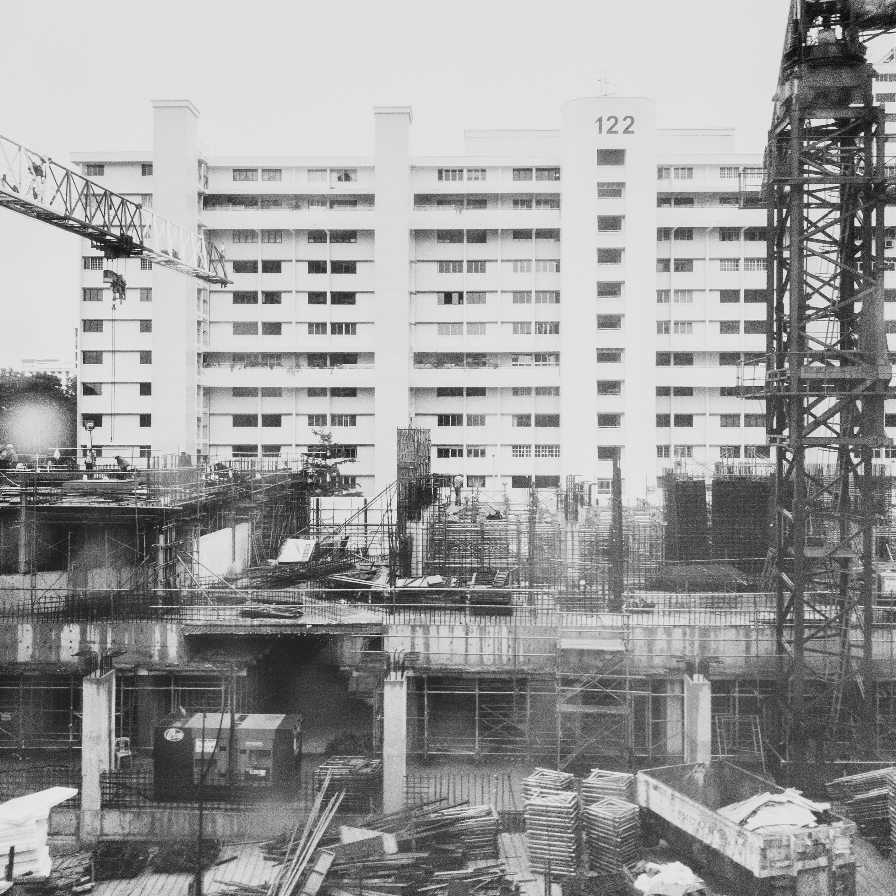
History of Singapore | Bedok follows one of Singapore’s oldest recorded place names from river and coast to fishing villages, seaside recreation, wartime geography, East Coast reclamation, HDB new-town building, Bedok Reservoir and today’s mature eastern town.
Bedok is unusual because its name appears in records centuries before modern Singapore’s public-housing era. A 1604 map by Manuel Godinho de Eredia marked a river called “Sunebodo”, linked by heritage research to today’s Sungei Bedok.
That means Bedok lets us zoom far back before the HDB town.
The story then moves through Kampong Bedok, Chai Chee, Siglap and Tanah Merah; fishing, farming and beach life; massive land reclamation beginning in the 1960s; new housing and industry; the reservoir created by deep excavation; MRT and expressway connections; and current renewal across Bedok and the wider East Region.
This page sits inside the larger History of Singapore | Singapore Atlas and How Singapore Works spine. Local eduKateSG routes include Things to do for Kids | Learning Bedok, Tutors | Bedok, Secondary 3 Additional Mathematics Tuition | Bedok and the growing Bedok North, Bedok Reservoir and Bedok Central education cluster.
The central questions are:
- How old is the name Bedok?
- Why did river and coast matter before urbanisation?
- What were Kampong Bedok and Chai Chee?
- Why was the old east coast famous for seaside recreation?
- How did reclamation move the shoreline?
- Why was Bedok Reservoir created?
- How did new housing and factories change local livelihoods?
- What is being renewed now under current HDB and URA plans?
1604: Bedok Appears on a Map
National Heritage Board’s Bedok Heritage Trail history notes that Bedok is one of the earliest documented place names in Singapore.
The 1604 map by Manuel Godinho de Eredia marks “Sunebodo”, associated with Sungei Bedok.
Later maps use related forms such as “Badok”.
This matters because it proves that the eastern landscape was named and known long before the British trading settlement of 1819.
Singapore history did not begin at the Singapore River.
What does Bedok mean?
The exact origin is debated.
One explanation connects the name to the Malay word bedoh, a wooden drum used to signal prayer.
Another connects it to biduk, a small riverine boat.
Both explanations fit aspects of the old river-and-village landscape, but the safest approach is to present the uncertainty rather than pretend one is fully proven.
Bedok Before the New Town: River, Coast and Villages
Older Bedok grew around water.
Sungei Bedok, the coast and smaller streams supported fishing, farming, travel and settlement.
The broader historical Bedok landscape included places now identified separately as Siglap, Tanah Merah and Chai Chee.
Villages had their own local identities even when later planning grouped them into larger towns and estates.
Kampong Bedok
The area around today’s Bedok Corner included Kampong Bedok Laut and Kampong Bedok Darat, founded in the nineteenth century.
National Heritage Board records fishing, farming, plantations and work serving nearby British military activity.
Residents grew tapioca, vegetables and corn. Others worked as hawkers, restaurant staff, builders, tailors or hairdressers.
The village was therefore economically diverse.
Chai Chee: A Market Becomes a Place Name
Chai Chee is commonly linked to a Hokkien name meaning vegetable market.
The name records an economic function.
Markets matter in village history because they connect farms and households.
A farmer can grow food, but the market is where production becomes trade.
As modern housing arrived, the old market economy changed, but the name survived into the estate.
Siglap and the Coconut Coast
The wider Bedok coast included Siglap, another name with deep local history.
Coconut trees, beach houses, kampongs and coastal roads shaped the area.
The old East Coast was not the same wide reclaimed park-and-expressway landscape seen today.
The shoreline lay much closer to Upper East Coast Road and old houses.
The coast was social space
Residents and visitors came for swimming, picnics, fishing, seafood and boat races.
Heritage accounts remember kolek racing and community dancing beneath coconut trees.
This is important because recreation did not begin with East Coast Park.
The modern park inherited an older tradition of coming east to enjoy the sea.
Tanah Merah: Red Cliffs Before Reclamation
Tanah Merah means “red earth” in Malay and referred to the reddish coastal cliffs that once characterised part of the eastern shore.
The cliffs were landmarks.
Reclamation and earthworks later transformed this topography dramatically.
Today, the name survives even though the coastline and cliff form are very different.
Again, language preserves vanished geography.
The East Coast Reclamation Scheme
The 1960s brought one of the largest physical transformations in Bedok’s history.
Land scarcity pushed Singapore to expand the coastline.
HDB began a pilot east-coast reclamation project in 1963 and the large East Coast Reclamation Scheme followed from 1966.
Sand and earth from Bedok, Siglap and Tampines were excavated and moved toward the coast.
The project eventually added about 1,525 hectares of land from Bedok toward Tanjong Rhu, according to National Heritage Board material.
The shoreline moves
This is a powerful idea for students.
A historical map and a current map can disagree about the coastline without either being wrong.
The difference records engineering.
Homes, roads and East Coast Park now occupy land that did not exist in the same form before reclamation.
Bedok Reservoir: A Hole Becomes Water Infrastructure
Deep excavation in the Bedok area did not leave only construction scars.
Bedok Reservoir was created from quarry-like excavation works linked to reclamation fill.
A site first used to remove earth later became part of Singapore’s water and recreation system.
That change in function is classic Singapore land adaptation.
One place, three jobs
- First: source of earth for reclamation.
- Later: reservoir and water infrastructure.
- Today: also recreation, sport and community space.
The physical depression did not disappear.
Its job changed.
Bedok New Town
Planning for Bedok as an HDB town began in the 1960s, and large-scale development accelerated in the 1970s.
By the early 1980s, Bedok New Town was substantially complete.
Like other new-generation HDB towns, Bedok was planned as a total living environment rather than a dormitory estate.
Housing was combined with schools, shops, markets, industry, parks, sports and transport.
Former farmers and fishermen become industrial workers
The local economy changed with the landscape.
Many residents who came from farming or fishing backgrounds moved into wage employment.
Factories in the east, including major electronics companies, offered new jobs.
This is economic transition at household scale.
The same family could move from village production to factory employment within one generation.
Industry and the Eastern Job Belt
Bedok’s growth sat beside a wider east-side industrial and aviation geography.
Factories, Changi-related employment and later business parks created jobs closer to eastern housing towns.
This reduced the idea that everyone had to commute into the traditional city centre for work.
The pattern later became a core principle of Singapore decentralisation.
The Pan-Island Expressway
The completion of the PIE across the island strengthened Bedok’s road connectivity.
Expressways change what is practical for logistics, buses, goods movement and private travel.
For the east, they also strengthened links to industrial areas, the airport and the rest of Singapore.
Road infrastructure and new-town development therefore reinforced each other.
Bedok MRT and the Rail Era
The East–West Line later made rail a central part of Bedok life.
Bedok MRT gave residents a fast route toward the city and the wider east-west corridor.
Bedok North, Bedok Reservoir and nearby areas later gained additional access through the Downtown Line.
A mature town can therefore accumulate transport layers rather than rely on the first network forever.
Bedok Town Centre and the Integrated Transport Hub
Bedok Town Centre has undergone major renewal under HDB’s Remaking Our Heartland programme.
Bedok Mall, the integrated transport hub, the hawker centre and town plaza brought transport, shopping, food and community activity into a more connected centre.
This is mature-town renewal rather than new-town construction.
Why integration matters
A resident can transfer from bus to MRT, buy food, shop and reach other services with fewer disconnected journeys.
That reduces friction in daily life.
The same logic appears across newer integrated hubs around Singapore.
Ageing in Bedok
Mature towns face demographic change as well as physical ageing.
In 2023, Bedok was announced as the third site for Community Care Apartments, with units planned as part of Chai Chee Green.
The model combines senior-friendly housing with access to services and community support.
This reflects a major shift in the public-housing problem.
Singapore once needed to house a young and growing population quickly.
Now it also needs to help older residents remain independent in familiar neighbourhoods.
Master Plan 2025 and the East Region
URA’s Master Plan 2025 East Region plans identify Bedok, Tampines and Pasir Ris as the mature-town anchors of the east.
The current approach is not to rebuild Bedok from scratch.
It is to refresh amenities, improve connectivity and create more opportunities for residents to reach recreation, jobs and services conveniently.
This mature-town model fits Bedok’s history.
The area has already been transformed several times. The next phase is careful renewal.
The Coast Still Matters
Even after reclamation moved the shoreline, coastal identity remains strong.
East Coast Park, cycling routes, seafood memories and old houses along Upper East Coast Road keep the sea in local culture.
This is continuity through displacement.
The coast moved physically, but Bedok did not stop being an eastern coastal town in people’s imagination.
Turn Bedok into a Field Classroom
English
Write two descriptions of the same area: one when the sea reached close to Upper East Coast Road and one after reclamation.
Mathematics
Use the 1,525-hectare reclamation figure for scale, compare reservoir distances or calculate cycling time along East Coast routes.
Science
Study reservoir ecology, coastal habitats, urban heat and water management.
History
Compare the 1604 map reference with modern Bedok. Ask what survives: name, river, direction and community memory.
Geography
Analyse how reclamation, expressways, industry and public housing changed land use together.
The eduKateSG Bedok learning guide provides a practical local starting point.
Bedok and the eduKateSG Knowledge Block
- Things to do for Kids | Learning Bedok owns the field-learning route.
- Tutors | Bedok is the tutor-location doorway.
- Bedok North, Bedok Reservoir and Bedok Central pages cover smaller local education routes.
- Secondary 3 Additional Mathematics Tuition | Bedok owns one subject-specific route.
- This article owns the long historical formation of Bedok.
- The Singapore Atlas and How Singapore Works connect Bedok to the national system.
The shared location creates coherence without requiring every page to repeat the same content.
A Compact Bedok Timeline
- 1604: a map by Manuel Godinho de Eredia records “Sunebodo”, associated with Sungei Bedok.
- Nineteenth century: coastal villages, farms, plantations and fishing communities expand across the wider Bedok area.
- 1850s: Kampong Bedok Laut and Kampong Bedok Darat develop around Bedok Corner.
- Early twentieth century: Bedok, Siglap and Tanah Merah become known for beach life, villages, villas and coastal recreation.
- 1963: HDB begins a pilot east-coast reclamation project.
- 1966 onward: the East Coast Reclamation Scheme dramatically moves the shoreline.
- 1970s: kampongs increasingly make way for public housing and industry.
- 1970s–early 1980s: Bedok New Town takes shape as a complete HDB town.
- 1980: the Pan-Island Expressway is completed across Singapore.
- 1980s: Bedok becomes fully integrated into the East–West Line rail era.
- 2000s–2010s: mature-town renewal reshapes the town centre and transport hub.
- 2010s: Downtown Line improves access to Bedok Reservoir and Bedok North areas.
- 2023: Bedok is selected as the third site for Community Care Apartments.
- 2025–2026: Master Plan 2025 places Bedok within a wider East Region mature-town renewal strategy.
Frequently Asked Questions
How old is the name Bedok?
A related form appears on a 1604 map, making Bedok one of Singapore’s earliest documented place names.
What does Bedok mean?
The origin is uncertain. Common explanations connect it either to bedoh, a wooden drum, or biduk, a small river boat.
What was Bedok like before HDB?
The wider area included fishing villages, farms, plantations, beach houses, restaurants, coastal recreation and rural settlements such as Kampong Bedok and Chai Chee.
Was the old coastline in the same place?
No. Large-scale reclamation from the 1960s moved the shoreline outward and created much of the modern East Coast landscape.
How was Bedok Reservoir formed?
It developed from deep excavation works used to obtain earth for reclamation, later becoming part of Singapore’s water and recreation system.
When was Bedok New Town built?
Planning began in the 1960s and major development took place through the 1970s, with the town substantially complete by the early 1980s.
What is changing now?
Bedok is undergoing mature-town renewal, with refreshed amenities, improved connectivity and senior-friendly housing initiatives within the wider East Region planning framework.
How does this page connect to tuition?
The history page explains the place. Bedok tutor and subject pages explain learning services. Internal links connect context without creating duplicate doorway content.
Helpful Reading and Local Routes
- National Heritage Board | Bedok Heritage Trail
- National Heritage Board | Kampong Bedok
- HDB | Bedok
- URA Master Plan 2025 | East Region
- URA | Transforming Towns for Tomorrow
- History of Singapore | Singapore Atlas
- How Singapore Works
- Things to do for Kids | Learning Bedok
- Tutors | Bedok
History of Singapore | Bedok
Bedok is a place where the map itself changed.
The name appears centuries ago.
The river and coast supported villages and fishing.
Beaches became social spaces.
Reclamation pushed the shoreline outward.
Excavation created the reservoir.
HDB created a major new town.
Factories and transport changed how residents worked and moved.
Today, a mature Bedok is adapting again for older residents and a more connected East Region.
The most useful lesson is simple.
Bedok did not replace one old landscape with one new landscape.
It changed jobs repeatedly while preserving names, memories and water as the long thread through the place.
Bedok as a 400-Year Map Lesson
Bedok is ideal for teaching students that place history can be longer than national political history.
The 1604 “Sunebodo” reference pushes the locality back into the early modern maritime world.
At that time, European powers were competing violently over Asian trade routes, while the Johor-Riau world remained central to regional politics.
The eastern coast of Singapore faced important maritime approaches.
Bedok was therefore not merely a future suburb waiting for urbanisation.
It occupied a strategic and inhabited coastline.
The map exercise
Place the 1604 map beside a modern map.
Do not expect the coastlines or labels to match exactly.
Instead, identify river direction, the eastern shore and nearby maritime routes.
The exercise teaches students how historical maps require interpretation rather than simple overlay.
The Santa Catarina and the Waters off Tanah Merah
The wider Bedok-Tanah Merah coast also connects to an event in 1603 that became important to the history of maritime law.
A Dutch force captured the Portuguese trading ship Santa Catarina in waters off Tanah Merah.
The legal arguments that followed contributed to Hugo Grotius’s writings on freedom of the seas and maritime trade.
The event reminds students that Singapore’s eastern waters were part of international competition centuries before Changi Airport and container ports.
Local coast, global law
This is a powerful history pattern.
A local geographical point can become connected to ideas that travel far beyond it.
Tanah Merah’s cliffs were a navigational landmark.
The sea beyond them was part of the contested trade world of the seventeenth century.
Military Bedok: The Coast as Defence
The eastern coast also had strategic military value.
British defences included artillery positions, pillboxes and military infrastructure around Tanah Merah and the wider east.
The logic is easy to understand.
A coast that allows ships and landing craft to approach also creates a defence problem.
The same open sea that supports fishing and recreation can become a military frontier during war.
Landmarks disappear, strategic geography remains
Some former military structures were removed during reclamation.
The cliffs themselves were reshaped.
Yet the strategic importance of the east did not vanish.
Changi’s later military and aviation roles continued to make the region nationally important.
Flooding in the Old Coastal Settlements
Low-lying coastal areas around Siglap and Bedok were vulnerable to flooding.
Former residents recalled moving furniture and adapting daily life during heavy rain.
This is useful environmental history.
Modern drains, canals, reclaimed land levels and reservoirs can make older flood risk less visible.
But those systems exist partly because the old problem was real.
Infrastructure changes what people remember
When drainage works well, later generations may assume floods were never serious.
That is one of infrastructure’s paradoxes.
A successful solution can make the original problem disappear from everyday awareness.
Historical accounts restore the reason the system was built.
Old Seawalls as Fossils of the Former Coastline
Fragments of old seawalls in the Bedok-East Coast area show where land once met sea.
They function almost like urban fossils.
A seawall that now sits inland makes no sense until the viewer knows reclamation moved the coastline.
Then the object becomes powerful evidence.
It lets a student stand on modern land and imagine water where roads and houses now exist.
Koh Sek Lim: Resettlement, Farming and Sand Mining
Koh Sek Lim adds another layer to the Bedok story.
In the early 1950s, land there was used to resettle families displaced by construction of Paya Lebar Airport.
Vegetable farming developed in the area.
At the same time, other parts were leased for sand mining.
The same locality therefore combined resettlement, food production and extractive industry.
The airport changes a farming area indirectly
This is a good example of how infrastructure creates consequences away from its construction site.
Paya Lebar Airport displaced families.
Those families moved to another area.
Their new farms changed Koh Sek Lim.
A single project can therefore alter several places at once.
From Sand Pit to Bedok Reservoir
The Bedok Reservoir story becomes even more interesting when read through Koh Sek Lim sand extraction.
National Heritage Board records large volumes of sand being removed from the area, creating a deep lake.
That water body later became the reservoir.
An extraction site became strategic water infrastructure and recreation space.
This is not only reuse.
It is a complete change in the value assigned to the same physical form.
NEWater and the Eastern Water Story
The wider Bedok-Tanah Merah area later became connected to another chapter of Singapore’s water history through NEWater demonstration and visitor facilities at Koh Sek Lim Road.
The sequence is remarkable.
- Rural wells and streams.
- Sand-mining lake.
- Reservoir.
- Reclaimed coast.
- Advanced water-reuse technology nearby.
A local area that once depended on simple water sources became part of a national high-technology water system.
That is a strong bridge between history and science.
Kampong Siglap Fire and the Acceleration of Redevelopment
Fires were a major risk in settlements built with timber and attap.
A large fire could destroy homes quickly and accelerate resettlement into modern housing.
The history of eastern redevelopment therefore includes both planned clearance and sudden disaster.
This reminds students that urban transformation is not always orderly.
Events can speed up a process already underway.
Fengshan: Heritage Moves with People
Fengshan Estate offers another useful memory lesson.
The name and community links connect to residents resettled from elsewhere, including former kampong communities associated with the Hong San temple.
When people move, place identity can move too.
A heritage name may be transferred into a new estate to preserve social continuity even when the original physical landscape disappears.
This is similar to temples moving with communities in other Singapore towns.
The New Town as a Total Living Environment
Bedok belonged to a later generation of HDB planning than Queenstown or Toa Payoh.
By the time Bedok was built, planners had more experience with how residents used town centres, neighbourhood shops, schools, transport and parks.
The phrase “total living environment” captures this maturity.
Housing quality could no longer be judged only by flat interiors.
The town around the flat mattered.
What makes a total living environment?
- Reliable transport.
- Schools across age groups.
- Markets and hawker centres.
- Healthcare.
- Parks and sports.
- Employment access.
- Community facilities.
- Safe walking routes.
- A recognisable town centre.
Bedok’s maturity comes from the accumulation of these systems.
Bedok Town Centre as an Everyday Interchange
The modern town centre combines rail, buses, retail, food and public space.
For residents, the value is practical.
Several errands can be combined into one trip.
For planners, the centre concentrates high footfall around public transport.
For historians, it shows how the idea of a town centre evolves while serving the same basic purpose: gather important daily functions.
Bedok Reservoir as a Recreation Landscape
The reservoir now supports running, water sports, school activities and community events.
That recreational identity can make the extraction history easy to forget.
A strong local-history lesson holds both at once.
The peaceful water exists partly because the ground was once excavated dramatically.
Beauty and industrial history are not mutually exclusive.
Bedok’s Hawker and Food Geography
Food is one of the strongest ways residents experience Bedok.
Markets, hawker centres, Bedok Corner and Simpang Bedok connect modern food culture with older village and roadside traditions.
The exact stalls change, but the east remains known for places where people gather to eat.
Food therefore acts as continuity even when buildings and coastlines change.
A food-centred history exercise
Ask a student to choose one food centre and trace three layers:
- What older settlement or road geography surrounds it?
- How do customers reach it today?
- Which foods or business patterns suggest older cultural communities?
The aim is not to prove one dish is ancient.
It is to connect food with migration, work and place.
The East Coast Park Memory Generation
For younger generations, East Coast Park may feel as historically “old” as any other major park.
Yet it sits on reclaimed land.
This creates a generational shift in memory.
Older residents remember the beach before reclamation.
Later generations remember cycling paths, barbecue pits, lagoons and park roads as the normal coastline.
Both memories are true for their time.
The historian’s job is to connect them.
Ageing in Place: Bedok’s Next Social Problem
Bedok is now mature enough that many long-term residents are older.
The Community Care Apartment programme reflects a new housing question.
How can seniors remain close to familiar markets, transport and neighbours while receiving appropriate support?
This is different from the 1970s problem of rehousing rural families.
The housing system changes because the population changes.
Mature towns can be an advantage for ageing
Older towns already have established shops, clinics, bus routes and social networks.
The challenge is to make them accessible and supportive enough for reduced mobility.
Renewal can therefore build on existing community rather than move everyone elsewhere.
Bedok and Climate Resilience
The eastern coast makes Bedok a useful place for discussing climate adaptation.
Reclaimed land, reservoirs, drainage, coast protection and sea-level planning all intersect with the region.
Current national plans for the east increasingly connect recreation, water and long-term resilience.
Students should distinguish historical reclamation from future climate measures, but they can see the common theme: Singapore repeatedly engineers its relationship with water.
A Bedok Source Ladder
Because Bedok has long local memory, students will find many stories online.
Use a source ladder.
- National Heritage Board for documented heritage research.
- HDB and URA for new-town and current planning.
- National Archives and NLB for photographs, newspapers and maps.
- Oral histories for lived experience.
- Family stories as valuable leads that should be compared with other evidence.
The rule is simple: match confidence to source quality.
A Bedok Research Project: Where Was the Sea?
A strong student project can be built around one question: “Where was the old Bedok coastline?”
Use an old map, current map, surviving seawall evidence and heritage photographs.
Then identify which modern roads, parks or housing stand on reclaimed land.
The student should explain not only where the coast moved but why Singapore chose to move it.
This creates a genuine cause-and-effect argument connecting land scarcity, engineering and urban growth.
What Bedok Teaches About Singapore
- Local place names can survive for centuries even when the landscape changes radically.
- Coasts support work, defence, recreation and identity at different times.
- Reclamation can change both geography and memory.
- Extraction sites can become reservoirs and parks.
- Resettlement links one infrastructure project to another locality.
- New towns change livelihoods as well as housing.
- Mature towns need to adapt for ageing residents.
- Water remains the long thread through Bedok’s history.
Bedok is therefore not simply an eastern HDB town.
It is a four-century lesson in how people keep reassigning meaning and function to river, coast and land.
Bedok and the Japanese Occupation
The Second World War added a much darker layer to the eastern landscape.
National Heritage Board material records mass graves in Siglap and Bedok connected to the Sook Ching killings during the Japanese Occupation.
Sites around Jalan Puay Poon and nearby areas later revealed human remains during post-war investigations and sand-washing works.
The discoveries changed the meaning of ordinary ground.
A road verge or former quarry could also be a site of civilian death and wartime memory.
Why this history must be taught carefully
The purpose is not to shock children.
It is to explain that war reaches civilian neighbourhoods and that peaceful present-day places can carry difficult histories.
Older students can compare official records, memorial sites and oral accounts to understand how evidence of atrocities is reconstructed after the event.
Bedok Hill and Captured Soldiers
The eastern war story also includes soldiers captured during the Battle of Singapore.
Heritage research records executions at Bedok Hill involving captured soldiers from local and Malayan volunteer units.
This connects Bedok to both civilian and military experience during 1942.
A strong local-history article therefore should not reduce the war to one battlefield or one famous surrender site.
The occupation affected many landscapes across the island.
A Bedok Family Memory Project
Bedok is especially suitable for oral-history work because many residents remember the transition from kampong, early HDB estate or reclaimed coast to the mature town.
Students can interview an older relative or neighbour with five simple questions.
- What is the earliest Bedok place you remember?
- Where was the sea or nearest open land then?
- How did you travel to school or work?
- Which market, hawker centre or shop mattered most to your family?
- What change made Bedok feel most different?
The answers should be labelled as personal memory and compared with maps or official records.
That turns family conversation into historical method.
The Bedok Question: What Stayed Even When the Coast Moved?
The coastline moved dramatically, but not everything disappeared.
Place names remained.
Food culture remained.
Road alignments and old neighbourhood identities continued.
Some seawalls and older buildings survived as physical evidence.
The habit of coming east for recreation also survived in a new form through East Coast Park.
This is continuity without physical sameness.
Bedok as a Learning Block for the East
Bedok’s value inside the eduKateSG ecosystem is that it can connect several neighbouring eastern localities without collapsing them into one page.
A Bedok history article can point toward Siglap, Tanah Merah, Chai Chee, Bedok Reservoir and Bedok North while allowing those smaller localities to keep their own learning and tuition pages.
That creates a useful hierarchy.
- Bedok owns the large historical frame.
- Smaller locality pages own their immediate lived environment.
- Subject pages own learning programmes.
- The Singapore Atlas reconnects all of them to national history.
This structure reduces SEO cannibalisation because each page answers a different question.
Continue Learning with eduKateSG
Start with Things to do for Kids | Learning Bedok, then use Tutors | Bedok and the relevant subject pages for local education routes.
eduKateSG
8 Fourth Avenue
Singapore 268674
Near Sixth Avenue MRT
3-pax small-group tuition
By appointment
Properly taught kids shine a bright light into the future.