
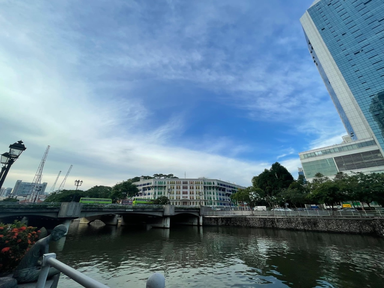
History of Singapore | River Valley follows the corridor between Fort Canning and the Singapore River from royal hill and colonial road to warehouses, secret-society houses, prisoner-of-war camps, amusement parks, river trade, public housing, river clean-up, Robertson Quay, Great World and today’s high-density city living.
River Valley is a small planning area with unusually deep historical surroundings. It sits between Orchard Road and the Singapore River, beside Fort Canning and close to Clarke Quay, Robertson Quay, Kim Seng and Great World. The name itself is geographical: early planners viewed the Singapore River as a valley between Fort Canning and Pearl’s Hill and named roads along the river accordingly.
URA’s River Valley urban design guidelines describe it today as a prime residential district between Orchard Road and Singapore River, with planning focused on high-quality city living. Nearby, Singapore River guidelines protect pedestrian-friendly waterfronts, conserved buildings and a mixed lifestyle district.
The river remains the main thread. It supported trade and warehouses. It carried pollution. Its cleanup became a national project. Its banks later became dining, housing and recreation. River Valley changed because the same waterway kept being asked to do a different job.
This page sits inside the larger History of Singapore | Singapore Atlas and How Singapore Works spine. Local eduKateSG routes include Things to do for Kids | Learning River Valley, Tutors | River Valley, A Student’s Life | River Valley and the Great World, Zion Road and Robertson Quay Mathematics pages.
The main questions are:
- Why is it called River Valley?
- How does Fort Canning connect to River Valley history?
- Why did warehouses and Chinese mansions appear near the river?
- What happened in the area during the Japanese Occupation?
- Why was Great World once a major amusement destination?
- How did Singapore River pollution affect the district?
- What did the river clean-up change?
- How did Robertson Quay become a residential and lifestyle waterfront?
- Why is River Valley now one of Singapore’s most central residential areas?
- How does URA plan the district today?
The Name River Valley
National Heritage Board material on the wider Singapore River landscape explains that early geographers saw the river as a valley between two high points: Fort Canning and Pearl’s Hill.
Roads on the two sides of the river reflected that geography.
River Valley Road therefore describes physical form rather than a person.
The name preserves the old topographic reading even though buildings now obscure the valley.
Fort Canning above the Valley
Fort Canning Hill rises above the eastern side of River Valley.
Archaeological research shows human occupation on the hill going back to the fourteenth century.
The hill is associated with the pre-colonial trading settlement of Temasek and local traditions of royal residence.
River Valley therefore sits beside evidence of Singapore history centuries before 1819.
The Hill and the River
High ground and river access form a powerful settlement combination.
The hill offers defence and visibility.
The river offers movement and trade.
The relationship helps explain why the Singapore River basin mattered long before modern roads.
Archaeology at Fort Canning
Excavations begun in the 1980s uncovered Chinese ceramics, coins, Malay earthenware and other artefacts.
These finds indicate a prosperous trading settlement connected to regional and international networks.
River Valley’s modern condominiums therefore sit beside one of Singapore’s most important archaeological landscapes.
The district is central because the geography was useful long before the modern city.
Colonial Fort Canning
After the British arrived, the hill was used for government and later military purposes.
Fort Canning reinforced the strategic importance of the river valley below.
Roads around the hill connected the growing town with inland areas.
Military and civic functions became another layer above older royal associations.
River Valley Road
River Valley Road became an important corridor running west from the city centre.
The road connected houses, warehouses, institutions and later entertainment uses.
It also provided access to roads leading toward Orchard and Tanglin.
The corridor’s long survival shows how early alignments can remain useful through completely different economies.
The Singapore River Economy
The river was Singapore’s early commercial artery.
Boats carried goods between ships, warehouses and merchants.
Warehouses, godowns and trading houses crowded the riverbanks.
River Valley lived beside this working waterfront rather than a scenic promenade.
Godowns and Storage
Warehouses near the river stored rice, spices, rubber, textiles and other goods.
The buildings needed direct access to water or roads for efficient loading.
Storage is an essential part of trade because goods rarely move instantly from ship to buyer.
The riverbank was therefore logistics infrastructure.
3A River Valley Road
River House at 3A River Valley Road is one of the oldest surviving buildings at Clarke Quay.
National Heritage Board notes that the traditional Chinese-style mansion dates to the late nineteenth century.
Research has complicated older assumptions about its ownership and possible use.
The building shows how merchant wealth and secret-society history intersected near the river.
Secret Societies
Secret societies were part of nineteenth-century Chinese migrant life in Singapore.
They could provide protection, employment networks and social ties while also becoming involved in violence or illegal activity.
A headquarters or meeting place near River Valley would have benefited from the district’s central location.
The topic reminds students that urban order was not always managed through modern formal institutions.
Merchant Houses
Wealth generated by trade created substantial residences near the commercial river.
A merchant could live relatively close to warehouses, offices and transport.
This mixed geography blurred the line between business district and residential district.
Modern zoning later separated some functions more clearly.
Clarke Quay
Clarke Quay sits immediately beside River Valley and belongs to the same river system.
The area was once dominated by warehouses and commercial river activity.
Its modern identity of restaurants and nightlife represents a dramatic change in function.
The buildings remained useful because heritage architecture could support a leisure economy.
Read Bridge
Read Bridge connected river communities and became a gathering point.
Bridges are especially important in river cities because they determine where people can cross.
A new bridge changes walking routes, trade and land value on both banks.
River Valley’s social geography is partly bridge geography.
Ord Bridge and Toddy Shops
National Heritage Board material remembers toddy shops near Ord Bridge and River Valley Road into the 1970s.
Toddy was a cheap fermented palm drink popular with working-class customers.
The shops reveal a less polished social world than today’s riverside restaurants.
Leisure and alcohol have long been part of the river district, though in very different forms.
Havelock and River Valley POW Camps
During the Japanese Occupation, camps for prisoners of war occupied areas around Havelock and River Valley Roads.
National Heritage Board historic-site material records thousands of POWs housed in poor attap huts.
The central river district therefore contains wartime incarceration history as well as commercial history.
Modern residential development can make this layer difficult to see.
War Changes Central Space
A road used for trade and housing can become a route to detention during war.
Ordinary buildings and open land can be requisitioned for military purposes.
The physical city remains but its rules change.
River Valley demonstrates how occupation can repurpose urban space without rebuilding it.
Fort Canning during War
Fort Canning also became important during the Battle of Singapore and Japanese Occupation.
Military command functions on the hill affected the surrounding district.
The river valley below sat beside one of the key command landscapes of wartime Singapore.
This creates a direct local connection to national military history.
Post-War River Trade
After 1945, the Singapore River returned to intense commercial use.
Lighters, warehouses and riverside businesses continued supporting trade.
The river remained economically useful even as road transport improved.
Old infrastructure rarely disappears the moment a newer technology arrives.
Pollution Builds Up
Decades of dense riverside activity left the Singapore River heavily polluted.
Waste from industries, markets, boats and settlements entered the water.
The river’s economic success produced environmental costs.
A working waterway can become unusable when too many activities treat it as a waste channel.
Kampongs and Squatter Settlements
Informal and low-income settlements existed along parts of the river system.
Residents depended on the same water environment that also received waste.
Sanitation and drainage problems affected health.
River cleanup therefore required social and housing changes as well as engineering.
Great World
Great World Amusement Park became one of Singapore’s famous mid-twentieth-century entertainment destinations near River Valley.
The park included cinemas, rides, food and other attractions.
It belonged to an era when amusement parks served as large mixed entertainment complexes.
The name survives today in Great World, even though the original park disappeared.
The Three Worlds Era
Great World was one of Singapore’s famous “World” amusement parks alongside New World and Happy World.
These parks combined cinema, performance, food and games.
They offered affordable mass entertainment before television and modern malls dominated leisure.
River Valley was therefore part of popular culture as well as trade.
Cinemas at Great World
Cinema was a major attraction at the amusement park.
Movie-going created evening crowds and supported food and retail businesses.
The entertainment economy relied on transport from across the city.
The district gained a leisure catchment larger than its resident population.
From Amusement Park to Mall
The former Great World site later became a modern shopping centre.
The name preserves the entertainment memory while the commercial form changes.
This is a good example of branding carrying history through redevelopment.
The land continues to serve leisure and shopping even after rides and old cinemas disappear.
Zion Road
Zion Road links River Valley with Great World and the river.
Food, transport and housing give the road a strong everyday role.
The name also connects with religious and historical landscapes nearby.
Micro-locations such as Zion Road deserve their own learning pages while River Valley owns the larger corridor.
Kim Seng
Kim Seng sits on the western side of the Singapore River corridor and is closely linked to River Valley and Great World.
The area’s roads, bridge and waterway connections tie it into the same urban system.
Modern planning boundaries simplify a historically interconnected neighbourhood.
Residents move across the boundaries without thinking about planning-area labels.
Robertson Quay
Robertson Quay was historically part of the working Singapore River waterfront.
Warehouses and commercial uses occupied the river edge.
Later redevelopment transformed the area into housing, hotels, restaurants and public promenades.
The quay became a major example of waterfront adaptive reuse.
Why Robertson Quay Changed
Containerisation and changing logistics reduced the need for old river warehouses.
Once trade shifted away from the river, valuable central land could take on new functions.
The same waterfront that served commerce became attractive for residential and leisure use.
Economic restructuring changed land value.
Warehouse Adaptive Reuse
Some former warehouse forms and conservation buildings were retained or adapted.
Large interiors work well for restaurants, galleries and commercial uses.
Waterfront heritage adds identity that new construction alone would struggle to create.
Old logistics architecture becomes lifestyle architecture.
Promenade Life
The river promenade supports walking, running, cycling and outdoor dining.
Public access to the river is much wider than in the old working-port era.
This is a major social change in who can use the waterfront.
The river edge shifted from workplace to public realm.
Singapore River Cleanup
The national effort to clean the Singapore River accelerated from the late 1970s with a ten-year target.
Industries, farms, street activities and settlements were relocated or reorganised.
Sewage and drainage systems improved.
The cleanup was as much a land-use transformation as a water-treatment project.
Why Cleanup Required Resettlement
Pollution sources were embedded in how people lived and worked.
Removing rubbish alone would not solve the problem.
Pig farms, workshops, hawkers and settlements needed alternative locations or better infrastructure.
Environmental policy therefore changed livelihoods and neighbourhoods.
A Clean River Changes Land Value
Once the river smelled better and became visually attractive, waterfront land gained new possibilities.
Housing, hotels and restaurants became more desirable.
Environmental improvement created economic value.
The cleanup helped make later riverfront redevelopment possible.
Clarke Quay Redevelopment
Clarke Quay’s warehouses were adapted for shopping, dining and entertainment.
The district preserved historic building scale while adding modern infrastructure.
The result helped turn the river into a tourism and nightlife destination.
Commercial heritage replaced commercial logistics.
Boat Quay and River Valley
Boat Quay lies farther downstream but belongs to the same river transformation.
The river’s different quays now offer distinct heritage and lifestyle identities.
River Valley residents can reach this larger waterfront network easily.
A clean river created continuity across central neighbourhoods.
Fort Canning Park
Fort Canning became a major green and heritage space beside River Valley.
The park combines archaeology, military history, colonial structures and recreation.
Its paths connect the district with museums, Clarke Quay and Orchard.
The hill now acts as both historical archive and urban park.
Fort Canning MRT
Fort Canning MRT on the Downtown Line improved rail access to River Valley and Clarke Quay.
The station reduces walking distance from the rail network for residents and visitors.
Transport reinforces the district’s centrality.
A historically old landscape gains new accessibility without changing its core geography.
Great World MRT
Great World station on the Thomson-East Coast Line gave western River Valley another direct rail connection.
The station strengthened access to homes, shopping and the river.
River Valley now benefits from several lines and nearby stations rather than one single transport node.
Distributed access suits a linear residential district.
Havelock MRT
Havelock MRT adds another connection toward the southern and western parts of the river corridor.
The line improves travel toward Orchard, Marina and the north.
Modern rail follows some of the same movement demands once handled by road and river.
Technology changes while corridor logic persists.
High-Rise Residential River Valley
River Valley became one of Singapore’s prime private residential districts.
Apartment towers and condominiums capitalised on central location and river proximity.
The planning area now contains high land values and dense housing.
This is a dramatic shift from warehouses, kampongs and amusement parks.
City Living
URA describes River Valley as a prime residential district for city living.
Residents can reach Orchard, Singapore River and the CBD quickly.
High accessibility supports residential density.
The district’s value comes from being between several major destinations rather than having one giant town centre.
Residential Quality
URA’s urban design guidelines focus on maintaining good residential quality.
This includes building form, streetscape and transition between developments.
Central density must still provide light, greenery and usable walking routes.
Prime location is not enough if the ground-level environment becomes hostile.
Killiney Road
Killiney Road forms part of the eastern edge of the wider River Valley-Orchard residential zone.
Shophouses and food businesses provide a finer street scale than nearby towers.
URA applies specific street-block controls to parts of the road.
Small-scale heritage can coexist with high-rise residential growth.
Oxley and Institution Hill
The broader River Valley planning area includes streets with political, institutional and residential associations.
Hills and old estates shaped road alignments.
The central district is not flat or uniform.
Topography still influences walking and development.
River Valley Primary School
Schools give River Valley a family dimension beyond high-end housing.
Daily student movement affects local buses, crossings and neighbourhood food.
A prime residential district still has ordinary school-day rhythms.
Education is part of city geography.
Robertson Quay as a Family District
Modern Robertson Quay combines restaurants with substantial residential development.
Families use the promenade, schools and nearby amenities.
The waterfront is not only nightlife.
Mature mixed-use districts support several populations at different times of day.
Night and Day
River Valley changes by hour.
Morning brings school and commuting movement.
Afternoon brings shopping and local services.
Evening shifts toward riverfront dining and leisure.
Time is another dimension of land use.
Noise and Residential Life
Mixed waterfront districts create tension between nightlife and residents.
Planning must manage noise, traffic and operating hours.
Vibrancy is valuable, but homes need reasonable comfort.
Urban success often creates management problems precisely because people want to be there.
River Valley and Orchard
The planning area sits immediately south of Orchard.
Residents can reach the shopping belt without living directly inside its commercial intensity.
This relationship mirrors Newton on Orchard’s northern side.
Orchard’s economic gravity shapes neighbouring residential land.
River Valley and Singapore River
The district also faces the Singapore River lifestyle and heritage zone.
URA treats the river as a distinct urban design area with public waterfront requirements.
River Valley therefore sits at the meeting of residential and riverfront planning systems.
Its identity comes from the overlap.
Urban Design Guidelines
URA updated River Valley urban design guidance as part of Master Plan 2025.
The objective remains high-quality residential city living while respecting conserved sites and street-block controls.
The district is not planned as a major commercial centre.
Its value lies in residential quality and proximity to stronger centres.
Residential with Commercial at First Storey
Master Plan amendments in 2026 included selected River Valley Road sites shifting toward residential use with commercial space at the first storey.
Ground-floor commerce can make residential streets more convenient and active.
The approach mixes homes with daily services without turning every site into a mall.
Street-level use shapes neighbourhood character strongly.
Walking to the River
Good River Valley planning depends on easy pedestrian connections to the Singapore River.
A waterfront is only useful if residents can reach it comfortably.
Crossings, shade and through-block routes matter.
The value of a river district is measured partly in walking time.
Cycling Connections
The wider central-city active-mobility network increasingly connects River Valley with Fort Canning, Orchard and the river.
Cycling extends the practical radius of short trips.
Residents can move between cultural, shopping and recreational districts without a car.
The area becomes more connected at human scale.
A River Valley Field Classroom
River Valley offers a compact route from Fort Canning archaeology to Clarke Quay warehouses, Robertson Quay and Great World.
The sequence covers more than six centuries of history.
Students can see royal-hill memory, colonial trade, war, pollution cleanup and modern residential redevelopment.
The eduKateSG River Valley learning guide gives families a practical starting route.
English from River Valley
Ask students to write the river from four perspectives: warehouse coolie, POW, amusement-park visitor and modern jogger.
The water remains while the human relationship changes.
This is an excellent exercise in point of view and historical evidence.
Local writing becomes time travel grounded in place.
Mathematics from River Valley
Students can measure river distance, walking routes, bridge spacing and station catchments.
They can compare direct promenade routes with road routes.
Older students can estimate residential density or land-use ratios.
The river gives geometry a real map.
Science from River Valley
Water quality, pollution, drainage and river ecology provide strong science topics.
The cleanup can be used to discuss dissolved oxygen, waste, sewage and ecosystem recovery.
Urban heat and tree shade add another layer.
Environmental science is visible in the city.
History from River Valley
River Valley’s strongest historical thread is reuse.
Royal hill becomes colonial fort and park.
Working river becomes polluted waterway and then lifestyle waterfront.
Amusement park becomes shopping centre.
Warehouses become restaurants and homes.
Geography from River Valley
The district demonstrates central-city land value.
Trade first made the river valuable.
Clean water and heritage later made it residentially and recreationally valuable.
Accessibility keeps land intense even as functions change.
River Valley and the eduKateSG Knowledge Block
The history page owns the broad place-development story.
Things to do for Kids owns the field-learning route.
Tutors | River Valley owns local education navigation.
Great World, Zion Road and Robertson Quay subject pages own precise local learning needs.
Local Routes in the eduKateSG Ecosystem
- Things to do for Kids | Learning River Valley
- Tutors | River Valley
- A Student’s Life | River Valley
- SEC Examination Mathematics Tuition | Great World
- Secondary 4 Mathematics Tuition | Robertson Quay
A Compact River Valley Timeline
- Fourteenth century onward: Fort Canning hill beside the future River Valley contains evidence of pre-colonial settlement.
- Early nineteenth century: the Singapore River becomes the commercial core of the British settlement.
- Nineteenth century: River Valley Road, warehouses and merchant houses develop along the river corridor.
- Late nineteenth century: River House and other substantial buildings reflect merchant and secret-society history.
- Early twentieth century: the river economy intensifies and surrounding residential districts grow.
- 1942–45: prisoner-of-war camps occupy areas around Havelock and River Valley Roads during the Japanese Occupation.
- Mid-twentieth century: Great World Amusement Park becomes a major popular-entertainment destination.
- 1960s–1970s: river trade continues while pollution worsens and central redevelopment accelerates.
- 1977 onward: the national Singapore River clean-up programme reorganises industries, settlements and waste systems.
- 1980s–1990s: old river warehouses increasingly shift toward conservation and lifestyle uses.
- 1990s–2000s: Robertson Quay and Clarke Quay become major mixed residential, dining and tourism districts.
- 2010s–2020s: new MRT stations strengthen River Valley’s accessibility.
- 2025–2026: updated URA design guidance continues to protect high-quality residential city living and pedestrian links to the Singapore River.
Frequently Asked Questions
Why is River Valley called River Valley?
The name reflects early geographical interpretation of the Singapore River as a valley between Fort Canning and Pearl’s Hill.
Why is Fort Canning important to River Valley history?
The hill contains archaeological evidence of fourteenth-century settlement and later became a colonial government and military site overlooking the river corridor.
What was the Singapore River like before cleanup?
It was a heavily used commercial waterway lined with warehouses, boats, industries and settlements, and became severely polluted over time.
What was Great World?
Great World was one of Singapore’s famous mid-twentieth-century amusement parks, combining cinemas, rides, food and entertainment near River Valley.
What happened during the Japanese Occupation?
Prisoner-of-war camps were established around Havelock and River Valley Roads, adding a difficult wartime layer to the district.
Why is Robertson Quay different today?
As river logistics declined and the river was cleaned, former warehouse land became suitable for housing, hotels, restaurants and public waterfront use.
What does URA plan for River Valley?
URA continues to position it as a prime residential district between Orchard Road and Singapore River, with design controls supporting high-quality city living and pedestrian connectivity.
How does this page connect to tuition?
The history page explains the district. Tutor, student-life and micro-location Mathematics pages handle education support and local routes.
Helpful Reading and Primary Routes
- URA | River Valley Urban Design Guidelines
- URA | Singapore River Urban Design Guidelines
- National Heritage Board | The Singapore River
- National Heritage Board | 3A River Valley Road
- National Heritage Board | Fort Canning Archaeology
- History of Singapore | Singapore Atlas
- How Singapore Works
- Things to do for Kids | Learning River Valley
- Tutors | River Valley
History of Singapore | River Valley
River Valley begins between hill and river.
Fort Canning gives high ground and deep history.
The Singapore River gives trade.
Warehouses and merchant houses turn the banks into logistics space.
War turns central land into detention space.
Great World turns the district into mass entertainment.
Pollution makes the river a national problem.
Cleanup changes both water and land use.
Warehouses become restaurants and homes.
Robertson Quay becomes a public waterfront.
MRT makes the district even more central.
URA now protects River Valley primarily as high-quality city living beside the historic river.
The water stayed.
The job changed.
River Valley as a History of the Working River
Modern visitors often see the Singapore River as scenery.
For most of its commercial history, the river was a workplace.
Boats loaded and unloaded.
Coolies carried goods.
Warehouses stored cargo.
The smell, noise and traffic were part of the economy.
A clean river can hide a hard-working past
Environmental improvement changes perception.
Once pollution and heavy commerce disappear, later generations can forget why warehouses and quays existed.
Local history restores the labour behind the waterfront.
Coolie Labour
River trade depended on large numbers of workers moving cargo manually.
Bags, boxes and baskets passed between boats, quays and warehouses.
The system required strength, timing and coordination.
Logistics before mechanisation
Modern containers hide much of the manual work once needed for trade.
The old river shows what logistics looked like before forklifts, container cranes and automated warehouses.
Lighters on the River
Lighters moved cargo between ocean-going ships and the riverfront.
Large vessels could not simply travel into every river warehouse.
Smaller craft solved the last-mile problem on water.
Last-mile logistics is an old problem
Modern delivery vans solve a similar task on roads.
The technology changes.
The need to bridge the final distance remains.
Warehouses and Risk
Stored goods could be damaged by water, fire, pests or theft.
Warehouse design and management therefore mattered to commercial success.
The riverfront economy required insurance, security and careful record-keeping.
Trade is an institutional system, not only movement.
Secret Societies and Migrant Networks
River Valley’s possible secret-society associations reveal how migrants built support structures outside formal government.
Some organisations provided jobs, protection and social belonging.
Others became involved in coercion and violence.
The same network could have several roles.
Informal institutions emerge when formal ones are weak
New migrants need information and trust.
Where official systems are inaccessible, community networks become powerful.
This is a recurring pattern in port cities.
River Valley during the Occupation
The POW camps around River Valley and Havelock sat inside a densely connected central district.
Prisoners experienced deprivation close to roads and places that had once supported commerce.
The war changed the use of central land without changing its geography.
Occupation turns ordinary space into controlled space
A hut, road or field can become part of a camp system.
Historical meaning can change instantly under new authority.
Great World as Popular Modernity
Great World Amusement Park represented modern mass leisure.
Electric lights, movies, rides and food created an exciting environment for working families and young people.
The park offered an affordable version of urban spectacle.
Entertainment is part of development history
A growing city needs leisure as well as jobs and housing.
Amusement parks show rising consumer culture and changing work-life rhythms.
Great World and Memory
The amusement park disappeared physically, but its name remained.
The modern shopping centre keeps the phrase “Great World” alive for another generation.
Brand continuity acts like place-name continuity.
The meaning shifts from rides and cinemas to mall and MRT.
The River Cleanup as a Governance Test
Cleaning the Singapore River required coordination across agencies.
Housing, sanitation, industry, farming, drainage and enforcement had to move together.
No single engineering department could solve the problem alone.
Coordination is the invisible infrastructure
Pipes and drains are visible.
Inter-agency coordination is not.
Yet large environmental projects fail without it.
Economic Cost of Cleanup
Relocating businesses and settlements imposed real costs.
Some livelihoods changed or disappeared.
The benefits of clean water were broad, but the transition was not painless for everyone.
Environmental policy creates winners and losers across time
A clean river benefits future residents and businesses.
The adjustment cost is often paid earlier by people whose activities are relocated.
Good history keeps both sides visible.
River Cleanup and Housing
Resettlement into formal housing improved sanitation for many families.
It also changed social networks and living patterns.
The cleanup therefore linked environmental improvement with public housing policy.
One national system reinforced another.
Waterfront Value after Cleanup
A cleaner river became suitable for restaurants, hotels, apartments and public promenades.
Property value rose because environmental quality improved.
This created a new economic model for the river.
Clean environment can be productive infrastructure
A pleasant waterfront attracts visitors and residents.
Environmental investment can therefore generate long-term economic value.
Robertson Quay as a Residential Experiment
Robertson Quay demonstrates how former commercial land can become a mixed residential district without abandoning the river.
Homes, hotels and restaurants share the waterfront.
The river becomes an amenity rather than a transport channel.
Amenity value is a modern economic value
A river view once helped merchants supervise trade.
Now it can increase residential desirability.
The same physical feature produces different value in different economies.
Public Waterfront Access
URA’s Singapore River guidelines protect public promenade continuity.
This matters because private waterfront developments could otherwise block access.
The river is treated as a shared city asset.
Publicness must be designed
A waterfront is not automatically public because people can see it.
Routes, easements and connected promenades determine whether people can actually walk beside the water.
Clarke Quay and Controlled Heritage
The conserved warehouse district uses colour, lighting and climate-control structures to support modern entertainment.
The intervention is more than restoration.
It adapts heritage to heavy visitor use.
Heritage districts are designed systems
Drainage, fire safety, servicing and pedestrian capacity must all work behind the historic appearance.
Conservation is not simply leaving old buildings untouched.
Fort Canning as the Green Counterweight
River Valley’s high-density housing sits beside Fort Canning Park.
The park gives residents access to large heritage greenery close to home.
This is one reason central living can remain attractive even at high density.
Parks create residential value
Green access improves recreation, cooling and identity.
Central parks are therefore social and economic infrastructure.
Great World Station and the Return of Rail
The Thomson-East Coast Line returned high-capacity transport to an area long served mainly by buses and roads.
Great World station gives the old amusement-park site a new transport role.
History layers rather than repeats.
River Valley and School-Day Geography
Families living in River Valley often travel to schools across central Singapore.
MRT, buses and walking routes shape daily schedules.
The district’s central location expands choice but can also create peak-hour complexity.
Accessibility changes education options
A family evaluates a school partly by travel time.
Transport becomes an education variable.
A River Valley Oral-History Project
Interview someone who remembers Great World, old Clarke Quay or the river before cleanup.
Ask:
- What did the river smell like?
- What businesses operated there?
- How did people travel?
- What entertainment did families use?
- Which modern change surprised you most?
Then compare the memory with official photographs.
A River Valley Environmental Project
Students can compare historical pollution with modern water quality.
Research:
- Waste sources.
- Cleanup policies.
- Resettlement.
- Sewerage improvements.
- River ecology after cleanup.
The goal is to understand why environmental recovery requires systems change.
A Waterfront Economics Project
Compare the old and new river economies.
Old value:
- Freight.
- Warehousing.
- Trading.
New value:
- Housing.
- Hospitality.
- Dining.
- Recreation.
- Heritage tourism.
Explain why the same river can support different economies over time.
What Future Historians May Ask
Future historians may ask whether central residential intensification preserved enough public river access, how Great World and Robertson Quay aged, and whether climate adaptation changed the riverfront again.
Current URA guidelines will become evidence of what planners valued in 2026.
So will ordinary photographs of promenades and apartment towers.
What River Valley Teaches About Singapore
- Central land can change function several times while remaining valuable.
- Trade infrastructure can become heritage and lifestyle infrastructure.
- Environmental cleanup requires social, housing and economic change.
- A clean river creates new economic value.
- Public waterfront access needs planning protection.
- Heritage is often the reuse of working buildings rather than monuments only.
- Transit can return new intensity to old districts.
- The same waterway can move from transport route to pollution problem to public amenity.
Continue Learning with eduKateSG
Start with Things to do for Kids | Learning River Valley, then use Tutors | River Valley and the relevant Great World, Zion Road or Robertson Quay pages.
eduKateSG
8 Fourth Avenue
Singapore 268674
Near Sixth Avenue MRT
3-pax small-group tuition
By appointment
Properly taught kids shine a bright light into the future.