
Did you know that a street name can be a small history lesson? In Bukit Timah, names such as Jalan Asas, Jalan Tekad and Jalan Haji Alias offer clues to how villages, places of worship and purpose-built housing estates grew beside one another.
The quick answer: Before the neighbourhood became known for major roads, schools and shopping centres, different communities lived in kampongs and small settlements. Fuyong Estate was deliberately developed as affordable modern housing in the 1950s. Nearby mosques, temples and other landmarks helped organise social life. Some physical settings changed dramatically, but a network of names, memories and institutions still explains the older district.
To follow this history, it helps not to imagine a single uniform ‘old Bukit Timah’. People arrived at different times, belonged to different communities and used the same landscape in different ways.
Conceptual illustration of the conserved Bukit Timah Railway Station, one of the landmarks featured on NHB’s Kampong Life Trail. It is not a photograph of Fuyong Estate or a former kampong.
At a glance: What did a kampong provide beyond housing? · Why was Fuyong Estate developed? · What do Jalan Asas and Jalan Tekad mean? · How Masjid Al-Huda supported the kampongs · How Hoon San Temple connected neighbours · Where did the railway fit into kampong life? · How can a student explore these places respectfully?
1. What did a kampong provide beyond housing?
A kampong is often translated simply as a village. But if we think only about houses, we miss how a village worked. Neighbours shared knowledge, bought food from local sellers, took part in celebrations, helped maintain places of worship and found ways to support one another.
Some everyday activities happened at home; others happened in communal spaces. A religious building could also function as a place to meet people, organise charity, teach younger generations and reconnect families who had moved away.
That does not mean village life was always easy. Singapore’s growing population faced housing shortages, and many residents of both rural settlements and crowded urban quarters needed better facilities. Modernisation changed opportunities while also disrupting old networks.
2. Why was Fuyong Estate developed?
The National Heritage Board explains that entrepreneur and philanthropist Lee Kong Chian developed Fuyong Estate in the 1950s to provide affordable modern homes. It was a 142-household estate, at a time when many Singaporeans were living in overcrowded dwellings or rural kampongs.
The estate was named for Fu Rong, Lee’s hometown village in Fujian, China. It stood near the former kampongs of Lorong Chamar and Chia Eng Say Road. Those neighbouring kampongs were later cleared, though NHB notes that foundations of some former houses remain as traces of the earlier landscape.
The important distinction: Fuyong Estate was not simply an old kampong given a new name. It was a planned housing development created in response to housing needs, existing beside older communities before the surrounding area changed.
3. What do Jalan Asas and Jalan Tekad mean?
NHB notes that the estate’s Malay street names were associated with the spirit of progress and self-government in the 1950s. They are an unusually clear example of how a community can express values through its geography.
Jalan Asas means ‘foundation’; Jalan Tumpu, ‘focus’; Jalan Siap, ‘readiness’; Jalan Tekad, ‘willpower’; and Jalan Uji, ‘challenge’. Put together, they read almost like a short list of qualities needed to build a new society.
Street names are not proof that everyone living there shared identical hopes or experiences. They are evidence of the ideas and identity chosen for the estate. When students compare names with archival accounts, they can explore the difference between official aspirations and residents’ lived experiences.
4. How Masjid Al-Huda supported the kampongs
Masjid Al-Huda, formerly called Masjid Kampong Coronation, was built in 1925 near villages including Kampong Tempe, Kampong Chantek, Kampong Banjir and Kampong Holland. According to NHB, its site was donated by a Hindu landowner in 1905—one memorable detail in a wider story of people with different backgrounds living near each other.
The mosque originally featured a wooden structure and tiered roof reflecting Javanese heritage. Local fundraising later helped rebuild it in brick and concrete; the new building was completed in 1966. Community contributions included earnings from the sale of tempeh, voluntary support from hawkers and portions of residents’ salaries.
This history is useful because it shows how a building happens: land, donations, labour, practical needs and generations of support. A heritage mosque is not just an architectural style. It is also evidence of cooperation and communal responsibility.
5. How Hoon San Temple connected neighbours
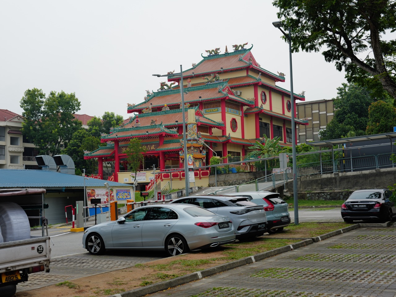
Another landmark on the Kampong Life Trail is Hoon San Temple, established in 1902 by migrants from Jiazhou village in Fujian. NHB describes its dedication to Lim Tai See and the temple’s role in religious and social life around Jalan Lim Tai See.
During the 1950s and 1960s, Chinese opera performances held near the temple attracted villagers from different backgrounds, including Malay residents from nearby Kampong Tempe. The temple was also renovated and preserved, and NHB notes that its relationship with Masjid Al-Huda continues through neighbourly exchanges on festive occasions.
Here is a better way to think about multicultural history: people can have different traditions and still share streets, performances, neighbourhood duties and acts of generosity. Proximity alone does not guarantee harmony. Relationships must be built and maintained.
6. Where did the railway fit into kampong life?
Transport shaped these communities too. The former Bukit Timah Railway Station appears alongside Masjid Al-Huda, Hoon San Temple and Fuyong Estate on the National Heritage Board’s Kampong Life Trail.
A railway can change where people work, how goods arrive and what journeys are possible. But a passing train can also enter childhood memory as a sound, a landmark or a marker of daily time. The physical system and social experience are connected.
The older railway station is preserved as heritage, and the railway corridor now has a different use. That transformation reminds us that community history is layered: what a place means to a commuter, shopkeeper, resident or visitor can vary across generations.
7. How can a student explore these places respectfully?
An easy classroom exercise is to draw a timeline with four lanes: housing, religion, transport and community memory. Place Fuyong Estate, the mosque, the temple and the railway on the same page. What changed together? What changed independently?
The takeaway is not that every original building survived. It is that a neighbourhood continues to carry traces of what people built, valued and shared.
- Start with the NHB Kampong Life Trail: read the official description before choosing your route.
- Look for dates: identify what was founded, rebuilt, conserved or cleared at different times.
- Notice names: ask what street and building names communicate about earlier residents.
- Respect active places of worship: check visitor rules and avoid disrupting religious activity.
- Do not enter private land or old foundations: observe only from permitted public routes.
Frequently asked questions
What is Fuyong Estate in Bukit Timah?
Fuyong Estate is a housing estate developed by Lee Kong Chian in the 1950s as affordable modern housing for 142 households, according to the National Heritage Board.
Are there still reminders of Bukit Timah’s kampong history?
Yes. NHB’s Kampong Life Trail highlights the former railway station, Masjid Al-Huda, Hoon San Temple and Fuyong Estate, along with their community histories.
When was Masjid Al-Huda built?
The original mosque was built in 1925, with a community-supported reconstruction completed in 1966.
Why do roads in Fuyong Estate have Malay names?
NHB explains that their meanings were chosen to convey ideals of progress and development in the 1950s.
Official references and further reading
For further details, visitors’ rules and historical context, follow these official sources:
- National Heritage Board: Fuyong Estate
- National Heritage Board: Bukit Timah Kampong Life Trail
- National Heritage Board: Masjid Al-Huda
- National Heritage Board: Hoon San Temple
Explore the How Bukit Timah Works series
- How Bukit Timah Works | Why Granite, Quarries and Hills Shaped the Area
- How Bukit Timah Works | How the Rainforest Survives Inside Singapore
- How Bukit Timah Works | How the Rail Corridor Connects History and Nature
- How Bukit Timah Works | Why Schools and MRT Stations Follow the Main Road
- How Bukit Timah Works | Why Floods Happen and How the 2026 Canal Upgrade Helps
- How Bukit Timah Works | How Beauty World Grew from a Market into a Town Centre
- How Bukit Timah Works | How Kampongs, Temples and Fuyong Estate Shaped the Neighbourhood (this guide)
- How Bukit Timah Works | Why Bukit Timah Was Crucial in World War II
See also: how roads, schools and MRT stations shape Bukit Timah.