
Did you know that an engineer counted more than 270,000 journeys near today’s Sixth Avenue in a single year—long before Singapore had an MRT network? The area that now has trains, buses, schools and neighbourhood shops was once a busy milestone along the road into the island’s interior.
That older story matters because modern transport does not appear on an empty map. Each new way of travelling builds on earlier roads, settlements, businesses and the routes people already use.
The quick answer: Sixth Avenue works as a local connection between Bukit Timah’s main road, residential side streets, bus services, schools and the Downtown Line. Its historic sixth-milestone surroundings also supported early industry, including a brickworks. The modern Sixth Avenue MRT (DT7) opened with Downtown Line Stage 2 on 27 December 2015, adding rapid transit to an already active corridor.
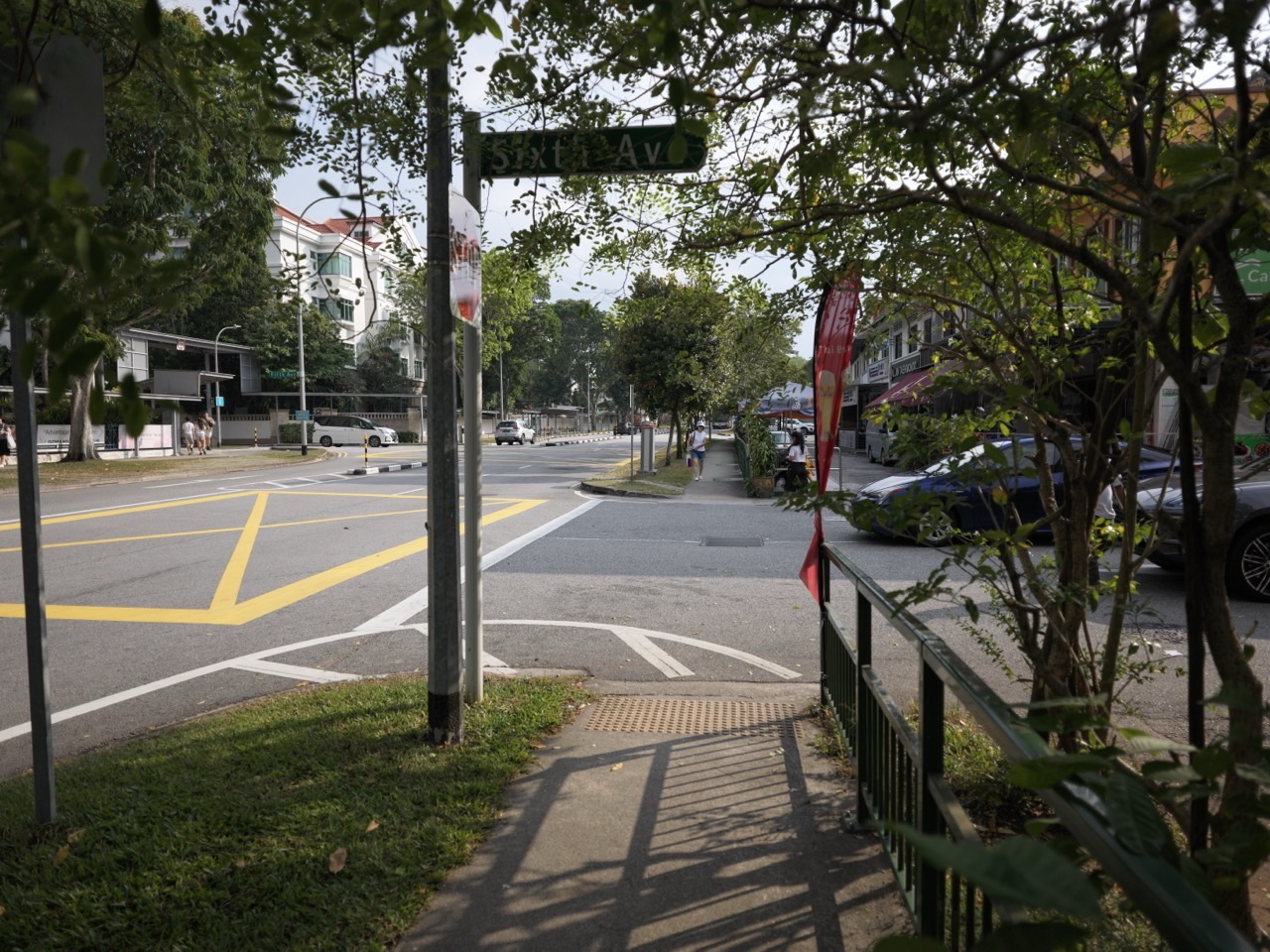
Featured image: Sixth Avenue streetscape from the eduKateSG media library; businesses and streetscape details may change.
At a glance: What did the ‘sixth milestone’ mean to earlier travellers? · Why did an engineer count traffic here in 1896? · How did that traffic count connect to the old railway? · Why was there a brickworks near Sixth Avenue? · What changed when the Downtown Line opened in 2015? · What is the ‘last mile’ in a Sixth Avenue journey? · How do bus services still contribute when there is an MRT? · Why did heavy rain matter so much to this road corridor? · What does a school and neighbourhood timetable add to the picture? · How can students investigate Sixth Avenue without complicated equipment?
1. What did the ‘sixth milestone’ mean to earlier travellers?
Before digital maps, travellers used known roads and milestones to describe places. Historical accounts of Bukit Timah Road refer to locations by their distance markers, making the milestones useful references for settlements, farms, factories and road junctions.
The National Heritage Board places the sixth milestone near today’s Sixth Avenue Centre. That helps anchor old descriptions in a neighbourhood people can recognise.
Do not assume a milestone functioned exactly like a modern street address. It was a reference along a route, not a precise substitute for today’s building numbers or MRT exits.
Understanding a historic location often requires translating between different systems: the old milestone, a road map from the period, and the present-day station or street.
2. Why did an engineer count traffic here in 1896?
In 1896, colonial engineer Captain F. J. Anderson examined traffic passing a police station at the sixth milestone of Bukit Timah Road. According to the National Heritage Board’s trail research, he recorded more than 270,000 journeys in both directions over twelve months.
Travellers then moved on foot, by horse-drawn carriage, by rickshaw and in bullock carts. That mix tells us how unlike today’s traffic the road would have looked.
The point of the count was practical: to consider whether a railway would be justified. A transport proposal becomes more persuasive when planners have evidence of existing travel demand instead of relying only on assumptions.
Be careful with that number. It records journeys at the survey location over a specified period; it does not mean 270,000 separate residents lived at Sixth Avenue in 1896.
3. How did that traffic count connect to the old railway?
The survey helped justify construction of the Singapore–Kranji Railway around the turn of the twentieth century. The Singapore-to-Bukit Timah section opened on 1 January 1903, followed by the Bukit Timah-to-Woodlands section on 10 April 1903.
Rail transport gave travellers another means of reaching areas along the main road and helped some residents move farther from the old town centre. The historic line broadly followed Bukit Timah Road across part of the district.
That older railway is not the same infrastructure as the Downtown Line beneath today’s road corridor. The former KTM line later ceased its Singapore operations in 2011, while the Downtown Line’s Bukit Timah stage opened in 2015.
This is an instructive timeline: road travel helped motivate a railway, and more than a century later a modern underground rail line added another layer of connectivity.
4. Why was there a brickworks near Sixth Avenue?
Large construction projects need raw materials, factories and ways to transport finished goods. The National Heritage Board records a brickworks near the sixth milestone, close to the area now known as Sixth Avenue Centre.
Brickmaking and other industrial activities were part of Bukit Timah’s early twentieth-century history. They complemented the area’s railway access and other local industries, including factories processing agricultural products.
A brickworks is a useful reminder that historic Bukit Timah was not merely a residential enclave with prestigious schools. People produced and moved materials there, and industrial work helped shape the district.
The old brickworks reference should not be confused with a specific active building today. NHB’s record establishes a historic industry near the milestone, not a surviving operating brick factory inside a current shop unit.
5. What changed when the Downtown Line opened in 2015?
Downtown Line Stage 2 opened on 27 December 2015, with twelve new stations across a 16.6-kilometre extension that improved access through Bukit Timah and towards other parts of Singapore.
Sixth Avenue became one of the underground stations along the corridor. Passengers gained an additional alternative to travelling the whole distance by road and bus.
That did not make nearby schools, housing estates or shopping services suddenly appear. These existed before the rail line. The new station changed the choices people had for reaching established destinations.
One transport principle becomes clear: a station is most useful when it works with the surrounding road, footpath and bus network. An underground platform is only one part of the trip.
6. What is the ‘last mile’ in a Sixth Avenue journey?
The last mile is the connection between a major transport service and a person’s real destination. Someone may arrive at Sixth Avenue MRT, but still need to walk to a nearby house, shopping unit, school, appointment or workplace.
The distance on a map may look short. In real life, a safe crossing, the correct station exit, an overhead bridge or weather protection can determine how convenient the walk is.
The area includes Bukit Timah Road and Dunearn Road, which carry traffic in different directions along much of the paired corridor. A bus stop on the wrong side may not serve the direction the passenger needs.
For anyone travelling with younger children, bags or mobility aids, checking the pedestrian route is as important as checking the train line. Never cross between moving vehicles just because a destination appears nearby.
7. How do bus services still contribute when there is an MRT?
Trains can move large numbers of people along fixed lines. Buses connect more streets and destinations, including locations not immediately adjacent to a railway entrance.
At Sixth Avenue, the two modes therefore solve different parts of the transport problem. A commuter may take a bus towards the main road and continue by MRT, or use the station then walk the final portion of a journey.
Not every possible connection will be the fastest. Waiting time, transfers, the direction of travel, rain and the actual school or work schedule all affect which route is best.
A practical journey planner should compare door-to-door options rather than treating the shortest rail journey as automatically the shortest overall trip.
8. Why did heavy rain matter so much to this road corridor?
The National Heritage Board records serious past flooding in parts of Bukit Timah Road, including areas around today’s Sixth Avenue. Schools and shops could be disrupted when heavy rain overwhelmed the drainage system.
The area was part of a wider valley-like catchment. Stormwater from surrounding land travelled toward drains and canals, while roads and increasingly built-up surfaces affected how quickly water moved.
Singapore began the Bukit Timah Flood Alleviation Scheme in 1966, with subsequent improvements and diversion canals. PUB’s latest Upper Bukit Timah Canal upgrade was completed in October 2026.
This does not mean Sixth Avenue was always flooded or that today’s rainfall poses the same risk as several decades ago. It means drainage engineering and transport planning have long had to work together in this corridor.
9. What does a school and neighbourhood timetable add to the picture?
Sixth Avenue lies amid mature residential areas and schools within the wider Bukit Timah corridor. Those institutions create repeated travel patterns: morning arrivals, afternoon departures, lessons, community activities and weekend errands.
People making those journeys use different combinations of train, bus, car and walking. Changing school schedules or work arrangements can therefore change how busy a particular crossing or stop feels at different times.
However, proximity should not be used to guarantee school admission or an exact journey time. A family should always assess the actual route, appropriate crossings and travelling conditions for its own destination.
That is a useful lesson in how neighbourhoods work: transport demand is produced by daily human routines, not only by roads and stations.
10. How can students investigate Sixth Avenue without complicated equipment?
Begin with a simple historical timeline. Mark the 1896 traffic survey, the 1903 railway, the historic brickworks and the Downtown Line opening in 2015.
Then choose two ordinary routes from an appropriate public observation point. Watch how buses, pedestrians and other vehicles interact, staying well away from the carriageway. Identify the role of crossings and overhead walkways.
Finally, compare a historic description from the National Heritage Board with a current map. Ask: which transport systems remain, which have disappeared and which have changed purpose?
Did you know the next MRT trip can also teach a lesson in economic history and urban planning? At Sixth Avenue, the answer is visible once you follow the transport timeline.
Frequently asked questions
When did Sixth Avenue MRT open?
It opened on 27 December 2015 as part of Downtown Line Stage 2.
What is Sixth Avenue MRT’s station code?
DT7 on the Downtown Line.
Was there really a brickworks near Sixth Avenue?
Yes. The National Heritage Board records a brickworks near the sixth milestone, close to present-day Sixth Avenue Centre.
What happened at the sixth milestone in 1896?
Engineer F. J. Anderson surveyed road traffic near the police station there, recording more than 270,000 journeys in both directions across one year as evidence for a proposed railway.
Why do road crossings matter near Sixth Avenue?
The busy Bukit Timah–Dunearn road corridor and different traffic directions mean the safe walking route may differ from the shortest straight line on a map.
Is Sixth Avenue connected to the former Bukit Timah railway?
It is in the same broader historic transport corridor, but the former railway and modern underground Downtown Line are distinct systems.
Official references and further reading
- National Heritage Board: Bukit Timah Heritage Trail, early railway and sixth milestone
- LTA: Downtown Line and 2015 Stage 2 opening
- NHB: Bukit Timah community heritage trail
- PUB: October 2026 Upper Bukit Timah Canal upgrade
Continue the How Bukit Timah Works series
- Why schools and MRT stations follow the main road
- How Bukit Timah Road and Dunearn Road run side by side
- How the railway connects history and nature
- How Hindhede Nature Park works
- How Eco-Link@BKE helps wildlife
- How the Herbarium turns plants into scientific records
For parents looking for a separate learning resource near Sixth Avenue, see Secondary 1 Mathematics Tutor Clementi — Small Groups Tutorials. The original tutorial information is unchanged.