
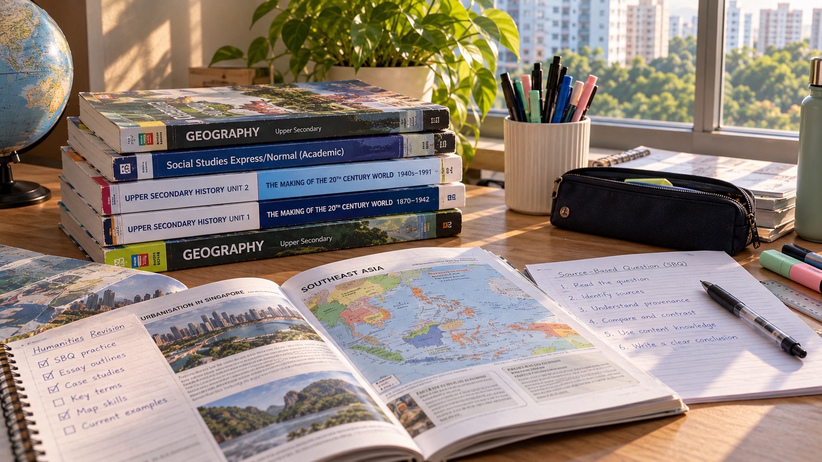
To survive G2 Geography, start looking at the places you already understand: the route to school, the nearby park, a tourist destination, and the weather you experience every day. Describe what you can observe, identify a geographical relationship, and explain it with evidence rather than guesses. Under the 2027 Singapore-Cambridge Secondary Education Certificate, standalone G2 Geography is syllabus K226. Both papers are 1 hour 45 minutes, 50 marks and 50% of the grade. Paper 1 covers fieldwork and tourism; Paper 2 covers everyday geography and climate. The straightforward survival strategy is to prepare both, read maps carefully and learn to make a reasoned decision from data.
This is an encouraging subject for people curious about the environment, travel, housing, climate and how cities function. Geography develops useful skills for environmental management, logistics, hospitality, urban planning, public services, data work and many other possibilities. It does not promise a career or a particular post-secondary offer. Your eventual opportunities depend on your full SEC profile, the course requirements and future qualifications. Build your ability to investigate a real question now and keep a sensible range of education choices open.
2027 SEC G2 Standalone Geography: paper-specific survival guides
These guides cover the actual SEAB K226 and K227 standalone papers, official timing, compulsory sections, original examples and parent-friendly plans. Standalone Geography K226 does not have the combined K229 Tectonics option; standalone History K227 covers different paper content from combined K230 History. Follow the registered syllabus.
- G2 Geography K226 Paper 1 — Fieldwork and Tourism
- G2 Geography K226 Paper 2 — Everyday Life and Climate
The quick seven-step G2 Geography plan
- Confirm the registered subject is standalone Geography K226, not combined Humanities (Social Studies, Geography) K229.
- Know Paper 1: compulsory fieldwork question and compulsory Tourism question; there is no choose-one topic there.
- Know Paper 2: compulsory Everyday Life question and compulsory Climate question; do not replace Tourism with Tectonics.
- Practise reading a map, legend, scale, climate graph and data table before writing an explanation.
- Carry out a tiny, safe observation exercise near home with a clearly defined method and limitation.
- Write one six-mark judgement using criteria, evidence and a supported recommendation.
- Keep an error log and prove one correction on a changed graph or decision scenario each week.
Start with a single practice question and show your complete reasoning. Instead of saying ‘I must memorise more facts’, identify whether the problem is a missing concept, a misread scale, weak comparison, an unsupported claim, or a judgement with no criteria. That exact distinction tells you what should be taught next. Small repeated repairs matter more than rushing through a stack of case studies.
What is the actual 2027 Geography K226 examination?
- Paper 1: 1 hour 45 minutes, 50 marks, 50% overall; two compulsory structured questions.
- Paper 1 Question 1: Geography in Everyday Life Topic 1.3, Geographical Methods/Fieldwork, 25 marks. The fieldwork scenario can draw on any syllabus cluster.
- Paper 1 Question 2: Tourism, 25 marks, including one six-mark judgement and decision-making question.
- Paper 2: 1 hour 45 minutes, 50 marks, 50% overall; two compulsory structured questions.
- Paper 2 Question 1: Geography in Everyday Life Topics 1.1 and 1.2, 25 marks.
- Paper 2 Question 2: Climate, 25 marks, including one six-mark judgement and decision-making question.
- Each question contains no more than 12 subparts. Approved calculators are permitted in both papers.
The syllabus covers three clusters: Geography in Everyday Life, Tourism and Climate. Students also undertake extended fieldwork of ten weeks as part of their learning. Do not confuse that school investigation with a separate coursework percentage: the published national exam assessment is the two written papers. In Paper 1, the fieldwork question assesses practical geographical thinking from a scenario, and the tourist destination content is compulsory. In Paper 2, climate is compulsory. This is different from K229, the combined Humanities syllabus with an optional Climate/Tectonics question.
SEAB organises assessment around Knowledge with Understanding, Skills and Analysis, and Judgement and Decision-Making. Each paper gives approximately 20% of the total syllabus weighting to knowledge, 20% to skills and 10% to judgement, for a combined 50% per paper. You must do more than recall words. You should describe patterns in evidence, choose appropriate methods and evaluate a proposal in its circumstances.
First principle: geography asks where, why there and with what consequences
Begin with location. Two places can contain similar buildings but have different patterns of movement, services, green spaces and needs. Maps and field observations reveal these relationships. A shopping centre beside an MRT station may attract customers differently from a standalone centre because accessibility changes the area that people can reach easily. But you must test the claim with the evidence provided; a visually busy photograph cannot prove who travels there or why.
Next ask about scale: an individual block, a neighbourhood, a town, a country and a region may all be relevant. A proposed walkway may serve one group of residents well yet affect others differently. A park’s shade may make one route more comfortable while nearby construction changes airflow or accessibility. Scale makes the explanation honest and helps avoid turning a local observation into a universal statement.
Then ask about consequences. Environmental, social and economic outcomes can interact, but do not automatically balance one another. A proposed measure can improve access but need maintenance; it may benefit visitors more than local residents or vice versa. To make a judgement, define the objective and weigh evidence rather than simply choose whichever option sounds most sustainable.
Geography in Everyday Life: make sense of familiar neighbourhoods
Sense of place is not just a map label
People attach memories, routines and meaning to spaces. A neighbourhood market may be an ordinary shopping place to one resident, a livelihood to a stallholder and a social meeting point to another. Geography asks how people encounter places repeatedly, how landmarks shape identity and why different representations may express different impressions of the same location.
For an invented classroom exercise, draw a simple route to school and mark two familiar landmarks. Write down what each place means to you, then identify one reason someone else might view it differently. The second answer may involve accessibility, time of day, age or the type of activity. The goal is not to decide whose feelings are correct; it is to explain how place experience changes with context.
Spatial patterns: clusters, corridors and service locations
Look at how places are arranged. Some services cluster near transport nodes; others are spread across residential areas. A pattern by itself does not prove a cause, but it can guide a question about accessibility or demand. Describe exactly what the map shows before explaining what may influence the distribution.
Suppose a fictitious map shows three childcare centres near an interchange and two dispersed among blocks. It supports the observation that some centres cluster near the interchange. It does not prove that all parents choose those centres for transport convenience. You would need additional data such as resident surveys, enrolment records or walking distances.
Sustainability requires trade-offs
The syllabus considers how urban neighbourhoods meet present needs without undermining future possibilities. Environmental features such as vegetation and drainage interact with economic activities and social access. When recommending a design, identify benefits, costs, feasibility, different users and possible unintended effects. Sustainability is an evidence-based problem, not a slogan.
For example, trees near a walkway may reduce exposure to direct sun and provide habitat, but the plan must consider growing space, roots, upkeep and route width. A shaded structure can be useful faster in some contexts but also has costs and maintenance needs. The better choice depends on the specific objective and constraints.
Fieldwork is a method of finding out, not just a trip outside
The ten-week extended fieldwork learning experience provides a way to understand geographical inquiry. Begin with a research question that can actually be investigated: ‘How does the number of people using two sheltered routes differ during the afternoon?’ is measurable, whereas ‘Is this neighbourhood good?’ is too vague without criteria. Establish variables and select a suitable method before gathering data.
Fieldwork methods can include observation, counts, questionnaires, photographs, sketch maps and existing datasets. Each method answers some questions better than others. A count may record the number of people passing a point but cannot reveal their satisfaction. A survey may capture perceptions but can suffer from sampling bias or leading questions. Use methods according to the evidence needed.
If students are surveying people, design respectful, clear and non-intrusive questions and follow school safety and consent rules. Do not collect personal details unnecessarily. If observations occur in public spaces, use teacher guidance, suitable locations and safe procedures. The goal is learning geographical method, not conducting unsupervised research in traffic or other hazardous environments.
Reliability, validity and practical improvement
Reliability concerns whether a method can produce consistent results under comparable conditions. Validity concerns whether it actually measures what you intended. These are related but different. A method may consistently record something that does not answer the research question. Repeating it perfectly will not solve the wrong measurement problem.
Imagine a survey intended to measure residents’ satisfaction with local shade. If students only ask people already using a shaded park, that sample may systematically miss residents who avoid exposed routes. Collecting 200 answers from the same narrow setting does not automatically make the conclusions representative. Improve the sampling design rather than only increasing the number of responses.
A common weak evaluation says, ‘The students should be more careful.’ A stronger one names the defect and how to fix it: ‘Repeat pedestrian counts at the same times on several comparable weekdays to reduce one-day variation’ or ‘Use a balanced set of locations rather than one convenient entrance’. Explain why the chosen improvement addresses the actual weakness.
Worked fieldwork question: pedestrian routes
Original practice data, entirely invented: students count people using Route A and Route B from 4:00 to 4:15 pm on three weekdays. Route A receives 40, 44 and 46 people; Route B receives 26, 28 and 30. Route A’s mean count is (40 + 44 + 46)/3 = 43.3 to one decimal place. Route B’s mean is 28.0. Route A averages about 15.3 more people per observed period.
A justified conclusion is that Route A had higher observed pedestrian usage during these three periods. It is not justified to conclude that A is always preferred at all hours, or that shade must be the only cause. The students would need evidence on route connectivity, shelter, destination and conditions to investigate why the difference occurred.
A stronger design could repeat counts during morning travel and weekend periods, and record whether rain affected behaviour. This example teaches calculation, evidence and limitation together. The next practice changes the count times and asks whether the conclusion can still be stated with the same level of confidence.
Tourism: the people, reasons and economic effects
Distinguish push factors from pull factors
Tourism is not just a list of attractive countries. A push factor concerns why someone wants to travel away from their usual environment, such as rest or curiosity. A pull factor concerns what attracts that traveller to a particular destination, such as heritage, scenery or facilities. The opportunity to travel also depends on time, money, accessibility and other constraints.
If a traveller wants to escape a stressful routine, the push factor is the desire for a break. If they choose Singapore for museums and food experiences, those destination attractions are pull factors. If travel costs rise significantly, the motivation may remain but the practical ability to travel can change. Separate motivation, attraction and constraint.
Tourism growth can create benefits and pressure
Visitors can support employment, business revenue, public transport and demand for services. However, tourism can place pressure on housing, infrastructure, local resources, heritage or ecosystems. The extent and distribution of those effects vary by place. Do not treat every tourist dollar as an identical net benefit to all residents.
An invented island receives many seasonal visitors. Accommodation and restaurants gain customers, but some water supplies and roads become more heavily used. An answer should identify which groups receive benefits, what pressures arise and what evidence would be needed to measure the consequences. A balanced explanation does not require denying genuine economic contributions.
Sustainable tourism should be tested
A destination may market itself as sustainable, but a label is not proof. Ask whether environmental pressures are monitored, local livelihoods benefit, visitor numbers are managed responsibly and community voices are considered. If a protected area restricts access, consider both conservation needs and legitimate opportunities for local enterprises.
For a six-mark judgement, compare options using explicit criteria. An application might ask whether limiting visitors or improving low-impact transport is more feasible. Choose the action best supported by the evidence in the question, acknowledge a limitation and explain how it addresses the stated objective.
Worked tourism judgement: a crowded heritage lane
Invented scenario: a heritage lane receives 1,000 visitors per day at peak season. Shop owners want visitors, while residents report crowding and noise. Proposal A limits tour-group entries in the busiest hour. Proposal B widens access by distributing guided visits across the afternoon. The question asks which should be tried first and why.
A developed answer might favour B where afternoon demand is underused, because spreading visits could reduce peak density while maintaining opportunities for local businesses. It should acknowledge that B needs cooperation from guides and may not work if most visitors arrive together. A might be more suitable if strict capacity or safety constraints require an immediate limit.
What earns quality is not a magic selection. The student should define success, use relevant stated information, compare the effects on residents and visitors, and reach a justified recommendation. Change the scenario to a protected nature trail where environmental capacity is the central concern and examine whether the preferred option changes.
Climate: understand weather, change and responses
Weather is not the same as climate
Weather describes atmospheric conditions over short periods; climate concerns patterns over much longer periods. A rainy afternoon in Singapore is weather evidence, not sufficient by itself to show long-term climate change. Learn to read temperature, rainfall, humidity and seasonal information using time scale and units.
A climate graph usually displays monthly mean temperature and rainfall. Check whether rainfall appears as bars and temperature as a line, whether there are separate axes and whether the scale is linear. A month with 220 mm of rainfall is not ‘220 degrees’; accurate units come before interpretation.
Do not infer more than the graph shows
Suppose an invented graph shows monthly mean temperature ranging from 25 to 28 degrees Celsius and rainfall from 50 to 230 millimetres. The graph can reveal warmer, cooler, wetter and drier months. One year of observations cannot by itself demonstrate a multi-decade climate trend. Students should not confuse an association between variables with proof that one caused the other.
For a fair comparison between locations, check that the data use the same periods, units and measurement methods. A bar starting at a nonzero baseline may exaggerate visual contrast. If data are incomplete, say how that affects confidence instead of silently filling the gaps with assumptions.
Climate change requires cause, impact and response
Climate-change questions can involve greenhouse gas emissions, changes in temperature patterns, impacts on people and environments, and possible responses. Distinguish mitigation, which reduces the drivers of warming, from adaptation, which helps people respond to effects. The same policy can have more than one impact, and feasibility depends on context.
For instance, urban shade planning can help people adapt to hotter conditions, while reducing energy-related emissions addresses a different part of the problem. When evaluating a measure, consider the time horizon, effectiveness, cost and needs of vulnerable groups. Avoid saying that one initiative can single-handedly ‘solve climate change’.
Monsoons and seasonal conditions
The syllabus discusses Singapore’s weather and climate characteristics, including relevant seasonal wind and rain patterns. A monsoon refers to a seasonal wind regime, not the claim that the entire season must contain rain every minute. Atmospheric conditions interact with other weather systems, and a single observed day cannot stand for all days in a season.
Explain a pattern through the physical processes specified by the syllabus. If a question gives a rainfall graph and a location, read the evidence first and choose explanations that actually fit. Generic statements such as ‘Singapore is tropical so it rains every day’ are too broad to support a precise answer.
Six-mark judgement questions: a repeatable approach
Both papers include a six-mark AO3 judgement in Question 2, but the context differs: tourism in Paper 1 and climate in Paper 2. Use a compact structure: identify the decision and success criteria, explain the strongest evidence for the leading option, consider an alternative or limitation, and make a conclusion proportionate to the situation.
A weak answer may list advantages without deciding. Another may announce a favourite solution without referring to the supplied map, chart or case facts. A good response shows how the recommendation follows from the evidence. If the question’s main objective is immediate safety, a fast response may matter more; if the objective is long-term sustainability, durability and maintenance may matter more.
Practise with different audiences: local residents, planners, visitors or businesses. A solution may have different costs for each. The aim is not to avoid a judgement in the name of balance. It is to make the judgement transparently, with recognised constraints.
The four-week Geography survival routine
Week 1: maps, patterns and scale
Revisit one G2 Geography marked script and identify reading mistakes. Read maps, legends, scale bars and simple charts. Practise a short description of an observed pattern followed by one supported geographical explanation. Keep units in every calculation.
Week 2: geographical methods and Tourism
Design a small safe fieldwork scenario using a research question, variables, sampling and data table. Practise one map or questionnaire evaluation, then study tourism push/pull factors and economic or environmental effects. Finish with a short recommendation based on evidence.
Week 3: Climate and applied decisions
Read two unfamiliar climate graphs and explain weather versus climate. Practise causes, consequences and responses to climate-related problems. Answer one six-mark judgement that weighs at least two appropriate criteria and acknowledges a real limitation.
Week 4: rehearse compulsory Papers 1 and 2
Attempt realistic short sections from fieldwork, tourism, everyday geography and climate. Revisit the Paper 1 and Paper 2 demands rather than assuming one can substitute for the other. Compare new independent responses with the original Week 1 errors.
From Secondary 1 to the SEC: what changes
Secondary 1: learn to see place and pattern
Lower-secondary Geography introduces ways of looking carefully at environments and human activity. Begin with the neighbourhood, a reliable map and a few geographic concepts. Accurate observation builds confidence before longer exam answers. A low early assessment may reveal unfamiliar methods or wording; it does not define a student’s potential.
Secondary 2: grow confidence with enquiry
Introduce simple investigation design, comparisons and data interpretation. Discuss future humanities choices with school teachers using interests, performance and available subjects. Standalone K226 and combined Humanities K229 are not the same examination, so course planning should refer to the actual offerings and subject combination.
Secondary 3: connect content with method
As topics become richer, use fieldwork principles and case knowledge together. A pupil might know that tourism creates jobs but struggle to interpret data on visitor spending. Train the move from general knowledge to a precise explanation of the provided evidence.
Secondary 4: practise the actual compulsory structure
Follow the 2027 K226 paper format, past school assessments and official notices. Practise reading longer tasks and completing a judgement without neglecting shorter subparts. The value of a mock is in its corrections. A dozen hurriedly completed papers without diagnosis may reinforce weak habits rather than repair them.
How parents and tutors can make Geography feel worthwhile
Ask the student what a local map or observation shows, what the evidence does not show and which additional data would help. A parent need not know all the chapter definitions to ask useful questions. Encourage a safe, sustainable routine that includes reading, practical observation, correction and rest. Do not turn every outdoor visit into a compulsory lesson.
A tutor should be able to diagnose map-reading difficulty, weak explanation, fieldwork evaluation or decision-making separately. A small-group session can be valuable when every student receives specific feedback and tests changed examples, but class size alone is not evidence of learning quality. Ask for a plan tied to the school’s assessed work.
If the student is interested in haze, nearby parks, public transport or tourism, use that curiosity as a doorway. Connect the real topic to official curriculum concepts while keeping invented teaching observations distinct from verified facts. An enjoyable example can lead to careful geographical reasoning without pretending a simple scenario proves a complicated environmental claim.
Where Geography can be useful after secondary school
Geographical thinking appears in city planning, hospitality, tourism management, logistics, disaster risk management, sustainability, environmental data, parks work, property research and community services. A logistics student may examine route connectivity; a hospitality student may consider visitor movement and local needs; an environmental worker may collect data to evaluate measures.
The first SEC cohort’s post-secondary applications are expected through a coordinated 2028 exercise. Entry criteria vary across programmes and depend on the full mix of subjects, levels and grades, not K226 alone. ITE Higher Nitec, polytechnics, JC/MI and other routes should be considered where individual eligibility applies. Real course modules and progression pathways matter more than social assumptions about subject levels.
A useful career exercise is to choose a field and ask what people actually do on a workday. How does a transport planner collect evidence? How does a hotel manage visitor demand? How does an environmental officer distinguish a pattern from a one-off event? Geography skills become meaningful when connected to such concrete work.
Frequently asked questions
Is K226 standalone Geography different from K229 combined Humanities?
Yes. K226 has two compulsory papers covering fieldwork, tourism, everyday geography and climate. K229 combines Social Studies with a different Geography examination structure.
Does K226 offer an exam choice between Climate and Tectonics?
No. That is not the standalone K226 format. Tourism and Climate are compulsory in their respective paper questions. Do not confuse K226 with the combined Humanities option.
How many papers are there?
Two papers, each 1 hour 45 minutes and 50 marks, with 50% weighting each.
Is extended fieldwork itself a separate exam paper?
No. The syllabus describes a ten-week extended fieldwork learning experience, while the national assessment consists of two structured written papers that test fieldwork skills.
Can I use a calculator?
Yes, the K226 syllabus allows an approved calculator for both papers.
What is the biggest fieldwork mistake?
Choosing a method or data sample that does not address the research question, then claiming the results prove more than they can.
What if my map explanation is too short?
Begin by describing the specific distribution and then relate it to a defensible factor with evidence. Avoid vague statements that places are ‘near things’.
What if I struggle with six-mark judgement questions?
Define success criteria, use evidence for a recommendation, acknowledge a relevant limitation and explain why the conclusion is appropriate in context.
Can I enter a tourism or environmental course through this subject?
The subject develops relevant foundations. Actual admission depends on the whole SEC profile and the published programme entry rules.
Should I memorise case studies?
Know required concepts and examples, but spend time interpreting unfamiliar maps and data. Examinations reward application and justified decisions, not just a rehearsed paragraph.
Your readiness checklist
- I have confirmed that my actual subject is G2 Geography K226.
- I know Paper 1 asks compulsory fieldwork and Tourism questions.
- I know Paper 2 asks compulsory Everyday Life and Climate questions.
- I can read and describe a map, scale, graph or data table correctly.
- I can design a safe enquiry with sampling, controls and a valid purpose.
- I can explain reliability and validity as different concerns.
- I can recommend a tourism or climate response using criteria and evidence.
- I can improve an old wrong answer independently on a changed question.
Related eduKateSG guides
Reliability and validity in fieldwork
How to survive G2 Humanities Social Studies/Geography K229
Graph and data literacy across SEC subjects
2028 Polytechnic admissions and early admissions
Official sources
SEAB 2027 Geography K226 syllabus PDF
MOE 2028 admissions information
Updated for the official 2027 SEC K226 syllabus as available in October 2026. All fieldwork counts, tourism cases and numerical examples in this article are invented classroom exercises, not real collected data or predictions of examination questions. Verify examination notices, school offerings and post-secondary requirements with the relevant authorities.
Continue G2 SEC 2027: All 25 subject survival guides · G2 Languages and Humanities survival collection · SEAB official G2 syllabus directory. Follow the actual subject code registered by the school.