
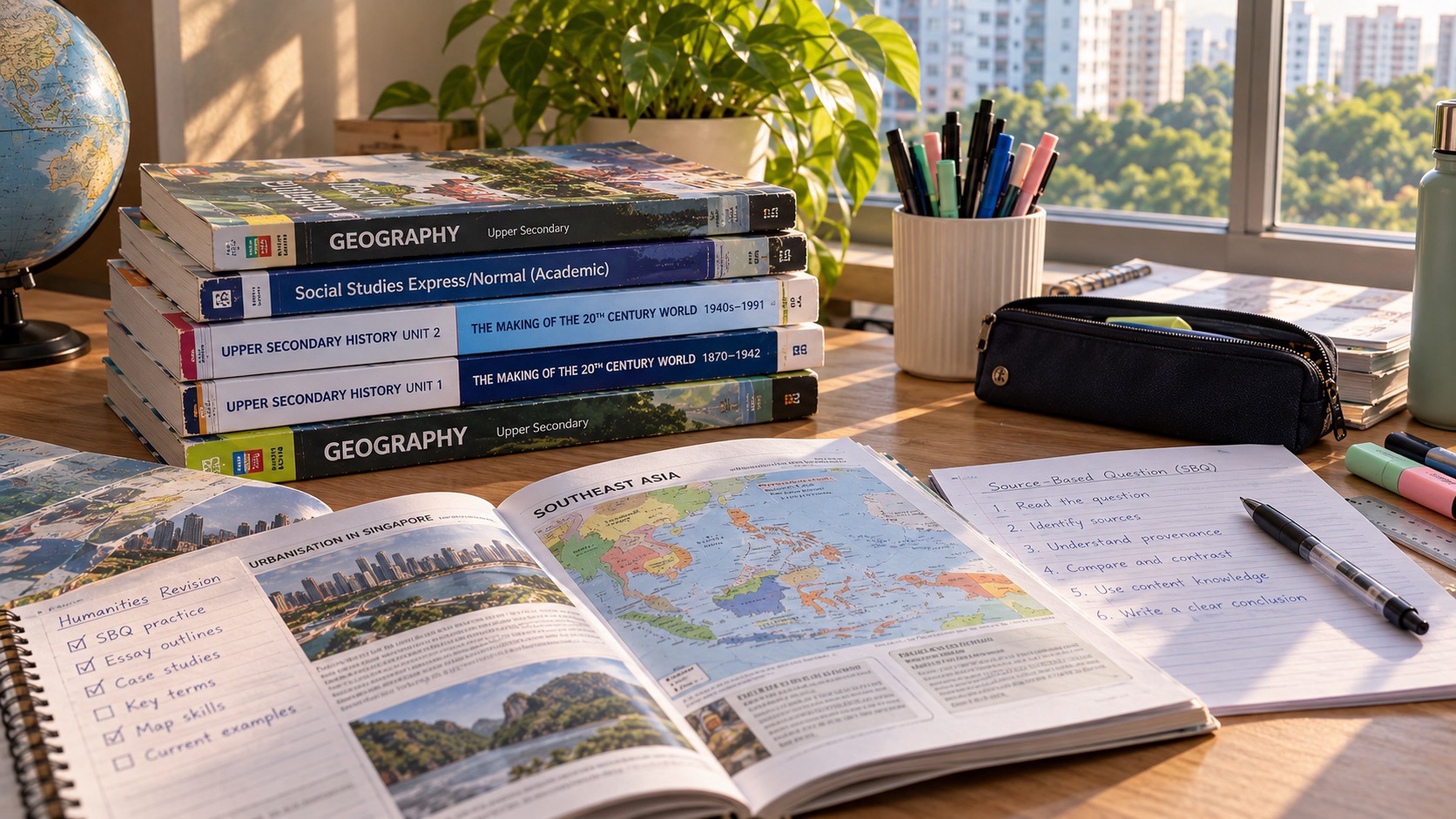
Do you know why G2 Geography is much more than remembering places? The 2027 SEC G2 Geography subject asks students to read information about the real world, conduct geographical enquiry, understand tourism and climate, and make justified decisions. A child who can explain a concept but cannot use a map, table or fieldwork evidence still has an important skill to build.
Start with the precise subject: standalone G2 Geography is K226. It is distinct from G2 Humanities (Social Studies, Geography) K229. K226 consists of two compulsory 105-minute papers worth 50% each. Geography in Everyday Life, Tourism and Climate are the three main clusters, and the syllabus provides for extended fieldwork.
This parent guide uses the official 2027 SEAB school-candidate syllabus as its reference. Worked numbers and local enquiry examples are invented for learning, not reproduced examination questions. Where school or private-candidate entry conditions matter, check the official 2027 catalogue and your school’s current guidance.
Find the answer you need
- Do you know which G2 Geography paper your child is preparing for?
- Do you know how the two 2027 K226 examinations are arranged?
- Do you know the three clusters behind the syllabus?
- Do you know why geographical thinking begins in ordinary neighbourhoods?
- Do you know what sustainable development actually asks students to weigh?
- Do you know why the syllabus includes a ten-week extended fieldwork experience?
- Do you know the difference between primary and secondary data?
- Do you know how to design a fair and safe mini fieldwork activity?
- Do you know what Tourism Activity means beyond famous attractions?
- Do you know what changes when tourism develops rapidly?
- Do you know why sustainable tourism is about choices rather than slogans?
- Do you know the difference between weather and climate?
- Do you know what to look for in a climate graph?
- Do you know what climate change and climate action require?
- Do you know what AO1, AO2 and AO3 stand for?
- Do you know how the six-mark judgement questions work?
- Do you know how to answer map, photograph and table questions?
- Do you know how to revise efficiently for the 105-minute papers?
- Do you know what progress looks like beyond memorising case studies?
- Do you know why school tests and SEC specimens can differ?
- Do you know what to ask about G2 versus G3 Geography?
- Do you know the most useful questions parents can ask teachers?
- Do you know how a practical eight-week improvement plan can work?
- Do you know the most common parent FAQs about K226?
Do you know which G2 Geography paper your child is preparing for?
For the 2027 Singapore–Cambridge Secondary Education Certificate, standalone G2 Geography is syllabus K226. Its previous GCE N(A)-Level reference is 2246. The word standalone matters: G2 Humanities (Social Studies, Geography), K229, is a different entry with different papers. Check the code on the school’s subject documentation, not merely the word “Geography” on a tuition worksheet.
A student learning geographical skills in school may encounter similar enquiry methods in both subjects, but the final assessment structure is not interchangeable. The first parent question should be “Are we preparing for K226 or K229?” before buying revision books, comparing mock results or counting study hours.
Do you know how the two 2027 K226 examinations are arranged?
K226 has two compulsory papers, each lasting 1 hour 45 minutes, carrying 50 marks and contributing 50% of the subject grade. Each paper contains two compulsory structured questions with no more than twelve sub-parts per question. There is no free choice of clusters: students must prepare all the assessed areas.
Paper 1 examines fieldwork within Geography in Everyday Life and Tourism. Paper 2 examines Thinking Geographically and Sustainable Development, together with Climate. An approved calculator may be used in both papers. Those details come from the 2027 SEAB syllabus; a school-based test may organise its questions differently as part of teaching and assessment.
Do you know the three clusters behind the syllabus?
The subject is organised as Geography in Everyday Life, Tourism, and Climate. Each cluster has three topics. The first covers thinking geographically, sustainable development and geographical methods. Tourism covers tourism activity, tourism development and sustainable tourism development. Climate covers weather and climate, climate change and climate action.
These names are more than a revision checklist. They connect habits of observation, concepts about people and place, and judgements about competing needs. A child who understands “tourism is growing” but cannot discuss its environmental consequences has only understood part of the syllabus. A child who recalls climate definitions but cannot interpret a temperature graph has the same problem.
Do you know why geographical thinking begins in ordinary neighbourhoods?
The Geography in Everyday Life cluster deliberately starts with familiar spaces. A bus interchange, drainage canal, neighbourhood park and shopping street are useful places to ask geographical questions: Who uses this place? Where do flows of people concentrate? What environmental conditions change with time? How might the answer differ for children, older residents and workers?
An effective geographical explanation includes location, scale, spatial distribution, relationships and evidence. Saying “there are many people at the station” is an observation. Explaining why the station draws people from surrounding housing estates, employment centres and transport routes begins to answer a geographical question.
Do you know what sustainable development actually asks students to weigh?
Sustainability questions are not tests of whether a student can repeat “protect the environment”. They often require a reasoned view of environmental, social and economic concerns. A proposal to attract tourists could generate jobs and improve services while increasing water consumption, congestion, noise or pressure on habitats. A good response makes the trade-offs explicit and identifies whose needs are affected.
Parents can help by asking, “Which benefit can we support with evidence, what possible harm follows, and how could we reduce that harm?” The student’s answer should distinguish a plausible mechanism from a demonstrated outcome. No one local case study proves that the same policy will work in every place.
Do you know why the syllabus includes a ten-week extended fieldwork experience?
The official K226 framework provides for extended fieldwork over ten weeks. Fieldwork is a way to connect classroom knowledge with an actual investigation: selecting a question, choosing methods, gathering information, analysing results and acknowledging limitations. The national Paper 1 includes a fieldwork-related structured question; it should not be confused with a separate fieldwork portfolio submitted as an additional national paper.
An illustrative class might investigate whether shade influences the use of different park paths. Students could specify when counts are taken, define who is counted, compare shaded and unshaded locations, and examine weather conditions. The lesson is methodological discipline, not just going outside and collecting photographs.
Do you know the difference between primary and secondary data?
Primary data are collected for the investigation by students or investigators: observations, pedestrian counts, short surveys or measurements. Secondary data already exist and may come from published weather records, government statistics, maps or prior studies. Both can be useful, but students should ask how the data were produced and whether the time period, scale and definitions suit the enquiry.
Imagine comparing two tourist sites using visitor figures from different years. Even if the numbers are accurate, the comparison might mislead unless one accounts for opening days, site boundaries and changes in counting methods. Explain the comparison problem before making a conclusion; good geography does not treat every table as self-explanatory.
Do you know how to design a fair and safe mini fieldwork activity?
Begin with a precise, manageable question such as “Does the proportion of shaded seating affect lunchtime use of this plaza?” Select observation points fairly, standardise the time interval and use clear categories. Do not collect identifying information unnecessarily. Follow school and site rules, avoid unsafe road crossings, seek appropriate permission and keep the activity accessible to participants.
One count at noon cannot tell us what happens during an evening rainstorm. Students should acknowledge limited sampling, unusual events, observer inconsistency and seasonal differences. A limitation is not a failed project; an explicit limitation demonstrates that the student understands what the data can and cannot establish.
Do you know what Tourism Activity means beyond famous attractions?
Tourism is a system of movement, services, motivations and destinations. Students should understand why people travel, how demand varies, and how attractions, accommodation, transport and supporting industries interact. A famous monument alone does not explain a destination’s visitor numbers: accessibility, affordability, events, safety perceptions and marketing can all contribute.
An exercise could compare two fictional destinations. Destination A receives more visitors but many stay only for a few hours; Destination B has fewer visitors but longer average stays. A conclusion about local economic benefit would need spending or employment evidence, not visitor totals alone.
Do you know what changes when tourism develops rapidly?
Tourism development can change jobs, land use, local identity, service provision and ecosystems. Students should distinguish short-term effects such as temporary congestion from long-term changes such as infrastructure investment or pressure on housing. They should avoid the simplistic assumption that all economic growth improves every resident’s situation.
A strong geographical response names a stakeholder and a mechanism. For instance, improved public transport may help residents as well as visitors, while rising demand for space may increase competition among uses. Evaluation becomes more convincing when it specifies who benefits, who bears a cost and what evidence could test the claim.
Do you know why sustainable tourism is about choices rather than slogans?
Sustainable tourism considers how visitors, businesses, communities and authorities can manage tourism’s economic benefits alongside social and environmental pressures. Measures may include visitor-flow management, waste reduction, habitat protection, public transport improvements or community participation. No measure is universally suitable: outcomes depend on implementation, local conditions and trade-offs.
Try a balanced practice question: a coastal village proposes a daily visitor cap. A student should identify possible environmental gains, possible income effects on small businesses, potential displacement to neighbouring sites and the information needed to judge success. Evaluating an intervention does not require pretending every effect is known in advance.
Do you know the difference between weather and climate?
Weather describes atmospheric conditions over shorter times and at particular places; climate concerns the longer-term patterns and statistics of those conditions. A hot afternoon alone neither establishes a new climate trend nor disproves global warming. Students should examine temporal scale, location, averages, variability and the appropriate evidence for a claim.
When a graph shows a run of warm days, ask whether it displays daily temperatures, monthly averages or a long-term series. Then separate what the graph actually demonstrates from larger explanations that require additional data. This disciplined reading is especially important when headlines turn unusual weather into sweeping conclusions.
Do you know what to look for in a climate graph?
Identify the axis labels, units, location and time period before interpreting a pattern. Distinguish an absolute temperature in degrees Celsius from a change in temperature in degrees Celsius. In a worked example, a measured monthly average that rises from 28°C to 30°C has increased by 2°C. That arithmetic does not identify the cause or show a century-long trend.
If rainfall rises from 100 mm to 125 mm, the increase is 25 mm, or 25% relative to the initial 100 mm. But the suitability of an explanation depends on the study period and evidence. Marking often rewards correct interpretation and qualification more than an elaborate story unsupported by the chart.
Do you know what climate change and climate action require?
The Climate cluster moves from processes and impacts to possible responses. Students should understand that climate risks can have uneven effects on places and communities, and that responses may involve mitigation, adaptation and combinations of both. Mitigation targets drivers such as greenhouse-gas emissions; adaptation reduces exposure or vulnerability to consequences already occurring or expected.
A neighbourhood tree-planting plan can be analysed in terms of shade, costs, maintenance, land use and its limits during extreme conditions. A stronger answer explains why a measure fits the stated problem and what would be monitored to judge whether it works.
Do you know what AO1, AO2 and AO3 stand for?
K226 assesses knowledge with understanding (AO1), skills and analysis (AO2), and judgement and decision-making (AO3). These are distinct abilities. A child may know the definition of “tourism” but be unable to compare two data sets, or may identify a trend without evaluating an intervention.
Practice should therefore cover three moves: explain the concept accurately; extract and compare evidence; make a justified judgement with appropriate criteria. An answer should be proportional to the mark allocation. Giving an unsupported opinion in a six-mark evaluation task is unlikely to demonstrate the requested reasoning.
Do you know how the six-mark judgement questions work?
Paper 1 includes a six-mark AO3 item in its Tourism question; Paper 2 includes a six-mark AO3 item in its Climate question. They are assessed using generic level descriptors, whereas the other questions in those papers are point-marked. This distinction matters: evaluation asks for a coherent line of reasoning, not an unconnected list of memorised facts.
One practical writing pattern is claim, relevant evidence, considered counterpoint and reasoned judgement. For example, an environmental policy may be helpful but limited by cost or enforcement. Students should not apply a rigid template blindly; they should answer the precise wording and criteria of the given question.
Do you know how to answer map, photograph and table questions?
First recognise what the resource represents. A map may show spatial pattern and accessibility; a photograph shows a scene from a particular viewpoint; a table records quantities, categories and a defined period. Each has limitations. A photograph does not automatically provide population counts, and a table cannot reveal causes merely because two variables change together.
Students can practise highlighting units, scale and legends, making one accurate comparison, and then explaining a plausible process only when the question asks for it. For maps, use relative location and distance appropriately. For charts, use data from the resource rather than replacing it with remembered general facts.
Do you know how to revise efficiently for the 105-minute papers?
Each paper has 105 minutes for two compulsory 25-mark questions. A rough first allocation is about 50 minutes per question with a few minutes for checking, but a student’s pace should be measured with timed practice. Use the paper’s structure to identify where reading, data interpretation or extended judgement consumes excessive time.
Students should practise reading the whole question, using sub-part marks as a guide, answering with the requested evidence and moving on when the response is complete. An answer longer than the marks demand may leave another compulsory sub-part unfinished. Finishing both questions is an essential exam skill.
Do you know what progress looks like beyond memorising case studies?
A strong improvement signal is the ability to analyse a new dataset without being told which facts to retrieve. Another is an explanation that names a process, cites relevant evidence and acknowledges uncertainty. Case studies can help, but examples should illuminate concepts rather than act as fixed scripts.
Track mistakes by category: misunderstanding a concept, reading data inaccurately, omitting a comparison, weak judgement, careless units or poor timing. Revising by error type is more productive than repeatedly doing whole papers without discovering why the same marks are lost.
Do you know why school tests and SEC specimens can differ?
Schools assess learning throughout the year, sometimes emphasising one cluster or a particular fieldwork skill. The SEC national assessment follows its stated syllabus and paper format. Therefore a lower score on an unfamiliar school task does not by itself prove that the student cannot handle the national examination; equally, a good memorisation score does not show that data analysis is secure.
Parents should ask for the specific learning outcome or question type behind a mark, not simply compare class rankings. Use school feedback together with the official 2027 K226 document to plan targeted improvement.
Do you know what to ask about G2 versus G3 Geography?
Subject levels under Full Subject-Based Banding reflect different syllabuses and assessment demands. Do not assume that a G3 revision paper is an appropriate measure of G2 readiness or that a student can change subject level without a school decision. A family should look at the learner’s current subject level, recent work and the school’s criteria for changes.
Where a student is extending learning, introduce more complex enquiry gradually: clearer comparative reasoning, richer evidence and independent evaluation. Extension should build understanding, not replace the syllabus actually being examined.
Do you know the most useful questions parents can ask teachers?
Ask which subject and syllabus code the child is taking; what was expected in the weakest question; whether difficulty lies in geographic vocabulary, fieldwork, resources or evaluation; and which topic should be repaired first. Ask whether upcoming assessments focus on Paper 1 or Paper 2 skills and what examples of improvement the teacher wants to see.
Do not ask only “How many more papers should my child do?” A student who misreads axes needs a different plan from one who can read a graph but cannot justify a decision. Diagnosis determines the right practice.
Do you know how a practical eight-week improvement plan can work?
Weeks 1–2: diagnose using a small set of representative questions and repair map/graph reading. Weeks 3–4: study Geography in Everyday Life and carry out a small safe enquiry with clear methods and limits. Weeks 5–6: strengthen Tourism and Climate, including one evidence-based evaluation in each area. Weeks 7–8: complete timed Paper 1 and Paper 2 sections, review errors, then repeat the hardest question types.
Adapt the plan to the school’s sequence and available time. Keep revision notes short enough to use: concepts, common mistakes, worked data examples, and model structures for judgement. The purpose is independent competence, not dependence on a tutor’s model answer.
Do you know the most common parent FAQs about K226?
Is G2 Geography K226 the same as Combined Humanities Geography K229? No; they are distinct subjects with different national paper structures. Is extended fieldwork a separate graded national coursework paper? K226 describes a ten-week learning experience and assesses fieldwork-related skills through Paper 1; consult the current syllabus and school instructions. Can my child skip Climate? No; it is part of compulsory Paper 2.
Can a private candidate assume K226 is available? No. The 2027 G2 school- and private-candidate catalogues are not identical. The published private-candidate list must be checked separately and should not be inferred from a school-candidate syllabus. Are examples in this guide past national questions? No; worked figures and practice scenarios are illustrative teaching examples.
Official syllabus and related guides
- 2027 SEAB G2 school-candidate catalogue
- Official 2027 K226 Geography syllabus PDF
- SEAB SEC overview
- G2 Humanities (Social Studies, Geography) K229 companion
- G2 Literature K228 companion
- eduKateSG Clementi small-group tutorial reference
Use the official syllabus and school advice to confirm subject codes and current paper arrangements. If your child is struggling, gather two or three marked responses and identify whether the difficulty is conceptual, data-related or evaluative before deciding on targeted tuition.