
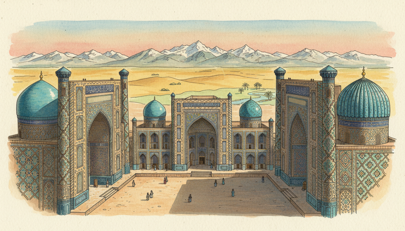
Samarkand is famous because it was one of Central Asia’s great Silk Roads crossroads and became a major capital of the Timurid world. Its Registan Square, blue-tiled madrasas, Shah-i-Zinda tombs, Bibi-Khanym Mosque, Gur-e-Amir mausoleum and the remains of Ulugh Beg’s observatory preserve evidence of trade, architecture, scholarship and political power. The historic city is a UNESCO World Heritage Site in present-day Uzbekistan.
But the most interesting answer is not simply that Samarkand has beautiful blue buildings. Its importance grew from a working system: an oasis made settlement possible, trade routes connected merchants, rulers invested in monumental architecture, schools and scholars exchanged knowledge, and craftsmen developed techniques used across regions. Modern Samarkand also has homes, universities, businesses and infrastructure. This guide follows those connections so the city makes sense beyond photographs.
Samarkand in one minute
Country: Uzbekistan. Region: Central Asia, in the Zeravshan River valley. Historical role: major Silk Roads trading and cultural centre; especially prominent under the Timurids in the fourteenth and fifteenth centuries. World Heritage: Samarkand – Crossroad of Cultures, inscribed in 2001.
Most recognisable square: Registan, with three monumental madrasas constructed in different periods. Other major places: Gur-e-Amir, Shah-i-Zinda, Bibi-Khanym, Afrasiab and Ulugh Beg’s observatory. Modern connections: railways, roads, tourism, artisans, markets, universities and public services. Key question: how did water, trade, education and political patronage help a city flourish here?
Where exactly is Samarkand?
Samarkand lies in the southeastern part of modern Uzbekistan’s interior, in the fertile Zeravshan River valley. It is not a seaport and it is not the country’s capital today; Tashkent is the capital. Its location gave travellers access to water, agriculture, surrounding settlements and routes that linked different areas of Central Asia.
A map makes the ancient economic advantage obvious. Long-distance travellers crossing difficult territory needed reliable places to rest and exchange goods. A settled oasis could provide markets, food, services, information and connections to other routes. Geography did not guarantee prosperity, but it created an opportunity for capable communities and rulers to develop a regional hub.
What does ‘Silk Road’ really mean?
The Silk Roads were overlapping networks of land and maritime routes connecting many parts of Asia, Europe, Africa and the Middle East over long periods. They were not one permanently marked highway along which every merchant travelled from China all the way to Rome. Traders often moved goods through multiple stages and markets.
Silk was one important commodity, but ceramics, metals, textiles, precious materials, ideas, beliefs and technical knowledge also moved. Cities provided safe storage, workshops, money-changing arrangements, caravan services and places to meet other traders. UNESCO’s Cities along the Silk Roads guide explains why such hubs supported cultural and intellectual exchange as well as trade.
Why did merchants stop at Samarkand?
Merchants needed more than a road. They needed water, provisions, animals, buyers, storage, reliable information and sometimes finance or protection. Samarkand’s oasis location and developed urban economy helped it function as a place to exchange goods and knowledge rather than merely pass through.
Think about a trader arriving after a difficult journey. The person may need repairs, a place to rest, a new supply of food and a buyer willing to pay a fair price. A city able to provide those services attracts more traders, which supports more shops and craftsmen. This reinforcing network is a basic mechanism of urban development and helps explain Samarkand’s lasting reputation.
Is Samarkand older than the Silk Roads?
Settlement in the region is ancient. UNESCO traces the city tradition to ancient Afrasiab, commonly dated to the seventh century BCE, while archaeological evidence in the area extends back further. Samarkand’s urban history therefore contains periods far older than the famous monuments people see today.
The buildings at Registan do not date from every phase of the city. Different settlements and architectural layers reflect periods of growth, destruction and rebuilding. A visitor should distinguish an archaeological site from a functioning medieval square and a later modern district. UNESCO’s Samarkand – Crossroad of Cultures account describes these overlapping urban layers.
What is Afrasiab?
Afrasiab is the archaeological area associated with ancient Samarkand. It preserves evidence of earlier urban life, including fortifications, residential quarters and monumental buildings. Excavations and historic paintings help researchers understand political contacts, craftsmanship and settlement long before the modern city acquired its current layout.
An archaeological site is not merely empty land waiting for tourist buildings. The soil layers contain evidence about how people lived, traded and organised a settlement. Conservation must balance archaeological research, visitor access and protection from damage. The ruins are an essential part of Samarkand’s story, even though they look very different from the tiled architecture of Registan.
What happened when the Mongols arrived?
Samarkand was captured during the Mongol campaigns of the early thirteenth century, with the destruction of parts of the older city in 1220. Political upheaval and violence affected the city’s settlement pattern. Over subsequent centuries, urban development shifted and new monuments arose in locations associated with later Samarkand.
This is why it is misleading to imagine every landmark standing unchanged for two thousand years. The city’s continuity lies partly in geography, communities and the repeated creation of institutions after disruption. UNESCO distinguishes the older Afrasiab area from later Timurid and nineteenth-century parts of the city. A living civilisation can rebuild and transform without becoming a completely new place.
Why did Timur make Samarkand important?
Timur, also known as Tamerlane, built a powerful empire during the late fourteenth century and made Samarkand a major political and ceremonial centre. His rule involved military conquest as well as the patronage of monumental construction and crafts. The city’s grand architectural ensembles reflect that era of imperial ambition and skilled workmanship.
Historical achievement and the human costs of conquest should both be acknowledged. Patronage of buildings and learning did not erase the violence associated with campaigns. Understanding the city accurately means examining how rulers concentrated labour, resources and artistic expertise—and how that produced monuments whose significance continues today. Samarkand is not merely a collection of flattering stories about one ruler.
What is Registan Square?
Registan is Samarkand’s best-known monumental square, bordered by three imposing madrasas with arched portals, decorative tilework and courtyards. The buildings were constructed in different centuries and together form one of the region’s most recognisable urban ensembles. The name is associated with the historic square and its civic role.
It was not built as one instant tourist attraction. The public space and successive buildings reflect changing institutions and architectural patronage. Today it is an important heritage destination, but its significance comes from how learning, religion, urban space and political authority interacted. UNESCO’s World Heritage description identifies Registan as an influential example of Islamic architecture.
Which three madrasas stand at Registan?
The three are the Ulugh Beg Madrasa, Sher-Dor Madrasa and Tilya-Kori Madrasa. Ulugh Beg’s is the oldest, associated with the early fifteenth century. Sher-Dor and Tilya-Kori were constructed in the seventeenth century. Their designs relate to one another, but calling all three ‘fourteenth-century Timurid schools’ would be inaccurate.
UNESCO’s Samarkand nomination records Ulugh Beg’s building around 1420, Sher-Dor’s main construction in 1619–1632 and Tilya-Kori’s in the mid-seventeenth century. Different sources sometimes use slightly different construction dates. The important distinction is chronology: the square became the ensemble seen today over generations, not during one single building campaign.
What was a madrasa?
Historically, a madrasa was an institution of learning in Islamic societies. The curricula and scholarly activities varied by time and place, and could include theology, law, mathematics and other subjects depending on patronage and teachers. It should not be automatically equated with a modern state-run primary or secondary school.
A historical madrasa had buildings, students, instructors and an intellectual network. The Registan structures demonstrate how education could be expressed architecturally as a civic institution. Studying them helps connect local history with the broader development of knowledge across Central Asia. For today’s school system, consult Understanding the Education System of Uzbekistan rather than assuming the historical institution still defines modern qualifications.
Who was Ulugh Beg?
Ulugh Beg was a Timurid ruler and a notable patron and practitioner of astronomy and mathematics. He is associated with a madrasa at Registan and with the famous astronomical observatory near Samarkand. His scientific work helped develop observations and star catalogues within a wider tradition of mathematical astronomy.
This matters because Samarkand was more than a commercial warehouse. It drew scholars and specialists whose work required instruments, texts, mathematical knowledge and sustained patronage. An important science centre needs reliable institutions just as a trade centre needs markets. The connection between learning and political support is one of the city’s distinguishing historical features.
Why is Ulugh Beg’s observatory famous?
The observatory is associated with fifteenth-century astronomical observations using large, carefully constructed instruments. Researchers measured the positions of celestial objects and improved observational knowledge through systematic work. Remains of the site are part of Samarkand’s recognised heritage.
Before modern electronic telescopes, astronomy required precise geometry, repeated observations, strong instruments and calculations. An impressive building without trained scholars would not have produced the same knowledge. Ulugh Beg’s observatory is a useful example of science as a coordinated system of people, equipment and records. UNESCO lists the observatory among Samarkand’s major monuments.
What is the Gur-e-Amir mausoleum?
Gur-e-Amir is a Timurid mausoleum associated with Timur and his dynasty. Its domed architecture and decorative craftsmanship are important to the history of monumental construction in Central Asia. It is both a historical burial site and an architectural landmark, so visits require respect for its cultural significance.
The building can teach more than dates. Its structure, surface decoration and relationship to the surrounding city show how rulers used architecture to express memory and legitimacy. Conservation specialists must protect materials that have experienced centuries of environmental wear and intervention. A landmark’s continued survival requires maintenance, skilled labour and public stewardship.
Why is Shah-i-Zinda famous?
Shah-i-Zinda is a complex of mausoleums and religiously significant architecture with richly decorated facades. It developed in phases and contains important examples of ceramic decoration and historic craftsmanship. The site occupies an important place in Samarkand’s cultural landscape.
A complex assembled over time allows historians to compare design choices, materials and inscriptions across different periods. Visitors should not assume all elements are the same age. Nor should a historic religious site be approached solely as a colourful backdrop. Its value includes memory, sacred associations, artistic skill and the evolving city around it.
What makes Bibi-Khanym Mosque important?
Bibi-Khanym Mosque is associated with Timur’s major construction programme around the turn of the fifteenth century. Its scale, domes and tilework demonstrate monumental ambition and skilled workmanship. The building also has a complicated conservation history, including losses and subsequent restoration.
Restoration must balance safety, historical evidence and authenticity. A reconstructed surface may look impressive but should not be mistaken for untouched original fabric. UNESCO notes conservation and restoration issues in Samarkand’s historic monuments. A good heritage guide distinguishes surviving original evidence from later repair without reducing the building’s importance.
Why are the blue tiles so distinctive?
Glazed ceramic tiles, mosaics and patterned surfaces are prominent in the region’s monumental architecture. Their colours and geometric arrangements can create extraordinary visual effects in changing sunlight. But decoration depended on specialised materials, kilns, designs, skilled labour and long-lasting architectural knowledge.
The tiles are part of a craft economy, not something that appeared because a ruler requested a pretty colour. Artisans had to prepare pigments and glazes, manufacture pieces and install them accurately on complex structures. Similar techniques influenced and interacted with traditions elsewhere. Appreciating the technology behind the decoration makes the architecture more interesting than a simple social-media caption.
How did science, religion and trade interact?
Cities along the Silk Roads supported different kinds of exchange. Merchants carried goods, religious and scholarly communities maintained institutions, craftspeople shared methods, and courts or local authorities organised parts of urban life. Connections changed over centuries, and cooperation existed alongside competition and conflict.
For a student, consider a book. It needs authors, paper, scribes or printers depending on the period, buyers, teachers and routes to other cities. The same trade network that brings valuable materials can carry ideas. Samarkand’s importance lies partly in this combined circulation of people, goods and knowledge. UNESCO’s Silk Roads programme describes cities as centres of intellectual exchange.
Was Samarkand a city of only one culture?
No. Its history includes successive populations, languages, beliefs and political traditions, shaped by migration, trade and changing rulers. Present-day Samarkand is part of Uzbekistan, but a modern national boundary should not be projected unchanged onto every earlier century. Uzbek and Tajik-speaking cultural connections are among the important strands in the city’s wider story.
Historical diversity does not imply that everyone lived in perfect harmony at every moment. It means the city was influenced by multiple traditions and exchanges. A sound account avoids pretending that one group created every element of the city independently of others. This is central to UNESCO’s description of Samarkand as a crossroads of cultures.
How did the oasis support the population?
Samarkand’s location in the Zeravshan valley gave access to water and agricultural land important to settlement. Crops, livestock, orchards, irrigation channels and local markets supported urban residents and travellers. A city with thousands of people cannot live by trade alone; it needs a dependable food and water system.
In arid and semi-arid environments, irrigation and water management can shape where people build homes and work. The same water supports farms and may be needed by workshops. Overuse or pollution can threaten both. Studying the oasis shows how environmental resources and administration underpin cultural achievements, even when the most visible heritage is made of stone and tile.
Why is Samarkand still an important city today?
Modern Samarkand is a regional urban centre with homes, schools, universities, health services, markets, transport links and business activities. Tourism and heritage employment contribute, but residents also work in ordinary commercial and public-service roles unrelated to visitors. The city must manage housing, waste, roads and water like any other functioning urban area.
A World Heritage designation does not freeze an entire city in time. Residents need safe access, productive work and dependable public infrastructure. The planning challenge is to protect historical significance while allowing contemporary life to function. The best urban policies recognise that historic monuments exist within a living community.
How does Samarkand connect to Tashkent?
Tashkent is Uzbekistan’s national capital, and Samarkand connects to it through road and rail corridors. Passenger trains, including services branded Afrosiyob on appropriate routes, have helped connect major Uzbek cities. Schedules, station access and prices can change, so travel information should come from current authorised operators.
Transport provides more than visitor convenience. Students, workers, businesses and families benefit when regional cities have reliable connections to the capital and each other. The station itself is only one node: useful travel also depends on local streets, public transport, tickets, accessibility and the final journey to a home or institution.
How are modern railways related to historic trade routes?
Both move people and goods between economic centres, but the technology, law, speed and scale are different. Historic caravans depended on animals, watering points and stopping towns. Modern rail needs tracks, signals, locomotives, electricity or fuel, border coordination and scheduled operations.
The shared principle is that transport creates value through connected intermediate services. A railway can reduce travel time, yet goods still need warehouses, customs and trucks. A caravan could reach a city, yet merchants still needed storage and buyers. Comparing them helps students identify what is truly persistent in commerce without pretending a high-speed train is merely a modern camel.
How does tourism create jobs in Samarkand?
Tourism supports hotels, restaurants, guides, museums, transport operators, artists, maintenance specialists and local shops. A visitor purchasing a ticket or hiring a guide creates demand for work beyond the most photographed monument. Heritage management also requires archaeologists, architects and conservation professionals.
Economic benefit is not automatic. If visitor demand strains water systems or replaces community housing, residents may face costs. Good tourism policy protects heritage, supports local enterprises and keeps public spaces functioning for the people who live there. The meaningful question is how well the city balances visitors’ experiences with residents’ needs and cultural integrity.
What does UNESCO World Heritage status mean?
Samarkand – Crossroad of Cultures was inscribed on the UNESCO World Heritage List in 2001 for cultural significance. The designation recognises outstanding universal value and brings expectations for conservation and management. It does not make UNESCO the ordinary municipal government of Samarkand.
National and local authorities, specialists and communities still have responsibilities under applicable law. UNESCO’s official site record highlights how Afrasiab, the Timurid core and later urban extensions form part of the historical landscape. It also discusses pressure from urban development and inappropriate restoration. Heritage status is a continuing management responsibility, not a one-time award.
Why do reconstruction and conservation need care?
Historic monuments may have lost original materials through age, damage or earlier rebuilding. Restoration can protect a structure, but inappropriate work can also obscure original evidence. Conservators must use historical documentation, architectural surveys and materials expertise when deciding how to intervene.
A visually striking repaired facade should be described accurately. Was it preserved, reconstructed or newly made? The distinctions matter to archaeologists and to visitors learning history. UNESCO’s heritage assessment notes both restoration and concerns about authenticity in parts of Samarkand. Responsible cultural tourism celebrates beauty without claiming that every tile has stood untouched for six hundred years.
How do mahallas shape neighbourhood life?
Mahallas are neighbourhood structures that play important social and community roles in Uzbekistan. Historic Samarkand’s urban fabric includes local streets and centres through which residents organise daily activities. Traditional courtyard homes and close neighbourhood networks are as significant to the city’s lived heritage as the grand public monuments.
UNESCO’s Urban Heritage Atlas of Samarkand documents courtyard housing, neighbourhood centres and related social practices. A city can preserve a monumental square yet lose important heritage if it destroys the everyday community fabric surrounding it. Good planning considers both.
Why does tourism need water and waste infrastructure?
A large visitor flow increases demand for toilets, drinking water, restaurants, accommodation and transport. Historic streets may have limited space for modern utilities or service vehicles. Planning must protect monuments while meeting sanitary and safety needs.
A well-managed destination needs clean water, functional drainage, rubbish collection and reliable power. These are not secondary matters to be solved after decorating the square. When maintenance fails, visitors and residents both suffer. The operating-system lesson is that heritage tourism depends on the same basic engineering as any other city.
How does Samarkand relate to the rest of Uzbekistan?
Samarkand is an important city within a much larger country. Uzbekistan also includes Tashkent, Bukhara, Khiva, Fergana Valley communities, Karakalpakstan and many other urban and rural areas. Their economies and environmental conditions are different.
A country guide should not use Samarkand’s architecture as a complete explanation of national institutions, agriculture or the Aral Sea crisis. For the broader system, read How Uzbekistan Works | Government, Water, Silk Roads and Economy. The country’s transport geography is explored separately in Why Is Uzbekistan Doubly Landlocked?. Distinct topics deserve distinct answers.
Case study: a merchant arrives in an ancient city
Imagine a merchant approaching Samarkand after several days of travel. The caravan needs water and rest, while the merchant needs information about market demand, suitable storage and people able to negotiate the sale. Craftspeople and other traders may buy the goods and sell different products in return.
The city benefits because it hosts an organised marketplace and a network of services. The merchant benefits because the journey can be broken into viable stages. Both sides need some level of predictable rules and protection. This simplified case shows why a crossroads becomes economically important: the infrastructure and institutions surrounding the road matter more than the road alone.
Case study: an astronomy student visits Ulugh Beg’s observatory
A student sees the remains of an astronomical instrument and asks how scholars could measure celestial movement without digital computers. The explanation begins with geometry, careful observation and repeated recording over time. Instruments and trained assistants make precision possible.
The student then compares the historical approach with modern scientific methods: instruments still require calibration, observations need documentation and findings must be checked. The technology has changed drastically, but the scientific habit of measurement survives. This is one reason Samarkand’s intellectual history makes such a strong educational subject.
Case study: a modern artisan repairs patterned tilework
A conservation project requires patterned ceramic elements. The team must study historical design, appropriate materials, colours, moisture exposure and the building’s condition. Specialists may prepare repairs with documentation showing what is original and what is new.
Simply copying a decorative motif is not enough if the repair traps moisture or harms older material. Skilled conservation combines art history with chemistry, engineering and records. The project creates work for craftspeople while protecting evidence for future generations. It illustrates how historic architecture still depends on technical expertise.
Case study: a family lives beside a heritage district
A family lives near a significant historic area and needs normal services: safe roads, piped water, rubbish collection, schools and access to jobs. Visitor traffic may bring business opportunities but also noise, congestion or rising costs. The local authority must consider more than ticket sales.
Good management protects both the monuments and the people whose everyday life gives the city continuity. A public space that is beautiful but unusable for residents is not a complete urban success. Tourism, conservation and local service delivery need joined-up planning.
Case study: a tourist takes the train to Samarkand
A visitor arrives by train and travels onward to the historic centre. The trip may involve digital booking, station staff, a local vehicle, wayfinding and entrance arrangements at monuments. The visitor’s experience depends on reliable connections between transport and heritage services.
A fast train is useful, but the final kilometre still matters. Accessibility, street safety, current ticket rules and responsible visitor conduct complete the journey. For actual travel schedules, use official operators rather than this undated example. The case demonstrates how the modern city continues Samarkand’s long history as a place of arrivals, transfers and exchange.
How can students understand Samarkand in five diagrams?
First draw Central Asia with the Zeravshan valley and the routes linking major oasis cities. Second, draw the different historical parts of Samarkand: Afrasiab, the Timurid town and later expansions. Third, create a timeline from ancient settlement to the Timurid period and the seventeenth-century Registan buildings.
Fourth, connect a Silk Roads merchant to market, food, water and craftsmen. Fifth, connect a modern visitor to rail, hotel, public services and conservation. These diagrams show how geography, institutions and infrastructure change across centuries while remaining interdependent. Compare with How Singapore Works to see how different kinds of trade hubs solve similar coordination problems.
Frequently asked questions about Samarkand
What is Samarkand famous for? Its Silk Roads history, Timurid heritage, Registan Square, architectural ensembles and scholarly traditions. Is Samarkand the capital of Uzbekistan? No, Tashkent is the capital. Where is it? In Uzbekistan’s Zeravshan valley in Central Asia. Why is Registan famous? It is an outstanding square surrounded by three historic madrasas.
Are all three Registan madrasas from the same century? No; the oldest is associated with the fifteenth century and the others with the seventeenth. Was Samarkand on the Silk Road? Yes, it was a major node in a broader network of routes. Who was Ulugh Beg? A Timurid ruler and noted astronomer associated with an observatory and madrasa. Is the city a UNESCO site? Yes, inscribed in 2001. Are the monuments completely untouched originals? No; various structures have undergone damage, rebuilding and conservation.
Explore the related country guides
The national guide is How Uzbekistan Works | Government, Water, Silk Roads and Economy. For a separate destination-focused article, read Top 10 Places to Visit When Touring Uzbekistan. For transport and trade mechanics see Why Is Uzbekistan Doubly Landlocked?.
The complete companion archive is How Countries Work. Compare a Central Asian oasis and trading city with the connected port and road systems in How Singapore Works. The aim is understanding rather than simply collecting attractive place names.
Sources and editorial date
Main reference: UNESCO World Heritage Centre, Samarkand – Crossroad of Cultures. The UNESCO Urban Heritage Atlas documents the city’s layers and neighbourhood culture. The UNESCO Silk Roads cities guide explains merchant, intellectual and cultural exchange. Historical construction details are documented in the Samarkand World Heritage nomination.
Editorial review: 20 October 2026. This educational history guide is not a live travel advisory. Admission rules, monument access and train timetables can change. Dates of ancient events and building phases should be treated according to archaeological and documentary evidence, which may have ranges and scholarly uncertainties.