
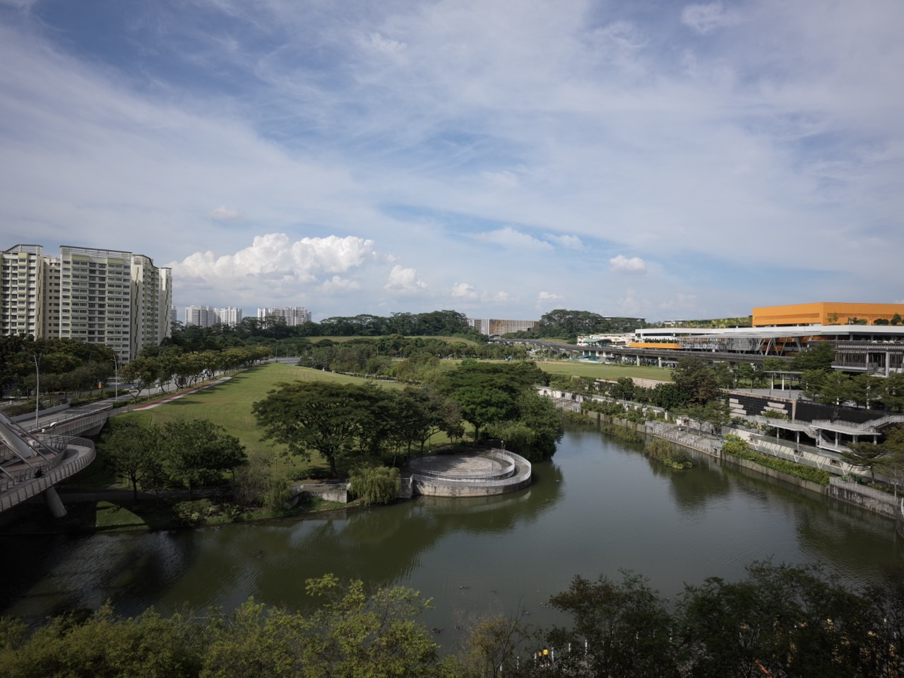
Parks and nature walks by Singapore LRT are easiest to plan around three official park systems: Zhenghua Nature Park via Bangkit BP9, Fajar BP10 or Segar BP11; Sengkang Riverside Park via Farmway SW2 or Kupang SW3; and Punggol Waterway Park via Damai PE7 or Punggol PTC/NE17. There is also a shorter coastal option at Punggol Point Park via Punggol Point PW3. The best station depends on the entrance and section you actually want, not the total size of the park.
For a first-time family visit, pick one public park entrance, decide how far you want to walk and allow time for the return. NParks describes Zhenghua as a 17.3-hectare, 2.5-kilometre linear corridor; Sengkang Riverside Park as a 21.3-hectare park divided into three main plots; and Punggol Waterway Park as a 25.79-hectare park with four themed areas. Those figures do not mean the same distance from a station gate. Park acreage, connector length and the last pedestrian walk are different measurements.
This park-and-wildlife route guide is a dedicated companion to the 42-station Singapore LRT index. It helps beginners, families and nature enthusiasts choose among forest edges, wetlands, waterfront bridges and coastal views, while making clear that wildlife sightings, level access, particular paths and the weather cannot be guaranteed.
Choose the right nature park and LRT stop
- Bangkit BP9: Zhenghua Nature Park via the Bangkit Road entrance — a nature corridor.
- Fajar BP10: Zhenghua Nature Park — another nearby LRT, with Fajar Shopping Centre as a food fallback.
- Segar BP11: Zhenghua Nature Park via the Segar Road entrance — also near Zhenghua Community Club.
- Farmway SW2: Sengkang Riverside Park’s Civic plot — NParks estimates around five minutes from the LRT.
- Kupang SW3: Sengkang Riverside Park’s Visitor and Mangrove plots — NParks estimates around five minutes.
- Damai PE7: Punggol Waterway Park — one of NParks’ listed nearby stops.
- Punggol PTC/NE17: Punggol Waterway Park — another NParks-listed approach, with Waterway Point as an indoor fallback.
- Punggol Point PW3: Punggol Point Park and coastal promenade — sea views and a deck, with an onward walking approach.
Definition lock: park size, station proximity and walking route are different
A park being near an LRT station means that the station can be a useful starting point for a public access route. It does not mean every facility in the park can be reached in five minutes. Larger parks have multiple entrances, different zones and internal trails, while a map may display a name at the geometric centre rather than at the most convenient entry point.
Park size is normally given in hectares. Connector length is the distance along a defined route. Station-to-entrance walk is the actual public pedestrian segment from the station exit to the park. Confusing these quantities gives readers falsely precise travel expectations.
For a practical outing, identify the entrance on the official NParks map before selecting the station. Then choose the length of your visit and a turning point. An out-and-back route may double the distance walked along a path, and time should be allowed for crossing roads and resting.
NParks pages sometimes describe parks as wheelchair accessible generally. That does not certify every pond edge or side path. Sengkang Riverside Park, for example, specifically states that its pond areas are not wheelchair accessible, even though the wider park has accessible paths.
1. Zhenghua Nature Park: the Bukit Panjang LRT nature choice
NParks describes Zhenghua Nature Park as a 17.3-hectare linear corridor stretching about 2.5 kilometres. It serves as an ecological link between Bukit Panjang Park Connector and the Bukit Timah Nature Reserve environment. The park is part of the Central Nature Park Network.
The authority names three main entrances: Bangkit Road, Segar Road and Chestnut Avenue, and identifies Bangkit, Fajar and Segar LRT as nearby stations. A reader should choose one of those entrances rather than assuming a train exit leads directly to forest vegetation.
Zhenghua’s purpose is different from a residential playground. The corridor supports trees, birds and other wildlife, and some paths offer a quieter experience than a busy town-centre mall. Visitors can observe planted buffers and the difference between built-up streets and a more natural habitat.
Do not promise that the full trail is uniformly level, dry or easy for every mobility need. Weather, maintenance and the entrance approach affect the experience. An older visitor may prefer a short section and a return instead of an ambitious full park traverse.
For a small educational activity, ask why a long strip of green land can matter to urban wildlife. It may provide habitat continuity, shade and food sources, although different species respond differently to roads, buildings and human disturbance.
2. Bangkit, Fajar or Segar: how to choose the Zhenghua entrance
Bangkit BP9 is a useful approach to the Bangkit Road entrance, and the Blocks 256–260 Bangkit Road shopping area provides a food or shopping option before or after the walk. It suits visitors starting from that part of the town or wanting a heartland meal with their nature visit.
Segar BP11 is a useful approach to the Segar Road entrance. Zhenghua Community Club is nearby, making it attractive to someone with a confirmed community activity. But an organised class and a nature walk have different schedules and access rules; neither automatically includes the other.
Fajar BP10 is another NParks-listed nearby station, associated with Fajar Shopping Centre. It can work when a visitor wants food and a green extension, but the correct park entrance should still be selected on a current map rather than guessing from the estate’s name.
All three stations lie on the Bukit Panjang LRT residential loop, where Service A and Service B operate in different directions. The fastest trip depends on which station you choose, your origin and the present train operation. Check live displays rather than relying solely on a memorised station sequence.
A good first visit chooses one station, one entrance and one turnaround point. There is no prize for combining all three Zhenghua approaches into one journey, and doing so can create a longer walk than the group is prepared for.
3. What can you observe in Zhenghua Nature Park?
NParks records more than 30 bird species in the nature park, with examples including olive-backed sunbirds, flameback woodpeckers, pink-necked green pigeons and greater racket-tailed drongos. The park also supports plants attractive to birds and butterflies, including Tembusu and Jejawi.
These species are possibilities, not booked attractions. A bird may appear briefly, remain concealed in vegetation or be absent from the route you walk. A responsible guide recommends quiet observation without guaranteeing a photograph.
A beginner can watch from a public path and describe colours, size, calls or movement before checking a field guide. Children can do a short nature-science observation by noticing the difference between a tree’s leaves and the surrounding low vegetation.
Do not play loud calls to draw birds close, enter planted areas to reach a nest or feed wildlife. Stay on the designated routes and follow NParks guidance. Observing responsibly helps protect the habitats that make the park worth visiting.
NParks lists the park as open 24 hours, but daylight is the sensible default for an unfamiliar visitor who wants to see wildlife and follow signs. ‘Open’ does not mean that a night walk is appropriate for every family.
4. Sengkang Riverside Park: the Farmway and Kupang split matters
NParks identifies Sengkang Riverside Park as a 21.3-hectare park centred around the Punggol River and a constructed wetland. Its current visitor guidance divides the park into Visitor, Mangrove and Civic plots.
This provides a rare example where official station advice is very specific. NParks recommends Kupang SW3 for the Visitor or Mangrove plots and Farmway SW2 for the Civic plot, estimating about a five-minute walk from each relevant station to its suggested park area.
Those five-minute figures are official guidance, but they are not a promise that everybody will reach every individual pond or bridge in five minutes. The park has internal paths and access points. A slower walker, pram user or visitor stopping for photographs may need longer.
If you want to look at the constructed wetland and mangrove-oriented habitat, Kupang’s Visitor or Mangrove plots are the more useful concept. If you want a public community-and-park combination, Farmway’s Civic plot can be a better start.
Try not to cross and recross the park merely because the map shows both stations nearby. Choose one side and give yourself time to enjoy it. Another day can be devoted to the other plot.
5. The constructed wetland, bridge and fruit trees at Sengkang
The park includes one of Singapore’s larger constructed wetlands, which helps filter water and provides habitat for birds and damselflies. Visitors may see planted marsh edges and wetland structures from public routes. A wetland is not an empty pond that can be entered at will.
NParks describes a 290-metre Sengkang Riverside Bridge with elevated views and fruit-themed areas. The park has more than twenty species of fruit trees, including mango, starfruit, longan and tamarind. These give families simple educational topics without requiring a formal guide.
A child can practise distinguishing a food plant from a purchased fruit. An example is to compare a real growing tree with its fruit at a market. However, do not pick fruit from managed park plantings unless explicit rules permit it; public access is not harvesting permission.
Dragonflies and birds may be seen, but no species is guaranteed. Keep quiet near wildlife and stay out of sensitive or restricted planting. Do not release animals, feed fish or throw litter into the wetland.
Accessibility caution: NParks specifically warns that the pond areas are not wheelchair accessible. Choose the accessible main park paths and the entrance appropriate to your group rather than assuming every water’s-edge route is usable.
6. Sengkang Riverside Park etiquette and the ‘no fishing’ rule
NParks lists Sengkang Riverside Park as open 24 hours and wheelchair accessible in general, while its rules include no fishing. These statements should be read together: general public access is not permission for every activity or every side path.
For children, keep a little distance from open water and stay attentive to bicycles on shared paths. Some areas may have benches or play spaces, but their availability and condition should be checked when you arrive.
A careful family visit could include a 20-minute out-and-back along a public path, a short pause to look for dragonflies and then a meal at a verified nearby outlet. It does not need to become an attempt to see every plot and the full park connector.
The setting is particularly useful for observing how constructed wetlands and public recreation coexist. The best experience respects both: visitors can enjoy views while leaving the planted habitat undisturbed.
If lightning or heavy rain is forecast, postpone the outdoor visit. A wetland is not a weatherproof venue, even though its public opening is listed as 24 hours.
7. Punggol Waterway Park: Damai or Punggol interchange?
NParks describes Punggol Waterway Park as a 25.79-hectare public park with Nature Cove, Recreation Zone, Heritage Zone and Green Gallery. NParks identifies Damai LRT PE7 and Punggol MRT NE17 among the nearby rail stops.
This is a broad waterway landscape, not one attraction directly in front of every rail exit. Use the latest NParks park map to choose the specific area you want, then select the station that gives the most sensible pedestrian access.
Damai PE7 may fit a visit that focuses on a particular park section and a quiet outdoor walk. Punggol PTC/NE17 is particularly convenient when Waterway Point is intended as a meal or weather fallback. The right station depends on the chosen entrance and group mobility.
Punggol’s bridges include Jewel Bridge, known for its dome-like form, and Kelong Bridge, designed as a reminder of traditional offshore fishing platforms. The bridges are at different positions along the waterway; don’t promise to reach every one in a brief walk.
NParks prohibits fishing in Punggol Waterway Park. The waterway is not a public swimming area. Shared paths, bridge railings and weather conditions require ordinary care, especially for families with small children.
8. Park connector length versus a short waterway stroll
NParks’ public information describes Punggol Waterway Park Connector as an 8.4-kilometre track along both sides of the waterway, while a separately described easy nature walk follows about 4.2 kilometres. Those distances refer to particular park-connector or walking routes, not the walk from Punggol MRT to a single bridge.
A visitor planning a brief outing need not complete either full route. A manageable short section with a comfortable turnaround can be more rewarding than attempting a long circuit that ends with tired children.
Choose whether the purpose is photography, gentle movement or a learning walk. A photographer may prefer one bridge and suitable daylight; a child might enjoy reading a sign about the waterway and seeing one aquatic plant. Both are meaningful experiences.
Be mindful of bicycles, joggers and shared space. Keep the walkway clear while taking photographs. Do not climb a bridge for a better view or reach over railings near the water.
An open park may have individual facility closures or areas under maintenance. Follow current barriers and signs rather than relying on a several-year-old route illustration.
9. Punggol Point PW3: a different coastal experience
NParks identifies Punggol Point Park at the northern end of Punggol Road, with Punggol Point LRT PW3 as a nearby station. It is a small 0.4-hectare coastal park, not another name for the much larger Punggol Waterway Park.
The park has sea views, a ship-inspired viewing deck and a pond with small wildlife. This makes it a distinctive choice for somebody who wants the coast rather than a riverine or constructed-wetland setting.
From PW3, plan the public onward walk towards the park rather than assuming the LRT platform is the viewing deck. The coast can be exposed, windy or wet, and the safe route may vary with temporary works or changing weather.
NParks describes Punggol Point Park as open 24 hours and accessible generally. For a family unfamiliar with the area, daylight or suitable early evening conditions are more comfortable than an unplanned late-night visit. Keep children supervised near water and public roads.
Punggol Point Park also connects to the wider Punggol Promenade area, but completing a long promenade walk is optional. Do not combine it with Coney Island or other parks without checking separate opening rules and the actual distance.
10. Choose the right environment for the people travelling
Young children: choose one park entrance and a short out-and-back. Wildlife is interesting, but no sighting is guaranteed. Keep children close at ponds, bridges and cycle paths, and stop before they become exhausted.
Older adults: prioritise level routes, seating, shade and a practical return. A park listed as accessible may still have pond edges or side trails unsuitable for wheelchair use. The NParks note about Sengkang Riverside Park’s pond areas is especially important.
Photographers: plan around a specific public view and safe weather rather than trying to collect all landmarks. Respect habitat and do not block shared paths for long setups.
Students: choose one observable question: how a constructed wetland supports water management, why plant corridors matter, or how a bridge’s design reflects local history. Record what you actually see and separate observation from a claim that needs a source.
Budget-minded visitors: public park walking does not normally need an admission ticket. Transport and any optional food, rentals or programmes are additional expenses.
11. Four manageable outdoor itineraries
- Short forest-edge walk: use Bangkit or Segar for a named Zhenghua Nature Park entrance and walk one comfortable section before returning.
- Wetland learning trip: choose Kupang for the Sengkang Riverside Park Visitor/Mangrove plots, observe from marked paths and turn back when ready.
- Green-and-food family outing: use Farmway for the Civic plot, then a verified food or community destination if the group remains comfortable.
- Bridge-and-waterway outing: choose Damai or Punggol MRT for a specific Punggol Waterway Park area and one named bridge, not the entire corridor.
- Coastal view alternative: use Punggol Point PW3 for a planned visit to Punggol Point Park; do not treat it as the same park as the waterway.
- Bad-weather rule: cancel exposed nature plans during thunderstorms and choose a safer indoor activity or another date.
12. Nature safety and etiquette that matter more than a route number
Bring water and appropriate footwear for the intended surface. On a hot, humid day, a short route may be more enjoyable than a long park circuit. During thunder or lightning, avoid open waterfront and forest-edge paths and seek proper shelter.
Stay on designated public paths and keep dogs leashed where required. Pick up waste and do not feed, release, capture or disturb wildlife. Respect signs at closed areas; a map cannot override a safety barrier.
If organising a large group, check park permit requirements. Zhenghua Nature Park, for example, requires advance application for activities involving more than thirty people. A casual family visit and an organised group event have different responsibilities.
Do not claim every point is accessible because a park’s general page has a wheelchair icon. Check entrance choice, slope, surface and any specific inaccessible area. Accessible planning should cover the whole trip from LRT platform to the chosen resting point.
Allow room to change your plan. A visit that ends after a safe 15-minute nature walk is complete; an ambitious itinerary that becomes unsafe or exhausting has missed the point.
Frequently asked questions about nature by LRT
Which LRT station is best for Zhenghua Nature Park?
Bangkit BP9, Fajar BP10 and Segar BP11 are all listed by NParks. Choose the named park entrance and your preferred public route.
Which LRT stop is nearest to Sengkang Riverside Park?
NParks recommends Kupang SW3 for Visitor and Mangrove plots and Farmway SW2 for the Civic plot, with about five-minute approaches.
Is the whole Sengkang Riverside Park wheelchair accessible?
NParks lists general wheelchair accessibility but states that its pond areas are not wheelchair accessible.
Which LRT station serves Punggol Waterway Park?
Damai PE7 and Punggol MRT NE17 are official nearby rail options. The best station depends on the section you want.
Is Punggol Point Park the same as Punggol Waterway Park?
No. Punggol Point Park is a smaller coastal destination, with Punggol Point PW3 nearby.
Can I fish in these parks?
NParks specifically prohibits fishing in Sengkang Riverside Park and Punggol Waterway Park. Follow posted rules at all parks.
Can I expect to see otters or birds on every visit?
No. Wildlife is not guaranteed, and visitors should not disturb animals to obtain a sighting.
Are the parks free?
Ordinary public park access generally does not require admission; transport, rentals, food and separately managed activities may cost money.
Does ‘open 24 hours’ mean safe to hike at night?
No. Park opening hours do not eliminate risks from darkness, weather or closed facilities. Daylight is often preferable for unfamiliar routes.
How long should a family spend?
Choose a short route that suits the youngest or slowest member of the group; a brief out-and-back can be more enjoyable than a full park circuit.
Official park sources and station guides
- NParks: Zhenghua Nature Park, entrances and wildlife
- NParks: Sengkang Riverside Park, plots and access
- NParks: Punggol Waterway Park, four zones and rules
- NParks: Punggol Point Park and PW3 access
- NParks: Punggol Waterway Park Connector route
- NParks: official walk at Punggol Waterway Park
- Complete Singapore LRT 42-station index
- Official LTA Sengkang and Punggol LRT network
Reviewed 1 November 2026 using NParks’ published park and access information. Wildlife sightings, route surfaces, accessibility, signage, weather and individual facilities may change. Choose the official park entrance and follow on-site rules.